Embed Size (px)
Citation preview

International Day for Disaster Reduction, 2012
Russian Centre of Science and Culture, Mitra Kunj
October 12, 2012
Nepal Geological Society
P. O. Box 231
Email: [email protected]
Website: www.ngs.org.np

Introduction: Established in 1980, Nepal Geological Society is a voluntary organization of professional geoscientists from Nepal and many other countries. It was the geoscientists and engineers at Department of Mines & Geology and at Tribhuvan University who took the necessary initiation in establishing this Society, because of the need they felt strongly for a scientific forum in order to cooperate, collaborate and benefit from a global community of scientists, researchers and practitioners who were active in the Himalayan regions. The strength of its memberships at present stands at 650 which comprise a significant number of foreign geoscientists from Asia-Pacific region, Europe, North America and Australia. Among its honorary members are such eminent geoscientists as (Late) Prof. P. Bordet (France), Late (Prof.) A. Gansser (Switzerland), Prof. P. Le Fort (France), Mr. Madhav Raj Pandey (Nepal), Prof. K. S. Valdiya (India) , Prof. K. Kizaki (Japan), Mr. G.S.Thapa (Nepal) and Prof. Dr. Paul Tapponnier (Singapore). The Society organizes international and national seminars, conferences and workshops regularly. The Nepal Geological Congress is the flagship international conference of the Society that is organized every three year in Nepal. The most recent one was the 6th Nepal Geological Congress held in November 2010. It has hosted in the past, among many others, the 5th Asian Regional Conference on Engineering Geology in 2005, the “International Symposium on Engineering Geology, Hydrology and Natural Disasters with emphasis on Asia” in 1999 and the 9th HKT Workshop in 1994. The Society publishes its own scientific journal, the Journal of Nepal Geological Society, which is being published regularly since 1980 and is in wide circulation all over the world. Nepal Geological Society (NGS) has been undertaking various activities related to disaster and awareness programs for disaster reduction in response to the United Nations since l991. In response to the call of (UNISDR), NGS organized a one-day seminar on the occasion of international Day for Disaster Reduction (IDDR) 2012 on 12th of October 2012 at Russian Centre of Science and Culture (Mitra Kunj) Kamalpokhari. The theme of the IDDR 2012 was "Step Up Women and Girls- The inVisible Force of Resilience". The main objective of the program was awareness building to all to the fact that Girls and Women around the world are on the frontline in making their communities and societies resilient to the impacts of disasters and the effects of the Climate Change. NGS had requested school children, university students, geoscientists and senior officials of ministries and departments of the Government of Nepal to participate in the program. The workshop was participated by two hundred participants. It was organized into two sessions: the first session was inaugural session and the second was technical session. Mr. Keshav Sthapit, Development Commissioner of the Kathmandu Valley Development Authority inaugurated the program. Mr. Sthapit highlighted on the present scenario of unmanaged urbanization in Kathmandu and stressed on the need of initiation from geoscientists for disaster reduction. He also requested the Nepal Geological Society for joint initiation with authority towards the disaster risk management related to urbanization. Mr. Sarbajit Prasad Mahato, Director General of Department of Mines and Geology shed light on the need of planned urbanization and role of geoscientists on it. He also focused on the increased involvement of women geoscientists in disaster reduction activities. Mr. Prakash Paudel, Director General, Department of Water Induced Disaster Prevention, Mr. Ganesh Shah, President of Mitra
Kunj and Former Minister, Ms. Anastasia Khokhlova, Deputy Director, Russian Center for Science and Culture, Mr. Kedar Bahadur Adhikari, Acting Mayor and Executive Officer, Kathmandu Metropolitan City also expressed their views. Mr. U. B. Shrestha, President of Nepal Geological Society welcomed the participants and highlighted on the need of organizing such seminars on natural disasters. Finally Mr. Sudhir Rajaure, General Secretary of the society paid vote of thanks. There were seven technical presentations on natural disaster and their mitigation. This event was organized jointly by the Nepal Geological Society and Department of Mines and Geology in association with the Russian Centre of Science and Culture, Kathmandu and was supported by Kathmandu Metropolitan City.
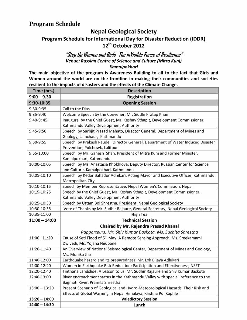
Program Schedule
Nepal Geological Society Program Schedule for International Day for Disaster Reduction (IDDR)
12th October 2012
"Step Up Women and Girls- The inVisible Force of Resilience" Venue: Russian Centre of Science and Culture (Mitra Kunj)
Kamalpokhari The main objective of the program is Awareness Building to all to the fact that Girls and Women around the world are on the frontline in making their communities and societies resilient to the impacts of disasters and the effects of the Climate Change.
Time (hrs.) Description
9:00 – 9.30 Registration
9:30‐10:35 Opening Session 9:30‐9:35 Call to the Dias
9:35‐9:40 Welcome Speech by the Convener, Mr. Siddhi Pratap Khan
9:40‐9: 45 Inaugural by the Chief Guest, Mr. Keshav Sthapit, Development Commissioner, Kathmandu Valley Development Authority
9:45‐9:50 Speech by Sarbjit Prasad Mahato, Director General, Department of Mines and Geology, Lainchaur, Kathmandu
9:50‐9:55 Speech by Prakash Paudel, Director General, Department of Water Induced Disaster Prevention, Pulchowk, Lalitpur
9:55‐10:00 Speech by Mr. Ganesh Shah, President of Mitra Kunj and Former Minister, Kamalpokhari, Kathmandu
10:00‐10:05 Speech by Ms. Anastasia Khokhlova, Deputy Director, Russian Center for Science and Culture, Kamalpokhari, Kathmandu
10:05‐10:10 Speech by Kedar Bahadur Adhikari, Acting Mayor and Executive Officer, Kathmandu Metropolitan City
10:10‐10:15 Speech by Member Representative, Nepal Women's Commission, Nepal
10:15‐10:25 Speech by the Chief Guest, Mr. Keshav Sthapit, Development Commissioner, Kathmandu Valley Development Authority
10:25‐10:30 Speech by Uttam Bol Shrestha, President, Nepal Geological Society
10:30‐10:35 Vote of Thanks by Mr. Sudhir Rajaure, General Secretary, Nepal Geological Society
10:35‐11:00 High Tea
11:00 – 14:00 Technical Session Chaired by Mr. Rajendra Prasad Khanal
Rapporteurs: Mr. Shiv Kumar Baskota, Ms. Suchita Shrestha 11:00 –11:20 Cause of Seti Flood of 5th May: A Remote Sensing Approach, Ms. Sreekamaml
Dwivedi, Ms. Yojana Neupane
11:20‐11:40 An Overview of National Seismological Center, Department of Mines and Geology, Ms. Monika Jha
11:40‐12:00 Earthquake hazard and its preparedness: Mr. Lok Bijaya Adhikari
12:00‐12:20 Women in Earthquake Risk Reduction: Participation and Effectiveness, NSET
12:20‐12:40 Tinthana Landslide: A Lesson to us, Mr. Sudhir Rajaure and Shiv Kumar Baskota
12:40‐13:00 River encroachment status in the Kathmandu Valley with special reference to the Bagmati River, Pramila Shrestha
13:00 – 13:20 Present Scenario of Geological and Hydro‐Meteorological Hazards, Their Risk and Effects of Global Warning in Nepal Himalaya, Krishna Pd. Kaphle
13:20 – 14:00 Valedictory Session
14:00 – 14:30 Lunch

Abstracts of the papers presented in the seminar
1 Cause of Seti Flood of 5th May 2012: A Remote Sensing Approach
Shreekamal Dwivedi, Yojana Neupane
Department of Water Induced Disaster Prevention, Pulchowk, Lalitpur, Nepal A catastrophic flash flood has occurred in the Seti River in the morning of May 5 2012 and has killed 72 people and has caused huge damage to the lives and livelihood in Sadikhola and Machhapuchhre VDCs of Kaski district, Western Nepal. The flood occurred in a clear day and no glacial lake of significant size was spotted in the satellite images captured immediately before the disaster. Several professionals and professional organizations have proposed different views and hypotheses regarding the cause of the flood. An attempt has been made here applying remote sensing to find out the cause of the flood which originated form very remote inaccessible area lying in the Western slope of the Annapurna IV peak. Comparative Analysis of the Landsat ETM satellite images of April 2012 and 6th May 2012 which were available online in NASA website revealed that the area of about 32000 square meter of the southern ridge 1.5 kilometer away from the Annapurna IV peak failed in the north western direction. The impact of descending mass of the failed mountain from 6850 meters to 4500 meters almost vertically pulverized the ice, sediment and rock. The pulverized mass formed dark brown cloud which was also captured by the ultralight aircraft of the Nepal Avia Club. The main direction of the failure was towards the North-West. The impact even triggered seismicity (at 9:09.56 a.m. local time) which was recorded all over the 21 stations of National Seismological Centre (Sapkota and Duvadi, 2012). The seismicity was equivalent to 3.8- 4 Richter scale in magnitude. The closest seismic station at Dansing which is 32 km. south west from the area recorded the high signals for 70 minutes which corresponds to the duration of the debris flow. The huge vibration and the heat generated by the impact caused the glaciers located on the slope to fail towards the origin of the Seti River. This whole mass descended further down slope to 3300 meter south western direction from where the Seti River starts. The huge mass of debris along with Ice chunks rushed down the river as a debris flow for 20 kilometres downstream at Kharapani in just 28 minutes (almost 12 meters/second). The photographs captured by the Avia Club Light aircraft before and after the event have also clearly shown the failed ridge.
The suspended sediment sample collected 100 meter downstream of the Irrigation Dam in Pokhara on 5th May was analyzed. Lab analysis of the flood water sample revealed the density of the flow as 1.88 gm/cc. The result of sieve analysis of the dried suspended sediment sample showed that it mostly contains fine sand and silt (Fig, 1. Acid test done in the dried sediments indicated calcareous contents in the flood water. Dark grains showed effervescence when powdered.
Analysis of the satellite based hourly rainfall GSMaP NRT from the period from 20th April -6th May 2012 revealed that there were just 4 occurrences of rainfall which amounted less than 1 mm/hour in the source area of the avalanche. The rainfall > 7mm/hour which occurred in the Kharapani area on 4 May was localized rainfall which did not extend to the avalanche area.
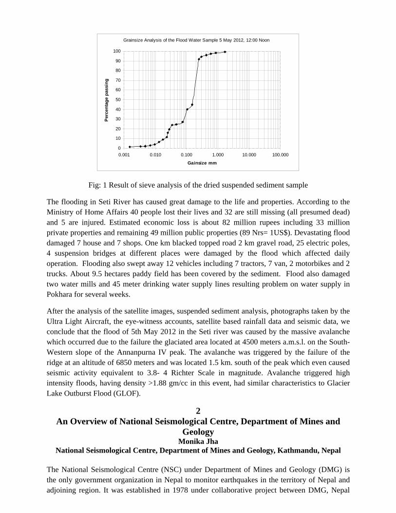
Fig: 1 Result of sieve analysis of the dried suspended sediment sample
The flooding in Seti River has caused great damage to the life and properties. According to the Ministry of Home Affairs 40 people lost their lives and 32 are still missing (all presumed dead) and 5 are injured. Estimated economic loss is about 82 million rupees including 33 million private properties and remaining 49 million public properties (89 Nrs= 1US$). Devastating flood damaged 7 house and 7 shops. One km blacked topped road 2 km gravel road, 25 electric poles, 4 suspension bridges at different places were damaged by the flood which affected daily operation. Flooding also swept away 12 vehicles including 7 tractors, 7 van, 2 motorbikes and 2 trucks. About 9.5 hectares paddy field has been covered by the sediment. Flood also damaged two water mills and 45 meter drinking water supply lines resulting problem on water supply in Pokhara for several weeks.
After the analysis of the satellite images, suspended sediment analysis, photographs taken by the Ultra Light Aircraft, the eye-witness accounts, satellite based rainfall data and seismic data, we conclude that the flood of 5th May 2012 in the Seti river was caused by the massive avalanche which occurred due to the failure the glaciated area located at 4500 meters a.m.s.l. on the South-Western slope of the Annanpurna IV peak. The avalanche was triggered by the failure of the ridge at an altitude of 6850 meters and was located 1.5 km. south of the peak which even caused seismic activity equivalent to 3.8- 4 Richter Scale in magnitude. Avalanche triggered high intensity floods, having density >1.88 gm/cc in this event, had similar characteristics to Glacier Lake Outburst Flood (GLOF).
2 An Overview of National Seismological Centre, Department of Mines and
Geology Monika Jha
National Seismological Centre, Department of Mines and Geology, Kathmandu, Nepal The National Seismological Centre (NSC) under Department of Mines and Geology (DMG) is the only government organization in Nepal to monitor earthquakes in the territory of Nepal and adjoining region. It was established in 1978 under collaborative project between DMG, Nepal
Grainsize Analysis of the Flood Water Sample 5 May 2012, 12:00 Noon
0
10
20
30
40
50
60
70
80
90
100
0.001 0.010 0.100 1.000 10.000 100.000
Gainsize mm
Per
cen
tag
e p
assi
ng
and Laboratoire de Géophysique (LDG), France, presently Department Analyse Surveillance et Environment (DASE), France.
At the moment, this network consists of twenty one short period vertical component, one 3-components long period and one 3-components broadband seismic stations covering the whole country and two independent recording centers. The main purpose of the network is to locate and evaluate local seismic events around the Nepal Himalaya and alert the concerned authorities of the occurrence of all events with magnitude greater than four within the national territory. By the end of September, 2012 the network has recorded total 150,251 earthquakes out of which 50,431 are local and 99,820 are teleseismic. Trend of this local seismicity allows us to refine the seismotectonic model, existing velocity model and basic input parameter for hazard assessment. This network is capable of detecting earthquake with magnitude greater than or equal to 2.0 within Nepal.
Seismic stations allow us to measure the magnitude of an earthquake but we cannot get directly the value of strong ground motion, which is one of the important parameter for developing the attenuation equations and updating the building code. To address this problem, 7 accelerometric stations have been deployed by the end of 2011 in collaboration with DASE from Taplejung to Dadeldhura including one in Department of Mines and Geology premises. With the help of this network we can report the peak ground acceleration (PGA), velocity (PGV) and displacement (PGD).
Earthquake in this region is due to the collision between two continental plates (Indian and Tibetan). Because of this collision, stress is developing between these plates. To monitor the stress development and deformation in this part of Himalaya, twenty nine GPS stations are installed in Nepal in collaboration with California Institute of Technology (Caltech) and DASE. Result from this network will allow us to map the present day situation of stress development during the interseismic period.
Instrumental seismology does not go back beyond seven decades and return period of megaquake might be more than a 500 years. This small time window cannot be extrapoleted for this long period of time. To address this problem NSC in collaboration with Earth Observatory Singapore (EOS), IPGP France and DASE France is conducting research on past surface rupture of great earthquake along the strike of the Main Frontal Thrust (MFT). Pleaoseismological research in the central and eastern Nepal has confirmed the emergent nature of MFT and exposed the surface rupture of 1934 earthquake. Similarly, surface rupture of 1505 earthquake has been exposed in far western Nepal.
Data from NSC network and output of other seismological research are the basic input parameter for updating and developing the building code and to assess the seismic hazard of the country. Earthquake hazard assessment and mitigation is one of the major tasks to cope with the earthquake related disasters. National Seismological Center of DMG has played a significant role in this regard.
3 Earthquake hazard and its preparedness
Mr. Lok Bijaya Adhikari Department of Mines and Geology, Lainchaur, Kathmandu, Nepal
Generally, people are horrified when they listen or read the news of earthquake occurred in any part of the world. The sole reason behind that is significant number of people have been killed in earthquake. It has been depicted in the different figures in the presentation where earthquake is clearly seen as a major among other natural disasters such as flood, storm, volcano etc. For instance, In China, even 450 years ago a single earthquake killed more than 8, 30,000 in 1556 A.D.
From the seismic hazard point of view, Nepal lies in highly vulnerable condition. The 1990 earthquake killed 8519 and destructed large number of structures in eastern and central part of Nepal with more effects in Kathmandu. Until now, there are not effective programs to aware the people on earthquake process, its effects and preparedness and the basic life saving techniques during the disaster therefore, people are horrified when listening about earthquake. In this context, it has been a necessary to aware the people on the fact that earthquake is still unpredictable in terms of the exact time but can easily told the region on which earthquake likely to occur.
There are two methods of describing the size of an earthquake: magnitude and intensity. The magnitude is a quantitative measure of the actual size of the earthquake which indicates the amount of energy released at the source. The magnitude of most earthquakes is measured on Richter scale, after Charles F. Richter (1935). In a unit increase in magnitude (for example from 3 to 4) on this scale 32 times more energy is released. The intensity is a qualitative measure of the actual shaking at a location determined from reported effects of the earthquake on human beings, furniture, building, geological structure etc. An earthquake intensity is most often measured using the Modified Mercalli Intensity (MMI) scale which uses Roman numerals I (least perceptive) to XII (most severe).
Earthquake itself is not a menace but the resulting effects viz. ground shaking, structural failure, surface faulting, landslide, fire, liquefaction and tsunami are threats to life.
There are very simple and effective preparedness techniques to follow before, during and after the earthquake. Unfortunately we have been unsuccessful to disseminate all information and aware the every household about earthquake and life saving techniques.
4 Women’s Participation and Effectiveness in Earthquake Risk Reduction for
IDDR Bhubaneswari Parajuli, Nisha Shrestha,
NSET, Kathmandu, Nepal
Disaster including earthquake has more impact on women than men particularly in a developing country like Nepal. Women are exposed to the risks of earthquake as they have limited access to education, information, skills, trainings, and resources and less decision-making power both
within and outside the home. These social physical and economic conditions are often perpetuated by socially constructed roles and responsibilities eventually creating different needs and concerns. This has resulted in a disproportionate percentage of the uneducated population of the world. How the world or a country can be safe if 50% of the population is at risk? This calls for making aware and educating them about the existing risk of earthquake, mitigation measures and preparedness activities which further calls for understanding their different needs and concerns so that they can complement the other initiatives in disaster risk management. Realizing this, various institutions working in this sector have developed strategies, programs and activities to address this pertinent issue. NSET has also worked towards this direction. NSET’s Approach for maximizing women participation in DRR/ERR is in one way as an integral part of the various programs and activities such as Safe Home Campaign, SESP- School Management Committee (SMC), Teachers/ Students Training & Orientation, Students 'Club, CBDRM – DMC, RAP, 3PERM, Orientations - Awareness, Trainings - Skill, Program for Enhancement of Emergency Response (PEER- Advanced Training). Also NSET adopts another approach to implement specific programs targeting women such as Housewife’s Training- Structural & NSM, Mason’s Training and also involvement in grassroots Women’s Network. NSET experience has shown that higher women participation in DRR means easier and quicker implementation, quicker and wider Information dissemination and knowledge Sharing, highly resource consciousness and optimum use of resources and also strong potential of low-cost and practical solutions.
5
Tin Thana Landslide: A Lesson to us Sudhir Rajaure and Shiv Kumar Baskota
Nepal Geological Society, Kathmandu, Nepal
A landslide occurred in Tinthana VDC - 5 in the early morning, around 1 AM of Ashwin 1 2069. The land mass, along with one house belonging on the land mass slid about 50 meters down. It was reported in news papers that the house owner was sleeping in the house and felt like an earthquake but realized about the incident two hours later only.
Visual inspection of the site reveals that the slope is not very steep and neither there was considerable toe cutting by the Balkhu Khola in the east. The landslide is a rotational one entierely in clay. Clay layers are exposed on the riverbed of the Balkhu Khola. The landslide blocked the Balkhu Khola for some hours and the nearby area got water logged.
There are many houses built on such slopes in the Kathmandu Valley and more will be constructed in the coming days. This incident has stressed on the need of geological and geotechnical investigation of construction sites in the Kathmandu Valley.
6
River encroachment status in the Kathmandu Valley, with special reference to
the Bagmati River
Pramila Shrestha Department of Irrigation, Lalitpur, Nepal
River form and fluvial process evolve simultaneously and operate through mutual adjustments towards self-stabilization. Channel stability is the ability of the stream, over time, to transport the flows and sediment of its watershed in such a manner that the dimension, pattern and profile of the river is maintained without aggrading or degrading. Also, rivers are significant geomorphological agent showing diversity in form and behavior and quickly responding to disturbances acting against their system.
The river system of the Kathmandu Valley has high cultural and aesthetical values. The Bagmati River is major river system of the Kathmandu Valley, which originates from eastern hill Nagarkot in Sudal, is seventh order drainage stretches about 51 km and flows over the valley covering 678 km2 of watershed. This river system is suffering from extreme human encroachment. Several anthropogenic activities as channelization, sediment excavation, effluent discharge, dumping waste in and along the river bank, building roads etc. are heading the river towards a narrow and passive channel. Such activities caused environmental degradation as well as cultural erosion of the system. Because of sever human encroachment river morphology is changing abnormally with increasing sinuosity of river but diminishing channel belt width, meander wavelength and radius of curvature. This shows that the river system is being deteriorated with time. But when river achieves its full potential it can cause extreme flood hazard. The present situation of river encroachment is very alarming and this can lead to unrecoverable damage to life and infrastructure. And also there is great risk of health hazard from polluted river flow.
7
Present Scenario of Geological and Hydro-Meteorological Hazards, Their Risk and Effects of Global Warming in Nepal Himalaya
Krishna P. Kaphle Nepal Geological Society, Kathmandu, Nepal
Different parts of Nepal are frequently suffering from Geological and Hydro-Meteorological hazards like earthquake, landslide, debris flow, flood, glacial lake outburst flood (GLOF), wind storm, hot and cold waves, epidemics, fire etc. and Himalayan region in particular is highly affected by global warming. Because of Global warming climate is changing in almost all parts of the earth especially in the Himalayan regions. As a result glaciers are retreating, snow is melting and a numbers of new glacial lakes are appearing in Nepalese Himalaya. Some of the glacial lakes could burst at any time and might bring the disasters in the downstream by GLOF. In the last 25 years natural disasters had caused tremendous losses of lives (about 865 lives every year), properties and severe damage of infrastructures costing billions of dollars and consequently GDP loss. Hazard when interact with vulnerability brings the disasters in the affected areas. The frequency of landslides, flood, debris flow, road accidents, airplane
crash etc. is increasing due to high rate of population growth, their multiple improper activities and human negligence. Disaster disturbs the normal life and social system, degraded the environment, aggravate the poverty and eco-system in the affected areas. Hazard maps are extremely important in disaster risk management, land use planning, infrastructure development planning, environment protection etc. Applications of information depicted in hazard map help to understand different type of hazards, identify possible risk areas and take suitable precautionary measures against possible disaster well in advance to minimize the loss. However, there is a need of good coordination and combined efforts of the government, local people, NGOs, INGOs as well as bilateral and multilateral agencies to deal with the disaster and save the vulnerable people, infrastructures and protect the natural environment.
Before 1985 Government of Nepal was giving high priority for post disaster rescue, relief operation and rehabilitation but after the bad experience of 1985 Dig Tso GLOF, 1988 earthquake and 1993 and 2007 Flood and Landslide disaster in Nepal and their severe effects causing tremendous loss of lives, properties and damage of infrastructures, it has realized the importance of pre-disaster preparedness and tried to make the people aware of such disasters with the help of Government Departments, NGO, INGOs and other agencies involved in development works in Nepal.
After the declaration of International Decade for Natural Disaster Reduction (IDNDR) by UN during 1991- 2000 and follow up International Strategy for Disaster Reduction (ISDR) and its worldwide awareness program the government of Nepal as well as Nepalese people realized that the effect of disasters can be reduced considerably if they are timely well aware of possible disasters and prepared to face them. Now the government has developed the capabilities in emergency response and logistic support management system up to the district level. It has a plan to extend in the village level. At the same time concerning government departments, some NGOs, INGOs, Red Cross Society, ICIMOD, UN agencies etc. are studying the effect of global warming, climate change, dangerous glacier lakes, and disclosing hydrological and meteorological information, geological maps, hazard maps, engineering and environmental geological maps which are quite helpful for infrastructure development planning, disaster risk management, environment protection in the country. Government of Nepal must continue its exercise to make the development work programs compatible with the disaster management with a view to meet the Millennium Development Goal (MDG).
Discussion in the Seminar: Various renowned geoscientists like Mr. N.D. Maskey, former president of the society concluded the session with highlightening the importance of the seminar. The representing officer of the Nepal Army had highly appreciated the about the information about GLOF (Glaciar Lake Outburst Flood) and informed that the Nepal army will informe all the concerened site offices to take neccssary precaution regarding safeguarding the people. Conclusion: Nepal is a mountainous country, which every year suffers from different types of natural as well as human induced disasters. All disasters cannot be predicted; however it is always better to create awareness in public so that the adverse impact of disasters could be minimized. Participants were interested on the presentations and stressed on the need of creation of awareness regarding different types of disasters. . The role of women and girls after any kind of disaster was highlighted and Awareness of disasters should start from the very beginning school level. Strong need was felt to suggest the concerned agencies to incorporate all kinds of disaster and their possible mitigative measures in curriculum from the very beginning of school education.

Acknowledgements: Nepal Geological Society expresses its sincere thanks to the Mitra Kunj and the Russian Centre of Science and Culture, Kamal Pokhari, Kathmandu, Nepal for providing the workshop hall. Similarly, the Society expresses hearty thanks to Mr. Kedar Bahadur Adhikari, Chief of the Kathmandu Metropolitan City and Department of Water Induced Disaster Prevention (DWIDP) and Department of Irrigation for their respective support to organize the workshop as in the past.
Annex
Glimpse of the IDDR 2012 Seminar
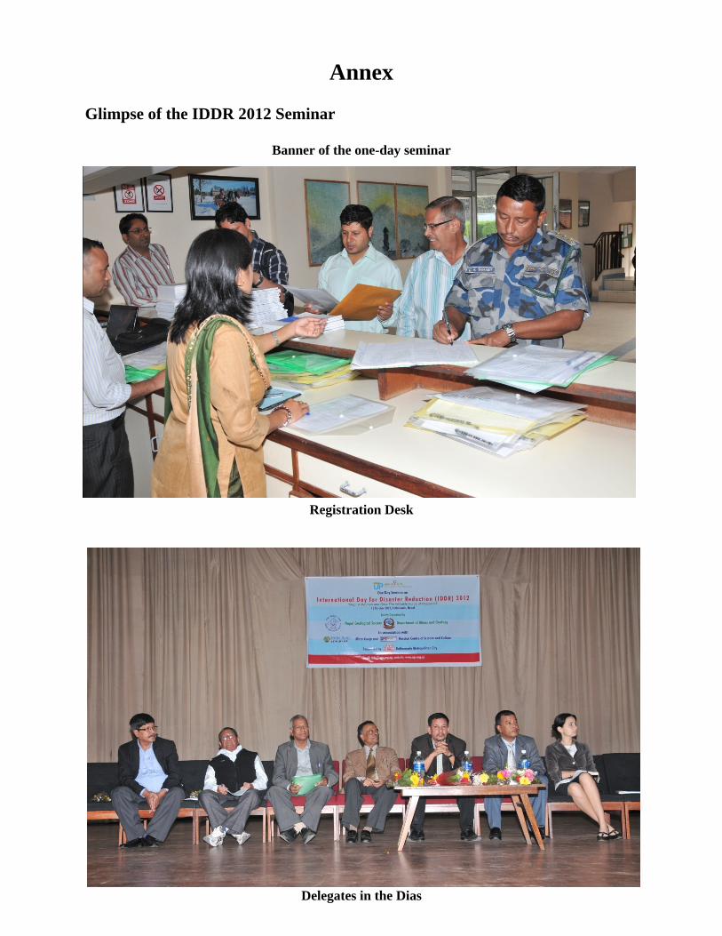
Banner of the one-day seminar
Registration Desk
Delegates in the Dias
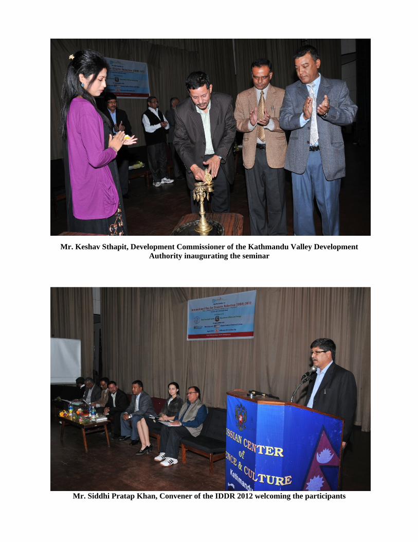
Mr. Keshav Sthapit, Development Commissioner of the Kathmandu Valley Development Authority inaugurating the seminar
Mr. Siddhi Pratap Khan, Convener of the IDDR 2012 welcoming the participants
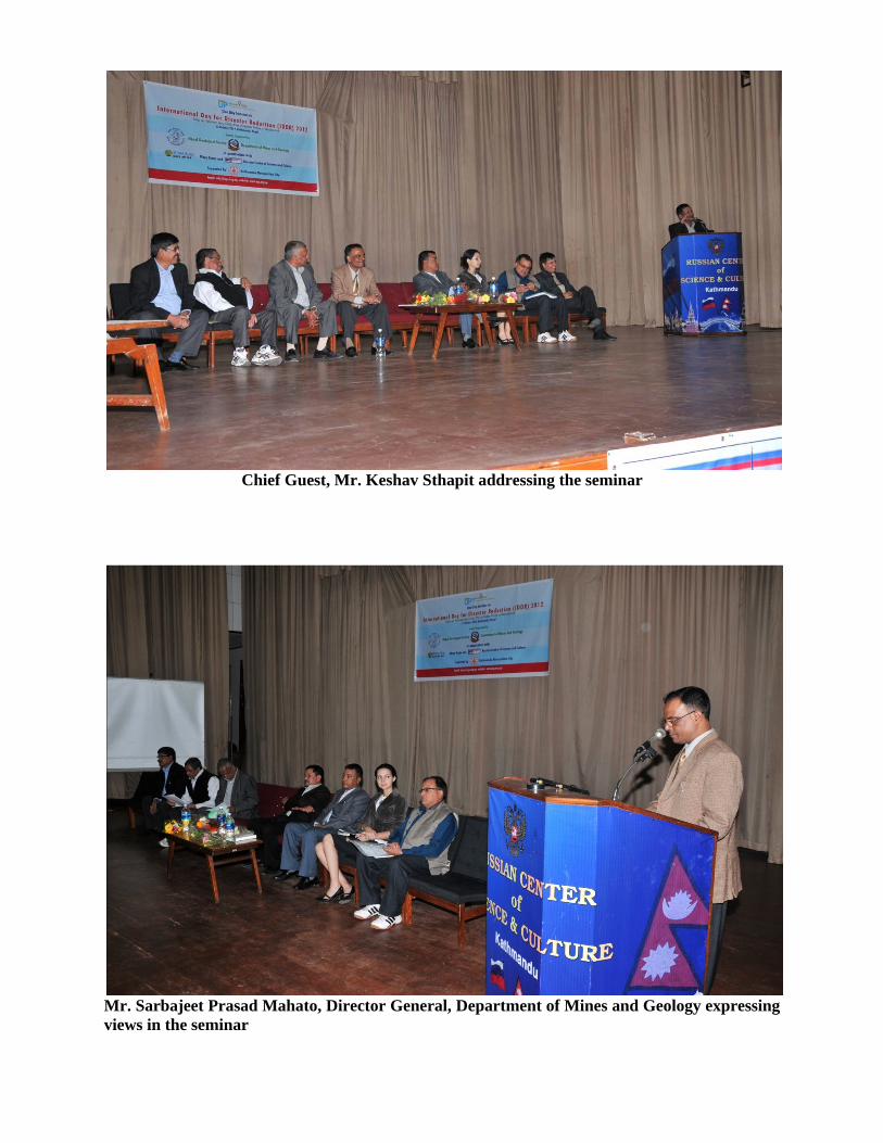
Chief Guest, Mr. Keshav Sthapit addressing the seminar
Mr. Sarbajeet Prasad Mahato, Director General, Department of Mines and Geology expressing views in the seminar
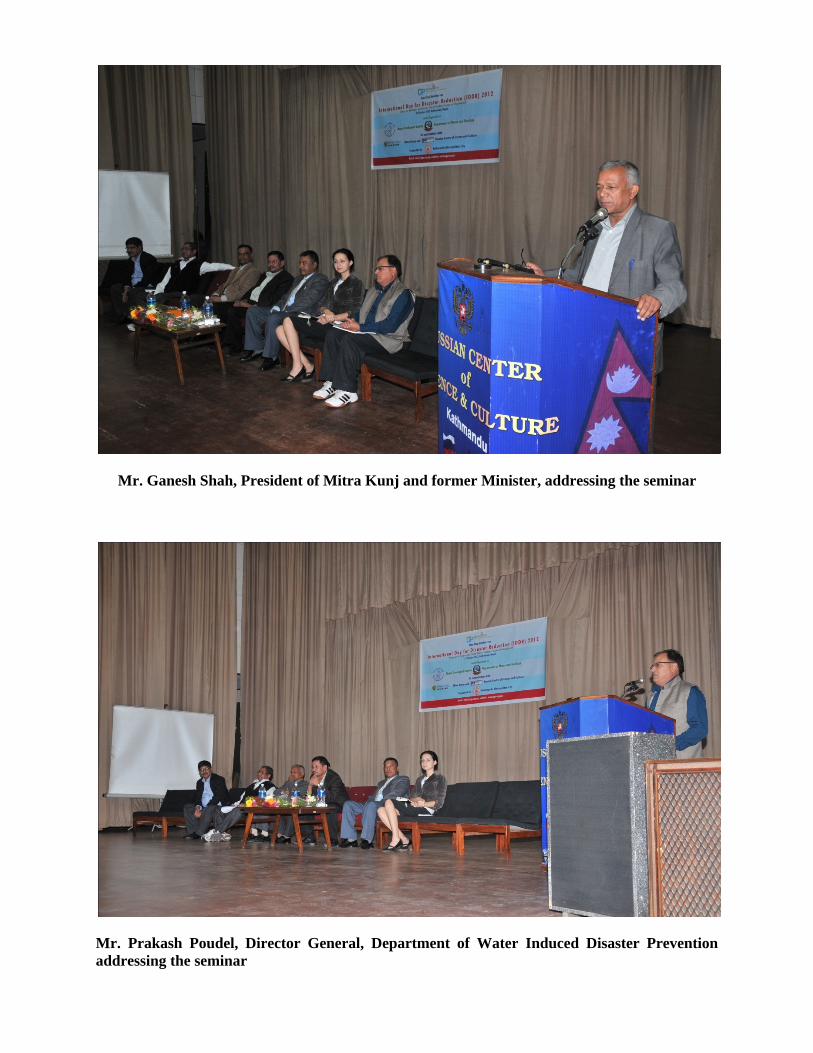
Mr. Ganesh Shah, President of Mitra Kunj and former Minister, addressing the seminar
Mr. Prakash Poudel, Director General, Department of Water Induced Disaster Prevention addressing the seminar
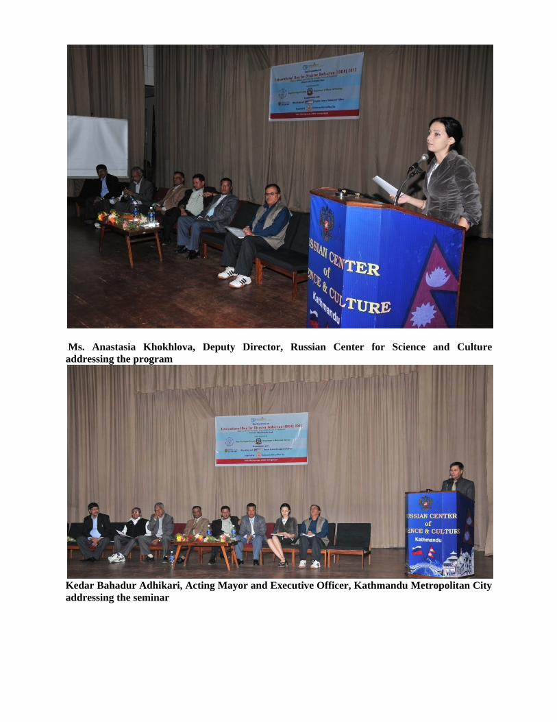
Ms. Anastasia Khokhlova, Deputy Director, Russian Center for Science and Culture addressing the program
Kedar Bahadur Adhikari, Acting Mayor and Executive Officer, Kathmandu Metropolitan City addressing the seminar

Mr. Uttam Bol Shrestha, President, Nepal Geological Society welcoming the participants
Mr. Sudhir Rajaure, General Secretary, Nepal Geological Society paying Vote of Thanks
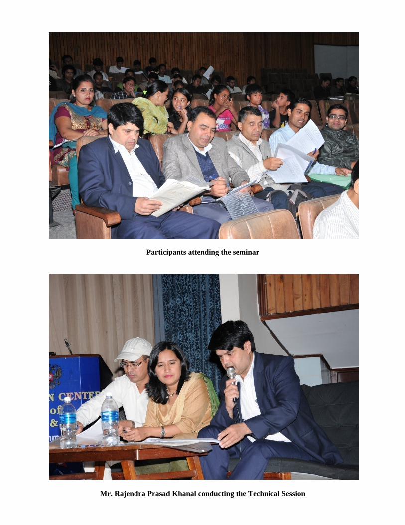
Participants attending the seminar
Mr. Rajendra Prasad Khanal conducting the Technical Session
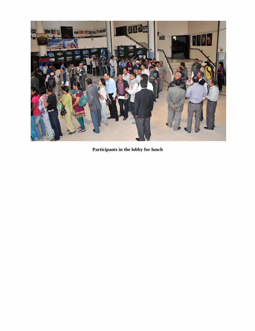
Participants in the lobby for lunch