Embed Size (px)
Citation preview
` 100 US$ 10 RNI NO. UPENG/2011/37063
Vol. 1 Issue. 5 Sep – Oct 2011
InterviewSanjay SahayInspector General of PolicePolice Computer Wing, Bangalore P.25
P.14
We Get the Point
Together with Leica Geosystems, we offer the
ERDAS IMAGINE®
, LPS, ERDAS APOLLO and Intergraph’s GeoMedia
®
at www.erdas.com/lidar.
Chairman MP NarayananPublisher Sanjay Kumar
Publication TeamExecutive Editor Bhanu RekhaProduct Manager Shivani LalAssistant Editors Aditi Bhan, Deepali Roy, Vaibhav AroraSub-Editor Anand Kashyap
Designed by Deepak KumarManoj Kumar Singh
Circulation TeamCirculation Manager Vijay Kumar Singh
Owner, Publisher & Printer Sanjay Kumar Printed at M. P. Printers, B - 220, Phase-II, Noida - 201 301, Gautam Budh Nagar (UP) India Publication Address A - 92, Sector - 52, Gautam Budh Nagar, Noida, India Editor Sanjay Kumar
Price `100, US$ 10
Geospatial Media and Communications Pvt. Ltd.(formerly GIS Development Pvt. Ltd.)A - 145, Sector - 63, Noida, IndiaTel + 91 120 4612500 Fax + 91 120 4612555/666
Geospatial Media and Communications Pvt. Ltd. does not necessarily subscribe to the views expressed in the publication. All views expressed in this issue are those of the contributors. The publication is not responsible for any loss to anyone due to the information provided.
Cover image courtesy www.transformers2.nethttp://1.bp.blogspot.com
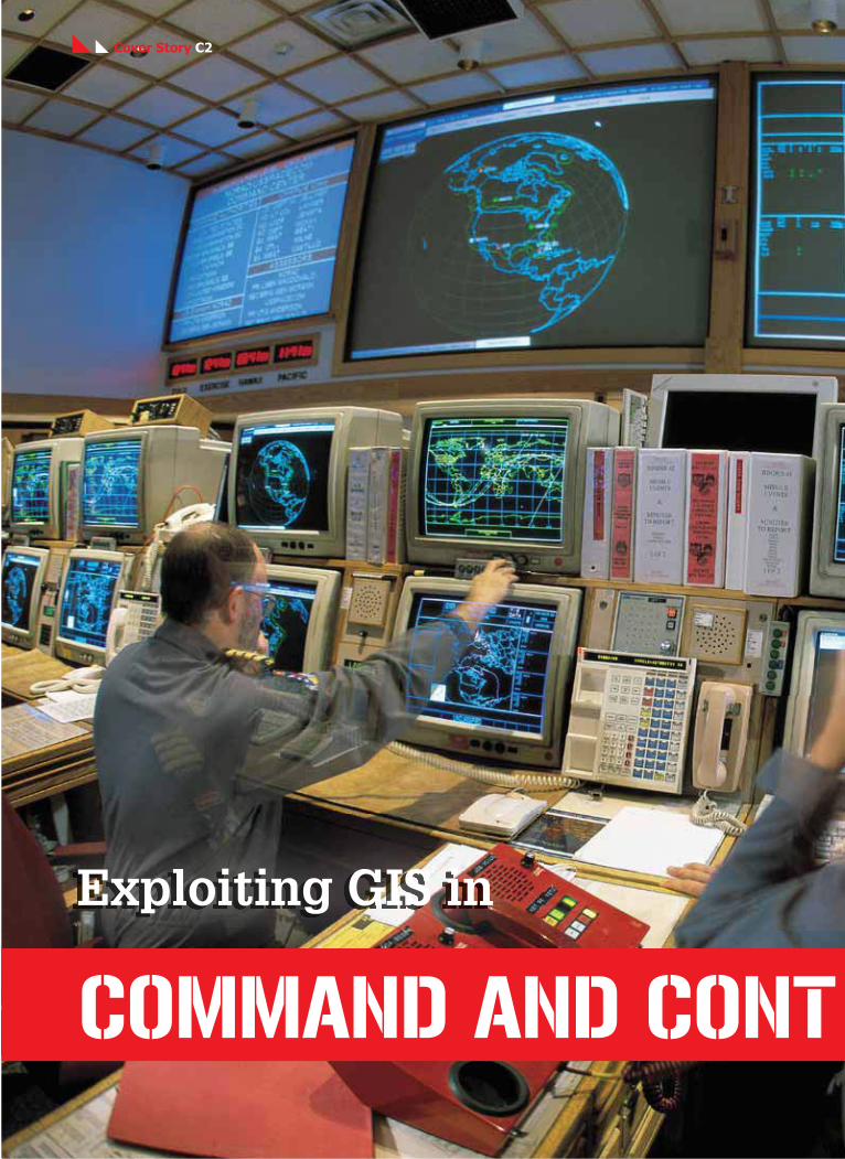
Exploiting GIS in command and control systemsIn
side
SECTIONSNews..................................................... 04
Events................................................... 41
Image Intelligence .......................... 42
25
14
GUEST ARTICLES
Geoint for guerrilla warfare 28Today’s unconventional warfare requires understanding of terrain and an ability to be able to anticipate your adversary’s next move. Geospatial intelligence helps you visualise the enemy’s possible gameplan
Guarding the frontiers 32Border management is important for a nation’s security. There is a need to cultivate modern surveillance technologies for the purpose
The potent technique 36The present day confl icts demand that security agencies invest in technologies that provide them complete situational awareness. This will go a long way in enhancing surveillance and emergency response capabilities of the state
REPORT
The booming market of homeland security 39
INTERVIEW
Sanjay SahayInspector General of PolicePolice Computer Wing, Bangalore
ADVERTORIAL
INTERGRAPH 21 Delivering Actionable Intelligence
GEOI
NTEL
LIGE
NCE
se
p – o
ct 2011
3
Rolta acquires ACLS Systems
Rolta has acquired the public safety and emergency response company ACLS Systems, FZC through complete asset purchase. This acquisition includes acquiring the full portfolio of ACLS software technology including source code, design documentation, IPR rights and all other related materials, along with exclusive world-wide sales and marketing rights and hiring of ACLS employees. ACLS software solutions are successfully deployed by numerous organisations for managing multi-agency responders including police, fi re-brigade and ambulance services. According to the company, the software is noted for its ease of use, adaptability to client specifi c requirements and reliability in supporting fi rst responders in dispatch centers and in the fi eld. With this acquisition, Rolta will now be able to comprehensively address the needs of security agencies in an integrated manner for homeland as well as maritime security applications, adds the company.
IAF needs advanced simulators
"The present requirement of advanced simulators for providing
AAASIAAAAAAAAAASSSSASIA
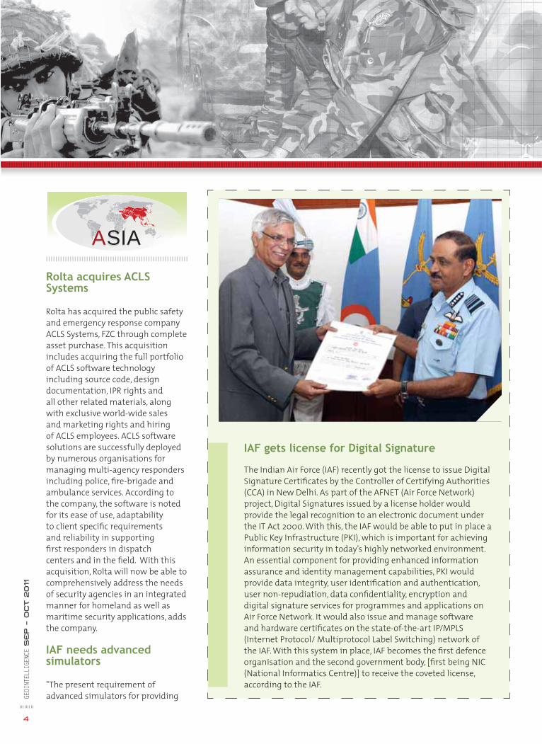
IAF gets license for Digital Signature
The Indian Air Force (IAF) recently got the license to issue Digital Signature Certifi cates by the Controller of Certifying Authorities (CCA) in New Delhi. As part of the AFNET (Air Force Network) project, Digital Signatures issued by a license holder would provide the legal recognition to an electronic document under the IT Act 2000. With this, the IAF would be able to put in place a Public Key Infrastructure (PKI), which is important for achieving information security in today’s highly networked environment. An essential component for providing enhanced information assurance and identity management capabilities, PKI would provide data integrity, user identifi cation and authentication, user non-repudiation, data confi dentiality, encryption and digital signature services for programmes and applications on Air Force Network. It would also issue and manage software and hardware certifi cates on the state-of-the-art IP/MPLS (Internet Protocol/ Multiprotocol Label Switching) network of the IAF. With this system in place, IAF becomes the fi rst defence organisation and the second government body, [fi rst being NIC (National Informatics Centre)] to receive the coveted license, according to the IAF.
GEOI
NTEL
LIGE
NCE
SE
P – O
ct 2011
4

5
effective training to Indian armed forces in cost effective manner is signifi cantly high, said Air Marshal KK Nohwar, Vice Chief of Air Staff, Indian Air force (IAF). He was speaking at SEM-SIM 2011, a National Seminar on Leveraging
Wipro Ltd has signed a Teaming Agreement (TA) with Saab to manufacture, deliver and market Saab’s entire suite of Land Electronic Defence Systems (LEDS) in India. LEDS provides active protection to light and medium combat vehicles as well as the main battle tanks against engagement by weapons like the RPGs, anti-tank missiles, mortars and artillery shells.
Wipro and Saab will jointly pursue opportunities for LEDS in India with Indian defence establishments and original equipment manufactures. Wipro will be involved in the development, adaptation and integration of the LEDS equipment and software for Indian customers.
LEDS combines active signature management, softkill and hardkill mechanisms to provide full spectrum active protection to land vehicles. The specifi cations include full
Saab and Wipro sign Teaming Agreement
Simulation Technologies to Enhance Combat Potential organised by CII in Delhi. He also called for a strong and long-lasting partnership between industry and armed services to meet the growing needs of simulators and
hemispherical coverage to detect incoming threats and alert the crew. When installed in full confi guration, the system offers protection to light and medium combat vehicles against engagement by weapons like the RPGs, anti-tank missiles, KE ammunition, mortars and artillery shells.
LEDS consists of a sensor suite including Laser Warning Systems and Radar sensors, a central active
defence controller (ADC), a high speed directed launch system (HSDL) and countermeasure options, ranging from fast multi-spectral smoke, through active signature management devices and decoys, to hardkill options. The deployment is controlled intelligently from the ADC by taking into consideration the wind conditions, threat engagement geometry and vehicle motion.
leveraging simulation technologies to enhance the combat potential of Indian armed forces. He also said that the use of simulators would signifi cantly bring down the fl ying cost, fuel cost and the loss of life and equipments.
Cou
rtes
y: S
AA
B
NEWS
Roke partners with Marshall Land Systems
Roke Manor Research has collaborated with Marshall Land Systems to provide a mobile surveillance and Electronic Warfare (EW) capability for Marshall's unmanned ground vehicle (UGV) platforms. Providing stand-off surveillance capabilities, the enhanced UGV will give troops advanced surveillance support, GE
OINT
ELLI
GENC
E S
EP – O
ct 2011
6
EEUURROOPPEEUUUUUUUUUUUUUU PEPEEEEEEEEEEEEEEEEEEEEEEEEPEPEEEEEEEEEEEEEEEEEEEEEEEEEEOOOOROROROROROROOOOOOOOOOOOOOOOO EEEEEEEEEEEUROPE
New 80 megapixel aerial camera from Trimble
Trimble recently released its new 80 megapixel Trimble Aerial Camera (TAC 80MP), extending the range of applications of medium-format aerial cameras.
With advanced features such as Trimble's forward motion compensation (FMC) technology, the TAC 80MP allows aerial service providers to or increase ground sampling distance. According to the company, this enables fi xed wing aircraft to deliver results previously only achievable with helicopter campaigns. With a weight of less than 3,000 grams (6.6 lbs.), the TAC 80MP is said to be an ideal camera for a variety of unmanned aerial vehicles (UAV), thus further extending its application range.
Designed as a workhorse for traditional fl ight campaigns, TAC 80MP is a suitable replacement for aging large-format analog cameras (LFC), which are increasingly being taken out of service. Because the long side of the TAC 80MP sensor is equal to an analog LFC image scanned at 20 micrometers, service providers are able to fl y the TAC 80MP instead of allocating
additional resources to their digital large-format fl eet. TAC 80MP is expected to be available in the fourth quarter of 2011 from Trimble and authorised resellers.
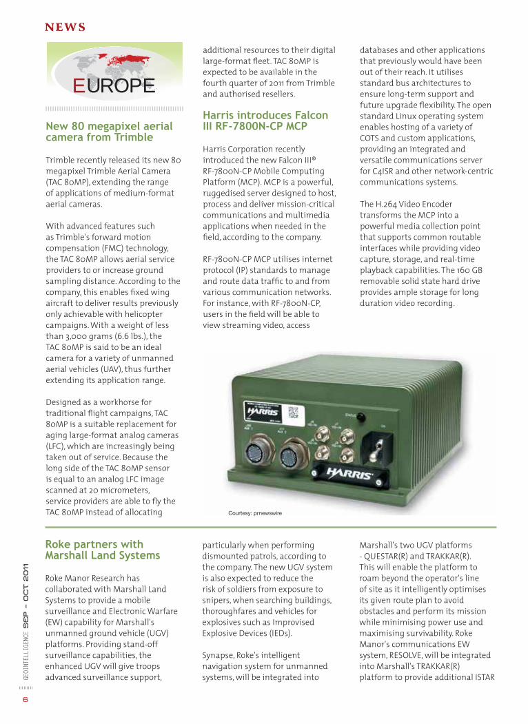
Harris introduces Falcon III RF-7800N-CP MCP
Harris Corporation recently introduced the new Falcon III® RF-7800N-CP Mobile Computing Platform (MCP). MCP is a powerful, ruggedised server designed to host, process and deliver mission-critical communications and multimedia applications when needed in the fi eld, according to the company.
RF-7800N-CP MCP utilises internet protocol (IP) standards to manage and route data traffi c to and from various communication networks. For instance, with RF-7800N-CP, users in the fi eld will be able to view streaming video, access
databases and other applications that previously would have been out of their reach. It utilises standard bus architectures to ensure long-term support and future upgrade fl exibility. The open standard Linux operating system enables hosting of a variety of COTS and custom applications, providing an integrated and versatile communications server for C4ISR and other network-centric communications systems.
The H.264 Video Encoder transforms the MCP into a powerful media collection point that supports common routable interfaces while providing video capture, storage, and real-time playback capabilities. The 160 GB removable solid state hard drive provides ample storage for long duration video recording.
particularly when performing dismounted patrols, according to the company. The new UGV system is also expected to reduce the risk of soldiers from exposure to snipers, when searching buildings, thoroughfares and vehicles for explosives such as Improvised Explosive Devices (IEDs).
Synapse, Roke's intelligent navigation system for unmanned systems, will be integrated into
Marshall's two UGV platforms - QUESTAR(R) and TRAKKAR(R). This will enable the platform to roam beyond the operator's line of site as it intelligently optimises its given route plan to avoid obstacles and perform its mission while minimising power use and maximising survivability. Roke Manor's communications EW system, RESOLVE, will be integrated into Marshall's TRAKKAR(R) platform to provide additional ISTAR
Courtesy: prnewswire
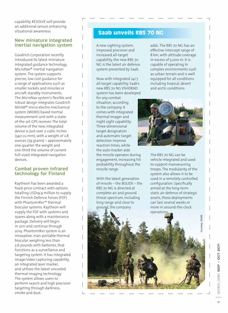
A new sighting system, improved precision and increased all-target capability, the new RBS 70 NG is the latest air defence system presented by Saab.
Now with integrated 24/7 all-target capability, Saab’s new RBS 70 NG VSHORAD system has been developed for any combat situation, according to the company. It comes with integrated thermal imager and night sight capability. Three-dimensional target designation and automatic target detection improve reaction times, while the auto-tracker aids the missile operator during engagement, increasing hit probability throughout the missile range.
With the latest generation of missile – the BOLIDE – the RBS 70 NG is directed at complete air and ground threat spectrum, including long range and close to ground, the company
adds. The RBS 70 NG has an effective intercept range of 8 km, with altitude coverage in excess of 5,000 m. It is capable of operating in complex environments such as urban terrain and is well equipped for all conditions including tropical, desert and arctic conditions.
The RBS 70 NG can be vehicle integrated and used to support manoeuvring troops. The modularity of the system also allows it to be used in a remotely controlled confi guration. Specifi cally aimed at the long-term static air defence of strategic assets, these deployments can last several weeks or more in around-the-clock operations.
Saab unveils RBS 70 NG
GEOI
NTEL
LIGE
NCE
SE
P – O
ct 2011
7
capability. RESOLVE will provide an additional sensor, enhancing situational awareness.
New miniature integrated inertial navigation system
Goodrich Corporation recently introduced its latest miniature integrated guidance technology, MicroNav® inertial navigation system. The system supports precise, low cost guidance for a range of applications such as smaller rockets and missiles or aircraft standby instruments. The MicroNav system's fl exible and robust design integrates Goodrich MinIM® micro electro-mechanical system (MEMS) based inertial measurement unit with a state-of-the-art GPS receiver. The total volume of the new, integrated device is just over 2 cubic inches (340 cu mm), with a weight of 2.8 ounces (79 grams) – approximately one-quarter the weight and one-third the volume of current full-sized integrated navigation devices.
Combat proven infrared technology for Finland
Raytheon has been awarded a fi xed-price contract with options totalling USD19.9 million to supply the Finnish Defence Forces (FDF) with PhantomIRxr™ thermal biocular systems. Raytheon will supply the FDF with systems and spares along with a maintenance package. Delivery will begin in 2011 and continue through 2014. PhantomIRxr system is an innovative, man-portable thermal biocular, weighing less than 3.6 pounds with batteries, that functions as a surveillance and targeting system. It has integrated image/video capturing capability, an integrated laser marker, and utilises the latest uncooled thermal imaging technology. The system allows users to perform search and high precision targeting through darkness, smoke and dust.
Cou
rtes
y: S
AA
B
NEWS
Real-time interpreter
Lockheed Martin has developed a real-time, virtual capability that allows forces battling language barriers to instantly connect to a pool of highly qualifi ed interpretation services. Tailored to meet the exponential demand for qualifi ed interpreters in theater, this Linguist on-line service, LinGo Link, uses an innovative service delivery model to connect the edge user to a bank of interpreters in a remote service center within the area of operations. The system can use either commercial cellular or Wi-Fi services, or a tactical communications network such as Lockheed Martin's MONAX™ persistent tactical broadband
capability. When support is needed, the user initiates a two-channel call to connect with a qualifi ed interpreter. Outfi tted with a Smartphone and LinGo Link's mobile peripheral devices, users can exchange high-quality audio, video, photos and text during conversations with interpreters. LinGo Link also enables the interpreter to provide "whisper-in-the-ear" cultural and intelligence support that goes beyond the words being spoken — offering clues to the community's culture, security, economy, and laws — and enhancing the quality of the exchange.
ITT and Mercury jointly develop embedded ISR processing system
ITT Corporation and Mercury Computer Systems, Inc. have jointly developed a processing solution known as FELCO (Federated
AAME IC SAAM ASAMEERIICCASSSMEMEMMMEMEEEEEEEEMEME AAASASASASSSSSSSSSSSSSSSSIIRRRRRIRIIIRRRRIIRIRIRIRIIIICICASSSSSAMERICAS
GEOI
NTEL
LIGE
NCE
SE
P – O
ct 2011
8
Embedded inteL-server for Collaborative Operations) that meets the ISR interoperability needs of the warfi ghter.
FELCO is expected to be the fastest means of transforming raw sensor imagery and metadata from airborne surveillance platforms into assured geospatial intelligence in a small, open-standard confi guration while a mission is on station.
According to the company, FELCO gives users more control of how they view the information besides removing processing time lag. The new system enables DVR-like interactions in which the user can stop, rewind, review in slow motion and resume live video. FELCO gives users the ability to customise the content of the information stream according to changing conditions.
Developed and supported on Mercury's Application-Ready Subsystems™ (ARS™), FELCO
completed a fail-safe analysis effort on the Spartan-6Q family to confi rm that the individual regions of FPGA are isolated from each other in the event of failure. Although designed to meet NSA requirements, the isolation design fl ow solution provides techniques useful in other high- reliability applications such as commercial avionics governed by FAA DO-254 and commercial cryptographic systems governed by NIST FIPS-140.
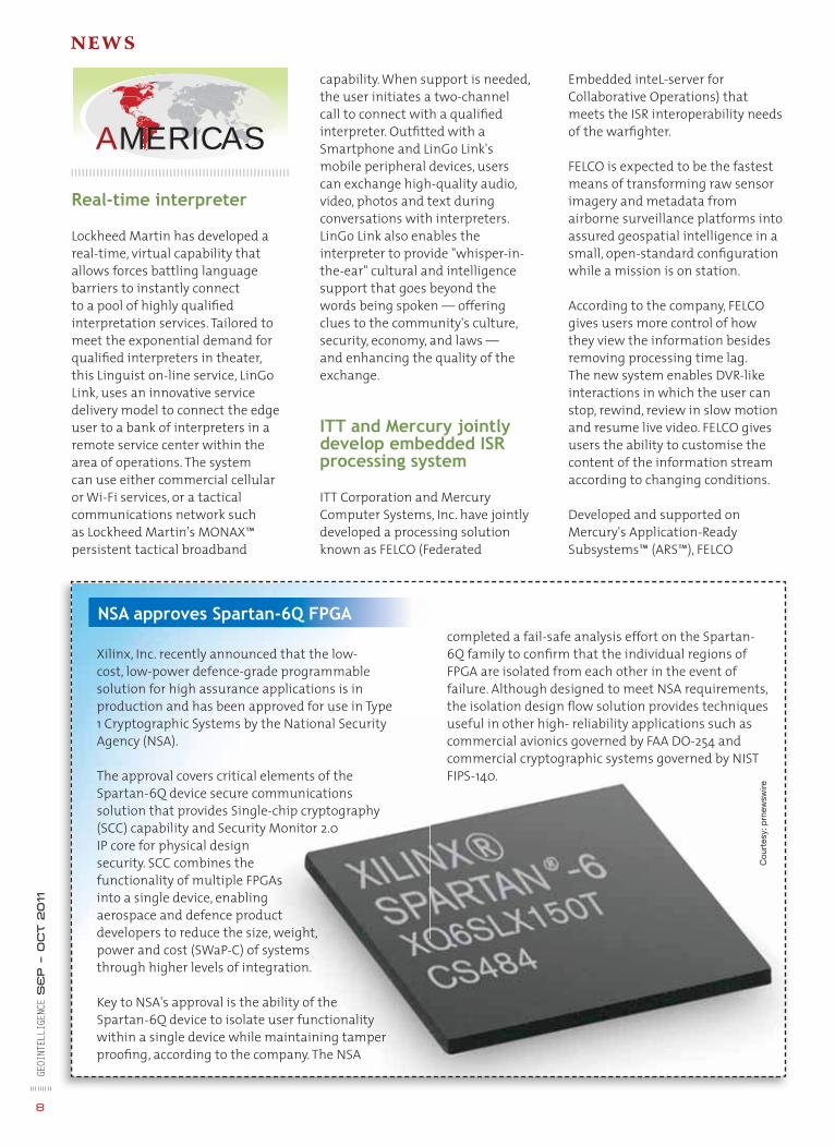
Xilinx, Inc. recently announced that the low-cost, low-power defence-grade programmable solution for high assurance applications is in production and has been approved for use in Type 1 Cryptographic Systems by the National Security Agency (NSA).
The approval covers critical elements of the Spartan-6Q device secure communications solution that provides Single-chip cryptography (SCC) capability and Security Monitor 2.0 IP core for physical design security. SCC combines the functionality of multiple FPGAs into a single device, enabling aerospace and defence product developers to reduce the size, weight, power and cost (SWaP-C) of systems through higher levels of integration.
Key to NSA's approval is the ability of the Spartan-6Q device to isolate user functionality within a single device while maintaining tamper proofi ng, according to the company. The NSA
NSA approves Spartan-6Q FPGA
Cou
rtes
y: p
rnew
swire
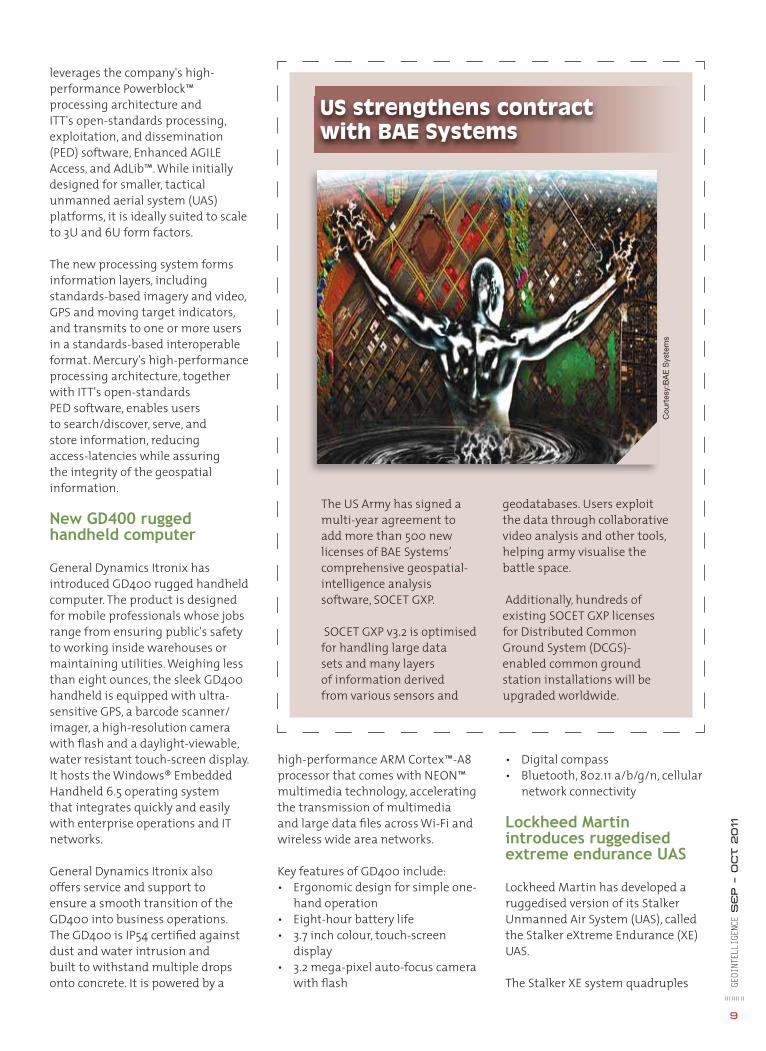
The US Army has signed a multi-year agreement to add more than 500 new licenses of BAE Systems’ comprehensive geospatial-intelligence analysis software, SOCET GXP.
SOCET GXP v3.2 is optimised for handling large data sets and many layers of information derived from various sensors and
US strengthens contract with BAE Systems
geodatabases. Users exploit the data through collaborative video analysis and other tools, helping army visualise the battle space.
Additionally, hundreds of existing SOCET GXP licenses for Distributed Common Ground System (DCGS)-enabled common ground station installations will be upgraded worldwide.
GEOI
NTEL
LIGE
NCE
SE
P – O
ct 2011
9
leverages the company's high-performance Powerblock™ processing architecture and ITT's open-standards processing, exploitation, and dissemination (PED) software, Enhanced AGILE Access, and AdLib™. While initially designed for smaller, tactical unmanned aerial system (UAS) platforms, it is ideally suited to scale to 3U and 6U form factors.
The new processing system forms information layers, including standards-based imagery and video, GPS and moving target indicators, and transmits to one or more users in a standards-based interoperable format. Mercury's high-performance processing architecture, together with ITT's open-standards PED software, enables users to search/discover, serve, and store information, reducing access-latencies while assuring the integrity of the geospatial information.
New GD400 rugged handheld computer
General Dynamics Itronix has introduced GD400 rugged handheld computer. The product is designed for mobile professionals whose jobs range from ensuring public's safety to working inside warehouses or maintaining utilities. Weighing less than eight ounces, the sleek GD400 handheld is equipped with ultra-sensitive GPS, a barcode scanner/imager, a high-resolution camera with fl ash and a daylight-viewable, water resistant touch-screen display. It hosts the Windows® Embedded Handheld 6.5 operating system that integrates quickly and easily with enterprise operations and IT networks.
General Dynamics Itronix also offers service and support to ensure a smooth transition of the GD400 into business operations. The GD400 is IP54 certifi ed against dust and water intrusion and built to withstand multiple drops onto concrete. It is powered by a
high-performance ARM Cortex™-A8 processor that comes with NEON™ multimedia technology, accelerating the transmission of multimedia and large data fi les across Wi-Fi and wireless wide area networks.
Key features of GD400 include:• Ergonomic design for simple one-
hand operation • Eight-hour battery life • 3.7 inch colour, touch-screen
display• 3.2 mega-pixel auto-focus camera
with fl ash
• Digital compass • Bluetooth, 802.11 a/b/g/n, cellular
network connectivity
Lockheed Martin introduces ruggedised extreme endurance UAS
Lockheed Martin has developed a ruggedised version of its Stalker Unmanned Air System (UAS), called the Stalker eXtreme Endurance (XE) UAS.
The Stalker XE system quadruples
Cou
rtes
y:B
AE
Sys
tem
s
NEWSGE
OINT
ELLI
GENC
E S
EP – O
ct 2011
10
‘Network in a box’
Lockheed Martin has developed Communications-on-the-Move (COTM) kit which gives warfi ghters access to various networks without having to incorporate equipments in their vehicles.
Lockheed Martin's Whetstone™ COTM network kit is an affordable, platform agnostic system for extending the network to soldiers at the tactical edge of the battlefi eld.
This "network in a box" has a confi guration that can be tailored to meet changing mission requirements, eliminating the need for vehicles to be tailored specifi cally for mobile communications. Depending on the mission performed, the kit can be integrated from one platform to another in less than one hour. It is completely scalable, provides SATCOM connectivity and can support anything from small unit missions with critical voice, data and video mission command services to fi lling the communications needs for a brigade combat team command post with complete battle staff.
This sophisticated suite of communications gear includes servers, solid state storage, a network switch, and a router. The kit can push various types of broadband data, such as satellite imagery down to small, company-level units that lack wideband connections.
It can also equip vehicles with communications link to satellite, enhanced position location reporting system, single channel ground and airborne radio system and UHF/VHF line of sight.
Stalker's fl ight endurance to eight-plus hours without impacting the mobility of the unmanned system or the fl exibility of its payload capabilities. It is powered by Ultra Electronics' pioneering hybrid energy source using a propane fuel cell with a small, conventional lithium polymer battery to handle power peaks.
The complete Stalker XE system includes two aircraft, fuel cells, command and control ground station, support equipment and small propane fuel storage tank. The standard air vehicle sensor is a modular dual daylight and night-time imager that allows persistent surveillance during the visual/thermal transition from day to night.
GPS IIF satellite ready for US Air Force
Boeing recently announced that the second of 12 GPS IIF satellites the company is building for the US Air Force has completed on-orbit checkout and spacecraft control authority transfer. With testing complete, GPS IIF-2, called SVN-63, will be the newest satellite to join the active 31-satellite GPS constellation operated by the Air Force 50th Space Wing and the 2nd Space Operations Squadron.
Boeing is responsible for the GPS ground and space segments, providing an integrated system solution for GPS IIF and for the operation of the entire constellation. GPS IIF will form the core of the GPS constellation for the next decade or longer, according to the company.
Harris Corporation bags USD 12 million contracts
Harris Corporation was awarded four contracts worth over USD 12 million by the US Air Force's electronic systems center through the cyber integration division, information transport systems programme management offi ce.
Cou
rtes
y: h
ttp
://lh
6.go
ogle
user
cont
ent.
com
jan – feb 2011 GEOINTELLIGENCE I 11
I would like to subscribe for (tick as applicable)
1 year (6 bimonthly issues for Rs.600 / US$60)
2 years (12 bimonthly issues for Rs.1200 / US$120)
First name ................................................ Last name ..........................................
Designation .............................................. Organization .......................................
Address ...................................................................................................................
City ............................................................ State ...................................................
Postal code .............................................. Country ................................................
Phone ........................................................ Fax .....................................................
Email ........................................................................................................................
I enclose cheque no .................................drawn on .............................................
dated ..........................................................towards subscription for GEO Intelligence
magazine in favour of Geospatial Media and Communication Pvt. Ltd.
Sign ......................................................... Date ..........................................................
Mail this form with payment to:Geospatial Media and Communication Pvt. Ltd.A-145, Sector - 63, Noida, IndiaTel + 91 120 4612500 Fax + 91 120 4612555 / 666
NEWS • VIEWS • REVIEWS • INTERVIEWS • NEWS • VIEWS • REVIEWS • INTERVIEWS • NEWS • VIEWS • REVIEWS • INTERVIEWS • NEWS • VVIEEEEWWWWWWWWWSSS • NEWS • VIEWS • REVIEWS • INTERVIEWS • NNNNNNNEEEEEWW
Cou
rtes
y: p
rnew
swire
NEWS
Under the contracts, Harris will install core IT infrastructure upgrades through extensive cabling and networking components at the four US Air Force bases. These bases include Malmstrom Air Force Base, Montana; Creech Air Force Base, Nevada; Randolph Air Force Base, Texas; and Vance Air Force Base, Oklahoma.
The Harris team includes subcontractor Trans-Tel Central, Inc. The projects were awarded under the Network-Centric Solutions (NETCENTS) contract vehicle.
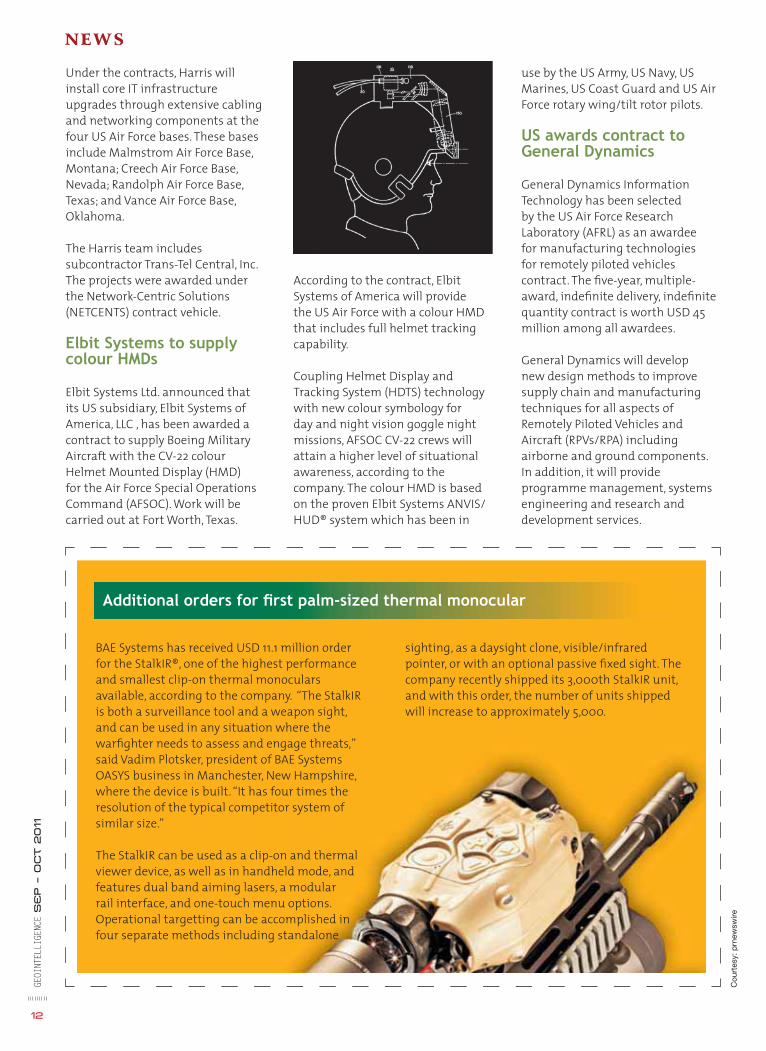
Elbit Systems to supply colour HMDs
Elbit Systems Ltd. announced that its US subsidiary, Elbit Systems of America, LLC , has been awarded a contract to supply Boeing Military Aircraft with the CV-22 colour Helmet Mounted Display (HMD) for the Air Force Special Operations Command (AFSOC). Work will be carried out at Fort Worth, Texas.
According to the contract, Elbit Systems of America will provide the US Air Force with a colour HMD that includes full helmet tracking capability.
Coupling Helmet Display and Tracking System (HDTS) technology with new colour symbology for day and night vision goggle night missions, AFSOC CV-22 crews will attain a higher level of situational awareness, according to the company. The colour HMD is based on the proven Elbit Systems ANVIS/HUD® system which has been in
BAE Systems has received USD 11.1 million order for the StalkIR®, one of the highest performance and smallest clip-on thermal monoculars available, according to the company. “The StalkIR is both a surveillance tool and a weapon sight, and can be used in any situation where the warfi ghter needs to assess and engage threats,” said Vadim Plotsker, president of BAE Systems OASYS business in Manchester, New Hampshire, where the device is built. “It has four times the resolution of the typical competitor system of similar size.”
The StalkIR can be used as a clip-on and thermal viewer device, as well as in handheld mode, and features dual band aiming lasers, a modular rail interface, and one-touch menu options. Operational targetting can be accomplished in four separate methods including standalone
12
use by the US Army, US Navy, US Marines, US Coast Guard and US Air Force rotary wing/tilt rotor pilots.
US awards contract to General Dynamics
General Dynamics Information Technology has been selected by the US Air Force Research Laboratory (AFRL) as an awardee for manufacturing technologies for remotely piloted vehicles contract. The fi ve-year, multiple-award, indefi nite delivery, indefi nite quantity contract is worth USD 45 million among all awardees.
General Dynamics will develop new design methods to improve supply chain and manufacturing techniques for all aspects of Remotely Piloted Vehicles and Aircraft (RPVs/RPA) including airborne and ground components. In addition, it will provide programme management, systems engineering and research and development services.
Additional orders for fi rst palm-sized thermal monocular
sighting, as a daysight clone, visible/infrared pointer, or with an optional passive fi xed sight. The company recently shipped its 3,000th StalkIR unit, and with this order, the number of units shipped will increase to approximately 5,000.
GEOI
NTEL
LIGE
NCE
SE
P – O
ct 2011
GEOI
NTEL
LIGE
NCE
SE
P – O
ct 2011
13
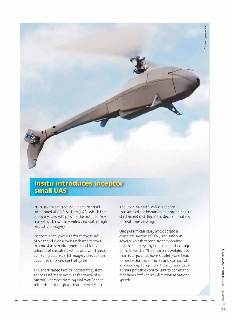
Insitu Inc. has introduced Inceptor small unmanned aircraft system (UAS), which the company says, will provide the public safety market with real-time video and stable, high-resolution imagery.
Inceptor's compact size fi ts in the trunk of a car and is easy to launch and recover in almost any environment. It is highly tolerant of sustained winds and wind gusts, achieving stable aerial imagery through an advanced onboard control system.
The short-range tactical rotorcraft system speeds and maneuvers at the touch of a button. Operator training and workload is minimised through a streamlined design
Insitu introduces Inceptor small UAS
and user interface. Video imagery is transmitted to the handheld ground control station and distributed to decision makers for real-time viewing.
One person can carry and operate a complete system reliably and safely in adverse weather conditions, providing instant imagery anytime an aerial vantage point is needed. The rotorcraft weighs less than four pounds, hovers quietly overhead for more than 20 minutes and can patrol at speeds up to 24 mph. The operator uses a small portable control unit to command it to hover or fl y in any direction at varying speeds.
Cou
rtes
y: p
rnew
swire
GEOI
NTEL
LIGE
NCE
SE
P – O
CT 2011
14
Exploiting GIS inExploiting GIS in
Cover Story C2
COMMAND AND CONT
GEOI
NTEL
LIGE
NCE
SE
P – O
CT 2011
15
ince the beginning of civilisation, military forces have played a dominant role in the world. The focus on strong military
continues to be a major force with a heavy reliance on technology. Technology has not only changed the way wars are fought, but its employment has become a key factor in attaining dominance in military power. Exercising of command and control (C2) is an essential element of military forces across the world. Use of technology for accurate and faster C2 has given paradigm elevation in situational awareness, thereby enabling military commanders to be ahead of enemy’s OODA (Observe, Orient, Decide and Act) loop by providing detailed informational decision support based on geo platform.
The need of swift and accurate C2 system was amply demonstrated during the Gulf war by Allied forces against Iraq. In an article published in Electronic Today (November 1996), Major General Gurbaksh Singh wrote: “The lessons gained from military history indicate that the key to military victory lies (regardless of military size of the opposing forces) in remaining ahead of the enemy in time sensitive C4I2 process. If a defending force or weapon system, with some accuracy and suffi cient warning, fi nds out where the attacker is or what his future course of action would be, it would be easier to defeat him by occupying position of advantage or by massing a superior force at the point of decision.”
GIS in C2 system
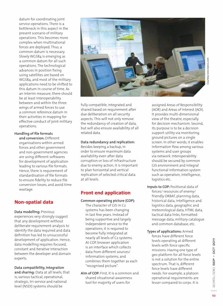
Command and Control, or C2, in a military organisation can be defi ned as the exercise of authority and direction by a designated commander over assigned and attached forces in the accomplishment of the mission. C2 functions are performed through
Cou
rtes
y: w
ww
.lock
heed
mar
tin.c
om
ROL SYSTEMS
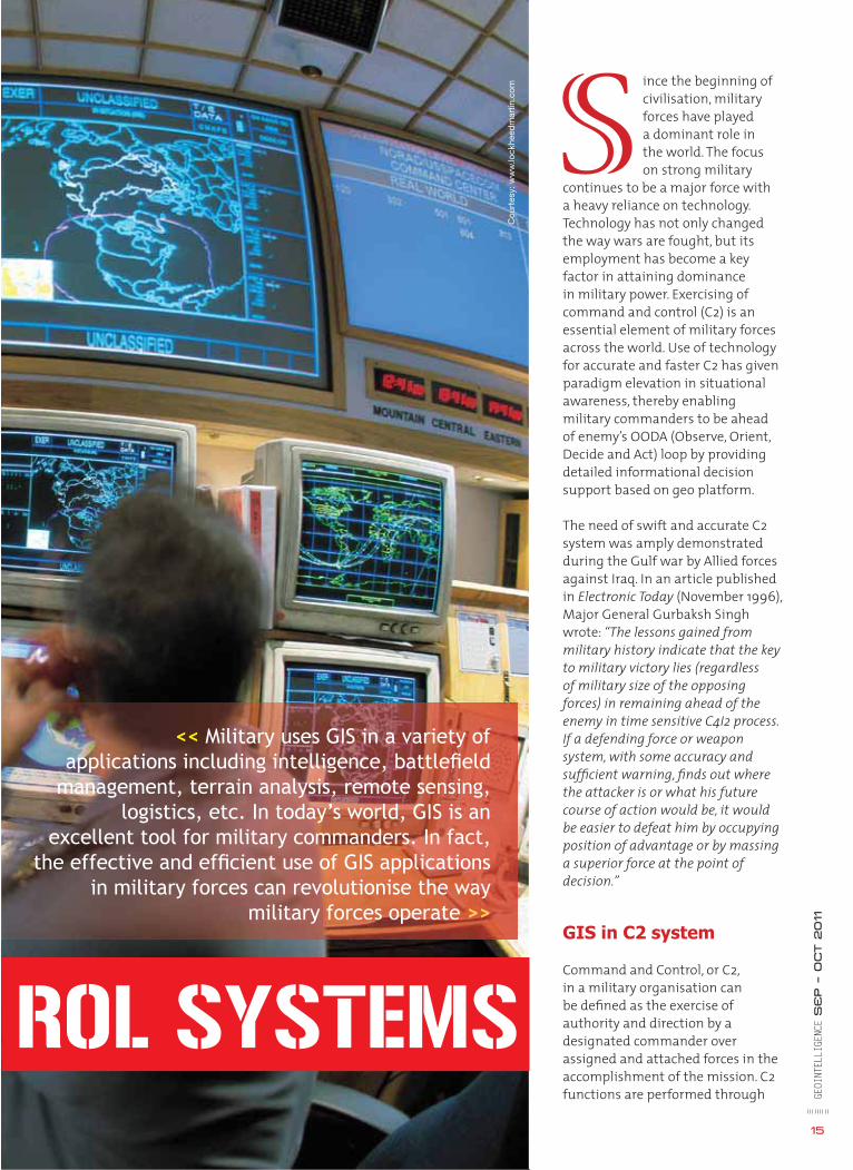
<< Military uses GIS in a variety of applications including intelligence, battlefi eld
management, terrain analysis, remote sensing, logistics, etc. In today’s world, GIS is an
excellent tool for military commanders. In fact, the effective and effi cient use of GIS applications
in military forces can revolutionise the way military forces operate >>
an arrangement of personnel, equipment, communications, facilities and procedures employed by a commander in planning, directing, coordinating and controlling forces and operations in the accomplishment of the mission. Commanders are assisted in executing these tasks by specialised staff offi cers and enlisted personnel, who provide a bi-directional fl ow of information between a commander and subordinate military units.
The purpose of military staff is mainly to provide accurate and timely information on which command decisions are based. The key application is that of decisions that effectively manage unit resources. While information fl ow towards the commander is a priority, information that is useful or contingent in nature is communicated to lower staff/ units.
The effect of technological developments in all facets of military arena cannot be ignored. In order to derive optimum benefi t from technologies, it is important to gather all types of information, that is, acquire, store and analyse information and process it in such a way that it is ready for use by commanders and staff. Along with obtaining information, it is critical
to present that information at the right place and right time on an easily understandable platform, and as accurate and updated as possible. One of the platforms that is used to manage the information is GIS. The technology provides analysing tools for decision makers to exercise C2. When we link the very complex spatial information with non-spatial information within a geographic model, it becomes easier to analyse and use information.
Power of GIS in C2 system
All operational activities are function of space and time. The aim of the decision spectrum involves making available operational resources at the right location and at the right time. The decision spectrum comprises OODA cycle, and the success of battlefi eld
management lies in reducing the time of our OODA cycle and increasing the cycle of the adversary. The power of GIS in C2 systems comes from the fact that GIS provides easily understandable geo platform with information plotted on it, thereby reducing time required to take decision, and issue orders to subordinate military units to take action.
Military GIS requirements are different and unique
Military decisions affect national security, human lives and can cause physical destruction. It is the last line of defence of a nation. There is therefore no scope for marginal error. Military planning is thus different from the way civil society plans. While GIS based civil application focuses on a few features and derive thematic layers from these features, military commanders would be interested in performing analysis on the entire layers on a cartographic map. In addition, tactical symbology is a vast and documented entity in itself which also forms part of a military commander’s analysis. Also, military decisions have a lot of subjectivity. These are some of the main factors that distinctly demarcates a military GIS application from that of any civil application.
Key applications for GIS based C2 systems
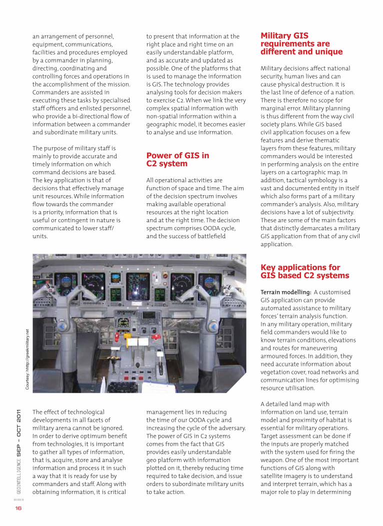
Terrain modelling: A customised GIS application can provide automated assistance to military forces’ terrain analysis function. In any military operation, military fi eld commanders would like to know terrain conditions, elevations and routes for maneuvering armoured forces. In addition, they need accurate information about vegetation cover, road networks and communication lines for optimising resource utilisation.
A detailed land map with information on land use, terrain model and proximity of habitat is essential for military operations. Target assessment can be done if the inputs are properly matched with the system used for fi ring the weapon. One of the most important functions of GIS along with satellite imagery is to understand and interpret terrain, which has a major role to play in determining
Cou
rtes
y: h
http
://g
reek
mili
tary
.net
GEOI
NTEL
LIGE
NCE
SE
P – O
CT 2011
16

GEOI
NTEL
LIGE
NCE
SE
P – O
CT 2011
19
datum for coordinating joint service operations. There is a bottleneck in this aspect in the present scenario of military operations. This becomes more complex when multinational forces are deployed. Thus, a common datum is necessary. Slowly WGS84 is emerging as a common datum for all such operations. The technological advances in position fi xing using satellites are based on WGS84, and most of the military applications need to be shifted to this datum in course of time. As an interim measure, there should be at least interoperability between and within the three wings of armed forces to use a common reference datum in their activities in mapping for effective conduct of joint military operations.
Handling of fi le formats and conversion: Different organisations within armed forces and other government and non-government agencies are using different softwares for development of application leading to various fi le formats. Hence, there is requirement of standardisation of fi le formats to ensure fi delity to reduce fi le conversion losses, and avoid time wastage.
Non-spatial data
Data modelling: Previous experiences very strongly suggest that any development without deliberate requirement analysis to identify the data required and data defi nition has led to unsuccessful development of application. Hence, data modelling requires focused, constant and iterative interaction between the developer and domain experts.
Data compatibility, integration and sharing: Data at all levels, that is, various tactical, operational, strategic, tri-service and national level (NSDI) systems should be
Cou
rtes
y:w
ww
.bar
co.c
om
fully compatible, integrated and shared based on requirement after due deliberation on all security aspects. This will not only remove the redundancy of creation of data, but will also ensure availability of all related data.
Data redundancy and replication: Besides keeping a backup, in order to ensure maximum data availability even after data corruption or loss of infrastructure due to enemy action, it is important to plan horizontal and vertical replication of selected critical data at all levels.
Front end application
Common operating picture (COP): The character of GIS in C2 systems has been changing in last few years. Instead of being supportive and largely independent service to the operations, it is required to become fully integrated at nearly all levels of C2 systems. At COP, browser application is an interface which collects data from different sources/ information systems, and combines them together as each “recognised picture”.
Aim of COP: First, it is a common and shared situational awareness tool for majority of users for
assigned Areas of Responsibility (AOR) and Areas of Interest (AOI). It provides multi-dimensional view of the theatre, especially for decision mechanism. Second, its purpose is to be a decision support utility via monitoring ground pictures on a single screen. In other words, it enables information fl ow among various systems and user groups via network. Interoperability should be secured by common GIS environment and integral functional information system such as operation, intelligence, logistics etc.
Inputs to COP: Positional data of forces/ resources of enemy/ friendly ORBAT, planning data, historical data, intelligence and logistics data, geographic and meteorological data, HTML data, tactical data links, formatted message data, military catalogue and common database, etc.
Types of applications: Armed forces have different force levels operating at different levels with force specifi c missions. Having one type of geo platform for all force levels is not a solution for the entire spectrum. That is, different force levels have different needs. For example, a platoon operational requirements are lesser compared to corps. It is
GEOI
NTEL
LIGE
NCE
SE
P – O
CT 2011
18
how troops can be deployed in the quickest and most effective way. Understanding land and what is located on it, is especially useful because a commander can determine strategic positions such as ideal locations for scouting parties, best line of sight/fi re and also the ability to hide troops and equipments.
Positioning and tracking systems:Military heavily depends on GIS and GPS to make tactical decisions such as guiding troops, supplies/equipment, informing them of possible threats, problems with terrain and also to direct attention to specifi c areas of interests.
Weather information system: Weather plays a dominant role in the battlefi eld. Real-time weather information is essential for fi eld commanders (be it on land, sea or in air) for successful completion of the task. At times, weather can play a crucial role in the success or failure of an operation. Thus, every battlefi eld commander requires information about cloud coverage, wind conditions, visibility, temperature parameters and other related inputs.
Simulation and wargaming: Operational information simulations would involve generation of 2D and 3D scenarios on a terrain backdrop which work on a database powered by “what if analysis” applications. Aim of these operational functions is to analyse the course of action of both enemy
as well as our own forces and aid in decision making.
3D terrain modelling, drape and fl y through systems: It is important to model the terrain and evaluate it before the operation begins. Draping of maps and imagery about the terrain is very helpful. This technology is also used for fl ight simulation.
Electronic warfare system: All electronic warfare systems require terrain data either for analysis or for display. GIS based platform is best suited for them.
Radar coverage and frequency analysis system: For the site selection of the radars and radio antennas, coverage area analysis, propagation analysis, weapon or missile corridors, fl ight corridors, etc. are analysed and displayed via GIS tools.
Geographic analysis: This includes profi le analysis, distance measurement, angle measurement, night visibility analysis, military overlay preparation tools, scaled and oriented value added map re-production, fi re coordination systems, deployment and transportation planning-monitoring systems etc.
Logistics management: GIS plays an important role in military logistics because it is able to move supplies, equipments and troops where they are needed, at the right time, place and in right quantity. GIS can be used to determine routes, for example, using network analysis for convoys, forces can establish alternative routes if mishaps or traffi c jams occur on the direct route. Application of GIS in the management of logistics bases facilitates maintenance. Planning for logistics with detailed route defi nitions, distribution models, shortest path analysis, query and display of the facilities and logistic infrastructure are other related issues addressed by the technology.
Challenges
There are various challenges ahead for exploitation of GIS in C2 systems. It involves multifaceted issues involving architecture, data, application, communication and organisation processes.
Architectural issues
Three tier (web) Vs two tier (client/ server) architecture
>>There is no need for high capacity RDBMS server with high capacity Web GIS server, high capacity network between client and server and between RDBMS server and web server for the web architecture, but all those are necessary for client/server architecture.
>> Technological future expectations and software management/ upgrade exist for web architecture but don’t exist for the client/ server architecture.
>> Response speed and network load is better in web architecture.
>> Cost of web architecture is low after 50 users but high in the client/server architecture.
Centralised vs distributed architecture: The decision on type should be taken after due deliberation on required response time, existing bandwidth, scale of the application, etc. For example, for an enterprise GIS covering large area, it should have distributed architecture. In line with the assessments above, the most effective architecture is “Web based GIS distributed architecture with RDBMS based spatial and non-spatial data storage.”
Spatial data
Common horizontal datum: It is necessary that the spatial data for use by military units reside within the framework of single
>> One of the most important functions of GIS along with
satellite imagery is to understand and interpret
terrain, which has a major role to play in determining
troop deployment in quickest and most effective way <<
GEOI
NTEL
LIGE
NCE
SE
P – O
CT 2011
20
similar to accessing different websites for the same data through a desktop/ laptop and mobile phones. Also, the nature of application will depend upon the mobile capability and characteristic of the force level. So while the back end database remains the same, what is required is that the application needs for different force level be identifi ed, and the applications developed accordingly. Also, there is need for seamless integration between all the applications.
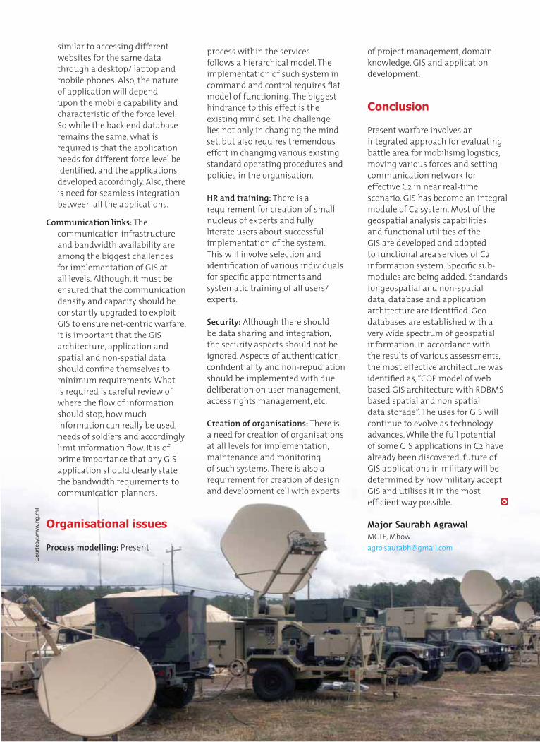
Communication links: The communication infrastructure and bandwidth availability are among the biggest challenges for implementation of GIS at all levels. Although, it must be ensured that the communication density and capacity should be constantly upgraded to exploit GIS to ensure net-centric warfare, it is important that the GIS architecture, application and spatial and non-spatial data should confi ne themselves to minimum requirements. What is required is careful review of where the fl ow of information should stop, how much information can really be used, needs of soldiers and accordingly limit information fl ow. It is of prime importance that any GIS application should clearly state the bandwidth requirements to communication planners.
Organisational issues
Process modelling: Present
process within the services follows a hierarchical model. The implementation of such system in command and control requires fl at model of functioning. The biggest hindrance to this effect is the existing mind set. The challenge lies not only in changing the mind set, but also requires tremendous effort in changing various existing standard operating procedures and policies in the organisation.
HR and training: There is a requirement for creation of small nucleus of experts and fully literate users about successful implementation of the system. This will involve selection and identifi cation of various individuals for specifi c appointments and systematic training of all users/ experts.
Security: Although there should be data sharing and integration, the security aspects should not be ignored. Aspects of authentication, confi dentiality and non-repudiation should be implemented with due deliberation on user management, access rights management, etc.
Creation of organisations: There is a need for creation of organisations at all levels for implementation, maintenance and monitoring of such systems. There is also a requirement for creation of design and development cell with experts
of project management, domain knowledge, GIS and application development.
Conclusion
Present warfare involves an integrated approach for evaluating battle area for mobilising logistics, moving various forces and setting communication network for effective C2 in near real-time scenario. GIS has become an integral module of C2 system. Most of the geospatial analysis capabilities and functional utilities of the GIS are developed and adopted to functional area services of C2 information system. Specifi c sub-modules are being added. Standards for geospatial and non-spatial data, database and application architecture are identifi ed. Geo databases are established with a very wide spectrum of geospatial information. In accordance with the results of various assessments, the most effective architecture was identifi ed as, “COP model of web based GIS architecture with RDBMS based spatial and non spatial data storage”. The uses for GIS will continue to evolve as technology advances. While the full potential of some GIS applications in C2 have already been discovered, future of GIS applications in military will be determined by how military accept GIS and utilises it in the most effi cient way possible.
Major Saurabh AgrawalMCTE, [email protected]
Cou
rtes
y:w
ww
.ng.
mil
Advertorial
ntergraph® is the leading global provider of engineering and geospatial solutions to businesses and governments in more than 60 countries. With industry-specifi c solutions, Intergraph infuses the
world with intelligence to make processes and infrastructures better, safer and smarter.
After a long and successful independent stint, Intergraph was acquired in 2010 and now functions as a wholly owned subsidiary of Hexagon AB, a leading provider of precision measurement technology systems.
Intergraph - SG&I Division
With more than 40 years of technology innovation to its credit, Intergraph’s Security, Government & Infrastructure (SG&I) division serves a range of industries, including defence and intelligence, public safety and security, government, transportation, communications and utilities. Intergraph’s unique combination of pioneering technology, comprehensive professional services and customer-focused programmes makes it a leading provider of geospatial solutions for resource management, land information management, earth imaging, mobile resource management, infrastructure management, geospatial data
management and cartographic production. Intergraph geospatial software integrates, geo-references and analyses large volumes of data from multiple sources to create, display and distribute actionable information to protect life, infrastructure and property.
Communications:Stay tuned
The Communications industry is experiencing an unprecedented evolution both in terms of technology and business, fi erce competition and demands for service reliability.
GEOI
NTEL
LIGE
NCE
SE
P – O
ct 2011
21
and administration. Intergraph enables local, regional and national governments develop and maintain public infrastructure. From land records to water, wastewater and transportation networks to economic development and planning, Intergraph’s advanced geospatial technology helps maintain, manage and analyse vast amounts of information and is an invaluable decision support tool. Intergraph’s solutions help government agencies maintain and increase their level of service while simultaneously streamlining their processes. Intergraph’s spatial data infrastructure (SDI) solutions integrate geospatial data across departments and organisations to enable quick, accurate information sharing for improved administration.
Defence: Toward actionable intelligence
Intergraph has been a trusted partner of defence and intelligence agencies across the world for more than 40
years. Drawing from its solid engineering heritage and open standards architecture, Intergraph brings people, data and systems together for faster, more accurate decision-making. Whether it is critical infrastructure protection, incident management and emergency response, cyberspace protection, facilities and resource management or geospatial intelligence exploitation, Intergraph delivers actionable intelligence to facilitate situational awareness and mission success.
Powerful technology solutions to suffi ciently support the growing and changing infrastructure are the need of the hour for the industry.
Intergraph’s geospatial tools to design, manage, monitor, maintain and analyse the facilities allow users to make intelligent decisions quickly. Intergraph’s automated solutions for managing geospatial communications network infrastructure help companies address these challenges. Adjunct technologies & applications like fi eld engineering, mobile workforce management (MWFM), enterprise integration and management of non-communications assets complete Intergraph’s offerings for a truly enterprise-wide communications solution. Also, by streamlining operational effi ciencies, Intergraph’s solutions signifi cantly improve customer service.
Government: For informed decisions
More than ever, governments and businesses are required to make swift, accurate and informed decisions to improve quality, productivity, ease of maintenance
GEOI
NTEL
LIGE
NCE
SE
P – O
ct 2011
22
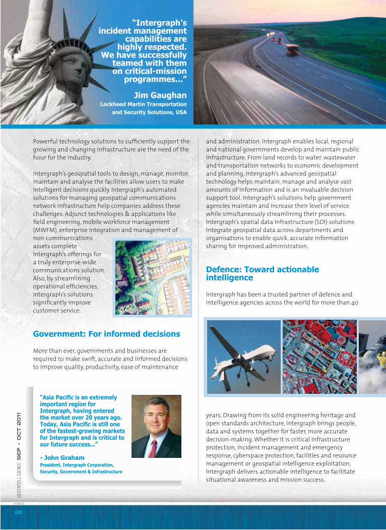
“Intergraph’sincident management
capabilities are highly respected.
We have successfully teamed with them on critical-mission
programmes...”
Jim Gaughan Lockheed Martin Transportation
and Security Solutions, USA
“Asia Pacifi c is an extremely important region for Intergraph, having entered the market over 20 years ago. Today, Asia Pacifi c is still one of the fastest-growing markets for Intergraph and is critical to our future success...”
- John Graham President, Intergraph Corporation, Security, Government & Infrastructure
23
GEOI
NTEL
LIGE
NCE
SE
P – O
ct 2011
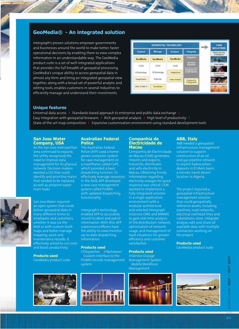
GeoMedia® - An integrated solution
Intergraph’s proven solutions empower governments and businesses around the world to make better, faster operational decisions by enabling them to view complex information in an understandable way. The GeoMedia product suite is a set of well-integrated applications that provides the full breadth of geospatial processing. GeoMedia’s unique ability to access geospatial data in almost any form and bring an integrated geospatial view together, along with a broad set of powerful analytic and editing tools, enables customers in several industries to effi ciently manage and understand their investments.
Unique featuresUniversal data access I Standards-based approach to enterprise and public data exchange I Easy integration with geospatial browsers I Rich geospatial analysis I High level of productivity I State-of-the-art map composition I Expansive customisation environment using standard development tools
San Jose Water Company, USAAs the San Jose metropolitan area continued to expand, the utility recognised the need to improve data management for its physical network. Decision-makers wanted a GIS that could identify and prioritise mains that needed to be replaced, as well as pinpoint water main leaks.
San Jose Water required an open system that could deliver geospatial data in many different forms to employees and customers, whether it was via the Web or with custom-built maps and better manage mapping, asset and maintenance records. It effectively aimed to cut costs and boost productivity.
Products usedGeoMedia product suite
Australian Federal PoliceThe Australian Federal Police (AFP) used a home-grown computer system for case management on a mainframe called CoPS, which provided a basic dispatching function. To effectively manage resources in the fi eld, AFP developed a new case management system called ProMIS with updated dispatching functionality.
Intergraph’s technology enabled AFP to accurately record incident and patrol information. With this, AFP supervisors/offi cers have the ability to view/monitor up-to-date dispatching information.
Products usedI/Dispatcher I I/Netviewer I Custom interface to the ProMIS records management system
Companhia de Electricidade de MacauCompanhia de Electricidade de Macau (CEM) generates, imports and exports, transmits, distributes and sells electricity in Macau. Obtaining timely information regarding electricity outages for quick response was critical. CEM wanted to implement a fully integrated solution in a single-application environment with a modular architecture and selected Intergraph InService OMS and MWMS to gain real-time analysis of the distribution network, optimization of network usage, and management of fault situations for greater effi ciency and customer satisfaction.
Products usedInService Outage Management System I Mobile Workforce Management
ABB, ItalyABB needed a geospatial infrastructure management solution to support construction of an oil and gas pipeline network to exploit hydrocarbon deposits in El Merk basin, a remote, harsh desert location in Algeria.
The project required a geospatial infrastructure management solution that could geospatially reference assets, including pipelines, road networks, electrical overhead lines and substations, store, integrate, analyse, edit and share all available data with multiple contractors working on the project.
Products usedGeoMedia product suite
GEOI
NTEL
LIGE
NCE
SE
P – O
ct 2011
24
Intergraph offers a wide array of solutions that enable military and intelligence organisations to combine data from different sources into a single, robust environment to provide dynamic data access for the richest, most powerful ‘common operating picture’ (COP) for better decision-making. Intergraph’s solutions facilitate CROP development by bringing together feature, image, surface and text data from all relevant parties in real time while automatically resolving differences in format, scale and temporality.
Intergraph’s interoperable tools enable collaboration not only within the enterprise, but also among other organisations and agencies at the federal, state and local levels. This collaboration is achieved by integrating and exploiting available data, generating raster data products that may be interchanged with other agencies and countries and processing classifi ed and commercial imagery into intelligence formats.
Transportation: For safe and smooth travel
Transportation networks worldwide are faced daily with thousands of decisions needed to keep intelligent transportation systems running smoothly and safely. Intergraph merges geospatial information technology and business process improvement tools to provide the transportation industry with complete solutions. Intergraph transportation solutions help keep people and assets moving safely and effi ciently across the world. Road, rail, transit agencies, as well as airports and seaports, use these solutions to secure, manage
and maintain their transportation networks. From visualising roadway assets and congestion to helping simplify monitoring and speed response to security-related issues, Intergraph solutions create awareness to keep systems effi cient, reliable and safe. Intergraph provides transportation experts with the tools to turn complex linear processes into automated workfl ows that result in clear capital improvement decisions.
Utilities: Facilitating optimum service
Intergraph serves as a source for infrastructure management and integrated operational support solutions for electric, gas, water, pipeline and other utilities. Intergraph provides a suite of industry specifi c solutions to address work design, network asset management, outage management and integrated mobile work force management. The foundation component for Intergraph’s
solutions is a comprehensive, enterprise-capable, network asset infrastructure management platform that houses a connected data model of the entire energy network or communications infrastructure. Intergraph solutions are based on open, scalable products optimised for interactive graphic performance, ease of integration and the enterprise data integrity needs of both large and small information systems environments. By automating entire workfl ows, Intergraph solutions help utilities optimise service delivery networks, make informed decisions, and respond to customers quickly.
“The service and products we receive from
Intergraph meet all of our requirements. The
commitment to customer service is excellent...”
Mark Day Southland District Council
New Zealand
For more information on Intergraph,visit www.intergraph.com/sgi
For more information on Intergraph,visit www.intergraph.com/sgi
“Geospatial is a good supervisory and monitoring tool”
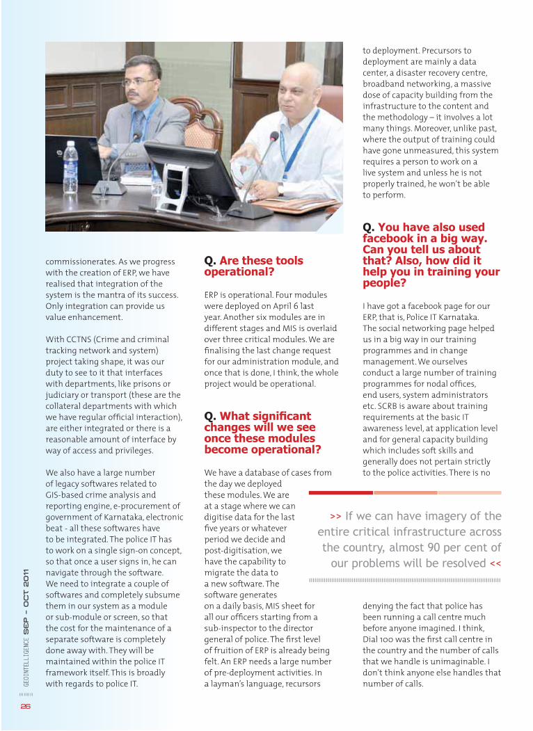
Q. You have been credited to have brought a silent revolution in the Karnataka State Police. Can you tell us about it?
This is primarily with regards to IT projects and the main software project which was trailing for the last six years, for sure not moving in the right track - Police IT ERP solution. Police IT ERP solution is a comprehensive end-to-end solution which has 12 modules. It integrates every single functioning of the police department in a seamless manner with a workfl ow intra-module and inter-module, and the whole software integrated as one. This would be one of the very few ERP solutions in the governmental sector and one of the few created by the IT industry. The software comprises 12 modules – three are critical modules - crime, law and order and traffi c. Three modules pertain to the administration side - administration, stores and fi nance. Ancillary support modules like the motor transport, the armed battalion management and other modules are related to training forensic science laboratory and a messaging service are all presently functional in the state. On these modules, we overlay the Management Information System (MIS), thus MIS provides the critical support to all our managers starting from SHO to the DG of the state. It started with the initial deployment of four of the modules. Crime, law and order and traffi c takes care of around 70 per cent of the usage and transfer of data, and are already functioning on pilot in 20 districts and four
Sanjay SahayInspector General of PolicePolice Computer Wing, Bangalore
Interview
GEOI
NTEL
LIGE
NCE
SE
P – O
ct 2011
25
<< He is said to have brought IT to the forefront in Karnataka State Police in India. In a tête-à-tête with GeoIntelligence, Sanjay Sahay, IGP, Bangalore, tells us about the progress of Police IT ERP solution and how geospatial technology can help deal with modern security challenges >>
Q. Are these tools operational?
ERP is operational. Four modules were deployed on April 6 last year. Another six modules are in different stages and MIS is overlaid over three critical modules. We are fi nalising the last change request for our administration module, and once that is done, I think, the whole project would be operational.
Q. What signifi cant changes will we see once these modules become operational?
We have a database of cases from the day we deployed these modules. We are at a stage where we can digitise data for the last fi ve years or whatever period we decide and post-digitisation, we have the capability to migrate the data to a new software. The software generates on a daily basis, MIS sheet for all our offi cers starting from a sub-inspector to the director general of police. The fi rst level of fruition of ERP is already being felt. An ERP needs a large number of pre-deployment activities. In a layman’s language, recursors
Q. Are these toolsoperational?
ERP is operational. Four mowere deployed on April 6 layear. Another six modules adifferent stages and MIS is over three critical modulesfi nalising the last change refor our administration modonce that is done, I think, thproject would be operation
Q. What signifi canchanges will we seonce these modulebecome operationa
We have a database of casethe day we deployedthese modules. We areat a stage where we can digitise data for the lastfi ve years or whateverperiod we decide andpost-digitisation, we have the capability tomigrate the data to a new software. Thesoftware generateson a daily basis, MIS sheet fall our offi cers starting fromsub-inspector to the directogeneral of police. The fi rst lof fruition of ERP is alreadyfelt. An ERP needs a large nof pre-deployment activitiea layman’s language, recurs
oaa
.edhn
teea
e
fmoe
yu
es
26
GEOI
NTEL
LIGE
NCE
SE
P – O
ct 2011
commissionerates. As we progress with the creation of ERP, we have realised that integration of the system is the mantra of its success. Only integration can provide us value enhancement.
With CCTNS (Crime and criminal tracking network and system) project taking shape, it was our duty to see to it that interfaces with departments, like prisons or judiciary or transport (these are the collateral departments with which we have regular offi cial interaction), are either integrated or there is a reasonable amount of interface by way of access and privileges.
We also have a large number of legacy softwares related to GIS-based crime analysis and reporting engine, e-procurement of government of Karnataka, electronic beat - all these softwares have to be integrated. The police IT has to work on a single sign-on concept, so that once a user signs in, he can navigate through the software. We need to integrate a couple of softwares and completely subsume them in our system as a module or sub-module or screen, so that the cost for the maintenance of a separate software is completely done away with. They will be maintained within the police IT framework itself. This is broadly with regards to police IT.
to deployment. Precursors to deployment are mainly a data center, a disaster recovery centre, broadband networking, a massive dose of capacity building from the infrastructure to the content and the methodology – it involves a lot many things. Moreover, unlike past, where the output of training could have gone unmeasured, this system requires a person to work on a live system and unless he is not properly trained, he won’t be able to perform.
Q. You have also used facebook in a big way. Can you tell us about that? Also, how did it help you in training your people?
I have got a facebook page for our ERP, that is, Police IT Karnataka. The social networking page helped us in a big way in our training programmes and in change management. We ourselves conduct a large number of training programmes for nodal offi ces, end users, system administrators etc. SCRB is aware about training requirements at the basic IT awareness level, at application level and for general capacity building which includes soft skills and generally does not pertain strictly to the police activities. There is no
denying the fact that police has been running a call centre much before anyone imagined. I think, Dial 100 was the fi rst call centre in the country and the number of calls that we handle is unimaginable. I don’t think anyone else handles that number of calls.
>> If we can have imagery of the entire critical infrastructure across the country, almost 90 per cent of
our problems will be resolved <<
Q. How are you incorporating geospatial technologies?
We have an application called GIS based crime analysis and reporting engine. It is based on maps with 1:5000 resolution for rural areas and 1:2000 resolution for the urban areas, primarily Bangalore. We have overlaid our jurisdiction map on these maps. We are also planning to add pictures of our police stations on them. We have already allocated funds for that. Besides, it has been integrated with state election commission data. This has helped us get information about the basic geographical features along with the information about population, caste and so on. These types of layers make data more sensible.
If you see the hot spots on a GIS based map, I think you get a totally different thought process, it’s able to create a totally different analytical thought process which cannot be created by any other medium. The other reason which is more critical and important is that you can have layers of data on the GIS mode. For example, on my jurisdiction map which is on the GIS platform, I can superimpose an electronic beat map. On this, I can put my AVLS (Automatic Vehicle Location System) map and then overlay that with the movements of supervisory offi cers. Similarly, I can add a couple of more layers. This information will come handy whenever I need an update about any incident. For example, suppose, I have to fi nd out about a robbery case that occurred in the middle of the night at a particular area. I just need to know the time and coordinates of the place, and I will be able to get information about the PCR vans which were there in the 200 metre radius, the offi cer who was in the vicinity, whether the beat was served or not and at what point of time. So it will throw up issues which were unimaginable in the past. It’s a very good supervisory and monitoring tool.
Q. You recently said that conventional and unconventional wars are no longer different from each other. Can you elaborate this?
Asymmetric warfare is only one of the different forms of unconventional warfare, and warfare today is certainly not limited to a physical war. It can be much more damaging without getting into the physical mode. And the biggest threat which even the most powerful nation in the world dreads is an attack on its data systems. So the whole repository of our complete data bases, data systems should be at a place which is delineated from us in most of the cases.
We are totally at the mercy of the person who physically holds the server. Nowadays, physical combat with a country with which you share international borders is an outdated concept. We have Moaists and there is also red corridor which fi nally ends in some other country. So, today’s war cannot be defi ned. My only contention is that, no matter the shape, form, complexity, nature or technicalities, our response has to be more than matching. This is where geospatial technology has a huge role to play. If my information is correct, 90 per cent of the world today is still not imaged to a level on which some comprehensible, actionable response can be made. I am not talking about law enforcement, but imagery for developmental projects like penetration of health schemes, etc. We don’t have imagery for those purposes also.
The issue of homeland security is a very recent one. Law enforcement has been out of the normal public view domain thought process since its inception. It has only now assumed centerstage because any country today can be kept in a stage of hostage for days together with just one single incident of terror.
Q. You have described SDI as an effective means of combating asymmetric warfare. In a country where sharing data is a big issue, how do you think this is possible?
Not sharing data is outdated. Just because the likelihood of something taking place is bleak or minimal does not stop me from taking concrete steps to achieve it. It is all the more reason for me to take real concrete steps and move in that direction and even partially achieve it. In fact, if we can have imagery of the entire critical infrastructure across the country, I think almost 90 per cent of our problems will be resolved.
Q. How do you perceive the future of this technology in India?
When IKONOS was launched, it was supposed to be one of the major milestones of space age. If the images obtained from satellites like IKONOS are put on our standard information and our standard systems of processing, it will greatly boost our capability to plan, predict and dictate the output. GE
OINT
ELLI
GENC
E S
EP – O
ct 2011
27
<< Geoint forGeoint forGuerrilla warfare Guerrilla warfare >>
o provide a framework for exploitation of geoint (geospatial intelligence) in countering the challenges
of asymmetric warfare, it is fi rst necessary to appreciate the context of such warfare. In his work Asymmetric Warfare: Old Method, New Concern, David L Grange states that strategists have defi ned asymmetric warfare as “confl ict deviating from the norm, or an indirect approach to affect a counter-balancing of force”. Importantly, as his title elucidates, asymmetric warfare is not a new
phenomenon. In the Lost Art of War, Sun Bin (circa 250-300BC), encapsulatesthe principle of asymmetry when he writes, “When conventional tactics are
altered unexpectedly according to the situation, they take on an element of surprise and increase in strategic value.”
What has emerged over the last decade, from experience gained in Africa, the Balkans and most recently in Iraq and Afghanistan, is the rise in what was defi ned initially by US Marine General
<< Today’s unconventional warfare requires understanding of terrain and
an ability to be able to anticipate your adversary’s next move. Geospatial intelligence helps you visualise the
enemy’s possible gameplan >>
Asymmetric warfare
Charles C Krulak as the 3 Block War. Subsequently this was reiterated by British Army General Rupert Smith in his exploration of wars among people. Several leading commentators have provided detailed insight into his evolving landscape including, inter alia, David Kaplan (The Coming Anarchy), Martin Van Krefeld (The Transformation of War) and Samuel P Huntington (The Clash of Civilizations). All these works defi ne causes of instability ranging from inter- and intra-state warfare to disease and poverty and through cultural clashes to the challenges of criminality, drugs, insurgency and terrorism. The challenge for governments in building stability is to appreciate the nature of the problem that asymmetric challenges pose. Warwick University’s Professor Keith Grint provides valuable insight in his work Wicked Problems and Clumsy Solutions. The content is that while very complex problems exist, sound management and known tested procedures can be applied to such problems to achieve a successful outcome. Alternatively, wicked problems such as countering criminality, drugs and terrorism, do not have such procedural solutions and require a strong thoughtful leadership approach. For Grint, the key is for the leader to drive consensus and bring together problem solving styles (hierarchical (military); consensus (government/NGOs); entrepreneurial (business))
GEOI
NTEL
LIGE
NCE
SE
P – O
CT 2011
28
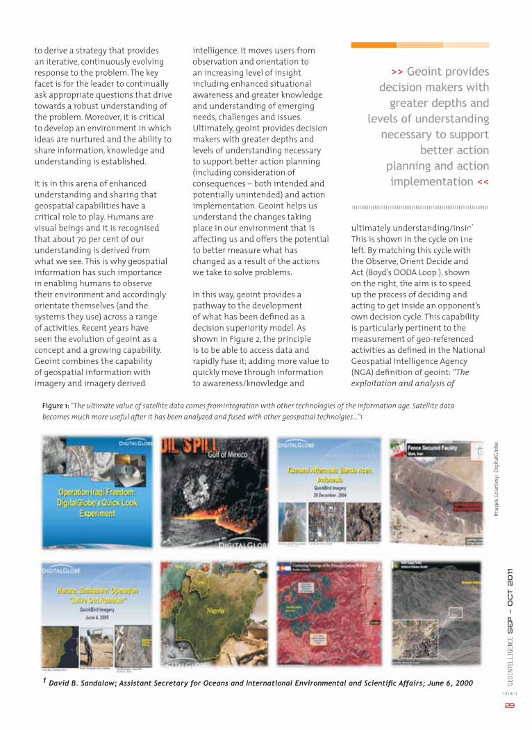
intelligence. It moves users from observation and orientation to an increasing level of insight including enhanced situational awareness and greater knowledge and understanding of emerging needs, challenges and issues. Ultimately, geoint provides decision makers with greater depths and levels of understanding necessary to support better action planning (including consideration of consequences – both intended and potentially unintended) and action implementation. Geoint helps us understand the changes taking place in our environment that is affecting us and offers the potential to better measure what has changed as a result of the actions we take to solve problems.
In this way, geoint provides a pathway to the development of what has been defi ned as a decision superiority model. As shown in Figure 2, the principle is to be able to access data and rapidly fuse it; adding more value to quickly move through information to awareness/knowledge and
to derive a strategy that provides an iterative, continuously evolving response to the problem. The key facet is for the leader to continually ask appropriate questions that drive towards a robust understanding of the problem. Moreover, it is critical to develop an environment in which ideas are nurtured and the ability to share information, knowledge and understanding is established.
It is in this arena of enhanced understanding and sharing that geospatial capabilities have a critical role to play. Humans are visual beings and it is recognised that about 70 per cent of our understanding is derived from what we see. This is why geospatial information has such importance in enabling humans to observe their environment and accordingly orientate themselves (and the systems they use) across a range of activities. Recent years have seen the evolution of geoint as a concept and a growing capability. Geoint combines the capability of geospatial information with imagery and imagery derived
ultimately understanding/insight. This is shown in the cycle on the left. By matching this cycle with the Observe, Orient Decide and Act (Boyd’s OODA Loop ), shown on the right, the aim is to speed up the process of deciding and acting to get inside an opponent’s own decision cycle. This capability is particularly pertinent to the measurement of geo-referenced activities as defi ned in the National Geospatial Intelligence Agency (NGA) defi nition of geoint: “Theexploitation and analysis of
Imag
es C
ourt
esy:
Dig
italG
lobe
GEOI
NTEL
LIGE
NCE
SE
P – O
CT 2011
29
Figure 1: “The ultimate value of satellite data comes fromintegration with other technologies of the information age. Satellite data becomes much more useful after it has been analyzed and fused with other geospatial technolgies...”1
1 David B. Sandalow; Assistant Secretary for Oceans and International Environmental and Scientifi c Affairs; June 6, 2000
>> Geoint provides decision makers with
greater depths and levels of understanding
necessary to support better action
planning and action implementation <<
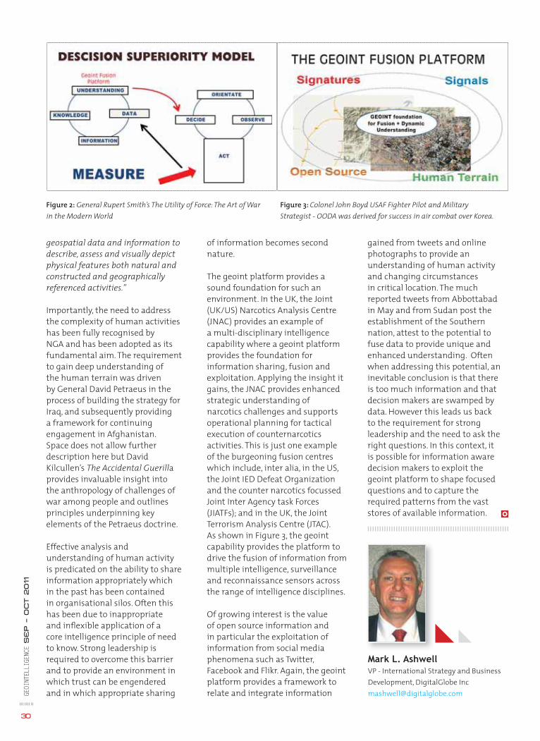
of information becomes second nature.
The geoint platform provides a sound foundation for such an environment. In the UK, the Joint (UK/US) Narcotics Analysis Centre (JNAC) provides an example of a multi-disciplinary intelligence capability where a geoint platform provides the foundation for information sharing, fusion and exploitation. Applying the insight it gains, the JNAC provides enhanced strategic understanding of narcotics challenges and supports operational planning for tactical execution of counternarcotics activities. This is just one example of the burgeoning fusion centres which include, inter alia, in the US, the Joint IED Defeat Organization and the counter narcotics focussed Joint Inter Agency task Forces (JIATFs); and in the UK, the Joint Terrorism Analysis Centre (JTAC). As shown in Figure 3, the geoint capability provides the platform to drive the fusion of information from multiple intelligence, surveillance and reconnaissance sensors across the range of intelligence disciplines.
Of growing interest is the value of open source information and in particular the exploitation of information from social media phenomena such as Twitter, Facebook and Flikr. Again, the geoint platform provides a framework to relate and integrate information
gained from tweets and online photographs to provide an understanding of human activity and changing circumstances in critical location. The much reported tweets from Abbottabad in May and from Sudan post the establishment of the Southern nation, attest to the potential to fuse data to provide unique and enhanced understanding. Often when addressing this potential, an inevitable conclusion is that there is too much information and that decision makers are swamped by data. However this leads us back to the requirement for strong leadership and the need to ask the right questions. In this context, it is possible for information aware decision makers to exploit the geoint platform to shape focused questions and to capture the required patterns from the vast stores of available information.
GEOI
NTEL
LIGE
NCE
SE
P – O
CT 2011
30
Mark L. AshwellVP - International Strategy and Business Development, DigitalGlobe [email protected]
Figure 2: General Rupert Smith’s The Utility of Force: The Art of War in the Modern World
Figure 3: Colonel John Boyd USAF Fighter Pilot and Military Strategist - OODA was derived for success in air combat over Korea.
geospatial data and information to describe, assess and visually depict physical features both natural and constructed and geographically referenced activities.”
Importantly, the need to address the complexity of human activities has been fully recognised by NGA and has been adopted as its fundamental aim. The requirement to gain deep understanding of the human terrain was driven by General David Petraeus in the process of building the strategy for Iraq, and subsequently providing a framework for continuing engagement in Afghanistan. Space does not allow further description here but David Kilcullen’s The Accidental Guerillaprovides invaluable insight into the anthropology of challenges of war among people and outlines principles underpinning key elements of the Petraeus doctrine.
Effective analysis and understanding of human activity is predicated on the ability to share information appropriately which in the past has been contained in organisational silos. Often this has been due to inappropriate and infl exible application of a core intelligence principle of need to know. Strong leadership is required to overcome this barrier and to provide an environment in which trust can be engendered and in which appropriate sharing

23 - 26 January 2012QEII Conference Centre,
Westminster, London
www.dgieurope.com
What do you have in common with these faces?
They’re facing the same challenges as youThey are just some of the heads of geoint speaking at DGI 2012:
www.dgieurope.comSAVE 15% OFF THE CURRENT PRICE, BOOK TODAY USING CODE MP15
Captain Stephen Malcolm, Royal Navy
Jim R Hill, Director, Geospatial Intelligence Directorate, Marine Corps Intelligence Activity, USA
Dr Khalid Abdulrahman Al Hiddan, Director of GIS, Directorate of the Central Informatics Organization, Bahrain
Capt. Sean Malinowski, Commanding Offi cer Foothill Patrol Division, LAPD
Bert Tiems, Chief C2 and Operations Services, C3 Agency, NATO
Eliza Manningham-Buller, Former Head, MI5
Vice Admiral (ret) Robert B Murrett, Deputy Director, Institute for National Security and Counterterrorism (INSCT)
Oliver Rajan, Head of Brussels Offi ce, European Union Satellite Centre
Radm Kenneth Pugh, Director Naval Intelligence, Chilean Navy
Dr Omer Al-Eman, Arab Science & Technology Foundation
Paul Hancock, Director, Defence Geographic Centre, Intelligence Collection Group, UK MOD
Andy Marles, Chief Fire Offi cer, South Wales Fire & Rescue
Col. Mark Burrows, Commander, JAGO, UK MOD
Frank Colley, Assistant Secretary Defence GEOINT, Defence Imagery and Geospatial Organisation (DIGO), Australian DoD
Lt Col Pat Fryer, Section Head Geospatial Policy & Operations, SHAPE,NATO
Captain Kjetil Utne, Director, Military Geographic Service, NorwegianMOD
Major (Armement) Frédérick Herpers, Defence Procurement Agency (DGA), Engineering Projects Directorate, C3I Engineering UNIT, MOD France
Brig Jim Hockenhull, D ISTAR, Head Information Superiority Land Forces UK MOD
Vanessa Lawrence, CEO, Ordnance Survey
Col. John Kedar, Chief of Staff Headquarters Engineer in Chief (Army), UK MOD
Lt. Col. Neil Marks, NATO
Marlene Meyer, Head of Defence, Geospatial Organisation, Denmark
Steven Ramage, Executive Director, Marketing and Communications, Open Geospatial Consortium (OGC)
Principal Sponsor: Associate Sponsor:
Premium Sponsor:
Sponsors:
Enterprise
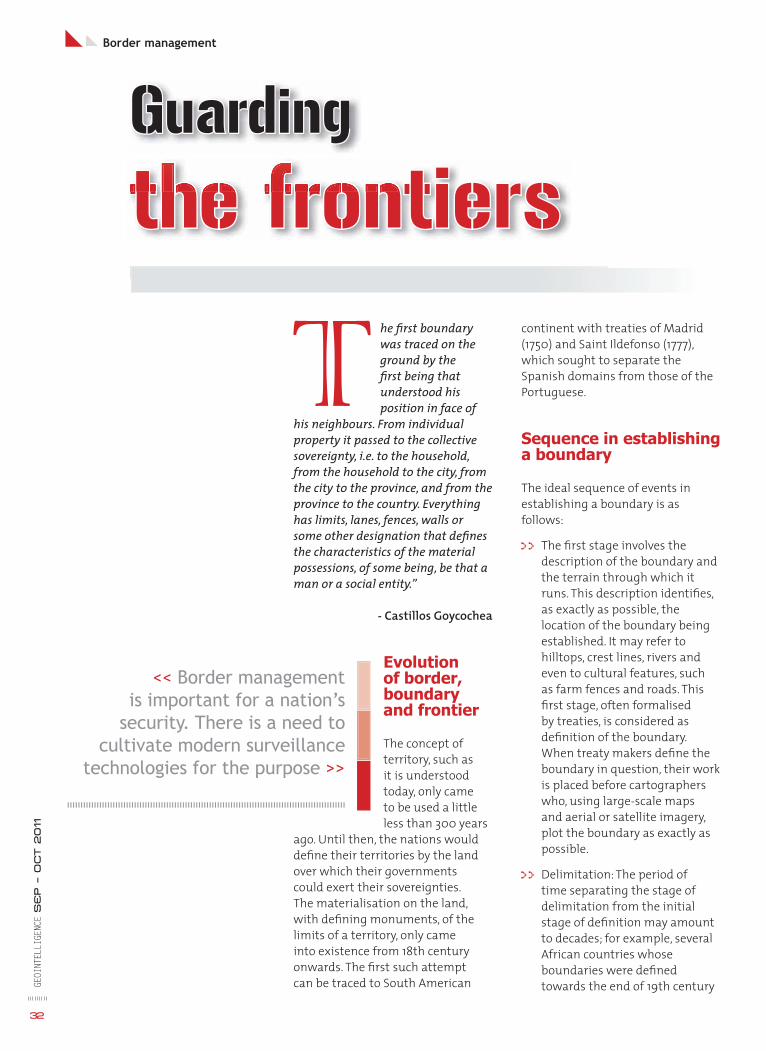
GEOI
NTEL
LIGE
NCE
SE
P – O
CT 2011
32
Border management
the frontiershe fi rst boundary was traced on the ground by the fi rst being that understood his position in face of
his neighbours. From individual property it passed to the collective sovereignty, i.e. to the household, from the household to the city, from the city to the province, and from the province to the country. Everything has limits, lanes, fences, walls or some other designation that defi nes the characteristics of the material possessions, of some being, be that a man or a social entity.”
- Castillos Goycochea
Evolutionof border, boundaryand frontier
The concept of territory, such as it is understood today, only came to be used a little less than 300 years
ago. Until then, the nations would defi ne their territories by the land over which their governments could exert their sovereignties. The materialisation on the land, with defi ning monuments, of the limits of a territory, only came into existence from 18th century onwards. The fi rst such attempt can be traced to South American
<< Border management is important for a nation’s
security. There is a need to cultivate modern surveillance
technologies for the purpose >>
continent with treaties of Madrid (1750) and Saint Ildefonso (1777), which sought to separate the Spanish domains from those of the Portuguese.
Sequence in establishing a boundary
The ideal sequence of events in establishing a boundary is as follows:
>> The fi rst stage involves the description of the boundary and the terrain through which it runs. This description identifi es, as exactly as possible, the location of the boundary being established. It may refer to hilltops, crest lines, rivers and even to cultural features, such as farm fences and roads. This fi rst stage, often formalised by treaties, is considered as defi nition of the boundary. When treaty makers defi ne the boundary in question, their work is placed before cartographers who, using large-scale maps and aerial or satellite imagery, plot the boundary as exactly as possible.
>> Delimitation: The period of time separating the stage of delimitation from the initial stage of defi nition may amount to decades; for example, several African countries whose boundaries were defi ned towards the end of 19th century
BoBorder managememene t
GuardingGuarding
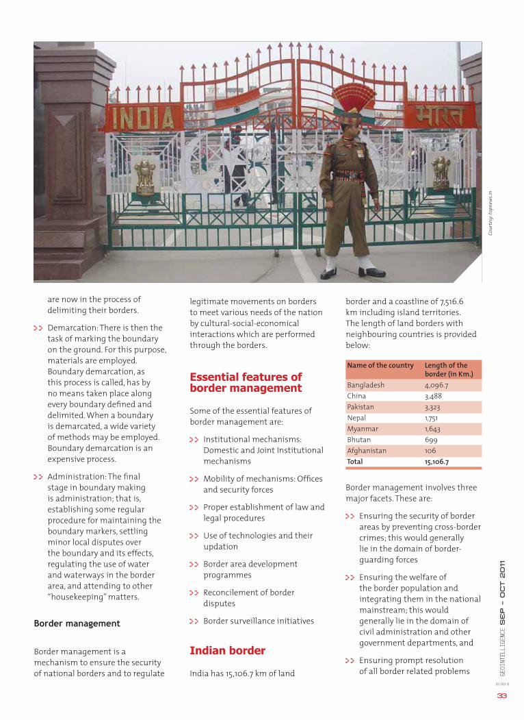
GEOI
NTEL
LIGE
NCE
SE
P – O
CT 2011
33
border and a coastline of 7,516.6 km including island territories. The length of land borders with neighbouring countries is provided below:
Name of the country Length of the border (in Km.) Bangladesh 4,096.7 China 3,488 Pakistan 3,323 Nepal 1,751 Myanmar 1,643 Bhutan 699 Afghanistan 106 Total 15,106.7
Border management involves three major facets. These are:
>> Ensuring the security of border areas by preventing cross-border crimes; this would generally lie in the domain of border-guarding forces
>> Ensuring the welfare of the border population and integrating them in the national mainstream; this would generally lie in the domain of civil administration and other government departments, and
>> Ensuring prompt resolution of all border related problems
are now in the process of delimiting their borders.
>> Demarcation: There is then the task of marking the boundary on the ground. For this purpose, materials are employed. Boundary demarcation, as this process is called, has by no means taken place along every boundary defi ned and delimited. When a boundary is demarcated, a wide variety of methods may be employed. Boundary demarcation is an expensive process.
>> Administration: The fi nal stage in boundary making is administration; that is, establishing some regular procedure for maintaining the boundary markers, settling minor local disputes over the boundary and its effects, regulating the use of water and waterways in the border area, and attending to other “housekeeping” matters.
Border management
Border management is a mechanism to ensure the security of national borders and to regulate
legitimate movements on borders to meet various needs of the nation by cultural-social-economical interactions which are performed through the borders.
Essential features of border management
Some of the essential features of border management are:
>> Institutional mechanisms: Domestic and Joint Institutional mechanisms
>> Mobility of mechanisms: Offi ces and security forces
>> Proper establishment of law and legal procedures
>> Use of technologies and their updation
>> Border area development programmes
>> Reconcilement of border disputes
>> Border surveillance initiatives
Indian border
India has 15,106.7 km of land
Cour
tesy
: top
new
s.in
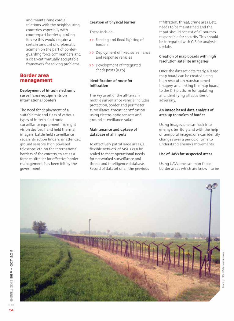
GEOI
NTEL
LIGE
NCE
SE
P – O
CT 2011
34
and maintaining cordial relations with the neighbouring countries, especially with counterpart border-guarding forces; this would require a certain amount of diplomatic acumen on the part of border-guarding force commanders and a clear-cut mutually acceptable framework for solving problems.
Border area management
Deployment of hi-tech electronic surveillance equipments on international borders
The need for deployment of a suitable mix and class of various types of hi-tech electronic surveillance equipment like night vision devices, hand held thermal imagers, battle fi eld surveillance radars, direction fi nders, unattended ground sensors, high powered telescope, etc. on the international borders of the country, to act as a force multiplier for effective border management, has been felt by the government.
Creation of physical barrier
These include:
>> Fencing and fl ood lighting of borders
>> Deployment of fi xed surveillance and response vehicles
>> Development of integrated check posts (ICPS)
Identifi cation of route for infi ltration
The key asset of the all-terrain mobile surveillance vehicle includes protection, border and perimeter surveillance, threat identifi cation using electro-optic sensors and ground surveillance radar.
Maintenance and upkeep of database of all inputs
To effectively patrol large areas, a fl exible network of MSUs can be scaled to meet operational needs for networked surveillance and threat and intelligence database. Record of dataset of all the previous
infi ltration, threat, crime areas, etc, needs to be maintained and the input should consist of all sources responsible for security. This should be integrated with GIS for analysis update.
Creation of map boards with high resolution satellite imageries
Once the dataset gets ready, a large map board can be created using high resolution pansharpened imagery, and linking the map board to the GIS platform for updating and identifying all activities of adversary.
An image based data analysis of area up to 100km of border
Using images, one can look into enemy’s territory and with the help of temporal images, one can identify changes over a period of time to understand enemy’s movements.
Use of UAVs for suspected areas
Using UAVs, one can man those border areas which are known to be
Cour
tesy
: htt
p://
stat
ic.p
anor
amio
.com
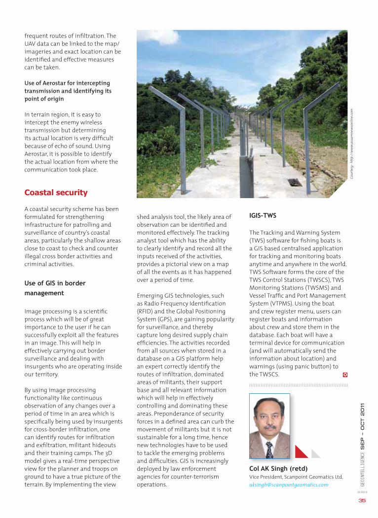
GEOI
NTEL
LIGE
NCE
SE
P – O
CT 2011
35
frequent routes of infi ltration. The UAV data can be linked to the map/ imageries and exact location can be identifi ed and effective measures can be taken.
Use of Aerostar for intercepting transmission and identifying its point of origin
In terrain region, it is easy to intercept the enemy wireless transmission but determining its actual location is very diffi cult because of echo of sound. Using Aerostar, it is possible to identify the actual location from where the communication took place.
Coastal security
A coastal security scheme has been formulated for strengthening infrastructure for patrolling and surveillance of country’s coastal areas, particularly the shallow areas close to coast to check and counter illegal cross border activities and criminal activities.
Use of GIS in border
management
Image processing is a scientifi c process which will be of great importance to the user if he can successfully exploit all the features in an image. This will help in effectively carrying out border surveillance and dealing with insurgents who are operating inside our territory.
By using image processing functionality like continuous observation of any changes over a period of time in an area which is specifi cally being used by insurgents for cross-border infi ltration, one can identify routes for infi ltration and exfi ltration, militant hideouts and their training camps. The 3D model gives a real-time perspective view for the planner and troops on ground to have a true picture of the terrain. By implementing the view
shed analysis tool, the likely area of observation can be identifi ed and monitored effectively. The tracking analyst tool which has the ability to clearly identify and record all the inputs received of the activities, provides a pictorial view on a map of all the events as it has happened over a period of time.
Emerging GIS technologies, such as Radio Frequency Identifi cation (RFID) and the Global Positioning System (GPS), are gaining popularity for surveillance, and thereby capture long desired supply chain effi ciencies. The activities recorded from all sources when stored in a database on a GIS platform help an expert correctly identify the routes of infi ltration, dominated areas of militants, their support base and all relevant information which will help in effectively controlling and dominating these areas. Preponderance of security forces in a defi ned area can curb the movement of militants but it is not sustainable for a long time, hence new technologies have to be used to tackle the emerging problems and diffi culties. GIS is increasingly deployed by law enforcement agencies for counter-terrorism operations.
IGIS-TWS
The Tracking and Warning System (TWS) software for fi shing boats is a GIS based centralised application for tracking and monitoring boats anytime and anywhere in the world. TWS Software forms the core of the TWS Control Stations (TWSCS), TWS Monitoring Stations (TWSMS) and Vessel Traffi c and Port Management System (VTPMS). Using the boat and crew register menu, users can register boats and information about crew and store them in the database. Each boat will have a terminal device for communication (and will automatically send the information about location) and warnings (using panic button) to the TWSCS.
Col AK Singh (retd)Vice President, Scanpoint Geomatics [email protected]
Cour
tesy
: htt
p://
ww
w.a
ssam
new
sonl
ine.
com
cts of terror, organised crime and communal riots are the major threats to internal
security. Terrorists aim to induce a state of chaos by threatening vital installations like government offi ces, defence installations, sensitive areas like places of worship, etc and ultimately common citizens. Over a period of time, the nature of terrorist operations too has undergone a sea change. Terrorist attacks have
become more bold, audacious and sophisticated. 9/11, Parliament attack and the more recent 26/11 Mumbai attacks are clear indicators of this trend. Home-grown terror too has engulfed large parts of the country and is being tackled on many fronts by various central and state police forces. India is facing the menace of terrorism from a very long time, be it Punjab, North-East or J&K. Post 26/11 Mumbai attacks, India has taken many initiatives
Emergency Response System
towards improving its intelligence gathering and post-incident response capabilities. However, GIS is still not being exploited fully for tacking terrorism. Creating a GIS-based common operating picture is very potent technique for tackling terrorism-related intelligence issues and operations.
Issues while addressing internal security
Tackling internal security situations are beset with numerous issues as follows:-
>>Collation and managing data: Internal security agencies have to access and manage data from numerous sources/ agencies in order to understand how they are exposed and their vulnerability areas.
>> Identify vulnerabilities and mitigation requirements: Data once made available needs to be analysed to study the impact and some meaningful mitigation strategy worked out along with suitable budgets and plans for response.
>>Develop suitable plans: The plans themselves need to be accurate and understandable by all stakeholders.
>>Track and manage resources: During the incident, public
GEOI
NTEL
LIGE
NCE
SE
P – O
CT 2011
36
<< Present day confl icts demand that security agencies invest in technologies that provide them
complete situational awareness. This will go a long way in enhancing surveillance and emergency
response capabilities of the state >>
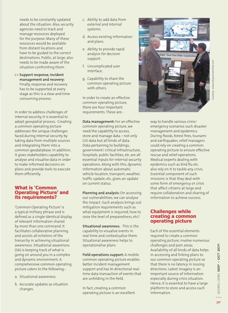
c. Ability to add data from external and internal systems.
d. Access existing information and plans.
e. Ability to provide rapid analysis for decision support.
f. Uncomplicated user interface.
g. Capability to share the common operating picture with others.
In order to create an effective common operating picture, there are four important requirements. These are:-
Data management: For an effective common operating picture, we need the capability to access, store and manage data – not only GIS data but all kinds of data. Data pertaining to buildings, government/ critical infrastructure, hospitals, public facilities, etc are all essential inputs for internal security operations. Along with this, dynamic information about automatic vehicle location, transport, weather, traffi c update, etc, gives an update on current status.
Planning and analysis: On accessing our vulnerabilities, we can analyse the impact. Such analysis brings out mitigation requirements such as what equipment is required, how to raise the level of preparedness, etc?
Situational awareness: This is the capability to visualise events in real-time and contextualise them. Situational awareness helps to operationalise plans.
Field operations support: A mobile common operating picture enables better incident management support and has bi-directional real-time data transaction of events that are unfolding in the fi eld.
In fact, creating a common operating picture is an excellent
needs to be constantly updated about the situation. Also, security agencies need to track and manage resources deployed for the purpose. Many of these resources would be available from distant locations and have to be guided to the correct destinations. Public, at large, also needs to be made aware of the situation confronting them.
>>Support response, incident management and recovery: Finally, response and recovery has to be supported at every stage as this is a slow and time consuming process.
In order to address challenges of internal security, it is essential to adopt geospatial process. Creating a common operating picture addresses the unique challenges faced during internal security by taking data from multiple sources and integrating them into a common geodatabase. In addition, it gives stakeholders capability to analyse and visualise data in order to make informed decisions on plans and provide tools to execute them effi ciently.
What is ‘Common Operating Picture’ and its requirements?
‘Common Operating Picture’ is a typical military phrase and is defi ned as a single identical display of relevant information shared by more than one command. It facilitates collaborative planning and assists all echelons of the hierarchy in achieving situational awareness. Situational awareness (SA) is keeping track of what is going on around you in a complex and dynamic environment. A comprehensive common operating picture caters to the following:-
a. Situational awareness.
b. Accurate updates as situation changes.
way to handle various crisis/ emergency scenarios such disaster management and epidemics. During fl oods, forest fi res, tsunami and earthquakes, relief managers could rely on creating a common operating picture to ensure effective rescue and relief operations. Medical experts dealing with epidemics such as bird fl u etc. also rely on it to tackle any crisis. Essential component of such missions is that they deal with some form of emergency or crisis that affect citizens at large and require collaboration and sharing of information to achieve success.
Challenges while creating a common operating picture
Each of the essential elements required to create a common operating picture, involve numerous challenges and pain areas. Availability of all kinds of data helps in accessing and linking plans to our common operating picture so that there is no latency in issuing directions. Latest imagery is an important source of information especially during crisis situation. Hence, it is essential to have a large platform to store and access such information. GE
OINT
ELLI
GENC
E S
EP – O
CT 2011
37
Cour
tesy
: ww
w.co
tsjo
urna
lonl
ine.
com
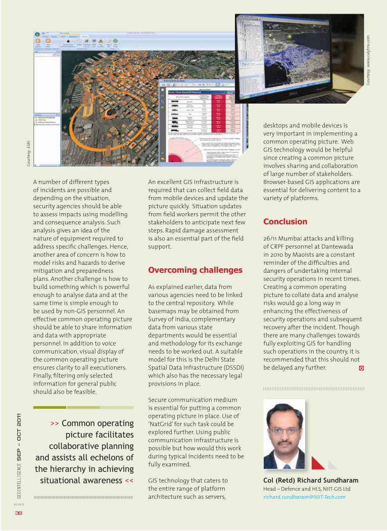
A number of different types of incidents are possible and depending on the situation, security agencies should be able to assess impacts using modelling and consequence analysis. Such analysis gives an idea of the nature of equipment required to address specifi c challenges. Hence, another area of concern is how to model risks and hazards to derive mitigation and preparedness plans. Another challenge is how to build something which is powerful enough to analyse data and at the same time is simple enough to be used by non-GIS personnel. An effective common operating picture should be able to share information and data with appropriate personnel. In addition to voice communication, visual display of the common operating picture ensures clarity to all executioners. Finally, fi ltering only selected information for general public should also be feasible.
An excellent GIS infrastructure is required that can collect fi eld data from mobile devices and update the picture quickly. Situation updates from fi eld workers permit the other stakeholders to anticipate next few steps. Rapid damage assessment is also an essential part of the fi eld support.
Overcoming challenges
As explained earlier, data from various agencies need to be linked to the central repository. While basemaps may be obtained from Survey of India, complementary data from various state departments would be essential and methodology for its exchange needs to be worked out. A suitable model for this is the Delhi State Spatial Data Infrastructure (DSSDI) which also has the necessary legal provisions in place.
Secure communication medium is essential for putting a common operating picture in place. Use of ‘NatGrid’ for such task could be explored further. Using public communication infrastructure is possible but how would this work during typical incidents need to be fully examined.
GIS technology that caters to the entire range of platform architecture such as servers,
desktops and mobile devices is very important in implementing a common operating picture. Web GIS technology would be helpful since creating a common picture involves sharing and collaboration of large number of stakeholders. Browser-based GIS applications are essential for delivering content to a variety of platforms.
Conclusion
26/11 Mumbai attacks and killing of CRPF personnel at Dantewada in 2010 by Maoists are a constant reminder of the diffi culties and dangers of undertaking internal security operations in recent times. Creating a common operating picture to collate data and analyse risks would go a long way in enhancing the effectiveness of security operations and subsequent recovery after the incident. Though there are many challenges towards fully exploiting GIS for handling such operations in the country, it is recommended that this should not be delayed any further.
GEOI
NTEL
LIGE
NCE
SE
P – O
CT 2011
38
Col (Retd) Richard SundharamHead – Defence and HLS, NIIT-GIS [email protected]
>> Common operating picture facilitates
collaborative planning and assists all echelons of the hierarchy in achieving
situational awareness <<
Cour
tesy
: ESR
I
Cour
tesy
: ww
w.ca
lytr
ix.co
m
Internal security
homeland security
omeland security is a relatively new concept in India, although internal peace was always a matter of concern in the
country. It is only in the recent past that it has come in the limelight more prominently after 9/11 attacks in the US and 26/11 Mumbai attacks. It is now one of the most aggressively pursued sectors of the country with
both government and industry investing heavily to provide the best technology to our security agencies – be it police, paramilitary or army.
Background
“India fi nds itself in a ring of fi re.” This is how Indian Home Minister P Chidambaram had described India’s
situation vis-a-vis its neighbours. Infi ltration from both east and west borders, illegal immigration, militancy in Kashmir and North East, factional rise owing to caste/ class rivalries, Maoist insurgency throughout central India are major challenges confronting the country.
In India, the Ministry of Home Affairs (MHA) is tasked with major homeland security-related functions. There are a
<< Prominent organisations, Assocham and Aviotech,
recently carried out a research to assess Indian
homeland security potential. GeoIntelligence presents
some facts from their book, ‘Homeland Security
Assessment – India’ >>GE
OINT
ELLI
GENC
E S
ep – O
ct 2011
39
multitude of agencies working under MHA in this direction.
Demand in India
The HLS (Homeland security) market which currently stands at about USD 8 bn and is likely to reach USD 16 bn per year by 2018.
Major areas of demand
Border Security
Fencing: India has a land border of 15,107 km (spread over 17 states) and a coastline border of 7,517km (spread over 13 states and 5 union territories). It has already begun fencing 4,300 km long border with Bangladesh of which 800 km is still left to be fenced.
Floodlighting: With the success of pilot project on 277 km of border, government has decided to undertake fl oodlighting on 2,840 km along Indo-Bangladesh border.
Roads: Construction of 27 roads (about 804 km) along India-China border is already underway. The government proposes construction of 1,271 km and 294 km of road along India-Nepal and India-Bhutan border respectively.
Integrate check posts (ICP): ICPs have been earmarked for 13 locations along
y
The booming market ofThe booming market of
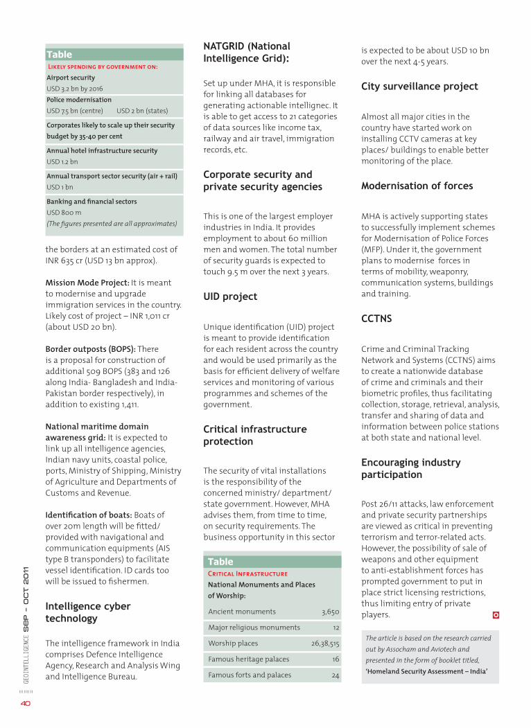
GEOI
NTEL
LIGE
NCE
Se
p – O
ct 2011
40
The article is based on the research carried out by Assocham and Aviotech and presented in the form of booklet titled, ‘Homeland Security Assessment – India’
NATGRID (National Intelligence Grid):
Set up under MHA, it is responsible for linking all databases for generating actionable intellignec. It is able to get access to 21 categories of data sources like income tax, railway and air travel, immigration records, etc.
Corporate security and private security agencies
This is one of the largest employer industries in India. It provides employment to about 60 million men and women. The total number of security guards is expected to touch 9.5 m over the next 3 years.
UID project
Unique identifi cation (UID) project is meant to provide identifi cation for each resident across the country and would be used primarily as the basis for effi cient delivery of welfare services and monitoring of various programmes and schemes of the government.
Critical infrastructure protection
The security of vital installations is the responsibility of the concerned ministry/ department/ state government. However, MHA advises them, from time to time, on security requirements. The business opportunity in this sector
the borders at an estimated cost of INR 635 cr (USD 13 bn approx).
Mission Mode Project: It is meant to modernise and upgrade immigration services in the country. Likely cost of project – INR 1,011 cr (about USD 20 bn).
Border outposts (BOPS): There is a proposal for construction of additional 509 BOPS (383 and 126 along India- Bangladesh and India-Pakistan border respectively), in addition to existing 1,411.
National maritime domain awareness grid: It is expected to link up all intelligence agencies, Indian navy units, coastal police, ports, Ministry of Shipping, Ministry of Agriculture and Departments of Customs and Revenue.
Identifi cation of boats: Boats of over 20m length will be fi tted/ provided with navigational and communication equipments (AIS type B transponders) to facilitate vessel identifi cation. ID cards too will be issued to fi shermen.
Intelligence cyber technology
The intelligence framework in India comprises Defence Intelligence Agency, Research and Analysis Wing and Intelligence Bureau.
is expected to be about USD 10 bn over the next 4-5 years.
City surveillance project
Almost all major cities in the country have started work on installing CCTV cameras at key places/ buildings to enable better monitoring of the place.
Modernisation of forces
MHA is actively supporting states to successfully implement schemes for Modernisation of Police Forces (MFP). Under it, the government plans to modernise forces in terms of mobility, weaponry, communication systems, buildings and training.
CCTNS
Crime and Criminal Tracking Network and Systems (CCTNS) aims to create a nationwide database of crime and criminals and their biometric profi les, thus facilitating collection, storage, retrieval, analysis, transfer and sharing of data and information between police stations at both state and national level.
Encouraging industry participation
Post 26/11 attacks, law enforcement and private security partnerships are viewed as critical in preventing terrorism and terror-related acts. However, the possibility of sale of weapons and other equipment to anti-establishment forces has prompted government to put in place strict licensing restrictions, thus limiting entry of private players.
TableCritical Infrastructure
National Monuments and Places of Worship:
Ancient monuments 3,650
Major religious monuments 12
Worship places 26,38,515
Famous heritage palaces 16
Famous forts and palaces 24
TableLikely spending by government on:Airport securityUSD 3.2 bn by 2016Police modernisationUSD 7.5 bn (centre) USD 2 bn (states)
Corporates likely to scale up their security budget by 35-40 per cent
Annual hotel infrastructure security USD 1.2 bn
Annual transport sector security (air + rail)USD 1 bn
Banking and fi nancial sectors USD 800 m(The fi gures presented are all approximates)

SEPTEMBER
3rd Annual Aviation Security 2011 September 18 - 21, 2011 Grand Millennium Hotel, Dubai, UAEwww.aviationsecurityme.com
Cyber Warfare Europe 2011September 27 - 28, 2011Berlin Marriott HotelBerlin, Germanyhttp://www.cyberwarfare-europe.com/Event.
aspx?id=512314
Future Mortar Systems 2011September 27 - 28, 2011Sheraton Park Lane HotelLondon, UKhttp://www.future-mortars.co.uk/Event.
aspx?id=503680
GDI APAC: Geospatial Defence & Intelligence APACSeptember 28 - 29, 2011Kuala Lumpur, Malaysia http://www.geospatialdefenceasia.com/Event.
aspx?id=456688
OCTOBER
Aerospace & Defense ProgramsOctober 24-26, 2011Arizona Biltmore Resort & Spa Phoenix, AZ, USA www.aviationweek.com/events/current/ad/
index.htm
Engineering Simulation for Military Technology Summit
October 24 - 26, 2011TBD, Washington DC USAwww.iqpc.com
SecureTech 2011October 25 - 27, 2011Ottawa Convention Centre, OttawaOntario, Canadawww.securetechcanada.com
Future MRO & Ageing Aircraft 2011October 26 - 27, 2011Holiday Inn BloomsburyLondon, United Kingdom www.smi-online.co.uk/mro-ageingaircraft19.asp
ISDEF 2011October 31 - November 2, 2011Israel Trade Fair & Convention CenterTel Aviv, Israelwww.isdef.co.il
NOVEMBER
Cyber Warfare IndiaNovember 1 - 2, 2011New Delhi, Indiawww.cyberwarfareindia.com
Border Management Conference and Technology ExpoNovember 7 - 9, 2011San Diego, CA, USAwww.bordertechexpo.com
UAV Summit WestNovember 7 - 9, 2011 Town & Country ResortSan Diego, CAwww.uavwest.com
International FighterNovember 8 - 10, 2011Royal Air Force MuseumLondon, UKwww.international-fi ghter.com
Cyber Security AsiaNovember 9 - 10, 2011Grand Copthorne Waterfront HotelSingaporewww.smi-online.co.uk/cybersecurityasia21.asp
ISR SummitNovember 14 - 16, 2011Washington DCUSAwww.isrsummit.com
Unmanned Aircraft SystemsNovember 16 - 17, 2011Copthorne Tara HotelLondon, United Kingdomwww.smi-online.co.uk/uas-conference20.asp
Future Artillery Middle East 2011November 21 - 23, 2011Amman, Jordanwww.futureartilleryme.com
8th Annual Global MDA: Coastal Surveillance 2011November 28 - 30, 2011TBC, Singaporewww.coastalsurveillancemda.com
DECEMBER
25th Large Installation System Administration ConferenceDecember 4 - 9, 2011Sheraton Boston HotelBoston, MA, USAwww.usenix.org
Military Airlift: Rapid Reaction and Tanker OperationsDecember 5 - 6, 2011Amsterdam Marriott HotelAmsterdam, Netherlandswww.smi-online.co.uk/military-airlift31.asp
The 11th Langkawi International Maritime and Aerospace ExhibitionDecember 6 - 10, 2011Mahsuri International Exhibition CentreLangkawi, Kedah, Malaysiawww.lima.com
Events
GEOI
NTEL
LIGE
NCE
SE
P – O
CT 2011
41
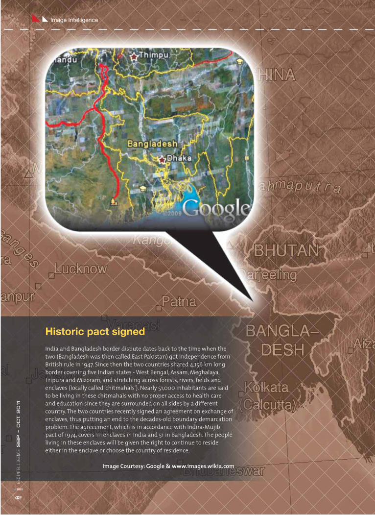
Historic pact signed
India and Bangladesh border dispute dates back to the time when the two (Bangladesh was then called East Pakistan) got independence from British rule in 1947. Since then the two countries shared 4,156 km long border covering fi ve Indian states - West Bengal, Assam, Meghalaya, Tripura and Mizoram, and stretching across forests, rivers, fi elds and enclaves (locally called ‘chitmahals’). Nearly 51,000 inhabitants are said to be living in these chitmahals with no proper access to health care and education since they are surrounded on all sides by a different country. The two countries recently signed an agreement on exchange of enclaves, thus putting an end to the decades-old boundary demarcation problem. The agreeement, which is in accordance with Indira-Mujib pact of 1974, covers 111 enclaves in India and 51 in Bangladesh. The people living in these enclaves will be given the right to continue to reside either in the enclave or choose the country of residence.
Image Courtesy: Google & www.images.wikia.com
Image IntelligenceGE
OINT
ELLI
GENC
E S
ep – O
ct 2011
42

Ms. Letitia A. LongDirector, National Geospatial-Intelligence Agency
www.geoint2011.comSee highlights from GEOINT 2010 at www.geointv.com
Join us Oct. 16-19 in San Antonio, Texas to hear from these Community leaders …
Mr. Bruce CarlsonDirector, National Reconnaissance Office
The Honorable James R. Clapper Jr.Director of National Intelligence
Gen. Douglas Fraser, U.S. Air ForceCommander, U.S. Southern Command
Gen. Keith B. Alexander, U.S. ArmyCommander, U.S. Cyber CommandDirector, National Security Agency
Gen. C. Robert “Bob” Kehler, U.S. Air ForceCommander, U.S. Strategic Command
Where Our National Security Begins…
The Honorable Michael G. “Mike” VickersUnder Secretary of Defense for Intelligence
Congressman Mike RogersMichigan, 8th District
CongressmanC.A. Dutch RuppersbergerMaryland, 2nd District
Rep. Rogers, Chairman, HPSCI,
and Rep. Ruppersberger, Ranking
Member, HPSCI, will provide a joint
keynote. Don’t miss this opportunity
to see two key decision-makers
share their knowledge.
http://geoint2011.com/registration
Register NOWand SAVE!
@GEOINTSymposium
The eighth annual GEOINT Symposium returns to San Antonio!The United States Geospatial Intelligence Foundation’s GEOINT Symposium will capture your interest with intriguing keynotes from Community leaders. In addition to a panel with IC CIO executives, breakout sessions provide opportunities to discuss socio-cultural analysis, crowd-sourced intelligence, GEOINT in support of homeland security, open source GEOINT apps, cloud computing and much more. With over 100,000 square feet of exhibits, attendees and exhibitors alike can learn about current trends and innovations. GEOINT 2011 also promises invaluable networking opportunities throughout the day and during evening receptions. You don’t want to miss this must-attend event.
![[XLS]library.iima.ac.inlibrary.iima.ac.in/public/download/FP_2017.xlsx · Web viewMavalankar, Dileep; Govil, Dipti Gupta, Sanjay Kumar Kaul, Asha Banerjee, Gargi Sahay, Arvind; Sinha,](https://img.pdfslide.net/doc/110x75/5b086c6b7f8b9a93738c5918/xls-viewmavalankar-dileep-govil-dipti-gupta-sanjay-kumar-kaul-asha-banerjee.jpg)