Embed Size (px)
Citation preview
M. Luthfi Rayes JURUSAN TANAH FP UNIV. BRAWIJAYA
The Automated Land Evaluation
System
(ALES)
M. Luthfi Rayes JURUSAN TANAH FP UNIV. BRAWIJAYA
INTRODUCTION
• The Automated Land Evaluation System, or ALES, is a computer program that allows land evaluators to build
expert systems to evaluate land according to the method presented in the FAO “Framework for Land Evaluation”(FAO 1976).
• It is intended for use in project or regional scale land evaluation.
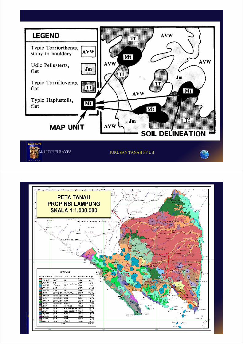
• The entities evaluated by ALES are map units, which may be defined either broadly (as in reconnaissance surveys and general feasibility studies) or narrowly (as in detailed resource surveys and farm-scale planning).
M. LUTHFI RAYES JURUSAN TANAH FP UB
M. Luthfi Rayes JURUSAN TANAH FP UNIV. BRAWIJAYA
M. LUTHFI RAYES JURUSAN TANAH FP UB
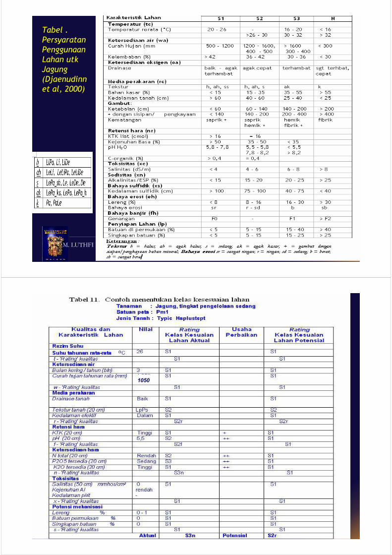
What is land evaluation?
match
Land-use
planning
Land-use
planning
policies & plans
Land
qualities
Land
qualitiesLand-use
requirements
Land-use
requirements
suitabilitysuitability
M. LUTHFI RAYES JURUSAN TANAH FP UB
Tabel .
Persyaratan
Penggunaan
Lahan utk
Jagung
(Djaenudinn
et al, 2000)
M. LUTHFI RAYES JURUSAN TANAH FP UB
1050
M. Luthfi Rayes JURUSAN TANAH FP UNIV. BRAWIJAYA
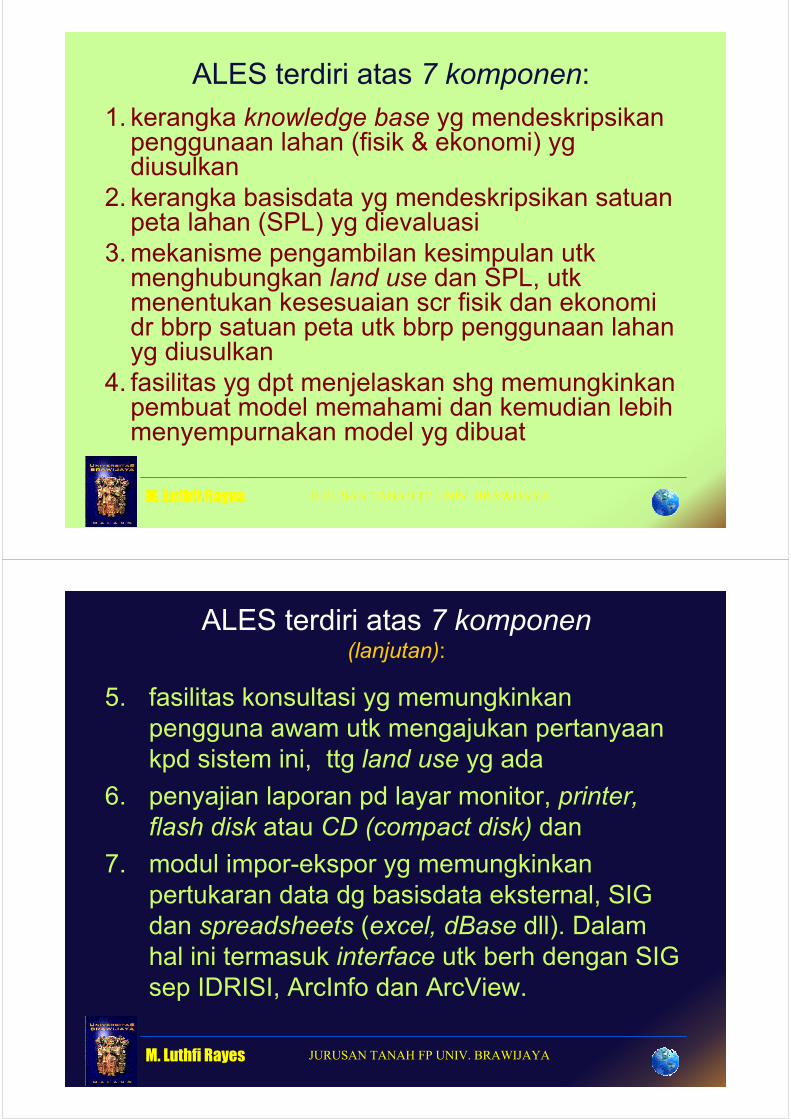
ALES terdiri atas 7 komponen:
1. kerangka knowledge base yg mendeskripsikan penggunaan lahan (fisik & ekonomi) yg diusulkan
2. kerangka basisdata yg mendeskripsikan satuan peta lahan (SPL) yg dievaluasi
3.mekanisme pengambilan kesimpulan utk menghubungkan land use dan SPL, utk menentukan kesesuaian scr fisik dan ekonomi dr bbrp satuan peta utk bbrp penggunaan lahan yg diusulkan
4. fasilitas yg dpt menjelaskan shg memungkinkan pembuat model memahami dan kemudian lebih menyempurnakan model yg dibuat
M. Luthfi Rayes JURUSAN TANAH FP UNIV. BRAWIJAYA
ALES terdiri atas 7 komponen(lanjutan):
5. fasilitas konsultasi yg memungkinkan
pengguna awam utk mengajukan pertanyaan
kpd sistem ini, ttg land use yg ada
6. penyajian laporan pd layar monitor, printer,
flash disk atau CD (compact disk) dan
7. modul impor-ekspor yg memungkinkan
pertukaran data dg basisdata eksternal, SIG
dan spreadsheets (excel, dBase dll). Dalam
hal ini termasuk interface utk berh dengan SIG
sep IDRISI, ArcInfo dan ArcView.

M. Luthfi Rayes JURUSAN TANAH FP UNIV. BRAWIJAYA
• ALES is not a GIS and does not itself
display maps. It can, however, analyze
geographic land characteristics if map
units are appropriate defined, and
• it can directly reclassify IDRISI or Arc/Info
or ArcView maps with the same mapping
unit legend as the ALES database.
M. Luthfi Rayes JURUSAN TANAH FP UNIV. BRAWIJAYA
Fig. 1. An overview of the ALES program flow.
M. Luthfi Rayes JURUSAN TANAH FP UNIV. BRAWIJAYA
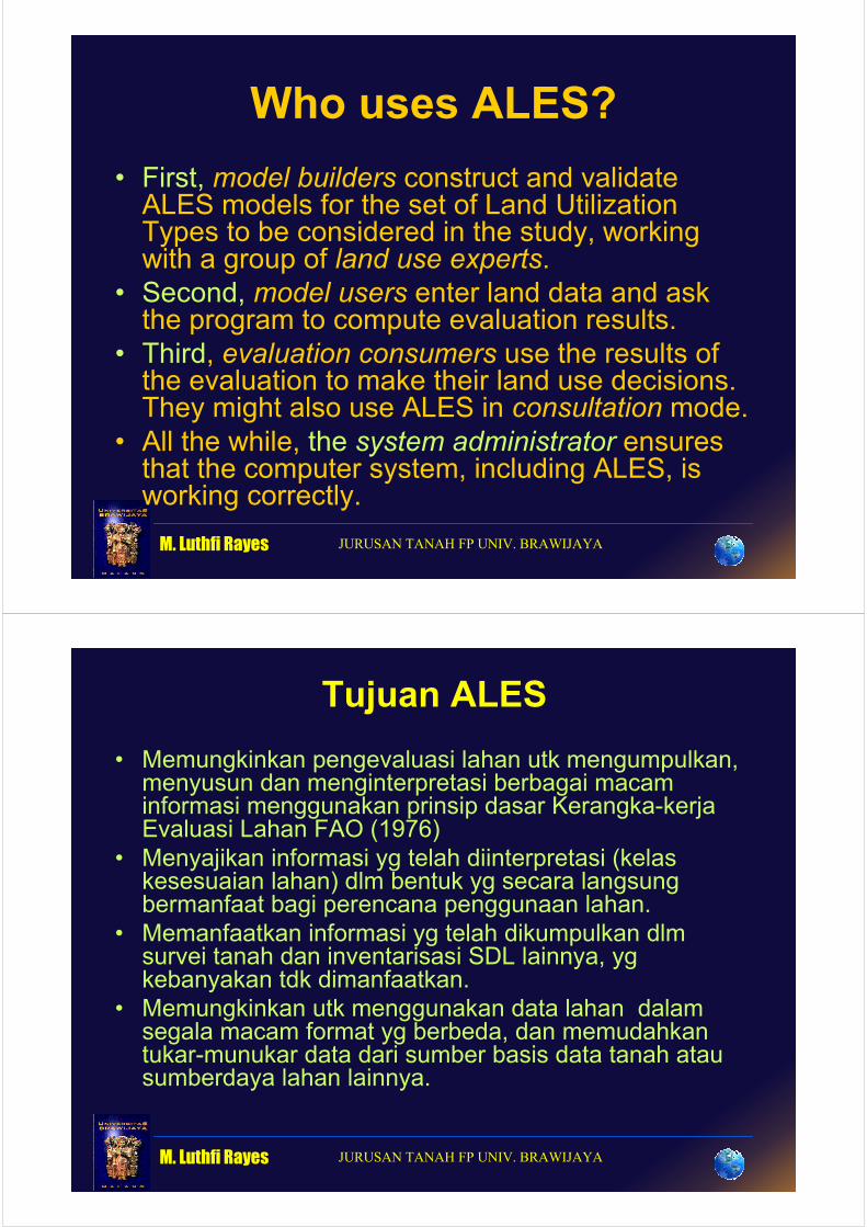
Who uses ALES?
• First, model builders construct and validate ALES models for the set of Land Utilization Types to be considered in the study, working with a group of land use experts.
• Second, model users enter land data and ask the program to compute evaluation results.
• Third, evaluation consumers use the results of the evaluation to make their land use decisions. They might also use ALES in consultation mode.
• All the while, the system administrator ensures that the computer system, including ALES, is working correctly.
M. Luthfi Rayes JURUSAN TANAH FP UNIV. BRAWIJAYA
Tujuan ALES
• Memungkinkan pengevaluasi lahan utk mengumpulkan, menyusun dan menginterpretasi berbagai macam informasi menggunakan prinsip dasar Kerangka-kerja Evaluasi Lahan FAO (1976)
• Menyajikan informasi yg telah diinterpretasi (kelas kesesuaian lahan) dlm bentuk yg secara langsung bermanfaat bagi perencana penggunaan lahan.
• Memanfaatkan informasi yg telah dikumpulkan dlm survei tanah dan inventarisasi SDL lainnya, yg kebanyakan tdk dimanfaatkan.
• Memungkinkan utk menggunakan data lahan dalam segala macam format yg berbeda, dan memudahkan tukar-munukar data dari sumber basis data tanah atau sumberdaya lahan lainnya.
M. Luthfi Rayes JURUSAN TANAH FP UNIV. BRAWIJAYA
KEUNGGULAN & KENDALA
• Mengevaluasi lahan utk berbagai TPL dan banyak SPT serta utk berbagai skala peta
• Mengevaluasi lahan scr fisik dan ekonomik
• Dgn basisdata yg terstruktur, � perubahan data (fisik atau ekonomik) dpt dilakukan kapan saja dan “scr otomatis” hasil evaluasi akan berubah sesuai data terbaru
• Belum seluruh daerah di Indonesia miliki Data spasial & tabular
• Perlu Keakhlian ?????
M. Luthfi Rayes JURUSAN TANAH FP UNIV. BRAWIJAYA
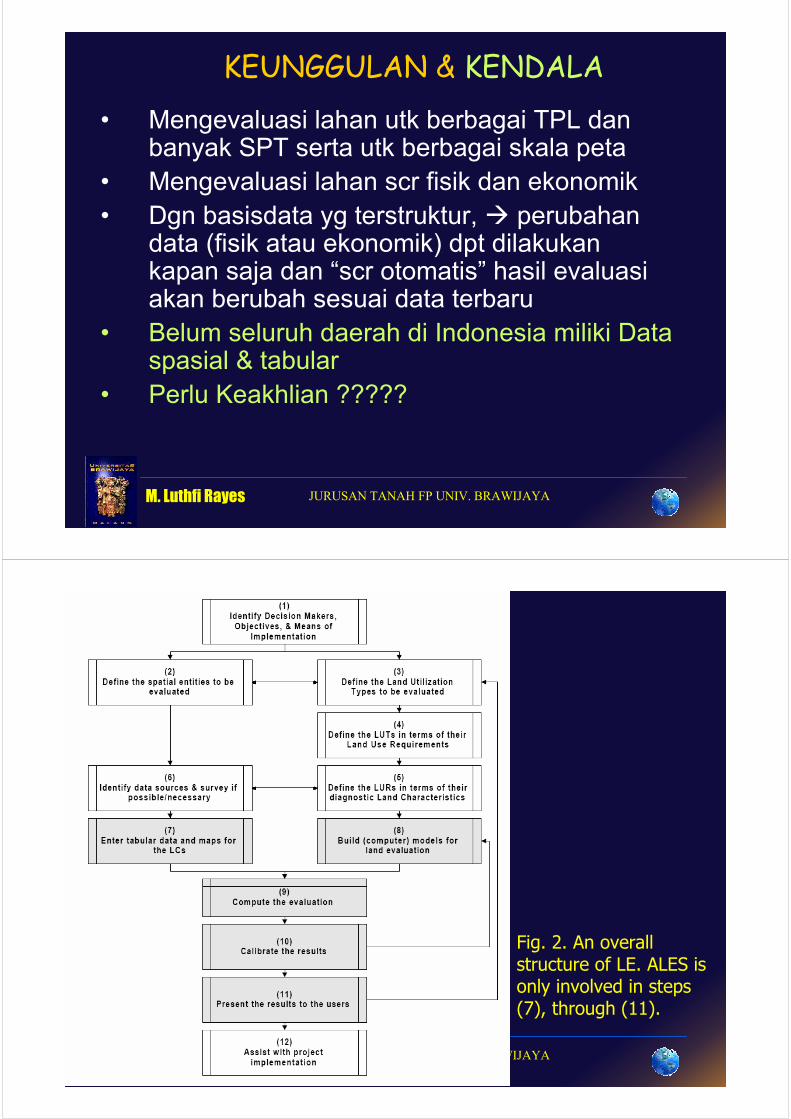
Fig. 2. An overall structure of LE. ALES is only involved in steps (7), through (11).
M. Luthfi Rayes JURUSAN TANAH FP UNIV. BRAWIJAYA
INITIAL CONSULTATIONS
• Objectives
• Data and assumptions
• Planning of the land evaluation
Major kinds of land use or land utilization types
Land Mapping Unit
Comparison of Land use with land
- matching
- economic and social
analysis
- Environmental Impact
Land Use Requirements and Limitations
Land Suitability Classification
Land Qualities
Presentation of Results
M. Luthfi Rayes JURUSAN TANAH FP UNIV. BRAWIJAYA
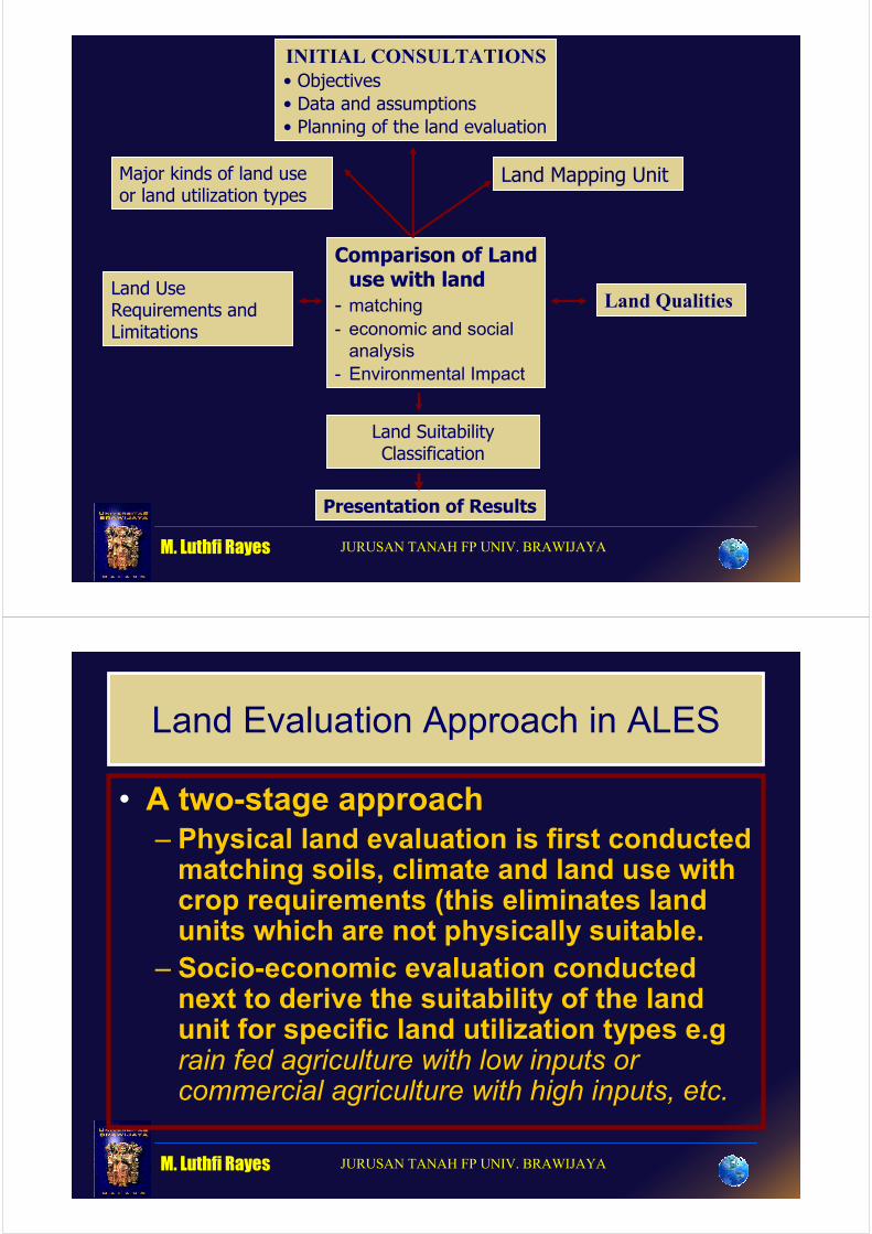
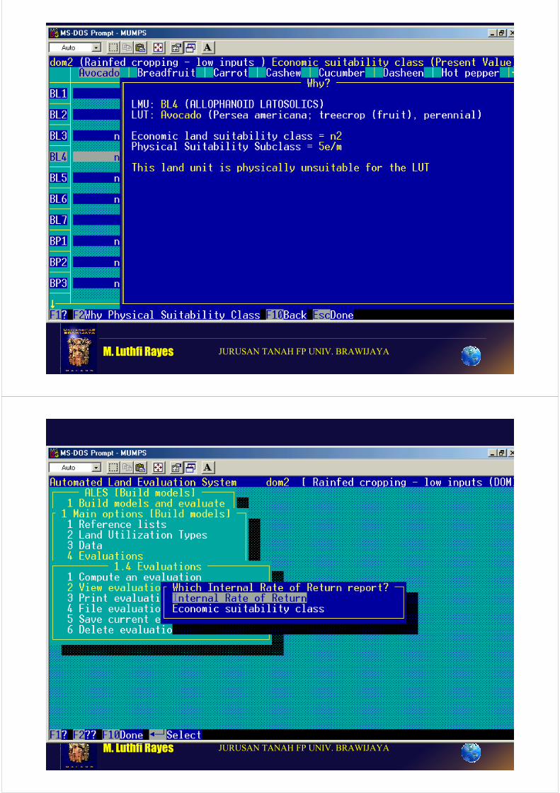
Land Evaluation Approach in ALES
• A two-stage approach
– Physical land evaluation is first conducted matching soils, climate and land use with crop requirements (this eliminates land units which are not physically suitable.
– Socio-economic evaluation conducted next to derive the suitability of the land unit for specific land utilization types e.g rain fed agriculture with low inputs or commercial agriculture with high inputs, etc.
M. Luthfi Rayes JURUSAN TANAH FP UNIV. BRAWIJAYA
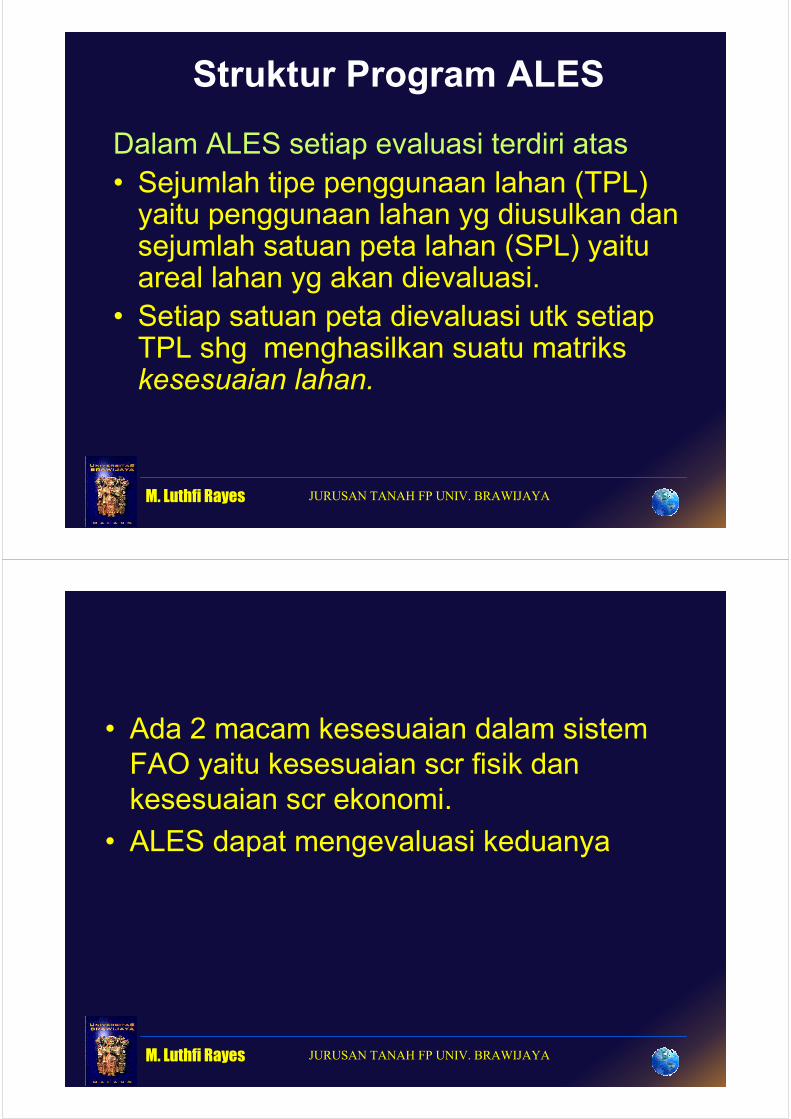
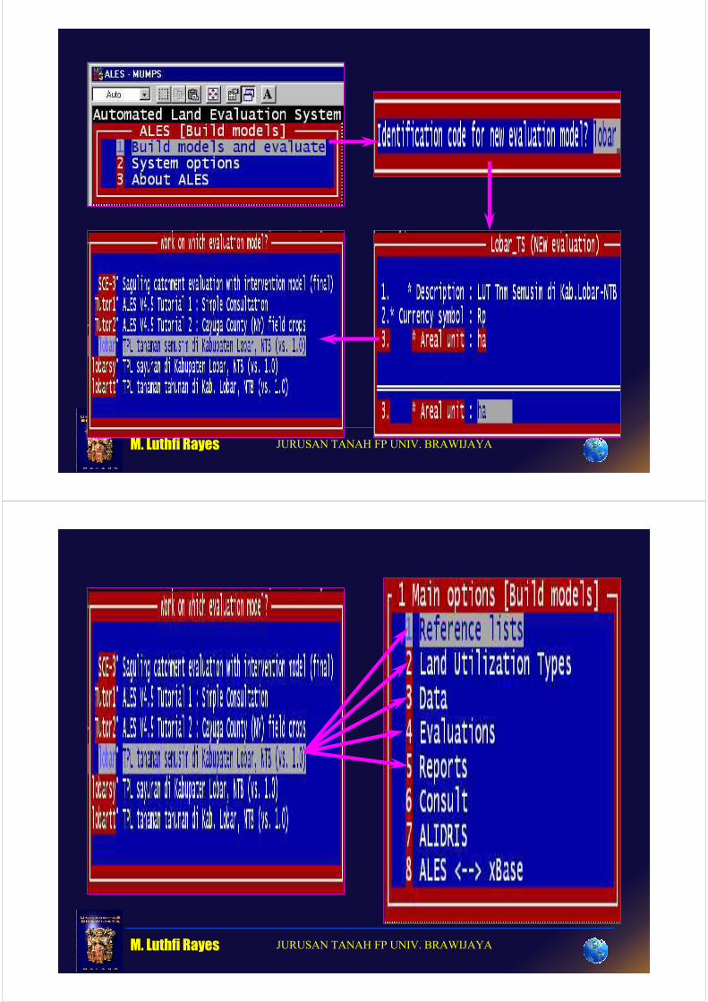
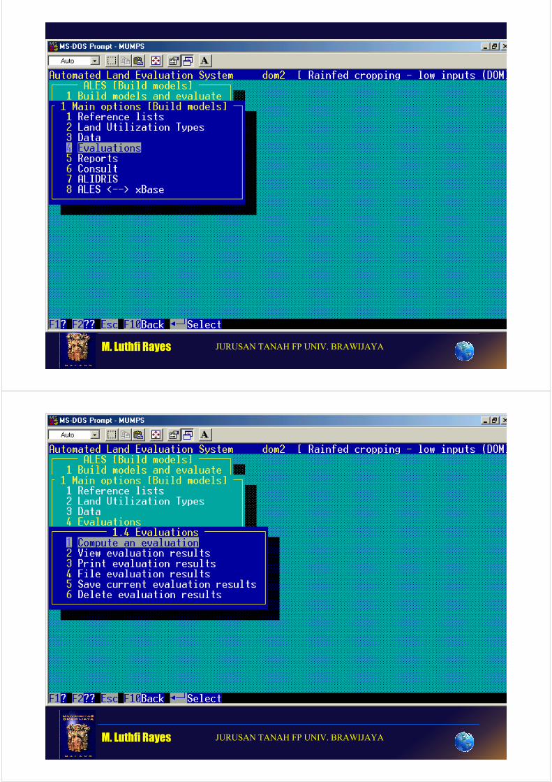
Struktur Program ALES
Dalam ALES setiap evaluasi terdiri atas
• Sejumlah tipe penggunaan lahan (TPL) yaitu penggunaan lahan yg diusulkan dan sejumlah satuan peta lahan (SPL) yaitu areal lahan yg akan dievaluasi.
• Setiap satuan peta dievaluasi utk setiap TPL shg menghasilkan suatu matriks kesesuaian lahan.
M. Luthfi Rayes JURUSAN TANAH FP UNIV. BRAWIJAYA
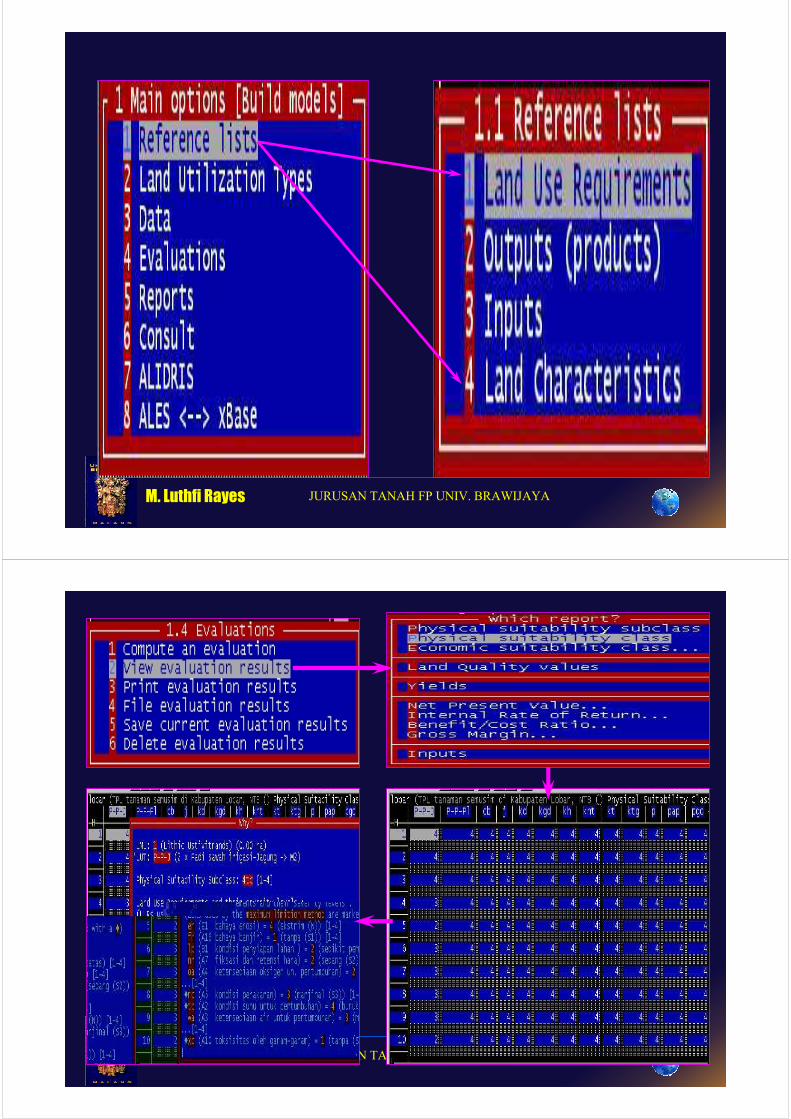
• Ada 2 macam kesesuaian dalam sistem
FAO yaitu kesesuaian scr fisik dan
kesesuaian scr ekonomi.
• ALES dapat mengevaluasi keduanya
M. Luthfi Rayes JURUSAN TANAH FP UNIV. BRAWIJAYA
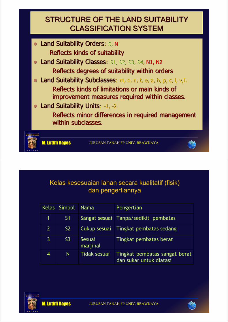
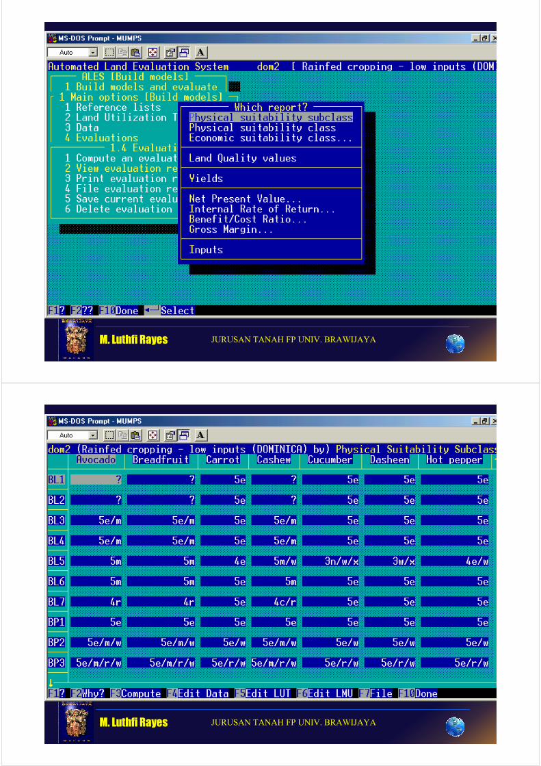
STRUCTURE OF THE LAND SUITABILITY STRUCTURE OF THE LAND SUITABILITY
CLASSIFICATION SYSTEMCLASSIFICATION SYSTEM
�� Land Suitability OrdersLand Suitability Orders: : S, S, NN
Reflects kinds of suitabilityReflects kinds of suitability
�� Land Suitability ClassesLand Suitability Classes: : S1, S2, S3, S1, S2, S3, S4S4, , N1, N2N1, N2
Reflects degrees of suitability within ordersReflects degrees of suitability within orders
�� Land Suitability SubclassesLand Suitability Subclasses: : m, o, n, t, e, a, h, p, c, l, v,I.m, o, n, t, e, a, h, p, c, l, v,I.
Reflects kinds of limitations or main kinds of Reflects kinds of limitations or main kinds of
improvement measures required within classes.improvement measures required within classes.
�� Land Suitability UnitsLand Suitability Units: : --1, 1, --22
Reflects minor differences in required management Reflects minor differences in required management
within subclasses.within subclasses.
M. Luthfi Rayes JURUSAN TANAH FP UNIV. BRAWIJAYA
Kelas kesesuaian lahan secara kualitatif (fisik)
dan pengertiannya
Kelas Simbol Nama Pengertian
1 S1 Sangat sesuai Tanpa/sedikit pembatas
2 S2 Cukup sesuai Tingkat pembatas sedang
3 S3 Sesuai
marjinal
Tingkat pembatas berat
4 N Tidak sesuai Tingkat pembatas sangat berat
dan sukar untuk diatasi
M. Luthfi Rayes JURUSAN TANAH FP UNIV. BRAWIJAYA
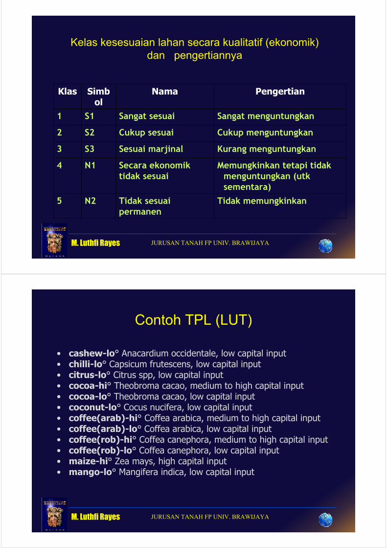
Kelas kesesuaian lahan secara kualitatif (ekonomik)
dan pengertiannya
Klas Simbol
Nama Pengertian
1 S1 Sangat sesuai Sangat menguntungkan
2 S2 Cukup sesuai Cukup menguntungkan
3 S3 Sesuai marjinal Kurang menguntungkan
4 N1 Secara ekonomik tidak sesuai
Memungkinkan tetapi tidak menguntungkan (utk sementara)
5 N2 Tidak sesuai permanen
Tidak memungkinkan
M. Luthfi Rayes JURUSAN TANAH FP UNIV. BRAWIJAYA
Contoh TPL (LUT)
• cashew-lo° Anacardium occidentale, low capital input • chilli-lo° Capsicum frutescens, low capital input• citrus-lo° Citrus spp, low capital input• cocoa-hi° Theobroma cacao, medium to high capital input• cocoa-lo° Theobroma cacao, low capital input• coconut-lo° Cocus nucifera, low capital input• coffee(arab)-hi° Coffea arabica, medium to high capital input• coffee(arab)-lo° Coffea arabica, low capital input • coffee(rob)-hi° Coffea canephora, medium to high capital input• coffee(rob)-lo° Coffea canephora, low capital input • maize-hi° Zea mays, high capital input• mango-lo° Mangifera indica, low capital input
M. Luthfi Rayes JURUSAN TANAH FP UNIV. BRAWIJAYA
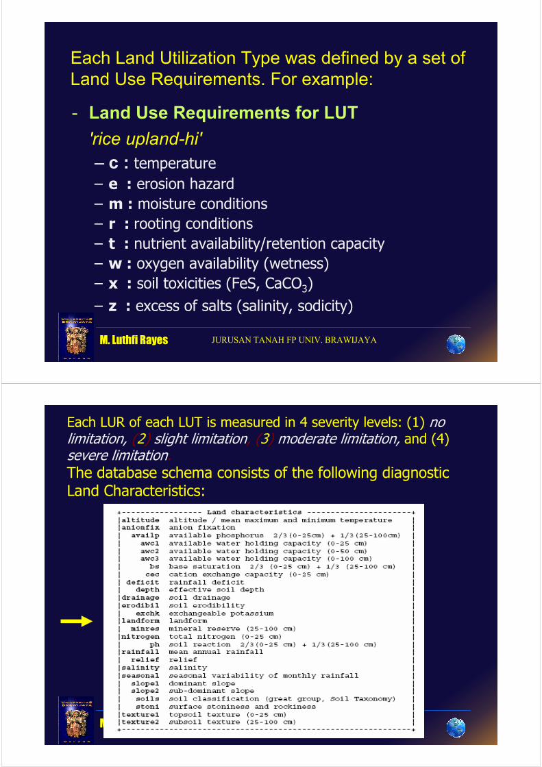
Each Land Utilization Type was defined by a set of
Land Use Requirements. For example:
- Land Use Requirements for LUT
'rice upland-hi'
– c : temperature
– e : erosion hazard
– m : moisture conditions
– r : rooting conditions
– t : nutrient availability/retention capacity
– w : oxygen availability (wetness)
– x : soil toxicities (FeS, CaCO3)
– z : excess of salts (salinity, sodicity)
M. Luthfi Rayes JURUSAN TANAH FP UNIV. BRAWIJAYA
Each LUR of each LUT is measured in 4 severity levels: (1) nolimitation, (2) slight limitation, (3) moderate limitation, and (4) severe limitation.
The database schema consists of the following diagnostic Land Characteristics:
M. Luthfi Rayes JURUSAN TANAH FP UNIV. BRAWIJAYA
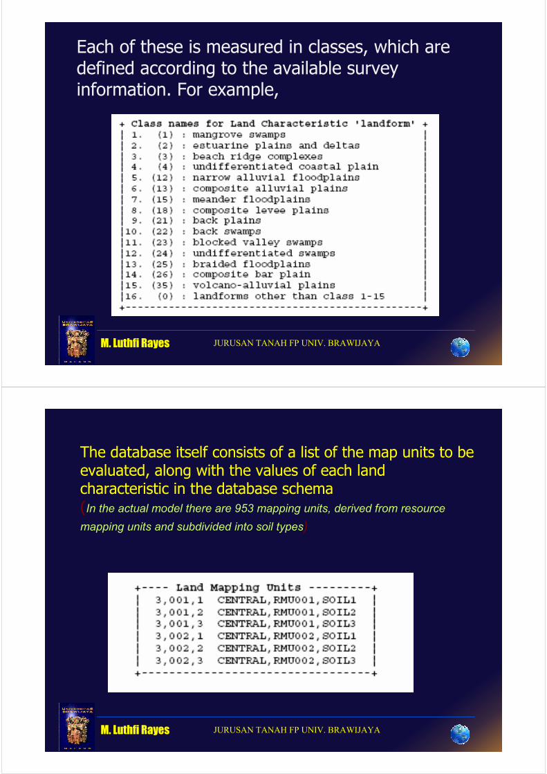
Each of these is measured in classes, which are defined according to the available survey information. For example,
M. Luthfi Rayes JURUSAN TANAH FP UNIV. BRAWIJAYA
The database itself consists of a list of the map units to be evaluated, along with the values of each landcharacteristic in the database schema (In the actual model there are 953 mapping units, derived from resource mapping units and subdivided into soil types)
M. Luthfi Rayes JURUSAN TANAH FP UNIV. BRAWIJAYA
BP035
EZ123
BP225
Data/profil:
“serie”
slope
relief
landform
dissection
BK185
BP087
BK016
EZ035
BP145
51
49
63
M. Luthfi Rayes JURUSAN TANAH FP UNIV. BRAWIJAYA
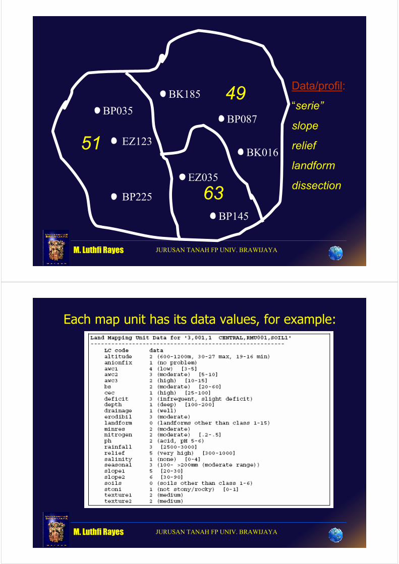
Each map unit has its data values, for example:
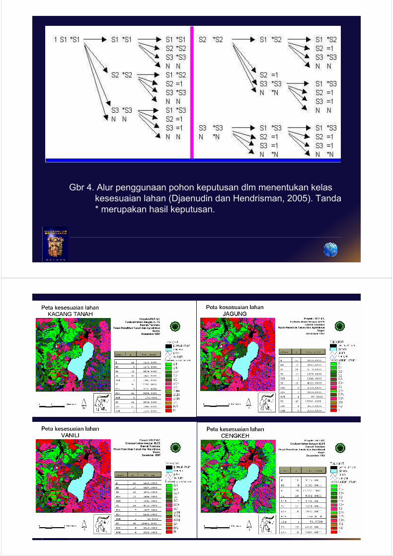
Gbr 4. Alur penggunaan pohon keputusan dlm menentukan kelas
kesesuaian lahan (Djaenudin dan Hendrisman, 2005). Tanda
* merupakan hasil keputusan.
M. Luthfi Rayes JURUSAN TANAH FP UNIV. BRAWIJAYA
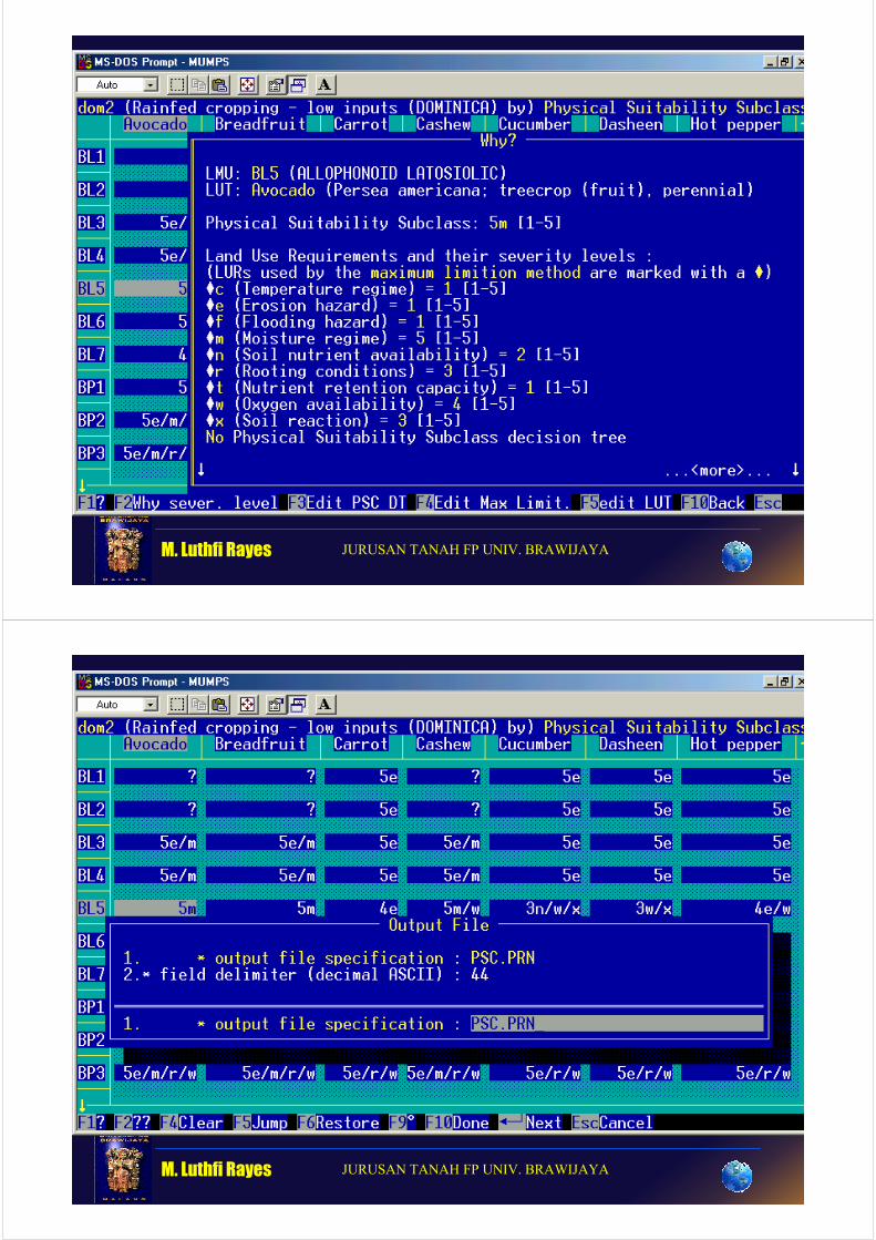
Once the model was set up and the database constructed, ALES was asked to compute Land Quality values, and then combine these into overall physical suitability. The results is an evaluation matrix, of which the following is only a small part:
M. Luthfi Rayes JURUSAN TANAH FP UNIV. BRAWIJAYA
Running
ALES Program
M. Luthfi Rayes JURUSAN TANAH FP UNIV. BRAWIJAYA
M. Luthfi Rayes JURUSAN TANAH FP UNIV. BRAWIJAYA
M. Luthfi Rayes JURUSAN TANAH FP UNIV. BRAWIJAYA
M. Luthfi Rayes JURUSAN TANAH FP UNIV. BRAWIJAYA
M. Luthfi Rayes JURUSAN TANAH FP UNIV. BRAWIJAYA
M. Luthfi Rayes JURUSAN TANAH FP UNIV. BRAWIJAYA

M. Luthfi Rayes JURUSAN TANAH FP UNIV. BRAWIJAYA
M. Luthfi Rayes JURUSAN TANAH FP UNIV. BRAWIJAYA
M. Luthfi Rayes JURUSAN TANAH FP UNIV. BRAWIJAYA
M. Luthfi Rayes JURUSAN TANAH FP UNIV. BRAWIJAYA
M. Luthfi Rayes JURUSAN TANAH FP UNIV. BRAWIJAYA
M. Luthfi Rayes JURUSAN TANAH FP UNIV. BRAWIJAYA
M. Luthfi Rayes JURUSAN TANAH FP UNIV. BRAWIJAYA
M. Luthfi Rayes JURUSAN TANAH FP UNIV. BRAWIJAYA

M. Luthfi Rayes JURUSAN TANAH FP UNIV. BRAWIJAYA
M. Luthfi Rayes JURUSAN TANAH FP UNIV. BRAWIJAYA
M. Luthfi Rayes JURUSAN TANAH FP UNIV. BRAWIJAYA
M. Luthfi Rayes JURUSAN TANAH FP UNIV. BRAWIJAYA
M. Luthfi Rayes JURUSAN TANAH FP UNIV. BRAWIJAYA
M. Luthfi Rayes JURUSAN TANAH FP UNIV. BRAWIJAYA
M. Luthfi Rayes JURUSAN TANAH FP UNIV. BRAWIJAYA
M. Luthfi Rayes JURUSAN TANAH FP UNIV. BRAWIJAYA
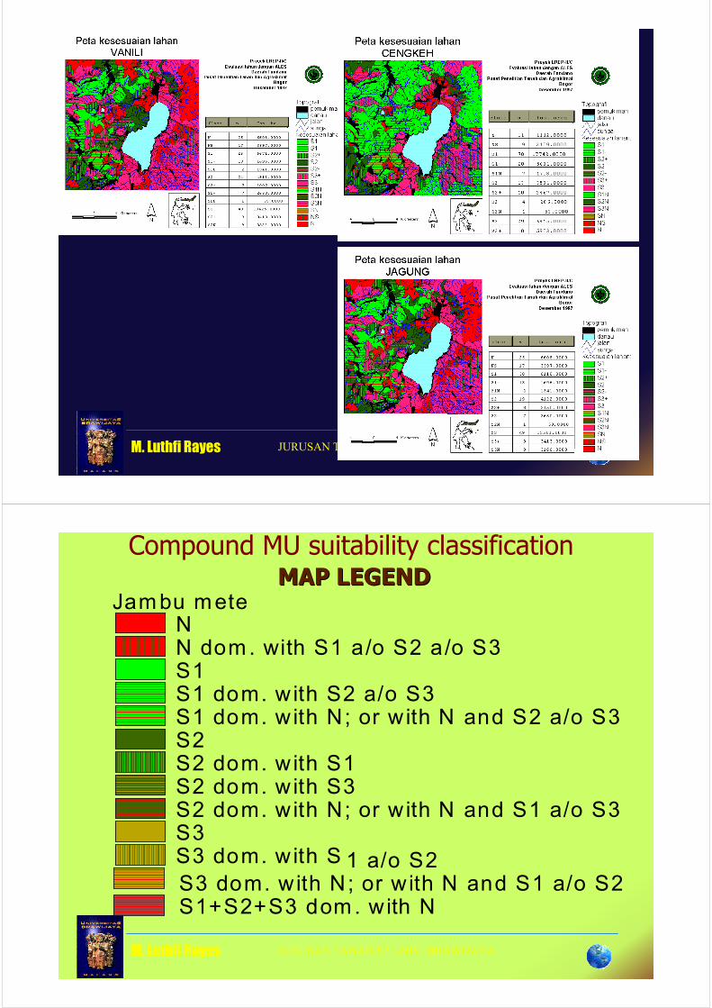
Compound MU suitability classificationMAP LEGENDMAP LEGEND
Jambu meteNN dom. with S1 a/o S2 a/o S3S1S1 dom. with S2 a/o S3S1 dom. with N; or with N and S2 a/o S3S2S2 dom. with S1S2 dom. with S3S2 dom. with N; or with N and S1 a/o S3S3S3 dom. with S 1 a/o S2S3 dom. with N; or with N and S1 a/o S2S1+S2+S3 dom. with N
M. Luthfi Rayes JURUSAN TANAH FP UNIV. BRAWIJAYA
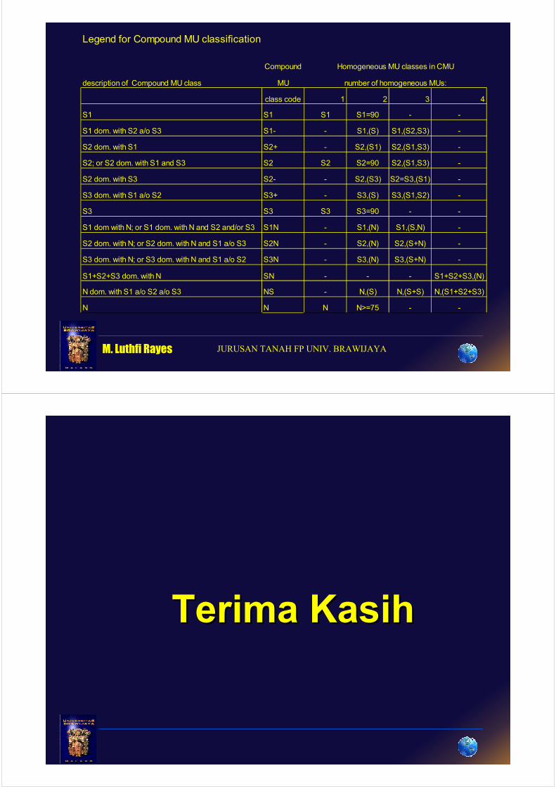
Legend for Compound MU classification
Compound Homogeneous MU classes in CMU
description of Compound MU class MU number of homogeneous MUs:
class code 1 2 3 4
S1 S1 S1 S1=90 - -
S1 dom. with S2 a/o S3 S1- - S1,(S) S1,(S2,S3) -
S2 dom. with S1 S2+ - S2,(S1) S2,(S1,S3) -
S2; or S2 dom. with S1 and S3 S2 S2 S2=90 S2,(S1,S3) -
S2 dom. with S3 S2- - S2,(S3) S2=S3,(S1) -
S3 dom. with S1 a/o S2 S3+ - S3,(S) S3,(S1,S2) -
S3 S3 S3 S3=90 - -
S1 dom with N; or S1 dom. with N and S2 and/or S3 S1N - S1,(N) S1,(S,N) -
S2 dom. with N; or S2 dom. with N and S1 a/o S3 S2N - S2,(N) S2,(S+N) -
S3 dom. with N; or S3 dom. with N and S1 a/o S2 S3N - S3,(N) S3,(S+N) -
S1+S2+S3 dom. with N SN - - - S1+S2+S3,(N)
N dom. with S1 a/o S2 a/o S3 NS - N,(S) N,(S+S) N,(S1+S2+S3)
N N N N>=75 - -
Terima KasihTerima Kasih