Embed Size (px)
Citation preview
GPS 101: Introduction to Geospatial TechnologiesAlabama Forest Owners’ Association Annual Meeting
Chris DillardGeospatial Extension SpecialistAlabama Cooperative Extension System
April 17th, 2010
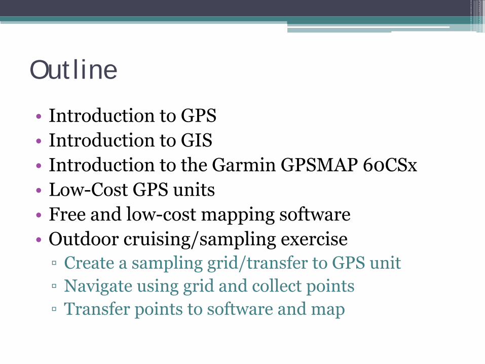
Outline
• Introduction to GPS• Introduction to GIS• Introduction to the Garmin GPSMAP 60CSx• Low-Cost GPS units• Free and low-cost mapping software• Outdoor cruising/sampling exercise▫ Create a sampling grid/transfer to GPS unit▫ Navigate using grid and collect points▫ Transfer points to software and map

Global Positioning System
What is GPS?
The Global Positioning System (GPS) is a U.S. space-based radionavigation system that provides reliable positioning, navigation, and timing services to civilian users on a continuous worldwide basis -- freely available to all.
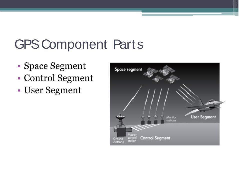
GPS Component Parts
• Space Segment• Control Segment• User Segment
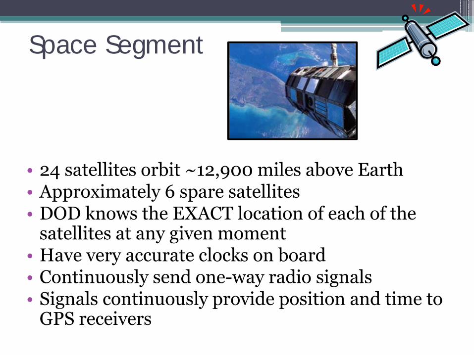
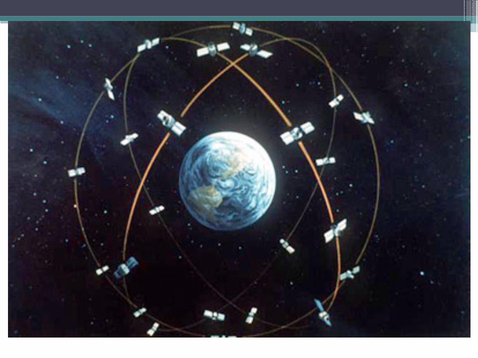
Space Segment
• 24 satellites orbit ~12,900 miles above Earth• Approximately 6 spare satellites• DOD knows the EXACT location of each of the
satellites at any given moment• Have very accurate clocks on board• Continuously send one-way radio signals• Signals continuously provide position and time to
GPS receivers
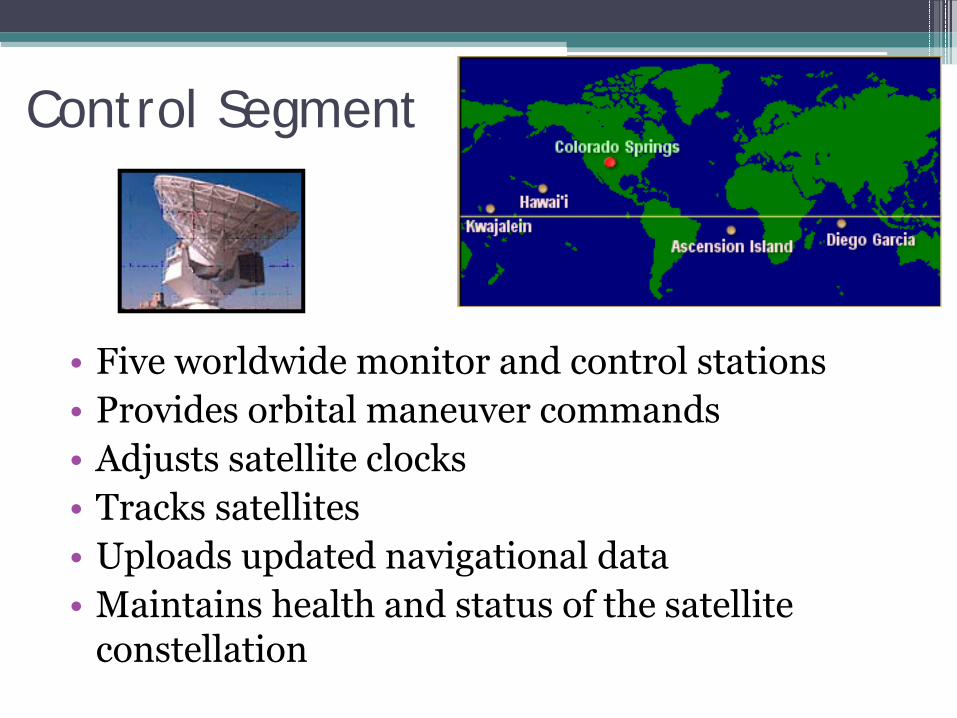
• Five worldwide monitor and control stations• Provides orbital maneuver commands• Adjusts satellite clocks• Tracks satellites• Uploads updated navigational data• Maintains health and status of the satellite
constellation
Control Segment
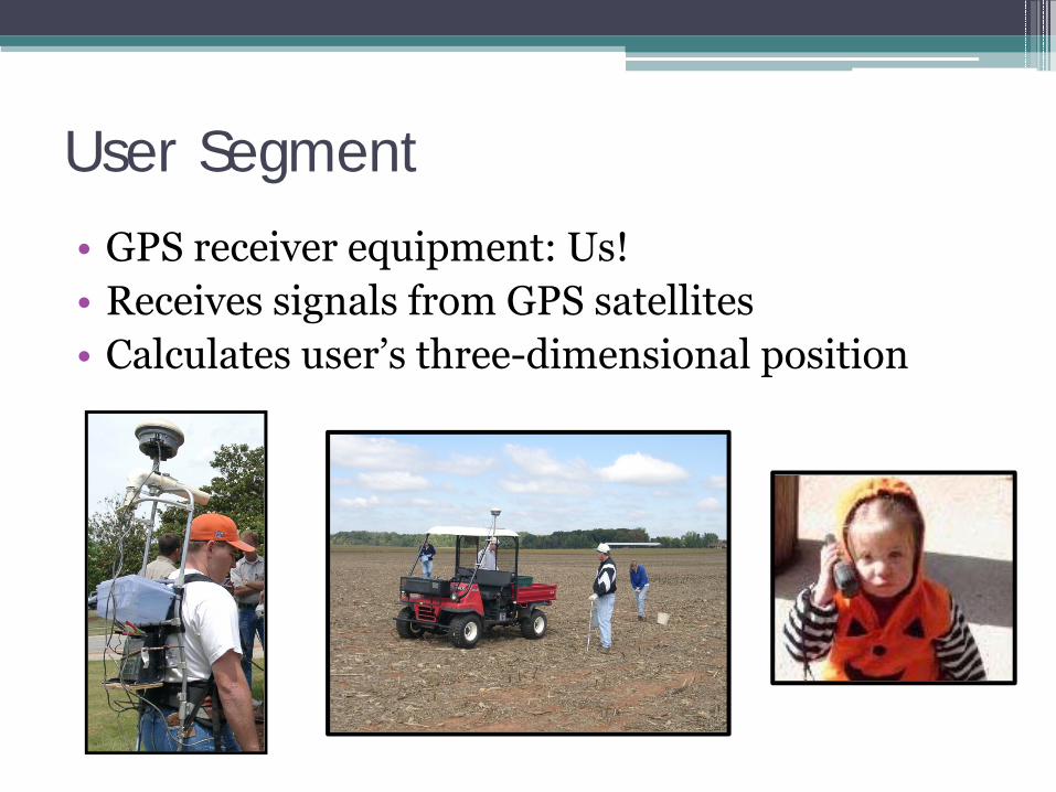
User Segment
• GPS receiver equipment: Us!• Receives signals from GPS satellites• Calculates user’s three-dimensional position
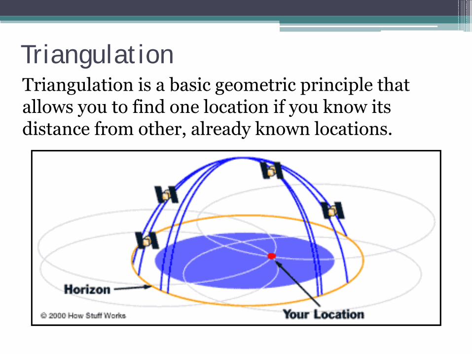
TriangulationTriangulation is a basic geometric principle that allows you to find one location if you know its distance from other, already known locations.
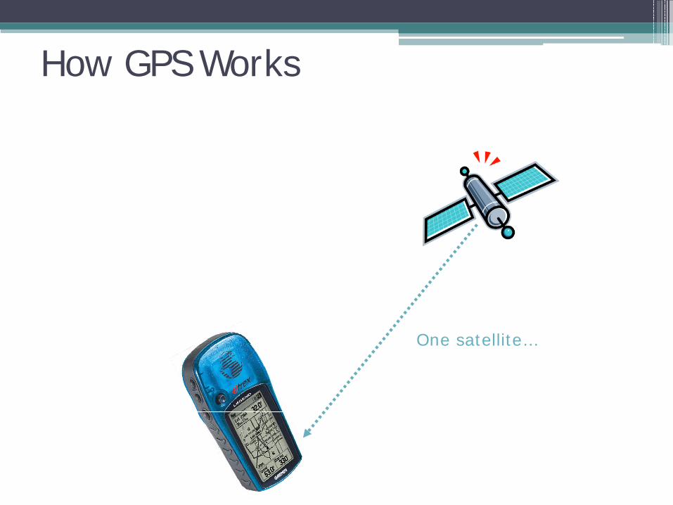
How GPS Works
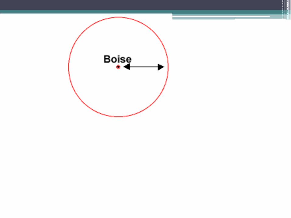
One satellite…
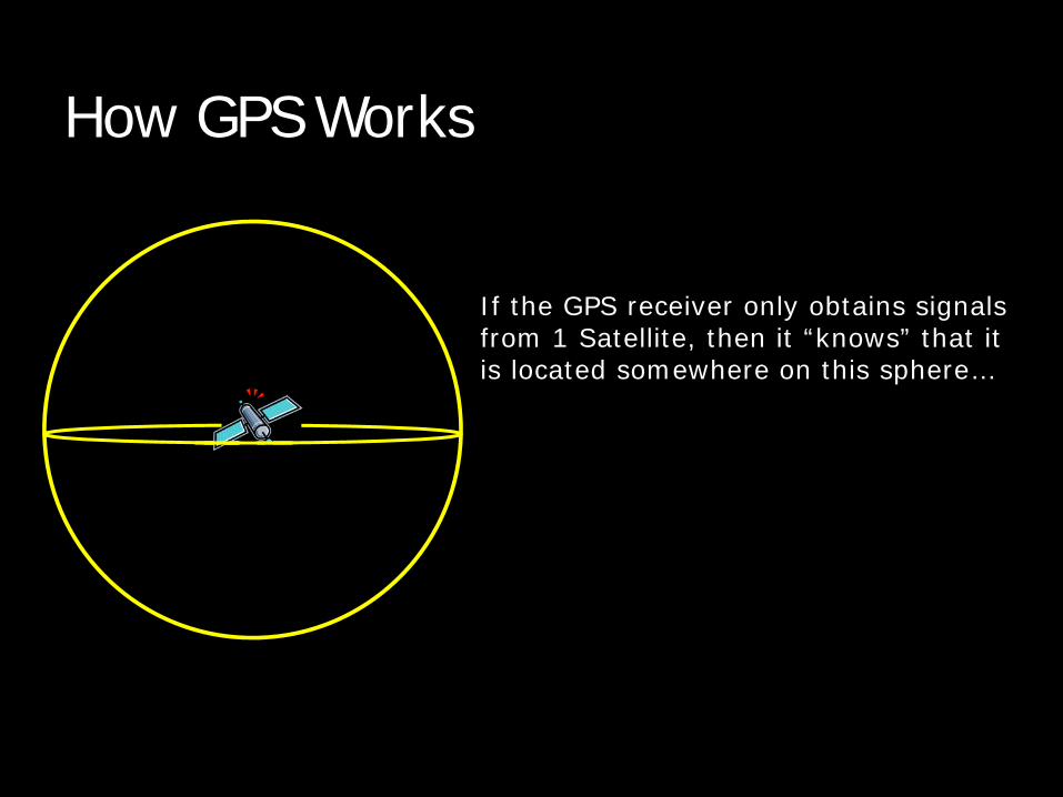
How GPS Works
If the GPS receiver only obtains signals from 1 Satellite, then it “knows” that it is located somewhere on this sphere…
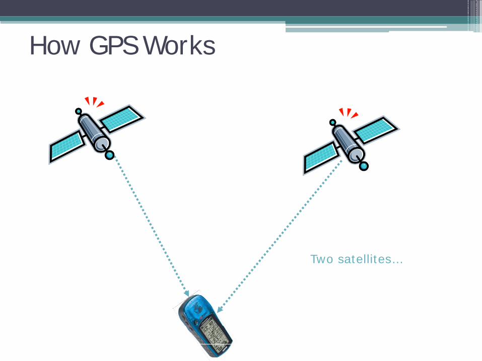
How GPS Works
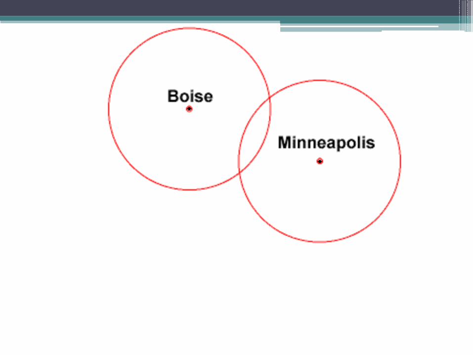
Two satellites…
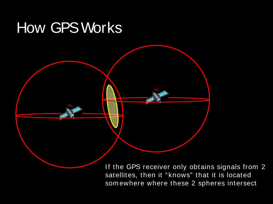
How GPS Works
If the GPS receiver only obtains signals from 2satellites, then it “knows” that it is locatedsomewhere where these 2 spheres intersect
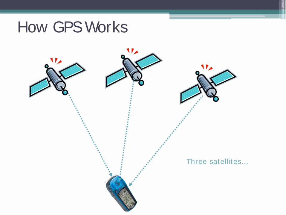
How GPS Works
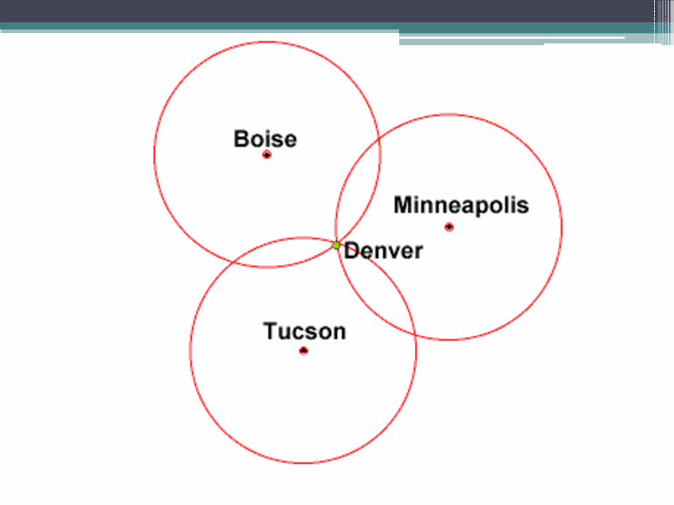
Three satellites…
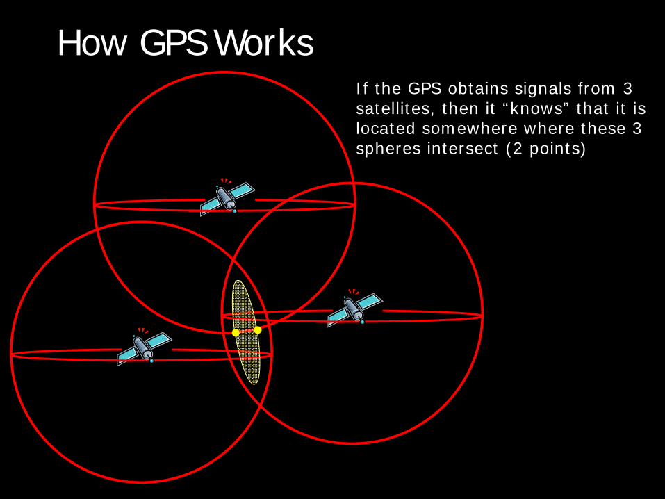
How GPS WorksIf the GPS obtains signals from 3satellites, then it “knows” that it is located somewhere where these 3 spheres intersect (2 points)
How GPS Works
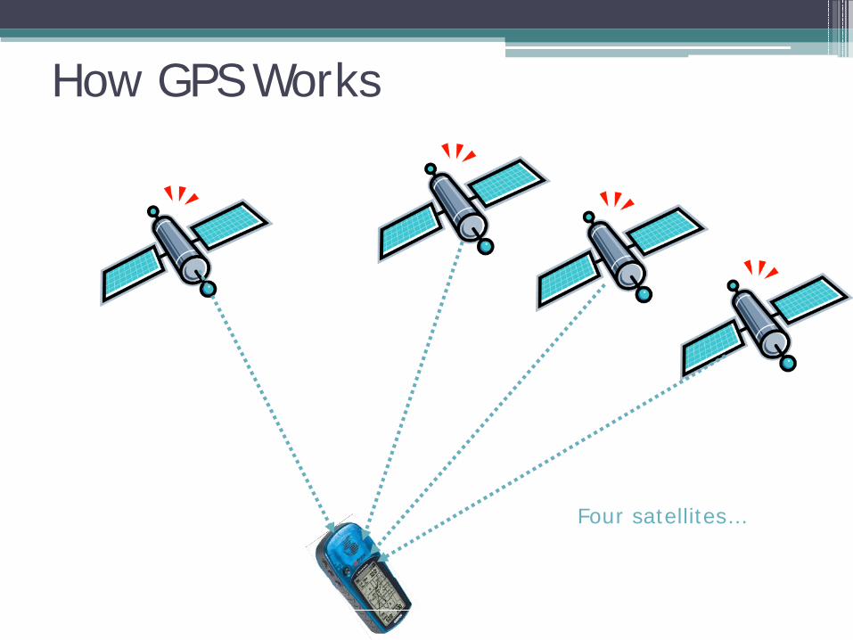
Four satellites…
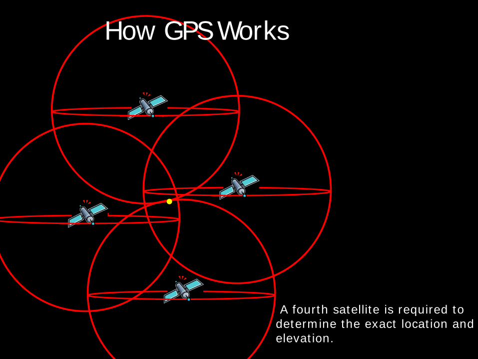
A fourth satellite is required to determine the exact location and elevation.
How GPS Works
Geographic Information Systems
What is a GIS?
A geographic information system, or GIS, integrates hardware, software, and data for capturing, managing, analyzing, and displaying all forms of geographically referenced information.
- ESRI
What is a GIS?
• Georeferenced data contains coordinate information (latitude and longitude, e.g.)
• GIS uses layers, called "themes," to overlay different types of information
• Display and analyze spatial data which are tied to databases▫ This connection is what gives GIS its power: maps
can be drawn from the database and data can be referenced from the maps
What is GIS?
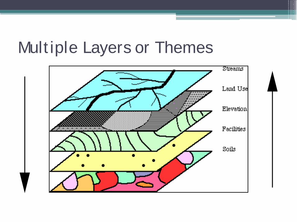
Multiple Layers or Themes
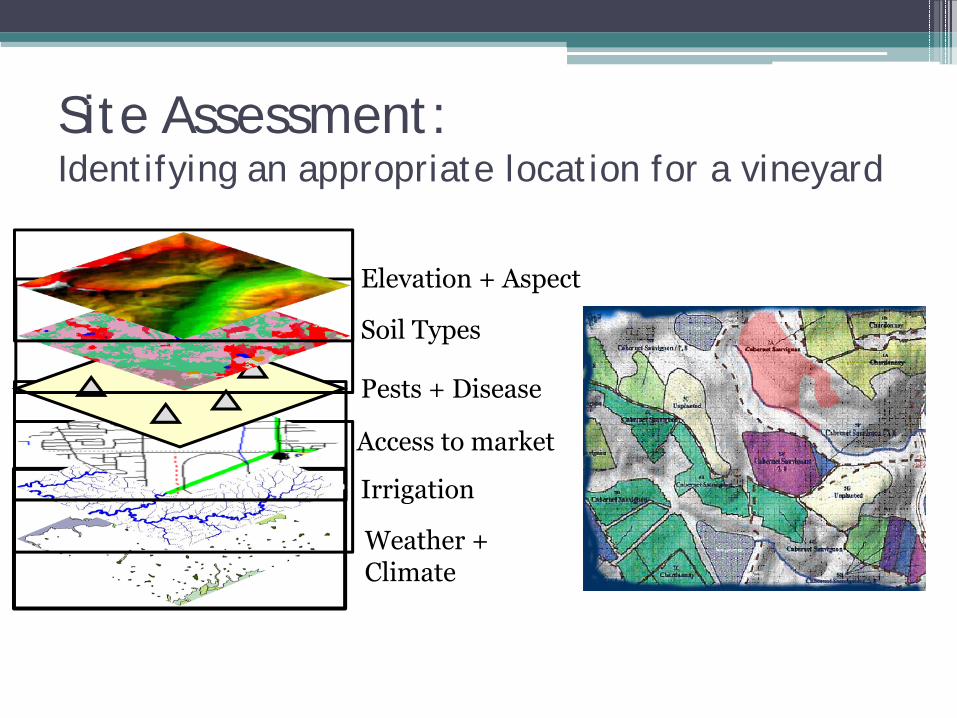
Weather + Climate
Irrigation
Site Assessment:Identifying an appropriate location for a vineyard
Access to market
Pests + Disease
Soil Types
Elevation + Aspect
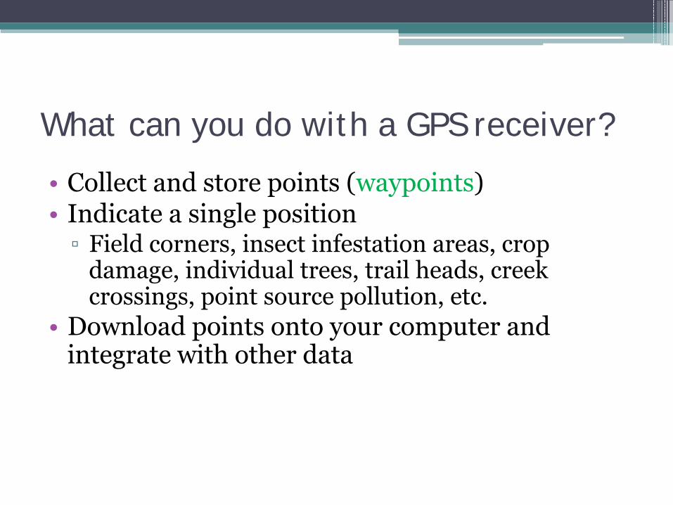
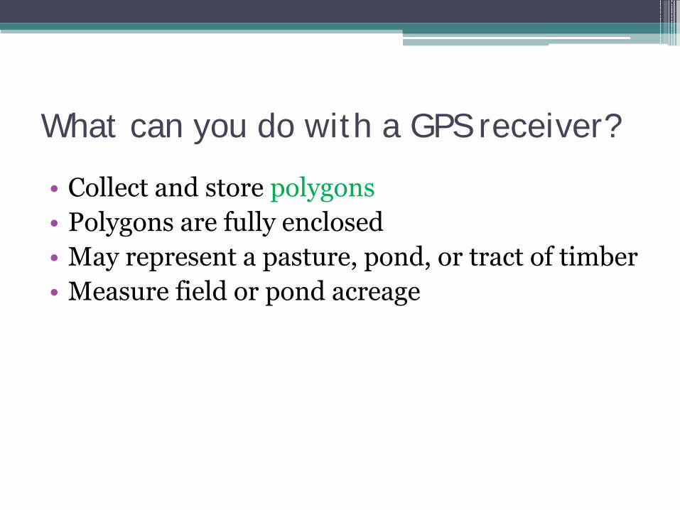
What can you do with a GPS receiver?
• Collect and store points (waypoints)• Indicate a single position▫ Field corners, insect infestation areas, crop
damage, individual trees, trail heads, creek crossings, point source pollution, etc.
• Download points onto your computer and integrate with other data
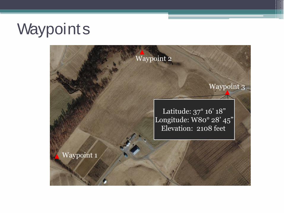
Waypoints
Waypoint 1
Waypoint 2
Waypoint 3
Latitude: 37° 16’ 18”Longitude: W80° 28’ 45”
Elevation: 2108 feet
What can you do with a GPS receiver?
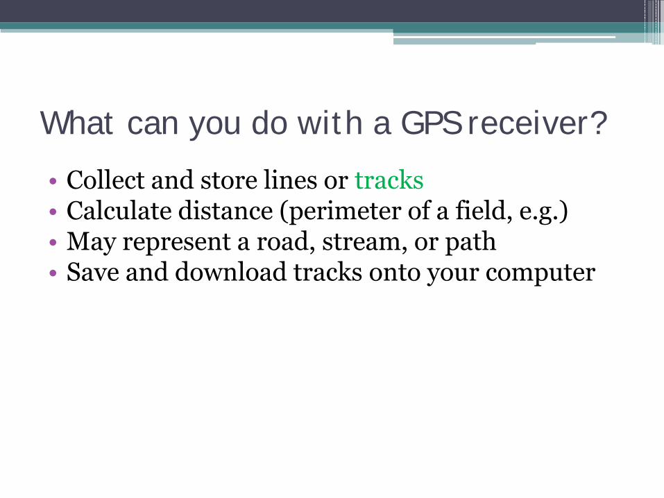
• Collect and store lines or tracks• Calculate distance (perimeter of a field, e.g.)• May represent a road, stream, or path• Save and download tracks onto your computer
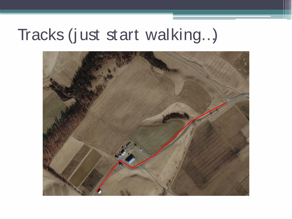
Tracks (just start walking…)
What can you do with a GPS receiver?
• Collect and store routes• Routes are similar to tracks, but are created
using waypoints • Routes can be handy for measuring “square
fields” and “straight lines”
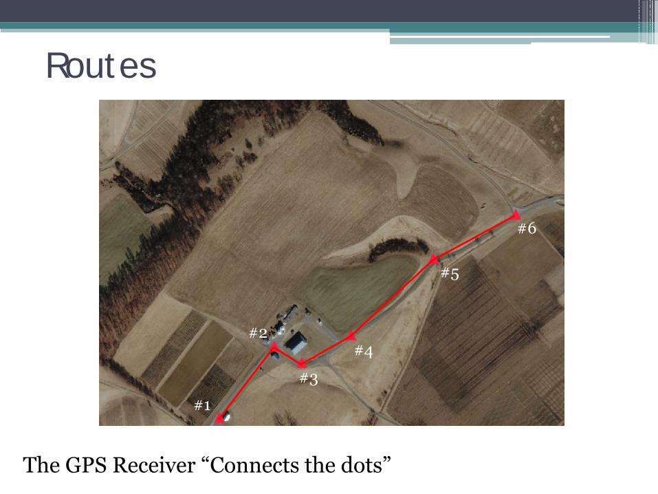
Routes
1. Establish Waypoints at strategic locations
The GPS Receiver “Connects the dots” 1. Area and perimeter measurements are generated
#1
#4
#3
#2
#5
#6
What can you do with a GPS receiver?
• Collect and store polygons• Polygons are fully enclosed• May represent a pasture, pond, or tract of timber• Measure field or pond acreage
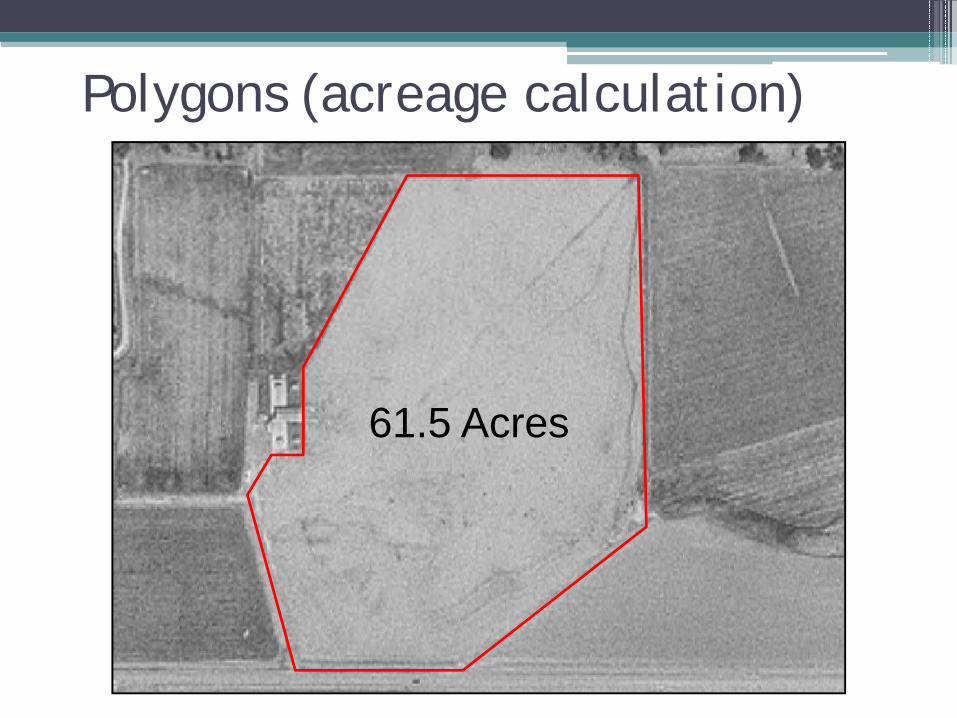
Polygons (acreage calculation)
61.5 Acres
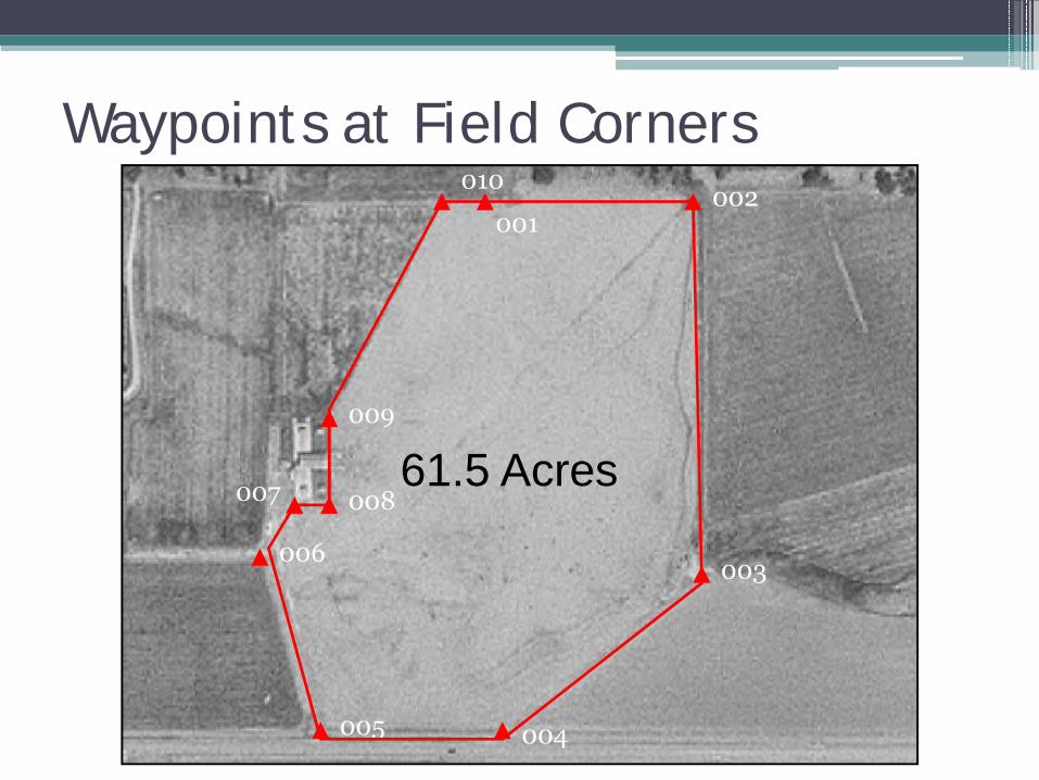
Waypoints at Field Corners
008
009
010002
003
004005
006
007
001
61.5 Acres
Low-Cost GPS Units
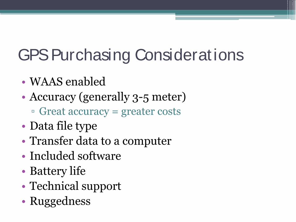
GPS Purchasing Considerations
• WAAS enabled• Accuracy (generally 3-5 meter)▫ Great accuracy = greater costs
• Data file type• Transfer data to a computer• Included software• Battery life• Technical support• Ruggedness
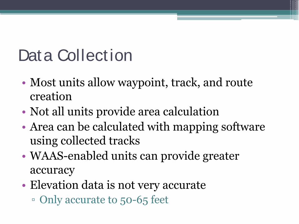
Data Collection
• Most units allow waypoint, track, and route creation
• Not all units provide area calculation• Area can be calculated with mapping software
using collected tracks• WAAS-enabled units can provide greater
accuracy• Elevation data is not very accurate▫ Only accurate to 50-65 feet
Low-Cost GPS Unit Providers
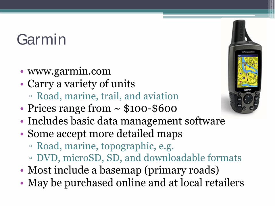
Garmin
• www.garmin.com• Carry a variety of units▫ Road, marine, trail, and aviation
• Prices range from ~ $100-$600• Includes basic data management software• Some accept more detailed maps▫ Road, marine, topographic, e.g.▫ DVD, microSD, SD, and downloadable formats
• Most include a basemap (primary roads)• May be purchased online and at local retailers
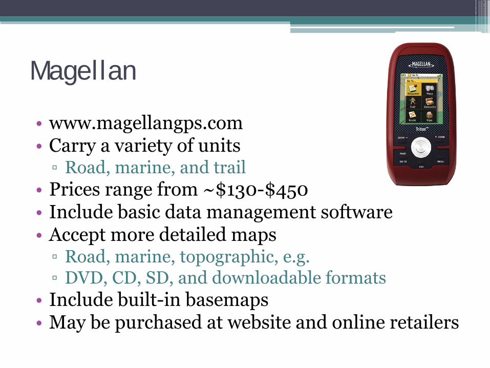
Magellan
• www.magellangps.com• Carry a variety of units▫ Road, marine, and trail
• Prices range from ~$130-$450• Include basic data management software• Accept more detailed maps▫ Road, marine, topographic, e.g.▫ DVD, CD, SD, and downloadable formats
• Include built-in basemaps• May be purchased at website and online retailers
The Garmin GPSMAP 60CSx
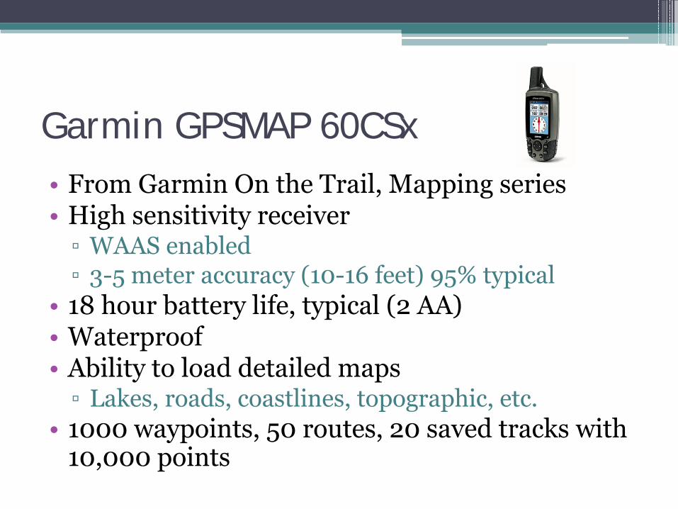
Garmin GPSMAP 60CSx• From Garmin On the Trail, Mapping series• High sensitivity receiver▫ WAAS enabled▫ 3-5 meter accuracy (10-16 feet) 95% typical
• 18 hour battery life, typical (2 AA)• Waterproof• Ability to load detailed maps▫ Lakes, roads, coastlines, topographic, etc.
• 1000 waypoints, 50 routes, 20 saved tracks with 10,000 points
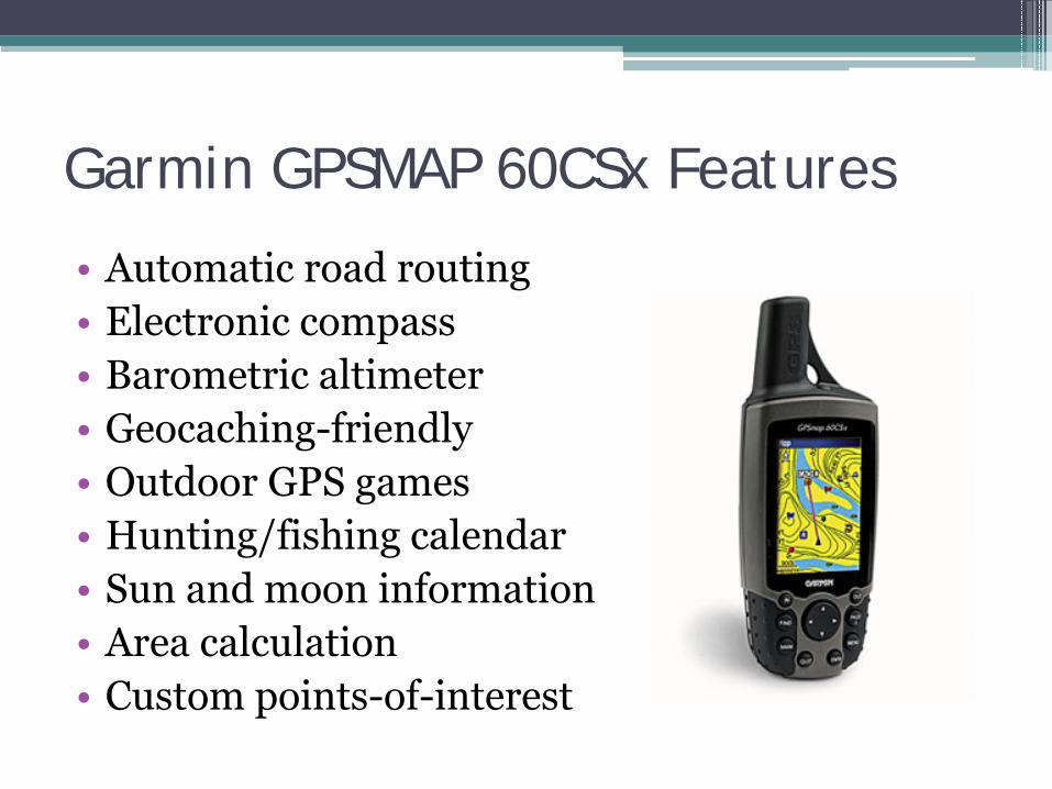
Garmin GPSMAP 60CSx Features
• Automatic road routing• Electronic compass• Barometric altimeter• Geocaching-friendly• Outdoor GPS games• Hunting/fishing calendar• Sun and moon information• Area calculation• Custom points-of-interest
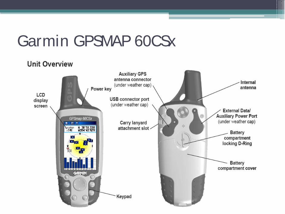
Garmin GPSMAP 60CSx
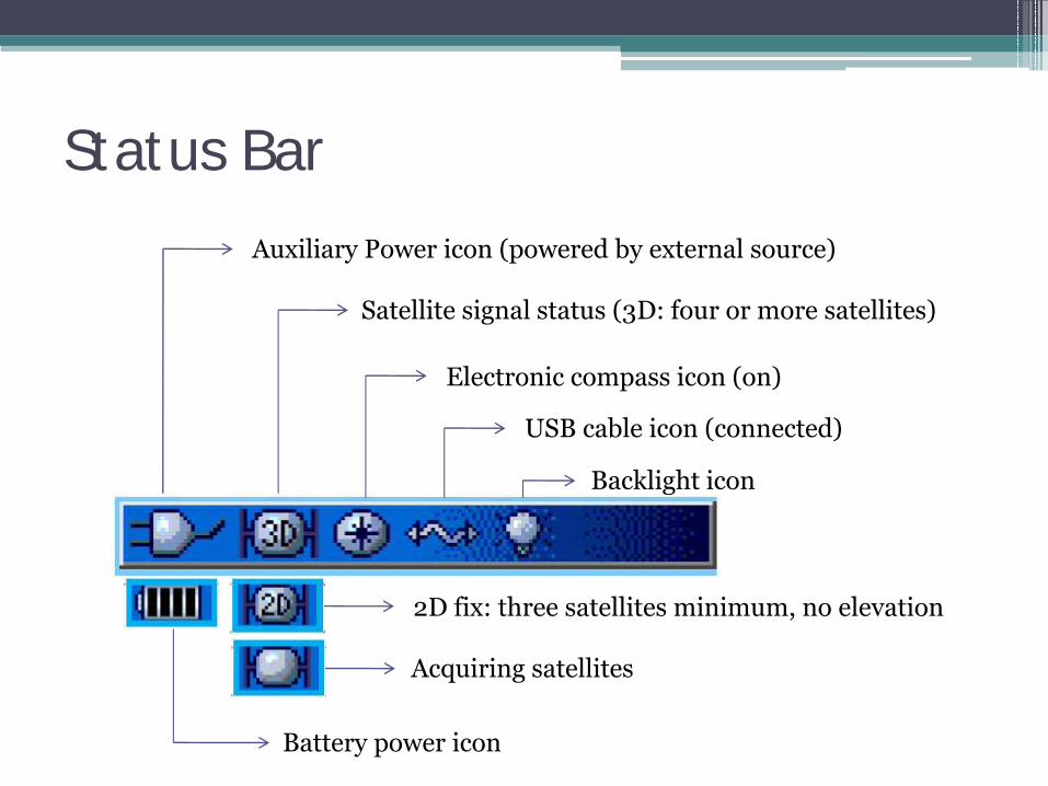
Status BarAuxiliary Power icon (powered by external source)
Satellite signal status (3D: four or more satellites)
Electronic compass icon (on)
USB cable icon (connected)
Backlight icon
Battery power icon
2D fix: three satellites minimum, no elevation
Acquiring satellites
Free and Low-Cost Mapping Software
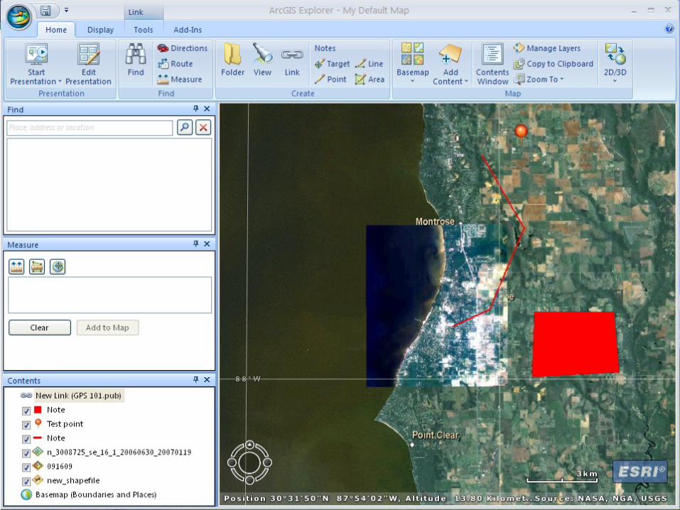
ArcGIS Explorer by ESRI
• www.esri.com• Free
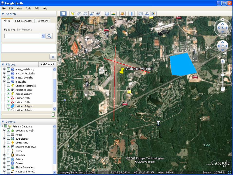
Google Earth by Google
• http://earth.google.com• Google Earth▫ Free
• Google Earth Pro▫ 7 day free trial▫ $400
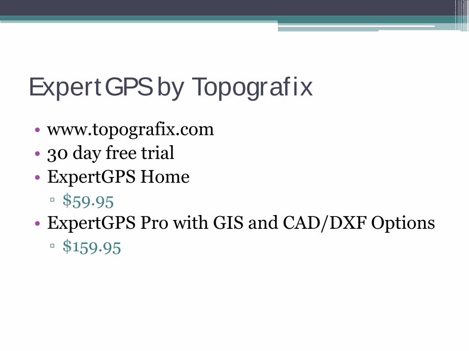
ExpertGPS by Topografix
• www.topografix.com• 30 day free trial• ExpertGPS Home▫ $59.95
• ExpertGPS Pro with GIS and CAD/DXF Options▫ $159.95
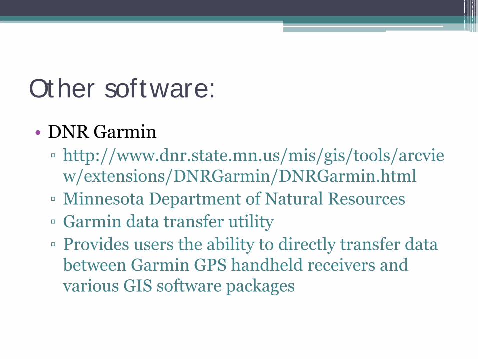
Other software:
• DNR Garmin▫ http://www.dnr.state.mn.us/mis/gis/tools/arcvie
w/extensions/DNRGarmin/DNRGarmin.html▫ Minnesota Department of Natural Resources▫ Garmin data transfer utility▫ Provides users the ability to directly transfer data
between Garmin GPS handheld receivers and various GIS software packages
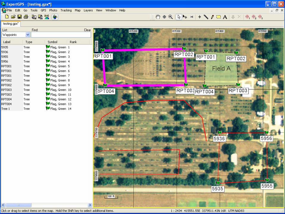
GPS/GIS Exercise
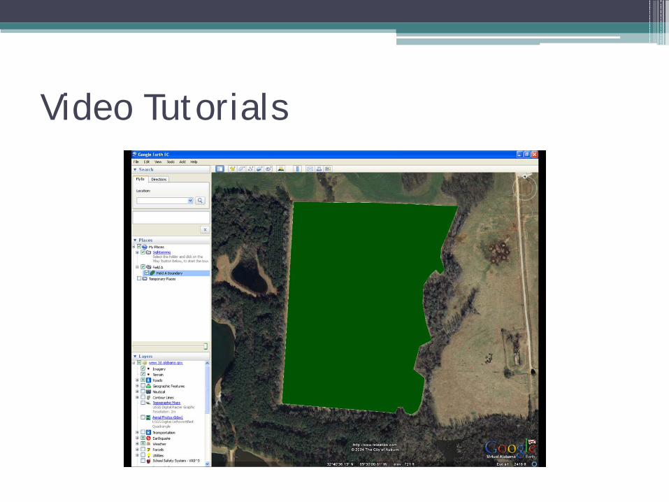
• Open an aerial image (freely available)• Create a sampling/cruising grid over a field• Transfer the grid to the GPS unit• Navigate through the field using the grid• Collect a waypoint within each grid square▫ Verifies that each grid square has been visited
• Transfer the waypoints into the GIS software

Any Questions?
Contact Information:
• Chris Dillard• Extension Specialist, Geospatial Technologies• Alabama Cooperative Extension System
110 Extension HallAuburn University, AL 36849
• Office: (334) 844-3921Mobile: (334) 728-3921Email: [email protected]