Embed Size (px)
Citation preview
September 12, 2018
Introduction to Remote Sensing
1. What is Remote Sensing.2. How does it work.3. Products, platforms and acquisition.4. Applications of Remote Sensing.
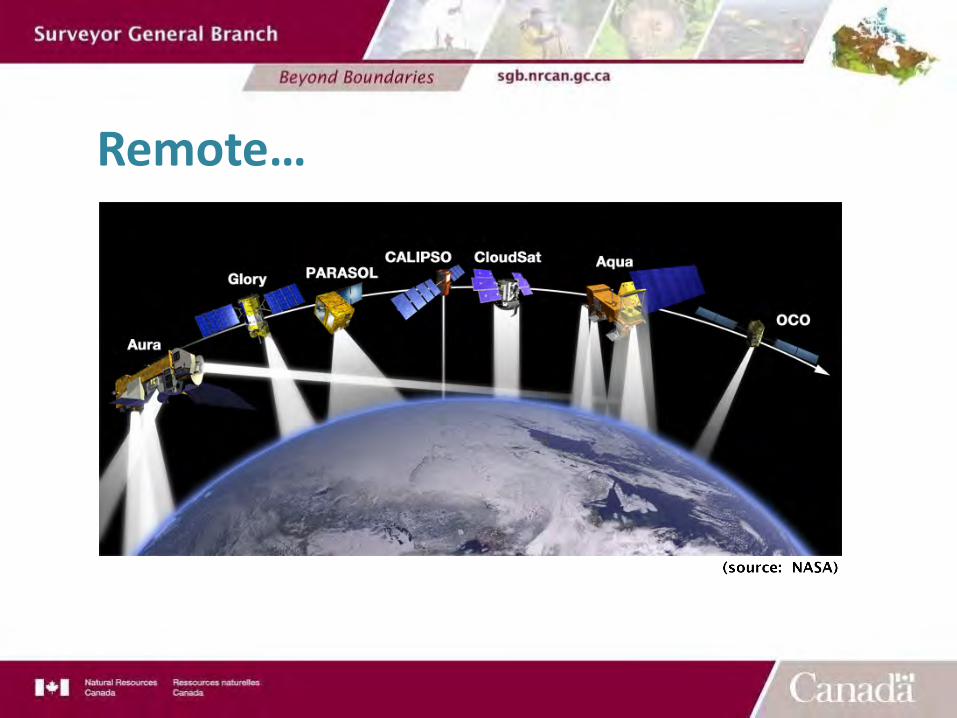
Remote…
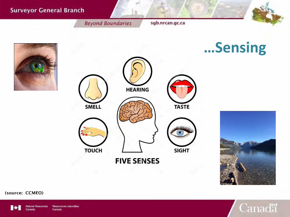
…Sensing
§ Acquiring information about the characteristics of materials without being in direct physical contact.
§ We are all remote sensing, all the time!
1- Remote Sensing, what is it?
§ Public Healthà Temperature scanner, X-rays, CAT Scan, MIR
§ Traffic Controlà Have you ever received a traffic ticket thanks to remote sensing!
§ Building Renovationà Temperature scanner to determine heat loss
§ Airport Securityà Radar scanning of passengers’ bodiesà X-ray scanning of baggage
Remote Sensing is Everywhere!
§ Applications:§ Agriculture – crop health§ Forestry – identification and health§ Land management – land use, ground feature
identification, asset management, emergency management, planning for future placement of assets
§ Resource industry – pipelines, contamination monitoring§ Topographic Surveying – surface modelling, area &
volume calculations§ Environment – Monitoring, ice, floods, vegetation
What can it do for us?
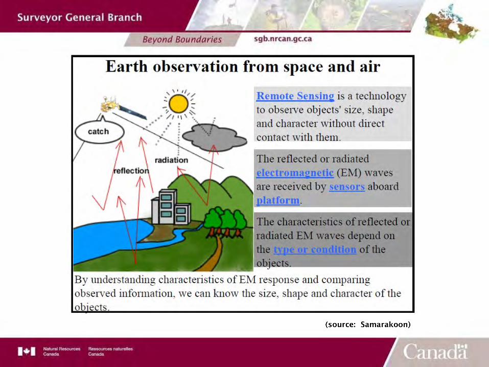
2- Remote Sensing – How does it work?
§ Information about the Earth’s surface is acquired by sensing and recording reflected or emitted energy and processing, analyzing, and applying that information.
§ 2 components for collecting this information:§ The Energy Source- Electromagnetic (EM) radiation & the
EM spectrum§ The Sensors
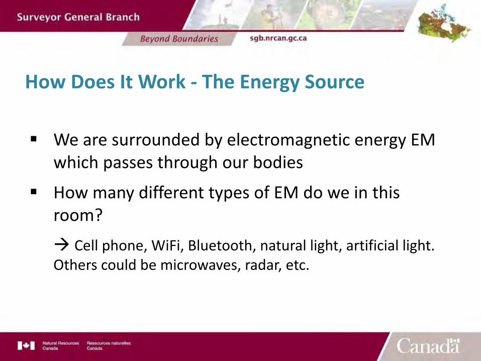
How Does It Work - The Energy Source
§ We are surrounded by electromagnetic energy EM which passes through our bodies
§ How many different types of EM do we in this room?à Cell phone, WiFi, Bluetooth, natural light, artificial light. Others could be microwaves, radar, etc.
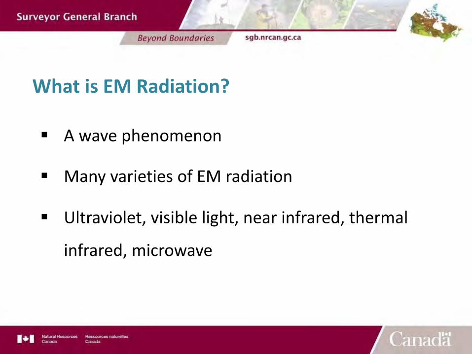
What is EM Radiation?
§ A wave phenomenon
§ Many varieties of EM radiation
§ Ultraviolet, visible light, near infrared, thermal
infrared, microwave
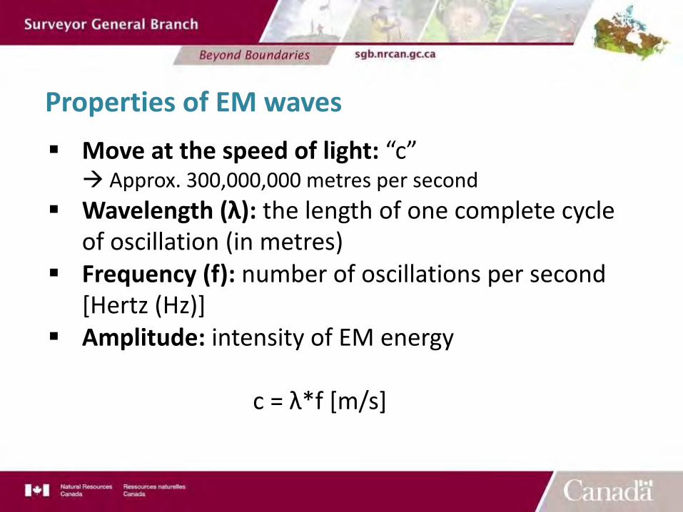
Properties of EM waves§ Move at the speed of light: “c”
à Approx. 300,000,000 metres per second§ Wavelength (λ): the length of one complete cycle
of oscillation (in metres)§ Frequency (f): number of oscillations per second
[Hertz (Hz)]§ Amplitude: intensity of EM energy
c = λ*f [m/s]
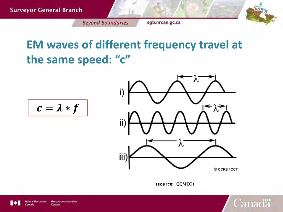
EM waves of different frequency travel at the same speed: “c”
! = # ∗ %
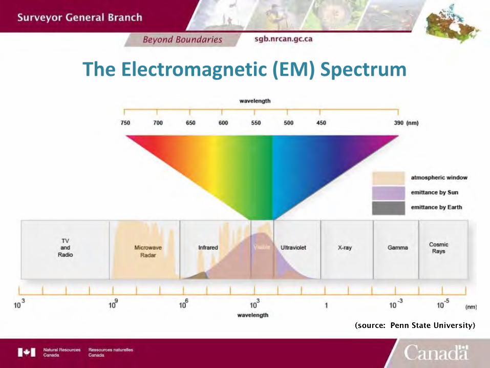
The Electromagnetic (EM) Spectrum
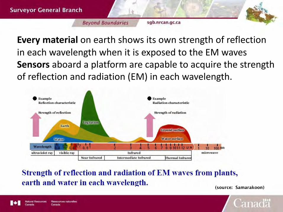
Every material on earth shows its own strength of reflection in each wavelength when it is exposed to the EM wavesSensors aboard a platform are capable to acquire the strength of reflection and radiation (EM) in each wavelength.
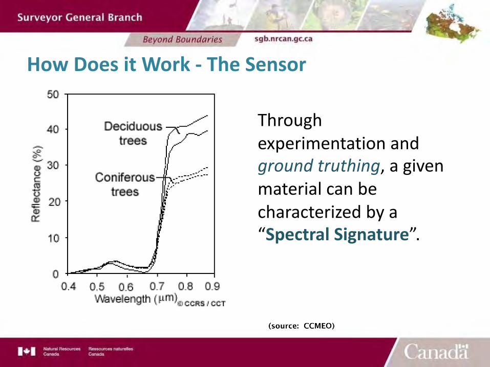
How Does it Work - The Sensor
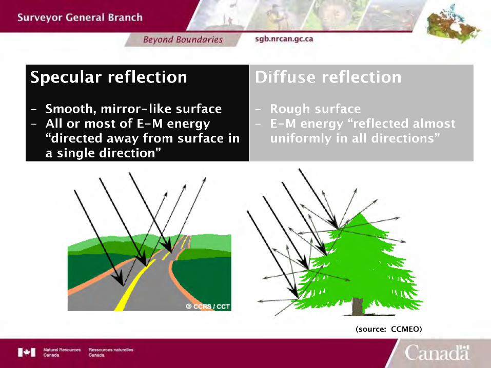
Through experimentation and ground truthing, a given material can be characterized by a “Spectral Signature”.
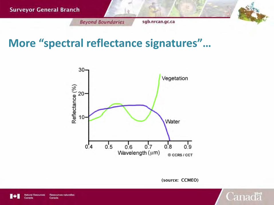
More “spectral reflectance signatures”…
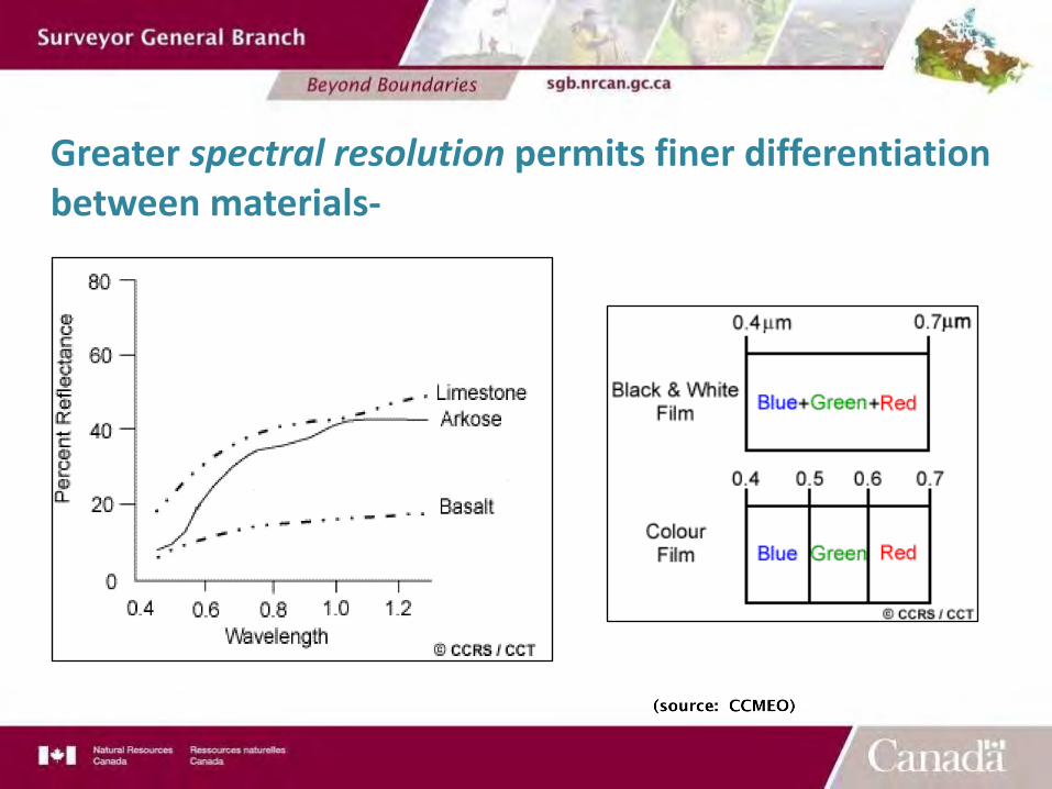
Greater spectral resolution permits finer differentiation between materials-
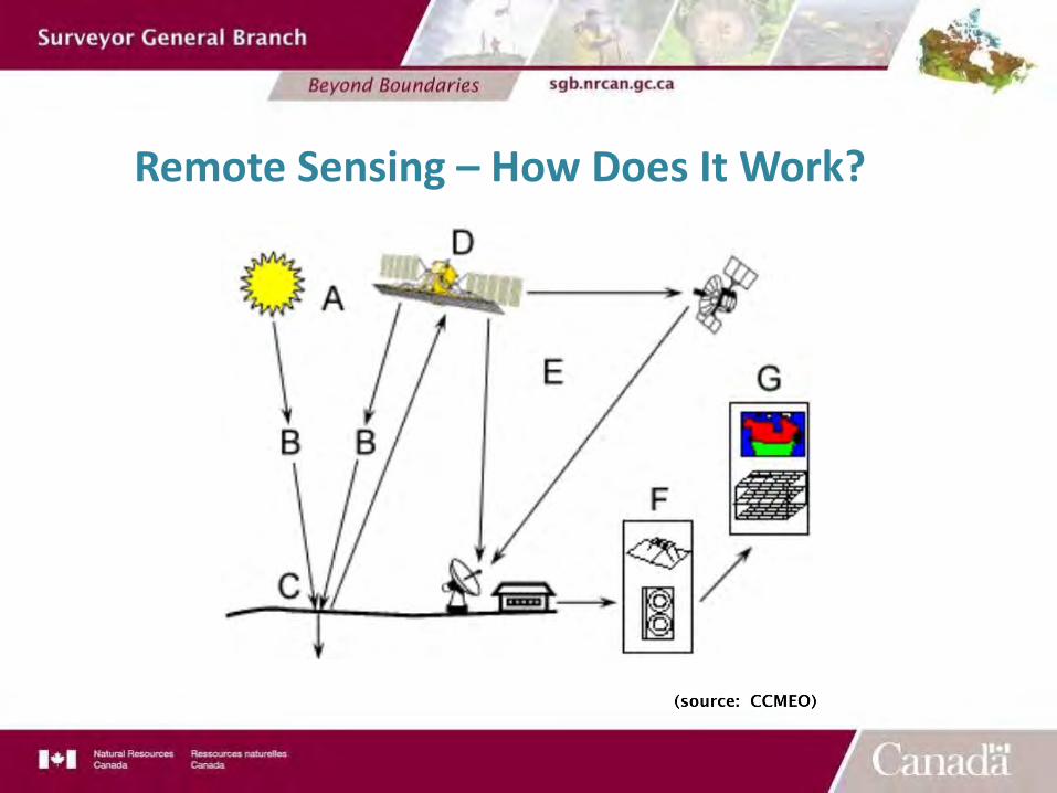
Remote Sensing – How Does It Work?
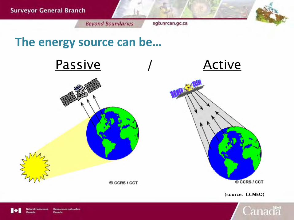
The energy source can be…
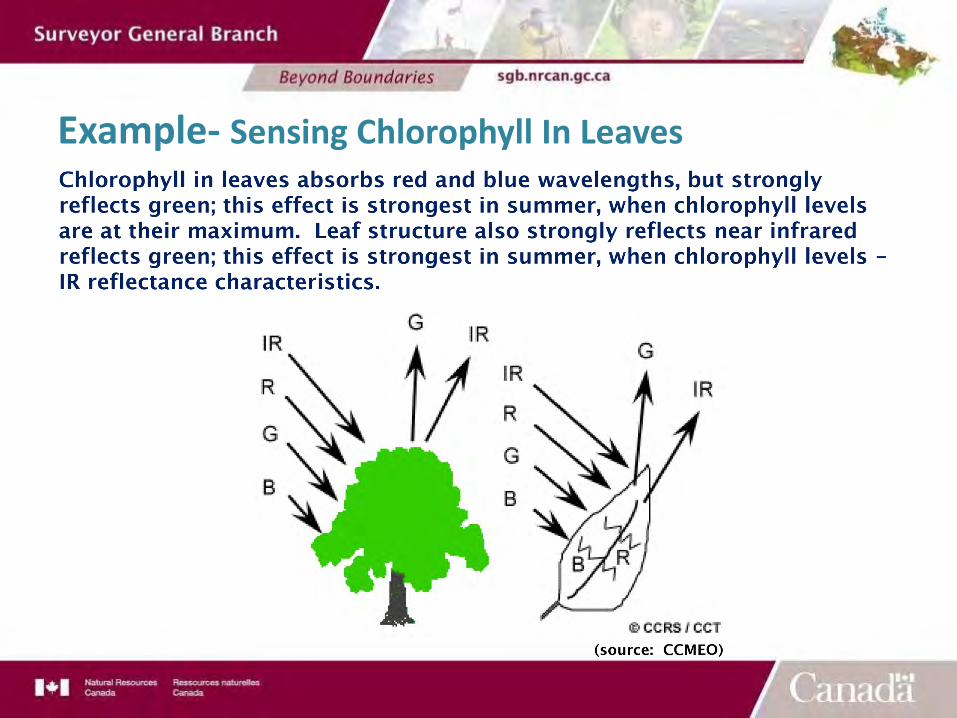
Example- Sensing Chlorophyll In Leaves
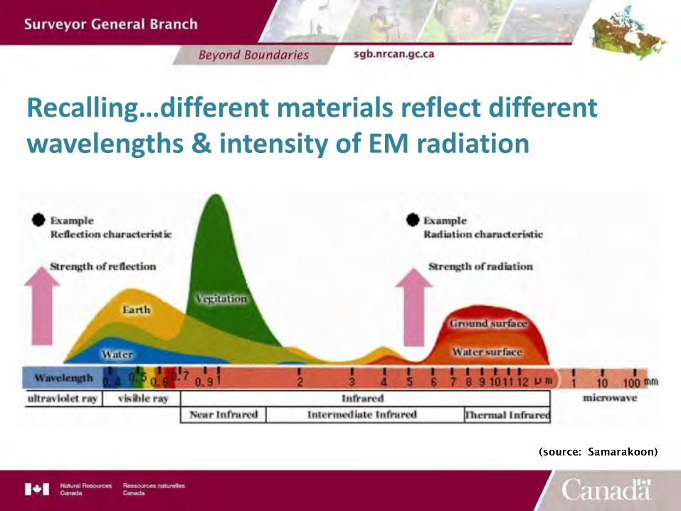
Recalling…different materials reflect different wavelengths & intensity of EM radiation
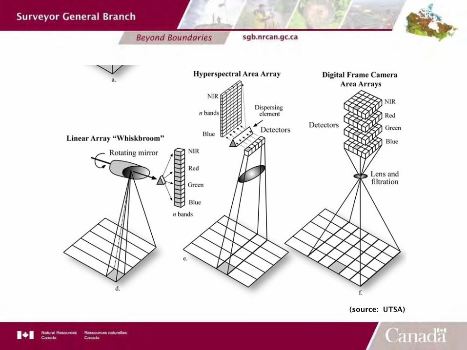
Sensor Systems
§ In a single field of view§ In a line of sensor elements§ In a two-dimensional array of sensor elements
How does a sensor capture reflectance values:
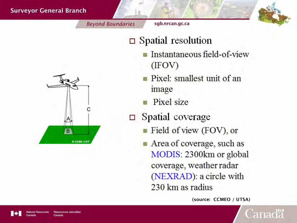
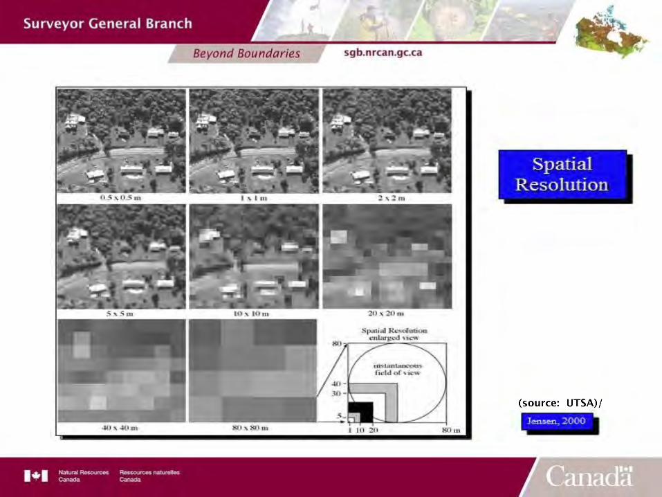
Spatial Resolution
§ Spatial Resolution is the size of the smallest possible feature that can be detected.
§ The distance between the target and the sensor plays a large role in determining the detail of the information being collected.
§ Other factors that affect spatial resolution are: altitude, detector size, focal size and system configuration.
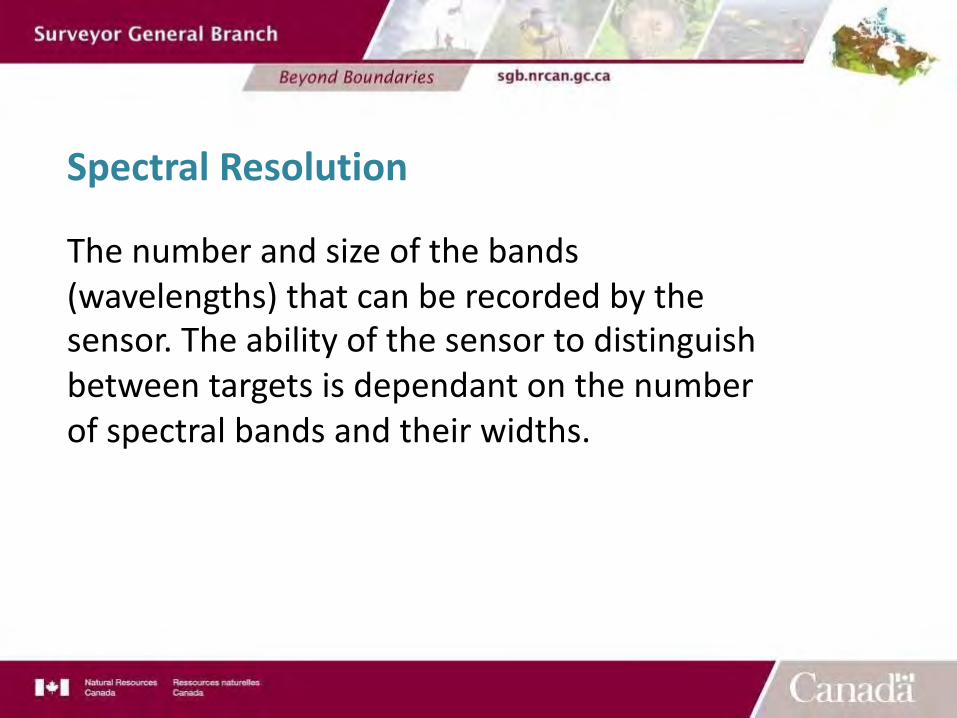
Spectral Resolution
The number and size of the bands (wavelengths) that can be recorded by the sensor. The ability of the sensor to distinguish between targets is dependant on the number of spectral bands and their widths.
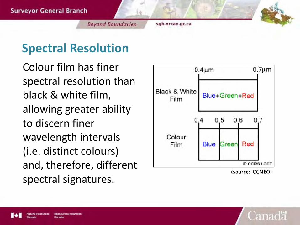
Spectral ResolutionColour film has finer spectral resolution than black & white film, allowing greater ability to discern finer wavelength intervals (i.e. distinct colours) and, therefore, different spectral signatures.
3 – Acquiring Remote Sensing Products§ Types of Products
§ Aerial Imagery – imagery from the visible lightspectrum, that has not been reduced or flattened. Itcan be used for the identification of ground features.You can’t use it for measurements or areas.
§ Orthophoto Images – aerial images that have beenreduced to a mapping plane. You can use them asabove but you can also scale off distances and makearea calculations (to an accuracy of the imagery.
§ Satellite Imagery - Various Sensors that can be usedto detect various resources.
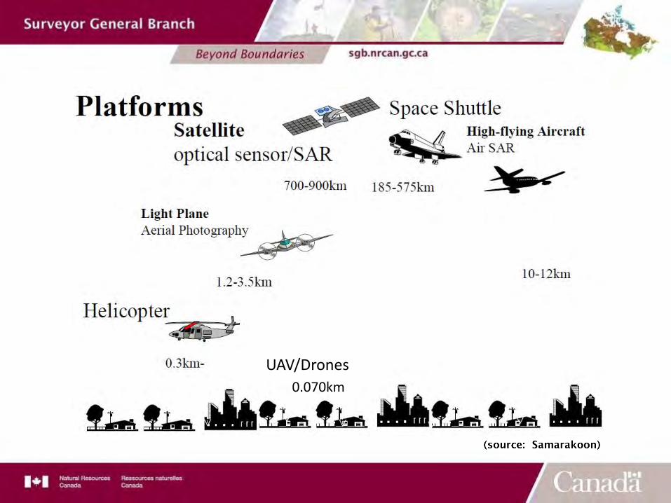
UAV/Drones0.070km
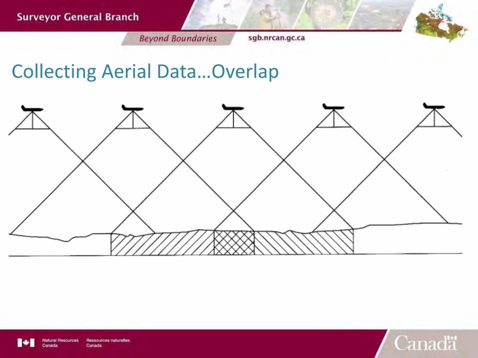
Collecting Aerial Data…Overlap
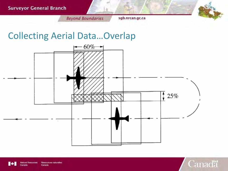
Collecting Aerial Data…Overlap
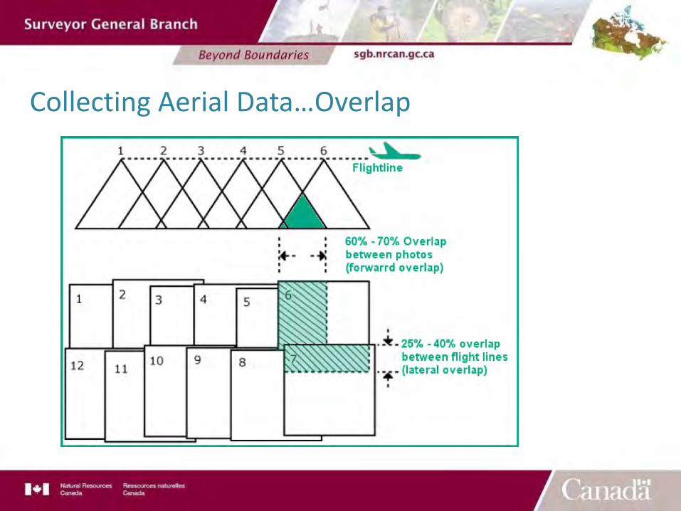
Collecting Aerial Data…Overlap
Acquiring Remote Sensing Products…continued§ Sources of Data:§ Previously acquired imagery
§ Using Online services or aerial image companiesto acquire images that have been previouslyflown and are available for re-sale:§ Best cost§ You have limited options for resolution, year
of imagery, time of season, cloud cover andlimits of project (mosaics of differentseasons). You can only get what is available.
Acquiring Remote Sensing Products…continued§ Sources of Data:§ Acquire new imagery
§ Engage a company who will acquire new data§ You can select the sensor type (visual,
infrared, etc.)§ You can select the resolution, time of season,
acceptable cloud cover amounts, project size,type of referencing (airborne GPS, groundcontrol, etc.)
§ Largest variation in price as you designproject parameters.
Acquiring Remote Sensing Products…continued§ Sources of Data:§ Acquire new imagery…continued
§ Your project parameters will determine whichtype of platform is best for your project§ Airplane§ Satellite§ UAV/Drone
4 – Applications of Remote Sensing§ Where to Start?
§ Budget, draft scope of work, purpose, collaborate§ Imagery Acquisition
§ New or old, Find a company or do it yourself§ Using your Imagery
§ GIS Mapping§ Types of Products
§ General maps, LUA, land use planning, agriculture, etc.§ Monitoring
§ Updating imagery for monitoring lands
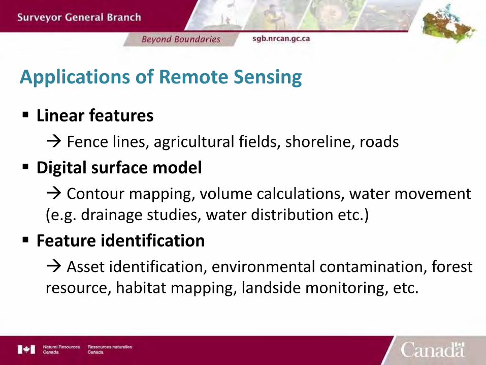
§ Linear featuresà Fence lines, agricultural fields, shoreline, roads
§ Digital surface modelà Contour mapping, volume calculations, water movement (e.g. drainage studies, water distribution etc.)
§ Feature identificationà Asset identification, environmental contamination, forest resource, habitat mapping, landside monitoring, etc.
Applications of Remote Sensing
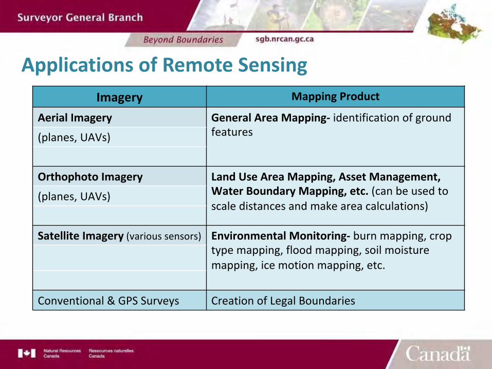
Applications of Remote SensingImagery Mapping Product
Aerial Imagery General Area Mapping- identification of ground features(planes, UAVs)
Orthophoto Imagery Land Use Area Mapping, Asset Management,Water Boundary Mapping, etc. (can be used to scale distances and make area calculations)
(planes, UAVs)
Satellite Imagery (various sensors) Environmental Monitoring- burn mapping, crop type mapping, flood mapping, soil moisture mapping, ice motion mapping, etc.
Conventional & GPS Surveys Creation of Legal Boundaries
Questions?
Thank you
Danica Pratt, CLS, E.I.T.
Surveyor, Alberta Regional OfficeSurveyor General [email protected]
http://www.nrcan.gc.ca/sites/www.nrcan.gc.ca/files/earthsciences/pdf/resource/tutor/fundam/pdf/fundamentals_e.pdf
https://www-calipso.larc.nasa.gov/
https://www.e-education.psu.edu/geog160/node/1958
http://www.isprs.org/caravan/documents/Lao_Basic_RS.pdf


![[REMOTE SENSING] 3-PM Remote Sensing](https://img.pdfslide.net/doc/110x75/61f2bbb282fa78206228d9e2/remote-sensing-3-pm-remote-sensing.jpg)


