Embed Size (px)
Citation preview
Investigating variations in the use of GIS within the NHS
Gary Higgs (University of Glamorgan) Myles Gould & Darren Smith (University of Leeds)
ESRC funded research projectWith support for dissemination from the Association of Geographical
Information, Health Special Interest Group
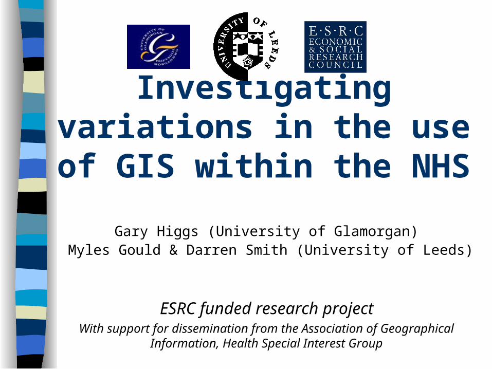
Structure
Background & Rationale Aims & Objectives Dissemination: Outcomes Research Design Postal Questionnaire
your initial feedback
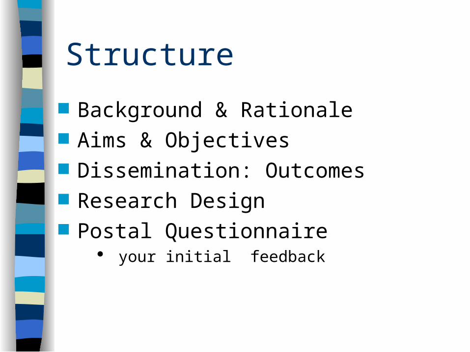
Background ESRC funded: March 2001- Feb. 2002 Investigate relevance of GIS to the
health care sector GIS as integrated systems for
managing, querying, analysing & displaying geographically referenced health data
Discrepancy between use ‘within’ NHS and ‘outside’ in academia
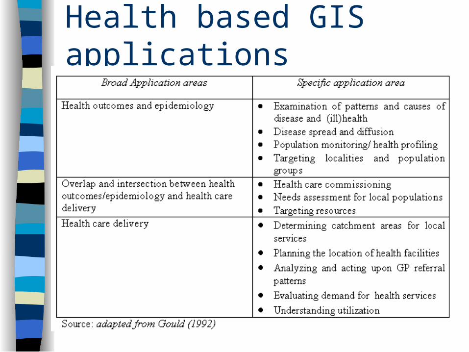
Health based GIS applications
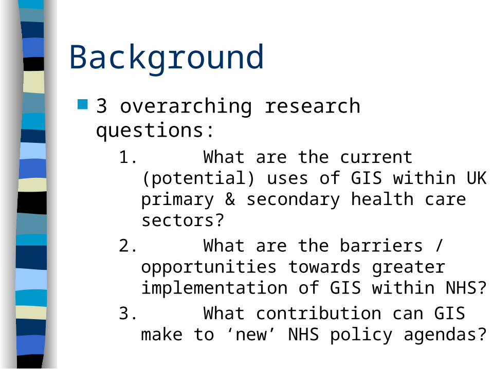
Background 3 overarching research questions:
1. What are the current (potential) uses of GIS within UK primary & secondary health care sectors?
2. What are the barriers / opportunities towards greater implementation of GIS within NHS?
3. What contribution can GIS make to ‘new’ NHS policy agendas?
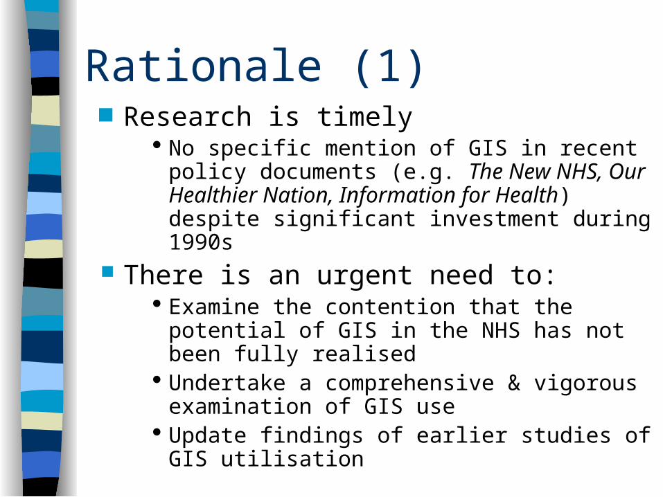
Rationale (1) Research is timely
No specific mention of GIS in recent policy documents (e.g. The New NHS, Our Healthier Nation, Information for Health) despite significant investment during 1990s
There is an urgent need to: Examine the contention that the potential of
GIS in the NHS has not been fully realised Undertake a comprehensive & vigorous
examination of GIS use Update findings of earlier studies of GIS
utilisation
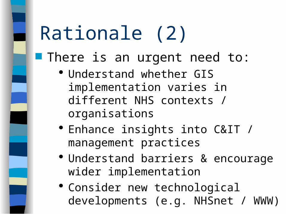
Rationale (2) There is an urgent need to:
Understand whether GIS implementation varies in different NHS contexts / organisations
Enhance insights into C&IT / management practices
Understand barriers & encourage wider implementation
Consider new technological developments (e.g. NHSnet / WWW)
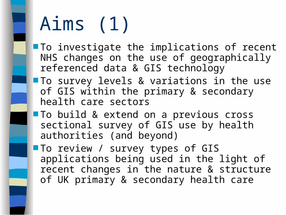
Aims (1) To investigate the implications of recent NHS
changes on the use of geographically referenced data & GIS technology
To survey levels & variations in the use of GIS within the primary & secondary health care sectors
To build & extend on a previous cross sectional survey of GIS use by health authorities (and beyond)
To review / survey types of GIS applications being used in the light of recent changes in the nature & structure of UK primary & secondary health care
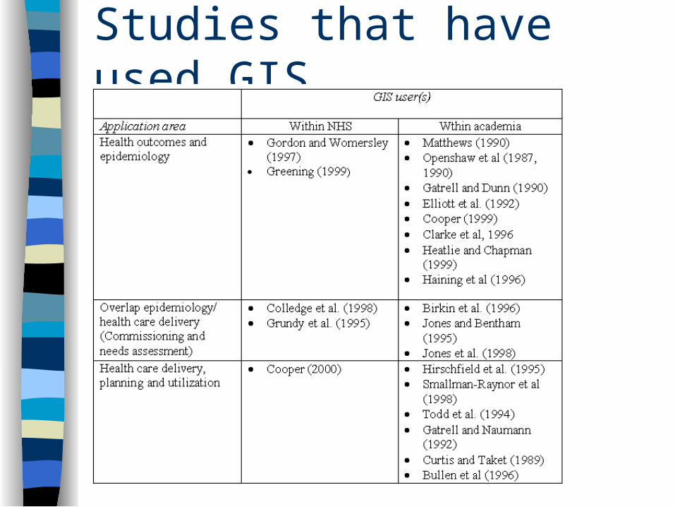
Studies that have used GIS
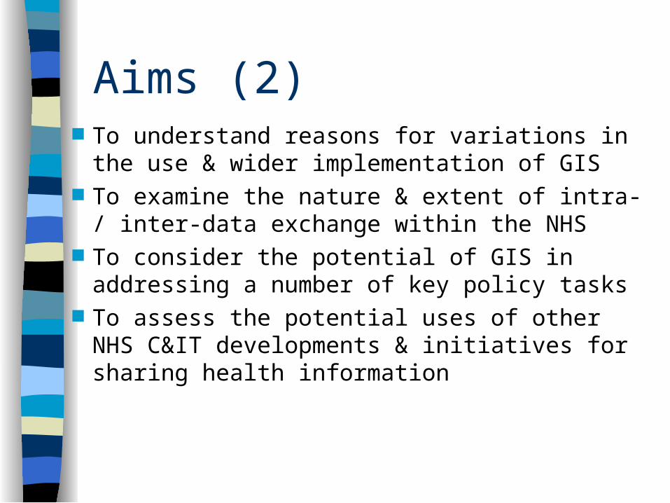
Aims (2) To understand reasons for variations in the use
& wider implementation of GIS To examine the nature & extent of intra- / inter-
data exchange within the NHS To consider the potential of GIS in addressing
a number of key policy tasks To assess the potential uses of other NHS
C&IT developments & initiatives for sharing health information
Objectives
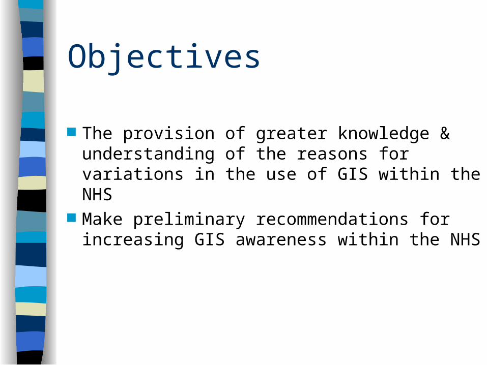
The provision of greater knowledge & understanding of the reasons for variations in the use of GIS within the NHS
Make preliminary recommendations for increasing GIS awareness within the NHS
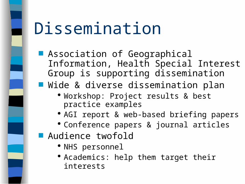
Dissemination Association of Geographical Information,
Health Special Interest Group is supporting dissemination
Wide & diverse dissemination plan Workshop: Project results & best practice
examples AGI report & web-based briefing papers Conference papers & journal articles
Audience twofold NHS personnel Academics: help them target their interests
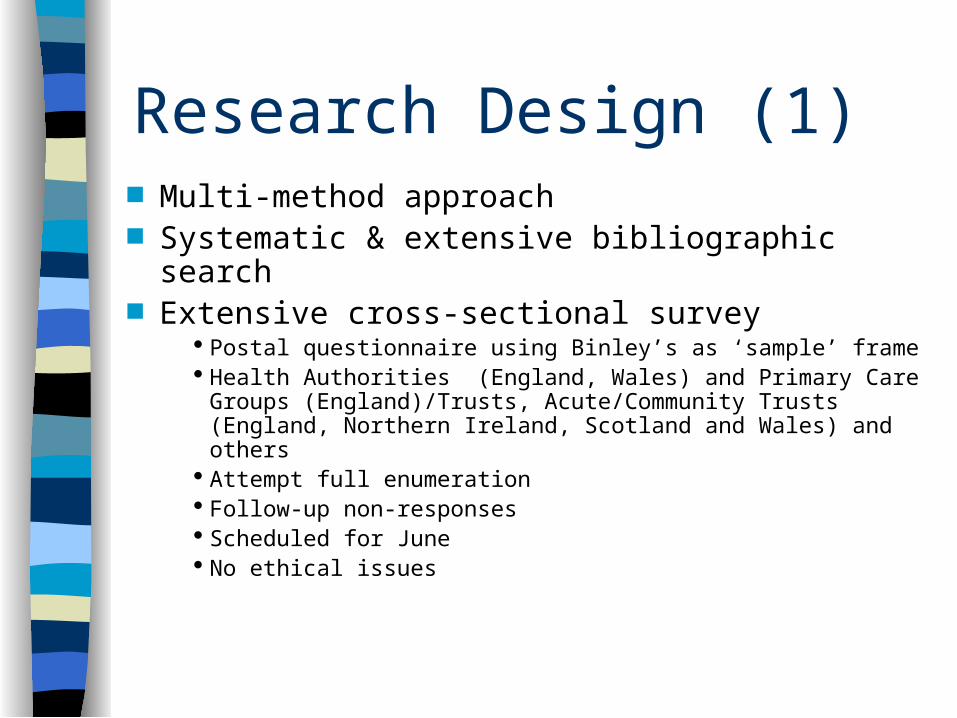
Research Design (1) Multi-method approach Systematic & extensive bibliographic search Extensive cross-sectional survey
Postal questionnaire using Binley’s as ‘sample’ frame Health Authorities (England, Wales) and Primary Care
Groups (England)/Trusts, Acute/Community Trusts (England, Northern Ireland, Scotland and Wales) and others
Attempt full enumeration Follow-up non-responses Scheduled for June No ethical issues
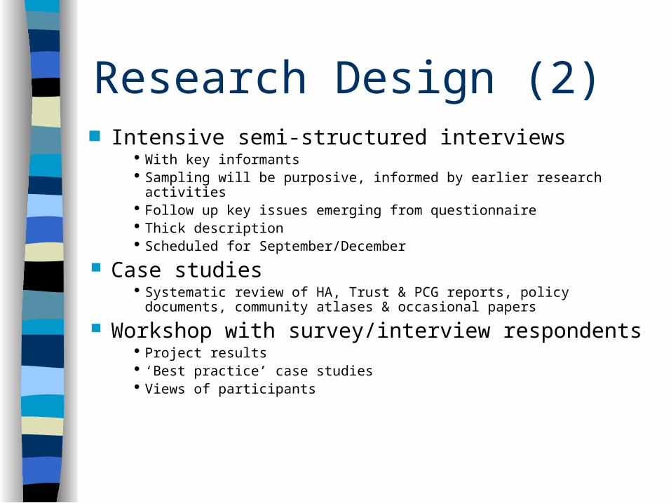
Research Design (2) Intensive semi-structured interviews
With key informants Sampling will be purposive, informed by earlier research activities Follow up key issues emerging from questionnaire Thick description Scheduled for September/December
Case studies Systematic review of HA, Trust & PCG reports, policy documents,
community atlases & occasional papers
Workshop with survey/interview respondents Project results ‘Best practice’ case studies Views of participants
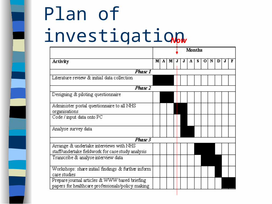
Plan of investigation Now
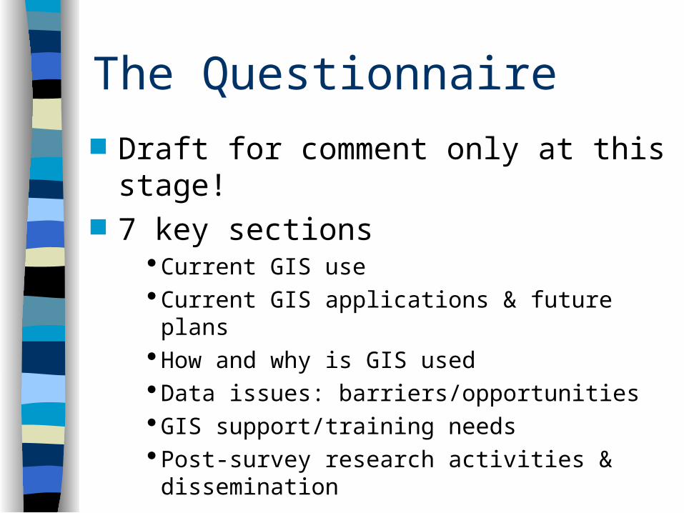
The Questionnaire
Draft for comment only at this stage! 7 key sections
Current GIS use Current GIS applications & future plansHow and why is GIS usedData issues: barriers/opportunities GIS support/training needsPost-survey research activities & dissemination
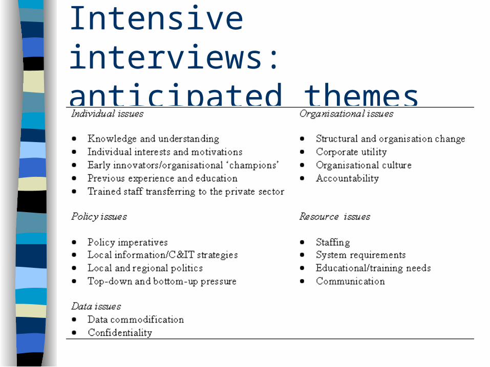
Intensive interviews: anticipated themes


![ESRC Report [English]](https://img.pdfslide.net/doc/110x75/577d1fa91a28ab4e1e910c34/esrc-report-english.jpg)