Embed Size (px)
Citation preview
LA-UR-08-11343202 March May 2008
EP2008-00160226
Investigation Report for Bayo Canyon Aggregate Area, Revision 1

Prepared by the Environmental Programs Directorate
Los Alamos National Laboratory, operated by Los Alamos National Security, LLC, for the U.S. Department of Energy under Contract No. DE-AC52-06NA25396, has prepared this document pursuant to the Compliance Order on Consent, signed March 1, 2005. The Compliance Order on Consent contains requirements for the investigation and cleanup, including corrective action, of contamination at Los Alamos National Laboratory. The U.S. government has rights to use, reproduce, and distribute this document. The public may copy and use this document without charge, provided that this notice and any statement of authorship are reproduced on all copies.
LA-UR-08-11343202 EP2008-00160226
Investigation Report for Bayo Canyon Aggregate Area, Revision 1
March May 2008
Responsible project leader:
Becky Coel-Roback Project Leader
Environmental Programs
Printed Name Signature Title Organization Date
Responsible LANS representative:
Susan G. Stiger Associate Director
Environmental Programs
Printed Name Signature Title Organization Date
Responsible DOE representative:
David R. Gregory Project Director DOE-LASO
Printed Name Signature Title Organization Date

Bayo Canyon Aggregate Area Investigation Report, Revision 1
EP2008-0226 v May 2008
EXECUTIVE SUMMARY
The Los Alamos National Laboratory (LANL or the Laboratory) Environmental Programs Directorate–Corrective Action Projects has investigated the Bayo Canyon Aggregate Area, located on Los Alamos County property adjacent to the Laboratory. The Bayo Canyon Aggregate Area includes Consolidated Units 10-001(a)-99 and 10-002(a)-99, Solid Waste Management Units (SWMUs) 10-004(a) and 10-006, and Areas of Concern (AOCs) C-10-001 and 10-009. Investigation activities were conducted between June 2007 and December 2007. In addition, historical data from previous investigations completed between 1994 and 1996 are incorporated in this investigation report.
During its operational history, the Bayo Canyon Aggregate Area was known as Technical Area (TA) 10 and included facilities that supported the development of nuclear weapons. Between 1943 and 1961, TA-10 was used primarily as a firing site to test assemblies containing conventional high explosives, including components made from depleted or natural uranium, and radiochemistry and liquid waste processing facilities used in the production of lanthanum-140. Between 1960 and 1963, TA-10 underwent decontamination and decommissioning (D&D), including the razing of all structures. The site remains under U.S. Department of Energy (DOE) administrative control and is located on Los Alamos County property; most areas are currently accessible by the public.
The 2007 investigation was primarily a drilling campaign: 55 boreholes were drilled for a total of more than 2500 linear ft. Surface and shallow subsurface sampling was also conducted using hand methods. A total of approximately 200 surface and subsurface samples were collected for analysis. Sampling locations were based on the specific data requirements identified in the approved Bayo Canyon Aggregate Area investigation work plan; these locations were selected to complete site characterization and support corrective measures decisions. In addition to sampling, surface radiological and geophysical surveys were conducted, and test pits were excavated in areas of known and suspected subsurface disposal.
The results of the geophysical surveys indicated that all subsurface structures in former TA-10 have been removed. There were no anomalies indicating the presence of drainlines or other pipes associated with SWMUs 10-004(a) and 10-004(b). A small segment of pipe visible at the surface near SWMU 10-002(b) was determined to be surface debris and was removed. SWMU 10-007, a building debris landfill, produced an anomaly indicating the area of the debris to be approximately 6000 ft2. AOC 10-009, a suspected debris landfill, produced no geophysical anomaly indicative of subsurface disposal. The results of the geophysical survey at AOC 10-009 were confirmed by drilling and excavation of test pits. Lastly, the geophysical surveys resulted in the determination of the extent of shrapnel in the shallow subsurface (up to approximately 1 ft below ground surface) at Consolidated Unit 10-001(a)-99.
The radiological surveys indicated the presence of small areas of elevated activity resulting from strontium-90 at Consolidated Unit 10-002(a)-99 and uranium-238 at Consolidated Unit 10-001(a)-99 and AOC 10-009. Little or no correlation was found between the results of the radiological survey and the geophysical survey for shrapnel, indicating the remaining shrapnel is not radioactive.
The principal chemical of potential concern (COPC) for the Bayo Canyon Aggregate Area is strontium-90; however, a total of 24 inorganic, 42 organic, and 6 radionuclide COPCs were identified in solid media at the site. The distributions of most inorganic, organic, and radionuclide COPCs had been defined during previous investigations. The specific concerns about contaminant distribution identified in the investigation work plan have been addressed by the 2007 investigation, and the nature and extent of site COPCs are defined. In general, the concentrations of inorganic and organic COPCs at all former TA-10 sites are low and do not exhibit marked concentration trends or strong correlation that would indicate a

Bayo Canyon Aggregate Area Investigation Report, Revision 1
May 2008 vi EP2008-0226
release. The 2007 data confirm the extent of the strontium-90 contamination associated with historical operations.
The estimated total excess lifetime cancer risk from chemical exposures is below the New Mexico Environment Department (NMED) target level of 1 × 10⁻⁵ for recreational, construction worker, and residential scenarios for all former TA-10 sites.
The hazard indexes (HIs) for the recreational and residential scenarios were less than the NMED target HI of 1.0 for all sites. Consolidated Units 10-001(a)-99 and 10-002(a)-99 and SWMU 10-004(a) had HIs greater than the NMED target HI of 1.0 for the construction worker scenario. The three HIs for the construction worker scenario are approximately 2, primarily from the detection of manganese. However, the exposure point concentrations for manganese are similar to soil and tuff background concentrations, indicating that exposures would be similar to background levels. The HIs without manganese are below 1.0, indicating no potential for unacceptable risk to the construction worker at any of the former TA-10 sites.
The doses for the recreational and construction worker scenarios were below the DOE target of 15 millirem per year (mrem/yr) for all areas. The dose for the residential scenario was below 15 mrem/yr at Consolidated Unit 10-001(a)-99, SWMU 10-004(a), and AOCs 10-009 and C-10-001. The estimated residential dose was greater than 15 mrem/yr at Consolidated Unit 10-002(a)-99.
Potential ecological risk was evaluated for several receptors using minimum ecological screening level comparisons, HI analyses, comparisons to background, potential effects to populations (individuals for threatened and endangered species), the relative toxicity of related compounds, and the infrequency of detection. The lines of evidence for each receptor support the conclusion that no potential ecological risk exists within the Bayo Canyon Aggregate Area.
The following recommendations are made for Consolidated Unit 10-001(a)-99, SWMUs 10-004(a) and 10-006, and AOCs C-10-001 and 10-009 based on the results of sampling and analysis, evaluation of nature and extent of contamination, and the assessment of potential risk and dose.
• Consolidated Unit 10-001(a)-99—The nature and extent of contamination are defined, and residual shrapnel does not pose a physical hazard or radiological risk; therefore, the SWMUs and AOCs within Consolidated Unit 10-001(a)-99 [SWMUs 10-001(a–d) and 10-005 and AOCs 10-001(e) and 10-008] are proposed as corrective actions complete without controls.
• SWMU 10-004(a)—The nature and extent of contamination are defined, and no cleanup is warranted; therefore, SWMU 10-004(a) is proposed as corrective actions complete without controls.
• AOC 10-009—The nature and extent of contamination are defined, and no cleanup is warranted; therefore, AOC 10-009 is proposed as corrective actions complete without controls.
• AOC C-10-001—The nature and extent of contamination are defined, and no further cleanup is warranted; therefore, AOC C-10-001 is proposed as corrective actions complete without controls.
• SWMU 10-006—Efforts were made to locate this SWMU, but it could not be found. There is no indication that it exists and may have been cleaned up during D&D of former TA-10. Therefore, SWMU 10-006 is proposed for corrective actions complete without controls.
Bayo Canyon Aggregate Area Investigation Report, Revision 1
EP2008-0226 vii May 2008
Pending DOE and Los Alamos County approval, the following actions are being planned for Consolidated Unit 10-002(a)-99.
• Maintain the Central Area under DOE administrative control, implement institutional controls to limit site access and potential strontium-90 mobilization, and negotiate additional actions, if needed, between DOE and the property owner (Los Alamos County).
• Remove two isolated areas of elevated strontium-90 activity identified outside of the Central Area within Consolidated Unit 10-002(a)-99 as a good stewardship practice.

Bayo Canyon Aggregate Area Investigation Report, Revision 1
EP2008-0226 ix May 2008
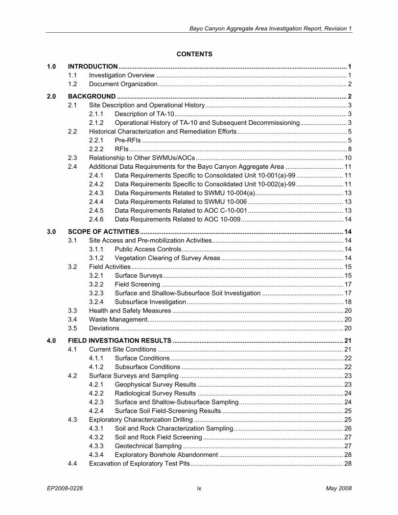
CONTENTS
1.0 INTRODUCTION............................................................................................................................... 1 1.1 Investigation Overview .......................................................................................................... 1 1.2 Document Organization......................................................................................................... 2
2.0 BACKGROUND ................................................................................................................................ 2 2.1 Site Description and Operational History............................................................................... 3
2.1.1 Description of TA-10................................................................................................ 3 2.1.2 Operational History of TA-10 and Subsequent Decommissioning.......................... 3
2.2 Historical Characterization and Remediation Efforts............................................................. 5 2.2.1 Pre-RFIs .................................................................................................................. 5 2.2.2 RFIs ......................................................................................................................... 8
2.3 Relationship to Other SWMUs/AOCs.................................................................................. 10 2.4 Additional Data Requirements for the Bayo Canyon Aggregate Area ................................ 11
2.4.1 Data Requirements Specific to Consolidated Unit 10-001(a)-99 .......................... 11 2.4.2 Data Requirements Specific to Consolidated Unit 10-002(a)-99 .......................... 11 2.4.3 Data Requirements Related to SWMU 10-004(a)................................................. 13 2.4.4 Data Requirements Related to SWMU 10-006 ..................................................... 13 2.4.5 Data Requirements Related to AOC C-10-001..................................................... 13 2.4.6 Data Requirements Related to AOC 10-009......................................................... 14
3.0 SCOPE OF ACTIVITIES ................................................................................................................. 14 3.1 Site Access and Pre-mobilization Activities......................................................................... 14
3.1.1 Public Access Controls.......................................................................................... 14 3.1.2 Vegetation Clearing of Survey Areas .................................................................... 14
3.2 Field Activities...................................................................................................................... 15 3.2.1 Surface Surveys .................................................................................................... 15 3.2.2 Field Screening ..................................................................................................... 17 3.2.3 Surface and Shallow-Subsurface Soil Investigation ............................................. 17 3.2.4 Subsurface Investigation....................................................................................... 18
3.3 Health and Safety Measures ............................................................................................... 20 3.4 Waste Management............................................................................................................. 20 3.5 Deviations ............................................................................................................................ 20
4.0 FIELD INVESTIGATION RESULTS ............................................................................................... 21 4.1 Current Site Conditions ....................................................................................................... 21
4.1.1 Surface Conditions ................................................................................................ 22 4.1.2 Subsurface Conditions .......................................................................................... 22
4.2 Surface Surveys and Sampling ........................................................................................... 23 4.2.1 Geophysical Survey Results ................................................................................. 23 4.2.2 Radiological Survey Results ................................................................................. 24 4.2.3 Surface and Shallow-Subsurface Sampling.......................................................... 24 4.2.4 Surface Soil Field-Screening Results.................................................................... 25
4.3 Exploratory Characterization Drilling ................................................................................... 25 4.3.1 Soil and Rock Characterization Sampling............................................................. 26 4.3.2 Soil and Rock Field Screening .............................................................................. 27 4.3.3 Geotechnical Sampling ......................................................................................... 27 4.3.4 Exploratory Borehole Abandonment ..................................................................... 28
4.4 Excavation of Exploratory Test Pits..................................................................................... 28
Bayo Canyon Aggregate Area Investigation Report, Revision 1
May 2008 x EP2008-0226
4.5 Investigation to Locate SWMU 10-006................................................................................ 28 4.6 Groundwater Conditions...................................................................................................... 28 4.7 Surface Water Conditions.................................................................................................... 29 4.8 Surface Air and Subsurface Vapor Conditions.................................................................... 29 4.9 Pilot Testing Results ............................................................................................................ 29
5.0 REGULATORY CRITERIA ............................................................................................................. 29 5.1 Current and Future Land Use.............................................................................................. 30 5.2 Screening Levels ................................................................................................................. 30 5.3 Cleanup Goals ..................................................................................................................... 30
6.0 SITE CONTAMINATION................................................................................................................. 31 6.1 Site Contamination at Consolidated Unit 10-001(a)-99....................................................... 32
6.1.1 Soil and Rock Analytical Results........................................................................... 32 6.1.2 Spatial Distribution of COPCs at Consolidated Unit 10-001(a)-99 ....................... 33
6.2 Site Contamination at Consolidated Unit 10-002(a)-99....................................................... 35 6.2.1 Soil, Rock, and Biota Analytical Results ............................................................... 35 6.2.2 Spatial Distribution of COPCs at Consolidated Unit 10-002(a)-99 ....................... 35
6.3 Site Contamination at SWMU 10-004(a) ............................................................................. 39 6.3.1 Soil and Rock Analytical Results........................................................................... 39 6.3.2 Spatial Distribution of COPCs at SWMU 10-004(a).............................................. 40
6.4 Site Contamination at AOC 10-009 and AOC C-10-001 ..................................................... 41 6.4.1 Soil and Rock Analytical Results........................................................................... 41 6.4.2 Spatial Distribution of COPCs at AOC 10-009 and AOC C-10-001...................... 42
7.0 CONCLUSIONS.............................................................................................................................. 43 7.1 Conclusive Summary of Investigations............................................................................ 4443
7.1.1 Consolidated Unit 10-001(a)-99 ............................................................................ 44 7.1.2 Consolidated Unit 10-002(a)-99 ............................................................................ 44 7.1.3 SWMU 10-004(a) .................................................................................................. 45 7.1.4 AOCs 10-009 and C-10-001 ................................................................................. 45
7.2 Conclusive Summary of Risk Screening Assessments....................................................... 46 7.2.1 Consolidated Unit 10-001(a)-99 ............................................................................ 46 7.2.2 Consolidated Unit 10-002(a)-99 ............................................................................ 47 7.2.3 SWMU 10-004(a) .................................................................................................. 48 7.2.4 AOCs 10-009 and C-10-001 ................................................................................. 49
8.0 RECOMMENDATIONS................................................................................................................... 50 9.0 REFERENCES AND MAP DATA SOURCES................................................................................ 51
9.1 References .......................................................................................................................... 51 9.2 Map Data Sources............................................................................................................... 54
Bayo Canyon Aggregate Area Investigation Report, Revision 1
EP2008-0226 xi May 2008
Figures
Figure 1.0-1 Location of TA-10 with respect to Laboratory technical areas..........................................55 Figure 1.0-2 Locations of Consolidated Units 10-001(a)-99 and 10-002(a)-99, SWMU 10-004(a),
and AOCs 10-009 and C-10-001 ......................................................................................56 Figure 2.1-1 Locations of SWMUs and AOCs within Consolidated Unit 10-002(a)-99 .........................57 Figure 4.2-1 Locations of surface and shallow subsurface samples collected from Bayo Canyon
Aggregate Area in 2007 ....................................................................................................57 Figure 4.3-1 Location of boreholes drilled at Consolidated Unit 10-002(a)-99 and
SWMU 10-004(a) ..............................................................................................................58 Figure 4.3-2 Locations of boreholes drilled at Consolidated Unit 10-001(a)-99 and AOC 10-009 in
2007 ..................................................................................................................................59 Figure 4.3-3 Locations of test pits excavated at AOC 10-009...............................................................60 Figure 4.3-4 Locations of test pits excavated at SWMU 10-007, located within Consolidated Unit
10-002(a)-99 .....................................................................................................................61 Figure 6.0-1 Index map showing the locations of plates and figures ....................................................62 Figure 6.1-1 SWMU 10-005 inorganic chemicals detected above BVs and detected organic
chemicals ..........................................................................................................................63 Figure 6.2-1 SWMU 10-003(h) inorganic chemicals and radionuclides detected above BVs/FVs .......64 Figure 6.2-2 SWMU 10-003(h) detected organic chemicals .................................................................65 Figure 6.2-3 SWMU 10-002(a) inorganic chemicals and radionuclides detected above BVs/FVs .......66 Figure 6.2-4 SWMU 10-002(a) detected organic chemicals .................................................................67 Figure 6.4-1 AOCs 10-009 and C-10-001 inorganic chemicals and radionuclides detected above
BVs/FVs ............................................................................................................................68 Figure 6.4-2 AOCs 10-009 and C-10-001 detected organic chemicals ................................................69
Tables
Table 2.1-1 Summary of Bayo Canyon Aggregate Area Consolidated Units, SWMUs, and AOCs ....71 Table 4.2-1 Surface and Shallow Subsurface Samples Collected in 2007 from the Bayo Canyon
Aggregate Area .................................................................................................................72 Table 4.2-2 Summary of 2007 Field Screening Results from Surface and Shallow Subsurface
Soil Samples Collected from Bayo Canyon Aggregate Area............................................75 Table 4.3-1 Location ID and Total Depth of Boreholes Drilled in 2007 at Bayo Canyon Aggregate
Area...................................................................................................................................77 Table 4.3-2 Borehole Samples Collected in 2007 from Bayo Canyon Aggregate Area ......................79 Table 4.3-3 Summary of 2007 Field Screening Results from Borehole Samples Collected from
Bayo Canyon Aggregate Area ..........................................................................................84 Table 4.3-4 Geotechnical Sampling Results from SWMU 10-007.......................................................88 Table 5.0-1 Summary of Applicable SSLs for Inorganic and Organic COPCs and SALs for
Radionuclide COPCs at Bayo Canyon Aggregate Area...................................................89 Table 6.1-1 Summary of Samples Collected and Analyses Requested for Soil, Sediment, and
Tuff at Consolidated Unit 10-001(a)-99.............................................................................97
Bayo Canyon Aggregate Area Investigation Report, Revision 1
May 2008 xii EP2008-0226
Table 6.1-2 Inorganic, Organic, and Radionuclide Chemicals of Potential Concern for Consolidated Unit 10-001(a)-99......................................................................................103
Table 6.1-3 Summary of Inorganic Chemicals above BVs in Soil, Sediment, and Tuff at Consolidated Unit 10-001(a)-99......................................................................................105
Table 6.1-4 Summary of Organic Chemicals Detected in Soil, Sediment, and Tuff at Consolidated Unit 10-001(a)-99......................................................................................117
Table 6.1-5 Summary of Radionuclides above BVs/FVs in Soil, Sediment, and Tuff at Consolidated Unit 10-001(a)-99......................................................................................119
Table 6.2-1 Summary of Samples Collected and Analyses Requested for Alluvium, Soil and Tuff at Consolidated Unit 10-002(a)-99..................................................................................121
Table 6.2-2 Inorganic, Organic, and Radionuclide COPCs for Consolidated Unit 10-002(a)-99.......135 Table 6.2-3 Summary of Inorganic Chemicals above BVs in Alluvium, Soil and Tuff at
Consolidated Unit 10-002(a)-99......................................................................................137 Table 6.2-4 Summary of Organic Chemicals Detected in Alluvium, Soil and Tuff at Consolidated
Unit 10-002(a)-99............................................................................................................167 Table 6.2-5 Summary of Radionuclides above BVs/FVs in Alluvium, Soil and Tuff at
Consolidated Unit 10-002(a)-99......................................................................................177 Table 6.2-6 Summary of Radionuclides Detected in Biota Collected from Consolidated
Unit 10-002(a)-99............................................................................................................183 Table 6.3-1 Summary of Samples Collected and Analyses Requested for Alluvium, Soil, and Tuff
at SWMU 10-004(a) ........................................................................................................184 Table 6.3-2 Inorganic, Organic, and Radionuclide COPCs for SWMU 10-004(a) .............................186 Table 6.3-3 Summary of Inorganic Chemicals above BVs in Alluvium, Soil, and Tuff at
SWMU 10-004(a) ............................................................................................................189 Table 6.3-4 Summary of Organic Chemicals Detected in Alluvium, Soil, and Tuff at
SWMU 10-004(a) ............................................................................................................193 Table 6.3-5 Summary of Radionuclides above BVs/FVs in Alluvium at SWMU 10-004(a) ...............195 Table 6.4-1 Summary of Samples Collected and Analyses Requested for Soil and Tuff at
AOCs 10-009 and C-10-001 ...........................................................................................196 Table 6.4-2 Summary of COPCs Identified at AOC 10-009 (includes C-10-001)..............................198 Table 6.4-3 Summary of Inorganic Chemicals above BVs in Soil and Tuff at AOCs 10-009 and
C-10-001 .........................................................................................................................199 Table 6.4-4 Summary of Organic Chemicals Detected in Soil and Tuff at AOCs 10-009 and
C-10-001 .........................................................................................................................201 Table 6.4-5 Summary of Radionuclides above BVs/FVs in Soil at AOCs 10-009 and C-10-001 ......201
Appendixes
Appendix A Acronyms and Abbreviations, Glossary, Metric Conversion Table, and Data Qualifier Definitions
Appendix B Field Methods
Appendix C 2007 Investigation Geodetic Survey Coordinates and Borehole Logs (on CD included with this document)
Bayo Canyon Aggregate Area Investigation Report, Revision 1
EP2008-0226 xiii May 2008
Appendix D Photographs of Field Activities
Appendix E Investigation-Derived Waste Management
Appendix F Analytical Program
Appendix G Analytical Suites and Results and Analytical Reports (on DVD and CD included with this document)
Appendix H Analytical Data Review and Assessment
Appendix I Risk Assessments
Appendix J Preliminary Corrective Action Alternatives for Former Technical Area 10
Appendix K Geophysical Survey Report: Shrapnel Survey
Appendix L Geophysical Survey Report: Landfill and Buried Structures Identification Survey
Appendix M Radiological Survey Report
Plates
Plate 1 Consolidated Unit 10-001(a)-99 inorganic chemical concentrations and radionuclides detected above background or fallout values
Plate 2 Consolidated Unit 10-001(a)-99 organic chemical concentrations detected
Plate 3 Consolidated Unit 10-002(a)-99 inorganic chemical concentrations detected above background values
Plate 4 Consolidated Unit 10-002(a)-99 organic chemical concentrations detected
Plate 5 Consolidated Unit 10-002(a)-99 radionuclides detected above background or fallout values
Plate 6 Consolidated Unit 10-002(a)-99, SWMU 10-002(b) inorganic chemical concentrations and radionuclides detected above background or fallout values
Plate 7 Consolidated Unit 10-002(a)-99, SWMU 10-002(b) organic chemical concentrations detected
Plate 8 SWMU 10-004(a) inorganic chemical concentrations and radionuclides detected above background or fallout values
Plate 9 SWMU 10-004(a) organic chemical concentrations detected

Bayo Canyon Aggregate Area Investigation Report, Revision 1
EP2008-0226 1 May 2008
1.0 INTRODUCTION
This investigation report discusses the 2007 investigation of the Bayo Canyon Aggregate Area (formerly designated as Technical Area [TA] 10) at Los Alamos National Laboratory (LANL or the Laboratory) and presents a comprehensive assessment of current site conditions based on the results of the 2007 and previous investigations.
The Laboratory is a multidisciplinary research facility owned by the U.S. Department of Energy (DOE) and managed by Los Alamos National Security, LLC. The Laboratory is located in north central New Mexico, approximately 60 mi northeast of Albuquerque and 20 mi northwest of Santa Fe (Figure 1.0-1). The Laboratory site covers 40 mi2 of the Pajarito Plateau, which consists of a series of fingerlike mesas that are separated by deep canyons containing perennial and intermittent streams running from west to east. Mesa tops range in elevation from approximately 6200 ft to 7800 ft. The eastern portion of the plateau stands 300 ft to 1000 ft above the Rio Grande.
The Environmental Programs (EP) Directorate is leading the Laboratory’s participation in a national DOE effort to clean up sites and facilities formerly involved in weapons research and development. The EP Directorate’s goal is to ensure that past operations do not threaten human or environmental health and safety in and around Los Alamos County. To achieve this goal, the Laboratory is currently investigating sites potentially contaminated by past operations; the sites under investigation are designated as consolidated units, solid waste management units (SWMUs), or areas of concern (AOCs).
As a result of its operational history, the Bayo Canyon Aggregate Area contains both radioactive and hazardous components. Information on radioactive materials and radionuclides, including the results of sampling and analysis of radioactive constituents, is voluntarily provided to the New Mexico Environment Department (NMED) in accordance with DOE policy.
Corrective actions at the Laboratory are subject to the March 1, 2005 Compliance Order on Consent (the Consent Order). The Consent Order was issued pursuant to the New Mexico Hazardous Waste Act, New Mexico Statutes Annotated (NMSA) 1978 §74-4-10, and the New Mexico Solid Waste Act, NMSA 1978, §74-9-36(D).
The Bayo Canyon Aggregate Area consists of two Consolidated Units [10-001(a)-99 and 10-002(a)-99], two SWMUs [10-004(a) and 10-006], and two AOCs [C-10-001 and 10-009] (Figure 1.0-2). The Bayo Canyon Aggregate Area investigation was conducted in accordance with the approved investigation work plan (LANL 2005, 092083) and was performed to satisfy the specific requirements contained in the Consent Order’s section IV.C.5.c, “Technical Area 10 Investigation.”
1.1 Investigation Overview
The purpose of the 2007 investigation was to complete the characterization of the nature and extent of contamination from historical TA-10 facility operations and to support future corrective actions for the site. The approved Bayo Canyon Aggregate Area investigation work plan (LANL 2005, 092083, pp. 4-6, 4-7) identified the following data needs for the investigation:
• nature and extent of surface and subsurface contamination across the site
• nature and extent of remaining surface shrapnel and/or radiologically contaminated shrapnel across Consolidated Unit 10-001(a)-99
• presence and distribution of perchlorate and cyanide across the site

Bayo Canyon Aggregate Area Investigation Report, Revision 1
May 2008 2 EP2008-0226
• confirmation of the highest strontium-90 concentrations at Consolidated Unit 10-002(a)-99
• extent of subsurface strontium-90 contamination at Consolidated Unit 10-002(a)-99
• physical extent of the SWMU 10-007 debris landfill
• physical location (if present) of the SWMU 10-003(n) leach field, the SMWU 10-002(b) pit, and the SWMU 10-004(b) drainline
• exact location (if present) and physical extent of SWMU 10-006
• nature and extent of subsurface contamination at AOC 10-009 and physical extent (if present) of the debris landfill
Specific details of the data requirements identified for this investigation are provided in the discussion of previous investigation results in section 2.
1.2 Document Organization
This investigation report is organized in seven sections, including this introduction, with multiple supporting appendixes. Section 2 presents an overview of the site operational history, the results of previous investigations, and details on additional investigation data requirements. Section 3 discusses the scope of investigation activities, and section 4 presents field investigation results, including physical and observational data, as well as survey results and field-screening data. Section 5 summarizes the regulatory criteria governing the evaluation of results. Section 6 summarizes site contamination based on the analytical results, the identification of chemicals of potential concern (COPCs), and the distribution of contamination. Section 7 presents conclusions based on applicable historical data as well as the 2007 investigation data and summarizes the risk screening assessments performed. Section 8 discusses recommendations for additional actions, when warranted, based on applicable data and the risk screening assessments. Section 9 includes a list of references cited in this report and the map data sources.
Appendixes A through G present field documentation and associated information, the analytical data (on DVD), a quality assurance/quality control (QA/QC) review of analytical data, and supplemental reports. Appendix H presents a detailed analysis of the analytical data and discusses the COPC identification process and presents an analysis of the nature and extent of contamination at Bayo Canyon. Appendix I details the risk screening assessments and interpretation of the results. Appendix J includes an evaluation of preliminary corrective action alternatives for areas of former TA-10 requiring further action. Appendixes K, L, and M provide more detailed results for the geophysical and radiological surveys conducted in Bayo Canyon during 2007.
2.0 BACKGROUND
This section provides a detailed description of former TA-10 and its operational history and includes a description of Bayo Canyon’s physical and operational relationship to other SWMUs, AOCs, and consolidated units. This section also summarizes the history of investigation activities conducted at the site, including the pre-Resource Conservation and Recovery Act (RCRA) facility investigation (RFI) and activities performed to satisfy the specific requirements for the investigation of Bayo Canyon contained in the Consent Order’s section IV.C.5.c, “Technical Area 10 Investigation.” Finally, this section summarizes historical information on the nature and extent of contamination at the site based on previous investigations and, most importantly, summarizes the additional data requirements specified in the
Bayo Canyon Aggregate Area Investigation Report, Revision 1
EP2008-0226 3 May 2008
approved Bayo Canyon Aggregate Area investigation work plan (LANL 2005, 092083) to complete the characterization of the site.
2.1 Site Description and Operational History
2.1.1 Description of TA-10
Former TA-10 is located in the central portion of Bayo Canyon, situated between Kwage Mesa to the south and Otowi Mesa to the north, approximately 0.5 mi west of the Los Alamos County Sewage Treatment Plant (Figure 1.0-2). Bayo Canyon is located at an elevation of approximately 6000 to 6740 ft above sea level and slopes to the southeast at an approximate 3% grade. TA-10 is at an elevation of approximately 6600 to 6700 ft above sea level and the elevations of adjacent mesa tops range from about 7000 to 7100 ft above sea level. The upper portions of the canyon walls are vertical to near-vertical cliffs cut into the upper Tshirege Member of the Bandelier Tuff. The canyon has cut into the lower Otowi Member of the Bandelier Tuff with a colluvial wedge near the cliffs that thins towards the center of the canyon. A narrow, braided ephemeral stream channel with low banks is present in the center of the canyon and is underlain with Quaternary stream alluvium (LANL 1996, 054491, p. 3). According to data from boreholes drilled in 1994, the alluvium ranges from approximately 30 to 45 ft below ground surface (bgs). In selected areas, the upper 5 to 15 ft of alluvium has been reworked, displaced, backfilled, and mixed with construction debris from the construction, decontamination, and decommissioning activities that occurred when TA-10 was operational (LANL 1996, 054491, p. 36). Vegetation in Bayo Canyon is a mixture of grasses, sagebrush, chamisa, smaller trees and shrubs, and large ponderosa pine.
Surface water flow in the canyon is ephemeral; runoff from heavy thunderstorms occurs over a period of several hours during the summer months (July through August). Individual flooding events can be severe and may cause realignment of the main channel. No perched or alluvial groundwater was encountered during subsurface investigations conducted at TA-10 in 1961–1962, 1973, 1974–1975, 1980, 1994, and 2007. The elevation of the regional aquifer in the vicinity of TA-10 is 6000 ft above sea level, or approximately 600 ft below the level of Bayo Canyon (LANL 1997, 056660.423, p. 6).
Former TA-10 underwent extensive decontamination and decommissioning (D&D), including razing all structures, from 1960 to 1963. All explosives testing ceased in 1961. The site was released to Los Alamos County in 1967 but has remained under the administrative control of DOE. Bayo Canyon is currently open to the public and used for recreational activities. The area encompassing the central liquid waste disposal complex [SWMUs 10-003(a–o)] was posted with monuments to prohibit excavation before the year 2142. A chainlink fence surrounds a debris landfill (SWMU 10-007) in the lower canyon and a suspected debris landfill (AOC 10-009) in the upper canyon. The chainlink fence that surrounds SWMU 10-007 is posted as a radiological contamination area (RCA). Recreation is the current and reasonably foreseeable future land use within Bayo Canyon, including the entire former TA-10 area.
2.1.2 Operational History of TA-10 and Subsequent Decommissioning
TA-10 was used as a firing test site from 1943 to 1961, and the area and all related structures were constructed to test assemblies that contained conventional high explosives (HE), including components made from depleted or natural uranium. The principal structures associated with TA-10 were a radiochemistry laboratory (TA-10-1), an assembly building (TA-10-12), inspection buildings (TA-10-8 and TA-10-9), a personnel building (TA-10-21), structures at two detonation-control complexes (TA-10-15 and TA-10-13), and adjacent firing pads. Formerly, TA-10 also included various ancillary facilities associated with waste disposal, particularly for the radiochemistry laboratory. Associated facilities included sanitary
Bayo Canyon Aggregate Area Investigation Report, Revision 1
May 2008 4 EP2008-0226
and radioactive liquid waste sewage lines, manholes, septic tanks, seepage pits, and solid radioactive waste disposal pits (Mayfield et al. 1979, 011717, p. 12).
TA-10 now consists of two Consolidated Units [10-001(a)-99 and 10-002(a)-99], two SWMUs [10-004(a) and 10-006], and two AOCs [C-10-001 and 10-009] (Figure 1.0-2). The consolidation of individual SWMUs and AOCs into Consolidated Units 10-001(a)-99 and 10-002(a)-99 was based on similarities in operational history, waste streams, geographical location, and transport mechanisms as well as the investigation required to assess contamination (LANL 1999, 063175).
The following sections describe each consolidated unit, SWMU, and AOC along with the operational history. The SWMUs and AOCs that make up TA-10 are presented in Table 2.1-1.
Consolidated Unit 10-001(a)-99 includes SWMUs 10-001(a)–(d) and 10-005 and AOCs 10-001(e) and 10-008 (Figure 1.0-2). SWMUs 10-001(a)–(d) are the former shot pads that made up two firing sites located in the western third of former TA-10. SWMUs 10-001(a)–(d) each consisted of five structures: a battery building (power source), a fire control building, an electronics chamber, an X-unit chamber, and an inspection building. SWMU 10-005 is a former open disposal pit approximately 62 ft west of the northwest firing point on the south side of the road. The exact dimensions of the pit are unknown (LANL 1990, 007512, p. 4). AOC 10-001(e) is a suspected sandpile detonation site adjacent to the TA-10 firing sites. The exact location of the site is not known; it was never documented on any original maps of the area. This site was approved for no further action by the U.S. Environmental Protection Agency (EPA) (EPA 2005, 088464). AOC 10-008 is a former satellite firing site located approximately 1400 ft northwest of the primary firing sites. During the 1994 interim action (IA), shrapnel was found embedded in the northwestern sides of trees in this area (opposite the known primary firing sites) (LANL 1997, 056660.423, p. 1).
Consolidated Unit 10-002(a)-99 includes SWMUs 10-002(a) and (b), 10-003(a)–(o), and 10-004(b), all of which were once part of a liquid waste disposal complex, and SWMU 10-007 (Figure 2.1-1). The liquid waste disposal complex served the radiochemistry laboratory (building TA-10-01) at TA-10, and waste was discharged to leach fields and pits. SWMUs 10-002(a) and (b) are former waste disposal pits used during radiochemistry laboratory operations. SWMUs 10-003(a–o) represent the majority of the liquid disposal complex, which consisted of liquid disposal pits, industrial waste manholes and septic tanks, industrial waste lines, and a leach field that served the radiochemistry laboratory. SWMU 10-004(b) was a reinforced-concrete sanitary septic tank that served the radiochemistry laboratory between 1944 and 1963 and may have also received liquid waste from radiochemistry laboratory operations. The entire area underwent D&D in 1963 (Blackwell and Babich 1963, 004751), and SWMU 10-007 was created as a building debris landfill where any remaining materials from the D&D activity were placed. SWMU 10-007 is in the footprint created by the excavation of solid waste disposal pits (containing radioactive, inorganic, and organic chemicals) used by the radiochemistry laboratory from 1945 to 1950. The wastes were removed, and the pits were backfilled with the uncontaminated shot pad building debris and site soil during the 1963 D&D activities. For SWMUs 10-003(a) and 10-007, the RFI results indicated the need for an IA. The IA was conducted in February 1997 and included sample collection, installation of stormwater control measures, and the construction of a fenced exclusion zone to minimize the potential for exposure to humans and animals (LANL 1997, 056358). This fenced zone is currently referred to as the Central Area and comprises all the SWMUs mentioned above, except SWMUs 10-002(a) and (b) and SWMU 10-003(h) (Figure 2.1-1).
SWMU 10-004(a) was a former 1060-gal. septic tank (structure TA-10-40) that discharged to a pit with associated lines and to an outfall located in a stream channel northeast of SWMU 10-002(a) (Figure 1.0-2). The tank served the personnel building (TA-10-21) from 1949 to 1963 and was removed

Bayo Canyon Aggregate Area Investigation Report, Revision 1
EP2008-0226 5 May 2008
during the 1963 D&D activities. No information is available regarding the removal of the 4-in.-diameter tile drain or the soil surrounding the outfall.
SWMU 10-006 is believed to consist of multiple locations where burning operations at TA-10 were conducted, primarily in the 1950s and early 1960s; however, the exact location of this SMWU is not known. Uranium-238 solutions were deposited on plywood and burned in 1955; the fate of the resultant ash is not known. Open-burning records are incomplete and lack details about location, type of materials, and ash disposition. The ash was probably transported either to Material Disposal Area (MDA) C at TA-50 or to MDA G at TA-54. Contaminants associated with open burning could have included uranium, strontium-90, and HE.
AOC C-10-001 is located within the fenced area that encompasses AOC 10-009 and consists of two former radioactive (strontium-90) soil contamination areas (Figure 1.0-2). These areas were bulldozed during 1963 D&D activities but were rediscovered during shrapnel-removal operations in 1994 (LANL 1996, 054617). A voluntary corrective action (VCA) was conducted in 1995 to excavate the radioactive soil and restore the site with clean fill material (LANL 1995, 049710).
AOC 10-009 is a suspected former landfill area that may have contained materials such as building debris, heavy-gauge and coaxial cable, glass laboratory equipment, and other debris (Figure 1.0-2). The EPA was notified of this SWMU in June 1995 shortly after it was identified, and the site was fenced off pending further investigation.
Further detail and description of the TA-10 sites and their history is presented in the historical investigation report (HIR) (LANL 2005, 089658).
2.2 Historical Characterization and Remediation Efforts
The majority of sites at TA-10 have undergone characterization and remediation efforts before 2007, including several investigations conducted between 1954 and 1992, and RFIs that are described in detail in the HIR (LANL 2005, 089658). Summary descriptions of the characterization and remediation investigations performed at TA-10 are presented below.
2.2.1 Pre-RFIs
The subsections below summarize the historical investigations conducted at TA-10 between 1954 and 1992.
2.2.1.1 1954 Radiological Survey, Firing Sites
A radiological survey (radioassay) of surface sediment was conducted during the summer of 1954 at the TA-10 shot pads [Consolidated Unit 10-001(a)-99] and the radiochemical laboratory (former building TA-10-01). Twenty-four samples were collected and analyzed for plutonium, polonium, strontium, and uranium. Strontium-90 was detected at 5000 disintegrations per minute per gram (dpm/g) of soil gross-beta activity in a small area adjacent to the radiochemical laboratory, which was no longer in use at the time of the survey. A gross-beta/-gamma activity of 15,000 dpm/g was recorded in a soil sample taken from the same area. Results from the shot pads indicated that sediment contained gross beta/gamma activity ranging from 36 to 125 dpm/g (Dodd 1956, 004695, pp. 4, 10).
Bayo Canyon Aggregate Area Investigation Report, Revision 1
May 2008 6 EP2008-0226
2.2.1.2 1956 Investigation of TA-10 Disposal Pits
The U.S. Geological Survey, in conjunction with the Los Alamos Scientific Laboratory (LASL), conducted a reconnaissance investigation of TA-10 in July 1956. The report noted, “Several concrete disposal pits were located but the location of the buried stainless-steel tanks, believed to contain radioactive material, was not determined” (Abrahams 1962, 001306). Soil samples were collected near the former radiochemistry laboratory and analyzed for radioactivity. The results indicated that radioactivity in soil and alluvial samples decreased with depth. The results are documented in a report titled “Radioactive Waste Disposal at Los Alamos, New Mexico” (Abrahams 1962, 001306).
2.2.1.3 1957 Remediation
SWMU 10-005, a disposal pit for residual shot material, was excavated. The wastes were burned on-site and the ash taken to MDA C at TA-50 (LANL 1990, 007512, p. 4).
2.2.1.4 1960 to 1963 Shrapnel Removal and D&D
Decommissioning of TA-10 began in 1960 and was completed in 1963. Most of the buildings were burned in place, and any remaining debris and/or ash was disposed of at MDA G at TA-54 (Mayfield 1979, 011717, p. 24). During cleanup activities in June 1963, 90 truckloads of debris, shrapnel, and explosive material were removed within a 2500-ft radius centered on the detonation control buildings and firing sites [Consolidated Unit 10-001(a)-99] and transported to MDA C at TA-50 and MDA G at TA-54. All structures were removed, with the exception of the concrete floor and foundation of the uncontaminated machine shop (building TA-10-20). More than 550 dump-truck loads of underground piping, contaminated waste, and burial pits were excavated and the material removed to TA-54 and disposed of at MDA G. All excavations were backfilled and the site graded. All concrete structures connected with the firing pads were demolished using dynamite (LASL 1963, 004771, pp. 19-20). A detailed account of structure and pit material removal is reported in Blackwell (1963, 004751) .
2.2.1.5 1961 to 1962 Subsurface Sampling and Radiation Surveys
Test holes were drilled at TA-10 to determine if perched water was present at the contact between the Bandelier Tuff and Puye Formation. No indication of perched water or any “excessive” moisture in the tuff was observed above the Puye Formation, and no sample analyses were performed (Mayfield et al. 1979, 011717, pp. 50-54). An Aerial Radiological Measuring Survey (ARMS II) was conducted between 1961 and 1962. This survey was part of a nationwide program designed to measure current environmental gamma radiation levels by conducting aerial surveys using a thallium-activated sodium iodide detector to count activity at specific altitudes. The survey concluded that “no unique observations were noted for Bayo Canyon itself” (Mayfield 1979, 011717, p. 14).
2.2.1.6 1965 and 1970 Sediment Sampling
In 1965 and 1970, sediment samples were collected in the channel downstream from TA-10. Radiological analyses (gross alpha, gross beta, gross gamma, and plutonium-238/239) showed no indication of contamination from the site (Mayfield 1979, 011717, p. 14).
2.2.1.7 1966 to 1976 Annual Inspections
From July 1966 to February 1976, Laboratory safety engineers conducted surveys and inspections of Bayo Canyon debris. During these surveys, additional surface debris was located, some of which was
Bayo Canyon Aggregate Area Investigation Report, Revision 1
EP2008-0226 7 May 2008
contaminated with strontium-90 and uranium. However, grass cover was considered excellent in the area visited by the general public, and former structures were no longer visible or easy to locate (Drake et al. 1976, 002078).
2.2.1.8 1973 Subsurface Sampling and Radiation Surveys
In 1973, the LASL Health Division began additional survey work in Bayo Canyon to assess the extent of radiological material remaining on-site. The survey was necessary to provide a basis for estimating potential exposures under conditions of continued recreational use, during light construction, and as an occupied residential area. Sediment samples were collected from various locations along the streambed present through Bayo Canyon and TA-10. The sediment samples were analyzed for strontium-90 and the results indicated that detected concentrations of strontium-90 were within the range attributable to worldwide fallout (Mayfield 1979, 011717, p. 14). In addition to the sediment sampling, three boreholes were drilled to approximately 20 ft bgs around the former radiochemistry laboratory (building TA-10-01). Several samples were collected from the boreholes and analyzed for plutonium isotopes and strontium-90. The results indicated that plutonium concentrations were within background, but concentrations of strontium-90 were slightly elevated with respect to background (Mayfield 1979, 011717, p. 51).
2.2.1.9 1974 to 1975 Additional Subsurface Sampling and Aerial Survey
In 1974, 11 additional boreholes were drilled to investigate the extent of elevated strontium-90 identified in subsurface samples collected around the radiochemistry laboratory. These boreholes were drilled in the vicinity of the former radiochemistry laboratory and were analyzed for gross-alpha and gross-beta activity. Analytical results from samples collected north and west of SWMU 10-002(b), north of the acid leaching field [SWMU 10-003(n)], and at the sanitary outfall [SWMU 10-004(b)] indicated that “no migration had occurred” (Mayfield 1979, 011717, p. 14). Elevated (3 to 20 times local background) beta activity was reported in samples collected from 0 to 4.0 ft bgs near the sanitary outfall. Sampling results north of the former industrial acid waste pits [SWMUs 10-003(a) and (b)] indicated both gross-alpha and gross-beta activity in tuff to a depth of 33 ft bgs.
In October 1975, ARMS II performed a second aerial survey that included flights over Bayo Canyon. As in 1962, exact mapping of radioactivity proved difficult, and the results showed no measurable quantity of yttrium-90 or depleted uranium (DU) in the vicinity of TA-10 (Mayfield 1979, 011717, p. 15). Yttrium-90 is a short-lived (64-h half-life) daughter product of strontium-90 that was widely dispersed during the firing site operations.
2.2.1.10 1976 to 1977 Formerly Utilized Sites Remedial Action Program Survey
In 1976, a radiological resurvey of Bayo Canyon was conducted under the Formerly Utilized Sites Remedial Action Program (FUSRAP) to determine whether any further corrective action was necessary. Surface and subsurface sampling was conducted using a variety of sampling methods (drive samples, hand auger, borehole samples, trench samples, etc.) near former structures, in the canyon bottom, at the former firing sites, and in the stream channel (Mayfield 1979, 011717, p. 25). A detailed description of these sampling techniques can be found in Appendix C of the Mayfield report (Mayfield 1979, 011717). The results indicated that residual strontium-90 surface contamination averaged about 1.4 pCi/g (approximately 3 times the level attributable to worldwide fallout), surface uranium averaged about 4.9 μg/g (approximately 1.5 times the amount naturally present in the native soil), and subsurface contamination associated with the former waste disposal locations was largely confined within a total area of about 10,000 m2
to a depth of about 16.4 ft. Of the 378 subsurface samples collected, fewer than 12%

Bayo Canyon Aggregate Area Investigation Report, Revision 1
May 2008 8 EP2008-0226
exceeded 13 pCi/g of gross-beta activity, which is comparable to the upper range of activities for uncontaminated local soil (Mayfield 1979, 011717).
2.2.1.11 1980 Additional Surface and Subsurface Sampling
Following the FUSRAP survey (Mayfield 1979, 011717), an additional 14 locations were selected for surface and subsurface sample collection. Six surface soil samples were collected from the firing sites [Consolidated Unit 10-001(a)-99], the canyon floor, and the natural drainage. Eight boreholes were drilled near the former waste pits and radiochemistry laboratory [part of Consolidated Unit 10-002(a)-99]. The results from the 1976–1977 FUSRAP survey and the additional 1980 investigation indicated that the extent of contamination was limited to a small area near the former solid waste pits [SWMU 10-002(b) and SWMU 10-003(m)], and that the contamination was more extensive around SWMU 10-003(b) (Ford et al. 1981, 008032, pp. 2-5).
2.2.1.12 1986 Comprehensive Environmental Assessment and Response Program Field Survey
A Comprehensive Environmental Assessment and Response Program (CEARP) field survey was conducted around the firing sites [Consolidated Unit 10-001(a)-99] that identified the presence of metal cable and small pieces of shrapnel. The shrapnel consisted of aluminum and steel with small amounts of lead, wood, and other shot residue (DOE 1986, 036442, p. 2). During the survey, six survey monuments and associated guard posts were installed in an area that roughly encompasses the old liquid waste disposal complex, radiochemistry laboratory (building TA-10-01), and the area of the waste disposal pit (TA-10-48). The monuments are marked “buried radioactive material no excavation prior to 2142 AD see county records” (DOE 1986, 036442, p. 4). A depression in the ground surface at SWMU 10-005 was observed 100 ft west of firing point 3 (LANL 1990, 007512, p. 4).
2.2.2 RFIs
The RFI activities conducted after 1992 were performed in accordance with the process specified in Module VIII (EPA 1994, 044146). A summary of the activities is presented below.
2.2.2.1 1993 Geomorphic Survey and 1994, 1995 Interim Action (Shrapnel Removal)
In September 1993, geomorphic mapping identified various types of radioactively contaminated shrapnel in the TA-10 area (Drake and Inoué 1993, 053456, p. 1). These results prompted an IA to remove shrapnel from Bayo Canyon (LANL 1996, 054491, p. 36). Shrapnel removal began in September 1994 and was completed by January 1995. More than 19,000 pieces of shrapnel were collected during the surface shrapnel removal operation. A total of 458 pieces (2.4%) were found to emit radioactivity levels that exceeded local background levels. The IA report concluded “that the measurements suggested that strontium-90/yttrium-90 was present as surface contamination, and uranium was present as an embedded mass” (LANL 1996, 054491). This observation is consistent with the current understanding of the test assembly construction. Some test assembly components were manufactured from uranium, but strontium-90/yttrium-90 were present in the assembly associated with the lanthanum-140 tracer (LANL 1996, 054491, p. 10).
Results of the IA indicated that there was a considerable variation in shrapnel distribution density. A 75-acre area had shrapnel densities ranging from 5000 to over 2 million pieces per acre, with the highest densities occurring near the shot pads. A majority (65%) of the shrapnel occurs in the top 3 in. of soil, and 68% of the shrapnel was found within the top 6 in. of soil. Less than 4% of the shrapnel occurs at depths greater than 1 ft. Approximately 1% of the 8513 shrapnel pieces collected near the shot pads had
Bayo Canyon Aggregate Area Investigation Report, Revision 1
EP2008-0226 9 May 2008
radioactive contamination levels of ≥200 counts per minute (cpm) (beta/gamma) (LANL 1996, 054491, pp. 5, 11). Geophysical surveys identified additional pieces of shrapnel in the active channel that runs through Bayo Canyon, in the remote firing site (AOC 10-008), and in the former landfill (AOC 10-009) (LANL 1996, 054491, pp. 8, 11).
2.2.2.2 1994 RFI Surface and Subsurface Sampling
The objective of the Phase I RFI was to determine if residual RCRA chemicals—particularly barium, beryllium, or lead—exist in surficial deposits near the firing pads [SWMUs 10-001(a)-(d)] and to confirm no human health or ecological risks were associated with the radiological constituents found in previous investigations (LANL 1995, 049974, p. v). The objective of the Phase I RFI associated with the subsurface disposal aggregate SWMUs 10-002(a) and (b), 10-003(a)–(o), 10-004(a) and (b), 10-005, and 10-007 “was to characterize the nature, concentrations, and lateral and vertical extent of potential subsurface contamination related to historic activities at the site” (LANL 1996, 054617, p. 4).
Surface Sampling
Seventy-eight surface soil samples were collected on a grid with 500-ft intervals over 400 acres along the length of Bayo Canyon in areas suspected to be influenced by testing operations. The surface soil samples were analyzed for gross-alpha, -beta, and -gamma radiation by a mobile radiological analytical laboratory (MRAL) and for total uranium, strontium-90, beryllium, barium, lead, target analyte list (TAL) metals, and HE by an approved analytical laboratory (LANL 1995, 049974, p. 23).
Thirty-two sediment samples were collected from the stream channel. These samples were analyzed for gross-alpha, -beta, and -gamma radiation by the MRAL and for total uranium, strontium-90, beryllium, barium, lead, and other TAL metals including cadmium, antimony, nickel, chromium, manganese, magnesium, cobalt, copper, and zinc by an approved laboratory. Six samples were analyzed for semivolatile organic compounds (SVOCs). Results of the MRAL gross radiation analyses showed no values above background levels (LANL 1995, 049974, p. 23). A detailed description of the surface sampling results is available in the HIR (LANL 2005, 089658).
Subsurface Sampling
Subsurface sampling was conducted to address potential contaminant releases from SWMUs 10-002(a)-(b), 10-003 (a)–(o), 10-004(a) and (b), 10-005, and 10-007. A pre-drilling beta and gamma radiological survey around the drilling and support areas indicated that chamisa plants exhibited beta radiation levels from approximately 190 to 10,000 cpm in several locations (ERM/Golder 1995, 049073, p. 4-1). The vegetation with elevated radiation levels was cut to ground level, containerized in lined 55-gal. drums, and removed to MDA G. A total of 93 boreholes in 11 drilling arrays were drilled in the vicinity of the former radiochemistry laboratory. Two boreholes were completed as monitoring wells: BCO-1 (total depth [TD] 67.9 ft bgs) and BCM-1 (TD 68.0 ft bgs). BCO-1 was a shallow observation well and BCM-1 was cased with a 2-in.-diameter aluminum pipe intended for logging in situ moisture measurements. Both wells were dry at the time of installation, and the wells have not been monitored since 1995 (LANL 2001, 071060, pp. 2-8, 3-24).
Radiological field-screening data collected during the investigation identified the presence of subsurface beta contamination in the alluvium from 5 ft bgs to 32 ft bgs. Field screening for volatile organic compounds (VOCs) using a photoionization detector (PID) identified 15 boreholes with VOC concentrations above 2.0 parts per million (ppm). The analytical data indicated that no TAL metals or SVOCs were detected above 1995 screening action levels (SALs). Analytical and field-screening data
Bayo Canyon Aggregate Area Investigation Report, Revision 1
May 2008 10 EP2008-0226
indicated no radioactivity above local background levels in boreholes targeting SWMU 10-005, former disposal pit TA-10-44, former septic tank TA-10-40, or in drilling arrays 4, 5, 6, and 7. Radioactivity above background levels was detected in boreholes drilled near TA-10-48 (ERM/Golder 1995, 049073, p. 7-1). Radionuclides were retained as COPCs at SWMUs 10-003(a)–(o), 10-007, and 10-002(b), and an IA was recommended to remove chamisa containing elevated levels of strontium-90 (LANL 1996, 054617, pp. ii, 64).
2.2.2.3 1995 VCA at AOC C-10-001
A VCA including a beta/gamma radiological survey, surface sampling, and removal of radioactive material was conducted at AOC C-10-001, an area with two known locations of radiologically contaminated soil. The radiological survey showed that the shrapnel removal activity conducted as part of the 1994 IA effectively removed the field-detectable radioactivity from one of the areas. The second site showed elevated levels of radioactivity, and soil samples were collected and analyzed for radionuclides. Results from the analysis indicated that strontium-90 was present at an activity of 3.518 pCi/g (LANL 1995, 049710, p. 1).
Subsurface samples were collected to evaluate the extent of contamination and the appropriate mode of removal. The results indicated that the area affected by the strontium-90 contamination was approximately 3.28 ft in diameter and 11.8 in. in depth (LANL 1995, 049710, p. 1). As a result, approximately 35.3 ft3 of soil was removed from AOC C-10-001, and confirmation samples were collected. The confirmation samples indicated that radioactivity in soil was well below the cleanup level. The excavation was backfilled with clean fill material and covered with pine needles.
2.2.2.4 1996 IA: Soil and Vegetation Sampling
An IA was conducted to address radioactive contamination of vegetation in the Central Area [part of Consolidated Unit 10-002(a)-99] in Bayo Canyon. Surface and subsurface soil and vegetation samples were collected. Soil samples were analyzed for beta and gamma radioactivity using an Eberline ESP-1. Eight confirmation soil samples were submitted to a fixed analytical laboratory and analyzed for strontium-90. The results indicated that the screening data correlate well with the analytical strontium-90 data (LANL 1997, 056358, p. 2). To control access to the area, a fenced exclusion zone was constructed and the area was posted as an RCA. Stormwater control measures, including silt fences and straw waddles, were emplaced along the northern and eastern parts of the site to capture runoff. Straw bales were placed along the edge of a channel that emerges from a culvert along the western part of the site to prevent run-on (LANL 1997, 056358, p. 12). After a final inspection on July 5, 2001, the Laboratory’s Water Quality and Hydrology Group determined the area was stabilized and no further inspections were necessary (Veenis 2005, 088799).
2.3 Relationship to Other SWMUs/AOCs
Bayo Canyon is relatively isolated. No other SWMUs are located near the TA-10 portion of Bayo Canyon (Figure 1.0-1). Upper portions of Bayo Canyon may be impacted by the northern portion of the Los Alamos townsite. These potential impacts will be addressed in the North Canyons investigation report. The work plan for North Canyons (LANL 2001, 071060) was submitted to NMED on September 21, 2001, and approved on July 19, 2005.
Bayo Canyon Aggregate Area Investigation Report, Revision 1
EP2008-0226 11 May 2008
2.4 Additional Data Requirements for the Bayo Canyon Aggregate Area
During the development of the approved Bayo Canyon Aggregate Area investigation work plan (LANL 2005, 092083), fixed laboratory data collected from historical investigations were reviewed to assess the nature and extent of contamination at Bayo Canyon. This information was used to (1) identify additional data requirements necessary to complete nature and extent characterization of contamination associated with former TA-10, and (2) to collect the data necessary to support the selection of a corrective action. The work plan evaluated the nature and extent of contamination and identified data needs for Consolidated Units 10-001(a)-99 and 10-002(a)-99, SWMUs 10-004(a) and SWMU 10-006, and AOCs 10-009 and C-10-001. The subsections summarize the data needs identified in the work plan for each consolidated unit, SWMU, and AOC for the Bayo Canyon Aggregate Area. Details of the historical investigations and the data assessment are provided in the HIR (LANL 2005, 089658) and the approved work plan (LANL 2005, 092083).
2.4.1 Data Requirements Specific to Consolidated Unit 10-001(a)-99
Surface grid sampling (0 to 0.33 ft bgs) on a grid over Consolidated Unit 10-001(a)-99 conducted during the 1994 RFI identified isolated locations containing inorganic chemicals above background values (BVs), strontium-90 above the fallout value (FV), and organic chemicals. Samples were collected from one depth interval, and the vertical extent of contamination at several surface locations was not defined; therefore, the approved work plan specified the collection of surface and shallow-subsurface samples at locations where the vertical extent was not defined (LANL 2005, 092083, pp. 8-9).
In addition to the grid samples, four borehole locations (10-01281 through 10-01284) drilled to 50 ft bgs were sampled at Consolidated Unit 10-001(a)-99, specifically targeting SWMU 10-005. Samples from two boreholes contained elevated concentrations of cadmium and strontium-90. The vertical extent of cadmium and strontium-90 contamination was defined during this investigation; therefore, the approved work plan specified that two additional boreholes be drilled in the vicinity of SWMU 10-005 to define the lateral extent of cadmium and strontium-90.
Perchlorate and cyanide data have not been collected from Consolidated Unit 10-001(a)-99; the approved work plan specified that these compounds be characterized across the site (LANL 2005, 092083, p. 9).
During historical investigations, surface radiological data were not collected with adequate spatial density or areal coverage to support a complete assessment of the potential exposure to site users. Further, shrapnel is known to remain on the site, particularly within the TA-10 area, but it is not known what percentage of the remaining shrapnel is radioactively contaminated, to what degree shrapnel correlates with elevated surface radiation levels, or if it presents a physical hazard. To assess the distribution of the remaining shrapnel at Consolidated Unit 10-001(a)-99 and to determine whether or not the shrapnel is radiologically contaminated, the approved work plan specified that geophysical and radiological surveys be conducted across the firing sites (LANL 2005, 092083, p. 9).
2.4.2 Data Requirements Specific to Consolidated Unit 10-002(a)-99
Consolidated Unit 10-002(a)-99 covers a large area and consists of multiple sites, many of which are only indirectly related by historical process. Therefore, to facilitate the evaluation of contaminant distributions across the consolidated unit and to focus the identification of additional data required to complete site characterization, the Central Area, which includes the fenced area surrounding SWMU 10-007, is discussed separately from the remainder of Consolidated Unit 10-002(a)-99.
Bayo Canyon Aggregate Area Investigation Report, Revision 1
May 2008 12 EP2008-0226
2.4.2.1 The Central Area
The Central Area (see HIR Figure 3.2.-3 [LANL 2005, 089658]) consists of multiple, now-removed liquid disposal pits and lines and the SWMU 10-007 debris landfill. During the 1994 RFI, several borehole arrays were drilled and sampled within the Central Area (LANL 1996, 054491). Borehole locations were centered on known contamination locations identified during the 1976–1977 FUSRAP investigation (Mayfield 1979, 011717). The results of the sampling indicated the presence of inorganic chemicals (antimony, beryllium, cadmium, mercury, and zinc) at concentrations above BVs and detected concentrations of organic chemicals (naphthalene, ethylbenzene, and xylene) in one or more boreholes at various depths. The 1994 RFI sampling campaign identified the presence of inorganic chemicals above BVs and detected organic chemicals in the subsurface, but the lateral and vertical extent of contamination was not defined; therefore, the work plan prescribed additional drilling and sampling in the Central Area to define the lateral and vertical extent of these contaminants (LANL 2005, 092083, pp. 10-11). In addition, the work plan specified that mercury data would be collected across the site to augment the existing mercury data (LANL 2005, 092083, p. 10).
The 1994 RFI determined that strontium-90 is present at activities greater than 100 pCi/g in samples collected throughout the Central Area, with samples from borehole location 10-02220 containing the highest activities of strontium-90 (up to approximately 40,000 pCi/g) (LANL 2005, 089658). Because of the significance and age of the existing strontium-90 data, the approved work plan specified additional drilling in the Central Area to confirm the highest strontium-90 concentration at borehole location 10-02220 and to define the lateral and vertical extent of strontium-90 contamination to the west and north of borehole location 10-02220 (LANL 2005, 092083, p. 11).
Several of the 1994 RFI boreholes planned for the Central Area were originally sited immediately over the SWMU 10-007 landfill location. The SWMU 10-007 debris landfill is collocated with the Central Area liquid waste disposal complex. During the 1994 RFI, landfill debris repeatedly prevented the array boreholes from being advanced to the planned TD, requiring many to be relocated (ERM/Golder 1995, 049073; LANL 2005, 089658). These borehole locations provide some information on the size and location of the landfill, but the full extent of the landfill was not well defined. The approved work plan specified that geophysical data be collected and test pits excavated to confirm the physical extent of SWMU 10-007 and to identify the type of debris present (LANL 2005, 092083, p. 11).
Perchlorate and cyanide data have not been collected from the Central Area; the approved work plan specified that these compounds be characterized at the site (LANL 2005, 092083, p. 11).
2.4.2.2 Outside the Central Area
The remainder of Consolidated Unit 10-002(a)-99 includes the liquid waste disposal system and septic system north-northeast of the former radiochemistry building [specifically SWMU 10-003(h)] as well as the SWMU 10-002(a) and 10-002(b) waste disposal pits.
Seven borehole arrays were drilled within Consolidated Unit 10-002(a)-99 exclusive of the Central Area (LANL 2005, 089658). Sampling results from these seven borehole arrays indicated the presence of inorganic chemicals (antimony, arsenic, beryllium, cadmium, chromium, copper, lead, mercury, and zinc) above BVs and detected organic chemicals [di-n-butylphthalate and bis(2-ethylhexyl)phthalate] in one or more boreholes at various depths. The 1994 RFI sampling campaign identified the presence of these contaminants in the shallow subsurface, and decreasing concentrations in the existing site data (Plates 1 and 2; LANL 2005, 089658) indicate that the vertical extent of these inorganic chemicals and organic chemicals was defined, but the lateral extent of contamination was not defined. To define the lateral

Bayo Canyon Aggregate Area Investigation Report, Revision 1
EP2008-0226 13 May 2008
extent of contamination, the approved work plan prescribed additional step-out boreholes to be drilled and sampled at Consolidated Unit 10-002(a)-99, outside the Central Area (LANL 2005, 092083, p. 12).
Strontium-90 was detected above FV in several surface samples collected from the borehole arrays around SWMU 10-002(b). The data collected from the 1994 sampling effort defined the vertical extent of strontium-90 contamination but not the lateral extent. The approved work plan prescribed additional step-out borings to be drilled and sampled at Consolidated Unit 10-002(a)-99 outside the Central Area to define the lateral extent of strontium-90 (LANL 2005, 092083, p. 12).
In addition, as identified in Section IV.C.5.iii of the Consent Order, the locations of the SWMU 10-002(b) pit and the SWMU 10-003(n) leach field are not known. Furthermore, it is not known if the SWMU 10-004(b) drainline remains buried in place. The Consent Order requires verification of the SWMU locations and data derived from the footprints of these SWMUs; the approved work plan prescribed that geophysical data be used to confirm if the SWMU 10-003(n) leach field, the SMWU 10-002(b) pit, and the SWMU 10-004(b) drainline remain in place.
Perchlorate and cyanide data have not been collected from the area outside the Central Area; the approved work plan specified that these chemicals be characterized across the area (LANL 2005, 092083).
2.4.3 Data Requirements Related to SWMU 10-004(a)
A single array consisting of eight boreholes was drilled at SWMU 10-004(a) (LANL 2005, 089658). The results of the borehole sampling indicated the presence of inorganic chemicals (beryllium, cadmium, lead, mercury, and zinc) at concentrations above BVs and detected bis(2-ethylhexyl)phthalate at various depths in one or more boreholes across SWMU 10-004(a). The 1994 RFI sampling campaign identified the presence of these contaminants in the subsurface, but did not bound either the lateral and/or vertical extent of these contaminants (LANL 2005, 089658). The work plan specified that additional boreholes be drilled to define the lateral and vertical extent of inorganic and organic contamination in the subsurface at SWMU 10-004(a). Perchlorate and cyanide data have not been collected from SWMU 10-004(a); the approved work plan specified that these compounds be characterized across the site (LANL 2005, 092083, p. 13).
2.4.4 Data Requirements Related to SWMU 10-006
The exact location of SWMU 10-006 is not known. The approved work plan required that if observations made during field work (e.g., geophysical and radiological surveys) at Consolidated Unit 10-001(a)-99 identified the location of SWMU 10-006 or indicated the possibility of a release associated with this SWMU, additional samples specifically targeting SWMU 10-006 would be collected (LANL 2005, 092083, p. 2).
2.4.5 Data Requirements Related to AOC C-10-001
Previous investigations identified strontium-90 activities up to 3518 pCi/g at AOC C-10-001 before the VCA implementation at the site (LANL 1995, 049710). The maximum activity of strontium-90 in the samples collected after the cleanup excavation was 12.8 pCi/g (LANL 1995, 049710, p. 1-2). The existing site data collected during the VCA defined the extent of residual strontium-90. No data have been collected from the site for hazardous constituents, perchlorate, or cyanide; therefore, the approved work plan specified that surface and shallow-subsurface samples be collected to characterize the site for these chemicals (LANL 2005, 092083, p. 13).
Bayo Canyon Aggregate Area Investigation Report, Revision 1
May 2008 14 EP2008-0226
2.4.6 Data Requirements Related to AOC 10-009
No previous investigations have been conducted at AOC 10-009. Therefore, the approved work plan specified the use of geophysical surveys and the excavation of test pits to characterize the physical extent and location of the suspected debris landfill (LANL 2005, 092083). Additionally, the work plan specified subsurface sampling to evaluate the presence and distribution of inorganic chemicals (including perchlorate and cyanide), organic chemicals, and radionuclides (LANL 2005, 092083).
3.0 SCOPE OF ACTIVITIES
This section presents an overview of preliminary activities and the field activities performed during the implementation of the Bayo Canyon Aggregate Area investigation; the field-investigation results and observations obtained are presented in detail in sections 4.0 and 6.0 and in the appendixes. The scope of activities for the 2007 Bayo Canyon Aggregate Area investigation included site access and premobilization activities; geodetic, geophysical, and radiological surveys; surface and shallow-subsurface sampling; borehole drilling, sampling, and abandonment; test pit excavation and debris sampling; activities to identify the location of SWMU 10-006; health and safety monitoring; and waste management activities.
3.1 Site Access and Pre-mobilization Activities
The area encompassing former TA-10 was transferred to Los Alamos County in 1967 but remains under DOE administrative control and is currently open to the public for recreational activities such as hiking, mountain biking, and horseback riding. Before field mobilization, the issue of public access was reviewed and efforts were made to not only provide a secure and safe work area in Bayo Canyon but to lessen impact to recreational users. The details of the premobilization activities are summarized below.
3.1.1 Public Access Controls
The area around the central liquid disposal complex [SWMUs 10-003 (a–o), part of Consolidated Unit 10-002(a)-99], is posted with monuments to prohibit excavation before the year 2142, and the two debris landfills (SWMU 10-007 and AOC 10-009 [suspected landfill]) are fenced. However, a frequently used trail system exists in the canyon bottom and along the cliffs above Bayo Canyon, and a dirt road runs adjacent to and along the streambed. A barbed-wire fence extends along the northern, western, and eastern perimeters of Bayo Canyon and crosses the stream channel northwest of the former firing sites [Consolidated Unit 10-001(a)-99]. The fence has been washed out or cut in various places, allowing unobstructed access into the Bayo Canyon investigation work areas. The fence around the perimeter of the DOE administrative-control area was repaired, and signs reading “caution do not enter” were placed on the fence. In addition, a gate was placed across the unimproved dirt road at the western end of the firing sites. Access is also limited by a locked gate at the eastern boundary of the DOE administrative-control area. Los Alamos County constructed a trail detour 50 yd east of the newly installed gate that guides trail users north, away from the primary investigation areas, and also upgraded the established trail. Extra signs were also placed at the western edge of the trail. These efforts provided recreational users with safe, undisturbed access to the trail system during the 2007 investigation.
3.1.2 Vegetation Clearing of Survey Areas
The floor of Bayo Canyon is heavily vegetated with a mixture of grasses, various native shrubs and brushes, and small trees. In order to increase the resolution and enhance the data quality of the
Bayo Canyon Aggregate Area Investigation Report, Revision 1
EP2008-0226 15 May 2008
radiological and geophysical walk-over surveys, the former firing site [Consolidated Unit 10-001(a)-99] area was mowed. A radiological control technician (RCT) spot-checked the mowed cuttings for gross-alpha and -beta radioactivity and determined the cuttings could be left in place.
3.2 Field Activities
The following subsections describe the field activities—including surface surveys, field screening, surface and shallow-subsurface sampling, borehole drilling, sampling and abandonment, exploratory test pit excavation, and field work to locate SWMU 10-006—conducted during the 2007 investigation. Details regarding the field methods and procedures used to perform these field activities are presented in Appendix B.
3.2.1 Surface Surveys
Geodetic, geophysical, and radiological surveys were conducted over most of the Bayo Canyon investigation area, including Consolidated Units 10-001(a)-99 and 10-002(a)-99, SWMU 10-004(a), and AOCs 10-009 and C-10-001. Details of the surface surveys and survey activities are presented below.
3.2.1.1 Geodetic Survey
A geodetic survey was conducted during the 2007 Bayo Canyon investigation to identify historical surface and subsurface sampling locations. The boring locations for the 2007 investigation were determined based on the location and results of the historical borehole samples. Geodetic surveys were conducted at the completion of the drilling and sampling campaign to establish the spatial coordinates for all sampling locations, trenches, and boreholes. Geodetic surveys were conducted using a Trimble 5700 differential global positioning system (DGPS). The survey data were collected by a licensed surveyor and conform to Laboratory Information Architecture project standards IA-CB02, “GIS Horizontal Spatial Reference System,” and IA-D802, “Geospatial Positioning Accuracy Standard for A/E/C and Facility Management.” All coordinates are expressed as State Plane Coordinate System 83, New Mexico Central, U.S. ft coordinates and are presented in Appendix C.
3.2.1.2 Geophysical Surveys
The 2007 geophysical surveys were conducted from July 19 to August 22, 2007. The purpose of the surveys were (1) to investigate the distribution of shrapnel dispersed during explosive testing at Consolidated Unit 10-001(a)-99, (2) to confirm removal of underground structures and locate any possible remaining buried structures associated with Consolidated Unit 10-002(a)-99 and SWMU 10-004(b), (3) to investigate the presence of possible buried debris at AOC 10-009, and (4) to define the lateral extent and depth of debris buried at SWMU 10-007. The methodologies used to conduct the 2007 geophysical surveys are presented below. Full details of the geophysical surveys are presented in the geophysical survey reports in Appendixes K and L. Photographs of the geophysical survey equipment are presented in Appendix D.
Shrapnel Survey
The shrapnel survey was conducted around the two shot pads at Consolidated Unit 10-001(a)-99. This survey covered an area of 37 acres divided into 200-ft2 grids. The shrapnel geophysical survey used a TM-5 electromagnetic unit (TM-5emu) coordinated with a DGPS. The TM-5emu geophysical survey system consists of a Norand 602 computer, a Minelab F1B2 electromagnetic sensor module, two 18-in.
Bayo Canyon Aggregate Area Investigation Report, Revision 1
May 2008 16 EP2008-0226
sensor coils, and an EMUDAS program. The equipment is mounted to a polyvinyl chloride frame and manually walked across the survey area. The TM-5emu system was selected for the TA-10 shrapnel survey because it can detect smaller metallic items in a variety of geologic settings. The survey was used to delineate geophysical anomalies attributed to shallow subsurface metallic content. The anomalies are inferred to be shrapnel derived from firing site operations. For the Bayo Canyon survey, geodetic coordinates were acquired at 1-s intervals to allow for adequate spatial sampling relative to walking speed. All geographic data are presented in New Mexico State Plane Coordinate System, Central Zone, North American Datum 1983, U.S. survey feet. Results of the geophysical shrapnel survey are presented in section 4.2.1 and in Appendix K.
Landfill and Buried Structure Identification Surveys
The geophysical survey used to identify buried structures and/or debris at Consolidated Unit 10-002(a)-99, SWMU 10-004(a), and AOC 10-009 employed electromagnetic (EM) geophysical methods, including EM31 (terrain conductivity) and EM61 (high-sensitivity metal detector) instrumentation. Where necessary, ground-penetrating radar (GPR) and radio frequency pipe locater instruments were used to better define the extent and/or presence of anomalies identified with EM. All geophysical survey instruments were integrated with a DGPS to allow real-time navigation along planned survey routes.
The EM surveys were conducted using a hand-held, digital, broadband EM sensor that uses the relationship among electric fields, magnetic fields, and electrical current to detect changes in subsurface conductivity. EM31 and EM61 data were recorded at approximately 2-ft intervals along lines spaced approximately 10 ft apart. Higher resolution coverage was completed in selected target areas using 5-ft line spacing. Geodetic coordinates were recorded at 1-s intervals using an integrated DGPS.
GPR uses the transmission and reflection of radio waves to image objects beneath the ground surface. The radio waves respond to changes in the electrical properties of the earth or buried materials. Line locations were chosen based on historical locations of target features such as suspected buried tanks and pipes. Section 4.2.1 discusses the results of the landfill and buried structure survey. Appendix L presents the geophysical investigation report.
3.2.1.3 Radiological Survey
Radiological walk-over surveys were conducted between July 22 and October 10, 2007, at Consolidated Unit 10-001(a)-99, Consolidated Unit 10-002(a)-99, SWMU 10-004(a), and AOC 10-009 to determine if areas of elevated radiation correlated to locations with a high density of shrapnel. Radiological surveys were also conducted at Consolidated Unit 10-002(a)-99, SWMU 10-004(a), and AOC 10-009 to identify areas of elevated radiation attributable to structure locations or releases, to bound the extent of surface radiological contamination, and to guide placement of borehole or surface sample locations. The surveys were performed using a DGPS coupled to radiological instrumentation. A diamond shaped pancake Geiger-Mueller (G-M) detector array was used for the radiological surveys because strontium-90 (a high-energy beta emitter) and DU (an alpha, beta, and gamma emitter) were the target radionuclides at the Bayo Canyon Aggregate Area.
Each DGPS-radiological survey system consisted of a Ludlum Model 2221 rate meter/scaler with a Ludlum Model 44-94 G-M detector coupled to a Trimble ProXRS mapping-grade DGPS. The Ludlum Model 2221 was operated in fast response rate meter mode, allowing for count rates tagged with corresponding coordinates to be collected at 1-s intervals. The radiological survey systems were carried in backpacks with the detectors held approximately 6 in. above the ground surface. Each detector line
Bayo Canyon Aggregate Area Investigation Report, Revision 1
EP2008-0226 17 May 2008
spacing was approximately 5 ft, and the walking survey speed was approximately 2.5 ft/s. At the end of each survey day, the field data were downloaded to a laptop computer and processed on-site using a combination of Trimble Pathfinder Office and ESRI ArcView Geographic Information System (GIS) computer applications. Section 4.2.1 discusses the results of the radiological survey, and Appendix M presents the radiological survey report. Photographs of the radiological survey equipment are presented in Appendix D.
3.2.2 Field Screening
Core samples, cuttings, and excavated material were screened for gross-alpha and -beta radiation. Screening was performed using an Eberline E600 with either an 380AB or SHP360 probe (or equivalent) and an ESP-1 rate meter with a 210 probe (or equivalent) in accordance with the Laboratory’s Standard Operating Procedure (SOP) 10.07, Field Monitoring for Surface and Volume Radioactivity Levels. The probe was held less than 1 in. away from the medium. Measurements were made by conducting a quick scan to find the location with the highest initial reading and then collecting a 1-min reading at that location to determine gross-alpha and -beta radiation levels. Soil and core material was sampled and logged only after radiological field-screening measurements were established so appropriate precautions could be taken before the sample was collected. Field personnel collected and recorded background measurements for gross-alpha and gross-beta radiation daily.
Before removing samples from the site for shipping, the samples were screened for radioactivity by an RCT. All samples were submitted to the American Radiation Services, Inc laboratory in White Rock, New Mexico for gross-alpha, -beta, and -gamma analyses prior to shipment by the Laboratory’s Sample Management Office (SMO) to ensure compliance with U.S. Department of Transportation (DOT) requirements.
Immediately after sample retrieval organic vapor monitoring of surface and subsurface samples was performed using a MiniRae 2000, Model PGM-7600 PID with an 11.7-electron-volt (eV) bulb. In addition, headspace vapor screening for VOCs was performed on recovered surface and subsurface media in accordance with SOP-06.33, Headspace Vapor Screening with a Photoionization Detector. Samples were placed in a glass container and covered with aluminum foil. The container was sealed, shaken gently, and allowed to equilibrate for 5 min. The sample was screened by inserting the PID probe into the container and measuring and recording any detected vapors. The workers’ breathing zone was also monitored using the MiniRae 2000.
Field-screening results were recorded on the borehole logs and/or corresponding sample collection logs, in the site safety officer field notebook, and in the RCT field notes (see Appendix C for boring logs). Field-screening results, along with the physical characteristics of the core (e.g., contacts, elevated moisture, or staining), were considered when sampling intervals were selected and are presented in section 4.0.
3.2.3 Surface and Shallow-Subsurface Soil Investigation
Sixty-six surface and shallow subsurface samples from 33 locations were collected in August, September, and December 2007. Surface samples were collected (1) at locations where the vertical nature and extent were not defined by historical sampling activities, (2) at AOC 10-009 to define the nature and extent of surface contamination in that area, and (3) at locations dictated by the results of the radiological survey.
Surface samples were collected from 0 to 0.5 ft using the spade-and-scoop method in accordance with SOP-06.09, Spade and Scoop Method for Collection of Soil Samples. The samples were collected using stainless-steel shovels or spoons and homogenized in stainless-steel bowls.
Bayo Canyon Aggregate Area Investigation Report, Revision 1
May 2008 18 EP2008-0226
Shallow-subsurface samples were collected from 1.5 to 2.0 ft using the hand-auger method in accordance with SOP-06.10, Hand Auger and Thin-Wall Tube Sampler. The material was placed in stainless-steel bowls and handled in the same manner as surface soil samples.
All surface and shallow-subsurface samples were placed in appropriate sample containers and submitted for laboratory analysis of the following chemical suites: strontium-90, TAL metals, explosive compounds, pH, cyanide, perchlorate, VOCs, SVOCs, and gross-alpha, -beta, and -gamma radiation. A subset of the surface samples collected from Consolidated Unit 10-001(a)-99 was also submitted for isotopic uranium analysis, and all surface and shallow-subsurface samples collected from Consolidated Unit 10-002(a)-99 were also analyzed for isotopic uranium, gross-alpha and -beta, and -gamma spectroscopy. Standard QA/QC samples (field duplicates and rinsate samples) were also collected in accordance with SOP-01.05, Field Quality Control Samples.
All sample collection activities were coordinated with the SMO. Upon collection, samples remained in the controlled custody of the field team at all times until delivered to the SMO. Sample custody was then relinquished to the SMO for delivery to a preapproved off-site analytical laboratory (refer to Appendix G for analytical data on DVD and CD). Selected photographs of surface sampling are presented in Appendix D.
3.2.4 Subsurface Investigation
The subsurface investigation included the drilling and sampling of 55 boreholes across the site and the excavation of exploratory test pits at AOC 10-009 and SWMU 10-007 [within Consolidated Unit 10-002(a)-99]. In addition, test pits and exploratory hand auger borings were dug in an attempt to locate SWMU 10-006. The details of these subsurface investigations are discussed below.
3.2.4.1 Borehole Drilling and Subsurface Sampling
For the 2007 drilling investigation, 55 boreholes were drilled to depths ranging from 30 to 68.5 ft bgs, and soil samples were collected to further characterize the site.
• Twenty-three boreholes were drilled and sampled within the Central Area of Consolidated Unit 10-002(a)-99 to define the lateral and vertical extent of a small number of inorganic and organic chemicals and to confirm the extent of strontium-90 at depth beneath the Central Area.
• Twenty boreholes were drilled and sampled at Consolidated Unit 10-002(a)-99, outside the Central Area, primarily to define the lateral and vertical extent of a small number of inorganic and organic chemicals and to define the lateral and vertical extent of strontium-90 in the area of SWMU 10-002(b).
• Five boreholes were drilled and sampled at SWMU 10-004(a) to define the vertical and lateral extent of a small number of inorganic chemicals and the lateral extent of bis(2-ethylhexyl)phthalate.
• Five boreholes were drilled and sampled to establish the presence and distribution of inorganic and organic chemicals and radionuclides at AOC 10-009 and to evaluate the physical dimensions of the suspected debris landfill.
• Two boreholes were drilled and sampled to define the lateral extent of strontium-90 and the vertical extent of cadmium at SWMU 10-005 [part of Consolidated Unit 10-001(a)-99].
Bayo Canyon Aggregate Area Investigation Report, Revision 1
EP2008-0226 19 May 2008
Samples were collected at target intervals based on criteria established in the approved work plan (LANL 2005, 092083). All sampled core material was placed in the appropriate sampling containers, labeled, documented, and preserved (as appropriate) for transport to the SMO. Samples were submitted for laboratory analysis of the following chemical suites: strontium-90, TAL metals, explosive compounds, pH, cyanide, perchlorate, VOCs, SVOCs, and gross-alpha, -beta, and -gamma radiation.
Field duplicates and rinsate blanks were submitted for the same suite of analyses as the investigation samples in accordance with SOP-01.05, Field Quality Control Samples. The drilling equipment was field-screened for alpha and beta radiation by a qualified RCT and decontaminated using dry methods following SOP-1.08, Field Decontamination of Drilling and Sampling Equipment, after each borehole was drilled or as necessary based on field-screening results.
3.2.4.2 Geotechnical Analysis
Geotechnical samples were collected as part of the evaluation to remove landfill material at SWMU 10-007 as presented in the approved work plan (LANL 2005, 092083). Samples were collected for geotechnical analyses by inserting a Lexan sleeve into the core barrel. The Lexan sleeve is used to preserve sample properties such as moisture. Geotechnical samples were analyzed for bulk density, saturated hydraulic conductivity, moisture content, and calculated total porosity.
3.2.4.3 Borehole Abandonment
Boreholes were abandoned in accordance with SOP-05.03, Monitoring Well and Borehole Abandonment. All boreholes were abandoned within 24 h of completion with bentonite grout by filling upward from the bottom via tremie pipe to within 2 ft of the surface. After 24 to 48 h, the backfilled level was checked for settling, and additional grout was added as necessary. The remainder of each boring was filled with Portland type I/II cement to surface grade.
3.2.4.4 Exploratory Test Pits
Exploratory test pits were excavated at AOC 10-009 to identify the location and physical extent of the suspected landfill and to characterize the type of debris.
Test pits at SWMU 10-007 were dug to confirm the physical extent of the debris landfill, to verify the depth to debris, and to characterize the physical, chemical, and radiological characteristics by sampling the debris.
Material debris collected and sampled was composed primarily of concrete and analyzed for VOCs (toxicity characteristic leaching procedure [TCLP]), SVOCs (TCLP), metals (TCLP), gross alpha, beta, and gamma, strontium-90, perchlorate, cyanide, and explosive compounds. Analytical data will be used to support corrective action measures and to finalize any future remedial efforts. The results of the trenching are discussed in section 4.0 and the preliminary measures evaluation for SMWU 10-007 is presented in Appendix J.
3.2.4.5 Investigation to Locate SWMU 10-006
SWMU 10-006 is thought to consist of various locations where burning operations were conducted, primarily in the 1950s and early 1960s. Open-burning records are incomplete, and details about location, type of materials, and ash disposition are unknown. Visual reconnaissance was conducted across Consolidated Unit 10-001(a)-99 to locate potential burn pits or debris that would indicate the location of

Bayo Canyon Aggregate Area Investigation Report, Revision 1
May 2008 20 EP2008-0226
SWMU 10-006. In addition to the visual reconnaissance, historical aerial photographs from the consolidated unit were examined, and one suspect depression was identified and selected for further investigation. The suspect area was located, and test pits and hand-auger holes were excavated to look for evidence of burning, such as ash, charcoal, and charred debris. Selected photographs from the investigation to locate SWMU 10-006 are presented in Appendix D.
3.3 Health and Safety Measures
All 2007 investigation activities were conducted in accordance with a site-specific health and safety plan, an integrated work document, and two radiological work permits that detailed work steps, potential hazards, hazard controls, and required training to conduct work. These health and safety measures included the use of modified level-D personal protective equipment (PPE) in areas where elevated radiation was expected and field monitoring for VOCs, gross-alpha and -beta radiation, and dust particulate matter using both portable and personnel air monitoring systems.
The Bayo Canyon Aggregate Area is located on Los Alamos County property and is accessible to the public via a trail system. Before field activities began, a gate was installed upcanyon of the study area. The hiking trail was upgraded and the western portion relocated and posted to detour trail users away from the potential hazards associated with drilling and sampling in the investigation area (see section 3.1 for details).
3.4 Waste Management
All investigation-derived waste (IDW) generated during the Bayo Canyon investigation was managed in accordance with the IDW management plan in the approved work plan (LANL 2005, 092083) as well as applicable regulations and Laboratory SOPs. These SOPs incorporate the requirements of all applicable EPA and NMED regulations. SOPs applicable to the characterization and management of IDW are SOP-01.06, Management of Environmental Restoration Project Waste, and SOP-01.10, Waste Characterization.
The waste streams associated with the investigation included drill cuttings and core materials and contact IDW. Drill cuttings and discarded core from boreholes were collected and containerized in roll-off bins or waste bags in a fenced and locked less-than-90-d waste storage area pending characterization. This waste stream was characterized in accordance with the approved waste characterization strategy form (WCSF), which is included in Appendix E. The drill cutting and discarded core waste stream was classified as hazardous waste pending analysis.
Contact IDW included PPE (gloves, ear plugs, Tyvek coveralls, plastic booties), plastic bags and sheeting, disposable sampling supplies, decontamination towels, and other solid waste that may have come into contact with possibly contaminated environmental media. Such waste was stored in 55- or 30-gal. drums placed on pallets in the fenced and locked less-than-90-day waste storage area pending characterization. As described in the WCSF, the contact IDW was characterized using knowledge of the waste generating process and the levels of radioactive contamination encountered.
3.5 Deviations
Deviations from the scope of activities, as defined in the approved work plan (LANL 2005, 092083), occurred during the implementation of the Bayo Canyon investigation.

Bayo Canyon Aggregate Area Investigation Report, Revision 1
EP2008-0226 21 May 2008
Borehole location 10-601177 was moved 30 ft west from its proposed location because of the presence of live overhead utilities. Borehole locations 10-601170 and 10-601171 were moved approximately 10 ft north to avoid low-lying potentially live power lines. Borehole location 10-601164 was moved approximately 4 ft east of the proposed location because auger refusal was encountered at 12 ft bgs and the boring could not be completed. Borehole location 10-601192 was not drilled to its proposed TD of 70 ft bgs because auger refusal was encountered at 68.5 ft bgs.
Two additional boreholes (locations 10-601182 and 10-601259) were added to the scope of this project. Borehole location 10-601182 was drilled to 60 ft bgs in the center of a possible geophysical anomaly identified near SWMU 10-002(b). Elevated beta radiation was encountered at borehole location 10-601163, and borehole location 10-601259 was drilled as a step-out boring to a depth of 50 ft bgs, to define the lateral extent of potential radiological contamination.
The geotechnical sampling intervals proposed in the work plan could not be collected from borehole location 10-601164 because radioactivity (based on field screening) was elevated at the targeted sample depths. Two deeper geotechnical samples were collected from borehole location 10-601164, and two additional geotechnical samples were collected from borehole location 10-601259 at the proposed depth intervals.
Historical surface sampling locations 10-01061 and 10-01062 were inaccessible for resampling because of steep terrain and were relocated 39 ft and 28 ft north, respectively. The 1994 coordinates placed the locations over the edge of a vertical cliff. The new coordinates for locations 10-01061 and 10-01062 are consistent with the location of other historical surface samples positioned along the cliff edge. Because of the inaccuracy of the historical coordinates and the possibility that locations 10-01061 and 10-01062 were not resampled from the exact historical location, both the historical data and the 2007 data are included in the reporting analytical data set and are presented for locations 10-01061 and 10-01062.
Surface sampling locations 10-01002 and 10-01003 were not sampled because new residential structures are situated atop these locations.
Finally, 20 of the surface samples collected from 10 locations at Consolidated Unit 10-001(a)-99 were analyzed for isotopic uranium. The isotopic uranium analysis was added to the sample suite because elevated beta radiation was observed during the walk-over radiological survey at Consolidated Unit 10-001(a)-99.
4.0 FIELD INVESTIGATION RESULTS
This section summarizes the results of the 2007 Bayo Canyon Aggregate Area field investigation conducted at Consolidated Units 10-001(a)-99 and 10-002(a)-99, SWMUs 10-004(a) and 10-006, and AOCs 10-009 and AOC C-10-001. As detailed above, the scope of field activities included radiological and geophysical surveys, surface-soil sampling, subsurface sampling of soil, tuff, and Quaternary alluvium, and the excavation of exploratory test pits.
4.1 Current Site Conditions
Bayo Canyon is currently open to the public for recreational activities. A well maintained hiking trail exists at the base of the cliff north of Consolidated Unit 10-002(a)-99 and a dirt road runs parallel to the firing sites [Consolidated Unit 10-001(a)-99] and ends in the stream channel near AOC 10-009. The area that made up the central liquid disposal complex [(SWMUs 10-003 (a-o)] has been posted to prohibit excavation before 2142.
Bayo Canyon Aggregate Area Investigation Report, Revision 1
May 2008 22 EP2008-0226
The only “intact” SWMU is 10-007, a landfill containing the waste and building debris generated during D&D activities associated with the former liquid disposal complex [Consolidated Unit 10-002(a)-99] and the firing sites [Consolidated Unit 10-001(a)-99]. This landfill is located near the drainage channel north of the former radiochemical laboratory (building TA-10-01) and remains in place. The landfill is covered with soil and sparse vegetation and is enclosed by a posted fenced area with a wattle-bermed barrier.
All known excavated sites from the 1963 D&D operation were backfilled with clean soil from other parts of the canyon or clean building debris from D&D activities (LANL 1992, 007668, Chapter 3). Shrapnel remains in the firing site dispersal area [Consolidated Unit 10-001(a)-99], and four asphalt pads from a 1994 subsurface (drilling) investigation remain on the south side of the road between the former central complex and the firing shot pads. Also present are utility poles with outlet boxes located near the former radiochemistry building that provided power to the support trailers.
4.1.1 Surface Conditions
The surface of Bayo Canyon is located at an elevation of approximately 6000 to 6740 ft above sea level and slopes to the southeast at an approximate 3% grade. A narrow, braided stream channel with low banks runs through the center of the canyon and is underlain with Quaternary stream alluvium (LANL 1996, 054491, p. 3). Surface soil in Bayo Canyon consists of poorly developed, well-drained soil of the Totavi series. The soil is generally 2 to 4 in. thick. In many parts of Bayo Canyon, the soil has been disturbed by historical operations and previous remediation activities. Vegetation is a mix of grass, sagebrush, chamisa, and pine trees.
Historical sedimentation on the floor of Bayo Canyon is minimal. The channel is discontinuous, and precipitation runoff generally spreads out over the grassy valley bottom. These areas of unchanneled flow are potential areas of sediment deposition (Broxton and Eller 1995, 058207pp. 67-68).
4.1.2 Subsurface Conditions
The Bayo Canyon Aggregate Area consists of a canyon bottom situated between two mesa tops. The near vertical mesa tops range in approximate elevation from 7000 to 7100 ft above sea level. The upper portion of the canyon walls is vertical, cut into the upper (Tshirege) Member of Bandelier Tuff. From the base of the cliffs, steep slopes ranging from 10 to 30 degrees lead downward to a wide, flat canyon floor. The canyon floor is mainly cut into the (lower) Otowi Member of the Bandelier Tuff.
Bandelier Tuff (Qbt) is subdivided into two members, the Otowi (or Lower) Member, and the Tshirege (or Upper) Member. The Tshirege Member is divided into four distinct cooling units that are exposed in the canyon walls above TA-10. The four cooling units comprising the Tshirege Member are, in descending sequence, Qbt 3, Qbt 2, Qbt 1v, and Qbt 1g (Broxton and Eller 1995, 058207, pp. 45-51). The Otowi Member consists of a relatively homogenous unit made up of a succession of ash-flow tuff. The base of the Otowi Member includes the Guaje Pumice Bed, a stratified pumice fall deposit (Broxton and Reneau 1995, 049726, p. 10). Bedrock directly underlying the site is the Otowi Member of the Bandelier Tuff. The 1994 and 2007 drilling investigations indicated that if present, the Otowi Member is 20–30 ft bgs and ranges in thickness from a few inches to 20 ft. The basal Guaje Pumice Bed occurs under TA-10 at 35 to 40 ft bgs and is up to 20 ft thick. In Bayo Canyon, the Guaje Pumice Bed separates Bandelier Tuff from the underlying paleosol that rests atop the Cerros del Rio basalt. The Otowi Member is overlain by up to 40 ft of colluvium, Quaternary alluvium (Qal), and soil. In many areas, the upper 5 to 15 ft of alluvium has been reworked, displaced, filled, and mixed with construction debris during the construction and D&D activities that took place while the site was operational.
Bayo Canyon Aggregate Area Investigation Report, Revision 1
EP2008-0226 23 May 2008
4.2 Surface Surveys and Sampling
The following subsections describe the results of the geophysical and radiological surveys and surface and shallow-subsurface sampling.
4.2.1 Geophysical Survey Results
As discussed above, two walk-over geophysical surveys were conducted at the Bayo Canyon Aggregate Area to investigate the distribution of shrapnel at Consolidated Unit 10-001(a)-99 and to locate buried debris and/or structures at Consolidated Unit 10-002(a)-99, SWMU 10-004(a), and AOC 10-009. A summary of the survey results is presented below. The methods used to collect the geophysical data are summarized in section 3.2.1 above and in Appendix B, and the full geophysical reports are presented in Appendices K and L.
4.2.1.1 Shrapnel Survey
A geophysical survey was conducted at Consolidated Unit 10-001(a)-99 to identify the extent of residual shrapnel within the area of the former firing sites. Refer to Appendix K for location maps, figures and details of methodology and findings. The results show a shrapnel density pattern consistent with central test explosions with the density of readings diminishing with distance from the source. The results also indicate that the shrapnel distribution is defined by the current survey boundary. Further, the shrapnel is primarily within the first few inches of the surface and consists of smaller items. These conclusions are consistent with field observations made during the walk over survey.
4.2.1.2 Landfill and Buried Structure Identification Surveys
GPR survey methods were used in an attempt to locate the former septic leach field, SWMU 10-004(b), east of the Central Area. Numerous GPR line surveys (Figure L-3.2-1 in Appendix L) were performed to identify any existing buried pipelines extending into the suspect area. Detailed computer analysis of the GPR data showed no anomalies that could be attributed to the alleged leach field.
EM and GPR techniques were used at SWMU 10-004(a) to detect buried structures. One anomaly was encountered near the center of the survey area attributed to the steel surface completion of a monitoring well. No other EM anomalies were observed (Figures L-3.4-1 and L-3.4-2 in Appendix L). GPR data were acquired over the area, but the results showed no evidence of buried features.
EM61 data were collected from the area around SWMU 10-002(b) to locate buried tanks or pipes. The only anomalies detected in this area were associated with surface interference from a pipe observed at the ground surface (Figure L-3.3-2 in Appendix L). The 3-ft-long piece of pipe protruding out of the ground near SWMU 10-002(b) was removed.
EM and GPR survey techniques were used to define the extent of the potential landfill at AOC 10-009. The data showed a halo of high conductivities associated with interference from the surrounding chainlink fence. Other than the anomaly caused by the fence, the EM (Figures L-3.5-1 and L-3.5-2 in Appendix L), and GPR data showed no evidence of buried debris at AOC 10-009. As a result, borehole and test pit placements were determined based on field observations such as the presence of surface debris and the lack of older trees that would be consistent with a recently disturbed area.
EM and GPR techniques were used to define the lateral extent of SWMU 10-007. The EM results showed a kidney-shaped anomaly interpreted as buried material and disturbed subsurface conditions. GPR data acquired over this same area identified various anomalous shapes, including tabular features interpreted
Bayo Canyon Aggregate Area Investigation Report, Revision 1
May 2008 24 EP2008-0226
as demolition debris. Based on the geophysical results, the interpreted area is approximately 6000 ft2 (Figures L-3.1-1 and L-3.1-2 in Appendix L).
In conclusion, EM and GPR data showed no evidence of buried pipes or structures at SWMUs 10-004(b), 10-004(a), and 10-002(b) and no evidence of buried material or debris at AOC 10-009. EM and GPR data confirmed the presence of buried construction debris at SWMU 10-007 and better defined the lateral extent of the known landfill.
4.2.2 Radiological Survey Results
Walkover radiological surveys were conducted over 23 acres of Bayo Canyon from four areas: Consolidated Unit 10-001(a)-99, Consolidated Unit 10-002(a)-99, SWMU 10-004(a), and AOC 10-009. The methods used to collect the radiological data are summarized in section 3.2.1 and Appendix B, and the full radiological survey report is presented in Appendix M.
Results from the radiological surveys identified six areas of elevated radioactivity within the firing sites [Consolidated Unit 10-001(a)-99]. These locations are labeled locations 1–6 in Figure M-2.2-1 in the radiological survey report (Appendix M). Although elevated radiation levels were detected, the results of the radiological survey show no correlation between elevated radiological contamination and shrapnel distribution at the firing sites. Visual inspection revealed millimeter-size particles of yellow material on the ground surface in one of the areas where elevated radiation was observed. A screening sample was collected and submitted for gross-alpha and -beta analysis. The screening results indicated that uranium-238 or possibly DU was present in the surface soil sample.
Four areas of elevated radioactivity were observed in Consolidated Unit 10-002(a)-99: two near SWMU 10-007 within the Central Area and two on the hill slope south of the former radiochemistry building. These locations are labeled locations 8–11 in Figure M-2.2-3 of the radiological report (Appendix M) and are above the local background for Consolidated Unit 10-002(a)-99. The elevated readings at SMWU 10-007 are likely a result of strontium-90 contamination. Historical data indicate that strontium-90 is present in surface and subsurface media at SWMU 10-007. Eight surface and shallow-subsurface samples from four locations (10-601319, 10-603263, 10-603264, and 10-603265) were collected at the two localized areas of elevated radioactivity.
One area of elevated radioactivity above local background was observed in AOC 10-009 (Figure M-2.2-2 in Appendix M). Visual inspection also revealed millimeter-sized particles of yellow material, similar to those at Consolidated Unit 10-001(a)-99 in the area where elevated radiation was observed. The elevated radioactivity at AOC 10-009 may be related to the presence of uranium-238 (as DU) in soil.
In summary, Consolidated Units 10-001(a)-99 and 10-002(a)-99 and AOC 10-009 each have areas of elevated radioactivity. Surface sample results and visual inspection confirm the presence of possible DU in soil at Consolidated Unit 10-001(a)-99 and AOC 10-009. Historical data and surface sample results confirm the presence of strontium-90 in soil at near the former radiochemistry building and SWMU 10-007. The radiological survey results are reported in Appendix M. The analytical data referenced in this discussion are presented in Appendix G and discussed further in Appendix H.
4.2.3 Surface and Shallow-Subsurface Sampling
Sixty-six surface and shallow-subsurface samples from 33 locations were collected during the 2007 investigation. Surface and shallow-subsurface activities included sampling soil, tuff, or Quaternary alluvium to shallow depths (maximum of 3.2 ft bgs) using spade-and-scoop or hand-auger methods.
Bayo Canyon Aggregate Area Investigation Report, Revision 1
EP2008-0226 25 May 2008
Samples from two depths (typically 0–0.5 ft bgs and 1.5–2.0 ft bgs) were collected from all 33 sampling locations.
Forty-eight surface and shallow-subsurface samples were collected from 24 historical sampling locations from Consolidated Unit 10-001(a)-99; 10 samples were collected from 5 locations were collected within AOC C-10-001; and 8 samples from 4 locations were collected near the former radiochemistry building [within Consolidated Unit 10-002(a)-99] at locations where elevated radiation was detected during the radiological survey. One surface sample was collected in September 2007 to confirm the results of the radiological survey and to characterize the nature of radiological contamination. In December 2007, seven additional surface and shallow-subsurface samples were collected to further characterize the nature and extent of strontium-90 and possible inorganic chemicals. The results of the seven samples collected in December 2007 are not included in the risk assessment, but no additional COPCs were identified. The results are presented in data tables and on maps and were used to determine the nature and extent of contamination at Consolidated Unit 10-002(a)-99.
A summary of the surface and shallow-subsurface samples collected as part of the 2007 investigation, and the requested chemical analyses are presented in Table 4.2-1. Figure 4.2-1 shows the location of the surface and shallow-subsurface samples collected in 2007.
4.2.4 Surface Soil Field-Screening Results
All samples were field screened for radioactivity and organic vapors. The instrumentation and methods used to collect field-screening data are discussed in section 3.2.2 and Appendix B. Background results for the PID instrument range from 0 ppm to 3.0 ppm because of the inherent sensitivity of the 11.7-eV bulb to moisture depending on a number of factors, including humidity, soil moisture of the sample, and ambient-air temperature.
Organic vapors were detected at several surface sample locations that were slightly moist and/or contained root material or pine needles. Detected organic vapor headspace concentrations ranged from 0.1–61.9 ppm in surface soil samples. Field screening for radioactivity produced no elevated readings for any surface and shallow-subsurface (0–2 ft) media sampled from Consolidated Unit 10-001(a)-99 and AOC C-10-001. Elevated radioactivity readings (>2 times local background) were recorded in only one surface sample (location 10-601319) collected from Consolidated Unit 10-002(a)-99; the maximum alpha and beta field-screening measurements recorded from this sample were 500 dpm and 15,000 dpm, respectively. The field-screening results are presented in Table 4.2-2.
4.3 Exploratory Characterization Drilling
This section provides results for all drilling, sampling, and related field screening, and geotechnical sampling activities performed within the Bayo Canyon Aggregate Area.
A total of 2563 vertical feet were drilled and sampled from 55 boreholes during the 2007 investigation using a Central Mine Equipment 85 hollow-stem auger (HSA) drill rig with 4.25-in.-inner-diameter (I.D.) and nominal 8.25-in.-outer-diameter (O.D.) augers. A hex-rod core retrieval system and 4-in.-O.D. stainless-steel core barrels were used for sampling. A nominal 9-in.-diameter drill bit was used for all borings. During HSA drilling, continuous core was recovered using stainless-steel core barrels through the center of the 4.25-in. drill string.
Forty-three boreholes were drilled to depths ranging from 30 to 63.5 ft bgs at Consolidated Unit 10-002(a)-99 (Figure 4.3-1). Borehole location 10-601259 was not identified in the approved work plan and was added as a “step-out” boring from location 10-601163 to bound the lateral extent of
Bayo Canyon Aggregate Area Investigation Report, Revision 1
May 2008 26 EP2008-0226
radiological contamination identified during field screening (see section 4.3.2 below). Five boreholes were drilled to depths ranging from 34–68.5 ft bgs at SWMU 10-004(a) (Figure 4.3-1). Five boreholes were drilled to 33 or 34 ft bgs at AOC 10-009 (Figure 4.3-2). No debris was encountered during drilling operations at AOC 10-009. Two boreholes were drilled to 34 ft bgs at SWMU 10-005 [part of Consolidated Unit 10-001(a)-99] (Figure 4.3-2).
Core from all boreholes was collected at 5-ft intervals. At the surface, cuttings and core were screened for radioactivity and VOCs (as described in section 3.2.2). At locations where elevated radiological contamination was expected (for example, borehole location10-601164), Lexan core-barrel liners were used to prevent contamination of the core barrel and cross-contamination at depth between samples.
All core material was photographed, visually inspected, and lithologically logged by a qualified geologist. The geologist noted variations and interpreted geologic contacts in the retrieved core and produced a written description in the field. Color of soil and core was determined using the Geological Society of America Munsell rock color chart. In addition, the geologist noted the results of field screening for VOCs and radiation; percent core recovery; relative moisture content and notations of odors, staining, fractures, water-bearing zones, and other features that could guide sample collection or interpretation of results.
The lithologic descriptions and geologic unit designations used are based on accepted terminology and stratigraphy for the Bandelier Tuff and associated units as outlined in reports of the geology of the Pajarito Plateau (Broxton and Eller 1995, 058207).
Boring logs are presented in Appendix C. Selected photographs from drilling operations and geologic units encountered during drilling are presented in Appendix D. Table 4.3-1 lists the 2007 borehole locations and TD drilled for each borehole. Figures 4.3-1 and 4.3-2 show the locations of the 55 boreholes.
4.3.1 Soil and Rock Characterization Sampling
A total of 117 soil, tuff, and Quaternary alluvium samples were collected during the 2007 drilling investigation. A minimum of two samples were collected for laboratory analyses from each of the boreholes drilled during the 2007 investigation. The sampling intervals were selected based on data requirements in the approved investigation work plan (LANL 2005, 092083) and/or
• the depth of the highest field-screening result, if applicable;
• the depth of geologically significant features; and
• the discretion of the field geologist.
Table 4.3-2 presents samples collected in the 2007 investigation from all boreholes and requested chemical analyses. A summary of all investigation samples collected in solid media by borehole location and corresponding sampled depths, media, and the analyses requested is presented in section 6 and Appendix G. A summary of all QA/QC samples collected in solid media by borehole location and corresponding depths (if applicable), sample type, media, and the analyses requested and chain of custody forms are also presented in Appendix G. The quality review of the analytical data is presented in Appendix F. Field-screening results are presented in Table 4.3-3.
Appendix H presents an analytical data review, the COPCs identified, and a discussion of a nature and extent of contamination from 2007 data as well as data from all relevant historical investigations.
Bayo Canyon Aggregate Area Investigation Report, Revision 1
EP2008-0226 27 May 2008
4.3.2 Soil and Rock Field Screening
All samples were field screened for radioactivity and organic vapors. The methods used for screening of gross radiation and organic vapors are discussed in section 3.2.2 and Appendix B. Field-screening results were recorded on the borehole logs and/or corresponding sample collection logs in addition to a PID screening log and the RCT field logbook. Field-screening results are presented in Table 4.3-3.
Field screening during drilling within the Bayo Canyon Aggregate Area for gross-alpha and -beta radiation detected elevated radioactivity (>2 times local background) in two boreholes, at locations 10-601163 and 10-601164. At borehole location 10-601163, beta activity was measured at 44,000 dpm on retrieved core from the 13–14.8-ft interval in alluvium/fill material. At borehole location 10-601164, drilled at a location with known elevated strontium-90 activity, beta radiation was measured at 400,000 dpm on retrieved core from the 14–16 ft interval and also in alluvium/fill material. Analytical samples were collected from both intervals.
Radiological measurements immediately above and below these intervals were slightly elevated with respect to local background activities.
No organic vapors were detected in any of the headspace measurements collected from core samples.
4.3.3 Geotechnical Sampling
Four samples were collected for geotechnical analyses from borings drilled in SWMU 10-007, located within the Central Area of Consolidated Unit 10-002(a)-99. Two samples each were collected for geotechnical analyses from borehole locations 10-601164 and 10-601259. Samples were collected from 8–9.6 ft bgs and 23–24.2 ft bgs at borehole location 10-601259 and from 34–35.4 ft bgs and 40.5–41.5 ft bgs at borehole location 10-601164. The locations, sample IDs, and results of analyses performed (included averages for each parameter) are listed in Table 4.3-4. The samples from borehole location 10-601164 were collected because it was the area of highest strontium-90 contamination. Additional samples were collected from borehole location 10-601259 because elevated field screening at borehole location 10-601164 prevented the collection of geotechnical samples from the target depths specified in the approved work plan (LANL 2005, 092083).
The minimum bulk density of 0.91 g/cm3 was measured at location 10-601164 at a depth of 40.5–41.5 ft bgs in the Guaje Pumice Bed. The maximum bulk density was 1.49 g/cm3 at borehole location 10-601259 at a depth of 8–9.6 ft bgs in sandy alluvium. The average bulk density for all geologic units was 1.205 g/cm3.
The minimum saturated hydraulic conductivity of 0.00029 cm/s was measured at borehole location 10-601164 at a depth of 40.5–41.5 ft bgs in the Guaje Pumice Bed. The maximum saturated hydraulic conductivity of 0.018 cm/s was at borehole location 10-601259 at a depth of 8–9.6 ft bgs in sandy alluvium. The average saturated hydraulic conductivity was 0.00503 cm/s.
The maximum moisture content value of 23.2% was measured at borehole location 10-601164 at a depth of 40.5–41.5 ft bgs in the Guaje Pumice Bed. The lowest moisture content of 8.5% was observed at borehole location 10-601164 at a depth of 34–35.4 ft bgs in alluvial sands. The average moisture content was 12.8%.
Porosity was lowest at borehole location 10-601259, with a value of 43.7% at 8–9.6 ft bgs in disturbed sands and silts. The maximum percent porosity calculated was 65.8% at borehole location 10-601164 at 40.5–41.5 ft bgs in the Guaje Pumice Bed. The average total porosity was 54.55%.
Bayo Canyon Aggregate Area Investigation Report, Revision 1
May 2008 28 EP2008-0226
4.3.4 Exploratory Borehole Abandonment
All 55 boreholes have been abandoned by emplacement of a bentonite and cement mixture (grout) from the bottom of the boring to within 2 ft of the surface using the tremie pipe method. The top 2 ft were plugged with Portland type I/II cement.
4.4 Excavation of Exploratory Test Pits
Six test pits were excavated at AOC 10-009 to identify the location and physical extent of the AOC 10-009 landfill and to characterize the type of buried debris. Four test pits were excavated to 5 ft bgs and two were excavated to 12 ft bgs. No subsurface debris was encountered and no samples were collected from the test pits excavated at AOC 10-009. Figure 4.3-3 shows the location of the test pits excavated at AOC 10-009. Photographs of the excavation and the debris encountered are presented in Appendix D.
Seven exploratory test pits were excavated in the vicinity of SWMU 10-007 to confirm the physical extent of the debris landfill, to verify the depth to debris, and to characterize the physical, chemical, and radiological characteristics of the debris. Five test pits were excavated to 5 ft bgs, and two were excavated to 12 ft bgs or refusal; one of the proposed 12-ft test pits was excavated to 10.5 ft bgs because large concrete slabs prevented deeper excavation. Debris (including concrete, rebar, and asphalt) was encountered from 3 to 12 ft bgs, and three debris samples were collected for chemical analysis. One debris sample (a composite sample from test pits 1–5) was collected from the 5-ft-deep test pits, and one sample was collected from 10.5-ft- and 12-ft-deep test pits (test pits 6 and 7, respectively). Figure 4.3-4 shows the locations of the test pits excavated at SWMU 10-007. Photographs of the excavation and the debris encountered are presented in Appendix D.
4.5 Investigation to Locate SWMU 10-006
During 2007 field activities, portions of Consolidated Unit 10-002(a)-99 were mowed to facilitate survey operations; no unusual features (such as pits or suspicious depressions) were observed during mowing. During both the radiological and geophysical walk-over surveys at Consolidated Unit 10-002(a)-99, no anomalous features indicating the presence of SWMU 10-006, such as a former pit or depression or area of former burning activities, were observed.
An examination of historical aerial photos of Bayo Canyon revealed a suspected pit near the westernmost firing pad. The area of suspected pit is currently level, and no surface expression of a former pit is evident. The entire area was visually scrutinized, and a series of hand-auger holes and shallow pits were dug. Aside from the normal small chunks of debris, millimeter- to a few-centimeter-size shrapnel items, recent trash (aluminum cans, etc.), and pieces of wire common in the firing site area, nothing unusual was observed on the surface and no evidence of previous burning was found. Within an approximate 20 ft2 area, six hand-auger borings were dug to a depth of 2.5 to 3 ft, and two small pits were excavated with a shovel to approximately 2 to 3 ft. Again, no chunks of charcoal, layers of charcoal, ash, or melted or fire-charred debris to indicate former burning activities were observed in any hand-augured boring or pit, so samples were not collected. All material examined was clean soil. Photographs of the hand-auger borings and pits are presented in Appendix D.
4.6 Groundwater Conditions
The top of regional groundwater beneath the Laboratory occurs at depths ranging from 600 ft to 1300 ft. In Bayo Canyon, the elevation of the regional aquifer is about 6000 ft above sea level or approximately 600 ft bgs (LANL 1997, 056660.423, p. 6). No perched or alluvial aquifers have been identified during any
Bayo Canyon Aggregate Area Investigation Report, Revision 1
EP2008-0226 29 May 2008
of the subsurface investigations conducted in 1961–1962, 1973, 1974–1975, 1980, 1994, and 2007 within Bayo Canyon. Per the approved investigation work plan (LANL 2005, 092083), no groundwater samples were collected as part of the 2007 investigation.
4.7 Surface Water Conditions
Surface water (stream) flow in the canyon is intermittent and rare, with runoff occurring primarily during the summer months (July through August) from heavy thunderstorms and confined to the upper canyon. The runoff is generally of short duration over a period of several hours. Stream flow can also occur as a result of spring snowmelt runoff. Individual flooding events may cause realignment of the main channel. No steam flow was observed during the 2007 investigation. Per the requirements specified in the approved work plan (LANL 2005, 092083), no surface water samples were collected as part of the 2007 investigation.
4.8 Surface Air and Subsurface Vapor Conditions
The approved investigation work plan (LANL 2005, 092083) did not require vapor sampling for the 2007 Bayo Canyon Aggregate Area investigation, and no vapor sampling was conducted.
4.9 Pilot Testing Results
The approved investigation work plan (LANL 2005, 092083) did not require pilot testing for the 2007 Bayo Canyon Aggregate Area investigation, and no pilot tests were conducted.
5.0 REGULATORY CRITERIA
This section describes the criteria used for screening COPCs and for evaluating potential risk to ecological and human receptors. Regulatory criteria identified by medium in the Consent Order include cleanup standards, risk-based screening levels, and risk-based cleanup goals. Table 5.0-1 presents a summary of applicable SSLs for inorganic and organic COPCs and SALs for radionuclide COPCs at Bayo Canyon Aggregate Area.
The objective of the current investigation is to complete the characterization of the nature and extent of contamination from historical TA-10 operations and to support any future corrective measures evaluations for the site. For each consolidated unit, SWMU, and AOC, the regulatory criteria and the data gathered during the investigation are used to identify COPCs (Appendix H), their distribution in the environment (section 6.0 and Appendix H), and the resulting potential human and ecological risks (section 7.0 and Appendix I). The results of the data assessment as well as the screening-level risk evaluations help to confirm the physical location and extent of specific sites, nature and extent of contamination, and the need for additional corrective actions at the site(s).
All analytical results obtained from samples collected during the 2007 investigation as well as relevant historical investigations are reviewed for quality (Appendix F), and all data found to be validated to current standards for data usability are regarded as “qualified data.” Only qualified data are included in the final data set used to characterize the nature and extent and evaluate potential risk associated with the Bayo Canyon consolidated units, SWMUs, or AOCs. Risk-screening evaluations are based on applicable exposure scenarios, as discussed below; thus, for Bayo Canyon, only qualified data obtained from samples collected from 0–1 ft, 0–5 ft, and 0–10 ft are used in the human health or ecological risk screening evaluations.
Bayo Canyon Aggregate Area Investigation Report, Revision 1
May 2008 30 EP2008-0226
Human health risk screening evaluations were conducted for the Bayo Canyon Aggregate Area using the NMED and EPA Region 6 guidance (NMED 2006, 092513; EPA 2007, 095866). An ecological screening assessment was performed using the Laboratory’s ecological screening methods (LANL 2004, 087630).
5.1 Current and Future Land Use
The specific screening levels used in the risk evaluation and corrective action decision process at a site depend on the current and reasonably foreseeable future land use. The current and reasonably foreseeable future land use for a site determines the receptors and exposure scenarios that are used to select screening and cleanup levels. The land use within and surrounding the Bayo Canyon Aggregate Area is currently recreational and is expected to remain recreational for the reasonably foreseeable future. A construction worker scenario is evaluated because underground sewer lines are present near or within the boundaries of the consolidated units, and maintenance or repair on these lines is a reasonable possibility in the foreseeable future. An industrial scenario is not assessed because it is not a foreseeable future land use for Bayo Canyon. Although the residential scenario is typically evaluated for comparison purposes per the Consent Order, it is the decision scenario for sites that do not pose a potential risk.
5.2 Screening Levels
Human health and ecological risk-screening evaluations were conducted for the solid media at the Bayo Canyon Aggregate Area. The human health screening assessment (Appendix I) was performed on inorganic and organic COPCs using NMED soil screening levels (SSLs) (NMED 2006, 092513) for the construction worker and residential scenarios. The recreational scenario was assessed using SSLs developed by the Laboratory (LANL 2007, 094496). Radionuclides were assessed using the Laboratory SALs (LANL 2005, 088493). When an NMED SSL was not available for a COPC for the construction worker and residential scenarios, the EPA Region 6 human health media-specific screening level (EPA 2007, 095866) was used (adjusted to a risk level of 10–5 for carcinogens). If an SSL is not available and if sufficient toxicity information was available, a SSL was calculated. A surrogate SSL is used for some COPCs based on structural similarity or breakdown products. Table 5.0-1 presents a summary of applicable SSLs for inorganic and organic COPCs and SALs for radionuclide COPCs at Bayo Canyon Aggregate Area.
The Laboratory’s ecological screening guidance (LANL 2004, 087630) and ecological screening levels (ESLs) from the ECORISK Database, Version 2.2 (LANL 2005, 090032) were used to evaluate ecological receptors. Ecological risks are assessed in Appendix I.
5.3 Cleanup Goals
The cleanup goals specified in Section VIII of the Consent Order are a target risk of 10–5 for carcinogens or a hazard index (HI) of 1 for noncarcinogens. The screening levels described in section 5.2 are based on these cleanup levels and a dose of 15 mrem/yr for radionuclides. As specified in Section VIII.B.1 of the Consent Order, the screening levels will be used as cleanup levels unless determined to be impracticable or unless SSLs do not exist for current and reasonably foreseeable future land use. If appropriate, the cleanup levels to be used in the Bayo Canyon Aggregate Area will be determined during the corrective measures evaluation.
Bayo Canyon Aggregate Area Investigation Report, Revision 1
EP2008-0226 31 May 2008
6.0 SITE CONTAMINATION
All site data representative of current conditions were reviewed to identify COPCs for Consolidated Units 10-001(a)-99 and 10-002(a)-99, SWMU 10-004(a), and AOCs 10-009 and C-10-001 and to establish the spatial distributions of site COPCs. Specifically, the site data set was evaluated to determine if the data requirements established in the approved Bayo Canyon Aggregate Area investigation work plan (LANL 2005, 092083) had been effectively addressed and if the data indicated the presence of a previously unidentified COPC.
The data included in this review were derived from multiple investigations, including a 1994 RFI (LANL 1995, 049974); a 1995 VCA at AOC C-10-001 (LANL 1995, 049710), a 1996 IA at Consolidated Unit 10-002(a)-99 (LANL 1997, 056358), and the 2007 investigation as prescribed in the approved investigation work plan (LANL 2005, 092083). Only data of acceptable quality from off-site analytical laboratories and accompanied by all supporting documentation were subjected to the review and used for decision making. A comprehensive discussion of the analyses performed, the quality of the analytical results, and the data meeting the requirements for inclusion in the data review is presented in Appendix F. Rejected analytical results are not included in the reporting data; data-quality issues, data qualifiers, and rejected analytical results are also discussed in Appendix F. Screening data were not included but were used to guide sample collection decisions and other elements of the investigations. The comprehensive data set used for this report is presented in Appendix G on DVD and CD.
It should be noted that historical data were revalidated to current data-quality standards for this report. Therefore, analytical results and qualifiers for historical data presented in this document are not identical to the analytical results and qualifiers for the historical data used to develop the approved investigation work plan (and HIR). Thus, some data results used in establishing data-quality requirements for the approved Bayo Canyon investigation work plan may now be excluded from the current data set (and will not be presented in plates and figures). But all previously established data requirements are discussed in the following sections for clarity and completeness. Appendix F provides a detailed discussion of rejected data, and Table F-2.1-1 presents a crosswalk between the data needs identified in the approved work plan, the historical data set, and the revalidated data set, where changes were made as a result of revalidation.
The COPCs are identified differently for inorganic chemicals, organic chemicals, and radionuclides. An inorganic chemical is initially identified as a COPC if at least one result or the analytical detection limit exceeds the BV. If additional comparisons with the background data set demonstrate that inorganic chemical concentrations are within the range of background concentrations, the inorganic chemical is eliminated as a COPC. If there is no associated BV, the inorganic chemical is a COPC if it is detected in site samples.
There are no BVs for organic chemicals, and therefore, any organic chemical detected in site samples is designated a COPC.
Radionuclides are divided into fallout radionuclides and naturally occurring radionuclides. The fallout radionuclides include tritium, strontium-90, cesium-137, plutonium-238, plutonium-239/240, and americium-241. FVs for the fallout radionuclides exist for the top 0–6 in. of soil and fill. If the activity of a fallout radionuclide exceeds the FV in a sample from the top 6 in., it is initially identified as a COPC. If additional comparisons with the background data set demonstrate that sample activities are within the range of background activities, the radionuclide is eliminated as a COPC. Fallout radionuclides detected in site samples collected below 6 in. or detected in tuff are designated as COPCs. Naturally occurring radionuclides (e.g., europium-152, uranium-234, uranium-235, and uranium-238) detected at activities above their respective BVs in sites samples are initially identified as COPCs. If additional comparisons
Bayo Canyon Aggregate Area Investigation Report, Revision 1
May 2008 32 EP2008-0226
with the background data set demonstrate that sample activities are within the range of background activities, the radionuclide is eliminated as a COPC. If there is no associated BV/FV for the radionuclide and it is detected in site samples, it is designated as a COPC.
Background data are available for soil (all soil horizons, designated by the media codes ALLH or SOIL), sediment (medium code SED), quaternary alluvium (medium code QAL), and several geologic units, including Bandelier Tuff (media codes QBT3, QBO, QBOF, and QBOG) (LANL 1998, 059730). QBOF is a media code used historically and is equivalent to the current QBO media code. QBOG is specific to the Guaje Pumice Bed in the Otowi Member (QBO) of the Bandelier Tuff and is compared with QBO for BVs (Broxton and Reneau 1995, 049726). Several other media codes and applicable BVs are defined for other media types identified at the Laboratory but were not observed within the Bayo Canyon Aggregate Area.
Appendix H discusses the method for identifying COPCs, including identification criteria in addition to those discussed above, and the application of these methods to the site data set, including definition of trace concentrations. Appendix F presents the definitions of estimated quantitation limit (EQL) and estimated detection limit (EDL).
Only the inorganic chemicals, organic chemicals, and radionuclides identified as COPCs were evaluated further to establish their spatial distribution within Consolidated Units 10-001(a)-99 and 10-002(a)-99, SWMU 10-004(a), and AOCs 10-009 and C-10-001.
The following sections summarize the COPCs identified at Consolidated Units 10-001(a)-99 and 10-002(a)-99, SWMU 10-004(a), and AOCs 10-009 and C-10-001 (which are combined for simplicity) and present an overview of the spatial distribution of COPCs with particular emphasis on addressing the investigation work plan data requirements; thus, not every COPC is discussed individually. The discussions presented in these sections are based on the analyses presented in Appendix H. The 2007 sampling locations for Consolidated Units 10-001(a)-99 and 10-002(a)-99, SWMU 10-004(a), and AOCs 10-009 and C-10-001 are shown in Figures 4.2-1, 4.3-1, and 4.3-2. Figure 6.0-1 is an index of plates and figures included in this investigation report.
6.1 Site Contamination at Consolidated Unit 10-001(a)-99
The subsections below summarize the results of laboratory analyses for soil, sediment, and tuff at Consolidated Unit 10-001(a)-99.
6.1.1 Soil and Rock Analytical Results
The data set reviewed for Consolidated Unit 10-001(a)-99 includes results from soil, sediment, and tuff samples collected during pre-2007 and the 2007 investigations. Samples were typically analyzed for pH (2007 only), TAL metals, perchlorate and cyanide (2007 only), total uranium (pre-2007 only), explosive compounds, SVOCs, VOCs, and strontium-90. A small subset of pre-2007 soil samples was analyzed by gamma spectroscopy for americium-241, cesium-137, cobalt-60, europium-152, ruthenium-106, and sodium-22. A smaller subset of 2007 samples was also analyzed for isotopic uranium.
Most of the 2007 samples were collected at existing sampling locations, primarily to define the vertical extent of previously identified contamination and to replace historical data that did not meet data-quality requirements. In general, only data from the 2007 investigation are included in the reporting data set for those locations and depth intervals sampled during both the previous and 2007 investigations because the newer data set is generally more comprehensive and representative of current site conditions. As a result, some historical data that led to the identification of the data requirements presented in the
Bayo Canyon Aggregate Area Investigation Report, Revision 1
EP2008-0226 33 May 2008
investigation work plan have been superseded and therefore do not appear in this investigation report. However, the samples proposed to fulfill the data requirements were collected and the data are included in the reporting data set, figures, and data tables. For completeness, the originally identified requirements are discussed below.
Twenty-three QC samples were collected in association with the samples. QC samples included 11 field duplicates, 6 rinsate samples, 5 trip blanks, and 1 field blank. For the 2007 investigation, QC samples were collected at the frequency specified in the approved investigation work plan (LANL 2005, 089331). The QC data are not included in the data set reviewed for COPC identification; QC data are discussed in Appendix F.
Twenty-three inorganic chemicals, 17 organic chemicals, and 1 radionuclide were identified and retained as COPCs at Consolidated Unit 10-001(a)-99.
6.1.1.1 Inorganic Chemicals
The inorganic COPCs identified in soil, sediment, and tuff at Consolidated Unit 10-001(a)-99 are summarized in Table 6.1-2.
6.1.1.2 Organic Chemicals
The organic COPCs identified in soil, sediment, and tuff at Consolidated Unit 10-001(a)-99 are summarized in Table 6.1-2.
6.1.1.3 Radionuclides
The radionuclide COPCs identified in soil, sediment, and tuff at Consolidated Unit 10-001(a)-99 are summarized in Table 6.1-2.
6.1.2 Spatial Distribution of COPCs at Consolidated Unit 10-001(a)-99
The inorganic chemical, organic chemical, and radionuclide distributions at Consolidated Unit 10-001(a)-99 (which includes SWMU 10-005) are described in the following sections. The Bayo Canyon Aggregate Area investigation work plan discussed in detail the data required to complete the characterization of inorganic, organic, and radionuclide COPCs at Consolidated Unit 10-001(a)-99; those data requirements are summarized in section 2.4. The nature and extent of site contamination are discussed in Appendix H. The discussion below summarizes the soil and rock analytical results for specific data requirements identified for the site.
6.1.2.1 Inorganic Chemicals
The distribution of inorganic COPCs at Consolidated Unit 10-001(a)-99 is shown in Plate 1 and Figure 6.1-1; the analytical results are presented in Table 6.1-3.
Concentration of cadmium decreases from the maximum (in the pre-2007 data set) of 1.1 mg/kg at location 10-01002 in a surface soil sample to below the BV at a depth of 1.5–2.0 ft at the same location. Cadmium was not detected at concentrations above the BV in any of the 2007 surface and shallow-subsurface samples.

Bayo Canyon Aggregate Area Investigation Report, Revision 1
May 2008 34 EP2008-0226
The concentrations of cadmium (ranging from 0.63 mg/kg to 2.4 mg/kg) detected in borehole locations 10-01281 and 10-01282 at SWMU 10-005 during the pre-2007 investigation decrease to below the BV in 2007 borehole locations 10-601156 and 10-601157 located north and south of borehole locations 10-01281 and 10-01282. Cadmium is not detected above BVs at the other 2007 boreholes drilled at SWMU 10-005.
Copper decreases from the maximum concentration of 50.8 mg/kg detected at location 10-01034 in a surface soil sample to a concentration below the BV at a depth of 1.5–2.0 ft at the same location. Copper was not detected at a concentration above the BV in any of the 2007surface and shallow-subsurface samples.
Lead was observed at concentrations slightly above the BV at several pre-2007 surface sampling locations including 10-01002, 10-01003, 10-01004, 10-01022, 10-01041, 10-01061, 10-01062, and 10-01663. The maximum lead concentration (28.3 mg/kg) was detected in the surface soil sample collected at location 10-01002. This location and location 10-01003 could not be resampled during the 2007 investigation because of access issues. The location where the second highest lead concentration (26.7 mg/kg) was detected was resampled in 2007. Lead was not detected at concentrations above the BV in any of the 2007 surface and shallow-subsurface sampling locations.
Mercury was detected at a concentration of 0.52 mg/kg in a surface soil sample and was not detected in any other pre-2007 sample. The EDL for a few samples were at or slightly above the BV. Mercury was not detected above the BV in any of the 2007 samples.
Zinc was detected at concentrations above the BV at several pre-2007 surface sampling locations. The maximum zinc concentration in the pre-2007 data set was 668 mg/kg. Zinc was detected at a concentration above the range of BVs in only one of the 2007 samples.
Perchlorate was detected in a single sample at a low concentration (0.0023 mg/kg); cyanide was not detected at concentrations above the BV in any of the 2007 samples.
6.1.2.2 Organic Chemicals
A total of 17 organic COPCs are present in the soil, sediment, and tuff at Consolidated Unit 10-001(a)-99. The distribution of organic chemicals detected across all of Consolidated Unit 10-001(a)-99 is shown in Plate 2; the analytical results are presented in Table 6.1-4.
High-melting explosive (HMX) and nitrobenzene were detected infrequently and at low concentrations during pre-2007 investigations. Neither of these organic chemicals was detected in any of the 2007 samples.
Benzoic acid was detected in a single surface soil sample collected during the 2007 investigation at a concentration of 0.733 mg/kg. All other organic chemicals were detected infrequently and at trace concentrations.
6.1.2.3 Radionuclides
Uranium-238 is the only radiological COPC identified at Consolidated Unit 10-001(a)-99 in the reporting data set. The distribution of radionuclides detected across all of Consolidated Unit 10-001(a)-99 is shown in Plate 1; the analytical results are presented in Table 6.1-5.
Bayo Canyon Aggregate Area Investigation Report, Revision 1
EP2008-0226 35 May 2008
Uranium-238 was detected at an activity above the BV in only one sample at Consolidated Unit 10-001(a)-99. The observed activity was 2.34 pCi/g and occurred in a surface soil sample; the activity decreased to below BV in the deeper subsurface sample collected at the same location.
6.2 Site Contamination at Consolidated Unit 10-002(a)-99
The sections below summarize the results of laboratory analyses for soil, alluvium, tuff, and biota (vegetation) at Consolidated Unit 10-002(a)-99.
6.2.1 Soil, Rock, and Biota Analytical Results
The data set reviewed for Consolidated Unit 10-002(a)-99 includes results from soil, alluvium, tuff, and biota samples collected during pre-2007 and 2007 investigations. Samples were typically analyzed for pH (2007 only),TAL metals, perchlorate and cyanide (2007 only), total uranium (pre-2007 only), HE, SVOCs, VOCs, and strontium-90. In addition, a suite of radionuclides including americium-241, cesium-134, cesium-137, cobalt-60, europium-152, ruthenium-106, and sodium-22 was analyzed for selected samples at localized areas of elevated radioactivity south of the former radiochemistry building. One pre-2007 sample was also analyzed for plutonium-238, -239 and -240. In addition, samples from chamisa plants within the Central Area were collected in 1996 and analyzed for strontium-90. Table 6.2-1 summarizes all samples collected and their associated analyses that are representative of current site conditions at Consolidated Unit 10-002(a)-99.
Eighty-one QC samples were collected in association with the samples included in the data review. QC samples included 33 field duplicates, 21 rinsate samples, 16 trip blanks, and 11 field blanks (historical samples only). For the 2007 investigation, QC samples were collected at the frequency specified in the approved work plan (LANL 2005, 089331). The QC data are not included in the data set reviewed for COPC identification; the QC data are discussed in Appendix F.
Twenty-two inorganic chemicals, 36 organic chemicals, and 6 radionuclides were identified and retained as COPCs at Consolidated Unit 10-002(a)-99.
6.2.1.1 Inorganic Chemicals
The inorganic COPCs identified in soil, alluvium, and tuff at Consolidated Unit 10-002(a)-99 are summarized in Table 6.2-2.
6.2.1.2 Organic Chemicals
The organic chemical COPCs identified in soil, alluvium, and tuff at Consolidated Unit 10-002(a)-99 are summarized in Table 6.2-2.
6.2.1.3 Radionuclides
The radionuclide COPCs identified in soil, alluvium, and tuff at Consolidated Unit 10-002(a)-99 are summarized in Table 6.2-2. Strontium-90 is the only radionuclide identified as a COPC in vegetation.
6.2.2 Spatial Distribution of COPCs at Consolidated Unit 10-002(a)-99
The inorganic chemical, organic chemical, and radionuclide distributions at Consolidated Unit 10-002(a)-99 are described in the following sections. Consolidated Unit 10-002(a)-99 covers a large
Bayo Canyon Aggregate Area Investigation Report, Revision 1
May 2008 36 EP2008-0226
geographic region and is complex. To facilitate the analysis of contaminant distributions and to focus defining the data requirements, the Bayo Canyon Aggregate Area investigation work plan divided the site into the Central Area and areas within Consolidated Unit 10-002(a)-99 exclusive of the Central Area. That division is retained below to further facilitate the analysis of COPC distributions at the site. The work plan also identified separately and discussed in detail the data required to complete the characterization of inorganic, organic, and radionuclide COPCs for the Central Area and those areas of Consolidated Unit 10-002(a)-99 outside of the Central Area. The data requirements are summarized in section 2.4 and are discussed in Appendix H. The discussion below summarizes the soil and rock analytical results for specific data requirements identified for the site.
6.2.2.1 Consolidated Unit 10-002(a)-99, Central Area
The spatial distribution of COPCs based on the data requirements specified in the approved investigation work plan for the Central Area are discussed in the following sections.
Inorganic Chemicals
The distribution of inorganic COPCs in the Central Area of Consolidated Unit 10-002(a)-99 is depicted in Plate 3; the analytical results are presented in Table 6.2-3.
Antimony and zinc concentrations above the BV of 10.4 mg/kg and 87.4 mg/kg (respectively) observed at the pre-2007 borehole location 10-01213 decrease laterally to the west to below the BV in samples collected from 2007 borehole locations 10-601241 and 10-601243.
Cadmium was detected at a concentration of 1.2 mg/kg at the TD (50 ft) in borehole location 10-01205 but was below the BV in samples collected from greater depths in the 2007 borehole location 10-601161, located near borehole location 10-01205. In addition, cadmium decreases to a concentration of 0.61 mg/kg in the surface sample collected at borehole location 10-601162, northwest of borehole location 10-01205, and to concentrations below the BV at depth.
Mercury was detected at borehole location 10-01294 during the pre-2007 investigation but was present at concentrations below the EDL in samples collected from 2007 borehole location 10-601160, located north of borehole location 10-01294. In addition, a significant number of pre-2007 mercury results was rejected because of analytical problems. During the 2007 investigation, 111 mercury samples were collected throughout Consolidated Unit 10-002(a)-99 inclusive of all locations in the Central Area at various depths and in all media. Mercury was not detected above the BV in any of the 2007 samples.
Beryllium decreases from 2.6 mg/kg at a depth of approximately 50 ft in pre-2007 borehole location 10-01294 to a level below the BV at a similar depth in borehole 10-601160, located to the north. Beryllium at concentrations of approximately 3 mg/kg in the range of 50 ft of depth in three neighboring borehole locations (10-02220, 10-601163, and 10-601164) decreased to concentrations similar to the BV in the suite of surrounding borehole locations and is not detected at depths greater than 50 ft.
Cyanide was detected at three scattered locations; the detections were estimated and were below the BV. All other sampling results were nondetects slightly above the BV. Perchlorate was also detected at three scattered locations at trace concentrations.
Organic Chemicals
The distribution of organic COPCs in the Central Area of Consolidated Unit 10-002(a)-99 is shown in Plate 4; the analytical results are presented in Table 6.2-4.
Bayo Canyon Aggregate Area Investigation Report, Revision 1
EP2008-0226 37 May 2008
The pre-2007 data indicating that ethylbenzene and xylene were detected in samples from borehole location 10-01294 were rejected after data-quality revalidation for this report. Borehole location 10-601160, located near 10-01294, was sampled at 0.8–2.8 ft bgs, 42–44 ft bgs, and 59.0–60.8 ft bgs; neither ethylbenzene nor xylene was detected in any of the samples. Further, ethylbenzene was not detected in any of the other Central Area samples, and xylene was detected (at a level near the EQL) in only a single pre-2007 sample.
Naphthalene was detected in samples from multiple depths in pre-2007 borehole location 10-01201. Naphthalene was not detected in any sample collected from the group of pre-2007 and 2007 boreholes surrounding borehole location 10-01201. In addition, the pre-2007 data indicating that naphthalene was detected in a sample from borehole location 10-02221 was rejected after reevaluation and validation for this report. Naphthalene was not detected in 2007 borings located near borehole location 10-02221.
All other organic chemicals were detected infrequently and typically only at trace concentrations.
Radionuclides
The distribution of radionuclide COPCs in the Central Area of Consolidated Unit 10-002(a)-99 is shown in Plate 5; the analytical results are presented in Table 6.2-5.
Borehole location 10-601164 was drilled approximately 4 ft southeast of borehole location 10-02220 to confirm the high levels of strontium-90 observed previously at borehole location 10-02220. The strontium-90 activities observed at borehole location 10-02220 ranged up to 40,325.8 pCi/g. At a depth close to 20 ft bgs, the strontium-90 activity was above 15,000 pCi/g, but strontium-90 was not detected in a sample collected from a depth near 40 ft. The strontium-90 activities observed in the 2007 borehole location were 1310 pCi/g (the highest activity of strontium-90 in any of the 2007 samples) at a depth similar to the 40,325.8 pCi/g result (approximately 14 ft bgs), 86.2 pCi/g in the 19–21-ft interval, and 1.36 pCi/g in the 52–54-ft interval. In addition, strontium-90 was observed at an activity of 466 pCi/g (the second highest result in the 2007 data set) in the sample collected from approximately 14 ft bgs in borehole location 10-601163, located approximately 5 ft northeast of borehole location 10-02220, and was not detected at depths greater than 2 ft in borehole location 10-601162, located approximately 15 ft northwest of borehole location 10-02220.
Multiple samples collected from borehole location 10-01205 contained strontium-90 with activities greater than 2000 pCi/g. Strontium-90 activities decrease to levels slightly above the FV in a surface soil sample and is not detected in all other samples collected from three surrounding boreholes located north, west, and east of borehole location 10-01205. Elsewhere in the Central Area, strontium-90 activities range from nondetects to approximately 20 pCi/g, and decrease with depth and laterally from locations with elevated activities.
The average strontium-90 activity from biota (vegetation) samples from chamisa plants within the Central Area is 97.4 pCi/g.
6.2.2.2 Consolidated Unit 10-002(a)-99, Exclusive of the Central Area
The spatial distribution of COPCs in the context of the data requirements specified in the investigation work plan for Consolidated Unit 10-002(a)-99 outside of the Central Area is discussed in the following sections.

Bayo Canyon Aggregate Area Investigation Report, Revision 1
May 2008 38 EP2008-0226
Inorganic Chemicals
The distribution of inorganic chemicals detected above BVs outside of the Central Area of Consolidated Unit 10-002(a)-99 is shown in Plates 3 and 6 and Figures 6.2-1 and 6.2-3; the analytical results are presented in Table 6.2-3.
Beryllium concentrations of 4.1 mg/kg and 2.8 mg/kg observed at depth in two neighboring pre-2007 boreholes decreased to concentrations slightly above the BV in 2007 boreholes sited to define the extent of beryllium laterally from the pre-2007 boreholes. In addition, beryllium concentrations (all less than 2.5 mg/kg) detected in neighboring boreholes in one of the historical sampling arrays decrease to below the BV in 2007 boreholes, located to the north, east, and south of the array boreholes.
Cadmium results for two pre-2007 samples were previously classified as analytical detections; the maximum detected concentration was 2.3 mg/kg. After data-quality revalidation for this report, the results were reclassified as nondetections. Further, cadmium was not detected (and analytical detection limits were below the BV) or was detected below the BV in neighboring 2007 borehole samples.
The concentrations of chromium (20.6 mg/kg), copper (9.1 mg/kg), and lead (28.6 mg/kg) above BVs are detected in one borehole (location 10-01242) but decrease to concentrations near BVs or to nondetects in a 2007 borehole located to the north. The mercury result for one pre-2007 sample was previously a detection (0.28 mg/kg). After data-quality revalidation for this report, the result was reclassified as rejected. Further, mercury was not detected above the BV in a neighboring 2007 borehole.
Elevated arsenic and antimony concentrations (1.4 mg/kg and 2.2 mg/kg, and 14.9 mg/kg and 18.8 mg/kg, respectively) detected in samples from three different pre-2007 boreholes decrease to nondetections in samples collected from multiple 2007 boreholes sited to define the lateral extent of these inorganic COPCs. Cyanide was detected at two locations at estimated concentrations below the BV; all other results were nondetects slightly above the BV. Perchlorate was detected at four scattered locations at trace concentrations.
Additional soil samples (not specified in the approved investigation work plan) were collected as part of the 2007 investigation to characterize two localized areas of elevated radiation, south of the former radiochemistry building, identified during the 2007 radiological surveys. Lead and mercury were detected above the BV in surface samples at locations 10-601319 and 10-603265 but decrease to less than BV at depth and are not detected above background concentrations at any other location. Perchlorate was detected in one surface sample (location 10-603265) at a trace concentration and was not detected at depth. These results are shown on the inset of Plate 6.
Organic Chemicals
The distribution of organic chemicals outside of the Central Area of Consolidated Unit 10-002(a)-99 is depicted on Plates 4 and 7 and Figures 6.2-2 and 6.2-4; the analytical results are presented in Table 6.2-4.
Bis(2-ethylhexyl)phthalate observed at the TD (approximately 50 ft) at borehole location 10-01251 but was not detected in samples collected from greater depths in two proximal boreholes sampled in 2007. Di-n-butylphthalate was detected in samples from borehole location 10-01271, but was not detected in samples collected from the 2007 borehole (location 10-6011257) sited (to the south) to define the lateral extent of di-n-butylphthalate.

Bayo Canyon Aggregate Area Investigation Report, Revision 1
EP2008-0226 39 May 2008
All other organic chemicals were detected infrequently and typically only at trace concentrations.
Additional soil samples not specified in the approved investigation work plan were collected as part of the 2007 investigation in order to characterize two localized areas of elevated radiation, south of the former radiochemistry building, identified during the 2007 radiological surveys. Two organic chemicals (di-n-butylphthalate and xylene[1,3-]+xylene[1,4-]) were detected at trace concentrations, each from single locations (10-603265 and 10-601319, respectively) at single depths. These results are shown on the inset of Plate 7.
Radionuclides
The distribution of radionuclides detected above BVs or FVs outside of the Central Area of Consolidated Unit 10-002(a)-99 is shown in Plates 5 and 6 and Figures 6.2-1 and 6.2-3; the analytical results are presented in Table 6.2-5 and Table 6.2-6.
Strontium-90 was detected at 340.02 pCi/g in a sample from the pre-2007 borehole location 10-01257 but was not detected in samples collected from a neighboring 2007 borehole. One strontium-90 result in a pre-2007 sample (158 pCi/g) was rejected as a result of data revalidation. Further, strontium-90 was not detected in any sample collected from nearby 2007 boreholes located. Strontium-90 was detected at around 3 pCi/g at depths up to 50 ft bgs in samples from a borehole located close to the southern boundary of the pre-2007 sampling area but was not detected in samples collected from the surrounding 2007 boreholes at depths ranging from 19.8–64.0 ft bgs.
Additional soil samples (not specified in the approved investigation work plan) were collected as part of the 2007 investigation to characterize two localized areas of elevated radiation, south of the former radiochemistry building, identified during the 2007 radiological surveys. Two samples, from the surface and from a depth of approximately 1.5–3.0 ft (all in soil), were collected at four locations south of the former radiochemistry building area. The analytical result from a surface sample collected at 10-601319 had the highest strontium-90 activity of 193 pCi/g. A sample collected at this same location from 1.5–2.0 ft had a strontium-90 activity of 2.89 pCi/g. Strontium-90 background for soil is 1.31 pCi/g. At the second area of elevated radiation three locations were sampled (10-603263, 10-603264, and 10-603265). The surface samples (0.0–1.0 ft) at location 10-603263 and 10-603264 had strontium-90 activities of 15 pCi/g and 6.06 pCi/g respectively. Samples at depth (1.5–2.0 ft) had reported strontium-90 activities of 0.785 pCi/g and 0.221 pCi/g, respectively. Strontium-90 activities from two samples collected at location 10-603265 are 0.531 pCi/g from the surface sample and nondetect from the sample at depth. These results are shown on the inset of Plate 6.
6.3 Site Contamination at SWMU 10-004(a)
The subsections below summarize the results of laboratory analyses for soil, alluvium, and tuff at SWMU 10-004(a).
6.3.1 Soil and Rock Analytical Results
The data set reviewed for SWMU 10-004(a) includes results from soil, alluvium, and tuff samples collected during pre-2007 and the 2007 investigations. Samples were typically analyzed for pH (2007 only), TAL metals, perchlorate and cyanide (2007 only), total uranium (pre-2007 only), HE, SVOCs, VOCs, and strontium-90. Table 6.3-1 summarizes all samples collected and their associated analyses that are representative of current site conditions at SWMU 10-004(a).

Bayo Canyon Aggregate Area Investigation Report, Revision 1
May 2008 40 EP2008-0226
Seven QC samples were collected in association with the samples included in the data review. QC samples included three field duplicates, two rinsate samples, one trip blank, and one field blank. For the 2007 investigation, QC samples were collected at the frequency specified in the approved investigation work plan (LANL 2005, 089331). The QC data are not included in the data set reviewed for COPC identification; the QC data are discussed in Appendix F.
Twenty-two inorganic chemicals, 12 organic chemicals, and 1 radionuclide were identified and retained as COPCs at SWMU 10-004(a).
6.3.1.1 Inorganic Chemicals
The inorganic COPCs identified in soil, alluvium, and tuff at SWMU 10-004(a) are summarized in Table 6.3-2.
6.3.1.2 Organic Chemicals
The organic chemical COPCs identified in soil, alluvium, and tuff at SWMU 10-004(a) are summarized in Table 6.3-2.
6.3.1.3 Radionuclides
The radionuclide COPCs identified in soil, alluvium, and tuff at SWMU 10-004(a) are summarized in Table 6.3-2.
6.3.2 Spatial Distribution of COPCs at SWMU 10-004(a)
The inorganic chemical, organic chemical, and radionuclide distributions at SWMU 10-004(a) are described in the following sections. The approved work plan discussed in detail the data required to complete the characterization of inorganic, organic, and radionuclide COPCs at SWMU 10-004(a); those data requirements are summarized in section 2.4 and are discussed in Appendix H. The discussion below summarizes the soil and rock analytical results for specific data requirements identified for the site.
6.3.2.1 Inorganic Chemicals
The distribution of inorganic COPCs at SWMU 10-004(a) is shown in Plate 8; the analytical results are presented in Table 6.3-3.
Beryllium, lead, and zinc decrease from the maximum concentrations of 4.6 mg/kg, 27.5 mg/kg, and 68.2 mg/kg, respectively, observed at TD of 62.5 ft at pre-2007 borehole location 10-01277, to concentrations below BVs at greater depth in a proximal 2007 borehole (location 10-601192) positioned immediately southeast of borehole location 10-01277. Cadmium decreases from the maximum observed concentration of 1 mg/kg in pre-2007 samples from borehole location 10-01279 to concentrations below the BV in samples collected from a 2007 borehole (location 10-601191) sited to the west to define the lateral extent of cadmium.
Mercury decreases from the maximum observed concentration of 0.69 mg/kg in the pre-2007 data set to nondetects in samples collected from the 2007 borehole (location 10-601190) sited (to the north) to define the lateral extent of mercury. Mercury also decreases from 0.13 mg/kg at TD (50 ft bgs) in a pre-2007 borehole to a level below the analytical detection limit in a sample collected from greater depth in a proximal 2007 borehole.
Bayo Canyon Aggregate Area Investigation Report, Revision 1
EP2008-0226 41 May 2008
Perchlorate was not detected in any of the SWMU 10-004(a) samples and therefore is not a site COPC. The cyanide detection limits for multiple SWMU10-004(a) samples exceeded the BV; however, all EDLs ranged from 0.52 mg/kg to 0.68 mg/kg, slightly above the BV of 0.5 mg/kg.
6.3.2.2 Organic Chemicals
The distribution of organic COPCs at SWMU 10-004(a) is shown in Plate 9; analytical results are presented in Table 6.3-4.
Bis(2-ethylhexyl)phthalate was detected at two pre-2007 locations but was not detected in samples collected from 2007 boreholes sited to complete the characterization of bis(2-ethylhexyl)phthalate. Furthermore, bis(2-ethylhexyl)phthalate was not identified as a detected chemical using current data-quality validation standards in any site samples, including the historical (pre-2007) samples and is no longer identified as a COPC for SWMU 10-004(a).
Methylene chloride was identified in the 2007 data as a COPC. Methylene chloride was observed at a maximum concentration of 0.00054 mg/kg from the 9.0–11.0-ft interval in borehole location 10-601191. Methylene chloride decreased to trace concentrations with depth at this location and is not detected above trace concentrations at any other location within the SWMU.
Di-n-butylphthalate had not been identified previously as a COPC at SWMU 10-004(a); however, after data quality revalidation of the pre-2007data for this report, results for two pre-2007 samples were re-qualified as detections. These results show that di-n-butylphthalate is present at concentrations of 45 mg/kg and 60 mg/kg in samples collected from intervals of 38.5–39.4 ft and 49.0–50.0 ft (TD) in borehole location 10-01279. Di-n-butylphthalate was not detected in any of the other site samples.
All other organic chemicals were detected infrequently and only at trace concentrations at SWMU 10-004(a).
6.3.2.3 Radionuclides
The distribution of radionuclides at SWMU 10-004(a) is shown in Plate 8; detected analytical results are presented in Table 6.3-5.
Strontium-90 was previously characterized at SWMU 10-004(a) and was not detected in any of the 2007 samples.
6.4 Site Contamination at AOC 10-009 and AOC C-10-001
The subsections below summarize the results of laboratory analyses for soil and tuff at AOCs 10-009 and C-10-001.
6.4.1 Soil and Rock Analytical Results
The data set reviewed for AOCs 10-009 and C-10-001 includes results from soil and tuff samples collected during pre-2007 and the 2007 investigations. Pre-2007 samples were analyzed for strontium-90 only; 2007 investigation samples were analyzed for pH, TAL metals, perchlorate, cyanide, HE, SVOCs, VOCs, and strontium-90. Table 6.4-1 summarizes all samples collected and their associated analyses that are representative of current site conditions at AOCs 10-009 and C-10-001.
Bayo Canyon Aggregate Area Investigation Report, Revision 1
May 2008 42 EP2008-0226
Six QC samples were collected in association with the samples included in the data review. QC samples included two field duplicates, two rinsate samples, and two trip blanks. For the 2007 investigation, QC samples were collected at the frequency specified in the approved investigation work plan (LANL 2005, 089331). The QC data are not included in the data set reviewed for COPC identification; the QC data are discussed in Appendix F.
Thirteen inorganic chemicals, one organic chemical, and one radionuclide were identified and retained as COPCs at AOCs 10-009 and C-10-001.
6.4.1.1 Inorganic Chemicals
The inorganic COPCs identified in soil and tuff at AOCs 10-009 and C-10-001 are summarized in Table 6.4-2.
6.4.1.2 Organic Chemicals
The organic chemical COPC identified in soil and tuff at AOCs 10-009 and C-10-001 is presented in Table 6.4-2.
6.4.1.3 Radionuclides
The radionuclide COPC identified in soil and tuff at AOCs 10-009 and C-10-001 is presented in Table 6.4-2.
6.4.2 Spatial Distribution of COPCs at AOC 10-009 and AOC C-10-001
The inorganic chemical, organic chemical, and radionuclide distributions at AOCs 10-009 and C-10-001 are described in the following sections. The approved work plan discussed in detail the data required to complete the characterization of inorganic, organic, and radionuclide COPCs at AOCs 10-009 and C-10-001; those data requirements are summarized in section 2.4 and are discussed in Appendix H. The discussion below summarizes the soil and rock analytical results for specific data requirements identified for the site.
6.4.2.1 Inorganic Chemicals
The distribution of inorganic COPCs at AOCs 10-009 and C-10-001 is shown in Figure 6.4-1; the analytical results are presented in Table 6.4-3.
Nearly all the inorganic COPCs identified at AOCs 10-009 and C-10-001, including aluminum, arsenic, barium, magnesium, manganese, nickel, and vanadium, are present at concentrations approximately less than 2 times the BV. Furthermore, the data show decreasing concentrations with depth, and the concentrations in the tuff are typically less than the BVs for soil.
Molybdenum was detected in soil and tuff samples at concentrations slightly greater than the EDL only.
Antimony, chromium, selenium, and cyanide were not detected at concentrations exceeding the BV in soil or tuff samples; however, the analytical detection limits for some samples exceeded the BV.
Perchlorate was not detected in any samples collected from AOCs 10-009 and C-10-001.
Bayo Canyon Aggregate Area Investigation Report, Revision 1
EP2008-0226 43 May 2008
6.4.2.2 Organic Chemicals
The distribution of organic COPCs at AOCs 10-009 and C-10-001 is shown in Figure 6.4-2; the analytical results are presented in Table 6.4-4.
Toluene was detected in one surface sample and three subsurface samples (from two 2007 boreholes). All concentrations of toluene were estimated values slightly above the EQL.
6.4.2.3 Radionuclides
The extent of strontium-90 was previously characterized at AOC C-10-001, and strontium-90 was not detected in any 2007 samples. The analytical results are presented in Table 6.4-5.
7.0 CONCLUSIONS
The Bayo Canyon Aggregate Area consists of Consolidated Units 10-001(a)-99 and 10-002(a)-99, SWMUs 10-004(a) and 10-006, and AOCs 10-009 and C-10-001. The Bayo Canyon Aggregate Area investigation was conducted in accordance with the approved investigation work plan (LANL 2005, 092083). The investigation work plan presented a comprehensive analysis of the existing (pre-2007) site data and identified the data required to complete an evaluation of the sites and to support corrective measures decisions. Soil, alluvium, and tuff were sampled during the 2007 investigation in an effort to complete the characterization of all sites. In addition, radiation surveys were conducted to characterize any residual radioactivity, and geophysical surveys were conducted to confirm the location and distribution of buried structures, shrapnel, and debris. Test pits were also excavated in specified areas to confirm the location of a suspected landfill, the waste types and volumes, and the distribution of buried debris to further support corrective measures evaluations. An effort was made to find the location of SWMU 10-006 through site walkovers, hand-augered test pits, and aerial photos. No evidence of the site was found and therefore no samples were collected.
Data from investigations conducted in 1994 and 1996 were combined with the 2007 investigation data to provide a comprehensive understanding of site contamination and potential human health and ecological risk. In general, concentrations of inorganic and organic COPCs at all sites sampled in the Bayo Canyon Aggregate Area are low, and the data do not exhibit marked concentration trends or strong correlations among COPCs. Previous site operations are known to have resulted in the release of strontium-90, principally at Consolidated Unit 10-002(a)-99, and DU at Consolidated Unit 10-001(a)-99. These releases were identified during previous investigations and are confirmed by the 2007 investigation results. The inorganic and organic COPCs are not consistently correlated with these areas of known historical operational releases. The sites underwent extensive D&D operations, including substantial soil removal work, which in part accounts for the current data on the site conditions.
The distributions of most inorganic, organic, and radionuclide COPCs were largely defined during previous investigations. The specific undetermined contaminant distribution concerns identified in the approved investigation work plan have been effectively addressed by the 2007 investigation, and the nature and extent of all site COPCs are defined. Appendix H discusses the factors considered when determining whether the nature and extent of a COPC are defined and analyzes the nature and extent of site releases for all site COPCs.
The following sections present a summary of investigation results and an overview of the risk evaluations for the individual sites that were sampled during the Bayo Canyon Aggregate Area investigation.
Bayo Canyon Aggregate Area Investigation Report, Revision 1
May 2008 44 EP2008-0226
7.1 Conclusive Summary of Investigations
All data used to support site decisions included in the final reporting data set meet Consent Order quality requirements. Analytical data collected during previous investigations conducted from 1994 to 1997 were revalidated to present data-quality standards and combined with the 2007 investigation data. A total of 24 inorganic, 42 organic, and 6 radionuclide COPCs were identified in solid media in the Bayo Canyon Aggregate Area. Conclusions from the 2007 investigation sampling and survey campaign are presented first, followed by the conclusions from the risk assessment.
7.1.1 Consolidated Unit 10-001(a)-99
Consolidated Unit 10-001(a)-99 was characterized by collecting surface, shallow-subsurface, and subsurface samples of solid media. A total of 26 new locations (24 surface and shallow subsurface and 2 boreholes) were sampled. Twenty-three inorganic, 17 organic, and 1 radionuclide COPCs were identified within Consolidated Unit 10-001(a)-99.
The nature and extent of all COPCs have been defined for this site, including the vertical extent of cadmium, copper, lead, mercury, zinc, nitrobenzene, and HMX at specific pre-2007 surface sampling locations, the lateral extent of cadmium, and the vertical and lateral extent of strontium-90 at specific pre-2007 surface sampling and borehole locations. No evidence was found of a release of cyanide or perchlorate at the site. Strontium-90 is not a COPC at Consolidated Unit 10-001(a)-99, and the nature and extent of uranium-238, identified as a COPC in the 2007 data set only, are defined.
The geophysical survey identified residual shrapnel in the soil with a higher quantity of material occurring nearer to former firing site pads and diminishing radially outward. The extent of the remaining shrapnel at Consolidated Unit 10-001(a)-99 is delineated, and the shrapnel is confined to the near surface. No ordnance hazards were identified.
The radiological survey conducted at the site identified localized areas of elevated radiation and defined the extent. The elevated radiation is attributed to small granules of uranium-238/DU disseminated in the soil. As stated above, the radionuclide data demonstrate the nature and extent of the uranium-238 are defined.
The combined radiological and geophysical survey data demonstrate that the localized areas of elevated radiation are not correlated to shrapnel. Thus, residual shrapnel is not a radiological risk.
Finally, six hand-auger borings and two small test pits were excavated at a suspected location in the search for SWMU 10-006. No evidence of residual contamination from burning activities was discovered.
7.1.2 Consolidated Unit 10-002(a)-99
A total of 47 new locations (43 borehole and 4 hand auger) were sampled at Consolidated Unit 10-002(a)-99. Twenty-two inorganic, 36 organic, and 6 radionuclide COPCs were identified at the site.
The nature and extent of all inorganic and organic COPCs have been defined for Consolidated Unit 10-002(a)-99 within the Central Area, including the lateral extent of antimony, beryllium, mercury, naphthalene, and zinc, and the lateral and vertical extent of cadmium, ethylbenzene, and xylene near the pre-2007 borehole locations discussed in section 2.4 and identified in Appendix H. No evidence was found of a release of perchlorate or cyanide at the site.
Bayo Canyon Aggregate Area Investigation Report, Revision 1
EP2008-0226 45 May 2008
The 2007 data also confirm the previous conclusions that the highest activities of strontium-90 occur in the interval between approximately 14 ft and 25 ft bgs in a spatially restricted area between borehole locations 10-01215 and 10-02220, with activities decreasing substantially with depth and laterally from this area. It is important to note that the pre-2007 samples were analyzed for strontium-90 by gamma spectroscopy; by contrast, the 2007 samples were analyzed using the more accurate gas proportional counting method. The different method and the natural radioactive decay that has occurred over the last 13 yr may explain why the activities are now substantially lower (approximately 30 times) than previously observed. In addition, the lateral extent of strontium-90 west and north of former sampling array 1 has now been defined, and the nature and extent of strontium-90 throughout the Central Area are defined.
The radiological survey conducted at Consolidated Unit 10-002(a)-99 outside of the Central Area identified two locations with elevated radioactivity. Analytical results confirmed the presence of strontium-90 at the locations south of the former radiochemistry building and also indicate that the nature and extent of strontium-90 contamination are well defined. Analytical results also confirmed that no hazardous organic or inorganic chemicals are associated with the two areas of elevated radioactivity.
Within the Central Area at Consolidated Unit 10-002(a)-99, the radiological survey identified two isolated areas with slightly elevated radioactivity (approximately 1.5 times the background count rate). The areas are limited in extent, well defined, and within the fenced area.
The geophysical surveys effectively confirmed the presence of buried construction debris within the Central Area at the location of the known landfill (SWMU 10-007) and improved the delineation of the buried debris. The landfill is estimated to cover an area of 6,010 sq ft. The geophysical surveys did not identify any anomalies that would indicate buried structures (or the leach field) in all other areas surveyed within the consolidated unit, indicating that these subsurface structures were removed during D&D activities.
7.1.3 SWMU 10-004(a)
A total of five new locations (all boreholes) were sampled at SWMU 10-004(a). Twenty-two inorganic, 12 organic, and 1 radionuclide COPCs were identified at SWMU 10-004(a).
The extent of all COPCs has been defined for SWMU 10-004(a), specifically including the lateral extent of cadmium, mercury, and bis(2-ethylhexyl)phthalate and the vertical extent of beryllium, lead, and zinc near the pre-2007 borehole locations discussed in section 2.4 and identified in Appendix H. No evidence was found of a release of perchlorate or cyanide at the site. In addition, bis(2-ethylhexyl)phthalate was not identified as a detected chemical in any site samples, including the historical (pre-2007) samples, when current data-quality validation standards were used and is no longer identified as a COPC for SWMU 10-004(a). Methylene chloride was identified in the 2007 data as a COPC; however, its concentrations decrease laterally and vertically to trace concentrations, and the nature and extent of methylene chloride are defined.
The geophysical survey did not identify subsurface anomalies, suggesting that the buried pipe thought to be in the area was removed during previous D&D activities. The radiological survey did not identify elevated radioactivity in the area.
7.1.4 AOCs 10-009 and C-10-001
A total of five surface and shallow-subsurface samples were collected and five boreholes were drilled to characterize AOCs 10-009 and C-10-001. In addition, six test pits were excavated in the area during the
Bayo Canyon Aggregate Area Investigation Report, Revision 1
May 2008 46 EP2008-0226
2007 investigation. Thirteen inorganic, one organic, and one radionuclide COPCs were identified at AOCs 10-009 and C-10-001.
The nature and extent of all COPCs have been defined for the site. The data indicate that the concentrations of inorganic COPCs are not indicative of any release and may be attributed to localized variability. No organic chemicals were detected in tuff, and toluene was detected only at a trace concentration in one soil sample.
The geophysical survey of the area did not identify any buried material, and it is concluded that a landfill or debris field does not exist in the area. The test pit data support this conclusion. The radiological survey identified minor areas of slightly elevated radiation and defined the extent. The elevated radiation is attributed to small granules of DU disseminated in the soil.
7.2 Conclusive Summary of Risk Screening Assessments
Screening-level human health and ecological risk assessments were performed to support site decisions. The potential risks associated with COPCs were assessed under recreational and construction worker scenarios; the site was also assessed under a residential scenario as required by the Consent Order for comparison purposes. Details of the risk assessment methods, scenario parameters, supporting data, and risk calculations and results are presented in Appendix I.
7.2.1 Consolidated Unit 10-001(a)-99
Screening-level human health risk assessments were performed for Consolidated Unit 10-001(a)-99 using the above scenarios to support site decisions.
7.2.1.1 Human Health Risk Screening Assessment
A human health screening assessment was conducted to determine if COPCs in soil and tuff at Consolidated Unit 10-001(a)-99 pose a potential unacceptable risk to human receptors. Based on the current and reasonably foreseeable land use, the recreational scenario was designated as the decision scenario for the consolidated unit.
The exposure point concentrations (EPCs) for carcinogenic COPCs were divided by the appropriate SSL and multiplied by 1 × 10⁻⁵ to estimate the excess lifetime cancer risk. The total excess cancer risk was compared to the NMED target risk level of 1 × 10⁻⁵ (NMED 2006, 092513). A hazard quotient (HQ) was generated for each noncarcinogenic COPC by dividing the EPC by the appropriate SSL. The HQs were summed to generate an HI, which was compared with the NMED target HI of 1.0 (NMED 2006, 092513).
The total excess cancer risk for the recreational scenario is 8 × 10–13, which is less than the NMED target risk of 1 × 10⁻⁵ (NMED 2006, 092513). Individual EPCs for the noncarcinogenic COPCs also did not exceed their respective recreational SSLs. The recreational HI is 0.03, which is less than the NMED target HI of 1.0 (NMED 2006, 092513).
The total excess cancer risk under the construction-worker scenario is approximately 1 × 10⁻⁶, which is below the NMED target risk of 1 × 10⁻⁵. The construction worker HI is approximately 2, which is above NMED’s target level of 1.0 (NMED 2006, 092513). Manganese contributed approximately 76% of the construction worker HI; however, the EPC (240 mg/kg) is similar to background concentrations (maximum background concentrations are 1100 mg/kg for soil, 752 mg/kg for Qbt 3, and 210 mg/kg for Qbo). Exposure across the site is, therefore, similar to background levels for the construction worker. The construction worker HI is 0.5 without manganese, which is less than NMED’s target level.
Bayo Canyon Aggregate Area Investigation Report, Revision 1
EP2008-0226 47 May 2008
The total excess cancer risk for a resident is approximately 3 × 10⁻⁶, which is below the NMED target risk of 1 × 10⁻⁵ (NMED 2006, 092513). The residential HI is 0.8, which is below the NMED target of 1.0 (NMED 2006, 092513).
Ten COPCs had risk-based SSLs above the soil saturation concentration (Csat) for at least one exposure scenario. The forward risk calculation results show that the excess cancer risk is below 10–5 and the HQs are below 1.0 for all scenarios.
One radionuclide, uranium-238, was identified as a COPC at Consolidated Unit 10-001(a)-99. The doses for the recreational, construction, and residential scenarios are 0.01mrem/yr, 0.2 mrem/yr, and 0.3 mrem/yr, respectively, which are below the target dose of 15 mrem/yr (DOE 2000, 067489). Excess cancer risk from uranium-238 was less than 1 × 10⁻⁵ for all scenarios.
7.2.1.2 Ecological Risk Screening Assessment
An ecological screening assessment was conducted to determine whether chemicals of potential ecological concern (COPECs) at Consolidated Unit 10-001(a)-99 result in a potential unacceptable risk to ecological receptors. Based on the ecological screening assessment, several COPECs (including COPECs without ESLs) were identified at the Bayo Canyon Aggregate Area sites. Receptors were evaluated for potential risk using the following lines of evidence: minimum ESL comparisons, HI analyses, comparison to background, potential effects to populations (individuals for threatened and endangered [T&E] species), the relative toxicity of related compounds, and the infrequency of detection.
The results of the ecological risk screening assessment indicate no potential risk to ecological receptors at the site, and further investigation or corrective action is not warranted based on ecological risk.
7.2.2 Consolidated Unit 10-002(a)-99
Screening-level human health risk assessments were performed for Consolidated Unit 10-002(a)-99 using the scenarios described above to support site decisions.
7.2.2.1 Human Health Risk Screening Assessment
A human health screening assessment was conducted to determine if COPCs in soil and tuff pose a potential unacceptable risk to human receptors. Based on the current and reasonably foreseeable land use, the recreational scenario was designated as the decision scenario.
The EPCs for carcinogenic chemicals were divided by the appropriate SSL and multiplied by 1 × 10⁻⁵ to estimate the excess lifetime cancer risk. The sum of the carcinogenic risks was compared to the NMED target risk level of 1 × 10⁻⁵ (NMED 2006, 092513). An HQ was generated for each noncarcinogenic COPC by dividing the EPC by the appropriate SSL. The HQs were summed to generate an HI. The HI was compared with the NMED target HI of 1.0 (NMED 2006, 092513).
No carcinogenic COPCs were identified for the recreational receptor and therefore no excess cancer risk exists. Individual EPCs for the noncarcinogenic COPCs also do not exceed their respective recreational SSLs. The recreational HI is 0.04, which is less than the NMED target HI of 1.0 (NMED 2006, 092513).
The total excess cancer risk under the construction worker scenario is approximately 2 × 10⁻⁶, which is below the NMED target risk of 1 × 10⁻⁵ (NMED 2006, 092513). The construction worker HI is approximately 2.0. Manganese contributed approximately 76% of the construction worker HI; however, the EPC (231 mg/kg) is similar to background concentrations (maximum background concentrations are
Bayo Canyon Aggregate Area Investigation Report, Revision 1
May 2008 48 EP2008-0226
1100 mg/kg for soil, 752 mg/kg for Qbt 3, and 210 mg/kg for Qbo). Therefore, exposure across the site is similar to background levels for the construction worker. Without manganese, the construction worker HI is 0.5, which is less than NMED’s target level.
The total excess cancer risk for a resident is approximately 4 × 10⁻⁶, which is below the NMED target risk of 1 × 10⁻⁵ (NMED 2006, 092513). The residential HI of 0.6 is below the NMED target of 1.0 (NMED 2006, 092513).
Two COPCs had risk-based SSLs above the Csat. None of the COPCs were carcinogenic. The HQs are below 1.0 for all scenarios.
One radionuclide, strontium-90, was identified as a COPC at Consolidated Unit 10-002(a)-99. The doses for the recreational, construction and residential scenarios are 0.2 mrem/yr, 0.6 mrem/yr, and 91 mrem/yr, respectively. The doses for the recreational and construction worker scenarios are below the target dose of 15 mrem/yr (DOE 2000, 067489). The total excess cancer risk from radionuclides under the recreational and construction worker scenarios is below 1 × 10⁻⁵. The excess cancer risk from radionuclides for the residential scenario is 1 × 10⁻⁴.
7.2.2.2 Ecological Risk Screening Assessment
An ecological screening assessment was conducted to determine whether COPECs at Consolidated Unit 10-002(a)-99 result in a potential unacceptable risk to ecological receptors. Based on the ecological screening assessment, several COPECs (including COPECs without ESLs) were identified at the Bayo Canyon Aggregate Area sites. Receptors were evaluated for potential risk using the following lines of evidence: minimum ESL comparisons, HI analyses, comparison to background, potential effects to populations (individuals for T&E species), the relative toxicity of related compounds, and the infrequency of detection.
The results of the ecological risk screening assessment indicate no potential risk to ecological receptors at the site, and further investigation or corrective action is not warranted based on ecological risk.
7.2.3 SWMU 10-004(a)
Screening-level human health and ecological risk assessments were performed for SWMU 10-004(a) using the scenarios described above to support site decisions.
7.2.3.1 Human Health Risk Screening Assessment
A human health screening assessment was conducted to determine if COPCs in soil and tuff pose a potential unacceptable risk to human receptors. Although the current and reasonably foreseeable land use is recreational, the residential scenario was designated as the decision scenario.
The EPCs for carcinogenic COPCs were divided by the appropriate SSL and multiplied by 1 × 10⁻⁵ to estimate the excess lifetime cancer risk. The total excess cancer risk was compared to the NMED target risk level of 1 × 10⁻⁵ (NMED 2006, 092513). An HQ was generated for each noncarcinogenic COPC by dividing the EPC by the appropriate SSL. The HQs were summed to generate an HI, which was compared with the NMED target HI of 1.0 (NMED 2006, 092513).
No COPCs were identified for the recreational receptor. No organic chemicals and inorganic chemicals were detected above the BV in the residential depth interval (0–1 ft bgs).
Bayo Canyon Aggregate Area Investigation Report, Revision 1
EP2008-0226 49 May 2008
The total excess cancer risk under the construction-worker scenario is approximately 2 × 10⁻⁶, which is below the NMED target risk of 1 × 10⁻⁵. The construction worker HI is approximately 2, which is above NMED’s target level of 1.0 (NMED 2006, 092513). Manganese contributed approximately 87% of the construction worker HI; however, the EPC (194 mg/kg) is similar to background concentrations (maximum background concentrations are 1100 mg/kg for soil, 752 mg/kg for Qbt 3, and 210 mg/kg for Qbo). The construction worker HI is 0.2 without manganese, which is less than NMED’s target level.
The total excess cancer risk for a resident is approximately 2 × 10⁻⁶, which is below the NMED target risk of 1 × 10⁻⁵ (NMED 2006, 092513). The residential HI of 0.9 is below the NMED target of 1.0 (NMED 2006, 092513).
Two COPCs had risk-based SSLs above the Csat. The results, provided in Table I-4.2-20, show excess cancer risk below the NMED target of 1 × 10⁻⁵ (NMED 2006, 092513) and HQs below 1.0 for all scenarios.
One radionuclide, strontium-90, was identified as a COPC at SWMU 10-004(a). The doses for the recreational, construction worker, and residential scenarios are 0.001 mrem/yr, 0.005 mrem/yr, and 0.7 mrem/yr, respectively, which are below the target dose of 15 mrem/yr (DOE 2000, 067489). The results for the dose assessment are presented in Table I-4.3-21. The excess cancer risk from strontium-90 was less than 1 × 10⁻⁵ for all scenarios.
7.2.3.2 Ecological Risk Screening Assessment
An ecological screening assessment was conducted to determine whether COPECs at SWMU 10-004(a) result in a potential unacceptable risk to ecological receptors. Based on the ecological screening assessment, several COPECs (including COPECs without ESLs) were identified at the Bayo Canyon Aggregate Area sites. Receptors were evaluated for potential risk using the following lines of evidence: minimum ESL comparisons, HI analyses, comparison to background, potential effects to populations (individuals for T&E species), the relative toxicity of related compounds, and the infrequency of detection.
The results of the ecological risk screening assessment indicate no potential risk to ecological receptors at the site, and further investigation or corrective action is not warranted based on ecological risk.
7.2.4 AOCs 10-009 and C-10-001
Screening-level human health and ecological risk assessments were performed for AOCs 10-009 and C-10-001 using the scenarios described above to support site decisions.
7.2.4.1 Human Health Risk Screening Assessment
A human health screening assessment was conducted to determine if COPCs in soil and tuff pose a potential unacceptable risk to human receptors. Although the current and reasonably foreseeable land use is recreational, the residential scenario was designated as the decision scenario.
The EPCs for carcinogenic chemicals were divided by the appropriate SSL and multiplied by 1 × 10⁻⁵ to estimate the excess lifetime cancer risk. The total excess cancer risk was compared to the NMED target risk level of 1 × 10⁻⁵ (NMED 2006, 092513). An HQ was generated for each noncarcinogenic COPC by dividing the EPC by the appropriate SSL. The HQs were summed to generate an HI, which was compared with the NMED target HI of 1.0 (NMED 2006, 092513).
Bayo Canyon Aggregate Area Investigation Report, Revision 1
May 2008 50 EP2008-0226
No carcinogenic COPCs were identified for the recreational receptor, and no excess carcinogenic risk exists. Individual EPCs for the noncarcinogenic COPCs also do not exceed their respective recreational SSLs. The recreational HI is approximately 0.0002, which is less than the NMED target HI of 1.0 (NMED 2006, 092513).
No carcinogenic COPCs were identified for the construction worker scenario, and no excess carcinogenic risk exists. The construction worker HI is approximately 0.0005, which is below NMED’s target level of 1.0 (NMED 2006, 092513).
No carcinogenic COPCs were identified for AOCs 10-009 and C-10-001 for the residential scenario. The concentrations of noncarcinogenic COPCs were all below their respective residential SSLs. The residential HI of 0.002 is below the NMED target of 1.0 (NMED 2006, 092513).
One COPC had a risk-based SSL above the Csat. The results, provided in Table I-4.3-25, show the COPC is not a carcinogen and the HQ is below 1.0.
One radionuclide, strontium-90, was identified as a COPC. The doses for the recreational, construction worker, and residential scenarios are 0.02 mrem/yr, 0.001 mrem/yr, and 13 mrem/yr, respectively. The doses for all scenarios are below the target dose of 15 mrem/yr (DOE 2000, 067489). The total excess cancer risk from radionuclides for the recreational and construction worker scenarios is below 1 × 10⁻⁵. The excess cancer risk from radionuclides for the residential scenario is 2 × 10⁻⁵.
7.2.4.2 Ecological Risk Screening Assessment
An ecological screening assessment was conducted to determine whether COPECs at AOC 10-009 result in a potential unacceptable risk to ecological receptors. Based on the ecological screening assessment, several COPECs (including COPECs without ESLs) were identified at the Bayo Canyon Aggregate Area sites. Receptors were evaluated for potential risk using the following lines of evidence: minimum ESL comparisons, HI analyses, comparison to background, potential effects to populations (individuals for T&E species), the relative toxicity of related compounds, and the infrequency of detection.
The results of the ecological risk screening assessment indicate no potential risk to ecological receptors at the site, and further investigation or corrective action is not warranted based on ecological risk.
8.0 RECOMMENDATIONS
The following recommendations are made for Consolidated Unit 10-001(a)-99, SWMUs 10-004(a) and 10-006, and AOCs C-10-001 and 10-009 based on the results of sampling and analysis, the evaluation of nature and extent of contamination, and the assessment of potential risk and dose.
• Consolidated Unit 10-001(a)-99—The nature and extent of contamination are defined, and residual shrapnel does not pose a physical hazard or radiological risk; therefore, the SWMUs and AOCs within Consolidated Unit 10-001(a)-99 [SWMUs 10-001(a–d) and 10-005 and AOCs 10-001(e) and 10-008] are proposed as corrective actions complete without controls.
• SWMU 10-004(a)—The nature and extent of contamination are defined and no cleanup is warranted; therefore, SWMU 10-004(a) is proposed as corrective actions complete without controls.
• AOC 10-009—The nature and extent of contamination are defined and no cleanup is warranted; therefore, AOC 10-009 is proposed as corrective actions complete without controls.
Bayo Canyon Aggregate Area Investigation Report, Revision 1
EP2008-0226 51 May 2008
• AOC C-10-001—The nature and extent of contamination are defined and no further cleanup is warranted; therefore, AOC C-10-001 is proposed as corrective actions complete without controls.
• SWMU 10-006—Efforts were made to locate this SWMU, but it could not be found. There is no indication that it exists and may have been cleaned up during D&D of former TA-10. Therefore, SWMU 10-006 is proposed for corrective actions complete without controls.
In addition, preliminary corrective action alternatives were evaluated for SWMU 10-007 and are discussed in detail in Appendix J. Based on the low radiological dose to humans and the absence of contaminant migration from the site, long-term institutional controls are an appropriate final action for the subsurface strontium-90 contamination beneath the buried debris. Other actions may also be identified, as determined by the DOE and the current property owner (Los Alamos County).
Lastly, removal of two isolated areas of elevated strontium-90 activity identified south of the former radiochemistry laboratory is proposed as a good stewardship practice, pending DOE and Los Alamos County approval.
9.0 REFERENCES AND MAP DATA SOURCES
9.1 References
The following list includes all documents cited in this report. Parenthetical information following each reference provides the author(s), publication date, and ER ID number. This information is also included in text citations. ER ID numbers are assigned by the Environmental Programs Directorate’s Records Processing Facility (RPF) and are used to locate the document at the RPF and, where applicable, in the master reference set.
Copies of the master reference set are maintained at the NMED Hazardous Waste Bureau; the U.S. Department of Energy–Los Alamos Site Office; the U.S. Environmental Protection Agency, Region 6; and the Directorate. The set was developed to ensure that the administrative authority has all material needed to review this document, and it is updated with every document submitted to the administrative authority. Documents previously submitted to the administrative authority are not included.
Abrahams, J.H., Jr., July 1962. “Radioactive Waste Disposal at Los Alamos, New Mexico,” U.S. Geological Survey Administrative Release, Albuquerque, New Mexico. (Abrahams 1962, 001306)
Blackwell, C.D., and F. Babich, August 19, 1963. “Removal of All Structures in Bayo Canyon,”
Los Alamos Scientific Laboratory memorandum to D.D. Meyer (H-1) from C.D. Blackwell (H-1), and F. Babich (H-1), Los Alamos, New Mexico. (Blackwell and Babich 1963, 004751)
Broxton, D.E., and P.G. Eller (Eds.), June 1995. “Earth Science Investigations for Environmental
Restoration—Los Alamos National Laboratory, Technical Area 21,” Los Alamos National Laboratory report LA-12934-MS, Los Alamos, New Mexico. (Broxton and Eller 1995, 058207)
Broxton, D.E., and S.L. Reneau, August 1995. “Stratigraphic Nomenclature of the Bandelier Tuff for the
Environmental Restoration Project at Los Alamos National Laboratory,” Los Alamos National Laboratory report LA-13010-MS, Los Alamos, New Mexico. (Broxton and Reneau 1995, 049726)
Dodd, A.O., April 1956. “A Survey of Some Los Alamos County Canyons for Radioactive Contamination,
Spring 1953 to Spring 1955,” Los Alamos Scientific Laboratory report LAMS-2038, Los Alamos, New Mexico. (Dodd 1956, 004695)
Bayo Canyon Aggregate Area Investigation Report, Revision 1
May 2008 52 EP2008-0226
DOE, October 1986. Excerpted pages and notes from Phase I: Installation Assessment, Los Alamos
National Laboratory, final, Volume 1 of 2, Comprehensive Environmental Assessment and Response Program, Environment and Health Division, Environmental Programs Branch, Albuquerque Operations Office, Albuquerque, New Mexico. (DOE 1986, 036442)
DOE (U.S. Department of Energy), June 13, 2000. “Procedure for the Release of Residual Radioactive
Material from Real Property,” U.S. Department of Energy memorandum to D. Glenn, I.R. Triay, M. Zamorski, E. Sellers, D. Gurule, and D. Bergman-Tabbert from C.L. Soden, Albuquerque, New Mexico. (DOE 2000, 067489)
Drake, P., and C. Inoué, September 1993. “Geomorphic Characterization of Operable Unit 1079
(OU-1079), Formerly Technical Area 10, Los Alamos National Laboratory, New Mexico,” report prepared for Los Alamos National Laboratory by Glorieta Geoscience, Inc., Santa Fe, New Mexico. (Drake and Inoué 1993, 053456)
Drake, R.W., C.D. Blackwell, and W.C. Courtright, March 29, 1976. “Survey of Old TA-10, Bayo Canyon,”
Los Alamos Scientific Laboratory memorandum (H-3-76-114) to R. Reider (LANL) from R.W. Drake (WX-DO), C.D. Blackwell (H-1), and W.C. Courtwright (H-3), Los Alamos, New Mexico. (Drake et al. 1976, 002078)
EPA (U.S. Environmental Protection Agency), April 19, 1994. “Module VIII of RCRA Permit No.
NM0890010515, EPA, Region 6, New Requirements Issued to Los Alamos National Laboratory, Los Alamos, New Mexico,” EPA Region 6, Hazardous Waste Management Division, Dallas, Texas. (EPA 1994, 044146)
EPA (U.S. Environmental Protection Agency), January 21, 2005. “EPA's Prior Decisions on SWMU/AOC
Sites at Los Alamos National Laboratory (LANL),” U.S. Environmental Protection Agency letter to J. Bearzi (NMED-HRMB) from L.F. King (EPA Federal Facilities Section Chief), Dallas, Texas. (EPA 2005, 088464)
EPA (U.S. Environmental Protection Agency), May 4, 2007. “EPA Region 6 Human Health Medium-
Specific Screening Levels,” U.S. EPA Region 6, Dallas, Texas. (EPA 2007, 095866) ERM/Golder, February 7, 1995. “Technical Area - 10, Bayo Canyon, Subsurface Sampling Field
Summary Report,” report prepared for Los Alamos National Laboratory, Los Alamos, New Mexico. (ERM/Golder 1995, 049073)
Ford, Bacon, and Davis (Ford, Bacon, and Davis Utah Inc.), September 1981. “Engineering Evaluation of
the Bayo Canyon Site, Los Alamos, New Mexico,” report prepared under subcontract to Bechtel National, Inc., for Los Alamos National Laboratory, Bechtel Report No. OR1/044/01, Subcontractor Report No. 409-317, Salt Lake City, Utah. (Ford, Bacon, and Davis 1981, 008032)
LANL (Los Alamos National Laboratory), November 1990. “Solid Waste Management Units Report,”
Vol. II of IV (TA-10 through TA-25), Los Alamos National Laboratory document LA-UR-90-3400, Los Alamos, New Mexico. (LANL 1990, 007512)
LANL (Los Alamos National Laboratory), May 1992. “RFI Work Plan for Operable Unit 1079,” Los Alamos
National Laboratory document LA-UR-92-850, Los Alamos, New Mexico. (LANL 1992, 007668) LANL (Los Alamos National Laboratory), August 30, 1995. “Voluntary Corrective Action Report,
PRS C-10-001, Radioactive Soil Contamination, Bayo Canyon,” Los Alamos National Laboratory document LA-UR-96-402, Los Alamos, New Mexico. (LANL 1995, 049710)
Bayo Canyon Aggregate Area Investigation Report, Revision 1
EP2008-0226 53 May 2008
LANL (Los Alamos National Laboratory), September 5, 1995. “RFI Report for Solid Waste Management
Units 10-001(a–d),” Los Alamos National Laboratory, Los Alamos, New Mexico. (LANL 1995, 049974)
LANL (Los Alamos National Laboratory), April 1996. “Interim Action Report for TA-10, Bayo Canyon
Shrapnel,” Los Alamos National Laboratory document LA-UR-96-1088, Los Alamos, New Mexico. (LANL 1996, 054491)
LANL (Los Alamos National Laboratory), June 1996. “Radiological Addendum to the RFI Report for
Potential Release Sites 10-002(a,b), 10-003(a-o), 10-004(a,b), 10-005, 10-007, TA-10 Subsurface,” Los Alamos National Laboratory document LA-UR-96-1748, Los Alamos, New Mexico. (LANL 1996, 054617)
LANL (Los Alamos National Laboratory), April 1997. “Interim Action Report for Potential Release Sites
10-002(a,b), 10-003(a-o), 10-004(a,b), and 10-007,” Los Alamos National Laboratory, Los Alamos, New Mexico. (LANL 1997, 056358)
LANL (Los Alamos National Laboratory), September 1997. “RFI Report for Potential Release
Site 10-008,” Los Alamos National Laboratory document LA-UR-97-3771, Los Alamos, New Mexico. (LANL 1997, 056660.423)
LANL (Los Alamos National Laboratory), September 22, 1998. “Inorganic and Radionuclide Background
Data for Soils, Canyon Sediments, and Bandelier Tuff at Los Alamos National Laboratory,” Los Alamos National Laboratory document LA-UR-98-4847, Los Alamos, New Mexico. (LANL 1998, 059730)
LANL (Los Alamos National Laboratory), April 23, 1999. “Los Alamos National Laboratory's
Environmental Restoration Project's Final Table (Revision 1) Listing Agreed Upon Annual Unit Audit Numbers,” Los Alamos National Laboratory letter (EM/ER:99-103) and enclosures to B. Garcia (NMED-HRMB) from J. Canepa (ER Program Manager) and T.J. Taylor (DOE-LAAO), Los Alamos, New Mexico. (LANL 1999, 063175)
LANL (Los Alamos National Laboratory), September 2001. “Work Plan for the North Canyons,”
Los Alamos National Laboratory document LA-UR-01-1316, Los Alamos, New Mexico. (LANL 2001, 071060)
LANL (Los Alamos National Laboratory), December 2004. “Screening-Level Ecological Risk Assessment
Methods, Revision 2,” Los Alamos National Laboratory document LA-UR-04-8246, Los Alamos, New Mexico. (LANL 2004, 087630)
LANL (Los Alamos National Laboratory), March 2005. “Investigation Work Plan for Consolidated Solid
Waste Management Units 16-007(a)-99 (30s Line) and 16-008(a)-99 (90s Line) at Technical Area 16,” Los Alamos National Laboratory document LA-UR-05-1694, Los Alamos, New Mexico. (LANL 2005, 089331)
LANL (Los Alamos National Laboratory), May 2005. “Derivation and Use of Radionuclide Screening
Action Levels, Revision 1,” Los Alamos National Laboratory document LA-UR-05-1849, Los Alamos, New Mexico. (LANL 2005, 088493)
LANL (Los Alamos National Laboratory), July 2005. “Historical Investigation Report for Technical Area
10,” Los Alamos National Laboratory document LA-UR-05-3955, Los Alamos, New Mexico. (LANL 2005, 089658)
Bayo Canyon Aggregate Area Investigation Report, Revision 1
May 2008 54 EP2008-0226
LANL (Los Alamos National Laboratory), September 2005. “Ecorisk Database (Release 2.2),” on CD,
LA-UR-05-7424, Los Alamos National Laboratory, Los Alamos, New Mexico. (LANL 2005, 090032)
LANL (Los Alamos National Laboratory), November 23, 2005. “Response to the Notice of Disapproval for
the Investigation Work Plan for the Bayo Canyon Aggregate Area and Revision to Same,” Los Alamos National Laboratory letter (ER2005-0885) to J.P. Bearzi (NMED-HWB) from D. McInroy (ENV-ERS Deputy Program Director) and D. Gregory (DOE Federal Project Director), Los Alamos, New Mexico. (LANL 2005, 092083)
LANL (Los Alamos National Laboratory), January 2007. “Technical Approach for Calculating Recreational
Soil Screening Levels for Chemicals,” Los Alamos National Laboratory document LA-UR-06-8828, Los Alamos, New Mexico. (LANL 2007, 094496)
LASL (Los Alamos Scientific Laboratory), May 1963. “TA-10 Bayo Canyon Cleanup, May 1963,”
Los Alamos Scientific Laboratory report LA-2945-MS, Los Alamos, New Mexico. (LASL 1963, 004771)
Mayfield, D.L., A.K. Stoker, and A.J. Ahlquist, June 1979. “Formerly Utilized MED/AEC Sites, Remedial
Action Program: Radiological Survey of the Bayo Canyon, Los Alamos, New Mexico,” U.S. Department of Energy Report No. DOE/EV-0005/15, Los Alamos, New Mexico. (Mayfield et al. 1979, 011717)
NMED (New Mexico Environment Department), June 2006. “Technical Background Document for
Development of Soil Screening Levels, Revision 4.0, Volume 1, Tier 1: Soil Screening Guidance Technical Background Document,” New Mexico Environment Department, Hazardous Waste Bureau and Ground Water Quality Bureau Voluntary Remediation Program, Santa Fe, New Mexico. (NMED 2006, 092513)
Veenis, S., June 24, 2005. Bayo Canyon BMPs [and attachment]. E-mail message to D. Stevens
(TerranearPMC) from S. Veenis (LANL), Los Alamos, New Mexico. (Veenis 2005, 088799)
9.2 Map Data Sources
Hypsography, 20 Foot Contour Interval; Los Alamos National Laboratory, ENV Environmental Remediation and surveillance Program; 1991.
LANL (Los Alamos National Laboratory), January 29, 2007. “Potential Release Sites; Los Alamos National Laboratory, Environment and Remediation Support Services Division, GIS/Geotechnical Services Group, Los Alamos, NM 87544.
LANL (Los Alamos National Laboratory), November 02, 2007. “TA-10 Bayo Canyon Site Structures”, EP-ERSS, SUID CCD7009, LANL Infrastructure Mapping Organization.
LANL (Los Alamos National Laboratory), November 27, 2007. “Former Bayo Roads”, Waste Environmental Services Division, Los Alamos, NM 87544.
Los Alamos County Structures; County of Los Alamos, Information Services; as published 16 May 2006.
Los Alamos County Streets; County of Los Alamos, Information Services; as published 16 May 2006.
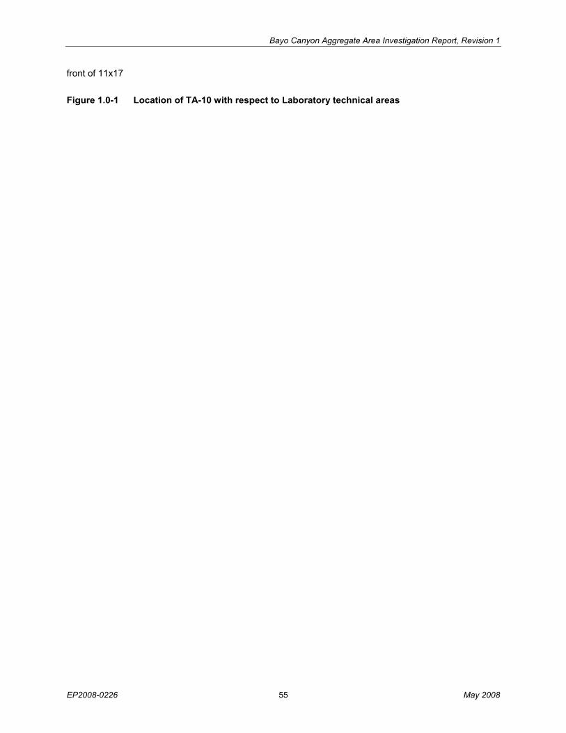
Bayo Canyon Aggregate Area Investigation Report, Revision 1
EP2008-0226 55 May 2008
front of 11x17
Figure 1.0-1 Location of TA-10 with respect to Laboratory technical areas
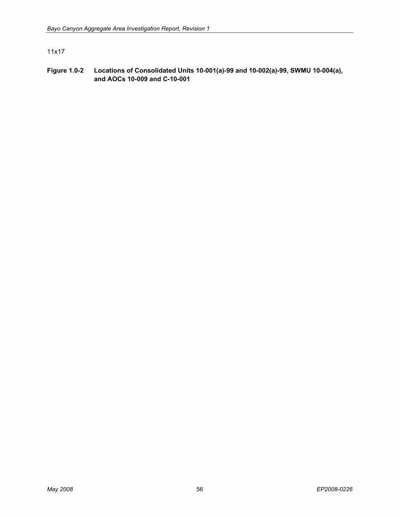
Bayo Canyon Aggregate Area Investigation Report, Revision 1
May 2008 56 EP2008-0226
11x17
Figure 1.0-2 Locations of Consolidated Units 10-001(a)-99 and 10-002(a)-99, SWMU 10-004(a), and AOCs 10-009 and C-10-001
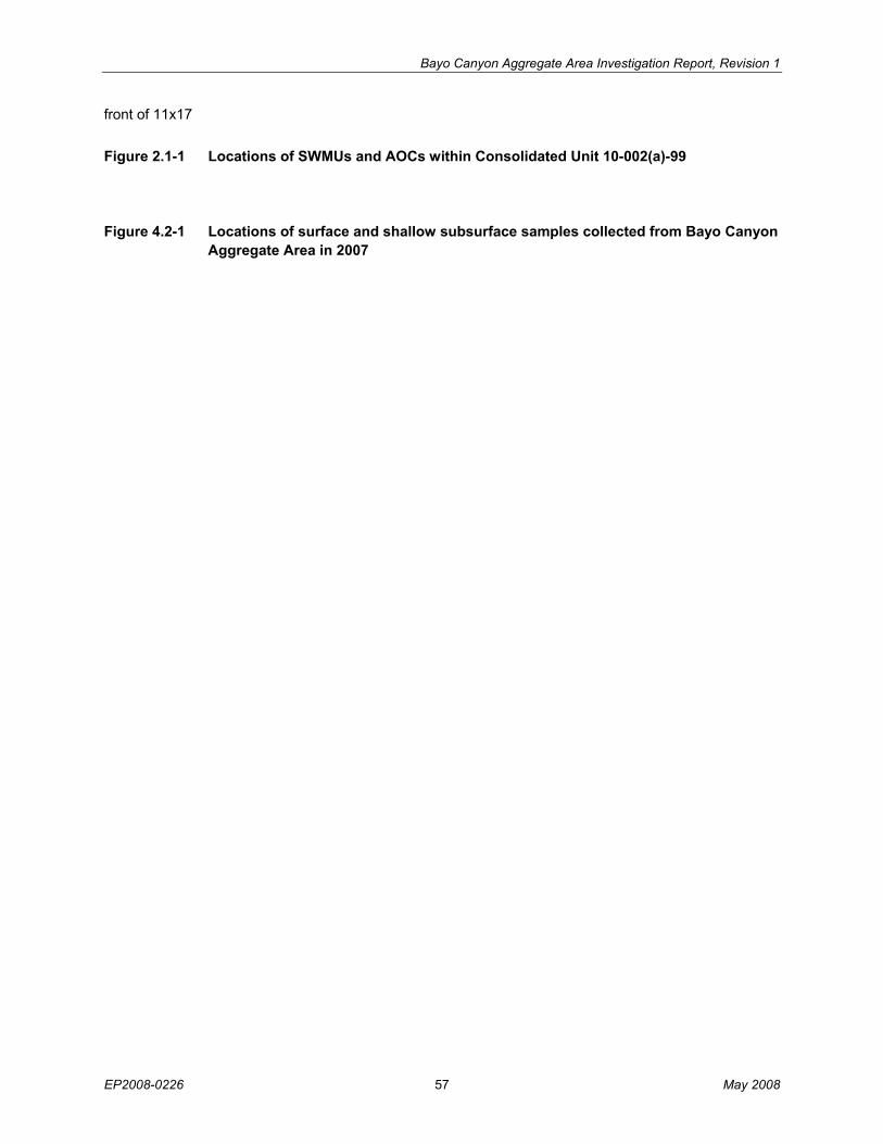
Bayo Canyon Aggregate Area Investigation Report, Revision 1
EP2008-0226 57 May 2008
front of 11x17
Figure 2.1-1 Locations of SWMUs and AOCs within Consolidated Unit 10-002(a)-99
Figure 4.2-1 Locations of surface and shallow subsurface samples collected from Bayo Canyon Aggregate Area in 2007
Bayo Canyon Aggregate Area Investigation Report, Revision 1
May 2008 58 EP2008-0226
11x17
Figure 4.3-1 Location of boreholes drilled at Consolidated Unit 10-002(a)-99 and SWMU 10-004(a)
EP
2008-0226 59
May 2008
Bayo C
anyon Aggregate A
rea Investigation Report, R
evision 1
Figure 4.3-2 Locations of boreholes drilled at Consolidated Unit 10-001(a)-99 and AOC 10-009 in 2007
May 2008
60 E
P2008-0226
Bayo C
anyon Aggregate A
rea Investigation Report, R
evision 1
Figure 4.3-3 Locations of test pits excavated at AOC 10-009
EP
2008-0226 61
May 2008
Bayo C
anyon Aggregate A
rea Investigation Report, R
evision 1
Figure 4.3-4 Locations of test pits excavated at SWMU 10-007, located within Consolidated Unit 10-002(a)-99
May 2008
62 E
P2008-0226
Bayo C
anyon Aggregate A
rea Investigation Report, R
evision 1
Figure 6.0-1 Index map showing the locations of plates and figures
Bayo Canyon Aggregate Area Investigation Report, Revision 1
EP2008-0226 63 May 2008
11x17
Figure 6.1-1 SWMU 10-005 inorganic chemicals detected above BVs and detected organic chemicals
Bayo Canyon Aggregate Area Investigation Report, Revision 1
May 2008 64 EP2008-0226
11x17
Figure 6.2-1 SWMU 10-003(h) inorganic chemicals and radionuclides detected above BVs/FVs

Bayo Canyon Aggregate Area Investigation Report, Revision 1
EP2008-0226 65 May 2008
11x17
Figure 6.2-2 SWMU 10-003(h) detected organic chemicals

Bayo Canyon Aggregate Area Investigation Report, Revision 1
May 2008 66 EP2008-0226
11x17
Figure 6.2-3 SWMU 10-002(a) inorganic chemicals and radionuclides detected above BVs/FVs
Bayo Canyon Aggregate Area Investigation Report, Revision 1
EP2008-0226 67 May 2008
11x17
Figure 6.2-4 SWMU 10-002(a) detected organic chemicals
Bayo Canyon Aggregate Area Investigation Report, Revision 1
May 2008 68 EP2008-0226
11x17
Figure 6.4-1 AOCs 10-009 and C-10-001 inorganic chemicals and radionuclides detected above BVs/FVs
Bayo Canyon Aggregate Area Investigation Report, Revision 1
EP2008-0226 69 May 2008
11x17
Figure 6.4-2 AOCs 10-009 and C-10-001 detected organic chemicals
Bayo Canyon Aggregate Area Investigation Report, Revision 1
May 2008 70 EP2008-0226