Embed Size (px)
Citation preview
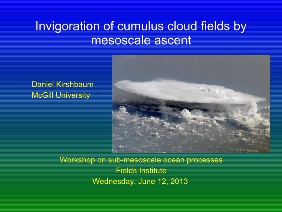
Invigoration of cumulus cloud fields by mesoscale ascent
Daniel KirshbaumMcGill University
Workshop on sub-mesoscale ocean processesFields Institute
Wednesday, June 12, 2013
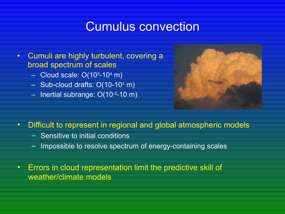
Cumulus convection
• Cumuli are highly turbulent, covering a broad spectrum of scales– Cloud scale: O(103-104 m)– Sub-cloud drafts: O(10-103 m)– Inertial subrange: O(10-2-10 m)
• Difficult to represent in regional and global atmospheric models– Sensitive to initial conditions– Impossible to resolve spectrum of energy-containing scales
• Errors in cloud representation limit the predictive skill of weather/climate models
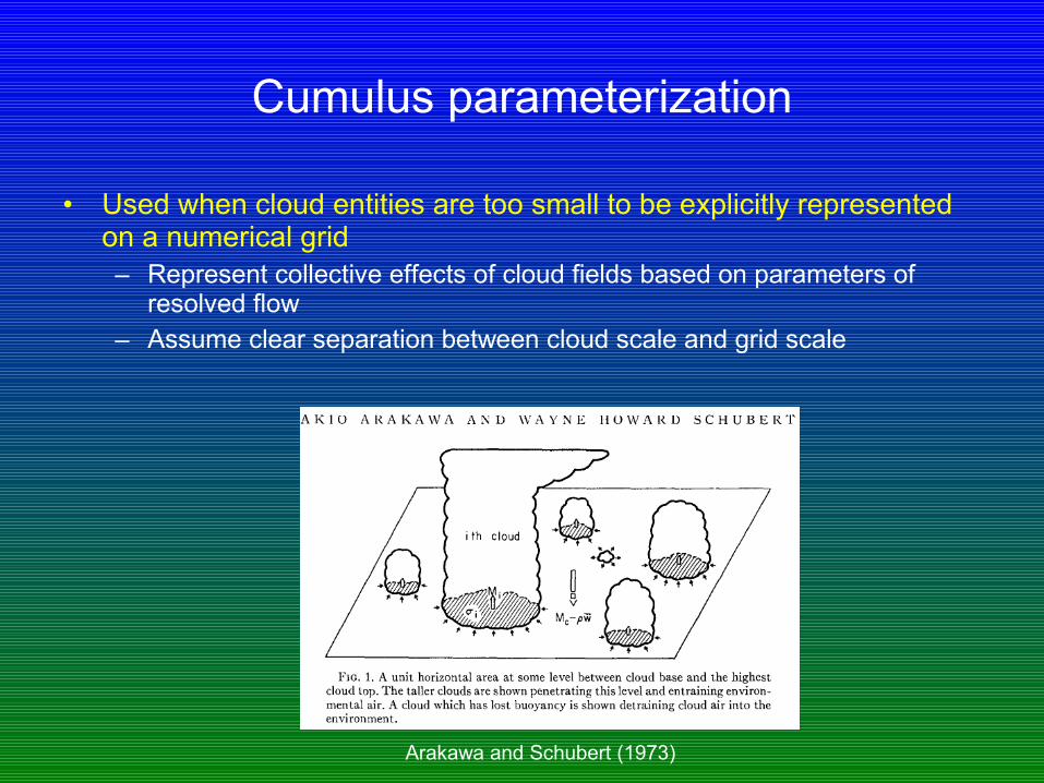
Cumulus parameterization
• Used when cloud entities are too small to be explicitly represented on a numerical grid– Represent collective effects of cloud fields based on parameters of
resolved flow– Assume clear separation between cloud scale and grid scale
Arakawa and Schubert (1973)

Parameterization problems
• Modern weather models moving to “convection-permitting” resolutions to avoid error-prone parameterization schemes– Short-range regional forecasts [O(1 km)]– Global forecast models [O(10 km)]– Problem: grid spacings of 10 km-1 km in the “grey zone”: clouds partially
resolved and scale-separation breaks down
• Even outside of grey zone, cumulus parameterization highly problematic– Phase error in diurnal convection cycle– Clouds fail to organize into realistic larger-scale structures
• How can we overcome these errors?
One source of error
• Modern understanding (and parameterization) of cumuli typically neglects the role of turbulence– Treats clouds as adiabatic or entraining/detraining plumes or thermals– Interaction with environment and other clouds neglected or externally
specified; not informed by theory– Fractional entrainment rate critical for climate prediction (e.g., Pascale
et al 2011) but poorly constrained
• More logical to treat clouds as buoyancy-containing components of a turbulent field– Grant and Lock (2004): scaling/similarity theory based on equilibrium
TKE budget
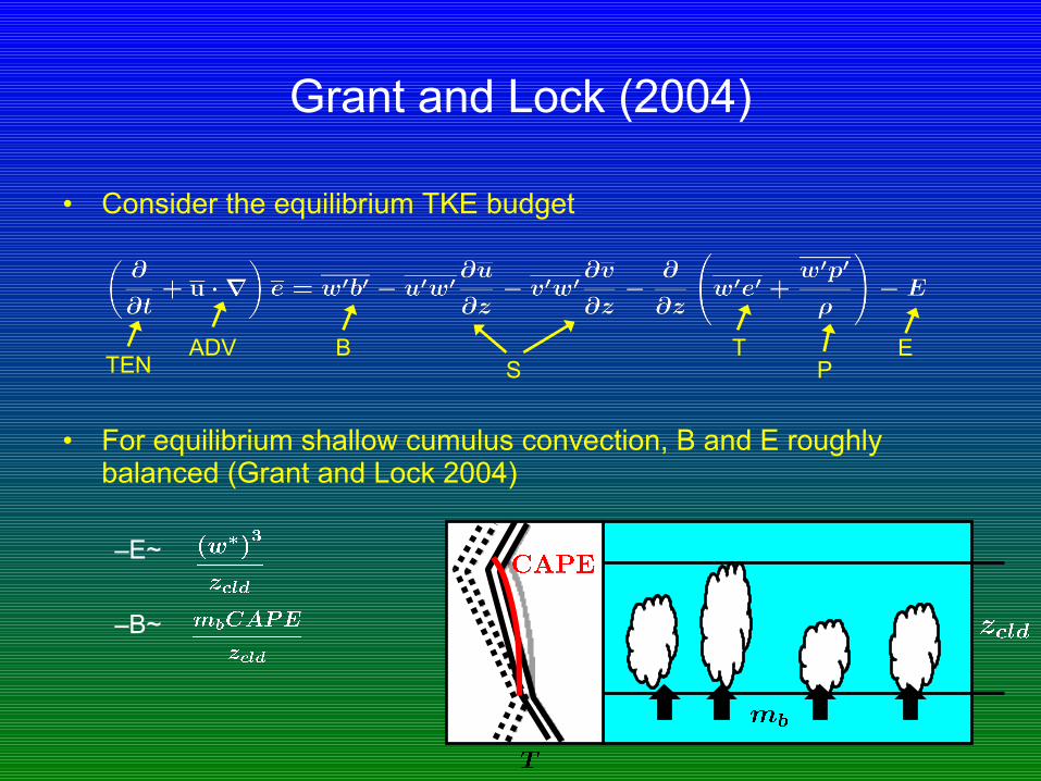
Grant and Lock (2004)
• Consider the equilibrium TKE budget
• For equilibrium shallow cumulus convection, B and E roughly balanced (Grant and Lock 2004)
–E~
–B~
ADV BS
TP
ETEN
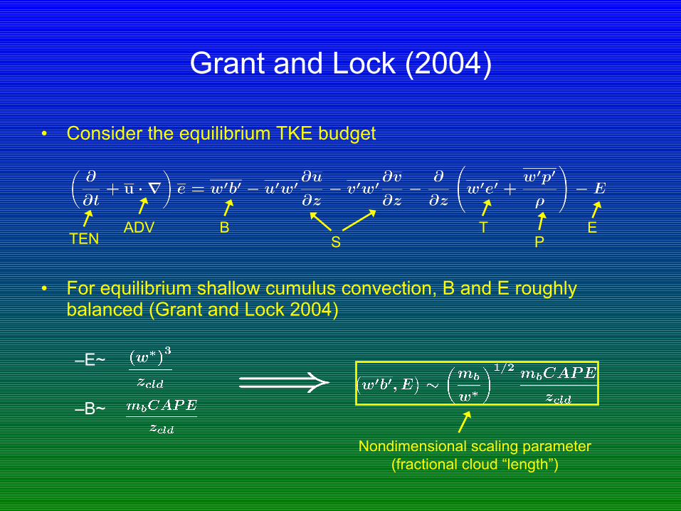
Grant and Lock (2004)
• Consider the equilibrium TKE budget
• For equilibrium shallow cumulus convection, B and E roughly balanced (Grant and Lock 2004)
–E~
–B~
ADV BS
TP
ETEN
Nondimensional scaling parameter (fractional cloud “length”)
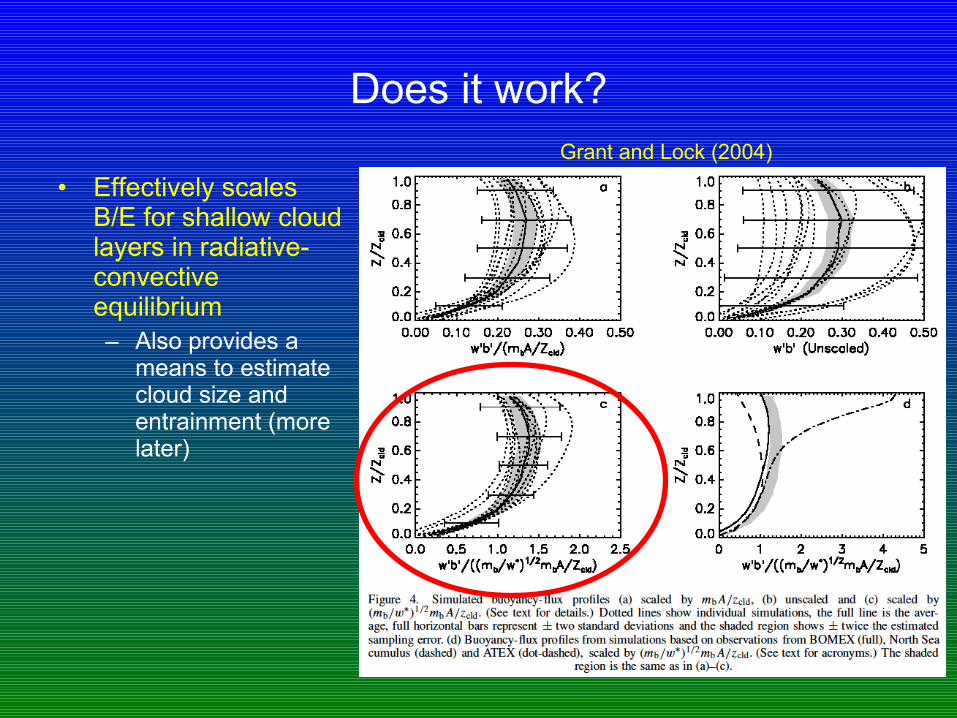
Does it work?
• Effectively scales B/E for shallow cloud layers in radiative-convective equilibrium– Also provides a
means to estimate cloud size and entrainment (more later)
Grant and Lock (2004)
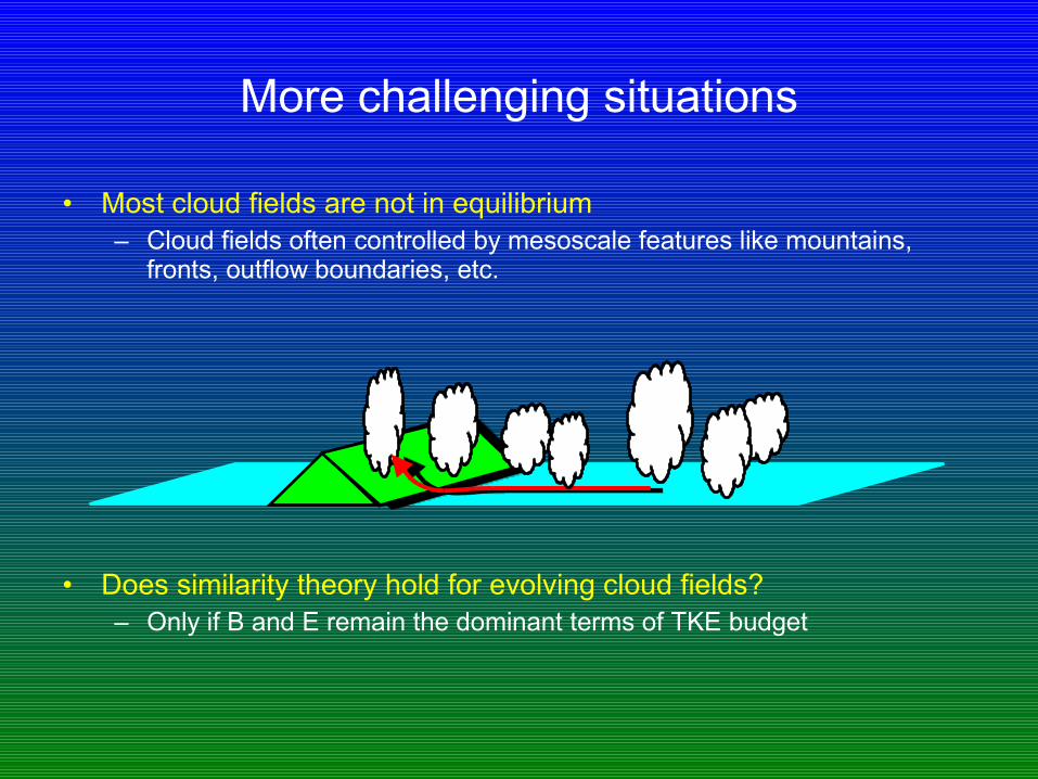
More challenging situations
• Most cloud fields are not in equilibrium– Cloud fields often controlled by mesoscale features like mountains,
fronts, outflow boundaries, etc.
• Does similarity theory hold for evolving cloud fields?– Only if B and E remain the dominant terms of TKE budget
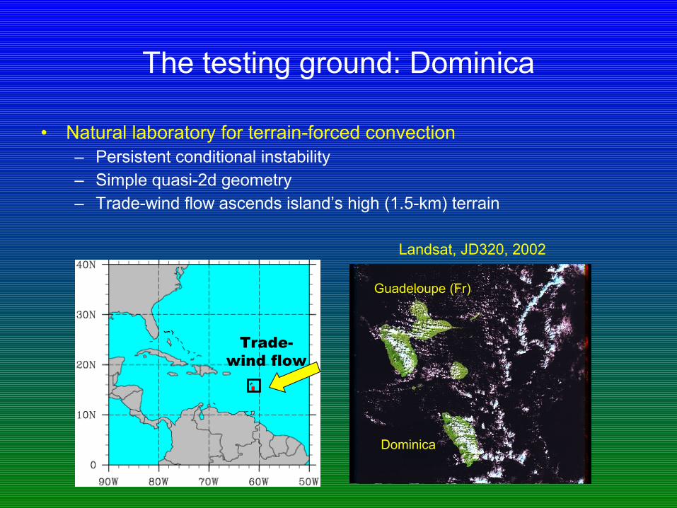
The testing ground: Dominica
• Natural laboratory for terrain-forced convection– Persistent conditional instability– Simple quasi-2d geometry– Trade-wind flow ascends island’s high (1.5-km) terrain
Trade-wind flow
Landsat, JD320, 2002
Dominica
Guadeloupe (Fr)
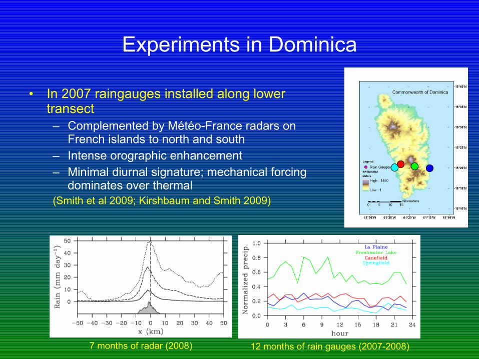
Experiments in Dominica
• In 2007 raingauges installed along lower transect– Complemented by Météo-France radars on
French islands to north and south– Intense orographic enhancement– Minimal diurnal signature; mechanical forcing
dominates over thermal(Smith et al 2009; Kirshbaum and Smith 2009)
7 months of radar (2008) 12 months of rain gauges (2007-2008)
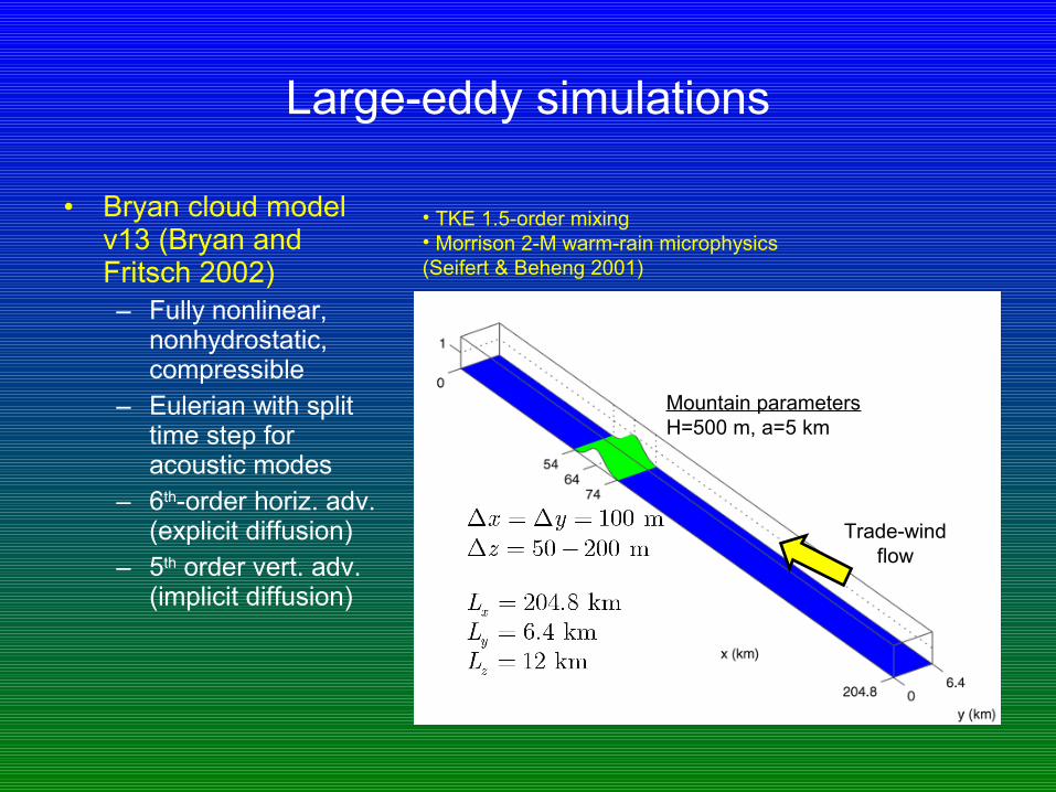
Large-eddy simulations
• Bryan cloud model v13 (Bryan and Fritsch 2002)– Fully nonlinear,
nonhydrostatic, compressible
– Eulerian with split time step for acoustic modes
– 6th-order horiz. adv. (explicit diffusion)
– 5th order vert. adv. (implicit diffusion)
Trade-wind flow
• TKE 1.5-order mixing• Morrison 2-M warm-rain microphysics(Seifert & Beheng 2001)
Mountain parametersH=500 m, a=5 km
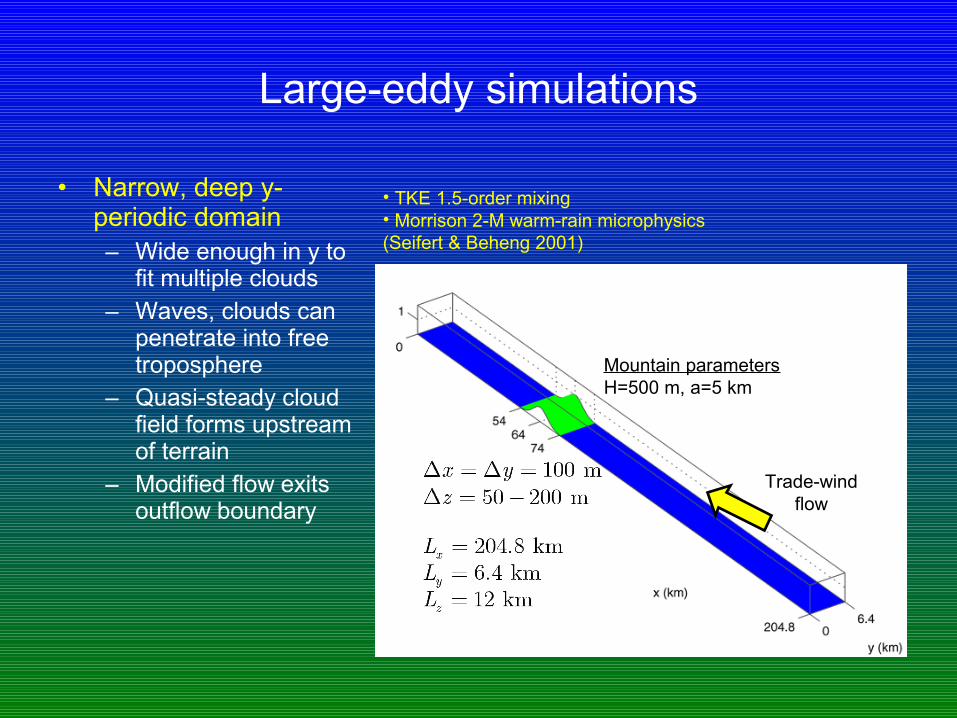
Large-eddy simulations
• Narrow, deep y-periodic domain– Wide enough in y to
fit multiple clouds– Waves, clouds can
penetrate into free troposphere
– Quasi-steady cloud field forms upstream of terrain
– Modified flow exits outflow boundary
Trade-wind flow
• TKE 1.5-order mixing• Morrison 2-M warm-rain microphysics(Seifert & Beheng 2001)
Mountain parametersH=500 m, a=5 km
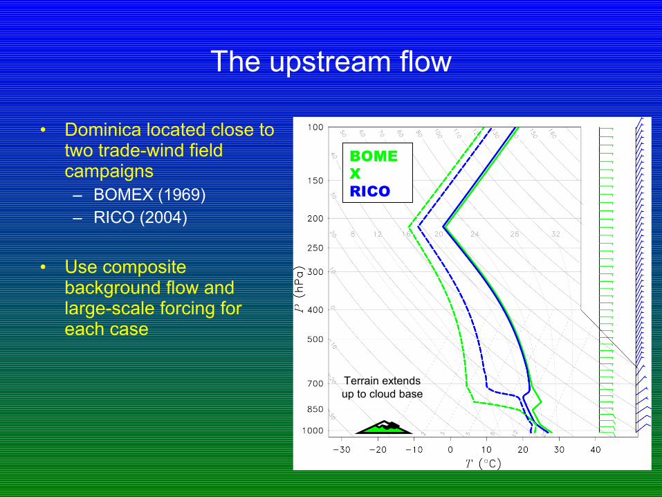
The upstream flow
• Dominica located close to two trade-wind field campaigns– BOMEX (1969)– RICO (2004)
• Use composite background flow and large-scale forcing for each case
BOMEXRICO
Terrain extends up to cloud base

RICO simulation
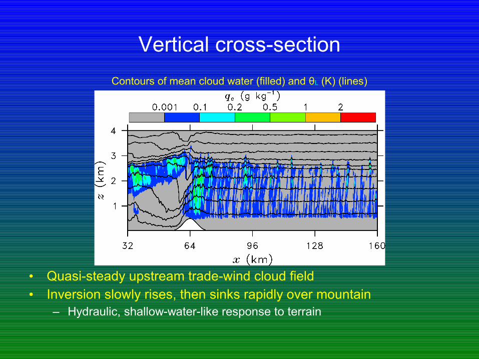
Vertical cross-section
• Quasi-steady upstream trade-wind cloud field• Inversion slowly rises, then sinks rapidly over mountain
– Hydraulic, shallow-water-like response to terrain
Contours of mean cloud water (filled) and θL (K) (lines)
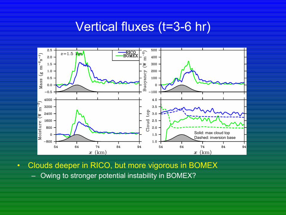
Vertical fluxes (t=3-6 hr)
• Clouds deeper in RICO, but more vigorous in BOMEX– Owing to stronger potential instability in BOMEX?
Solid: max cloud topDashed: inversion base
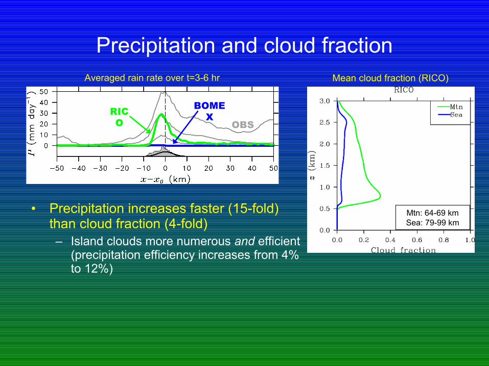
Precipitation and cloud fraction
• Precipitation increases faster (15-fold) than cloud fraction (4-fold)– Island clouds more numerous and efficient
(precipitation efficiency increases from 4% to 12%)
Averaged rain rate over t=3-6 hr
BOMEXRIC
O OBS
Mean cloud fraction (RICO)
Mtn: 64-69 kmSea: 79-99 km
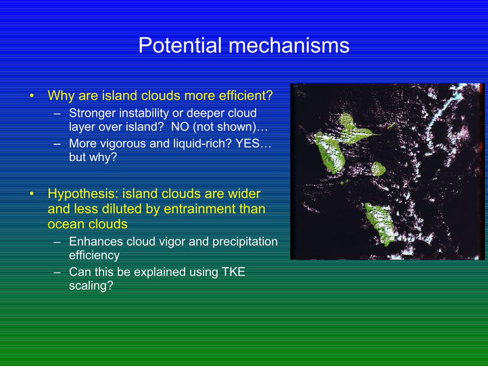
Potential mechanisms
• Why are island clouds more efficient?– Stronger instability or deeper cloud
layer over island? NO (not shown)…– More vigorous and liquid-rich? YES…
but why?
• Hypothesis: island clouds are wider and less diluted by entrainment than ocean clouds– Enhances cloud vigor and precipitation
efficiency– Can this be explained using TKE
scaling?
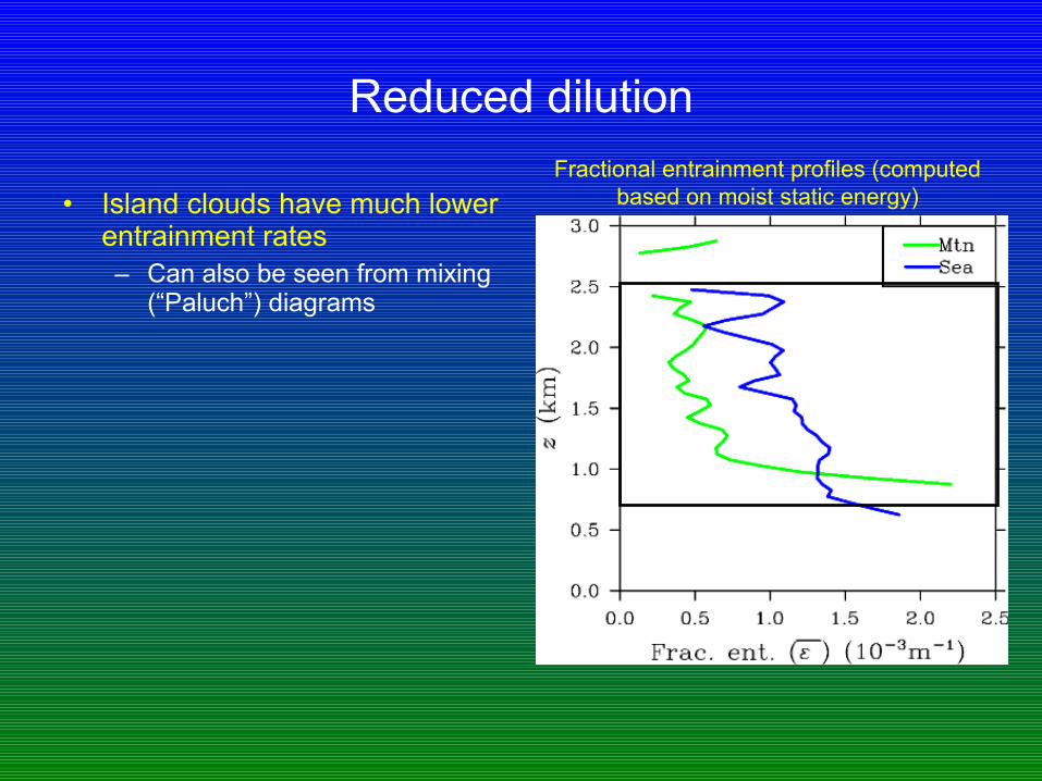
Reduced dilution
• Island clouds have much lower entrainment rates– Can also be seen from mixing
(“Paluch”) diagrams
Fractional entrainment profiles (computed based on moist static energy)

Conditional core averages (t=3-6 hr)
• Reduced dilution renders island cloud cores more buoyant, vigorous, and liquid-rich
Perturbations relative to local y-average (RICO simulation)
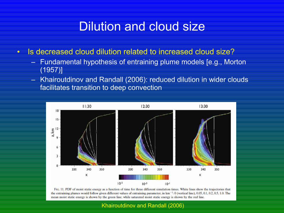
Dilution and cloud size
• Is decreased cloud dilution related to increased cloud size?– Fundamental hypothesis of entraining plume models [e.g., Morton
(1957)]– Khairoutdinov and Randall (2006): reduced dilution in wider clouds
facilitates transition to deep convection
Khairoutdinov and Randall (2006)
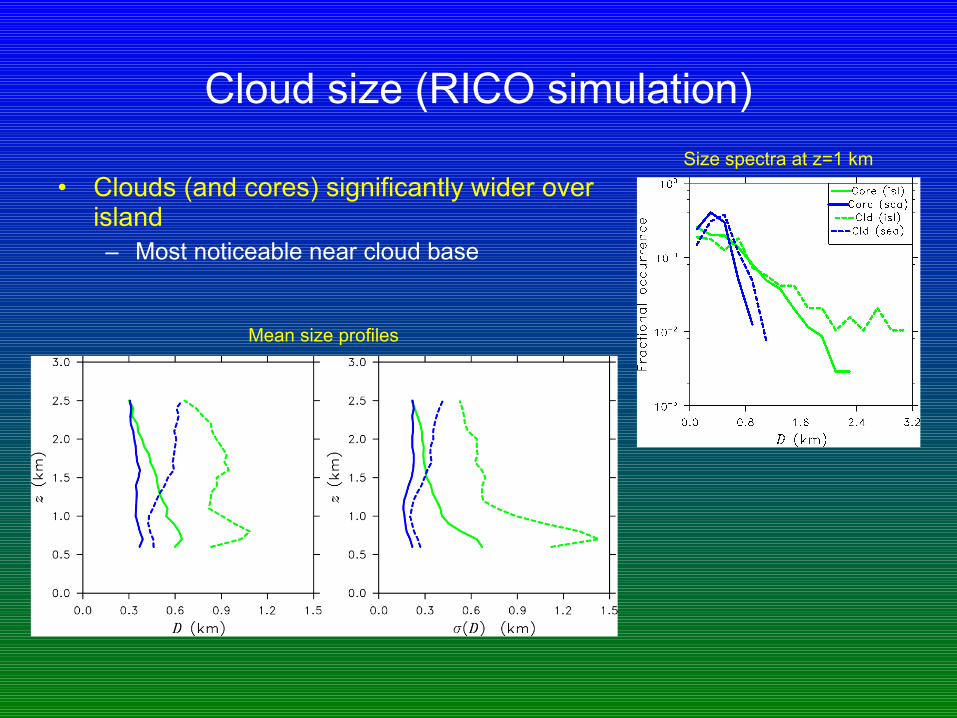
Cloud size (RICO simulation)
• Clouds (and cores) significantly wider over island– Most noticeable near cloud base
Size spectra at z=1 km
Mean size profiles
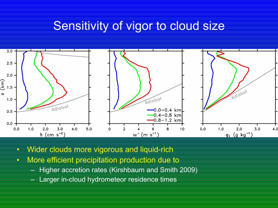
Sensitivity of vigor to cloud size
•
• Wider clouds more vigorous and liquid-rich• More efficient precipitation production due to
– Higher accretion rates (Kirshbaum and Smith 2009)– Larger in-cloud hydrometeor residence times

Controlling the cloud size
• Can isolate cloud-size mechanism by conducting experiments that control the cloud size, with all else held fixed
• Create neutrally buoyant moisture “patches” in upstream flow with fixed horizontal wavelengths– Perturbations columnar in shape– Use sounding from RICO, but without surface fluxes or large-scale
forcings (suppresses upstream convection)– Convection only forms directly over the island
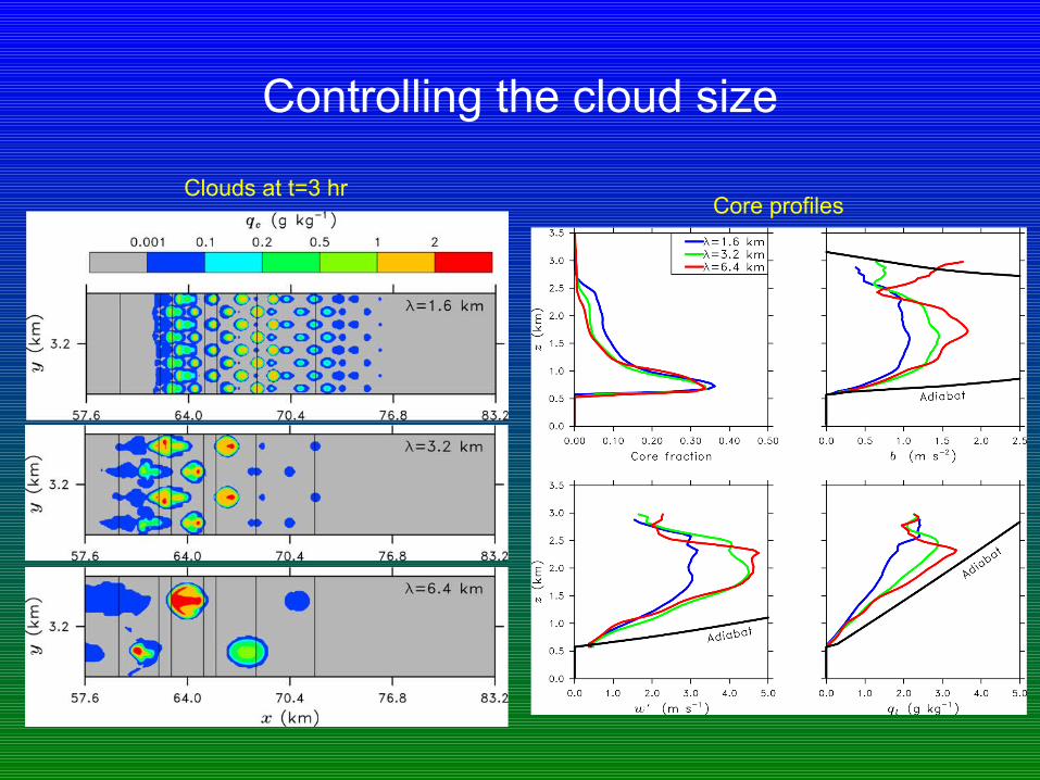
Controlling the cloud size
• Core profiles
Clouds at t=3 hr
Intermediate conclusions and outlook
• What we have shown– Clouds are wider over the island than over the sea– Wider clouds are generally more vigorous and liquid-rich– Together with increased cloud number, this explains the increased
precipitation observed over the island
• Why, then, do the clouds widen over the island? Two hypotheses:1. Turbulent constraints2. Sub-cloud moisture anomalies
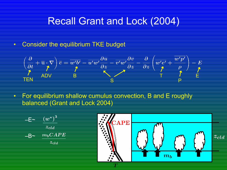
Recall Grant and Lock (2004)
• Consider the equilibrium TKE budget
• For equilibrium shallow cumulus convection, B and E roughly balanced (Grant and Lock 2004)
–E~
–B~
ADV BS
TP
ETEN

Applying scaling to simulation
• Scaling from Grant and Lock (2004) works well, even for non-equilibrium island flow
• Details of dynamics over windward slope:– B, E, and ADV all increase but not
simultaneously– E lags ADV by eddy-turnover time
(zcld/w*)– Equilibrium approximation
overestimates dissipation (and hence w*) in this region
TKE-budget terms, integrated over cloud layer
From Kirshbaum and Grant (QJ, 2012)
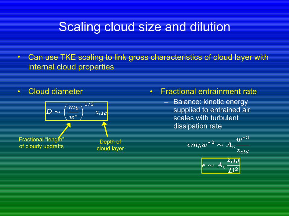
Scaling cloud size and dilution
• Cloud diameter • Fractional entrainment rate– Balance: kinetic energy
supplied to entrained air scales with turbulent dissipation rate
• Can use TKE scaling to link gross characteristics of cloud layer with internal cloud properties
Depth of cloud layer
Fractional “length” of cloudy updrafts
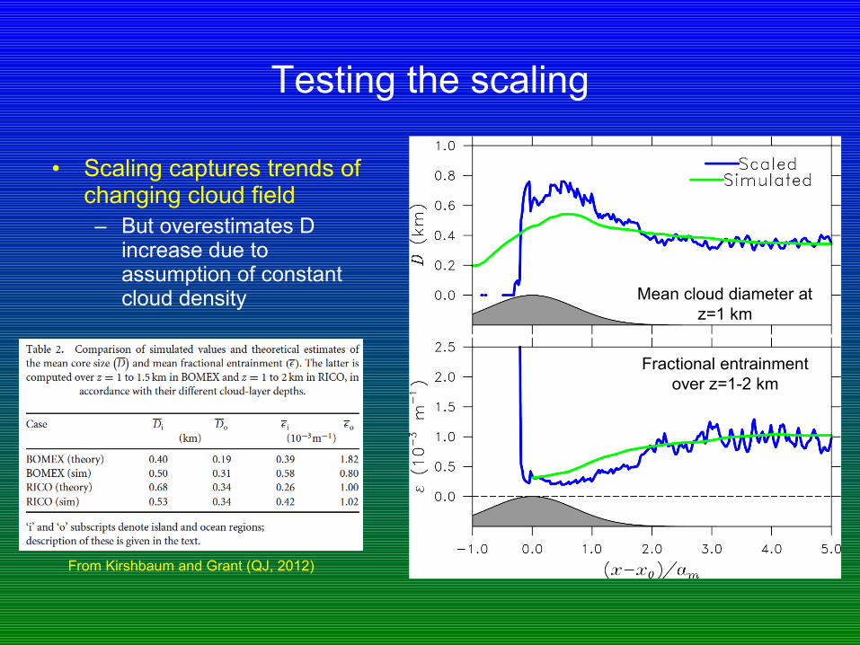
Testing the scaling
• Scaling captures trends of changing cloud field– But overestimates D
increase due to assumption of constant cloud density Mean cloud diameter at
z=1 km
Fractional entrainment over z=1-2 km
From Kirshbaum and Grant (QJ, 2012)

Physical interpretation
• Turbulent constraints on w* control cloud response as mb increases over island
• Increased cloud diameter:– w* constrained by instability (which remains roughly constant), cannot
keep pace with increased mb
– For a given cloud density, increased mb requires increased D
• Decreased fractional entrainment:– Dissipation, which scales with w*3, also cannot keep pace with
increased mb
– For balance to be maintained between entrainment and dissipation, ε must decrease
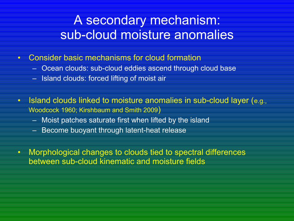
A secondary mechanism:sub-cloud moisture anomalies
• Consider basic mechanisms for cloud formation– Ocean clouds: sub-cloud eddies ascend through cloud base– Island clouds: forced lifting of moist air
• Island clouds linked to moisture anomalies in sub-cloud layer (e.g., Woodcock 1960; Kirshbaum and Smith 2009)– Moist patches saturate first when lifted by the island– Become buoyant through latent-heat release
• Morphological changes to clouds tied to spectral differences between sub-cloud kinematic and moisture fields

Sub-cloud moisture anomalies
• Power spectra of upstream w’ and qv’ fields at z=500 m
– w perturbations control cloud sizes over ocean– qv perturbations control cloud sizes over island

Which mechanism is it?
• Speculation– Below ~1 km: strong lifting, non-equilibrium. Sub-cloud moisture
patches determine morphology
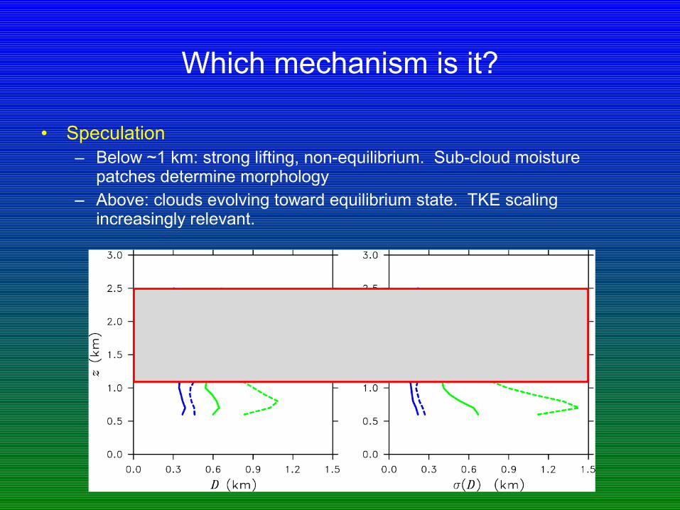
Which mechanism is it?
• Speculation– Below ~1 km: strong lifting, non-equilibrium. Sub-cloud moisture
patches determine morphology– Above: clouds evolving toward equilibrium state. TKE scaling
increasingly relevant.

Summary
• Sharp uplift over narrow island dramatically increases turbulent fluxes and precipitation– Enhancement not just due to increased cloud coverage– Clouds themselves are invigorated
• Hypothesis: reduced dilution in wider island clouds creates more intense and liquid-rich updafts
• Clouds widen and purify for two reasons– Forced saturation of broad sub-cloud moisture “patches”– Turbulent constraints on updraft velocities force clouds to widen and
become less diluted
Conclusions and future work
• Findings relevant to basic understanding and parameterization of convection– TKE scaling provides a link between grid-scale parameters and internal
cloud properties– Allows entrainment rate (the great unknown) and cloud size to be
inferred from mesoscale environment
• Future work– Use turbulence theory for observational entrainment retrievals– Incorporate TKE scaling into convection parameterization schemes
(may need to design new schemes from the ground up)


![[Challenge:Future] ASSIST - Social Invigoration Systems](https://img.pdfslide.net/doc/110x75/589fd6c21a28abf06d8b5f65/challengefuture-assist-social-invigoration-systems.jpg)