Embed Size (px)
Citation preview

ISSMGE TC209 Workshopon
Challenges of Offshore Geotechnical Engineering
25 September 2019Bodrum - Turkey

Offshore Site Investigation and Site CharacterizationAntonia Makra, Suleyman B. Parlak
Challenges of Offshore Geotechnical EngineeringBodrum, Turkey – September 2019
Challenges of Offshore Geotechnical EngineeringBodrum, Turkey – September 2019
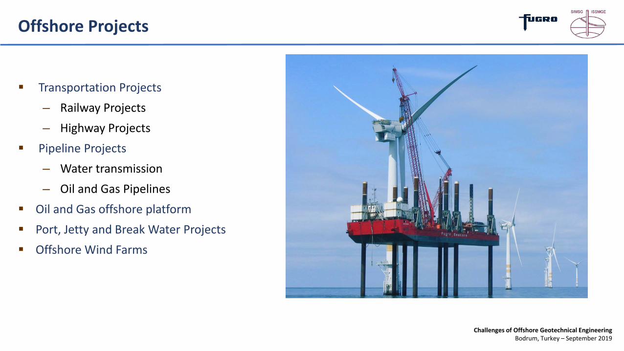
Transportation Projects– Railway Projects– Highway Projects
Pipeline Projects– Water transmission– Oil and Gas Pipelines
Oil and Gas offshore platform Port, Jetty and Break Water Projects Offshore Wind Farms
Offshore Projects
Challenges of Offshore Geotechnical EngineeringBodrum, Turkey – September 2019
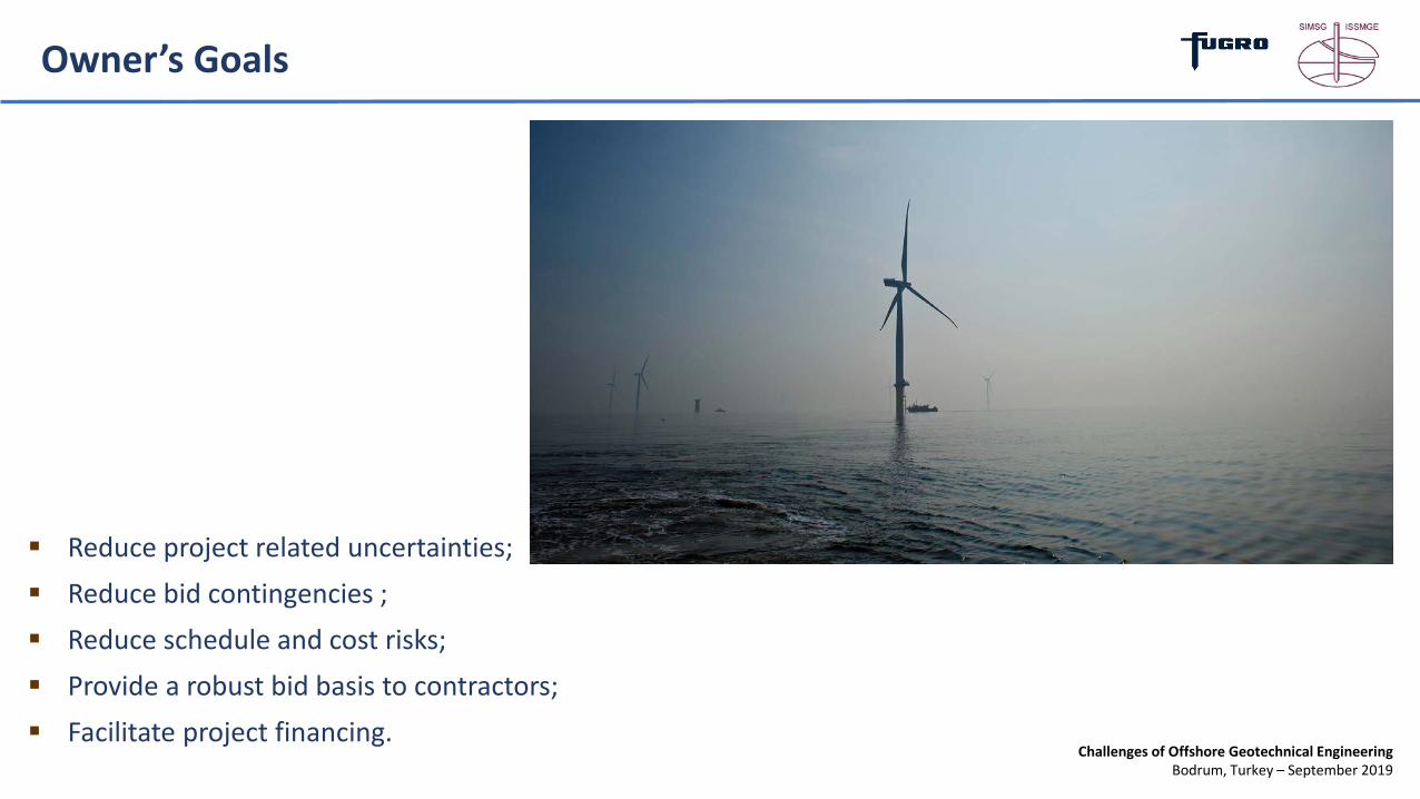
Reduce project related uncertainties; Reduce bid contingencies ; Reduce schedule and cost risks; Provide a robust bid basis to contractors; Facilitate project financing.
Owner’s Goals

Challenges of Offshore Geotechnical EngineeringBodrum, Turkey – September 2019
Project Challenges
What are the surface/subsurface conditionsWhat are the primary geohazards
Deep Soft and Liquefiable Soils Present At Site?

Challenges of Offshore Geotechnical EngineeringBodrum, Turkey – September 2019
Work Sequence
1. Existing Information/ Desktop Study2. Area-wide Bathy / Geophysical Surveys3. Develop and Execute Project-Specific Geotechnical Exploration Program4. Data Integration and Interpretation5. Project GIS database6. 3D Model of the Subsurface
Integrated Site Characterization

Challenges of Offshore Geotechnical EngineeringBodrum, Turkey – September 2019
Bathy – Geophysical Surveys
Multibeam Bathymetry
Seabed Features – SSS and Magnetometer
Bathymetric and Geophysical Surveys
Challenges of Offshore Geotechnical EngineeringBodrum, Turkey – September 2019
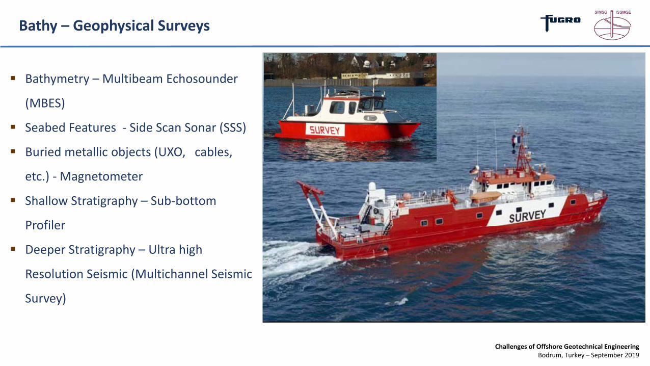
Bathy – Geophysical Surveys
Bathymetry – Multibeam Echosounder
(MBES)
Seabed Features - Side Scan Sonar (SSS)
Buried metallic objects (UXO, cables,
etc.) - Magnetometer
Shallow Stratigraphy – Sub-bottom
Profiler
Deeper Stratigraphy – Ultra high
Resolution Seismic (Multichannel Seismic
Survey)
Challenges of Offshore Geotechnical EngineeringBodrum, Turkey – September 2019
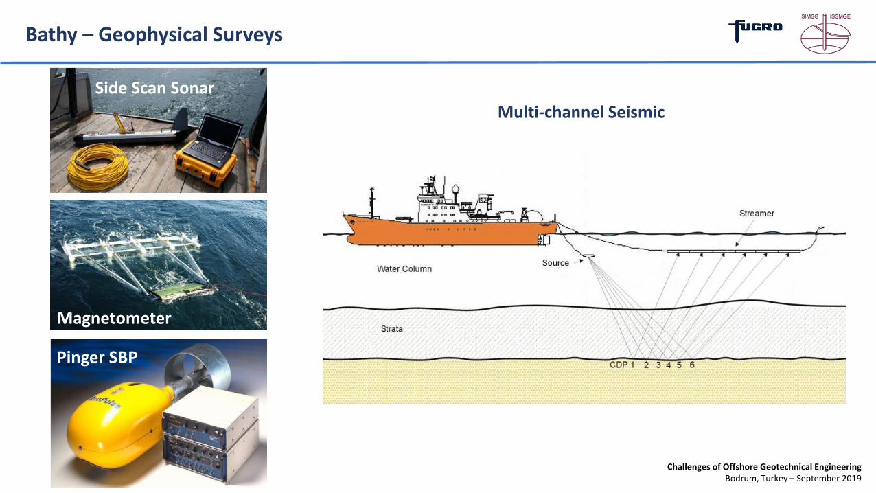
Bathy – Geophysical Surveys
Multi-channel SeismicSide Scan Sonar
Magnetometer
Pinger SBP

Challenges of Offshore Geotechnical EngineeringBodrum, Turkey – September 2019
Bathy – Geophysical Surveys
Multibeam Bathymetry
Seabed Features – SSS and Magnetometer
Challenges of Offshore Geotechnical EngineeringBodrum, Turkey – September 2019
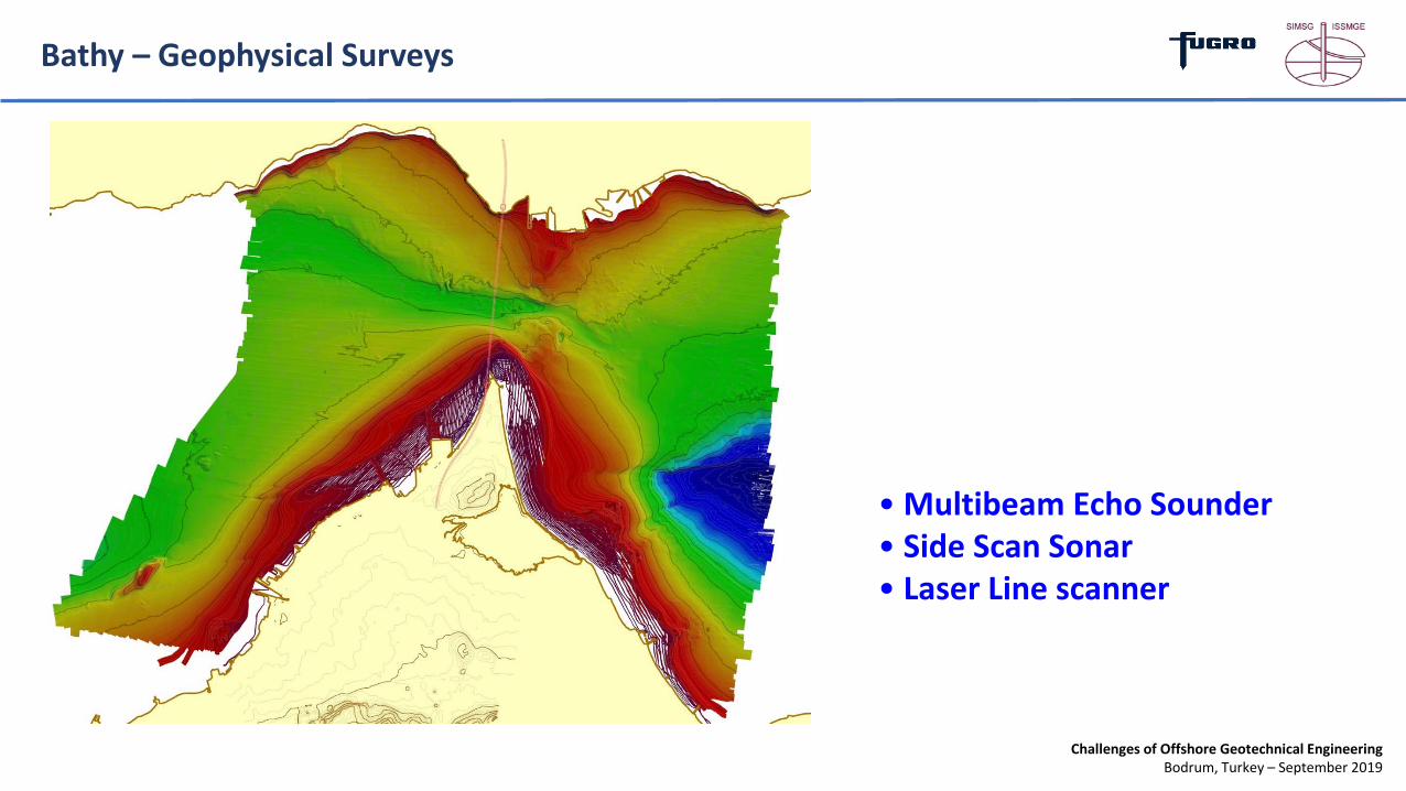
Bathy – Geophysical Surveys
Bathymetry – MBES/SSS
Seabed Features – SSS and Magnetometer
Seabed Features – SSS and Magnetometer
• Multibeam Echo Sounder• Side Scan Sonar• Laser Line scanner
Challenges of Offshore Geotechnical EngineeringBodrum, Turkey – September 2019
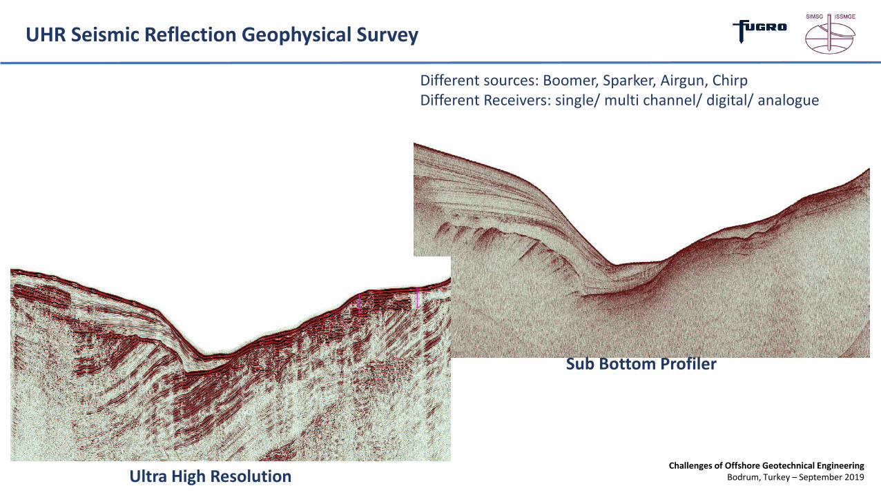
UHR Seismic Reflection Geophysical Survey
Different sources: Boomer, Sparker, Airgun, ChirpDifferent Receivers: single/ multi channel/ digital/ analogue
Sub Bottom Profiler
Ultra High Resolution

Challenges of Offshore Geotechnical EngineeringBodrum, Turkey – September 2019
Geotechnical Investigations

Challenges of Offshore Geotechnical EngineeringBodrum, Turkey – September 2019
Geotechnical Survey - Vessels
Dynamically Positioned (DP2) Vessels
Semi-Submersible Drilling Vessels
Jack-ups (Lift-Barges)

Challenges of Offshore Geotechnical EngineeringBodrum, Turkey – September 2019
Geotechnical Survey – Seabed vs Downhole
Wison XP : Downhole CPT/ undisturbed samplingSeacalf: Seabed CPT Continuous data Maximum depths 40m
depending on water depth and ground conditions
Discontinuous data – 3m strokes Much higher penetration depths Alternation between in situ
testing and sampling

Challenges of Offshore Geotechnical EngineeringBodrum, Turkey – September 2019
Geotechnical Survey – Drilling

Challenges of Offshore Geotechnical EngineeringBodrum, Turkey – September 2019
Geotechnical Survey – In situ testing
sleeve friction
pore water pressure
cone tip resistance
reaction blade
shear blade
Marine CPT
Downhole and Seabed Techniques
Isolation from Vessel Movement
Superior Penetration Capability
High Production Rate
In situ Shear Vane Test

Challenges of Offshore Geotechnical EngineeringBodrum, Turkey – September 2019
Geotechnical Survey – In situ testing
P-S Suspension LoggingSeismic CPT – S wave velocity profile
Challenges of Offshore Geotechnical EngineeringBodrum, Turkey – September 2019
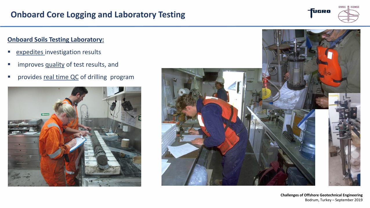
Onboard Core Logging and Laboratory Testing
Onboard Soils Testing Laboratory:
expedites investigation results
improves quality of test results, and
provides real time QC of drilling program
Challenges of Offshore Geotechnical EngineeringBodrum, Turkey – September 2019
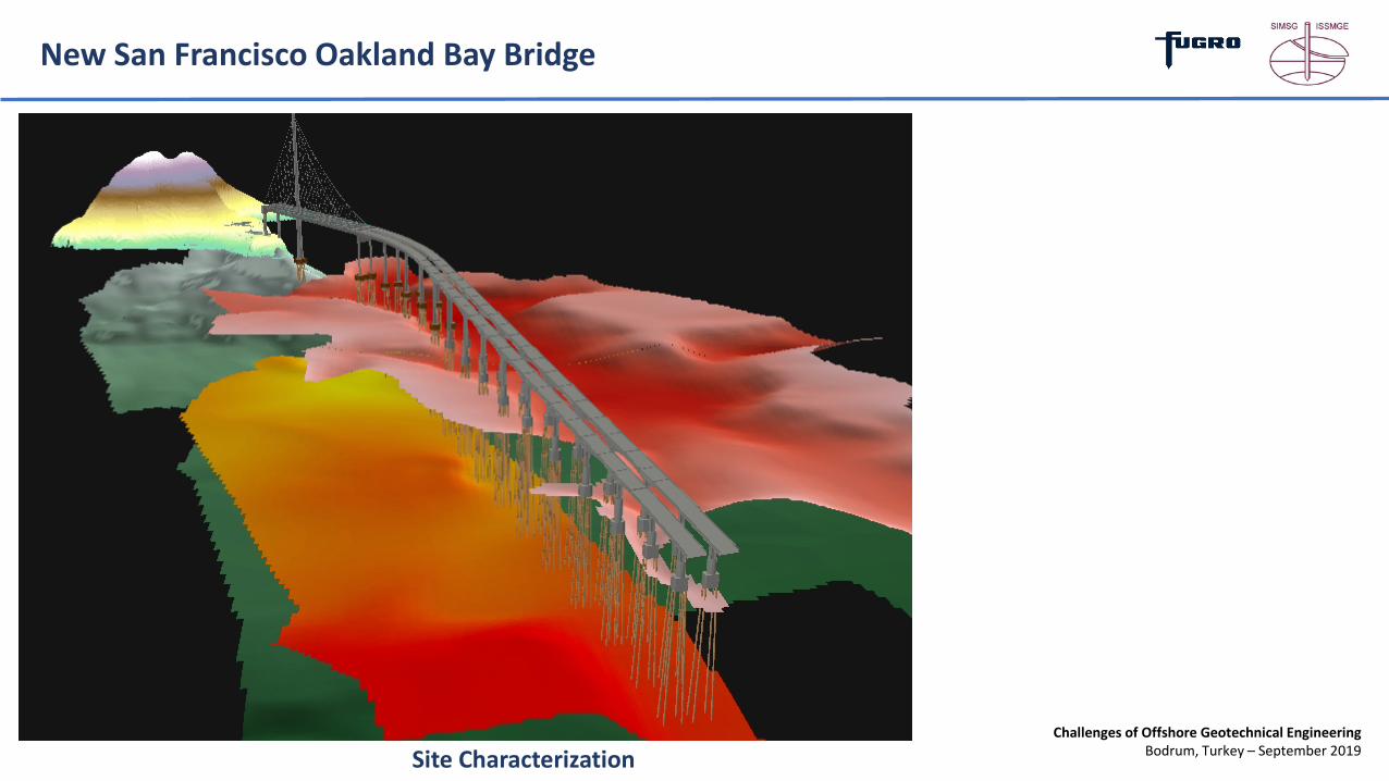
New San Francisco Oakland Bay Bridge
Site Characterization

Challenges of Offshore Geotechnical EngineeringBodrum, Turkey – September 2019
New San Francisco Oakland Bay Bridge
Application of Standard Land-based Techniques
Can Result in Underprediction of
Shear Strengths by on the order of 25 to 50
percent!
-300
-250
-200
-150
-100
-50
0
0 1 2 3 4 5 6 7 8Undrained Shear Stength (ksf)
Pile
Pen
etra
tion
Bel
ow M
udlin
e(ft
)
Design Profile from Existing Data
Design Profile from Fugro Data
BART Data (UC Tests)YOUNG BAY MUD
OLD BAY MUD/UPPERALAMEDA SEDIMENT
LOWER ALAMEDAALLUVIAL SEDIMENT
MERRIT-POSEY-SAN ANTONIO FORMATION

Challenges of Offshore Geotechnical EngineeringBodrum, Turkey – September 2019
New San Francisco Oakland Bay Bridge
0
50
100
150
200
250
300
3500 4,000 8,000 12,000 16,000 20,000
Axial Pile Capacity (kips)Pi
le P
enet
ratio
n B
elow
Mud
line
(ft)
Typical Land Style Boring
Fugro Marine Boring
-- Design Tip Elevation --
Comparison of Computed Pile
Capacity Standard “Land” vs “Marine”

Challenges of Offshore Geotechnical EngineeringBodrum, Turkey – September 2019
New San Francisco Oakland Bay Bridge
2.5 m
85 - 95 m
50 - 75 mm
1
8
PILEBATTER AXIAL CAPACITY:
120 - 140 MN
ENERGY TODRIVE PILE:
1,000 - 1,700 kN-m
Skyway Foundation:• 28 Footing Locations• 160 piles
The savings decrease in pile length alone exceeds the additional costs for the offshore SI

Challenges of Offshore Geotechnical EngineeringBodrum, Turkey – September 2019
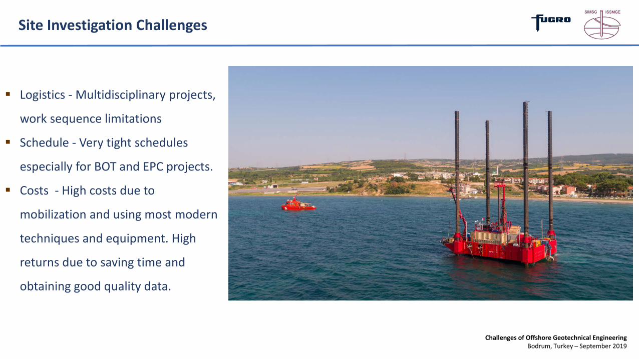
Site Investigation Challenges
Site Conditions
― Boat Traffic (Bosporus, Çanakkale Straits)
― Currents
― Weather
― Shallow Gas
― Seabed Conditions (UXO, Cables, Shipwrecks etc)
Challenges of Offshore Geotechnical EngineeringBodrum, Turkey – September 2019
Site Investigation Challenges
Logistics - Multidisciplinary projects,
work sequence limitations
Schedule - Very tight schedules
especially for BOT and EPC projects.
Costs - High costs due to
mobilization and using most modern
techniques and equipment. High
returns due to saving time and
obtaining good quality data.
Challenges of Offshore Geotechnical EngineeringBodrum, Turkey – September 2019
Site Characterization
Challenges of Offshore Geotechnical EngineeringBodrum, Turkey – September 2019
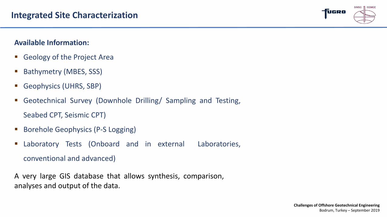
Integrated Site Characterization
Available Information:
Geology of the Project Area
Bathymetry (MBES, SSS)
Geophysics (UHRS, SBP)
Geotechnical Survey (Downhole Drilling/ Sampling and Testing,
Seabed CPT, Seismic CPT)
Borehole Geophysics (P-S Logging)
Laboratory Tests (Onboard and in external Laboratories,
conventional and advanced)
A very large GIS database that allows synthesis, comparison,analyses and output of the data.
Challenges of Offshore Geotechnical EngineeringBodrum, Turkey – September 2019
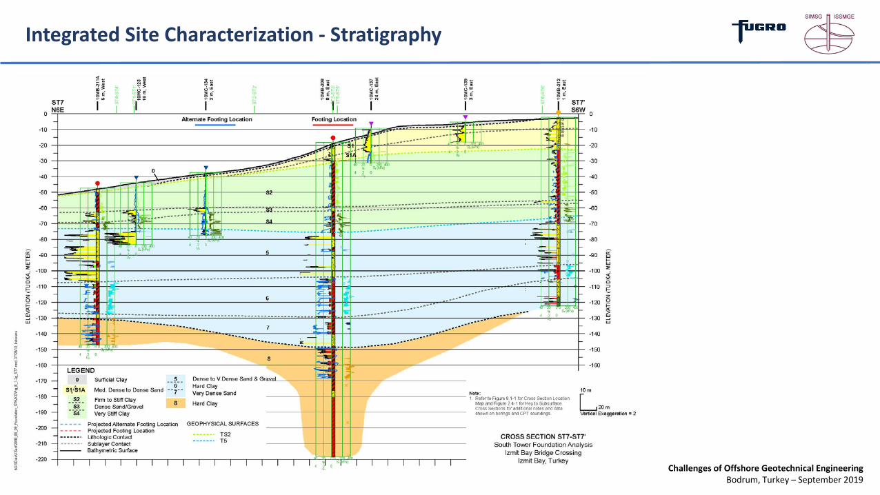
Integrated Site Characterization - Stratigraphy
Challenges of Offshore Geotechnical EngineeringBodrum, Turkey – September 2019
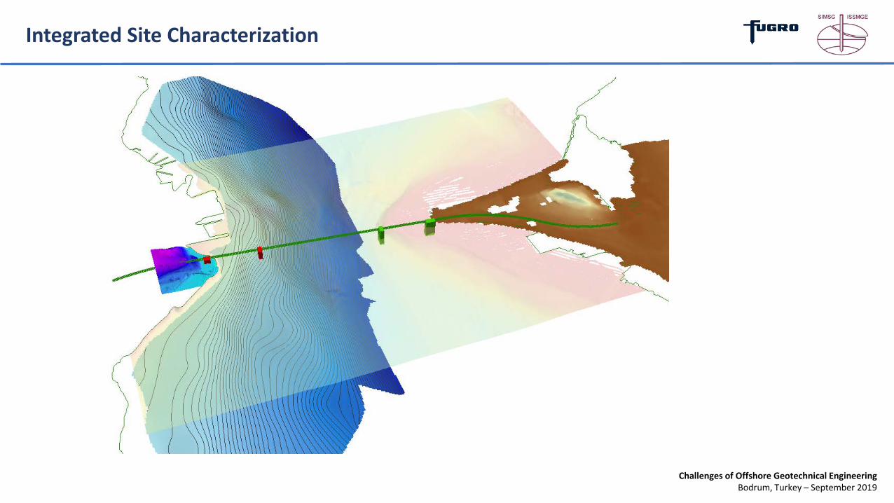
Integrated Site Characterization

Challenges of Offshore Geotechnical EngineeringBodrum, Turkey – September 2019
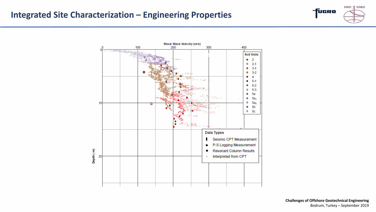
Integrated Site Characterization – Engineering Properties
Challenges of Offshore Geotechnical EngineeringBodrum, Turkey – September 2019
Integrated Site Characterization – Engineering Properties

Challenges of Offshore Geotechnical EngineeringBodrum, Turkey – September 2019
Geohazards

Challenges of Offshore Geotechnical EngineeringBodrum, Turkey – September 2019
Geohazard Identification - Faults

Challenges of Offshore Geotechnical EngineeringBodrum, Turkey – September 2019
Geohazard Identification – Slope Instabilities
Base of Disturbed Sediments
Challenges of Offshore Geotechnical EngineeringBodrum, Turkey – September 2019
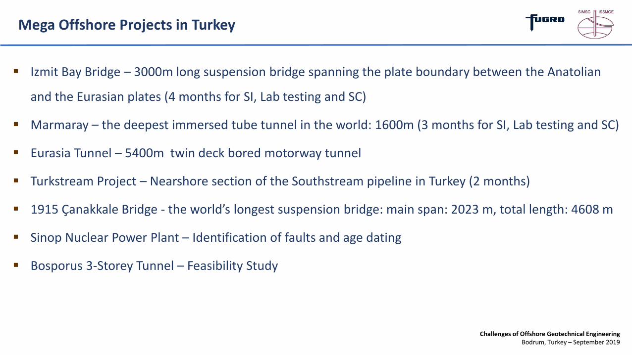
Mega Offshore Projects in Turkey
Izmit Bay Bridge – 3000m long suspension bridge spanning the plate boundary between the Anatolian
and the Eurasian plates (4 months for SI, Lab testing and SC)
Marmaray – the deepest immersed tube tunnel in the world: 1600m (3 months for SI, Lab testing and SC)
Eurasia Tunnel – 5400m twin deck bored motorway tunnel
Turkstream Project – Nearshore section of the Southstream pipeline in Turkey (2 months)
1915 Çanakkale Bridge - the world’s longest suspension bridge: main span: 2023 m, total length: 4608 m
Sinop Nuclear Power Plant – Identification of faults and age dating
Bosporus 3-Storey Tunnel – Feasibility Study
Challenges of Offshore Geotechnical EngineeringBodrum, Turkey – September 2019
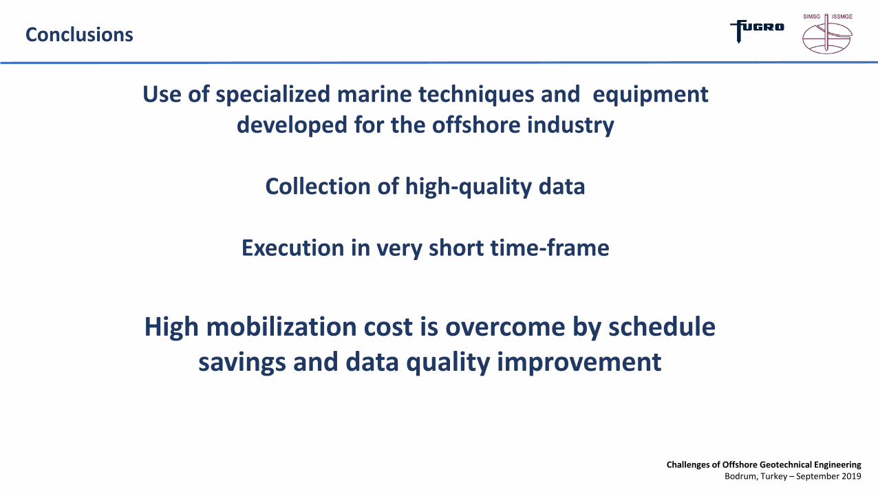
Conclusions
Use of specialized marine techniques and equipment developed for the offshore industry
Collection of high-quality data
Execution in very short time-frame
High mobilization cost is overcome by schedule savings and data quality improvement

Challenges of Offshore Geotechnical EngineeringBodrum, Turkey – September 2019
Thank You!Questions?