Embed Size (px)
Citation preview
The Texas Department of Transportation (TxDOT) is exploring and refining alternatives to address the continued growth facing the Houston area while balancing the needs of those that commute, live, and work in the nation’s fourth largest city. For more than 10 years, we have worked diligently to identify a recommended alternative to provide a safer I-45 North transportation corridor with additional capacity to meet current and future demand by incorporating transit opportunities, travel demand strategies, and flexible operations. Since 2011, we have held multiple rounds of public meetings to present options for the North Houston Highway Improvement Project (NHHIP) and get direct input on the most viable alternatives.
A public hearing held in May 2017 and online posting of documents provided opportunities to review and comment on the Recommended Alternative and Draft Environmental Impact Statement (EIS). More than 460 individuals made comments on the Draft EIS. Since the hearing, we have met with over 100 community groups, property owners, local elected officials and agencies, and other stakeholders to discuss concerns and take additional comments, all of which are being considered in the Final EIS documentation.
This newsletter discusses changes made to the schematic design of the project to incorporate public comments, as well as our efforts to minimize impacts and proposed measures to mitigate adverse impacts. Future newsletters will discuss additional subject areas where TxDOT has responded to community concerns.
CONTACT US
http://www.ih45northandmore.com
713-802-5076
TABLE OF CONTENTSProgress ......................1
Design Changes ...........2
Pedestrian/Bicyclist Improvements ..............3
Relocation Assistance ...................3
Noise ...........................4
Air Quality ....................4
Flooding .......................4
ISSUE 1 | SPRING 2019
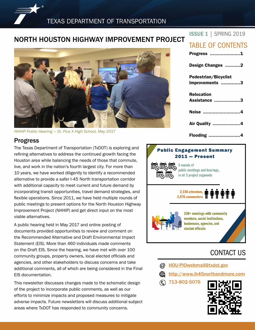
NHHIP Public Hearing — St. Pius X High School, May 2017
NORTH HOUSTON HIGHWAY IMPROVEMENT PROJECT
Progress
2
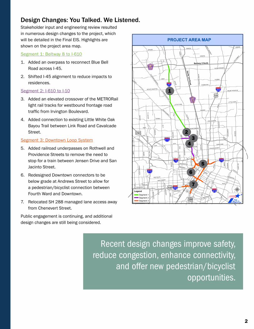
Design Changes: You Talked. We Listened.Stakeholder input and engineering review resulted in numerous design changes to the project, which will be detailed in the Final EIS. Highlights are shown on the project area map.
Segment 1: Beltway 8 to I-610
1. Added an overpass to reconnect Blue Bell Road across I-45.
2. Shifted I-45 alignment to reduce impacts to residences.
Segment 2: I-610 to I-10
3. Added an elevated crossover of the METRORail light rail tracks for westbound frontage road traffic from Irvington Boulevard.
4. Added connection to existing Little White Oak Bayou Trail between Link Road and Cavalcade Street.
Segment 3: Downtown Loop System
5. Added railroad underpasses on Rothwell and Providence Streets to remove the need to stop for a train between Jensen Drive and San Jacinto Street.
6. Redesigned Downtown connectors to be below grade at Andrews Street to allow for a pedestrian/bicyclist connection between Fourth Ward and Downtown.
7. Relocated SH 288 managed lane access away from Chenevert Street.
Public engagement is continuing, and additional design changes are still being considered.
Ib
K̈
%&j(
!"h$
?h
!"̀$
Hardy
Toll Road
!"h$
Beltway 8 North
Ib
!"̀$
LITTLE YORK
§̈¦¦69
§̈¦¦69BINZ
MO
NTR
OS
E
%&j(
TIDWELL
ANTO
INE
AIRLIN
E
YALE
LITTLE YORK
43RD
SHEP
HE
RD
34TH WAY
SID
E
PARKER
HIR
SCH
HO
ME
STE
AD
RICHMOND
RANKIN
11TH
CLINTON
FULTON
FANN
IN
POLK
WESTHEIMER
KIRB
Y
AL DIN
E W
ES
TF IEL D
MEMORIAL
SAN FELIPE
WEST
WESTPARK
LAUDER
CAVALCADE
ELGIN
ALDINE BENDER
WIR
T
MC
CA
RTY
ALDINE MAIL
HEMPSTEAD20TH
MARKET
LOC
KW
OO
D
E LYS
IAN
IRV
ING
TON
CROSSTIMBERS
18TH
DU
RH
AM
NAVIGATION
BISSONNET
MONTGOMERY
SCO
TT
T C JE
ST E
R
VETERANS MEM
ORIAL
WASHINGTON
TOMBALL
SPEARS
CH
IMN
EY R
OC
K
HE
IGH
T S
WALLISVILLE
MOUNT HOUSTON
CU
LLEN
OLD H
UMBLE
KRES
S
S ILBE
R
MA
NG
UM
MAI
N
LATH
RO
P
LONG POINT
JOHN F KENNEDY
WE
SLAYA
N
COLLINGSWORTH
KUYKENDAHL
GULFTON
LAURA KOPPE
POS
T OA
K GELLHORN
PATTON
HAMMERLY
FOU
NTA
IN V
IEW
GRIGGS
HO
US
TON
STUD
EW
OO
D
NE
WC
AS
TLE
HIDALGO
BUFFA
LO SP
EE
DW
AY
CRAW
FORD
STUEBNER AIRLINE
ATASCOCITA
MACGREGOR
PRAIRIE
KELLEY
RIC
E
HA
RD
Y
YAL E
RO
SS
LYN
MAIN
RANKIN
FULT
ON
HIR
SC
H
MOUNT HOUSTON
GREENS
ELL A
µLegendSegment 1Segment 2Segment 3
PROJECT AREA MAP
1
23
4
56
7
Recent design changes improve safety, reduce congestion, enhance connectivity,
and offer new pedestrian/bicyclist opportunities.
3
Through close coordination with local agencies and stakeholders, TxDOT has provided connections between existing and future trails, enhanced bridges across the freeway that support bicycle lanes and a pedestrian realm, and highway caps with potential for private investment.
• In joint work sessions about integrating the City of Houston Bike Plan into NHHIP’s schematic design, TxDOT and the city agreed that all 44 street crossings in Segment 3 would have a pedestrian realm. Ranging 12 to 17 feet in width, this feature includes a wide sidewalk, bicycle lane, and a buffer zone.
• To raise the freeway out of the 100-year flood elevations, the proposed I-45 freeway elevations over Little White Oak Bayou will be higher than the existing structure. This allows a future trail connection with a bridge to link Woodland and Moody Parks.
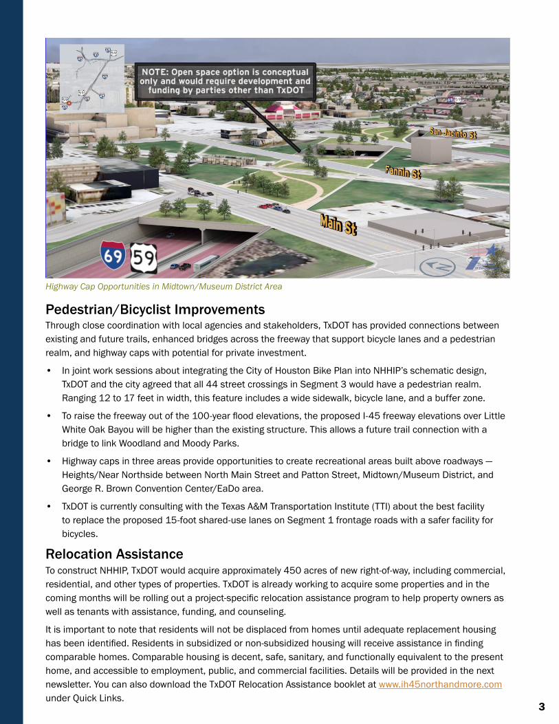
• Highway caps in three areas provide opportunities to create recreational areas built above roadways — Heights/Near Northside between North Main Street and Patton Street, Midtown/Museum District, and George R. Brown Convention Center/EaDo area.
• TxDOT is currently consulting with the Texas A&M Transportation Institute (TTI) about the best facility to replace the proposed 15-foot shared-use lanes on Segment 1 frontage roads with a safer facility for bicycles.
Relocation AssistanceTo construct NHHIP, TxDOT would acquire approximately 450 acres of new right-of-way, including commercial, residential, and other types of properties. TxDOT is already working to acquire some properties and in the coming months will be rolling out a project-specific relocation assistance program to help property owners as well as tenants with assistance, funding, and counseling.
It is important to note that residents will not be displaced from homes until adequate replacement housing has been identified. Residents in subsidized or non-subsidized housing will receive assistance in finding comparable homes. Comparable housing is decent, safe, sanitary, and functionally equivalent to the present home, and accessible to employment, public, and commercial facilities. Details will be provided in the next newsletter. You can also download the TxDOT Relocation Assistance booklet at www.ih45northandmore.com under Quick Links.
Pedestrian/Bicyclist Improvements
Highway Cap Opportunities in Midtown/Museum District Area
www.ih45northandmore.com 4
TxDOT has taken multiple steps to minimize impacts to noise-sensitive areas adjacent to the project. A noise analysis conducted for the proposed project resulted in a recommendation to build noise barriers of various lengths at 75 locations adjacent to single and multifamily residences, parks, churches, schools, and recreational areas.
Actual construction of noise barriers will depend on adjacent landowner approval and site-specific conditions. In other areas, TxDOT is proposing to build aesthetic walls to visually screen the roadway from adjacent properties and provide some noise reduction. Meetings will be held with adjacent property owners to determine if they want the barriers or walls built, and to solicit their input on the desired color and texture on the property owners’ side.
Pavement on the mainlanes and access roads associated with the project would be finished with vertical grooves that help absorb car tire noise. During construction, qualifying residences may be eligible for construction noise mitigation options, such as window air conditioning units, weather-stripping, storm window or door installation, and utility bill assistance.
NoiseTxDOT conducted two air quality studies. Air quality was modeled at five locations to establish a baseline to conduct a carbon monoxide (CO) traffic air quality analysis. Modeling to project future CO concentrations through the year 2040 indicated that concentrations are not expected to exceed national standards at any time along any segment of the project. A mobile source air toxics analysis of nine compounds identified by the EPA as cancer-risk drivers indicated that a decrease in these compounds can be expected through the year 2040, compared with 2018.
Air quality would be improved by the proposed project in part because of reduced congestion. NHHIP would help reduce congestion on 12 segments of the “Texas 100 Most Congested Roadways” reported by TTI. These 12 segments annually account for 39 million person-hours of delay, $788 million in congestion costs, and 11.9 million gallons of excess fuel used. The wasted fuel produces an estimated 120,209 tons of excess carbon dioxide.
NHHIP provides options to reduce single occupant vehicle driving — four Managed Express Lanes for use by transit vehicles, buses, car pools, and future autonomous vehicles, as well as improved pedestrian and bicyclist facilities. This is another way in which the project contributes to reduced congestion and improved air quality.
Air Quality
Heavy rains the past few years have highlighted the massive damage and loss of life that can occur in Houston from flooding. Using recorded rainfall and flood data from three major floods — Memorial Day (2015), Tax Day (2016), and Hurricane Harvey (2017) — the NHHIP drainage study developed a flood model to assist in the design of roadway and bridge elevations along with the storm water drainage system. The study found that base flood elevations are much higher than the current FEMA Flood Insurance Rate Maps.
TxDOT is committed to designing drainage structures that meet or exceed water volumes associated with Houston’s recent flood events. Backup pumps will be included in the system in case of primary pump failure. Berms or walls will be built around depressed roadway sections to prevent flowing water from overtopping into those areas. Coordination with Harris County Flood Control District and the City of Houston to neutralize any flood elevation rise is ongoing. The crossings over Little White Oak Bayou would be wider to accommodate water flow as well as pedestrians and bicyclists.
Flooding