Embed Size (px)
Citation preview

ISSUE 13
Planetek Hellas 10 years in Space
Earth Observation:Free and Open Satellite DataRheticus®: continuous monitoring of the Earth changesSupporting EU and local directives in coastal areasForest fires monitoring and prevention from SpaceSoil sealing satellite detection services
Interoperability & SDI:Spatial Data Infrastructures on the CloudThe European INSPIRE GeoportalLinked open geographic data for enhanced SDI
Security & Defence:How we do prevent environmental crimesIncreasing targeting accuracy with 3D coordinates
Space:Space systems for EO and Cosmic exploration missionsPlanck Added Value InterfacesSatellite ground segment

Copernicus is a European program for
monitoring the Earth.
Collecting data from multiple
sources, Copernicus
provides users with reliable
and up-to-date information
through a set of services related to environmental
and security issues.
The main users of Copernicus services are
policymakers and public authorities
who need the information to develop
environmental legislation and
policies or to take critical decisions.

Giovanni Sylos LabiniCEO of Planetek Italia
The advent of Space Stream
It is a special pleasure for me to intro-duce this new exciting number of our GeoXperience Magazine. The capabilities of Planetek Group are declining the new paradigm of Space in all their instances, from the up stream to the down stream, from geoinforma-tion to geoanalytics in a very impressi-ve way. Planetek has a visionary approach to space and we have, in the last few ye-ars, aggressively pursued it. First of all, Copernicus Sentinels are
providing for the first time a continuous stream of data, free and open, with an horizon of availability that exceed 30 years. Finally, 20 years of maste-ring EO application found adequate fuel for new exceptional application. Our cloud based Info as a Service geoanalytics delivery platform Rheti-cus®, not by chance named upon the only pu-pil of Copernicus, delivers every two weeks new performances to our customers, thanks to our Agile and Dev-ops software approach. The Rhe-ticus® Displacement services, developed in co-operation with our spin-off with Bari University GAP srl, is a best seller around the world, beside enthusiastic national commercial user like Metro-politane Milanesi, we reached several distribution agreements worldwide.
Our Greek sister company Planetek Hellas is ten years old, and it is a pretty mature and active te-enager. In this number you will find several achie-vements of PKH, that I let you discover. Planetek Italia is also perfectly tuned with Hexa-gon Geospatial, and we share our friend’s stra-tegy on software as a service that materializes in the new Cloud paradigm and Smart M.Apps. In this issue, you will find some very cute cases of use of this very powerful set of tools that will change the way in which geodata will be acqui-red, processed and presented for a brand new user experience. Who of you follows us since sometimes, knows that Planetek is fast moving up-stream on the Space value chain. In the following pages, you will be surprised of the number of achieve-ments from ground data processing, to on-board data analysis our Group of-fers nowdays. As per the title of this editorial, in Pla-netek, separation between Up Stream and Down Stream has definitively come to an end, delivering an marvelous, continuous SPACESTREAM.

4geoxperience | issue 13 www.planetek.it
Summary
16Forest fires monitoring and prevention from Space
18Supporting EU and local directives in coastal areas
20Soil sealing satellite detection services
22 Protecting nature from Space
OPEN GOVERNMENT
ENVIRONMENT
CIVIL PROTECTION
AGRICULTURE AND FORESTS
INFOMOBILITY
INFRASTRUCTURES ENGINEERING
TOURISM AND TERRITORIAL
MARKETING
ENERGY AND UTILITIES
SECURITY AND DEFENCE
SPACE SOFTWARE
PLANETARY EXPLORATION
LAND PLANNING
SEA AND COASTAL AREAS
APPLICATIONS08 Planetek Hellas 10 years in Space
10 Free and Open Satellite Data
12Rheticus®: continuous monitoring of the Earth changes
14Striving for excellence in EO services

5issue 13 | geoxperiencewww.planetek.it
24How we do prevent environmental crimes
26 Geospatial Products and solutionsFocus on Hexagon Geospatial portfolio and solutions developed by Planetek.
27 Spatial Data Infrastructures on the Cloud
28The European INSPIRE Geoportal
30Linked open geographic data for enhanced SDI
32Increasing targeting information accuracy with 3D coordinates
34Improving Civil and Construction Workflows with EO data
36Space systems for EO and Cosmic exploration missions
38Satellite Ground Segment
42Planetek: Simplifying the use of geo-localized information
Planetek Italia s.r.l. Via Massaua, 12 - I-70132 Bari,
Italy. Ref: pkm002-587-13.0 - Free copy
This document is under Creative
Commons licence, available on
http://creativecommons.org/
licenses/by-nd/4.0
Trademarks and logos are the registered trademarks
of respective owners organizations.
Images Credits:
p.01, p.10, p.16, Copernicus Sentinel data / ESA;
p.02, p.08, p.11, p.37, p.40 ESA; p.03 ESA/C-
WAMS (left); Copernicus Sentinel data / ESA (center);
ESA (right); p.04 Sentinel-1_over_Italy.jpg (ESA /
DLR);Lockheed Martin Corporation; p.05 Terra Bella;
p.07, p.32 Airbus Defence and Space; p.14 Agenzia
Spaziale Italiana; p.15 Copernicus data (2014)/ESA/
PPO.labs/Norut/COMET-SEOM Insarap study; p.17
Coastal TEP / ESA; p.18 REUTERS / Max Whittaker;
p.21 ESA / AOES (top); EEA (bottom); p.22 Cornell
University; p.23 Unica.it / Flowered EU H2020; p.24
campaniasuweb.it; p.25 (center) U.N.; (bottom) ISAF;
p.26 Hexagon Geospatial; p.30 DigitalGlobe (top); Anja
Jentzsch (bottom); p 31 Eric Fischer; p.33 e-Geos
(bottom right), Armasuisse (center), Rhode Island
National Guard (top), Hexagon Geospatial (bottom left);
p.35 Nearmap; p.36 NASA, ESA, Hubble Heritage;
p.39 ESA / D. Ducros; p.41 ESA / ATG Medialab; p.43
EUMETSAT; p.44 ESA (right top and bottom images);
Gracieusetè (left bottom image); p.46 NASA/GSFC
Printed by Grafisystem
Concept and layout CaruccieChiurazzi

6geoxperience 11 / EN
Contributors
PAG. 8/24Stelios Bollanos
Director. Part of the Planetek Group Since 2004. In 2005,
he returned from Italy to Greece and co-founded Planetek Hellas. Since
then, he managed different EU and ESA projects for the company in the Earth
observation and Geomatics fields. He has matured
experience in the Greek and International Space Markets.
PAG. 20Valentina Urbano
Government & Security SBU - Business Development
Specialist.Degree in Forestry Sciences.
She is specialized in GIS and Remote Sensing for
the evaluation of territorial and infrastructural systems.
Since 2009 she works in Planetek Italia in charge of
the business development on the government market.
PAG. 14Daniela Iasillo
Sr. Technical Manager Geoservices.
Physics Degree, since 1997 she works for Planetek Italia.
She has been involved in many projects for sea water
quality monitoring, forest protection, land use mapping
and risk mitigation.
PAG. 12/34Andrea Navarra
Business to Business SBU - Sr. Business Development Specialist. Degree in Political
Science, specialized in E-Business Management. In Planetek Italia since 2003, he
is in charge of commercial consultancy for EO solutions
dedicated to private organizations of Infrastructures Engineering, Energy and Oil &
Gas industries.
PAG. 18/22Vicky Avgikou
Sr. Technical Specialist - EO Analyst. Since 2013, she is
EO data processing operator at Planetek Hellas. Degree in Forestry Sciences, M.Sc. in Applied Geography and
Area Management. She has wide experience in GIS and Spatial Statistics, Remote Sensing, Management of Environmental Resources, Planning & Management.
PAG. 10Daniela Valentino
Government & Security SBU - Technical Assistant.
Degree in Computer Science and Digital Communication, specialized in Geographic Information Systems. In
Planetek Italia since 2005, she is a Pre-Sales Technical Assistant for geospatial data.
She is point of contact in Planetek for the international
satellite data providers.
PAG. 27/28Mauro Casaburi
Government & Security SBU - Technical Manager Spatial Data Infrastructures. Degree
in Electronic Engineering. Since 2002, he works for
Planetek Italia in the design and development of systems
for SDI on the Web and several regional and national GeoPortals. He is author of
several publications.
PAG. 16Giulio Ceriola
Sr. Technical Specialist Geoservices.
Degree in Physics, he is author of several published
papers related to processing techniques of satellite derived data. In Planetek Italia since 2006, he has been involved
in several European EO projects for the monitoring of sea water quality, land use
mapping and risk mitigation.

7geoxperience11 / EN
PAG. 41Ilias Ioannou
Technical Specialist - Software Developer.
MSc degree in Computer Engineering. He is a member of Planetek since 2013, and has been involved in design and development of projects concerning the management
of geospatial data for environmental monitoring and
emergencies.
PAG.30Marco Fago
Government & Security SBU – Technical Manager
System Engineering. Degree in Electronic Engineering, PhD in
Information Engineering.Since 2013 in Planetek Italia,
as Project Manager he is involved in the design and
development of systems for SDI on the Web and regional
and national GeoPortals, focusing on Linked Open Data.
PAG. 36Daniela Drimaco
SpaceStream SBU – Business Development Specialist.
Degree in Telecommunication Engineering, she is specialized
in the field of satellite Earth Observation data processing.
Since 2007, she works in Planetek Italia involved in the design and development of
systems and softwares for the Space Systems domain.
PAG. 40Leonardo Amoruso
SpaceStream SBU –Technical Manager.Degree in Electronic
Engineering, he is specialized in the field of satellite Earth
Observation data processing (SAR & optical).
Since 2009 he works in Planetek Italia involved in the design and development of systems and softwares for
the Space Systems domain.
PAG. 39Stratos Gerakakis
Senior Software Engineer and Project Manager.
Bachelors in Computer science and Mathematics. He has been involved in a
wide variety of projects for the implementation of web based and back-end server solutions, with many years of experience
producing well structured code and managing teams of
developers.
PAG. 32Claudio La Mantia
Technical Manager Geoservices. Since 2002, he works in Planetek Italia and matured a vast experience with optical high resolution image processing involved in several international and
national projects.In the Earth Observation application field he is also
author of many works.

8geoxperience | issue 13 www.planetek.it
Planetek Hellas10 years in SpaceThe decision of Greece to
invest in Space and join the European Space
Agency (ESA) in 2005, was the starting point of Planetek Hellas, which since the following year, has been operating in the field of Satellite Earth Observation, Spatial Data Infrastructure and software development for “on-board” and “on ground” Space applications.The expertise of Planetek Hellas in these 10 years of operations has been gathered from a variety of activities implemented, mainly, in seven different projects for the European Space Research Institute of ESA (ESRIN) and in seven Space projects funded by the European Commission through FP7 & HORIZON 2020. Planetek Hellas
is also working for the European Space Astronomy Centre of ESA in Madrid, Spain, for which has already completed one big project and is involved in big projects like the Planck Value Adding Interfaces system (PLAAVI).The know-how of Planetek Hellas and its participation to the above projects has led to the formalization of specific products / services derived from satellite Earth
observation such as, Near Real Time Sea Water Quality Monitoring, Seabed and Sea Grass Mapping, Critical Infrastructure Monitoring (Oil and Gas / Road / Railway networks), Urban dynamics, Wildfire monitoring and others.This know-how, combined with the technological evolution of nowadays, the global trends of Earth observation and the vision for the future of the Planetek Group

9issue 13 | geoxperiencewww.planetek.it
has given birth to Rheticus®, which is now the “locomotive” of Planetek Hellas towards the global market.At the same time in Planetek Hellas we count always to our institutional costumers, which come from a variety of organizations in both private and public sector, for which we work hard to provide customized solution in the framework of bigger projects. We have done this for the Region of Epirus, for the Decentralized Administration of Corfu and the Hellenic General Secretariat for Research and Technology.Through these years of operation, we worked in close collaboration with all the stakeholders of
the Space sector in Greece, both in the industry and in the academic sector. We were founding members of the Space industries cluster and one of the first members of the Hellenic Association of Space Companies. In Planetek Hellas, we are confident that, despite the difficulties of our times, we will continue our successful operations from Greece, offering to our national and global costumers state-of-the-art satellite data exploitation services and real life problem solutions.
Planetek Hellas website:
www.planetek.gr
In the Copernicus Training and Information Session that was held in Athens on October 7, 2016 at the premises of the National Hellenic Research Foundation (N.H.R.F), Planetek Hellas presented the usefulness of Satellite Earth Observation in monitoring the Coastal Environment. All the material of the event (video and presentations) can be downloaded here http://workshop.copernicus.eu/greece-infosession/material
Copernicus Training and Information Session

10geoxperience | issue 13 www.planetek.it
Free and open satellite data
Today, Landsat 8 consistently acquires high quality pictures over the entire globe. The free and open data policy is confirmed for Landsat 9, to be launched in 3 years.Copernicus, the European E.O. program, is much more ambitious than the Landsat initiative. Rather than a single satellite, Copernicus comes with several, to be launched over many years: the Sentinels. This is the name of the new family of satellite missions designed specifically for the operational needs of the Copernicus program. Each Sentinel mission is based on a constellation of two satellites to fulfil revisit and coverage requirements, and the different missions carry a range of technologies, such as radar and multi-spectral imaging instruments for land, ocean and atmospheric monitoring. In addition to data from the
Open data usually refers to information the public sector makes
(or should make) available to ensure transparency and create business opportunities. A long-standing problem for users is the lack of harmonisation and integration of databases. This is an issue with geographical data too; an obstacle that the standardisation process of INSPIRE is slowly trying to solve.Non-commercial satellite images are the exception. Freely accessible and reusable, they have the characteristics that any data analyst dreams of: Earth observation data is usually available in standard formats, no matter the area covered. It is frequently updated, of great quality and a reliable source of information: the best conditions to build a sustainable business.Just as the EC was discussing
licensing conditions for Copernicus, a 2012 ESA study showed that an open access government policy for satellite data is beneficial in the medium to long term.
We are talking
about environmental
benefits, but also
economic
i.e. an estimated 30 billion market and tens of thousands of new jobs by 2030.The Americans did it first, it must be said. The breakthrough arrived in 2008, when the US Geological Survey (USGS) decided to open its archive of Landsat satellite images collected over forty years.

11issue 13 | geoxperiencewww.planetek.it
Copernicus is the European program for the collection of environmental information through Earth Observation (EO) data. This program, previously named GMES (Global Monitoring for Environment and Security) aims at providing information to EU Member States on the status of the environment, by integrating different data sources such as EO and in situ data.Six are the main themes covered by the Copernicus Programme: land, water, atmosphere, climate change, emergency and security. For each theme, many applications have been analyzed, including territorial planning, agriculture, forestry, health, transport, protected areas, civil protection, and marine and coastal zones, among the others.Copernicus users are the public authorities and planners who address laws for environmental protection and who act in case of emergency, but also private citizens, businesses
and industries can benefit from the results of the program.The European Commission coordinates the Copernicus program. The European Space Agency is responsible for the infrastructure for the space component and the European Environmental Agency, with the cooperation of the European Member States, is responsible of the in situ component. Planetek Group operates mainly in the development and integration of Earth Observation data processing chains, designed for the supply and distribution of user solutions derived from optical and radar satellite data. Planetek has also a great expertise in developing large-scale Spatial Data Infrastructures for managing multi-source data and user segment elements.
Resources:
www.copernicus.eu
Copernicus, the European Earth monitoring program
Sentinels, the Copernicus program delivers the so-called Core Services, that is, value-added geo-information products, or thematic maps on soils, seas, atmosphere, climate change, emergency management and security. The European Environment Agency, for instance, manages such a service: land.copernicus.eu. The output of the Core Services is generally available as open data too.The major opportunity and challenge of Copernicus is to generate enough interest in the development of useful, affordable downstream services beyond current capacities, services geared to meet demand.With the caveat that such services should exploit, not only satellite data, but also information and other data available, such as all the data published by governments, local authorities, private companies and even by individuals - just think of OpenStreetMap, the free and openly licensed map of the world created entirely by volunteers.The free and open data distribution policy of Copernicus aims to promote the full adoption of Earth observation technologies from Europe, in order to obtain environmental benefits, but also economic effects. This involves a perspective of sustainability for the space market in the next 34 years, which is the rationale behind the huge investments of Planetek in this area.
Euronews video
“Copernicus: down-to-Earth opportunities for
SMEs reaching for the stars”
https://goo.gl/gLg4rS
Eurisy article
“Free and open satellite data”
https://goo.gl/3cpqMh

12geoxperience | issue 13 www.planetek.it
Towards automatic, user-defined updated knowledge of the territory for continuous monitoring of the Earth changes
Rheticus®
continuous delivery of information and analytics.Rheticus® is a cloud-based data and services hub able to deliver Earth Observation added-value products through automatic complex processes and, if appropriate, a minimum interaction with human beings.Rheticus® provides timely information that fits the needs of a growing number of business applications. The information is provided as a service and includes maps, reports and geospatial indexes, designed to monitoring several phenomena.Territorial changes, urban dynamics
Decision-making processes needs today more and more fast, updated, user defined and interoperable spatial information, in order to make quick and aware decisions. Earth observation has become over the years a fundamental basis for decision-making in several areas, such as environmental protection, land use, disaster management or sustainable development. More and more, huge information is collected from multiple data sources and is also free available to anyone as open data, such as the data of Copernicus Sentinels satellites, which the European Commission
made available in open data mode. The Sentinels are of 6 different types. The Sentinels 1, 2 and 3 are already in orbit and are providing images of the whole globe with a frequency of 6 days, if we consider the two Sentinel-1 satellites.These frequently updated, reliable and of great quality source of information are today a great opportunity to offer value added products and services to finals users.This is what Planetek Italia made by developing Rheticus®, its new cloud based geospatial information platform, switching from the data provision model, to the geospatial

13issue 13 | geoxperiencewww.planetek.it
summary information and user friendly analysis tools, which open users to a complete set of information over the phenomena.Rheticus® guarantees always the best quality-price ratio available on the market, thanks to the use of
open data, automatic processing procedures and its cloud based architecture.
Resources:
www.planetek.it/eng/rheticus
The distribution of Rheticus® services is global. Thanks to our valued Authorized Distributors, you will be able to ask information and receive assistance anywhere near your region.
and land use changes, ground displacements, landslides and infrastructures stability, new infrastructure and construction areas, wildfire burned areas or coastal sea waters quality.Accessing directly to open data images (i.e. Copernicus Sentinel, Landsat 8 satellites), cartographic data and environmental information, Rheticus® provides timely information over the chosen area. Depending on the application, the service is provided on a monthly, up to a daily base.Subscribed users can access the information from multiple devices, such as personal computers, tablets & smartphones. Once logged in, users access to a personal area which consist of a dashboard designed to display
Authorized Distributors
Authorized Distributor Geographic Area
GeoSolutions Consulting Inc. Central America
International Integrated Environmental Services Ltd. Kuwait
The Wroclaw Institute Poland
Gjeo-Vjosa sh.p.k. Albania
Kaliopa d.o.o. Slovenia
Monitoring the evolution of our Earth
www.rheticus.eu
Rheticus® DisplacementA geoinformation service designed specifically to detect and report earth’s surface movements, aimed at monitoring areas subject to landslides and subsidence, and the stability of infrastructures, as buildings, roads and railways.
Rheticus® MarineA geoinformation service designed for the monitoring of coastal seawaters quality, in order to meet the environmental reporting requirements of local governments in compliance with the EU Directive on “Marine Strategy”.
Rheticus® WildfireA geoinformation service designed to support burned area monitoring, through burned area mapping and detection of illegal land use changes.
Rheticus® UrbanDynamicsA geoinformation service designed to support monitoring and reporting land use changes, soil loss and infrastructures development, to support decision makers in territorial planning and infrastructures building.
Rheticus®
Services

14geoxperience | issue 13 www.planetek.it
Striving for excellence in Earth observation servicesThe Copernicus program is today at a cornerstone.The Sentinel satellites are being deployed. Their images, associated with Third Party missions’ data are being used for delivering Copernicus core services results (at global, European, and regional levels).The European entities (EEA, ECMWF, EMSA , etc.) and the scientific community are starting to use operationally these data and the results for a better knowledge and understanding of the key land-cover stakes and environmental monitoring.Nevertheless, the regional actors who are responsible for managing (at least partially) land-cover and natural resources policies have still difficulties to get access to these data and information, and moreover
are not in position to combine them with their existing geo-information systems.A group of five SMEs (TerraNIS, Spacebel, Planetek, Terraspatium and Sertit), supported by a consulting firm specialized in Space market innovation and organization (Cap High Tech), is proposing to provide the regional institutional and commercial users with operational information services. These services will take the highest benefit from Copernicus outputs, for territory monitoring and management.These SMEs have decided to put in common their complementary skills and products, in the frame of a dedicated association (called EUGENIUS). They will implement “regional hubs” (Geo-information platforms) building the first instance
of the “EUGENIUS network”.These regional hubs shall deliver services in the following domains:• Urbanization monitoring and
management (densification, preservation of rural and “green” areas, transportation means, etc.)
• Agriculture areas and activities (crop monitoring, crop identification and classification, potential yield assessment, water resources and irrigation, etc.)
• Forest monitoring (surfaces, trees species classification, exploitation status, etc.)
• assessing and monitoring some natural risks at regional levels (flooding, landslides and water quality)
The Eugenius project (European

15issue 13 | geoxperiencewww.planetek.it
Group of Enterprises for a Network of Information using Space) aims at creating a network of SMEs distributed across the different European regions in order to deliver geo-information services in the regions where they are located.The overall objective of Eugenius project is:• To develop a viable market
based on EO services for different thematic domains linked to territories management (Urbanization, Agriculture, Forestry, etc.) in several European regions
• To build up a network of replicable and generic processing and archiving platforms to ensure regular access to the Copernicus data and core services results, and able to support collaborative actions among them
• To push for making applicative tools able to generate “industrialized” end products
Resources:
http://cordis.europa.eu/project/rcn/206009_
en.html
FAST4MAP is a project funded by ASI aimed at establishing a geospatial service for landslides and floods monitoring based on SAR data. This service uses mainly Sentinel 1A/B products for continuous monitoring of areas at high risk of landslides or flooding, using COSMO-SkyMed (CSK) data (and simulated COSMO-SkyMed Second Generation (CSG) data or real if available) at higher resolution for event based analysis (danger situation or alert prediction) by accessing the modality of planning and acquisition in emergency situations as provided for CSK mission.
This service is based on capability to measure displacement from SAR interferometric data. In particular, the techniques Multi-Temporal InSAR (MTI) allow to accurately measure millimetric soil displacements in correspondence of those targets on the ground (PS - Persistent Scatters and DS - Distributed Scatters) that have a high temporal coherence radar. The processing chain provides integration between PS and DS techniques (integration of Spinua-PS and DARIS-DS techniques) and will exploit mainly Interferometric Wide Swath data provided by Sentinel 1 mission and Stripmap, Spotlight data provided by Cosmo-SkyMed.
The MTI techniques are based on complex algorithms, whose configuration and execution
are typically offloaded to expert operators, who can recognize and also manage abnormal situations due to particular noise conditions or in the presence of artefacts. In case of FAST4MAP, the processing chain SPINUA-DARIS is fully automatic.
Moreover, to speed up the processing, very heavy from the computational point of view, some processing algorithms exploit massive parallelism of GPU; therefore some code running on standard HW architecture CPU based, is re-written by kernels running on GPUs and considering a hybrid architecture host-device.
This allows a compact architecture that can be easily moved in proximity of the data and with a best speed ratio than more traditional computing server.
FAST4MAPFast & Advanced SAR Techniques for Monitoring & Alerting Processes
GPU4EO challenge is an international competition among researchers, held in 2015, which aimed at improving the performance of a processing software of remotely sensed data using the processing capacity of the GPU (graphics processing unit).
Resources:
www.planetek.it/eng/gpu4eo

16geoxperience | issue 13 www.planetek.it
Supporting EU and local directives in coastal areas Monitoring of Water
Quality (WQ) in coastal areas is of
concern to many human activities in terms of economic benefits, or impact on the marine ecosystem. The European Union issued the Water Framework Directive (WFD) and the Marine Strategy Framework Directive (MSFD) to foster the correct management and monitoring of coastal waters and nearby open sea. In most cases the Member States implemented such directives into their respective National legislation by appointing a central institute for coordination and reporting to EU and by assigning the monitoring to local environmental authorities/agencies. Italy is an example of that, where the measurement of the WQ parameters is demanded to regional authorities (ARPA), which perform regular sampling campaigns at sea, and are coordinated at national level by a central institute (ISPRA) appointed by the Environment Ministry. Such practices, however, are expensive and the frequency and the area covered by the campaigns are limited and need to be integrated by other means.
WQ measurements from Earth Observation (EO) is a common practices based on past (ENVISAT), present (AQUA, TERRA, VIIRS) and recent (Sentinel-3) missions, but up to now they lack in spatial details (ranging between 300m and 1km) and accuracy in the proximity of the shoreline, which prevents them to be a concrete support for coastal areas monitoring. Planetek set up an operational service, intended as continuous access for the user to information, such as accurate and spatially enhanced WQ measurements (chlorophyll, water transparency and turbidity), as response to the need of local authorities to monitor and provide reporting in accordance to the above mentioned directives. The service - experimented in the context of the Integrated Coastal Water Management for Mediterranean (ICWM for MED) project, funded by ESA under the ARETS 20 Integrated Application Programme – relies on Rheticus®, the Planetek’s cloud-based data and services hub, designed to deliver products through complex automatic processes which integrate EO data, real time in situ measurements and
other local information. This service is now part of the Planetek offer and is called Rheticus® Marine. Among the first customers, there is the Province of Thesprotia (Region of Epirus, Greece), which, through the SAIMON project, part of the “GREECE-ALBANIA IPA Cross Border Programme 2007-2013”, aims to establish a Near Real Time and continuous satellite monitoring network for the eutrophication risk over the total eligible marine area of interest for the program. The information will be available via the internet to the citizens, the scientific community and the responsible authorities. The evolution of the service is being implemented in the context of the ESA Coastal Thematic Exploitation Platform (C-TEP) project, where the interaction of Rheticus® (child C-TEP) with the central C-TEP processing node (mother C-TEP) brings to a further extension of the overall service capabilities following the Big Data paradigm.
Resources:
www.planetek.it/eng/sea_coastal_monitoring
17issue 13 | geoxperiencewww.planetek.it
SAIMON (SAtellIte Near Real Time MOnitoring Network of the Eutrophication Risk) is a Near Real Time and continuous satellite monitoring network for costal waters of the province Thesprotia (Region of Epirus, Greece). It established a service for monitoring the eutrophication risk over the total eligible marine area of province of Thesprotia, which is available via the internet to the citizens, the scientific community and the responsible authorities. For the needs of the project, on site data collection is
planned, so as to come up with clear proposed indications for actions, towards the responsible authorities, in a way that will permit to better address the common problem of the eutrophication risk in the marine areas. The costumer of Planetek Hellas was the Water Directorate Epirus of the Decentralized Administration of Epirus & Western Macedonia. The Water Directorate implemented the service in the framework of an collaboration project funded by the INTERREG Greece-Albania Cooperation Program. SAIMON aims to establish
collaboration at a high level between the two countries and lead the bilateral relations towards finding solutions for common problems, by implementing a coordinated environmental protection action targeted to the eutrophication risk. On the same hand, the outputs of the project will help the partners from the Greek side to comply better with the EC relevant directives on Waters and Marine Strategy.
Resources:
www.saimon-project.eu
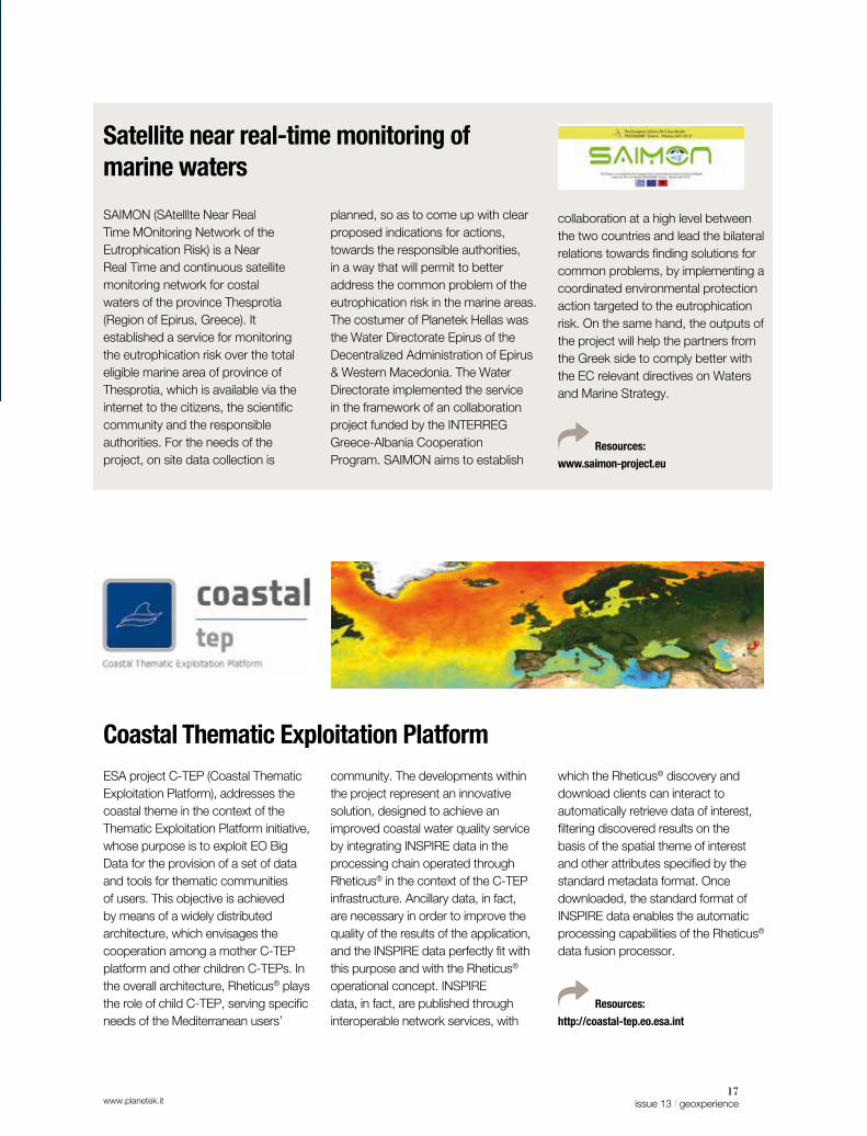
ESA project C-TEP (Coastal Thematic Exploitation Platform), addresses the coastal theme in the context of the Thematic Exploitation Platform initiative, whose purpose is to exploit EO Big Data for the provision of a set of data and tools for thematic communities of users. This objective is achieved by means of a widely distributed architecture, which envisages the cooperation among a mother C-TEP platform and other children C-TEPs. In the overall architecture, Rheticus® plays the role of child C-TEP, serving specific needs of the Mediterranean users’
community. The developments within the project represent an innovative solution, designed to achieve an improved coastal water quality service by integrating INSPIRE data in the processing chain operated through Rheticus® in the context of the C-TEP infrastructure. Ancillary data, in fact, are necessary in order to improve the quality of the results of the application, and the INSPIRE data perfectly fit with this purpose and with the Rheticus® operational concept. INSPIRE data, in fact, are published through interoperable network services, with
which the Rheticus® discovery and download clients can interact to automatically retrieve data of interest, filtering discovered results on the basis of the spatial theme of interest and other attributes specified by the standard metadata format. Once downloaded, the standard format of INSPIRE data enables the automatic processing capabilities of the Rheticus® data fusion processor.
Resources:
http://coastal-tep.eo.esa.int
Satellite near real-time monitoring of marine waters
Coastal Thematic Exploitation Platform
18geoxperience | issue 13 www.planetek.it
Forest fires monitoring and prevention from Space
parameters, which describe the dryness state of the atmosphere and of the biomass based on climatic time series. The regular satellite observation products from the new system of meteorological satellites of EUMETSAT will ensure the continuous enrichment of the national database. HOLISTICReducing the number and the impact of forest fires, protecting people, natural environment and properties, and promoting fire prevention among rural communities in Adriatic regions: these are the purposes of the Holistic projects, realized by Planetek Hellas for the Decentralised Administration of Peloponnese, Western Greece & Ionian with the support of Region of Ionian Islands. Furthermore, the project provides
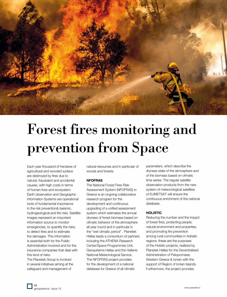
Each year thousand of hectares of agricultural and wooded surface are destroyed by fires due to natural, fraudulent and accidental causes, with high costs in terms of human lives and ecosystem. Earth observation and Geographic Information Systems are operational tools of fundamental importance in the risk prevention& (seismic, hydrogeological and fire risk). Satellite images represent an important information source to monitor emergencies, to quantify the risks, to detect fires and to estimate the damages. This information is essential both for the Public Administration involved and for the insurance companies that deal with this kind of risks.The Planetek Group is involved in several initiatives aiming at the safeguard and management of
natural resources and in particular of woods and forests.
NFOFRASThe National Forest Fires Risk Assessment System (NFOFRAS) in Greece is an ongoing collaborative research program for the development and continuous upgrading of a unified assessment system which estimates the annual dryness of forest biomass based on climatic behavior of the atmosphere all year round and in particular in the “wet climatic period” . Planetek Hellas leads a consortium of partners including the ATHENA Research Center/Space Programmes Unit, Geosystems Hellas and the Hellenic National Meteorological Service.The NFOFRAS project provides for the development of a national database for Greece of all climate

19issue 13 | geoxperiencewww.planetek.it
actions related to earthquakes risk aimed at establishing a permanent instrument for preventing, controlling and managing strategic public buildings from earthquakes’ damage risk. The general strategic objective is the prevention and mitigation of the natural risks, with special focus on wildfire risks, through the improvement, promotion and strengthening of institutional capabilities in implementing policies, procedures and coordination mechanisms aiming at reducing the causes of potential start of natural breakdown as well as at improving the prevention and mitigation activity.Forest fires represent a constant threat to ecological systems, infrastructure, economy and human lives. It is then necessary to undertake joint actions towards the increase in the level of protection against forest fires. The Holistic approach to forest fire prevention is based on two topics, trying to integrate advanced forest fire
protection and prevision measures, economic use of biomass, tourism and recreation, based on advanced forest fire monitoring system conceived of a network of automatic video surveillance and meteorological monitoring stations, supported by advanced regional systems for micro-location forest fire risk indices calculation and simulation of forest fire propagation and behaviour.Organised system for collection of forest looping after forest fire thinning and clearing, its cutting and finally its use as a commercial biomass fuel in communal district heating and cogeneration plants, or in individual heating system of public buildings. Furthermore, it includes the systematic clearance of forest corridors as not only easy access routes for firefighters, but also as routes for sport, recreation and
village eco-tourism.Benefits of Holistic Forest Fire Protection model are in all forest fire stages: Before Fire, During Fire and After Fire.Strategic buildings’ Earthquake risk assessment, prevention and monitoring aims to establish instruments for monitoring Strategic Public Buildings (SPBs) (D.G.R. n. 438), from earthquakes’ damage risks and develop joint proposals for legislative and institutional regulations for SPBs’ protection, based on the “protection of SPBs from earthquake’s risks”.The action focuses on the monitoring of changes in SPBs’ vulnerability over a defined time period, due to the natural degradation of material properties and cumulative damage from continuous low-level seismic activity in the two areas.
Resources:
www.planetek.gr/holistic
Need to identify the areas affected by
forest fires in a simple and automatic
way? By exploiting the free and open
Sentinel-2 and Landsat-8 satellite images,
IMAGINE Fire Mapper makes the burnt
area mapping quick and easy.
Developed using the geoprocessing tools
of the Hexagon Geospatial software suite,
IMAGINE Fire Mapper can be easily used
even by operators without experience in
remote sensing. Simply choose the two
satellite images of the area of interest
(before and after the fire event), then just
click the button to launch the automated
workflow, and finally save the shapefile of
the burned areas.
The tool, also available on-line as a
Hexagon Smart M.App, allows monitoring
the burnt areas over time by providing
relevant information about the state of
vegetation and the appearance of new
constructions or substantial changes in
areas affected
by fire, by means
of an automatic
change detection
features.
The automated procedure for the
delimitation of the areas covered by
IMAGINE Fire Mapper is implemented
using the modeling tools and
geoprocessing made available by the
Hexagon Geospatial Spatial Modeler, with
automated workflows.
Risorse:
www.planetek.it/imagine_fire_mapper
Fire Mapper: satellite burned area detection

www.planetek.it
Soil sealing satellite detection services
the Imperviousness and forest map in Southern Europe, for a total of 1.202.046 square kilometers, of 11 nations: Albania, Bosnia and Herzegovina, Croatia, Cyprus, Greece, Italy, Kosovo, Montenegro, Malta, Portugal (incl. the Azores and Madeira), Spain (incl. Baleares and Canaries).In 2014, ISPRA was in charge for the thematic and geometric
The European Environment Agency (EEA) describes soil sealing as the covering of the soil surface with materials like concrete and stone, as a result of new buildings, roads, parking places but also other public and private space. The main drivers for soil sealing are related to urban sprawl and transport infrastructure, which occur as a result of increasing populations. Depending on its degree, soil sealing reduces or most likely completely prevents natural soil functions and ecosystem services on the area concerned.Impervious areas (covering the ground with an artificial, impermeable material) is one of the main causes of soil degradation in the EU.The study and monitoring of soil sealing is extremely important in order to understand the irreversible loss of the ecological functions of soil and to mitigate its effects. According to the Italian National Institute for Environmental Protection and Research (ISPRA) research
recently published, regarding the soil sealing in Italy, more than 4 square meters of soil per second are lost in Italy as a result of soil sealing.At European level, the EEA has started since 2006 the mapping of sealed areas for the whole of European territory, covering an area of over 5.8 million square kilometers with the help of satellite data, within the Copernicus programme. The resulting product is the raster dataset of built-up areas and not, including the degree of soil sealing in full spatial resolution (20m x 20m).This activity was repeated in 2009 and 2012.Planetek Italia’s experience in imperviousness products started in 2006 with the precursor geo-information imperviousness service within the Copernicus initiative. The first update of the imperviousness layer was done in 2009 in the frame of the geoland2 FP7 research project.In 2012, the company lead the consortium for the production of
20geoxperience | issue 13

21issue 13 | geoxperiencewww.planetek.it
improvement of the 20 m product over Italy.A new semi-automatic procedure has been set up based on the integration of the European 20 m product with a re-elaboration of the full resolution (5 m) input RapidEye images and the inclusion of regional and open source ancillary data.With respect to the European scale, the higher spatial resolution data allowed the classification of minor sealed soil elements (including road and railway network) contributing for about 20% to the total amount of sealed soil in Italy.Based on the resulting enhanced product and integrating them with historical data, the different trends of imperviousness levels were reported, through the use of geospatial indexes and ISPRA produced for Italy a set of environmental indicators at national, regional and up to the local (e.g. municipal) scale.All these methodologies can be easily used with submetrical resolution satellite imagery to produce soil sealing maps, which fits perfectly with the needs of urban planning at municipal level.The Italian 5 m resolution Imperviousness layer is the first example of reuse at national level of Copernicus core downstream services, which Planetek Italia realized in 2015 for the Italian National Institute for Environmental Protection and Research (ISPRA). At European level, Copernicus Land operational project, in GIO-land, produced several land cover dataset using satellite images. In the framework of the pan-European component of the project, in 2012 five high resolution layers (HRL) have been produced, regarding five land cover classes on 39 European countries (32 EEA members countries plus six Balkan countries and Turkey). Among them, Planetek Italia has provided a service for sealed area
extraction (including buildings, roads and infrastructures) and, at a later time, the Imperviousness layer were used for the production of a new version of the same layer, for Italy, at a better spatial resolution of 5 meters.ISPRA used the new layer to derive analysis of the soil consumption at national and local level. The advent of the new Copernicus Sentinel missions, with their free and open access policy, has then changed the methodologies and the philosophy of the production of the five HR layers. Planetek has developed new procedures combining the SAR and optical data coming from the Sentinel missions, giving support to ISPRA for the production of the 2016 Italian report of soil loss.The production of the national map of land use is based on the improvement of the geometric and temporal resolution of Copernicus
land monitoring services, using Sentinel-2 satellite data at 10 meters resolution. The new information layer has been produced through the change detection analysis between the cartography already produced by ISPRA in the previous year, with a resolution of 5 meters, and the Sentinel-2A coverage for the year 2015.The comparison between the dataset allowed identifying significant changes of the land cover in terms of variations of its artificial coverage. The methodology of analysis could benefit from the wide availability of Sentinel-2A data, whose multi-temporal coverages of the territory benefits the quality of the change detection process.
Risorse:
www.planetek.it/eng/soil_sealing

22geoxperience | issue 13 www.planetek.it
Protecting nature from Space
initiatives (GEOSS, Copernicus, INSPIRE). Researchers assessed study areas in three Mediterranean and two western European
Ecosystems and biodiversity are under growing threat from human activities and the negative environmental impacts they produce. These impacts may occur in the period between when an area is chosen to become a protected site and when it is actually made so.During this time, these areas may be subject to forest fires, logging, mining, poaching or spillage of waste. The cumulative effect of such localised activities can lead to habitat loss and fragmentation. However, changes in the local environment can be detected remotely, using Earth observation (EO) technologies, thereby enabling
authorities to take appropriate action.The aim of the ‘Biodiversity multi-source monitoring system: From space to species’ (BIO_SOS) project was to develop an ecological modelling system. The system will be used for monitoring NATURA 2000 sites and their surrounding areas, which are exposed to a range of pressures. NATURA 2000 is a network of nature protection networks within the EU.Named ‘Earth observation data for habitat monitoring’ (EODHAM), the proposed system complies with other EO and global monitoring

23issue 13 | geoxperiencewww.planetek.it
countries. Additional areas were considered in Brazil and India where the NATURA 2000 network does not exist. However, both countries would benefit from an advanced monitoring system for biodiversity protection.A key challenge was to develop a cost-effective system for monitoring changes in land cover within and along the borders of affected areas. Therefore, project partners used high spatial and hyper-spectral resolution EO data-understanding techniques to generate land cover and land change maps.Researchers also developed a modelling framework at both the habitat and landscape level to combine EO and in situ data for
habitat maps. The maps were used for developing biodiversity indicators and for assessing and predicting the impact that human activities may have on biodiversity.BIO_SOS has resulted in advances in technical know-how and provided operational open source tools for site managers, researchers and policymakers. This has enabled them to implement adaptive management strategies
and improve conservation of natural resources. The EODHAM system will also help reporting for the Convention of Biological Diversity, the European Biodiversity Strategy and the Habitat Directive.BIO_SOS is a FP7 funded project coordinated by CNR-ISSIA, Italy.
Resources:
www.biosos.eu
Development of a sustainable water
management system in areas affected by
fluoride contamination in water, soil and
food in the African Rift Valley (Ethiopia,
Kenya and Tanzania).
Focusing on innovative technologies and
practices and taking into account local
experiences, FLOWERED will implement
an integrated water and agriculture
management system and will enable local
communities to manage water resources,
starting from using efficient defluoridation
techniques and applying sustainable
agricultural practices.
In FLOWERED, the aim is to contribute
to the knowledge of the land use, as a
main component of the human impact on
the environment
and in particular
on the water
resources.
Planetek is in
charge for the
development of
automatic Remote Sensing classification
algorithms in order to derive surface
features. The free and open access
satellite data from Copernicus Sentinel,
Landsat and MODIS, contribute to the
creation of an environmental knowledge in
the three test sites of the project located
along the Rift Valley. Land use maps and
Surface soil moisture maps are based
on local features and mainly focused
on water management in rural areas
and water bodies. The frequent image
acquisitions ensured by the different
satellite constellations, allow to monitor
specific land cover changes: whenever
detailed information are required on
specific areas, commercial satellite data
with sub-metric spatial resolution are
acquired and processed. Project data may
be accessed through a web platform for
data sharing, supporting the interlinking of
open data based on common ontologies.
Resources:
http://www.planetek.it/eng/projects/
flowered
Sustainable water management

24geoxperience | issue 13 www.planetek.it
How we do prevent environmental crimes
Illegal building, misuse of natural resources and other environmental abuses are just
some of the elements that lead municipal governments to pay attention to human activities that involve changes of the territory and threats to human health. To keep track of the progressive changes of the territory, and to avoid the risks associated with environmental crimes, Planetek Italia has set up a set of tools, procedures and infrastructure solutions, aimed at implementing an Integrated Environmental Crime Prevention service. This integrated service, for the monitoring and prevention of urban and environmental crimes, allows the analysis and the control of the urbanization and the impact of other human activities in the urban area.Through the use of satellite imagery, sensors, cameras and web reporting tools for citizens, and thanks to the support of geospatial intelligence, we enable operators of the municipality and the Police to get a quick acknowledge of the phenomena related to their areas, to process information, and to identify priority. All this in a very short time , enabling quick actions and effective interventions.Those services, already adopted by several municipalities in Italy (eg. the city of Canosa di Puglia, in a land very attentive to the issue of prevention of environmental
risks, or the city of Giugliano in Campania, epicenter of an area with important issues of environmental significance), supports decision making and intervention strategies through workflows accessible via a Web platform (Smart Client) by a potentially unlimited number of users. The workflow is oriented to the maximum ease of use. Using Geospatial Intelligence softwares, base maps, Earth observation data collected on a regular basis and other information sources accessible through the integration with external systems (such as, for example, the Information System for the Environmental Protection of the Italian police), the operators can update cartographic themes dedicated to the land monitoring.
Those new information can be compared with geocoded records and reports, in order to provide information for the planning of interventions, and to manage afterwards the results of the actions taken.This approach increases the level of control of the territory, the capacity and resources of local operators committed to a continuous control of the territory, whose presence and intervention is the best deterrent for environmental crimes, and provides citizens important resources for their active participation in the policies for land conservation and prevention of environmental crimes.
Resources:
www.planetek.it/eng/simp_canosa
Tools, procedures and infrastructures solutions to increase the control and the intervention capacity on the territory

25issue 13 | geoxperiencewww.planetek.it
The EO Data Fusion for UN (United Nations) project is an ESA funded project within the VAE program. The Consortium developing the project is composed of Planetek Hellas (Prime, GR) and IRIDA Labs (GR).The goal of the project is to exploit and improve current advanced EO Fusion techniques involving the more recent EO data (both radar and optical) to derive information products/services which can give a relevant contribution to the enhancement of the existing users’ capabilities.The scenario is about supporting the UN Department of Field Support (UN DFS) involved in peacekeeping missions around the globe.Within this scenario, the project aims in demonstrating the usefulness of the EO derived products/services and the concrete possibility to transfer them to the Users operational environment with little additional development effort thanks to the activities performed within this project. The main objectives of the project are:• To demonstrate and validate
the capability of delivering prototype EO based products
and services able to support the UN DFS duties and mature enough to allow the roll out for operational utilization.
• To deliver pre-operational products and services by means of real use-case service trials and also to transfer capabilities to UN DFS, with the aim of improving the awareness and understanding of the associated benefits and impacts. This in turn, is meant to favor the evaluation of a full operational utilization and procurement for the benefit of the similar type of agencies and EO value added industry sector.
• To validate and qualify the products and service deliver and to evaluate the service utility and success.
• To obtain from UN DFS clear and realistic evaluation and prospects concerning the utility of the products and services delivered within the project.
• To elaborate a roadmap and a plan to transfer to a fully operational service.
Resources:
http://www.planetek.gr/projects/eo_data_
fusion_for_un
Earth observation to support the United Nations peacekeeping missions

26geoxperience | issue 13 www.planetek.it
Hexagon Geospatial Planetek Italia is the Premium Partner of Hexagon Geospatial in Italy. We work alongside the partners of our national channel to ensure we succeed together. We provide platforms, products, and support to system integrators and IT companies, so that they may successfully deliver sophisticated solutions for their customers. Our software portfolio combines the best photogrammetry, remote sensing, GIS and cartography technologies available. Flowing seamlessly from the desktop to server-based and cloud-based solutions, these technologies specialize in data organization, automated geoprocessing, SDIs, workflow optimization, web editing, and web mapping.We provide solutions based on the Hexagon Geospatial technology to exploit the value of geospatial data through all phases of data life cycle from acquisition, storage, management up to analysis and sharing. As member of the Hexagon Geospatial Developer Network (HGDN), we support solutions built on top of Hexagon Geospatial software for custom projects or commercial resale.
The Power Portfolio organizes Hexagon Geospatial’s products into suites, combining the best photogrammetry, remote sensing, GIS and cartography technologies available. Hexagon Geospatial’s Power Portfolio enables you to understand change and derive information you need to make mission and business critical decisions. With creative and intuitive interfaces, smart workflows, and automated technologies, the Power Portfolio enables you to transform multi-source content into actionable information.The Producer, Provider & Platform suites contain globally-recognized software products: ERDAS Imagine, ER Mapper, GeoMedia, GeoMedia Smart Client, GeoMedia WebMap, ERDAS APOLLO, Geospatial SDI and Mobile MapWorks.
Resources:
www.hexagongeospatial.com
Hexagon Smart M.App is a simple to use cloud-based platform, that any organization or freelance developer can use to build lightweight and dynamic applications, targeted to solve a specific problem. Hexagon Smart M.Apps are map applications that solve real business problems, combining content, business workflows, geoprocessing and analytics, fused together into a single application, to produce powerful visualizations and a dynamic user experience.Through the M.App Portfolio, our partners have the ability to design, build, and deploy their own Hexagon Smart M.Apps, using core technologies that our customers know and trust.Our network of Hexagon Geospatial partners are already working with customers worldwide to develop Hexagon Smart M.Apps that leverage these technological strengths, simplifying and customising the experience for their users.

27issue 13 | geoxperiencewww.planetek.it
be directly overlapped with other information, achieving an overall representation of entities and regional events. This, on the one hand, extends and enriches the knowledge residing in the individual systems, according to a paradigm of rationalization of information and investment; on the other hand, it creates an updated, shared and interoperable geographic registry of regional location entities and local events. The main difference, compared to common GIS, even federated, lies in the possibility offered by I.TER Campania to provide end-users, on the Cloud, a series of hand-key SW applications, accessible in a SaaS mode, thus reducing the amount of investment needed.
Risorse:
www.planetek.it/eng/ITER_campania
Spatial Data Infrastructures on the Cloud
To develop an innovative Cloud-based platform to streamline the management workflow of the territorial knowledge in the Campania Region: this is the aim of I.TER Campania infrastructure, implemented by Planetek Italia, in collaboration with AlmavivA and Trilogis, to support decisions and publish regional information.This project makes available to the regional departments and authorities an innovative Cloud based technology, which allows the different offices to geo-localize their services and share them easily, with intuitive mapping tools.I.TER Campania has the role of aggregator and Data Hub of all information related to the entities related to the physical, natural and anthropogenic territory (e.g. buildings, rivers, roads), and the events occurring in the area (e.g. works, fires, interventions, landslides, floods), with their geographical location. By primarily using geospatial data as baseline, this approach facilitates the knowledge and the governance of the territory, and the progressive realization of value-added services, that can be a factor of regional economic development.I.TER Campania is becoming the unique platform for the management of spatial knowledge of the region, integrating the DB with information and geo-resources, obtained directly by the agencies and offices in charge of land management, and related to the different application field of the
regional offices.The application platform is based on the Cloud Computing paradigm in its declination of Software as a Service (SaaS). The realization of the project requires that information layers produced and updated by each department, thanks to the tools available on the regional cloud, can
New paradigms for the sharing of geospatial knowledge

28geoxperience | issue 13 www.planetek.it
The INSPIRE Geoportal Rich user experience across member states’ services
Geoportal’s view and download capabilities and share findings and information of interest within the Geoportal’s community.
Resources and video:
www.planetek.it/eng/inspire_geoportal
The INSPIRE Geoportal is designed to be the unique access point to global European environment geoinformation resources shared and made available by all member states within the framework of the “Infrastructure for Spatial Information in the European Community” (INSPIRE) Directive. The main objective of this project is to provide the operational version of the INSPIRE Geoportal at European level, including integration interfaces for discovery, view and download services from member state portals and thus to foster the harmonization
of member states’ national geoportals implementations through the adoption of open standards and open source products. The INSPIRE Geoportal will further provide access to the services of non-member states that have taken the initiative to implement INSPIRE compliant services.The new portal’s functionalities enable to perform cross-country and cross-language searches through the entire INSPIRE ecosystem. Through iterative refinements of results and cross-border combination of datasets, the users then easily exploit the

29issue 13 | geoxperiencewww.planetek.it
The solutions developed by Planetek for the European INSPIRE Geoportal and for the Geoportal of the Emilia Romagna Region have been awarded by a panel of INSPIRE experts during the last INSPIRE conferences.During the INSPIRE Conference 2014 in Aalborg, Planetek was awarded the “smeSPIRE Challenge Award” in the session “Best Practices for INSPIRE” presenting its GetLOD solution developed for
the Geoportal of the Region Emilia Romagna.During the INSPIRE Conference 2013 Planetek Italia has been assigned the award for Academic Excellence and Innovation in INSPIRE for the innovative activities in the field of INSPIRE and SDI development. This award, promoted by the Technical Committee “of the European Committee for Standardization, CEN/TC 287, has been assigned for innovative parts of
the developments made by Planetek Italia and lat/lon in the frame of the “Development of the technical components of the INSPIRE Geoportal at European Level”.
eENVpluseEnvironmental services for advanced applications within INSPIREThe aim of this European Commission funded project is to integrate a large amount of environmental data provided by the National/Regional Environmental Agencies and other public and private environmental stakeholders involved. This is necessary to answer to the requests for
environmental monitoring and reporting requested by the European, national and local policies.This will be achieved through the harmonisation and integration, within an operational framework, of existing services resulting from previous European initiatives (funded projects, good practices, EU/national/local experiences) and it will allow overcaming of cross-
border/languages barriers.eENVplus provides not only the ICT infrastructure but also the documentation and support to ensure delivery of an operational infrastructure and which can become profitable, based on a well-defined organisational model and a tutored training framework
Resources:
http://www.eenvplus.eu/
Awards from the INSPIRE Community

30geoxperience | issue 13 www.planetek.it
Linked Open Geographic Data for Enhanced Spatial Data InfrastructuresThe publication of spatial
data as Linked Open Data (LOD) facilitates
their aggregation, processing and analysis with other data and maximizes the value of geographic information. Thanks to their open and standardized format, LOD can be accessed and reused by any computer application and can be crossed and linked automatically with other heterogeneous information, without any human intervention, but simply with machine to machine (M2M) operations.To ensure the web publication of its own geospatial data as open and linkable data, ISPRA (the Italian Institute for Environmental Protection and Research) adopted LOD4SDI, a solution developed by Planetek Italia that automatically generate LOD, according to the standard RDF/XML, using the cartographic web OGC®
services (WFS, CSW etc) provided by Spatial Data Infrastructures as input data. The system was implemented with the aim of publishing the ISPRA geographic data on the web as LOD and making them available in an open way and usable efficiently and transparently.
LOD4SDI is designed as an extension that can be integrated into existing SDI platforms and, thanks to its compliance to INSPIRE standards, can be used with any system adopting these standards. As a great advantage, no adjustment is then needed to

31issue 13 | geoxperiencewww.planetek.it
the infrastructure that receives it. LOD4SDI is the bridge between the INSPIRE GeoData and the INSPIRE Ontologies, improving the SDI with a new access channel based on the Sparql End-Point. The LOD4SDI’s workflow can automatically manage the geospatial data, generate the RDF/XML through Ontologies, store the LOD in the Triple Store DataBase and publish a Sparql End Point. By using several Ontologies, LOD4SDI becomes an essential element of an SDI. The reference data used by ISPRA in its first implementation are the European Corine Land Cover 2006 and 2012. The ontologies considered are those already known and widely accepted of the harmonISA project, which define the semantic descriptions of use of the territory and categories of land cover. LOD4SDI is also designed in view of the update the Corine using the Copernicus data.Thanks to LOD4SDI several advantages are achievable: a full standardization of open data, their indexing on search engines, their connection with other open data
published on the Web and their full accessibility for anyone who wants to access, extract, download in various formats, and cross data with other linked data available.Is a solution developed by Planetek Italia that meets the needs of the Italian Public Administrations to share their open data, in compliance with European PSI (Public Sector Information) Directive on the transparency of the information of public interest.
critical to foster greater administrative transparency in action, the active participation of citizens in decision-making processes.LOD4SDI is designed as an extension to be integrated in existing SDI platforms and, thanks to its full compliance with INSPIRE standards, for use by any system that adopts
such standards. The infrastructure that integrates LOD4SDI does not need any modification. LOD4SDI is able to automatically generate Linked Open Data (LOD) according to the RDF / XML standard, using the cartographic web services OGC (WFS, CSW, etc.) provided by Spatial Data Infrastructures (SDI) as input data.LOD4SDI makes possible a full standardization of open data, their indexing on search engines and their connection with other open data published on the Web. Thanks to LOD4SDI, data can be extracted, downloaded in various formats and crossed with other linked data available on the LOD cloud.
Resources:
www.planetek.it/LOD4SDI
The Open Data
is a key element in
the Open Government
strategies

32geoxperience | issue 13 www.planetek.it
Increasing targeting information accuracy with 3D coordinatesInnovative algorithms to improve information accuracy from RADAR satellites.
the targeting operational activities of the Italian FFAA. To increase the performances of targeting activities, an extensive and innovative use of remote sensing data and new generation of elaboration algorithms was introduced. A computer system integrates innovative IMINT methodologies into a sophisticated process, resulting in a significant improvement in the accurate recognition and classification of
The geospatial intelligence (geospatial information, satellite data and
positioning systems) is a key resource in many application relevant for citizen security, humanitarian operation, peace keeping operation.Planetek Italia is actively involved in dual mission studies - whose results produce advantages both in civil and military sector - and citizen security
research projects at national and international level.Multisource 3D IMagery INTelligence 3D IMINT: design and implementation of a computer system able to support the targeting activities of the Italian Armed Forces.Getting the maximum detail from imagery and from geoinformation data is crucial for Imagery intelligence activities. The aim of the 3D IMINT project is to support

33issue 13 | geoxperiencewww.planetek.it
targets, by using, among others, accurate 3D coordinates. Key elements of the project are the adoption of the 3rd dimension to increase information accuracy; the extraction of Ground Control Points from Satellite RADAR data, archived in a global catalog, to increase military operations accuracy; the management of geo-information assets through proper storage,
updating and accessibility of the data; the integration of different types of data through data fusion techniques; the automation of the entire process with benefits in terms of time and cost saving; the introduction of standardized e-learning systems.
Resources:
www.planetek.it/eng/3Dimint
Geospatial Intelligence (GEOINT) must rely on spatial data infrastructures that ensure interoperability, security, on-the-fly data distribution, access and exploitation. New technological solutions today can meet these requirements, based on international standards, which allow a wide range of users to produce, manage, share and spread value-added geospatial data in secure networks. M.App X is an enterprise solution, created by Hexagon Geospatial, which provides to defense
users intuitive tools for image processing and intelligence, through a lightweight web client. Exploitation services can run over multi-source content to enable measurement and analysis of terrain conditions. Users can examine an area of interest to see what has changed over a period of time, annotate what has changed, and create a report to share the results. This solution improves the management of IMINT and GEOINT processes, while enabling significant savings in costs.
New solutions for Geospatial Intelligence: M.App X

34geoxperience | issue 13 www.planetek.it
Improving Civil and Construction Workflows with EO data
support. Cooperating with other technologies based on aerial/UAV/lidar surveys and measurement campaigns of environmental and cartographic features, satellites allow for the improvement in the relationship between performances and costs, reducing the time needed to acquire the information.Modern satellite sensors, capable of acquiring Earth data quickly worldwide, give the chance to obtain updated pictures of the environmental situation with resolutions, accuracies and costs that can vary according to the project’s requirements.Satellite image datasets can be used not only as a reference layer for environmental assessments and preliminary infrastructure design, but also to create added value services and data, obtained by
When an engineering company approaches the phases of planning
and design of an on-shore or off-shore infrastructure, from railways to pipelines, from highways to dams, it must take care of the environment it will serve, considering different points of view.Updated cartographic and topographic information like land use and coverage, soil composition and orography set up the bases for a modern design. The use of these instruments gives architects and engineers the possibility to evaluate the morphology of the area, the impact of construction activities on environmental dynamics, the possible future coexistence between works and neighbouring areas. All of these activities contribute towards
the achievement of many correlated purposes: reducing the impact on the environment, optimizing investments, limiting maintenance and management duties.The availability of this kind of information, updated and accurate, is not always guaranteed in difficult to reach areas. Operating in this area, performing ground surveys or using aerial sensors can be costly and difficult to realize.The analysis of satellite remotely sensed images proposes itself as a new frontier in the field of design and environmental monitoring

www.planetek.it35
issue 13 | geoxperience
merging different sources through automatic and photo-interpretation processing techniques, useful for supporting engineering companies in their activities. This is done using their radiometric content, in terms of reflected energy from the ground, and their spatial content, in terms of distribution and shape of the objects positioned on the ground. An example of added value data obtained from satellite imagery is a digital elevation model, commonly referred to as DEM, which reproduce the orography of an area in digital formats, thus allowing virtual 3D representations to be adopted for direct, impressive and visual renderings. This type of data can be considered a valid support to simplify the understanding of reality, through simple picture and motion representations of different environments. Moreover, they represent the optimal solution for fast data procurement in all situations in which it is essential to have accurate orographic data quickly for studies and projects, even in remote areas.The obtained resolutions are comparable to the ones obtained from traditional aerial surveys.Data processing systems can be used to extract a great quantity of information from a DEM. For example,
The exploration of seas and oceans, searching for possible hydrocarbons spills, defined as “Oil Spills”, is a very important topic. It involves both International Institutions, in marine environment protection and in ecological disaster prevention, and Oil&Gas companies, for the control and monitoring of existing
infrastructures and the search for new offshore oil fields.These activities can be effectively supported by satellite technologies and, among these, by Radar SAR (Synthetic Aperture Radar) sensors. The technical principles that make SAR valuable for such activities are very simple. The presence of hydrocarbons on the water surface damps the motion of the waves causing the reflection of electromagnetic energy emitted from the satellite sensor in the specular direction. In this way, the measured reflected energy is minimal and the
areas interested by oil spills appear on the radar datasets as dark patches, which can be identified with automated algorithms and characterized by a certain confidence level, assigned from an expert operator.
it is possible to evaluate the shape and distribution of shadows knowing the sun’s position; to estimate the possible impact of flooding on a valley or a town; to quantify digging activities during works and excavations; to model mass movements; to simulate flights and disaster recognitions, and much more.This kind of data can greatly support engineering companies in a variety of activities, which cover preliminary and feasibility studies, infrastructure design and monitoring, and the study of transformations in the environment. The innovation represented by satellites and the information they are capable of providing must be seen as an opportunity for an engineering company to improve its daily activities. Considering the high capacity to be used and manipulated in a GIS and CAD environment and the various standard formats in which these data can be supplied, satellite remote sensed products, services and instruments can be easily included into robust workflows, making them more efficient, in exchange for short efforts in terms of integration and learning. This is what we provide to our customers with our products Preciso® Zeta.
More resources:
www.planetek.it/eng/preciso_zeta
Earth Observation and Oil Spill Monitoring

36geoxperience | issue 13 www.planetek.it
Space systems for EO and Cosmic exploration missions
Supported interpreters are Python and
Tcl/Tk that allow the “on-line” definition of
specific monitoring windows and scientific
packets quick look analysis.
spacePTS allows to log and save all
monitored events into a local DB in order
to allow off-line analyses on the test
sessions and their «replay».
On-board payload data processing
Payload Data Processing framework, transferring satellite data processing from Ground to Space Segment.A smart way to manage the huge satellite data volume that nowadays space missions produce, is moving data processing from the ground segment to space, developing ad-hoc On-board Payload Data
Over the last few years, the increasing number of EO and Cosmic missions have brought about the need to have more performing systems able to manipulate, store, analyse, compare, share and display data aquired by different satellite platforms. One of the reasons to have tools like these available, is to facilitate planetary research and Cosmic exploration.
Space Payload Test System
EGSE SW Front-End for Integration, Verification & Validation activities of a satellite payload.spacePTS is a SW product that
implements the business logic of the
Electrical Ground Support Equipment
(EGSE) and provides full front-end
functionalities on top of a commercial HW
platform.
By having simulation capabilities of
external sensors and systems, spacePTS
manages the HW interfaces towards the
Equipment Under Test and the services
for the check-out systems.
spacePTS relies on the SCOS 2000 MIB
database and provides users with easy
access and browsing functionalities.
It integrates structured scripting languages
interpreted by plug-in modules, thus
providing means to execute complex
test procedures, exposing appropriate
interfaces to:
• HW resources
• TM/TC de-formatting/formatting
functions
• HK parameters

www.planetek.it37
issue 13 | geoxperience
Even in absence of gyro’s measurements, the algorithm implemented in spaceADM is able to achieve high precision estimates combining kinematics and dynamics models.spaceADM is especially suitable for CubeSats, which are particularly prone to noisy measurements.
Resources:
www.planetek.it/eng/spacepts
www.planetek.it/eng/spacepdp
www.planetek.it/eng/spaceop3c
www.planetek.it/eng/spaceadm
Processing capabilities, looking at automatic data selection and autonomous taskingspacePDP, Space Payload Data Processing system, is a product intended to ease the development of such capabilities.spacePDP is a Software Development Toolkit (SDK) useful to implement in a simple way the processing of science payload or telemetry data directly on board in order to take decisions directly on board, or to overcome typical satellite constraints like memory, time, data bandwidth, earth visibility and so on. It provides a complete toolchain to develop, compile, transfer and debug the SW, interfaces useful to get and send information to external component (bus and memories), and a standard template to allow the user to concentrate only on the algorithm implementation. spacePDP fits both on satellite platforms and on planetary exploration rovers.Some spacePDP applications:• TM/TC management• Image Compression • Cloud Detection• Features Extraction• Space Debris Detection
On-board Processing for Compression and Clouds Classification
FPGA or SW solution for on-board hi-performance hyperspectral data compression and cloud classification.spaceOP3C is a new compression technique based on a Patent Pending methodology from Planetek Hellas, named HUNPCA (Hybrid Un-mixing Principal Component Analysis).spaceOP3C is a product that achieves high compression ratios, low data distortion, keeping a limited computation complexity suitable to
the on-board constraints.OP3C compressed data can be processed in their compressed form. This is a typical characteristic of the class of techniques known as compressed sensing.OP3C applicable sensors are:• Hyperspectral sensors• Imaging spectrometers• Sounding (infrared) imaging
sensors• Thermal hyperspectral imagers
Space Attitude Determination Module
Fast and robust satellite attitude determination.spaceADM is a real time algorithm to evaluate satellite attitude based on Kalman Filter theory. It is able to integrate data from different devices (Star Trackers, Gyros, Sun Sensors) in order to provide highly precision estimates to satellite attitude.spaceADM applies several mathematical and engineering innovative approaches to decrease computational cost while increasing precision. It ensures high precision even in the case of highly-non linear functions, that’s to say, when the satellite follows “non stable orbits” with very rapid variations in time.
In the field of compressive sensing techniques, Planetek is involved in PHySIS project - Sparse Signal Processing Technologies for HyperSpectral Imaging Systems, whose objective is to develop, test, and evaluate novel signal processing technologies for real-time processing of hyperspectral data cubes.PHySIS is a H2020 funded project.
PHySIS

38geoxperience | issue 13 www.planetek.it
A common spatial and visualization system for Cosmic Exploration data
and that allows users to apply various post-processing to PLA data before downloading them. PLAAVI functionalities allow the users to reprocess the scientific data in a different way respect to the Planck data processing centers and thereby generate their own specific products.PLAAVI system includes the Web
Application and seven Added Value
Interfaces:
• Noise Map Cut-out
• Effective Beam Averaging on Map
Cut-out
• Unit Conversion
• Colour Correction
• Planck Sky Model (PSM)
• Map-making
• Component separation
PLAAVI offers the described functionalities
to users from a single web-based access
point.
The increasing number of planetary and cosmic missions leads Space Agencies and scientific communities to require for their activities more performing systems able to handle, store, analyse, compare, share and display the data collected by different satellite platforms.Planetek is strongly involved in activities focused on design and implementation of innovative technologies to solve issues related to data and products access, sharing, processing and fusion. These individual solutions help scientists to portray morphologic, topographic and spectral data compositions and allow them to see the observations into a common spatial and visualization system.
Science Value Tool
It is a Decisions Support System (DSS) for the storage and analysis of scientific publications in the field of Universe Exploration. The system helps the measurement of the scientific return of Space Missions. It reads any kind of scientific publication and extract information (structured and unstructured) like authors, affiliations, space missions, used instruments, used observations/data, indexes and so
on. By making use of the aforesaid information, the system generate a big DataWareHouse, from which is possible to extract different kinds of reports. A system like this, ESA SAPS (Science Archives Publication System), has been already released to ESA.Currently, the system is the unique point that collects publications and observations metadata for many ESA missions. It allows to understand the success of a mission or instrument in the scientific community by the number of the publications about.
Spatial Data Infrastructure for Science
spaceSDI is a web component designed to transform a collection of planetary data into a GeoSpatial Web Portal. It allows both scientists and non-professional users to interactively browse the catalog and the data, in order to find, analyze and download the needed information.Planck Legacy Archive Added Value Interface (PLAAVI) is one of spaceSDIs developed by Planetek.PLAAVI is an ongoing ESA ESAC funded project whose aim is to develop the PLAAVI that makes available to users from a web-portal
Software applications for managing, storing, processing, sharing and archiving Cosmic data
PROC system: a screeshot showing the interface to access published data by the scientific community and public.
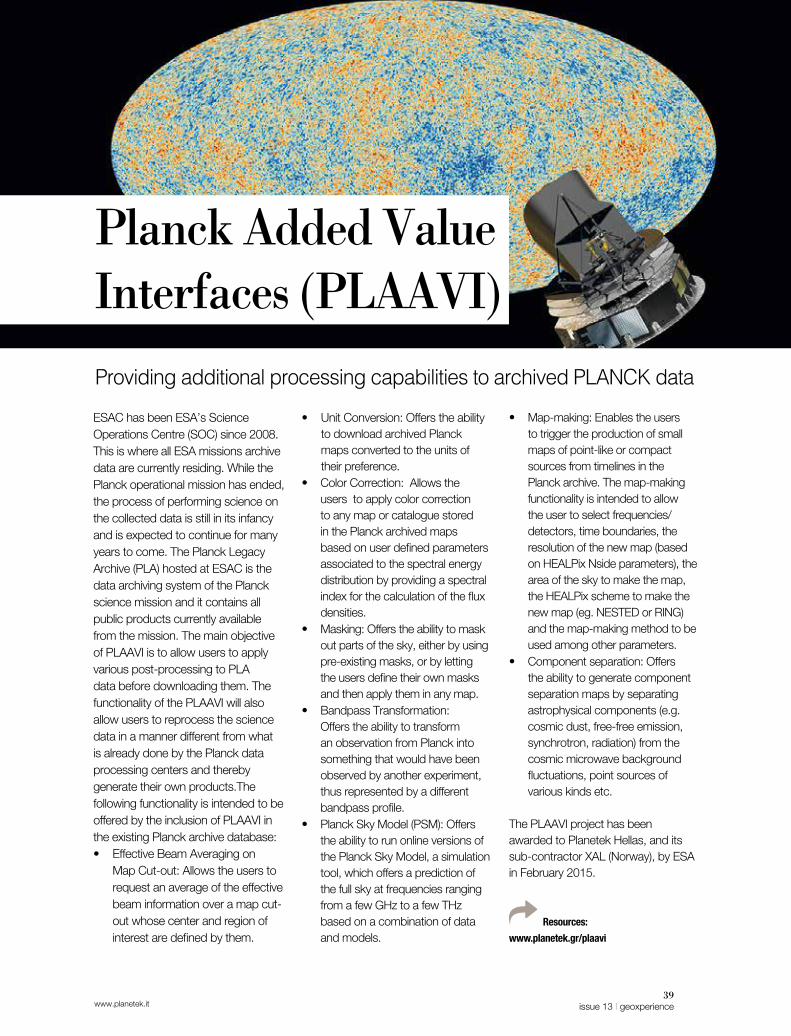
39issue 13 | geoxperiencewww.planetek.it
• Map-making: Enables the users to trigger the production of small maps of point-like or compact sources from timelines in the Planck archive. The map-making functionality is intended to allow the user to select frequencies/detectors, time boundaries, the resolution of the new map (based on HEALPix Nside parameters), the area of the sky to make the map, the HEALPix scheme to make the new map (eg. NESTED or RING) and the map-making method to be used among other parameters.
• Component separation: Offers the ability to generate component separation maps by separating astrophysical components (e.g. cosmic dust, free-free emission, synchrotron, radiation) from the cosmic microwave background fluctuations, point sources of various kinds etc.
The PLAAVI project has been awarded to Planetek Hellas, and its sub-contractor XAL (Norway), by ESA in February 2015.
Resources:
www.planetek.gr/plaavi
ESAC has been ESA’s Science Operations Centre (SOC) since 2008. This is where all ESA missions archive data are currently residing. While the Planck operational mission has ended, the process of performing science on the collected data is still in its infancy and is expected to continue for many years to come. The Planck Legacy Archive (PLA) hosted at ESAC is the data archiving system of the Planck science mission and it contains all public products currently available from the mission. The main objective of PLAAVI is to allow users to apply various post-processing to PLA data before downloading them. The functionality of the PLAAVI will also allow users to reprocess the science data in a manner different from what is already done by the Planck data processing centers and thereby generate their own products.The following functionality is intended to be offered by the inclusion of PLAAVI in the existing Planck archive database: • Effective Beam Averaging on
Map Cut-out: Allows the users to request an average of the effective beam information over a map cut-out whose center and region of interest are defined by them.
• Unit Conversion: Offers the ability to download archived Planck maps converted to the units of their preference.
• Color Correction: Allows the users to apply color correction to any map or catalogue stored in the Planck archived maps based on user defined parameters associated to the spectral energy distribution by providing a spectral index for the calculation of the flux densities.
• Masking: Offers the ability to mask out parts of the sky, either by using pre-existing masks, or by letting the users define their own masks and then apply them in any map.
• Bandpass Transformation: Offers the ability to transform an observation from Planck into something that would have been observed by another experiment, thus represented by a different bandpass profile.
• Planck Sky Model (PSM): Offers the ability to run online versions of the Planck Sky Model, a simulation tool, which offers a prediction of the full sky at frequencies ranging from a few GHz to a few THz based on a combination of data and models.
Providing additional processing capabilities to archived PLANCK data
Planck Added Value Interfaces (PLAAVI)

40geoxperience | issue 13 www.planetek.it
Satellite Ground Segment
Hyperspectral Precursor of the Application Mission (PRISMA)It is an ongoing Italian Space Agency EO mission with innovative electro-optical instrumentation that combines a hyperspectral sensor with a medium-resolution panchromatic camera. Planetek has the responsibility for the design and development of the full automatic L2 Processor chain in the Ground Segment. This S\S takes in input products of level 1 and produces geo-referred and geo-coded products of level 2. In addition Planetek is responsible of design and development of G(round)C(ontrol)P(oint)-DB Facility, a component of the PRISMA Ground Segment that has in charge to store and prepare GCP and DEM auxiliary data for each processing request.
Resources:
www.planetek.it/eng/cosmo_SG
www.planetek.it/eng/prisma
Planetek has a sound experience in definition and implementation of software for missions, ground and space systems for EO and Planetary data. Its capabilities range from the system definition, the design and development, to the validation and the on-site delivery. Planetek provides “Ground Segment” systems and technologies to receive and process satellite data acquired by the spacecraft’s instruments to archive, disseminate, publish and share the generated products as well as engineering consulting services for new missions definition, feasibility studies, ground control system architecture definition, requirements specification and system design.
Cosmo Second Generation (CSG)Within Italy’s Second Generation COSMO- SkyMed constellation of two satellites, Planetek is responsible for the design and implementation of the following processing facilities:Non-standard processors:• PFMOS: Processor that takes
in input CSG Level 1D (Ground Terrain Corrected) and DEM data to generate 1D and DEM Mosaicked products
• PFSPF: Processor that takes in input CSG Level 1B products to generate Speckle Filtered products
• PFCRP: Processor that takes in input CSG Level 1 standard and not standard products to generate Cropped products
Image Quality Assessment:• PFQCA: Tool for CSG standard
and not standard products quality control.
In the context of PFQCA tool developments a new product, spaceBIT, has been developed by Planetek, based on a plugin architecture and GPU based accelerators technology.
spaceBITVery Big Image Tool• Big Image & Data visualization
(HDF5 & Tiff)• GPU based acceleration Engine
for real-time visualization, graphical operation, image filtering and processing
• Multi-display support • Plugin architecture• Open to other image formats• Open to other image processing
tool
Software infrastructures for managing, acquiring, processing, archiving and disseminating satellite data
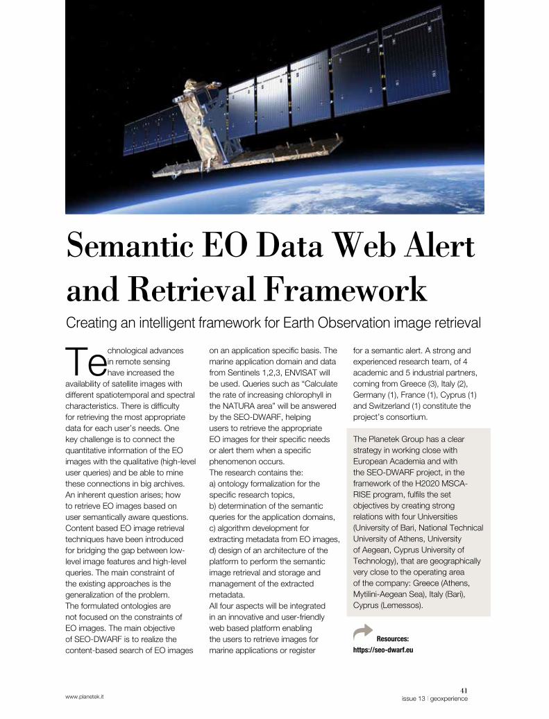
41issue 13 | geoxperiencewww.planetek.it
for a semantic alert. A strong and experienced research team, of 4 academic and 5 industrial partners, coming from Greece (3), Italy (2), Germany (1), France (1), Cyprus (1) and Switzerland (1) constitute the project’s consortium.
The Planetek Group has a clear strategy in working close with European Academia and with the SEO-DWARF project, in the framework of the H2020 MSCA-RISE program, fulfils the set objectives by creating strong relations with four Universities (University of Bari, National Technical University of Athens, University of Aegean, Cyprus University of Technology), that are geographically very close to the operating area of the company: Greece (Athens, Mytilini-Aegean Sea), Italy (Bari), Cyprus (Lemessos).
Resources:
https://seo-dwarf.eu
Technological advances in remote sensing have increased the
availability of satellite images with different spatiotemporal and spectral characteristics. There is difficulty for retrieving the most appropriate data for each user’s needs. One key challenge is to connect the quantitative information of the EO images with the qualitative (high-level user queries) and be able to mine these connections in big archives. An inherent question arises; how to retrieve EO images based on user semantically aware questions. Content based EO image retrieval techniques have been introduced for bridging the gap between low-level image features and high-level queries. The main constraint of the existing approaches is the generalization of the problem. The formulated ontologies are not focused on the constraints of EO images. The main objective of SEO-DWARF is to realize the content-based search of EO images
on an application specific basis. The marine application domain and data from Sentinels 1,2,3, ENVISAT will be used. Queries such as “Calculate the rate of increasing chlorophyll in the NATURA area” will be answered by the SEO-DWARF, helping users to retrieve the appropriate EO images for their specific needs or alert them when a specific phenomenon occurs. The research contains the: a) ontology formalization for the specific research topics, b) determination of the semantic queries for the application domains, c) algorithm development for extracting metadata from EO images, d) design of an architecture of the platform to perform the semantic image retrieval and storage and management of the extracted metadata. All four aspects will be integrated in an innovative and user-friendly web based platform enabling the users to retrieve images for marine applications or register
Semantic EO Data Web Alert and Retrieval Framework Creating an intelligent framework for Earth Observation image retrieval

42geoxperience | issue 13 www.planetek.it
Simplifying the space complexity OUR MISSION & VISION
The growing availability of geo-localized data is a condition that had
never occurred to date. These data have informative content, which, to be valorised, require an in-depth revision of the processes by which the data are produced, shared and used.For this reason, we design new processes and solutions that simplify the use of geo-localized
information to facilitate the understanding of the world around us. Our systems are designed to enable our users, public officials, researchers, major industries, entrepreneurs or individuals, to act in an informed and timely manner. We work in all phases of the life cycle of geo-localized data from the acquisition, storage, management, analysis and sharing of information to produce and generate
knowledge.At all stages, we adopt the principles of strategic design to create and develop solutions able to meet the requirements of our users, adopting the best technologies available on the market, with full respect for economic, social and environmental sustainability. We operate in different application areas: scientific missions for
We simplify the adoption of geospatial data in order to understand the world better. Thus, enabling people to act in an aware and timely manner in order to live better and preserve the Earth.
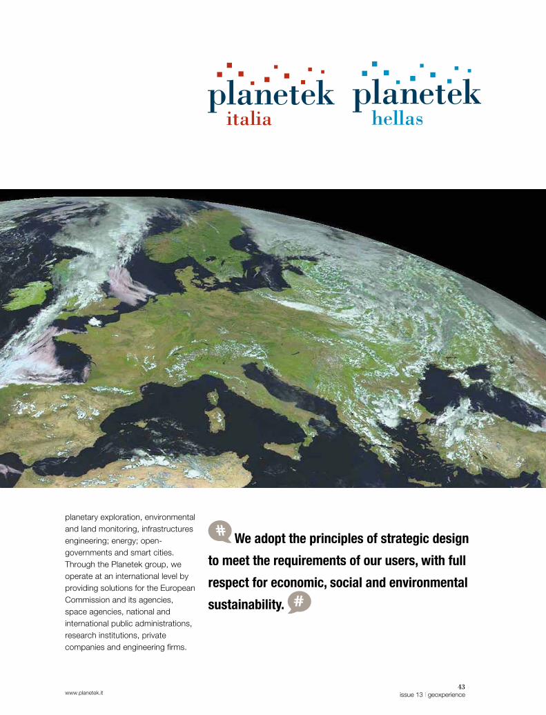
www.planetek.it43
issue 13 | geoxperience
planetary exploration, environmental and land monitoring, infrastructures engineering; energy; open-governments and smart cities. Through the Planetek group, we operate at an international level by providing solutions for the European Commission and its agencies, space agencies, national and international public administrations, research institutions, private companies and engineering firms.
We adopt the principles of strategic design
to meet the requirements of our users, with full
respect for economic, social and environmental
sustainability.

44geoxperience | issue 13 www.planetek.it
The organization of the company is structured into Corporate and
Strategic Business Unit (SBU) functions, which constitute the Executive Committee. Strategic Business Units are segmented by market in order to better understand the needs of customers while at the same time ensuring continuity over time. The SBUs are structured to operate independently with planning, sales and production capacities.In our software development projects we use Agile and Dev-ops methodologies.
Business 2 BusinessThe target market consists of companies operating in the Oil & Gas, Renewable Energy, transport (railways, roads) sectors and engineering work and infrastructure activities. Its products range from systems for business intelligence on geographic data to the creation of geoinformative products to
value-added data from Earth observation.
Government & Security SBUIt offers application solutions and services in the P.A. market at national and international levels, and for the Defence, Educational and scientific research markets in Italy. It provides geospatially powered solutions to the agencies and institutions of the European market such as the European Environment Agency, the European Defence Agency, the European Union (EC, REA, JRC). It develops solutions for the Earth observation using optical and radar data from satellite, aircraft and drones. It develops Spatial Data Infrastructures compliant to INSPIRE, based on the Cart@net® platform, using Free Open Source and commercial software from major vendors. It offers solutions for the creation of open data geographies and metadata catalogs. It distributes remote sensing satellite data from major international
operators through the Preciso® product family. It looks after the distribution of Hexagon Geospatial products within the Italian market.
SpaceStream SBUThe target market consists of space agencies (e.g. the Italian Space Agency with the COSMO-SkyMed program, and the European Space Agency with the Sentinel program); those related to them (such as Galileo) and the major players in the aerospace market. It develops and integrates hardware and software infrastructures for the acquisition, processing and distribution of remote sensing data along their entire chain of production: from Earth Observation to Deep Space; from the Space Segment to the Ground Segment to the User Segment. The main responsibilities of the SBU fall into Systems and Software Engineering with strong verticalization towards Space Mission Analysis and Design (SMAD).
From Space to applications: closer to users’ needs

www.planetek.it45
issue 13 | geoxperience
Giovanni Sylos LabiniChief Executive Officer and founder of Planetek Italia. He cooperated with NASA and ESA, and was director of the Center of Space Geodesy of the Italian Space Agency. Chairman of AIPAS. Vice Chairman of EARSC Association, board member of SME4SPACE and Apulian Aerospace District. He is also Professor at Venice University (IUAV).
Cristoforo AbbattistaHead of SpaceStream SBU. From 2002 he works in Planetek, mainly involved in the design and development of SDI and space systems. He has been teacher of WebGIS at Venice University.
Mariella PappaleporeChief Financial Officer and founder of Planetek Italia. Vice President of Confindustria Bari and Bat.
Vincenzo BarbieriChief Marketing Officer & Head of Design Lab. Founder of Planetek Italia, he matured expertise in the market of geospatial applications for Public Administration.
Massimo ZottiHead of Government & Security SBU. Responsible for the business development in the Defence market and of the Hexagon Geospatial portfolios. He is also active in several
associations dealing with OpenData, OpenGovernment and Geospatial innovation.
Sergio SamarelliChief Technical Officer and Head of Business to Business SBU. Founder of Planetek Italia. He has been teacher of Remote sensing image processing at Venice University (IUAV).
Paolo ManuntaCorporate Business Advisor. He published several papers in signal processing for environmental applications. Member of IMG-S Integrated Mission Group for Security and EO/(GMES) Copernicus working group.
Our team leaders
Stelios BollanosDirector and co-founder of Planetek Hellas. Since 2004, he is involved in different EU and ESA projects in the EO and Geomatics fields. He matured experience in the Greek and International Space Markets.

46geoxperience | issue 13 www.planetek.it
The group
Planetek HellasFounded in 2006, Planetek Hellas EPE is headquartered in Athens, Greece. It operates mainly in the Greek market and with leading international agencies. It provides solutions in the field of Geomatics, involving the use of E.O. data and systems that share spatial information for environmental monitoring, urban planning and civil protection. It operates in the principal EU programs in the field of Space research, where it is experienced in developing systems for data management of Space missions. www.planetek.gr
Geo-KGEO-K s.r.l. is the first spin-off of the University of Rome Tor Vergata, founded in 2006. Its mission is to carry out research and development and provide advice, services and products in the field of image processing and optical, hyperspectral, and microwave remote sensing. GEO-K personnel have vast experience on an international level in projects developed and promoted by the ESA and the EU Commission.www.geok.it
GAPGAP s.r.l., a spin-off of the University of Bari. It develops products, processes and services of highly scientific or technological content in the field of remote sensing and related hardware and software technologies, with an emphasis on Geomatic applications.The scientific component operates in close synergy with the Remote Sensing Group of the Physics Department of the University of Bari and CNR-ISSIA Institute.GAP has developed specific expertise in the detection of millimetre movements of the earth’s surface by means of the analysis of interferometric data acquired by synthetic aperture radar satellite sensors, to estimate water quality via the analysis of passive satellite sensor operators in the dominion of optical radiation and in the development of environmental modelling.www.gapsrl.eu
The Planetek group consists of 4 companies. In addition to the Planetek Italia s.r.l. parent company, Hellas Planetek EPE and two university spinoffs, GAP s.r.l. and GEO-K s.r.l., also belong to the group and are specialized remote sensing data processing with optical and radar sensors.

Cover image:Athens, Greece.
High-resolution optical image
from Sentinel-2A. The image captures
various vessels in the area,
waiting to enter or exit the port, visible thanks
to the 10m resolution on Sentinel-2A’s
camera.
Credits: Copernicus
Sentinel data / ESA

11 / EN
Share & read more
All about the Hexagon Geospatial portfolio: news, tutorials and articles for Italian users.
www.planetek.it www.planetek.gr
/geospatialvideotutorial
blog.planetek.it
geospatialnews.planetek.it
/planetek
/planetek
/planetekhellas
/company/planetek-italia
/company/planetek-hellas
/planetekitalia
Visit our web channels to explore more resources, documents, video and tutorials, and feel free to contact us, make comments and give us your likes.