Embed Size (px)
Citation preview
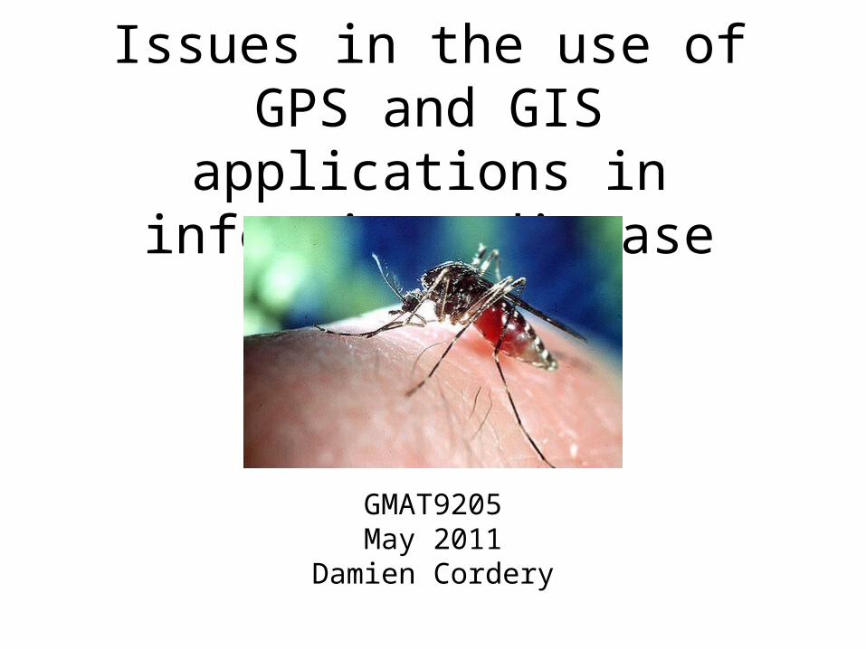
Issues in the use of GPS and GIS applications in infectious disease
GMAT9205May 2011
Damien Cordery
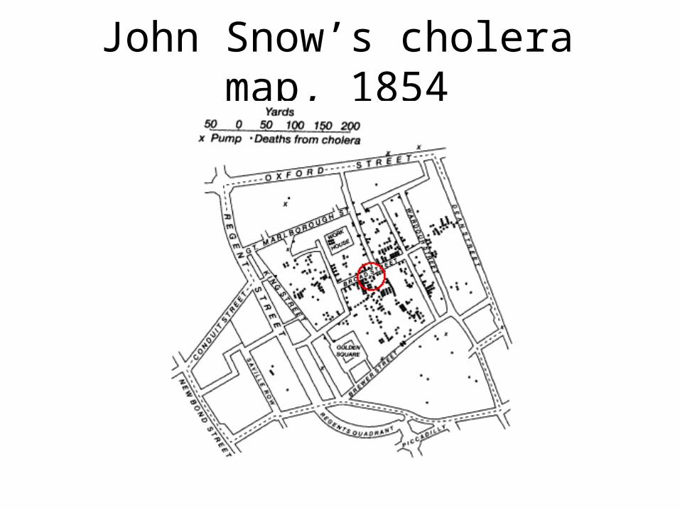
John Snow’s cholera map, 1854
Potential role for GPS/GIS in infectious disease
Tracking of diseases:- case clusters, similar to the cholera map
- surveillance of disease- epidemic prediction and response
- emerging infections (SARS, West Nile virus) - potential influence climate change
- especially useful in resource delivery in developing world
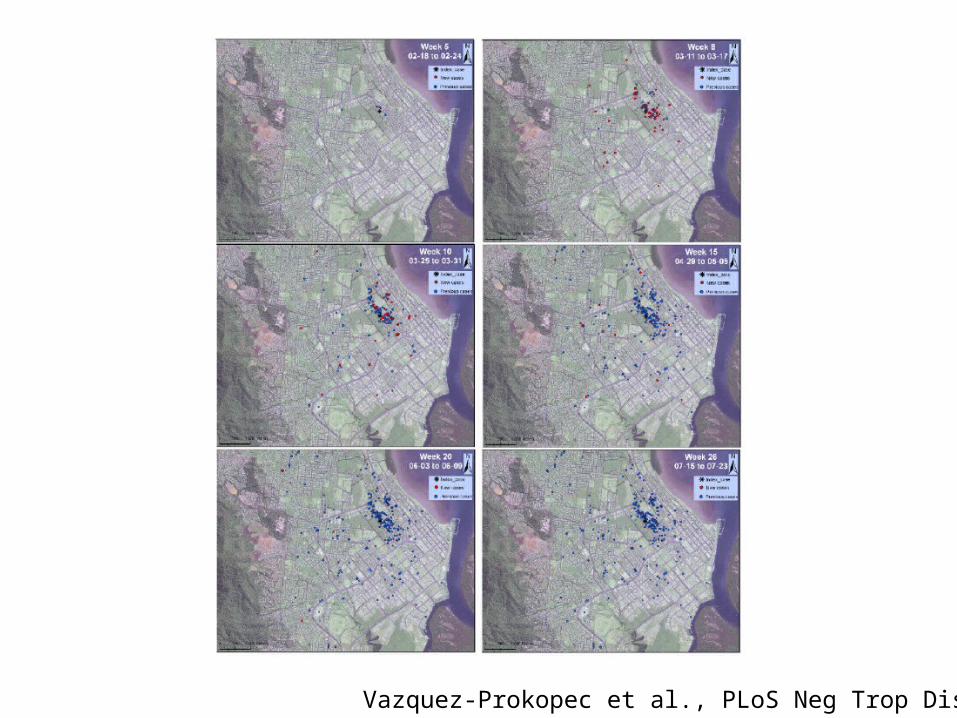
Vazquez-Prokopec et al., PLoS Neg Trop Dis, 2010
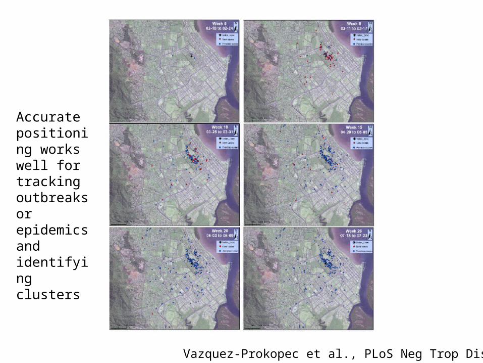
Vazquez-Prokopec et al., PLoS Neg Trop Dis, 2010
Accurate positioning works well for tracking outbreaks or epidemics and identifying clusters
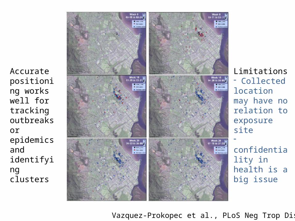
Vazquez-Prokopec et al., PLoS Neg Trop Dis, 2010
Limitations- Collected location may have no relation to exposure site- confidentiality in health is a big issue
Accurate positioning works well for tracking outbreaks or epidemics and identifying clusters
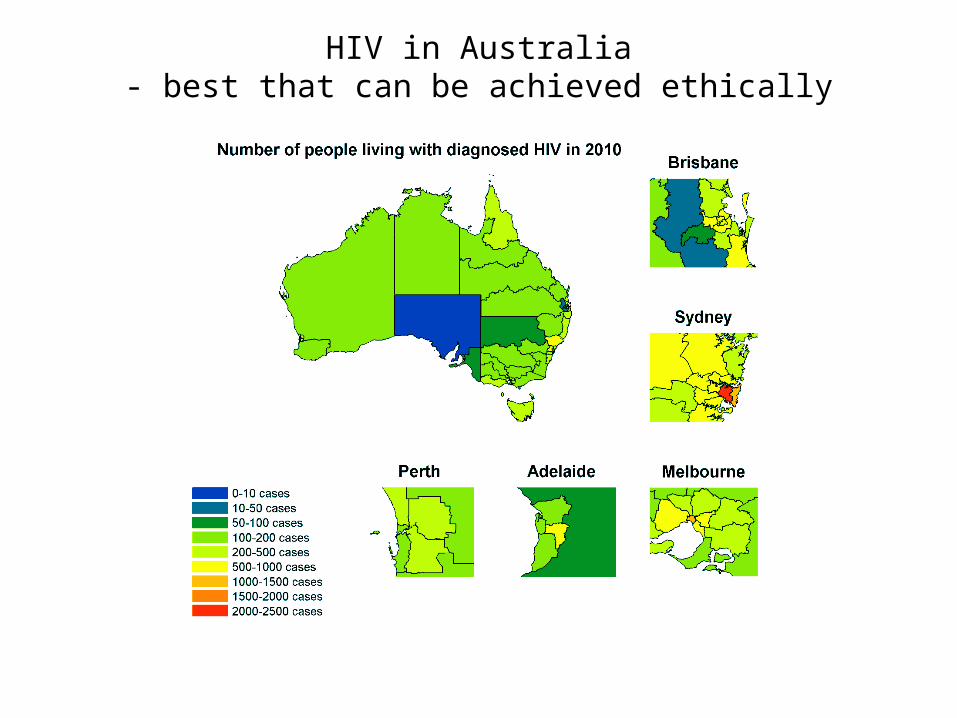
HIV in Australia- best that can be achieved ethically
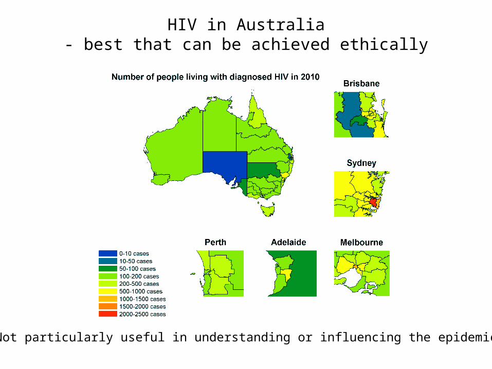
HIV in Australia- best that can be achieved ethically
Not particularly useful in understanding or influencing the epidemic
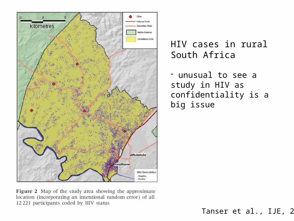
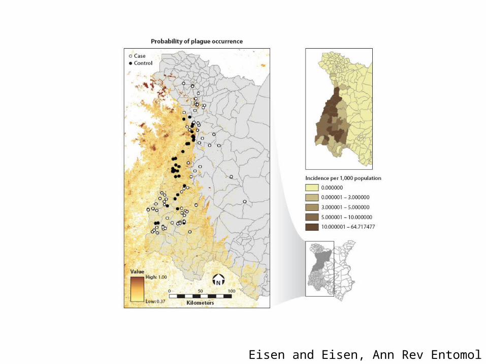
HIV cases in rural South Africa
- unusual to see a study in HIV as confidentiality is a big issue
Tanser et al., IJE, 2009
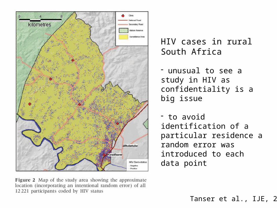
HIV cases in rural South Africa
- unusual to see a study in HIV as confidentiality is a big issue
- to avoid identification of a particular residence a random error was introduced to each data point
Tanser et al., IJE, 2009
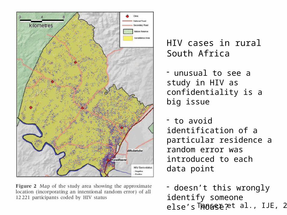
HIV cases in rural South Africa
- unusual to see a study in HIV as confidentiality is a big issue
- to avoid identification of a particular residence a random error was introduced to each data point
- doesn’t this wrongly identify someone else’s house?
Tanser et al., IJE, 2009
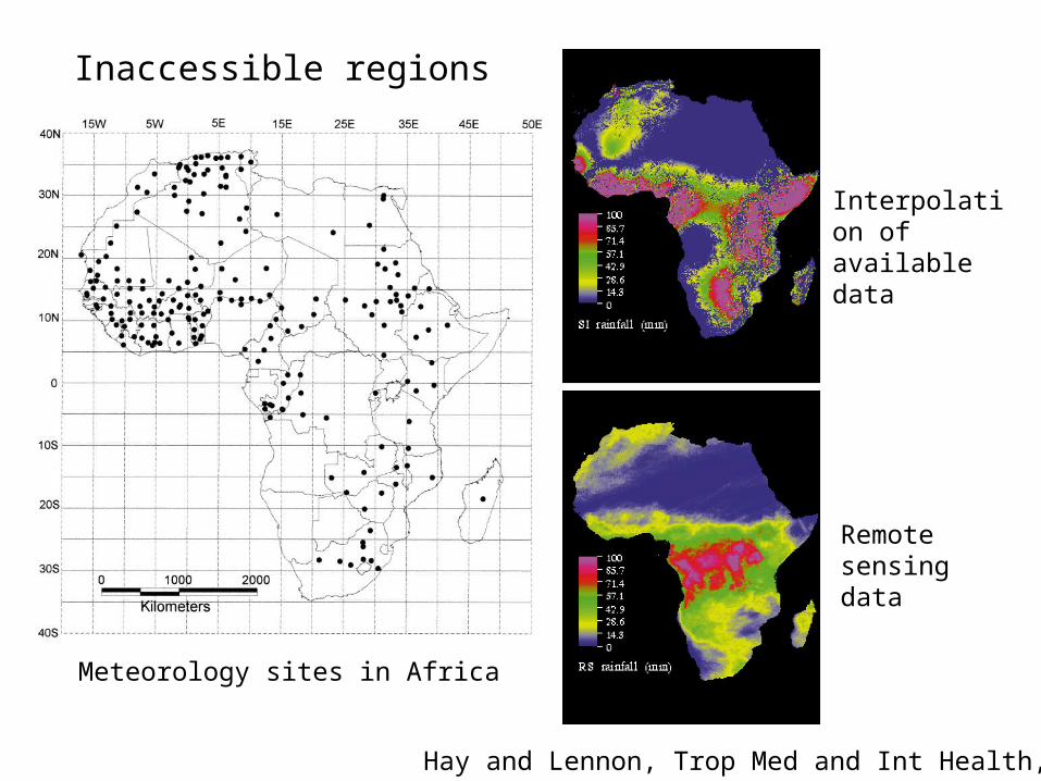
Spatially interpolated
Remote sensing
Meteorology sites in Africa
Interpolation of available data
Remote sensing data
Inaccessible regions
Hay and Lennon, Trop Med and Int Health, 1998
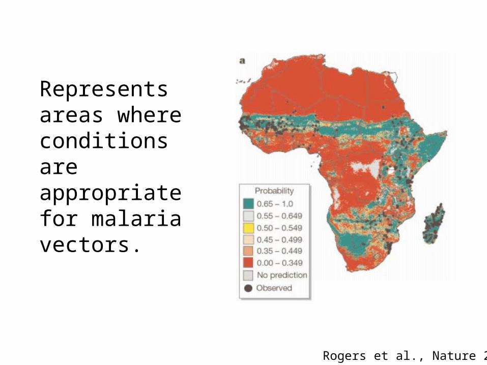
Represents areas where conditions are appropriate for malaria vectors.
Rogers et al., Nature 2002
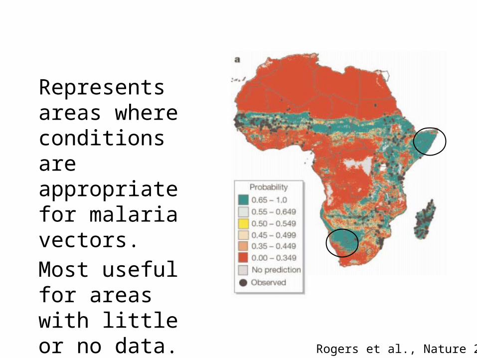
Represents areas where conditions are appropriate for malaria vectors.Most useful for areas with little or no data.
Rogers et al., Nature 2002
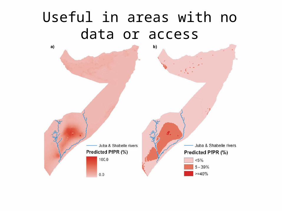
Useful in areas with no data or access
Eisen and Eisen, Ann Rev Entomol 2011
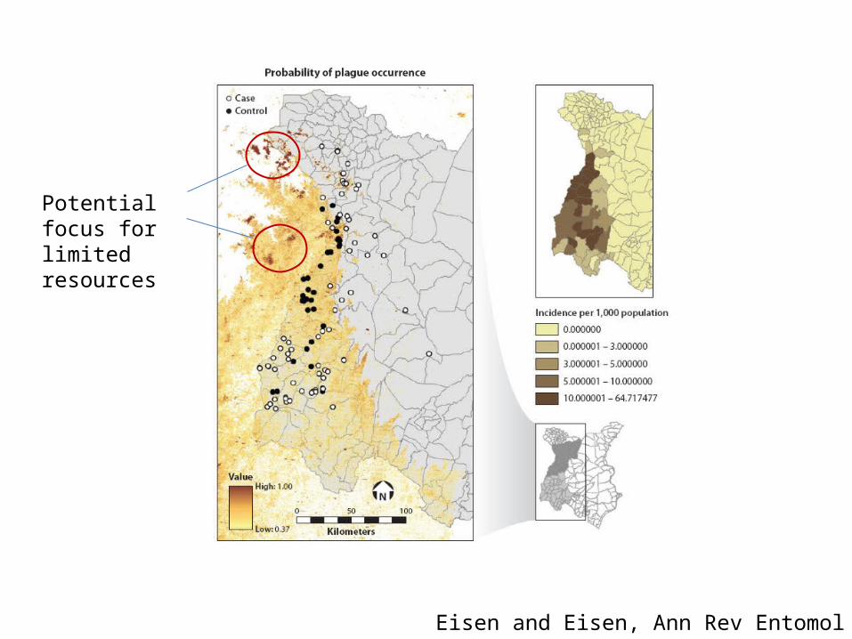
Potential focus for limited resources
Eisen and Eisen, Ann Rev Entomol 2011
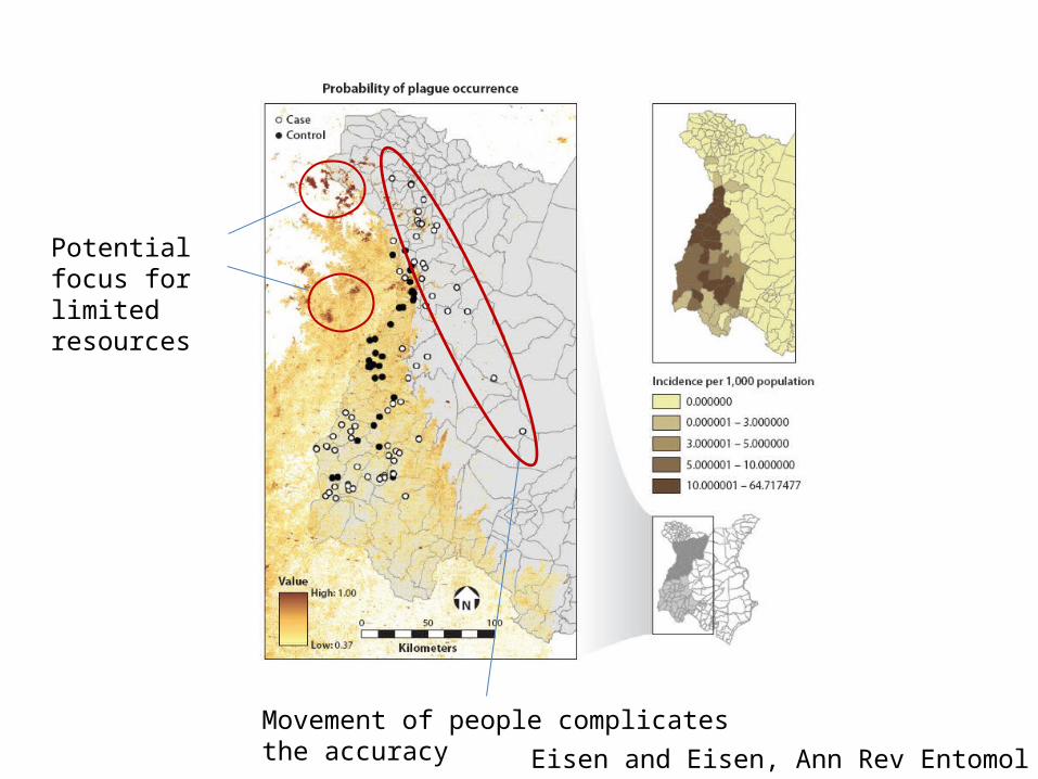
Potential focus for limited resources
Movement of people complicates the accuracy Eisen and Eisen, Ann Rev Entomol 2011
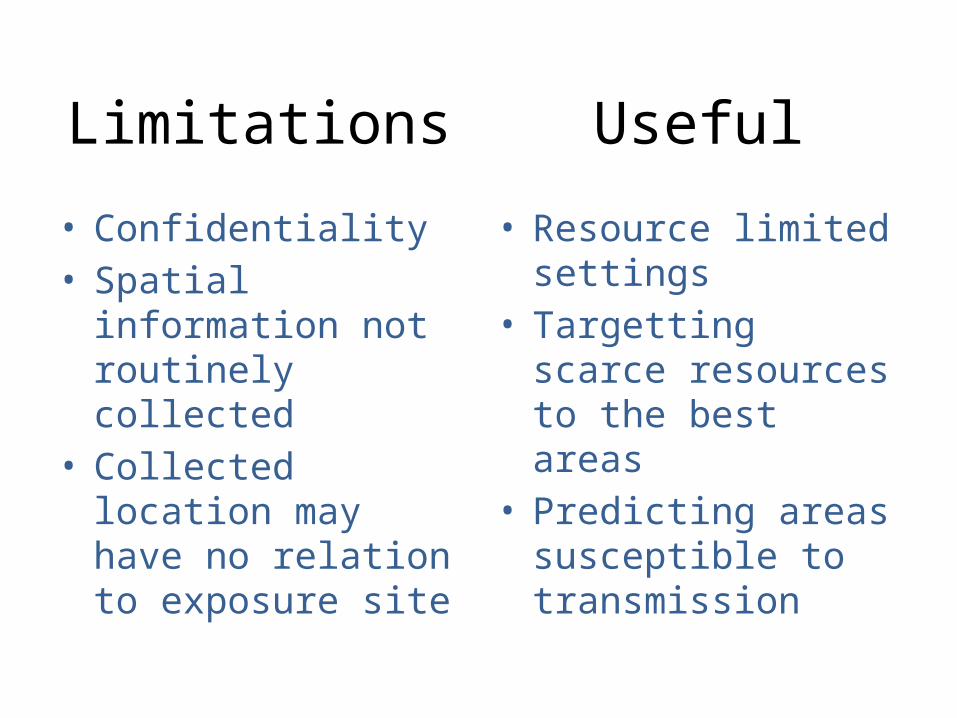
Limitations
• Confidentiality• Spatial information not
routinely collected • Collected location may
have no relation to exposure site
• Resource limited settings
• Targetting scarce resources to the best areas
• Predicting areas susceptible to transmission
Useful