Embed Size (px)
Citation preview

John Peabody Harrington’s Takelma Indian Field Notes: Outline
Hugo Native American Team
For Hugo Neighborhood Association & Historical Society &Josephine County Historical Society
August 2012

John Peabody Harrington’s Takelma Indian Field Notes: Outline
Harrington, John Peabody. 1981. The Papers of John Peabody Harrington in the NationalAnthropological Archives of the Smithsonian Institution, 1907-1957. Reel number 28. KrausInternational Publications. Millwood, New York.
The Hugo Native American Team has Harrington, 1981, Reel 28, Frames (Pages) Nos. 0001 -0889 (i.e., 889 pages of material). When referencing this material the following will bereferenced: Harrington, the year 1981, and the page/frame number (e.g, Harrington 1981: 876). Sometimes a topic might follow the page/frame number (e.g, Harrington 1981: 876 - dan-mologol).
The following information are quotes of the introduction to John Peabody Harrington’s TakelmaIndian Field Notes (prior to page/frame number 0001).
The Papers Of John Peabody Harrington
Prepared in the National Anthropological Archives, Department of Anthropology, NationalMuseum of Natural History, Washington, D.C.
The Paper of John Peabody Harrington In The Smithsonian Institution: 1907 - 1957
Published by Kraus International Publications, A Division of Kraus-Thomson OrganizationLimited, Millwood, N. Y., 1981
The microfilm edition of the Papers Of John Peabody Harrington was made possible by a grantfrom the National Historical Publications and Records Commission to the SmithsonianInstitution.
The original documents are housed in the National Anthropological Archives and were preparedthere for publication by Elaine L. Mills, Project Editor.
Dr. Herman J. Viola served as Project Director and Dr. Ives Goddard as Project Linguist. Thestaff also included James R. Glenn, Assistant Director; Joan L. Saverano and Linda A. Hudson,Archives Technicians; and Michele Albert, Secretary.
In publishing any of this material, users are requested to credit the John P. Harrington Papers,National Anthropological Archives, Smithsonian Institution. Citations from the microfilm editionshould include relevant reel and frame numbers.
All original documents have been photographed, except as noted in the accompanying guide. Insome instances, these originals are brittle, faded, or dark, making them difficult to photograph. Every effort has been made to provide the best reproduction possible for this film edition. As anadditional aid to the user, transcripts have been prepared to appear beside the original documentwhenever it was deemed necessary. Some pages were hand numbered by the author. Occasionally a number may be lacking or repeated. These flaws do not reflect filming errors.”

i
John Peabody Harrington’s Takelma Indian Field Notes: Outline
Outline
I. HUGO NATIVE AMERICAN TEAM
II. PROJECT & PROCESS
III. THOMAS DOTY’S 12 VOLUMES
IV. DENNIS GRAY’S WORK
V. RESEARCH AND ANALYSIS TO UNDERSTANDING THE FIELD NOTES A. Utilized Dennis Gray’s Work in Understanding the Field Notes
1. The Ethnographers/Linguistsa) Edward Sapir b) John Peabody Harrington
2. Native American Informantsa) Frances Johnson b) Molly Orton c) Aneti Scottd) Hoxie Simmonse) Netti Westf) Mary Eagan
3. Local Resident Informants: Mr. Crow, Miss Savage, Mr. Emanuell,George and Evelyn Baker, and Ned Evans
4. Territorial Boundariesa) Upland Takelmab) Lowland Takelmac) Northern Takelmad) Applegate/Galice Creek Athapascans
5. Gray Quotes For Transcriptions Test B. Preliminary Transcriptions Test Analysis By Hugo Native American Team
1. Informants & Territorial Boundaries2. Transcriptions Test 3. Harrington’s Abbreviations
VI. PRELIMINARY OUTLINE OF JOHN PEABODY HARRINGTON’S FIELD NOTESA. Volume 1. John Peabody Harrington Papers, Reel 28 (Frame Nos. 0001 - 0074)B. Volume 2. John Peabody Harrington Papers, Reel 28 (Frame Nos. 0075 - 0169)C. Volume 3. John Peabody Harrington Papers, Reel 28 (Frame Nos. 0170 - 0255)D. Volume 4. John Peabody Harrington Papers, Reel 28 (Frame Nos. 0256 - 0347) E. Volume 5. John Peabody Harrington Papers, Reel 28 (Frame Nos. 0348 - 0433)F. Volume 6. John Peabody Harrington Papers, Reel 28 (Frame Nos. 0434 - 0504)
ii
G. Volume 7. John Peabody Harrington Papers, Reel 28 (Frame Nos. 0505 - 0586)H. Volume 8. John Peabody Harrington Papers, Reel 28 (Frame Nos. 0587 - 0654)I. Volume 9. John Peabody Harrington Papers, Reel 28 (Frame Nos. 0655 - 0710)J. Volume 10. John Peabody Harrington Papers, Reel 28 (Frame Nos. 0711 - 0779)K. Volume 11. John Peabody Harrington Papers, Reel 28 (Frame Nos. 0780 - 0848)L. Volume 12. John Peabody Harrington Papers, Reel 28 (Frame Nos. 0849 - 0889)
VII. HARRINGTON’S MAPS
VIII. DOCUMENTATION & PUBLICATIONA. Encourage Neighbors’ Interest in Their Geographic Place, In Their CommunityB. Credible Documentation
MAPS
Map 1. Takelma Lands In Southwestern OregonMap 2. Takelma IndiansMap 3. Harrington Map 460 Takelma VillagesMap 4. Harrington Map 560 Medicine RockMap 5. Harrington Map 583 Medicine RockMap 6. Harrington Map 876 Medicine RockMap 7. Takelma Villages At Confluences of Applegate & Rogue Rivers
BIBLIOGRAPHY
ATTACHMENTS
Attachment 1. Map 1. Takelma Winter Villages Confluence of Rouge River and ApplegateRiver: 1855. Developed October 5, 2011.
Edited and approved by the following members of the Hugo Native American Team: JeanBoling, Karen Rose, and Mike Walker.
C:\Documents and Settings\mike\My Documents\Genealogy\Native_Americans\References\Harrington Papers Outline 082312.wpd

1
John Peabody Harrington’s Takelma Indian Field Notes: Outline
I. HUGO NATIVE AMERICAN TEAM
One of the main reasons the Hugo Native American Team (HNAT) developed this projectdocument was a special need to respect the landscapes of the Lowland Takelma Indians. See Hugo Neighborhood Association & Historical Society’s Native American Brochure Series at http://www.hugoneighborhood.org/Native_American_Brochure_Series.htm.
In addition, the HNAT felt that there was a need of the private landowner for privacy, and respectfor their lands. The Hugo Emigrant Trails Committee has operated under this policy to goodeffect as private landowners along the Applegate Trail continued to reinforce this psychologicalneed.
Honor Sacred Places The HNAT’s values are to honor and preserve the sacred places,archaeological sites, landscapes and cultural traditions of Native peoples. We believe thisenriches our shared American heritage and connections with place (Reference: Brochure NA-1B,Hugo's Native American Team).
We believe that members of different cultural groups have important shared values such as highhopes for their children's school success, a recognition of the importance of educationalachievement, and a strong emphasis on the importance of hard work.
Respect Private Property An important policy of the HNAT is to be respectful of thelandowner’s privacy and property (Reference: Brochure NA-1B, Hugo's Native AmericanTeam). Do not trespass on private property not open to the public. Members of the HNAT willtravel to private property site only with specific permission of the landowner as to the time anddate, and only with the landowner in attendance.
II. PROJECT & PROCESS
This HNAT project was to transcribe John Peabody Harrington’s Takelma Indian Field Notes. This project has several phases.
Harrington, John Peabody. 1981. The Papers of John Peabody Harrington in the NationalAnthropological Archives of the Smithsonian Institution, 1907-1957. Reel number 28, Frames (Pages) Nos. 0001 - 0889. Kraus International Publications. Millwood, NewYork.
The crucial starting point is to begin to understand the broad outline of information in JohnPeabody Harrington’s Takelma Indian Field Notes (Phase 1), to develop a preliminary outline ofthe field notes (Phases 2 - 3), to conduct research and analysis for understanding the field notes(Phases 4 - 6), and document the transcripts of selected sections of the field notes (Phase 7).

2
Phase 1. Peruse John Peabody Harrington’s Takelma Indian Field Notes.Phase 2. Understand Thomas Doty’s 12 Volumes (this document).Phase 3. Develop a Preliminary Outline of the Field Notes (this document).Phase 4. Utilized Dennis Gray’s Work in Understanding the Field Notes.Phase 5. Final Preliminary Analysis & Outline By Hugo Native American TeamPhase 6. Transcribe Selected Sections of Field NotesPhase 7. Documentation & Publication
This description of an outline for John Peabody Harrington’s Takelma Indian Field Notes,although final, is also preliminary as it will evolve over time.
III. THOMAS DOTY’S 12 VOLUMES
The HNAT now has a copy of Harrington’s field notes on the Galice/Applegate Tekelma from Thomas Doty, Story Teller.
Thomas Doty, Story TellerDoty & Coyote: Stories from the Native WestP.O. Box 3397Ashland, OR 97520541-482-3447Email: [email protected]: http://www.dotycoyote.com/biography/programs_projects.html
Doty organized Harrington’s 0889 frames/pages on the Galice/Applegate Tekelma into 12volumes. The HNAT will use, as applicable, Doty’s 12 volume approach in order tocommunicate with each other and with Doty.
There is not a single topic for each volume. The HNAT’s goal is to review and identify theapplicable topics per volume.
After we understand the organization of the papers the members of the HNAT will starttranscribing/analyzing information of interest.
IV. DENNIS GRAY’S WORK
Dennis Gray’s 1987 study synthesizes the available ethnographic and relevant archaeologicaldata pertaining to the Native American groups who formerly occupied the upper Rogue Riverdrainage of southwestern Oregon (Gray 1987: iii). The information presented concerns material,social, and religious aspects of aboriginal life as practiced by the Takelma of the Rouge RiverValley, and their culturally akin Athapascan neighbors, the Da-du-be-te-de (ApplegateRivergroup), and the Tal-tuc-tun-te-da (Galice Creek Group). The ethnographic materialrepresents the time period immediately prior to the subjugation of these Native Americans, andtheir subsequent removal from southwestern Oregon in the 1850s.

3
Gray, Dennis J. 1987. The Takelmas and Their Athapascan Neighbors: A NewEthnographic Synthesis for the Upper Rogue River Area of Southwestern Oregon.University of Oregon. Anthropological Papers, No. 37. Eugene: Department ofAnthropology. University of Oregon. Eugene, OR. Document is web published athttp://soda.sou.edu/awdata/021104a1.pdf.
Gray’s work is important for several reasons. He identified the major ethnographers andlinguists, the major Native American informants, and the Takelma’s territorial boundaries. Healso had already transcribed many segments of Harrington’s very difficult scribblings (fieldnotes). Analyzing and understanding Gray’s transcriptions will make it easier for the HNAT toeventually transcribe Harrington’s field notes.
V. RESEARCH AND ANALYSIS TO UNDERSTANDING THE FIELD NOTES A. Utilized Dennis Gray’s Work in Understanding the Field Notes
The introductory chapter of Gray’s study was intended to orient the reader to the geography ofthe region, the anthropologists and Native American informants who generated the ethnographicmaterial, and the territories occupied by the specific ethnographic groups (Gray 1987: 2).
1. The Ethnographers/Linguists Gray identified several anthropologists, linguists, andethnographers conducting work in the field: Edward Sapir, John Peabody Harrington, MelvilleJocobs, Philip Drucker, Homer Garner Barnett, and Pliny Earl Goddard (Gray 1987: 10 - 12). This paper is concerned with Edward Sapir and John Peabody Harrington.
a) Edward Sapir (Gray 1987: 10), linguist and ethnographer, was a brilliant scholar who madea lasting impression on the field of cultural anthropology. Born in Germany in 1884, heemigrated with his family to the United States at the age of five. His scholastic aptitudes wererecognized early on, and culminated with a four year Pulitzer Fellowship to Columbia College,where he graduated in 1904. His graduate work continued at Columbia and it was during thistime, while in his early twenties, that Sapir undertook research into the Takelma language. Thiswas the study which he presented for his doctoral dissertation. Before receiving his Ph.D. fromColumbia in 1909, Sapir also studied and taught at the University of California, Berkeley, and atthe University of Pennsylvania. Sapir spent the next fifteen years employed with the CanadianNational Museum in Ottawa, where he sought out and studied many of the languages ofCanadian Native Americans. The remainder of his professional career was spent at the Universityof Chicago and Yale University until his death in 1939.
In addition to his talents in linguistics and ethnography, Sapir was a student of theoreticalconcerns of cultural anthropology, in particular the concept of culture and personality. His workin linguistics over the years included the study of Germanic, African, Indo-European, andSemitic languages, in addition to his work in Canada. His interests ranged far beyondanthropology, for he had considerable skill as a poet, musician, and literary critic. Like manyAmerican anthropologists of his generation, he was a student, admirer, and friend of Franz Boas.

4
b) John Peabody Harrington (Gray 1987: 10 - 11), probably the most prolific yet least knownof the many great ethnographers/linguists of the early twentieth century, remains an enigma. Born in Massachusetts in 1884, he grew up in California and studied anthropology and classicallanguages at Stanford University. While a student at the University of California he wasinfluenced by A. L. Kroeber and P. E. Goddard to devote his career to the study of NativeAmerican languages and culture.
Following graduate studies in Germany in 1905-06, Harrington returned to the United States andbegan a part-time investigation of several California Indian cultures. The years 1909-1915 werespent in the Southwest with various institutions where he engaged in linguistic research. In 1915Harrington was awarded a permanent position as a field ethnologist with the Bureau of AmericanEthnology, a position he was to hold for almost forty years.
It was during those forty years that Harrington amassed (figuratively) "tons" of field notes onalmost every aboriginal linguistic group in North America. His obsession to record data wassuch that he rarely took the time to publish or synthesize his material. In the fall of 1933Harrington pursued work in the Rogue River region. Following interviews at the SiletzReservation, he took several informants on automobile trips to southwestern Oregon to confirmplace names and village site locations. Although primarily concerned with linguistic information,Harrington's field notes are replete with ethnographic and ethnobotanical details.
Harrington's personality could best be described as eccentric and obsessive. He had little contactwith his colleagues, and was fearful of such contact lest someone should pirate his work. Hiswife of seven years, Carobeth Laird, describes a most painful relationship with a man who wasobsessed with his work and an economizer with his earnings. Whatever the facets of hispersonality may have been, he left an amazing amount of valuable information on many now-extinct cultures. This information is only now becoming available through the auspices of theNational Anthropological Archives.
2. Native American Informants Gray identified several Native American informants: FrancesJohnson, Molly Orton, Aneti Scott, Hoxie Simmons, Netti West, and Mary Eagan (Gray 1987: 13- 16). Gray also identified local residents that Harrington interviewed: Mr. Crow, Miss Savage,Mr. Emanuell, George and Evelyn Baker, and Ned Evans (Gray 1987: 16). This paper isconcerned with all the informants.
a) Frances Johnson (Gray 1987: 13) whose Takelma name was Gwisgwashan, was the soleinformant for both Sapir and Harrington concerning the Lowland Takelma. According to Sapir:
In 1884 there were no more than twenty-seven Takelmas. The Takelma language isspoken by only three or four older women now [1906]. From the most intelligent of theseall of my information was obtained.
This last sentence is no doubt a subjective judgement on Sapir's part, and may reflect in actualitythe willingness, memory and/or physical condition of those surviving Takelmas. Twenty-five or

5
so years later, Frances Johnson was again to be a primary source of information about theLowland Takelma, this time for J. P. Harrington.
Mrs. Johnson's native village was located somewhere north of the Rogue River and slightly eastof Grants Pass, Oregon. Sapir gives the name of Dak'ts!asin in the neighborhood of Jumpoff JoeCreek, and near a local spiritual rock (dan-moloqol) as her native village. In Harrington's notesJohnson says she was born at Rib Creek (i.e. Grave Creek), a place just the other side ofMedicine Rock, or maybe at Ranie Falls on the Rogue River. There is, then, general agreement asto the geographic area of her early residence, and indeed most of the information supplied byJohnson concerns the area north of the Rogue River. In neither account is her age given;however, she stated that she was a young girl at the time of the Rogue River Wars during the1850s.
Frances Johnson was interviewed by Harrington and Sapir at the Siletz Reservation, in additionto which Harrington brought her to the Rogue River region on a short automobile trip to assist inplace name identification.
Some details of her ancestry are as follows. Her maiden name was Harney, and her youngerbrother, George Harney, was a chief who at one time traveled to Washington D.C. Cow CreekSally and Evans Bill were her first cousins. Her mother's father and also a cousin of her father,Chief Taylor, were from Ta'waxki (possibly Evans Creek). Frances' mother's uncle and hermother's mother were from the Table Rock region. Frances Johnson died in 1933.
b) Molly Orton (Gray 1987: 13 - 14), sometimes referred to as Molly Orcutt, was a speaker ofthe Upland or "Table Rock" Takelma dialect. According to Frances Johnson, "Molly Orton wasprobably from Ashland, Jacksonville. She is not Shasta. She talks my [Takelma] language".Molly Orton was Harrington's and Drucker's informant for the areas around Table Rock andeastward in the Bear Creek Valley. According to Drucker, Molly Orton was the last member ofher people to have any recollection of the old culture. Harrington also brought her to the area byautomobile toidentify place name locations. No details are available concerning her age or placeof birth; however she stated that while living on the Grand Ronde Reservation, her father told herabout the country where he had lived called So-ytanakh, which was probably near the headwatersof Little Butte Creek, north of Ashland, Oregon. Molly and her husband Steven lived in theRogue Valley and surrounding mountains during the late nineteenth century, for they witnessedthe completion of the Oregon-California Railroad. Molly claimed close kinship with FrancesJohnson. She also had an uncle from the Jacksonville area and a cousin known as Table RockJenny.
c) Aneti Scott (Gray 1987: 14), or Mrs. Spencer Scott, was interviewed by Harrington in 1933 atthe Siletz Reservation. She was a full blooded Applegate (or Da-ka-tu-be-te) and one of the lastsurvivors of that culture. She said she was eighty years old in 1933; however, she also stated thatshe was a fair-sized girl at the time of the Rogue River Wars which wold put her closer to ninety.She spoke the Applegate and Takelma languages fluently; the latter she learned from a husbandshe had years ago, Evans Bill. Aneti Scott's mother spoke the language of the Klamath RiverIndians (which group is unknown) for she was partly of that descent

6
d) Hoxie Simmons (Gray 1987: 14), was the prime source of information for Harrington, Jacobsand Barnett (and probably Drucker as well) concerning the Galice Creek and ApplegateAthaspascan cultures. In 1940 he claimed to be 68 years old; however, in another statement hesaid he was born in 1882. In either case he was not born until after the Rogue River Wars and thesubsequent removal of the native population to reservations.
Simmons apparently learned the Galice Creek language from his mother who lived at GaliceCreek. He learned a great deal from his stepfather, a man named Simmons, who was anApplegate Indian and a great storyteller. In 1940 Haxie stated that he was only one of twopersons alive who spoke the Galice language, and that he spoke it the best. The only other detailknown about his background is that his great grandmother was from Agnes, a town near thePacific Coast at the confluence of the Illinois and Rogue Rivers.
e) Netti West (Gray 1987: 14), an informant on the Galice culture, was interviewed in 1934by Homer Barnett. Very little information was recorded concerning her life outside of herlineage. Her mother and mother's father were from the Galice Creek region; her mother's motherwas from Cow Creek; her father's mother was from Yamhill and her father's father was white.Hoxie Simmons stated that by 1940 she (one of the few speakers of the Galice language) haddied, thereby placing her death sometime between Barnett's interview in 1934 and 1940.
f) Mary Eagan (Gray 1987: 14 - 16). Another informant possibly employed by Harrington wasMary Eagan. It is unclear if she was actually interviewed by Harrington; however, she wasreferred to by both Frances Johnson and Molly Orton. The few references to her are of someimportance because Mary Eagan was referred to as Takelma; however, she spoke a dialect of thelanguage that differed from that spoken by Frances Johnson and Molly Orton. Mary Eagan wasfrom an area known in Takelma as Ha-ne-sakh, and was closely related to both Molly andFrances.
3. Local Resident Informants: Mr. Crow, Miss Savage, Mr. Emanuell, George and EvelynBaker, and Ned Evans (Gray 1987: 16). Harrington was in the habit of using, when possible,local residents to help in identifying place name locations. In the Rogue River area localinformants were a Mr. Crow, an early settler from the Jumpoff Joe Creek vicinity, Miss Savageand Mr. Emanuell. Miss Savage’s father was an early settler in the area after whom SavageRapids on the Rogue River were named. George and Evelyn Baker accompanied Harrington andFrances Johnson and Molly Orton on their automobile trip to the Rogue Valley. Ned Evans, whowas part Takelma and part Shasta (and who spoke both languages), also provided someinformation (Gray 1987: 16).
4. Territorial Boundaries (Gray 1987: 16 - 17). The question of territorial boundaries for theaboriginal groups of southwestern Oregon has been debated and discussed since the beginning ofEuro-American settlement in the region. The problem has been one primarily for theanthropological community since it is self-evident that the Native Americans knew preciselywhere they lived.

7
a) Upland Takelma (Gray 1987: 17 - 21) Probably the most controversial boundary in theregion is that between the Upland Takelma (or Lat-ga-wa) and the Shasta in Bear Creek Valley.
The Shasta/Upland Takelma boundary was in the Bear Creek Valley near Ashland at the time ofEuro-American contact. The remaining boundaries of the Upland Takelma are more easilyascertained. Directly east of Bear Creek Valley the limits of their territory extended toGreensprings Mountain or Table Mountain. From that point the border continued along thesummit of the Cascades, adjoining Klamath territory to the east, to the headwaters of Little ButteCreek near Bieberstedt Butte. Little Butte Creek drainage formed the approximate northeastboundary to its junction with the Rogue River. The entire Table Rock region extending to GoldHill was Upland Takelma land and a line from Gold Hill to Jacksonville separating the Ashland-Jacksonville-Table Rock (Map 1).
b) Lowland Takelma (Gray 1987: 21 - 24). The Lowland Takelma nuclear territory extendedwestward from the Gold Hill-Jacksonville line along the northern bank of the Rogue River to apoint somewhere between the Illinois River and Galice Creek. The western boundary of theLowland Takelma nuclear territory would have been near the confluence of Grave Creek and theRogue River. Northward from the Rogue, Takelma territory extended to the upper drainage ofCow Creek and then east to include the entire drainages of Grave Creek, Junpoff Joe Creek andEvans Creek (Map 1).
c) Northern Takelma (Gray 1987: 24 - 25). The general area is the mountainous terrain of theupper reaches of the Rogue River drainage above Little Butte Creek, and no further north thanthe Prospect area (Map 1).
d) Applegate/Galice Creek Athapascans (Gray 1987: 25 - 26). The Applegate Athapascansappear to have occupied almost the entire course of the Applegate River fram near its headwatersin the Siskiyou divide to its confluence with the Rogue River. A second geographic area iscentered at the mouth of Galice Creek where it joins the Rogue, the nuclear territory of this groupno doubt included the area some distance up that tributary (Map 1).
5. Gray Quotes For Transcriptions Test The transcriptions test was a preliminary experimentin whether Gray’s references to Harrington’s field notes could be found with the copy the HNAThas for review. The following quotes by Gray were selected because of topics of interest to theHNAT.
Harrington Quote No. 1 by Gray (Gray 1987: 13).
Frances Johnson (whose Takelma name was Gwisgwashan (Sapir 1909:2]) was the soleinformant for both Sapir and Harrington concerning the Lowland Takelma.
Mrs. Johnson's native village was located somewhere north of the Rogue River andslightly east of Grants Pass, Oregon. Sapir gives the name of Dak'ts!asin in theneighborhood of Jumpoff Joe Creek, and near a local spiritual rock (dan-moloqol) as hernative village (Sapir 1907a:256). In Harrington's notes Johnson says she was born at Rib
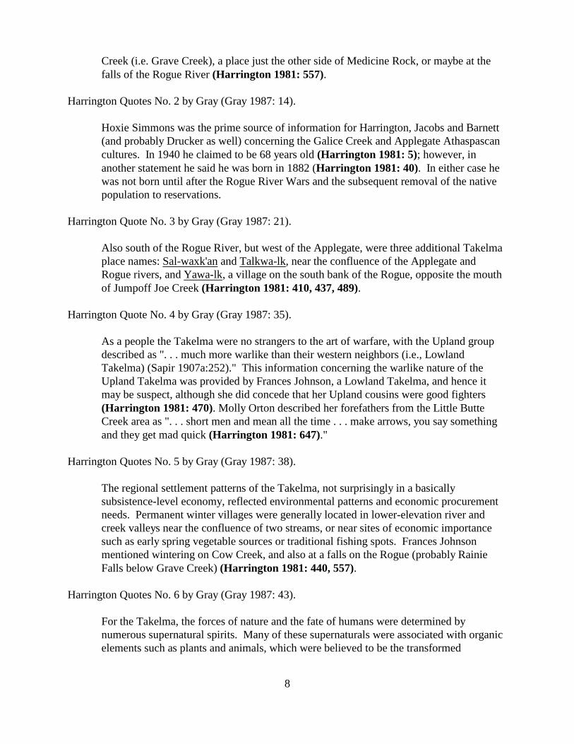
8
Creek (i.e. Grave Creek), a place just the other side of Medicine Rock, or maybe at thefalls of the Rogue River (Harrington 1981: 557).
Harrington Quotes No. 2 by Gray (Gray 1987: 14).
Hoxie Simmons was the prime source of information for Harrington, Jacobs and Barnett(and probably Drucker as well) concerning the Galice Creek and Applegate Athaspascancultures. In 1940 he claimed to be 68 years old (Harrington 1981: 5); however, inanother statement he said he was born in 1882 (Harrington 1981: 40). In either case hewas not born until after the Rogue River Wars and the subsequent removal of the nativepopulation to reservations.
Harrington Quote No. 3 by Gray (Gray 1987: 21).
Also south of the Rogue River, but west of the Applegate, were three additional Takelmaplace names: Sal-waxk'an and Talkwa-lk, near the confluence of the Applegate andRogue rivers, and Yawa-lk, a village on the south bank of the Rogue, opposite the mouthof Jumpoff Joe Creek (Harrington 1981: 410, 437, 489).
Harrington Quote No. 4 by Gray (Gray 1987: 35).
As a people the Takelma were no strangers to the art of warfare, with the Upland groupdescribed as ". . . much more warlike than their western neighbors (i.e., LowlandTakelma) (Sapir 1907a:252)." This information concerning the warlike nature of theUpland Takelma was provided by Frances Johnson, a Lowland Takelma, and hence itmay be suspect, although she did concede that her Upland cousins were good fighters(Harrington 1981: 470). Molly Orton described her forefathers from the Little ButteCreek area as ". . . short men and mean all the time . . . make arrows, you say somethingand they get mad quick (Harrington 1981: 647)."
Harrington Quotes No. 5 by Gray (Gray 1987: 38).
The regional settlement patterns of the Takelma, not surprisingly in a basicallysubsistence-level economy, reflected environmental patterns and economic procurementneeds. Permanent winter villages were generally located in lower-elevation river andcreek valleys near the confluence of two streams, or near sites of economic importancesuch as early spring vegetable sources or traditional fishing spots. Frances Johnsonmentioned wintering on Cow Creek, and also at a falls on the Rogue (probably RainieFalls below Grave Creek) (Harrington 1981: 440, 557).
Harrington Quotes No. 6 by Gray (Gray 1987: 43).
For the Takelma, the forces of nature and the fate of humans were determined bynumerous supernatural spirits. Many of these supernaturals were associated with organicelements such as plants and animals, which were believed to be the transformed

9
manifestations of primeval earthy inhabitants. Some physical forces of nature, forexample thunder and lightning, were believed to be caused by the actions of the organicsupernatural spirits. Inorganic objects such as the sun, moon, or rain also were identifiedwith their own supernatural beings.
On a more localized level, some supernatural beings were directly associated withparticular natural objects, including rocks, trees, and mountains. It was to these specificobjects that offerings of food and valuables, as well as prayers, were often made. Anexample of the practice was noted by Sapir and Harrington in regard to dan-mologol orMedicine Rock. This spirit was localized in a large rock located in Lowland Takelmaterritory near Sexton Mountain (Harrington 1981: 876). Medicine Rock had the powerto cure various kinds of illness, as well as inflict pain or death. Offerings of food (e.g.,salmon or camas) were deposited on top of the Medicine Rock and prayers were directedto its spirit. Associated with the rock were several implements including a bucket, a stickfor picking up hot rocks to use in boiling food, a stirring paddle, and a pipe. It is not clearfrom the accounts whether these were, in fact, the actual implements of daily life or wereother spirit rocks which represented the actual tools. In either case, Sapir recorded a mythfran Frances Johnson which details the use of these implements by dan-moloqol to inflictrevenge upon an evil shaman (Sapir 907b: 46-47).
Harrington Quotes No. 7 by Gray (Gray 1987: 44).
Other specific spirit objects mentioned by Frances Johnson include four mountain spirits,two of whom were brothers. They shared the name Aldauvak'wadis and weresubordinates to the spirit of dan-mologol. One of the mountains was located nearMedicine Rock, and most likely was Sexton Mountain (Harrington 1981: 876); the otherwas near the Illinois River. The third spirit mountain, Alsawent'adis, located near SextonMountain, was likely Walker or Roberts Mountain. An interesting side note concerningthis spirit mountain was that Frances Johnson told Harrington that it was on this mountainthat ". . . the boat rested after the world flood, they found boat there (Harrington 1981:608)." The fourth mountain spirit recorded by Sapir, called Aldank!olo'ida, was nearJacksonville. Apparently each of these localized spirits was capable of defending theaverage person against the evil caused by shamans.
Harrington Quotes No. 8 by Gray (Gray 1987: 79).
Tannaxule-tha: "Medicine Rock, it is like a round table." "Tannaxule-tha is the localitywhere the Medicine Rock was, 'where the rock sits down' . . . where the Medicine Rock isof 'altawaykhwa’ mountain, a trail ran past Tannaxule-tha (Harrington 1981: 601-2)."
[In the vicinity of Sexton Pass near present day Interstate 5. See Chapter 5 for adiscussion of "Medicine Rock."]
10
Harrington Quotes No. 9 by Gray (Gray 1987: 81).
'altawayakhwa’ Mountain: "Where the Medicine Rock is." "On my way back toCalifornia from Siletz, I stop in the evening on top of Sexton Mountain at the place wherethe rock is with the maple growing out of it (Harrington 1981: 602, 876)."
[Sexton Mountain, north of Grants Pass.]
Harrington Quotes No. 10 by Gray (Gray 1987: 85).
Taktkamaykh: "A portage of canoes and big waterfall way down Rogue River. Informant[Frances Johnson] was never there." "Mr. Crow . . . Evidently lower falls of the RogueRiver, three miles below mouth of Grave Creek (Harrington 1981:509)." [Sapir lists theplace name Daktaamek, which may be the same, as meaning 'above which are elk' andlocates it 'below Table Rock' (Sapir 1907a:255). The falls referred to by Mr. Crow areknown as Rainie Falls and are approximately three miles below the mouth of GraveCreek on the Rogue.]
B. Preliminary Transcriptions Test Analysis By Hugo Native American Team
1. Informants & Territorial Boundaries
There is no doubt that Gray provides a service when he identified the ethnographers/linguistsEdward Sapir and John Peabody Harrington as Harrington’s field notes do not explain anythingabout himself or Sapir which he quotes.
The same result occured when Gray identified the Native American and local resident informantsas Harrington only identifies his informant by name.
Gray’s description of the territorial boundaries of the Takelma is also invaluable in providing thebig picture including regional maps which are lacking in Harrington’s field notes.
2. Transcriptions Test The transcriptions test was to find the Gray quotes for Harrington’sfield notes in the actual field notes. The preliminary results are a mixed bag.
Harrington Quote No. 1/Harrington 1981: 557. Yes, on quote, but cannot tell if reference isfor Frances Johnson per Gray. Why does Gray feel Johnson is being referenced? The precedingpage at 0556 has Frances being quoted.
“??? was born at Rib Creek (i.e. grave ck.), a place just the other side of Medicine Rock,or maybe at the fall of the Rogue River - in the winter time they were always camped atthis fall.”

11
Harrington Quote No. 2/Harrington 1981: 5. Yes.
“Hoxie says he is 1940 68 yrs. old.”
Harrington Quote No. 2/Harrington 1981: 40. Yes.
“Hoxie was then a boy about 10 yrs. old. Hoxie was born in 1882.”
Harrington Quote No. 3/Harrington 1981: 410. No: Can not read.
“. . . for Miss Savage said there is a flat on far side of that hill, but when Francesenumerated places along the old Pac. hw. in order, Med. Rock salwaxkan, ???, . . .”
Harrington Quote No. 3/Harrington 1981: 437. Sal-waxk'an, Talkwa-lk, Yawa-lk Unknown?
“When asked at mouth of JJ. ck., says she does not know is ??? ??? is dr. or ??? of mouthof JJ. Ck. (But see other notes, where she said it is Little below).” “But know it is acrossRogue River from sumulkh. sumulkh means oak sp. yawakha was on . . .”
Harrington Quote No. 3/Harrington 1981: 489. No on page/frame 489; Yes? on map atpage/frame 490.
“salwaxkan”, “talkwa’lk”, “TaTmelmal”
Harrington Quote No. 4/Harrington 1981: 470. Yes.
Frances Johnson. “They were good fighters Too.”
Harrington Quote No. 4/Harrington 1981: 647. Yes.
". . . people are small (short) men & mean all the time make arrows, & you say something?? & they get mad quick. They were short heavy-set men”
Harrington Quote No. 5/Harrington 1981: 440. Yes.
Frances Johnson. “They went to Galice ck. & then went & spent the winter at Cow ck. &then next spring Frances & her folks ??? by trails across the mts. to ???, which is on then. edge of R. River, a big flat, nice place.”
Harrington Quote No. 5/Harrington 1981: 557. Yes. See Harrington Quote No. 1/Harrington1981: 557.
Harrington Quote No. 6/Harrington 1981: 876. Yes - Map of Sexton Pass and “medicinerock”, but field 876 map notes do not identify a “spirit”, or “dan-mogol”. Why does Gray feelthe “rock” is a “spirit” and “dan-mogol”(Appendix A)? Rock is identified as medicine rock next

12
to Sexton Mountain (“altawayakhwa mt”) on map (“Rock” Harrington 1981: 600, 876). “Medicine Rock” at Sexton Mountain is identified in Harrington 1981: 256, 410, 419, 423, 424,431, 557, 558, 560, 582, 583, 587, 588, 589, 591, 593, 601, 602, 604, 605, 606, 608, 609, 610,611, 876.
“On my way back to California from Siletz stop in the evening on Top of Sexton Mt. Andpaced where the ?? rock is with maple growing out of it.” “Rock with maple Treegrowing in it, at very top of pass. Molly says this is the med. Rock.” “Rock 3 ft. n. ofbarn, Frances that this was the rock..” “altawayakhwa mt”.
The first review identified one reference to a spirit (i.e., Doctor’s Spirit (Harrington 1981:0223)). The first review did not identified one reference “dan-mogol” or Rock Old Woman. Gray synthesized the information by Harrington and Medicine Rock and “dan-mogol” or RockOld Woman from Sapir.
Map of Medicine Rock at Sexton Mt. Pass. (Harrington 1981: 0560). Comments byFrancis Johnson.
“That is probably the medicine rock.” “Fence of Smith ranch; the old road; 99hw.” “Summit of Sexton Mt. Pass is here; immediately south of the barn.”
Map of Medicine Rock at Sexton Mt. Pass. (Harrington 1981: 0583). Comments byFrancis Johnson.
“Summit of grass; Maple Tree Rock; Red barn; med rock.”“Tompson’s fence; old Ind. Trail on old road; Pac - Hw.”
At base of Medicine Rock (Harrington 1981: 604).
“At the base of medicine rock were a bucket, a stick for picking up rocks, a 6"long ?? pipe, & a stirring paddle. They are not on the smooth top of the rock, butat the base of the rock. ??? which side of base of rock there things were, thebucket was there, no handle on it. ??? went from trail to rock & deposited theirofferings, & prayed the rock.”
“When ?? Passed they always deposited salmon, camass, etc. on top of that rock.”
“?? The rock was med. Rock, iron pipe, which he sometimes lent to a ??? doctorto smoke, & he wd. Die later.”
“Med. Rock we boil a bad doctor’s heart (a bad doc. Who has poisoned goodchildren of a family) to punish bad doctor, in the bucket, & ??? to with the paddle,& use the ??? for picking up hot rocks to put into the basket to make doctor’sheart boil.”

13
“??? Poes, Frances mother’s bro’s son, told Frances that med. Rock had offeredhim a pipe to smoke – and in 5 yrs. He died.”
Doctor’s Spirit (Harrington 1981: 0223)
“Says (jargon) Tamanowas? is a doctor’s spirit = takyuhapxta?.”
Harrington Quote No. 7/Harrington 1981: 876. Yes - Map of Sexton Mountain(“altawayakhwa mt”), Sexton Pass and “medicine rock” (see Harrington Quote No. 6/Harrington1981: 876). There is no mention on 876 map of the four mountain spirits, two of whom werebrothers that shared the name Aldauvak'wadis and were subordinates to the spirit of dan-mologol(see Harrington Quote No. 7/Harrington 1981: 608).
Harrington Quote No. 7/Harrington 1981: 608. Yes - According to Gray, AlsawentadisMountain, located near Sexton Mountain, was likely Walker or Roberts Mountain (Appendix A).
“‘altakanxita is the next mt. to tannaxule-tha: [medicine rock] It was on altakanxitamt.[Alsawentadis Mountain; or altawayakhwa mt?]. That the boat rested after the worldflood. ‘altakanxita is a high mt., about the same height as altawayakhwa mt?. Theyfound an ‘ey (= boat) there.”
“Rhg. Says the mts. Are there (as we stop at Pleasant Valley on way from gr Pass to medmt.: (mt symbol & tannaxule-tha); (mt symbol & altawayakhwa); (mt symbol&altakanxita). (east) a mt. Near the deer lick, also seen? it? at head of Grants Pass.”
Harrington Quotes No. 8/Harrington 1981: 601 - 602. Yes.
Harrington 1981: 601.
“Tanmuletha = medicine rock. It is like a round table. ???” “??? ??? a med. rock.??? used to be a ½ way stage sta. ???”
Harrington 1981: 602.
“Tanmuxultha, where the medicine rock is, on altawdyakhwa? mt. A trail goespast Tanmuliuletha.” “Rhg. Tanmuxu?tha is the locality where the medicine rockwas. ??? is “where (the rock) sits down.” “Rhg. ??? Tanmuxuuletha is - med.Rocks’s ???. Very satisfactory.”
Harrington Quotes No. 9/Harrington 1981: 602 & 876. Yes.
Harrington 1981: 602. See Harrington Quote No. 8/Harrington 1981: 602.
Harrington 1981: 876. See Harrington Quote No. 6/Harrington 1981: 876.

14
Harrington Quotes No. 10/Harrington 1981: 509. Yes.
“Taktkamaykh, a portage of ??? just like Eng. Make canoes, & by waterfall, way downRogue River. Inf. [Frances Johnson] never there. Her mother told about it all the time Aboat was lost there. You must never go above that fall, you might fall in.”
3. Harrington’s Abbreviations
Applegate Tribe = Aple? (Frame No. 0005)
Apl. = Applegate? (Frame Nos. 0345 - 346)
“Bit” refers to Bitanny, a Navaho Informant, (Frame No. 0059)
English = Eng.
Gal. = “Apl. Taatxkxc, yes son, of ?? = Gal. Thaiitay?. (Galice Creek?) (Frame Nos. 0005 - 0006). Homer Evans, the ?? Son of the ?? Evans Family, can talk Gal. (Frame No. 0026)
Gal. Ck. = Galice Creek “Hoxie says that there is a place in the Gal. Ck. . . .” (Frame No. 0019)
Gal. Ck. Store Site = “This ?? place is the first openish place that one comes to in going ?? fromGal. Ck. Store Site. ?? - This place ?? Is way ?? from Gal. Store & is above Big Bank”(Frame No. 0024)
Hox Gal = Hoxie Simmons from Galice (Frame Nos. 0048, 0050 - 0109, 0117).
Johnson, Frances = Informant Frances Johnson = Frances Informant = Frances infm, (Frame No.0121, 0127) = Frz? (Frame No. 0349) = F??? (Frame No. 0555) = F.J. (Frame No. 0598)
“Kar.” refers to Karok. (Frame No. 0300)
Orcutt, Molly. Molly, Molly Orton (Frame Nos. 0266 - 0335)
Place Name(s) “Plcn.” means placename. (Frame Nos. 0288, 0505, 0536, 0541); Pln (Frame Nos.0507, 0508, 0509, 0510, 0524); Plcns (Frame Nos. 0513, 0527)
“Sap.” refers to Edward Sapir’s “The Takelma Language of Southwestern Oregon” In Handbookof American Indian Languages, Bureau of American Ethnology Bulletin 40, Part 2, 1922. (FrameNo. 0136)
Simmons, Hoxie = Informant Hoxie Simmons = Hoxie, Hox., Hoxi, (Frame Nos. 0003, 0075 -0120); Hox Gal (Frame Nos. 0048, 0050 - 0109, 0117).

15
“Tiat’s. Voc.” refers to Boas and Goddard’s “Vocabulary of an Athapascan Dialect of the Stateof Washington, (Frame No. 0104).
Young, Robert W. “Y” in annotation refers to Robert W. Young, Harrington’s coworker onAthapascan languages.
Warren, John = “J.W.”, Speaker of Upper Umpqua at Grand Ronde, (Frame Nos. 0009 - 0008)
??? = Gal., G?l (Frame Nos. 0005, 0006, 0007, 0016, 0019, 0027, 0031, etc. - hundred of pages)??? = Gill? (Frame Nos. 0048)R???, Frz??? & Moz??? (Frame No. 0349)Rrbns. Ph.rhg, d ??? (Frame No. 0350)Phg. “says” (Frame Nos. 0353, 0519); perhaps Phg = place name? (Frame Nos. 0537, )phg, prg, prhg, phrhg. (Frame Nos. 0353, 0357, 0358, 0360, 361, 0363, 0365, 0367, 0523)
VI. PRELIMINARY OUTLINE OF JOHN PEABODY HARRINGTON’S FIELDNOTES
A. Volume 1. The Papers of John Peabody Harrington’s: Galice/Applegate Takelma,Reel 28 (Frame/Page Nos. 0001 - 0074)
Informant Hoxie Simmons, Galice Tribe, & Galice, Oregon AreaTopic: Miscellaneous Linguistic, Historical and Biographical Notes, (Frame No. 0002)
Topic: Hoxie’s mother was Galice Cr. (Frame No. 0003)
Topic: Thaaltis - tini = nax yilis kwrik = galiis?? Agnes They call it Galis
(Talustun for Galice Creek?). (Frame No. 0003)
Topic: “Applegate Tribe talked mainly? Gallice – just about the same ???”
“Apl. Taatxkxc, yes son, of ?? = Gal. Thaiitay?. (Frame No. 0005)
Topic: Informant Hoxie Simmons = Hox. or Hoxie (Frame Nos. 0003 - 0008, 0041 - 0074)
Topic: John Warren, Speaker of Upper Umpqua at Grand Ronde, (Frame Nos. 0009 - 0008)
Topic: Hoxie says that there is a place in the Gal. Ck. (Frame No. 0019)
Topic: “This ?? place is the first openish place that one comes to in going ?? from
Gal. Ck. Store Site. ?? - This place ?? Is way ?? from Gal. Store & is above Big Bank”
(Frame No. 0024)
Topic: Homer Evans, the ?? Son of the ?? Evans Family, can talk Gal. (Frame No. 0026)
Topic: “. . . Kwits, Washington, for that is the place the Hudson’s Bay 1 came from.” (Frame No. 0028)st
Topic: Reference is to the work of Melville Jacobs, (Frame No. 0049)
Topic: Annotation “Bit” refers to Bitanny, a Navaho Informant, (Frame No. 0059)
Topic: Hox Gal (Frame Nos. 0048, 0050 - 0074)
B. Volume 2. The Papers of John Peabody Harrington’s: Galice/Applegate Takelma,Reel 28 (Frame/Page Nos. 0075 - 0169)
Informants Hoxie Simmons Galice Tribe, & Galice, Oregon Area(Frame/Page Nos.0075 - 0120) & Frances Johnson (Frame/Page Nos. 0121 - nothing else in this volumeon Frances) Topic: Informant Hoxie = Hox., Hoxi, Hox Gal (Frame Nos. 0075 - 0120)
Topic: “Y” in annotation refers to Robert W. Young, Harrington’s coworker on Athapascan languages.

16
Topic: “Tiat’s. Voc.” refers to Boas and Goddard’s “Vocabulary of an Athapascan Dialect of the State of
Washington, (Frame No. 0104)
Topic: The following pages of notes from Hoxie Simmons appear to have been made a different session
from those preceding, (Frame No. 0111)
Topic: These notes from Hoxie Simmons may have been made during Harrington’s return to Siletz in 1942,
(Frame No. 0115 - 0120)
Topic: Records of Placename Trips - This section of notes covers trips Harrington made with Frances
Johnson = Frances Informant = Frances infm, (Frame No. 0121)
Topic: Takelma - Linguistic, Ethnographic, and Biographical Notes, (Frame Nos. 0122 - 0123)
Topic: This section of notes is from Frances Johnson, (Frame No. 0124)
Topic: The obliterated numbers in the upper right-hand corner of each page were not Harrington’s. They
were added merely as control numbers when the notes were on loan to the University of California,
Berkeley. (Frame No. 0125)
Topic: Note regarding Edward Sapir’s work on Takelma, (Frame No. 0126)
Topic: Note regarding from Edward Sapir’s work on Takelma, (Frame No. 0128)
Topic: Molluscs, (Frame No. 0129)
Topic: Insects, (Frame No. 0133)
Topic: “Sap.” refers to Edward Sapir’s “The Takelma Language of Southwestern Oregon” In Handbook of
American Indian Languages, Bureau of American Ethnology Bulletin 40, Part 2, 1922. (Frame No. 0136)
Topic: Fishes. (Frame No. 0140)
Topic: Frogs and Waterdogs. (Frame No. 0147)
Topic: Snakes. (Frame No. 0150)
Topic: Lizards. (Frame No. 0151)
Topic: Birds. (Frame No. 0153)
C. Volume 3. The Papers of John Peabody Harrington’s: Galice/Applegate Takelma,Reel 28 (Frame/Page Nos. 0170 - 0255)
Major Topics: ??
Topic: Birds continued from Volume 2. (Frame No. 0170)
Topic: Mammals. (Frame No. 0181)
Topic: Baskets. (Frame Nos. 0219 - 0223)
Topic: “Says (jargon) Tamanowas? is a doctor’s spirit = takyuhapxta?.” (Frame No. 0223)
Topic: Myth: She was Otter’s wife. (Frame No. 0227)
Topic: Men’s caps. (Frame Nos. 0229 - 230)
Topic: Myth: a boy turned into a cedar tree. (Frame No. 0232)
Topic: “It was dangerous to have children alone - for people took & sold children in old times,
in war times.” (Frame No. 0234)
Topic: Indians make black paint. (Frame No. 0235)
Topic: Infant baptized in river (Gray 1987: 40). (Harrington 1981: 0237)
Topic: Ghost dance. (Frame No. 0238)
Topic: Myth: Coyote & Dead People. (Frame No. 0244)
Topic: Mrs Spencer Scott. (Frame Nos. 0247 - 0248)
Topic: George Harney, Mrs. Baker’s father, was chief; Frances Johnson’s relatives (Frame No. 0251)
D. Volume 4. The Papers of John Peabody Harrington’s: Galice/Applegate Takelma,Reel 28 (Frame/Page Nos. 0256 - 0347)
Informants Frances Johnson, Molly Orcutt, & Aneti ScottTopic: Frances Johnson’s sound recordings have not been located. (Frame Nos. 0260 - 0265)
Topic: This section of notes is from Molly Orcutt on Indian words. (Frame Nos. 0266 - 0327)
Topic: “Plcn.” means placename. (Frame No. 0288)
Topic: Molly Orcutt Misc. (Frame Nos. 0328 - 0333)

17
Topic: “Kar.” refers to Karok. (Frame No. 0300)
Topic: Whites dug out all Indian graves in the Table Rock region. (Frame No. 0329)
Topic: Indian Myth. (Frame No. 0331)
Topic: This section of notes is from Aneti Scott. It contains Applegate as well as Takelma vocabulary.
(Frame Nos. 0336 - 03??)
Topic: Warm house dance. (Frame No. 0338)
Topic: Mrs Spencer Scott Interview, Nov. 5, 1933 (Frame No. 0340)
E. Volume 5. The Papers of John Peabody Harrington’s: Galice/Applegate Takelma,Reel 28 (Frame/Page Nos. 0348 - 0433)
Informants Frances Johnson, Molly Orcutt, & Aneti Scott On Coast & Grants Passto Grave CreekTopic: This section contains notes from Frances Johnson, Molly orcutt [also Orton], and Anetl Scott
(Frame No. 0348)
Topic: Coast Indians. (Frame Nos. 0352 - 0353)
Topic: Umpqua Country. (Frame Nos. 0354 - 0355)
Topic: Records of Placename Trips. (Frame No. 0399)
Topic: This section of notes covers trips Harrington made with Frances Johnson. (Frame No. 0400)
Topic: Map of Coos Bay. (Frame No. 0401)
Topic: Trip from Grants Pass Town to see Wagner’s Old Home Site, etc. (Frame No. 0407)
Topic: Map of Wagner’s Old Home Site Area. (Frame No. 0409)
Topic: Remains of old ox wagon from a killing of whites in the gulch through which the road passes just
towards Savage’ house (see map at Frame No. 0423). (Frame No. 0416)
Topic: Two graves on the hill above Shady Rest Service Station. (Frame No. 0417)
Topic: GP Stage Station, Pacific Highway from Brownie Auto Camp, Savage Ranch. (Frame No. 0418)
Topic: Frances: String of place names along old highway. (Frame No. 0419)
Topic: Map from Grants Pass to Neal, Savage, & Wagner Old Home Sites & North to Medicine Rock
and Grave Creek. (Frame No. 0423)
Topic: Ha' laemsi is a flat just south of crossing Jumpoff Joe Creek (Frame No. 0425)
Topic: Map on Wagner Old Home Site to Pleasant Valley Cemetery. (Frame No. 0425)
Topic: Wagner Place, Dutch Ranch Flat, Pacific Highway, & Pleasant Valley Cemetery. (Frame No. 0426)
Topic: Taylor, an Indian Chief, got hung at Mastalow’s Place. (Frame No. 0429)
Topic: Naming of Savage Rapids. (Frame No. 0430)
Topic: Evans Creek named after Coyote Evans. (Frame No. 0431)
Topic: Frances said that old Willamette-California road passed through Tannaxuletha (Medicine Rock),
Salwaxkan, Salom, Tipoltsita (Jumpoff Joe Creek), Ha' laemsi (flat just south of Jumpoff Joe
Creek), Wagner’s house (Wagner’s place = Titalam), Temehuwan, Evans Creek, Jacksonville, &
Ashland (see Map at Frame No. 0423). (Frame No. 0431)
Topic: When Frances was a girl at Wagner’s place. (Frame No. 0433)
F. Volume 6. The Papers of John Peabody Harrington’s: Galice/Applegate Takelma,Reel 28 (Frame Nos. 0434 - 0504)
Informants Miss Savage, Frances Johnson, Crow, Molly Orton About Rogue River:Applegate to Ranie Falls, Mastalow Slough, & Upstream of Grants PassTopic: Informant Miss Savage (Frame Nos. 0434 - 435)
Topic: Thursday Nov. 2 Trip With Frances (Frame No. 0436)
Topic: Indian Villages at Confluence of Applegate & Rogue River. (Frame No. 0437)
Topic: Chief Taylor was Frances Johnson’s father’s cousin. (Frame No. 0438)
Topic: Jimmy Dean Ranch below Galice. (Frame No. 0440)
Topic: Misc Notes. (Frame No. 0447)

18
Topic: Friday Nov. 3 Trip With Frances; Fort Vannoy & Slough at Rogue River (Frame No. 0459)
Topic: Rogue River Maps (Frame Nos. 0460 - 0463)
Topic: Map: Confluence of Applegate & Rogue Rivers. (Frame No. 0460)
Topic: Map: Confluence of Applegate & Rogue Rivers & Illinois’ Road. (Frame No. 0462)
Topic: Map: Confluence of Applegate & Rogue Rivers & Great 1/4 Mile Slough. (Frame No. 0463)
Topic: Place names Up Rogue River From Grants Pass. (Frame No. 0468)
Topic: Map: Confluence of Evans Creek & Rogue River. (Frame No. 0487)
Topic: Rogue River Falls: Mill Creek & Red Blanket. (Frame No. 0487)
Topic: Rogue River Falls: Mill Creek & Gold Hill. (Frame No. 0488)
Topic: Central Rogue River Placenames (Frame No. 0489)
Topic: Map: Indian Villages & Masterlows Slough At Confluence of Applegate & Rogue Rivers.
(Frame No. 0490)
Topic: Frances: Frenchmen came to that lake to see if they catch beaver there. (Frame No. 0491)
Topic: Salwaxkan village is where ferryboat crosses Applegate Creek. (Frame No. 0492)
Topic: Mastalow was name of a white man. (Frame No. 0497)
G. Volume 7. The Papers of John Peabody Harrington’s: Galice/Applegate Takelma,Reel 28 (Frame Nos. 0505 - 0586)
Placenames: Rogue River, Illinois River, Grants Pass, Klamath River, UmpquaRiver Topic: Placenames way down Rogue River. (Frame No. 0505)
Topic: Illinois River Placenames. (Frame No. 0522)
Topic: Placenames near Grants Pass Town. (Frame No. 0527)
Topic: Ha' laemsi: "Place name between the Wagner house and Jump-Off Joe Creek." (Frame No. 0528)
Ha'laemsi is a flat, a long strip between the crossing of Jump-Off Joe Creek and Wagner's
house, just a little south of Jump-Off Joe Creek crossing . . . maybe." "On the side of Jump-Off
Joe Creek, between Jump-Off Joe Creek and Grants Pass, used to dig camas there." "Old
Willamette road and trail that goes up Rogue River passes Ha'laemsi (Gray 1987 :32;
Harrington 1981: 410, 419, 431, 424, 528, 530)."
Topic: Waggoner’s place. (Frame No. 0529)
Topic: Klamath River Region Placenames. (Frame No. 0541)
Topic: South Fork Umpqua Placenames to Smith Ranch, incl. Placenames. (Frame No. 0546)
Topic: Grave Creek. (Frame No. 0556)
Topic: Indian places on Grave Creek, big field, medicine rock, Smith Ranch. (Frame No. 0558)
Topic: Canyon Gap between Grave Creek Sexton Mt. Summit. (Frame No. 0559)
Topic: The “Falls” on Rogue River where they caught lots of fish in winter time. (Frame No. 0559)
Topic: Map of Medicine Rock at Sexton Mt. Pass. (Frame No. 0560)
Topic: Glendale. (Frame No. 0565)
Topic: Rock House. (Frame Nos. 0567 - 0574)
Topic: Map of Canyonville Region. (Frame No. 0573)
Topic: Lots of information on Medicine Rock. (Frame No. 0582)
Topic: Map of Medicine Rock. (Frame No. 0583)

19
H. Volume 8. The Papers of John Peabody Harrington’s: Galice/Applegate Takelma,Reel 28 (Frame Nos. 0587 - 0654)
Medicine Rock to Grants Pass; Butte Falls & Table Rock RegionTopic: Medicine Rock to Grants Pass. (Frame No. 0587)
Topic: Sketch of Medicine and Sexton Mountain. (Frame No. 0589)
Topic: Rock Just North of Thompson’s barn; None of Smith Family left. (Frame No. 0600)
Topic: Mrs. McCormick at Hugo. (Frame No. 0600)
Topic: Smith Ranch. (Frame No. 0605)
Topic: Pleasant Valley Cemetery. (Frame No. 0617)
Topic: Ranie Falls on Rogu e River. (Frame No. 0618)
Topic: Map of Savage Property & Old Wagner Log Cabin. (Frame No. 0619)
Topic: This section covers placenames trips Harrignton made with Molly Orcutt. (Frame No. 0620)
Topic: Nov. 13, 1933 Trip to Butte Falls & Camp Two. (Frame No. 0621)
Topic: Nov. 14, 1933 Trip to Table Rock Region. (Frame No. 0648)
I. Volume 9. The Papers of John Peabody Harrington’s: Galice/Applegate Takelma,Reel 28 (Frame Nos. 00655 - 0710 )
Table Rock Region, Gold Hill, & Rock PointTopic: Nov. 15, 1933 Trip. Trip with Molly, Geo. Baker, Mrs Baker, & Mr. Joe Plass (sp.?) To Table Rock
Region. (Frame No. 0655)
Topic: Table Rock Area Map. (Frame No. 0658)
Topic: Table Rock Area Map. (Frame No. 0659)
Topic: Nov. 15, 1933 Trip. Trip with Molly, Geo. Baker, Mrs Baker, & Gib Baker to Gold Hill city
pumping plant dam falls, Rock Point, & back (Frame No. 0674)
Topic: Gold Hill Rogue River Area Map. (Frame No. 0682)
Topic: Nov. 16, 1933 Trip. Trip with Molly, Mr. Geo. Baker, Mrs Baker, & Gib Baker to Paulsen Ranch
and back (Frame No. 0688)
Topic: Ashland region Placenames. (Frame No. 0695)
Topic: Nov. 17, 1933 Trip. (Frame No. 0704)
J. Volume 10. The Papers of John Peabody Harrington’s: Galice/Applegate Takelma,Reel 28 (Frame Nos. 0711 - 0779 )
Roxy Ann Mt & Jacksonville PlacenamesTopic: Nov. 19, 1933 Trip. (Frame No. 0723)
Topic: Roxy Ann Mt. Placenames. (Frame No. 0737)
Topic: Jacksonville region Placenames. (Frame No. 0758)
K. Volume 11. The Papers of John Peabody Harrington’s: Galice/Applegate Takelma,Reel 28 (Frame Nos. 0780 - 848)
Gold Hill & Rocky PointTopic: Gold Hill. (Frame No. 0780)
Topic: Ti'lo-mi-kh: " . . . Is a waterfall, also called Rock Point. (Frame No. 0785)
Topic: Titankh: "Rock Point. Whites used to call the place Rock Point. (Frame No. 0786)
Topic: Titankh: Rocky Point Map. (Frame No. 0814)

20
L. Volume 12. The Papers of John Peabody Harrington’s: Galice/Applegate Takelma,Reel 28 (Frame Nos. 0849 - 0889)
General Maps: Gold Hill, Rocky Point, Gold Ray Dam, Sam’s Valley, Table Rock,Rock Old Woman At Mt. Sexton PassTopic: General Maps. (Frame No. 0849)
Topic: Rocky Point & Gold Hill Map. (Frame No. 0850)
Topic: Rocky Point Map. (Frame No. 0851)
Topic: Gold Ray Dam Map. (Frame No. 0854)
Topic: Sam’s Valley Map. (Frame No. 0857)
Topic: Table Rock Map. (Frame No. 0860)
Topic: Miscellaneous notes relating to placenames trips. (Frame No. 0868)
Topic: This section covers Harrington’s return trip from Siletz, Oregon to California. (Frame No. 0873)
Topic: Rock Old Woman At Mt. Sexton Pass Map. (Frame No. 0876)
Topic: The Papers Of John Peabody Harrington. (Frame No. 0888)
Topic: END of Film Please Rewind. (Frame No. 0889)
VII. HARRINGTON’S MAPS
John Peabody Harrington was one of the great ethnographers/linguists of the early twentiethcentury. Although his 889 pages of field notes on the Takelma Indians were primarily concernedwith linguistic information, there are also replete with ethnographic and ethnobotanical details.
Harrington’s produced dozens and dozens of maps (sketches) based on the information hisinformants provided him. These maps/sketches are not to scale, but they are extremely importantin providing geographic relationships. This preliminary analysis does not even scratch the surfacewith a look at four of his maps/sketches.
Map 3. Harrington Map 460 Takelma VillagesMap 4. Harrington Map 560 Medicine RockMap 5. Harrington Map 583 Medicine RockMap 6. Harrington Map 876 Medicine Rock
The map titles are identified by the author, Harrington, the frame/page number, and the topic.
Map 3. Harrington Map 460 Takelma Villages At Confluence Of Applegate and RogueRivers
Map 3 was produced by Beckham (Bechham 1993: 62) from Harrington’s map/sketch (Harrington1981: 460).
Villages at Confluence of Applegate and Rogue Rivers. Frances Johnson recalled three villagesites : Tatmelmal on the north bank, Talkwa’lk near of grove of cottonwood [balm or “bam” trees]on the south bank west of the mouth of the Applegate, and Salwaxkan, the “big red flat back ofHusey’s”]. (Harrington 1981: 490; Beckham 1993: 43).

21
In 2011 the Neighborhood Association & Historical Society and the Josephine County HistoricalSociety produced brochures (i.e., NA-33, NA-34, & NA-35 Of Hugo’s Native American BrochureSeries) on the three Takelma Villages at confluence of Applegate and Rogue Rivers. Map 7 isfrom that effort (http://www.hugoneighborhood.org/Hugo_Native_American_Program.htm).
Map 7. Takelma Villages At Confluences of Applegate & Rogue Rivers (Attachment 1).
Map 4. Harrington Map 560 Medicine Rock
Frances Johnson was the Lowland Takelma Indian informant. Her Takelma name wasGwisgwashan. Mrs. Johnson's native village was located somewhere north of the Rogue River,the NNAT believes it was in the Hugo area. Sapir gives the name of Dak'ts!asin in theneighborhood of Jumpoff Joe Creek, and near a local medicine rock (dan-moloqol) as her nativevillage. The rock was at the Sexton Mt. Summit. In Harrington's notes Johnson says she wasborn at Rib Creek (i.e. Grave Creek), a place just the other side of Medicine Rock, or maybe at thefalls of the Rogue River. She stated that she was a young girl at the time of the Rogue River Warsduring the 1850s. The following three maps were produced by Harrington from his NativeAmerican informant Frances Johnson.
Map 4. Harrington Map 560 Medicine RockMap 5. Harrington Map 583 Medicine RockMap 6. Harrington Map 876 Medicine Rock
Some might find the memories of a young girl (10 years old?) suspect. However, she was born atGrave Creek (Sunny Valley?) or Ranie Falls on the Rogue River. Her village was probably inHugo and she would have personally traveled over the Sexton Mountain Pass along the IndianTrail by medicine rock She had many personal memories of the Rogue River, her village, RanieFalls, the medicine rock, and Grave Creek. If she was 10 years old in 1856 when her tribe wasmoved to Silitz reservation, she was c.a., 77 years old in 1933 when she was interviewed
Map of Medicine Rock at Sexton Mt. Pass. (Harrington 1981: 0560). Comments byFrancis Johnson (see Map 4. Harrington Map 560 Medicine Rock).
“That is probably the medicine rock.” “Fence of Smith ranch; the old road; 99hw.” “Summit of Sexton Mt. Pass is here; immediately south of the barn.”
Map 5. Harrington Map 583 Medicine Rock
Map of Medicine Rock at Sexton Mt. Pass. (Harrington 1981: 0583). Comments byFrancis Johnson (see Map 5. Harrington Map 583 Medicine Rock).
“Summit of grass; Maple Tree Rock; Red barn; med rock.”“Tompson’s fence; old Ind. Trail on old road; Pac - Hw.”
Map 5 is unique in that it identified the old road as the Takelma Indian Trail location over SextonMountain Pass in 1856 when Francis Johnson and the remaining Takelma Indians were moved out

22
of the Rogue River to the Slitz Reservation after the Indian War of 1855. It and Map 4 and Map 6all identify the summit of Sexton Mountain Pass, the barn at the summit of Sexton Mountain Pass,the old road on the north side of Sexton Mountain Pass, and the new 1920 - 1921 paved PacificHighway.
Maps 4 - 6 (sketches) are not to scale, but they are extremely important in providing geographicrelationships. This is because the HNAT also has the nine foot 1940 engineered map of theSexton Mountain Pass at 1" - 100' that shows all the geographic features that maps 4 - 6 identify(Oregon State Highway Department. August 1940. Right of Way Map, Sexton Mt. Section. PacificHighway, Josephine County. Scale 1" = 100'. Part 1 of 2, Drg. No. 5B-28-11. Oregon WaterResources Department, Grants Pass Office. 1939. October 20, 1939 Aerial Photo CIZ 26-92).
The three Harrington maps and the 1940 Oregon highway map are definitive proof that the 1,060'segment of the Trail identified as “Applegate Trail I North Sexton Pass I-5 East” (i.e., SextonMountain Pass in south to Applegate Trail site near I-5 sign in north) is the old emigrantApplegate Trail as it evolved into a wagon road on top of the original Indian Trail(http://www.hugoneighborhood.org/NORTH_SEXTON_PASS_PAPER_I_013012.pdf).
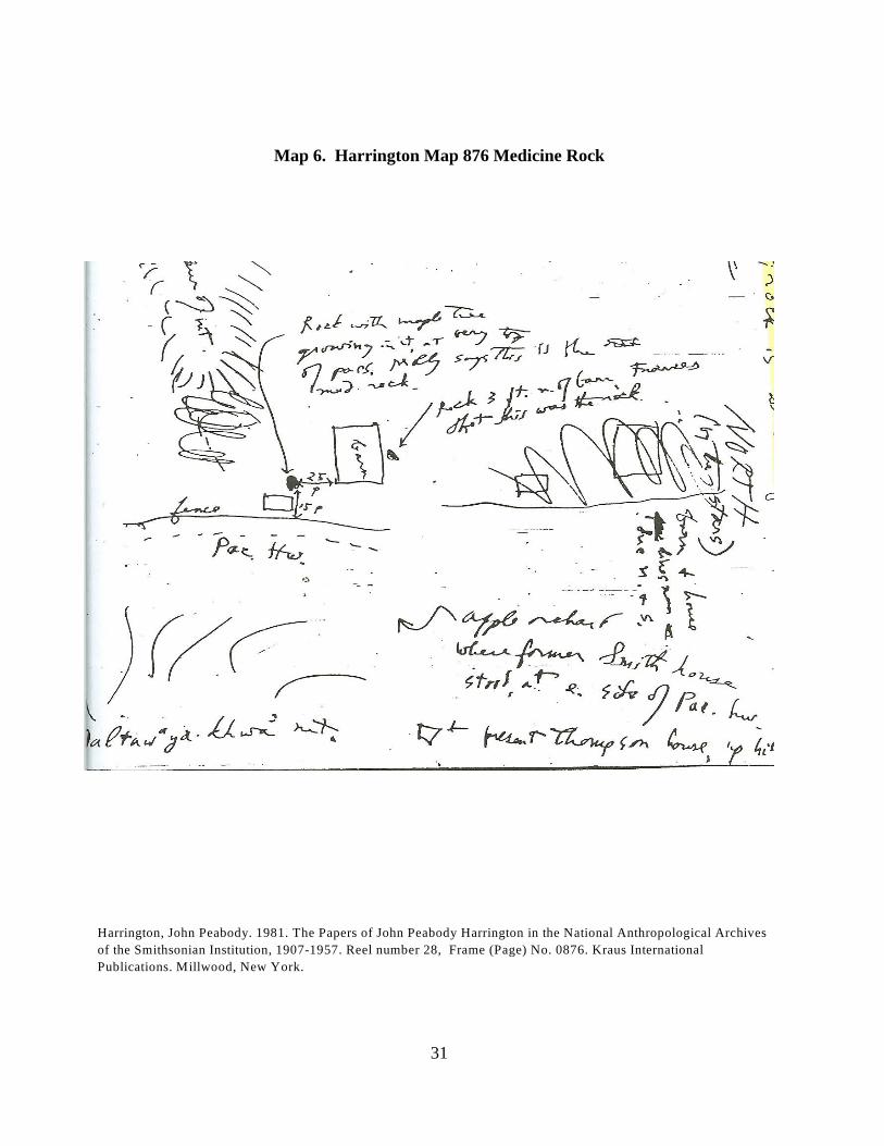
Map 6. Harrington Map 876 Medicine Rock
Harrington Map 876 Medicine Rock is a map of Sexton Pass and “medicine rock”, but field 876map notes do not identify a “spirit”, or “dan-mogol” (Harrington Quote No. 6/Harrington 1981:876; see Map 6. Harrington Map 876 Medicine Rock).
Rock is identified as medicine rock next to Sexton Mountain (“altawayakhwa mt”) on Map 6.“Medicine Rock” at Sexton Mountain is identified in Harrington 1981: 256, 410, 419, 423, 424,431, 557, 558, 560, 582, 583, 587, 588, 589, 591, 593, 601, 602, 604, 605, 606, 608, 609, 610,611, 876.
“On my way back to California from Siletz stop in the evening on Top of Sexton Mt. Andpaced where the ?? rock is with maple growing out of it.” “Rock with maple Tree growingin it, at very top of pass. Molly says this is the med. Rock.” “Rock 3 ft. n. of barn,Frances that this was the rock..” “altawayakhwa mt”.
VII. DOCUMENTATION & PUBLICATION
A. Encourage Neighbor’s Interest in Their Geographic Place, In Their Community
One of the ways the Hugo Neighborhood aims to best promote the social welfare of its Hugoneighbors is by collecting, preserving, interpreting, and researching its rich local history, andencouraging neighbor’s interest in the history of the Hugo area, in their geographic place, in theircommunity. We know the quality of rural life in Hugo is enhanced through citizen knowledge ofits history and the sense of community that a historical perspective facilitates.

23
Culture is the distillation of those things that identify us as people, including our shared andindividual sense of heritage, history, place, creativity and art, traditions and customs, and it is anintegral part of Oregon and Hugo. We believe culture, as one basis for a healthy community, canbe an alternative to destructive behavior and a healing force, and that children educated in theirhistory and culture will contribute to the creative workforce of our evolving technological world.
In the end, Hugoites will be able to tell the story of cultural growth and cultural impact. Childrenwill see its impact on their learning. Families will see the effect of culture through their localparticipation and use of resources. Community development will see its impact economically andthrough greater social involvement and especially pride.
B. Credible Documentation
Documentation is a term with many meanings, just a few of which follow.
1. Set of documents provided on paper, or online, or on digital or analog media, suchas audio tape or CDs, etc.
2. The process of documenting knowledge, as in scientific articles. 3. The process of providing evidence.
This includes updating the HNAT’s draft brochure on John Peabody Harrington’s TakelmaIndian Field Notes (Hugo Neighborhood Association & Historical Society and Josephine CountyHistorical Society. September 9, 2011. Very Draft John Peabody Harrington’s Takelma IndianField Notes. Brochure NA-18G Of Hugo’s Native American Brochure Series. Hugo, OR.) andother information brochures as applicable.
The goal of the HNAT is credible documentation in the sense of transcribing Harrington’s fieldnotes.
24
Appendix A. Gray’s Dan-mologol or Medicine Rock(http://www.hugoneighborhood.org/BROCHURE_NA18AB%20Grays%20Medicine%20Rock%20090711.pdf)
Hugo Neighborhood Association & Historical Society and Josephine County Historical Society.September 7, 2011. Gray’s Dan-mologol or Medicine Rock. Brochure NA-18AB Of Hugo’sNative American Brochure Series. Hugo, OR.
Brochure NA-18AB was written based on Gray’s work before the Hugo Native American Teamacquired a copy of Harrington’s Takelma Indian Field Notes in August 2012. The one referenceto Harrington turned out to be a map of Sexton Pass that identified a medicine rock, but not a“spirit”, or “dan-mogol” (Harrington 1981:876).
“On my way back to California from Siletz stop in the evening on Top of Sexton Mt. Andpaced where the ?? rock is with maple growing out of it.” “Rock with maple Tree growingin it, at very top of pass. Molly says this is the med. Rock.” “Rock 3 ft. n. of barn,Frances that this was the rock..” “altawayakhwa mt”.
The following is the text from the Gray’s Dan-mologol or Medicine Rock brochure.
GRAY’S DAN-MOLOGOL OR MEDICINE ROCK
Overview Hugo, Oregon like most places has its Native American history, some known, mostnot. Hugo’s first citizens or peoples were the Lowland Takelma Indians of the Rogue RiverValley. The Takelmas and Their Athapascan Neighbors Supernatural Beings. For the Takelma, the1
forces of nature and the fate of humans were determined by numerous supernatural spirits. Manyof these supernaturals were associated with organic elements such as plants and animals, whichwere believed to be the transformed manifestations of primeval earthy inhabitants. Some physicalforces of nature, for example thunder and lightning, were believed to be caused by the actions ofthe organic supernatural spirits. Inorganic objects such as the sun, moon, or rain also wereidentified with their own supernatural beings (page 43).1
Dan-mologol or Medicine Rock On a more localized level, some supernatural beings weredirectly associated with particular natural objects, including rocks, trees, and mountains. It was tothese specific objects that offerings of food and valuables, as well as prayers, were often made. Anexample of the practice was noted by Sapir and Harrington in regard to Dan-mologol orMedicine Rock. This spirit was localized in a large rock located in Lowland Takelma territorynear Sexton Mountain (Gray 1987:43; Harrington 1981:876).1 2
ALDAUVAK’WADIS WERE TWO MOUNTAIN BROTHER SPIRITS
Medicine Rock had the power to cure various kinds of illness, as well as inflict pain or death. Offerings of food (e.g., salmon or camas) were deposited on top of the Medicine Rock andprayers were directed to its spirit. Associated with the rock were several implements including abucket, a stick for picking up hot rocks to use in boiling food, a stirring paddle, and a pipe. It is

25
not clear from the accounts whether these were, in fact, the actual implements of daily life or wereother spirit rocks which represented the actual tools. In either case, Sapir recorded a myth fromFrances Johnson which details the use of these implements by Dan-moloqol to inflict revengeupon an evil shaman. Other specific spirit objects mentioned by Frances Johnson include fourmountain spirits, two of whom were brothers. They shared the name Aldauvakwadis and weresubordinates to the spirit of Dan-mologol. One of the mountains was located near MedicineRock, and most likely was Sexton Mountain; the other was near the Illinois River. The thirdspirit mountain, Alsawentadis, located near Sexton Mountain, was likely Walker or RobertsMountain. An interesting side note concerning this spirit mountain was that Frances Johnsontold Harrington that it was on this mountain that ". . . the boat rested after the world flood, theyfound boat there." The fourth mountain spirit recorded by Sapir, called Aldank!ol'ida, was nearJacksonville. Apparently each of these localized spirits was capable of defending the averageperson against the evil caused by shamans. (pages 43 - 44)
Tannaxule-tha: "Medicine Rock, it is like a round table." "Tannaxule-tha is the locality wherethe Medicine Rock was, 'where the rock sits down' . . . where the Medicine Rock is ofAltawaykhaw Mountain, a trail ran past Tannaxule-tha." In the vicinity of Sexton Pass nearpresent day Interstate 5 (page 79).1
ALTAWAYAKHW MOUNTAIN = SEXTON MOUNTAIN
'Altawayakhw' Mountain: Sexton Mountain "Where the Medicine Rock is." "On my wayback to California from Siletz, I stop in the evening on top of Sexton Mountain at the place wherethe rock is with the maple growing out of it" (page 81). 1
Alsawentadis: "Next to the first of the two mountain brothers." [Walker or RobertsMountain, north of Grants Pass.] (page 81 )1
Lathpaltha': "A place this side of Medicine Rock. Between Grave Creek and Medicine Rock.From thpal, a yard high plant, eat roots like carrots" somewhere in the area north of SextonMountain, and south of Grave Creek (page 83).1
Daldanik: "A village north of the Rogue River between Grants Pass and Leaf Creek; in thevicinity of dan mologol" between Grants Pass and Grave Creek, in the vicinity of SextonMountain (page 85).1
Be Respectful. Always be respectful of your neighbor’s property rights. With permission, leaveonly footprints.
Want more information? Contact an member of the HNAT.
1. Gray, Dennis J. (1987). The Takelmas and Their Athapascan Neighbors: A New Ethnographic Synthesis for the
Upper Rogue River Area of Southwestern Oregon, University of Oregon Anthropological Papers, No. 37. Eugene:
Department of Anthropology, University of Oregon.
2. Harrington, John Peabody. 1981 The Papers of John Peabody Harrington in the National Anthropological Archives
of the Smithsonian Institution 1907-1957. Reel number 28. Kraus International Publications. Millwood, New York.

26
MAPS
Map 1. Takelma Lands In Southwestern OregonMap 2. Takelma IndiansMap 3. Harrington Map 460 Takelma VillagesMap 4. Harrington Map 560 Medicine RockMap 5. Harrington Map 583 Medicine RockMap 6. Harrington Map 876 Medicine Rock
Map 1. Takelma Lands In Southwestern Oregon
Map 1. Takelma Lands

27
Map 2. Takelma Indians
Map 1. Takelma Indians

28
Map 3. Harrington Map 460 Takelma Villages
Beckham, Stephen Dow. September 30, 1993. Takelman And Athapascan Lifeways And History, Rogue River
Corridor – Applegate River To Grave Creek: Investigations For Interpretive Programs. Page 460. Submitted to BLM
Medford District. Heritage Research Associates, Inc. Eugene, OR.
Harrington, John Peabody. 1981. The Papers of John Peabody Harrington in the National Anthropological Archives
of the Smithsonian Institution, 1907-1957. Reel number 28, Frame (Page) No. 0460. Kraus International
Publications. Millwood, New York.

29
Map 4. Harrington Map 560 Medicine Rock
Harrington, John Peabody. 1981. The Papers of John Peabody Harrington in the National Anthropological Archives
of the Smithsonian Institution, 1907-1957. Reel number 28, Frame (Page) No. 0560. Kraus International
Publications. Millwood, New York.

30
Map 5. Harrington Map 583 Medicine Rock
Harrington, John Peabody. 1981. The Papers of John Peabody Harrington in the National Anthropological Archives
of the Smithsonian Institution, 1907-1957. Reel number 28, Frame (Page) No. 0583. Kraus International
Publications. Millwood, New York.
31
Map 6. Harrington Map 876 Medicine Rock
Harrington, John Peabody. 1981. The Papers of John Peabody Harrington in the National Anthropological Archives
of the Smithsonian Institution, 1907-1957. Reel number 28, Frame (Page) No. 0876. Kraus International
Publications. Millwood, New York.

32
Map 7. Takelma Villages At Confluences of Applegate & Rogue Rivers
See Attachment 1: Map 1. Takelma Winter Villages Confluence of Rouge River and ApplegateRiver: 1855 October 5, 2011.

33
Bibliography
Beckham, Stephen Dow. September 30, 1993. Takelman And Athapascan Lifeways And History,Rogue River Corridor – Applegate River To Grave Creek: Investigations For InterpretivePrograms. Submitted to BLM Medford District. Heritage Research Associates, Inc. Eugene, OR.
Beckham, Stephen Dow. 1971. Requiem For a People: The Rogue Indians and the Frontiersmen.University of Oklahoma Press. Norman, OK.
Gray, Dennis J. 1985. The Takelma and their Athapascan Kin: an Ethnographic Synthesis ofSouthwestern Oregon. A Thesis submitted to Oregon State University in partial fulfillment ofthe requirements for the degree of Master of Arts in Interdisciplinary Studies. Corvallis, OR(http://scholarsarchive.library.oregonstate.edu/xmlui/bitstream/handle/1957/7902/Gray_Dennis_J_1985.pdf?sequence=1)
Gray, Dennis J. 1987. The Takelmas and Their Athapascan Neighbors: A New EthnographicSynthesis for the Upper Rogue River Area of Southwestern Oregon, University of OregonAnthropological Papers, No. 37. Eugene: Department of Anthropology, University of Oregon. (http://soda.sou.edu/awdata/021104a1.pdf)
Harrington, John Peabody. 1981. The Papers of John Peabody Harrington in the NationalAnthropological Archives of the Smithsonian Institution, 1907-1957. Reel number 28, Frames(Pages) Nos. 0001 - 0889. Kraus International Publications. Millwood, New York.
Sapir, Edward. 1907. Notes on the Takelma Indians of Southwestern Oregon, AmericanAnthropologist. Volume 9, Number 2:251-275. (http://www.jstor.org/stable/659586)
Sapir, Edward. 1907. The Religious Ideas of the Takelma Indians of Southwestern Oregon,Journal of American Folklore. Volume 20:33-49. (http://www.jstor.org/stable/534724)
Sapir, Edward. 1909. Takelma Texts. Anthropological Publications, Volume 2. University ofPennsylvania.
.
C:\Documents and Settings\mike\My Documents\Genealogy\Native_Americans\References\Harrington Papers Outline 082312.wpd