Embed Size (px)
Citation preview
Form 62-330.060(1)
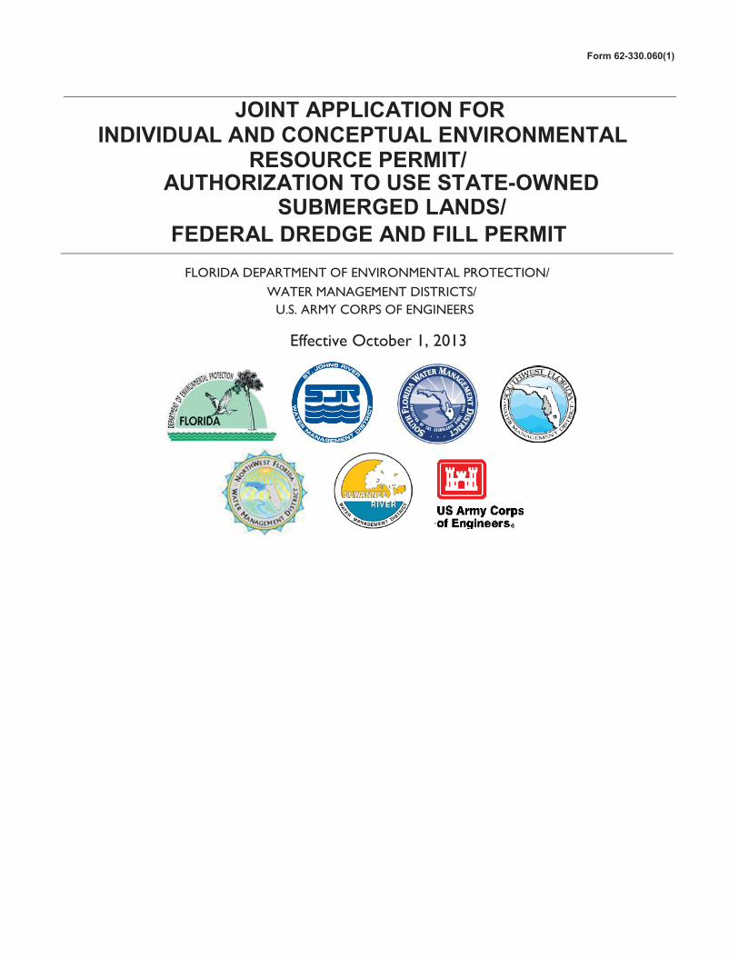
JOINT APPLICATION FORINDIVIDUAL AND CONCEPTUAL ENVIRONMENTAL
RESOURCE PERMIT/AUTHORIZATION TO USE STATE-OWNED
SUBMERGED LANDS/FEDERAL DREDGE AND FILL PERMIT
FLORIDA DEPARTMENT OF ENVIRONMENTAL PROTECTION/ WATER MANAGEMENT DISTRICTS/
U.S. ARMY CORPS OF ENGINEERS
Effective October 1, 2013
Form 62-330.060(1)
Section A
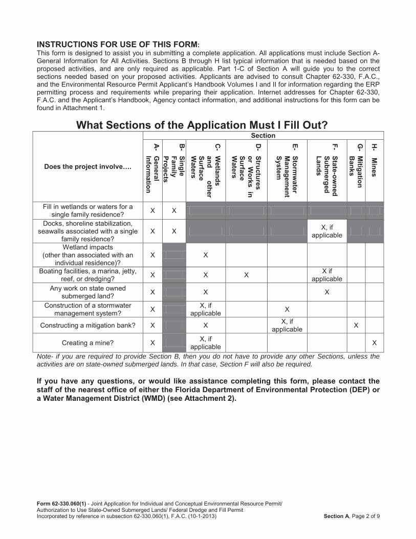
INSTRUCTIONS FOR USE OF THIS FORM:
What Sections of the Application Must I Fill Out?
Does the project involve….
Section
A-
General
Information
B-
Single Fam
ily Pro jects
C-
Wetlands
and other
Surface W
aters
D-
Structures or W
orks in Surface W
aters
E- Storm
water
Managem
ent System
F- State-ow
nedSubm
erged Lands
G- M
itigation B
anks
H-
Mines
Note- if you are required to provide Section B, then you do not have to provide any other Sections, unless the activities are on state-owned submerged lands. In that case, Section F will also be required.
If you have any questions, or would like assistance completing this form, please contact the staff of the nearest office of either the Florida Department of Environmental Protection (DEP) or a Water Management District (WMD) (see Attachment 2).
Form 62-330.060(1)
Section A
Section A: General Information for All ActivitiesPART 1: NAME, APPLICATION TYPE, LOCATION, AND DESCRIPTION OF ACTIVITY
new
Conceptual Approval
existing
Maintenance or repair
existing unpermitted
List the type of activities proposed. Check all that apply, and provide the supplemental information requested in each of the referenced application sections. Please also reference Applicant’s Handbooks I and II for the type of information that may be needed.
Provide the information requested in Section B. Do not complete Section C.
Examples include dredging, filling, outfall structures, docks, piers, over-water structures, shoreline stabilization, mitigation, reclamation, restoration/enhancement. Provide the information requested in Section C.
In addition to Section C, also provide the information requested in Section D.
See Chapter 18-21, F.A.C. https://www.flrules.org/gateway/ChapterHome.asp?Chapter=18-21): In addition to Section B or C, also provide the information requested in Section F
Selmon West Extension
✔
✔
4111755.00
✔
Form 62-330.060(1)
Section A
Provide the information requested in Section E.
Provide the information requested in Section G.
Provide the information requested in Section H.
Please attach a location map showing the location and boundaries of the proposed activity in relation to major intersections or other landmarks. The map should also contain a north arrow and a graphic scale; show Section(s), Township(s), and Range(s); and must be of sufficient detail to allow a person unfamiliar with the site to find it.
✔
✔
Gandy Blvd. from existing terminus to Gandy Bridge
Tampa Hillsborough 33611
4 & 5 30S 18E
8 & 9 30S 18E
27 53 34.61 82 31 26.87
LABINS.org
FDOT right-of-way; THEA parcels
Head south from I-275 on Dale Mabry Highway to intersection of Dale Mabry Highway and Gandy Boulevard
101.7
Form 62-330.060(1)
Section A
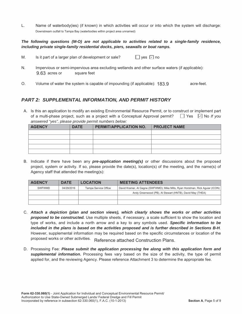
The following questions (M-O) are not applicable to activities related to a single-family residence,including private single-family residential docks, piers, seawalls or boat ramps.
PART 2: SUPPLEMENTAL INFORMATION, AND PERMIT HISTORY
If youanswered “yes”, please provide permit numbers below:AGENCY DATE PERMIT/APPLICATION NO. PROJECT NAME
pre-application meeting(s)
AGENCY DATE LOCATION MEETING ATTENDEES
Attach a depiction (plan and section views), which clearly shows the works or other activitiesproposed to be constructed.
Specific information to be included in the plans is based on the activities proposed and is further described in Sections B-H.
Please submit the application processing fee along with this application form and supplemental information.
Downstream outfall to Tampa Bay (waterbodies within project area unnamed)
✔
9.63
183.9
✔
SWFWMD 04/29/2016 Tampa Service Office David Kramer, Al Gagne (SWFWMD); Mike Mills, Ryan Horstman, Rick Aguiar (ICON)
Andy Greenwood (PB), Al Stewart (HNTB), David May (THEA)
Reference attached Construction Plans.
Form 62-330.060(1)
Section A
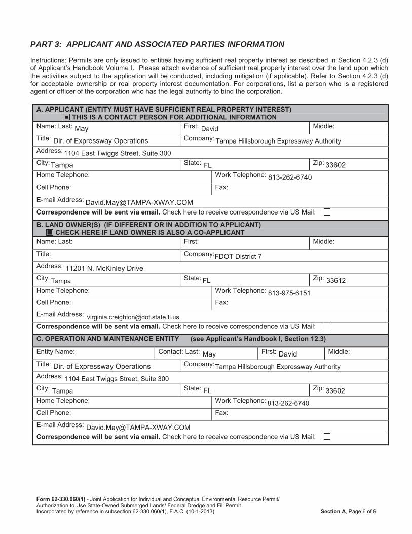
PART 3: APPLICANT AND ASSOCIATED PARTIES INFORMATION
A. APPLICANT (ENTITY MUST HAVE SUFFICIENT REAL PROPERTY INTEREST) THIS IS A CONTACT PERSON FOR ADDITIONAL INFORMATION Correspondence will be sent via email.
B. LAND OWNER(S) (IF DIFFERENT OR IN ADDITION TO APPLICANT)CHECK HERE IF LAND OWNER IS ALSO A CO-APPLICANT
Correspondence will be sent via email.
C. OPERATION AND MAINTENANCE ENTITY (see Applicant’s Handbook I, Section 12.3) Correspondence will be sent via email.
■
May David
Dir. of Expressway Operations Tampa Hillsborough Expressway Authority
1104 East Twiggs Street, Suite 300
Tampa FL 33602813-262-6740
FDOT District 7
11201 N. McKinley Drive
Tampa FL 33612
813-975-6151
May DavidDir. of Expressway Operations Tampa Hillsborough Expressway Authority
1104 East Twiggs Street, Suite 300
Tampa FL 33602
813-262-6740
Form 62-330.060(1)
Section A
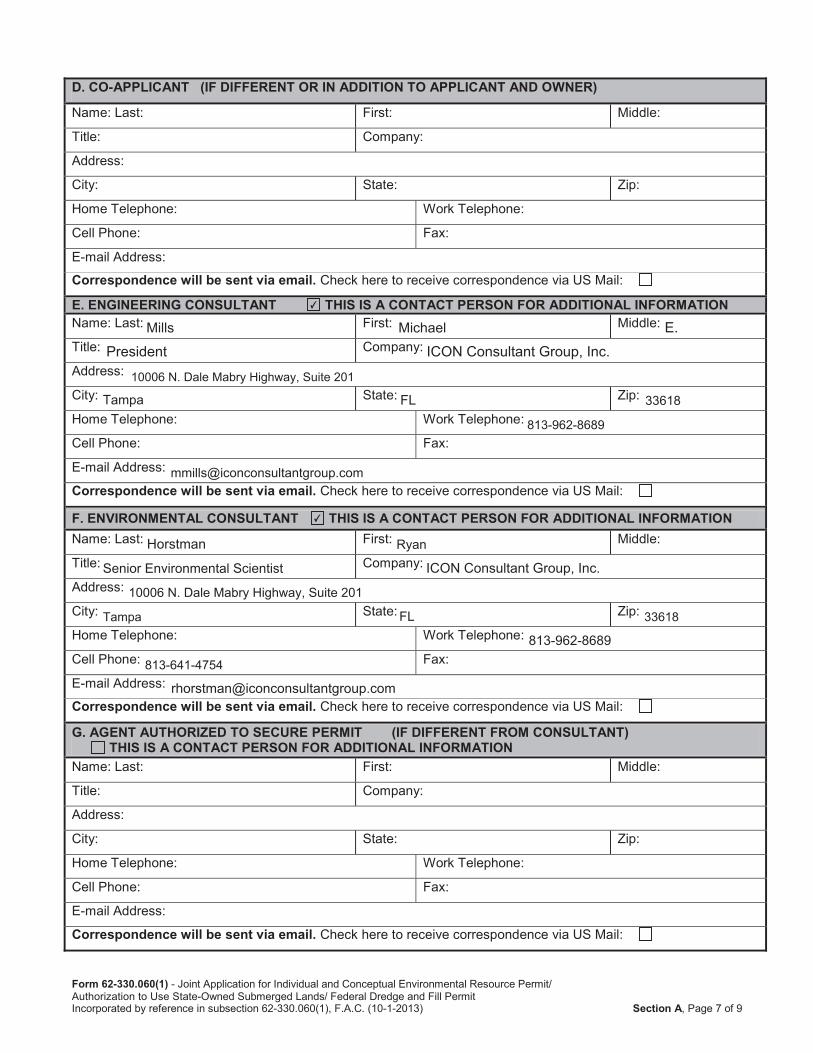
D. CO-APPLICANT (IF DIFFERENT OR IN ADDITION TO APPLICANT AND OWNER) Correspondence will be sent via email.
E. ENGINEERING CONSULTANT THIS IS A CONTACT PERSON FOR ADDITIONAL INFORMATION Correspondence will be sent via email.
F. ENVIRONMENTAL CONSULTANT THIS IS A CONTACT PERSON FOR ADDITIONAL INFORMATION Correspondence will be sent via email.
G. AGENT AUTHORIZED TO SECURE PERMIT (IF DIFFERENT FROM CONSULTANT)THIS IS A CONTACT PERSON FOR ADDITIONAL INFORMATION
Correspondence will be sent via email.
✔
Mills Michael E.President ICON Consultant Group, Inc.
10006 N. Dale Mabry Highway, Suite 201
Tampa FL 33618
813-962-8689
✔
Horstman Ryan
Senior Environmental Scientist ICON Consultant Group, Inc.
10006 N. Dale Mabry Highway, Suite 201
Tampa FL 33618
813-962-8689
813-641-4754
Form 62-330.060(1)
Section A
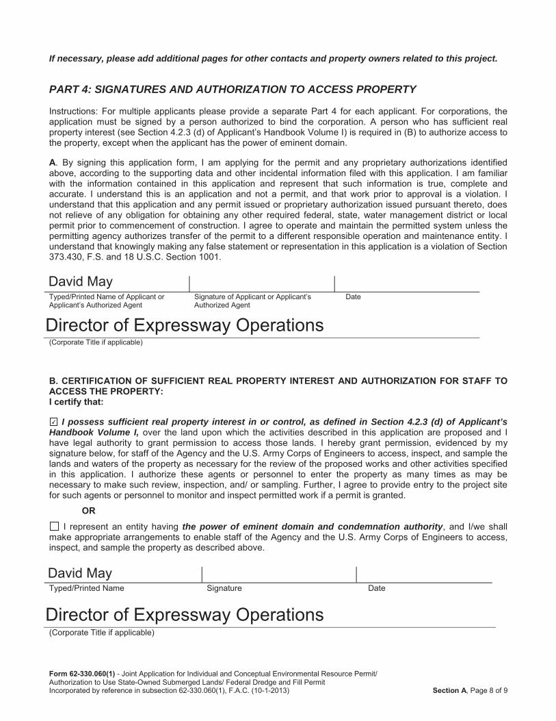
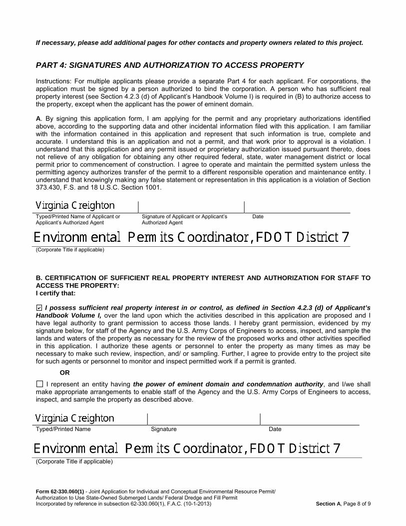
If necessary, please add additional pages for other contacts and property owners related to this project.
PART 4: SIGNATURES AND AUTHORIZATION TO ACCESS PROPERTY
A
B. CERTIFICATION OF SUFFICIENT REAL PROPERTY INTEREST AND AUTHORIZATION FOR STAFF TOACCESS THE PROPERTY: I certify that:
I possess sufficient real property interest in or control, as defined in Section 4.2.3 (d) of Applicant’s Handbook Volume I,
ORthe power of eminent domain and condemnation authority
David May
Director of Expressway Operations
✔
David May
Director of Expressway Operations
Form 62-330.060(1) - Joint Application for Individual and Conceptual Environmental Resource Permit/ Authorization to Use State-Owned Submerged Lands/ Federal Dredge and Fill Permit Incorporated by reference in subsection 62-330.060(1), F.A.C. (10-1-2013) Section A, Page 8 of 9
If necessary, please add additional pages for other contacts and property owners related to this project.
PART 4: SIGNATURES AND AUTHORIZATION TO ACCESS PROPERTY Instructions: For multiple applicants please provide a separate Part 4 for each applicant. For corporations, the application must be signed by a person authorized to bind the corporation. A person who has sufficient real property interest (see Section 4.2.3 (d) of Applicant’s Handbook Volume I) is required in (B) to authorize access to the property, except when the applicant has the power of eminent domain. A. By signing this application form, I am applying for the permit and any proprietary authorizations identified above, according to the supporting data and other incidental information filed with this application. I am familiar with the information contained in this application and represent that such information is true, complete and accurate. I understand this is an application and not a permit, and that work prior to approval is a violation. I understand that this application and any permit issued or proprietary authorization issued pursuant thereto, does not relieve of any obligation for obtaining any other required federal, state, water management district or local permit prior to commencement of construction. I agree to operate and maintain the permitted system unless the permitting agency authorizes transfer of the permit to a different responsible operation and maintenance entity. I understand that knowingly making any false statement or representation in this application is a violation of Section 373.430, F.S. and 18 U.S.C. Section 1001.
Typed/Printed Name of Applicant or Applicant’s Authorized Agent
Signature of Applicant or Applicant’s Authorized Agent
Date
(Corporate Title if applicable)
B. CERTIFICATION OF SUFFICIENT REAL PROPERTY INTEREST AND AUTHORIZATION FOR STAFF TO ACCESS THE PROPERTY: I certify that:
I possess sufficient real property interest in or control, as defined in Section 4.2.3 (d) of Applicant’s Handbook Volume I, over the land upon which the activities described in this application are proposed and I have legal authority to grant permission to access those lands. I hereby grant permission, evidenced by my signature below, for staff of the Agency and the U.S. Army Corps of Engineers to access, inspect, and sample the lands and waters of the property as necessary for the review of the proposed works and other activities specified in this application. I authorize these agents or personnel to enter the property as many times as may be necessary to make such review, inspection, and/ or sampling. Further, I agree to provide entry to the project site for such agents or personnel to monitor and inspect permitted work if a permit is granted.
OR
I represent an entity having the power of eminent domain and condemnation authority, and I/we shall make appropriate arrangements to enable staff of the Agency and the U.S. Army Corps of Engineers to access, inspect, and sample the property as described above.
Typed/Printed Name Signature Date
(Corporate Title if applicable)
Form 62-330.060(1)
Section A
C. DESIGNATION OF AUTHORIZED AGENT (IF APPLICABLE):
Form #62-330.060(1) - Joint Application for Individual and Conceptual Environmental Resource Permit/ Authorization to UseState-Owned Submerged Lands/ Federal Dredge and Fill PermitIncorporated by reference in subsection 62-330.060(1), F.A.C. (October 1, 2013) Section C, Page 1 of 10
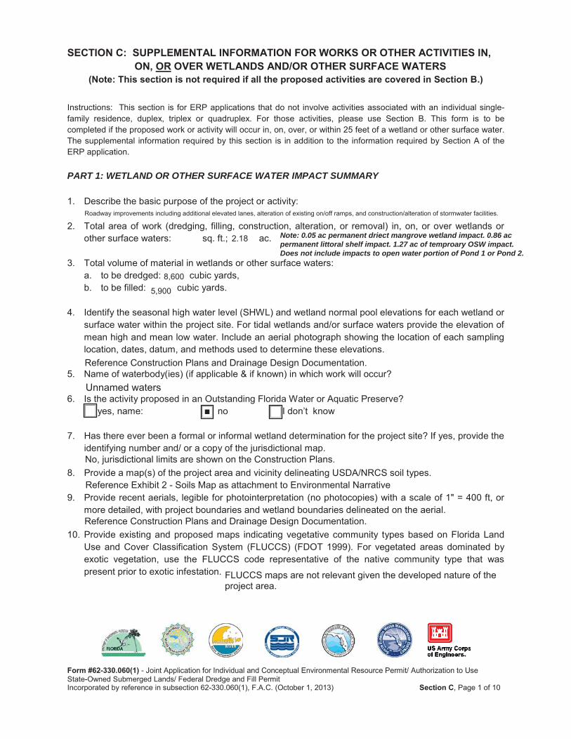
SECTION C: SUPPLEMENTAL INFORMATION FOR WORKS OR OTHER ACTIVITIES IN, ON, OR OVER WETLANDS AND/OR OTHER SURFACE WATERS
(Note: This section is not required if all the proposed activities are covered in Section B.)
Instructions: This section is for ERP applications that do not involve activities associated with an individual single-family residence, duplex, triplex or quadruplex. For those activities, please use Section B. This form is to be completed if the proposed work or activity will occur in, on, over, or within 25 feet of a wetland or other surface water. The supplemental information required by this section is in addition to the information required by Section A of the ERP application.
PART 1: WETLAND OR OTHER SURFACE WATER IMPACT SUMMARY
1. Describe the basic purpose of the project or activity:
2. Total area of work (dredging, filling, construction, alteration, or removal) in, on, or over wetlands or other surface waters: sq. ft.; ac.
3. Total volume of material in wetlands or other surface waters: a. to be dredged: cubic yards, b. to be filled: cubic yards.
4. Identify the seasonal high water level (SHWL) and wetland normal pool elevations for each wetland or surface water within the project site. For tidal wetlands and/or surface waters provide the elevation of mean high and mean low water. Include an aerial photograph showing the location of each sampling location, dates, datum, and methods used to determine these elevations.
5. Name of waterbody(ies) (if applicable & if known) in which work will occur?
6. Is the activity proposed in an Outstanding Florida Water or Aquatic Preserve?yes, name: no I don’t know
7. Has there ever been a formal or informal wetland determination for the project site? If yes, provide the identifying number and/ or a copy of the jurisdictional map.
8. Provide a map(s) of the project area and vicinity delineating USDA/NRCS soil types.
9. Provide recent aerials, legible for photointerpretation (no photocopies) with a scale of 1" = 400 ft, or more detailed, with project boundaries and wetland boundaries delineated on the aerial.
10. Provide existing and proposed maps indicating vegetative community types based on Florida Land Use and Cover Classification System (FLUCCS) (FDOT 1999). For vegetated areas dominated by exotic vegetation, use the FLUCCS code representative of the native community type that was present prior to exotic infestation.
Note: 0.05 ac permanent driect mangrove wetland impact. 0.86 acpermanent littoral shelf impact. 1.27 ac of temproary OSW impact.Does not include impacts to open water portion of Pond 1 or Pond 2.
Roadway improvements including additional elevated lanes, alteration of existing on/off ramps, and construction/alteration of stormwater facilities.
2.18
8,600
5,900
Reference Construction Plans and Drainage Design Documentation.
Unnamed waters
■
No, jurisdictional limits are shown on the Construction Plans.
Reference Exhibit 2 - Soils Map as attachment to Environmental Narrative
Reference Construction Plans and Drainage Design Documentation.
FLUCCS maps are not relevant given the developed nature of theproject area.
Form #62-330.060(1) - Joint Application for Individual and Conceptual Environmental Resource Permit/ Authorization to UseState-Owned Submerged Lands/ Federal Dredge and Fill PermitIncorporated by reference in subsection 62-330.060(1), F.A.C. (October 1, 2013) Section C, Page 2 of 10
11. Provide existing and proposed maps indicating vegetative community types based on the Florida Natural Areas Inventory Guide to the Natural Communities of Florida.
12. Impact Summary Tables (located at the end of this section):
a. For all projects, complete Table 1, 2 and 3 as applicable.
b. For shoreline stabilization projects, provide the information requested in Table 4.
13. Adjacent property owners. The following information is required only for projects proposed to occur in, on or over wetlands that need a federal dredge and fill permit and/or authorization to use state owned submerged lands and is not necessary when applying solely for an Environmental Resource Permit. If the activity is located on state owned submerged lands and requires a lease or easement, provide a list of names and addresses from the latest county tax assessment roll of all property owners located within a 500 ft. radius of the proposed lease or easement boundary in mailing label format, or you may elect to send notice to those persons by certified mail, with the return-receipt card addressed to the DEP or water management district, as applicable, in accordance with subsection 18-21.005(3), F.A.C., and Section 253.115, F.S. For projects that need a federal dredge and fill permit, please provide the names, addresses and zip codes of property owners whose property directly adjoins the project (excluding applicant). Attach additional sheets if necessary.
1. 2.
3. 4.
5. 6.
PART 2: ENVIRONMENTAL CONSIDERATIONSNote: for many questions, a state rule/Applicant’s Handbook Volume I (AH I) section is cited to assist the applicant in addressing these questions. However, additional Federal criteria may apply.
1. Elimination or Reduction of Impacts (Avoidance and Minimization). Describe measures taken to eliminate or reduce impacts to wetlands and other surface waters (Refer to AH I Section 10.2.1).
2. Fish, Wildlife, Listed Species and their Habitats. Provide results of any wildlife assessments that have been conducted on the project site and provide any comments pertaining to the project from the Florida Fish and Wildlife Conservation Commission and/or the U.S. Fish and Wildlife Service (Refer to AH I Section 10.2.2).
3. Water quantity impacts to wetlands and other surface waters (Refer to AH I Section 10.2.2.4 and AH II).
FNAI vegetative community maps are not relevant given the developed nature of the project area.
See attached Table 1.
N/A
No SSL. To be provided separately if required forUSACE permitting
Impacts to wetlands have been avoided and impacts to surface waters have been minimized.Reference Environmental Narrative for additional details.
Reference Environmental Narrative for details regarding wildlife and habitats.
Reference Drainage Design Documentation for details.
Form #62-330.060(1) - Joint Application for Individual and Conceptual Environmental Resource Permit/ Authorization to UseState-Owned Submerged Lands/ Federal Dredge and Fill PermitIncorporated by reference in subsection 62-330.060(1), F.A.C. (October 1, 2013) Section C, Page 3 of 10
a. Does the activity include a proposed stormwater water management system with a control elevation different than the wetland normal pool elevation(s) of existing or proposed created wetlands or other surface waters?
b. If yes to (a), provide documentation (e.g. drawdown assessment or other methods) that shows the proposed surface water management system will not change the hydroperiod of the existing or created wetland or other surface water.
4. Public Interest Test. Please describe how the proposed activity will not be contrary to the public interest, OR if such an activity significantly degrades or is located within an Outstanding Florida Water (OFW), that the regulated activity will be clearly in the public interest (Refer to AH I Section 10.2.3).
a. Please describe how the project will be designed to avoid adverse affects to public health, safety, or the welfare or the property of others.
b. Please describe how the project will be designed to avoid adverse affects to the conservation of fish and wildlife, including endangered or threatened species, or their habitats.
c. Please describe how the project will be designed to avoid adverse affects to navigation or the flow of water or cause harmful erosion or shoaling.
d. Please describe how the project will be designed to avoid adverse affects to the fishing or recreational values or marine productivity in the vicinity of the activity.
e. Will the project be of a temporary or permanent nature?
f. Please describe how the project will be designed to avoid adverse impacts to significant historical and archaeological resources, under the provisions of section 267.061, F.S.
g. Please describe how the project will be designed to avoid adverse affects to the current condition and relative value of functions being performed by areas affected by the proposed regulated activity.
5. Water Quality. Provide a description of how water quality will be maintained in wetlands and other surface waters that will be preserved or will remain undisturbed, both on and offsite. Please address both short-term (such as during construction) and long-term water quality considerations (Refer to AH I Section 10.2.4).
6. Class II Waters; Waters approved for shellfish harvesting (Refer to AH I Section 10.2.5).
a. Will the project occur in Class II that are NOT approved for shellfish harvesting? If yes, please provide a plan or procedure detailing the measures to be taken to meet the requirements of AH ISection 10.2.5(a).
b. Is the project located adjacent to or in close proximity to Class II waters? If yes, please provide a plan or procedure detailing the measures to be taken to meet the requirements of AH I Section 10.2.5(b).
No, reference Drainage Design Documentation for details.
Reference Environmental Narrative for details regarding Public Interest Test.
Reference Drainage Design Documentation for details.
N/A
Form #62-330.060(1) - Joint Application for Individual and Conceptual Environmental Resource Permit/ Authorization to UseState-Owned Submerged Lands/ Federal Dredge and Fill PermitIncorporated by reference in subsection 62-330.060(1), F.A.C. (October 1, 2013) Section C, Page 4 of 10
c. Is the project located in Class II or Class III waters that are classified as “approved”, “restricted”, “conditionally approved”, or “conditionally restricted”? If yes, demonstrate that the project meets the requirements of AH I Section 10.2.5(c).
7. Vertical seawalls. Are vertical seawalls proposed in an estuary or lagoon as part of the project? If yes, please describe how the project meets the requirements of AH I Section 10.2.6.
8. Secondary Impacts (AH I Section 10.2.7).
a. Will an upland buffer, with a minimum width of 15' and an average width of 25', be provided between the proposed activities and existing wetlands or wetlands to be preserved, enhanced, restored, or created? Provide the location and dimension of all buffers on the plans. If not,demonstrate that secondary impacts will not occur or how they will be offset.
b. If listed species are present or may be present then coordination with wildlife agencies is needed. Have you coordinated with the FFWCC and/or USFWS? If so, please provide correspondence from the wildlife agencies indicating concurrence with the species management plan(s).
c. What measures will be taken to avoid impacts to wetland-dependent wildlife and/or listed species that use uplands for nesting or denning?
d. Describe whether there are any other relevant activities that are very closely linked and causally related to any proposed dredging or filling in wetlands or other surface waters that have the potential to cause impacts to significant historical and archaeological resources.
e. Are there additional future phases or extensions of the proposed activities that are not shown? If yes, please describe.
9. Cumulative Impacts. Is the proposed mitigation located within the same drainage basin (Refer to AH I Figures 10.2.8.1 – 10.2.8.5) as the proposed wetland impacts? If not, please submit a Cumulative Impact Evaluation in accordance with AH I Section 10.2.8.
10. Mitigation Plan (Refer to AH I Section 10.3).
a. If a mitigation bank is proposed to offset wetland/other surface water impacts, provide:
i. the name of the bank: . A letter of reservation from the banker will be required once the application has been evaluated.
ii. If the mitigation bank was assessed using UMAM, provide UMAM worksheets for impact area(s). If the bank was assessed using a method other than UMAM, then prepare the impact assessment using the same method.
b. If mitigation is proposed to offset wetland/other surface water impacts, please provide a mitigation plan that includes, at a minimum, the following:
i. Proposed mitigation narrative: (1) Describe the current and proposed condition for each type of mitigation
component (restoration, enhancement, creation, preservation), including:(a) Describe current and proposed vegetation
N/A
Buffers maintained where feasible and currently present.
Listed species have not been documented onsite and impacts are unlikely.
Suitable upland habitat is not present within or adjacent to the project limits.
Project is located in areas previously disturbed by development and road construction.
No additional phases or extensions are planned or known at this time.
Yes
TBMB
Reference UMAM Assessment Worksheets in Appendix A of the Environmental Narrative.
Form #62-330.060(1) - Joint Application for Individual and Conceptual Environmental Resource Permit/ Authorization to UseState-Owned Submerged Lands/ Federal Dredge and Fill PermitIncorporated by reference in subsection 62-330.060(1), F.A.C. (October 1, 2013) Section C, Page 5 of 10
(b) Describe current and proposed hydrologic conditions for the proposed mitigation.
(c) Describe the soil types from NRCS maps and confirm if actual soil conditions appear to match.
(2) Provide details of the proposed construction/mitigation activities including phasing and timing, as appropriate.
(3) Identify measures that will be implemented during and after construction to avoid adverse impacts related to the proposed activities.
(4) A mitigation implementation and monitoring schedule with dates.(5) Identify the success criteria.(6) Describe the anticipated site conditions in and around the mitigation area after
the mitigation plan is successfully implemented.(7) Provide a comparison of current fish and wildlife habitat to expected habitat
after the mitigation plan is successfully implemented.ii. Provide a Management Plan that includes, as appropriate, aspects of operation and
maintenance, including water management practices, vegetation establishment, exotic and nuisance species control, fire management, and control of access.
iii. Maps:(1) Soil map (include soil names/codes, hydrologic soil groups and hydric soil
types).(2) Topographic map of the mitigation area and adjacent contributing and receiving
areas.(3) Hydrologic features map of the mitigation area and adjacent contributing and
receiving areas.(4) Vegetative communities map (using FLUCCS or other appropriate classification
system).(5) For all maps, indentify source.
iv. Provide the necessary supporting information for the application of sections 62-345.400 - .600 (Uniform Mitigation Assessment Method (UMAM)). To meet this requirement, submittal of UMAM worksheets is acceptable for impact and mitigation areas.
v. If onsite and/or offsite applicant-responsible mitigation is proposed, submit a draft Conservation Easement document or other form of restrictive covenant that provides for protection of the mitigation area in perpetuity. Standard forms, as described in subsection 62-330.301(6), F.A.C., are available from the Agency or on its website.
vi. If onsite and/or offsite applicant-responsible mitigation is proposed, submit a cost estimate for completing the mitigation, including monitoring and maintenance.
vii. If onsite and/or offsite applicant-responsible mitigation is proposed and the proposed mitigation exceeds $25,000, please provide a draft financial assurance document.
viii. Identify the entity responsible for monitoring, maintenance and long-term stewardship of the mitigation area (i.e. the landowner or homeowner association, not the consultant or contractor that will do the work).
Form #62-330.060(1) - Joint Application for Individual and Conceptual Environmental Resource Permit/ Authorization to UseState-Owned Submerged Lands/ Federal Dredge and Fill PermitIncorporated by reference in subsection 62-330.060(1), F.A.C. (October 1, 2013) Section C, Page 6 of 10
PART 3: PLANS
PLANS: The information listed in the checklist below represent the typical information required on the submitted project plans. The Plans checklists in each application section are cumulative unless otherwise noted. Separate plans for each application section are not required.
1. Include the following on the construction plans and cross sections:
a. An Existing Conditions sheet showing the entire project and wetland/other surface water boundaries. Include the following: Acreage and type (herbaceous, forested or other surface water) of each wetland/other surface water.
b. A Proposed Conditions sheet showing the entire project and wetland/other surface water boundaries with construction plan overlay.
c. A Proposed Wetland Impact sheet that include the following:i. Acreage and type (herbaceous, forested or other surface water) of each wetland/other
surface water to be impacted.ii. Proposed upland buffers with dimensions.iii. Identify the seasonal high water and wetland normal pool elevations on the plans.iv. Separately identify WMD/FDEP and USACE wetland/other surface water impacts if
different.d. Include wetland boundaries on all construction plan sheets.
2. If onsite and/or offsite applicant-responsible mitigation is proposed, submit mitigation permit plans and cross sections including, at a minimum:
a. existing conditions plan sheet identifying upland and wetland communities and acreage of each, topography, drainage patterns, and location of cross-section detail.
b. proposed conditions plan sheet identifying proposed improvements by type (restoration, enhancement, creation, preservation), acreage of each, topography, drainage patterns, and location of cross-section detail.
c. monitoring plan sheet including proposed improvements, monitoring transects, photostations, and mitigation signage (if applicable).
d. cross-section and/or profile detail(s) sheet(s) including representative section of each type of mitigation component. Include existing and proposed conditions and representative elevations.
e. planting schedule, plant species including common and scientific names divided into three sections (canopy, shrub, herbaceous) by mitigation component, quantity, spacing, size, and elevation range.
Neither onsite nor offsite mitigation is proposed as part of this project.
✔
✔
✔
✔
✔
✔
✔
Form #62-330.060(1) - Joint Application for Environmental Resource Individual Permit/ Authorization to UseState-Owned Submerged Lands/ Federal Dredge and Fill PermitIncorporated by reference in subsection 62-330.060(1), F.A.C. (October 1, 2013) Section C, Page 7 of 10
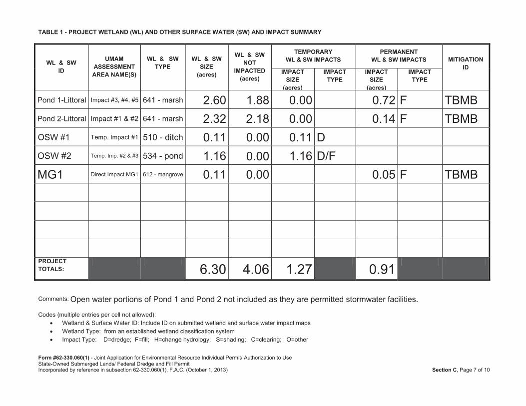
TABLE 1 - PROJECT WETLAND (WL) AND OTHER SURFACE WATER (SW) AND IMPACT SUMMARY
WL & SWID
UMAM ASSESSMENT AREA NAME(S)
WL & SWTYPE
WL & SW SIZE
(acres)
WL & SWNOT
IMPACTED (acres)
TEMPORARYWL & SW IMPACTS
PERMANENTWL & SW IMPACTS MITIGATION
IDIMPACT
SIZE (acres)
IMPACT TYPE
IMPACT SIZE
(acres)
IMPACT TYPE
PROJECT TOTALS:
Comments:
Codes (multiple entries per cell not allowed):Wetland & Surface Water ID: Include ID on submitted wetland and surface water impact mapsWetland Type: from an established wetland classification systemImpact Type: D=dredge; F=fill; H=change hydrology; S=shading; C=clearing; O=other
Open water portions of Pond 1 and Pond 2 not included as they are permitted stormwater facilities.
Pond 1-Littoral Impact #3, #4, #5 641 - marsh 2.60 1.88 0.00 0.72 F TBMBPond 2-Littoral Impact #1 & #2 641 - marsh 2.32 2.18 0.00 0.14 F TBMBOSW #1 Temp. Impact #1 510 - ditch 0.11 0.00 0.11 DOSW #2 Temp. Imp. #2 & #3 534 - pond 1.16 0.00 1.16 D/FMG1 Direct Impact MG1 612 - mangrove 0.11 0.00 0.05 F TBMB
6.30 4.06 1.27 0.91
Form #62-330.060(1) - Joint Application for Environmental Resource Individual Permit/ Authorization to UseState-Owned Submerged Lands/ Federal Dredge and Fill PermitIncorporated by reference in subsection 62-330.060(1), F.A.C. (October 1, 2013) Section C, Page 8 of 10
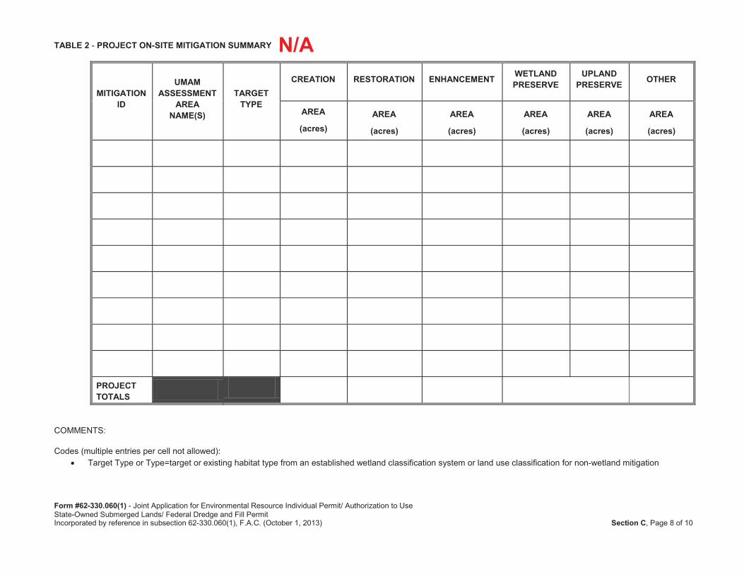
TABLE 2 - PROJECT ON-SITE MITIGATION SUMMARY
MITIGATION ID
UMAM ASSESSMENT
AREA NAME(S)
TARGETTYPE
CREATION RESTORATION ENHANCEMENT WETLAND PRESERVE
UPLAND PRESERVE OTHER
AREA
(acres)AREA
(acres)
AREA
(acres)
AREA
(acres)
AREA
(acres)
AREA
(acres)
PROJECT TOTALS
COMMENTS:
Codes (multiple entries per cell not allowed):Target Type or Type=target or existing habitat type from an established wetland classification system or land use classification for non-wetland mitigation
N/A
Form #62-330.060(1) - Joint Application for Environmental Resource Individual Permit/ Authorization to UseState-Owned Submerged Lands/ Federal Dredge and Fill PermitIncorporated by reference in subsection 62-330.060(1), F.A.C. (October 1, 2013) Section C, Page 9 of 10
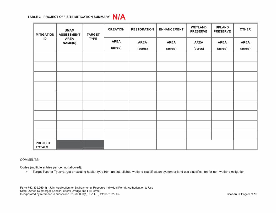
TABLE 3 - PROJECT OFF-SITE MITIGATION SUMMARY
MITIGATION ID
UMAM ASSESSMENT
AREA NAME(S)
TARGETTYPE
CREATION RESTORATION ENHANCEMENT WETLAND PRESERVE
UPLAND PRESERVE OTHER
AREA
(acres)AREA
(acres)
AREA
(acres)
AREA
(acres)
AREA
(acres)
AREA
(acres)
PROJECT TOTALS
COMMENTS:
Codes (multiple entries per cell not allowed):Target Type or Type=target or existing habitat type from an established wetland classification system or land use classification for non-wetland mitigation
N/A
Form #62-330.060(1) - Joint Application for Environmental Resource Individual Permit/ Authorization to UseState-Owned Submerged Lands/ Federal Dredge and Fill PermitIncorporated by reference in subsection 62-330.060(1), F.A.C. (October 1, 2013) Section C, Page 10 of 10
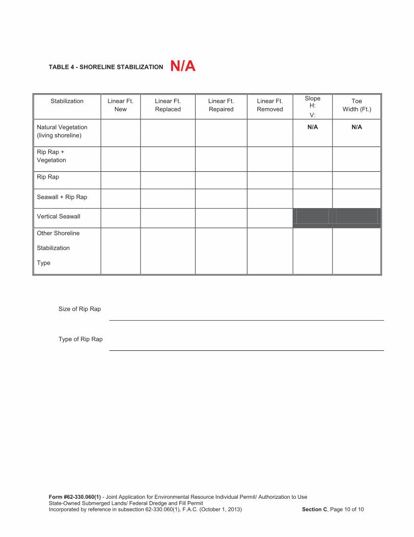
TABLE 4 - SHORELINE STABILIZATION
Stabilization Linear Ft. New
Linear Ft. Replaced
Linear Ft. Repaired
Linear Ft. Removed
SlopeH:V:
Toe Width (Ft.)
Natural Vegetation (living shoreline)
N/A N/A
Rip Rap + Vegetation
Rip Rap
Seawall + Rip Rap
Vertical Seawall
Other Shoreline
Stabilization
Type
Size of Rip Rap
Type of Rip Rap
N/A
Form 62-330.060(1) - Joint Application for Individual and Conceptual Environmental Resource Permit/ Authorization to UseState-Owned Submerged Lands/ Federal Dredge and Fill PermitIncorporated by reference in subsection 62-330.060(1), F.A.C. (October 1, 2013) Section E, Page 1 of 6
SECTION E: SUPPLEMENTAL INFORMATION REQUIRED FOR WORKS OR OTHER ACTIVITIES INVOLVING A STORMWATER MANAGEMENT SYSTEM
(OTHER THAN A SINGLE-FAMILY PROJECT)
Instructions: The information listed in the checklists below represents the level of information that is usually required to evaluate an application. Information can be provided within reports, plans and documents. The level of information required for a specific project will vary depending on the nature and location of the site and the activity proposed. Conceptual approvals generally do not require the same level of detail as a construction permit. However, providing a greater level of detail will reduce the need to submit additional information at a later date. If an item does not apply to your project, proceed to the next item. The supplemental information required by this section is in addition to the information required by Section A of the ERP application.
PART 1: STORMWATER MANAGEMENT SYSTEM SUMMARY
Provide drainage calculations, signed and sealed by an appropriate registered professional, and supporting documentation demonstrating that the proposed project meets the conditions for issuance under 62-330.301(1)(a),(b),(c),(e), F.A.C. The drainage calculations should include, but not necessarily be limited to, the following:
1. General Site Information:
a. Provide pre-development and post-development drainage map(s), as appropriate, that include drainage patterns and basin boundaries with acreage served by each hydraulically separate system, showing the direction of flows, including any off-site runoff being routed through or around the system; topographic information; and connections between wetlands and other surface waters.
b. Provide the results of any percolation tests, where appropriate, and soil borings that are representative of the actual site conditions. Identify the wet season high water table elevations, soil profiles, and hydraulic conductivity. Include dates, datum, and methods used to determine these soil parameters.
c. Identify the onsite hydrologic soil classification (e.g. Type A, B/D, D). Reference the source, such as the USDA/NRCS Soil Survey, used in estimating the onsite hydrologic soil classification. Provide maps, as appropriate, with the project limits delineated.
d. Identify the seasonal high water or mean high tide elevation for receiving waters/wetlands into which runoff will be discharged. Include dates, datum, and methods used to determine these elevations.
e. Identify the name of each receiving waterbody to which the proposed stormwater management system will discharge: .
f. Indicate the existing land use and land cover.
g. Provide the acreage, and percentages of the total project, of the following: 1. Impervious surfaces, excluding buildings, wetlands and other surface waters; 2. Buildings;
See attached Drainage Design Documentation.
See attached Drainage Design Documentation.
See attached Drainage Design Documentation.
Refer to Drainage DesignDocumentation.
See attached Drainage Design Documentation.
See attached Drainage Design Documentation.
✔
✔
✔
✔
✔
✔
✔
Form 62-330.060(1) - Joint Application for Individual and Conceptual Environmental Resource Permit/ Authorization to UseState-Owned Submerged Lands/ Federal Dredge and Fill PermitIncorporated by reference in subsection 62-330.060(1), F.A.C. (October 1, 2013) Section E, Page 2 of 6
3. Pervious surfaces (green areas not including wetlands);4. Lakes, canals, retention areas, other open water areas; and5. Wetlands (Please refer to Section C to ensure consistency in wetland acreages).
h. Provide the location and description of any nearby existing offsite features (such as wetlandand other surface waters, stormwater management ponds, and building or other structures)which might be affected by or affect the proposed construction or development.
2. Water Quality Analysis:
a. Provide a description of the proposed stormwater treatment methodology that addresses thetype of treatment, pollution abatement volumes, and recovery analysis.
b. Is the receiving waterbody known to be impaired, and/or has an established Total MaximumDaily Load (TMDL) or Basin Management Action Plan (BMAP)? If so, please provide specificdescriptions of all water quality parameters for which the waterbody is known to be impaired?For more information about water quality, impaired waters, and to determine whether a TMDLhas been adopted in your project area, refer to: http://waterwebprod.dep.state.fl.us/basin411/downloads/Florida-Adopted-TMDLs.pdf. To determine whether a BMAP exists, or is being developed in your project area, refer to:http://www.dep.state.fl.us/water/watersheds/bmap.htm#rad.
yes no don’t knowIf yes, provide calculations demonstrating that the proposed project will not contribute toviolations of state water quality standards in accordance with the applicable Applicant’sHandbook, Vol. II.
c. Does the project have a direct discharge to a Class I, Class II, Outstanding Florida Waters orClass III waters, which are approved, conditionally approved, restricted, or conditionallyrestricted for shellfish harvesting? To determine whether your project is within, or willdischarge to an OFW, or for more information about OFWs in general, refer to:http://www.dep.state.fl.us/water/wqssp/ofw.htm.
yes no don’t knowIf yes, additional treatment in accordance with the applicable Applicant’s Handbook, Vol. II,may be required.
d. Provide construction plans and calculations that address the required treatment volume andrecovery, as well as stage-storage and design elevations, which demonstrate compliancewith the appropriate water quality treatment criteria in the applicable Applicant’s Handbook,Vol. II.
. Provide a description of the engineering methodology, assumptions and references for the parameters listed above, and a copy of all such computations, engineering plans, and specifications used to analyze the system. If a computer program is used for the analysis, provide the name of the program, a description of the program, input and output data, and justification for model selection.
3. Water Quantity Analysis:
Provide calculations and documentations demonstrating that the project, as proposed, meets theapplicable design criteria as indicated in the applicable Applicant’s Handbook, Vol. II. Typically, theinformation would include, at a minimum, but is not necessarily be limited to, the following:
See attached Drainage Design Document.
See attached Drainage Design Documentation.
See attached Drainage Design Documentation.
See attached Drainage Design Documentation.
✔
✔
✔
✔
✔
✔
✔
Form 62-330.060(1) - Joint Application for Individual and Conceptual Environmental Resource Permit/ Authorization to UseState-Owned Submerged Lands/ Federal Dredge and Fill PermitIncorporated by reference in subsection 62-330.060(1), F.A.C. (October 1, 2013) Section E, Page 3 of 6
a. For projects requiring pre-development analysis, provide an analysis of the pre-development peak rate of discharge and / or volume of runoff, for all design storm events. Account for all onsite depressional storage and offsite contributing area. Please refer to the applicable Applicant’s Handbook, Vol. II for the design storm event(s) that apply to your project.
b. Provide an analysis of the post-development peak rate of discharge and / or volume of runoff for all applicable design storm events. Account for all onsite storage and offsite contributing area. Please refer to the applicable Applicant’s Handbook, Vol. II for the design storm event(s) and criteria that apply to your project.
These analyses should include:
Runoff characteristics, including area, runoff curve number or runoff coefficient, and time of concentration for each drainage basins in the pre-development and post-development condition;
Design storms used including rainfall depth, duration, frequency, and distribution;
Runoff hydrograph(s) for each drainage basin, for all required design storm event(s);
Stage-storage computations for any area such as a reservoir, closed basin, detention area, or channel, used in storage routing;
Stage-discharge computations for any storage areas at a selected control point, such as control structure or natural restriction;
Flood routings through on-site conveyance and storage areas;
Water surface profiles in the primary drainage system for each required design storm event(s);
Runoff peak rates and volumes discharged from the site for each required design storm event(s);
Design tailwater elevation(s) for each storm event at all points of discharge (include source or method of estimate); and
Pump specifications and operating curves for range of possible operating conditions (if used in system).
Provide a description of the engineering methodology, assumptions and references for the parameters listed above, and a copy of all such computations, engineering plans, and specifications used to analyze the system. If a computer program is used for the analysis, provide the name of the program, input and output data, justification for model selection, and, if necessary, a description of the program.
4. Floodplain Analysis (where applicable).
a. If the project is in a known floodplain of a stream or other water course, identify the appropriate floodplain boundary and approximate flooding elevations of any lake, stream or other watercourse located on or adjacent to the site.
b. For traversing works, in accordance with the applicable Applicant’s Handbook, Vol. II, provide:
See attached Drainage Design Documentation.
See attached Drainage Design Documentation.
N/A
See attached Drainage Design Documentation.
✔
✔
✔
✔
✔
✔
✔
✔
✔
✔
✔
✔
✔
Form 62-330.060(1) - Joint Application for Individual and Conceptual Environmental Resource Permit/ Authorization to UseState-Owned Submerged Lands/ Federal Dredge and Fill PermitIncorporated by reference in subsection 62-330.060(1), F.A.C. (October 1, 2013) Section E, Page 4 of 6
Hydraulic calculations for all proposed traversing works; and
Water surface profiles showing upstream impact of traversing works.
c. For impacts to regulated floodplains, in accordance with the applicable Applicant’s Handbook, Vol. II, provide:
Location and volume of encroachment within regulated floodplain(s); and
Plans and calculations for compensating floodplain storage, if necessary, and calculations required for determining minimum building and road flood elevations.
PART 2: CONSTRUCTION PLANS
1. Provide clear, construction level detailed plans for the system. The plans must be signed and sealed by an appropriate registered professional as required by law. These plans should include cumulative information from all applicable sections; as well as the following:
a. Project area boundary and total area, including distances and orientation from roads or other landmark.
b. . Existing topography extending at least 100 feet off the project area. All topography shall include location and description of benchmarks, reference to NGVD 1929 or NAVD 1988along with the conversion factor.
c. Proposed site plan with acreage, including the following:plan view of proposed development, including impervious surfaces and water management areas;land cover and natural communities*;wetlands and other surface waters*; undisturbed uplands*; aquatic communities*;proposed buffers*;proposed impacts to wetlands and other surface waters, and any proposed connections/outfalls to other surface waters or wetlands, (if applicable); andonsite wetland mitigation areas*.
*Please refer to Section C.
For phased projects, provide a master development plan clearing delineating the limits of each phase of construction.
d. Paving, Grading, and Drainage Information, which includes, but not necessarily limited to, the following:
Existing topography;Boundaries of wetlands and other surface waters and upland buffers (see Section C); Plan view of proposed development;Proposed elevations and/or profiles, including:
roadway, parking, and pavement grades;floor slabs, walkways, and other paved surfaces;earthwork grades for pervious landscaped areas; andperimeter site grading, tying back into existing grades.
See attached Construction Plans.
See attached Construction Plans.
✔
✔
✔
✔
✔
✔
✔
✔
✔
✔
✔
✔
✔
✔
✔
✔
✔
✔
✔
✔
Form 62-330.060(1) - Joint Application for Individual and Conceptual Environmental Resource Permit/ Authorization to UseState-Owned Submerged Lands/ Federal Dredge and Fill PermitIncorporated by reference in subsection 62-330.060(1), F.A.C. (October 1, 2013) Section E, Page 5 of 6
Location of all water management areas, including elevations, dimensions, side slopes, and design water depths;Location, size, and invert elevations of existing and proposed stormwater conveyance systems;
Vegetative cover plan for all on-site and off-site earth surfaces disturbed by construction; and Rights-of-way and easements for the system, including all on-site and off-site areas to be reserved for water management purposes (including access), and rights-of-way and easements for the existing drainage system, if any.
e. Stormwater detail information, including but not necessarily limited to, the following:Cross section of all stormwater management areas, including elevations, dimensions, side slopes, and proposed stabilization measures (with location of the cross section(s) shown on the corresponding plan view);Detail of all proposed control structures, including elevations, dimensions, and skimmer, where applicable; andDetails of proposed stormwater management systems, such as underdrains, exfiltration trenches, vaults, and other proposed Best Management Practices (BMPs).
f. Location and description of any nearby existing offsite features (such as wetland and other surface waters, stormwater management ponds, and building or other structures) which might be affected by or affect the proposed construction or development.
PART 3: CONSTRUCTION SCHEDULE AND TECHNIQUES
Provide a construction schedule, and a description of construction techniques, sequencing and equipment. This information should include, as applicable, the following.
a. Access and staging of equipment;
b. Location and details of the erosion, sediment and turbidity control measures to be implemented during each phase of construction and all permanent control measures to be implemented in post-development conditions.
c. The location of disposal site(s) for any excavated material, including temporary and permanent disposal sites.
d. A demolition plan for any existing structures to be removed.
e. Dewatering plan details. If dewatering is required, detail the dewatering proposal including the methods that are proposed to contain the discharge, methods of isolating dewatering areas, and indicate the period dewatering structures will be in place; Note: a Consumptive Use or Water Use permit may be required for dewatering.
f. Methods for transporting equipment and materials to and from the work site. If barges are required for access, provide the low water depths and draft of the fully loaded barge;
PART 4: OPERATION AND MAINTENANCE AND LEGAL DOCUMENTATION:
a. Describe the overall maintenance and operation schedule for the proposed system.
b. Identify the entity (or entities) that will be responsible for operating and maintaining the system (or parts of the system) to demonstrate that the entity (or entities) meet(s) the requirements of section 12.3 of the Applicant’s Handbook, Vol. I.
The stormwater management system will be maintained consistent with FDOT standards.
Tampa Hillsborough Expressway Authority.
Materials and equipment can be staged and stored in the construction footprint.
See SWPPP, contractor will develop site-specific erosion control plan with implementation schedule per FDOT specs.
The contractor awarded the construction project will identify disposal sites.
To be provided by contractor.
Contractor will develop a site-specific dewatering plan with an implementation schedule.
Conventional construction vehicles are proposed; no barges.
✔
✔
✔
✔
✔
✔
✔
✔
✔
✔
Form 62-330.060(1) - Joint Application for Individual and Conceptual Environmental Resource Permit/ Authorization to UseState-Owned Submerged Lands/ Federal Dredge and Fill PermitIncorporated by reference in subsection 62-330.060(1), F.A.C. (October 1, 2013) Section E, Page 6 of 6
If different from the permittee, provide a draft document enumerating the enforceable affirmative obligations on the entity to properly operate and maintain the system for its expected life, and documentation of the entity's financial responsibility for long-term maintenance. If the proposed operation and maintenance entity is not a property owner's association, provide proof of the existence of an entity, or the future acceptance of the system by an entity which will operate and maintain the system.
c. Provide drafts of all proposed conservation easements, stormwater management system easements, draft property owner's association documents, and plats for the property containing the proposed system.
d. Provide legal reservations for access to the treatment system for maintenance and operation by future maintenance entities for subdivided projects.
e. Provide indication of how water and wastewater service will be supplied.
f. Provide a copy of the boundary survey and/or legal description and acreage of the total land area of contiguous property owned/controlled the applicant.
PART 5: WATER USE
a. Describe how irrigation will be provided to the project. Will the surface water system be used for water supply, including landscape irrigation, or recreation?
b. If a Consumptive Use or Water Use permit has been issued for the project, state the permit number:
c. If a Consumptive Use or Water Use permit has not been issued for the project, indicate if such a permit will be required. yes no don’t knowIf yes, please indicate when the application for a permit will be submitted:
d. Indicate how any existing wells located within the project site will be utilized or abandoned.
PART 6: SPECIAL BASIN INFORMATION
Is your project within a special basin as described in the applicable Applicant’s Handbook, Vol. II?
yes no don’t know
If yes, please demonstrate that the project will meet the applicable special basin criteria.
All proposed work will be within FDOT/THEA owned property and/or R/W.
N/A
Please refer to the submitted plan set.
Please refer to the submitted plan set for maintenance access locations.
✔
✔
No irrigation is proposed
N/A
■
N/A
✔

![Chapter 46 - Swamp Hardwood Cover Type · 2020-05-28 · 6loylfxowxuh +dqgerrn & 6rlo 3uhihuhqfh 7kh vzdps kdugzrrg fryhu w\sh rffxuv rq iruhvwhg zhwodqgv vzdpsv fkdudfwhul]hg e\](https://img.pdfslide.net/doc/110x75/5f0e6a4b7e708231d43f228d/chapter-46-swamp-hardwood-cover-type-2020-05-28-6loylfxowxuh-dqgerrn-.jpg)


![Planungshinweise Neolith 17-1 · vt vxuidfh dj qhrolwk gluhvfr ]rgldt 64 6xuidfh $* 5lhghqhuvwudvvh 'lhwolnrq zzz vt vxuidfh fk lqir#vt vxuidfh fk 7ho )d[](https://img.pdfslide.net/doc/110x75/5e155146b5756b541b3f3df2/planungshinweise-neolith-17-1-vt-vxuidfh-dj-qhrolwk-gluhvfr-rgldt-64-6xuidfh-.jpg)


![Never get stuck again · oil search png [22 wells, 22 sections] &olhqw revhuyhg pxowlsoh orvw %+$ 5v zklovw guloolqj vxuidfh dqg lqwhuphgldwh vhfwlrqv ohdglqj wr pxowlsoh vlgh wudfnv](https://img.pdfslide.net/doc/110x75/602366b81283a5133910b45c/never-get-stuck-again-oil-search-png-22-wells-22-sections-olhqw-revhuyhg.jpg)