Embed Size (px)
Citation preview
Jokulhlaup Geomorphology
a. Jokulhlaup/glacial terminology
b. Skeidararjokull Event
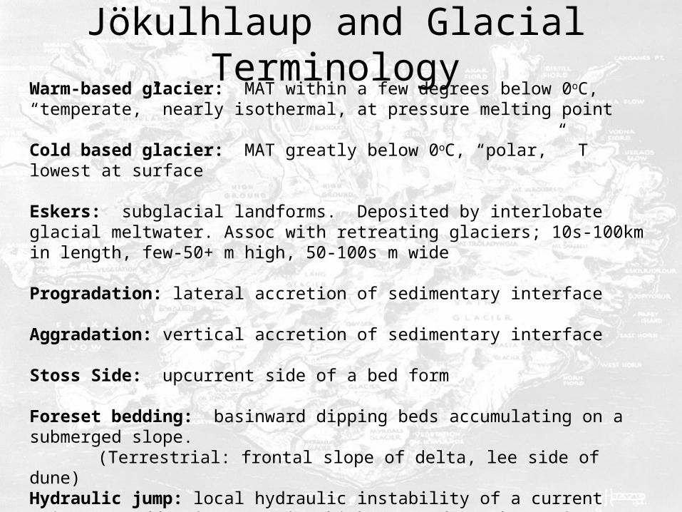
Jökulhlaup and Glacial TerminologyWarm-based glacier: MAT within a few degrees below 0oC, “temperate,” nearly isothermal, at pressure melting point
Cold based glacier: MAT greatly below 0oC, “polar,” T lowest at surface
Eskers: subglacial landforms. Deposited by interlobate glacial meltwater. Assoc with retreating glaciers; 10s-100km in length, few-50+ m high, 50-100s m wide
Progradation: lateral accretion of sedimentary interface
Aggradation: vertical accretion of sedimentary interface
Stoss Side: upcurrent side of a bed form
Foreset bedding: basinward dipping beds accumulating on a submerged slope. (Terrestrial: frontal slope of delta, lee side of dune)
Hydraulic jump: local hydraulic instability of a current owing to sudden increase in thickness and/or change in gradient
Jökulhlaup: “glacier-run” Icelandic term for catastrophic flood from the collapse of an ice dam. Supraglacial, subglacial
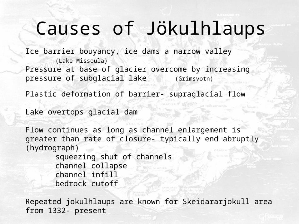
Causes of Jökulhlaups
Ice barrier bouyancy, ice dams a narrow valley(Lake Missoula)
Pressure at base of glacier overcome by increasing pressure of subglacial lake (Grimsvotn)
Plastic deformation of barrier- supraglacial flow
Lake overtops glacial dam
Flow continues as long as channel enlargement is greater than rate of closure- typically end abruptly (hydrograph)
squeezing shut of channelschannel collapsechannel infillbedrock cutoff
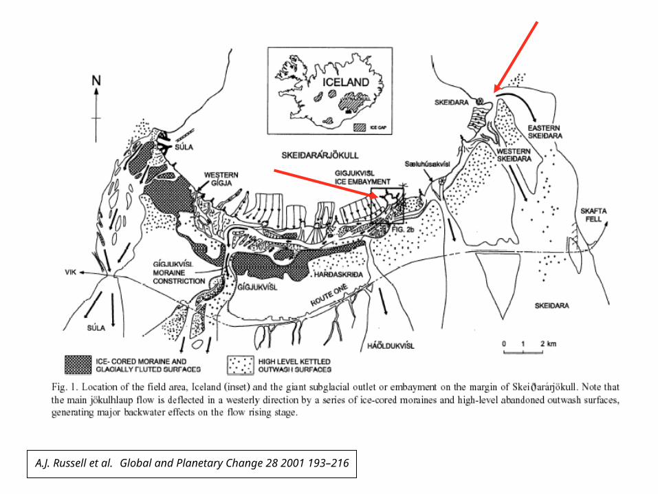
Repeated jokulhlaups are known for Skeidararjokull area from 1332- present
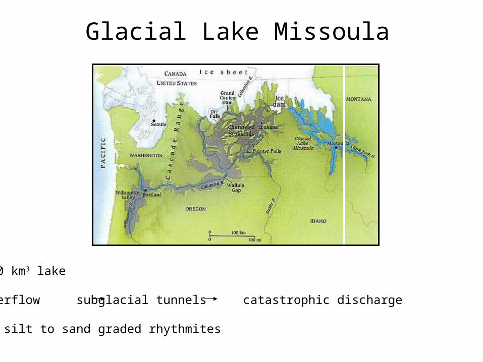
Glacial Lake Missoula
2500 km3 lake
Underflow subglacial tunnels catastrophic discharge
40+ silt to sand graded rhythmites
The Skeidararjokull Event
November 5 – 7 1996
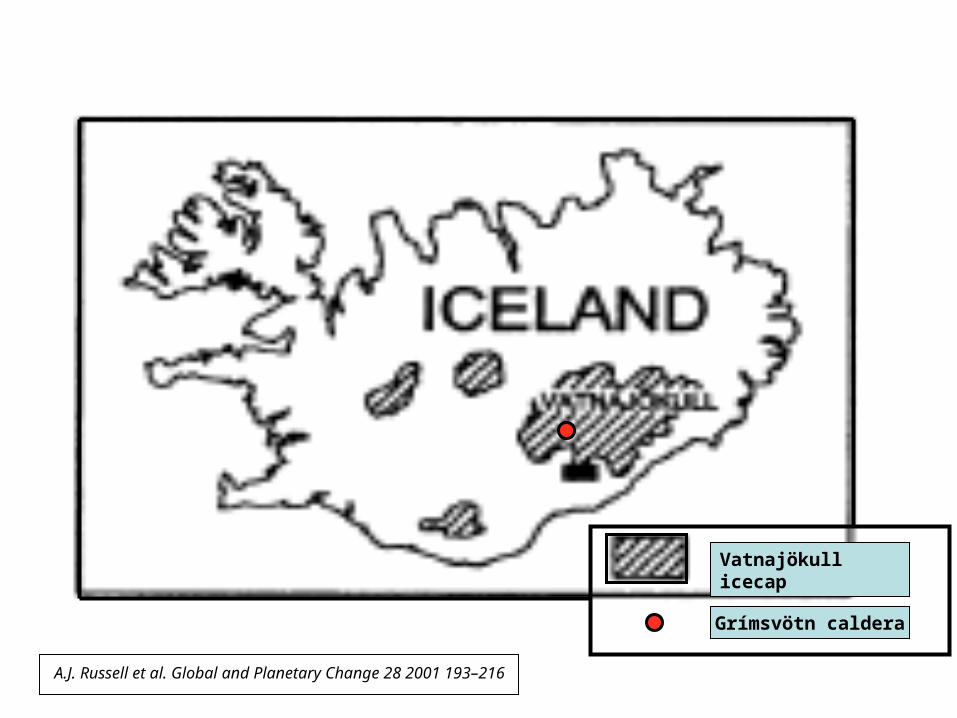
A.J. Russell et al. Global and Planetary Change 28 2001 193–216
Vatnajökull icecap
Grímsvötn caldera
A.J. Russell et al. Global and Planetary Change 28 2001 193–216

A.J. Russell et al. Global and Planetary Change 28 2001 193–216

A.J. Russell et al. Global and Planetary Change 28 2001 193–216
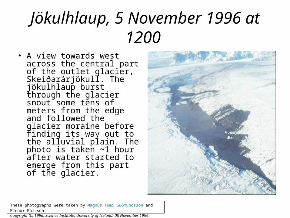
Jökulhlaup, 5 November 1996 at 1200
• A view towards west across the central part of the outlet glacier, Skeiðarárjökull. The jökulhlaup burst through the glacier snout some tens of meters from the edge and followed the glacier moraine before finding its way out to the alluvial plain. The photo is taken ~1 hour after water started to emerge from this part of the glacier.
These photographs were taken by Magnús Tumi Guðmundsson and Finnur Pálsson. Copyright (C) 1996, Science Institute, University of Iceland. 08 November 1996
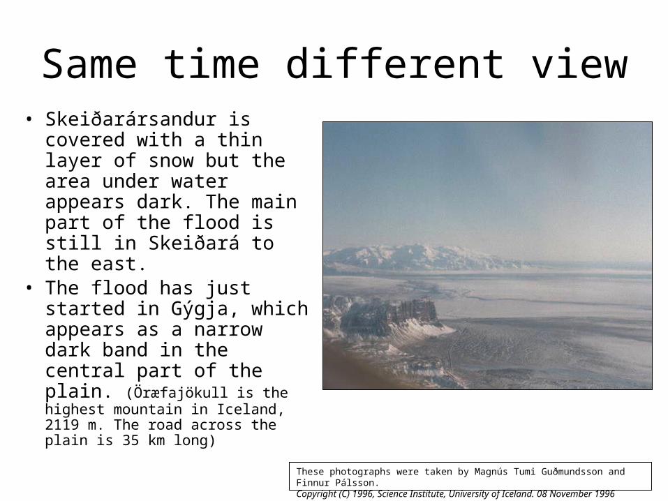
Same time different view• Skeiðarársandur is
covered with a thin layer of snow but the area under water appears dark. The main part of the flood is still in Skeiðará to the east.
• The flood has just started in Gýgja, which appears as a narrow dark band in the central part of the plain. (Öræfajökull is the highest mountain in Iceland, 2119 m. The road across the plain is 35 km long)
These photographs were taken by Magnús Tumi Guðmundsson and Finnur Pálsson. Copyright (C) 1996, Science Institute, University of Iceland. 08 November 1996
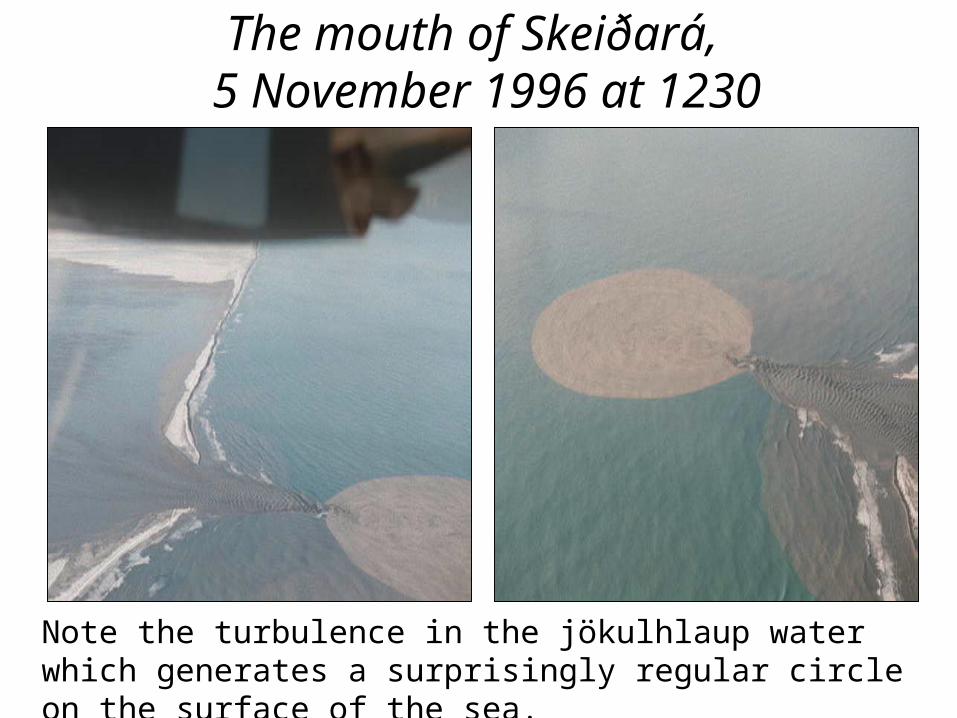
The mouth of Skeiðará, 5 November 1996 at 1230
Note the turbulence in the jökulhlaup water which generates a surprisingly regular circle on the surface of the sea.
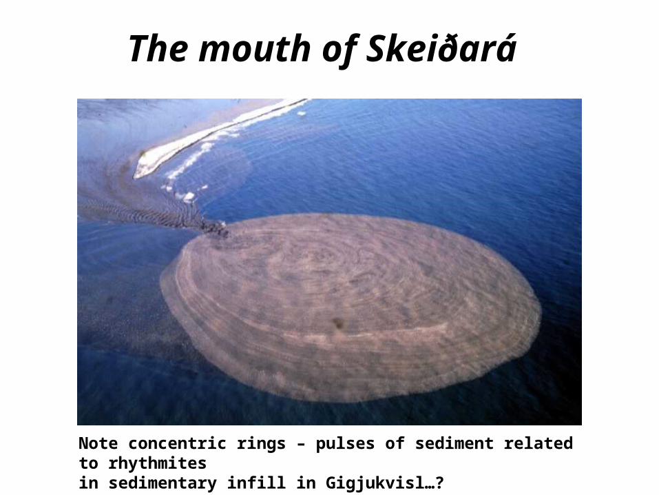
The mouth of Skeiðará
Note concentric rings – pulses of sediment related to rhythmites in sedimentary infill in Gigjukvisl…?
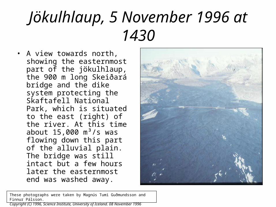
Jökulhlaup, 5 November 1996 at 1430
• A view towards north, showing the easternmost part of the jökulhlaup, the 900 m long Skeiðará bridge and the dike system protecting the Skaftafell National Park, which is situated to the east (right) of the river. At this time about 15,000 m³/s was flowing down this part of the alluvial plain. The bridge was still intact but a few hours later the easternmost end was washed away.
These photographs were taken by Magnús Tumi Guðmundsson and Finnur Pálsson. Copyright (C) 1996, Science Institute, University of Iceland. 08 November 1996
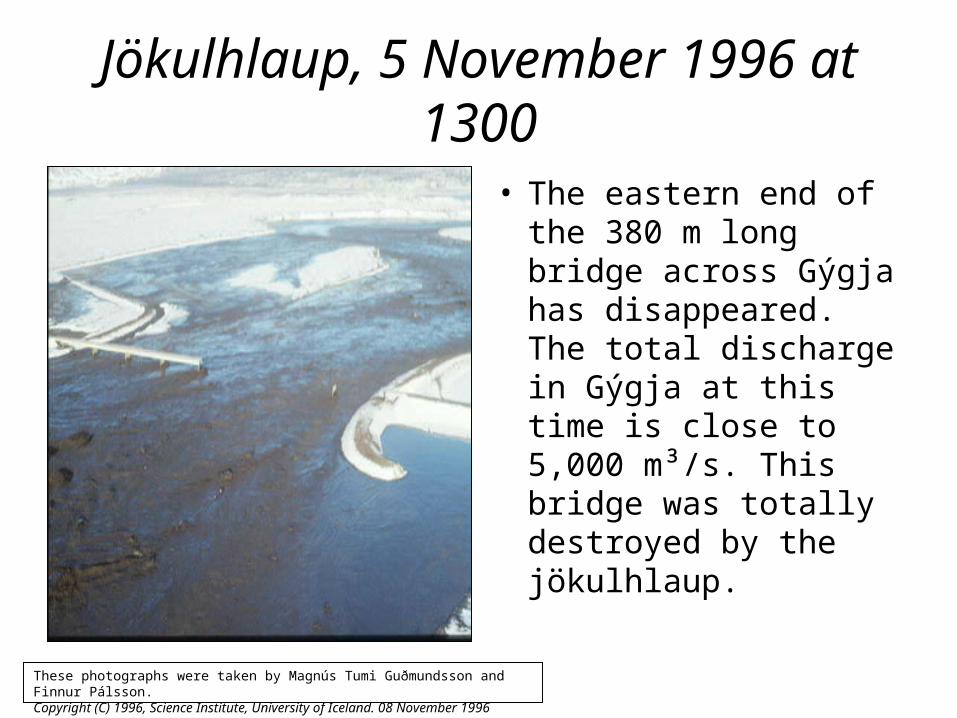
Jökulhlaup, 5 November 1996 at 1300
• The eastern end of the 380 m long bridge across Gýgja has disappeared. The total discharge in Gýgja at this time is close to 5,000 m³/s. This bridge was totally destroyed by the jökulhlaup.
These photographs were taken by Magnús Tumi Guðmundsson and Finnur Pálsson. Copyright (C) 1996, Science Institute, University of Iceland. 08 November 1996
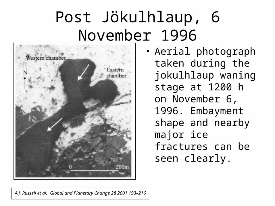
Post Jökulhlaup, 6 November 1996
• Aerial photograph taken during the jokulhlaup waning stage at 1200 h on November 6, 1996. Embayment shape and nearby major ice fractures can be seen clearly.
A.J. Russell et al. Global and Planetary Change 28 2001 193–216

Downstream, where the Jökulhlaup crossed Route 1
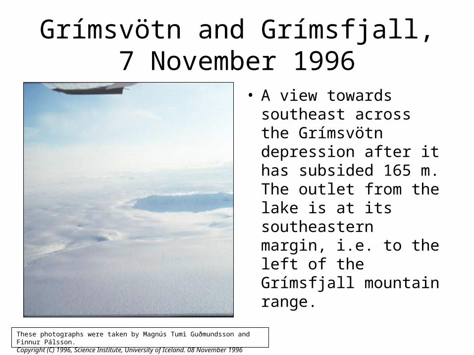
Grímsvötn and Grímsfjall,7 November 1996
• A view towards southeast across the Grímsvötn depression after it has subsided 165 m. The outlet from the lake is at its southeastern margin, i.e. to the left of the Grímsfjall mountain range.
These photographs were taken by Magnús Tumi Guðmundsson and Finnur Pálsson. Copyright (C) 1996, Science Institute, University of Iceland. 08 November 1996
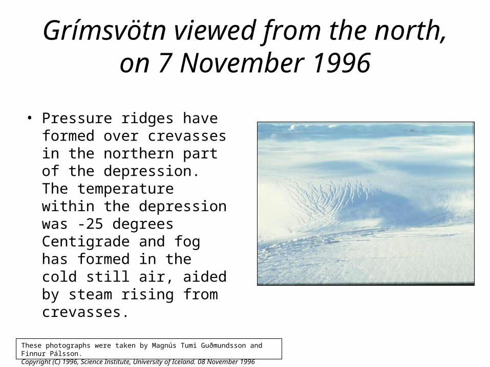
Grímsvötn viewed from the north,on 7 November 1996
• Pressure ridges have formed over crevasses in the northern part of the depression. The temperature within the depression was -25 degrees Centigrade and fog has formed in the cold still air, aided by steam rising from crevasses.
These photographs were taken by Magnús Tumi Guðmundsson and Finnur Pálsson. Copyright (C) 1996, Science Institute, University of Iceland. 08 November 1996

Closeup of the Grímsvötn outlet by the eastern rim of Mt. Grímsfjall, 7
November 1996. • The mountain cliffs are about
300 m high. Huge cauldrons formed at regular intervals within the 6 km long and 500 m wide outlet. The outlet canyon was formed during the flood on 5-6 November.
• On 6 November flowing water could be seen at the bottom of the largest pit craters formed in the canyon where the roof over the subglacial outlet tunnel had collapsed.
These photographs were taken by Magnús Tumi Guðmundsson and Finnur Pálsson. Copyright (C) 1996, Science Institute, University of Iceland. 08 November 1996

Southern part of the Grímsvötn outlet, 7 November 1996.
• The glacier canyon is 6 km long and 500 m wide with an average subsidence of 100 m. Steam rises from the canyon.
These photographs were taken by Magnús Tumi Guðmundsson and Finnur Pálsson. Copyright (C) 1996, Science Institute, University of Iceland. 08 November 1996
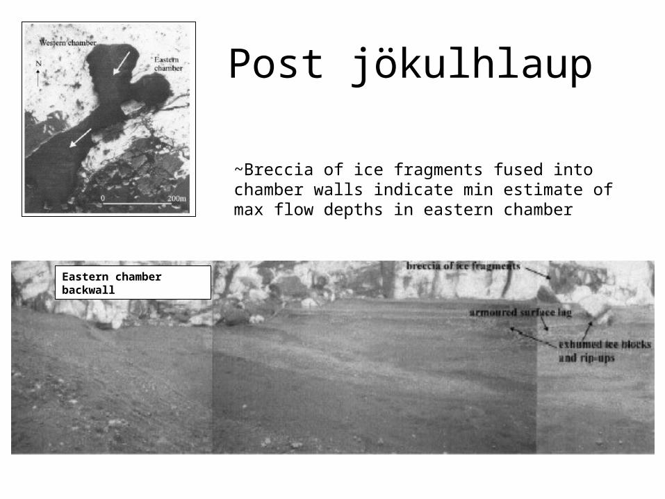
Post jökulhlaup
Eastern chamber backwall
~Breccia of ice fragments fused into chamber walls indicate min estimate of max flow depths in eastern chamber
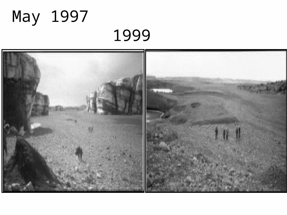
May 1997 1999

During flow… After meltdown…2 yrs
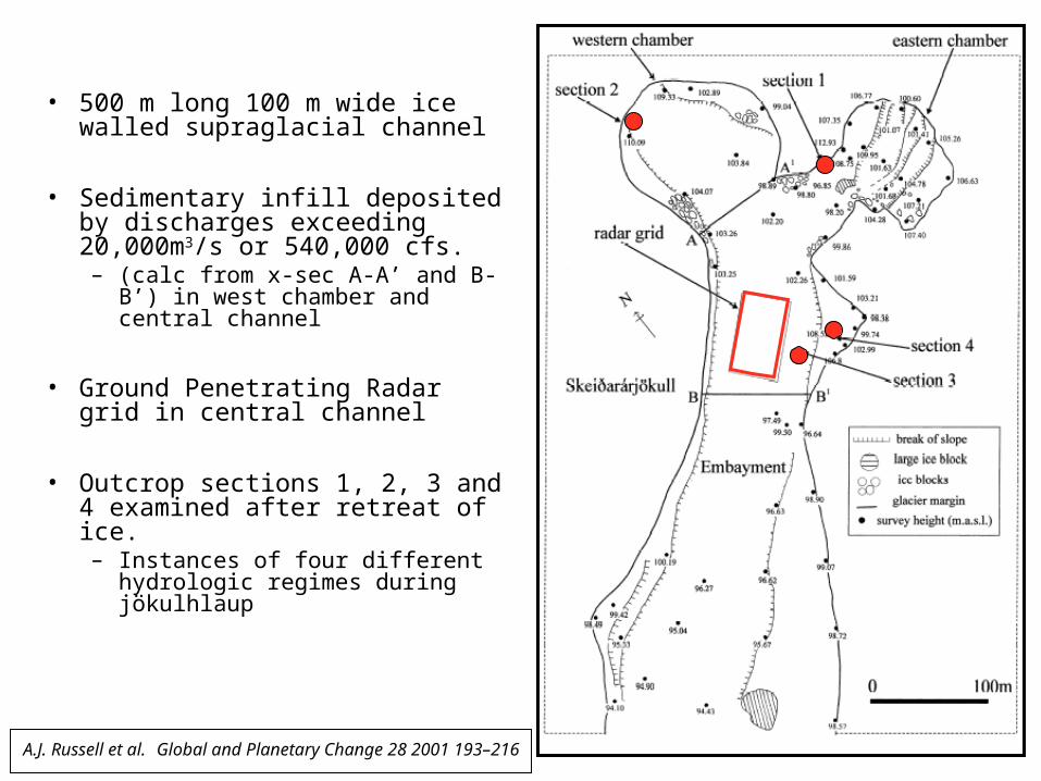
• 500 m long 100 m wide ice walled supraglacial channel
• Sedimentary infill deposited by discharges exceeding 20,000m3/s or 540,000 cfs. – (calc from x-sec A-A’ and B-B’)
in west chamber and central channel
• Ground Penetrating Radar grid in central channel
• Outcrop sections 1, 2, 3 and 4 examined after retreat of ice. – Instances of four different
hydrologic regimes during jökulhlaup
A.J. Russell et al. Global and Planetary Change 28 2001 193–216
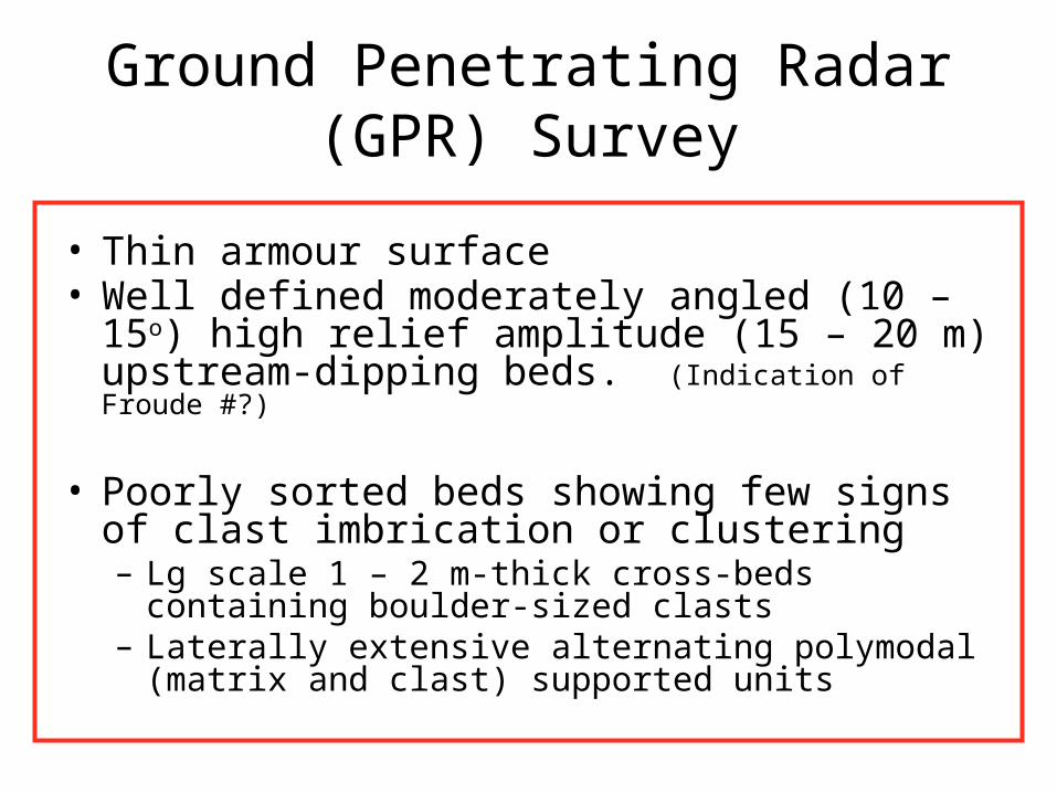
Ground Penetrating Radar (GPR) Survey
• Thin armour surface• Well defined moderately angled (10 – 15o) high
relief amplitude (15 – 20 m) upstream-dipping beds. (Indication of Froude #?)
• Poorly sorted beds showing few signs of clast imbrication or clustering– Lg scale 1 – 2 m-thick cross-beds containing boulder-
sized clasts – Laterally extensive alternating polymodal (matrix and
clast) supported units
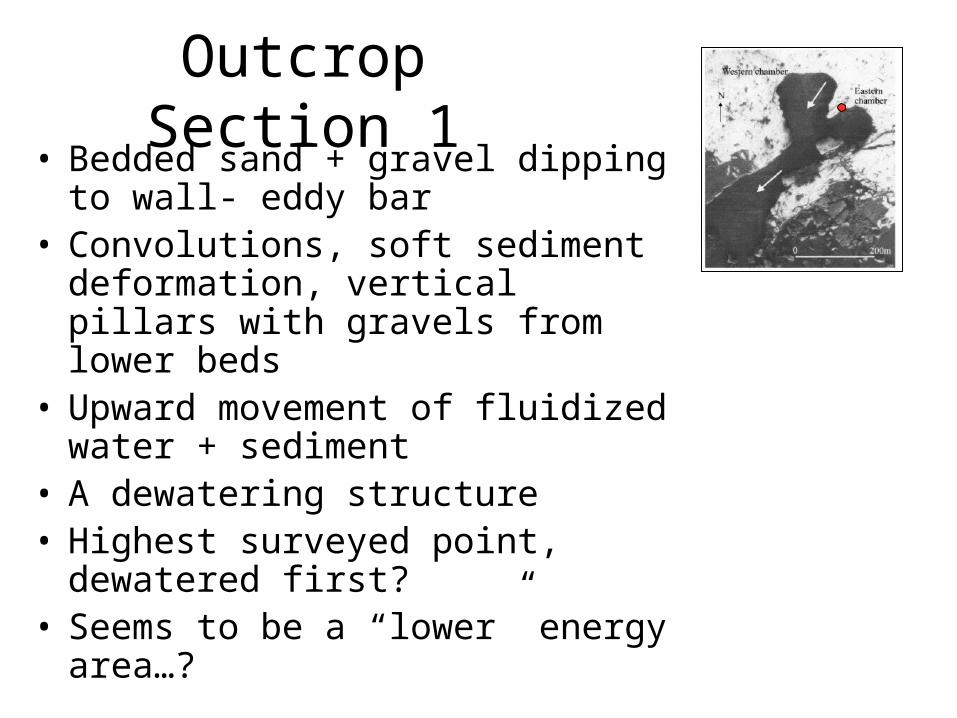
Outcrop Section 1• Bedded sand + gravel dipping to
wall- eddy bar• Convolutions, soft sediment
deformation, vertical pillars with gravels from lower beds
• Upward movement of fluidized water + sediment
• A dewatering structure• Highest surveyed point, dewatered
first?• Seems to be a “lower” energy
area…?
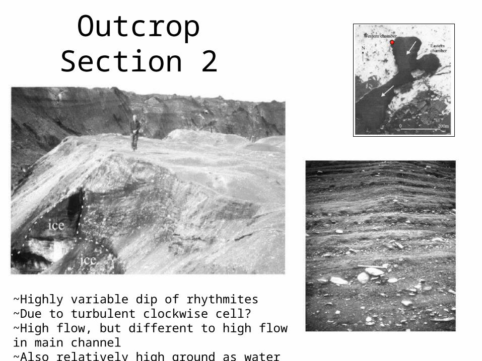
Outcrop Section 2
~Highly variable dip of rhythmites~Due to turbulent clockwise cell?~High flow, but different to high flow in main channel~Also relatively high ground as water resided
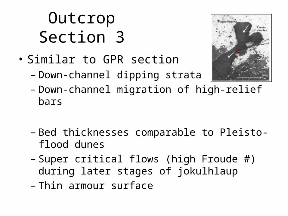
Outcrop Section 3
• Similar to GPR section– Down-channel dipping strata– Down-channel migration of high-relief bars
– Bed thicknesses comparable to Pleisto-flood dunes
– Super critical flows (high Froude #) during later stages of jokulhlaup
– Thin armour surface

Outcrop Section 4
• Terraced appearance, covered by rip-up clasts
• Deposited supraglacially
• 2 lg cross stratified sections capped by erosional contact
• Imbricated gravel unit above
• Anticlockwise eddy in corner
• Foreset bedding
Is this a new analog for eskers?
• Was the mid and eastern US an area with high jokulhlaup activity?
• Do we find jokulhlaups associated with other landforms usually associated with eskers?
• Do we know enough about the sedimentology of eskers to compare them with this process?
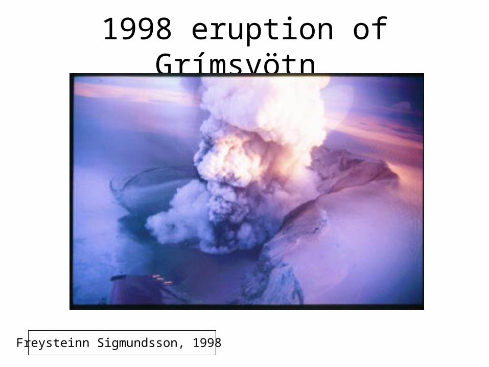
1998 eruption of Grímsvötn
Freysteinn Sigmundsson, 1998
References
• Russel et al, 2001. Morphology and sedimentology of a giant supraglacial, ice-walled, jokulhlaup channel, Skeidararjokull, Iceland: implications for esker genesis
• Russel et al, 2001. Sedimentary Architecture Of A Supraglacial Jökulhlaup Channel-fill, Skeiðarárjökull, Iceland.
• Sigurdsson et al, 2000. The jokulhlaup on Skeidararsandur in November 1996: Event, discharge and sediment