Embed Size (px)
Citation preview
DRAFT KAIKOHE Community Plan
[Stage 1 – Information]
Front cover design to be agreed with community.
{Date signed off}
Table of ContentsTable of ContentsTable of ContentsTable of Contents Introduction............................................................................................................... 4
Executive Summary .................................................................................................. 5
Kaikohe Community Profile ...................................................................................... 7
History .................................................................................................................. 7
Demographics ......................................................................................................10
Total population ...................................................................................................10
Number of occupied dwellings counted ................................................................10
Age ......................................................................................................................10
Ethnic groups .......................................................................................................11
Birthplace.............................................................................................................11
Languages spoken ................................................................................................11
Education .............................................................................................................11
Work ....................................................................................................................11
Development Profile.............................................................................................12
Environment & Planning Profile...........................................................................18
Growth Opportunities\Nodes\Drivers ...................................................................18
Future Plans .............................................................................................................26
Live..........................................................................................................................26
Zoning (settlement & land use).............................................................................26
Infrastructure ........................................................................................................26 Water ...............................................................................................................26 Wastewater ......................................................................................................26 Solid Waste ......................................................................................................26 Roads...............................................................................................................26 Community Facilities .......................................................................................26
Affordable Housing ..............................................................................................26 Broadband/Telecommunication .........................................................................26
Expansion of infrastructure...................................................................................26 Culture .................................................................................................................27 Tangata Whenua .................................................................................................27
Health...................................................................................................................27
Social Welfare ......................................................................................................27
Education .............................................................................................................27
Work ........................................................................................................................27 Economic .............................................................................................................27 Transportation - links, mobility ...........................................................................27
Play..........................................................................................................................27 Recreation ...........................................................................................................27 Open space..........................................................................................................27 Significant community events (festivals, sporting events)..................................27 Green spaces.......................................................................................................27 Arts.......................................................................................................................27
Protect......................................................................................................................27 Environment ........................................................................................................27 Community Safety ...............................................................................................27 Civil Defense........................................................................................................27 Heritage ...............................................................................................................27
Strong Communities.................................................................................................27

Volunteering ........................................................................................................27 Supporting Key Groups (Age, disability, Tangata Whenua, etc) ..........................27
Community-Based Initiatives ...............................................................................27
Introduction This section will be written towards the end of the process, i.e. shortly before the document is finalised. It should be drafted for and signed by a local community leader, e.g. Community Board chairperson or member. The Introduction will
• Describe the purpose of the Community Plan
• Identify the stakeholders who participated in the Plan's development
• Describe process used and key milestones in its development.
• Identify the Plan's relationship to other documents (e.g. linkage documents)

Executive Summary This section will be written towards the end of the process, i.e. shortly before the document is finalised. It should be drafted for and signed by a local community leader, e.g. Community Board chairperson or member. The executive summary will include all the key outcomes along with their respective actions derived from the plan process.
1. Community Vision This section will be written towards the end of the process, i.e. shortly before the document is finalized. The vision will describe
• The kind of place that residents, business owners and leaders want for the future.
• The key values and aspirations of the community insofar as these relate to: o Residential, business and industry land use and development o The natural environment o Recreation o Infrastructure o Social services
• Key community assets – i.e. those things about the community which the community considers its key assets, i.e. the things that distinguish it from other communities. These assets can range from natural landscapes, specific buildings, ethnic diversity, etc.
The vision will set out high-level key messages about the community: it will identify what participants like and value about where they live - what they want to protect or develop. Similarly it will explain the aspects of the community that they most want to change.
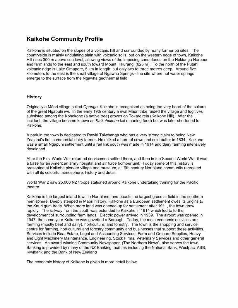
Kaikohe Community Profile Kaikohe is situated on the slopes of a volcanic hill and surrounded by many former pā sites. The countryside is mainly undulating plain with volcanic soils, but on the western edge of town, Kaikohe Hill rises 300 m above sea level, allowing views of the imposing sand dunes on the Hokianga Harbour and farmlands to the east and south toward Mount Hikurangi (625 m). To the north of the Putahi volcanic ridge is Lake Omapere, 5 km in length, but only two to three metres deep. Around five kilometers to the east is the small village of Ngawha Springs - the site where hot water springs emerge to the surface from the Ngawha geothermal field.
History
Originally a Māori village called Opango, Kaikohe is recognised as being the very heart of the culture of the great Ngapuhi iwi. In the early 19th century a rival Māori tribe raided the village and fugitives subsisted among the Kohekohe (a native tree) groves on Tokareireia (Kaikohe Hill). After the incident, the village became known as Kaikohekohe kai meaning food) but was later shortened to Kaikohe.
A park in the town is dedicated to Rawiri Taiwhanga who has a very strong claim to being New Zealand's first commercial dairy farmer. He milked a herd of cows and sold butter in 1834. Kaikohe was a small Ngāpuhi settlement until a rail link south was made in 1914 and dairy farming intensively developed.
After the First World War returned servicemen settled there, and then in the Second World War it was a base for an American army hospital and air force bomber unit. Today some of this history is presented at Kaikohe pioneer village and museum, a 19th century Northland community recreated with all its colourful atmosphere, history and detail.
World War 2 saw 25,000 NZ troops stationed around Kaikohe undertaking training for the Pacific theatre.
Kaikohe is the largest inland town in Northland, and boasts the largest grass airfield in the southern hemisphere. Deeply steeped in Maori history, Kaikohe as a European settlement owes its origins to the Kauri gum trade. When more land was opened up for settlement after 1911, the town grew rapidly. The railway from the south was extended to Kaikohe in 1914 which led to further development of surrounding farm lands. Electric power arrived in 1939. The airport was opened in 1947, the same year Kaikohe was gazetted a Borough. Today, the main economic activities are farming (mostly beef and dairy), horticulture, and forestry. The town is the shopping and service centre for farming, horticultural and forestry community and businesses that support these activities. Services include Real Estate, Legal and Accounting Services, Farm and Orchard Supplies, Heavy and Light Machinery Maintenance, Engineering, Stock Firms, Veterinary Services and other general services. An award-winning Community Newspaper, (The Northern News), also serves the town. Banking is provided by many of the NZ Banking facilities including the National Bank, Westpac, ASB, Kiwibank and the Bank of New Zealand
The economic history of Kaikohe is given in more detail below.
Gum
In the 1880s, Europeans lured by the trade in Kauri gum soon established the town of Kaikohe in the centre of the mid-north gum fields. By 1890, eight European families were living in Kaikohe. Businesses were established and by 1892 there was a blacksmith's shop, wheelwright, storekeeper, saddler, photographer, auctioneer and boot and shoe maker. Dalmatian immigrants transformed the search for gum from individual digging into industry. Kaikohe soon became the commercial centre for the gum trade. Gum diggers systematically stripped away the surface of already dug-over land to extract the last gum that lay beneath. As the diggers moved on, they were replaced by farmers who converted the now bare landscape to rough pasture for stock. Dairy Dairy farming has been an important part of the regions history with the first Dairy Company starting at Ohaewai in 1902 along with a creamery at Okaihau. The factories struggled for a number of years due to only slow increases in herd size. The creamery closed in 1908 mostly because farmers now had separators on-farm and the new enterprise of farm gate collection took over. By 1914, dairying had become well established as the ease of production and payment for product became the norm. Dairying was in fact seen as a bit of a saviour as bush work decreased and gum digging declined. It meant secure income for those that stayed on the land. Production increased further after World War 1 as returning soldiers opened up more land. In 1929, the dairy factory shifted from Ohaewai to the railway at Moerewa. With the increased distance and to solve the transport problem, a factory was established in Kaikohe in 1957. Tung Oil 1130 acres of Tung Oil trees were planted at Kaikohe around 1931 by a company called Tung Oil Groves and was part of a much larger attempt to grow Tung Oil across various parts of Northland. By 1938, the fledgling industry admitted defeat and the few remaining trees left alive were transferred to Awarua. An investigation concluded that the venture was speculative at best and failed through a lack of satisfactory growth in the trees. Rail Kaikohe was linked to the national rail network with the arrival of a branch line railway being built from Otiria on the North Auckland Line to Kaitaia, which opened to Kaikohe on 1 May 1914. Although Kaikohe had become established as the service centre of the Far North, it failed to generate much rail traffic in the early years of the line. When railcars were introduced on services north of Auckland in November 1956, they ran through Kaikohe all the way to Okaihau. Previously, a carriage train known as the Northland Express had run from Auckland to Opua with connections to Kaikohe and Okaihau via the mixed trains. In July 1967, the very popular railcar service was withdrawn and the branch was closed to passengers on 21 June 1976. In 1977, a relaxation of road transport laws led to a decline in freight traffic on the line. Scheduled trains were cancelled on 12 August 1983, and for a little over four years the line was shunted when required. The branch closed on 1 November 1987 and the track was lifted. Famous People Born in Kaikohe Hone Tuwhare (21 October 1922 – 16 January 2008), a noted New Zealand poet of Maori ancestry. Hone Tuwhare was born in Kaikohe, into the Nga Puhi tribe (hapu Ngati Korokoro, Ngati Tautahi, Te Popoto, Uri-o-hau). Tuwhare was awarded one of the inaugural Prime Minister's Awards for Literary Achievement for poetry and received an honorary Doctor of Literature degree from The University of Auckland in 2005. At the time of his death Hone Tuwhare was described as "New Zealand's most distinguished Maori writer".
Ngapua, Hone Heke 1869 – 1909 was born at Kaikohe, most closely affiliated to Nga Puhi through Ngati Rahiri, Ngai Tawake, Ngati Tautahi, Te Matarahurahu and Te Uri-o-Hua. The family and tribal home was at Kaikohe. In 1893, in his early 20s, he was elected to the House of Representatives. His mana was greatly derived from his grandfather Tuhirangi who was the brother of Hone Heke Pokai making him the nearest connected descendant of Hone Heke Pokai. Throughout his parliamentary career Heke remained an advocate of legislative reform to improve conditions for Maori people. He died of tuberculosis on 9 February 1909, thought to be aged 40, about 8,000 people came to mourn him. Two years later a memorial stone to Hone Heke was unveiled on Kaikohe Hill. Residing in Kaikohe Hone Heke Pokai - The warrior chief was brought up in Kaikohe; his kainga was down Taheke Rd, just west of the Mataraua junction. He trained his warriors for the 1845 “Heke War” down Mangakahia Rd. After the battle at Ruapekapeka, Heke returned to Kaikohe. While in Kaikohe, and after his war party disbanded, Heke was captured and tied to a puriri tree just behind where the Warehouse exists today. Friends released him before he was handed over to the British. He moved to Tautoro where his support was strong. He died in 1850. David Lange a former New Zealand Prime Minister was once a resident of Kaikohe. Jim Peters a former New Zealand First Member of Parliament and brother of Winston Peters was also a resident. Sources Kawharu, Freda Rankin. Heke Pokai, Hone Wiremu? - 1850. Dictionary of New Zealand Biography, updated 22 June 2007.: http://www.dnzb.govt.nz/ http://www.teara.govt.nz/en/1966/kaikohe/1 http://www.teara.govt.nz/en/northland-places/10 http://www.kaikohe.co.nz/ Thanks to Bruce Gillies of Heritage Kaikohe for proof reading the history section, corrections and oversights.
Demographics
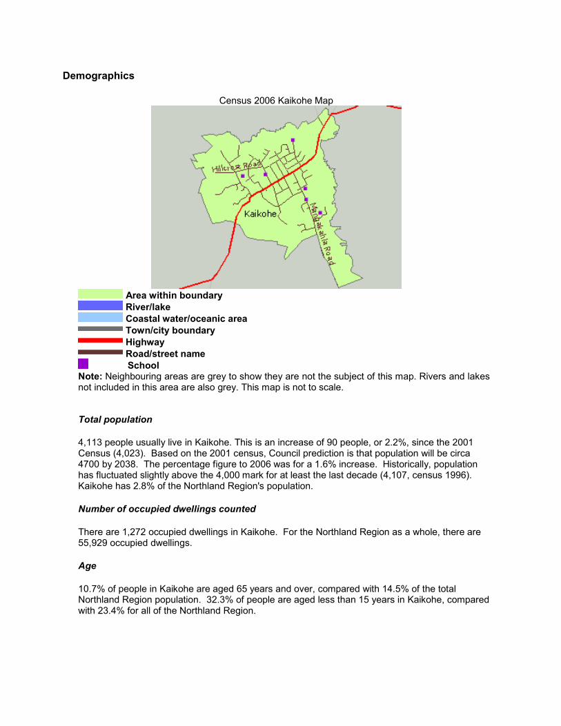
Census 2006 Kaikohe Map
Area within boundary River/lake Coastal water/oceanic area Town/city boundary Highway Road/street name
School Note: Neighbouring areas are grey to show they are not the subject of this map. Rivers and lakes not included in this area are also grey. This map is not to scale.
Total population
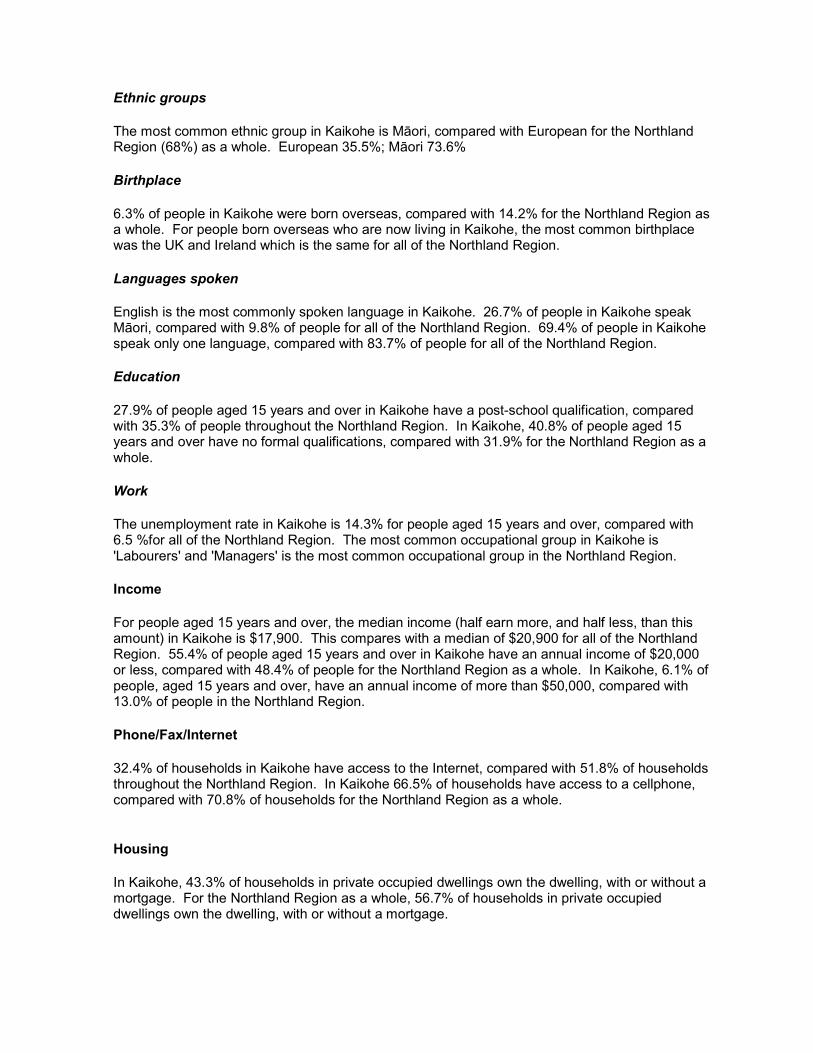
4,113 people usually live in Kaikohe. This is an increase of 90 people, or 2.2%, since the 2001 Census (4,023). Based on the 2001 census, Council prediction is that population will be circa 4700 by 2038. The percentage figure to 2006 was for a 1.6% increase. Historically, population has fluctuated slightly above the 4,000 mark for at least the last decade (4,107, census 1996). Kaikohe has 2.8% of the Northland Region's population.
Number of occupied dwellings counted
There are 1,272 occupied dwellings in Kaikohe. For the Northland Region as a whole, there are 55,929 occupied dwellings.
Age
10.7% of people in Kaikohe are aged 65 years and over, compared with 14.5% of the total Northland Region population. 32.3% of people are aged less than 15 years in Kaikohe, compared with 23.4% for all of the Northland Region.
Ethnic groups
The most common ethnic group in Kaikohe is Māori, compared with European for the Northland Region (68%) as a whole. European 35.5%; Māori 73.6%
Birthplace
6.3% of people in Kaikohe were born overseas, compared with 14.2% for the Northland Region as a whole. For people born overseas who are now living in Kaikohe, the most common birthplace was the UK and Ireland which is the same for all of the Northland Region.
Languages spoken
English is the most commonly spoken language in Kaikohe. 26.7% of people in Kaikohe speak Māori, compared with 9.8% of people for all of the Northland Region. 69.4% of people in Kaikohe speak only one language, compared with 83.7% of people for all of the Northland Region.
Education
27.9% of people aged 15 years and over in Kaikohe have a post-school qualification, compared with 35.3% of people throughout the Northland Region. In Kaikohe, 40.8% of people aged 15 years and over have no formal qualifications, compared with 31.9% for the Northland Region as a whole.
Work
The unemployment rate in Kaikohe is 14.3% for people aged 15 years and over, compared with 6.5 %for all of the Northland Region. The most common occupational group in Kaikohe is 'Labourers' and 'Managers' is the most common occupational group in the Northland Region.
Income
For people aged 15 years and over, the median income (half earn more, and half less, than this amount) in Kaikohe is $17,900. This compares with a median of $20,900 for all of the Northland Region. 55.4% of people aged 15 years and over in Kaikohe have an annual income of $20,000 or less, compared with 48.4% of people for the Northland Region as a whole. In Kaikohe, 6.1% of people, aged 15 years and over, have an annual income of more than $50,000, compared with 13.0% of people in the Northland Region.
Phone/Fax/Internet
32.4% of households in Kaikohe have access to the Internet, compared with 51.8% of households throughout the Northland Region. In Kaikohe 66.5% of households have access to a cellphone, compared with 70.8% of households for the Northland Region as a whole.
Housing
In Kaikohe, 43.3% of households in private occupied dwellings own the dwelling, with or without a mortgage. For the Northland Region as a whole, 56.7% of households in private occupied dwellings own the dwelling, with or without a mortgage.
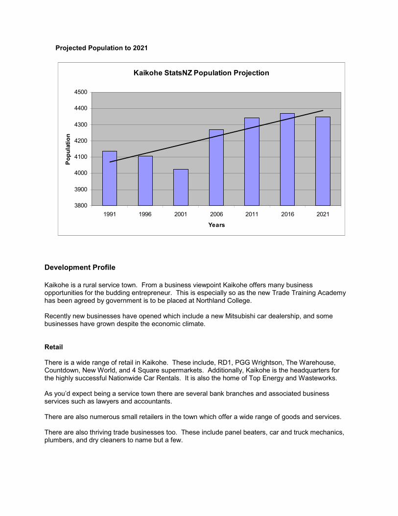
Projected Population to 2021
Kaikohe StatsNZ Population Projection
3800
3900
4000
4100
4200
4300
4400
4500
1991 1996 2001 2006 2011 2016 2021
Years
Population
Development Profile
Kaikohe is a rural service town. From a business viewpoint Kaikohe offers many business opportunities for the budding entrepreneur. This is especially so as the new Trade Training Academy has been agreed by government is to be placed at Northland College. Recently new businesses have opened which include a new Mitsubishi car dealership, and some businesses have grown despite the economic climate. Retail There is a wide range of retail in Kaikohe. These include, RD1, PGG Wrightson, The Warehouse, Countdown, New World, and 4 Square supermarkets. Additionally, Kaikohe is the headquarters for the highly successful Nationwide Car Rentals. It is also the home of Top Energy and Wasteworks. As you’d expect being a service town there are several bank branches and associated business services such as lawyers and accountants. There are also numerous small retailers in the town which offer a wide range of goods and services. There are also thriving trade businesses too. These include panel beaters, car and truck mechanics, plumbers, and dry cleaners to name but a few.
Manufacturing Kaikohe has a small manufacturing sector such as engineering that supports the rural economy. There is room for expansion of the manufacturing base as there is affordable industrially zoned land available. Tourism Tourism in the future will play a greater role in the town’s economy, particularly if the cycleway is built. There are a number of accommodation providers in the town. Tourisms highlights include the Pioneer Village, Ngawha Spring hot pools, Hone Heke monument, as well as a fledgling arts sector in the town. Primary Industries Primary Industries are the economic backbone of the town. Kaikohe has some of the best quality soils in the country. Land prices are extremely competitive. General Kaikohe offers excellent business opportunities due to its affordability. It has the luxury of location, being half way between the Bay of Islands and the Hokianga on a State Highway network. With Kaikohe being affordable along with good social infrastructure like schools and health services, it is great place for families to buy their first home. Key Agencies
Far North District Council Memorial Ave Ministry of Education
Group Special Education 111 Broadway Ministry of Social Development
Child, Youth and Family Memorial Ave Work and Income Memorial Ave
Ministry of Justice Kaikohe District Court Station Road Kaikohe Police Station 142 Broadway Northland Regional Corrections Facility Ohaeawai Rd, State Highway 12
Power supply - Top Energy Built over previous decades, particularly during the 1960s and 1970s, the Far North’s electricity network capacity has recently experienced significant increases in demand, so that additional capacity is now required to be constructed. For electricity supply growth to continue, there is a pressing need to invest substantially in the network, to both expand the volume of power which it can handle and to improve the system’s reliability. This investment will not only ensure sufficient new capacity for local residents but will also encourage new businesses to the region. On the transmission side, 15,000 power consumers at the Kaikohe point of supply rely on a single Transpower feeder and ageing transformers. Top Energy will need to increase network investment across the district by about $124 million, over and above the historic level of around $60m for a similar period. The key projects planned for Kaikohe is the construction of a new dual circuit, 33kV High Capacity Line between Kaikohe and Waipapa (which will have an eventual upgrade to 110kV planned). When expansion of the Ngawha geothermal power station (situated 3 km west of Kaikohe) is completed, it is expected to provide 70% of the district's power. Telecommunication Internet speeds of up to 20 megabytes per second will be possible in Far North towns including Kaikohe by the end of 2011. Telecom’s network arm Chorus is committed to building a world-class
network capable of delivering broadband connections between 10 to 20MBps to 80 percent of New Zealanders. It plans to add 11.6km of fibre optic cable to its 662km Far North fibre optic network, install 13 new roadside cabinets and upgrade seven exchanges in communities with 500 or more connections. Kaikohe will be upgraded to ADSL2+ around September 2010. The upgrade will allow internet service providers to deliver ADSL2+ broadband speeds to internet users in urban areas allowing them to watch DVD-quality movies online, hold high-resolution video conferences and stream high-definition TV broadcasts. Other telecommunication systems are:
• Telecom landlines • Vodafone, 2degrees and Telecom mobile networks • Internet dial-up via landlines.
Growth While there are no major projects currently planned for this area by Council, this does not mean that new infrastructure ceases. Growth still causes a need to enlarge such things as sewerage, water services, particularly reticulation and treatment along with a need to increase the availability of recreational facilities such as libraries, reserves, improve the carrying capacity of the roading network and to provide all the facilities that a growing community needs. New infrastructure can only be paid for in one of two ways. Either Council borrows the money and every ratepayer pays that cost, or the new developers that cause the need for the increased infrastructure, pay for it. The works that a developer undertakes are generally those that relate to the development itself rather than as an offset against the additional infrastructural demand caused by the growth. The types of works that may be required include the provision of reticulation, footpaths, internal or access road works, street lighting etc within the subdivision. Transport Council maintains 32.443 km of roading in this area. Of this, 29.834 km is sealed leaving 2.2.609 unsealed. The state highway (SH 12), 2.520 km, is controlled by the New Zealand Transport Authority (NZTA). As per the Annual Plan 2010/2011, the following sealing projects have been identified, subject to funding from NZTA being available:
• Piccadilly Road from Mangakahia Road – target length to be sealed 1.5 km
Council is currently undertaking a Roughness and Rating survey to determine what current roads need future works to be carried out. Additionally:
• The township is on State Highway 12 which merges into State Highway 1 to the east of Kaikohe
• Rail Access at Otiria to the east of Kaikohe, plus the rail corridor to Kaikohe still exists from Otiria
• Nearest port is Ōpua. Nearest commercial port of scale is Whāngārei; approximately 80 km’s away
• Commercial air links via Kerikeri / Bay of Islands Airport • Kaikohe has an airport which has commercial possibilities and is the longest runway in the
southern hemisphere • The town is well serviced by trucking firms.
Walking and Cycling A draft strategy designed to encourage the establishment of a network of walkways and cycling tracks in high demand areas across the Far North was released for public comment in March 2007. In short, the “Walking & Cycling Strategy” identifies a need for improved and extended footpaths and dedicated cycle-ways in areas surrounding schools and in high density pedestrian traffic areas in urban centres such as Kaikohe. The major project undertaking is a feasibility study for a walkway:
The original proposal for a cycleway came from the Kaikohe and Okaihau communities wishing to see the old railway corridor re-opened as a non-motorised transport corridor. The rationale behind this is for the communities to enjoy and to create better connectivity between them. The Western Community Board has championed this project as there are obvious beneficial outcomes. At the government’s job summit the prime minister announced the concept of a national cycleway, which became the ‘Great Rides’ concept. $50 million has been set aside in the budget to allow the Ministry of Tourism to set up “New Zealand Cycleway Trail Project – Nga Haerenga”. Far North District Council has successfully bid into the “New Zealand Cycleway Trail Funding” through support from the region agencies such as NRC, TLA’s, and Sport Northland, etc. The Cycleway will go from Horeke to Opua predominantly via the disused rail corridor: through the townships of Okaihau, Kaikohe, Moerewa, and Kawakawa. It is important to note that it will be a multi-day ride which meets the needs of the target market (50+ people and families) known as the “soft market”. The cycleway is approx 100kms long and part of the experience will be using the vintage railway from Kawakawa to Opua. The cycleway has been chosen by government as one of the seven “quick starts”. The above funding is for a feasibility case. The feasibility centres on whether or not the cycleway is viable from an engineering and commercial point of view. Aspects of the feasibility study include a business case / model (allows for free access), governance, economic impact, marketing, engineering report and a consultative process of affected landowners, townships and iwi as well as importantly for the government - job creation. The feasibility report was sent to government by 18th December 2009 for their consideration. It is anticipated that government will respond by early March 2010. If the government response is positive - it is further anticipated that government will further fund or co-fund the building of the infrastructure. If this is the case the cycleway should be open for business by the beginning of the Rugby World Cup 2011. Car Parks Council provides and maintains the Memorial Avenue Car park in Kaikohe. All other car parks are privately owned. Stormwater Catchment Council owns and operates the public stormwater system serving the Kaikohe area. The Kaikohe urban stormwater catchment comprises some 413 ha. 31 sub-catchments have been identified and each subcatchment has its own existing drainage system. 13 Sub-catchments incorporate overland flow and surface water drains to carry surface water into the Mangamutu, Ouehaere, Papahawaiki, and Waioro Streams and their tributaries. Culverts are used to pass flows beneath drives and roadways. 18 Sub-catchments incorporate catchpits, pipes and surface water drains to collect and carry surface water flows to the Mangamutu, Ouehaere,Papahawaiki, and Waioro Streams and their tributaries. In some areas culverts are used to pass flows beneath drives and roadways. 1,193 private properties are serviced along with 141 businesses. The public system provides for the collection and conveyance of stormwater from roads and from developed areas. Typically runoff from roads, driveways and properties is collected via kerb and channel, catch pits, open drains and conveyed through a limited piped network to discharge to open drains, streams or rivers. Council is responsible for:
• Maintaining the road drainage system (not including SH 12), kerb and channel and culverts • Providing for and maintaining the public stormwater drainage system that receives
stormwater from individual properties, reticulation (pipes), catch pits, manholes, inlets/outlets, detention dams/ponds
• Maintaining public watercourses, open drains, and overland flow paths.
Wastewater Disposal Council supplies a full reticulation (37.3 km2) and sewerage system suitable for all household and most industrial purposes. The area of benefit services 4,271 people and has a total of 6,247 connections. The annual discharge of 676,024 m3 is treated by oxidation ponds and wetlands. The current treatment system is being upgraded with inlet screens and a new anaerobic pond. Water The Kaikohe – Ngawha reticulated (62 km2) public water supply systems services a population of 4,113 through 1,738 connections. Water is pumped (2 pumping stations) from a river source as well as boreholes. Water is also supplied to 217 fire hydrants within the area of benefit. Transfer Stations Kaikohe refuse transfer station is a class 1 facility located on Station Road. The facility is open 7 days per week from 7.30am to 5pm (Mon to Fri) and from 9am to 5pm (Sat & Sun) and takes general and commercial waste as well as hazardous waste, car bodies and greenwaste. Community Facilities Pensioner Housing Council has one complex in Kaikohe, comprising 38 units with the following configuration. The complex usually has a small number of vacancies.
• Two units with single bedroom • Thirty six Bedsits.
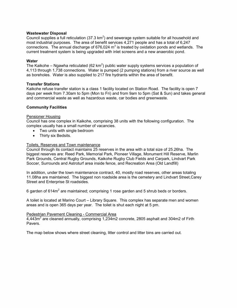
Toilets, Reserves and Town maintenance Council through its contact maintains 25 reserves in the area with a total size of 25.26ha. The biggest reserves are: Reed Park, Memorial Park, Pioneer Village, Monument Hill Reserve, Marlin Park Grounds, Central Rugby Grounds, Kaikohe Rugby Club Fields and Carpark, Lindvart Park Soccer, Surrounds and Astroturf area inside fence, and Recreation Area (Old Landfill) In addition, under the town maintenance contract, 40, mostly road reserves, other areas totaling 11.08ha are maintained. The biggest non roadside area is the cemetery and Lindvart Street,Carey Street and Enterprise St roadsides. 6 garden of 614m2 are maintained; comprising 1 rose garden and 5 shrub beds or borders. A toilet is located at Marino Court – Library Square. This complex has separate men and women areas and is open 365 days per year. The toilet is shut each night at 5 pm. Pedestrian Pavement Cleaning - Commercial Area 4,443m2 are cleaned annually, comprising 1,234m2 concrete, 2805 asphalt and 304m2 of Firth Pavers. The map below shows where street cleaning, litter control and litter bins are carried out.
Education Seven state funded schools catering for Yrs1 – 15:
Northland College is a secondary (years 9-15) school with a roll of 454. It was founded in 1947 on the site of a former American army camp. The school incorporates a working farm and forestry block.
Kaikohe Intermediate is an intermediate (years 7-8) school with a roll of 199. It was established in 1969, taking over the grounds of the former Kaikohe Primary School.
Kaikohe East School and Kaikohe West School are contributing primary (years 1-6) schools with rolls of 228 and 367, respectively. Kaikohe West School opened in 1882 as Kaikohe Native School. The name changed to Kaikohe Maori School in the mid 1950s; and to the current name in 1969. Kaikohe East School has a Maori unit offering bilingual and total immersion classes.
Te Kura Kaupapa Maori o Kaikohe is a composite (years 1-15) school with a roll of 222. It is a Kura Kaupapa Māori school which teaches fully in the Māori language up until year 7. The school originated in the early 1990s and opened on its present site about 2003.
Kaikohe Christian School is a Christian state-integrated composite (years 1-15) school with a decile rating of 4 and a roll of 171. It opened in 1985.
All these schools are coeducational and all but the Kaikohe Christian School have a decile rating of 1.
Tertiary Education
• Northtec Campus • Ngati Hine Health Trust Matauranga Whanu • Quality Education • Te Kotahitanga E Mahi Kaha Trust • People Potential Ltd.
Environment & Planning Profile
This section will provide maps and information about current zoning, land use and settlement patterns within the community. In addition, depending on the community, the following topics may be described:
o Catchments and Flood Zones o Biodiversity o Landscapes o High Class soils o Stability o Erosion o Contamination.
Growth Opportunities\Nodes\Drivers
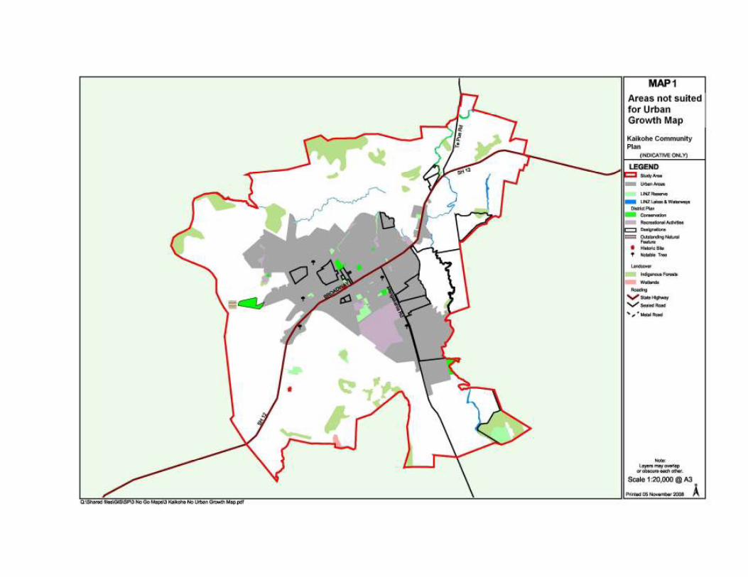
The following constraint and opportunity maps1 provide general guidance on the constraints associated with known and potential hazards and other restrictions. The maps indicate areas
1 Kent Consulting (New Zealand) Ltd, Constraints & Opportunity Mapping, 2008
unsuited for development, and areas where future development may be appropriate. They are based on information currently held by Council and have been developed at a very broad scale. Hence, they should not be related to specific sites and are provided for information purposes only. The types of information which the maps have been based on include:
• Hazard areas (e.g. floodplains, landslips, coastal erosion) • Important cultural and heritage sites (e.g. sites of significance to Maori including Pa and
waahi tapu, heritage buildings, registered archaeological sites) • Natural features (e.g. geological features such as lava flows and volcanic cones) • Indigenous vegetation • Waterways (e.g. lakes, rivers, streams) • Soil type.
As part of the community planning process, the purpose of the maps is to provide background information to assist the community in developing their aspirations. The maps provide a valuable visual and information tool, and, like pictures, are worth a thousand words. The constraint and opportunity maps have been divided into four categories: Map 1 – Areas not suited for Urban Growth (no growth opportunities) This information identifies land characteristics that cannot be changed or have to be retained (these are referred to as “no go areas”). These are areas that cannot, for a number of reasons, be developed in the future for intensive urban living. These include factors such as:
• Being subject to coastal flooding; • Is within an extreme flood risk area; • Is reserved for public use (public reserve); or • Is identified as a site of cultural significance to Maori, or an historic site has been identified on
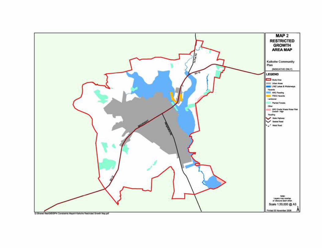
the site. Map 2 - Restricted Growth Areas (limited growth opportunities) These are areas identified as being affected by issues that may currently hinder development of land, but which are not regulated in any way (i.e.) they may at some stage be overcome (by engineering or future technology advances) and/or may cease to be restrictive in the future. These include factors such as:
• An outstanding natural feature2 has been identified on the site; • Is subject to flooding3; • Is identified as being within a high density kiwi area; or • The soil type associated with the area is considered unsuitable for on-site wastewater
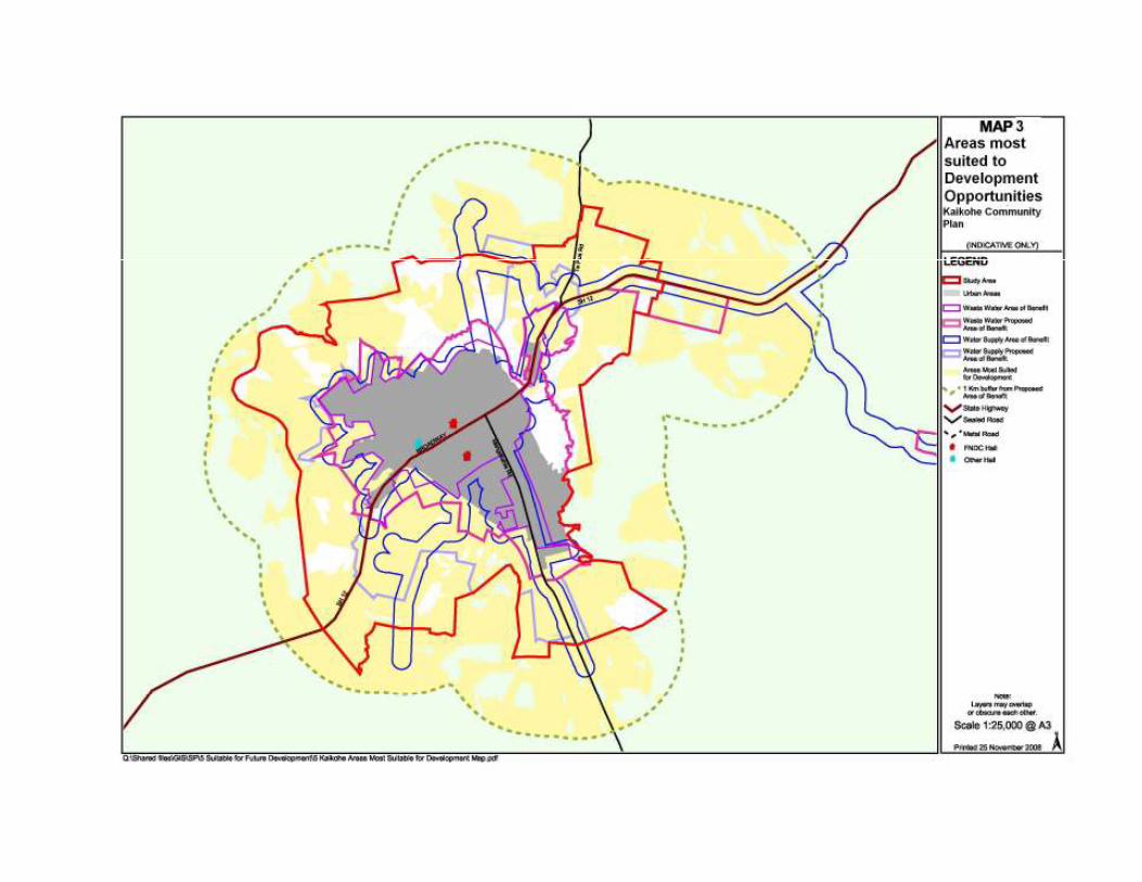
systems. Map 3 - Areas most suited to development opportunities
The areas not included in Maps 1 & 2 are considered to be most suited to future urban growth. The map identifies areas suitable for intensive future urban development only as far as 1km away from the existing proposed Area of Benefit. These are the areas closest to existing urban development, are areas that are under pressure for subdivision and development, and are within or close to the current Area of Benefit. It shows where the need for serviced land is most likely to be needed, and where the potential demand for facilities in the future is likely to be.
2 A list of Outstanding Natural Features in the Far North can be found in the Far North District Plan, 2009. 3 Indicative flood maps have been sourced from the Northland Regional Council and have been included in the Far North
District Plan, 2009

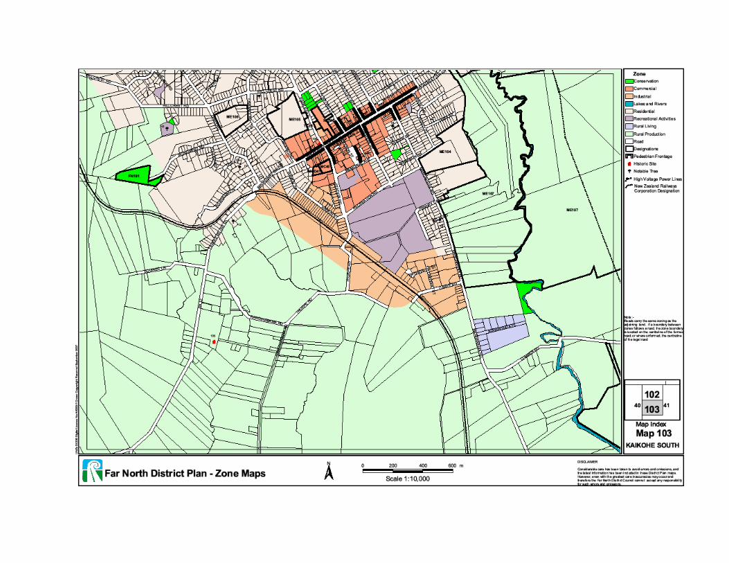
District Plan Zone Maps - South & North The District Plan zoning map shows the current zonings for the area. It can be compared to the areas identified as most suitable for future higher density urban development and shows where future changes to the District Plan may be appropriate, if the need arises.
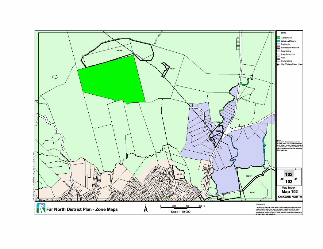
Future Plans This section of the document will be presented to the community at the third community meeting. This section will be prepared by Council staff to identify projects and initiatives currently planned for the area using the headings below as appropriate for the community. In the first instance, the 'deliverer' of the service or project will need to identify the priority of the work (overall in the context of other works). Subsequently the community will need to identify its own prioritisation of these works. Note that it is unlikely that agreement will occur. In addition to Future Plans, the community may wish to include works notnotnotnot planned, e.g. a seal extension project which Council does not intend to deliver but which is a community priority. This way, unfulfilled aspirations can be reviewed as the Plan is reviewed in future years.
Live
Zoning (settlement & land use)
Infrastructure
Water
Wastewater
Solid Waste
Roads
Community Facilities
Affordable HousingAffordable HousingAffordable HousingAffordable Housing
BroadBroadBroadBroadband/Telecommunicationband/Telecommunicationband/Telecommunicationband/Telecommunication
Power & EnergyPower & EnergyPower & EnergyPower & Energy
Expansion of infrastructure
PriorityPriorityPriorityPriority ProjectProjectProjectProject TimeframeTimeframeTimeframeTimeframe Rationale (should link back to Rationale (should link back to Rationale (should link back to Rationale (should link back to Community Profile)Community Profile)Community Profile)Community Profile) DelivererDelivererDelivererDeliverer CommunityCommunityCommunityCommunity
CultureCultureCultureCulture
Tangata WhenuaTangata WhenuaTangata WhenuaTangata Whenua
Health
Social Welfare
Education
Work
EconomicEconomicEconomicEconomic
TrTrTrTransportansportansportansportation ation ation ation ---- links links links links, mobility, mobility, mobility, mobility
Play
RecreationRecreationRecreationRecreation
Open spaceOpen spaceOpen spaceOpen space
Significant community events (festivals, sporting events) Significant community events (festivals, sporting events) Significant community events (festivals, sporting events) Significant community events (festivals, sporting events)
Green spacesGreen spacesGreen spacesGreen spaces
ArtsArtsArtsArts
Protect
EnvironmentEnvironmentEnvironmentEnvironment
Community SafetyCommunity SafetyCommunity SafetyCommunity Safety
Civil DefenseCivil DefenseCivil DefenseCivil Defense
HeritageHeritageHeritageHeritage
Strong Communities
VolunteeringVolunteeringVolunteeringVolunteering
Supporting Key Groups (Supporting Key Groups (Supporting Key Groups (Supporting Key Groups (Age, disability, Age, disability, Age, disability, Age, disability, Tangata Whenua, Tangata Whenua, Tangata Whenua, Tangata Whenua, etc)etc)etc)etc)
Community-Based Initiatives
(This section is developed by the community independently for self-help projects, e.g. murals, bus shelters, etc.) Process Note:Process Note:Process Note:Process Note: Once the community has been supplied with the Community Profile and Future Plans, the next task will be for the community to agree a process for considering this information and putting it into context. Using this information, and working with a Council facilitator (where necessary) the community needs to feed back into the process:
• A local priority implementation plan o Do they agree with the Future Plans? o What is most important\most urgent? o Are there gaps? o Are there things included the community doesn't want?
• A list of local projects it wishes to pursue to contribute to community wellbeing (e.g volunteer projects)
• The community vision statement(s). How the community does this should be largely determined by the participants. As the Plan develops, this section will need to be refined to reflect community views and local knowledge.