Embed Size (px)
Citation preview

Kansas PreservationR E A L P L A C E S . R E A L S T O R I E S .Volume 33, Number 3
Historical Society
A Coffey BreakSee story on page 16.

Kansas PreSerVatioNPublished quarterly by the Kansas Historical
Society, 6425 SW 6th Avenue, Topeka KS 66615-1099.
Please send change of address information to the above address or email [email protected].
Third class postage paid at Topeka, Kansas.
Governor Sam Brownback Jennie Chinn, State Historic Preservation Officer
Patrick Zollner, Deputy SHPO, Editor Linda Kunkle Park, Graphic Designer
Partial funding for this publication is provided by the National Park Service, Department of the Interior. The contents and opinions do not necessarily reflect the views or policies of the Department of the Interior, nor does the mention of trade names or commercial products constitute an endorsement or recommendation by the Department of Interior.
This program receives federal funds from the National Park Service. Regulations of the U.S. Department of the Interior strictly prohibit unlawful discrimination in departmental federally assisted programs on the basis of race, color, national origin, age, or handicap. Any person who believes he or she has been discriminated against in any program activity or facility operated by a recipient of federal assistance should write to: Office of Equal Opportunity, National Park Service, 1849 C Street NW, Washington DC 20240.
ON THE COVER: Eisenhower Veteran’s Administration, Leavenworth, was among new National Historic Landmarks that were recently announced, Building 19, pictured. Inset: The chapel is another building in the complex.
©2011
Newsletter of the Cultural Resources Division
Kansas Historical Society
Volume 33, Number 3Contents
1 National Register Nominations
8 Hispanic Heritage in Kansas City
16 2011 Kansas Archeology Training Program
19 Blue Earth Kansa Indian Village
22 KAA Fall Fling
24 National Conservation Award
Kansas Preservation ConferenceThe 2012 Kansas Preservation Conference is planned in partnership with the Regional Energy Sustainability Summit and Fair January 25-28, 2012, in Wichita.
This event is the perfect opportunity to experience two great conferences with a single registration. This combined conference has something for everyone!
• Kansas Historic Preservation Office staff will present introductory information on the Kansas Historic Resources Inventory (KHRI), listing a property to the National Register of Historic Places, and funding programs for historic properties.
• Tour the historic Orpheum Theater and attend screenings of two documentaries.
• Learn about new technology meant to improve energy efficiency in existing buildings.
• Network with individuals, organizations, and companies that share your passion for preserving historic resources while providing for a sustainable future.
• Learn how to effectively winterize your home.• Experience a showcase of products and services from vendors working
with energy efficiency, environmental compliance, sustainability, historic preservation, and LEED design.
The conference will be held at the Drury Plaza Hotel Broadview and the adjacent Century II Convention Center in Wichita.
Additional conference, hotel, and registration information is available at greenwichita.org.
Kansas Preservation Conference will be held at the Drury Plaza Hotel Broadview, Wichita.

V O L u m E 3 3 | 3 | 2 0 1 1 1
At its regular quarterly meeting held at the Kansas Historical Society in Topeka on Saturday, November 19, the Historic Sites Board of Review voted to list four properties in the Register of Historic Kansas Places and to forward 14 nominations to the office of the Keeper of the National Register of Historic Places in Washington, D.C., to be evaluated by its professional staff. If the staff concurs with the board’s findings, the properties will be included in the National Register. One of the nominated properties is the union National Bank building in Wichita, site of the historic 1958 Dockum Drug Store sit-in.
site of 1958 Dockum Drug store sit-In among national Register nominations
Right, Union National Bank, Sedgwick County.
Union National Bank – 104 S Broadway, Wichita, Sedgwick CountyBuilt in 1926, the 14-story union National Bank building is a classic example of a tall, concrete-framed, Chicago-style office building. The building was financed by the Edith Rockefeller mcCormick Trust of Chicago, designed by K. m. Vitzthum and J. J. Burns Architects, and constructed by Wichita builder George Siedhoff. It took just eight months to complete the building at a cost of $200,000, and upon its completion it was the tallest building in Kansas. The building is particularly significant as the location of a student-led sit-in in 1958 at the Dockum Drug Store on the first floor. With support from the local NAACP chapter and leaders such as Chester Lewis and Vivian Parks, a group of young African Americans peacefully protested the drug store’s discriminatory policies for three weeks. Their efforts convinced the Dockum Company and the associated Rexall Corporation to change their policies in stores throughout Kansas. Although rarely recognized, this protest inspired other sit-ins in Oklahoma City and across the country. The building is nominated for its architectural significance and as part of the “African American Resources of Wichita” multiple property nomination for its association with the 1958 sit-in.
by Sarah Martin National Register Coordinator, Kansas Historical Society

2 K A N S A S P R E S E R V A T I O N
Horace Mann elementary School – 824 State avenue, Kansas City, Wyandotte CountyThe Horace mann Elementary School was designed by Kansas City, Kansas School District architect William W. Rose in a restrained Classical Revival style. Built in 1909, the three-story, symmetrical masonry building features classrooms arranged around a central stair tower and specialized rooms for manual training and assembly. Elements of the Classical Revival style include engaged pilasters, multi-light windows, a rusticated stone base, and classical cornice elements. Rose’s successor, architect Joseph Radotinsky, designed a 1939 addition to the east end of the building, which blends well with the massing and materials of the original building. The building functioned as an elementary school through 1939 when it was converted to use by the Kansas City Junior College, which occupied the building until 1968. It is nominated for its local significance in the areas of architecture and education.
Kansas City, Kansas High School Gymnasium & Laboratory – 1017 N 9th Street, Kansas City, Wyandotte CountyThe Kansas City, Kansas High School Gymnasium and Laboratory building was built in 1923 as an education- related structure intended to support educational activities. The related high school sat across the street, but a fire destroyed the school in 1934. A tunnel beneath 9th Street had connected the two buildings. The three-story gym and lab building featured specialized classrooms, such as chemistry and physics laboratories and a home economics department, and indoor athletic facilities that included a spacious two-story gymnasium, swimming pool, and locker rooms with showers. After the fire, a Junior College program moved into the gym and lab building and would later expand into the nearby Horace mann Elementary School and remained there until 1968. The high school left
the building for good when the new Wyandotte High School opened in 1937. School district architects William W. Rose and David B. Peterson designed the gym and lab building in the Renaissance Revival style. It is nominated for its local significance in the area of education.
Winfield National Bank – 901 Main Street, Winfield, Cowley CountyBy the early 1890s, there were four bank buildings located at the intersection of Ninth and main in Winfield. The Winfield National Bank built a two-story brick building at the southwest corner of this prominent intersection in 1879 and significantly remodeled the building in 1916. However, by 1923, the bank had contracted with the American Fixture Company to construct a new building. Just as the 1879 brick building had reflected the bank’s investment in the community with its construction of one of the community’s early brick structures, the new 1923 Classical Revival-style building reflected financial prosperity and stability. The bank survived the Great Depression, but later merged with First National Bank in 1945 and moved across the street. The building’s Classical Revival details include a formal, symmetrical façade and a smooth stone exterior. It has a temple front with paired pilasters framing the recessed entrance and a tall and prominent parapet. The building is nominated for its local significance in the area of commerce and architecture.
atSF Motive Power Building – 1001 Ne atchison, topeka, Shawnee County The motive Power Building was constructed in 1910 and expanded in 1930 to serve as offices to the adjacent Santa Fe Railroad shops. The turn of the century represented a new era for Santa Fe when Topeka citizens supported the relocation of the shops to the Oakland neighborhood in 1902. When completed, the investment was nearly
Left to right, Horace Mann Elementary School, Wyandotte County; Kansas City, Kansas High School Gymnasium & Laboratory; Winfield National Bank, Cowley County.

$400,000 and employed 3,000 men and the shops covered nearly 120 acres. many workers lived in the surrounding area and the availability of railroad jobs is partially attributed to the influx of mexican immigrants to Oakland. In addition to housing offices, the motive Power Building functioned as a sort of community center for shop employees and their families. An auditorium on the top floor was used for social activities and even included performances by the Santa Fe employees’ band. The shops evolved to meet the railroad’s changing needs as it transitioned from steam to diesel power and terminated passenger service. The motive Power Building closed its doors in 2002. The four-story building features an exposed concrete structure and a simplified, symmetrical façade reflective of the Commercial style with applied Classical Revival ornament. It is nominated in the area of commerce.
Church of the Holy Name – 1110 SW 10th Street, topeka, Shawnee Countyuntil 1914, Topeka Catholics were served by two parishes—St. Joseph’s and Assumption. By the early 20th century, Topeka’s westward-moving population necessitated the creation of a new parish to accommodate the 250 Catholic families who lived west of Topeka Boulevard and south of the Kansas River. The fledgling new Holy Name parish purchased property at the corner of Tenth and Clay streets on which to build its first building—a combination church, school, rectory, and office building. under the leadership of Father michael O’Leary, the parish made plans for a permanent house of worship, and hired Chicago architect Henry Schlacks to design the building. Schlacks combined his interest in architecture and devotion to the Catholic Church when in 1898 he founded the Notre Dame architecture program, the first at any Catholic university in America. modeled after Chicago’s St. Ignatius Church, which Schlacks designed, Topeka’s Church of the Holy
Name was completed in 1925 and reflects the Renaissance Revival style. The two-story building features a cross plan, a dressed Carthage limestone exterior with Tuscan columns and pilasters, and a tile roof. The building is nominated for its architecture.
Sedgwick Downtown Historic District – Sedgwick, Harvey CountyThe Sedgwick Downtown Historic District encompasses the majority of the west side of the 500 block of North Commercial Avenue in Sedgwick. The oldest town in Harvey County, Sedgwick is located 16 miles southwest of Newton, the county seat. The town was sited at the junction of the Little Arkansas River and Sand Creek, and is located on a Santa Fe Railroad spur line that stretches north from Wichita to connect to the main Santa Fe line in Newton. There are 11 buildings in this district built between 1880 and 1930 representing several phases of development. The earliest building is a wood-frame false-front building that was moved to the downtown in 1880. Some buildings were built or modified following a devastating tornado in 1923, and others, like the Sedgwick State Bank, were updated after World War II when Sedgwick experienced a population boom of aircraft workers who were employed at Wichita’s Boeing and Cessna plants. The district is nominated for its association with the growth development of Sedgwick.
Beaumont Hotel – 11651 Se Main Street, Beaumont, Butler CountyThe Beaumont Hotel was originally built in 1879 as a railroad hotel, but was significantly remodeled in 1953 to serve as fly-in guests. The building took on its current form through the vision of local rancher James Clinton Squier. By the time Squier purchased the hotel and began remodeling it, his business associates were already
2 K A N S A S P R E S E R V A T I O N V O L u m E 3 3 | 3 | 2 0 1 1 3
Left to right, ATSF Motive Power Building, Shawnee County; Church of the Holy Name, Shawnee County; Sedgwick Downtown Historic Dis-trict, Sedgwick, Harvey County.

using the adjacent pasture as a grass airstrip. Among the character-defining features from the mid-century remodel are viewing decks that were constructed to provide views to the surrounding Flint Hills landscape and the nearby grass airstrip. Soon, the hotel and its restaurant were attracting ranchers, hobby pilots, and day-trippers from nearby Wichita. In 1962, Squier removed the fence between the hotel and airstrip, thus beginning the tradition of pilots taxiing from the airstrip and parking their planes in front of the hotel. The building continues to serve as a hotel and restaurant, and it is nominated for its transportation and agricultural significance.
Luling’s City Laundry – 1730-1746 e Douglas, Wichita, Sedgwick CountyLikely enticed by his older brother and Wichita pioneer businessman Charles Luling, a young Julius Luling arrived in Wichita during the height of the 1880s real estate boom. Julius began his laundry business career at the Wichita Steam Laundry, the city’s first professional laundry operation. He remained there until 1910 when he began operating his own laundries. In 1924, Julius followed the lead of many other prominent businessmen and industrialists and hired well-known Wichita contractor George Siedhoff to construct a new laundry building. When it opened, the Luling Laundry employed 60 people, most of them women. The arduous laundry process consumed 50,000 gallons of near-boiling water each day, and began with a rinse, then an hour-long wash, and then dried with “centrifugal water extractors” whirling at “a rate of a thousand revolutions a minute.” Starched clothes were hung and passed through a steam chamber. Although Julius died unexpectedly in 1929, his laundry business thrived and expanded in the 1930s. The building is nominated for its association with the steam laundry industry in Wichita and for its Commercial-style architecture.
Kansas Gas & electric Company Building – 120 e 1st Street, Wichita, Sedgwick CountyOn march 18, 1953, the Kansas Gas and Electric Company announced plans for the construction of a seven-story office building on the site of their former offices located on the corner lot of First and market Streets. Planned by noted Wichita architects, Glen H. Thomas and Arthur B. Harris, also responsible for the design of numerous buildings in a variety of architectural styles in Sedgwick County, the KG&E Building stands as one of the firm’s best examples of the modern era. Designed in the International style, the building marks the beginning of the modern era for the Central Business District and was the first in a major building boom for the city. Hallmark features of the building’s International style include its form and massing, emphasis on the horizontal, ribboned fenestration, and large unadorned walls. The building is nominated for its architectural significance.
Bitting Building – 107 N Market Street, Wichita, Sedgwick CountyThe Bitting Building was constructed as a four-story building in 1912, and seven stories were added in 1919. A. W. and C. W. Bitting were known throughout the midwest as successful merchants and real estate entrepreneurs. They established a men’s clothing store in a two-story wood-frame building at this location in 1878 and in 1886 relocated the building to make way for a four-story brick structure. That building was razed in 1911 to make way for a new four-story building in 1912 from which they did business and leased office and retail space. The Bitting brothers maintained offices in the building until their deaths in the early 1930s. The property changed hands several times was completely renovated in 1959. Exterior changes included the installation of aluminum-framed
Left to right, Beaumont Hotel, Butler County; Luling’s City Laundry, Sedgwick County, Kansas Gas & Electric Company Building, Sedgwick County.
4 K A N S A S P R E S E R V A T I O N

windows and storefronts, the installation of black granite panels at the base of the building, and replacement of the cornice and belt course with aluminum panels. The interior was again renovated in the 1980s. It is nominated for its commercial significance.
John C. Harmon House – 915 SW Buchanan, topeka, Shawnee CountyThe Harmon House is located in a close-in turn-of-the-20th-century neighborhood that is 11 blocks west of the commercial district lining Kansas Avenue, eight blocks west of the Kansas State Capitol, and just three blocks west of Topeka High School. The neighborhood lining 800 and 900 blocks of Buchanan Street was historically known as Governor’s Row or Governor’s Square and includes impressive turn-of-the-century residences including ones designed by Holland and Squires and Wight and Wilder. John C. Harmon, a local mortgage banker, commissioned the Kansas City-based architectural firm of Wilder and Wight to design a residence. He may have known Edward T. Wilder, who was from Topeka. The house was built by local contractor Harry S. Douglas in the Neoclassical style. Key elements of the style are reflected in the home’s monumental portico, symmetry, elaborate columns, porch and roofline balustrades, decorative window and door surrounds, multi-light windows, and overhanging eaves with dentils. The property includes a contributing carriage house, well house, and modern garage. It is nominated for its architecture.
rocky Ford School – 1969 Barnes road, Manhattan, riley CountyRocky Ford School is a one-room limestone schoolhouse near manhattan in Riley County that was built in 1903 and rebuilt in 1927 after a fire. Various repairs and
improvements were made to the property within its first two decades. An outhouse was built in 1904, a well was first excavated in 1909, but a new well was dug in 1933, and a merry-go-round was installed in 1929. These contributing elements remain associated with the property. The school building served first through eighth grade students in District 70 until consolidation with District 1 in 1938. Although consolidation had been a topic of discussion during District 70 board meetings as early as 1921, they chose to rebuild the school after a fire nearly destroyed it in 1927. Builder Fred Hulse used the original limestone during the reconstruction and improvements, such as electric lighting, were made. The building is nominated as part of the “Historic Public Schools of Kansas” multiple property nomination for its educational and architectural significance.
Peabody City Park – Peabody, Marion CountyThe 23-acre Peabody City Park has a long and colorful history that began in the 1870s with its use as a fairground owned by the marion County Agricultural Society and its later use as a community park. This property on the west edge of town has hosted all kinds of community events including county fairs, a statewide fair in 1885, numerous chautauquas in the early 1900s, and sporting events. Old issues of the Peabody Gazette provide much of the history of the property’s development and reveal the names of those hired to erect buildings and plant trees, such as builder A. K. Steward and landscape gardener E. W. Stephens. New Deal-era labor enhanced the park in the 1930s with the construction of picnic facilities and athletic field bleachers. Today, the park is a layered landscape that retains components of its development from fairground to New Deal-era park to a modern city park including a late 19th century horse racetrack, octagonal
Left to right, Bitting Building, Sedgwick County; John Harmon House, Shawnee County; Rocky Ford School, Riley County;
4 K A N S A S P R E S E R V A T I O N V O L u m E 3 3 | 3 | 2 0 1 1 5

6 K A N S A S P R E S E R V A T I O N
floral exhibition hall, stone entranceway, athletic field with stone bleachers, picnic tables and stoves, and plantings. The park is nominated for its local significance in the areas of recreation, entertainment, and architecture.
Register of Historic Kansas Places
Claude Bichet Farmstead – 2959 US Highway 50, Florence, Marion County French immigrant Claude Francis Bichet and his wife Sophia settled this property in 1858, two years before the Kansas Territorial Legislature established marion County’s boundaries and seven years before the county government organized. The property is located in the Cottonwood River valley where some of the area’s earliest residents settled, including a group of French-speaking immigrants from France, Belgium, and Switzerland. This French colony centered near Florence developed over a period of forty years, and, by 1885, included over 60 families. The young Bichet family erected a log cabin on this property in about 1859 and later added an impressive two-story limestone wing in 1875. Their son Alphonse Bichet owned the property in the late 19th century and passed it to his son
Frederick. The property remains in the Bichet family, and extant farm buildings include an 1875 stone smokehouse and a mid-20th century barn and milkhouse. It is nominated for its association with the early settlement of marion County and for its architecture.
Stilwell Grade School – 6415 W 199th Street, Stilwell, Johnson County The Stilwell Grade School was built in 1910 following a fire that destroyed the Aubry Rural School. The Aubry and Stilwell areas were growing rapidly in the early twentieth century and area school districts struggled to keep up with the growth. Prior to the destructive fire, Aubry Rural School received an addition to accommodate more students. The new Stilwell school was much bigger than its predecessors and served grades one through 12 until a new high school was constructed across the street in 1920. Stilwell Grade School was built by L. A. medaris and is an example of a town graded school, which was designed for graded instruction. Graded schools emerged in towns across Kansas after 1900, and they were often built as one- and two-story brick buildings exhibiting common architectural styles of the period. This type of school building was one of the most flexible in terms of student population and could serve grades one through six or eight, while some even served all grades. The Neoclassical style is subtly exhibited on the Stilwell Grade School and is found primarily in the decorative quoining at the corners, raised brick ornamentation, and symmetrical elevations. It is nominated for its architecture and educational history.
Left to right, Peabody City Park, Marion County; Claude Bichet Farmstead, Marion County; Stilwell Grade School, Johnson Countuy
Claude Bichet’s son Alphonse built this stone addition in 1875 as noted on the stylized date stone.

6 K A N S A S P R E S E R V A T I O N V O L u m E 3 3 | 3 | 2 0 1 1 7
Belleview School, District 68 – Caldwell vicinity, Sumner CountyBelleview School was constructed in 1894 as a one-room country schoolhouse that served rural students in Sumner County’s district 68 until it closed in 1956. The district’s first building was erected in 1878 on land in Caldwell Township, and it is not known why a new building was needed in 1894. The Chisholm Trail – a trade route linking the Arkansas River valley with the Indian Territory that was later used as a cattle-driving route – passed through the Caldwell area. As a result, this vicinity witnessed rapid population and commercial growth when the county was opened for white settlement in 1870. One-room schools popped up throughout the township during the 1870s and 1880s. After Belleview School closed in 1956, the building was used as a polling place until 1998. It sat vacant for nearly 15 years before the township sold it to the current owners who relocated it to their nearby farm in 2009. It is nominated for its association with local education.
M. W. Gilchrist House – 1101 W South avenue, emporia, Lyon Countymarlin W. and Jane Gilchrist developed this property into a small suburban farmstead of 43-acres in 1876, and a residence, barn, and two wells were completed by the end of the summer. In partnership with his brothers William and John, m. W. Gilchrist owned and operated both the metropolitan Stable and Gilchrist and Brothers Lumber Yard in Emporia. Gilchrist sold the house in 1883, and in subse-quent years, the land was subdivided and developed. The property has been the home to several locally well-known Emporia figures through the years including Gilchrist, cattleman Sylvan Nation, and railroad businessman Roy Kramm and his wife Lura, an accomplished gardener. The Kramms were responsible for several modifications to the
landscape in the 1930s including stone entrance piers, an outdoor stone fireplace and picnic tables, and a concrete fishpond. The two-story residence features a cross-gabled plan with Folk Victorian architectural influences. metal siding was recently removed from the exterior of the house, and it is currently being rehabilitated. The property is nominated for its social history and architecture.
Left to right, Belleview School, Sumner County; M. W. Gilchrist House, Lyon County.
The National Register of Historic Places is the country’s official list of historically significant properties. Properties must be significant for one or more of the four criteria for evaluation. Under Criterion A, properties can be eligible if they are associated with events that have made a signifi-cant contribution to the broad patterns of our history. Under Criterion B, properties can be eligible if they are associated with the lives of persons significant in our past. Under Criterion C, properties can be eligible if they embody the distinctive characteristic of a type, period, or method of construction, or represent a significant and distinguishable entity whose components may lack individual distinction. Under Criterion D, properties may be eligible for the National Register if they have yielded or may be likely to yield information important in prehistory or history. The National Register recognizes properties of local, statewide, and national significance.
The Register of Historic Kansas Places is our state’s official list of historically significant properties. Properties included in the National Register are automatically listed in the state register. However, not all properties listed in the state register are included in the National Register. The same general criteria are used to assess the eligibility of a property for inclusion in the state register, but more flexibility is allowed in the interpretation of the criteria for eligibility.
8 K A N S A S P R E S E R V A T I O N
While the legend of the 1951 Flood is a staple of local and regional history, its impact on racial and ethnic
minorities has not been well documented. In the case of the mexican Americans living in the Argentine and Armourdale neighborhoods of Kansas City, Kansas, the flood represented personal tragedy, but also helped bring to a close a dark chapter of publically-mandated school segregation that is largely absent from the historical record.
This was among the key discoveries of a recent survey of Hispanic-American Historic Places undertaken with the support of a Historic Preservation Fund grant from the Kansas Historical Society. In 2010 a university of Kansas
professor and undergraduate student launched a historic resources survey of places, structures, and sites of significance to the mexican American experience in Kansas City. Within the study’s identified boundaries, which included three distinct urban neighborhoods, the study sought out structures and sites that might be eligible for inclusion on the local, state and National Registers of Historic Places, or that might serve as contributing struc-tures for a thematic register nomination.
A historic resources survey involves documenting both the physical features and unique history of sites and buildings. It is the first formal step in determining a
Finding Latin Roots: Hispanic Heritage in Kansas City
The 1951 Kansas River Flood devastated communities throughout Kansas. major cities along the Kaw, including manhattan, Topeka, Lawrence and Kansas City, suffered extensive damage when the River topped levees and overran neighborhoods nestled in its oxbows and valleys.
By Daniel Serda, Ph.D.
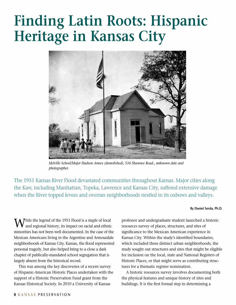
Melville School/Major Hudson Annex (demolished), 516 Shawnee Road., unknown date and photographer.

8 K A N S A S P R E S E R V A T I O N
building’s historic significance, and its eligibility to be included on a local historic registry, or the National Register of Historic Places, which is administered by the National Park Service. A historic resources survey is also an important step in raising awareness of the unique role such places and buildings have played in shaping community history. A survey also represents the first step toward making the buildings eligible for preservation funding, such as grants or tax credits to aid in their repair or rehabilitation.
Places of absenceThe Hispanic community is the largest and most rapidly growing minority group within the united States. While the continued influx of Spanish-speaking immigrants from mexico and Central America continues to stoke debates on federal immigration policy, Hispanic influence in the midwest dates to the earliest periods of Spain’s colonial history in the Americas. Despite this longstanding presence, however, Latinos are not actively engaged in the formal preservation movement, and the history of Latino communities is poorly represented in the pantheon of sites and structures surveyed and designated by historic surveys and local, state or national registers of historic places.
Nationally, the Hispanic American community is represented in preservation primarily through the recognition of Spanish colonial sites, the best examples of which are recognized not only for their historical significance, but also for their distinction as distinguished examples of Spanish colonial architecture. most of these sites are located in the Southwest, which has a lasting and obvious symbolic and cultural association with Hispanic presence in the Americas.
At the 2009 National Preservation Conference, the National Trust for Historic Preservation launched a Latino/Hispanic American Historic Places Initiative to broaden the reach, relevance and impact of the national preservation movement to Latino communities throughout the united States. The Kansas City survey project was intended to draw national attention to the rich heritage and contributions of distinct Hispanic communities in the urban
midwest. Presentation of the survey’s results played a key role in a 2011 National Trust forum (dubbed a conversación, the Spanish word for conversation or convening) that drew together nearly 60 regional and community leaders to explore the potential contribution and missing links in preserving sites related to the history of the local Hispanic population.
The Kansas City survey also differed from some traditional efforts in a key aspect: local community members were consulted early and throughout the process to provide guidance in helping to identify the kinds of places that are meaningful to Kansas City’s Hispanic community. From the outset, the survey team expected that many of these sites and places might not easily fit the traditional criteria for register listing, including their architectural merit and the likelihood that they may have been dramatically altered, if not demolished. Because so few sites related to Hispanic heritage have been surveyed in Kansas, the project offered an opportunity to understand the historical narratives that are meaningful to specific ethnic communities, as well as to evaluate the types of resources that represent this heritage, and challenges that might limit their inclusion in formal preservation efforts.
Kansas City’s Mexican american Heritagemexican Americans first immigrated in significant numbers to Kansas during the late 19th and early 20th
Our Lady of Mount Carmel Catholic Church (demolished), 813 St. Paul, circa 1925, unknown photographer.
V O L u m E 3 3 | 3 | 2 0 1 1 9

10 K A N S A S P R E S E R V A T I O N
centuries. In 1909 regional railroads began to recruit mexican laborers, leading to the establishment of a large mexican barrio in the midst of the Atchison, Topeka and Santa Fe yards in Argentine (then an independent city, now a distinct neighborhood in Kansas City, Kansas). Around the same time, the Kansas City Southern Railroad drew mexican workers to its yard near Kansas City, missouri’s West Side neighborhood, and the Frisco Railroad brought mexican workers to its yards in nearby Rosedale (also now a part of Kansas City).
Recruitment of mexican workers to the midwest expanded greatly after World War I, when Congress passed the 1918 Foreign Exclusion Act, which limited European immigration for the first time in u.S. history. In 1910, 55 percent of all track laborers in Kansas City, Kansas, were mexicans; by 1915, this number had increased to 85 percent, and to more than 90 percent by the late 1920s. Similarly, meatpacking plants in Kansas City, which had heavily relied on Slavic immigrants in the late 19th century, turned their attention to workers from mexico.
Hundreds of these laborers, who worked primarily as section hands responsible for maintaining tracks, switches, and rolling stock in the railyards, were housed in “campos”, or camps, where they were sheltered in railroad box cars. Drawing on the manuscript schedules of the 1920 u.S. Census, the survey identified the largest of such camps adjacent to the Santa Fe freight yards in Argentine. A smaller Santa Fe campo was located in nearby Turner, Kansas, while the union Pacific Railroad’s camps housed mexican section workers in Edwardsville and Bonner Springs, the site of another campo established by the local cement plant. The census manuscripts suggest that large groups of African American workers also lived near the mexican settlements in Rosedale and Argentine.
The presence of so many workers and their families living under marginal conditions, literally “on the other side of the tracks”, reinforced the stigmas imposed by the majority population on the dark-skinned, Spanish- speaking workers, many of whom were drawn to Kansas City from the interior mexican states of michoacán, Jalisco, and Guanajuato. The harsh living conditions, coupled with the outbreak of Spanish Flu in 1918, fueled suspicions and widespread concern among Anglos about the hygiene and morals of the new immigrants. This was a period in which resentment against foreign laborers, including Eastern and Southern Europeans, fueled the rise and national prominence of the Ku Klux Klan, which
established an office on minnesota Avenue in downtown Kansas City in the early 1920s. (The Klan was publically aligned with the anti-immigrant movement from the late 19th century through World War I, in part on the basis of the Catholic heritage of many of the Slavic “foreigners” deemed suspect by the advent of war.)
Local attitudes and economic realities created an environment of uncertainty around the place of mexican immigrants in local communities. During an economic recession in 1922, meatpacking plants, railroads and manufacturers furloughed thousands of laborers in Kansas City and other cities around the industrial midwest. In response, massive repatriation efforts were organized to send displaced workers back to mexico. In 1920 and 1921 close to 100,000 unemployed mexican laborers were repatriated from the u.S. to mexico. In June 1921 the Kansas City Chamber of Commerce and a coalition of local charities (including some within the mexican American community itself) jointly sponsored a missouri Pacific “day coach” for between 800 and 900 mexican workers and their families, which left union Station bound for Wichita and El Paso, where they disembarked and were transferred to a mexican Railroad train destined for Ciudad Juarez. By the late 1920s, the u.S. government began to restrict mexican immigration administratively, resulting the eventual expulsion of nearly 65,000 mexican workers from the u.S. during the Great Depression.
Heritage and the Social Fabric of Local CommunitiesPreliminary research supporting the survey effort focused primarily on academic studies, including doctoral and master’s theses about Kansas City’s mexican American community. Given the tenuous living circumstances and meager wealth of the early immigrants, the survey team was unsure whether any significant structures were likely to have survived the passage of time. Consultations with community leaders did suggest, however, that important civic institutions, such as local churches and schools, would provide a basic framework of sites for the survey process. The team identified four extant churches, along with one destroyed by the 1951 Flood, that were of critical importance to the mexican American community. Despite their impressive Gothic revival and regional vernacular architecture, all had been overlooked by previous survey efforts.
To supplement this formal research process, the team organized two community meetings, which were held on
10 K A N S A S P R E S E R V A T I O N V O L u m E 3 3 | 3 | 2 0 1 1 1 1
Saturday afternoons and advertised through local church bulletins and community newsletters. The forums offered the team an opportunity to explain the basics of preservation to community members, many of whom assumed that their history lacked significance. The forums were an important connection for the team to identify sites and stories, along with local cultural traditions that needed to be commemorated. It was also through the forums that the team learned about two important longstanding annual traditions: a reunion of mexican Americans who survived the 1951 Flood, and a reunion of former students from a segregated mexican school.
Based on both formal research and the community meetings, the team focused its efforts on three categories of sites and buildings: civic institutions (two segregated mexican schools and five Catholic parishes); places of social importance (recreational facilities, including the Argentine Parish House, Pan-American Club and Armourdale Bath House); and entertainment facilities (such as Argentine’s Park Theatre). The team also learned through the community meetings about mexican-owned businesses that existed before 1951 but were wiped out or relocated by the Flood, but were not able to find adequate supporting information in city directories and other sources to adequately document them.
It was through the community outreach process that the team learned about one of the most unique and important social institutions in Argentine, the Eagle’s Nest, a local American Legion Post established by mexican American veterans who were not allowed to join the established local Post after World War II. The story of this site is emblematic of the Hispanic community’s arrival as working-class immigrants and emergence as fully-vested citizens in American society.
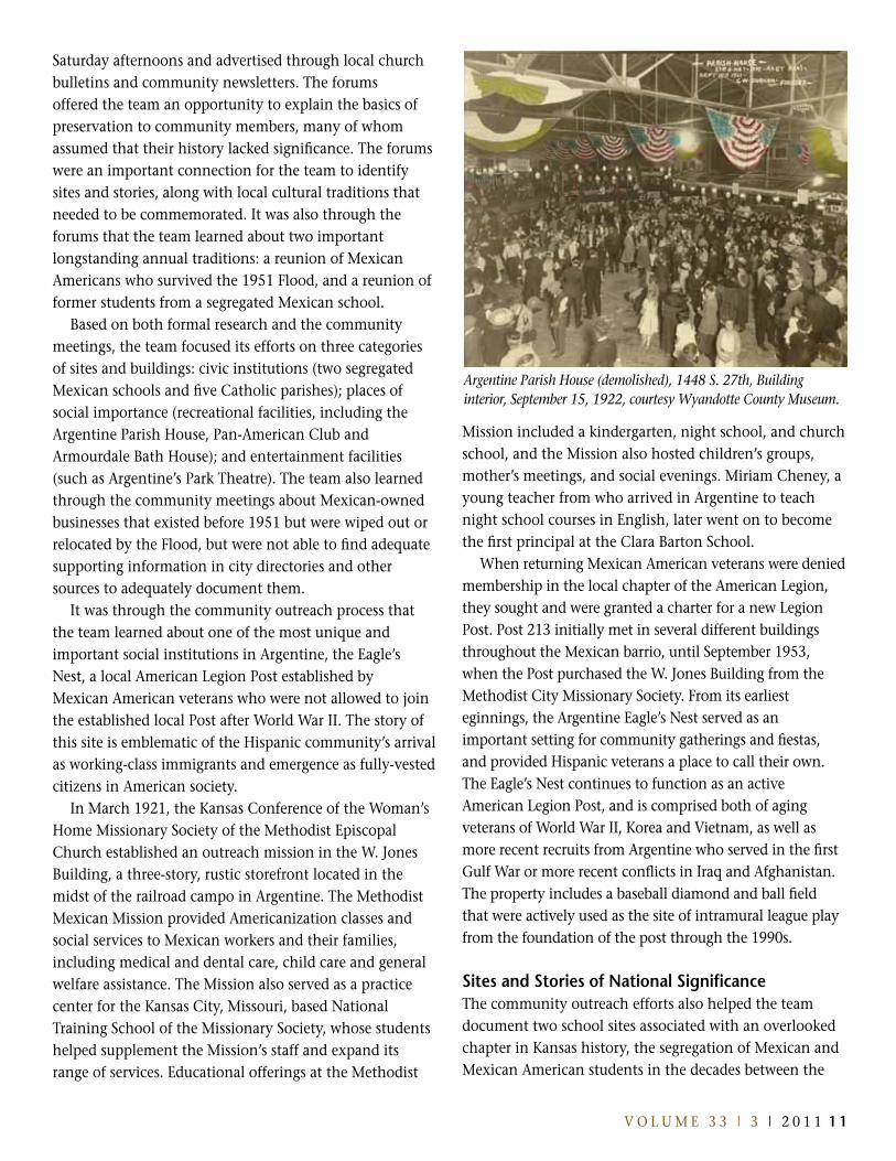
In march 1921, the Kansas Conference of the Woman’s Home missionary Society of the methodist Episcopal Church established an outreach mission in the W. Jones Building, a three-story, rustic storefront located in the midst of the railroad campo in Argentine. The methodist mexican mission provided Americanization classes and social services to mexican workers and their families, including medical and dental care, child care and general welfare assistance. The mission also served as a practice center for the Kansas City, missouri, based National Training School of the missionary Society, whose students helped supplement the mission’s staff and expand its range of services. Educational offerings at the methodist
mission included a kindergarten, night school, and church school, and the mission also hosted children’s groups, mother’s meetings, and social evenings. miriam Cheney, a young teacher from who arrived in Argentine to teach night school courses in English, later went on to become the first principal at the Clara Barton School.
When returning mexican American veterans were denied membership in the local chapter of the American Legion, they sought and were granted a charter for a new Legion Post. Post 213 initially met in several different buildings throughout the mexican barrio, until September 1953, when the Post purchased the W. Jones Building from the methodist City missionary Society. From its earliest eginnings, the Argentine Eagle’s Nest served as an important setting for community gatherings and fiestas, and provided Hispanic veterans a place to call their own. The Eagle’s Nest continues to function as an active American Legion Post, and is comprised both of aging veterans of World War II, Korea and Vietnam, as well as more recent recruits from Argentine who served in the first Gulf War or more recent conflicts in Iraq and Afghanistan. The property includes a baseball diamond and ball field that were actively used as the site of intramural league play from the foundation of the post through the 1990s.
Sites and Stories of National SignificanceThe community outreach efforts also helped the team document two school sites associated with an overlooked chapter in Kansas history, the segregation of mexican and mexican American students in the decades between the
Argentine Parish House (demolished), 1448 S. 27th, Building interior, September 15, 1922, courtesy Wyandotte County Museum.

12 K A N S A S P R E S E R V A T I O N
two World Wars. The story of segregated mexican schools in Kansas is not only largely absent from national accounts of the Civil Rights movement, but it has been acknowledged primarily in academic research that does little to commemorate the specific places and sites associated with that history. Nonetheless, this heritage has long been a part of local community folk history, as confirmed by several oral history projects consulted by the survey team.
In the fall of 1918, following public concerns about the ongoing influenza epidemic, local residents pressured the Kansas City school district to forbid the children of mexican laborers from attending local public schools. Instead, the school district confined mexican American students, many of whom were born in Kansas and thus u.S. citizens, to attending classes in the poorly-ventilated basements of existing buildings. By the early 1920s, mexican schoolchildren in Kansas City were being taught in extremely large classes (up to 80 students) in the basements of two existing elementary schools, Emerson in Argentine and John J. Ingalls in Armourdale.
According to architectural plans prepared when the building was remodeled in the early 1920s, the “mexican Room” at Ingalls shared the floor with a coal room and boys and girls toilets. In 1921 the teacher to student ratio in the dank basement reached 1 to 72, prompting a new
wave of concern among Anglo parents about the potential for epidemic disease. The following year, the district constructed a separate three-room annex on the school grounds, and justified the ongoing segregation of mexican students as part of an “Americanization” program promoted by the city’s chamber of commerce.
In Argentine, after four years of lobbying by local civic leaders and the Emerson and Ingalls PTA chapters, the district built Clara Barton, the first formally segregated mexican school in Kansas City. Located at 25th and Cheyenne Avenue, Clara Barton sat in the midst of the railroad campo on the north side of the Santa Fe Railway’s Argentine yard. Sited near the foot of the “Old Southern Bridge” that carried Argentine Boulevard across the Kansas River from Armourdale, Clara Barton originally contained three classrooms that housed approximately 125 students, ranging in age from first through eighth grades. The school averaged a 40 to 1 pupil to teacher ratio, and was soon overcrowded. Two additional classrooms were later added to the building.
The segregation of mexican students in Kansas City, Kansas was not confined to the immigrant barrios of Armourdale and Argentine. In September 1924 a mob of at least 200 Anglo parents surrounded major Hudson Elementary School and refused entry to four mexican children who had been permitted to attend regular classes
Pan-American Club (demolished), 617 Shawnee Avenue, Sanborn maps and Google aerial map showing change over time, complied by Kathleen Bole.

12 K A N S A S P R E S E R V A T I O N V O L u m E 3 3 | 3 | 2 0 1 1 13
at the newly-built school in Rosedale. Over the course of the next 18 months, at the persistent urging of mexican diplomats, the u.S. State Department intervened and eventually succeeded in requiring Kansas City, Kansas School District to educate the mexican students. The State Department’s intervention was prompted by entreaties from the mexican Consul in Kansas City and the mexican Embassy in Washington, which cited the equal protection clause of the 14th Amendment, as well as the Treaty of Guadalupe Hidalgo (which guaranteed formal civic rights to mexican Americans), in instating that the mexican children be admitted to the city’s public schools.
According to district records and local media accounts, the “racial problem” in Rosedale was “solved” in 1925, when the school district created a segregated mexican classroom in the 1887 melville School, the two-room, wood-frame schoolhouse that major Hudson replaced. The creation of the major Hudson “mexican Annex” in Rosedale and the Clara Barton School in Argentine was consistent with Plessy v. Ferguson, the 1896 u.S. Supreme Court decision that sanctioned “separate but equal” education. It would not be until 1954, the same year that the Supreme Court overturned Plessy in Brown v. Board of Education, that the Court would agree in Hernandez v. Texas that minority groups other than African Americans were entitled to equal protection under the 14th Amendment.
Advocacy by mexican workers themselves eventually opened the doors to integrated public education for the children of mexican American immigrants throughout Kansas City, Kansas. Saturnino Alvarado, a shoemaker who operated a cobbler’s shop from his home in Argentine, was determined to see his two teenaged children graduate from high school. At the time, the Kansas City School District made no accommodations for mexican children to attend schools past the eighth grade, arguing that most would drop out to work or were otherwise uninterested in obtaining a high school diploma. Like the parents of the children in Rosedale, Alvarado pressed his case with the mexican consul, and in 1930, some four years after his initial request, his son Jesse and daughter Luz graduated from Argentine High School. In 2003 the School District renamed the auditorium at Argentine middle School (a more modern building that formerly served as Argentine High) in Alvarado’s honor, and he was inducted into the mid-America Education Hall of Fame at Kansas City, Kansas, Community College.
By the early 1940s, the Kansas City, Kansas School District had determined (presumably in the face of dwindling enrollment) that major Hudson’s mexican Annex was “no longer needed.” The historical record is unclear as to when the basement classrooms at Emerson and Ingalls ceased operations. In a moment identified as deeply significant by many community members consulted during the survey, the Clara Barton School in Argentine was washed off its foundations and split in two by the 1951 Flood. The following school year saw mexican American students admitted to the general population at Emerson Elementary for the first time since 1918.
Mexican americans, Civil rights and Urban renewalSchools were not the only public facilities to which mexican Americans in Kansas City were denied or limited access. Before the 1951 Flood, the Armourdale Community “Bath House” not only featured a gymnasium, community library and classrooms, but also an in-ground, outdoor swimming pool. According to local oral histories, before the 1951 Flood, mexican Americans—who had been segregated to the worst housing in the eastern part of the neighborhood, adjacent to the Swift and Cudahy meatpacking houses where many worked—were not
Argentine Parish House (demolished), 1448 S. 27th, east elevation rendering from Kansas City Kansas, June 3, 1921.
14 K A N S A S P R E S E R V A T I O N
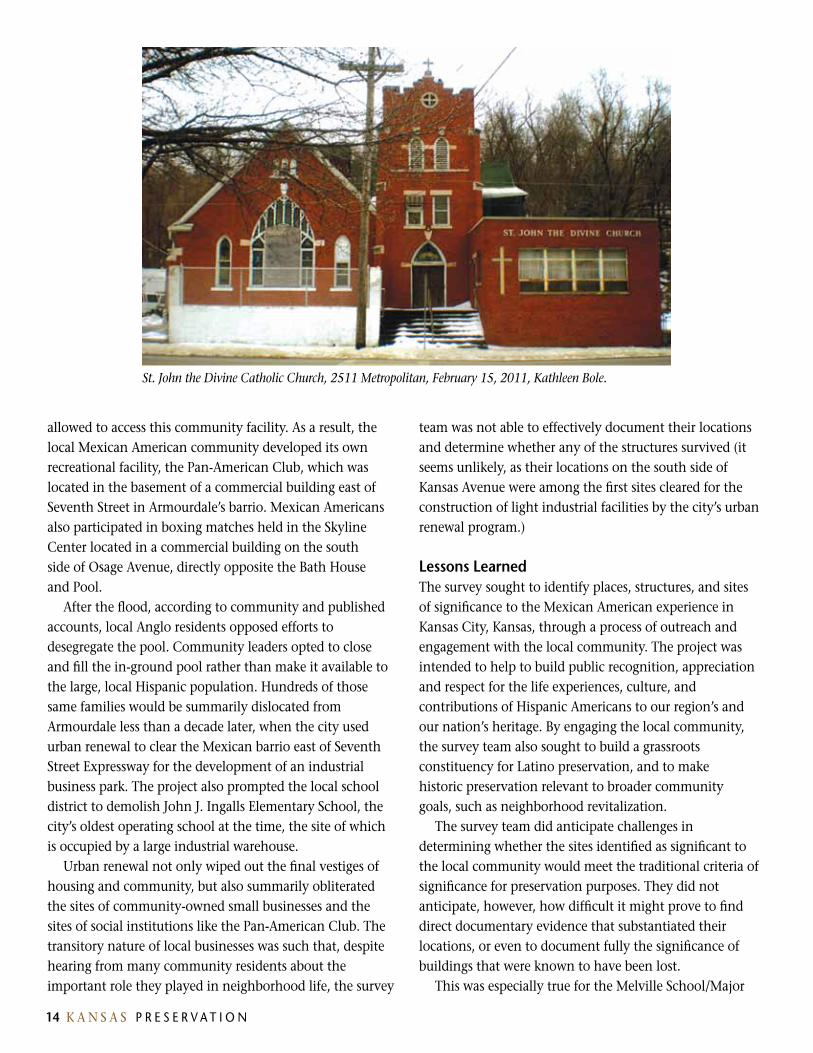
St. John the Divine Catholic Church, 2511 Metropolitan, February 15, 2011, Kathleen Bole.
allowed to access this community facility. As a result, the local mexican American community developed its own recreational facility, the Pan-American Club, which was located in the basement of a commercial building east of Seventh Street in Armourdale’s barrio. mexican Americans also participated in boxing matches held in the Skyline Center located in a commercial building on the south side of Osage Avenue, directly opposite the Bath House and Pool.
After the flood, according to community and published accounts, local Anglo residents opposed efforts to desegregate the pool. Community leaders opted to close and fill the in-ground pool rather than make it available to the large, local Hispanic population. Hundreds of those same families would be summarily dislocated from Armourdale less than a decade later, when the city used urban renewal to clear the mexican barrio east of Seventh Street Expressway for the development of an industrial business park. The project also prompted the local school district to demolish John J. Ingalls Elementary School, the city’s oldest operating school at the time, the site of which is occupied by a large industrial warehouse.
urban renewal not only wiped out the final vestiges of housing and community, but also summarily obliterated the sites of community-owned small businesses and the sites of social institutions like the Pan-American Club. The transitory nature of local businesses was such that, despite hearing from many community residents about the important role they played in neighborhood life, the survey
team was not able to effectively document their locations and determine whether any of the structures survived (it seems unlikely, as their locations on the south side of Kansas Avenue were among the first sites cleared for the construction of light industrial facilities by the city’s urban renewal program.)
Lessons LearnedThe survey sought to identify places, structures, and sites of significance to the mexican American experience in Kansas City, Kansas, through a process of outreach and engagement with the local community. The project was intended to help to build public recognition, appreciation and respect for the life experiences, culture, and contributions of Hispanic Americans to our region’s and our nation’s heritage. By engaging the local community, the survey team also sought to build a grassroots constituency for Latino preservation, and to make historic preservation relevant to broader community goals, such as neighborhood revitalization.
The survey team did anticipate challenges in determining whether the sites identified as significant to the local community would meet the traditional criteria of significance for preservation purposes. They did not anticipate, however, how difficult it might prove to find direct documentary evidence that substantiated their locations, or even to document fully the significance of buildings that were known to have been lost.
This was especially true for the melville School/major

14 K A N S A S P R E S E R V A T I O N V O L u m E 3 3 | 3 | 2 0 1 1 15
Hudson Annex, which appeared in city directories at erroneous addresses and was not included in the historic Sanborn atlases (due to the fact that the contemporaneous baseline map was created before the site was annexed to the city limits of Kansas City, Kansas). Ironically, the survey team located a 1940 newspaper article noting that the school district itself was unable to locate title documents at the time it was preparing to sell the school. Fortunately, we were able to locate the warranty deed transferring ownership of the building and site to a local church. By practical necessity, the deed contained a detailed legal description that finally confirmed the school’s location, which has since been partitioned (but not formally subdivided) into four lots on which single family homes have been constructed. Additional confirmation of the school’s location was obtained by examining a nearly century-old plat of subdivision for lands surrounding the school site.
In addition to identifying sites that were not well known or had been overlooked by previous efforts, the survey also identified social and institutional relationships between different neighborhood areas that have not been adequately documented. It was not surprising to learn, for example, that a Catholic church (Our Lady of mount Carmel) was created in Armourdale to house a group of mexican parishioners who had previously met in the basement of the nearby St. Thomas the Apostle Catholic Church. It was interesting to learn, however, that St. John the Divine Church in Argentine was originally established as a mission of mount Carmel, with the two sharing a single parish priest. Likewise, Holy Name Church in Rosedale was originally established as a mission of St. Joseph’s Catholic Church in Shawnee, some six miles to the southwest, a fact that seems anomalous until one recognizes that, in the late 19th century, both communities were rural outposts on the Frisco Railroad outside Kansas City. mount Carmel was destroyed by the 1951 Flood, while St. John the Divine was restored and continued to serve mexican Americans from both neighborhoods for some four decades.
A further challenge is that the dozen or so notable sites and structures identified as potential candidates for preservation (including local churches, fraternal lodges, neighborhood community centers and longstanding Hispanic businesses) are not all recognized by public officials or community residents as worthy of preservation. A key case in point is St. John the Divine Catholic Church. Considerable anxiety exists among
residents of Argentine about the merits and feasibility of preserving this church, which has been shuttered for two decades and is seen by many as a blight and vestige of an oppressive era best forgotten. A local community development organization has proposed demolishing the church and replacing it with new market-rate housing, which has divided even past parishioners over the merits of preserving the structure, which is intact but in signifi-cant need of repair.
In retrospect, the study’s most important finding was that Latino heritage is sometimes best represented through the oral history traditions and commemorative cultural activities of Kansas City’s mexican American community. For example, while the Clara Barton School was destroyed by the 1951 Flood, a sizeable but declining group of former students has held annual school reunions for nearly 40 years. The 2010 Clara Barton reunion offered a unique opportunity to engage community members in the process of identifying additional sites of importance, as well as to better identify important dates and relationships among the sites being surveyed. The results of the survey have played an instrumental role in stirring the interest of the Kansas City museum in fashioning a public history agenda that includes collections development, educational programming, and exhibits exploring both the history of the local Latino community, as well as the stories of recent immigrants.
The Hispanic American Historic Places Survey of Kansas City, Kansas, will help educate all Americans about the struggles faced by immigrants as they assimilated to American society and culture. The reality that many ethnic communities occupy humble places, along with challenges of documenting sites that have been damaged or destroyed, determining whether they meet established criteria of significance, and whether there is community support for their preservation, all need to be recognized as harbingers of the challenges to implementing a traditional preservation agenda in the Latino community.
This project represents an important opportunity to tell the stories of immigrants seeking the American dream. The sites and places documented by the survey carry profound cultural and social meaning for mexican American families in Kansas City. This project is a way of telling those stories, and helping to make these places relevant to all Americans.

16 K A N S A S P R E S E R V A T I O N
This past June the Kansas Archeology Training Program field school took on the challenge offered by the Coffey site (14PO1). The Coffey site is an important Archaic-age locality situated on the banks of the Big Blue River north of manhattan, Kansas. This summer’s project was a cooperative effort among the Kansas Historical Society, the university of Kansas, and the u.S. Army Corps of Engineers. Over the span of two weeks, a total of 180 volunteers and staff from the Kansas Anthropological Association shared their mutual interests and joined forces with 11 Ku undergraduate and graduate students and with personnel from Ku’s Odyssey Geoarchaeological program. As it turned out, every single trowel was needed!
a Coffey Break …
Active erosion by the Big Blue River has been destroying what little remained of the Coffey site, and action was
called for. unfortunately, the elements were not in a cooperative mood. Not only was the river threatening the site, it threatened the sheer reality of a field school. The week prior to the start of the project, the river flooded the premises. Nevertheless, thanks to the cool-headed patience and dedication of the staff, the field school was able to proceed after all. The area initially targeted for excavation being unavailable, a new grid was set in an elevated part of the site, out of reach of the rapidly rising waters.
The river was indubitably dealing the cards, but in doing so, surprisingly threw several aces in our direction. One of the sensations of the summer was the discovery of numerous artifacts in the cut bank—in a geological layer seemingly too old to contain any evidence of human presence. As explained
below, this turn of events may have increased the scientific significance of what was already one of the jewels of Kansas archeology. It certainly raises brand new questions about the 14PO1.
The Coffey site was discovered in the early 1950s in the wake of a pedestrian survey that was documenting archeological sites in the area impacted by the construction of the Tuttle Creek dam. It was later excavated in the 1970s, first by a team from Kansas State university under the direction of Patricia O’Brien, and then by Larry Schmits of the university of Kansas. Schmits’ excavations from 1972 to 1975 were the most extensive. They revealed a complex sequence of Archaic occupations buried in fluvial deposits. The archeological sequence exposed at Coffey was so rare for the North American Plains that it alone warranted the placement of the site on the National Register of Historic Places in 1977.
by Frederic Sellet
Left to right, close-up view of the horizontal excavation of Area 112 at the Coffey site; KU faculty archeologists Jack Hofman (front) and Rolfe Mandel (back) searching for possible pre-Clovis artifacts in the cut bank of the Big Blue River.

16 K A N S A S P R E S E R V A T I O N V O L u m E 3 3 | 3 | 2 0 1 1 17
“Archaic” is a catchall label, typically used to designate a period that lasted about six millennia on the plains, starting with the end of the Paleoindian era (about 8,000 years before present [BP]) and lasting until around 2,000 years ago. While the Coffey site over the years has yielded numerous diagnostic artifacts with a large temporal spread, from Paleoindian to Woodland times, the site’s significance comes mainly from a well-preserved series of middle Archaic campsites, dating to about 5,000 to 6,000 years BP. This period marked the end of the Altithermal, a pronounced dry climatic episode that has long puzzled archeologists.
One central question regarding the Altithermal has been the nature of humans’ response to the drastic environmental changes that resulted from this prolonged drought. Based on the Coffey site archeological sequence, it seems that prehistoric groups in the Flint Hills were thriving—thanks to a broad-spectrum diet, which included a wide variety of plant and animal species, from bison to deer and from fish and turtle to water fowl.
In light of this data, the stated purpose of this summer’s excavation was to refine extant interpretations of Archaic adaptations by picking up where Schmits had stopped in 1975. Heavy equipment was brought in to strip the old overburden and to expose the bottom of his excavation pit. Alas, once the proper levels were finally reached (after several failed attempts), the flooding river rose again to foil our efforts.
Instead, we moved our attention to another part of the site about 30 m north. This area contained the same geological layer: the Archaic-age Gunder member. The excavation focused on the top of the Gunder member, which yielded a relatively rich archeological component with several hundred lithic artifacts; unfortunately, none were diagnostic. Based on its stratigraphic position, this layer is likely to be late Archaic in age and probably dates to around 3,000 years BP. No discrete feature or activity area was encountered, and further analysis is needed to specify the nature of the geological processes, as well as the range of human behaviors responsible for the accumulation of artifacts in this locality.
The careful three-dimensional mapping of all recovered items will facilitate the final analysis. To simplify the mapping process, a team of seasoned KAA enthusiasts designed an ingenious system on which a digital camera was mounted on a pole. A series of additional devices made it possible to take pictures of an excavated unit at a consistent distance and, thus, to control for parallax and distortion. The photos were printed on the spot. Each excavator then
annotated the print and associated every piece-plotted item with its ancillary catalog number. The result of this high resolution mapping process is illustrated here.
This mapping technique, via digital photography, is faster and in many ways superior to the old and proven hand-drawn maps. It minimizes mistakes and at the same time allows for an easy processing of the data, such as the creation of three-dimensional renditions of the excavation.
Plan view of the excavation at Area 115. Mapped items are indicated in yellow and overlay the digital photographs of the excavated units.
Three-dimensional mapping of the artifacts from Area 115 at the Coffey site. The picture on top integrates the mapped items and the digital photographs of the excavation. The bottom map reveals areas of greater artifact density.

As stated earlier, the surprise of the summer did not come from the site’s Archaic layers but from elsewhere. In the cut bank adjacent to the newly excavated area, erosion by the Big Blue River revealed a series of artifacts deeply buried in the Severance formation. The Severance formation is a Pleistocene-age geological unit that stopped accumulating at about the time of the Clovis cultural tradition, around 11,000 years BP. The recovered artifacts, which included a broken biface, were found 50 to 70 cm below the top of the Severance. Consequently, the lithic artifacts from the bank exposure would be at least twice as old as the mid-Archaic layers unearthed by Schmits, and more importantly they might precede the Clovis era and be among the oldest ever found in Kansas. Caution is needed, though, because nature loves to play tricks, and all post-depositional disturbances have to be ruled out before the age of the deposits can be asserted with confidence. A good radiocarbon chronology for the newly discovered area needs to be developed as well. In the absence of more refined chronological and stratigraphic data, the pre-Clovis age of the site remains speculative, but tantalizing.
In short, while this summer’s KATP field school did not yield the expected wealth of Archaic artifacts, it did serve to reestablish the importance of preserving the Coffey site, one of the most significant archeological localities in Kansas. unfortunately, parts of this important site are being lost at a very fast rate to fluvial erosion, and this exceptional prehistoric record is threatened by the Big Blue River. The clock is ticking, but thanks to cooperative efforts like the KATP and Ku field schools, we can stem the tide of lost cultural heritage. Well-designed public training programs such as this are a real asset in preservation and at the same time can stimulate exciting new research questions.
18 K A N S A S P R E S E R V A T I O N
Left to right, the Coffey site excavations as seen from the river; “fine” excavation by backhoe. The machine is exposing the archeological levels excavated in the 1970s in Area 111.
Digital mapping of the excavated units with the KAA-designed de-vice; overview of Area 112 at the Coffey site. The Archaic levels are being excavated by the KATP crew.

V O L u m E 3 3 | 3 | 2 0 1 1 19
Blue Earth Kansa Indian Village (14PO24) is perhaps the largest American Indian village site in the state and one of the most important archeological sites in Kansas. The village was home to approximately 1,500 Kansa Indians during the late 18th and early 19th centuries. The site reportedly contains the remains of more than 150 Kansa earthlodges, spread over more than 100 acres, and is located on the outskirts of the city of manhattan near the confluence of the Kansas and the Big Blue rivers. until recently, most scholars believed that most of the Blue Earth village site had been destroyed by the lateral movement of the Kansas River. Recently, KSHS archeologists began a reinvestigation of the area in advance of a construction project by the Kansas Department of Transportation. KDOT and KSHS work together on projects across the state to ensure that damage to historic and archeological sites is minimized. my background research for the KDOT project led to the rediscovery of unpublished 19th-century maps of the Blue Earth Village. These maps indicate that large portions of Blue Earth Village remain.
The Rediscovery of Lost Maps of Manhattan’s Blue Earth Kansa Indian Village
Historical records state that the Kansa established Blue Earth Village as early as 1790 and that the site was
continuously occupied for more than 30 years. In 1819 Thomas Say visited the Kansa at Blue Earth Village in association with the Stephen Long expedition. The Kansa abandoned Blue Earth Village in 1830, and by the mid-19th century only the circular depressions of the earthlodges remained.
In 1880 KSHS Secretary Franklin G. Adams commissioned Henry Stackpole, a prominent manhattan attorney, to create a detailed map of what remained of the Blue Earth Village site. Following the completion of Stackpole’s survey, Adams published a general map of the Blue Earth Village site in Volume I of the Transactions of the Kansas State Historical Society. Prior to the KDOT project, this map was generally considered to be Stackpole’s only map of the Blue Earth Village site. However, discrepancies in the description of Stackpole’s map and the published map have also led to
speculation that an unpublished, detailed map of the site might have existed at one time.
I conducted an extensive search for an unpublished map of the Blue Earth Village in the State Archives research room, yet no traces of an unpublished map could be found. As a last ditch effort I contacted KSHS archivist Bob Knecht, and we discussed the possibility that an unpublished map of the site might exist somewhere in the Historical Society archives. Within a week my persistence paid off, and Bob informed me that he had indeed relocated not one, but two of Stackpole’s unpublished 1880 maps of the site.
The first of these maps appears to be Stackpole’s original 1880 field map of Blue Earth Village. This map depicts more than 150 earthlodges of varying sizes on the north bank of the Kansas River. The map caption reads “map of a part of Tp. 10S., R.8,E., Kansas; showing the site of the Kansas Indian village as described by Prof. Thomas Say, of maj. Long’s exploring expedition in 1819. Surveyed, and sites of lodges
John tomasicarcheologist, Kansas Historical Society
18 K A N S A S P R E S E R V A T I O N

20 K A N S A S P R E S E R V A T I O N
mapped by the Kansas Historical Society, may 1880.” The second of these maps appears to be the revised version of Stackpole’s 1880 field map. The revised map contains an inset map showing the general location of Blue Earth Village, and this map inset is clearly the same general map of Blue Earth Village published in 1880. Thanks to the KSHS staff in imaging and photo archives, these unpublished maps were scanned and uploaded to Kansas Memory, where they are now available to the public (kansasmemory.org/item/224981).
Since the 1880 survey of the site by Stackpole, portions of the site have been destroyed by the lateral migration of the Kansas River. Prior to the rediscovery of Stackpole’s unpublished maps of the Blue Earth Village site, most scholars believed that the vast majority of the site had been destroyed by the Kansas River. Based on a careful review of
Stackpole’s unpublished 1880 site maps, it now appears that much more of the Blue Earth Village site remains than previously assumed. These unpublished maps clearly demonstrate that major portions of the village site are located beyond the areas destroyed by the lateral movement of the Kansas River, and perhaps three quarters of the Blue Earth Village site remains.
While much of the area of Blue Earth Village remains, the site is still endangered by construction and agricultural practices. But thanks to the cooperative efforts between KDOT and the archeologists and archivists at KSHS, some hope remains of finding and protecting the remnants of this important site.
1881 Regional Map of the Blue Earth village site

V O L u m E 3 3 | 3 | 2 0 1 1 2120 K A N S A S P R E S E R V A T I O N
Henry Stackpole’s recently rediscovered unpublished 1880 field map (left) and final map (right) of the Blue Earth Kansa Indian Village site. Both maps are now available on Kansas memory kansasmemory.org/item/224981.

22 K A N S A S P R E S E R V A T I O N
Kansas Anthropological Association members undertook a three-day archeological salvage project in Cowley County for the 2011 Fall Fling event. Taking advantage of exceptionally beautiful fall weather, 25 volunteers contributed 422 hours to the project from noon on Friday, October 21, through noon on Sunday, October 23.
Kaa Fall Fling sweet success
Former KSHS archeologist Randy Thies recorded 14CO1310 in April 2003 on a low cultivated terrace of
Grouse Creek near the town of Dexter. From the surface he collected chipped stone scrapers, bifaces, and debitage but no diagnostic artifacts. He observed burned limestone that he interpreted as hearth rock. In fall 2003 testing was carried out by a crew from Louis Berger Group, a CRm firm in Iowa. They excavated in the western part of the field, recovering numerous stone and bone artifacts. They obtained five
radiocarbon samples, ranging from 3370 to 1060 +/- 40 years before present, which place the site in the Archaic period. The site was determined eligible for, although it is not listed on, the National Register of Historic Places.
Subsequent road construction borrowing of dirt from the east side of the field closer to the creek exposed buried cultural deposits, including mussel shell, burned rock, bone, and stone debitage. A small KSHS crew, led by Highway Archeologist Tricia Waggoner, investigated this area in early
By Virginia a. Wulfkuhle and tricia Waggoner
Bob Hoard describes and interprets the cut bank profile during a break.

22 K A N S A S P R E S E R V A T I O N V O L u m E 3 3 | 3 | 2 0 1 1 23
Top to bottom, Tricia Waggoner orients the group to the site, Zella Riley and Chris Hord, both from the Kansas City area, measure as they prepare to record the floor of their excavation level; Nancy Arendt from Colby and Paula Cooper from California record a shell midden feature that they have exposed below.
spring 2009. They found multiple features eroding out of the cut bank left by the borrow activity. One feature was partially excavated and yielded abundant cultural material. At that time it was determined that salvage of the remaining features would be worthwhile.
When the opportunity arose, KAA members were eager to help save important prehistoric data that otherwise would be lost. They were directed by KSHS archeologists Waggoner, Virginia Wulfkuhle, and Bob Hoard with the assistance of numerous experienced KAA members. The project offered participants an opportunity to fulfill requirements in at least two KAA Certification Program categories.
During the salvage project, no grid was laid out, but participants set up excavation units over surface scatters of cultural material, and these were mapped with total station equipment. Ten 1 x 2-meter units were opened, and nine features were explored. Three Archaic dart points were found, along with chipped stone debris, mussel shell, bone, and burned rock.
A number of features were evident in a nearby cut bank of Grouse Creek, and Bob Hoard defined and made an extensive profile drawing. In addition, a control soil profile was excavated and recorded, and a limited metal detector survey was performed on an adjacent area, which had potential for historic material but yielded no diagnostic artifacts.
Landowner Kent Radcliff generously granted permission for the work and was enthusiastic about the project. The proprietors of Henry’s Candies, a candy factory and retail store in Dexter, allowed KAA participants to park in their parking lot. Their confections provided extra sweetness to the already successful weekend.

24 K A N S A S P R E S E R V A T I O N
As a national Project Archaeology partner, the Kansas Historical Society is a recipient of a 2011 Secretary of the Interior’s Partnerships in Conservation award. On September 21, 2011, in Washington, DC, 17 organizations from across the united States were recognized for achieving exemplary conservation results with community engagement and local partnerships. Jeanne moe and Crystal Alegria of the national Project Archaeology office in Bozeman, montana, accepted the award on behalf of the entire Project Archaeology network and all state, local, and national partners. The KSHS received a certificate signed by Secretary of the Interior Ken Salazar.
KsHs shares in national Conservation award
Partnerships in Conservation awards recognize partnerships that use innovation and collaboration
to promote conservation, initiate large landscape projects, and protect natural and cultural resources through diverse stakeholder and youth engagement. A national panel, assembled by the Department of the Interior, selected the award winners from a large pool of nominees. Winners were chosen for their exceptional contributions to conservation and management of the public lands and comprised more than 500 individuals from all 50 states, including representatives from Tribes, local communities and states, other Federal agencies, business and industry, nonprofit institutions, and private landowners.
Every year Project Archaeology uses a collaborative network of state and regional programs to provide educational materials and professional development opportunities to nearly 10,000 classroom teachers and informal educators nationwide. Sponsored by the BLm and montana State university, Project Archaeology annually engages an estimated 210,000 students in cultural resource stewardship education in classrooms, museums, visitor centers, and in America’s great outdoors. The Kansas Historical Society has been part of the network since 2002 and not only has contributed to the national education program, but also has created state-specific materials for
Kansas students and teachers, grades 3 through 8 (see kshs.org/p/project-archaeology-in-kansas/15251).
“The Partners in Conservation Awards demonstrate that our nation’s greatest conservation legacies often emerge when agencies and citizens from a wide range of backgrounds come together to address shared challenges,” Secretary Salazar said. “I am pleased to recognize the efforts of dedicated people from across our nation to conserve and restore our treasured landscapes, address water issues and forge solutions to complex natural resource issues through good government and strong partnerships.”
By Virginia a. Wulfkuhle

24 K A N S A S P R E S E R V A T I O N V O L u m E 3 3 | 3 | 2 0 1 1 25
CONTACT US
Jennie Chinn Preservation Officer (SHPO)785-272-8681, ext. 205 [email protected]
Rick anderson National Register Historian785-272-8681, ext. 228 [email protected]
Dorothy Booher Office Assistant785-272-8681, ext. 230 [email protected]
Kim norton Gant Review and Compliance Coordinator785-272-8681, ext. 225 [email protected]
Chris Garst Laboratory Archeologist 785-272-8681, ext. 151 [email protected]
steven Keehner Administrative Assistant785-272-8681, ext. 235 [email protected]
Bob Hoard State Archeologist 785-272-8681, ext. 269 [email protected]
Michelle HolmesAdministrative Assistant 785-272-8681, ext. 230 [email protected]
Matthew Holtkamp Tax Credit Reviewer 785-272-8681, ext. 256 [email protected]
Kristen JohnstonTax Credit Coordinator 785-272-8681, ext. 213 [email protected]
Marsha Longofono Tax Credit Clerk785-272-8681, ext. 240 [email protected]
amanda Loughlin Survey Coordinator 785-272-8681, ext. 257 [email protected] sarah Martin National Register Coordinator785-272-8681, ext. 216 [email protected] Ken Price Architect 785-272-8681, ext. 212 [email protected]
Katrina Ringler Grants manager/CLG Coordinator785-272-8681, ext. 215 [email protected]
John TomasicArcheologist 785-272-8681, ext. [email protected]
Cindi VahsholtzGrants Clerk785-272-8681, ext. [email protected]
Tricia Waggoner Highway Archeologist 785-272-8681, ext. 267 [email protected]
Tim Weston SHPO Archeologist 785-272-8681, ext. 214 [email protected]
Virginia Wulfkuhle Public Archeologist 785-272-8681, ext. 266 [email protected]
Patrick Zollner Division Director & Deputy SHPO 785-272-8681, ext. 217 [email protected]
Cultural Resources Division state Historic Preservation Office (sHPO) and archeology staff
Historic sites Board of ReviewThe Kansas Historic Sites Board of Review is a group of 11 professionals from various fields that meets quarterly to review and recommend nominations to the National Register of Historic Places and the Register of Historic Kansas Places, and award preservation planning and rehabilitation grants. As prescribed by the Kansas Historic Preservation Act of 1977 (K.S.A. 75-2719), the board is comprised of the following members: the governor or the governor’s designee, the state historic preservation officer or such officer’s designee, and nine members appointed by the governor for three-year terms. At least one member must be professionally qualified in each of the following disciplines: architecture, history, prehistoric archeology, historical archeology, and architectural history.
Jennie Chinn, State Historic Preservation Officer Craig Crosswhite, Ness City, chairJ. Eric Engstrom, Wichita, governor’s designee, vice chairJohn W. Hoopes, Lawrence nancy Horst, WinfieldLeo Oliva, Stockton Billie Marie Porter, NeodeshaDaniel sabatini, LawrenceDavid H. sachs, manhattanJay Price, Wichita Margaret Wood, Topeka

Happenings in Kansasthrough april 28 Ledger Art of the Cheyennes and Kiowas Exhibit • Pawnee Indian museum State Historic Site, Republic
January 20-april 29 You Are Here: Putting Kansas on the Map Exhibit • Kansas museum of History, Topeka
January 25-28 Kansas Preservation Conference • Wichita
January 27-29 Kansas Day Commemorations • Various locations – visit kshs.org for details
Sundays, January 29 – February 26 Bleeding Kansas Series • Constitution Hall State Historic Site, Lecompton
February 10 William Allen White Community Birthday Party • William Allen White House State Historic Site, Emporia
February 11, March 10 Second Saturdays by the Grinter Stove • Grinter Place State Historic Site, Kansas City
February 18 Historic Sites Board of Review • Kansas Historical Society, Topeka
February 18-19 KAA Certification Seminar “Field and Laboratory Photography” • Bethany College, Lindsborg
april 8 Spring Lecture • Pawnee Indian museum State Historic Site, Republic
april 14 Spring Tea • Grinter Place State Historic Site, Kansas City
april 21 KAA Annual meeting • meade County Historical museum, meade
april 24-27 Theme Days • Shawnee Indian mission State Historic Site, Fairway
april 26 History and Environmental Fair • Kansas museum of History, Topeka
april 28-29 Grinter Place Quilt Show • Grinter Place State Historic Site, Kansas City
april 29 Archaeology Family Day • Topeka and Shawnee County Public Library, Topeka
online at kshs.org/events
Historical Society
6425 SW 6th Avenue Topeka KS 66615-1099
Join the Preserving Kansas listserv under Historic Preservation at kshs.org.
nonprofit org
U.S. poStagepaid
topeka kSpermit no 299