Embed Size (px)
Citation preview

KENT MINERALS LOCAL PLANCONSTRUCTION AGGREGATES
WRITTEN STATEMENT
ADOPTEDDECEMBER 1993
Kent County Council This Plan replaces the Sand and Gravel, andRagstone sections of the Kent Minerals SubjectPlan. These sections were adopted by the KentCounty Council in November 1983.
FOREWORD
In July 1990 the County Council's Planning Sub-Committeeauthorised publication of a Consultative Draft WrittenStatement. Views were sought from the public, local councils,the minerals industry and other interested parties such as theNational Rivers Authority, the Nature Conservancy Council andthe Ministry of Agriculture, Fisheries and Food. In February1991 the Planning Sub-Committee considered the views receivedand agreed changes to the Consultative document.
The resulting Draft Plan was then placed `on deposit' for aperiod of 6 weeks until 31 May 1991. Unresolved objections tothe Draft Plan were heard at a public local inquiry, heldbetween November 1991 and February 1992. In December 1992 thePlanning Sub-Committee considered the Inspector's report onthe objections, and his recommendations. Modifications to thedeposit Draft Plan were proposed. Objections to the proposedmodifications were considered in April 1993 and furthermodifications proposed. Objections to the proposed furthermodifications were considered by the Planning Sub-Committee inOctober 1993, who then resolved its `disposition to adopt' thePlan as modified. The modified Plan was adopted by the CountyCouncil on 14 December 1993.
Objectives The Plan looks at materials used as construction aggregates. Its principal objective is to provide for their future supplyto meet community requirements in an environmentallyacceptable way. It is a Plan for both the industry and Kentresidents. The Plan does not deal with other importantminerals found in Kent, such as chalk - when used for cementmaking or as agricultural lime - clay and brickearth. Thesedo not fall within this Plan's definition of constructionaggregates and are dealt with in the Approved Structure Planor the Minerals Plan for Brickearth.
Areas of An important element in the Draft Plan is the Search identification of areas of search for minerals. Areas of Search:
* identify where minerals are believed to be present, freeof major environmental or conservation constraints(identified in part 5 of the Plan).
* guide the minerals industry to broad locations whereworking could be acceptable;
* identify areas where development should avoid sterilisingminerals or could itself be adversely affected by futureworking.
It is important to note therefore that areas of search do notidentify land where mineral working will necessarily takeplace within the plan period.
Update Since November 1991, when the Local Plan Inquiry started, thefollowing major policy documents have been published:
* PPG7 The Countryside and the Rural Economy* PPG20 Coastal Planning* Kent Structure Plan Third Review, Deposit Draft
Their contents will be incorporated into the Plan when it isreviewed. In the meantime they will, along with this Plan, betaken into account in planning control.
NB. In order to keep to a minimum the renumbering consequentupon modifications to the deposit Draft Plan, there is no

policy CA14 in the Plan.
DEFINITIONS
CONSTRUCTIONThese are rock, gravel, sand or other materialsAGGREGATES which are used in building or civil engineering work. Such
works include road construction, concrete making, mortar,plaster and tile making.
Rock, gravel and sand are commonly referred to as PRIMARYAGGREGATES. Minerals such as shale and chalk (when usedas fill or hardcore), together with man made or wastematerials such as slag, minestone, pulverised fuel ash andchina clay waste are commonly referred to as SECONDARYAGGREGATES; the latter four are also known as SUBSTITUTEMATERIALS.
N.B. Although it falls outside the strict definition ofconstruction aggregates, the Plan looks also at SILICASAND, which is produced in Kent primarily for use infoundry work and glass making. The Plan considers thesesands because they are found in the Folkestone Beds, whichis the major source of Kent's building sand; the two areoften worked together.
In 1989 over 14 million tonnes of construction aggregateswere produced in or imported into Kent (together with afurther 6 million tonnes used in the Channel TunnelProject). 50 to 60 tonnes of aggregates are used in theconstruction of the average house, whilst a mile ofconcrete motorway requires some 100,000 tonnes.
ABBREVIATIONS
AOD/OD (Above) Ordnance DatumAONB/AsONB Area(s) of Outstanding Natural BeautydB(A) The deci-Bel scale used for rating the loudness of soundDoE Department of the EnvironmentEC European CommunityLeq The average continuous sound levelMAFF Ministry of Agriculture, Fisheries and FoodMPG Minerals Planning Guidance Note(s)mt million tonnesmtpa million tonnes per yearNNR National Nature ReservePPG Planning Policy Guidance Note(s)SAC Special Areas of ConservationSPA Special Protection AreaSERPLAN South East Regional Planning ConferenceSSSI Site of Special Scientific Interest
CONTENTS Page
Part 1 INTRODUCTION 1The Need for a PlanThe Scope and Purpose of this Document
The Proposals MapThe Plan Period and the Area CoveredMonitoring and Review
THE PLANNING BASIS 6The Strategic Planning Context
National PolicyRegional Guidelines
The Development PlanThe Kent Structure PlanLocal Plans in Kent
Part 2 THE REPORT OF STUDIES 12The Main Findings and Issues
THE STRATEGY 17
SOURCES OF SUPPLY
Part 3 IMPORTS 24Principles of Site SelectionProposed Locations
Part 4 SECONDARY AGGREGATES 30
Part 5 LOCAL SOURCES 32The General ApproachGravel and Concreting SandRagstoneBuilding SandSilica SandLimestone
Part 6CRITERIA FOR THE ASSESSMENT OF 52PLANNING APPLICATIONS
General ConsiderationsThe Impact of Development/Principles of Working and
ReclamationArchaeology
Part 7 THE RECLAMATION OF FORMER MINERAL WORKINGS 69
APPENDICES Page
1 National Policy Considerations 722 The Development Plan Framework - Relevant Policies 78
in the Approved Kent Structure Plan3 Principles of Operation and Working 854 Principles of Landscaping 885 Principles of Reclamation 906 Planning Requirements for Certain Areas of Search 97
PROPOSALS MAPKey Plan and Insets
PRINCIPAL SOURCE DOCUMENTS
NATIONAL* Minerals Planning Guidance Notes 1 and 6* Planning Policy Guidance Note 16: Archaeology and Planning
REGIONAL* A New Strategy for the South East (SERPLAN, RPC 1789)* The Apportionment of the Production of Construction Aggregates
in the South East up to 2006 (SERPLAN, RPC 1446)
LOCAL* Kent Structure Plan* Kent Minerals Subject Plan (Sand and Gravel, Ragstone)

1
PART 1
INTRODUCTION
THE PLANNING BASIS
2
INTRODUCTION
THE NEED FOR A PLAN
1.1 The Kent Minerals Local Plan is being prepared in stages. The Sand and Gravel and Ragstone sections were prepared in1981-1982, and following a Public Inquiry were formallyadopted by the County Council in November 1983. Thesesections remained in force until adoption of this Plan forConstruction Aggregates. The Brickearth Section was adoptedin May 1986. It was the intention that those parts of thePlan relating to sand and gravel and ragstone would bereviewed about every three years. Although the need for areview cannot be justified solely on the basis that thisperiod has elapsed, there have been a number of developmentswhich point to the need for a review.
Levels of 1.2 Firstly, in response to economic growth,Consumptionperspectives relating to future levels ofconsumption of construction aggregates have changed since theoriginal sections of the Plan were drawn up in 1981/2. Revised national and regional guidance on future levels ofconsumption has now been published and new levels of provisionincorporated into the Approved Structure Plan (in accordancewith central government advice and the new regionalguidelines). These need to be carried forward into the LocalPlan.
Environ- Secondly, there is a growing awareness of environ-mentalmental issues. Great importance is now attached toIssuesthe need both for sustainable development and to minimise the
environmental impact of mineral related activities. In 1988the government stated its intention (Our Common Future) todevelop policies consistent with the concept of sustainabledevelopment, building on the 1980 `World ConservationStrategy':
`Development and conservation are equally necessary forour survival and for the discharge of our responsibilitiesas trustees of natural resources for the generations tocome.'
Britain's This intention is now set out in the White Paper Environ-`This Common Inheritance' (September 1990). The mentalgovernment sees no contradiction in arguing both for
Strategyeconomic growth and environmental good sense; thechallenge is to integrate the two. In its view there is amoral duty to look after the planet and to hand it on in goodorder to future generations.
The County Council recognises that the environment is anessential input to human well being and fully supports thegovernment's view that it is a valuable asset which must notbe wasted or unnecessarily harmed.RagstoneThirdly, futuresupplies of ragstone were not assured when preparation of thePlan began in 1988 and this issue was identified as oneneeding to be addressed. In the event supplies have sincebeen secured.
New Fourthly, new resources of construction aggregatesResourcesare being identified or becoming available. Forexample crushed rock is now being brought into Kent by sea andthere is the possibility in the longer term of mininglimestone in East Kent. Such resources could supplement, andeven in the long term substantially replace, some traditionalKent land won minerals. In the longer term the County islikely to strengthen its already significant mineralsimporting role. Attention needs to be given to these newpotentials, which are recognised in the Approved StructurePlan, for incorporation into a comprehensive minerals plan
3
relating to construction aggregates.
Agri- Fifthly, since the Sand and Gravel and Ragstone cultural sectionsof the Minerals Plan were adopted, there has Land and been a change ofemphasis in government policies for Nature the safeguarding of agriculturalland and for Conser- conservation of the natural environment. The vation policies
are summarised in Appendix 1. Consideration needs to be givento the implications of these changes for future mineralworking in Kent.
Dungeness Lastly, technical studies relating to the impact on waterresources of mineral working on Dungeness have been completedand reassessed. The Dungeness area has traditionally suppliedabout a third of Kent's production of high qualityconstruction aggregates and the studies need to be taken intoaccount in determining the future for mineral extraction inthis area.
THE SCOPE AND PURPOSE OF THIS DOCUMENT
Functions 1.3 The functions of the Minerals Local Plan are to:-
(i) develop and amplify national, regional and structure planpolicies which bear upon the supply of constructionaggregates and to relate the more detailed draftpolicies and proposals to specific areas of land;
(ii) set out a policy framework for the control ofaggregate mineral working and supply, and forancillary uses of land.
1.4 The Plan sets down policies and makes proposals for:
(i) the import into Kent of construction aggregates;
(ii) the use of substitute and recycled materials;
(iii) maintaining a landbank of permitted reserves ofaggregates, by identifying areas of search formineral working and safeguarding mineral resources;
(iv) the working and management of Kent's constructionaggregate resources in an environmentally acceptableway and their restoration to an appropriate afteruseat the earliest opportunity.
Impact on In respect of these land uses the County Council Localrecognises that the working and supply of minerals
Environmentcan have an adverse impact on the localenvironment. It is an important objective of the Plan thatadequate protection be secured for areas affected by suchdevelopments. These issues are addressed by way of thecontrol criteria that will be applied in consideringapplications for mineral working and its supply.
THE PROPOSALS MAP
1.5 The Proposals Map is an integral part of the Draft Plan. Its main purpose is to provide a comprehensive index of thePlan's proposals on a map base. From this the reader canidentify whether property interests are likely to be affected. Accordingly it is on an Ordnance Survey base and showsnational grid lines and numbers, with the scale and an
4
explanation of the notations used. Larger scale insets areused, with their boundary shown on the main proposals map. The map:
(i) defines the area of the local plan;
(ii) identifies the proposals in the Draft WrittenStatement;
(iii) defines areas of search for mineral working andlocations for wharves and depots to import minerals;
(iv) defines areas to which specific policies will beapplied.
Report of 1.6 A Report of Studies provides detailed back-Studies ground material. The Report was published in September 1990
to accompany the Consultative Draft of this Plan. It remainsavailable and has been updated with an addendum. However thisWritten Statement is designed to be read on its own; itincludes a reasoned justification for the policies andproposals.
THE PLAN PERIOD AND THE AREA COVERED
1.7 The Plan outlines a strategy for the longer term bylooking forward both to 2006, in line with published RegionalGuidance, and beyond. The strategy will be rolled forwardwhen the Plan is reviewed. Within this framework the mainobjective of the Plan is to set down policies and makedetailed proposals for the period to 2006. This encompassesboth the timescale of the Approved Structure Plan, which setsa framework for development and the environment over the next15 years, and the minimum 10 year period sought by theGovernment for the provision and maintenance of a landbank forall aggregate minerals.
1.8 The Plan covers the whole of Kent.
MONITORING AND REVIEW
1.9 It is important both to secure and to maintain a steadysupply of materials to meet the community's requirements forconstruction aggregates, and at the same time to ensure thatenvironmental standards are continually improved. To this endit is essential that policies and proposals in the MineralsLocal Plan are monitored, reviewed and rolled forward on aregular basis. In particular it is important that a landbankis maintained for at least a 10 year period (see Appendix 1). Accordingly the County Council will review the Plan within 5years of its adoption. It will also monitor the supply of,and demand for, construction aggregates every two years in thelight of published regional statistics. This monitor maytrigger an earlier review of Structure and Local Planpolicies.
5
THE PLANNING BASIS
THE STRATEGIC PLANNING CONTEXT
Minerals 1.11 National and regional policies and guidance Planningare set out in Minerals Planning Guidance Notes 1 and
Guidance 6 ('General Considerations and the Development Plan(MPG 1 & 6)System', and 'Guidelines for Aggregates Provisionin England and Wales'). The latter uses a 1985 nationalsurvey of production and sales of aggregate to develop andcarry forward, to 1996 and 2006,
Circular advice originally given in a 1982 government circular21/82which looked principally to 1991.
NATIONAL POLICY
1.12 The Government recognises that minerals areimportant national resources and that their exploitation makesan essential contribution to the nation's prosperity andquality of life. National policy is that for the economicwell being of the country, it is essential that theconstruction industry is provided with an adequate and steadysupply of the minerals it needs. The Government attachesgreat importance to the provision and maintenance of alandbank for all aggregate minerals (a stock of permittedreserves sufficient for at least 10 years extraction). Itacknowledges that most of the construction aggregates requiredare likely to be supplied for the foreseeable future fromtraditional sources (ie. pits and quarries and offshore sandsand gravels). It is also recognised that mineral working hasan impact on the environment, that strong conflicts ofinterest inevitably arise and that a balance has to be struckbetween the need for mineral extraction and the protection ofthe environment. A summary of national policy considerationsas they relate to construction aggregates is set out inAppendix 1.
REGIONAL GUIDELINES
1.13 The government attaches importance to the effectiveand
speedy
implementation
6
of
the
`Guide-
MPG6 lines for Aggregates Provision in England and Wales'. Thepurpose of the Guidelines is to advise mineral planningauthorities on the provision for aggregates that needs to bemade. The following general supply policy is adopted for theSouth East Region:
The "Demand in the South East is expected to continue Regionalincreasing in the period to 2006, but there is
Supply nevertheless likely to be a continuingreduction Policy in the proportion of total demandmet by material from local land-won sources. The mineralsindustry will continue in its endeavours to increase thecontribution to total demand from marine, rail-borne andsea-borne sources in the light of what is practicabletaking into account market and economic forces. The localplanning authorities for their part will use their bestendeavours to provide a framework to enable the industryto obtain planning permissions and to maintain regionalproduction of local land-won aggregate at broadly the 1985level (32.5mt). In some parts of the region, whereexceptional circumstances prevail or are likely toprevail, it may not be possible for an individualauthority to make sufficient provision for the industry tomaintain local production at the 1985 level; in thatevent, local planning authorities collectively should takeaction to ensure that due allowance is made in other partsof the South East."
Mineral planning authorities were asked to have regard tothese guidelines and the County Council endorsed them inSeptember 1988. The indicative figures for the South EastRegion for 1996 and 2006 are set out in paragraph 2.1.1 below. Government advice is that, as far as possible, the indicativefigures produced at the regional level will need to betranslated into figures for each mineral planning authorityarea. This is a task for the Development Plan (see paragraphs1.15 to 1.21 below).
A New 1.14 An updated regional dimension was published Strategy inSeptember 1990 by the London and South East for the
Regional Planning Conference (SERPLAN, RPC 1789). SouthEastThis was presented to government as the planning strategywhich the Conference believed to be required to carry SouthEast England into the next century. The Strategy states thatthe level of development envisaged and the weight given toenvironmental constraints should be major factors in theshaping, through regional arrangements, of policies foraggregates supply and for the restoration and afteruse ofextraction sites. The present basis of policy is to constrainlocal land won extraction to its present level. However
7
growing problems are acknowledged in ensuring that riversidewharves and rail transfer depots are strategically planned. Greater attempts to secure the use of recycled and secondarymaterials will be appropriate.
THE DEVELOPMENT PLAN
Planning 1.15 The Government considers Development Plans Policy(Structure and Local Plans) to be a vital part of the
Guidance framework for controlling development. They are(PPG1 intended to provide a firm basis for rational andGeneral consistent decisions on planning applications. ThePolicy and importance of local plans as the basis forsound and Principles, effective development control isemphasised. Such and PPG12 plans provide the medium formaking proper provision Development for development andat the same time for taking Plans account of the interests ofconservation and of the
and need to protect the local environment. TheRegional government's view is that local plans must makePlanning realistic provision for the foreseeable developmentGuidance) needs of the area and that the planning process will not be
effective unless such provision is made.
Circular 1.16 Government advice is that both structure and22/84 local plans should ensure that local, regional and national
demands for minerals can be met. The Structure Plan sets outpolicies and general proposals within the national andregional context and provides for the co-ordination of mineralworking with other elements of strategic planning. Mineralplanning authorities are encouraged to draw up minerals localplans to give detailed expression to Structure Plan policiesand to provide the necessary framework for development control(they cannot be used to alter the Structure Plan). Mineralslocal plans define the areas in which mineral working will orwill not normally be permitted and also those areas in whichmineral resources are to be safeguarded against sterilizationby other types of development. In addition local plans shouldcontain policies and proposals:
(i) setting out the criteria to be applied in determiningplanning applications; this means identifying thesteps to be taken to minimise the impact of workingson local communities and the countryside;
(ii) relating to restoration and aftercare, to facilitatethe beneficial afteruse of sites.
It is regarded by the Government as important that such plansare kept up to date.
The Future 1.17 After consultation the government decided inSeptember 1990 that the `two tier' system of Development Plans(Structure Plans, along with mandatory district-wide localplans) would be retained. At the same time all counties wouldbe required to prepare minerals local plans.
1.18 These intentions, together with proposals tostreamline the processes (for example Structure Plans will nolonger need central government approval), requiredlegislation. This Plan is incorporated into the amended

8
Development Plan system.
THE KENT STRUCTURE PLAN
The 1.19 The County Council's approach to the Approvedprovision of construction aggregates is fully in Kentaccord with national policy as applied to the South
Structure East. In accordance with government advice, thePlan Approved Kent Structure Plan seeks to providefor a sufficient stock of permitted reserves with planningpermission (a land bank). In respect of sand and gravel thisis to be for at least 10 years. The provision and maintenanceof a 10 year landbank is a specific issue for Kent'sDevelopment Plan. Wherever possible the size of the permittedreserves is quantified. The relevant Structure Plan policiesare set out in full in Appendix 2.
1.20 The Structure Plan's objectives are an importantstarting point for local plan policies and proposals. Thestrategic minerals policies seek to:
(i) meet the community's requirements for constructionaggregates (Policies MWD1 to 4);
(ii) encourage the import of construction aggregates byensuring that adequate depot and wharf facilitiesare available in Kent to receive minerals fromsources which lie outside the County (Policies MWD2and MWD 3);
(iii) encourage the use of substitute materials (eg.minestone) and acceptable new local sources ofsupply; in respect of the latter the County Councilhas resolved to give favourable consideration toproposals for limestone mining in East Kent subjectto local environmental and highway issues being ableto be dealt with satisfactorily (Policy MWD2);
(iv) provide as necessary for the further release of landwon workings (Policy MWD 4) and to prevent thesterilization of known resources (Policy MWD1). This is in recognition that imports, substitutes andpossible new sources will not remove the demand forlocal land won resources, particularly sand andgravel. Policy MWD4 provides for the continuingproduction of about 2.0 million tonnes per year(mtpa) of gravel and concreting sand, about 1.9 mtpaof building sand, about 0.25 mtpa of silica sand andabout 0.6 mtpa of ragstone.
(v) recognise that mineral working and supply are likely tocause some loss of countryside resources and to haveat least a temporary, though sometimes lengthy,detrimental impact on the local environment. Manyquarries in Kent are still operating with planningpermissions granted over 40 years ago. In thisrespect the best of Kent's countryside resourceswill be conserved, appropriate restoration andaftercare will be required at new workings andadequate protection provided for the environment inareas close to all extraction sites or other sourcesof supply. So far as the latter is concerned it isparticularly important to have regard to the effectsof vehicular traffic. Policies MWD 1 and MWD 3 setout the criteria against which all proposals will beconsidered.
9
Some or all of the following Structure Plan Policies will alsobe relevant, depending on the particular circumstances of eachproposal; S1, S2, S5, S6, RS6, T5-T8, CC1-3 and CC5-CC11.
The Explanatory Memorandum to the Approved Structure Planmakes it clear that there is no automatic presumption againstmineral working in the Metropolitan Green Belt, an approachwhich is consistent with government policy (as set out inAppendix 1).
1.21 The Minerals Local Plan is required to conform tothe Kent Structure Plan.
LOCAL PLANS IN KENT
The Kent 1.22 The Kent Minerals Local Plan (ConstructionMinerals Aggregates) is the principal operative plan so farLocal as mineral working for construction aggregates isPlan concerned. Other Local Plans may also be relevant: the Kent
Countryside Plan, the Stour Valley Plan, the DungenessCountryside Plan, and plans prepared by District Councils. The policies in these Plans have been taken into account whenpreparing policies or proposals for specific areas.
1.23 Planning applications will be considered against allrelevant Development Plan policies, and also against allrelevant Draft Plan policies which have been adopted fordevelopment control purposes.
The advice in PPG1 (paragraphs 25 to 34) will guide the weightto be accorded to these Plans.

10
PART 2
THE REPORT OF STUDIES
THE STRATEGY
11
THE REPORT OF STUDIES
THE MAIN FINDINGS AND ISSUES
Consumption 2.1.1 The community's consumption of constructionaggregates is expected to continue to grow both nationally andregionally. Published forecasts indicate that production inEngland and Wales will increase from some 200mt in 1985 to245mt by 2005; also that the South East Region's consumptionwill increase from 55mt in 1985, to 68mt in 1996, and to 77mtby 2006. However recent trends indicate that these estimatesmay be too low and government work on a revised forecast hasalready begun. Historic consumption and supply patterns inKent reflect those at the regional level.
Future2.1.2 The minerals strategy in the Approved Demand Structure Planis based on the following general conclusions:-
(a) Locally Won Gravel and Concreting Sand: Although recentproduction had been below the 2.0mt per yearindicated in the previously approved Structure Plan,this figure is retained for the period to 2006 so asto take account of the demands expected to begenerated by construction of the Channel Tunnel.
(b) Local Ragstone: The industry had contracted in the 1970s,but output rose steadily in the 1980s. An increaseto about 0.6mt per year for the period to 2006, fromthe 0.3mt assumed in the Minerals Subject Plan, issought.
(c) Secondary Aggregate: Whilst it was recognised that thesematerials could never make a major contribution tofuture requirements, they could be a usefulsupplement and their use should continue to beencouraged. Taking into account possible short termrequirements for the Channel Tunnel, a contributionof about 0.4mt a year for the period to 2006 isconsidered to be realistic.
(d) Building and Silica Sand: To reflect the steady increasein output of building sand since 1977 a level ofproduction of about 1.9mtpa is proposed for theperiod to 2006. The production level for silica sandremains at about 0.25mtpa for this period.
(e) A continued high level of imports is considered to be anessential element in the minerals planning strategyof both Kent and the South East region, and so isencouraged. Although the Structure Plan does notspecify amounts, consumption and supply patternsindicate an annual contribution as follows for theperiod to 2006:
Marine Dredged Aggregate 3.5 - 4.0mtImported Crushed Rock 2.5 - 3.5mtOther Imported Sand & Gravel 0.3mt
2.1.3 It is accepted in both national and regionalpolicies that the South East region will not be able to meetforecast levels of consumption from its own resources. Thereis also at present no local source of good quality hard rock. For these reasons the proportion of regional consumptionwhich is met by imports is expected to increase, from 41% in1985 to 54% in 2006. The ranges expressed in 2.1.2 (e) above
12
reflect these regional considerations in Kent. Theexpectation is that as the contribution to Kent's constructionaggregate requirements from local land won resources willremain steady, the anticipated increase in the communitiesrequirements over the next 15 years would be met by imports.
Imports 2.1.4 For the foreseeable future Kent will continue torely very heavily on imports to meet its constructionaggregate requirements. Their availability at source isoutside the direct control of the County Council. There isnow questioning in the traditional source areas (eg theMendips) of the continuing use of their own resources, withthe consequent environmental disturbance, to help meet theconsumption requirements of London and the South East. Also,increased sea-dredging is not a problem-free solution. Nevertheless, with recent investment in new ships for marinedredging and with increasing amounts of Scottish granitearriving, the indications are that imports can be increasedduring the Plan period.
2.1.5 Because of its long coastline, good rail links andsituation near to London, Kent should be encouraged tocontinue developing its significant minerals importing rôle. Acceptable locations for import points need to be identified. A main planning consideration derives from the heavy vehicletraffic associated with such developments. Distribution fromthe import point into the local market will normally be byroad. For these reasons facilities need to be well related toa sensible transport network. The import points also need tobe located where they can operate without an unacceptableimpact on the local environment.
2.1.6 With closure in 1989 of a siding at Sevenoaks, Kentwas left with two operational depots for the import of hardrock by rail. The retention of existing and the provision ofnew importing points, particularly for rail borne material, isa major consideration for this Plan.
2.1.7 There is considered to be an urgent need to identifysites for new or expanded rail depots and wharves. If Kent'sshare of regional aggregates consumption remains at its 1987level then on the basis of regional forecasts, by 2001 and2006 a total Kent demand of some 12 to 13 mt a year isindicated. This would be an increase of 3 to 4 mt over 1987amounts. If as expected the contribution to total consumptionfrom land won resources remains about the same, then theincreases will have to be provided for by imports. With anaverage annual throughout of some 500,000t, provision for upto six new or expanded import points by 2001 is indicated. The lack of import facilities is most apparent for servingSouth West and North East Kent.
Substitute 2.1.8 A significant contribution to Kent'sMaterialsconstruction aggregate requirements from substitute/secondary materials is most unlikely. In 1987 theycontributed less than 3% of total aggregate sales.
Local 2.1.9 If imports can be increased then there will Productionbe acontinuing reduction in the proportion (although not theactual amount) of total demand which is met from local land-won sources. In order to secure an adequate supply of locallywon minerals a landbank of reserves needs to be identified androlled forward. This means proposing areas where, subject todetailed consideration, mineral working could be accepted. Inprinciple, and consistent with regional guidance, planningpermissions should continue to be granted such that local
13
production of construction aggregates in Kent can bemaintained at about recent levels of production.
2.1.10 Of the local materials, ragstone, building sand andsandstone gravels have a landbank of permitted reserves eitherabout or in excess of 10 years. On the other hand there is anexisting shortage of high quality local (mainly flint)gravels, and increasing difficulty in identifying new resourceareas for this aggregate where working is not open to strongplanning objections.
SERPLAN 2.1.11 In March 1989 the County Council accepted, RPC1446as its contribution to meeting South East Regional (Therequirements for sand and gravel (see paragraph Apportion- 1.13), an
'apportionment' for Kent of 3.5 mtpa landment of the won material for the forward planning of aggregate Production
production for the period up to 1996. This apportion-of Const- ment includes building sand as well as gravel andruction concreting sand. It is accepted as a basis for plan-Aggregates ning, to be tested in the preparation or amendmentin theof development plans and to be taken into accountSouth East when determining planning applications. It is theup to 2006) intention of the South East Regional Planning Conference
(SERPLAN) to review this apportionment every two years and tomake any necessary adjustments every four years; in themeantime the apportionment is to be used as an indicativetotal for the period after 1996.
Agri- 2.1.12 A major factor in identifying future cultural prospects formineral working is the degree of Land protection tobe afforded to the best and most versatile agricultural land(ie. grades 1 and 2). Although if a return to goodagricultural use can be secured there may be no objection tomineral working on such land, the County Council takes theview that this should happen only when supplies of theparticular mineral cannot be maintained from elsewhere in anacceptable way. Where the minerals can be obtained from landof lower quality mineral working on land of grades 1 and 2quality will not normally be permitted.
Environ- 2.1.13 Minerals are an essential part of modern life mentaland the County Council, as the Mineral Planning ConsiderAuthority, has a responsibility to secure an adequate
ationssupply for community needs. On the basis of averageyields in Kent, an output of say 1.0 mtpa of gravel andconcreting sand would mean an additional 20 hectares of landbeing worked each year. However their winning from the groundand their supply are sensitive activities, springing in partfrom the industry's image and style of working. In recentyears there has been a considerable rise in publicexpectations as to how and where minerals are not to beworked.
2.1.14 The County Council recognises the detrimental impacton the local environment that mineral working and supply canhave. The need to secure adequate protection is identified asa major issue for the plan.
14
THE STRATEGY
2.2.1 Although the County Council would support inprinciple acceptable alternative methods which reduced thedemand for construction aggregates, as a major mineralsplanning authority it has a duty to make provision to supply,in an environmentally acceptable way, the constructionaggregates that the community needs. An aim of the Plan is todevelop, roll forward and implement a 10 year programme whichprovides for the appropriate development of Kent'sconstruction aggregates industry. The programme is part of along term strategy for the provision of aggregate minerals. It is consistent with national, regional and ApprovedStructure Plan policies and is based on the twin objectivesof:-
Objectives (i) delivering land opportunities for the supply ofminerals to meet community requirements, whilst atthe same time
(ii) conserving the best of Kent's countryside resources,securing, maintaining and improving protection ofthe environment, and minimizing the impact on thecommunity of mineral working and its supply.
2.2.2 Both the strategy, as expressed in the ApprovedStructure Plan, and the detailed policies and proposals in theDraft Local Plan, are developed against the assumption of asteady increase in the community's requirements forconstruction aggregates. In addition the County Councilrecognises that, like the South East Region as a whole, Kentdoes not now, nor will in the future be able to, meet thecommunity's requirements from its own surface land resources. The Plan reflects
Substitute these factors in three ways. Firstly the use ofMaterialssecondary or substitute materials is encouraged. Secondly the Plan carries forward government support for theprinciple of marine dredging of aggregates as a means ofreducing the pressure to work land of high agriculturalquality and/or of environmental
Imports value. Thirdly it is consistent with regional expectationsthat imports into the South East both of crushed rock andmarine dredged material will continue to grow. For theselatter two reasons new import points, focused onto rail andwater transport, are encouraged as a major element of thestrategy. The establishment of a network of import points issought, with the provision of up to 6 new or expandedfacilities by 2001. The precise number would depend upon theoverall level of demand and their capacity.
2.2.3 In accepting that imports and the use of substitutematerials will provide only partially for the constructionaggregates that the community requires, the Plan developsnational and regional
Local advice to maintain a rolling programme of permitted Resourcesreserves(a landbank of local material). Consistent with the firstobjective of delivering opportunities for the supply ofminerals, the Plan sets down a land use framework to maintainproduction, through the Plan period, of local aggregates forat least 10 years ahead.
This is done by identifying Areas of Search, where mineralworking might be acceptable at some future date. Everyapplication to work minerals will be considered against itsrelationship to these Areas of Search and against the case of
15
need for the particular mineral as it exists at the time theproposal is made (eg whether there is a 10 year landbank).
Environ- 2.2.4 In accordance with the second objective of mentalthe Plan the County Council fully accepts national
Consider- policy that the need for minerals must be balancedationsagainst other relevant considerations, particularlythose relating to the environment (eg nature conservation,which must be taken into account in all activities whichaffect rural land use). Accordingly broad areas are identifiedwhere mineral related development will not normally bepermitted. Control criteria are set down which will be usedfirstly in the determination of planning applications formineral working and supply, and secondly to secure theoperation of any permitted proposals in an environmentallyacceptable way.
Landbank 2.2.5 Recent increases in the production of constructionaggregates have called into question the continued relevanceof the demand forecasts on which current national and regionalpolicies are based. The forecasts use 1985 returns ofproduction as a starting point. The County Council takes theview that these increases support rather than invalidate thegeneral approach of the Plan to future mineral working andsupply in Kent. The Structure Plan policies on which thisPlan is based take account of more recent (1987) returns, andthe appropriate size of the landbank for each mineral is beinglooked at again in the current review of the Structure Plan;this will take account of 1989 returns and any resultingchanges will be carried forward into a review of this Plan. The aim of the County Council is to ensure a steady supplyinto the community of the aggregates that it needs and themost important consideration is to secure and maintain theidentified 10 year landbank. If, during the period of thePlan, the rate at which the landbank is being used up exceedsthat on which Approved Structure Plan Policy MWD4 is based, itis expected that this will result in a greater number ofplanning applications coming forward from within the Areas ofSearch. The lack of a 10 year landbank will then be takeninto account when assessing the case of need on individualplanning applications.
LOCAL LAND WON RESOURCES
2.2.6 In seeking to achieve and maintain a 10 yearlandbank of permitted reserves, the County Council has lookedseparately at each of its construction aggregate resources. It has concluded that there is no overriding difficulty inmaintaining or in seeking to maintain a 10 year landbank inrespect of * sandstone derived gravel and concreting sand.* ragstone* building sand
Sandstone 2.2.7 The predominantly sandstone gravels of theGravelsupper Medway (mainly to the east of Tonbridge) at present have a landbank in excess of 10 years. ExtensiveAreas of Search are identified in the existing Minerals Planand most of these are carried forward in this Plan. Becauseof their extent no new Areas of Search are identified. Forthe longer term additional sandstone gravel prospects could ifnecessary be identified in a subsequent review of the Plan onwhat is better quality agricultural land. For this reason nodifficulties are foreseen in carrying forward and maintainingan appropriate landbank for sandstone gravels.
16
Ragstone With the granting of major planning permissions at HermitageLane, Aylesford and at Blaise Farm, Offham (to the west ofMaidstone), a landbank for ragstone in excess of 30 years hasbeen secured and there is no need for the Plan to identify anyAreas of Search.
Building Although there is at present a 10 year landbank for Sandbuilding sand, it is an important objective for this to bemaintained. Accordingly Areas of Search are identified(between Borough Green and Charing) on the main resource, theFolkestone Beds. Many of these are carried forward from theexisting Plan and because of their extent no major new Areasof Search are identified.
A subsequent review of the Plan will consider the prospectsfor working the Oldhaven and Woolwich Beds. These outcropacross North Kent and so could serve a different part of theCounty to that of the Folkestone Beds; they may also be ableto make a modest contribution to maintaining gravel andconcreting sand requirements.
2.2.8 The main planning difficulties are in seeking to re-establish and maintain a 10 year landbank in respect of
* silica sand* flint based gravels
Silica2.2.9 At present there are limited permittedSand reserves of silica sand, and in accordance with national
policy for this resource, the Plan should seek to identifyopportunities to achieve and maintain a landbank of at least10 years. However the known deposits, between Aylesford andAddington, are within areas of high landscape value, partbeing within the North Downs Area of Outstanding NaturalBeauty. As a general principle the County Council takes theview that the national importance of the mineral could providesufficient justification for limited working to take place. Since building sand resources are widely available fromelsewhere on the Folkestone Beds outcrop in other parts ofKent, such workings would be solely for silica sand. Thespecific case of need would be assessed as each planningapplication is dealt with.
Flint 2.2.10 In respect of the better quality coarse Gravelsaggregates(mainly flint and chert derived gravels), approachingexhaustion rules out any major and long term contribution tosupplies from Kent's river valleys (principally the lowerreaches of the Darent, Medway and Stour). Also with thestrong planning constraints on further major working of thebeach gravels at Dungeness, the County Council considers thatto re-establish and maintain a 10 year landbank for this typeof construction aggregate for the long term will be verydifficult.
2.2.11 Because of the current lack of a 10 year landbank,some flint gravel resources under higher quality agriculturalland (see paragraph 2.1.12) and under land of high natureconservation value are identified as areas of search. Evenso, it is concluded that whilst these new areas might enablethe re-establishment of a 10 year landbank for a number ofyears, the landbank will not be able to be maintained beyondthe period of this Plan. For medium term prospects land ofhigh agricultural quality on the Hoo Peninsula has to beconsidered. This will be considered for working only when theA228 to Chattenden has been improved to the satisfaction ofthe Highway Authority and when the Wainscott Northern By Pass
17
is open.
Environ- 2.2.12 At present good operational, working and mentalreclamation practices are not universal. With Consider- mineral
developments it is essential for the industryationsto conform to an agreed set of operating standards so that the public
can have confidence in how mineral operators will behave inKent. The emphasis must be on high quality practices, withthe industry being seen to be making a positive contributionboth to Kent's economy and to its environment. Whilst overthe last few years there have been significant improvementsmade by the industry, it needs a clear commitment to, anddemonstration of, positive measures of environmental control. Operators must take account of best environmental practiceand aim to be good neighbours. A high quality approach isespecially important in respect of site reclamation. In orderto improve the performance of both the planning authority andthe industry in securing proper reclamation, clear objectivesare needed. This is particularly so as there is now a shiftaway from the traditional `agricultural' after use on lowerquality agricultural land, and nature conservation orientedafteruses are becoming more important. To this end, Part 6 ofthe Plan sets out policies to secure and maintain the bestpossible operational, working and reclamation practices.
THE LONG TERM
2.2.13 The County Council takes the view that, whether ornot alternatives become available, a 10 year landbank forflint gravels will not be able to be maintained at thecurrently specified level. In the longer term it isconsidered that the only prospect for the establishment andmaintenance of a
Mined 10 year landbank for locally won aggregates of a Limestonesimilarquality is from mined limestone in East Kent. This is awholly acceptable alternative to flint gravels and developmentof the resource is a major policy objective. However,consistent with policy MWD2 of the Approved Structure Plan,when assessing Kent's land won construction aggregaterequirements, no account will be taken of this prospect untilproduction is assured.
2.2.14 The Structure Plan strategy, within which the morelimited timescale of this Plan is developed, impliessignificant changes in the supply pattern of Kent'sconstruction aggregate requirements. There will continue tobe a long term future for local production of building andsilica sands and ragstone, concentrated in mid Kent, and ofsandstone gravels in the Upper Medway. However, it isexpected that within the period of this Plan flint gravelworking will be running down in the Darenth, Medway and Stourvalleys and their tributaries. Gravel working will also berunning down on the open gravel areas of Dungeness, to theeast of Lydd.
2.2.15 Proposals for gravel working in North East Kentaround Highstead, on the Hoo Peninsula and along Thames-sideare seen as medium term prospects only. Because of theirlimited occurrence they cannot be considered as a long termresource and the community's requirements for higher qualitymaterials will have to be met in other ways. By about 2010 itis envisaged that the contribution from imports, whether ofcrushed rock or marine dredged material, distributed through anetwork of wharves and rail depots, will have furtherincreased; these imports will be supplemented by increased use

18
of recycled materials. Also by this time it is hoped that, inaccordance with the Approved Structure Plan, the supply ofhard rock from limestone mining in East Kent will be coming onstream.

19
SOURCES OF SUPPLY
PART 3 IMPORTSPART 4 SECONDARY AGGREGATESPART 5 LOCAL SOURCES

20
PART 3
IMPORTS
21
IMPORTS
National 3.1 An essential element in the aggregates and supply policy for the south-east region is the Regional endeavour of the minerals industry to increase the Policies contribution to total supply from marine, rail-borne and sea-
borne sources in the light of what is practicable, taking intoaccount market and economic forces. The Government attachesimportance to the effective and speedy implementation of thesepolicies (see paragraph 1.13) and encourages the principle ofmarine dredging for aggregates.
Marine3.2 Despite some concerns about the size and Aggregates security of resources, the industry is confident of an assured
future for marine dredged aggregates. This is reflected inthe recent delivery of new, larger shipping capacity which cannow work the sea bed below 40 metres.
The Role 3.3 Consistent with the regional supply policy, of the theApproved Structure Plan (Policies MWD2 and MWD3) Planning
encourages the import into Kent of constructionAuthorityaggregates. Implementation of the regional supplypolicy will be secured by seeking to ensure that adequatewharf and depot facilities are available to receive materialbrought into Kent by sea and by rail. Accordingly it is amajor objective of this
Objective Plan to identify appropriate locations for new or of the Plan expanded wharves and depots. A pattern of marine and rail
depots across Kent is sought to increase security of supplyand also to reduce the pressure on local land won resources. On the basis of the demand perspectives outlined in paragraph2.1.7, up to 6 new or expanded import points are sought in theperiod up to 2001.
PRINCIPLES OF SITE SELECTION
Access- 3.4 Since distribution of material into the localibilitymarket will normally be by lorry, aggregate importpoints are recognised as major road traffic generators. Toreflect the importance of minimizing the impact of lorrytraffic on the local community, when identifying potential newor expanded import points the first planning consideration isto secure that they enjoy good accessibility and have no undueimpact upon road safety and road congestion. This may meanthe construction of a purpose built access
Accessfrom the wharf or depot as part of the development. Consider- From a more specific locational point of view, ationsalthough access to the primary road network may be available, parts of
the route network are considered to be less well developed. For example some locations are on relatively poorly alignedsingle carriageway roads which can gain access to motorways ordual carriage-ways only through built up areas; this detractsfrom their accessibility. Where wharves are to be developed,principally to serve remote markets, a connection to the railnetwork will be necessary. An important objective will be tomaximise the use of rail and water and to minimise the use ofroads.Accordingly:-
POLICY CA1: WHEN CONSIDERING POTENTIAL LOCATIONS FORWHARVES AND RAIL DEPOTS TO RECEIVE AGGREGATES,THE COUNTY COUNCIL WILL NORMALLY REQUIRE THATTHEY (i) HAVE NO UNDUE IMPACT UPON ROAD SAFETYAND ROAD CONGESTION, (ii) AVOID RESIDENTIALAREAS AND (iii) IN THE CASE OF WHARVES ARECAPABLE OF LINKING TO THE RAIL NETWORK.
22
Primary 3.5 Pursuant to the regional planning and Planningconservation objectives of the Approved Structure
ConstraintsPlan, as a general principle locations for newwharves or depots which are subject to strategic countrysideand regional planning policy constraints are not considered tobe acceptable. The County Council considers that therecognition and consistent application of these constraintsshould be the first step in identifying suitable locations. Accordingly:-
POLICY CA2A: PURSUANT TO THE APPROPRIATE STRUCTURE PLANPOLICIES PROPOSALS FOR WHARVES OR DEPOTS TORECEIVE AGGREGATES WILL NOT NORMALLY BEPERMITTED ON LAND SUBJECT TO ONE OR MORE OFTHE FOLLOWING CONSTRAINTS:
(i) SITES WHERE THE NATURE CONSERVATION INTEREST IS OFINTERNATIONAL IMPORTANCE (pursuant to the EC andnational policy considerations set out below).
(ii) NATURE RESERVES AND SITES OF SPECIAL SCIENTIFICINTEREST DESIGNATED BY ENGLISH NATURE (pursuant toStructure Plan Policy CC8).
(iii) AREAS OF OUTSTANDING NATURAL BEAUTY (pursuant toStructure Plan Policy CC7).
(iv) SPECIAL LANDSCAPE AREAS (pursuant to Structure PlanPolicy CC7)
(v) THE BEST AND MOST VERSATILE AGRICULTURAL LAND (pursuant toStructure Plan Policy CC2).
(vi) AREAS OF SPECIAL SIGNIFICANCE FOR AGRICULTURE(pursuant to Structure Plan Policy CC8).
(vii) AREAS OF HIGH NATURE CONSERVATION VALUE (pursuant toStructure Plan Policy CC9).
(viii) IMPORTANT ARCHAEOLOGICAL SITES AND ANCIENTMONUMENTS, AND THEIR SETTINGS (pursuant to StructurePlan Policy BE4).
(ix) METROPOLITAN GREEN BELT (pursuant to Structure PlanPolicy MGB2).
Sites where the nature conservation interest is ofinternational significance are Ramsar Sites, and declared andpotential Special Protection Areas and Special Areas ofConservation under the Birds Directive and the Habitats andSpecies Directive (see Appendix 1, paragraph 7).
POLICY CA2B: AREAS SUBJECT TO THE CONSTRAINTS LISTED INPOLICY CA2A WILL NOT NORMALLY BE REGARDED AS`APPROPRIATE LOCATIONS' FOR WHARVES OR DEPOTSWITHIN THE TERMS OF STRUCTURE PLAN POLICYMWD3.
POLICY CA2C: WHARVES OR DEPOTS TO RECEIVE AGGREGATES WILLNOT NORMALLY BE PERMITTED OUTSIDE OF EXISTINGPORT, INDUSTRIAL OR RAILWAY OPERATIONAL AREASAND OF THE LOCATIONS IDENTIFIED IN POLICY CA4. SPECIAL CIRCUMSTANCES WILL HAVE TO BEDEMONSTRATED TO JUSTIFY EXCEPTIONS TO THISPOLICY.
23
With the exception of proposals that have already beenimplemented or otherwise committed, those in the MineralsSubject Plan adopted in November 1983 have been carriedforward.
Local 3.6 Wharves and depots are developments of an Consider-industrial nature, generally permanent, which will
ationsgenerate some disturbance. As a matter of principle itis considered that they are normally inappropriate withinprimarily residential areas. For this reason locations aresought either on industrial estates, or at the edge or out oftown. Also it is an important objective to avoid areas ofenvironmental or conservation importance. (These would includeareas identified in District Local Plans, eg. areas of locallandscape importance), and local features such as AncientMonuments, Sites of Nature Conservation Interest and LocalNature Reserves. Accordingly:
POLICY CA3: WHEN CONSIDERING PROPOSED WHARVES OR DEPOTS TORECEIVE AGGREGATES THE COUNTY COUNCIL WILLNORMALLY REQUIRE THAT:
(i) THE PROPOSAL DOES NOT ADVERSELY AFFECT LOCALFEATURES OF IDENTIFIED IMPORTANCE OR THEIRSETTING; AND/OR THAT SITE SPECIFIC PROTECTIONPOLICIES IN A LOCAL PLAN OR AREAS OTHERWISEIDENTIFIED AS OF CONSERVATION SIGNIFICANCE (EGCONSERVATION AREAS) ARE NOT COMPROMISED
(ii) THE OPERATION CAN BE CARRIED OUT CONSISTENTWITH THE REQUIREMENTS OF POLICIES CA16 TO CA23
(iii)THE PROPOSAL IS NOT UNDULY OBTRUSIVE INTHE LANDSCAPE
Isle of The existing import points at Grain, and at Sevington Grainto the south east of Ashford, are operating with andtemporary planning permissions. Because of the deep
Sevington, water facilities at Grain and its locationwithin a Ashfordmajor industrial type area, there is noobjection in principle to the operation becoming a permanentone or to it being extended. This facility is particularlyimportant at the present time as it imports granite, which canbe used as an alternative to both flint gravel and limestone. However, this will be subject to such a proposal playing itspart in bringing forward road improvements on the A228, andthe Wainscott Northern Bypass. Similarly, because of its goodaccessibility and siting within a proposed employment area,permanent retention of the facility at Sevington isencouraged.
3.7 For railway operational reasons no proposals for newfacilities are made on the line between Tonbridge andFolkestone.
PROPOSED LOCATIONS
3.8 Pursuant to these considerations and to the precedingpolicies, and to supplement the existing import pointsidentified in the Report of Studies:-
POLICY CA4: SUBJECT TO THE REQUIREMENTS OF POLICIES CA2AAND CA3 BEING MET, PROPOSALS FOR WHARVES ORDEPOTS TO RECEIVE AND DISPATCH AGGREGATES WILLNORMALLY BE PERMITTED AT THE FOLLOWING

24
LOCATIONS IDENTIFIED ON THE PROPOSALS MAP:
Wharves . STONE MARSHES, DARTFORDand/or . ISLE OF GRAINDepots . SHEERNESS/QUEENBOROUGH
. RIDHAM DOCK
. DOVER HARBOUR
. RICHBOROUGH
. CLIFFE TERMINAL. STROOD
Depots . NORTH FARM, TUNBRIDGE WELLS. HOLBOROUGH, MEDWAY GAP
ALLINGTON, MAIDSTONE. SHELFORD, CANTERBURY. HERSDEN, CANTERBURY. SEVINGTON, ASHFORD. EAST PECKHAM

25
PART 4
SECONDARY AGGREGATES
26
SECONDARY AGGREGATES
4.1 In Kent the main potential sources of secondary aggregatesare:
Substitute * colliery spoil/ - the waste from coal Materials minestone mining, available from
the old collieries inEast Kent.
* ash - principally pulverised fuel ashfrom Kingsnorth PowerStation on the LowerMedway.
* slag - from steelworks.
Minerals * chalk - minor quantities are usedas fill or hardcore.
ECOTEC4.2 A study at national level (Estimating the Demand for AggregateMinerals, ECOTEC, 1987) has indicated that usage of secondaryaggregates is, and is likely to remain, of a minor ordercompared with the use of primary aggregates. It approximatesto 5% of total consumption and no observable trend towardsincreasing use was found. This situation is mirrored at thelocal level. In 1987 0.2mt of secondary aggregate wasproduced in Kent; this was some 2% of the total productionand import of some 10mt of construction aggregates.
4.3 Use of secondary aggregates can not only assist in meetingthe community's requirements for construction aggregates,although only to a limited degree in volume terms, but canalso bring planning gain in making practical use of otherwisewaste materials. Policy MWD2 of the Approved Structure Planencourages the use of substitute materials. This support isextended also to recycled material such as demolition debris. Accordingly:
POLICY CA5: THE COUNTY COUNCIL SUPPORTS THE USE OFSUBSTITUTE AND RECYCLED MATERIALS AND, WHENDEALING WITH SUCH PROPOSALS WILL NORMALLY GIVEPERMISSION FOR THEIR IMPORT, REWORKING ORPROCESSING, SUBJECT TO THE LOCATION BEINGACCEPTABLE AND TO THE IMPACT OF THE OPERATIONBEING ACCEPTABLE WITHIN THE TERMS OF POLICIESCA 16 TO CA 23.

27
PART 5
LOCAL SOURCES
28
THE GENERAL APPROACH
5.1.1 Minerals can only be worked where they are found andthe objective of this part of the Plan is to identify areas ofsearch for future land won workings. `Areas of Search' areidentified on the Proposals Map. Any application to workminerals in these areas would be considered against:
(i) the viability of the mineral deposit, which in many areascan only be ascertained with certainty throughboreholes;
(ii) the case of need for the mineral, having regard tothe 10 year landbank position;
(iii) the site specific constraints pursuant to Approved Structure Plan Policy MWD1, which are setout in detail in Part 6.
Areas of search are designed to meet the following specificpurposes:-
(i) to bring to the attention of the public and interestedbodies the broad locations where mineral workingmight take place at some future date;
(ii) to guide the industry to broad locations where,subject to the planning considerations set down inPart 6, mineral working could be acceptable;
(iii) to identify areas where development could sterilisemineral resources or could be adversely affected byany future working.
They do not indicate areas where mineral working willnecessarily take place within the plan period. Accordingly:-
POLICY CA6: IN THE AREAS OF SEARCH IDENTIFIED ON THEPROPOSALS MAP, PROPOSALS TO EXTRACT MINERALSWILL BE ACCEPTABLE PROVIDED THE COUNTY COUNCILIS SATISFIED THAT THERE IS A CASE OF NEED TORELEASE SUCH ADDITIONAL LAND SUFFICIENT TOOVERRIDE THE MATERIAL INTERESTS IDENTIFIED INSTRUCTURE PLAN POLICY MWD1; AND ALSO PROVIDEDTHAT THE REQUIREMENTS SET OUT IN APPENDIX 6,AND OF OTHER RELEVANT POLICIES IN THIS PLAN,ARE SATISFIED.
When assessing the case of need, regard will be had to theprovisions of Structure Plan Policy MWD4 and to anyrequirements of a specific infrastructure project.
The material interests identified in Structure Plan PolicyMWD1 are agriculture, landscape, conservation and environment. If these interests, and the requirements of the otherpolicies in the Plan, cannot be satisfied then the applicationwill be refused.
Provision 5.1.2 Pursuant to consideration (i) in paragraph of5.1.1 the County Council will require that a planning
Geological application is supported by evidence that thesite Informationcontains workable reserves of a quality whichwould justify weighing the need for the mineral against the
29
impact that its working would have on the local environment. The evidence will normally comprise borehole locations andreadings, the estimated quantity and composition of themineral and details of the thickness of topsoil, subsoil andoverburden. If this essential supporting information islacking then the County Council will use its powers to requiresuch information. Accordingly:
POLICY CA7: THE COUNTY COUNCIL WILL REQUIRE IN SUPPORT OFAN APPLICATION FOR MINERAL WORKING EVIDENCE OFTHE EXTENT AND QUALITY OF RESERVES IN THESITE.
Strategic 5.1.3 The areas of search derive initially from anPlanning examination of strategic or 'primary' planningconstraintsconstraints in relation to the potential mineralresources. These constraints are based on national policyconsiderations (set out in paragraph 1.12 and Appendix 1) andon the strategic countryside conservation policies of theApproved Structure Plan (set out in Appendix 2).
The County Council considers that the recognition andconsistent application of these constraints should be thefirst step in evaluating future proposals for working localconstruction aggregate resources (including silica sand). Thepurpose of this part of the Local Plan is to provide aframework for identifying areas of search, by specifying thoseareas where mineral working will not normally be permitted. The objective is that land subject to such constraints in Kentshould prima facie be kept free from mineral working. Accordingly:
POLICY CA8A: PURSUANT TO THE APPROPRIATE STRUCTURE PLANPOLICIES, PROPOSALS FOR THE WORKING OFMINERALS WILL NOT NORMALLY BE PERMITTED ONLAND SUBJECT TO ONE OR MORE OF THE FOLLOWINGCONSTRAINTS:
(i) SITES WHERE THE NATURE CONSERVATIONINTEREST IS OF INTERNATIONAL IMPORTANCE(pursuant to the EC and national policyconsiderations set out below).
(ii) NATURE RESERVES AND SITES OF SPECIALSCIENTIFIC INTEREST DESIGNATED BYENGLISH NATURE (pursuant to StructurePlan Policy CC8).
(iii)AREAS OF OUTSTANDING NATURALBEAUTY (pursuant to Structure PlanPolicy CC7).
(iv) SPECIAL LANDSCAPE AREAS (pursuant toStructure Plan Policy CC7).
(v) THE BEST AND MOST VERSATILE AGRICULTURALLAND (pursuant to Structure Plan PolicyCC2).
(vi) AREAS OF SPECIAL SIGNIFICANCE FORAGRICULTURE (pursuant to Structure PlanPolicy CC3).
(vii)AREAS OF HIGH NATURE CONSERVATIONVALUE (pursuant to Structure Plan PolicyCC9).
30
(viii)IMPORTANT ARCHAEOLOGICAL SITESAND ANCIENT MONUMENTS, AND THEIRSETTINGS (pursuant to Structure PlanPolicy BE4).
AREAS SUBJECT TO SUCH CONSTRAINTS WILL NOT BEREGARDED AS 'APPROPRIATE LOCATIONS' FORMINERAL WORKING WITHIN THE TERMS OF STRUCTUREPLAN POLICY MWD1.
Sites where the nature conservation interest is ofinternational significance are Ramsar Sites, and declared andpotential Special Protection Areas and Special Areas ofConservation under the Birds Directive and the HabitatsDirective (see Appendix 1, paragraph 7).
Applications within AONBs, NNRs and SSSIs will be subject tothe most rigorous examination.
First Stage These strategic planning constraints are used as a Filterfirststage 'filter' to identify those general areas where futureworkings will not normally be permitted.
5.1.4 At Dungeness and Hythe the following are also to beconsidered as primary planning constraints:
. Water resource safeguarding areas.
. Sea defence safeguarding limits.
These local constraints will apply alongside those identifiedin Policy CA8A.
Accordingly:-
POLICY CA8B: AT DUNGENESS AND HYTHE PROPOSALS FOR THEWORKING OF MINERALS WILL NOT NORMALLY BEPERMITTED ON LAND SUBJECT TO ONE OR BOTH OFTHE FOLLOWING CONSTRAINTS:-
(i) WATER RESOURCE SAFEGUARDING AREAS
(ii) SEA DEFENCE SAFEGUARDING LIMITS
AREAS SUBJECT TO SUCH CONSTRAINTS WILL NOT BEREGARDED AS `APPROPRIATE LOCATIONS' FORMINERAL WORKING WITHIN THE TERMS OF STRUCTUREPLAN POLICY MWD1.
5.1.5 The setting of the City of Canterbury is consideredto be a local constraint having national importance. It isdefined in the adopted Canterbury City Local Plan of 1985. The conservation of the City's setting should be regarded as aprimary planning constraint in the locality and appliedalongside those identified in Policy CA8A.
Accordingly:-
POLICY CA8C: MINERAL WORKING WILL NOT NORMALLY BE PERMITTEDWHERE PERMANENT DAMAGE TO THE SETTING OFCANTERBURY (AS DEFINED IN THE ADOPTEDCANTERBURY CITY LOCAL PLAN OF 1985) WOULDRESULT.
Green Belt 5.1.6 For the sake of clarity it is emphasised that the
31
Metropolitan Green Belt is not a primary constraint on mineralworking (see Appendix 1).
Circular 5.1.7 When assessing the importance of agricultural16/87 land Government policy is that the best and most High versatile land is a national resource for the longerQuality term and should in general be protected from Agricul- irreversible development. In such cases therefore,tural Land additional weight needs to be given to the agricultural
factor. In this Plan, the `best and most versatile' land istaken to be that in Grades 1 and 2 of the Agricultural LandClassification System.
Where mineral resources of a similar type and of a quantitysufficient to maintain a 10 year landbank can be identified onland of a lower agricultural quality, mineral working will notnormally be permitted on the higher grade land. There are twoexceptions. Firstly, where a definite need for the mineralhas been proven, and there are no alternative areas on lowerquality land, the presumption may be overridden provided thatany consent is made subject to conditions to ensure a highstandard of restoration to agriculture and aftercare. On thisbasis the agricultural constraint is not applied to flintgravels because of the general shortage of such resources (seesection 5.2 below). Secondly, some areas of search forsandstone gravels and building sand which are identified inthe 1983 adopted Minerals Plan are now known to be on highergrade land. So as to give consistency to the Local Planprocess insofar as it provides a framework for long terminvestment decisions, these areas are retained (and areidentified in Appendix 6, Insets U and V). These are notregarded as precedents and as a prerequisite to any permissionfor mineral working on such land, it will be necessary todemonstrate that a high standard of restoration and aftercarecan be achieved.
Second5.1.8 The County Council has applied the primaryStage planning constraints set out in policies CA8A, CA8BFilterand CA8C to those areas which on present information are considered to
contain workable and useful resources. A second filter isthen used to narrow down onto areas of search by excluding thefollowing:-
* land sterilized by, or committed to development in suchterms that prior working may frustrate other importantplanning objectives
* mineral resources already existing, permitted or workedout
* resources which are considered to be too small to justifybeing worked. In the case of gravels, where processingplant is required, this applies to freestanding depositswhich are expected to yield less than 500,000 tonnes ofaggregate.
* locations where a local land use planning constraint isconsidered to constitute an overriding prima facie caseagainst the successful outcome of an application to workaggregate minerals. In most cases the constraint deriveseither from previous planning decisions relating to thearea (for example poor road access), or from policies andproposals in a District Local Plan.
Third Stage 5.1.9 More specific local constraints, which will Filterbe
32
taken into account when considering individual proposals, aredealt with in Part 6 (Criteria for the Assessment of PlanningApplications).
An important third stage filter relates to nature conservationinterests and the Plan's general approach at that stage is setout in Part 6 below (paragraph 6.2.2). Application of theconstraints identified in Policy CA8A above leaves Sites ofNature Conservation Interest (SNCI's) within areas of search. Given the extent of sandstone gravel and building sandresources shown on the Proposals Map, as a starting principlethe County Council would wish to see the landbank for thesetwo mineral resources maintained from outside SNCI's. Inaccordance with Structure Plan Policy CC10 specificjustification would be needed for any sandstone gravel orbuilding sand working within SNCI's.
5.1.10 When assessing the importance of an archaeologicalsite in national, regional or local terms, regard will be had,and in the light of professional judgement to the Secretary ofState's non-statutory criteria for the scheduling of ancientmonuments (as set out at the end of Appendix 1).
Existing 5.1.11 All potential construction aggregate Areas ofresources have been looked at. Accordingly, areas
Searchof search in the existing Minerals Plan have beenreviewed within the framework set out above. As a result manyareas are carried forward, but the following have beenexcluded:-
(a) where it has since been established that the mineralresource is unlikely to be of a workable amount orquality;
(b) land which has since been designated as a Site of SpecialScientific Interest;
(c) where planning permissions for working have been grantedsince the existing Plan was published.
5.1.12 The Kent Minerals Subject Plan which was approved in1983 had two policies for `areas of search', SG2 and SG3. Thedivision was an attempt to identify separately those areaswhich it was considered would `figure prominently inapplications for working over the next ten years'. It wasanticipated that they would form the first phase of landrelease from the areas of search as each needs case wasjustified. These `first phase' areas, subject to Policy SG2,were known to contain viable reserves and to be owned by or beavailable to the industry within the Plan period; they weredescribed as `areas where sand and gravel deposits are knownto exist'. In practice they have not formed the first phaseof releases. As all proposals in any event need to beaccompanied by evidence of workable reserves (see Policy CA7)and as there is no difference in land use planning termsbetween the `SG2' and `SG3' areas which would justify separatepolicy treatment in the Development Plan, the distinction isnot carried forward.
Exceptions 5.1.13 It is anticipated that the land bank requirementswill be met from proposals coming forward from within theareas of search. The special circumstances concerning flintgravels and silica sand are dealt with in Sections 5.2 and 5.5below.
Accordingly:-

33
POLICY CA8D: MINERAL WORKING WILL NOT NORMALLY BE PERMITTEDOUTSIDE AREAS OF SEARCH, UNLESS IT CAN BESHOWN THAT A NEED EXISTS WHICH CANNOT BE METFROM WITHIN THE AREAS OF SEARCH.
Borrow Pits 5.1.14 Borrow pits for specific construction projects(particularly road building) require specific attention; eachsuch proposal will be considered within the context ofDepartment of the
Circular Environment Circular `Use of Waste Material for Road20/87 Fill', and having regard to whether the advantages of quick working
and the saving of heavy traffic movements on local roads wouldbe sufficient to set aside the prima facie constraintsidentified in Structure Plan Policy MWD1, and Policies CA8A,CA8B and CA8C above. Applications for borrow pits should besubmitted at the same time as that for the particularconstruction project, so that their restoration andlandscaping can be integrated into the permanent schemes. Inany event a standard of working and restoration consistentwith the policies set out in Part 6 below will be required.
Accordingly:-
POLICY CA9: PROPOSALS FOR BORROW PITS (TO MEET THESPECIFIC REQUIREMENTS OF INFRASTRUCTUREPROJECTS) WHICH ARE WITHIN AN AREA SUBJECT TOA PRIMARY PLANNING CONSTRAINT SHOULD BE GIVENAPPROPRIATE CONSIDERATION AT THE TIME OFEXAMINING THE PARTICULAR PROJECT GIVING RISETO THE NEED FOR THE BORROW PIT.
5.1.15 The Approved Structure Plan acknowledges that inmany cases extensions to existing operations can offeradvantages over the opening of a new pit. Such proposals willbe looked at on their own merits to determine whether workingand restoration can be achieved without an unacceptable localimpact. Even so, if similar resources are available elsewhere,there will be a presumption against extensions in areassubject to Policies CA8A, CA8B and CA8C.
Mineral 5.1.16 For the success of the Plan's strategy it isConsult-important for the Mineral Planning Authority to be
ation Areas consulted on any proposals for development which mightprejudice the working or supply of minerals. MineralConsultation Areas are therefore identified. These are:
(i) Areas of Search(ii) Potential silica sand resources in the
Addington/Ryarsh Area as shown on Consultation Plan1
(iii) Proposed locations for Wharves and/or Depots on landnot already used, or proposed, for industrial orcommercial purposes
Pursuant to paragraph 7 of Schedule 1 of the Town and CountryPlanning Act 1990, District Councils are asked to consult theCounty Council on any proposals within these areas which fallto them to determine.
POLICY CA10: IT WILL BE THE OBJECTIVE OF THE COUNTY COUNCILTO SAFEGUARD WORKABLE RESERVES AND POTENTIALSUPPLY POINTS. WHEN CONSIDERING APPLICATIONSFOR DEVELOPMENT WITHIN THE MINERALCONSULTATION AREAS, ACCOUNT WILL BE TAKEN OFTHE EXTENT TO WHICH THE WORKING OR SUPPLY OF

34
MINERALS MAY BE PREJUDICED.
35
GRAVEL AND CONCRETING SAND
5.2.1 Historically gravels and concreting sand have Thebeen the most important of Kent's land won Structure
construction aggregate resources. The Approved PlanStructure Plan seeks releases to enable a level of
production from land won workings of about 2.0mtpa. A 10 yearlandbank would mean a stock of permitted reserves of about 20million tonnes.
5.2.2 There are two main types of gravel and concretingsand in Kent, the higher quality, mainly flint, deposits fromthe main river valleys (Darent, Lower Medway and Stour) andfrom Dungeness, and the predominantly sandstone gravels fromthe Upper Medway Valley. In the recent past the former havecontributed about 80% and the latter about 20% of Kent'sgravel and concreting sand production. As at the present timeit appears that they meet different requirements of theaggregates market, they are dealt with separately. Accordingly 10 year landbanks of 16 mt and 4 mt respectivelyare sought.
Flint 5.2.3 Flint gravels are becoming more difficult to Gravelsidentifyand on the basis of an 80% proportion of Kent's production,the County has not had a 10 year (16mt) landbank for suchgravels during much of the 1980s. The main reasons are theapproaching exhaustion of workable reserves in the three mainriver valleys, and the major planning constraints againstfurther extraction, particularly at Dungeness. At thebeginning of 1990 permitted reserves of predominantly flintgravels and concreting sands were some 9mt. In the period tothe end of 1990, permissions were authorised which would add afurther 12mt to the landbank. In order to re-establish a 10year landbank and to maintain it at the end of the Planperiod, provision needs to be made for at least 20mt, with afurther allowance for non-availability.
5.2.4 The areas of search identified in the Plan areestimated to yield in total some 37mt. This is a maximum andmakes no allowance for losses due to local planningconsiderations. So, even with the inclusion of areas ofsearch of that land of high agricultural quality which is nototherwise constrained, it is concluded that whilst this mightlead to the re-establishment of a 10 year permitted reservefor some years, the landbank is unlikely to be able to bemaintained well beyond the Plan period. Hence the emphasis ofthe strategy on providing for alternative sources of supply,particularly imports and in the long term new undergroundresources in East Kent.
5.2.5 Although some new resources are identified aroundDartford and North East of Canterbury (see next paragraph), nomajor, long term areas of search are proposed in the mainriver valleys. Workable reserves of flint gravels here areeither sterilised by built development, almost exhausted orsubject to strong planning constraints. It is concluded thatin the long term, flint gravel working in these areas willcease. Also no major new areas are identified on the opengravel at Dungeness; here important nature conservation andwater resource constraints and Defence land requirements willcurtail any further major lateral extensions of workings.
New Areas 5.2.6 Because of the current shortage of flint ofSearchgravels new areas of search have been identified. Theseare river gravels to the north of Dartford and to the east of
36
Gravesend, and some Head Gravel deposits around Faversham andto the south east of Herne Bay. They are primarily on landwhich until now has been protected because of its agriculturalquality. Also in the later 1990s some new areas might be ableto be released for working on high quality agricultural landon the Hoo Peninsula (see Policy CA11). Although working inmost of these Areas would prima facie be contrary to PolicyCA8A, their inclusion reflects both the difficulty of re-establishing and maintaining a 10 year landbank for flintgravels and also the decision to run down mineral working onthe open gravel areas of Dungeness.
5.2.7 Where high grade agricultural land is involved,agricultural restoration to the highest standards will berequired (see Appendix 5).
5.2.8 In recognition of current traffic conditions on theHoo Peninsula, the following policy will apply:-
POLICY CA11: WITH THE EXCEPTION OF APPROPRIATE EXTENSIONSTO ESTABLISHED OPERATIONS WHICH WILL MAINTAINEXISTING PRODUCTION, NO PROPOSALS TO WORKMINERALS ON THE HOO PENINSULA, WHICH WOULDINVOLVE THE TRANSPORT OF MATERIALS BY ROAD,WILL BE PERMITTED UNTIL THE A228 FROMCHATTENDEN TO THE POINT AT WHICH THE PROPOSALSWOULD GAIN ACCESS TO THE ROAD HAS BEENIMPROVED TO AN APPROPRIATE STANDARD AND THEWAINSCOTT NORTHERN BYPASS IS OPEN TO TRAFFIC.
Regard will also be had to the highway issues set out inAppendix 6.
5.2.9 Consideration will also be given to proposals to wingravel in conjunction with established brickearth workings inthe Sittingbourne/Faversham area. At a subsequent review ofthe Plan areas of search for building sand might also beidentified on the Oldhaven and Woolwich Beds (see part 5.4);these may yield some modest quantities of gravel andconcreting sand.
The 5.2.10 Very large resources of deep buried channelLonger Term gravels have been identified alongside the Thames from
Dartford to Allhallows. The development of such largeresources may justify infrastructure investment on a largerscale than normally considered. The County Council willconsult landowners with a view to studying the overallfeasibility and viability of working these resources. Therelevant district councils and nature conservation bodieswould be involved in any study. Should it be shown that theresources could be developed, they would be expected to figureprominently in a review of this part of the Minerals Plan.
There are however likely to be significant logistical problemswith their development, in the means of access, the economicsof working by comparison with imported crushed rock andbearing in mind the international, national and otherstrategic importance of many of the areas overlying andsurrounding them, the extent of conflict with natureconservation and other environmental interests.
Sandstone 5.2.11 The predominantly sandstone gravels of theGravelsUpper Medway are at present worked from 3 pits. At thebeginning of 1990 permitted reserves were some 4mt. Theexisting Minerals Plan identifies extensive areas of search. They are estimated to yield some 40mt of material, more than

37
sufficient to secure the maintenance beyond the period of thisPlan of a 10 year landbank of 4mt. On this basis it isconcluded that there is no justification for identifyingfurther areas in the Draft Plan. The position will be lookedat again when the Plan is reviewed.
5.2.12 From a locational point of view some existing areasof search in the Upper Medway, particularly those to the westof Tonbridge and to the north and west of Five Oak Green, arenot well related to the A class roads, particularly by virtueof lorries having to pass considerable housing development. Accordingly when considering further proposals to work thesandstone gravels particular regard will be had, pursuant toPolicy CA16, to whether suitable access can be gained to themain road network.

38
RAGSTONE
5.3.1 The Approved Structure Plan seeks releases to enablea level of production from local land won workings of about0.6mtpa. A 10 year landbank would mean a stock of permittedreserves of about 6mt.
5.3.2 Permitted reserves (over 30mt) give a landbank whichwill remain well in excess of 10 years at the end of the Planperiod. On the basis of Approved Structure Plan Policies MWD1and MWD4 there is no case of need for additional workingduring the Plan period. Accordingly no areas of search forragstone are identified in the Draft Plan. When consideringany detailed proposals for ragstone working on the committedsites, regard will be had to Policies CA16 to CA23.
39
BUILDING SAND
5.4.1 Almost all of Kent's building sand requirements comefrom pits within the County. The main resource is theFolkestone Beds which are valued for their thickness and thefact that a range of sands can often be obtained fromdifferent depths within the same pit. There has been asignificant increase in the demand for building sand in the1980s and the returning popularity of brick building,including repairs to old structures,
The indicates that these higher levels of demand will Structurepersist. Accordingly the Approved Structure Plan
Planseeks releases to enable a level of production from land-won workings of about 1.9 mtpa. A 10 year landbank would meana stock of permitted reserves of about 19mt. At thebeginning of 1990 permitted reserves of building and silicasand were some 32mt. However approximately half of this totalis at one pit and therefore unlikely to be made available inits entirety during the Plan period. During 1990 a permissionwas issued which increased the total reserve by more than 2mt.
Folkestone 5.4.2 The Folkestone Beds outcrop right across theSandsCounty. They are an extensive resource and considerableareas of search can be identified on land which is free ofstrategic planning constraints, pursuant to Policies CA8A,CA8B and CA8C. Most are carried forward from the existingMinerals Plan. The total yield from areas of searchidentified in the Plan is estimated conservatively at over50mt. It is considered that these will be more than adequateto maintain a 10 year landbank both through and beyond thePlan period.
5.4.3 Because of water resource constraints on infilling,restoration of Folkestone Beds workings is usually to a lowerlevel with relatively steep side slopes; this means a net lossof agricultural land. Given the extensive resource, the lossof higher quality land can be avoided. Accordingly no furtherland of grades 1 and 2 agricultural quality on the FolkestoneBeds is identified as an area of search. When consideringapplications to extract building sand from the FolkestoneBeds, other things being equal, land of lesser agriculturalquality will be worked before that of higher quality.
40
SILICA SAND
5.5.1 The term "silica sand" describes sands which areused for a range of non-construction aggregate applicationssuch as glass making, foundry purposes and a number of otherindustrial uses (for example glass fibre and waterfiltration). The distinction made between silica sand andbuilding sand from sources in the Folkestone Beds is basedprimarily on their end-use applications and marketspecifications, rather than on an absolutely fundamentaldifference between the two materials "in the ground". Depending on the degree of processing applied to a silicasand, its as dug properties may be substantially modified. The extent to which this modification is possible will dependnot only on the inherent properties of the sand itself butalso on economic factors. The distinction between potentialsilica sand and building sand is not precise. Building sandresources in the Folkestone Beds may be considered aspotential sources of silica sand, although silica sandoperations are likely to be located at sites where therequired grades can be produced economically.
National 5.5.2 The government recognises that silica sandPolicyis of national importance as an essential raw material for the glass,
foundry and other industries. In its view such high qualitysands are a scarce national resource and there is a need tomaintain national productive capacity and long term permittedreserves. The government considers that taking account oflikely investment levels and the need for security of supply,a 20 year site life should normally be regarded as reasonable.
Existing 5.5.3 Most of Kent's silica sand production has Resources come from that part of the Folkestone Beds between Aylesford
and Addington. At present it is worked at Aylesford andAddington sandpits, where it is graded and dried for, amongstother things, moulding and glass manufacture. Silica sand isalso worked from land adjacent to Ryarsh Brickworks, where itis
The used to make calcium silicate bricks. The ApprovedStructure Structure Plan seeks releases to enable a level ofPlan production from local land-won workings of about 0.25mt pa. A
10 year landbank would mean a stock of permitted reserves ofabout 2.5mt. Provision for, and maintenance of, a landbankboth during and at the end of the Plan period involves 7mt ofsand.
5.5.4 Because of the undertaking to keep confidential thecircumstances of individual operators, the amount of permittedreserves is not identified. There are considerable reservesat Aylesford which are worked together with building sand butthey are available to a single operator and will be worked attheir pace over the life of the pit (an estimated 20/30 years,depending upon levels of production). The permitted reservesat Ryarsh will be worked out within a few years. There iscurrently a shortage of fine grade silica sand at Addington.
5.5.5 With the exception of the Aylesford Pit itself, allof the area between Aylesford and Addington is subject tostrategic planning constraints. Pursuant to Policy CA8A,mineral working here will not normally be permitted. Howeverbecause of the importance of silica sand it is considered thatKent should play its part in maintaining national productivecapacity by accepting the principle of long term permittedreserves as an exception to Policy CA8A. Because of thestrong planning constraints on mineral working in this area,

41
and the importance of husbanding resources of silica sand, itwould be reasonable to ensure that high grade deposits ofsilica sand are reserved for uses requiring such sand. However it is recognised that there will in most cases be secondary production of the lower quality sands forconstruction use. Accordingly:-
POLICY CA12: ANY PROPOSAL TO WORK SILICA SAND WILL BECONSIDERED AGAINST THE SPECIAL CASE OF NEEDFOR THE MAINTENANCE OF SUCH RESERVES AND THENEED FOR THEIR EXTRACTION BEING SUFFICIENT TOOVERRIDE THE MATERIAL INTERESTS IDENTIFIED INSTRUCTURE PLAN POLICY MWD1. IF SUCH A CASE ISPROVEN AND THE PROPOSAL SATISFIES BOTH WATERRESOURCE INTERESTS AND POLICIES CA15 TO CA26,PERMISSION WILL BE GIVEN.
42
5.6 LIMESTONE
5.6.1 Carboniferous Limestone is known to exist under alarge part of east Kent. In other parts of the country thismineral is used as a high quality aggregate. The depositthickness in east Kent probably exceeds 300 metres, so for thepurposes of the strategy outlined in this Plan, the resourcecould be considered as inexhaustible. In September 1986,following consideration of the response to a consultationdocument, the County Council resolved that:
(a) subject to local and highway issues being able to be dealtwith satisfactorily the County Council would givefavourable consideration to a proposal for alimestone mine in East Kent;
(b) appropriate policies to reflect this support be added intothe Structure Plan and the Kent Minerals Plan at thenext available opportunity.
Structure 5.6.2 The Approved Structure Plan now includes aPlanpolicy (MWD2) to encourage the development of acceptablealternative local sources of supply. To this end favourableconsideration would be given to proposals for limestone miningin East Kent.
The 5.6.3 In principle there is a sound and workableProspectprospect for the mining and processing of severalmillion tonnes a year of limestone as a constructionaggregate. Potentially it is a resource of regionalsignificance which, if developed, could have majorenvironmental benefits for Kent by reducing the surfaceworking of local resources. However, there remains anoverriding need to prove the deposit. This would be bydrilling and geophysical investigation to examine roofbedding, rock quality and groundwater.
CRITERIA FOR THE DEVELOPMENT OF THE RESOURCE
5.6.4 Although alternative proposals may be developed, thelimestone prospect is considered on the basis of a mineoperating from plant at a base level of 5m AOD to the west ofRichborough Power Station, through a drift inclined at 1 in3.5 (passing under the railway at a depth of about 30 metres)to a starting level in the limestone assumed at 400m below ODunder suitable roof bedding. An output in excess of some 3mta year is assumed.
5.6.5 Because of the anticipated scale and nature of thedevelopment and of the fact that it is expected to be a majorproject of more than local importance, a formal proposal willneed to be
Environ- accompanied by an Environmental Statement so as to mental beable to assess all the likely impacts on theStatementenvironment (eg. the effects of dust emissions). Thefollowing criteria would need to be satisfied:-
(a) Surface facilities - that the environmental impact isminimized. This will mean using the lowestpracticable plant. It will also mean the facilitiesbeing grouped, set into the ground or otherwisesubstantially shielded by shallow mounding. Controls will be sought over noise and dustemissions. It is expected that stockpiles will behoused, surfaced areas maintained and lorriessheeted. On the basis that the surface development
43
would be in the close vicinity of Richborough PowerStation and the industrial development alongSandwich Road, ancillary development such as readymixed concrete and asphalt would be acceptable inprinciple.
(b) Mining - it would need to be confirmed that no adverseeffects (eg. by virtue of noise, vibration or dust)would be caused either by the mining itself or bythe necessary blasting. Particular regard will needto be had to any possible effects on surface orunderground water resources (for example fromencroachment of seawater). Account would also haveto be taken of the possible effects of subsidence onagricultural land at the surface and any possiblechange in the normal drainage of the affected area. Long term stability would need to be assured. Thesurface area has important nature conservationinterests, (eg. the pastures, dykes and bird life). These will need to be identified through theecological aspects of an Environmental Assessment. It is particularly important that water levels andquality are not put at risk.
(c) Infrastructure - because of the large volumes of materialbeing moved, the amount going by road would need tobe minimised. A commitment would be required totransport by rail or water all material not beingdelivered into the local East Kent market. TheCounty Council would also need to be satisfied thatappropriate infrastructure precedes the development. This is particularly important to ensure thatEbbsfleet Lane/Thorn Hill are not used by heavyvehicles from the development.
(d) Restoration - provision would need to be made for surfacerestoration and aftercare.
Accordingly:-
POLICY CA13: SUBJECT TO THE COUNTY COUNCIL BEING SATISFIEDTHAT THE IMPACT OF THE DEVELOPMENT IN RESPECTOF THE LOCAL ENVIRONMENT, WATER RESOURCES ANDTRANSPORT IS ACCEPTABLE AND THAT REQUIREMENTSOF POLICIES CA16 TO CA26 CAN BE MET,FAVOURABLE CONSIDERATION WILL BE GIVEN TOPROPOSALS TO MINE AND PROCESS LIMESTONE FROMWITHIN THE APPROPRIATE AREAS IDENTIFIED ON THEPROPOSALS MAP.
The `appropriate areas' are the possible area of mining andthe location for surface aggregate processing facility andmine access. In respect of transport arrangements the CountyCouncil will require a commitment to transport by rail orwater all material not being delivered into the local EastKent market.
44
PART 6
CRITERIA FOR THE ASSESSMENT OF PLANNING APPLICATIONS
GENERAL CONSIDERATIONS
THE IMPACT OF DEVELOPMENT/PRINCIPLES OF WORKING AND RECLAMATION
ACCESSLANDSCAPE AND THE LOCAL ENVIRONMENTLANDSCAPING THE SITERECLAMATION
ARCHAEOLOGY
45
GENERAL CONSIDERATIONS
National 6.1 Government advice is that development plans Policyshould include policies:
(MPG1)(i) on the development control criteria which will be applied
to planning applications;
(ii) for restoration and aftercare.
Regional guidance also identifies the need for environmentalsafeguards, and high quality working, restoration andafteruse.
6.2 The County Council accepts that adequate protection mustbe provided to mitigate the impact that mineral working, itshandling and processing
Structure can have on the local environment. Accordingly this PlanPolicyissue is now given more explicit policy expression inthe Approved Structure Plan. Policy MWD1 states thatpermission for mineral extraction or associated plant andbuildings will only be granted at appropriate locations wherethere are adequate measures:
(i) for access;
(ii) to minimise disruption to the landscape and localenvironment;
(iii) to landscape the site;
(iv) to remove plant and buildings after workings haveceased and to restore the land to an appropriateafter use, together with aftercare whereappropriate.
6.3 The purpose of this part of the Minerals Plan is todevelop the Structure Plan policy to secure adequateprotection for areas affected by mineral working and mineralrelated developments. The criteria and policies set out belowalso incorporate recent national guidance. A main objectiveis to identify, for both the local community and the mineralsindustry, the standards expected in Kent from mineraldevelopments. Also, mineral working can provide positiveopportunities for future land uses and regard will need to behad to such possibilities. Any permission granted willinclude conditions to secure that operations are carried out,and the site restored, in compliance with these policies. TheCounty Council will seek to ensure that planning conditionsare complied with, using its enforcement powers whereappropriate.
6.4 The Government's view is that the cost of meetingacceptable environmental standards falls on industry in linewith the `polluter pays' principle. Whilst conflicts ofinterest will not be eliminated, an important objective ofthis Plan is to provide a rational framework for decisionssuch that measures to minimise environmental impact, includingany necessary road improvements, are an integral part of anyproposal. Accordingly the industry will wish to build intonew projects the costs of meeting the environmental standardsset out in this Plan. The County Council will require bycondition detailed schemes of working, restoration andlandscaping to be approved before any substantive operationscommence on site and may require such schemes to be submittedas part of the application where that is considered to be
46
necessary. Where existing workings have inadequatereclamation conditions the government looks to a partnership,by way of the Review of Mineral Sites, between the industryand the mineral planning authorities to put them in goodorder.
6.5 As a general principle the County Council looks to theindustry to take upon itself the responsibility for securinghigh standards. Good site management is a major factor inmineral operations. High standards can be achieved andmaintained only with careful and sustained attention to on-site management practices. Operators are a part of the localcommunity and are encouraged to develop close links with it. The County Council will support actively any local traininginitiatives to improve and maintain standards. It alsoencourages, and would be happy to assist with, theestablishment by operators of environmental managementguidelines as an integral part of their operations in Kent. The guidelines would specify, and seek to maintain, objectivesand standards which make clear an operator's widerresponsibilities and achievements. The County Council willalso have regard to the success or otherwise of the industryin site management when considering applications for newworkings. Accordingly:
POLICY CA15: WHEN CONSIDERING APPLICATIONS FOR THE WORKINGOR SUPPLY OF CONSTRUCTION AGGREGATES THECOUNTY COUNCIL WILL HAVE REGARD TO THEINDUSTRY'S PAST RECORD IN RESPECT OFCOMPARABLE OPERATIONS AND TO THE FEASIBILITYOF THE RECLAMATION PROPOSALS BEINGIMPLEMENTED.
6.6 The policies set out below incorporate the CountyCouncil's requirements for the detailed control of mineralsites. Advice on the content of planning applications to meetthese requirements is set out in Appendices 3 to 6. Whereproposals for new working or supply cannot comply with theprovisions of policies CA16 to CA26, permission will not begiven.
47
THE IMPACT OF DEVELOPMENT/PRINCIPLES OF WORKING AND RECLAMATION
ACCESS
Traffic 6.1.1 The road traffic associated with mineral Consider-working and its supply is usually one of the most
ationssignificant environmental impacts, and will be amaterial consideration in determining applications. Dailyheavy goods vehicle movements from a site can run into threefigures and with comparatively small outputs to a scatteredmarket, the prospects for rail or water transport are limited. Whilst movement by rail or water is encouraged, it has to beaccepted that local movements will normally be by road. Thereis some flexibility in the location of depots and wharves toreceive imported aggregate and so they can be well related tothe primary road network. However, because minerals can onlybe worked where they are found, extraction is sometimesproposed where access is not ideal. An access consistent withthe principles of Approved Structure Plan Policies T6 to T8will be sought, if necessary by the securing, as aprerequisite, of necessary highway improvements such asvisibility splays and off site improvements. These willnormally be secured at the applicant's expense, and regardwill be had to the environmental impact of the necessaryimprovements themselves. In order to assess the impact ofroad traffic, the County Council will require proposals toinclude details of the expected volume and duration oftraffic, its routeing, the size of vehicles and any markedseasonal variations. An important consideration will be toavoid as far as possible settlements or residential frontagesclose to the main carriageway. In evaluating the impact oflorry traffic, regard will be had to:
(i) proximity to existing and proposed developments;
(ii) existing traffic levels (including pedestrians);
(iii) the capacity and structure of the roads.
Permission will be refused if there is considered to be anadverse effect on the highway network. Accordingly:
POLICY CA16: WHEN CONSIDERING APPLICATIONS FOR THE WORKINGOR SUPPLY OF CONSTRUCTION AGGREGATES THECOUNTY COUNCIL WILL:
(i) REFUSE PERMISSION IF IT IS CONSIDEREDTHAT THE PROPOSED ACCESS, OR THE EFFECTSOF VEHICLES TRAVELLING TO AND FROM THESITE, WOULD ADVERSELY AFFECT IN AMATERIAL WAY THE SAFETY AND CAPACITY OFTHE HIGHWAY NETWORK.
(ii) ENSURE THAT ANY HIGHWAY IMPROVEMENTSNECESSARY TO SECURE ACCEPTABLE ACCESS TOTHE DEVELOPMENT ARE COMPLETED BEFOREMINERAL EXTRACTION OR SUPPLY COMMENCES.
If access to the public road network adjacent to the proposedsite is considered to be unacceptable then the construction ofa private road or conveyor to an appropriate point on thehighway network would be considered.
6.1.2 Mud and debris such as stones and sand deposited onthe public highway is unsightly and can cause a traffichazard. For this reason operations must be carried out in
48
such a way as to ensure that vehicles only leave the siteafter such material has been removed from them. Accordingly:
POLICY CA17: THE COUNTY COUNCIL WILL REQUIRE MEASURES TO BETAKEN AND MAINTAINED TO PREVENT MUD AND DEBRISBEING DEPOSITED ON THE PUBLIC HIGHWAY.
These measures will include, as necessary:
(i) provision for cleaning lorry wheels and bodywork (eg awheel splash, high pressure hose);
(ii) the hard surfacing of quarry access roads;
(iii) keeping access roads and hardstanding free from dustand mud;
(iv) the sheeting or covering of lorries.
LANDSCAPE AND THE LOCAL ENVIRONMENT
Proximity 6.2.1 In a densely settled County like Kent to Built extraction sites which are remote from any built Development development, particularly housing, are rare. The issue of
protection for adjoining development will be examined in eachcase. Because of the wide variations in working practices fordifferent types of material, of local variations in topographyand screening and of the safeguarding limits inherent in thePlan's policies to protect against visual intrusion, noise anddust, the appropriate distance from built development in eachcase will be considered against the requirements of PoliciesCA16 to CA23. The direction and strength of the prevailingwind will also be taken into account.
Impact6.2.2 For both geological and geographical reasons on naturemany potential mineral workings affect or adjoin conserv- areas
known to have nature conservation or other ation environmental interests. When considering proposals and other for mineral working or supply in suchsituations, it environ- will be an important objective, pursuant to govern-mentalment policy (See Appendix 1, paragraph 7) and interests to the Approved Structure Plan's countryside conservation (CC)
policies, for important nature conservation and otherenvironmental interests to be safeguarded and retainedwherever possible. To this end a planning application withinthose areas listed in Appendix 6 will be required to identifythe nature conservation or other environmental interest asappropriate and to set out any steps proposed for theirsafeguarding, retention or enhancement. An unworked area orbuffer zone may be justified. Professional advice should besought.
Noise 6.2.3 Noise can be a major determining factor in and theacceptability or otherwise of minerals Vibrationactivities. If a proposal is near to noise sensitivedevelopment then it will need to be supported by a noise, andif necessary a vibration, survey to demonstrate that theoperations proposed will not give rise to a nuisance. Thesurvey will include details of sources, ambient levels andmeasures proposed to reduce noise and vibration levels. Wherever necessary, suppression or insulation measures will berequired and maximum permissible noise levels set. If in theopinion of the County Council noise and vibration nuisancecannot be prevented then permission will be refused.
6.2.4 To implement Policy CA18 below, noise controlmeasures sought will include:
49
(i) Acoustic screening, by earth mounding, planting orfencing.
(ii) Siting of plant and access away from housing.
(iii) Control of working practices and cladding of plant.
(iv) Leaving unworked margins.
(v) Control over hours of working.
These measures would be such as to ensure that the followingnoise levels are not exceeded. They relate to the normalworking day and to the facade of the most exposed point of thenearest residential building. In some cases however it may bemore appropriate to relate levels to other buildings or tosite boundaries. In such circumstances the following will beused as a guide:
(a) during site preparation and final restoration (eg. bundconstruction, soil stripping and spreading)* maximum Leq (1 hour) 75dB(A)* maximum peak noise level 80dB(A)
(b) during mineral working and reclamation* L90 - existing L90 + 5dB(A)* Leq - existing L90 + 10dB(A)* L Peak - existing L90 + 15dB(A)
If plant or machinery has to operate during the night, themaximum level will be the existing L90 at night minus 5dB(A).
These levels mean that Kent's standards would reflect thosegenerally adopted nationally, although the position willcontinue to be reviewed in the light of fresh advice.
Dust 6.2.5 The County Council also will need to be satisfiedthat dust will not cause a nuisance in the area. Dust controlmeasures will include as necessary:
(i) the use of conveyors rather than vehicles for internalhaulage;
(ii) hard surfacing around plant and along access roads;
(iii) the seeding down of all exposed earth surfaces;
(iv) the watering of hard and exposed surfaces in dryweather;
(v) screening and tree planting.
Accordingly:
POLICY CA18: BEFORE GRANTING PERMISSION FOR THE WORKING ORSUPPLY OF CONSTRUCTION AGGREGATES, THE COUNTYCOUNCIL WILL REQUIRE TO BE SATISFIED THATNOISE, VIBRATION AND DUST FROM BOTH THE SITEAND HAULAGE VEHICLES CAN BE SATISFACTORILYCONTROLLED.
Plant and 6.2.6 The erection of plant and buildings at aBuildings mineral working site can be permitted development under the
General Development Order (GDO), Schedule 2, Part 19. Under
50
Part 19A, development is permitted for purposes in connectionwith the winning and working, treatment, storage and removalof minerals provided that specified height and size dimensionsare not exceeded and that the external appearance of themineral site is not materially affected. When dealing withthe siting of fixed plant and buildings at a mineral working,the MPA will apply the principles set out in Appendix 3. Accordingly:-
POLICY CA19: WHERE THE EXTERNAL APPEARANCE OF THE WORKINGSWOULD BE MATERIALLY AFFECTED BY FIXED PLANTAND BUILDINGS, THE COUNTY COUNCIL WILL REQUIRETHAT APPROVAL IS GIVEN FOR THE SITING, DESIGNAND EXTERNAL APPEARANCE OF FIXED PLANT ANDBUILDINGS.
POLICY CA20: WHERE THE EXTERNAL APPEARANCE OF THE WORKINGSWOULD BE MATERIALLY AFFECTED BY FIXED PLANTAND BUILDINGS,WHEN CONSIDERING DETAILSRELATING TO THE SITING AND DESIGN OF FIXEDPLANT AND BUILDINGS, THE COUNTY COUNCIL WILLSEEK TO:
(i) GROUP THEM, TO FACILITATE SCREENING ANDTO PREVENT SPRAWL.
(ii) APPROVE DESIGNS AND MEANS OF OPERATIONWHICH MINIMISE VISUAL AND NOISEINTRUSION.
(iii)SECURE APPROPRIATE COLOUR TREATMENT, TO REDUCE THEIR SCALE ANDIMPACT AND TO ASSIST THEIR INTEGRATIONINTO THE LOCAL LANDSCAPE.
The County Council will normally require the removal of plant,buildings and haul routes as soon as possible once they are nolonger needed for working or reclamation. When consideringproposals pursuant to CA20(ii) the County Council will haveregard to the effects of illumination in the open countryside.
Ancillary 6.2.7 Under Part 19B of Schedule 2 of the GDO,Operations development is permitted as ancillary to a working for the
treatment or preparation of minerals. Such developmentincludes value added processing, eg. ready mix concrete,mortar and asphalt plant and block and brick making works. The MPA can control the siting, design and external appearanceof the proposed building, plant or machinery if the amenity ofthe neighbourhood would be injured. However where suchsecondary processing is proposed in relation to an importingdepot then a full application for planning permission isrequired.
6.2.8 As a general principle, and so far as it is withinthe powers of the MPA to control, there is an initialpresumption in favour of combined mineral working/importingsites with secondary ancillary processing operations where themajor portion of the raw materials required for suchoperations is either won from or imported by rail or water tothe site. This reflects sound traffic movement reasons forcarrying out such preparation near to the main source of rawmaterials. Accordingly:-
POLICY CA20A: AT ACTIVE WORKINGS AND AT RAIL DEPOTS ANDMARINE WHARVES LOCATED OUTSIDE
51
ESTABLISHED INDUSTRIAL AREAS, THE COUNTYCOUNCIL WILL PERMIT PLANT ADDITIONAL TOTHAT REQUIRED TO WORK AND PROCESS THEMINERAL BEING DUG ONLY WHERE:-
(i) THE MAJOR PORTION OF THE RAW MATERIALSREQUIRED FOR SUCH PLANT IS EITHER WORKEDFROM, OR IMPORTED BY RAIL OR SEA ONTOTHE SITE
(ii) THE SITE IS WELL RELATED TO THE DEFINEDINTER URBAN PRIMARY OR SECONDARY ROUTENETWORK
(iii)THE PROVISIONS OF POLICIES CA16 TOCA23 ARE MET
AND IN THE CASE OF MINERAL SITES THECOUNTY COUNCIL WILL REQUIRE THE PLANT TOBE REMOVED WHEN WORKING IS COMPLETE.
In respect of (i), at active workings the County Council willneed to be satisfied that there are sufficient permittedreserves to justify the ancillary operation. In respect of(ii) mineral workings, wharves or depots not well related tothe inter urban primary or secondary route network will not beconsidered suitable for ancillary operations. The last pointreflects the County Council's view that ancillary operationsare of a temporary nature when linked to a mineral working.
6.2.9 When considering whether there are any overridingobjections and whether the provisions of Policies CA16 to CA23can be met, the County Council will have regard to theprinciples set out in Appendices 3 to 5.
6.2.10 Within the Green Belt ancillary development,including such processing plant as requires specific planningapproval, will not be permitted except in very specialcircumstances.
Hours of 6.2.11 The Mineral Industry generally operates overWorking the whole of the `traditional' working week ie. between 7am to
6pm Monday to Friday and 7am to 1pm on Saturday, with noworking on Saturday afternoons, Sundays and Bank Holidays. Where operational factors obtain greater flexibility isneeded, for example to meet railway timetables, tides, specialor urgent contracts. In each case hours of operations will beconsidered on their own merits. However because of thedensely populated nature of Kent special justification foroperating outside of the traditional working week willnormally be required.
6.2.12 For these reasons, when giving permissions formineral working and its supply the County Council will notnormally make provision for maintenance work outside thetraditional working week. However in recognition of the factthat exceptional situations may arise which necessitate somesuch work, conditions in the planning permission will beframed to allow for the approval of specific activitiesoutside of normal hours if the exceptional circumstances areconsidered to warrant it.
Public6.2.13 Although there is a requirement under Rights of separatelegislation for a right of way to be stopped Wayup or divertedbefore it is obstructed, the County Council will take account,
52
as a material planning consideration, of the interests offootpath and bridleway users (eg. walkers and horse riders)when determining proposals for the working or supply ofminerals. The use of primarily pedestrian rights of way togain vehicular access to a site will normally be resisted. Accordingly:-
POLICY CA21: WHERE PROPOSALS TO WORK OR SUPPLY CONSTRUCTIONAGGREGATES COULD ADVERSELY AFFECT A PUBLICRIGHT OF WAY, THE COUNTY COUNCIL WILL TAKEACCOUNT OF THE INTERESTS OF ITS USERS.
If permission is granted the County Council will draw theattention of the applicant to his obligation to secure thediversion or stopping up of a public right of way before it isobstructed. Reversion to the original line of the footpathwill be sought wherever that is practical.
LANDSCAPING THE SITE
Land- 6.3.1 Landscaping has two aims: firstly to screen scapingoperationsfrom outside views and from nearby uses, particularly fromdwellings; secondly in the longer term to assist the mergingback of the site into the surrounding landscape. If possibleand appropriate the restored area should become a landscapefeature in its own right. Accordingly:
POLICY CA22: BEFORE MINERAL EXTRACTION OR SUPPLY COMMENCESTHE COUNTY COUNCIL WILL REQUIRE TO BESATISFIED THAT AN APPROPRIATE LANDSCAPINGSCHEME IS AN INTEGRAL PART OF THE DEVELOPMENT.
The principles which the County Council would wish to seeaddressed in any scheme of landscaping are set out in Appendix4.
RECLAMATION
Working and 6.4.1 The County Council accepts the reclamationReclamationprinciples set out in the Government's GuidanceNote MPG7. It is essential that land worked for minerals isreclaimed to be capable of a sustainable and approved afteruseas soon as possible. There is a presumption that the best andmost versatile agricultural land will be restored to thehighest possible standard and as near as possible to theoriginal grade. It is also an important principle thatextensive mineral bearing areas are worked and reclaimedprogressively, without a proliferation in the number of pitsopen at any one time. It will be expected that the intendedafteruse of the site is identified at the outset so thatoperations can be directed towards achieving that use and anyplanning conditions will be framed with the intended afterusein mind. Reclamation and afteruse requirements, as identifiedin Appendix 5, will be secured by conditions attached to agrant of planning permission. If there is serious doubt as towhether a satisfactory scheme of working and reclamation canbe achieved, this will be a material factor in consideringwhether planning permission for mineral working should begiven. Accordingly:-
POLICY CA23: BEFORE ANY EXTRACTION OR SUPPLY COMMENCES THECOUNTY COUNCIL WILL REQUIRE TO BE SATISFIEDTHAT SATISFACTORY WORKING AND RECLAMATIONSCHEMES ARE AN INTEGRAL PART OF THE PROPOSAL. THE SCHEMES SHOULD BE DESIGNED TO RETURN THELAND TO A PLANNED AFTERUSE AT THE HIGHEST

53
STANDARD AND AS QUICKLY AS POSSIBLE, ANDSHOULD TAKE ACCOUNT OF THE CUMULATIVE IMPACTOF ANY NEARBY WORKINGS.
The principles which the County Council requires to seeaddressed in any scheme of working and reclamation are set outin Appendices 3 and 5.
As a general principle, where reclamation of part of a site isnot to be agriculture, forestry or for a built development,the County Council will seek to maximise any opportunities fornature conservation by encouraging the creation andenhancement of wildlife habitats and other conservationinterests; these may be water areas.
54
ARCHAEOLOGY
THE GENERAL POLICY FRAMEWORK
6.5.1 It is an important objective for this Plan toprovide an ordered framework to secure the marrying ofarchaeological interests with the community's requirements forminerals. Both known and potential archaeological interestsneed to be safeguarded.
Government 6.5.2 Government policy on archaeology, as set out Advicein PPG16: Archaeology and Planning (November 1990),
PPG16is summarised in Appendix 1. The Government recognisesthat the desirability of preserving an ancient monument andits setting is a material consideration in determiningplanning applications, whether that monument is scheduled orunscheduled. It also recognises the importance of allowingthe opportunity for proper archaeological excavation inadvance of development.
Structure 6.5.3 The Approved Structure Plan recognises that PlanKenthas a particularly rich heritage of archaeological sites andancient monuments. It is strategic policy to preserve them. Accordingly important archaeological sites and ancientmonuments, whether scheduled ancient monuments or
Policy BE4 not, and their settings, will be protected and enhanced. Where development would lead to the destruction orsterilisation of an archaeological site or ancient monument,appropriate arrangements will be required for investigationand recording by a recognised archaeological team. StructurePlan Policy (BE4) is set out in Appendix 2.
6.5.4 In deciding whether there is any specialjustification for relaxing protection of an archaeologicalsite or ancient monument, regard will be had to:
(i) its archaeological, historic, amenity and tourismimportance;
(ii) the extent of destruction;
(iii) whether satisfactory arrangements can be made forprior investigation;
(iv) the case of need for the mineral working.
Applicants may be invited to furnish evidence of anyjustification.
CBI Code 6.5.5 Regard also needs to be had to the procedures ofPracticeset out in the Confederation of British Industry's'Archaeological Investigations Code of Practice for MineralOperators'.
THE BASIC APPROACH
6.5.6 For the purposes of considering proposals to workminerals, three levels of archaeological interest areidentified:-
(a) where the site, or part of it, is considered to be of suchimportance that the remains should be preserved insitu
55
(b) where preservation in situ cannot be justified, butexcavations are considered to be necessary prior toworking
(c) where excavation cannot be justified but a watching briefis considered to be necessary, to record finds ofinterest
A fourth level indicates no archaeological interest:-
(d) where no archaeological response is required.
6.5.7 A three phase approach will be followed. The firststep will be to establish whether there is any archaeologicalinterest. The County Sites and Monuments Record should bechecked to establish whether a Site of Archaeological Interest(as defined in the Town and Country Planning, GeneralDevelopment, Order 1988) would be affected. However, theremay be other areas, not identified on the Record, wherehorizons of potential archaeological importance are buriedbeneath recent alluvial deposits. Accordingly, the earliestpossible consultation with the County Archaeological Officeris strongly advised.
Assessment 6.5.8 The second step will be to ascertain the nature andimportance of the archaeological interest. When assessingimportance, regard will be had to the Secretary of State'scriteria for the scheduling of ancient monuments (PPG16, Annex13) which is reproduced at the end of Appendix 1. On thosesites or parts of sites where an archaeological interest ofpotential importance has been identified to its satisfaction,the County Council will require further assessment in order toascertain its nature and importance. The assessment mayinvolve excavation and/or geophysical or other field survey toa specification approved by the County Council. Such workwill be the responsibility of the operator and will ensurethat all the relevant information is available to enable thearchaeological interest to be properly identified before anyproposal to work minerals is determined.
Preser- 6.5.9 The third step will be to secure appropriate vationsafeguards for the archaeological interest. Policy in
situCA8A identifies the existence of an importantarchaeological site or ancient monument and its setting as aprimary planning constraint against mineral working. So,where archaeological remains of importance have beenidentified which justify preservation in situ then there is astrong presumption against permission being given on that partof the site.
Excavation 6.5.10 Where archaeological excavation is considered to benecessary prior to mineral working, a detailed scheme ofworking will be required, to a programme and specification andby an archaeological body to be approved by the CountyCouncil.
6.5.11 On many sites there will be no known, or littlepotential, archaeological interest. Even so, it is animportant planning objective to ensure that any archaeologicalevidence is not destroyed without the opportunity beingprovided for it to be recorded. Accordingly, mineraloperators may be
Watching required to afford a watching brief and to make Briefavailable to archaeologists facilities of access to watch
and if necessary to record any finds, whilst critical earthmoving operations are taking place.
56
6.5.12 A planning application should show clearly how it isproposed to deal with the archaeological interest.
6.5.13 The applicant will need to have regard to theframework set out above, to Policies CA8A, CA8B, and CA8C andto the following policies:-
POLICY CA24: ON THOSE PARTS OF PROPOSED MINERAL WORKINGS,OR OF PROPOSED SITES FOR THE SUPPLY OFMINERALS, WHERE THE COUNTY COUNCIL CONSIDERSTHAT ARCHAEOLOGICAL REMAINS OF IMPORTANCE MAYEXIST, AN ARCHAEOLOGICAL ASSESSMENT WILL BEREQUIRED TO A SPECIFICATION AND BY ANARCHAEOLOGIST OR AN ARCHAEOLOGICALORGANISATION APPROVED BY THE COUNTY COUNCILBEFORE ANY APPLICATION IS DETERMINED.
POLICY CA25: ON SITES WHERE REMAINS OF ARCHAEOLOGICALIMPORTANCE HAVE BEEN IDENTIFIED BUT WHEREPERMANENT PRESERVATION IS NOT CONSIDERED TO BEWARRANTED, A SCHEME OF WORKING WILL BEREQUIRED TO INCLUDE PROVISION TO THESATISFACTION OF THE COUNTY COUNCIL FORARCHAEOLOGICAL RECORDING IN ADVANCE OF MINERALEXTRACTION.
POLICY CA26: WHEN GRANTING PLANNING PERMISSION FOR AMINERAL WORKING, THE COUNTY COUNCIL MAYREQUIRE OPERATORS TO AFFORD ACCESS AT ALLREASONABLE TIMES TO AN APPROPRIATEARCHAEOLOGICAL ORGANISATION, AND TO ALLOW THATORGANISATION TO OBSERVE OPERATIONS AND TORECORD ITEMS OF INTEREST AND FINDS.
6.5.14 Some areas of search are already known to contain anarchaeological interest of potential importance. In order forprospective operators to be able to establish the nature andextent of any interest, the earliest possible contact isadvised with the County Archaeological Officer.

57
PART 7
THE RECLAMATION OF FORMER MINERAL WORKINGS
58
RECLAMATION OF FORMER MINERAL WORKINGS
7.1 The adverse view of the minerals industry by many membersof the public results in part from their knowledge of pastworkings, either left derelict with abandoned plant andmachinery, or only inadequately reclaimed. This legacy fuelsthe public's lack of confidence in the industry's ability andwillingness to secure a high standard of reclamation.
7.2 Whilst sites worked since 1948 are subject to planningpermission, early permissions may have no, or no adequate,reclamation conditions. There are also areas of derelictionresulting from workings which pre-dated planning controls. Insuch cases where reclamation has not been achieved the CountyCouncil will look to the industry to undertake the reclamationof derelict and despoiled workings still in their ownership. The County Council will encourage the reclamation of landunder Section 1 of the Derelict Land Act 1982 which providesfor grant aid for private companies and other bodies forreclamation works. The County Council will also, wherepossible and practical,
The 1981 pursue reclamation under the provisions of the Town Mineralsand Country Planning (Minerals) Act 1981. The
Act effectiveness of any action by the County Council will to alarge extent depend upon the co-operation of the industry.
THE REVIEW OF MINERALS SITES
7.3 The review of mineral sites as required by the 1981 Actcommenced in Kent on 1 August 1986. All sites which theMinerals Planning Authority has a duty to review (some 80 intotal) were looked at along with some 50 sites which, althoughthey had not been worked in recent times, had permittedreserves remaining (known as "dormant" sites). Afterconsideration of the Survey, the County Council determined afirst round of priorities. A programme of action has beenauthorised concentrating attention on those sites where it wasconsidered that for planning reasons a resumption of mineralworking would be undesirable. This action uses new powersavailable to the Mineral Planning Authority. Priority is nowbeing directed to those sites where cessation of working couldbe secured through the making of Prohibition Orders - toprohibit the resumption of working.
7.4 Action under the Minerals Act to secure environmentalimprovements will be pursued by the County Council as anintegral part of its duties as Mineral Planning Authority.
59
APPENDICES
Appendix 1 National Policy Considerations
Appendix 2 The Development Plan Framework
Appendix 3 Principles of Operation and Working
Appendix 4 Principles of Landscaping
Appendix 5 Principles of Reclamation
Appendix 6 Planning Requirements for Certain Areas ofSearch
60
APPENDIX 1
NATIONAL POLICY CONSIDERATIONS
MPG1 and 1. Although there is always a presumption in MPG6favourof allowing applications for development, local policies formineral extraction must balance the need for the developmentagainst environmental, social, agricultural and other relevantconsiderations.
2. Plans should indicate areas where mineral workingmay or may not be acceptable. Policies which rule out allforms of mineral working within an area will not normally beappropriate.
Safe- 3. Care must be taken to safeguard mineralguardingdeposits of economic importance against developmentthat would sterilize them.
Extensions 4. Extensions to existing workings may generally bepreferable to allowing new greenfield sites.
Agri- 5. The agricultural implications of developmentcultural must be considered together with the environmental Land andeconomic aspects. The best and most versatile
agricultural land is a national resource for thelonger term and should in general be protected from
Circular irreversible development. The agricultural quality 16/87ofthe land, the need to control the rate at which land is takenfor development, the fact that minerals have to be workedwhere they occur, and the feasibility of a high standard ofrestoration are among the factors to be taken into account indeciding proposals for mineral working which affectagricultural land.
Areas of 6. Minerals applications in AONBs `should beOutstanding subject to the most rigorous examination'; this Natural
policy is also extended to applications affecting Beauty,National Nature Reserves (NNR) and Sites of Special NatureScientific Interest (SSSI). The need for the mineral Reserves must be ba
and Sites relevant considerations. Where consent is given, ofSpecial careful consideration should be given to the need toScientific impose conditions relating to the process of Interest.
extraction and the restoration and aftercare of the Circular site27/87.
7. In respect of nature conservation issues, thesignatories (which included Britain) to the Ramsar Conventionon Wetlands of International importance agreed to `formulateand implement their planning so as to promote..... as far aspossible the wise use of wetlands'. Under the EC Directive onthe Conservation of Wild Birds, the government is required totake special measures to conserve the habitat of all speciesof naturally occurring wild birds. In particular this means classifying the
Special most suitable areas for these species as Special Protection Protectionscientific and cultural requirements to ensure the survivaland reproduction of specified birds, is satisfied either thatthe disturbance to the birds or damage to their habitats, willnot be significant, or that any such disturbance or damage isoutweighed by economic or recreational requirements. Also,when considering planning applications outside SPAs, theplanning authority is asked to strive to avoid pollution ordeterioration of wild bird habitats.
Before approving any development proposal affecting a site of
61
international importance, it is imperative that theinternational conservation aspects are fully addressed. TheLeybucht judgement in the context of SPAs is for the timebeing relevant. When the Habitats and Species Directive isimplemented, developments which would be likely to affectsignificantly a SPA or SAC should not normally be permittedunless the existence of imperative reasons of over-ridingpublic interest can be proved, and there is an absence ofalternative solutions. Developments within a Ramsar siteshould be the subject of similar rigorous examination.
Other 8. Although careful consideration is needed, theEnviron- protection given to other environmentally significant mentally areas as iAreas statutory designated areas (AONB, NNR, SSSI).
Green Belt 9. The extraction of minerals need not be incompatiblewith Green Belt objectives provided that high environmentalstandards are maintained and that the site is well restored.
Water 10. The need to protect the flow and quality of Supplywatersupplies should be taken into account.
Marine 11. Marine dredging has a very important role to Dredgingplayand should be encouraged as far as possible withoutunacceptable damage to sea fisheries and the marineenvironment, and at no risk to coastal erosion or navigation. It reduces the pressure to work land of agricultural orenvironmental value and the material can often be landed closeto the point of demand. Local plans should endeavour toidentify suitable locations for marine aggregates wharves.
Secondary 12. Although there is no foreseeable prospect ofMaterialswaste materials becoming a major national source ofaggregates, increased utilisation of wastes can reduce thedemand for primary aggregates. Accordingly the use ofsecondary materials in a constructive and economic way is tonational advantage and should be encouraged.
Coastal 13. Coastal superquarries are expected to play Super- auseful part in meeting some of the demands.quarries
Silica 14. High quality silica sands are a relatively Sandsscarceresource and are of national importance. County Councils areadvised to make provision for long term continuity of supply.
Environ- 15. The objective must be to ensure that any mentalenvironmental damage or loss of amenity caused by
Effectsaggregate mineral working and ancillary activities iskept to an acceptable level.
Working, 16. There is a need for carefully designed Restorationworking and phasing plans to cover landscaping, andscreening, restoration and aftercare. Restoration Aftercare should be
Archaeology 17. Government advice is for Local Plans to include policiesfor the protection, enhancement and preservation of sites ofarchaeological interest and of their settings (see p.77below).
18. The government recognises that archaeological remains arepart of our sense of national identity and are irreplaceable,a finite and non-renewable resource. Care must be taken toensure that remains are not needlessly or thoughtlesslydestroyed. There should be a presumption in favour of thepreservation of important archaeological remains, whether
62
scheduled or not, and their settings; this recognises that notall remains meriting preservation will be scheduled.
19. If physical preservation in situ is not feasible, anarchaeological excavation to preserve `by record' may beacceptable as a second best option. In these circumstances itwould be entirely reasonable for the planning authority to besatisfied, before granting permission, that appropriate andsatisfactory provision had been made for excavation andrecording before development commences. This could be with anagreement, or by a condition prohibiting commencement of thedevelopment before any necessary archaeological works had beencarried out.
GOVERNMENT ADVICE
Landbanks 20. A sufficient stock of permitted reserves (a landbank)should be maintained for all aggregate minerals throughdevelopment plans. Landbank policies are suggested to ensurea rolling programme of permitted reserves to secure acontinuous supply of material in the face of fluctuations indemand. The size of the stock of permitted reserves for eachmineral should reflect the different lead times and differentmethods of operation which are involved. For sand and gravel,provision for at least 10 years extraction should be madeunless exceptional circumstances prevail. For most types ofrock a landbank of at least 20 years would not beinappropriate.
21. In the South East Region county landbanks are calculatedby multiplying the `apportionment' (see paragraph 2.1.11) byten; this is as advised in SERPLAN RPC 1446.
22. Landbanks identified in Local Plans should be likely tobecome available to the minerals industry within the planperiod.
23. Counties normally constitute the appropriate area forlandbank purposes.
MPG6 24. Landbanks for sand and gravel in the South East should besufficient for at least 10 years extraction at 1985 levels.
63
ARCHAEOLOGY
PLANNING POLICY GUIDANCE NOTE 16
ANNEX 3 - SECRETARY OF STATE'S CRITERIA FOR SCHEDULING ANCIENT MONUMENTS
The following criteria, which are not in order of ranking, are used forassessing the national importance of an ancient monument and whetherscheduling is appropriate. The criteria should not however be regarded asdefinitive, rather they are indicators which form part of a wider judgementbased on the individual circumstances of a case.
(i) Period: all types of monuments that characterise acategory or period should be considered for preservation.
(ii) Rarity: there are some monument categories which incertain periods are so scarce that all surviving exampleswhich still retain some archaeological potential, should bepreserved. In general, however, a selection must be madewhich portrays the typical and commonplace as well as therare. This process should take account of all aspects of thedistribution of a particular class of monument, both in anational and a regional context.
(iii) Documentation: the significance of a monument maybe enhanced by the existence of records of previousinvestigation or, in the case of more recent monuments, by thesupporting evidence of contemporary written records.
(iv) Group Value: the value of a single monument (suchas a field system) may be greatly enhanced by its associationwith related contemporary monuments (such as a settlement andcemetery) or with monuments of different periods. In somecases, it is preferable to protect the complete group ofmonuments, including associated and adjacent land, rather thanto protect isolated monuments within the group.
(v) Survival/Condition: the survival of a monument'sarchaeological potential both above and below ground is aparticularly important consideration and should be reassessedin relation to its present condition and surviving features.
(vi) Fragility/Vulnerability: highly importantarchaeological evidence from some field monuments can bedestroyed by a single ploughing or unsympathetic treatment;vulnerable monuments of this nature would particularly benefitfrom the statutory protection which scheduling confers. Thereare also existing standing structures of particular form ofcomplexity whose value can again be severely reduced byneglect or careless treatment and which are similarly wellsuited by scheduled monument protection, even if thesestructures are already listed historic buildings.
(vii) Diversity: some monuments may be selected forscheduling because they possess a combination of high qualityfeatures, others because of a single important attribute.
(viii) Potential: on occasion, the nature of the evidencecannot be specified precisely but it may still be possible todocument reasons anticipating its existence and importance andso to demonstrate the justification for scheduling. This isusually confined to sites rather than upstanding monuments.
Reference will be made to the above criteria and to professional judgementwhen assessing the importance of an archaeological site in national,regional or local terms.

64
65
APPENDIX 2
THE DEVELOPMENT PLAN FRAMEWORK
THE APPROVED KENT STRUCTURE PLAN
The following policies are of direct relevance to the workingand supply of construction aggregates in Kent. Others, forexample the strategic and economic development policies, mayalso be applicable in some circumstances.
MINERALS
MWD1: Before permitting any mineral extraction or associated plantand buildings, the County Council will require to be satisfiedthat there is a need for such development which would overridea material agricultural, landscape, conservation orenvironmental interest. Further, permission will only begranted if there are adequate access proposals, measures tominimise disruption to the landscape and local environment, tolandscape the site, to remove plant or buildings afterworkings have ceased and to restore the land to an appropriateafter-use, normally as working progresses. Whereverappropriate a period of aftercare will also be required. Steps will be taken to prevent the sterilisation of knownresources.
MWD2: In order to ensure the continuing provision of minerals tomeet the needs of Kent's construction industry, and to extendthe life of Kent's land won sand and gravel resources, theCounty Council will encourage the import of constructionaggregate, the use of substitute materials and the developmentof acceptable alternative local sources of supply. In respectof the latter, subject to Policy MWD1, the County Council willgive favourable consideration to proposals for limestonemining in East Kent; when assessing Kent's land wonconstruction aggregate requirements, no account will be takenof this project until production is assured.
MWD3: Pursuant to Policy MWD2 there will be a presumption in favourof proposals for marine terminals and wharves and rail depots,to receive and process imports of marine dredged aggregate,drystone and other aggregates on appropriate sites. Inassessing whether a site is appropriate the County Councilwill consider all material planning interests, including thoserelating to agriculture, landscape, conservation, environmentand access.
MWD4: The County Council will seek to maintain a land bank ofpermitted reserves of sand and gravel and ragstone sufficientfor at least 10 years' production at 1985 levels. There willbe a presumption in favour of proposals for the extraction ofsand and gravel and ragstone at appropriate locations pursuantto Policy MWD1, that would release additional land to enable alevel of production from land-won workings of about 2.0million tonnes per annum of gravel and concreting sand, about1.9 million tonnes per annum of building sand, about 0.25million tonnes per annum of industrial sand and about 0.6million tonnes per annum of ragstone, to be maintainedcountywide.
AGRICULTURE
CC 1: Development which will cause a loss of productive or
66
potentially productive agricultural land, or reduce theviability of farm holdings, will not be permitted, unless itcan be demonstrated that the need for the developmentoverrides agricultural considerations and no alternative siteon non-agricultural land is available.
CC 2: Policy CC 1 will be applied with particular force in respectof land classified as Grade 1 and 2 (as defined by the MAFFland classification system) or on the better Grade 3 land,where there will be a presumption against development, otherthan for the purposes of agriculture.
CC 3: Seven Areas of Special Significance for Agriculture aredefined:
North West Kent Market Garden BeltHoo PeninsulaNorth Kent Horticultural BeltNorth East KentIghtham to PluckleyNorth East of AshfordRomney Marsh
The local planning authorities will give long term protectionto these areas and will give priority to the needs ofagriculture over other planning considerations.
(NB. These agricultural policies are to be reviewed in theStructure Plan 3rd Review, in the light of current nationalconsiderations; as reflected in DoE Circular 16/87).
COUNTRYSIDE CONSERVATION
CC 5: (i) In considering proposals for development or tree fellingin the countryside existing trees and woodlands willwherever a practicable be conserved when theycontribute significantly to the wildlife, thelandscape or the appearance of a site or itslocality.
(ii) The County Council will plant trees or grant aidtree planting in the countryside, where this willsignificantly improve the landscape, with prioritygiven to areas seriously affected by Dutch ElmDisease.
(iii) Tree Preservation Orders will be made to protecttrees and woodlands as necessary if their loss wouldseriously impair wildlife or the landscape.
CC 6: Development will normally not be permitted if it is likely tocause a loss of, or material damage to, landscape areas andfeatures which are:
(i) representative of the Kent countryside by reason of theirphysiographic character or vegetation cover, withparticular regard being paid to those areas of rareor possibly unique quality; or
(ii) of historic interest; or
(iii) of an unspoilt quality free from urban intrusion.
67
CC 7: Special Landscape Areas are defined as follows:
North Downs : including the scarp and crestGreensand Ridge: from Westerham to Ightham
: south of MaidstoneHigh WealdOld Romney ShorelineNorth Kent MarshesSandwich Bay/Pegwell BayDungeness, andBlean Woods
The local planning authorities will give long term protectionto these areas, which incorporate the Kent Downs and proposedHigh Weald AsONB, and will normally give priority to theirlandscape over other planning considerations.
CC 8: Development will not be permitted at or near nature reservesor Sites of Special Scientific Interest, unless it can beshown that the proposals will not materially harm themaintenance of the scientific interest.
CC 9: In the following areas of high nature conservation value, thepolicy is not to permit development harmful to the maintenanceof scarce and potentially vulnerable wildlife habitats:
North Kent MarshesNorth Downs Scarp and CrestDungenessSandwich Bay/Pegwell BayBlean Woods
CC 10: In areas to which Policies CC 8 and CC 9 do not applydevelopment will not be permitted if it is likely to cause aloss of habitats or features which have importance for natureconservation, unless it can be demonstrated to thesatisfaction of the local planning authorities that the needfor the development overrides the nature conservation interestand no appropriate alternative site is available.
CC 11: Development, particularly urban or industrial development,will not be permitted if it materially detracts from theunspoilt scenic quality of scientific value of the undevelopedcoastline, whether such development is on the coast or in theadjoining countryside.
RURAL SETTLEMENTS
RS6: Development will not normally be permitted in rural Kent otherthan at the villages or small rural towns unless, inter alia,it is demonstrated to be necessary to agriculture, forestry,the winning or import of minerals or other land useessentially demanding a rural location.
ARCHAEOLOGY
BE4: In the control of development and through policies andproposals in local plans:
(i) the archaeological, architectural and historic integrityof ancient monuments and of buildings of specialarchitectural or historic interest and the characterof their settings will be protected and enhanced;
68
(ii) changes of use will normally be permitted wherethese would provide the best reasonable means ofconserving the character, appearance, fabric,integrity and setting of ancient monuments andbuildings of special architectural interest;
(iii) important archaeological sites and their settingwill normally be protected. Where development wouldlead to the destruction or sterilisation ofarchaeological sites, appropriate arrangements willbe required for investigation and recording by arecognised archaeological team.
TRANSPORT
T5: The County Council and its agents will advise developers howto overcome any traffic problems likely to be generated bytheir proposals.
T6: Exceptional circumstances will be needed to justify proposeddevelopment which involves construction of new accesses ontothe defined inter-urban primary or secondary route network orincreased use of existing accesses onto primary or secondaryroutes or the continuation of these routes into urban areaswhere local plan policies for these routes have not yet beenformulated. There will normally be a presumption that newdevelopment should have access via an access road onto a localroute.
T7: Exceptional circumstances will be needed to justify proposeddevelopment that generates significant volumes of traffic,especially commercial vehicles, if it is not well related tothe defined inter-urban primary or secondary route network orthe continuation of these routes into urban areas where localplan polices for these routes have not yet been formulated.
T8: Before proposals for new development are permitted, the LocalPlanning Authority will require to be satisfied that highwayimprovements, the need for which arises wholly orsubstantially from the development in question, are or will beprovided.
T11: All new development will normally be required to provideparking in accordance with the County Council's VehicleParking Standards.....
T12: Traffic management measures and road improvements will becarried out where they are a cost effective means ofprotecting the environment.
T13: As far as possible all traffic outside urban areas will bechannelled onto the County's primary and secondary routenetwork.
T14: As far as possible all long-distance traffic in urban areaswill be channelled onto primary distributor roads and trafficbetween and within residential, industrial, and principalbusiness districts of the same town, will be channelled ontodistrict distributors.
PORTS
P1: The growth of cross-Channel traffic at Kent ports will besupported; road and rail improvements will be encouraged,provided the economic benefits can be shown to outweigh anyenvironmental disadvantages. This policy will continue to
69
apply after the comp- letion of the Channel Tunnel, anddiversification into alternative uses, where compatible withother planning policies, will be supported in order tomaintain the viability and continuing functioning of theports.
P3: The growth of cross-Channel traffic through the port of Doverwill be supported. An inland site for port operational useswill be accepted on the A2 route to the port, especially aspart of a comprehensive development, assuming that land cannotpracticably be made available by further reclamation withinDover Harbour. Suitable alternative uses within DoverHarbour, including leisure and tourist developments will beencouraged.
P4: The growth of cross-Channel traffic through Port Ramsgate,based on the present extent of port operational land, will besupported. Subject to completion of a new access, furtherexpansion of the port operational area and suitablediversification of the port will be accepted, subject toenviron- mental considerations and nature conservationconstraints.
P6: The growth of cross-Channel traffic through Folkestone basedon the present extent of port operational land will besupported, and proposals for further expansion will beassessed in the context of their demands on infrastructure andin the light of Structure Plan conservation and environmentalpolicies. If cross-Channel services cannot continue, with orwithout completion of the Channel Tunnel, development of theport area including commercial, tourist and leisure uses willbe encouraged, subject to access.
P7: The expansion of Sheerness port to facilitate the growth ofcross-Channel traffic and deep sea trade will be supported.The necessary improvements to the A249 will be encouraged aspart of this expansion.
P8: The further development of Dartford International FerryTerminal will be supported, and the provision of a rail linkinto the site encouraged.
P9: The growth of cross-Channel traffic at Chatham will besupported subject to access, traffic and environ- mentalconsiderations.
P10: The expansion of port traffic at wharves in Kent includingRochester, Ridham Dock, Whitstable Harbour and Richboroughwill be supported subject to traffic and other environmentalconsiderations.
P11: The development of new ports and wharves on sites notcurrently used or approved for this purpose will not bepermitted outside urban areas, unless a strong justificationcan be shown, having regard to infra-structure costs, economicimpact and environmental considerations.
70
APPENDIX 3
PRINCIPLES OF OPERATION AND WORKING
Plant, 1. The Key elements in operation and working are:-Machinery (a) excavating plantand (b) processing plantBuildings (c) internal transport arrangements
(d) external transport arrangements
The main principles are to minimize the visual impact and toensure adequate protection for the local community from anyadverse effects of the working itself and of noise and dustgeneration.
So far as plant and buildings are concerned this will mean:-
i) keeping the height as low as possible, includingwhere necessary their placing below ground level
ii) grouping to facilitate screening and reduce sprawliii) siting to take advantage of topography and natural
coveriv) painting to reduce obtrusiveness
Government regulations give a general planning permission tocertain types of development which are ancillary to mineralworking (eg. the erection of plant and buildings). This isknown as `permitted development'.
The impact on the locality of plant and buildings is normallysuch that when granting permission the County Council willwithdraw permitted development rights, so as to be able tocontrol siting, design and external appearance.
In respect of internal transport, the use of conveyors ratherthan wheeled transport is encouraged. Any haul route must bedesigned so as to minimize noise and dust nuisance; to thisend haul routes will have an even surface and be well drained.
2. Plant and machinery will be removed from the site as soonas it is no longer required.
Noise 3. Proposals should be accompanied by information on theprevailing background noise levels, together with anassessment, at the site boundaries, of:-
(i) maximum noise levels;
(ii) variations during the day.
4. Noise is more intrusive when ambient levels are low. Thisapplies particularly to the early morning and so particularattention will be paid to plant which is proposed to be usedbefore the normal start time of 7am. There is no substitutefor reducing noise at source. Noise can be reduced bycladding of plant or by using modern sound suppressedequipment and vehicles. Acoustic screens can be used in noisesensitive areas. Where necessary batch heaters in a coatingplant should be enclosed and insulated in all but the mostisolated locations.
5. Whenever Health and Safety legislation requires the use ofaudible reversing warning, then means of design and operationwill be required to address in a positive manner theinevitable conflict between safety and amenity. If such noiseis considered to be unacceptably intrusive in surrounding
71
areas then permission will be refused.
Traffic 6. If access from the site to the primary roadMovementnetwork is gained more appropriately by a specificroute then the operator may be required to enter into a formalagreement to secure the desired routeing. In somecircumstances it may be appropriate to secure access andegress from different directions.
Dust 7. If the excavated material could be subject to windblowthen the sheeting of loaded lorries will be required.
Protection 8. Safeguards are needed to prevent water pollution of Water from spillwater courses, working areas must be completely segregated -provision for the discharge of water from any washing plantmay need to be agreed.
9. So far as the working itself is concerned, the CountyCouncil will take into account any physical constraints on theland. Where the possibility of
Ground ground instability is suspected, applications willInstabilitybe required to be accompanied by a stabilityreport, describing and analysing the relevant issues anddemonstrating how they would be overcome. Further informationis contained in PPG14 (Development on Unstable Land).
Land 10. Adjoining land will need to be protected inDrainage order to safeguard land drainage interests. An unexcavated
margin of at least 30 metres will normally be requiredalongside the banks of main rivers, and 15 metres alongsideInternal Drainage Board watercourses. The face of workingsadjacent to these margins will normally be required to bebattered to a slope not steeper than 5 horizontally to 1vertically, and maintained at that angle.
Site 11. The County Council recognises that a high Management standard of site management is a major factor in securing and
maintaining a minerals operation which minimises itsenvironmental impact. The County Council will look to theindustry to achieve this standard. It means not onlycomplying with planning requirements but also acting as a goodneighbour and a responsible member of the local community. Regular litter collection, maintenance of verges, advancewarning to local residents of new operations, are all examplesof good practice. The environmental management (audit) systemoutlined in The Minerals Industry, Environmental PerformanceStudy (HMSO 1991) is commended as a framework for establishingand maintaining good practice. Ensuring that lorries are notwaiting for opening time either at the gate or in theimmediate vicinity is an example of good practice. For itsown part the County Council will monitor operations to ensurethat the requirements of the planning permission are met andwill investigate claims of unauthorised activities. Town andParish Councils can play a part in the monitoring process.
Local 12. As regards being a good neighbour in the localLiaisoncommunity, the County Council supports the setting upof regular local liaison between representatives of localresidents (normally the Parish or Town Council) and theoperator.
72
APPENDIX 4
PRINCIPLES OF LANDSCAPING
1. When considering proposals for mineral working orits supply, the County Council will examine the implicationsfor the local landscape. If it is concluded that theintrusion into the landscape would be unacceptable, thenpermission will normally be refused. Features of landscapeimportance, which should normally be protected, includeancient woodland, historic parkland and gardens, hedgerows andtrees (eg. old pollards) of particular historic or landscapeimportance.
2. Permission will not necessarily be refused if asatisfactory land form can be recreated. In circumstanceswhere it is considered that in principle the impact on thelandscape can be accepted, then when dealing with the detailsof landscaping the main objectives will be:
(i) in the short term to screen views and to soften the impactof operations. This will include the provision andmaintenance of perimeter landscaping.
(ii) in the longer term to enhance the appearance of thelocality and to assist in the merging of the workedsite back into the surrounding landscape asrestoration proceeds. This will mean recreating theoriginal variety. Regard will also be had to natureconservation enhancement.
(iii) to restore habitat continuity and wildlife linkswith the surrounding countryside, and to maximisenature conservation interests in the design andcomposition of the landscape scheme.
3. A detailed landscaping scheme will be approvedbefore extraction or import commences. Professional adviceshould be sought.
4. As many as possible of the existing landscapefeatures should be retained and where necessary physicallyprotected from damage, for example by fencing and/or a bufferzone.
5. Replacement planting, which should be at least on aone to one/equal area basis, should be of indigenous speciesand of a diversity reflecting the existing vegetation types inthe area. Seed mixes should also be of native origin,avoiding vigorous hybrids. In certain special circumstances,for nature conservation reasons, some natural colonisation maybe appropriate. Unsuccessful planting can often be ascribedto failure to observe the success of local species andreference is recommended to 'Atlas of the Kent Flora' (Philp,1982).
6. Single rows of trees and shrubs have a limitedimpact and may add to the artificial appearance of the newlandscape. As a general principle blocks of planting or'shaw' type shapes are preferred.
Short Term 7. Wherever possible, screen planting and earthObjectivesmodelling should be integrated into long termrestoration proposals without major alteration. Screening andscreen planting should normally be implemented in the firstplanting season following the grant of permission.
73
8. Temporary screening with topsoil and overburdenshould be seeded at the first opportunity. A gentle gradienton its outward facing slope will reduce the artificialappearance. Care should be taken however, to ensure that theloss, dilution or mixing of valuable soil reserves needed foragricultural restoration does not occur due to this action.
Longer Term 9. Landscaping should be designed andObjectivesimplemented with the eventual after use and landformin mind. The approved scheme will be implemented at the firstavailable opportunity and so phased with the working andrestoration schemes. For example tree planting and hedgerows,if created as soon as possible, will have the chance to becomeestablished before operations finish.
Maintenance 10. Maintenance is a major consideration and the planningpermission will require a detailed scheme of management forthe life of the site and its aftercare period. A maintenanceagreement (to include a 5 year schedule setting out therequired annual operations) should be concluded to ensure thatthe planting is protected from damage, watered, fertilized andkept weed free, and that losses are replaced promptly.
74
APPENDIX 5
PRINCIPLES OF RECLAMATION
Reclamation is defined in the Government's Minerals PlanningGuidance Note 7 as:-
`operations designed to return the area to an acceptableenvironmental condition'.
On this basis reclamation comprises:-
* restoration* aftercare* operations which occur both before and during
mineral extraction (eg. the stripping and protectionof soils)
1. Before granting a permission for mineral working theCounty Council will need to be satisfied that the site can bereclaimed satisfactorily, including the need to protect waterresource interests. The drawing up of practical proposals forreclamation will require a careful site investigation prior tothe submission of an application. The investigation willidentify soil resources by defining the amounts andcharacteristics of topsoil, subsoil, soil-making materials andoverburden, drainage and original landforms.
Working 2. As a first principle progressive working will besought. Not only does this minimize the amount of land openat any one time, but it also facilitates early and thenprogressive reclamation. An additional advantage is that ifthe quarry is worked to its full depth at one point then plantand machinery can be placed below surrounding ground levels. A method of working will be sought which minimizes the amountof land out of its normal use; this will form an integral partof any planning permission and be controlled by conditions. Aproductive use will be expected to continue on land not yetworked, and to be re-established as soon as possible onrestored land. Accordingly in active quarries a balance willbe sought between rates of extraction and restoration.
3. The opening of a new quarry can be by far the mostintrusive phase of the whole operation. Accordingly thestarting point and the sequence of working are importantconsiderations.
Reclamation 4. A sustainable after use will be required, whichbecomes an integral part of the local scene. In some casesbuilt development may be appropriate. Selection of theafteruse will entail attention to adjoining uses and toadjoining landscape features such as planting, landform andwater. The government's policy to encourage diversificationof the rural economy does not mean a lessened commitment tohigh standards of reclamation. In certain circumstancesnature conservation can be accepted as a justified and viableafteruse. In any event provision for some wildlife habitatswill always be sought. The appropriate District Council willbe consulted on restoration and afteruse proposals.
Water Areas 5. The creation of extensive new water areas will notbe acceptable on the best and most versatile agriculturalland, and elsewhere will be acceptable only if:-
75
(i) a water feature is acceptable in the local landscape;
(ii) a realistic water based after use can be demonstrated and a need established. This couldinclude the storage of water for its own sake.
All wet pits should be capable of supporting features ofnature conservation value. The main elements in such a useare maintenance of high water quality, an irregular shoreline,shallows and islands and recolonization by indigenous speciesof water plants, shrubs and trees.
Agri- 6. Where an agricultural after use is proposedculturethe County Council will require restoration to thehighest possible standard and as near as possible to theoriginal grade. As a general principle an agricultural afteruse will be sought on the best and most versatile agriculturalland and schemes of restoration and aftercare will be soughtto enable such land to retain its long term potential as anagricultural resource.
7. The key to good land restoration is the correctmanagement of soil resources. Topsoil and subsoil need to bestored and replaced in the correct sequence and in goodcondition so as to be able to carry the after use. Importing`alien' substrata should be avoided. The planning permissionwill control the height, shape and location of soil storageheaps, as well as their management during storage, such as byseeding and weed control. The main principles are:-
(a) Topsoil has its own special characteristics of structure,organic matter, nutrient content and biologicalactivity which, once lost, take many years and mucheffort to replace. Therefore topsoil, subsoil andother overburden should always be strippedseparately and then either stored in separatemounds, or directly replaced in the correct sequenceof defined thickness. Where possible, immediatereplacement is better than intermediate storage (andalso cheaper because double-handling is avoided). However, in the early stages, immediate replacementis impossible and it will have to be stored: oftenthis same material can be used to advantage increating temporary screen mounds.
(b) Movement of soil must be such as to minimise loss ofstructure by compaction, smearing, etc. Thedelicate balance of soil, humus, water and air iseasily destroyed by careless handling or use ofinappropriate machinery. Some soils are moresusceptible to damage than others, and therefore aprior soil survey is important in suggesting ways inwhich the particular soil should be handled. Acorollary of this is that soil stripping machineryshould as far as possible follow defined routeswhich avoid running over topsoil and subsoil. Mechanical subsoiling will be required if necessaryto relieve compaction.
(c) Soil should only be moved when soil and weather conditionsare suitable: this is because wet soils are moreeasily damaged by smearing and compaction when soilmovements are taking place. Wetness is difficultboth to define and predict in the variable Englishclimate. However, soil operations should generally
76
only be carried out between 1st May and 30thSeptember. Outside this period, unless there is anexceptional dry spell, any apparent dryness isliable to be confined to the surface layers, oroperations may have to be called off at short noticebecause of further rain. Even during the summercareful efforts of soil handling and restorationgenerally will be vitiated by persisting in soilmovement during wet weather. Operators will beexpected to use the best techniques for the handlingof soils. Criteria for the control of soil movementneed to be determined for each site individuallysince soils differ so much in character.
(d) The timescale over which topsoil in particular is kept instorage heaps should be minimised. Whenconstructing soil stockpiles excessive compactioncan be reduced by creating low wide mounds ratherthan tall narrow ones (3m maximum). It is likelythat soils will deteriorate during storage bybecoming anaerobic, and bacteriological activity instored soils diminishes with depth and earthwormswill be absent. So, even low heaps will deteriorateover long periods. This is linked to point (a)above about direct replacement where possible. There is evidence that topsoil heaps can bemaintained in better heart by promoting grass growthon them. This is also desirable from an amenitypoint of view.
8. Where restoration is to be by infilling of importedmaterials, a permission will normally require phased workingsuch that restoration progresses behind the extraction. Ifsufficient fill is unavailable at any time, extraction wouldbe delayed to allow the progression to be maintained.
9. Where restoration is to be by infilling the planningpermission will seek progressive backfilling and control overthe intended gradients, drainage and contours of the finalsurface of the fill. This may involve surcharging of the siteto allow for likely settlement. However in floodplains, finallevels should be no higher than the original ground level. Where protection of the water supply is important, specialconsideration will need to be given to the materials used, tothe method of restoration and to the final gradient. Whereinfill may generate harmful gases, special attention will begiven, pursuant to DOE Circular 17/89, to all such proposalsand in particular to those which are nearer than 250 metres toother development.
10. Where restoration to or near original levels is notsought, graded side slopes will be required which maintain arelationship with surrounding topography. This will meanappropriate variations in gradient and as a general rule themaximum slope sought will be 18°; this is also the limit fortwo-wheel drive tractors and for most forestry machinery. 11°would facilitate an agricultural after use. 7° is the maximumfor high grade agricultural land and the limit for precisionseeding and harvesting equipment.
11. When material is being replaced, careful groundpreparation is necessary. If the soil has become compacted,deep ripping may improve drainage and root penetration. Earlydrainage is vital and invariably a piped drainage system willbe required.
77
Nature 12. Where nature conservation is the proposed Conser-afteruse, provision should be made for it to relate
vationto and complement surrounding wildlife corridors.
Any infilling will need to be consistent with natureconservation requirements and in circumstances where a lowernutrient status is preferred, the existing topsoil would notbe reused.
Many mineral excavations can provide valuable wildlifehabitats, especially where there is adjacent habitat to act asa source of colonisation and where substrata is exposed whichallows the development of a range of species which tended tobe ousted by competition from nutrient rich conditions.
Where nature conservation is the proposed after use, it may beappropriate to retain the exposures of strata. The interestmay develop on the quarry floor or walls and so infill shouldbe avoided or undertaken to a lower level to leave a "cliffeffect".
The key is to plan the site prior to excavation. All wet pitsshould be capable of supporting features of natureconservation value. The main elements in such use aremaintenance of high water quality, an irregular shoreline,shallows and islands and recolonisation by indigenous speciesof water plants, shrubs and trees. In dry quarries such asragstone, a rough irregular surface with a variety of aspectswill facilitate colonisation.
Where some restoration is undertaken, it may be better not toreplace topsoil but to retain the lower fertility of thesubsoil. Planting may not be necessary in all areas if thereare sources of natural colonisation nearby.
Native trees and shrubs should be used where planting isundertaken. Any seed mixes for grassland areas should be ofnative origin, avoiding vigorous hybrids. Herbicides andfertilisers should normally be avoided.
A long term programme of management and monitoring should beprepared and undertaken. Management regimes of grass mowingetc. should be geared towards ecological objectives.
Where appropriate, access can be encouraged and environmentaleducation facilities provided. This will help in creating animpression of a nature conservation afteruse as a positiveinitiative.
Aftercare 13. Aftercare needs to be seen as a long term commitment, andprovision for it built into the initial planning of theoverall scheme. Where the proposed after use is agriculture,forestry or amenity, the County Council will require at leasta five year period of aftercare (maintenance in the case ofnature conservation) following completion of restoration. Specific steps will be required to treat the land to bring itto an appropriate standard. The ultimate aim is that overtime the reclaimed land does not have to have treatment verydifferent from undisturbed land. However, the use offertilisers and herbicides should be confined to proposedagricultural areas; they are normally detrimental to thecreation or retention of nature conservation interest. Aftercare begins from compliance with the restorationconditions on particular parts of the site and can includesteps such as planting, cultivating, fertilising, watering,
78
draining and measures designed to control leachate andlandfill gas (as advised in Department of the EnvironmentCircular 17/89).
14. Where the land is to be retained in grass during thatperiod, aftercare will involve continuing maintenanceincluding further soil testing, application of fertiliser, andpossibly re-seeding as appropriate. Normally the best methodof promoting good growth and preventing weed growth is to letout the land for controlled grazing. However, over-intensivegrazing, or grazing in wet weather, particularly by horses orcattle, can be counter-productive resulting in `poaching' ofthe soil and killing off the grass. Sheep are often best. Analternative to grazing is to cut for a hay or silage crop. Failing this, mowing will be needed. In some cases arablecropping may be desirable during the aftercare period.
15. On steeper slopes of a former quarry margins, permanentretention of the land for grazing may be best; or forestry maybe an alternative. There is an interplay here between quarrygradients, landscape impact, farming practice in thesurrounding area, and commercial considerations of alternativeafter-uses, which requires careful planning at an early stageif the end result is to be successful in environmental andland management terms. On the flatter quarry floor, it may bepossible after an initial period to consider arable cropping.
Machinery 16. The use of equipment will be required which minimises theimpact on the local area. This will apply particularly topotentially noisy operations and to those relating to soilmovement.
79
APPENDIX 6
PLANNING REQUIREMENTS FOR CERTAIN AREAS OF SEARCH
Pursuant to Approved Structure Plan Policy MWD1 and to thepolicies in this Plan, applications in the following areaswill need to have particular regard to the considerationsidentified.
These considerations are intended to advise prospectiveapplicants of important matters identified during preparationof the Plan. They should not be regarded as comprehensive. When preparing an application, early discussion with theplanning authority is strongly recommended.
INSET A
Land north of * Provision of a route toDartford the A282/Dartford Tunnel Approach
Road will be a pre-requisite to anypermission. Lorry trafficthrough the Temple Hillresidential area will notbe permitted.
* A scheme of mineral workingand reclamation will berequired which does notprejudice uses proposed inthe Dartford Local Plan. This will include the needto both retain and enhancean appropriateenvironmental context forfuture uses.
* An application will need toidentify all natureconservation interests. This will include anassessment of the differentmarsh habitats, wildlifeand the existing dykesystem. An assessment willalso be required of thehydrological impact ofmineral working. Theapplication will set outany steps proposed for thesafeguarding, retention andenhancement of the natureconservation interest. Tothis end a method ofworking and reclamationwill be required whichretains at least themajority of the existingdyke system and ensuresthat reclamation(particularly in respect offinal land levels) isconsistent with the natureconservation objectives ofthe Dartford Local Plan.
80
* Prior to any workingEnglish Nature will berequested to review theextent to which theDartford Fresh Marshesqualify for SSSI status.
* Proposals will need todemonstrate that thefoundations of LittlebrookPower Station would not beaffected by alterations tothe water table.
The following additional considerations apply to land east ofJoyce Green Lane.
* Proposals for extractionwill need to be consideredagainst the context of theacknowledged strategicimportance of the economicdevelopment potential ofthe area, the policy basisfor which is set out in theKent Structure Plan and theBorough of Dartford LocalPlan.
* Accordingly any extractionmust be co-ordinated withother developments orredevelopments in the area. This will be done in sucha way as to protect theplanned acute hospital atDarenth Park. It will alsobe essential to ensure thatprogress on important builtdevelopment proposals, suchas the proposed universitycampus, is not prevented ordelayed.
* The need to safeguard asatisfactory water tableregime in the general area.
* The need to ensuresatisfactory operationalconditions for thecontinued use of JoyceGreen Hospital.
Land at BlackdaleFarm
* Any proposals would need totake account of adjoiningroad schemes. SafeguardingPolicy CA10 will apply.
INSET B
* Appropriate road accesswill need to be secured.
81
This may include a haulroad direct to the A226.
Land in the vicinity * An application will of Queen's Farm and need to identify natureEast Court Farm conservation interests and to set
out any steps proposed fortheir safeguarding,retention and enhancement. To this end regard will bepaid to any relevantconclusions from the NorthKent Marshes Study.
* An application will need tobe weighed against anynature conservationinterest of internationalimportance and for the timebeing the Leybuchtjudgement stands. When theHabitats and Speciesdirective is implemented,developments which would belikely to affectsignificantly a SPA or SACshould not normally bepermitted, unless theexistence of imperativereasons of overridingpublic interest can beproved, and there is anabsence of alternativesolutions.
INSET C
Land at St Mary Hoo * The Highway Authorityand Allhallows will need to be satisfied that
both the local highwaynetwork and the RatcliffeHighway are capable oftaking any additionalmovements proposed.
INSET D
Land in the vicinity * A scheme of workingof Kingsnorth and reclamation will be required
which does not prejudicethe employment/developmentproposals in the MedwayTowns Local Plan.
* Access will be requireddirect to the A228 suchthat traffic avoids Hoovillage.
Land between Hoo * Access will be requiredand Kingsnorth direct to the A228 such that
traffic avoids Hoo village.
* An application will need toidentify nature
82
conservation interests andto set out any stepsproposed for theirsafeguarding, retention andenhancement.
* An application will need tobe weighed against anynature conservationinterest of internationalimportance and for the timebeing the Leybuchtjudgement stands. When theHabitats and Speciesdirective is implemented,developments which would belikely to affectsignificantly a SPA or SACshould not normally bepermitted, unless theexistence of imperativereasons of overridingpublic interest can beproved, and there is anabsence of alternativesolutions.
INSET E
Land at Isle of * Although only the Grain Terminal frontage land is identified
on the Proposals Map as alocation for wharf/depotpursuant to Policy CA4,there would be no objectionin principle to plantwithin the employment areaidentified on the MedwayTowns Local Plan.
* An application will need tobe weighed against anynature conservationinterest of internationalimportance and for the timebeing the Leybuchtjudgement stands. When theHabitats and Speciesdirective is implemented,developments which would belikely to affectsignificantly a SPA or SACshould not normally bepermitted, unless theexistence of imperativereasons of overridingpublic interest can beproved, and there is anabsence of alternativesolutions.
INSET F
Land at Sheerness * Any proposal which resultedin a significant increasein road traffic should
83
await the Iwade Bypass -Queenborough improvementscheme. Detailed trafficmovement data would need tobe considered.
* There will be a presum-ption against any proposalwhich damages the natureconservation interests ofthe Medway Estuary andMarshes SSSI.
* An application will need tobe weighed against anynature conservationinterest of internationalimportance and for the timebeing the Leybuchtjudgement stands. When theHabitats and Speciesdirective is implemented,developments which would belikely to affectsignificantly a SPA or SACshould not normally bepermitted, unless theexistence of imperativereasons of overridingpublic interest can beproved, and there is anabsence of alternativesolutions.
INSET G
Land at Ridham Dock * Satisfactory arrangements willneed to be made to securethe interests of users ofthe Saxon Shore Way LongDistance Footpath.
* Any proposal which resultedin a significant increasein road traffic shouldawait the Iwade Bypass -Queenborough improvementscheme. Detailed trafficmovement data would need tobe considered.
* An application will need tobe weighed against anynature conservationinterest of internationalimportance and for the timebeing the Leybuchtjudgement stands. When theHabitats and Speciesdirective is implemented,developments which would belikely to affectsignificantly a SPA or SACshould not normally bepermitted, unless the
84
existence of imperativereasons of overridingpublic interest can beproved, and there is anabsence of alternativesolutions.
INSET H
Land to the north of * Working and reclamationJoco Pits at proposals will be Borough Green required to meet the local
landscape and afterusepolicies of the AdoptedBorough Green and PlattLocal Plan.
* An application will need toidentify nature conservation interests andto set out any stepsproposed for theirsafeguarding, retention andenhancement.
INSET J
* Applications for mineralsupply will need to haveregard to the safeguardedline of the Rail Link.
Holborough * An application will need tohave regard to theproposals of the Medway Gapand Vicinity Local Plan.
INSET K
* Applications for mineralworking or supply will needto have regard to thesafeguarded line of theRail Link.
Land at Allington * Development proposals Quarry will need to have regard to
the need to protect theGeological ConservationReview Site.
INSET L
Cliffe * An application will need toidentify natureconservation interests andto set out any stepsproposed for theirsafeguarding, retention andenhancement.
* An application will need tobe weighed against any
85
nature conservationinterest of internationalimportance and for the timebeing the Leybuchtjudgement stands. When theHabitats and Speciesdirective is implemented,developments which would belikely to affectsignificantly a SPA or SACshould not normally bepermitted, unless theexistence of imperativereasons of overridingpublic interest can beproved, and there is anabsence of alternativesolutions.
Mineral supply proposalsleading to additional roadtraffic will not bepermitted.
INSET M
Land at Ham Farm, * Working and reclamationFaversham proposals will be required to
return the land to highgrade agricultural use, inaccordance with the AdoptedFaversham Local Plan.
INSETS N
Land in the vicinity * Working and reclamation of Tonford Manor will be required to make positive
proposals to implement thepublic access, riverside,and landscape settingpolicies, and to furtherthe landscape enhancementpolicies, in the AdoptedCanterbury City Local Plan.
* Regard will need to be paidto securing satisfactoryarrangements for anynecessary diversion ofpublic paths, in particularthe Stour Valley Walk.
Land adjoining the A2
* An application will need tobe accompanied by ageotechnical reportdemonstrating that therewould be no risk to thestability of the A2. As ageneral guide the top ofany excavation should be aminimum of 30 metres fromthe A2 fence line.
86
Land at Horton Manor
* An archaeologicalinvestigation of the sitewill be required before anyworking is permitted.
* An application will need toidentify natureconservation interests andto set out any stepsproposed for theirsafeguarding, retention andenhancement.
INSET O
* An application will need tohave particular care inselecting and landscapingthe site of any processingplant and machinery. Thelocation of fixed plant andmachinery off site may benecessary.
* Access from any working orplant site should bealigned to make travel inany direction other thandirect to A299 difficult,unless traffic regulationmeasures prevent the use ofMargate Road by heavyvehicles.
INSET P
Land to the west of * A scheme of working Sturry will be required to make
positive proposals toimplement the publicaccess, and landscapesetting policies, and tofurther the landscapeenhancement policies, inthe Adopted Canterbury CityLocal Plan.
* An application will need tobe accompanied by anarchaeological assessmentpursuant to Policy CA24. The nature of theassessment and the area tobe covered, which should besubstantial, are to bedetermined in consultationwith the MPA.
* The Highway Authority willneed to be satisfied thatthe local highway networkis capable of taking anyadditional traffic
87
movements proposed. Inparticular direct access toA28 in advance of theSturry Bypass would beunacceptable.
* Restoration proposalsshould recognise thenationally importantsetting of Canterbury. Thecreation of lakes followingextraction will not beacceptable.
* An application will need tohave regard to any possiblehydrological impact on thenearby Stodmarsh potentialSPA.
INSET Q
* Any proposal involving alarge generation of trafficwould be considered aspremature in advance of theSturry Bypass.
* An application would needto identify natureconservation interests bothat and in the vicinity ofthe site, and to set outany steps proposed fortheir safeguarding,retention and enhancement.
* An application will need tobe weighed against anynature conservationinterest of internationalimportance and for the timebeing the Leybuchtjudgement stands. When theHabitats and Speciesdirective is implemented,developments which would belikely to affectsignificantly a SPA or SACshould not normally bepermitted, unless theexistence of imperativereasons of overridingpublic interest can beproved, and there is anabsence of alternativesolutions.
INSET R
Land at Richborough * Satisfactory arrangements willneed to be made to securethe interests of users of
88
the Saxon Shore Way LongDistance Footpath.
* An application will need tobe weighed against anynature conservationinterest of internationalimportance and for the timebeing the Leybuchtjudgement stands. When theHabitats and Speciesdirective is implemented,developments which would belikely to affectsignificantly a SPA or SACshould not normally bepermitted, unless theexistence of imperativereasons of overridingpublic interest can beproved, and there is anabsence of alternativesolutions.
INSET S
Land west of * An application willBarden Park need to identify nature
conservation interests andto set out any stepsproposed for theirsafeguarding, retention andenhancement.
* No access will be permittedto the road between PowderMills and Leigh.
INSET U
Land in the * Any proposal involvingvicinity of East an increased generationPeckham of traffic would be
considered as premature inadvance of the HaleStreet/East Peckham Bypass.
* An application will need to identify nature
conservation interests andto set out any stepsproposed for theirsafeguarding, retention andenhancement.
* Recreational factors willalso need to be taken intoaccount.
Land north of * Restoration and after-Postern Heath Farm, care proposals will bearound Hartlake Farm required which return
89
and to the south east the land to its exist-of Stilstead Farm ing high agricultural
potential.
Land at Tanyard * An application willFarm need to identify nature
conservation interests andto set out any stepsproposed for theirsafeguarding, retention andenhancement. Anyapplication will need tomake provision for theexclusion of the dykes,hedgerows and pollards, andfor a nature conservationoriented afteruse.
INSET V
Land between * Road access via the Harrietsham and villages themselves Charing and along Charing Heath
Road/Church Hill/LenhamHeath Road/SandwayRoad/East Street will beprohibited.
* For areas to the south andwest of Lenham a new accessdirect to the A20 will berequired.
* For areas around LenhamForstal, access to NewShelve Lane will berequired.
Land in the vicinity * An application willof Kiln Wood, Lenham need to identify natureHeath Pit, north of conservation interestsMount Castle Farm and to set out any and west of Stubble steps proposed for Hill Farm their safeguarding, retention and
enhancement.
Land west of Chapel * Restoration and after-Farm, at the Forstal, care proposals will beCherry Farm, Burleigh required which Farm, Tile Lodge Farm return the land to itsand south of Newlands existing high agricul-Farm tural potential.
Land west of The * Applications for Pincushion mineral working will need
to have regard to thesafeguarded line of theRail Link.
* An application will need tobe accompanied by ageotechnical reportdemonstrating that therewould be no risk to thestability of the motorway. As a general guide the top
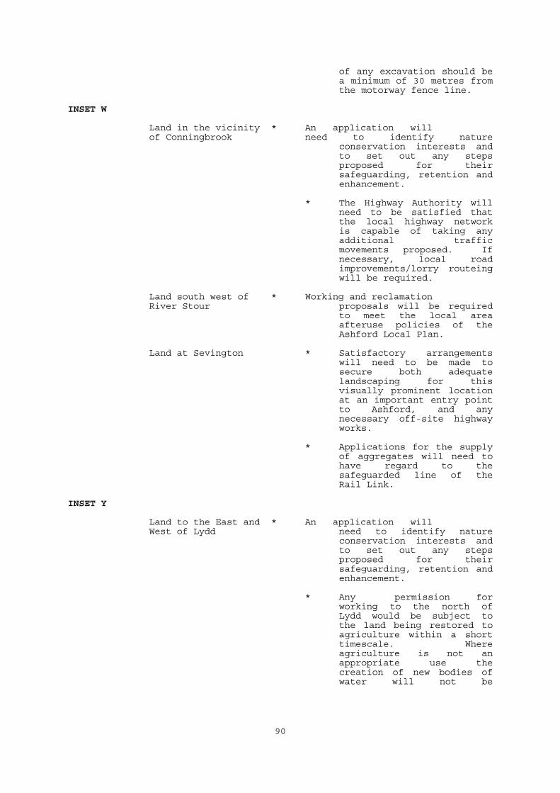
90
of any excavation should bea minimum of 30 metres fromthe motorway fence line.
INSET W
Land in the vicinity * An application willof Conningbrook need to identify nature
conservation interests andto set out any stepsproposed for theirsafeguarding, retention andenhancement.
* The Highway Authority willneed to be satisfied thatthe local highway networkis capable of taking anyadditional trafficmovements proposed. Ifnecessary, local roadimprovements/lorry routeingwill be required.
Land south west of * Working and reclamationRiver Stour proposals will be required
to meet the local areaafteruse policies of theAshford Local Plan.
Land at Sevington * Satisfactory arrangementswill need to be made tosecure both adequatelandscaping for thisvisually prominent locationat an important entry pointto Ashford, and anynecessary off-site highwayworks.
* Applications for the supplyof aggregates will need tohave regard to thesafeguarded line of theRail Link.
INSET Y
Land to the East and * An application willWest of Lydd need to identify nature
conservation interests andto set out any stepsproposed for theirsafeguarding, retention andenhancement.
* Any permission forworking to the north ofLydd would be subject tothe land being restored toagriculture within a shorttimescale. Whereagriculture is not anappropriate use thecreation of new bodies ofwater will not be
91
acceptable.
* An application will need toconsider airport safety.
* Mineral working willonly be permitted where itcan be shown that therewill be no adverse effectson the water quality,efficiency and storagecharacteristics of theaquifer.
* An application will need tobe weighed against anynature conservationinterest of internationalimportance and for the timebeing the Leybuchtjudgement stands. When theHabitats and Speciesdirective is implemented,developments which would belikely to affectsignificantly a SPA or SACshould not normally bepermitted, unless theexistence of imperativereasons of overridingpublic interest can beproved, and there is anabsence of alternativesolutions.
INSET Z
W HYTHE/DYMCHURCH * An application will need tohave regard to the settingof Dymchurch Redoubt.
CALP.RG2