Embed Size (px)
DESCRIPTION
Â
Citation preview


NOTE REGARDING ALCANAR (TARRAGONA) PP-9
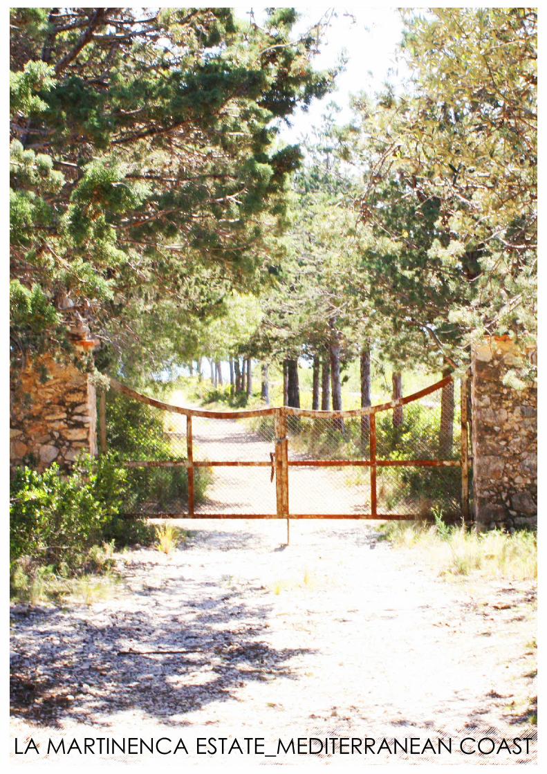
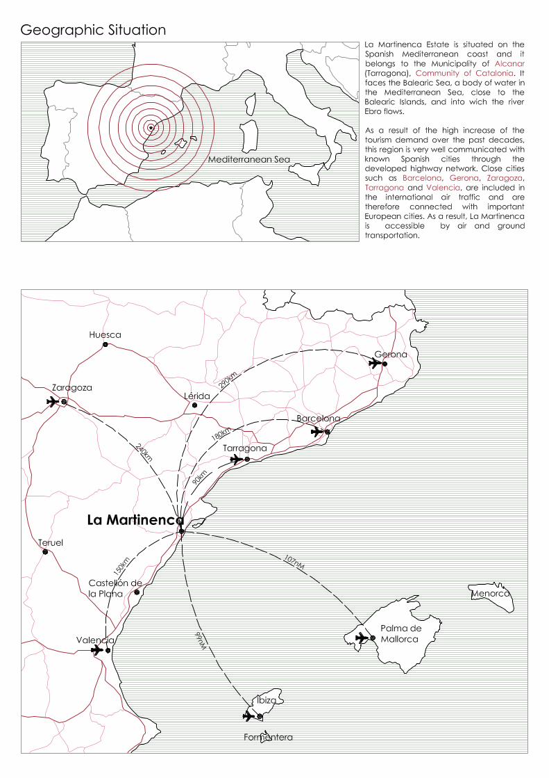
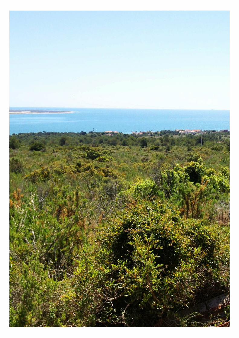
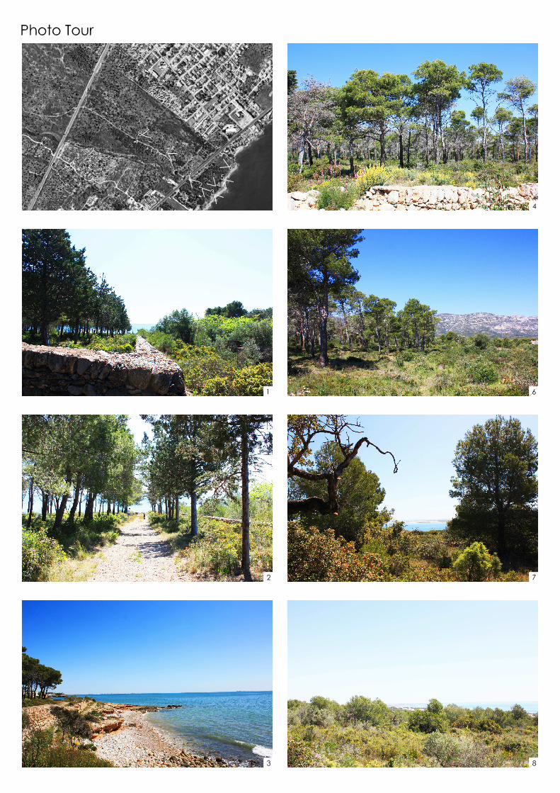
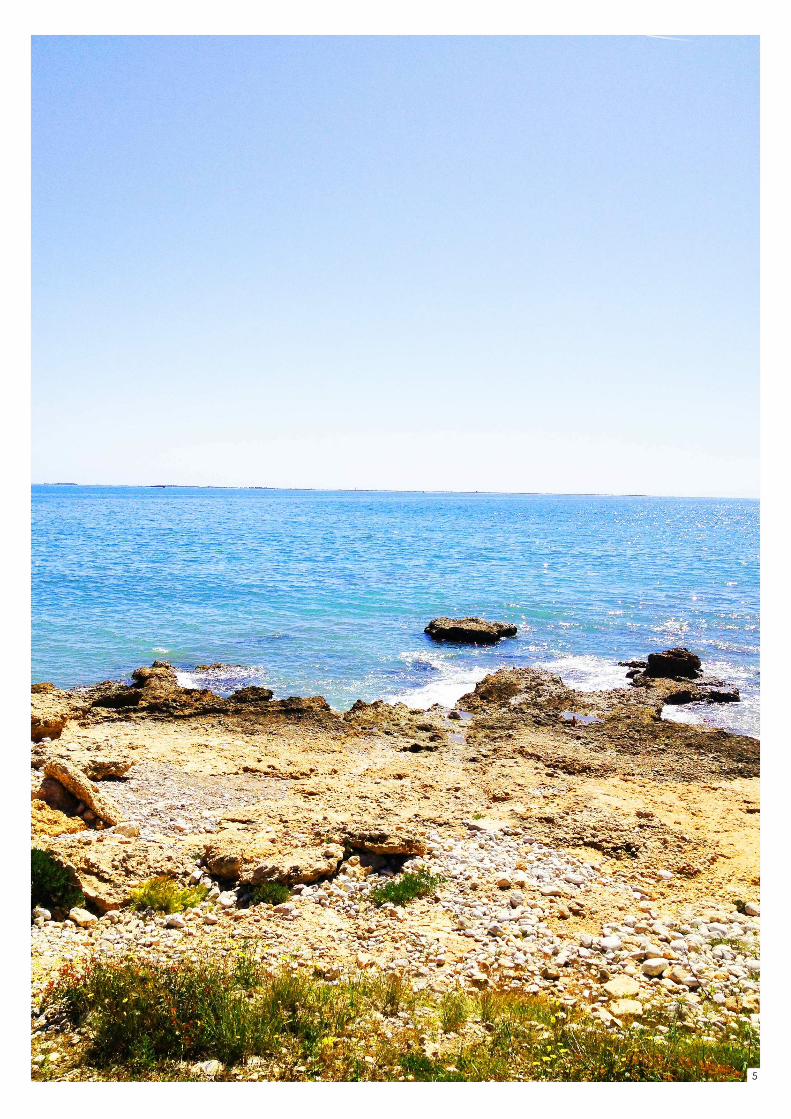
FINCA LA MARTINENCA
I.- The Alcanar General Urban Development Plan (Plan General de
Ordenación Urbana de Alcanar), (D.O.G.C. no. 4389 dated 23.5.05,
pages.14620 and successive) establishes that the PP-9 comprises 26.20 Ha of non-
programmed land designated for development (suelo urbanizable no
programado), in order to carry out the residential development of “Finca La
Martinenca”, which is bordered by the CN-340 main road, the Montsiá Mar
urbanisation, the coastal area (zona marítimo terrestre - ZMT) and the “Barranco de
la Martinenca”, which will be managed via a landowners body (sistema de
cooperación).
II.- The P.D.U.S.C.-2 “Coastal Area Urban Planning Master Plan (Plan Director
Urbanístico de los ámbitos del Sistema Costero), comprised of the sectors of zoned
land designated for development (suelo urbanizable delimitado) without an
approved local level plan (plan parcial)”,(D.O.G.C. no. 4577 dated 17.2.06), affected
the PP-9 , as it identified it as sector no. 44 and originally classified it as land not
designated for development, as it was included in Art. 5.1.
In relation to the PDUSC-2 which applied the classification of land not designated
for development to the PP-9, the co-owners appealed to the authorities and
brought a lawsuit before the Catalonia Supreme Court of Justice, and
these petitions were settled (via the ruling dated 29.2.08 by Catalonia's regional
policy minister) and the lawsuit (with the Catalonia Supreme Court of Justice judgement
dated 01 September 2010) awarded in favour of permitting its land classification as
land designated for development, that had already been established in the
Alcanar general urban development plan, by including it in Art.5.2, but with the
following requirements:
1.DEVELOPMENT TERMS & CONDITIONS:
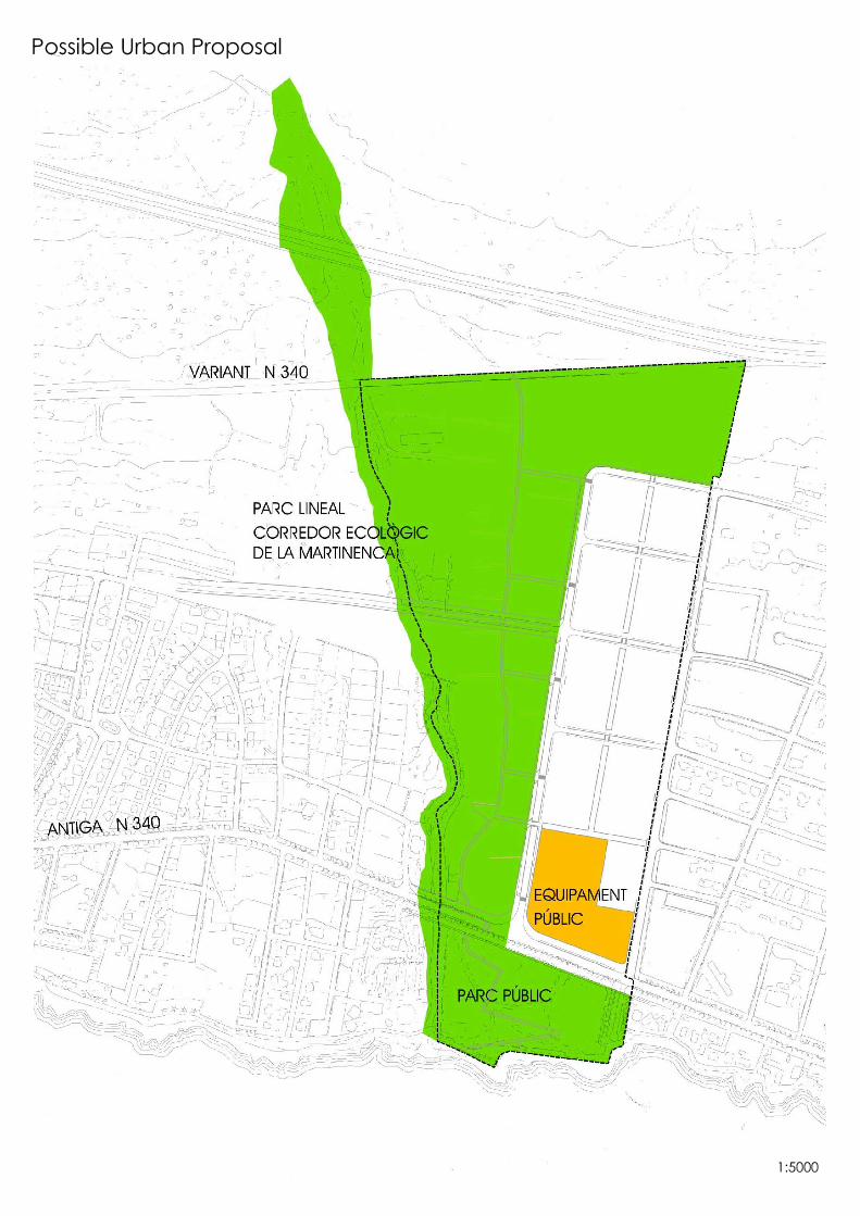
- The protected coastal area (as marked)
- Half of the south-westerly area of the area indicated in the plan
will be reserved as a protected scenic area.
Urban planning terms and conditions:
- The protected coastal and scenic areas, will be classified as open
public spaces and the obligatory transfer of land for public services
may not be located in these areas.
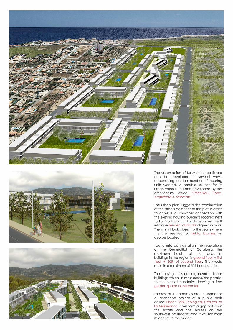
- The buildable area may not exceed a maximum of
45,000 sq m.
- The maximum number of homes will be 509.
2. Obligatory transfer of 154,769.94 sq m of land, in favour of the Alcanar Town
Hall, to be used as open spaces and protected coastal and scenic areas and the
obligatory transfer of 13,193.43 sq m of land for public services. All of the above in
accordance with the specific regulation record (ficha normativa específica) and
corresponding Urban Plan in accordance with the aforementioned resolutions.
III.- The “Las Tierras del Ebro Sub Regional Plan (Plan Territorial Parcial - PTPTE)",
included the PP-9 as “land not designated for development”, based on the fact that

that was how it was originally classified by the PDUSC-2, without taking in to
consideration the aforementioned petition and judgement.
In an attempt to avoid errors, the co-owners proposed an adjustment to the
PTPTE with regard to this classification as “land not designated for development”, by
informing the official co-ordinating the plan, Mr. Gabriel A. Palacios y Villacampa for
this purpose on 17.12.10, in the following manner: …For its part, Art. 3.1 of the Regional Plan urban planning regulations (Normas de ordenación del
Plan territorial) literally states, that this has been drawn up in accordance with regional, sector
specific and urban planning legislation in force, as well as with the remainder of the applicable
legal resolutions, and Art. 3.4 of the same regional urban planning regulations, also literally
stipulates in its text, that areas located in historic centres and their surrounding areas and special
areas indicated on urban plans, comprise urban land (suelo urbano) and land designated for
development in the urban planning in force, in accordance with the information available at the
time the Plan was drawn up. In the event of doubt or contradiction, the
classification that the area actually has shall prevail… i.e. land
designated for development as detailed in the urban planning
instruments that have been definitively approved at the time the
Regional Plan was finally approved.
"As a result, in accordance with these principles and that stipulated in the ruling of the Catalonia
Supreme Court of Justice dated 01 September 2010 the inclusion of PP-9 in the
specially protected land not designated for development
remains null and void… and, therefore, it retains its
status as land designated for development … with part of the land comprising a specialised residential area and another part as protected
regional land (suelo de protección territorial), in accordance with Art. 5.2 of the
PDUSC-2 in force (consistent with the other Alcanar sector that has the same ruling)”. Therefore, it is not necessary to amend the Regional Plan in this case, neither does it need to be
amended each time that a new urban planning designation is approved that introduces
changes to the Land designation (Régimen de suelo) or a new informative study or infrastructure
construction project that modifies the design of the same, as indicated in the Regional Urban
Development Plans.


![Christmas Songbook€¦ · A Spaceman Came Travelling – Chris De Burgh (1975) Intro: [Am]La la la [Em] La la la [F] La [C]La la la [G] La la la [F] La [F!][G!] [Am]La la la [Em]](https://img.pdfslide.net/doc/110x75/61296d24f21e2b096536cbbb/christmas-songbook-a-spaceman-came-travelling-a-chris-de-burgh-1975-intro-amla.jpg)
![LEAVIN’ ON A JET PLANE · [F] La la la la la [A7] laaaa la la [Dm] la la la la la la [F7] laaaaaa La la la la [Bb] laaa la la la la [C7] laaaa la la la [F] laaaa [F7] So [Bb] listen](https://img.pdfslide.net/doc/110x75/5fd12ba0d69a5f331475cebd/leavina-on-a-jet-f-la-la-la-la-la-a7-laaaa-la-la-dm-la-la-la-la-la-la-f7.jpg)


![Songbook - Headcorn Ukulele Group · [C]La la la la la [E7]laaaa la la [Am]la la la la la la [C7]laaaaaa La la la la [F]laaaa la la la la [G7]laaaa la la la [C]laaaa [C7] So [F]listen](https://img.pdfslide.net/doc/110x75/5fd12ba0d69a5f331475cebe/songbook-headcorn-ukulele-group-cla-la-la-la-la-e7laaaa-la-la-amla-la-la.jpg)