Embed Size (px)
Citation preview
Jason Knievel ATEC Forecasters’ Conference, July and August 2006 1
Lake-effect precipitation from the
Great Salt Lake
Jason Knievel
Material contributed by: Greg Byrd, Josh Hacker, Scott
Halvorson, Daryl Onton, and Jim Steenburgh
Jason Knievel ATEC Forecasters’ Conference, July and August 2006 2
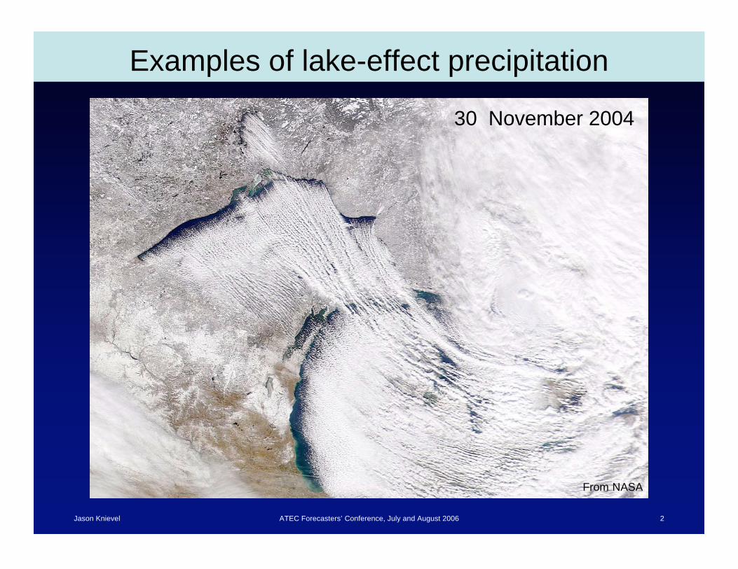
Examples of lake-effect precipitation
From NASA
30 November 2004
Jason Knievel ATEC Forecasters’ Conference, July and August 2006 3
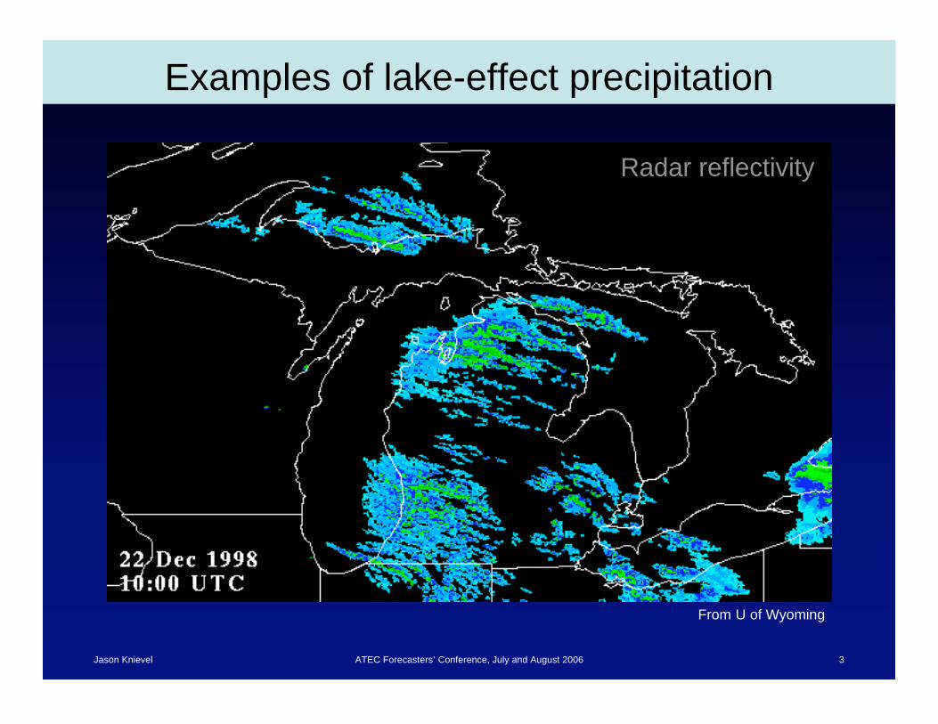
Examples of lake-effect precipitation
Radar reflectivity
From U of Wyoming
Jason Knievel ATEC Forecasters’ Conference, July and August 2006 4
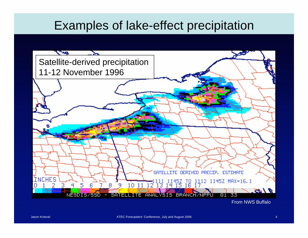
Examples of lake-effect precipitation
Satellite-derived precipitation
11-12 November 1996
From NWS Buffalo
Jason Knievel ATEC Forecasters’ Conference, July and August 2006 5
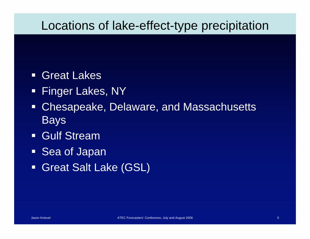
Locations of lake-effect-type precipitation
Great Lakes
Finger Lakes, NY
Chesapeake, Delaware, and Massachusetts
Bays
Gulf Stream
Sea of Japan
Great Salt Lake (GSL)
Jason Knievel ATEC Forecasters’ Conference, July and August 2006 6
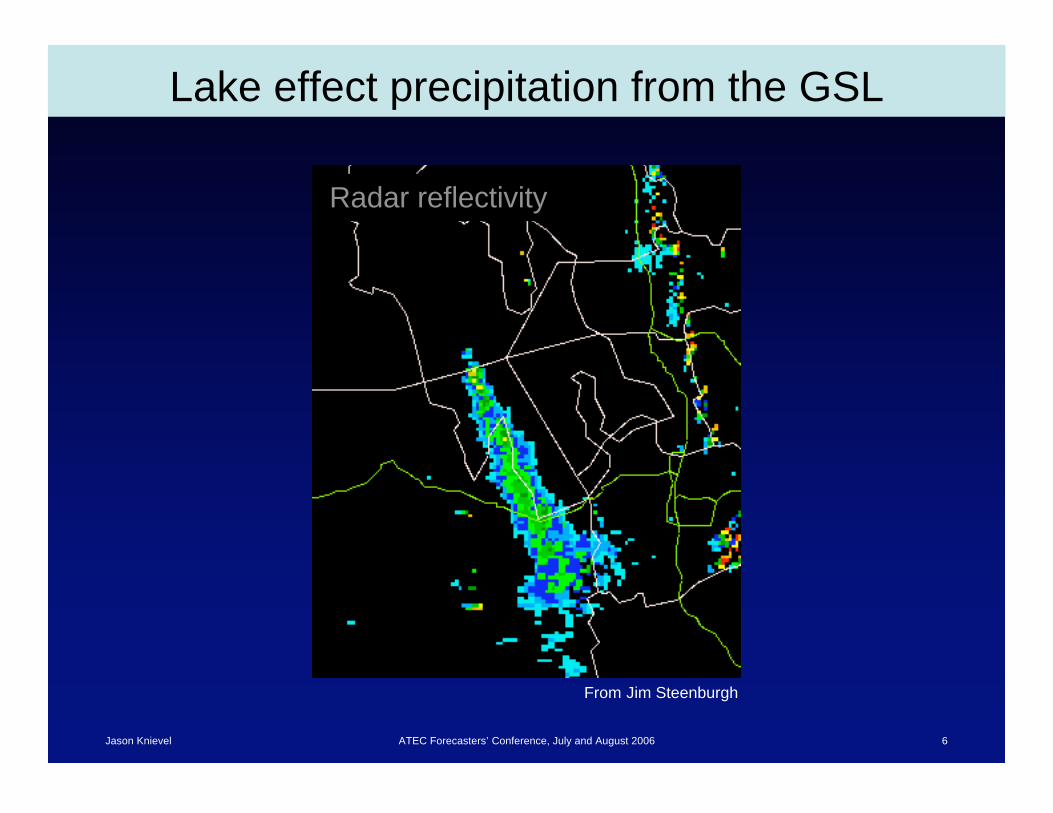
Lake effect precipitation from the GSL
Radar reflectivity
From Jim Steenburgh
Jason Knievel ATEC Forecasters’ Conference, July and August 2006 7
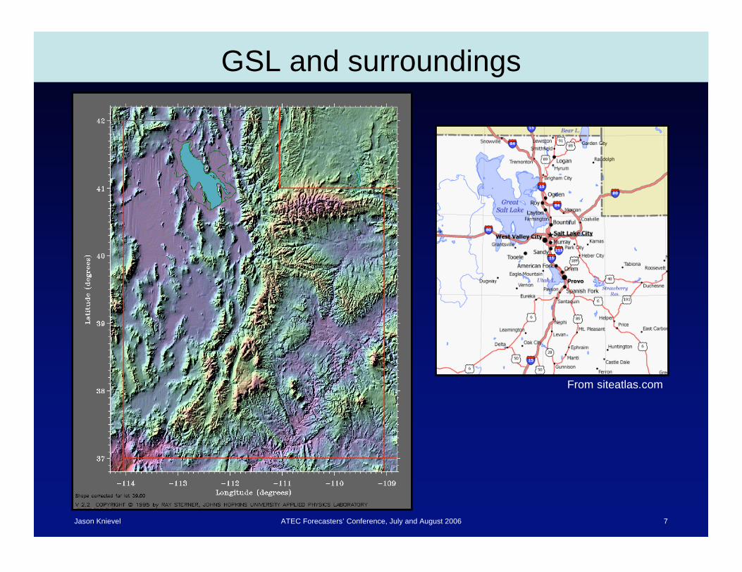
GSL and surroundings
From siteatlas.com
Jason Knievel ATEC Forecasters’ Conference, July and August 2006 8
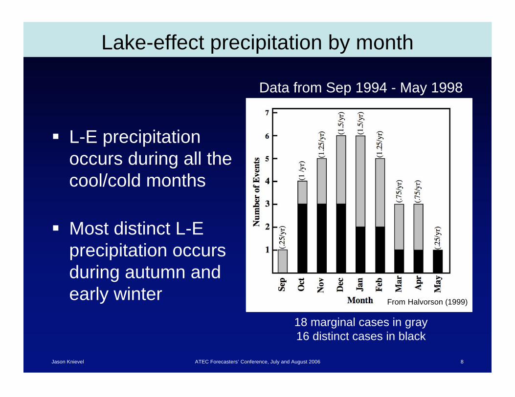
Lake-effect precipitation by month
L-E precipitation
occurs during all the
cool/cold months
Most distinct L-E
precipitation occurs
during autumn and
early winterFrom Halvorson (1999)
Data from Sep 1994 - May 1998
18 marginal cases in gray
16 distinct cases in black

Jason Knievel ATEC Forecasters’ Conference, July and August 2006 9
Climate of GSL temperature
From Halvorson (1999)
Jason Knievel ATEC Forecasters’ Conference, July and August 2006 10
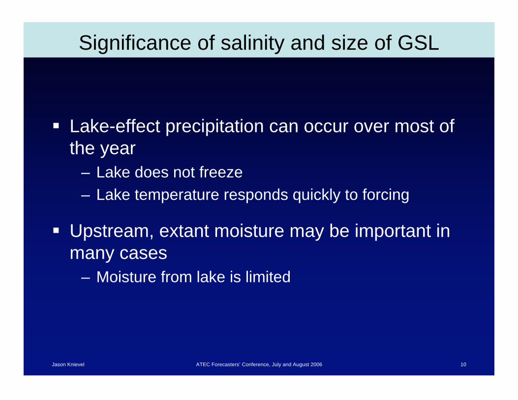
Significance of salinity and size of GSL
Lake-effect precipitation can occur over most of
the year
– Lake does not freeze
– Lake temperature responds quickly to forcing
Upstream, extant moisture may be important in
many cases
– Moisture from lake is limited
Jason Knievel ATEC Forecasters’ Conference, July and August 2006 11
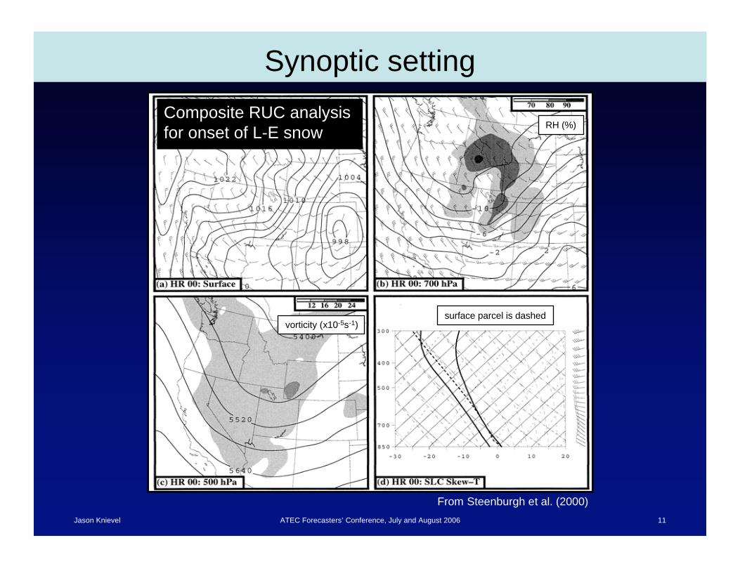
Synoptic setting
From Steenburgh et al. (2000)
Composite RUC analysis
for onset of L-E snowRH (%)
vorticity (x10-5s-1)surface parcel is dashed

Jason Knievel ATEC Forecasters’ Conference, July and August 2006 12
Timing and duration of snows
Most episodes start and night and last 12-36 h
From Halvorson (1999)From Halvorson (1999)
Jason Knievel ATEC Forecasters’ Conference, July and August 2006 13
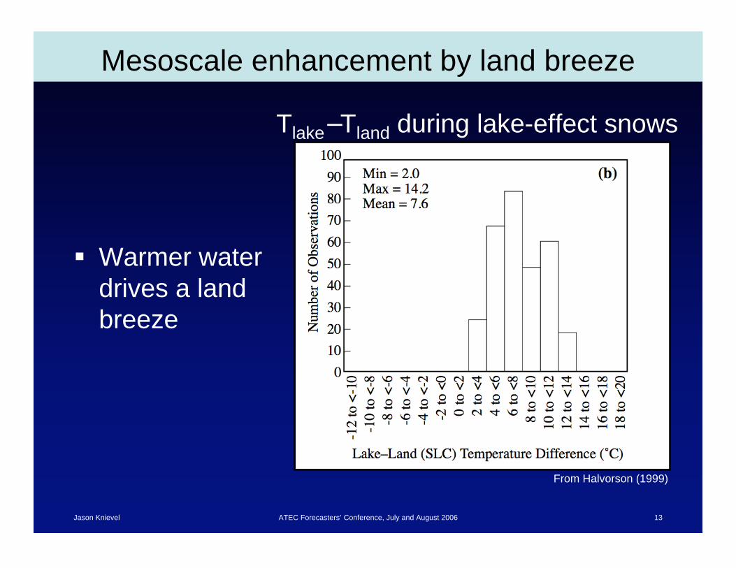
Mesoscale enhancement by land breeze
Warmer water
drives a land
breeze
Tlake Tland during lake-effect snows
From Halvorson (1999)
Jason Knievel ATEC Forecasters’ Conference, July and August 2006 14
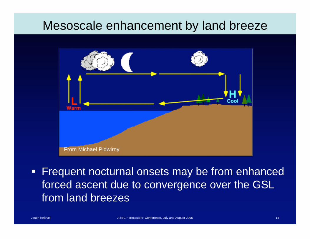
Mesoscale enhancement by land breeze
Frequent nocturnal onsets may be from enhanced
forced ascent due to convergence over the GSL
from land breezes
From Michael Pidwirny

Jason Knievel ATEC Forecasters’ Conference, July and August 2006 15
Role of static instability
Tlake T700 during lake-effect snows
From Halvorson (1999)
Jason Knievel ATEC Forecasters’ Conference, July and August 2006 16
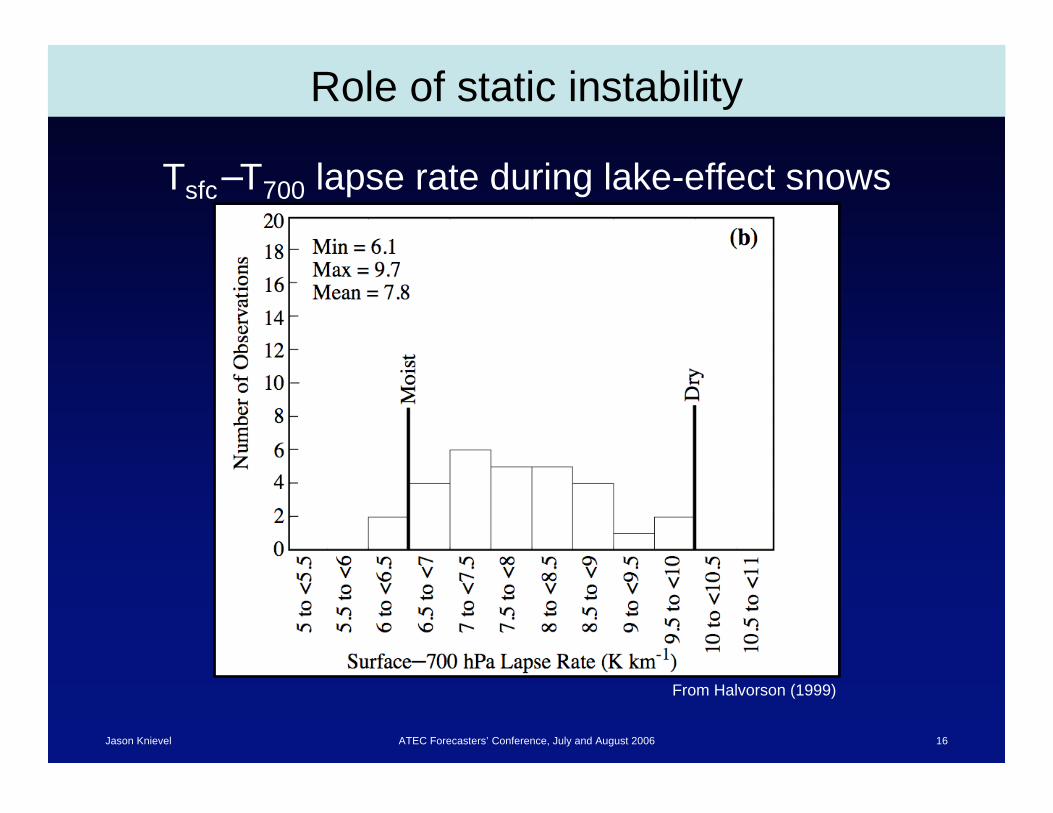
Role of static instability
Tsfc T700 lapse rate during lake-effect snows
From Halvorson (1999)
Jason Knievel ATEC Forecasters’ Conference, July and August 2006 17
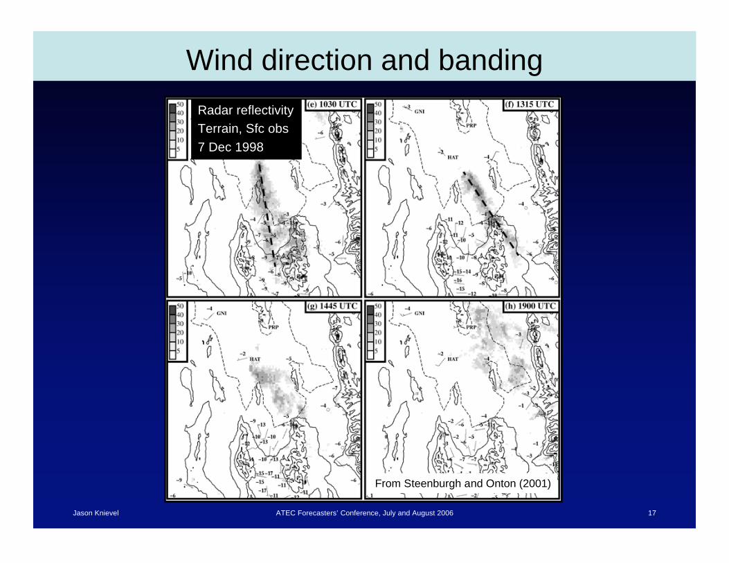
Wind direction and banding
Radar reflectivity
Terrain, Sfc obs
7 Dec 1998
From Steenburgh and Onton (2001)
Jason Knievel ATEC Forecasters’ Conference, July and August 2006 18
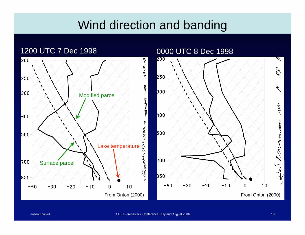
Wind direction and banding
From Onton (2000)From Onton (2000)
1200 UTC 7 Dec 1998 0000 UTC 8 Dec 1998
Lake temperature
Modified parcel
Surface parcel
Jason Knievel ATEC Forecasters’ Conference, July and August 2006 19
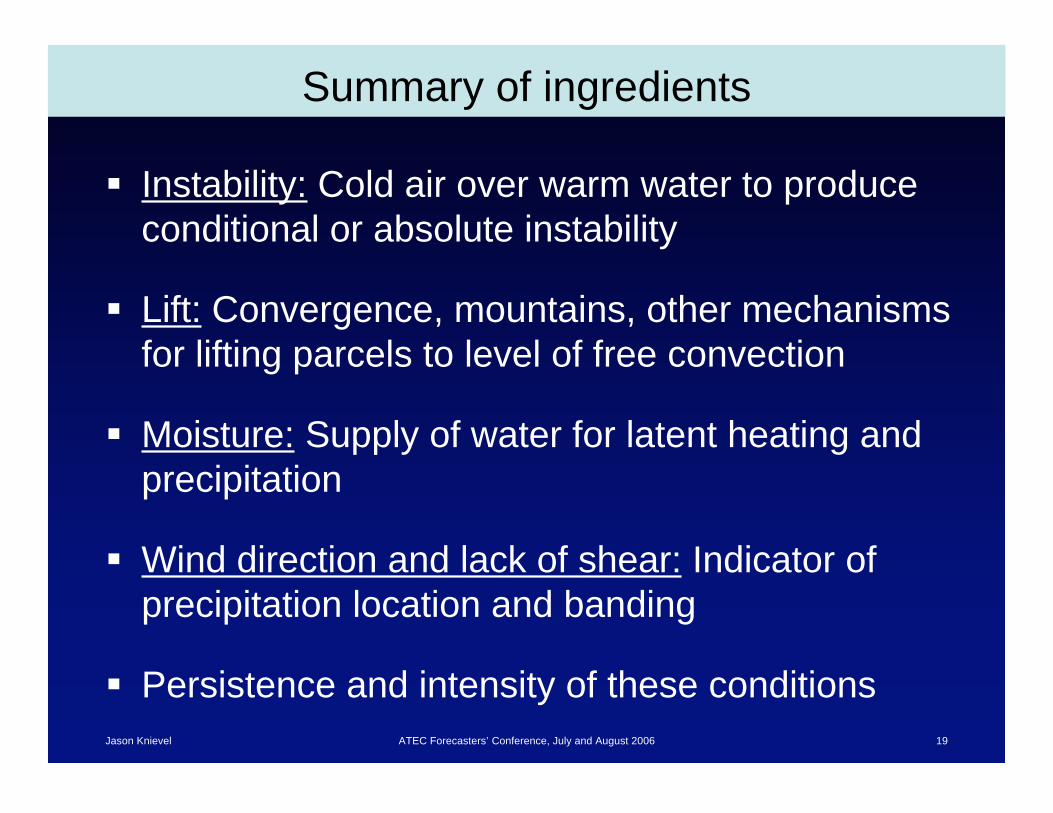
Summary of ingredients
Instability: Cold air over warm water to produce
conditional or absolute instability
Lift: Convergence, mountains, other mechanisms
for lifting parcels to level of free convection
Moisture: Supply of water for latent heating and
precipitation
Wind direction and lack of shear: Indicator of
precipitation location and banding
Persistence and intensity of these conditions
Jason Knievel ATEC Forecasters’ Conference, July and August 2006 20
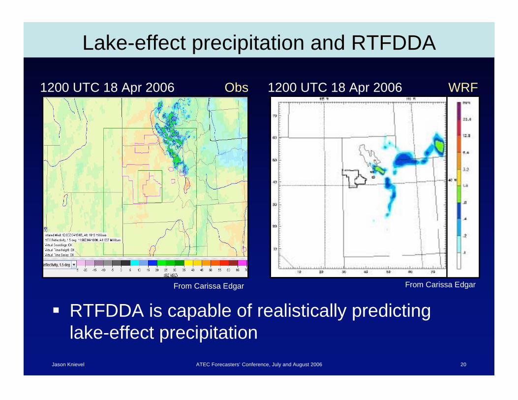
Lake-effect precipitation and RTFDDA
RTFDDA is capable of realistically predicting
lake-effect precipitation
1200 UTC 18 Apr 2006 1200 UTC 18 Apr 2006Obs WRF
From Carissa Edgar From Carissa Edgar
Jason Knievel ATEC Forecasters’ Conference, July and August 2006 21
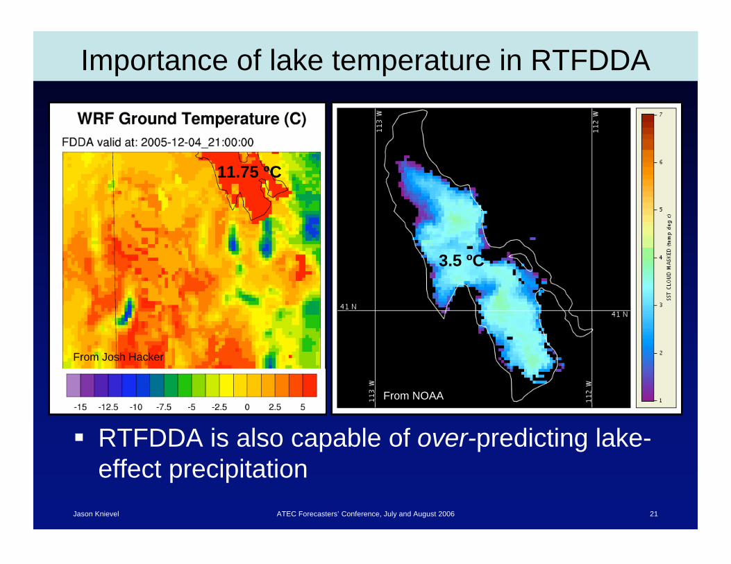
Importance of lake temperature in RTFDDA
RTFDDA is also capable of over-predicting lake-
effect precipitation
11.75 ºC
From Josh Hacker
3.5 ºC
From NOAA

Jason Knievel ATEC Forecasters’ Conference, July and August 2006 22
Additional reading
Carpenter, D. M., 1993: The lake effect of the Great Salt Lake: Overview and forecast
problems. Wea. Forecasting, 8, 181–193.
Halvorson, S. F., 1999: Climatology of lake-effect snowstorms of the Great Salt Lake.
M. S. thesis, Dept. of Meteorology, University of Utah, 78 pp.
Onton, D. J., 2000: An observational and numerical modeling investigation of Great
Salt Lake effect snow. Ph. D. dissertation, Dept. of Meteorology, University of Utah,
131 pp.
Steenburgh, W. J., S. F. Halvorson, and D. J. Onton, 2000: Climatology of lake-effect
snowstorms of the Great Salt Lake. Mon. Wea. Rev. , 128, 709–727.
Steenburgh, W. J., and D. J. Onton, 2001: Multiscale analysis of the 7 December
1998 Great Salt Lake-effect snowstorm. Mon. Wea. Rev., 129, 1296–1317.