Embed Size (px)
Citation preview
Lake Worth Lagoon C-51 Sediment Trap
Richard E. Barnes, Jr., PSM Ryan F. Kett, SIT

Statement of Work • Conduct a Hydrographic
Survey from Congress Ave. to S-155.
• Analyze and re-trace the surveys performed by Sea Diversified, Inc. from 2007 through 2010.
• Collect additional data immediately upstream of S-155.
• Review flow data from the SFWMD DBHYDRO data base.
• Prepare a survey drawing and report detailing our findings and making comparisons to the Sea Diversified, Inc. surveys.
• Recommendations for future surveys.
2
Summit Blvd.
Forest Hill Blvd.
S-155
Sediment
Trap

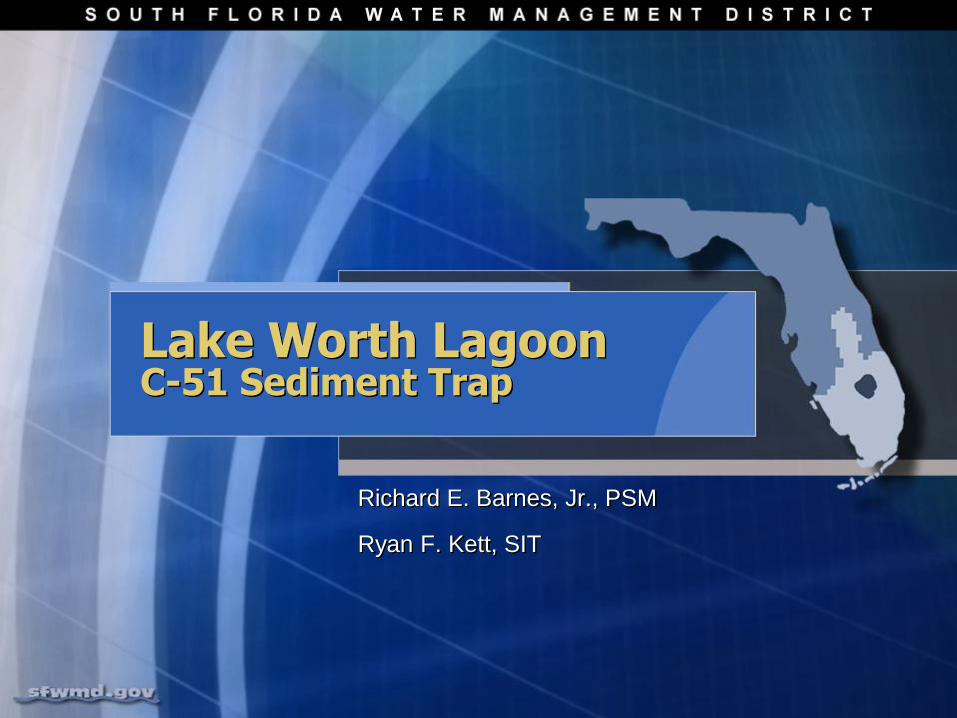
Equipment & Field Procedure
Vertical Datum = NAVD 88
• Elevations established using published values
• FCE 3521 – USACOE
• Summit 10 - PBC
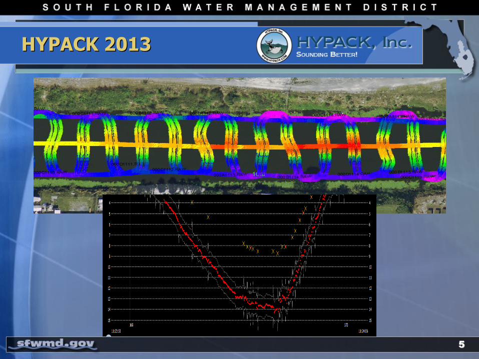
• Odom HydroTrac Echo Sounder to collect depth soundings.
• 0.1’ Resolution
• 200 KHz transducer
Horizontal Datum = NAD 83
• Trimble SPS351 DGPS
• Sub-Meter accuracy
3
4

6
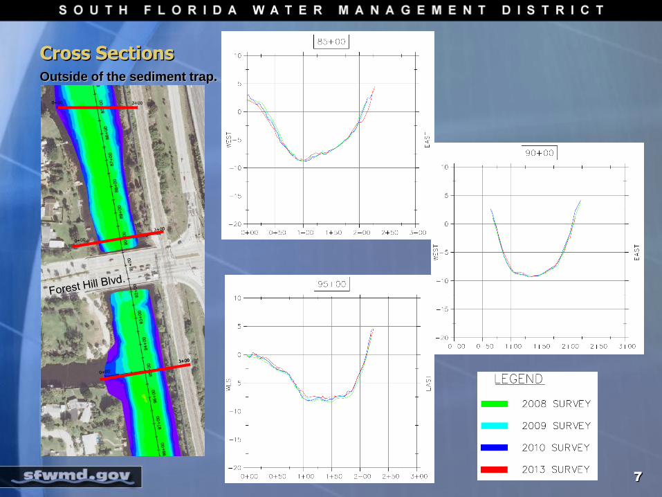
Cross Sections Outside of the sediment trap.
7

2007 vs. 2013 Elevation
Sea Diversified, Inc.
November 2007 (as-built)
SFWMD
June 2013
8

Sediment Accumulation
9
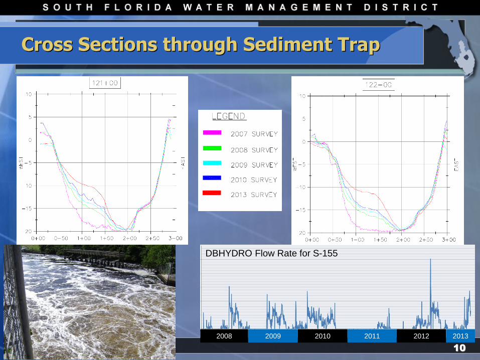
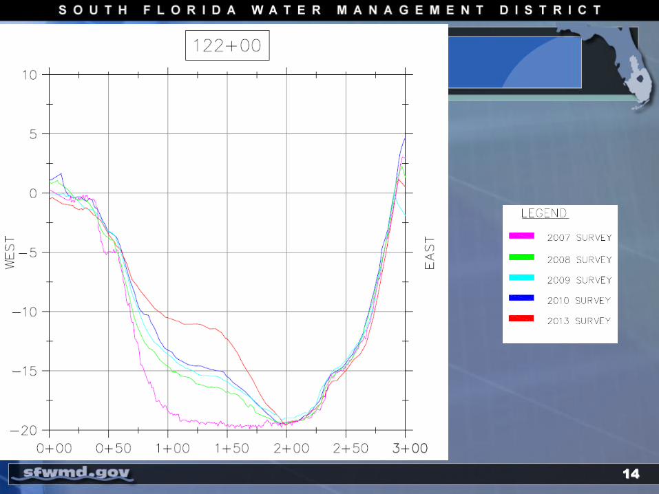
Cross Sections through Sediment Trap
10
2008 2009 2010 2011 2012 2013
DBHYDRO Flow Rate for S-155

Sediment Collection
11
Total Accretion
Years 2007 – 2008 2008 – 2010 2010 – 2013
Total (CY) 10,478 6,401 8,643
Average / Year 10,478 3,200 2,881

Survey Conclusions
• It appears the sediment trap is working.
• There is approximately 1 foot of material accumulation per year along westerly portion of the trap after year one.
• Flow rates through S-155 do not appear to effect the performance of the trap.
• There are no significant changes in the C-51 bottom configuration upstream or downstream of the trap.
12
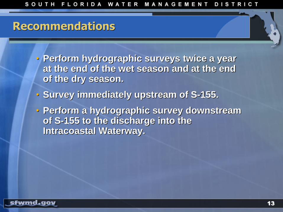
Recommendations
• Perform hydrographic surveys twice a year at the end of the wet season and at the end of the dry season.
• Survey immediately upstream of S-155.
• Perform a hydrographic survey downstream of S-155 to the discharge into the Intracoastal Waterway.
13
14

Questions?
15