Embed Size (px)
Citation preview
Ethiopia
Sudan
Somalia
YemenEritrea
Kenya
Djibouti
KenyaUganda
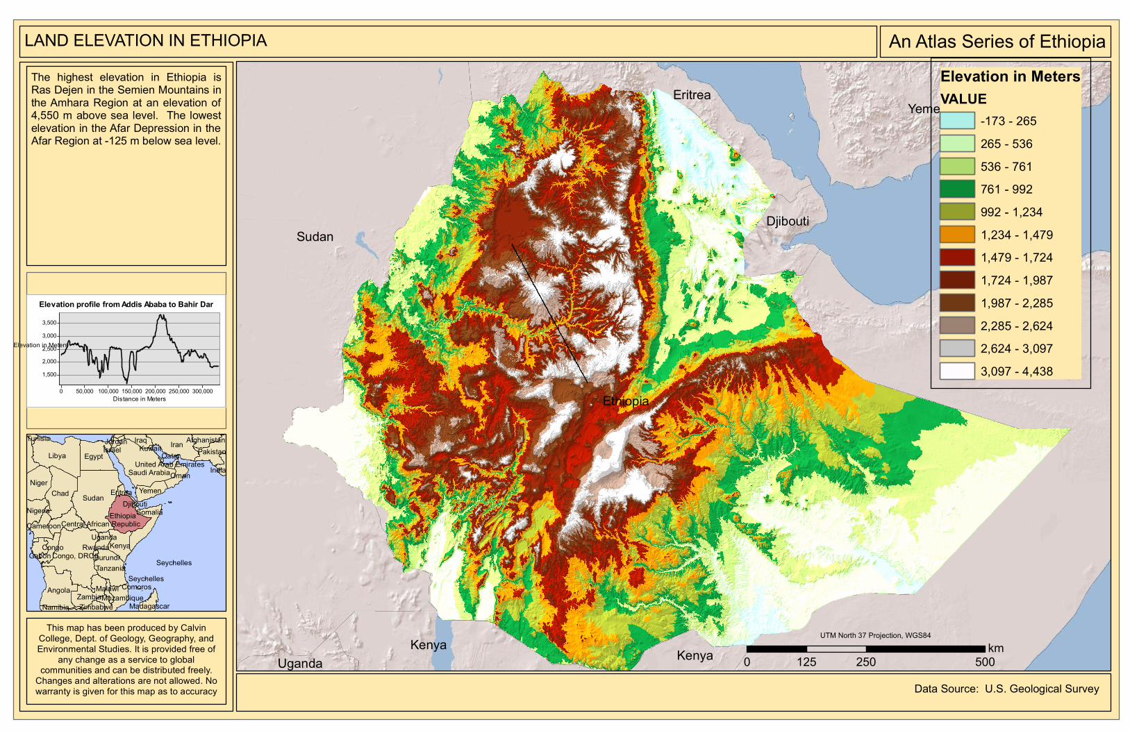
An Atlas Series of EthiopiaLAND ELEVATION IN ETHIOPIAThe highest elevation in Ethiopia isRas Dejen in the Semien Mountains inthe Amhara Region at an elevation of4,550 m above sea level. The lowestelevation in the Afar Depression in theAfar Region at -125 m below sea level.
0 250 500125km
Elevation in MetersVALUE
-173 - 265265 - 536536 - 761761 - 992992 - 1,2341,234 - 1,4791,479 - 1,7241,724 - 1,9871,987 - 2,2852,285 - 2,6242,624 - 3,0973,097 - 4,438
Sudan
LibyaIran
Chad
Angola
EgyptSaudi Arabia
Niger
Ethiopia
Congo, DRCTanzania
Zambia
Kenya
Somalia
IraqPakistan
Nigeria
Yemen
Congo
Oman
Cameroon
Mozambique
Gabon
India
Uganda
Afghanistan
Central African Republic
MadagascarNamibia Zimbabwe
Eritrea
Malawi
JordanTunisiaIsrael
Burundi
United Arab Emirates
Rwanda
Djibouti
KuwaitQatar
Comoros
SeychellesSeychelles
This map has been produced by CalvinCollege, Dept. of Geology, Geography, andEnvironmental Studies. It is provided free of
any change as a service to globalcommunities and can be distributed freely.
Changes and alterations are not allowed. Nowarranty is given for this map as to accuracy
UTM North 37 Projection, WGS84
Data Source: U.S. Geological Survey
Elevation profile from Addis Ababa to Bahir Dar
Distance in Meters300,000250,000200,000150,000100,00050,0000
Elevation in Meters
3,5003,0002,5002,0001,500