Embed Size (px)
Citation preview

National Park ServiceU.S. Department of the Interior
Natural Resource Program Center
Landbird Monitoring in the Sonoran Desert NetworkStatus Report 2008
Natural Resource Technical Report NPS/SODN/NRTR–2009/0XX

ON THE COVERGreater roadrunner (Geococcyx californianus). Photo ©Greg Lavaty.

Landbird Monitoring in the Sonoran Desert NetworkStatus Report 2008
Natural Resource Technical Report NPS/SODN/NRTR–2009/0XX
AuthorAaron FleschSchool of Natural Resources325 Biological Sciences EastTucson, Arizona 85721
Editing and DesignAlice Wondrak BielSonoran Desert Network 7660 E. Broadway Blvd, Suite 303Tucson, Arizona 85710
Month 2009
U.S. Department of the InteriorNational Park ServiceNatural Resource Program CenterFort Collins, Colorado

The Natural Resource Publication series addresses natural resource topics that are of interest and applicability to a broad readership in the National Park Service and to others in the management of natural resources, including the scientifi c community, the public, and the NPS conservation and environmental constituencies. Manuscripts are peer-reviewed to ensure that the information is scientifi cally credible, technically accurate, appropriately written for the intended audience, and is designed and published in a professional manner.
The Natural Resource Technical Report series is used to disseminate the peer-reviewed results of scientifi c studies in the physical, biological, and social sciences for both the advancement of science and the achievement of the National Park Service’s mission. The reports provide contributors with a forum for displaying comprehensive data that are often deleted from journals because of page limitations. Current examples of such reports include the results of research that addresses natural resource management issues; natural resource inventory and monitoring activities; resource assessment reports; scientifi c literature reviews; and peer-reviewed proceedings of technical workshops, conferences, or symposia.
Views, statements, fi ndings, conclusions, recommendations, and data in this report are solely those of the author(s) and do not necessarily refl ect views and policies of the U.S. Department of the Interior, National Park Service. Mention of trade names or commercial products does not constitute endorsement or recommendation for use by the National Park Service.
Printed copies of reports in this series may be produced in limited quantity, and are only available as long as the supply lasts. You may send a request to: Sonoran Desert Network 7660 E. Broadway Blvd, Suite 303 Tucson, Arizona 85710
This report is also available electronically from the Learning Center of the American Southwest, http://southwestlearning.org, or athttp://www.nature.nps.gov/publications/NRPM/index.cfm.
Please cite this publication as:Flesch, A. 2009. Landbird monitoring in the Sonoran Desert Network: Status report 2008. Natural Resource Technical Report NPS/XXXN/NRTR–2009/0XX. National Park Service, Fort Collins, Colorado.
NPS D-XXX, Month 2009
IntroductionBackgroundThe primary mission of the National Park Service (NPS) is to protect and preserve natural and cultural resources for future generations. Responding to criticism that it lacked basic infor-mation on the condition of natural resources within national parks, the NPS initiated a servicewide Inventory and Monitor-ing (I&M) Program to determine status and trends in ecologi-cal resources (NPS 1992).
Established in 2001, the Sonoran Desert Network (SODN) In-ventory and Monitoring Program includes 11 parks in south-ern Arizona and New Mexico that range in size from 356 (Tumacácori National Historical Park) to 133,882 hectares (Organ Pipe Cactus National Monument). Collectively, these parks are representative of most of the ecological communi-ties present within the Sonoran Desert and Apache Highlands Ecoregions (NPS 2005).
Birds as a focus for monitoringIn 2005, SODN staff completed a monitoring plan that identi-fi ed “vital signs,” or parameters, representing a diverse range of natural resources including air, water, climate, soils, plants, invertebrates, and vertebrates (NPS 2005). During this pro-cess, population parameters of landbirds were considered among the most feasible vertebrate parameters for long-term monitoring, in part because birds are highly detectable, easy to survey, and because they are good indicators of the environ-mental conditions upon which they depend.
Goal and parameters The overall goal of the SODN landbird monitoring program is to detect biologically signifi cant changes in bird populations over time. To achieve this goal, we are monitoring for density of the most-common species in SODN parks, and estimat-ing the proportion of sites occupied for most species in most
parks.1 These parameters focus on trend information. Detailed data exploration (including external data sources) and trend analysis of landbird data and will be explored in detail in the network’s comprehensive Synthesis and Trends reports, to be released at fi ve-year intervals (Powell et al. 2007).
In the meantime, parameters to be reported in annual status reports, such as this one, include (1) total detections by spe-cies, park, and habitat type; (2) community composition, (3) observations of breeding behaviors; and (4) notable observa-tions and species additions. This annual status report provides a brief summary of SODN landbird monitoring efforts and results during the 2008 fi eld season. This report also outlines changes made to the network’s landbird monitoring protocol and provides additional background and recommendations to aid future implementation.
Methods Sampling designIn 2008, we surveyed landbirds within all seven parks that were sampled in 2007 (CAGR, FOBO, ORPI, MOCC/MOWE, SAGE/SAGW, TUMA, and TUZI), and one addi-tional park (TONT), where we surveyed three transects (Table 1; all tables appear after main text. See box, next page, for park acronyms). We also added a riparian transect (Rip-2) at ORPI in 2008. We surveyed a total of 34 transects, with the number
http://southwestlearning.org
PROJECT REPORT
1.23.09 Prepared by Andy Hubbard, Sonoran Desert Network
S O N O R A N D E S E R T N E T W O R K
Landbird MonitoringStatus Report 2008
Aaron Flesch, University of Arizona
U.S. FISH
AND
WILD
LIFE SERVIC
E/KARN
EY
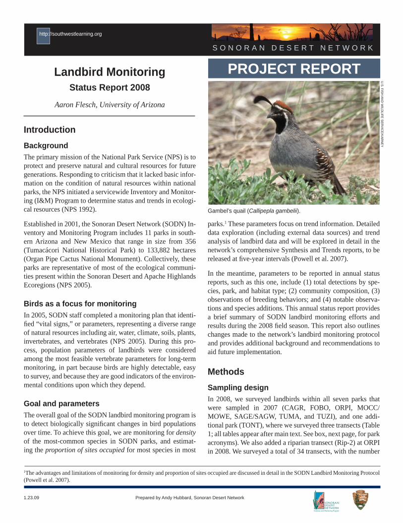
Gambel’s quail (Callipepla gambelii).
1The advantages and limitations of monitoring for density and proportion of sites occupied are discussed in detail in the SODN Landbird Monitoring Protocol (Powell et al. 2007).
2 Landbird Monitoring: Status Report 2008
http://southwestlearning.org
of transects per park ranging from 1 at CAGR to 6 at SAGE. Sites in each park were classifi ed as either riparian or upland; we classifi ed these sites separately because of variation in bird communities and because we wanted to focus some survey ef-fort in riparian communities (see Powell et al. 2007).
Site establishmentIn most parks, we used sites selected with methodology out-lined in Powell et al. (2007) (see Appendix A). Exceptions oc-curred at Organ Pipe Cactus NM and Saguaro NP. In 2007, safety concerns related to undocumented immigration and smuggling at ORPI led park managers to institute travel re-strictions that created signifi cant obstacles for monitoring staff attempting to incoporate a random component to site selec-tion. As a result of those concerns, only eight of the approxi-mately 40 sites proposed for monitoring proved acceptable to park staff; all sites in the southern and western portions of the park were excluded from sampling. After some safety re-strictions were lifted in 2008, those same eight transects were re-sampled by single observers and an additional transect was added.
Field methodsWe surveyed transects located in riparian areas four times and transects located in upland areas three times each. We re-duced survey effort in upland areas in 2008, due to budget constraints and because sample-size information and power analyses suggested that three visits facilitated monitoring of nearly as many species over time as four visits.
We maintained four visits in riparian areas because higher en-counter rates in these vegetation communities made monitor-ing more effi cient. Seasonal timing of surveys varied among parks. Timing of initial surveys was earlier in low-elevation parks (CAGR, ORPI, and SAGW) and later in mid-elevation parks (SAGE, FOBO, TUMA) and those in the Verde Valley (MOCC/MOWE and TUZI). Variation in timing was intended to account for differences in the onset of breeding for most spe-cies in each park. We spaced surveys a minimum of 1.5 weeks apart and completed all surveys by July 3 (see Table 1).
We used the point-transect survey method (Nelson and Fancy 1999, Buckland et al. 2001), which is the most widespread and accepted method for estimating landbird density (Rosenstock et al. 2002). Details on how to conduct point-transect surveys are provided in Powell and others (2007) and briefl y outlined here.
We spent eight minutes at each station and used a rangefi nd-er to estimate the linear distance to each bird detected. We recorded all birds, regardless of detection distance from the surveyor, including birds fl ying over observers. After counts were completed, observers located successive survey points with use of a handheld GPS. While walking between points, observers searched for species not recorded during the count period. Although monitoring staff deviated from the published protocol at ORPI in 2007, by working in groups of two, we surveyed transects independently in 2008.
Changes to the protocol We made a few small changes to the SODN landbird monitor-ing protocol in 2008. First, we differentiated auditory detec-tions with use of three classifi cations: singing (S), calling (C), and sounds made by birds’ wings (W), whereas in the past all
Park acronyms used in this document
CAGR Casa Grande Ruins National MonumentCHIR Chiricahua National MonumentCORO Coronado National MemorialFOBO Fort Bowie National Historic SiteGICL Gila Cliff Dwellings National MonumentMOCC Montezuma Castle National Monument
(Castle Unit)MOWE Montezuma Castle National Monument
(Well Unit)ORPI Organ Pipe Cactus National MonumentSAGE Saguaro National Park
(Rincon Mountain Unit)SAGW Saguaro National Park
(Tucson Mountain District)TONT Tonto National MonumentTUMA Tumacácori National Historical ParkTUZI Tuzigoot National Monument
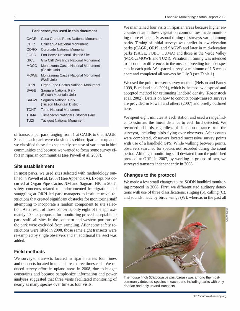
The house fi nch (Carpodacus mexicanus) was among the most-commonly detected species in each park, including parks with only riparian and only upland transects.
©G
REG
LAVATY

Sonoran Desert Network 3
http://southwestlearning.org
of these cues were simply classifi ed as auditory (A). We con-sidered singing birds to be those that were delivering territo-rial vocalizations made only by males (e.g., fl ycatchers were not considered), which in the SODN region are predominantly perching birds (Passeriformes). We added these additional codes to facilitate trend estimation for singing males, which could vary less across time than estimations for all individuals combined.
We also noted initial detection distances of birds that were in fl ight if these species were aerial foragers (e.g., swallows) or hoverers (e.g., hummingbirds).
All data upon which this report is based were subject to SODN I&M QA/QC procedures and certifi cation. These processes enabled us to identify and correct numerous errors created during the data-entry process.
Species accounts refi nedIn 2008, we reviewed species lists for each park in the NP-Spe-cies database. As part of this task, we noted species that may require additional documentation before they are included on park lists, as well as species already on the lists that are rare or unlikely to occur. Some species that are on park lists may have suffi cient documentation for inclusion, but were noted as “need documentation” if we did not review the evidence.
Results and DiscussionThe results summarized in this report represent an initial sum-mary of bird data collected by fi eld personnel in SODN parks in 2008. More focused and detailed reviews of these data and assessments of temporal trends in populations of landbirds will be completed after additional seasons of data are avail-able.
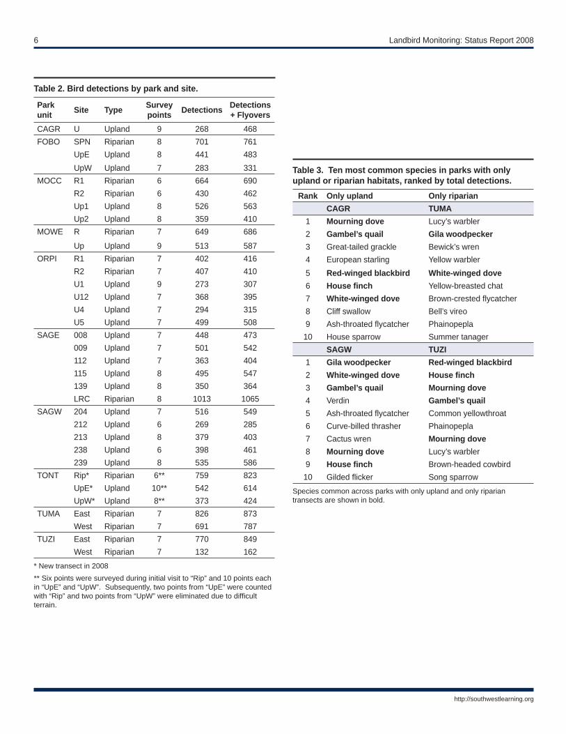
Total detectionsWe recorded a total of 18,428 observations of 167 species dur-ing point counts (Table 2). Of these, 1,663 observations (e.g., individuals or groups) were fl yovers and 12 species were de-tected only as fl yovers. The greatest number of observations occurred at SAGE (n = 3,395); the fewest number occurred at CAGR (n = 468). We observed the greatest number of species at FOBO (n = 93), SAGE (n = 88), and TUZI (n = 88), and the least at CAGR (n = 40).
Community compositionSpecies richness and community composition varied widely among all eight parks surveyed. The 10 most frequently de-tected species in each park also varied among parks, although parks that supported large riparian areas often had similar composition to parks that were predominantly uplands (Table 3). Among the most frequently detected species in each park (Tables 3–4) were house fi nch, Gila woodpecker, verdin, cac-tus wren, white-winged dove, brown-crested and ash-throated fl ycatchers, and black-throated sparrow.
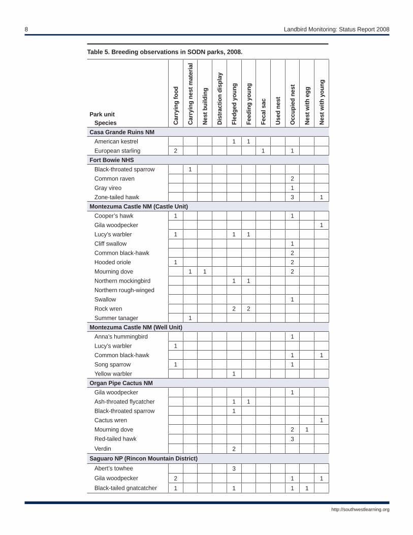
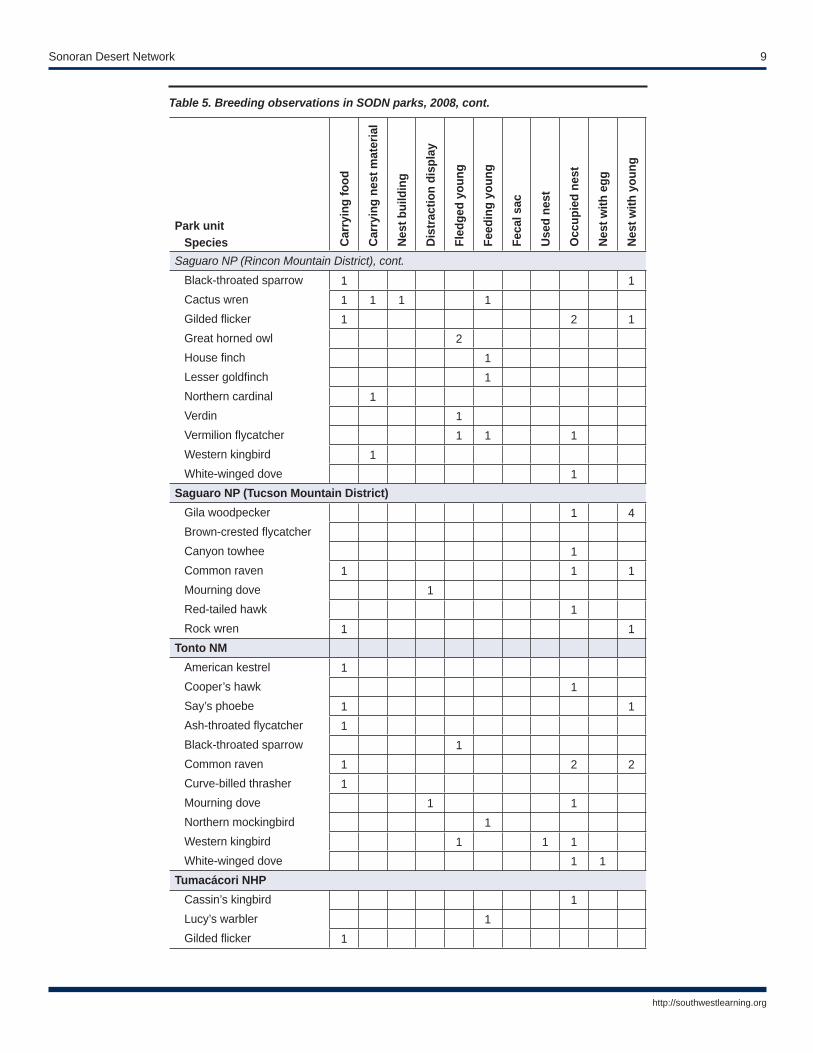
Breeding activityWe made total of 134 observations of confi rmed breeding ac-tivity, including 11 behaviors or observation types (Table 5). In comparison, only 42 observations of confi rmed breeding activity were obtained in 2007. Most breeding observations were in SAGE (n = 32) and MOCC (n = 24). Notable ob-servations included nesting common black hawk at MOCC and MOWE and zone-tailed hawk and gray vireo at FOBO. Breeding records provided by the SODN augment known re-cords across the network.
Species additions and species of interestWe added 18 new species to park lists in 2008, two of which were added to more than one park list (Table 6). We added the greatest number of new species to the TONT park list (n = 6) and the fewest to the park lists of TUZI (n = 1), CAGR (n = 1), and ORPI (n = 0). Notable new species included Ameri-can redstart (TUZI) and northern parula (SAGE, along Rincon Creek). Additionally, a calling adult elegant trogon was de-tected incidentally in riparian forest at MOCC on the morn-ings of June 17 and 18, but was not relocated on July 1–2. Also of note was a calling clapper rail in the marsh at TUZI on May 6, and a soaring gray hawk above TONT on April 23.
Recommendations for future effortsOverall, implementation of bird monitoring in SODN parks during 2008 was remarkably successful. The relatively minor
A calling clapper rail (Rallus longirostris) was detected in the marsh at Tuzigoot National Monument.
©G
REG
LAV
ATY

4 Landbird Monitoring: Status Report 2008
http://southwestlearning.org
changes made to the existing protocol indicate the protocol’s substantial utility for sampling bird communities. However, several recommendations should aid implementation during future years. When checking and certifying data from 2008, we found that the errors made most frequently were incorrect visit numbers and use of bird codes for the wrong species for some detections (<0.1%). To ameliorate the former problem, we suggest preparing and carefully checking the data that com-prise Table 2 of this report before certifying data. To minimize the latter issue, we suggest preparing and carefully checking the data that comprise Table 3 of this report before certifying data; observers should focus on identifying entries of species that do not occur in a given park or of rare species that seem potentially out of place. Additionally, modifying the database so that only codes for species that have been detected within a park are acceptable values in the species fi eld will help reduce these hard-to-fi nd errors.
Perhaps our greatest limitation during the 2008 fi eld season was insuffi cient time during which to complete vegetation measurements. These basic vegetation characterizations were designed to aid in the detailed explorations of bird popula-tion and community trends to be reported in the Synthesis and Trends reports (Powell et al. 2007). However, the vegetation surveys proved to be more time-consuming than predicted, which constrained the time allotted to database quality assur-ance/quality control (QA/QC). As SODN vegetation moni-toring and mapping should provide similar data that would exceed our needs during the synthesis and trends analyses for birds, we recommend dropping all of the vegetation sampling from the bird protocol. The savings in staff time could be bet-ter spent on additional database QA/QC and perhaps adding additional sites in high-elevation habitats. Sampling of these habitats (at CHIR, CORO, GICL, and high-elevation SAGE) were initially restricted to fi ve-year intervals due to increased access costs and lower detectability. However, bird commu-nities at high elevation may be at greater risk from climate change than those at low- and mid-elevations. We recommend exploring the effi cacy of annual surveys at high-elevation sites in 2009.
AcknowledgementsMoez Ali and Jon Green collected a wealth of data for this project and performed these duties with remarkable skill and dedication. Jon Green assisted in preparing several tables in this report and with the data certifi cation process; both Moez and Jon entered all data and implemented SODN QA/QC pro-cedures on data collected during the 2007 fi eld season. Glenn Johnson also assisted with data collection. SODN park staff provided essential guidance and assistance during this fi eld
season. Specifi cally, thanks go to Tim Tibbitts, of ORPI, for completing two surveys and helping with safety issues. At other SODN parks, thanks to Dennis Casper, Jeremy Moss, Duane Hubbard, Don Swann, Natasha Kline, Larry Ludwig, Danielle Foster, Carol West, and others for assisting with ac-cess, permits, housing, and other logistics. Andy Hubbard, Kristen Beaupre, Debbie Angell, and the rest of the staff at the SODN I&M offi ce supported our work; without their as-sistance, our efforts would not have been possible. I also thank Brian Powell for providing a wealth of guidance on numerous issues related to program implementation.
Literature citedBuckland, S. T., D. R. Anderson, K. P. Burnham, J. L. Laake,
D. L. Borchers, and L. Thomas. 2001. Introduction to distance sampling: Estimating abundance of biological populations. Oxford, U.K.: Oxford University Press.
National Park Service (NPS). 1992. NPS-75: Natural resourc-es inventory and monitoring guidelines. U.S. Department of Interior, Washington, D.C.
——. 2005. Sonoran Desert Network vital signs monitoring plan. Technical Report NPS/IMR/SODN-003. National Park Service, Denver, CO.
Nelson, J. T., and S. G. Fancy. 1999. A test of the variable cir-cular-plot method where exact density of a bird population was known. Pacifi c Conservation Biology 5:139–143.
Powell, B. F., A. D. Flesch, T. Mau-Crimmins, D. Angell, K. Beaupre, and W. L. Halvorson. 2007. Landbird monitor-ing protocol for the Sonoran Desert Network. Version 1.02. Unpublished protocol to the National Park Service, Sonoran Desert Network Inventory and Monitoring Pro-gram, Tucson, AZ.
Rosenstock, S. S., D. R. Anderson, K. M. Giesen, T. Leuker-ing, and M. F. Carter. 2002. Landbird counting techniques: Current practices and an alternative. Auk 119:46–53.
Project contactAndy Hubbard, Program Manager [email protected] Desert NetworkNational Park Service7660 E. Broadway Blvd., Suite #303Tucson, Arizona 85710Phone: 1+520-546-1607x1http://www.nature.nps.gov/im/units/sodn/

Sonoran Desert Network 5
http://southwestlearning.org
Table 1. 2008 sampling dates by park and site.
Park unit Site Visit 1 Visit 2 Visit 3 Visit 4CAGR U April 15 April 25 May 19 --FOBO SPN April 28 May 27 June 12 June 26
UpE April 29 May 27 June 13 --UpW April 29 June 12 June 25 --
MOCC R1 May 8 May 28 June 17 July1 R2 May 9 May 28 June 18 --Up1 May 8 June 17 July 1 --Up2 May 9 June 18 July 2 --
MOWE R May 7 May 30 June 20 July 3
Up May 7 May 30 June 20 --ORPI R1 April 11 May 22 May 30 --
R2 April 10 May 1 May 21 --U1 April 11 May 2 May 22 --U12 April 10 May 1 May 21 --U4 April 9 May 1 May 21 --U5 April 9 May 2 May 29 --
SAGE 008 April 21 May 18 June 4 --009 April18 May 16 June 2 --112 April 17 May 13 June 6 --115 April 22 May 19 June 3 --139 April 22 May 14 June 3 --LRC April 21 May 17 June 4 June 16
SAGW 204 April 16 May 12 June 5 --212 April 9 April 23 May 15 --213 April 16 May 12 June 5 --238 April 17 May 15 June16 --239 April 25 May 13 June 6 --
TONT Rip* April 23 May 14 June 11 July 4UpE* April 24 May 15 June 10 --UpW* April 24 June 10 July 4 --
TUMA East April 30 May 20 June 9 June 24West May 5 May 20 June 9 June 23
TUZI East May 6 May 29 June 19 July 2West May 6 May 29 June 19 --
See Appendix A for site locations.
6 Landbird Monitoring: Status Report 2008
http://southwestlearning.org
Table 2. Bird detections by park and site.
Park unit Site Type Survey
points Detections Detections + Flyovers
CAGR U Upland 9 268 468FOBO SPN Riparian 8 701 761
UpE Upland 8 441 483UpW Upland 7 283 331
MOCC R1 Riparian 6 664 690R2 Riparian 6 430 462Up1 Upland 8 526 563Up2 Upland 8 359 410
MOWE R Riparian 7 649 686
Up Upland 9 513 587ORPI R1 Riparian 7 402 416
R2 Riparian 7 407 410U1 Upland 9 273 307U12 Upland 7 368 395U4 Upland 7 294 315U5 Upland 7 499 508
SAGE 008 Upland 7 448 473009 Upland 7 501 542112 Upland 7 363 404115 Upland 8 495 547139 Upland 8 350 364LRC Riparian 8 1013 1065
SAGW 204 Upland 7 516 549212 Upland 6 269 285213 Upland 8 379 403238 Upland 6 398 461239 Upland 8 535 586
TONT Rip* Riparian 6** 759 823UpE* Upland 10** 542 614UpW* Upland 8** 373 424
TUMA East Riparian 7 826 873West Riparian 7 691 787
TUZI East Riparian 7 770 849West Riparian 7 132 162
* New transect in 2008** Six points were surveyed during initial visit to “Rip” and 10 points each in “UpE” and “UpW”. Subsequently, two points from “UpE” were counted with “Rip” and two points from “UpW” were eliminated due to diffi cult terrain.
Table 3. Ten most common species in parks with only upland or riparian habitats, ranked by total detections.
Rank Only upland Only riparianCAGR TUMA
1 Mourning dove Lucy’s warbler2 Gambel’s quail Gila woodpecker3 Great-tailed grackle Bewick’s wren4 European starling Yellow warbler5 Red-winged blackbird White-winged dove6 House fi nch Yellow-breasted chat7 White-winged dove Brown-crested fl ycatcher8 Cliff swallow Bell’s vireo9 Ash-throated fl ycatcher Phainopepla10 House sparrow Summer tanager
SAGW TUZI1 Gila woodpecker Red-winged blackbird2 White-winged dove House fi nch3 Gambel’s quail Mourning dove4 Verdin Gambel’s quail5 Ash-throated fl ycatcher Common yellowthroat6 Curve-billed thrasher Phainopepla7 Cactus wren Mourning dove8 Mourning dove Lucy’s warbler9 House fi nch Brown-headed cowbird10 Gilded fl icker Song sparrow
Species common across parks with only upland and only riparian transects are shown in bold.

Sonoran Desert Network 7
http://southwestlearning.org
Rank Species % in riparian
% in upland
Fort Bowie NHS1 House fi nch 54% 46%2 Cactus wren 42% 58%3 Ash-throated fl ycatcher 33% 67%4 Bewick’s wren 51% 49%5 Canyon towhee 43% 57%6 House fi nch 29% 71%7 Scott’s oriole 35% 65%8 Common raven 57% 43%9 Mourning dove 35% 65%10 Gambel’s quail 37% 63%
Montezuma Castle NM (Castle Unit)1 House fi nch 44% 56%2 Lucy’s warbler 61% 39%3 Gambel’s quail 39% 61%4 Brown-crested fl ycatcher 35% 65%5 Mourning dove 55% 45%6 Bewick’s wren 30% 70%7 Phainopepla 46% 54%8 Ash-throated fl ycatcher 23% 77%9 Black-throated sparrow -- 100%10 Brown-headed cowbird 59% 41%
Montezuma Castle NM (Well Unit)1 Mourning dove 47% 53%2 House fi nch 34% 66%3 Northern mockingbird 3% 97%4 Yellow warbler 83% 17%5 Bewick’s wren 66% 34%6 Lesser goldfi nch 53% 47%7 Gila woodpecker 82% 18%8 Black-throated sparrow --- 100%9 Brown-crested fl ycatcher 75% 25%10 Brown-headed cowbird 82% 18%
Species are ranked by total detections for 2008.
Rank Species % in riparian
% in upland
Organ Pipe Cactus NM1 Gambel’s quail 34% 66%2 Ash-throated fl ycatcher 29% 71%3 House fi nch 32% 68%4 Mourning dove 35% 65%5 Gila woodpecker 33% 67%6 Verdin 39% 61%7 Black-tailed gnatcatcher 28% 72%8 Cactus wren 42% 58%9 Gilded fl icker 42% 58%10 Black-throated sparrow 25% 75%
Saguaro NP (Rincon Mountain Unit)1 House fi nch 20% 80%2 Gila woodpecker 19% 81%3 Gambel’s quail 27% 73%4 Cactus wren 19% 81%5 Ash-throated fl ycatcher 12% 88%6 Black-throated sparrow 10% 90%7 Mourning dove 21% 79%8 House fi nch 30% 70%9 Curve-billed thrasher 16% 84%10 Lucy’s warbler 71% 29%
Tonto NM1 Mourning dove 33% 67%2 Black-throated sparrow 30% 70%3 Gambel’s quail 31% 69%4 Ash-throated fl ycatcher 35% 65%5 Gila woodpecker 47% 53%6 Bell’s vireo 67% 33%7 Northern mockingbird 22% 78%8 Cactus wren 45% 55%9 Verdin 37% 63%10 Brown-crested fl ycatcher 47% 53%
Table 4. Ten most common species in SODN parks, by the habitat types (riparian vs. upland) in which they were detected.
8 Landbird Monitoring: Status Report 2008
http://southwestlearning.org
Table 5. Breeding observations in SODN parks, 2008.
Park unitSpecies C
arry
ing
food
Car
ryin
g ne
st m
ater
ial
Nes
t bui
ldin
g
Dis
trac
tion
disp
lay
Fled
ged
youn
g
Feed
ing
youn
g
Feca
l sac
Use
d ne
st
Occ
upie
d ne
st
Nes
t with
egg
Nes
t with
you
ng
Casa Grande Ruins NMAmerican kestrel 1 1European starling 2 1 1
Fort Bowie NHSBlack-throated sparrow 1Common raven 2Gray vireo 1Zone-tailed hawk 3 1
Montezuma Castle NM (Castle Unit)Cooper’s hawk 1 1Gila woodpecker 1Lucy’s warbler 1 1 1Cliff swallow 1Common black-hawk 2Hooded oriole 1 2Mourning dove 1 1 2Northern mockingbird 1 1Northern rough-wingedSwallow 1Rock wren 2 2Summer tanager 1
Montezuma Castle NM (Well Unit)Anna’s hummingbird 1Lucy’s warbler 1Common black-hawk 1 1Song sparrow 1 1Yellow warbler 1
Organ Pipe Cactus NMGila woodpecker 1Ash-throated fl ycatcher 1 1Black-throated sparrow 1Cactus wren 1Mourning dove 2 1Red-tailed hawk 3Verdin 2
Saguaro NP (Rincon Mountain District)Abert’s towhee 3Gila woodpecker 2 1 1Black-tailed gnatcatcher 1 1 1 1
Sonoran Desert Network 9
http://southwestlearning.org
Park unitSpecies C
arry
ing
food
Car
ryin
g ne
st m
ater
ial
Nes
t bui
ldin
g
Dis
trac
tion
disp
lay
Fled
ged
youn
g
Feed
ing
youn
g
Feca
l sac
Use
d ne
st
Occ
upie
d ne
st
Nes
t with
egg
Nes
t with
you
ng
Saguaro NP (Rincon Mountain District), cont.Black-throated sparrow 1 1Cactus wren 1 1 1 1Gilded fl icker 1 2 1Great horned owl 2House fi nch 1Lesser goldfi nch 1Northern cardinal 1Verdin 1Vermilion fl ycatcher 1 1 1Western kingbird 1White-winged dove 1
Saguaro NP (Tucson Mountain District)Gila woodpecker 1 4Brown-crested fl ycatcherCanyon towhee 1Common raven 1 1 1Mourning dove 1Red-tailed hawk 1Rock wren 1 1
Tonto NMAmerican kestrel 1Cooper’s hawk 1Say’s phoebe 1 1Ash-throated fl ycatcher 1Black-throated sparrow 1Common raven 1 2 2Curve-billed thrasher 1Mourning dove 1 1Northern mockingbird 1Western kingbird 1 1 1White-winged dove 1 1
Tumacácori NHPCassin’s kingbird 1Lucy’s warbler 1Gilded fl icker 1
Table 5. Breeding observations in SODN parks, 2008, cont.

10 Landbird Monitoring: Status Report 2008
http://southwestlearning.org
Park unitSpecies C
arry
ing
food
Car
ryin
g ne
st m
ater
ial
Nes
t bui
ldin
g
Dis
trac
tion
disp
lay
Fled
ged
youn
g
Feed
ing
youn
g
Feca
l sac
Use
d ne
st
Occ
upie
d ne
st
Nes
t with
egg
Nes
t with
you
ng
Tuzigoot NMBlue grosbeak 1Mourning dove 1Northern cardinal 1Northern mockingbird 1Red-winged blackbird 1 1
Table 5. Breeding observations in SODN parks, 2008, cont.
Table 6. New bird species added to park lists in 2008.
Species CA
GR
FOB
O
MO
CC
SAG
E
TON
T
TUM
A
TUZI
Eurasian collard-dove XAmerican redstart XCassin’s fi nch XCassin’s vireo X XClapper rail XBlue grosbeak XCommon black-hawk XCommon nighthawk XDouble-crested cormorant XElegant trogon* XGray hawk* XGray vireo XGray-headed junco XGreat blue heron XNorthern beardless-tyrannulet XNorthern parula XPurple martin XPyrrhuloxia XRufous-winged sparrow X X X
*Incidental detection.No new species were added at Organ Pipe Cactus National Monument.

Sonoran Desert Network 11
http://southwestlearning.org
Appendix A. Landbird Sampling Locations in Sonoran Desert Network Parks
Casa Grande Ruins National MonumentCoolidge, AZ
Map created by Sonoran Desert Network, August 2008
National Park ServiceU.S. Department of the Interior
Park boundary
Bird sampling group
Roads
Visitor Center 0 250 500 750 1,000Meters

12 Landbird Monitoring: Status Report 2008
http://southwestlearning.org
UpW
UpE
SPN
Fort
Bow
ie N
atio
nal H
isto
ric S
iteB
owie
, AZ
Nat
iona
l Par
k S
ervi
ceU
.S. D
epar
tmen
t of t
he In
terio
r
Map
cre
ated
by
Sono
ran
Des
ert N
etw
ork,
Jul
y 20
08
Park
bou
ndar
y
Bird
sam
plin
g gr
oups
Roa
ds
Trai
ls0
0.5
11.
52 Ki
lom
eter
s
Sonoran Desert Network 13
http://southwestlearning.org
Up2
Up1
R1
R2
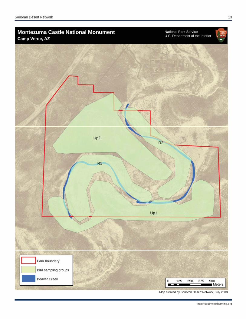
Camp Verde, AZ U.S. Department of the InteriorMontezuma Castle National MonumentCamp Verde, AZ
Map created by Sonoran Desert Network, July 2008
National Park ServiceU.S. Department of the Interior
Park boundary
Bird sampling groups
Beaver Creek 0 125 250 375 500Meters
14 Landbird Monitoring: Status Report 2008
http://southwestlearning.org
U1
R1
U12
U5
U4
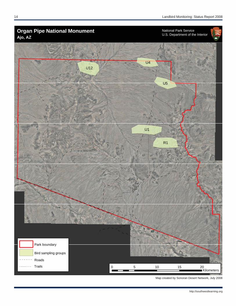
Ajo, AZ U.S. Department of the InteriorOrgan Pipe National MonumentAjo, AZ
Map created by Sonoran Desert Network, July 2008
National Park ServiceU.S. Department of the Interior
Park boundary
Bird sampling groups
Roads
Trails 0 5 10 15 20Kilometers

Sonoran Desert Network 15
http://southwestlearning.org
115
112
139
008
009
LRC
Sagu
aro
Nat
iona
l Par
k–Ea
stTu
cson
, AZ
Map
cre
ated
by
Sono
ran
Des
ert N
etw
ork,
Jul
y 20
08
Nat
iona
l Par
k S
ervi
ceU
.S. D
epar
tmen
t of t
he In
terio
r
Park
bou
ndar
y
Bird
sam
plin
g gr
oups
Trai
ls
Vis
itor C
ente
r
Loop
driv
e
02.
55
7.5
10Ki
lom
eter
s

16 Landbird Monitoring: Status Report 2008
http://southwestlearning.org
239
204
213
212
238
Saguaro National Park WestTucson, AZ
National Park ServiceU.S. Department of the Interior
Saguaro National Park–WestTucson, AZ
Map created by Sonoran Desert Network, July 2008
National Park ServiceU.S. Department of the Interior
Park boundary
Bird sampling groups
Roads 0 1 2 3 4Kilometers
Sonoran Desert Network 17
http://southwestlearning.org
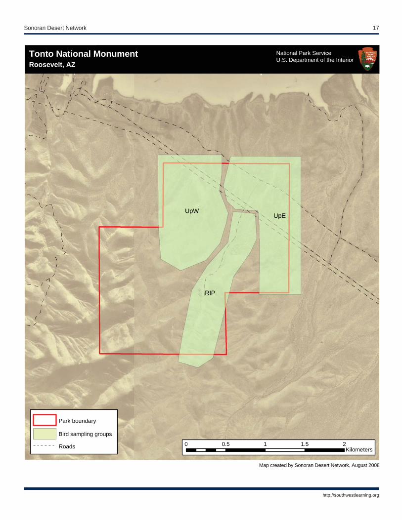
UpEUpW
RIP
Tonto National MonumentRoosevelt, AZ
National Park ServiceU.S. Department of the Interior
Tonto National MonumentRoosevelt, AZ
Map created by Sonoran Desert Network, August 2008
National Park ServiceU.S. Department of the Interior
Park boundary
Bird sampling groups
Roads 0 0.5 1 1.5 2Kilometers
18 Landbird Monitoring: Status Report 2008
http://southwestlearning.org
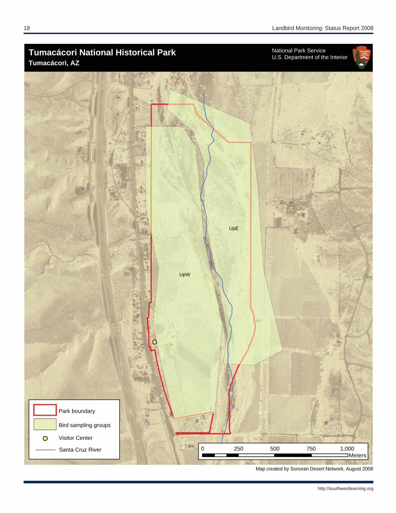
UpE
UpW
Tumacacori National Historic ParkTumacacori, AZ
National Park ServiceU.S. Department of the Interior
Tumacácori National Historical ParkTumacácori, AZ
Map created by Sonoran Desert Network, August 2008
National Park ServiceU.S. Department of the Interior
Park boundary
Bird sampling groups
Visitor Center
Santa Cruz River 0 250 500 750 1,000Meters
Sonoran Desert Network 19
http://southwestlearning.org
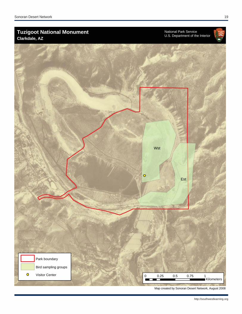
Est
Wst
Clarkdale, AZ U.S. Department of the InteriorTuzigoot National MonumentClarkdale, AZ
Map created by Sonoran Desert Network, August 2008
National Park ServiceU.S. Department of the Interior
Park boundary
Bird sampling groups
Visitor Center 0 0.25 0.5 0.75 1Kilometers

20 Landbird Monitoring: Status Report 2008
http://southwestlearning.org

The Department of the Interior protects and manages the nation’s natural resources and cultural heritage; pro-vides scientifi c and other information about those resources; and honors its special responsibilities to American Indians, Alaska Natives, and affi liated Island Communities.
NPS D-XXX, Month 2009

Natural Resource Program Center 1201 Oak Ridge Drive, Suite 150 Fort Collins, Colorado 80525
www.nature.nps.gov
EXPERIENCE YOUR AMERICA™
National Park ServiceU.S. Department of the Interior