Embed Size (px)
Citation preview

Landforms of the Ocean

What Can You Find Down There?
• The ocean floor contains all of the
geographic features that can be found on
the continents: Mountains, volcanoes,
plains, valleys, and canyons.
• These underwater landforms are many
times taller, deeper, longer, and wider than
those on dry land.
Continental Shelf• The edges of the continents slopes down
from the shore into the ocean.
• The part of the continent located under the
water is known as the continental shelf.
• The width of the continental shelf varies
around the edges of the continents.
• In some places, the continental shelf is
fairly shallow and in
other places it
becomes very deep.

Continental Slope• The steep slope where the continental
shelf drops to the bottom of the ocean
floor is called the continental slope.
• The ocean becomes very deep here.

Mid-Ocean Ridge• The largest mountain range on Earth.
• It divides the ocean floor into two parts.
• Made by volcanoes
• Those volcanic mountains that are not formed on the mid-ocean ridge (and do not break the surface of the ocean) are called seamounts. See the next slide to view some!

Seamounts

Rift Zone• In the center of the highest part of the mid-ocean
ridge is a narrow trench called a rift.
• Underwater volcanic activity that adds mountains to either side of the mid-ocean ridge occurs at the rift zone.

Trench• There are many steep-sided
canyons and deep, narrow
valleys in the bottom of the
ocean.
• Ocean trenches are the
deepest part of the ocean
basin and are deeper than
any valley found on land.

Ocean Basin• Located on either side of the mid-ocean
ridge is the ocean basin.
• It is made up of low hills and flat plains.

Abyssal Plain
• The flat area of the ocean basin is called
the abyssal plain.
• Seamounts are generally formed on the
ocean basin.

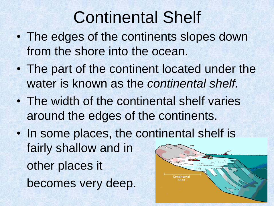
How do scientist know the
landforms are there?
• Maps of the ocean floor are created by collecting and plotting depth measurements.
• Depth measurements are taken by sonar.
• Sonar are sound waves that are sent from the ocean surface to the ocean floor. The amount of time it takes for the sound to travel down and back is one depth measurement.
How do scientist know the
landforms are there?• Variations in depth are used to infer or
explain elevations and depression in the
ocean floor.
• Depth measurements compiled together
make a depth profile.

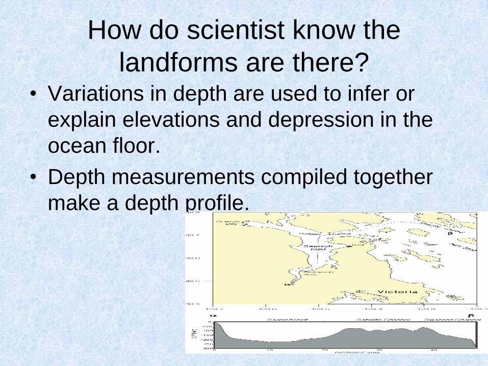
What are the features of the ocean floor?
continent
continental slope
continental shelf
continental rise
sea mount
mid-ocean
ridge
rift valley
trench
abyssal
plain
Can you name the landforms
of the ocean floor?