Embed Size (px)
Citation preview
The Landscape Assessment of Kent
October 2004

Prepared for Kent County Council by Jacobs Babtie
Kent County Council Invicta House County Hall Maidstone Kent ME14 1XX Tel: 01622 221537
Jacobs Babtie Miller House Lower Stone Street Maidstone Kent ME15 6GB Tel: 01622 666000
Produced with the financial support of the European Regional Development Fund
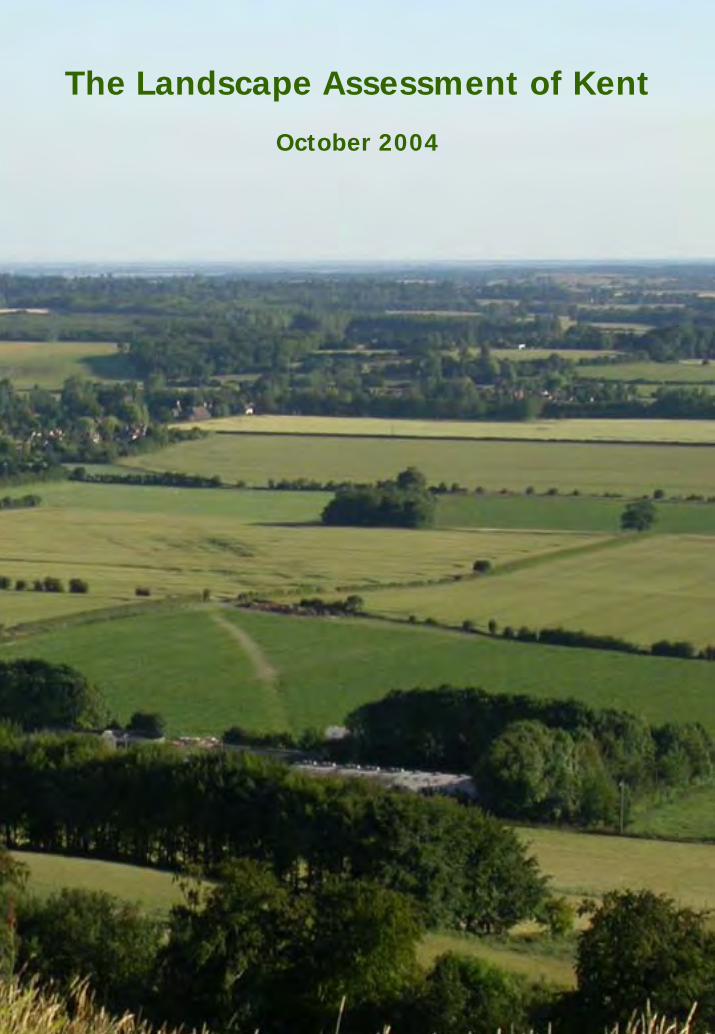
Front cover photograph courtesy of Jason Mitchell
EXECUTIVE SUMMARY The Kentish landscape has evolved over many hundreds of years. It has been created by the interaction of the natural environment and human activities, in particular the combination of physical, biological and cultural influences. Physical influences such as geology and landform, together with the overlying pattern of settlement and land use are key determinants of landscape character. The Landscape Assessment of Kent is a landscape character based study that draws together existing landscape character assessments of the county and updates them to conform to the current guidance. Additional work on the condition and sensitivity of the Kent landscape has been used to formulate character-based strategies to ensure the continued distinctiveness of the Kent landscape. It is intended that the Landscape Assessment of Kent will be used in a variety of forward planning strategies, in land management schemes and in planning control. The objective is to ensure that decisions on the rural landscape are underpinned by a robust and widely accepted assessment of the landscape character. The challenge is to find ways of identifying the important characteristics of the landscape that assist the process of accommodating change, where this is both desirable and practicable, whilst maintaining the links with the past and the natural environment. There is a need to retain pattern and diversity in the landscape to ensure that character and local distinctiveness are maintained. This is not necessarily about keeping the landscape as it is but is more about preventing everywhere becoming the same. In addition we need to ensure that landscapes are visually satisfying and give enjoyment to those who visit them and those who live and work in them. In recent years landscape characterisation has increased in importance as a tool for countryside planning policy. National policy guidance within Planning Policy Statement 7 (PPS7) promotes the character approach in order to offer more tailored guidance for the whole of the countryside, including less popular and damaged landscapes. The Kent and Medway Structure Plan provides the strategic planning framework, guiding decisions on development, transport and environmental matters over the next 20 years. Guidelines as a supplement to policies on landscape character within the Structure Plan have been developed in Supplementary Planning Guidance for Landscape Character. The Landscape Assessment of Kent has been written up as two page reports for each character area providing a description of the landscape and a landscape ‘vision’ or ‘strategy’ that directly reflects the condition and sensitivity of the area. It offers a broad-brush, strategic approach and is written with the intention that detailed local studies should be undertaken to assess site specific proposals. Local landscape assessments undertaken at a district scale or for specific sites and areas can focus on a greater level of detail and therefore give more targeted information. Other guidance on landscape character is available in Village and Parish Design Statements and, within Areas of Outstanding Beauty (AONB), in AONB Design Guides.
CONTENTS
What information would you like to access? 1.0 An introduction to the Landscape Assessment of Kent
2.0 Kent Character Area Map To view the location of each character area in Kent go to the map. Click on the
name of the character area for a link to the report card containing the landscape description.
3.0 Kent Character Area Reports To view the description of the character area and a summary of the actions,
click on the report card you would like to view in this list.
4.0 District Map To view a map of Kent Character Areas in relation to District boundaries, click
here.
5.0 Natural Area Map To view a map of Kent Character Areas in relation to Natural Areas, click here.
6.0 How we produced the Landscape Assessment of Kent For more information on the methodologies used to complete the Landscape
Assessment of Kent, click here.
7.0 Glossary of Terms
8.0 List of Abbreviations
9.0 Other useful published information
10.0 Where to go for further information
1.0 INTRODUCTION The Kentish landscape has evolved over many hundreds of years. It has been created by the interaction of the natural environment and human activities, in particular the combination of physical, biological and cultural influences. Physical influences such as geology and landform, together with the overlying pattern of settlement and land use are key determinants of landscape character. The Landscape Assessment of Kent is a landscape character based study that draws together existing landscape character assessments of the county. It also updates these to conform to the current guidance using judgments based on condition and sensitivity to promote a vision for each area. The objective is to ensure that decisions on the rural landscape are underpinned by a robust and widely accepted assessment of the landscape character. The challenge is to find ways of identifying the important characteristics of the landscape that assist the process of accommodating change, where this is both desirable and practicable, whilst maintaining the links with the past and the natural environment. There is a need to retain pattern and diversity in the landscape to ensure that character and local distinctiveness are maintained. This is not necessarily about keeping the landscape as it is but is more about preventing everywhere becoming the same. In addition we need to ensure that landscapes are visually satisfying and give enjoyment to those who visit them and those who live and work in them. Many of the judgments regarding landscapes are subjective, which means that they are open to equally valid but different individual interpretations. The process of landscape assessment has to resolve this matter and has evolved so that current practice is now based on a logical and well thought out procedure. This procedure breaks down the analysis into the component parts that collectively make up the landscape as we know it. It is a logical process that enables decisions to be revisited over time as well as enabling different assessors to understand and contribute to the decisions reached. In recent years landscape characterisation has increased in importance as a tool for countryside planning policy. National policy guidance within Planning Policy Statement 7 (PPS7) promotes the character approach in order to offer more tailored guidance for the whole of the countryside, including less popular and damaged landscapes. 1.1 DEVELOPING THE LANDSCAPE ASSESSMENT OF KENT 1.1.1 Landscape Character Local character areas have previously been identified across the county. These are described in the following reports that are collectively referred to as the Landscape Assessment of Kent.
• The High Weald (1994) • The Kent Downs (1995) • Thames Gateway, Eastern Swale Marshes and Eastern Fruit Belt (1995) • The Low Weald Landscape Assessment & Guidelines (1997) • The Greensand Belt Landscape Assessment & Guidelines (1998)
• North West Kent Landscape Assessment & Guidelines (1998) • North East Kent Landscape Assessment & Guidelines (1998) • Romney Marsh Landscape Assessment & Guidelines (1998)
These studies were undertaken over a number of years whilst landscape assessment methodologies were developing and therefore there is a need to bring them together on the same basis and update them to conform to the current landscape assessment guidance. The character area boundaries were revisited and minor amendments have been made to the boundaries to align them with features on the ground. These minor revisions, along with the condition and sensitivity study described below, were subject to a consultation with district councils in September 2000. This document repeats the landscape character descriptions in the above documents so that the whole county can be viewed in a consistent format in one report. Some minor editing has been undertaken to obtain consistency throughout the document and to update development proposals, such as the Channel Tunnel Rail Link, that were referred to as proposed or under construction in the original texts and are now built. 1.1.2 Landscape Condition and Sensitivity The condition and sensitivity study of the Kent landscape aims to formulate character-based strategies to ensure the continued distinctiveness of the Kent landscape. It is written with the intention of the specific landscape aims being used in a variety of forward planning strategies, in land management schemes and in planning control. Field Evaluation Sheets have been used to analyse the component factors of the landscape to reach a series of decisions on the: • visual unity • ecological integrity • condition of heritage features • cultural integrity • contribution of built form • time-depth and distinctiveness of features • visibility This information has been written up as a summary of issues for all character areas and includes a landscape ‘vision’ or ‘strategy’ that directly reflects the condition and sensitivity of the area. These reports are supplementary to existing landscape character descriptions. The conclusions reached for each of the character areas are expressed using a matrix that encompasses Condition and Sensitivity, generating a broad indication of what the strategy for the area might be. The detail of the draft strategies has been formulated by cross-referencing • existing character information • the findings of the field evaluation sheets (i.e. - what exactly is in poor condition or is
highly sensitive?, what can be enhanced or created or conserved to ensure a distinctive landscape?)
• existing biodiversity targets • strategies of adjacent areas
• historic landscape character information This systematic process of evaluation not only clarifies how judgements have been made, it also allows re-interrogation of the decisions as they are being made, and subsequent updating if the landscape changes. Guidelines are offered which are locally appropriate to the character area and respond to the generic strategies that have been identified. Many of these strategies are not likely to be within the remit of the Local Authority to implement directly as they are not responsible for managing the land in most cases. Such references have been included with a view to influencing opinions, generating support and guiding policy. 1.1.3 Other Initiatives/datasets/studies A number of other County Council projects and initiatives have informed this project: • Kent Historic Landscape Characterisation Study • Kent Habitat Capability Study • Kent Habitat Survey 2003 • Kent Lifescapes Information System Since completion of the Landscape Assessment of Kent, Kent County Council has subscribed to the Living Landscapes Project. The aim of this project is to identify homogenous landscape description units (LDUs) based on national datasets for natural and cultural attributes. These LDUs provide a further layer of landscape data that is complementary to the landscape character areas. In many instances a character area will be an amalgam of a number of LDUs , on others the LDUs will be divided into a number of character areas. This reflects changes in local cultural and visual attributes that would not be reflected in national datasets. These LDUs are being used to identify biodiversity opportunities. In the next few years the Kent & Medway Structure Plan will provide the strategic planning framework, guiding decisions on development, transport and environmental matters across Kent and Medway. Once adopted it is anticipated Plan policies will promote the use of character assessment. Supplementary Planning Guidance will provide recommended guidelines to support the use of the landscape character policies. 1.1.4 Relationship to District Level Assessment It should be noted the countywide studies offer a broad-brush, strategic approach and are written with the intention that detailed local studies should be undertaken to assess site specific proposals. This broad-brush approach means that judgements made on individual areas will not necessarily focus on detail. For example, a character area may have pockets that are in better or worse condition, or higher or lower sensitivity. Judgements are therefore a summary of the overall picture. Local landscape assessments undertaken at a district scale or for specific sites and areas can focus on a greater level of detail and therefore give more targeted information. Other
guidance on landscape character is available in Village and Parish Design Statements and, within Areas of Outstanding Beauty (AONB), in AONB Design Guides. Generally, for development proposals, the most detailed / local landscape assessment should be referred to in the first instance. For example for a site specific proposal a district/unitary level assessment should be used, if this is not available then the countywide study will offer guidance. Conversely, when developing land based strategies at a regional scale a top down approach may be more appropriate.
Fruit Belt
Thanet
The Blean
East Kent Arable Belt
Ash Downs
Hoo Peninsula
Bicknor: Mid Kent Downs
Petham: East Kent Downs
Elham: East Kent Downs
Eastern Fruit Belt
Swale Marshes
East Kent Horticultural Belt
Beult Valley
Alkham: East Kent Downs
Oxney: Lower Rother Valley
Challock: Mid Kent Downs
Hollingbourne Vale
Bethersden Farmlands
North Sheppey
Kent Fruit Belt: Kentish High Weald
Dungeness Shingle
Cranbrook: Kentish High Weald
The Wantsum and Lower Stour Marshes
Western Wooded Farmlands
Penshurst: Central High Weald
Low Weald Fruit Belt
Low Weald Fruit Belt
Brookland Farms
Romney Marsh Settlements
Old Romney Shoreline Wooded Farmlands
Medway Marshes
Bodiam: Lower Rother Valley
Eastern Thames Marshes
Kent Water: Upper Medway
Romney Marsh Mixed Farmlands
South Foreland
The Romney Coast
Teise Valley
Wye: Stour Valley
Stowting: Postling Vale
Swale Marshes
Staplehurst-Headcorn Pasturelands
North Darent: Darent Valley
Greensand Fruit Belt - Maidstone
Southfleet Arable Lands
Sissinghurst Wooded Farmlands
Mereworth Woodlands
Darenth Downs
North Kent Fruit Belt
Shorne
Bewl and Bedgebury:Kentish High Weald
Darenth Downs
Walland Marsh Farmlands
Medway Valley
Biddenden-High Halden Wooded Farmlands
Hothfield Heathy Farmlands
Upper Stour Valley
Kingdown: West Kent Downs
Chatham Outskirts: Mid Kent Downs
Staplehurst-Headcorn Pasturelands
Kemsing Vale - Kent Downs
North Kent Fruit BeltWest Darent: Darent Valley
Low Weald Fruit Belt
Westerham Greensand: Sevenoaks Ridge
Thanet
Luddesdown: West Kent Downs
Ightham Greensand: Sevenoaks Ridge
Coxheath Plateau Farmlands
East Kent Arable Belt
Shirley Moor
Western Low Weald: The Low Weald
Knockholt: Darent Valley
Greensand Fruit Belt - Malling
Bayham: Central High Weald
Knockholt Downs
Eastern Swale Marshes
Brabourne Vale
Valeside Farms and Parklands
Aldington Ridge
East Kent Horticultural Belt
Sutton Valence to Pluckley Mixed Farmlands
Sellindge Plateau Farmlands
Greensand Ridge - Maidstone
Chilham: Stour Valley
Greensand Fruit Belt - Egerton
The Stour Valley
Pembury: Central High Weald
The Stour - Stour Gap
Capstone Downs
The Western Scarp:
Medway
Faversham Fruit Belt: Mid Kent Downs
Hollingbourne Vale East
Brabourne Lees Mixed Farmlands
East Kent Horticultural Belt
Eastern Swale
Marshes
Medway Valley Lower
Biddenden-High Halden Wooded Farmlands
North Sheppey
Hildenborough-Leigh Farmlands
Swanley Fringe
Wrotham Heath-Ryarsh Gap
Wrotham Heath-Ryarsh Gap
Cobham: West Kent Downs
Mersham Farmlands
Leeds-Lenham Farmlands
Lower Darent Valley
Medway Valley
Greensand Fruit Belt - Wateringbury
Swanley Fringe
Romney Marsh: Lympne
Hildenborough-Leigh Farmlands
Boxley Vale: Medway
Highknock Channel
and Dowels
Eden Valley
Eastern Low Weald: The Low Weald
Dartford and Gravesend Fringes
Swanley Fringe
Hythe Escarpment: Lympne
The Eastern Scarp: Medway
Medway Marshes
Upper Stour Valley
Valeside Farms and Parklands
Hollingbourne Vale West
Hollingbourne Vale West
The Stour Valley
The Stour Valley
Greensand Ridge - Plaxtol
Nashenden Valley: Mid Kent Downs
Kent Downs - Medway,
Western & Eastern Scarp
Aldington: Lympne
Folkestone Outskirts: Postling Vale
Romney Marsh Settlements
Hollingbourne Vale West
Hampton: Stour Valley
Saltwood: Postling Vale
Kemsing Vale
Medway Marshes
Western Thames Marshes
Kent Downs - Medway, Western &
Eastern Scarp
Romney Marsh
Settlements
Swale Marshes
Dartford and Gravesend Fringes
North Kent Fruit Belt
The Stour - Stour Valley
Western Thames Marshes
Greensand Ridge - Plaxtol
Medway Valley Upper
Medway Marshes
Dartford and Gravesend Fringes
Greensand Ridge
- Plaxtol
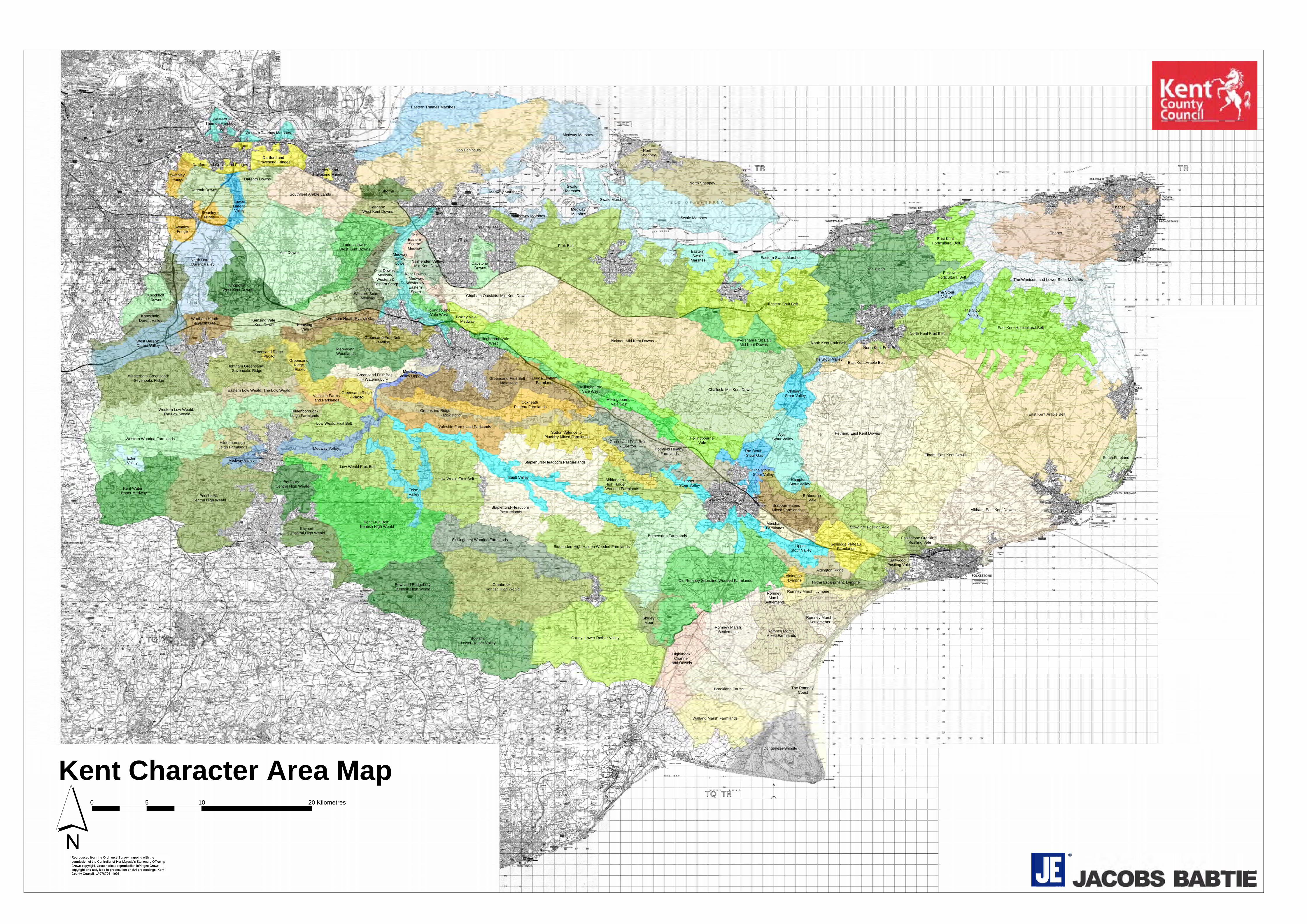
Kent Character Area Map 0 10 205 Kilometres
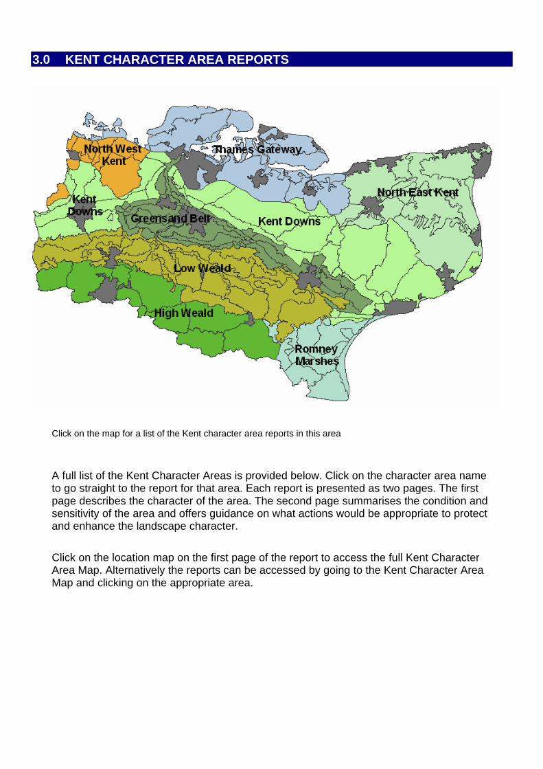
3.0 KENT CHARACTER AREA REPORTS
Click on the map for a list of the Kent character area reports in this area
A full list of the Kent Character Areas is provided below. Click on the character area name to go straight to the report for that area. Each report is presented as two pages. The first page describes the character of the area. The second page summarises the condition and sensitivity of the area and offers guidance on what actions would be appropriate to protect and enhance the landscape character. Click on the location map on the first page of the report to access the full Kent Character Area Map. Alternatively the reports can be accessed by going to the Kent Character Area Map and clicking on the appropriate area.
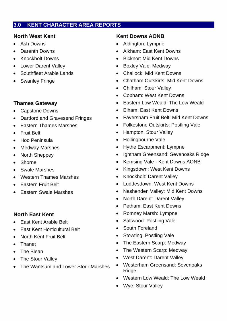
3.0 KENT CHARACTER AREA REPORTS
North West Kent • Ash Downs
• Darenth Downs
• Knockholt Downs
• Lower Darent Valley
• Southfleet Arable Lands
• Swanley Fringe Thames Gateway • Capstone Downs
• Dartford and Gravesend Fringes
• Eastern Thames Marshes
• Fruit Belt
• Hoo Peninsula
• Medway Marshes
• North Sheppey
• Shorne
• Swale Marshes
• Western Thames Marshes
• Eastern Fruit Belt
• Eastern Swale Marshes North East Kent • East Kent Arable Belt
• East Kent Horticultural Belt
• North Kent Fruit Belt
• Thanet
• The Blean
• The Stour Valley
• The Wantsum and Lower Stour Marshes
Kent Downs AONB • Aldington: Lympne
• Alkham: East Kent Downs
• Bicknor: Mid Kent Downs
• Boxley Vale: Medway
• Challock: Mid Kent Downs
• Chatham Outskirts: Mid Kent Downs
• Chilham: Stour Valley
• Cobham: West Kent Downs
• Eastern Low Weald: The Low Weald
• Elham: East Kent Downs
• Faversham Fruit Belt: Mid Kent Downs
• Folkestone Outskirts: Postling Vale
• Hampton: Stour Valley
• Hollingbourne Vale
• Hythe Escarpment: Lympne
• Ightham Greensand: Sevenoaks Ridge
• Kemsing Vale - Kent Downs AONB
• Kingsdown: West Kent Downs
• Knockholt: Darent Valley
• Luddesdown: West Kent Downs
• Nashenden Valley: Mid Kent Downs
• North Darent: Darent Valley
• Petham: East Kent Downs
• Romney Marsh: Lympne
• Saltwood: Postling Vale
• South Foreland
• Stowting: Postling Vale
• The Eastern Scarp: Medway
• The Western Scarp: Medway
• West Darent: Darent Valley
• Westerham Greensand: Sevenoaks Ridge
• Western Low Weald: The Low Weald
• Wye: Stour Valley
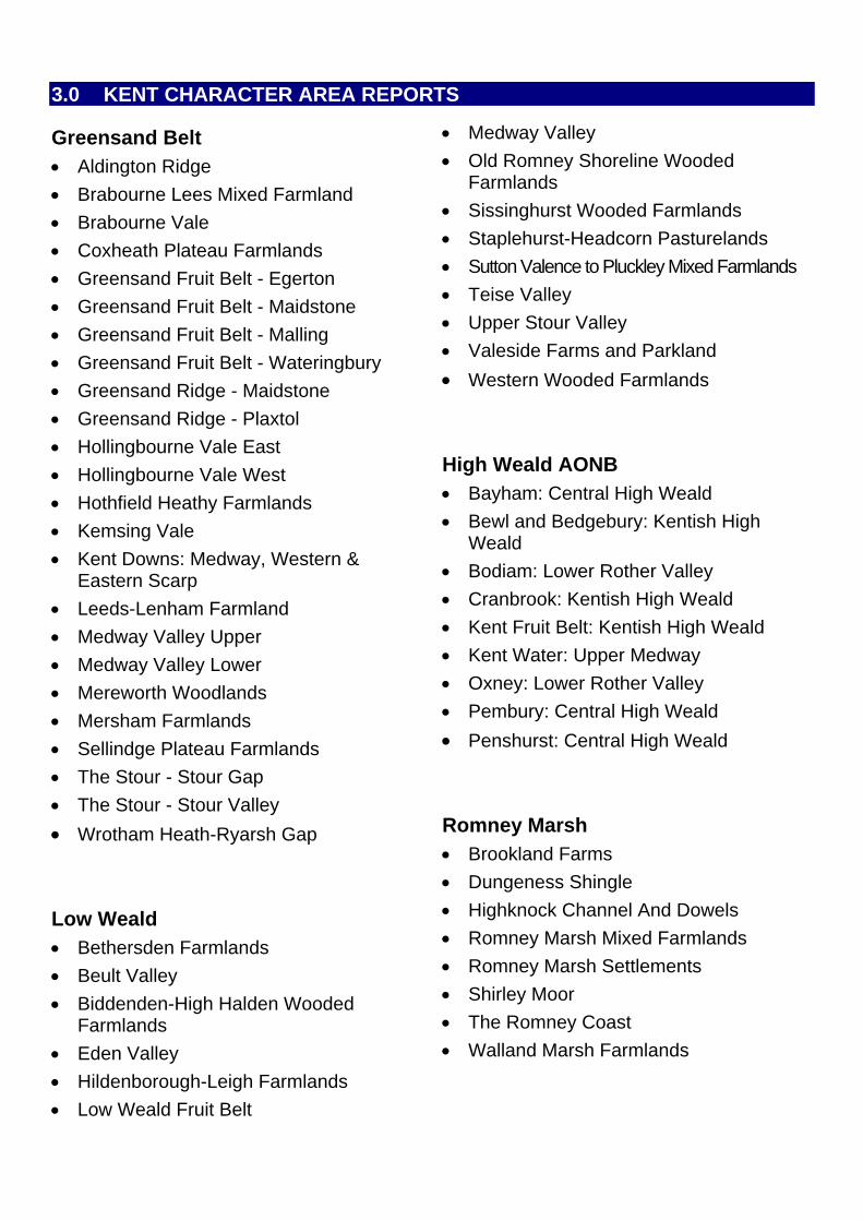
3.0 KENT CHARACTER AREA REPORTS
Greensand Belt • Aldington Ridge
• Brabourne Lees Mixed Farmland
• Brabourne Vale
• Coxheath Plateau Farmlands • Staplehurst-Headcorn Pasturelands
• Greensand Fruit Belt - Egerton • Sutton Valence to Pluckley Mixed Farmlands
• Greensand Fruit Belt - Maidstone
• Greensand Fruit Belt - Malling
• Greensand Fruit Belt - Wateringbury
• Greensand Ridge - Maidstone • Western Wooded Farmlands
• Greensand Ridge - Plaxtol
• Hollingbourne Vale East
• Hollingbourne Vale West
• Hothfield Heathy Farmlands
• Kemsing Vale
• Kent Downs: Medway, Western & Eastern Scarp
• Leeds-Lenham Farmland
• Medway Valley Upper
• Medway Valley Lower
• Mereworth Woodlands
• Mersham Farmlands
• Sellindge Plateau Farmlands • Penshurst: Central High Weald
• The Stour - Stour Gap
• The Stour - Stour Valley
• Wrotham Heath-Ryarsh Gap Low Weald • Bethersden Farmlands
• Beult Valley
• Biddenden-High Halden Wooded Farmlands
• Eden Valley
• Hildenborough-Leigh Farmlands
• Low Weald Fruit Belt
• Medway Valley
• Old Romney Shoreline Wooded Farmlands
• Sissinghurst Wooded Farmlands
• Teise Valley
• Upper Stour Valley
• Valeside Farms and Parkland
High Weald AONB • Bayham: Central High Weald
• Bewl and Bedgebury: Kentish High Weald
• Bodiam: Lower Rother Valley
• Cranbrook: Kentish High Weald
• Kent Fruit Belt: Kentish High Weald
• Kent Water: Upper Medway
• Oxney: Lower Rother Valley
• Pembury: Central High Weald
Romney Marsh • Brookland Farms
• Dungeness Shingle
• Highknock Channel And Dowels
• Romney Marsh Mixed Farmlands
• Romney Marsh Settlements
• Shirley Moor
• The Romney Coast
• Walland Marsh Farmlands
ALDINGTON RIDGE
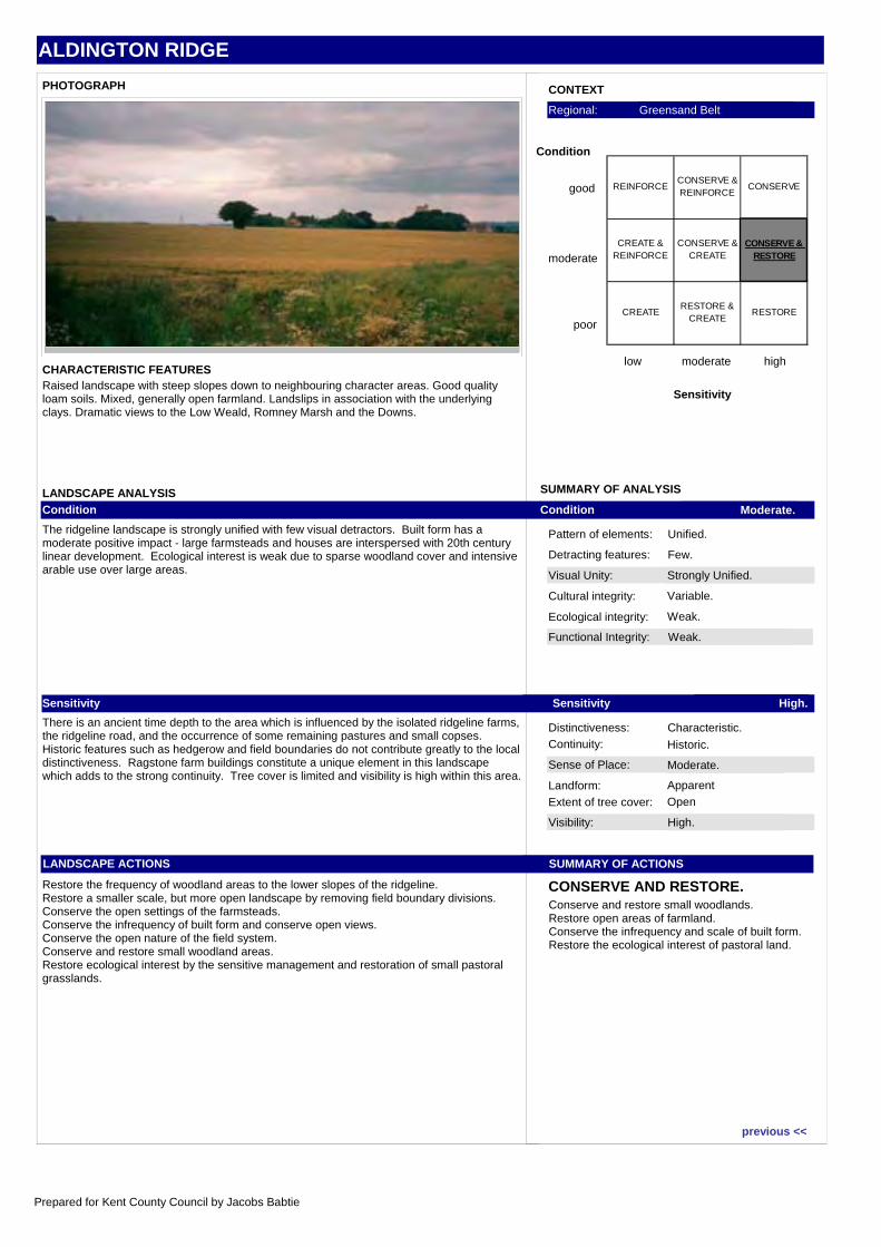
CHARACTER AREA DESCRIPTIONHigh up on the Hythe Beds the Aldington Ridge stands out above the plain of the Low Weald. The good quality loam soils are generally well-drained and support a mixed land use ranging from large arable fields east of Aldington to the pastures north of the B2067 from Court-at-Street to Upper Otterpool. Along the edge of the ridge south-west of Aldington are distinctive irregular pastures developed on former landslips, that are characteristic of this junction between the Hythe Beds and the Atherfield Clay below.
Although essentially a rural landscape the settlements at Lympne and that north of Port Lympne introduce discordant elements in the landscape, their siting appearing unrelated to topography or other natural features. These developments grew up in association with the wartime airfield, however, sited to take advantage of the elevated position of this hinterland to the historic Old Romney Shoreline. This airfield is now closed, which also explains why the land locally appears disturbed where much of the fabric has been demolished. The village of Aldington too has spread haphazardly down its Roman road giving little sense of structure. It retains dramatic views over the Low Weald, however.
Court-at-Street is an attractive village, however, on the edge of the North Downs AONB. To the south there are fantastic views glimpsed through the often wooded AONB to Romney Marsh below.
Along the B2067 in the vicinity of this village are bushy hazel hedges but locally these have been lost giving a gappy appearance. North of the B2067 the land falls away more gradually to the Sellindge plateau with the North Downs framing the views beyond.
Location map:
next >>
Prepared for Kent County Council by Jacobs Babtie
ALDINGTON RIDGE
Visual Unity: Strongly Unified.
Functional Integrity: Weak.
Sense of Place: Moderate.
Visibility: High.
Condition Moderate.
Sensitivity High.
SUMMARY OF ACTIONS
CONSERVE AND RESTORE.
Pattern of elements: Unified.
Detracting features: Few.
Cultural integrity: Variable.
Ecological integrity: Weak.
Distinctiveness: Characteristic.Continuity: Historic.
Landform: Apparent
Extent of tree cover: Open
SUMMARY OF ANALYSIS
CONTEXT
low moderate high
Sensitivity
good
moderate
poor
Condition
Regional: Greensand Belt
PHOTOGRAPH
CHARACTERISTIC FEATURES
LANDSCAPE ANALYSISCondition
The ridgeline landscape is strongly unified with few visual detractors. Built form has a moderate positive impact - large farmsteads and houses are interspersed with 20th century linear development. Ecological interest is weak due to sparse woodland cover and intensive arable use over large areas.
Sensitivity
There is an ancient time depth to the area which is influenced by the isolated ridgeline farms, the ridgeline road, and the occurrence of some remaining pastures and small copses. Historic features such as hedgerow and field boundaries do not contribute greatly to the local distinctiveness. Ragstone farm buildings constitute a unique element in this landscape which adds to the strong continuity. Tree cover is limited and visibility is high within this area.
LANDSCAPE ACTIONS
Restore the frequency of woodland areas to the lower slopes of the ridgeline.Restore a smaller scale, but more open landscape by removing field boundary divisions. Conserve the open settings of the farmsteads.Conserve the infrequency of built form and conserve open views.Conserve the open nature of the field system.Conserve and restore small woodland areas.Restore ecological interest by the sensitive management and restoration of small pastoral grasslands.
Raised landscape with steep slopes down to neighbouring character areas. Good quality loam soils. Mixed, generally open farmland. Landslips in association with the underlying clays. Dramatic views to the Low Weald, Romney Marsh and the Downs.
Conserve and restore small woodlands.Restore open areas of farmland.Conserve the infrequency and scale of built form.Restore the ecological interest of pastoral land.
REINFORCECONSERVE & REINFORCE
CONSERVE
CREATE & REINFORCE
CONSERVE & CREATE
CONSERVE & RESTORE
CREATE RESTORE &
CREATERESTORE
previous <<
Prepared for Kent County Council by Jacobs Babtie
ALDINGTON: LYMPNE
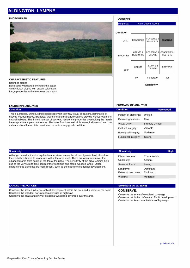
CHARACTER AREA DESCRIPTIONALDINGTONIn the extreme west of this area, the underlying sandstones gradually give way to the heavy Weald Clay, resulting in softer, more rounded slopes. This change is also reflected in the high proportion of deciduous, ancient woodland, most of which was formerly coppiced, which dominates the scarp at Aldington. The gentle topography of the lower slopes, however, allows some arable cultivation and as a result the wild, bleak appearance of the eastern sections is lost. The loss is reinforced by the elements of suburbanisation associated with the substantial properties which are scattered across the area, overlooking the magnificent views.
LYMPNEAldington lies within the larger character area of Lympne.
The most southerly part of the AONB extends from Hythe west to Aldington. The character area includes part of the Hythe escarpment, which overlooks Romney Marsh. Until the early Middle Ages, this scarp formed the edge of a large, marshy lagoon. Gradually, however, the lagoon was reclaimed, through a combination of the natural accumulation of silt and shingle, the construction of sea defences and sustained drainage. The resulting land now forms one of the most fertile areas of Kent, with a particularly long growing season.
Most of the Hythe escarpment is the eroded face of the greensands and in particular of the calcareous Kentish ragstone. Over the centuries the surface has gradually slipped to form a steep, uneven slope, enclosing the northern edge of the marsh. The vulnerability of the coast to attack has left a legacy of old military defences scattered across the area, from the tumbled walls of the Roman fort of Lemanis, to the 19th century Royal Military Canal at the foot of the escarpment and the last of the Second World War 'Sound Mirrors' behind Burmarsh, 'listening' for approaching aircraft.
The scarp is highly visible from the flat marsh, forming a long hillside of rough grassland, dotted with scrub. Several large deciduous woodlands break up the sweep of the landform, being more characteristic in the west around Aldington. Between these woodlands there are spectacular views across Romney Marsh and the English Channel.
Location map:
next >>
Prepared for Kent County Council by Jacobs Babtie
ALDINGTON: LYMPNE
Visual Unity: Strongly Unified.
Functional Integrity: Strong.
Sense of Place: Strong.
Visibility: Moderate.
Condition Very Good.
Sensitivity High.
SUMMARY OF ACTIONS
CONSERVE.
Pattern of elements: Unified.
Detracting features: Few.
Cultural integrity: Variable.
Ecological integrity: Moderate.
Distinctiveness: Characteristic.Continuity: Ancient.
Landform: Dominant.
Extent of tree cover: Enclosed.
SUMMARY OF ANALYSIS
CONTEXT
low moderate high
Sensitivity
good
moderate
poor
Condition
Regional: Kent Downs AONB
PHOTOGRAPH
CHARACTERISTIC FEATURES
LANDSCAPE ANALYSISCondition
This is a strongly unified, simple landscape with very few visual detractors, dominated by heavily-wooded ridges. Broadleaf woodland and managed coppice provide widespread semi-natural habitats. The limited number of secreted residential properties overlooking the marsh have a positive impact on the area. This area functions well - it is ecologically robust and has a clear cultural focus. It is considered to be in a very good condition.
Sensitivity
Although on a dominant scarp landscape, views are well enclosed by woodland, therefore the visibility is limited to 'moderate' within the area itself. There are open views over the adjacent marsh from points at the top of the ridge. The sensitivity of the area remains high due to the very strong time depth of the woodland and steep, wooded lanes. Other characteristic elements are more recent, such as the ridgeline residential development.
LANDSCAPE ACTIONS
Conserve the limited influence of built development within the area and in views of the scarpConserve the wooded, narrow characteristics of highwaysConserve the scale and unity of broadleaf woodland coverage over the area
Rounded slopesDeciduous woodland dominates the scarp.Gentle lower slopes with arable cultivation.Large properties with views over the marsh
Conserve the scale of woodland coverageConserve the limited influence of built developmentConserve the key characteristics of highways
REINFORCECONSERVE & REINFORCE
CONSERVE
CREATE & REINFORCE
CONSERVE & CREATE
CONSERVE & RESTORE
CREATE RESTORE &
CREATERESTORE
previous <<
Prepared for Kent County Council by Jacobs Babtie
ALKHAM: EAST KENT DOWNS
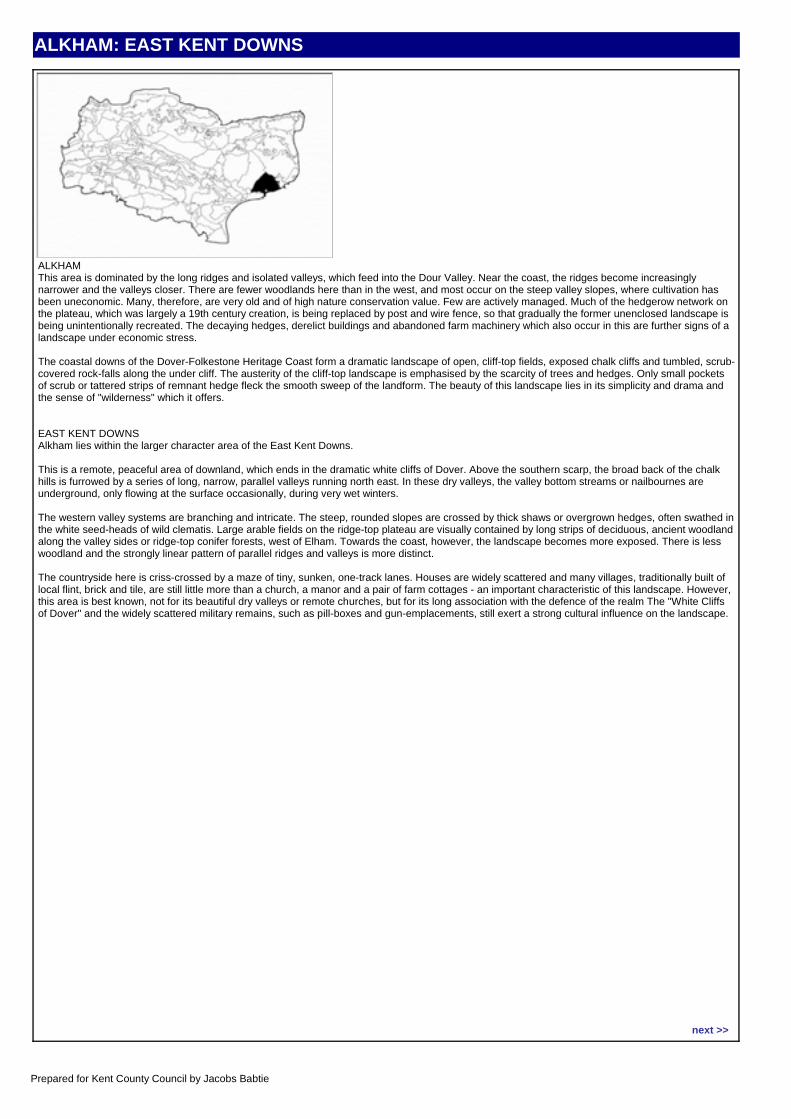
CHARACTER AREA DESCRIPTIONALKHAMThis area is dominated by the long ridges and isolated valleys, which feed into the Dour Valley. Near the coast, the ridges become increasingly narrower and the valleys closer. There are fewer woodlands here than in the west, and most occur on the steep valley slopes, where cultivation has been uneconomic. Many, therefore, are very old and of high nature conservation value. Few are actively managed. Much of the hedgerow network on the plateau, which was largely a 19th century creation, is being replaced by post and wire fence, so that gradually the former unenclosed landscape is being unintentionally recreated. The decaying hedges, derelict buildings and abandoned farm machinery which also occur in this are further signs of a landscape under economic stress.
The coastal downs of the Dover-Folkestone Heritage Coast form a dramatic landscape of open, cliff-top fields, exposed chalk cliffs and tumbled, scrub-covered rock-falls along the under cliff. The austerity of the cliff-top landscape is emphasised by the scarcity of trees and hedges. Only small pockets of scrub or tattered strips of remnant hedge fleck the smooth sweep of the landform. The beauty of this landscape lies in its simplicity and drama and the sense of "wilderness" which it offers.
EAST KENT DOWNSAlkham lies within the larger character area of the East Kent Downs.
This is a remote, peaceful area of downland, which ends in the dramatic white cliffs of Dover. Above the southern scarp, the broad back of the chalk hills is furrowed by a series of long, narrow, parallel valleys running north east. In these dry valleys, the valley bottom streams or nailbournes are underground, only flowing at the surface occasionally, during very wet winters.
The western valley systems are branching and intricate. The steep, rounded slopes are crossed by thick shaws or overgrown hedges, often swathed in the white seed-heads of wild clematis. Large arable fields on the ridge-top plateau are visually contained by long strips of deciduous, ancient woodland along the valley sides or ridge-top conifer forests, west of Elham. Towards the coast, however, the landscape becomes more exposed. There is less woodland and the strongly linear pattern of parallel ridges and valleys is more distinct.
The countryside here is criss-crossed by a maze of tiny, sunken, one-track lanes. Houses are widely scattered and many villages, traditionally built of local flint, brick and tile, are still little more than a church, a manor and a pair of farm cottages - an important characteristic of this landscape. However, this area is best known, not for its beautiful dry valleys or remote churches, but for its long association with the defence of the realm The "White Cliffs of Dover" and the widely scattered military remains, such as pill-boxes and gun-emplacements, still exert a strong cultural influence on the landscape.
Location map:
next >>
Prepared for Kent County Council by Jacobs Babtie
ALKHAM: EAST KENT DOWNS
Visual Unity: Coherent.
Functional Integrity: Coherent.
Sense of Place: Moderate.
Visibility: Moderate.
Condition Moderate.
Sensitivity Moderate.
SUMMARY OF ACTIONS
CONSERVE AND CREATE.
Pattern of elements: Coherent.
Detracting features: Some.
Cultural integrity: Variable.
Ecological integrity: Moderate.
Distinctiveness: Characteristic.Continuity: Historic.
Landform: Apparent.
Extent of tree cover: Intermittent.
SUMMARY OF ANALYSIS
CONTEXT
low moderate high
Sensitivity
good
moderate
poor
Condition
Regional: Kent Downs AONB
PHOTOGRAPH
CHARACTERISTIC FEATURES
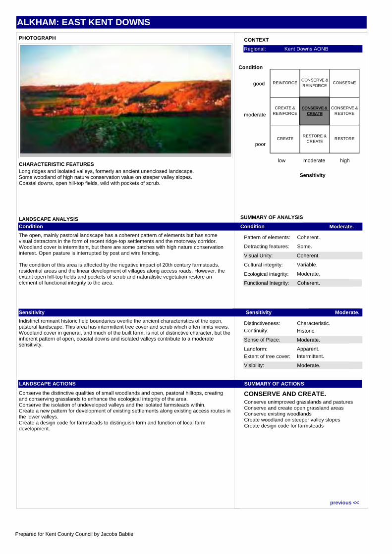
LANDSCAPE ANALYSISCondition
The open, mainly pastoral landscape has a coherent pattern of elements but has some visual detractors in the form of recent ridge-top settlements and the motorway corridor. Woodland cover is intermittent, but there are some patches with high nature conservation interest. Open pasture is interrupted by post and wire fencing.
The condition of this area is affected by the negative impact of 20th century farmsteads, residential areas and the linear development of villages along access roads. However, the extant open hill-top fields and pockets of scrub and naturalistic vegetation restore an element of functional integrity to the area.
Sensitivity
Indistinct remnant historic field boundaries overlie the ancient characteristics of the open, pastoral landscape. This area has intermittent tree cover and scrub which often limits views. Woodland cover in general, and much of the built form, is not of distinctive character, but the inherent pattern of open, coastal downs and isolated valleys contribute to a moderate sensitivity.
LANDSCAPE ACTIONS
Conserve the distinctive qualities of small woodlands and open, pastoral hilltops, creating and conserving grasslands to enhance the ecological integrity of the area.Conserve the isolation of undeveloped valleys and the isolated farmsteads within.Create a new pattern for development of existing settlements along existing access routes in the lower valleys.Create a design code for farmsteads to distinguish form and function of local farm development.
Long ridges and isolated valleys, formerly an ancient unenclosed landscape.Some woodland of high nature conservation value on steeper valley slopes.Coastal downs, open hill-top fields, wild with pockets of scrub.
Conserve unimproved grasslands and pasturesConserve and create open grassland areasConserve existing woodlandsCreate woodland on steeper valley slopesCreate design code for farmsteads
REINFORCECONSERVE & REINFORCE
CONSERVE
CREATE & REINFORCE
CONSERVE & CREATE
CONSERVE & RESTORE
CREATE RESTORE &
CREATERESTORE
previous <<
Prepared for Kent County Council by Jacobs Babtie
ASH DOWNS
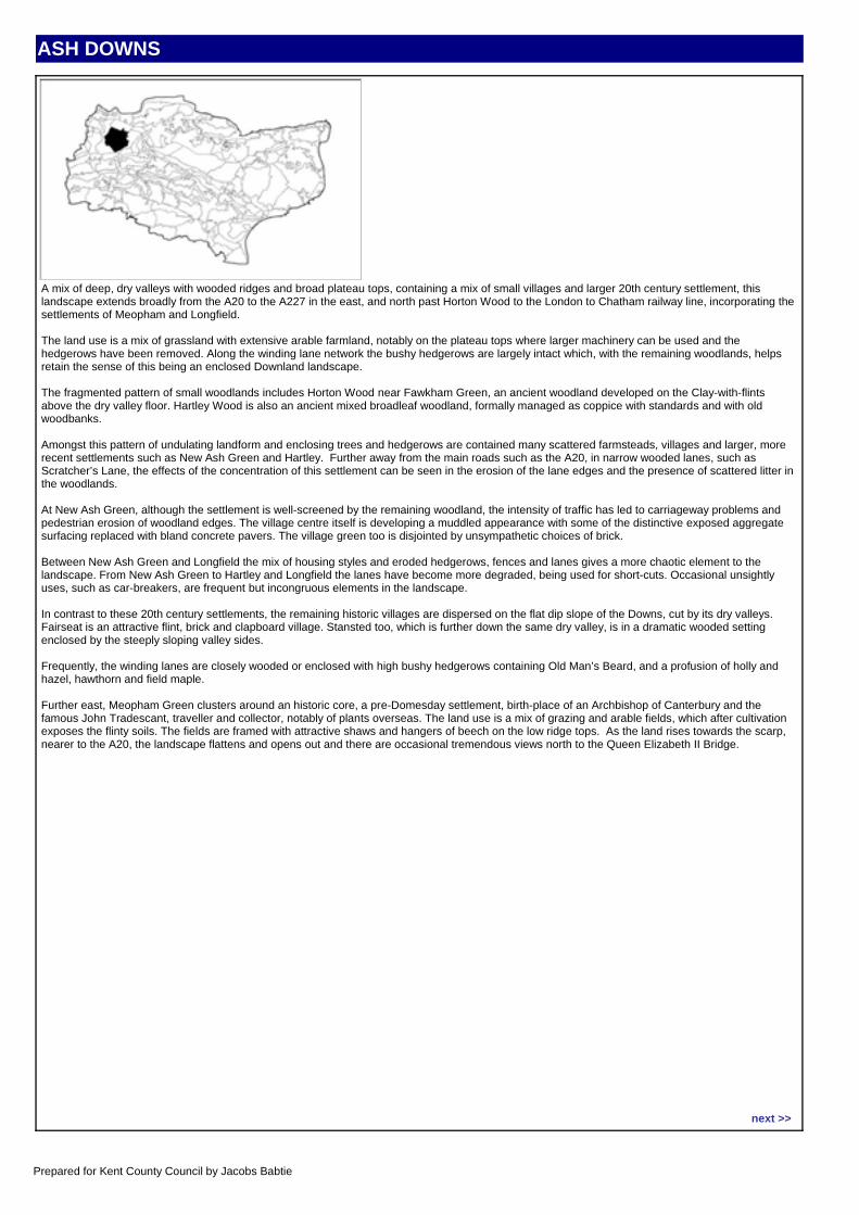
CHARACTER AREA DESCRIPTIONA mix of deep, dry valleys with wooded ridges and broad plateau tops, containing a mix of small villages and larger 20th century settlement, this landscape extends broadly from the A20 to the A227 in the east, and north past Horton Wood to the London to Chatham railway line, incorporating the settlements of Meopham and Longfield.
The land use is a mix of grassland with extensive arable farmland, notably on the plateau tops where larger machinery can be used and the hedgerows have been removed. Along the winding lane network the bushy hedgerows are largely intact which, with the remaining woodlands, helps retain the sense of this being an enclosed Downland landscape.
The fragmented pattern of small woodlands includes Horton Wood near Fawkham Green, an ancient woodland developed on the Clay-with-flints above the dry valley floor. Hartley Wood is also an ancient mixed broadleaf woodland, formally managed as coppice with standards and with old woodbanks.
Amongst this pattern of undulating landform and enclosing trees and hedgerows are contained many scattered farmsteads, villages and larger, more recent settlements such as New Ash Green and Hartley. Further away from the main roads such as the A20, in narrow wooded lanes, such as Scratcher’s Lane, the effects of the concentration of this settlement can be seen in the erosion of the lane edges and the presence of scattered litter in the woodlands.
At New Ash Green, although the settlement is well-screened by the remaining woodland, the intensity of traffic has led to carriageway problems and pedestrian erosion of woodland edges. The village centre itself is developing a muddled appearance with some of the distinctive exposed aggregate surfacing replaced with bland concrete pavers. The village green too is disjointed by unsympathetic choices of brick.
Between New Ash Green and Longfield the mix of housing styles and eroded hedgerows, fences and lanes gives a more chaotic element to the landscape. From New Ash Green to Hartley and Longfield the lanes have become more degraded, being used for short-cuts. Occasional unsightly uses, such as car-breakers, are frequent but incongruous elements in the landscape.
In contrast to these 20th century settlements, the remaining historic villages are dispersed on the flat dip slope of the Downs, cut by its dry valleys. Fairseat is an attractive flint, brick and clapboard village. Stansted too, which is further down the same dry valley, is in a dramatic wooded setting enclosed by the steeply sloping valley sides.
Frequently, the winding lanes are closely wooded or enclosed with high bushy hedgerows containing Old Man’s Beard, and a profusion of holly and hazel, hawthorn and field maple.
Further east, Meopham Green clusters around an historic core, a pre-Domesday settlement, birth-place of an Archbishop of Canterbury and the famous John Tradescant, traveller and collector, notably of plants overseas. The land use is a mix of grazing and arable fields, which after cultivation exposes the flinty soils. The fields are framed with attractive shaws and hangers of beech on the low ridge tops. As the land rises towards the scarp, nearer to the A20, the landscape flattens and opens out and there are occasional tremendous views north to the Queen Elizabeth II Bridge.
Location map:
next >>
Prepared for Kent County Council by Jacobs Babtie
ASH DOWNS
Visual Unity: Coherent.
Functional Integrity: Strong.
Sense of Place: Strong.
Visibility: Moderate.
Condition Good.
Sensitivity High.
SUMMARY OF ACTIONS
CONSERVE.
Pattern of elements: Coherent.
Detracting features: Some.
Cultural integrity: Good.
Ecological integrity: Moderate.
Distinctiveness: Characteristic.Continuity: Ancient.
Landform: Apparent.
Extent of tree cover: Intermittent.
SUMMARY OF ANALYSIS
CONTEXT
low moderate high
Sensitivity
good
moderate
poor
Condition
Regional: North West Kent
PHOTOGRAPH
CHARACTERISTIC FEATURES
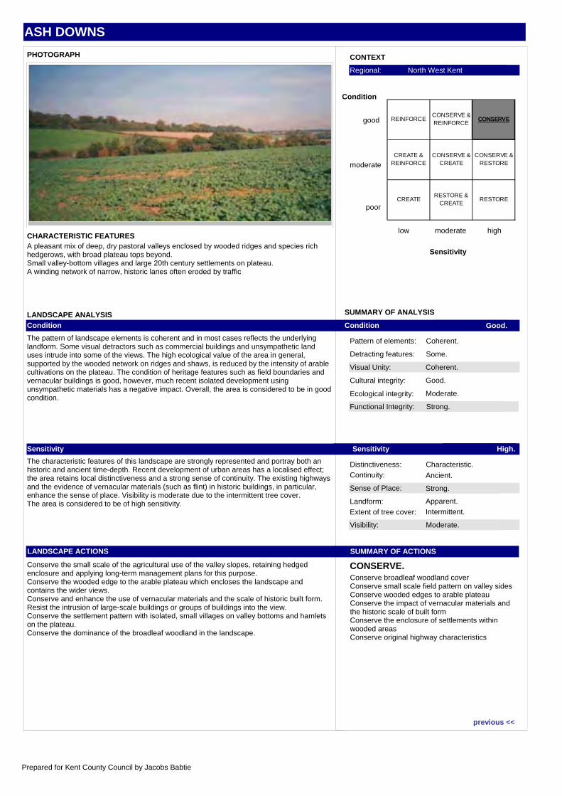
LANDSCAPE ANALYSISCondition
The pattern of landscape elements is coherent and in most cases reflects the underlying landform. Some visual detractors such as commercial buildings and unsympathetic land uses intrude into some of the views. The high ecological value of the area in general, supported by the wooded network on ridges and shaws, is reduced by the intensity of arable cultivations on the plateau. The condition of heritage features such as field boundaries and vernacular buildings is good, however, much recent isolated development using unsympathetic materials has a negative impact. Overall, the area is considered to be in good condition.
Sensitivity
The characteristic features of this landscape are strongly represented and portray both an historic and ancient time-depth. Recent development of urban areas has a localised effect; the area retains local distinctiveness and a strong sense of continuity. The existing highways and the evidence of vernacular materials (such as flint) in historic buildings, in particular, enhance the sense of place. Visibility is moderate due to the intermittent tree cover.The area is considered to be of high sensitivity.
LANDSCAPE ACTIONS
Conserve the small scale of the agricultural use of the valley slopes, retaining hedged enclosure and applying long-term management plans for this purpose. Conserve the wooded edge to the arable plateau which encloses the landscape and contains the wider views. Conserve and enhance the use of vernacular materials and the scale of historic built form. Resist the intrusion of large-scale buildings or groups of buildings into the view. Conserve the settlement pattern with isolated, small villages on valley bottoms and hamlets on the plateau.Conserve the dominance of the broadleaf woodland in the landscape.
A pleasant mix of deep, dry pastoral valleys enclosed by wooded ridges and species rich hedgerows, with broad plateau tops beyond.Small valley-bottom villages and large 20th century settlements on plateau.A winding network of narrow, historic lanes often eroded by traffic
Conserve broadleaf woodland coverConserve small scale field pattern on valley sidesConserve wooded edges to arable plateauConserve the impact of vernacular materials and the historic scale of built formConserve the enclosure of settlements within wooded areasConserve original highway characteristics
REINFORCECONSERVE & REINFORCE
CONSERVE
CREATE & REINFORCE
CONSERVE & CREATE
CONSERVE & RESTORE
CREATE RESTORE &
CREATERESTORE
previous <<
Prepared for Kent County Council by Jacobs Babtie
BAYHAM: CENTRAL HIGH WEALD
CHARACTER AREA DESCRIPTIONBAYHAMThe traditional pattern of Wealden land use is still to be found in this area. On the shallower slopes, sheep graze the pastures, whilst the steeper hill-sides are clothed by large areas of deciduous woodland. In these woods, when the winter trees are bare, the whine of chainsaws and the acrid smell of wood smoke give away the presence of small gangs of coppice-workers cutting out the young poles to be used for fencing or firewood. The short cycle of cutting and regrowth, taking place in the sweet chestnut stands perhaps every 15 - 20 years, changes the appearance of this area from year to year, so that the open glade of one spring becomes the dense thicket of the next. Constant throughout the seasons, however, are the tall oaks and Scots Pines, which remain unharvested between the coppice-stools. Below the woodlands, in the Teise valley, lies Bayham Park, originally designed by Humphrey Repton. Within this landscape, the ruined walls of Bayham Abbey rear up from the flat valley bottom like an ancient skeleton washed clean by the nearby river.
Most of the farms here have oast-houses, a reminder of the wide-spread hop-gardens in the 19th century, none of which now remain. Today, ease of access to Tunbridge Wells has seen most of these farms and oast-houses climb the social ladder under the influence of non-agricultural wealth and the release from the necessity of farming.
Throughout this area, tiny roads squeeze between small fields and thick hedges, and secretive green lanes entice the passer-by onto a maze of sunken footpaths and almost forgotten tracks.
CENTRAL HIGH WEALDBayham lies within the larger character area of the Central High Weald.
The Central High Weald surrounds Tunbridge Wells, which exerts a strong influence on the neighbouring countryside. It extends south to Crowborough, west to Chiddingstone and east to Pembury and Bayham.
This is the landscape of the great estates, such as Penshurst Place, where dignified expanses of parkland impart a genteel appearance to the countryside. Much of this landscape can be seen from the Mark Cross to Tunbridge Wells ridge, from where the overall impression is of large commercial woodlands and unintensive pastures, interspersed with sweeps of parkland and occasional orchards. Along the northern reaches of the Medway valley beyond Penshurst, the woodlands are replaced by wide arable fields, whilst the steep valleys around Speldhurst and Bidborough are a patchwork of tiny meadows and strips of ghyll woodland.
Despite the peaceful, timeless quality of this landscape, this was an industrial district in the later Middle Ages, with major iron-workings at Eridge Park and Bayham and, in the 19th century, paper mills at Chafford. Many of the houses, especially those belonging to the large estates, are built of local sandstone, whilst the farms which nestle into the valley slopes off the ridge are frequently of warm red brick and tile, sometimes partially timber-framed. Many of these farmsteads are actually a group of several buildings, including barns and cottages, where several farm workers' families would have lived. In the18th and 19th centuries, when hops became widely used in beer, almost every farm in this area had a hop garden. Nowadays they have almost all gone, but the red-tiled, white-cowled oast-houses still haunt the farmyards and in springtime, wavering, green arms of naturalised hops still reach up from the hedges, as if searching for the long-lost hop-poles.
Tunbridge Wells, founded in 1606 around one of the local iron-rich springs, has gradually influenced the character of this part of the High Weald. As wealth and employment have been created, so the pressure on this landscape has increased. Developers are eager to build on the surrounding fields, commuters use the tiny lanes to avoid the busy main roads and the local population find recreation and escape amongst the gentle slopes of this area.
Tunbridge Wells lies on a ridge. Around the edges of this ridge, especially at Speldhurst and Bayham, steep ghylls descend into the more open, rolling valleys of the River Medway and River Teise. In the north beyond Penshurst, the landscape flattens out towards the valley of the River Eden.
Location map:
next >>
Prepared for Kent County Council by Jacobs Babtie
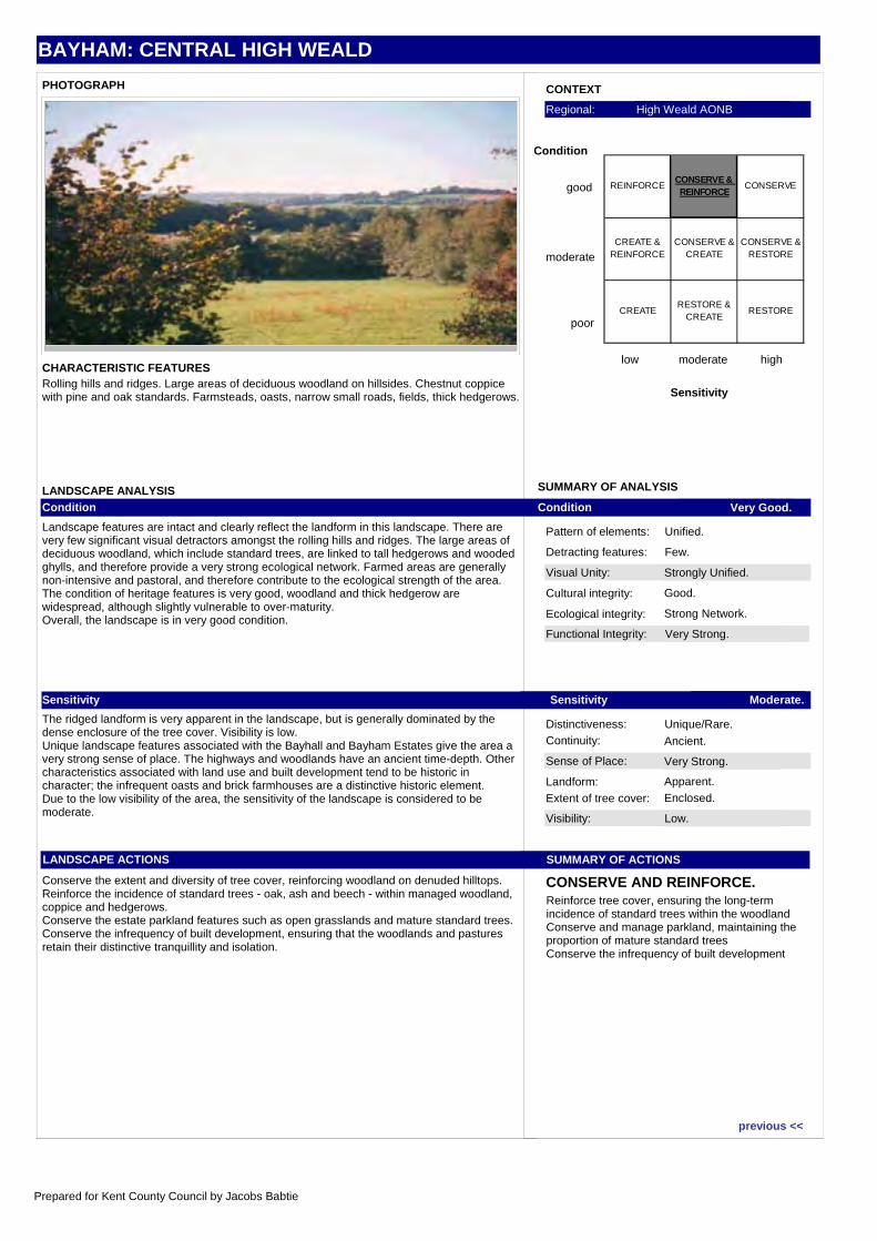
BAYHAM: CENTRAL HIGH WEALD
Visual Unity: Strongly Unified.
Functional Integrity: Very Strong.
Sense of Place: Very Strong.
Visibility: Low.
Condition Very Good.
Sensitivity Moderate.
SUMMARY OF ACTIONS
CONSERVE AND REINFORCE.
Pattern of elements: Unified.
Detracting features: Few.
Cultural integrity: Good.
Ecological integrity: Strong Network.
Distinctiveness: Unique/Rare.Continuity: Ancient.
Landform: Apparent.
Extent of tree cover: Enclosed.
SUMMARY OF ANALYSIS
CONTEXT
low moderate high
Sensitivity
good
moderate
poor
Condition
Regional: High Weald AONB
PHOTOGRAPH
CHARACTERISTIC FEATURES
LANDSCAPE ANALYSISCondition
Landscape features are intact and clearly reflect the landform in this landscape. There are very few significant visual detractors amongst the rolling hills and ridges. The large areas of deciduous woodland, which include standard trees, are linked to tall hedgerows and wooded ghylls, and therefore provide a very strong ecological network. Farmed areas are generally non-intensive and pastoral, and therefore contribute to the ecological strength of the area. The condition of heritage features is very good, woodland and thick hedgerow are widespread, although slightly vulnerable to over-maturity.Overall, the landscape is in very good condition.
Sensitivity
The ridged landform is very apparent in the landscape, but is generally dominated by the dense enclosure of the tree cover. Visibility is low.Unique landscape features associated with the Bayhall and Bayham Estates give the area a very strong sense of place. The highways and woodlands have an ancient time-depth. Other characteristics associated with land use and built development tend to be historic in character; the infrequent oasts and brick farmhouses are a distinctive historic element.Due to the low visibility of the area, the sensitivity of the landscape is considered to be moderate.
LANDSCAPE ACTIONS
Conserve the extent and diversity of tree cover, reinforcing woodland on denuded hilltops. Reinforce the incidence of standard trees - oak, ash and beech - within managed woodland, coppice and hedgerows.Conserve the estate parkland features such as open grasslands and mature standard trees. Conserve the infrequency of built development, ensuring that the woodlands and pastures retain their distinctive tranquillity and isolation.
Rolling hills and ridges. Large areas of deciduous woodland on hillsides. Chestnut coppice with pine and oak standards. Farmsteads, oasts, narrow small roads, fields, thick hedgerows.
Reinforce tree cover, ensuring the long-term incidence of standard trees within the woodlandConserve and manage parkland, maintaining the proportion of mature standard treesConserve the infrequency of built development
REINFORCECONSERVE & REINFORCE
CONSERVE
CREATE & REINFORCE
CONSERVE & CREATE
CONSERVE & RESTORE
CREATE RESTORE &
CREATERESTORE
previous <<
Prepared for Kent County Council by Jacobs Babtie
BETHERSDEN FARMLANDS
CHARACTER AREA DESCRIPTIONThis is a varied landscape extending from the rise at Bethersden, through flat farmland to Great Chart and east to Kingsnorth, extending south through more varied landform to Woodchurch on the edge of Shirley Moor. The grey, shelly Paludrina Limestone, that forms the resistant strata of the Bethersden rise, has been used in the past for church building, notably the tower of Bethersden church itself.
Ancient settlement in this landscape is evidenced by the line of the Roman road to Tenterden that crosses near Shirkoak and the vernacular village centres of Bethersden and Kingsnorth. There is also dull 20th century development, however, in association with these villages, for example.
Although around Bethersden and Woodchurch, the typical Wealden pattern of small fields and bushy hedgerows remains, where the land is flatter, from Great Chart, around Stubb’s Cross and across to Kingsnorth, this has broken down with fields enlarged and hedgerows removed to allow mechanisation for arable farming. Where this has occurred a smooth, simple landscape has resulted, often with the garish hues and pungent odour of oilseed rape dominating in summer.
Enclosure is provided at the perimeter of the character area by the large blocks of woodland of the Old Romney Shoreline landscape that enclose these farmlands to the south.
Here there is a definite sense of being on a plateau and of height, and then suddenly the ground plunges away towards Woodchurch with long views to Great Heron Wood and the Isle of Oxney.
The farmlands along the B2067 form an enclosing, undulating backdrop to the flat, remote expanse of Shirley Moor ,the scene punctuated rarely by vernacular farmsteads or small settlements. Woodchurch itself, with its mix of brick and white weatherboard buildings and the conspicuous church of All Saints provides a historic landmark for many miles for what is, in part, a seemingly unpopulated character area.
Population pressure is focused on the flatter lands to the north where both agricultural intensification and expansion of Ashford, notably through proposals for Chilmington Green and Park Farm are changing the established rural landscape patterns to one that is both less varied and less tranquil.
Location map:
next >>
Prepared for Kent County Council by Jacobs Babtie
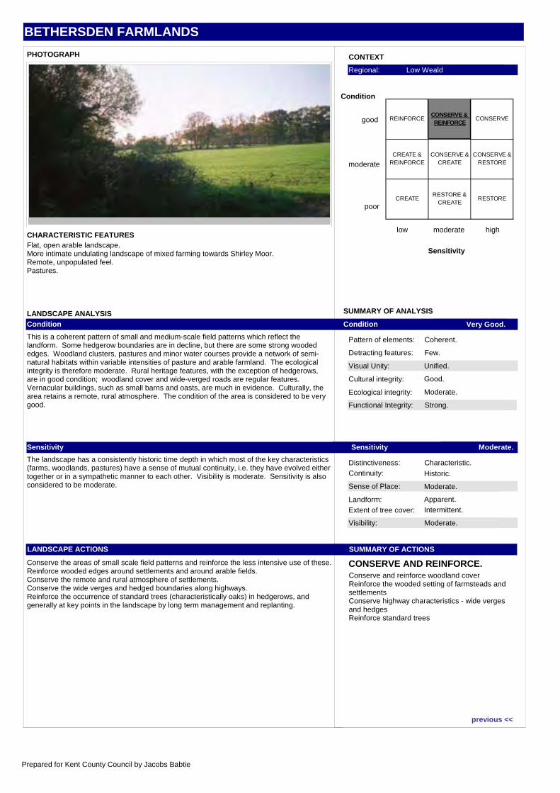
BETHERSDEN FARMLANDS
Visual Unity: Unified.
Functional Integrity: Strong.
Sense of Place: Moderate.
Visibility: Moderate.
Condition Very Good.
Sensitivity Moderate.
SUMMARY OF ACTIONS
CONSERVE AND REINFORCE.
Pattern of elements: Coherent.
Detracting features: Few.
Cultural integrity: Good.
Ecological integrity: Moderate.
Distinctiveness: Characteristic.Continuity: Historic.
Landform: Apparent.
Extent of tree cover: Intermittent.
SUMMARY OF ANALYSIS
CONTEXT
low moderate high
Sensitivity
good
moderate
poor
Condition
Regional: Low Weald
PHOTOGRAPH
CHARACTERISTIC FEATURES
LANDSCAPE ANALYSISCondition
This is a coherent pattern of small and medium-scale field patterns which reflect the landform. Some hedgerow boundaries are in decline, but there are some strong wooded edges. Woodland clusters, pastures and minor water courses provide a network of semi-natural habitats within variable intensities of pasture and arable farmland. The ecological integrity is therefore moderate. Rural heritage features, with the exception of hedgerows, are in good condition; woodland cover and wide-verged roads are regular features. Vernacular buildings, such as small barns and oasts, are much in evidence. Culturally, the area retains a remote, rural atmosphere. The condition of the area is considered to be very good.
Sensitivity
The landscape has a consistently historic time depth in which most of the key characteristics (farms, woodlands, pastures) have a sense of mutual continuity, i.e. they have evolved either together or in a sympathetic manner to each other. Visibility is moderate. Sensitivity is also considered to be moderate.
LANDSCAPE ACTIONS
Conserve the areas of small scale field patterns and reinforce the less intensive use of these.Reinforce wooded edges around settlements and around arable fields.Conserve the remote and rural atmosphere of settlements.Conserve the wide verges and hedged boundaries along highways.Reinforce the occurrence of standard trees (characteristically oaks) in hedgerows, and generally at key points in the landscape by long term management and replanting.
Flat, open arable landscape.More intimate undulating landscape of mixed farming towards Shirley Moor.Remote, unpopulated feel.Pastures.
Conserve and reinforce woodland coverReinforce the wooded setting of farmsteads and settlementsConserve highway characteristics - wide verges and hedgesReinforce standard trees
REINFORCECONSERVE & REINFORCE
CONSERVE
CREATE & REINFORCE
CONSERVE & CREATE
CONSERVE & RESTORE
CREATE RESTORE &
CREATERESTORE
previous <<
Prepared for Kent County Council by Jacobs Babtie
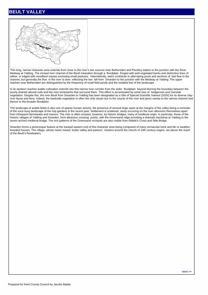
BEULT VALLEY
CHARACTER AREA DESCRIPTIONThis long, narrow character area extends from close to the river’s two sources near Bethersden and Pluckley station to the junction with the River Medway at Yalding. The incised river channel of the Beult meanders through a floodplain fringed with well-vegetated banks and distinctive lines of willow or edged with woodland copses enclosing small pastures. Intermittently, weirs contribute to alternating pools and sections of fast flow in the channel, but generally the flow in the river is slow reflecting the low fall from Smarden to the junction with the Medway at Yalding. The upper reaches near Bethersden are distinguished by the frequency of small field ponds and the isolated feel of the landscape.
In its western reaches arable cultivation extends into this narrow river corridor from the wider floodplain beyond blurring the boundary between the poorly drained alluvial soils and the river brickearths that surround them. This effect is accentuated by some loss of hedgerows and riverside vegetation. Despite this, the river Beult from Smarden to Yalding has been designated as a Site of Special Scientific Interest (SSSI) for its diverse clay-river fauna and flora. Indeed, the bankside vegetation is often the only visual clue to the course of the river and gives variety to the narrow channel and thence to the broader floodplain.
The landscape of arable fields is also one of sparse human activity, the presence of several large oasts at the margins of the valley being a reminder of the once busy landscape of the hop gardens in the recent past. Settlement is scattered, rarely occurring on the river alluviums themselves apart from infrequent farmsteads and manors. The river is often crossed, however, by historic bridges, many of medieval origin. In particular, those of the historic villages of Yalding and Smarden, form attractive crossing points, with the Greensand ridge providing a dramatic backdrop at Yalding to the seven-arched medieval bridge. The rich patterns of the Greensand orchards are also visible from Rabbit’s Cross and Stile Bridge.
Smarden forms a picturesque feature at the tranquil eastern end of this character area being composed of many vernacular brick and tile or weather-boarded houses. The village, whose name means ‘butter valley and pasture’, clusters around the church of 13th century origins, set above the reach of the Beult’s floodwaters.
Location map:
next >>
Prepared for Kent County Council by Jacobs Babtie
BEULT VALLEY
Visual Unity: Coherent.
Functional Integrity: Weak.
Sense of Place: Weak.
Visibility: Moderate.
Condition Poor.
Sensitivity Low.
SUMMARY OF ACTIONS
CREATE.
Pattern of elements: Incoherent.
Detracting features: Few.
Cultural integrity: Poor.
Ecological integrity: Moderate.
Distinctiveness: Indistinct.Continuity: Historic.
Landform: Insignificant.
Extent of tree cover: Open.
SUMMARY OF ANALYSIS
CONTEXT
low moderate high
Sensitivity
good
moderate
poor
Condition
Regional: Low Weald
PHOTOGRAPH
CHARACTERISTIC FEATURES
LANDSCAPE ANALYSISCondition
The Beult river itself is of high ecological value, however, in visual terms, the area is incoherent as a river valley with much intensive, open cultivated farmland and little apparent riparian vegetation. Historic bridging points are visually unremarkable. Although the area retains tranquillity and inaccessibility and has few visual detractors, the floodplain has lost the diversity of features. Built development has a coherent pattern on the edge of the floodplain, but generally has a moderately negative impact on the area.
Sensitivity
This flat area has intermittent groups of trees which give a moderate visibility throughout the valley. Historic features such as ditches and mature tree groups within the farmland are no longer distinctive visual features - ditches do not appear to exhibit noticeable marginal or wetland vegetation although there are more characteristic willow and poplar on the river itself. The ditches along the highway contribute to some local distinctiveness.
LANDSCAPE ACTIONS
Although tranquil and rural, the specific natural attributes of the river valley are not fully realised, despite the ecological value of the river. The historic characteristics have also diminished in importance in the landscape. A new emphasis on the natural characteristics and form of the wider river floodplain would re-introduce sustainable distinctive features compatible with the changing land use. This involves the sensitive management of some existing agricultural land.The creation of a wider landscape corridor would re-introduce landscape features of ecological interest to include open shallow banks and willow/black poplar groups. The characteristics of field and roadside drainage ditches could be augmented by encouraging marginal grasses and wetland flora.The significance and appeal of the bridging points may be enhanced by appropriate detailing and treatment of the immediate river banks.The upper edge of the floodplain may be delineated by the creation of small woodland blocks.
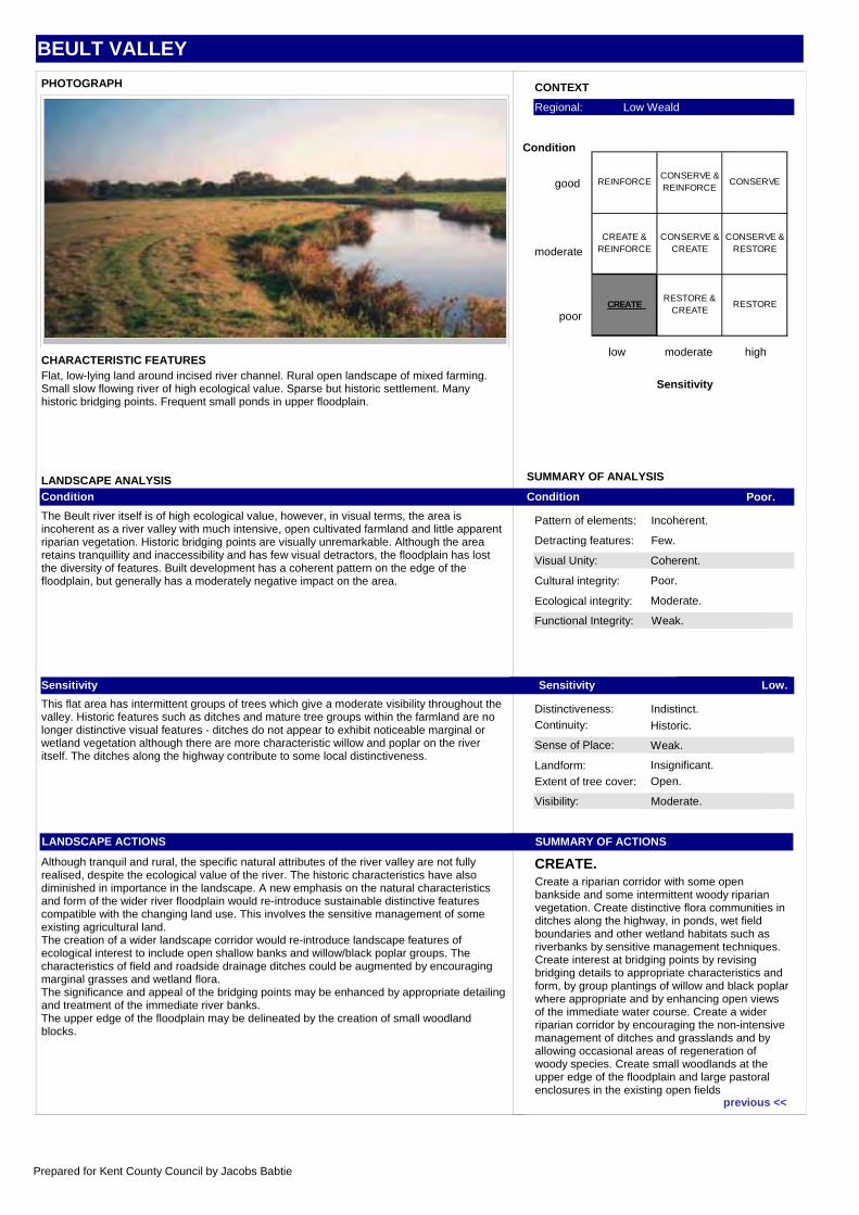
Flat, low-lying land around incised river channel. Rural open landscape of mixed farming. Small slow flowing river of high ecological value. Sparse but historic settlement. Many historic bridging points. Frequent small ponds in upper floodplain.
Create a riparian corridor with some open bankside and some intermittent woody riparian vegetation. Create distinctive flora communities in ditches along the highway, in ponds, wet field boundaries and other wetland habitats such as riverbanks by sensitive management techniques. Create interest at bridging points by revising bridging details to appropriate characteristics and form, by group plantings of willow and black poplar where appropriate and by enhancing open views of the immediate water course. Create a wider riparian corridor by encouraging the non-intensive management of ditches and grasslands and by allowing occasional areas of regeneration of woody species. Create small woodlands at the upper edge of the floodplain and large pastoral enclosures in the existing open fields
REINFORCECONSERVE & REINFORCE
CONSERVE
CREATE & REINFORCE
CONSERVE & CREATE
CONSERVE & RESTORE
CREATE RESTORE &
CREATERESTORE
previous <<
Prepared for Kent County Council by Jacobs Babtie
BEWL AND BEDGEBURY KENTISH HIGH WEALD
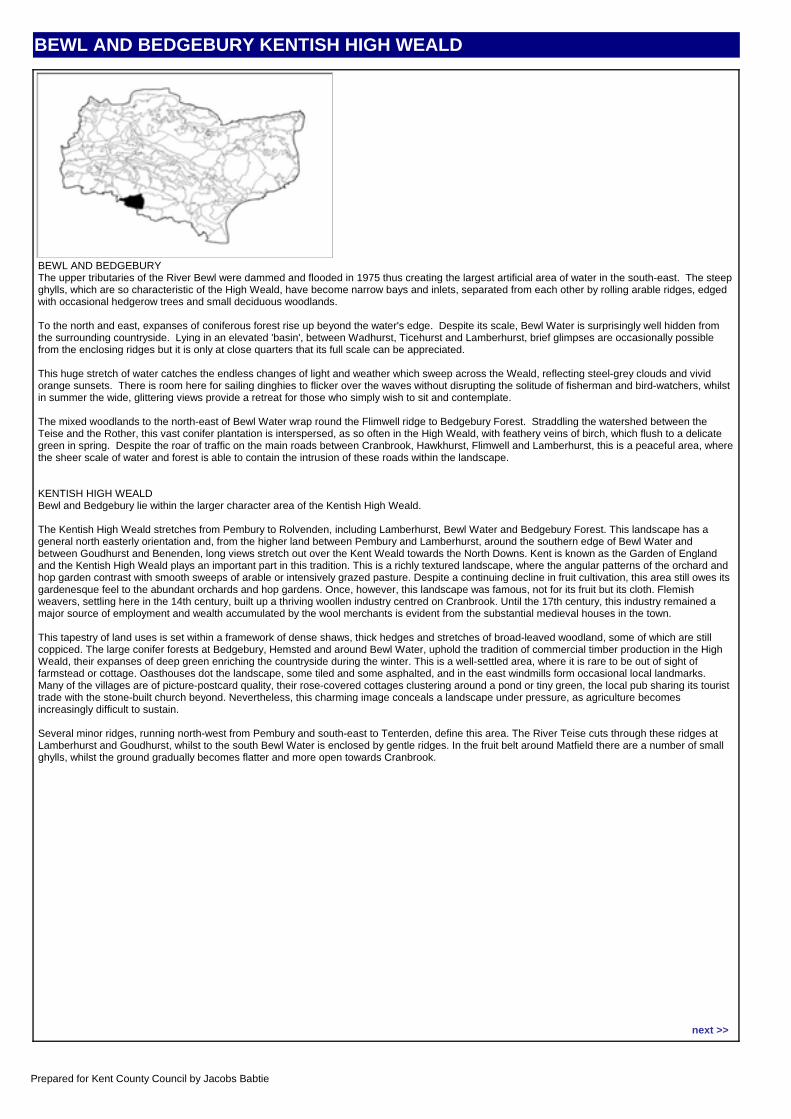
CHARACTER AREA DESCRIPTIONBEWL AND BEDGEBURYThe upper tributaries of the River Bewl were dammed and flooded in 1975 thus creating the largest artificial area of water in the south-east. The steep ghylls, which are so characteristic of the High Weald, have become narrow bays and inlets, separated from each other by rolling arable ridges, edged with occasional hedgerow trees and small deciduous woodlands.
To the north and east, expanses of coniferous forest rise up beyond the water's edge. Despite its scale, Bewl Water is surprisingly well hidden from the surrounding countryside. Lying in an elevated 'basin', between Wadhurst, Ticehurst and Lamberhurst, brief glimpses are occasionally possible from the enclosing ridges but it is only at close quarters that its full scale can be appreciated.
This huge stretch of water catches the endless changes of light and weather which sweep across the Weald, reflecting steel-grey clouds and vivid orange sunsets. There is room here for sailing dinghies to flicker over the waves without disrupting the solitude of fisherman and bird-watchers, whilst in summer the wide, glittering views provide a retreat for those who simply wish to sit and contemplate.
The mixed woodlands to the north-east of Bewl Water wrap round the Flimwell ridge to Bedgebury Forest. Straddling the watershed between the Teise and the Rother, this vast conifer plantation is interspersed, as so often in the High Weald, with feathery veins of birch, which flush to a delicate green in spring. Despite the roar of traffic on the main roads between Cranbrook, Hawkhurst, Flimwell and Lamberhurst, this is a peaceful area, where the sheer scale of water and forest is able to contain the intrusion of these roads within the landscape.
KENTISH HIGH WEALDBewl and Bedgebury lie within the larger character area of the Kentish High Weald.
The Kentish High Weald stretches from Pembury to Rolvenden, including Lamberhurst, Bewl Water and Bedgebury Forest. This landscape has a general north easterly orientation and, from the higher land between Pembury and Lamberhurst, around the southern edge of Bewl Water and between Goudhurst and Benenden, long views stretch out over the Kent Weald towards the North Downs. Kent is known as the Garden of England and the Kentish High Weald plays an important part in this tradition. This is a richly textured landscape, where the angular patterns of the orchard and hop garden contrast with smooth sweeps of arable or intensively grazed pasture. Despite a continuing decline in fruit cultivation, this area still owes its gardenesque feel to the abundant orchards and hop gardens. Once, however, this landscape was famous, not for its fruit but its cloth. Flemish weavers, settling here in the 14th century, built up a thriving woollen industry centred on Cranbrook. Until the 17th century, this industry remained a major source of employment and wealth accumulated by the wool merchants is evident from the substantial medieval houses in the town.
This tapestry of land uses is set within a framework of dense shaws, thick hedges and stretches of broad-leaved woodland, some of which are still coppiced. The large conifer forests at Bedgebury, Hemsted and around Bewl Water, uphold the tradition of commercial timber production in the High Weald, their expanses of deep green enriching the countryside during the winter. This is a well-settled area, where it is rare to be out of sight of farmstead or cottage. Oasthouses dot the landscape, some tiled and some asphalted, and in the east windmills form occasional local landmarks. Many of the villages are of picture-postcard quality, their rose-covered cottages clustering around a pond or tiny green, the local pub sharing its tourist trade with the stone-built church beyond. Nevertheless, this charming image conceals a landscape under pressure, as agriculture becomes increasingly difficult to sustain.
Several minor ridges, running north-west from Pembury and south-east to Tenterden, define this area. The River Teise cuts through these ridges at Lamberhurst and Goudhurst, whilst to the south Bewl Water is enclosed by gentle ridges. In the fruit belt around Matfield there are a number of small ghylls, whilst the ground gradually becomes flatter and more open towards Cranbrook.
Location map:
next >>
Prepared for Kent County Council by Jacobs Babtie
BEWL AND BEDGEBURY KENTISH HIGH WEALD
Visual Unity: Strongly Unified.
Functional Integrity: Very Strong.
Sense of Place: Strong.
Visibility: Moderate.
Condition Very Good.
Sensitivity High.
SUMMARY OF ACTIONS
CONSERVE.
Pattern of elements: Unified.
Detracting features: Few.
Cultural integrity: Good.
Ecological integrity: Strong Network.
Distinctiveness: Characteristic.Continuity: Ancient.
Landform: Dominant.
Extent of tree cover: Enclosed.
SUMMARY OF ANALYSIS
CONTEXT
low moderate high
Sensitivity
good
moderate
poor
Condition
Regional: High Weald AONB
PHOTOGRAPH
CHARACTERISTIC FEATURES
LANDSCAPE ANALYSISCondition
This is a strongly unified landscape in which there are few visual detractors and in which the landform and landscape pattern are unified. The large areas of deciduous woodland, coppice and thick shaws form a very strong ecological network. Tree cover is extensive and the wooded edges to small scale fields are generally good. Other features include estate parkland and conifer plantations. The scattered network of small villages, some enlarged, have a high positive impact and contribute to the very strong functional integrity of the area. The condition of the area is considered to be very good.
Sensitivity
The ridged landscape is a dominant part of the area, but visibility is moderate due to the enclosure of the extensive woodlands. There is a strong continuity to the landscape which contributes to the strong sense of place, and it is considered to be highly sensitive.
LANDSCAPE ACTIONS
Conserve the frequency and density of woodland cover on the ridges and slopes. Ensure that appropriate species are used for replanting.Encourage the retention of small scale pastoral clearings and the low-intensity agricultural use of these clearings and other enclosed areas. Conserve the narrow form of lanes; protect wooded edges to vehicular routes and replant where these have been lost. Conserve the characteristics of thick shaws/hedgerows by replanting with appropriate species and maintaining the level of vegetative enclosure to field systems and settlements, and on steep slopes.Conserve the scattered and isolated nature of the network of villages and hamlets.
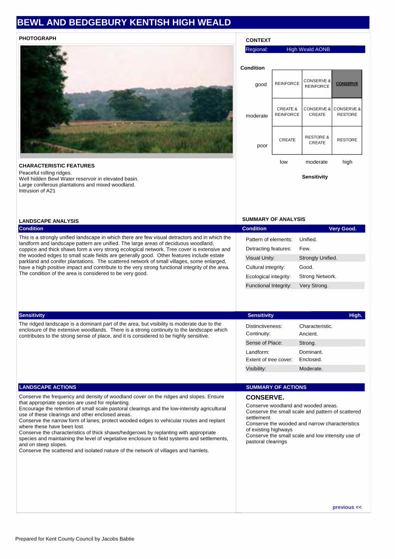
Peaceful rolling ridges.Well hidden Bewl Water reservoir in elevated basin.Large coniferous plantations and mixed woodland.Intrusion of A21
Conserve woodland and wooded areas.Conserve the small scale and pattern of scattered settlement.Conserve the wooded and narrow characteristics of existing highwaysConserve the small scale and low intensity use of pastoral clearings
REINFORCECONSERVE & REINFORCE
CONSERVE
CREATE & REINFORCE
CONSERVE & CREATE
CONSERVE & RESTORE
CREATE RESTORE &
CREATERESTORE
previous <<
Prepared for Kent County Council by Jacobs Babtie
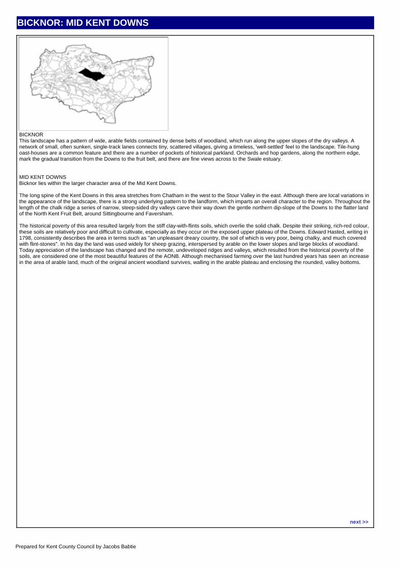
BICKNOR: MID KENT DOWNS
CHARACTER AREA DESCRIPTIONBICKNORThis landscape has a pattern of wide, arable fields contained by dense belts of woodland, which run along the upper slopes of the dry valleys. A network of small, often sunken, single-track lanes connects tiny, scattered villages, giving a timeless, 'well-settled' feel to the landscape. Tile-hung oast-houses are a common feature and there are a number of pockets of historical parkland. Orchards and hop gardens, along the northern edge, mark the gradual transition from the Downs to the fruit belt, and there are fine views across to the Swale estuary.
MID KENT DOWNSBicknor lies within the larger character area of the Mid Kent Downs.
The long spine of the Kent Downs in this area stretches from Chatham in the west to the Stour Valley in the east. Although there are local variations in the appearance of the landscape, there is a strong underlying pattern to the landform, which imparts an overall character to the region. Throughout the length of the chalk ridge a series of narrow, steep-sided dry valleys carve their way down the gentle northern dip-slope of the Downs to the flatter land of the North Kent Fruit Belt, around Sittingbourne and Faversham.
The historical poverty of this area resulted largely from the stiff clay-with-flints soils, which overlie the solid chalk. Despite their striking, rich-red colour, these soils are relatively poor and difficult to cultivate, especially as they occur on the exposed upper plateau of the Downs. Edward Hasted, writing in 1798, consistently describes the area in terms such as "an unpleasant dreary country, the soil of which is very poor, being chalky, and much covered with flint-stones". In his day the land was used widely for sheep grazing, interspersed by arable on the lower slopes and large blocks of woodland. Today appreciation of the landscape has changed and the remote, undeveloped ridges and valleys, which resulted from the historical poverty of the soils, are considered one of the most beautiful features of the AONB. Although mechanised farming over the last hundred years has seen an increase in the area of arable land, much of the original ancient woodland survives, walling in the arable plateau and enclosing the rounded, valley bottoms.
Location map:
next >>
Prepared for Kent County Council by Jacobs Babtie
BICKNOR: MID KENT DOWNS
Visual Unity: Unified.
Functional Integrity: Weak.
Sense of Place: Weak.
Visibility: Moderate.
Condition Moderate.
Sensitivity Low.
SUMMARY OF ACTIONS
CREATE AND REINFORCE.
Pattern of elements: Coherent.
Detracting features: Few.
Cultural integrity: Poor.
Ecological integrity: Moderate.
Distinctiveness: Indistinct.Continuity: Historic.
Landform: Apparent.
Extent of tree cover: Intermittent.
SUMMARY OF ANALYSIS
CONTEXT
low moderate high
Sensitivity
good
moderate
poor
Condition
Regional: Kent Downs AONB
PHOTOGRAPH
CHARACTERISTIC FEATURES
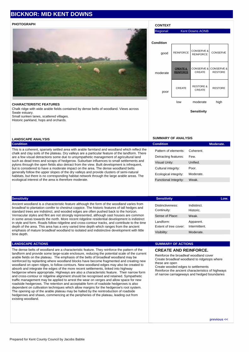
LANDSCAPE ANALYSISCondition
This is a coherent, sparsely settled area with arable farmland and woodland which reflect the chalk and clay soils of the plateau. Dry valleys are a particular feature of the landform. There are a few visual detractions some due to unsympathetic management of agricultural land such as dead trees and scraps of hedgerow. Suburban influences to small settlements and pylons through the open fields also detract from the view. Built development is infrequent, but is considered to have a moderate impact on the area. The dense woodland belts generally follow the upper slopes of the dry valleys and provide clusters of semi-natural habitats, but there is no corresponding habitat network through the large arable areas. The ecological interest of the area is therefore moderate.
Sensitivity
Ancient woodland is a characteristic feature although the form of the woodland varies from broadleaf to plantation conifer to chestnut coppice. The historic features of tall hedges and standard trees are indistinct, and wooded edges are often pushed back to the horizon. Vernacular styles and flint are not strongly represented, although oast houses are common in some areas towards the north. More recent ridgeline residential development is indistinct in style and form. Roads follow ridgeline and cross-contour tracks, and contribute to the time depth of the area. This area has a very varied time depth which ranges from the ancient emphasis of mature broadleaf woodland to isolated and indistinctive development with little time depth.
LANDSCAPE ACTIONS
The dense belts of woodland are a characteristic feature. They reinforce the pattern of the landform and provide some large-scale enclosure, reducing the potential scale of the current arable fields on the plateau. The emphasis of the belts of broadleaf woodland may be reinforced by replanting where woodland blocks have become fragmented and creating new woodland on open ridges, to follow contours. New woodland edges may also be created to absorb and integrate the edges of the more recent settlements, linked into highway hedgerow where appropriate. Highways are also a characteristic feature. Their narrow form and cross-contour or ridgeline alignment should be recognised and retained. Sympathetic traffic management may be applied to arrest the wear on verges and allow space for new roadside hedgerows. The retention and acceptable form of roadside hedgerows is also dependent on cultivation techniques which allow margins for the hedgerow's root system. The opening up of the arable plateau may be halted by the reintroduction of roadside hedgerows and shaws, commencing at the peripheries of the plateau, leading out from existing woodland.
Chalk ridge with wide arable fields contained by dense belts of woodland. Views across Swale estuary.Small sunken lanes, scattered villages.Historic parkland, hops and orchards.
Reinforce the broadleaf woodland coverCreate broadleaf woodland to ridgetops where these are openCreate wooded edges to settlementsReinforce the ancient characteristics of highways of narrow carriageways and hedged boundaries
REINFORCECONSERVE & REINFORCE
CONSERVE
CREATE & REINFORCE
CONSERVE & CREATE
CONSERVE & RESTORE
CREATE RESTORE &
CREATERESTORE
previous <<
Prepared for Kent County Council by Jacobs Babtie
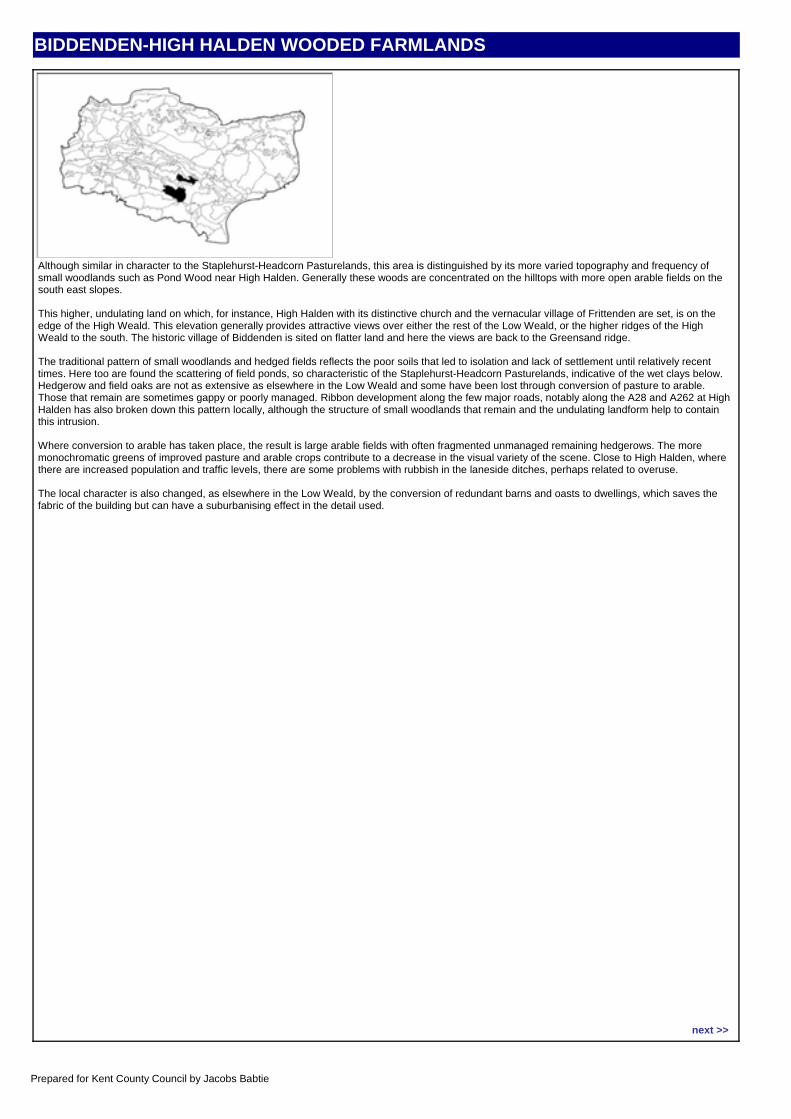
BIDDENDEN-HIGH HALDEN WOODED FARMLANDS
CHARACTER AREA DESCRIPTIONAlthough similar in character to the Staplehurst-Headcorn Pasturelands, this area is distinguished by its more varied topography and frequency of small woodlands such as Pond Wood near High Halden. Generally these woods are concentrated on the hilltops with more open arable fields on the south east slopes.
This higher, undulating land on which, for instance, High Halden with its distinctive church and the vernacular village of Frittenden are set, is on the edge of the High Weald. This elevation generally provides attractive views over either the rest of the Low Weald, or the higher ridges of the High Weald to the south. The historic village of Biddenden is sited on flatter land and here the views are back to the Greensand ridge.
The traditional pattern of small woodlands and hedged fields reflects the poor soils that led to isolation and lack of settlement until relatively recent times. Here too are found the scattering of field ponds, so characteristic of the Staplehurst-Headcorn Pasturelands, indicative of the wet clays below. Hedgerow and field oaks are not as extensive as elsewhere in the Low Weald and some have been lost through conversion of pasture to arable. Those that remain are sometimes gappy or poorly managed. Ribbon development along the few major roads, notably along the A28 and A262 at High Halden has also broken down this pattern locally, although the structure of small woodlands that remain and the undulating landform help to contain this intrusion.
Where conversion to arable has taken place, the result is large arable fields with often fragmented unmanaged remaining hedgerows. The more monochromatic greens of improved pasture and arable crops contribute to a decrease in the visual variety of the scene. Close to High Halden, where there are increased population and traffic levels, there are some problems with rubbish in the laneside ditches, perhaps related to overuse.
The local character is also changed, as elsewhere in the Low Weald, by the conversion of redundant barns and oasts to dwellings, which saves the fabric of the building but can have a suburbanising effect in the detail used.
Location map:
next >>
Prepared for Kent County Council by Jacobs Babtie
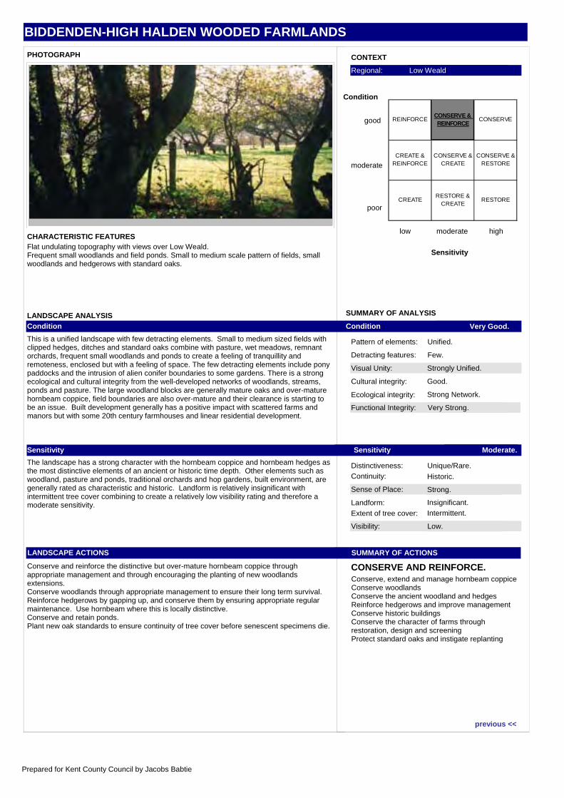
BIDDENDEN-HIGH HALDEN WOODED FARMLANDS
Visual Unity: Strongly Unified.
Functional Integrity: Very Strong.
Sense of Place: Strong.
Visibility: Low.
Condition Very Good.
Sensitivity Moderate.
SUMMARY OF ACTIONS
CONSERVE AND REINFORCE.
Pattern of elements: Unified.
Detracting features: Few.
Cultural integrity: Good.
Ecological integrity: Strong Network.
Distinctiveness: Unique/Rare.Continuity: Historic.
Landform: Insignificant.
Extent of tree cover: Intermittent.
SUMMARY OF ANALYSIS
CONTEXT
low moderate high
Sensitivity
good
moderate
poor
Condition
Regional: Low Weald
PHOTOGRAPH
CHARACTERISTIC FEATURES
LANDSCAPE ANALYSISCondition
This is a unified landscape with few detracting elements. Small to medium sized fields with clipped hedges, ditches and standard oaks combine with pasture, wet meadows, remnant orchards, frequent small woodlands and ponds to create a feeling of tranquillity and remoteness, enclosed but with a feeling of space. The few detracting elements include pony paddocks and the intrusion of alien conifer boundaries to some gardens. There is a strong ecological and cultural integrity from the well-developed networks of woodlands, streams, ponds and pasture. The large woodland blocks are generally mature oaks and over-mature hornbeam coppice, field boundaries are also over-mature and their clearance is starting to be an issue. Built development generally has a positive impact with scattered farms and manors but with some 20th century farmhouses and linear residential development.
Sensitivity
The landscape has a strong character with the hornbeam coppice and hornbeam hedges as the most distinctive elements of an ancient or historic time depth. Other elements such as woodland, pasture and ponds, traditional orchards and hop gardens, built environment, are generally rated as characteristic and historic. Landform is relatively insignificant with intermittent tree cover combining to create a relatively low visibility rating and therefore a moderate sensitivity.
LANDSCAPE ACTIONS
Conserve and reinforce the distinctive but over-mature hornbeam coppice through appropriate management and through encouraging the planting of new woodlands extensions.Conserve woodlands through appropriate management to ensure their long term survival.Reinforce hedgerows by gapping up, and conserve them by ensuring appropriate regular maintenance. Use hornbeam where this is locally distinctive.Conserve and retain ponds.Plant new oak standards to ensure continuity of tree cover before senescent specimens die.
Flat undulating topography with views over Low Weald.Frequent small woodlands and field ponds. Small to medium scale pattern of fields, small woodlands and hedgerows with standard oaks.
Conserve, extend and manage hornbeam coppiceConserve woodlandsConserve the ancient woodland and hedgesReinforce hedgerows and improve managementConserve historic buildingsConserve the character of farms through restoration, design and screeningProtect standard oaks and instigate replanting
REINFORCECONSERVE & REINFORCE
CONSERVE
CREATE & REINFORCE
CONSERVE & CREATE
CONSERVE & RESTORE
CREATE RESTORE &
CREATERESTORE
previous <<
Prepared for Kent County Council by Jacobs Babtie
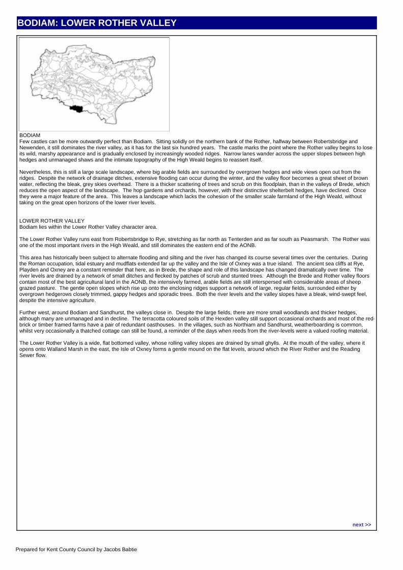
BODIAM: LOWER ROTHER VALLEY
CHARACTER AREA DESCRIPTIONBODIAMFew castles can be more outwardly perfect than Bodiam. Sitting solidly on the northern bank of the Rother, halfway between Robertsbridge and Newenden, it still dominates the river valley, as it has for the last six hundred years. The castle marks the point where the Rother valley begins to lose its wild, marshy appearance and is gradually enclosed by increasingly wooded ridges. Narrow lanes wander across the upper slopes between high hedges and unmanaged shaws and the intimate topography of the High Weald begins to reassert itself.
Nevertheless, this is still a large scale landscape, where big arable fields are surrounded by overgrown hedges and wide views open out from the ridges. Despite the network of drainage ditches, extensive flooding can occur during the winter, and the valley floor becomes a great sheet of brown water, reflecting the bleak, grey skies overhead. There is a thicker scattering of trees and scrub on this floodplain, than in the valleys of Brede, which reduces the open aspect of the landscape. The hop gardens and orchards, however, with their distinctive shelterbelt hedges, have declined. Once they were a major feature of the area. This leaves a landscape which lacks the cohesion of the smaller scale farmland of the High Weald, without taking on the great open horizons of the lower river levels.
LOWER ROTHER VALLEYBodiam lies within the Lower Rother Valley character area.
The Lower Rother Valley runs east from Robertsbridge to Rye, stretching as far north as Tenterden and as far south as Peasmarsh. The Rother was one of the most important rivers in the High Weald, and still dominates the eastern end of the AONB.
This area has historically been subject to alternate flooding and silting and the river has changed its course several times over the centuries. During the Roman occupation, tidal estuary and mudflats extended far up the valley and the Isle of Oxney was a true island. The ancient sea cliffs at Rye, Playden and Oxney are a constant reminder that here, as in Brede, the shape and role of this landscape has changed dramatically over time. The river levels are drained by a network of small ditches and flecked by patches of scrub and stunted trees. Although the Brede and Rother valley floors contain most of the best agricultural land in the AONB, the intensively farmed, arable fields are still interspersed with considerable areas of sheep grazed pasture. The gentle open slopes which rise up onto the enclosing ridges support a network of large, regular fields, surrounded either by overgrown hedgerows closely trimmed, gappy hedges and sporadic trees. Both the river levels and the valley slopes have a bleak, wind-swept feel, despite the intensive agriculture.
Further west, around Bodiam and Sandhurst, the valleys close in. Despite the large fields, there are more small woodlands and thicker hedges, although many are unmanaged and in decline. The terracotta coloured soils of the Hexden valley still support occasional orchards and most of the red-brick or timber framed farms have a pair of redundant oasthouses. In the villages, such as Northiam and Sandhurst, weatherboarding is common, whilst very occasionally a thatched cottage can still be found, a reminder of the days when reeds from the river-levels were a valued roofing material.
The Lower Rother Valley is a wide, flat bottomed valley, whose rolling valley slopes are drained by small ghylls. At the mouth of the valley, where it opens onto Walland Marsh in the east, the Isle of Oxney forms a gentle mound on the flat levels, around which the River Rother and the Reading Sewer flow.
Location map:
next >>
Prepared for Kent County Council by Jacobs Babtie
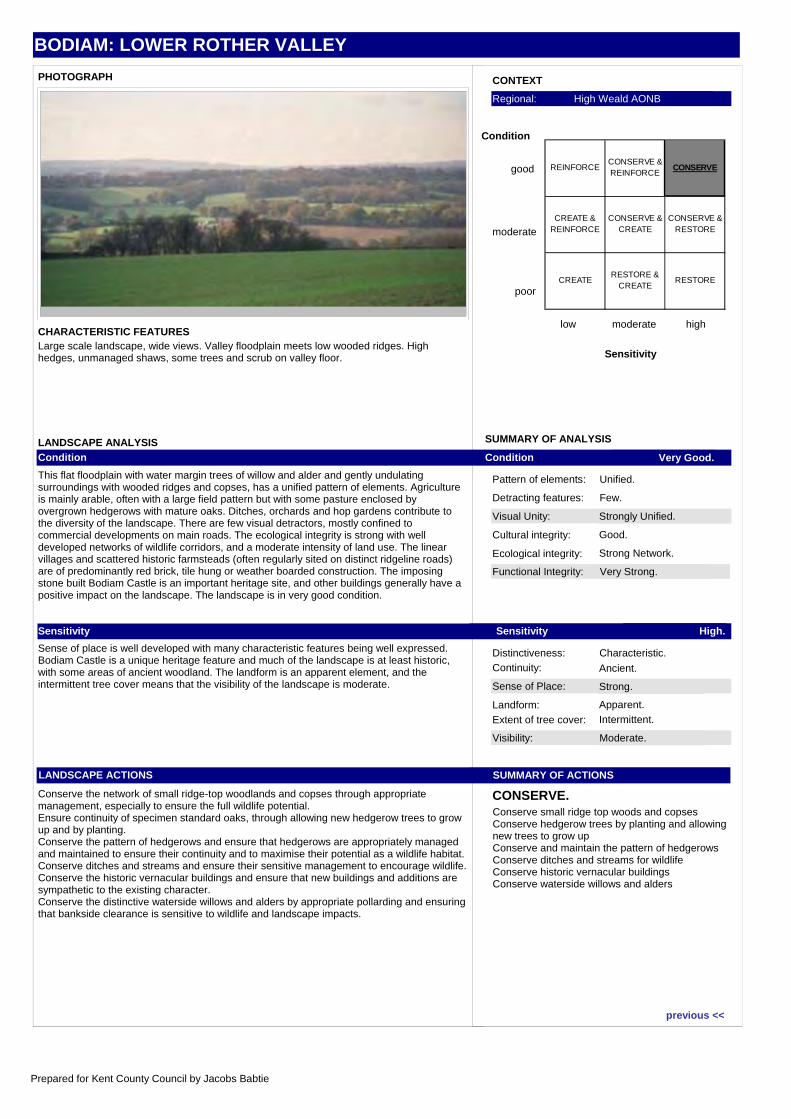
BODIAM: LOWER ROTHER VALLEY
Visual Unity: Strongly Unified.
Functional Integrity: Very Strong.
Sense of Place: Strong.
Visibility: Moderate.
Condition Very Good.
Sensitivity High.
SUMMARY OF ACTIONS
CONSERVE.
Pattern of elements: Unified.
Detracting features: Few.
Cultural integrity: Good.
Ecological integrity: Strong Network.
Distinctiveness: Characteristic.Continuity: Ancient.
Landform: Apparent.
Extent of tree cover: Intermittent.
SUMMARY OF ANALYSIS
CONTEXT
low moderate high
Sensitivity
good
moderate
poor
Condition
Regional: High Weald AONB
PHOTOGRAPH
CHARACTERISTIC FEATURES
LANDSCAPE ANALYSISCondition
This flat floodplain with water margin trees of willow and alder and gently undulating surroundings with wooded ridges and copses, has a unified pattern of elements. Agriculture is mainly arable, often with a large field pattern but with some pasture enclosed by overgrown hedgerows with mature oaks. Ditches, orchards and hop gardens contribute to the diversity of the landscape. There are few visual detractors, mostly confined to commercial developments on main roads. The ecological integrity is strong with well developed networks of wildlife corridors, and a moderate intensity of land use. The linear villages and scattered historic farmsteads (often regularly sited on distinct ridgeline roads) are of predominantly red brick, tile hung or weather boarded construction. The imposing stone built Bodiam Castle is an important heritage site, and other buildings generally have a positive impact on the landscape. The landscape is in very good condition.
Sensitivity
Sense of place is well developed with many characteristic features being well expressed. Bodiam Castle is a unique heritage feature and much of the landscape is at least historic, with some areas of ancient woodland. The landform is an apparent element, and the intermittent tree cover means that the visibility of the landscape is moderate.
LANDSCAPE ACTIONS
Conserve the network of small ridge-top woodlands and copses through appropriate management, especially to ensure the full wildlife potential.Ensure continuity of specimen standard oaks, through allowing new hedgerow trees to grow up and by planting.Conserve the pattern of hedgerows and ensure that hedgerows are appropriately managed and maintained to ensure their continuity and to maximise their potential as a wildlife habitat.Conserve ditches and streams and ensure their sensitive management to encourage wildlife.Conserve the historic vernacular buildings and ensure that new buildings and additions are sympathetic to the existing character.Conserve the distinctive waterside willows and alders by appropriate pollarding and ensuring that bankside clearance is sensitive to wildlife and landscape impacts.
Large scale landscape, wide views. Valley floodplain meets low wooded ridges. High hedges, unmanaged shaws, some trees and scrub on valley floor.
Conserve small ridge top woods and copsesConserve hedgerow trees by planting and allowing new trees to grow upConserve and maintain the pattern of hedgerowsConserve ditches and streams for wildlifeConserve historic vernacular buildingsConserve waterside willows and alders
REINFORCECONSERVE & REINFORCE
CONSERVE
CREATE & REINFORCE
CONSERVE & CREATE
CONSERVE & RESTORE
CREATE RESTORE &
CREATERESTORE
previous <<
Prepared for Kent County Council by Jacobs Babtie
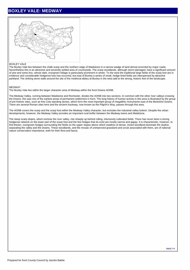
BOXLEY VALE: MEDWAY
CHARACTER AREA DESCRIPTIONBOXLEY VALEThe Boxley Vale lies between the chalk scarp and the northern edge of Maidstone in a narrow wedge of land almost encircled by major roads. Nevertheless this is an attractive and anciently settled area of countryside. The scarp woodlands, although storm-damaged, have a significant amount of yew and some box, whose dark, evergreen foliage is particularly prominent in winter. To the west the traditional large fields of the scarp foot are in evidence and considerable hedgerow loss has occurred, but east of Boxley a series of small, hedge lined fields are interspersed by attractive parkland. The striking stone walls around the site of the medieval abbey at Boxley in the west add to the strong, historic feel of the landscape.
MEDWAYThe Boxley Vale lies within the larger character area of Medway within the Kent Downs AONB.
The Medway Valley, running between Maidstone and Rochester, divides the AONB into two sections. In common with the other river valleys crossing the Downs, this was one of the earliest areas of permanent settlement in Kent. The long history of human activity in this area is illustrated by the group of pre-historic sites, such as Kits Coty standing stones, which form the most important group of megalithic monuments east of the Berkshire Downs. There are several Roman sites here and the ancient trackway, now known as the Pilgrim's Way, passes through this area.
The AONB covers the scarp and the scarp foot within the Medway Valley character, but excludes the industrial valley bottom. Despite the urban developments, however, the Medway Valley provides an important rural buffer between the Medway towns and Maidstone.
The steep scarp slopes, which enclose the river valley, rise sharply up behind rolling, intensively cultivated fields. There has never been a strong hedgerow network on the lower part of the scarp foot and the few hedges that do exist are mostly narrow and gappy. It is characteristic, however, to find thicker, overgrown hedges surrounding the fields on the upper slopes above which swathes of dense, mixed woodland dominate the skyline, separating the valley and the Downs. These woodlands, and the mosaic of unimproved grassland and scrub associated with them, are of national nature conservation importance, both for their flora and fauna.
Location map:
next >>
Prepared for Kent County Council by Jacobs Babtie
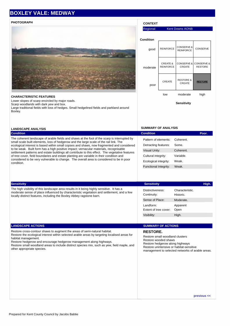
BOXLEY VALE: MEDWAY
Visual Unity: Coherent.
Functional Integrity: Weak.
Sense of Place: Moderate.
Visibility: High.
Condition Poor.
Sensitivity High.
SUMMARY OF ACTIONS
RESTORE.
Pattern of elements: Coherent.
Detracting features: Some.
Cultural integrity: Variable.
Ecological integrity: Weak.
Distinctiveness: Characteristic.Continuity: Historic.
Landform: Apparent
Extent of tree cover: Open
SUMMARY OF ANALYSIS
CONTEXT
low moderate high
Sensitivity
good
moderate
poor
Condition
Regional: Kent Downs AONB
PHOTOGRAPH
CHARACTERISTIC FEATURES
LANDSCAPE ANALYSISCondition
The coherent landscape of arable fields and shaws at the foot of the scarp is interrupted by small scale built elements, loss of hedgerow and the large scale of the rail link. The ecological interest is based within small copses and shaws, now fragmented and considered to be weak. Built form has a high positive impact; vernacular materials, recognisable settlement patterns and estate buildings all contribute to this effect. The vegetative features of tree cover, field boundaries and estate planting are variable in their condition and considered to be very vulnerable to change. The overall area is considered to be in poor condition.
Sensitivity
The high visibility of this landscape area results in it being highly sensitive. It has a moderate sense of place influenced by characteristic vegetation and settlement, and a few locally distinct features, including the Boxley Abbey ragstone barn.
LANDSCAPE ACTIONS
Restore cross-contour shaws to augment the areas of semi-natural habitat.Restore the ecological interest within selected arable areas by targeting localised areas for habitat management.Restore hedgerow and encourage hedgerow management along highways.Restore small woodland areas to include distinct species mix, such as yew, field maple, and other appropriate species.
Lower slopes of scarp encircled by major roads.Scarp woodlands with dark yew and box.Large traditional fields with loss of hedges. Small hedgelined fields and parkland around Boxley.
Restore small woodland clustersRestore wooded shawsRestore hedgerow along highwaysRestore unintensive or habitat-sensitive management to selected networks of arable areas.
REINFORCECONSERVE & REINFORCE
CONSERVE
CREATE & REINFORCE
CONSERVE & CREATE
CONSERVE & RESTORE
CREATE RESTORE &
CREATERESTORE
previous <<
Prepared for Kent County Council by Jacobs Babtie
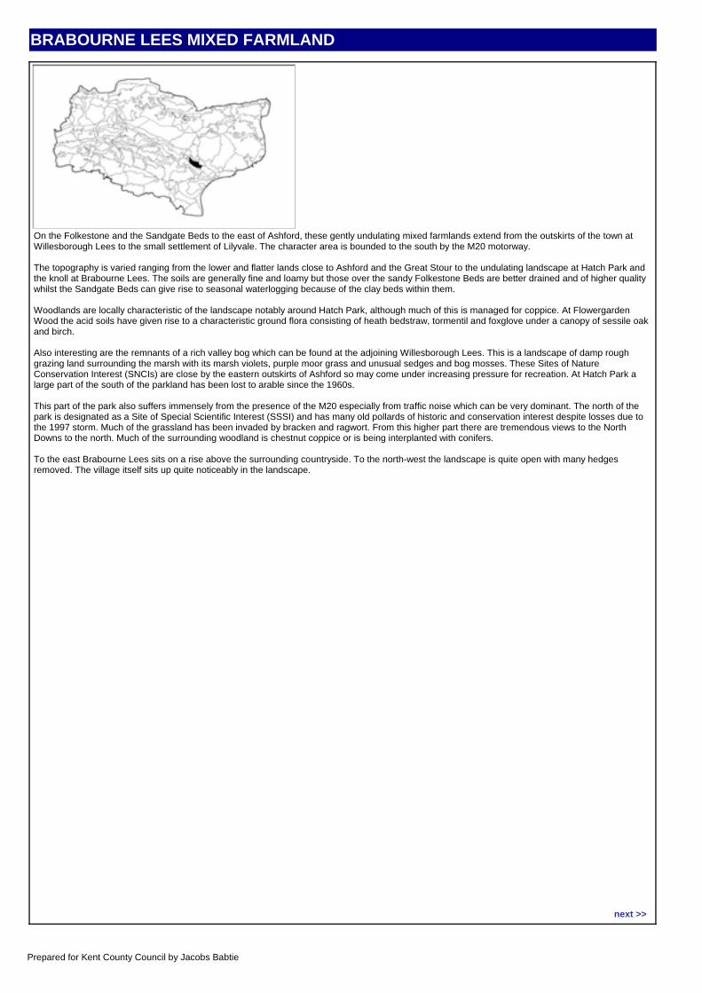
BRABOURNE LEES MIXED FARMLAND
CHARACTER AREA DESCRIPTIONOn the Folkestone and the Sandgate Beds to the east of Ashford, these gently undulating mixed farmlands extend from the outskirts of the town at Willesborough Lees to the small settlement of Lilyvale. The character area is bounded to the south by the M20 motorway.
The topography is varied ranging from the lower and flatter lands close to Ashford and the Great Stour to the undulating landscape at Hatch Park and the knoll at Brabourne Lees. The soils are generally fine and loamy but those over the sandy Folkestone Beds are better drained and of higher quality whilst the Sandgate Beds can give rise to seasonal waterlogging because of the clay beds within them.
Woodlands are locally characteristic of the landscape notably around Hatch Park, although much of this is managed for coppice. At Flowergarden Wood the acid soils have given rise to a characteristic ground flora consisting of heath bedstraw, tormentil and foxglove under a canopy of sessile oak and birch.
Also interesting are the remnants of a rich valley bog which can be found at the adjoining Willesborough Lees. This is a landscape of damp rough grazing land surrounding the marsh with its marsh violets, purple moor grass and unusual sedges and bog mosses. These Sites of Nature Conservation Interest (SNCIs) are close by the eastern outskirts of Ashford so may come under increasing pressure for recreation. At Hatch Park a large part of the south of the parkland has been lost to arable since the 1960s.
This part of the park also suffers immensely from the presence of the M20 especially from traffic noise which can be very dominant. The north of the park is designated as a Site of Special Scientific Interest (SSSI) and has many old pollards of historic and conservation interest despite losses due to the 1997 storm. Much of the grassland has been invaded by bracken and ragwort. From this higher part there are tremendous views to the North Downs to the north. Much of the surrounding woodland is chestnut coppice or is being interplanted with conifers.
To the east Brabourne Lees sits on a rise above the surrounding countryside. To the north-west the landscape is quite open with many hedges removed. The village itself sits up quite noticeably in the landscape.
Location map:
next >>
Prepared for Kent County Council by Jacobs Babtie
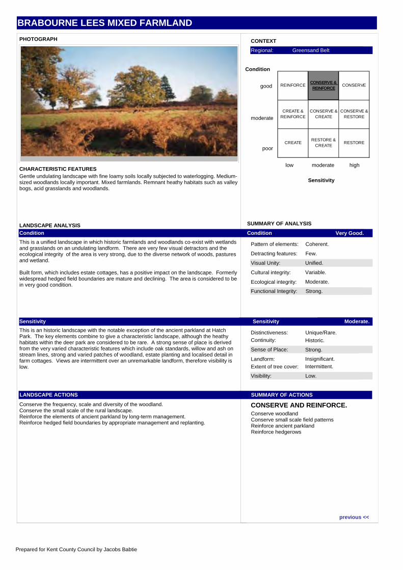
BRABOURNE LEES MIXED FARMLAND
Visual Unity: Unified.
Functional Integrity: Strong.
Sense of Place: Strong.
Visibility: Low.
Condition Very Good.
Sensitivity Moderate.
SUMMARY OF ACTIONS
CONSERVE AND REINFORCE.
Pattern of elements: Coherent.
Detracting features: Few.
Cultural integrity: Variable.
Ecological integrity: Moderate.
Distinctiveness: Unique/Rare.Continuity: Historic.
Landform: Insignificant.
Extent of tree cover: Intermittent.
SUMMARY OF ANALYSIS
CONTEXT
low moderate high
Sensitivity
good
moderate
poor
Condition
Regional: Greensand Belt
PHOTOGRAPH
CHARACTERISTIC FEATURES
LANDSCAPE ANALYSISCondition
This is a unified landscape in which historic farmlands and woodlands co-exist with wetlands and grasslands on an undulating landform. There are very few visual detractors and the ecological integrity of the area is very strong, due to the diverse network of woods, pastures and wetland.
Built form, which includes estate cottages, has a positive impact on the landscape. Formerly widespread hedged field boundaries are mature and declining. The area is considered to be in very good condition.
Sensitivity
This is an historic landscape with the notable exception of the ancient parkland at Hatch Park. The key elements combine to give a characteristic landscape, although the heathy habitats within the deer park are considered to be rare. A strong sense of place is derived from the very varied characteristic features which include oak standards, willow and ash on stream lines, strong and varied patches of woodland, estate planting and localised detail in farm cottages. Views are intermittent over an unremarkable landform, therefore visibility is low.
LANDSCAPE ACTIONS
Conserve the frequency, scale and diversity of the woodland.Conserve the small scale of the rural landscape.Reinforce the elements of ancient parkland by long-term management.Reinforce hedged field boundaries by appropriate management and replanting.
Gentle undulating landscape with fine loamy soils locally subjected to waterlogging. Medium-sized woodlands locally important. Mixed farmlands. Remnant heathy habitats such as valley bogs, acid grasslands and woodlands.
Conserve woodlandConserve small scale field patternsReinforce ancient parklandReinforce hedgerows
REINFORCECONSERVE & REINFORCE
CONSERVE
CREATE & REINFORCE
CONSERVE & CREATE
CONSERVE & RESTORE
CREATE RESTORE &
CREATERESTORE
previous <<
Prepared for Kent County Council by Jacobs Babtie
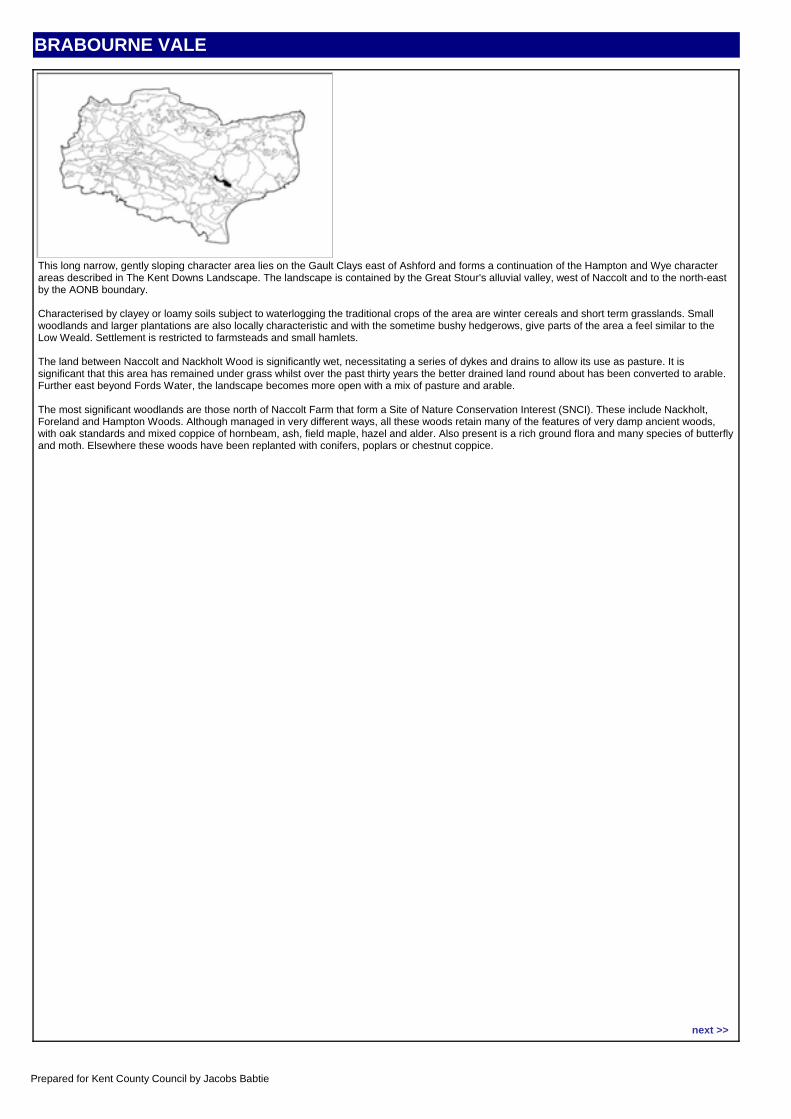
BRABOURNE VALE
CHARACTER AREA DESCRIPTIONThis long narrow, gently sloping character area lies on the Gault Clays east of Ashford and forms a continuation of the Hampton and Wye character areas described in The Kent Downs Landscape. The landscape is contained by the Great Stour's alluvial valley, west of Naccolt and to the north-east by the AONB boundary.
Characterised by clayey or loamy soils subject to waterlogging the traditional crops of the area are winter cereals and short term grasslands. Small woodlands and larger plantations are also locally characteristic and with the sometime bushy hedgerows, give parts of the area a feel similar to the Low Weald. Settlement is restricted to farmsteads and small hamlets.
The land between Naccolt and Nackholt Wood is significantly wet, necessitating a series of dykes and drains to allow its use as pasture. It is significant that this area has remained under grass whilst over the past thirty years the better drained land round about has been converted to arable. Further east beyond Fords Water, the landscape becomes more open with a mix of pasture and arable.
The most significant woodlands are those north of Naccolt Farm that form a Site of Nature Conservation Interest (SNCI). These include Nackholt, Foreland and Hampton Woods. Although managed in very different ways, all these woods retain many of the features of very damp ancient woods, with oak standards and mixed coppice of hornbeam, ash, field maple, hazel and alder. Also present is a rich ground flora and many species of butterfly and moth. Elsewhere these woods have been replanted with conifers, poplars or chestnut coppice.
Location map:
next >>
Prepared for Kent County Council by Jacobs Babtie
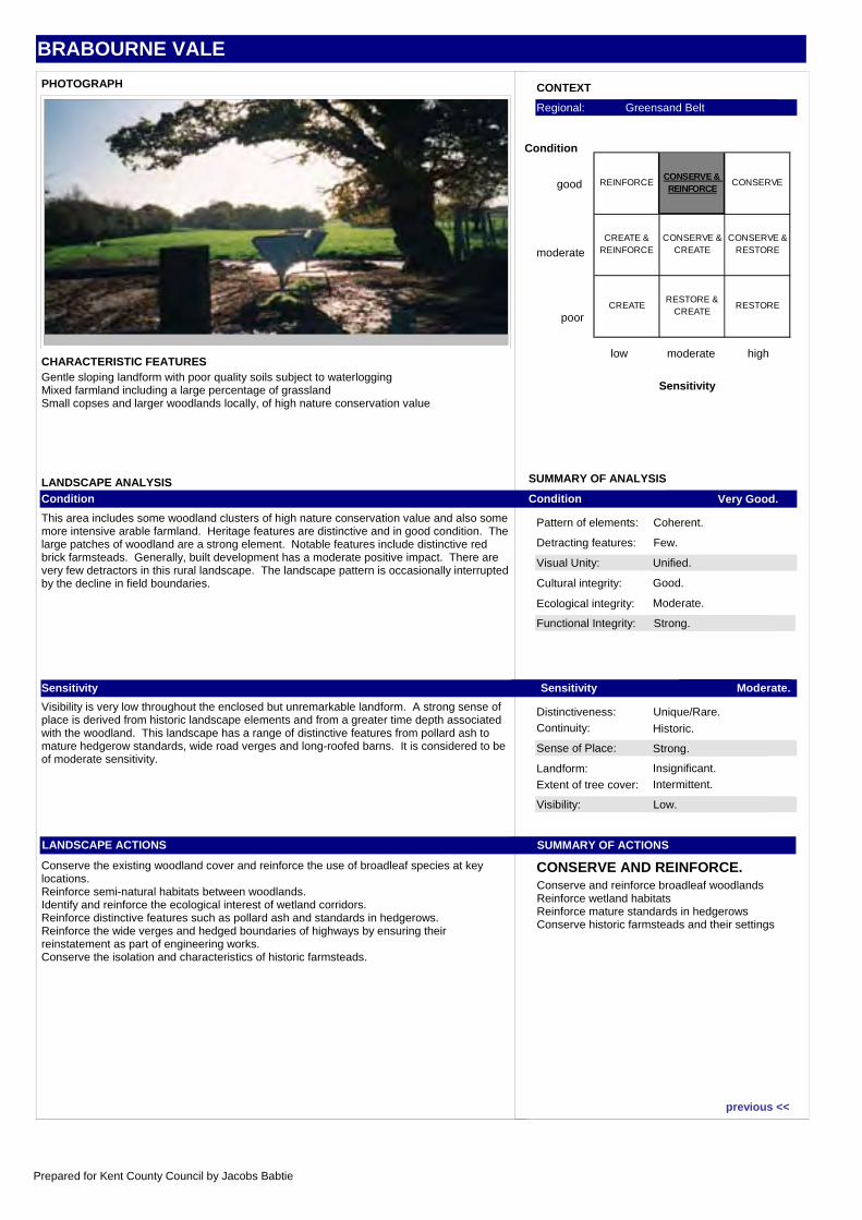
BRABOURNE VALE
Visual Unity: Unified.
Functional Integrity: Strong.
Sense of Place: Strong.
Visibility: Low.
Condition Very Good.
Sensitivity Moderate.
SUMMARY OF ACTIONS
CONSERVE AND REINFORCE.
Pattern of elements: Coherent.
Detracting features: Few.
Cultural integrity: Good.
Ecological integrity: Moderate.
Distinctiveness: Unique/Rare.Continuity: Historic.
Landform: Insignificant.
Extent of tree cover: Intermittent.
SUMMARY OF ANALYSIS
CONTEXT
low moderate high
Sensitivity
good
moderate
poor
Condition
Regional: Greensand Belt
PHOTOGRAPH
CHARACTERISTIC FEATURES
LANDSCAPE ANALYSISCondition
This area includes some woodland clusters of high nature conservation value and also some more intensive arable farmland. Heritage features are distinctive and in good condition. The large patches of woodland are a strong element. Notable features include distinctive red brick farmsteads. Generally, built development has a moderate positive impact. There are very few detractors in this rural landscape. The landscape pattern is occasionally interrupted by the decline in field boundaries.
Sensitivity
Visibility is very low throughout the enclosed but unremarkable landform. A strong sense of place is derived from historic landscape elements and from a greater time depth associated with the woodland. This landscape has a range of distinctive features from pollard ash to mature hedgerow standards, wide road verges and long-roofed barns. It is considered to be of moderate sensitivity.
LANDSCAPE ACTIONS
Conserve the existing woodland cover and reinforce the use of broadleaf species at key locations.Reinforce semi-natural habitats between woodlands.Identify and reinforce the ecological interest of wetland corridors.Reinforce distinctive features such as pollard ash and standards in hedgerows.Reinforce the wide verges and hedged boundaries of highways by ensuring their reinstatement as part of engineering works.Conserve the isolation and characteristics of historic farmsteads.
Gentle sloping landform with poor quality soils subject to waterloggingMixed farmland including a large percentage of grasslandSmall copses and larger woodlands locally, of high nature conservation value
Conserve and reinforce broadleaf woodlandsReinforce wetland habitatsReinforce mature standards in hedgerowsConserve historic farmsteads and their settings
REINFORCECONSERVE & REINFORCE
CONSERVE
CREATE & REINFORCE
CONSERVE & CREATE
CONSERVE & RESTORE
CREATE RESTORE &
CREATERESTORE
previous <<
Prepared for Kent County Council by Jacobs Babtie
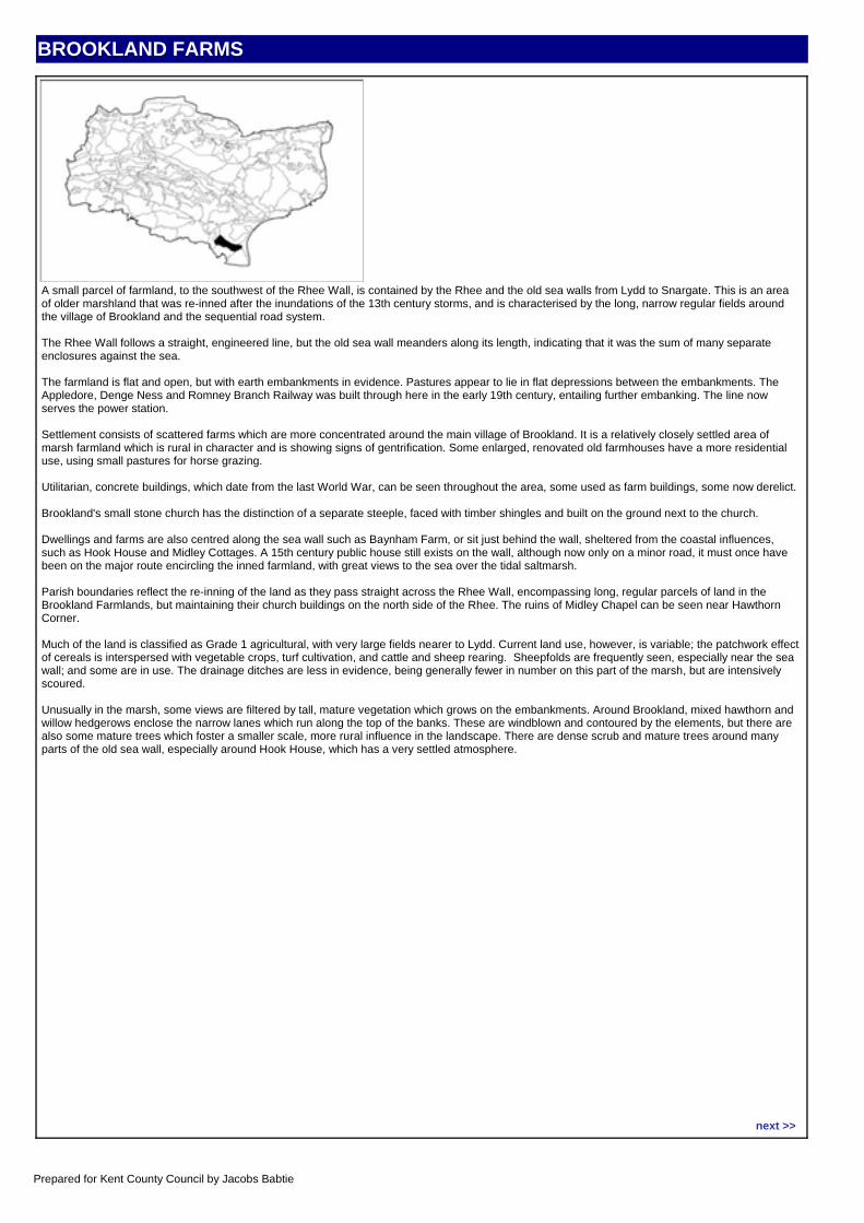
BROOKLAND FARMS
CHARACTER AREA DESCRIPTIONA small parcel of farmland, to the southwest of the Rhee Wall, is contained by the Rhee and the old sea walls from Lydd to Snargate. This is an area of older marshland that was re-inned after the inundations of the 13th century storms, and is characterised by the long, narrow regular fields around the village of Brookland and the sequential road system.
The Rhee Wall follows a straight, engineered line, but the old sea wall meanders along its length, indicating that it was the sum of many separate enclosures against the sea.
The farmland is flat and open, but with earth embankments in evidence. Pastures appear to lie in flat depressions between the embankments. The Appledore, Denge Ness and Romney Branch Railway was built through here in the early 19th century, entailing further embanking. The line now serves the power station.
Settlement consists of scattered farms which are more concentrated around the main village of Brookland. It is a relatively closely settled area of marsh farmland which is rural in character and is showing signs of gentrification. Some enlarged, renovated old farmhouses have a more residential use, using small pastures for horse grazing.
Utilitarian, concrete buildings, which date from the last World War, can be seen throughout the area, some used as farm buildings, some now derelict.
Brookland's small stone church has the distinction of a separate steeple, faced with timber shingles and built on the ground next to the church.
Dwellings and farms are also centred along the sea wall such as Baynham Farm, or sit just behind the wall, sheltered from the coastal influences, such as Hook House and Midley Cottages. A 15th century public house still exists on the wall, although now only on a minor road, it must once have been on the major route encircling the inned farmland, with great views to the sea over the tidal saltmarsh.
Parish boundaries reflect the re-inning of the land as they pass straight across the Rhee Wall, encompassing long, regular parcels of land in the Brookland Farmlands, but maintaining their church buildings on the north side of the Rhee. The ruins of Midley Chapel can be seen near Hawthorn Corner.
Much of the land is classified as Grade 1 agricultural, with very large fields nearer to Lydd. Current land use, however, is variable; the patchwork effect of cereals is interspersed with vegetable crops, turf cultivation, and cattle and sheep rearing. Sheepfolds are frequently seen, especially near the sea wall; and some are in use. The drainage ditches are less in evidence, being generally fewer in number on this part of the marsh, but are intensively scoured.
Unusually in the marsh, some views are filtered by tall, mature vegetation which grows on the embankments. Around Brookland, mixed hawthorn and willow hedgerows enclose the narrow lanes which run along the top of the banks. These are windblown and contoured by the elements, but there are also some mature trees which foster a smaller scale, more rural influence in the landscape. There are dense scrub and mature trees around many parts of the old sea wall, especially around Hook House, which has a very settled atmosphere.
Location map:
next >>
Prepared for Kent County Council by Jacobs Babtie
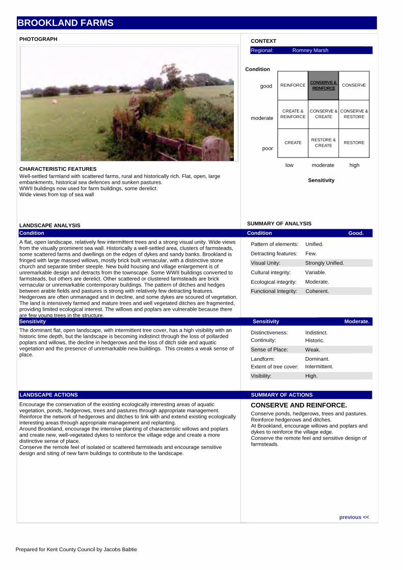
BROOKLAND FARMS
Visual Unity: Strongly Unified.
Functional Integrity: Coherent.
Sense of Place: Weak.
Visibility: High.
Condition Good.
Sensitivity Moderate.
SUMMARY OF ACTIONS
CONSERVE AND REINFORCE.
Pattern of elements: Unified.
Detracting features: Few.
Cultural integrity: Variable.
Ecological integrity: Moderate.
Distinctiveness: Indistinct.Continuity: Historic.
Landform: Dominant.
Extent of tree cover: Intermittent.
SUMMARY OF ANALYSIS
CONTEXT
low moderate high
Sensitivity
good
moderate
poor
Condition
Regional: Romney Marsh
PHOTOGRAPH
CHARACTERISTIC FEATURES
LANDSCAPE ANALYSISCondition
A flat, open landscape, relatively few intermittent trees and a strong visual unity. Wide views from the visually prominent sea wall. Historically a well-settled area, clusters of farmsteads, some scattered farms and dwellings on the edges of dykes and sandy banks. Brookland is fringed with large massed willows, mostly brick built vernacular, with a distinctive stone church and separate timber steeple. New build housing and village enlargement is of unremarkable design and detracts from the townscape. Some WWII buildings converted to farmsteads, but others are derelict. Other scattered or clustered farmsteads are brick vernacular or unremarkable contemporary buildings. The pattern of ditches and hedges between arable fields and pastures is strong with relatively few detracting features. Hedgerows are often unmanaged and in decline, and some dykes are scoured of vegetation. The land is intensively farmed and mature trees and well vegetated ditches are fragmented, providing limited ecological interest. The willows and poplars are vulnerable because there are few young trees in the structure.Sensitivity
The dominant flat, open landscape, with intermittent tree cover, has a high visibility with an historic time depth, but the landscape is becoming indistinct through the loss of pollarded poplars and willows, the decline in hedgerows and the loss of ditch side and aquatic vegetation and the presence of unremarkable new buildings. This creates a weak sense of place.
LANDSCAPE ACTIONS
Encourage the conservation of the existing ecologically interesting areas of aquatic vegetation, ponds, hedgerows, trees and pastures through appropriate management.Reinforce the network of hedgerows and ditches to link with and extend existing ecologically interesting areas through appropriate management and replanting.Around Brookland, encourage the intensive planting of characteristic willows and poplars and create new, well-vegetated dykes to reinforce the village edge and create a more distinctive sense of place.Conserve the remote feel of isolated or scattered farmsteads and encourage sensitive design and siting of new farm buildings to contribute to the landscape.
Well-settled farmland with scattered farms, rural and historically rich. Flat, open, large embankments, historical sea defences and sunken pastures.WWII buildings now used for farm buildings, some derelict.Wide views from top of sea wall
Conserve ponds, hedgerows, trees and pastures.Reinforce hedgerows and ditches.At Brookland, encourage willows and poplars and dykes to reinforce the village edge.Conserve the remote feel and sensitive design of farmsteads.
REINFORCECONSERVE & REINFORCE
CONSERVE
CREATE & REINFORCE
CONSERVE & CREATE
CONSERVE & RESTORE
CREATE RESTORE &
CREATERESTORE
previous <<
Prepared for Kent County Council by Jacobs Babtie
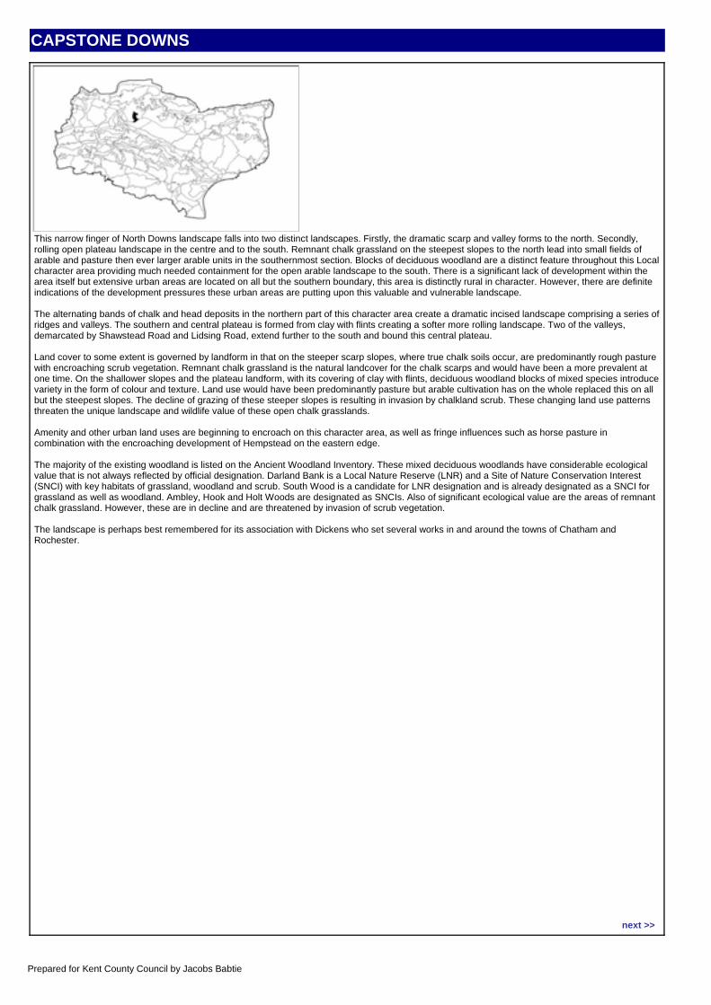
CAPSTONE DOWNS
CHARACTER AREA DESCRIPTIONThis narrow finger of North Downs landscape falls into two distinct landscapes. Firstly, the dramatic scarp and valley forms to the north. Secondly, rolling open plateau landscape in the centre and to the south. Remnant chalk grassland on the steepest slopes to the north lead into small fields of arable and pasture then ever larger arable units in the southernmost section. Blocks of deciduous woodland are a distinct feature throughout this Local character area providing much needed containment for the open arable landscape to the south. There is a significant lack of development within the area itself but extensive urban areas are located on all but the southern boundary, this area is distinctly rural in character. However, there are definite indications of the development pressures these urban areas are putting upon this valuable and vulnerable landscape.
The alternating bands of chalk and head deposits in the northern part of this character area create a dramatic incised landscape comprising a series of ridges and valleys. The southern and central plateau is formed from clay with flints creating a softer more rolling landscape. Two of the valleys, demarcated by Shawstead Road and Lidsing Road, extend further to the south and bound this central plateau.
Land cover to some extent is governed by landform in that on the steeper scarp slopes, where true chalk soils occur, are predominantly rough pasture with encroaching scrub vegetation. Remnant chalk grassland is the natural landcover for the chalk scarps and would have been a more prevalent at one time. On the shallower slopes and the plateau landform, with its covering of clay with flints, deciduous woodland blocks of mixed species introduce variety in the form of colour and texture. Land use would have been predominantly pasture but arable cultivation has on the whole replaced this on all but the steepest slopes. The decline of grazing of these steeper slopes is resulting in invasion by chalkland scrub. These changing land use patterns threaten the unique landscape and wildlife value of these open chalk grasslands.
Amenity and other urban land uses are beginning to encroach on this character area, as well as fringe influences such as horse pasture in combination with the encroaching development of Hempstead on the eastern edge.
The majority of the existing woodland is listed on the Ancient Woodland Inventory. These mixed deciduous woodlands have considerable ecological value that is not always reflected by official designation. Darland Bank is a Local Nature Reserve (LNR) and a Site of Nature Conservation Interest (SNCI) with key habitats of grassland, woodland and scrub. South Wood is a candidate for LNR designation and is already designated as a SNCI for grassland as well as woodland. Ambley, Hook and Holt Woods are designated as SNCIs. Also of significant ecological value are the areas of remnant chalk grassland. However, these are in decline and are threatened by invasion of scrub vegetation.
The landscape is perhaps best remembered for its association with Dickens who set several works in and around the towns of Chatham and Rochester.
Location map:
next >>
Prepared for Kent County Council by Jacobs Babtie
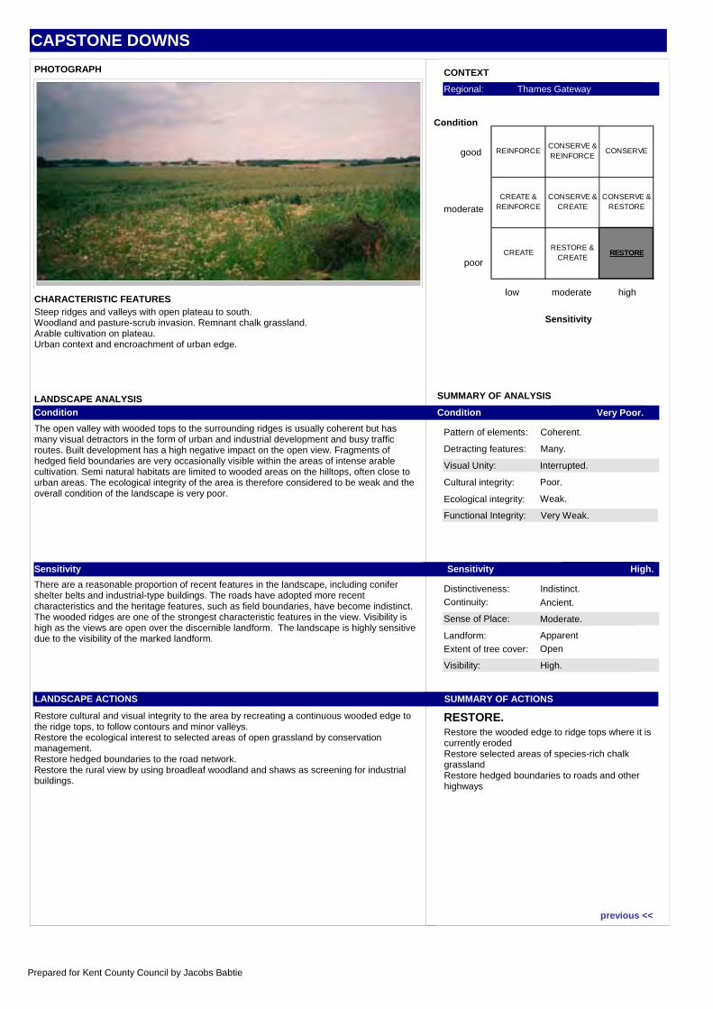
CAPSTONE DOWNS
Visual Unity: Interrupted.
Functional Integrity: Very Weak.
Sense of Place: Moderate.
Visibility: High.
Condition Very Poor.
Sensitivity High.
SUMMARY OF ACTIONS
RESTORE.
Pattern of elements: Coherent.
Detracting features: Many.
Cultural integrity: Poor.
Ecological integrity: Weak.
Distinctiveness: Indistinct.Continuity: Ancient.
Landform: Apparent
Extent of tree cover: Open
SUMMARY OF ANALYSIS
CONTEXT
low moderate high
Sensitivity
good
moderate
poor
Condition
Regional: Thames Gateway
PHOTOGRAPH
CHARACTERISTIC FEATURES
LANDSCAPE ANALYSISCondition
The open valley with wooded tops to the surrounding ridges is usually coherent but has many visual detractors in the form of urban and industrial development and busy traffic routes. Built development has a high negative impact on the open view. Fragments of hedged field boundaries are very occasionally visible within the areas of intense arable cultivation. Semi natural habitats are limited to wooded areas on the hilltops, often close to urban areas. The ecological integrity of the area is therefore considered to be weak and the overall condition of the landscape is very poor.
Sensitivity
There are a reasonable proportion of recent features in the landscape, including conifer shelter belts and industrial-type buildings. The roads have adopted more recent characteristics and the heritage features, such as field boundaries, have become indistinct. The wooded ridges are one of the strongest characteristic features in the view. Visibility is high as the views are open over the discernible landform. The landscape is highly sensitive due to the visibility of the marked landform.
LANDSCAPE ACTIONS
Restore cultural and visual integrity to the area by recreating a continuous wooded edge to the ridge tops, to follow contours and minor valleys.Restore the ecological interest to selected areas of open grassland by conservation management.Restore hedged boundaries to the road network.Restore the rural view by using broadleaf woodland and shaws as screening for industrial buildings.
Steep ridges and valleys with open plateau to south.Woodland and pasture-scrub invasion. Remnant chalk grassland.Arable cultivation on plateau.Urban context and encroachment of urban edge.
Restore the wooded edge to ridge tops where it is currently erodedRestore selected areas of species-rich chalk grasslandRestore hedged boundaries to roads and other highways
REINFORCECONSERVE & REINFORCE
CONSERVE
CREATE & REINFORCE
CONSERVE & CREATE
CONSERVE & RESTORE
CREATE RESTORE &
CREATERESTORE
previous <<
Prepared for Kent County Council by Jacobs Babtie
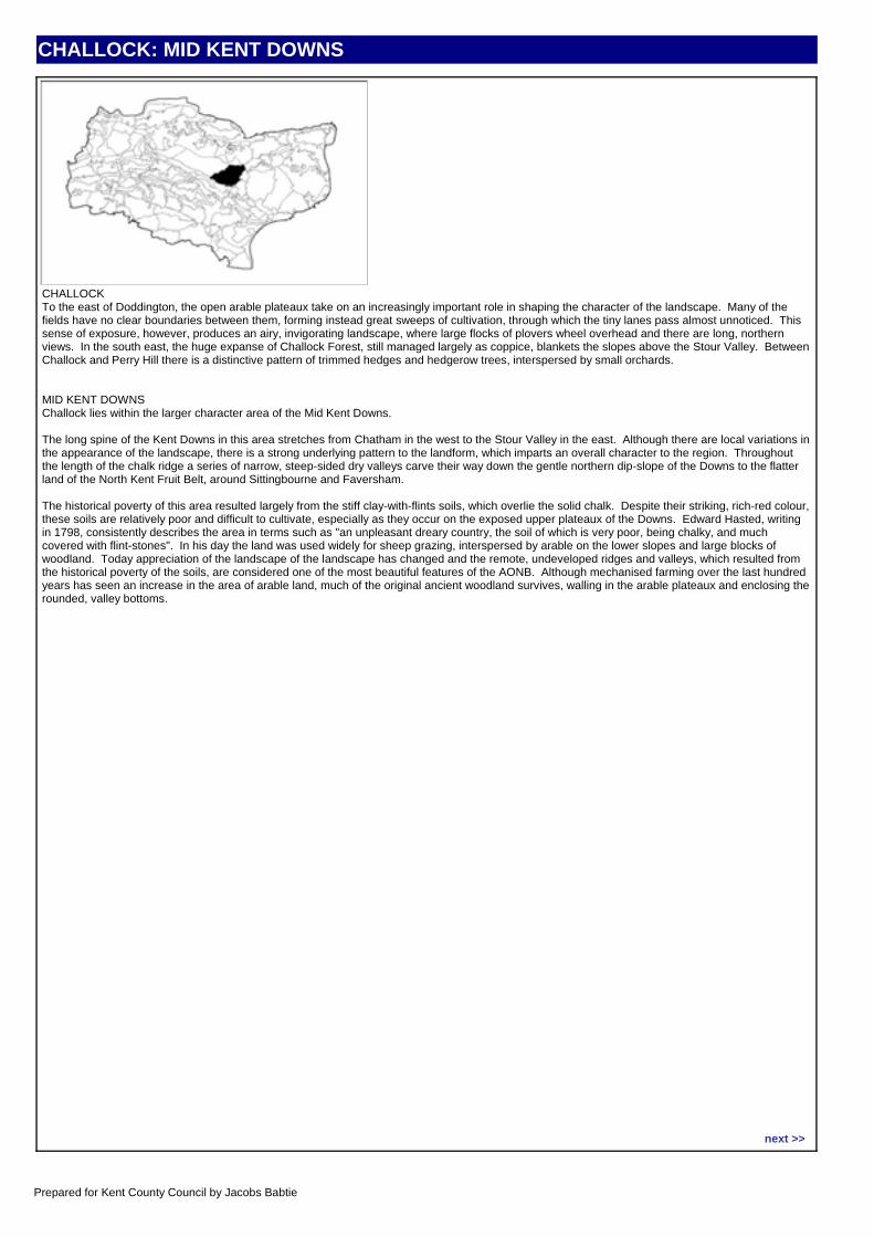
CHALLOCK: MID KENT DOWNS
CHARACTER AREA DESCRIPTIONCHALLOCKTo the east of Doddington, the open arable plateaux take on an increasingly important role in shaping the character of the landscape. Many of the fields have no clear boundaries between them, forming instead great sweeps of cultivation, through which the tiny lanes pass almost unnoticed. This sense of exposure, however, produces an airy, invigorating landscape, where large flocks of plovers wheel overhead and there are long, northern views. In the south east, the huge expanse of Challock Forest, still managed largely as coppice, blankets the slopes above the Stour Valley. Between Challock and Perry Hill there is a distinctive pattern of trimmed hedges and hedgerow trees, interspersed by small orchards.
MID KENT DOWNSChallock lies within the larger character area of the Mid Kent Downs.
The long spine of the Kent Downs in this area stretches from Chatham in the west to the Stour Valley in the east. Although there are local variations in the appearance of the landscape, there is a strong underlying pattern to the landform, which imparts an overall character to the region. Throughout the length of the chalk ridge a series of narrow, steep-sided dry valleys carve their way down the gentle northern dip-slope of the Downs to the flatter land of the North Kent Fruit Belt, around Sittingbourne and Faversham.
The historical poverty of this area resulted largely from the stiff clay-with-flints soils, which overlie the solid chalk. Despite their striking, rich-red colour, these soils are relatively poor and difficult to cultivate, especially as they occur on the exposed upper plateaux of the Downs. Edward Hasted, writing in 1798, consistently describes the area in terms such as "an unpleasant dreary country, the soil of which is very poor, being chalky, and much covered with flint-stones". In his day the land was used widely for sheep grazing, interspersed by arable on the lower slopes and large blocks of woodland. Today appreciation of the landscape of the landscape has changed and the remote, undeveloped ridges and valleys, which resulted from the historical poverty of the soils, are considered one of the most beautiful features of the AONB. Although mechanised farming over the last hundred years has seen an increase in the area of arable land, much of the original ancient woodland survives, walling in the arable plateaux and enclosing the rounded, valley bottoms.
Location map:
next >>
Prepared for Kent County Council by Jacobs Babtie
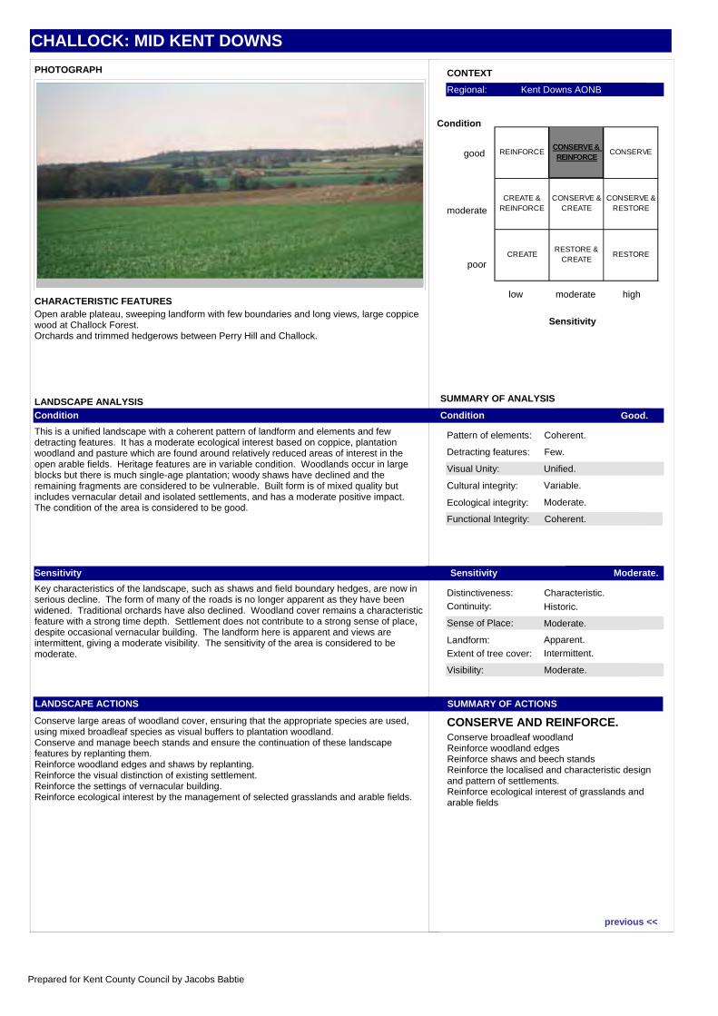
CHALLOCK: MID KENT DOWNS
Visual Unity: Unified.
Functional Integrity: Coherent.
Sense of Place: Moderate.
Visibility: Moderate.
Condition Good.
Sensitivity Moderate.
SUMMARY OF ACTIONS
CONSERVE AND REINFORCE.
Pattern of elements: Coherent.
Detracting features: Few.
Cultural integrity: Variable.
Ecological integrity: Moderate.
Distinctiveness: Characteristic.Continuity: Historic.
Landform: Apparent.
Extent of tree cover: Intermittent.
SUMMARY OF ANALYSIS
CONTEXT
low moderate high
Sensitivity
good
moderate
poor
Condition
Regional: Kent Downs AONB
PHOTOGRAPH
CHARACTERISTIC FEATURES
LANDSCAPE ANALYSISCondition
This is a unified landscape with a coherent pattern of landform and elements and few detracting features. It has a moderate ecological interest based on coppice, plantation woodland and pasture which are found around relatively reduced areas of interest in the open arable fields. Heritage features are in variable condition. Woodlands occur in large blocks but there is much single-age plantation; woody shaws have declined and the remaining fragments are considered to be vulnerable. Built form is of mixed quality but includes vernacular detail and isolated settlements, and has a moderate positive impact. The condition of the area is considered to be good.
Sensitivity
Key characteristics of the landscape, such as shaws and field boundary hedges, are now in serious decline. The form of many of the roads is no longer apparent as they have been widened. Traditional orchards have also declined. Woodland cover remains a characteristic feature with a strong time depth. Settlement does not contribute to a strong sense of place, despite occasional vernacular building. The landform here is apparent and views are intermittent, giving a moderate visibility. The sensitivity of the area is considered to be moderate.
LANDSCAPE ACTIONS
Conserve large areas of woodland cover, ensuring that the appropriate species are used, using mixed broadleaf species as visual buffers to plantation woodland.Conserve and manage beech stands and ensure the continuation of these landscape features by replanting them.Reinforce woodland edges and shaws by replanting.Reinforce the visual distinction of existing settlement.Reinforce the settings of vernacular building.Reinforce ecological interest by the management of selected grasslands and arable fields.
Open arable plateau, sweeping landform with few boundaries and long views, large coppice wood at Challock Forest.Orchards and trimmed hedgerows between Perry Hill and Challock.
Conserve broadleaf woodlandReinforce woodland edgesReinforce shaws and beech standsReinforce the localised and characteristic design and pattern of settlements. Reinforce ecological interest of grasslands and arable fields
REINFORCECONSERVE & REINFORCE
CONSERVE
CREATE & REINFORCE
CONSERVE & CREATE
CONSERVE & RESTORE
CREATE RESTORE &
CREATERESTORE
previous <<
Prepared for Kent County Council by Jacobs Babtie
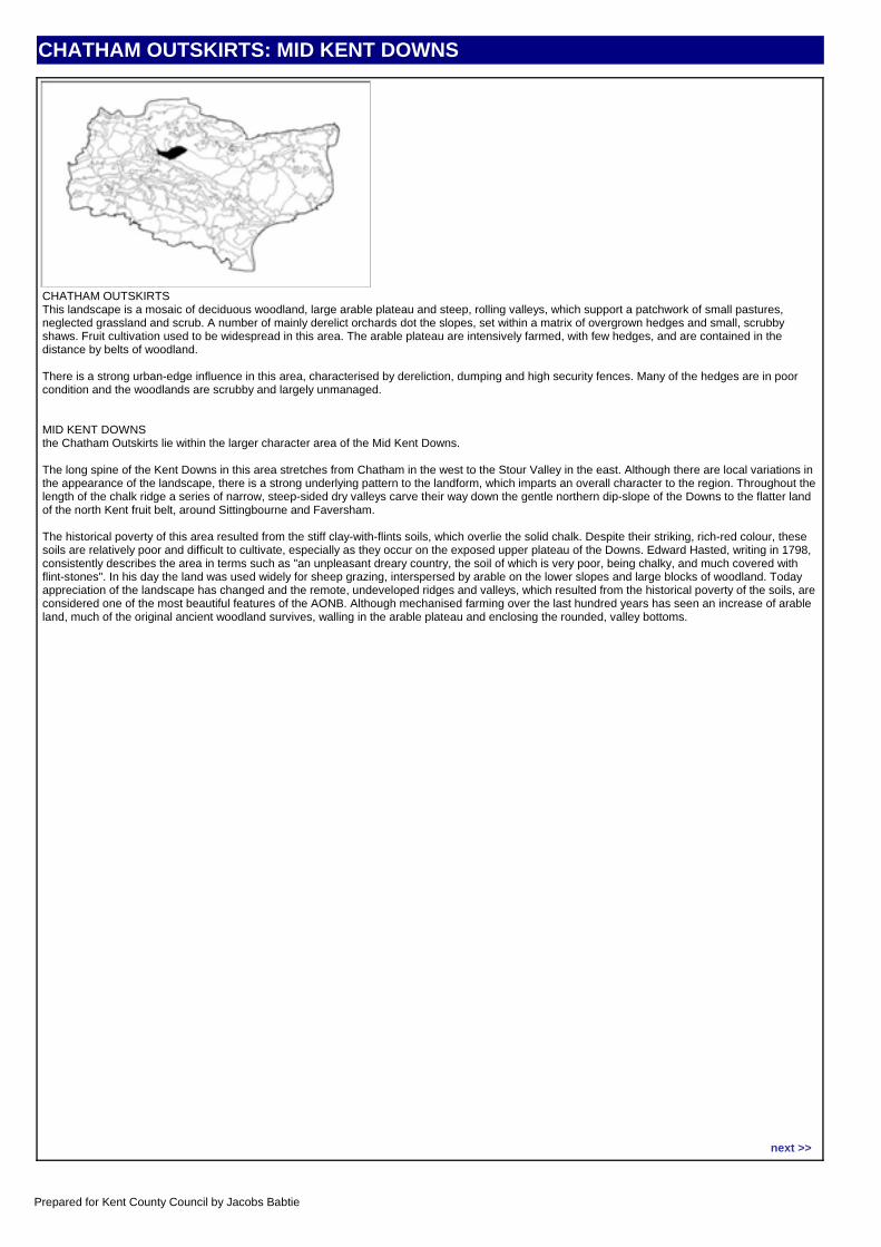
CHATHAM OUTSKIRTS: MID KENT DOWNS
CHARACTER AREA DESCRIPTIONCHATHAM OUTSKIRTSThis landscape is a mosaic of deciduous woodland, large arable plateau and steep, rolling valleys, which support a patchwork of small pastures, neglected grassland and scrub. A number of mainly derelict orchards dot the slopes, set within a matrix of overgrown hedges and small, scrubby shaws. Fruit cultivation used to be widespread in this area. The arable plateau are intensively farmed, with few hedges, and are contained in the distance by belts of woodland.
There is a strong urban-edge influence in this area, characterised by dereliction, dumping and high security fences. Many of the hedges are in poor condition and the woodlands are scrubby and largely unmanaged.
MID KENT DOWNSthe Chatham Outskirts lie within the larger character area of the Mid Kent Downs.
The long spine of the Kent Downs in this area stretches from Chatham in the west to the Stour Valley in the east. Although there are local variations in the appearance of the landscape, there is a strong underlying pattern to the landform, which imparts an overall character to the region. Throughout the length of the chalk ridge a series of narrow, steep-sided dry valleys carve their way down the gentle northern dip-slope of the Downs to the flatter land of the north Kent fruit belt, around Sittingbourne and Faversham.
The historical poverty of this area resulted from the stiff clay-with-flints soils, which overlie the solid chalk. Despite their striking, rich-red colour, these soils are relatively poor and difficult to cultivate, especially as they occur on the exposed upper plateau of the Downs. Edward Hasted, writing in 1798, consistently describes the area in terms such as "an unpleasant dreary country, the soil of which is very poor, being chalky, and much covered with flint-stones". In his day the land was used widely for sheep grazing, interspersed by arable on the lower slopes and large blocks of woodland. Today appreciation of the landscape has changed and the remote, undeveloped ridges and valleys, which resulted from the historical poverty of the soils, are considered one of the most beautiful features of the AONB. Although mechanised farming over the last hundred years has seen an increase of arable land, much of the original ancient woodland survives, walling in the arable plateau and enclosing the rounded, valley bottoms.
Location map:
next >>
Prepared for Kent County Council by Jacobs Babtie
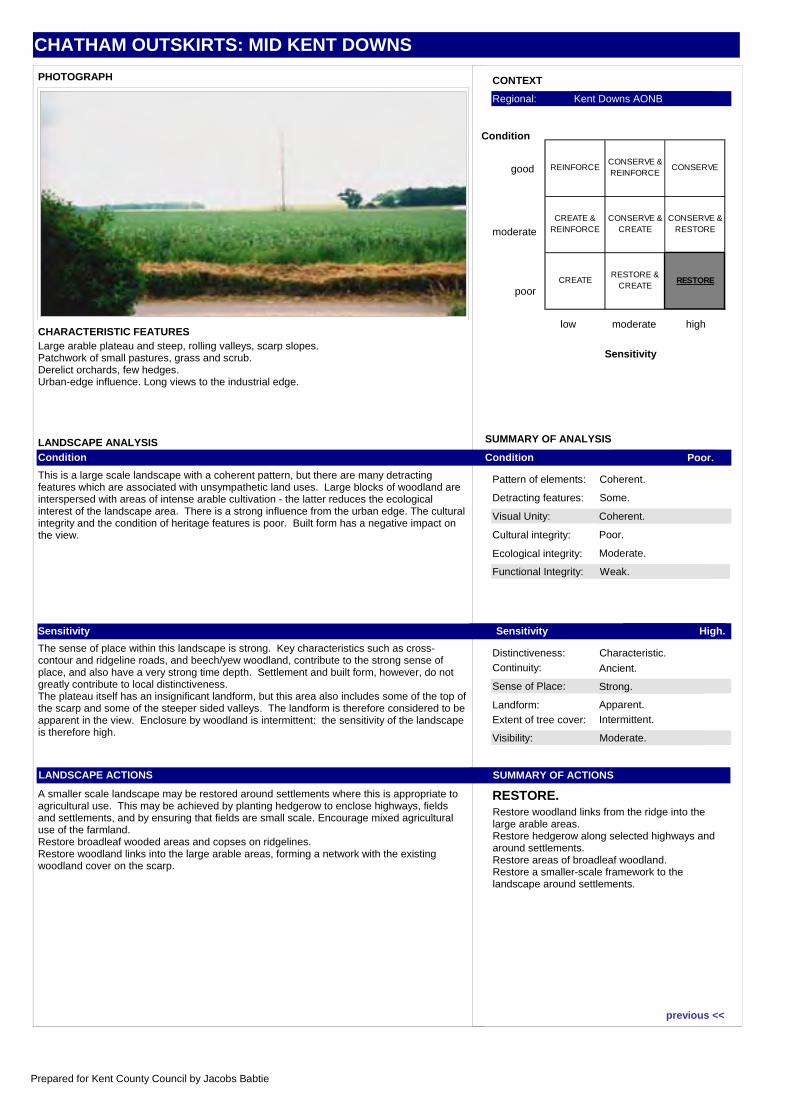
CHATHAM OUTSKIRTS: MID KENT DOWNS
Visual Unity: Coherent.
Functional Integrity: Weak.
Sense of Place: Strong.
Visibility: Moderate.
Condition Poor.
Sensitivity High.
SUMMARY OF ACTIONS
RESTORE.
Pattern of elements: Coherent.
Detracting features: Some.
Cultural integrity: Poor.
Ecological integrity: Moderate.
Distinctiveness: Characteristic.Continuity: Ancient.
Landform: Apparent.
Extent of tree cover: Intermittent.
SUMMARY OF ANALYSIS
CONTEXT
low moderate high
Sensitivity
good
moderate
poor
Condition
Regional: Kent Downs AONB
PHOTOGRAPH
CHARACTERISTIC FEATURES
LANDSCAPE ANALYSISCondition
This is a large scale landscape with a coherent pattern, but there are many detracting features which are associated with unsympathetic land uses. Large blocks of woodland are interspersed with areas of intense arable cultivation - the latter reduces the ecological interest of the landscape area. There is a strong influence from the urban edge. The cultural integrity and the condition of heritage features is poor. Built form has a negative impact on the view.
Sensitivity
The sense of place within this landscape is strong. Key characteristics such as cross-contour and ridgeline roads, and beech/yew woodland, contribute to the strong sense of place, and also have a very strong time depth. Settlement and built form, however, do not greatly contribute to local distinctiveness.The plateau itself has an insignificant landform, but this area also includes some of the top of the scarp and some of the steeper sided valleys. The landform is therefore considered to be apparent in the view. Enclosure by woodland is intermittent: the sensitivity of the landscape is therefore high.
LANDSCAPE ACTIONS
A smaller scale landscape may be restored around settlements where this is appropriate to agricultural use. This may be achieved by planting hedgerow to enclose highways, fields and settlements, and by ensuring that fields are small scale. Encourage mixed agricultural use of the farmland.Restore broadleaf wooded areas and copses on ridgelines.Restore woodland links into the large arable areas, forming a network with the existing woodland cover on the scarp.
Large arable plateau and steep, rolling valleys, scarp slopes.Patchwork of small pastures, grass and scrub.Derelict orchards, few hedges.Urban-edge influence. Long views to the industrial edge.
Restore woodland links from the ridge into the large arable areas.Restore hedgerow along selected highways and around settlements.Restore areas of broadleaf woodland.Restore a smaller-scale framework to the landscape around settlements.
REINFORCECONSERVE & REINFORCE
CONSERVE
CREATE & REINFORCE
CONSERVE & CREATE
CONSERVE & RESTORE
CREATE RESTORE &
CREATERESTORE
previous <<
Prepared for Kent County Council by Jacobs Babtie