Embed Size (px)
Citation preview
Heath J. GrantKaren J.Terry
Allyn & Bacon75 Arlington St., Suite 300
Boston, MA 02116www.ablongman.com
0-205-39379-9 Exam Copy ISBN(Please use above number to order your exam copy.)
© 2005
s a m p l e c h a p t e rThe pages of this Sample Chapter may have
slight variations in final published form.
Visit www.ablongman.com/replocator to contact your local Allyn & Bacon/Longman representative.
LAW ENFORCEMENT IN THE 21ST CENTURY
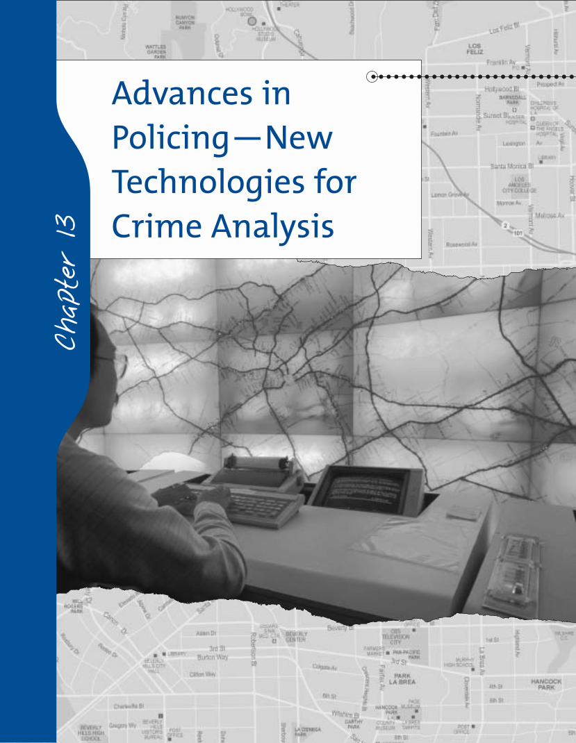
Advances inPolicing—NewTechnologies forCrime Analysis
Chap
ter 13
● Identify the stages of technologi-cal advancement in policing and the
implications of technology utilizationin the field.
● Understand the different types ofcrime analysis and the technologies
available for them, such as GIS.
● Know the variety of applications ofGIS technology.
● Appreciate the many types of tech-nology available to modern law en-forcement.
Chapter Outline
Chapter Objectives
Introduction
The Stages of Technological Advancement in Policing The First Stage (1881–1945)
The Second Stage (1946–1959)
The Third Stage (1960–1979)
The Fourth Stage (1980–present)
Crime Analysis Strategic Crime Analysis
Tactical Crime Analysis
Geomapping Crime Patterns: Moving Beyond Push Pins What Crime Maps Do: GIS as a Technical Aid to Problem-oriented Policing
Types of Data with Mapping Applications
LINKAGES IN LAW ENFORCEMENT: GIS Applications to Sex-offender ManagementMapping and Accountability: GIS in Action
GIS and the Patrol Officer
Other Applications: Geographic Profiling
LINKAGES IN LAW ENFORCEMENT: GIS Applications to Community Policing
Twenty-first Century Technologies in PolicingSurveillance Technologies
Closed-Circuit Television
Global Positioning Systems
BiometricsFacial Recognition Software
Fingerprint Identification Systems
Interjurisdictional Communication Technology
Offender Databases
Cross-Jurisdictional Radio Communications
Electronic Warrant Processes
Information Security Through Encryption
The World Wide Web andCommunity Policing
Improving Accountability: MobileCommunications with Patrol
Mobile Digital Communications
Automatic Vehicle Monitoring
Chapter Summary
LINKING THE DOTS
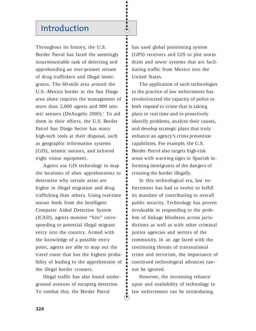
Throughout its history, the U.S.
Border Patrol has faced the seemingly
insurmountable task of detecting and
apprehending an ever-present stream
of drug traffickers and illegal immi-
grants. The 60-mile area around the
U.S.–Mexico border in the San Diego
area alone requires the management of
more than 2,000 agents and 900 seis-
mic sensors (DeAngelis 2000).1 To aid
them in their efforts, the U.S. Border
Patrol San Diego Sector has many
high-tech tools at their disposal, such
as geographic information systems
(GIS), seismic sensors, and infrared
night vision equipment.
Agents use GIS technology to map
the locations of alien apprehensions to
determine why certain areas are
higher in illegal migration and drug
trafficking than others. Using real-time
sensor feeds from the Intelligent
Computer Aided Detection System
(ICAD), agents monitor “hits” corre-
sponding to potential illegal migrant
entry into the country. Armed with
the knowledge of a possible entry
point, agents are able to map out the
travel route that has the highest proba-
bility of leading to the apprehension of
the illegal border crossers.
Illegal traffic has also found under-
ground avenues of escaping detection.
To combat this, the Border Patrol
has used global positioning system
(GPS) receivers and GIS to plot storm
drain and sewer systems that are facil-
itating traffic from Mexico into the
United States.
The application of such technologies
to the practice of law enforcement has
revolutionized the capacity of police to
both respond to crime that is taking
place in real time and to proactively
identify problems, analyze their causes,
and develop strategic plans that truly
enhance an agency’s crime prevention
capabilities. For example, the U.S.
Border Patrol also targets high-risk
areas with warning signs in Spanish in-
forming immigrants of the dangers of
crossing the border illegally.
In this technological era, law en-
forcement has had to evolve to fulfill
its mandate of contributing to overall
public security. Technology has proven
invaluable in responding to the prob-
lem of linkage blindness across juris-
dictions as well as with other criminal
justice agencies and sectors of the
community. In an age faced with the
continuing threats of transnational
crime and terrorism, the importance of
continued technological advances can-
not be ignored.
However, the increasing reliance
upon and availability of technology to
law enforcement can be intimidating.
Introduction
324
This technology brings with it new
legal challenges, particularly with regard
to the balance between crime control
and the private interests of citizens,
which was discussed at the beginning
of this book. This chapter will begin
with a brief overview of the develop-
ment of technological advances in law
enforcement, followed by descriptive
coverage of key technological applica-
tions in policing. Particular attention
will be paid to the use of GIS in facili-
tating proactive police management in
the twenty-first century.
Introduction 325
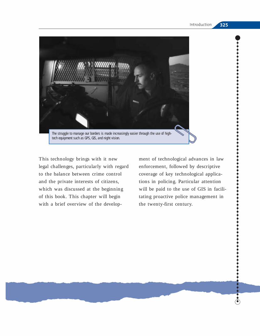
The struggle to manage our borders is made increasingly easier through the use of high-tech equipment such as GPS, GIS, and night vision.
The Stages of Technological Advancementin Policing
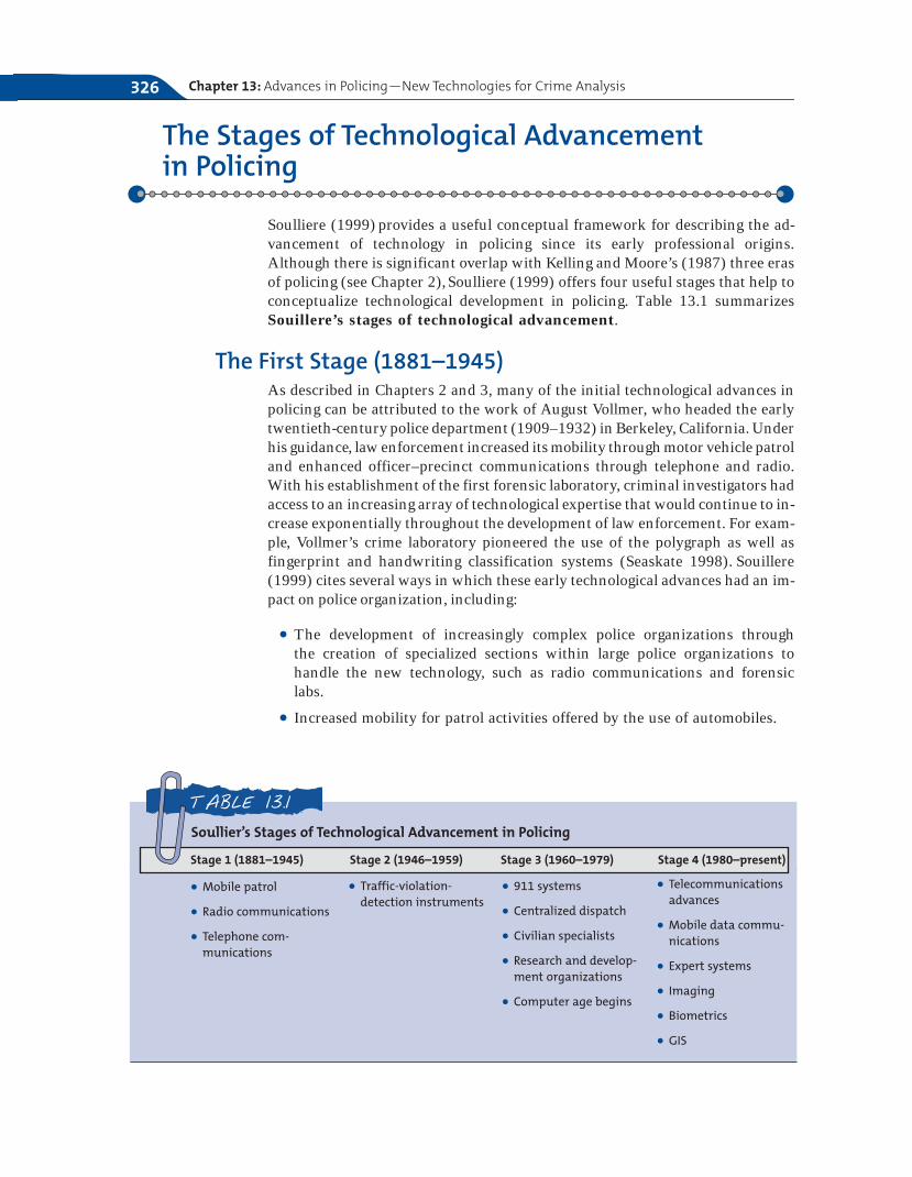
Soulliere (1999) provides a useful conceptual framework for describing the ad-vancement of technology in policing since its early professional origins.Although there is significant overlap with Kelling and Moore’s (1987) three erasof policing (see Chapter 2),Soulliere (1999) offers four useful stages that help toconceptualize technological development in policing. Table 13.1 summarizesSouillere’s stages of technological advancement.
The First Stage (1881–1945)As described in Chapters 2 and 3, many of the initial technological advances inpolicing can be attributed to the work of August Vollmer, who headed the earlytwentieth-century police department (1909–1932) in Berkeley, California. Underhis guidance, law enforcement increased its mobility through motor vehicle patroland enhanced officer–precinct communications through telephone and radio.With his establishment of the first forensic laboratory, criminal investigators hadaccess to an increasing array of technological expertise that would continue to in-crease exponentially throughout the development of law enforcement. For exam-ple, Vollmer’s crime laboratory pioneered the use of the polygraph as well asfingerprint and handwriting classification systems (Seaskate 1998). Souillere(1999) cites several ways in which these early technological advances had an im-pact on police organization, including:
● The development of increasingly complex police organizations through the creation of specialized sections within large police organizations to handle the new technology, such as radio communications and forensic labs.
● Increased mobility for patrol activities offered by the use of automobiles.
Chapter 13: Advances in Policing—New Technologies for Crime Analysis326
● Mobile patrol
● Radio communications
● Telephone com-munications
Soullier’s Stages of Technological Advancement in Policing
Stage 1 (1881–1945) Stage 2 (1946–1959) Stage 3 (1960–1979) Stage 4 (1980–present)
TABLE 13.1
● Traffic-violation-detection instruments
● 911 systems
● Centralized dispatch
● Civilian specialists
● Research and develop-ment organizations
● Computer age begins
● Telecommunicationsadvances
● Mobile data commu-nications
● Expert systems
● Imaging
● Biometrics
● GIS
● Increased officer safety made possible with enhanced communications andthe use of automobiles.
The Second Stage (1946–1959)Roughly corresponding with the beginnings of Kelling and Moore’s (1987) re-form era of policing, Soulliere (1999) notes that the second stage of advance-ment saw the bureaucratization of policing organizations that, to some degree,was a result of technological advancements. During this stage, traffic police re-ceived a significant boost with the advent of the first instruments to measureboth speeding violations and the condition of the driver. Although early instru-ments were rather crude indicators, they would grow over time to include thesignificant automobile surveillance mechanisms and blood-alcohol measuresdiscussed briefly in Chapter 6.
The Third Stage (1960–1979)As society in general entered the computer age, Soulliere (1999) claims that po-lice technology began to truly emerge. It is during this stage that call distributioncenters, computerized databanks, and computer-aided dispatch (CAD) be-came commonplace in police agencies. Some of the significant technological ad-vancements in this stage can be attributed to President Lyndon B. Johnson. In1967, Johnson created the President’s Commission on Law Enforcement andthe Administration of Justice to analyze U.S. crime patterns and provided re-sources to combat crime. Importantly, the report generated by the Commissionon Law Enforcement highlighted the slow infusion of societal technological ad-vances into the criminal justice system, with particular attention paid to polic-ing. To this end, the report stated (President’s Commission on Law Enforcementand the Administration of Justice 1967):
The police, with crime laboratories and radio networks, made early use of technology,but most police departments could have been equipped 30 or 40 years ago as well asthey are today. . . . Of all criminal justice agencies, the police have had the closestties to science and technology, but they have called on scientific resources primarilyto help in the solution of specific serious crimes, rather than for assistance in solvinggeneral problems of policing. (p. 125)
A notable gap existed between the technologies that were currently availablethat had potential law enforcement applications and what police agencies wereactually using. In response to this gap, the Johnson administration began “theflow, a trickle at first, of what eventually became billions of dollars in direct andindirect assistance to local and state law enforcement” (Seaskate 1998, p. 2).
Importantly, the commission argued for the establishment of a single tele-phone number that citizens across the country could use to contact the police inthe case of an emergency. In only a matter of years following AT&T’s an-nouncement of the first 911 system in 1968, its use became a driving force forpolice departments across the country (Seaskate 1998). As highlighted through-out earlier chapters, this increasing emphasis on calls for service would haveboth benefits (the seeming ease of access to the police in times of emergency),as well as detriments (this became the principal means of determining police re-source deployment and performance evaluation). Skolnick and Bayley (1986)
The Stages of Technological Advancement in Policing 327
point out that patrol personnel can easily be exhausted by rushing between callsfor service, rather than taking the time needed to truly digest and understandthe human situations into which they are thrown constantly.
During this third stage of development, large municipalities began to cen-tralize the dispatch of all fire, police, and medical services (Seaskate 1998). Theover-reliance of the average citizen on the use of 911, regardless of the nature orseriousness of the problem, has led to the establishment of 311 systems inmany metropolitan areas to try and decrease the significant burden 911 has hadon city emergency resources. The 311 system is available for all calls to policeand fire personnel that are not emergencies. Other recent strategies for handlingthe call volume brought about by 911 include the differential response ap-proaches described in Chapter 6.
Increased research on law enforcement applications and technological de-velopment was also a key characteristic of the third stage. The National Instituteof Justice (NIJ) was created in 1968 and it continues to play a leading role in en-hancing the field of law enforcement both nationally and internationally(Soulliere 1999). An increasing reliance on civilian specialists within large po-lice organizations also continued throughout this stage because of developmentsin the areas of forensics and communication technologies.
The Fourth Stage (1980–present)Information access and use characterize Soulliere’s (1999) fourth stage of tech-nological development. In addition to simply amassing a volume of informa-tion—a task that law enforcement agencies have been successful at since theircreation—technological advancement now focuses on the speed and ease of in-formation use. Moreover, technology developed throughout the fourth stagenow provides law enforcement with access to data that would be unavailable tothem without these tools. Collaboration between traditional law enforcementand the military has resulted in many of the technologies introduced in thisstage. Examples of such new tools include those in telecommunications, mobilecomputing, expert systems, imaging, and biometric technologies (Soulliere1999). Each of these areas will be described further in this chapter.
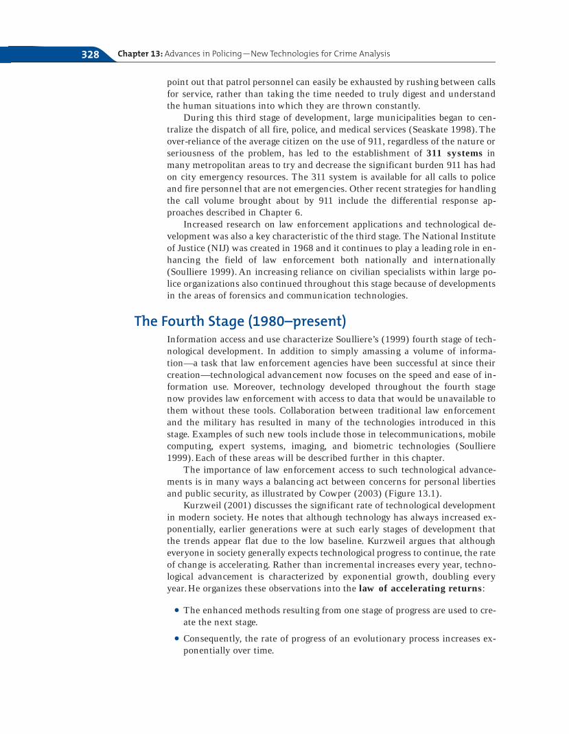
The importance of law enforcement access to such technological advance-ments is in many ways a balancing act between concerns for personal libertiesand public security, as illustrated by Cowper (2003) (Figure 13.1).
Kurzweil (2001) discusses the significant rate of technological developmentin modern society. He notes that although technology has always increased ex-ponentially, earlier generations were at such early stages of development thatthe trends appear flat due to the low baseline. Kurzweil argues that althougheveryone in society generally expects technological progress to continue, the rateof change is accelerating. Rather than incremental increases every year, techno-logical advancement is characterized by exponential growth, doubling everyyear. He organizes these observations into the law of accelerating returns:
● The enhanced methods resulting from one stage of progress are used to cre-ate the next stage.
● Consequently, the rate of progress of an evolutionary process increases ex-ponentially over time.
Chapter 13: Advances in Policing—New Technologies for Crime Analysis328
● In addition, the speed and cost-effectiveness of a technological advancementwill also increase exponentially over time.
● Finally, current methods of solving a problem in technology (such as shrink-ing transistors on an integrated circuit as an approach to making more pow-erful computers) will provide exponential growth until the method exhaustsits potential. At this time, a fundamental change will result that will allowthe exponential growth to continue.
Cowper (2003) summarizes the law of accelerating returns by saying thatwe will have 100 years of progress in the next 25 years and 20,000 years ofprogress in the next 100 years. Thus, the technology of science fiction thatwe often think of as being so far in the future is perhaps not as distant as itmight seem. The applications available to policing now or in the near futuremight seem more the work of science fiction than reality. Certainly the ap-plications of technology to policing have greatly enhanced the ability of lawenforcement organizations to meaningfully engage in the problem-solvingprocess. Although many police departments continue to be behind the curvein terms of integrating new technologies into day-to-day operations, the suc-cess of many applications to sound policing will make ignoring progress in-creasingly difficult over time.
Crime Analysis
Integral to the process of problem solving discussed in Chapter 12 is crimeanalysis. Crime analysis has been defined as involving “the collection andanalysis of data pertaining to a criminal incident, offender, and target” (Canter2000, p. 4). Ideally, crime analysis will guide police managers in making deploy-ment and resource allocation decisions that are linked to a true understandingof the nature of the problem. The more important data collected and analyzed
Crime Analysis 329
The balancing act for law enforcement technology utilization
FIGURE 13.1
Use of technology
Freedom Democracy Social Welfare Privacy Security
Modified from Cowper (2003).
related to all components of the crime triangle (victim, offender, location) (seeChapter 12), the better equipped police organizations will be to develop innova-tive, out-of-the-box solutions that include the full spectrum of suppression, in-tervention, and prevention options.
An important note of caution must be stressed here. Crime analysis willonly be as good as the data or information that is collected. There are three es-sential criteria for crime analysis that departments should use when de-signing data collection processes as well as when interpreting the meaning ofinformation resulting from crime analysis. These criteria are:
1. Timeliness: Does the pattern or trend presented reflect a current problem or issue or is it more representative of a previous situation?Deployment decisions with respect to both prevention and offender-apprehension efforts must be based on information that is as current aspossible.
2. Relevancy: Do the measures used in the analysis accurately reflect what isintended? For example, whether a pattern is based upon calls-for-service data or incident data can be a very important determination de-pending on what the police manager is trying to understand.
3. Reliability: Would the same data, interpreted by different people at differ-ent times, lead to the same conclusions?
Canter (2000) categorizes crime analysis into both strategic and tacticalfunctions.
Strategic Crime AnalysisThe collection and analysis of data spanning a long period of time is strategiccrime analysis. This type of analysis is said to be research focused because it in-cludes the use of statistics to make conclusions (Canter 2000). This form ofanalysis can be useful to departments in terms of crime-trend forecasting, orusing data to estimate future crime based on past trends (Canter 2000). Withcrime-trend forecasting, important decisions can be made as to the deploymentof patrol as a reflection of the changing volume of criminal activity.
Another important benefit of strategic crime analysis is the analysis ofchanging community dynamics and risk factors that might be contributing tothe particular crime trends of a specific area (Canter 2000).Once again, this typeof analysis over time can result in more informed decision making that can leadto police partnerships with other city and community agencies that can help cre-ate more long-term, sustainable reductions in criminal activity.
Tactical Crime AnalysisWhereas strategic crime analysis involves the review of data spanning generallya year or more, tactical crime analysis uses real-time data spanning severaldays. One of the principal uses of this type of analysis involves problem identi-fication, or the pattern detection of multiple offenses over a short period oftime that have common characteristics, such as the type of crime, modusoperandi, and type of weapon used (Canter 2000).One example of tactical crimeanalysis that will be discussed later in this chapter is geographic profiling, which
Chapter 13: Advances in Policing—New Technologies for Crime Analysis330
can be used to suggest the likelihood of where an offender lives based on the pat-tern of where victims and offenses occur. Tactical crime analysis can occur onas large an area as a department’s entire jurisdiction or as small as the few blockradius of a hot spot.
Linkage analysis involves connecting a suspect to a series of incidentsbased on commonalities in modus operandi and suspect description as well asknown offenders that live in close proximity to a given area (Canter 2000).Following a nationwide effort by state legislatures to implement sex offenderregistration laws (Terry and Furlong 2004), many police departments regularlysearch their databases of registered sex offenders when a known series of sex-ual offenses is identified.
Finally, target profiling involves the use of data to determine the potentialrisks certain areas may have for criminal victimization based on known offensepatterns in the area. Following the previous example, some departments have ex-perimented with community-risk profiles (i.e., day care centers, presence ofparks, etc.) as a means of notifying the community of the presence of registeredsex offenders.
Geomapping Crime Patterns: Moving BeyondPush Pins
Based on the previous discussion of the applications of crime analysis to polic-ing, the integral role that geographic information systems (GIS) play inthe process is readily apparent. A GIS is an automated system for the capture,storage, retrieval, analysis, and display of spatial data (Clarke 1990). Othershave noted that “GIS technology is to geographical analysis what the micro-scope, the telescope, and computers have been to other sciences” (Cowen 2001,p. 3). By visually representing diverse data sources that can be geographicallylocated, such as crime events, land usage, property values, racial ethnic com-position, and so on, GIS enables planners to “manipulate and display geo-graphical knowledge in new and exciting ways” (Cowen 2001, p. 3). Despiteits diverse applications across various fields, the common focus of GIS is theenhancement of decision making.
In law enforcement, GIS has revolutionized the practice of electronic crimemapping, or visually displaying crime incidents on a mapped surface of a par-ticular jurisdiction. However, the use of crime maps has a long history withinpolicing. For example, the NYPD used pin maps to represent crime patternsat least as far back as 1900 (Harries 1999). Moreover, criminologists and so-ciologists have examined the spatial trends of crime and delinquency since asfar back as mid-nineteenth-century France’s Quetelet (Phillips 1972) and thesocial ecology of crime efforts pioneered by Shaw and McKay (1942). Thedifference is, of course, that until the use of GIS became more commonplacein policing practice throughout the 1990s, crime patterns were literally repre-sented by inserting push pins into the map of a jurisdiction that was usuallymounted on the wall.
Although these early crime maps proved to be useful in visually showingwhere crimes occurred, patterns would be lost over time as more and more pins
Geomapping Crime Patterns: Moving Beyond Push Pins 331
were added to the map. Additionally, these maps were very difficult to archivefor later retrieval and analysis unless they were photographed (Shaw andMcKay 1942).
What Crime Maps Do: GIS as a Technical Aid to Problem-oriented Policing
GIS has revolutionized the way in which problem-oriented policing is conductedinternationally. This is largely due to the police’s ability to now overlay seem-ingly diverse types of data that all contribute to a true understanding of a par-ticular problem. For example, a series of burglaries taking place between thehours of 1:00 AM and 3:00 AM might be the first thing visually displayed on acrime map. This would correspond with the scanning (problem-identification)part of the problem-solving model detailed in Chapter 12. However, getting atthe underlying causes of the burglary problem requires deeper probing and in-novative thinking. In this case, the crime analyst might overlay the burglary in-cident data with available data about land usage in the area. The crime analystmight then learn that the burglaries are occurring within walking distance of anarea high school.
Although this might seem to be an obvious linkage to many, individualsoften overlook such connections. By visually displaying overlays of various po-tential data combinations, GIS can play a critical role in jump-starting the analy-sis process. With the current example, the police manager might begin todevelop a series of hypotheses related to the fact that the burglaries might becaused by troublemaking youths playing hooky from their afternoon classes. Inaddition to providing a large pool of individuals from which investigators mightseek to learn information about the incidents, police planners may also begin to
Chapter 13: Advances in Policing—New Technologies for Crime Analysis332
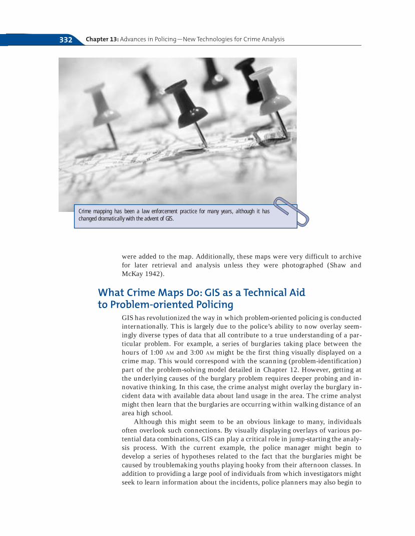
Crime mapping has been a law enforcement practice for many years, although it haschanged dramatically with the advent of GIS.
collaborate with the school to develop responses that increase truancy en-forcement in area schools.
Types of Data with Mapping ApplicationsMany types of data can be used for mapping purposes. Any data that can begeocoded, or for which there is geographic reference information, can be usedfor GIS analysis (Harries 1999). Although early forms of geocoding only per-mitted street addresses as the geographic unit upon which to map data, blocksand census tracts can now be used. Crime incidents are readily applicable forgeocoding purposes given that they are almost always available as street ad-dresses or are otherwise locationally based (Harries 1999).
To summarize, direct crime mapping pattern applications of GIS can include(Harries 1999):
● Mapping incident types and modus operandi
● Mapping attributes of victims and suspects
Based on the initial pattern analysis, overlays of other forms of data can helpto present a broader understanding of the problem. For example, a pattern analy-sis might indicate a problem of disorderly conduct and assaults in an area. Anoverlay with available liquor stores and bars in an area may present the plannerwith a series of hypotheses as to what factors might be driving the problem. Anadditional benefit of GIS is that they are directly compatible with statisticalanalyses to further refine causal projections. Thus, a city planner might be ableto statistically link the rate of disorderly conduct and assaults in city jurisdic-tions with the overall density of alcohol availability or other possibilities.
Geomapping Crime Patterns: Moving Beyond Push Pins 333
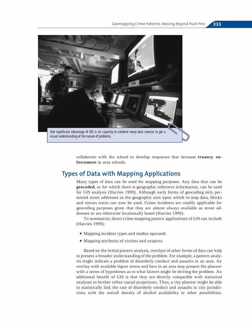
One significant advantage of GIS is its capacity to combine many data sources to get a visual understanding of the nature of problems.

Chapter 13: Advances in Policing—New Technologies for Crime Analysis334
Linkages in Law Enforcement
GIS applications can also help to increase law en-forcement’s capacity to engage in the collabora-tive problem-solving process with other criminaljustice and community agencies. The visual rep-resentation of information can be a powerfultool in coming to a common understanding ofthe nature of problems even across planninggroups with diverse perspectives.
The authors of this text participated on a citywide task force in New York City composed of representatives from law enforcement, proba-tion and parole, family and criminal courts, men-tal health, treatment providers, and victimadvocates to examine the issue of sex-offendermanagement in the community (Grant and Terry 2000). Although New York City had a largeregistered sex offender population at the time(over 3,000 offenders), there was no comprehen-sive plan for the management of these offendersin the community involving collaboration be-tween each of the key stakeholders. Building on the recognition across team members of theclear need for such a collaborative approach tosex-offender management, as well as a need to better understand the dynamics of the prob-lem through data collection, the New York CitySex Offender Management Team had tremen-dous momentum from the start, with agenciesopening their doors to facilitate the data collec-tion process.
Beginning at the first team meeting, partnerssought to identify a mechanism for gaining acomplete understanding of the sex offender pop-ulation currently residing in the community.Although it was initially suggested that each ofthe five District Attorneys represented conductsearches on sex offenders within their own data-bases to form an initial population for study, itbecame immediately apparent that the most effi-cient access to such data would be to use a data-base of all registered sex offenders in the city.
Based on this initial database, the team soughtto get complete information on probation condi-tions, employment, treatment, living situation,probation officer contacts, mental status, sub-stance abuse history, and so on. In addition, com-plete criminal histories on the offenders wererequested in order to gain a true understandingof the nature of the population being managedso that accurate comprehensive strategies couldbe devised. At all points, ethical considerationswere paramount in the use of this information,which was always presented in aggregate formand never published beyond the law enforcementplanning team purposes.
In a city the size of New York, and with such alarge number of offenders, GIS mapping of of-fender residences is essential for two reasons:First, depending on the plan developed by theteam, it might have been necessary to pilot thedemonstration project within one borough giventhe tremendous task and the resources requiredfor a citywide approach. Having a visual displayof where offenders are most concentrated canhelp aid planners in making decisions as towhere to target initial resources. Second, offendermapping had the tremendous ability to demon-strate to the team the scope of the problem, par-ticularly given the obvious clustering of offendersin several city locations. Mapping allowed re-searchers to present the planning team withbbuuffffeerr zzoonneess around each offender, combining of-fender density in a given area with overlays ofkey risk factors for reoffending drawn from therelapse-prevention literature and connected toeach offender residence location. Examination ofthis data by school and daycare locations, parks,available treatment resources, and so on were allpart of the process for meaningful informedproblem solving, to which GIS proved to be theessential core tool.
GIS Applications to Sex-offender Management
Although such analyses can only show planners of possible relations betweentwo variables, or correlations, rather than saying conclusively that X causes Y(causation), there can be no doubt that such findings greatly enhance the levelof informed decision making by law enforcement and other key stakeholders ina city.
Mapping and Accountability: GIS in ActionCrime mapping can greatly increase the accountability of a department by visu-ally demonstrating incident patterns for which departmental administrators canhold commanding officers accountable for over time. A proactive police managershould use GIS and other problem-solving tools to create sound strategic andtactical decisions related to such things as officer deployment, resource alloca-tion, and partnerships with other agencies for sustained crime reductions. TheCompStat model of the NYPD institutionalized the use of GIS for departmentalplanning purposes. The program was such a success that similar versions ofCompStat have been implemented in departments across the country.
The NYPD Crime Control Model, or CompStat, cannot be oversimplified tosimply refer to quality-of-life policing, aggressive policing, or even data-drivenpolicing, as is commonly found in the literature about the model. Rather, as po-
Geomapping Crime Patterns: Moving Beyond Push Pins 335
Questions
1. Discuss different ways GIS might be ap-plied to community policing and specifi-cally problem-solving related to crimeconcerns in your community.
2. What are the ethical considerations ofmapping offender residence locations?Research national approaches to sex of-fender registration and notification.
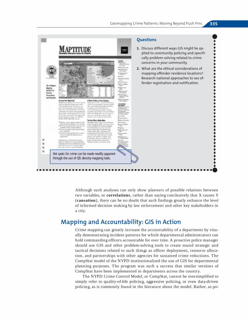
Hot spots for crime can be made readily apparentthrough the use of GIS density-mapping tools.
lice scholar Phyllis McDonald (2002) emphatically states, “this proliferation ofsingularly focused descriptors does a disservice to the management principles of CompStat and its potential for use in other jurisdictions. CompStat (from“computer-driven crime statistics”) is a comprehensive, continuous analysis ofresults for improvement and achievement of prescribed outcomes” (p. 7). Inother words, CompStat involves managing police operations by institutional-izing accountability and analysis processes that are the embodiment of the problem-oriented policing model.
McDonald (2002) offers a concise overview of the key elements of theCompStat model and issues involved in its replication in other departments. Tosummarize, these elements include:
● Specific objectives
● Accurate and timely intelligence
● Effective tactics
● Rapid deployment of personnel and resources
● Relentless follow-up and assessment
As we have seen in earlier chapters, police organizations, like any otherform of bureaucracy, are often extremely resistant to change. How then, didsuch a seemingly proactive, forward-looking model become implemented in thecountry’s largest police department? In his prior position as head of the NewYork City Transit Police in the early 1990s, former NYPD police commissionerWilliam Bratton had seen tremendous successes in focusing departmental oper-ations on specific measurable objectives and an ongoing review of outcomeachievement. Following a series of complementary strategies in the notoriouslydangerous New York City subways, such as increased undercover and uni-formed police presence and the removal of graffiti and other signs of disorder,dramatic declines in robberies, fare evasion, and general disorder resulted. NewYorkers once again began to feel safe about riding the subways.
When Bratton came to the helm of the NYPD in 1994, he began a dramaticreengineering effort that included interviews and focus groups involving repre-sentatives of every rank and bureau in order to assess the state of command inthe department (Silverman 1999a). Seven specific objectives were created toguide the future direction of the department (McDonald 2002):
1. Get guns off the street.
2. Curb youth violence in the schools and on the streets.
3. Drive drug dealers out of NYC.
4. Break the cycle of domestic violence.
5. Reclaim the public spaces of NYC.
6. Reduce auto-related crime in NYC.
7. Root out corruption and build organizational integrity in the NYPD.
In order to achieve these outcomes, as well as to measure departmentalprogress towards them, ready access to timely data was essential. However, a sig-nificant problem became immediately apparent: The NYPD was not equipped to
Chapter 13: Advances in Policing—New Technologies for Crime Analysis336
provide up-to-date crime reports. In fact, there was generally a reporting lag ofthree to six months for crime statistics, and even then, any meaningful analysisat the incident-based level was near impossible (Silverman 1996). Headquarterswas not systematically tracking crime activity in the precincts, let alone usingsuch information to evaluate the performance of its commanding officers(Silverman 1999a). As a result, precinct commanders did not view crime reduc-tion as a primary job responsibility. Common to departments across the coun-try, efficiency concerns in responding to crime were seen as more important.Detective bureaus and other specialized functions thus only rarely collaboratedwith patrol, and often directly clashed over territory and other concerns.
CompStat was devised as a means of reforming these organizational issuesby pushing all precincts to generate weekly crime activity reports so that theycould be held accountable for the achievement of the seven specific objec-tives outlined in the reengineering process (McDonald 2002). In the begin-ning, the Patrol Bureau staff computerized this data and compiled it into the“CompStat Book,” offering year-to-date crime complaints and arrests for everymajor felony category in addition to gun arrests (Silverman 1999a). These datawould then be compared at citywide, patrol-borough, and precinct levels. Inaddition, precinct commanders quickly became accountable for not only crimeactivity, but also for any inaccuracies in the data. Over time, these data became even more readily available and could be downloaded directlyfrom the department’s On-Line Booking Service (OLBS). Headquarters wouldcome to rank order the precincts in terms of overall crime changes withintheir jurisdiction.
By providing timely and accurate data it quickly became clear to precinctcommanders that their role had changed; they were now being held account-able for the crime under their charges. As such, they began to realize thatthey had to stop simply responding to crime and had to begin to proactivelythink about ways to deal with it from all angles: suppression, intervention,and prevention.
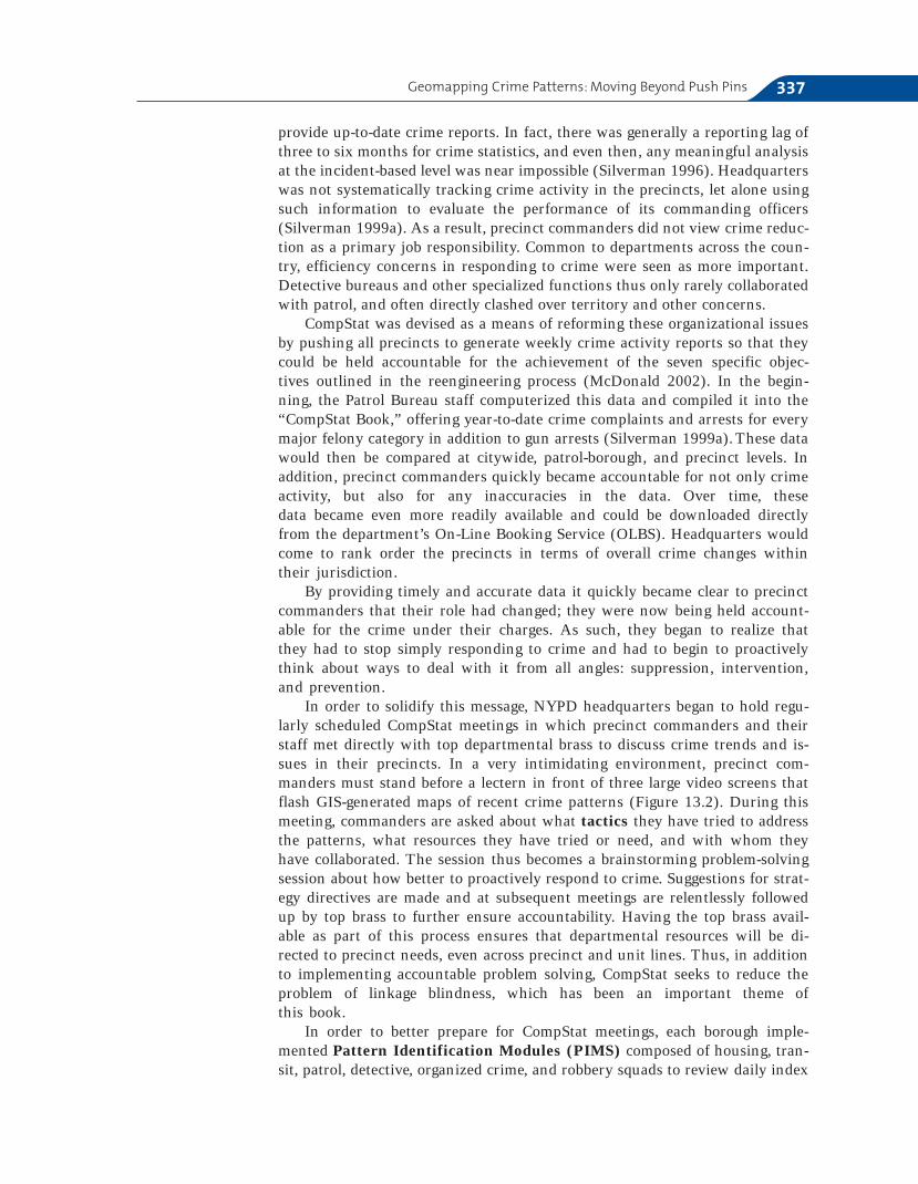
In order to solidify this message, NYPD headquarters began to hold regu-larly scheduled CompStat meetings in which precinct commanders and theirstaff met directly with top departmental brass to discuss crime trends and is-sues in their precincts. In a very intimidating environment, precinct com-manders must stand before a lectern in front of three large video screens thatflash GIS-generated maps of recent crime patterns (Figure 13.2). During thismeeting, commanders are asked about what tactics they have tried to addressthe patterns, what resources they have tried or need, and with whom theyhave collaborated. The session thus becomes a brainstorming problem-solvingsession about how better to proactively respond to crime. Suggestions for strat-egy directives are made and at subsequent meetings are relentlessly followedup by top brass to further ensure accountability. Having the top brass avail-able as part of this process ensures that departmental resources will be di-rected to precinct needs, even across precinct and unit lines. Thus, in additionto implementing accountable problem solving, CompStat seeks to reduce theproblem of linkage blindness, which has been an important theme of this book.
In order to better prepare for CompStat meetings, each borough imple-mented Pattern Identification Modules (PIMS) composed of housing, tran-sit, patrol, detective, organized crime, and robbery squads to review daily index
Geomapping Crime Patterns: Moving Beyond Push Pins 337
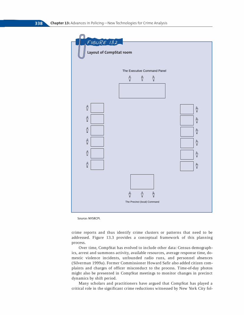
crime reports and thus identify crime clusters or patterns that need to be addressed. Figure 13.3 provides a conceptual framework of this planningprocess.
Over time, CompStat has evolved to include other data: Census demograph-ics, arrest and summons activity, available resources, average response time, do-mestic violence incidents, unfounded radio runs, and personnel absences(Silverman 1999a). Former Commissioner Howard Safir also added citizen com-plaints and charges of officer misconduct to the process. Time-of-day photosmight also be presented in CompStat meetings to monitor changes in precinctdynamics by shift period.
Many scholars and practitioners have argued that CompStat has played acritical role in the significant crime reductions witnessed by New York City fol-
Chapter 13: Advances in Policing—New Technologies for Crime Analysis338
Layout of CompStat room
FIGURE 13.2
The Precinct (local) Command
The Executive Command Panel
Source: NYSRCPI.
lowing its implementation (Silverman 1999a). Others are more skeptical ofthese claims, arguing that the crime reductions in New York City can be attrib-uted to larger patterns in society (Karmen 1996). The answer is likely some-where in the middle; however, the tremendous impact CompStat has had onpolice management practices cannot be denied. Although some reports havepointed to the demoralizing effects of the process on precinct commanders andofficers who feel a pressure to produce numbers, many others cite the signifi-cant increases in job satisfaction found by those who feel empowered by theproblem-solving aspects brought to the job.
An important concern that has been raised is whether the pressure to keepcrime statistics low has led to a zero-tolerance policing style that loses sight ofcommunity concerns, damaging police–community relations. The answer tothis issue is unclear, as it is probably too soon to come to concrete conclusions.These questions will have to be tracked by practitioners and academicians alikeas the model is implemented across diverse contextual conditions within theUnited States and abroad.
GIS and the Patrol OfficerAs GIS crime mapping became recognized as an important tool in both track-ing and responding to crime at the neighborhood level, departments across the country sought to expand its use beyond administrative planning to patrol officers and community residents. For example, the Camden New JerseyPolice Department began providing officers with access to crime-mapping
Geomapping Crime Patterns: Moving Beyond Push Pins 339
Conceptual framework of the CompStat planning process
FIGURE 13.3
• Precinctcrime data
• Arrestprofiles
• Citizencomplaintsand chargesof brutality
Compstat Meetings
• Top brass• Precinct commanders
and staff
PIMS STRATEGYDIRECTIVES

information on desktop computers and even on wireless laptops in patrol cars(American City and Country 2002). The department allowed officers to access information on crime based on location, type, and time in order to better focus their patrol efforts. The maps have also been designed to allowofficers to pinpoint business contact information when an alarm is sounded,rather than having to call a dispatcher for the information (American City and Country 2002). Moreover, in 1998 the NIJ awarded the leading GIS software provider, Environmental Systems Research Institute, Inc.(ESRI), a $500,000 grant to work with local law enforcement agencies anduniversities to effectively use GIS as a crime-fighting tool (Carney 1998).Collaborating with several local law enforcement agencies, ESRI developed anaccessible GIS software program with a simple interface that would be easilytransferable to large-scale departmental use outside of a specialized civilian an-alyst capacity.
Other Applications: Geographic ProfilingGeographic profiling, or the combined use of geography, psychology, andmathematics to identify the location of an offender, is most commonly associ-ated with tracking down serial killers, rapists, and arsonists. However, it is auseful investigative tool in any case in which an individual offender has com-mitted criminal activity across a series of locations (including crimes as diverseas robbery, burglary, theft, and fraud). Building from the significant empiricalefforts of Brantingham and Brantingham (1981), geographic profiling suggestsinvestigative alternatives based on the “hunting behavior” of the offender.Leading geographic profiler Kim Rossmo argues that criminals are no differentin their pattern of carrying out their offenses as ordinary citizens are in goingabout their day-to-day activities (Onion 2002).
Following this logic, geographic profiling uses the nearness principle as akey rule. The nearness principle argues that offenders will remain within alimited range that is comfortable to them when committing their offenses(Rossmo 1998), just as animals will tend to forage within a limited range fromtheir base (Onion 2002). Geographic profiling incorporates all possible methodsof transportation available to an offender when calculating the area in which theoffender is most likely to reside.
This research has led to the creation of a computerized geographic profil-ing workstation called Rigel that includes statistical analyses, GIS features,and database management functions to aid in the process of offering calcu-lated investigative suggestions. Crime scenes are broken down by type (re-member the primary and secondary distinctions discussed in Chapter 8) andthen entered by location. Based on the theoretical principles of geographic pro-filing, addresses of suspects can be evaluated based on their probability ofbeing the actual offender (Harries 1999). This can help investigators sortthrough their existing databases, such as those of registered sex offenders, andother investigative information available to them. When a specific suspect poolis not known, geographic profiling can help to pinpoint the highest probabil-ity areas in which to focus the search. As with the offender-profiling processdiscussed in Chapter 8, geographic profiling should only be considered as anadditional tool for investigators; solving a series of offenses ultimately requiresa sound investigative strategy.
Chapter 13: Advances in Policing—New Technologies for Crime Analysis340
Twenty-first Century Technologies in Policing
In addition to the introduction of GIS into everyday crime-fighting activities,over the past decade numerous other technologies have become available, fromrecord management systems (RMS) that help departments to store and read-ily retrieve the immense amounts of data they receive on a day-to-day basis tosophisticated weaponry and intelligence technologies that have reached law en-
Twenty-first Century Technologies in Policing 341
Linkages in Law Enforcement
Beginning in 1995, the Chicago Police Department(CPD) implemented one of the most easy to useand accessible GIS systems in the country as acomplement to its department-wide CChhiiccaaggooAAlltteerrnnaattiivvee PPoolliicciinngg SSttrraatteeggyy ((CCAAPPSS)) communitypolicing approach. Called IInnffoorrmmaattiioonn CCoolllleeccttiioonnffoorr AAuuttoommaatteedd MMaappppiinngg ((IICCAAMM)), the program en-ables departmental personnel to generate maps ofreported offenses by type in particular areas, in-cluding charts of the ten most frequently reportedoffenses through a series of easy clicks with amouse (Rich 1996).
CAPS was implemented in 1993 in pilot dis-tricts and has since expanded to all twenty-fiveof the city’s policing districts. This formula forcommunity policing emphasizes officer problemsolving by assigning officers to their beats for atleast a year, altering dispatch schedules so thatthe time spent responding to crime outside oftheir beats is limited, and requiring regular beatofficer attendance at meetings with communityresidents (Rich 1996). Early evaluation of CAPSdemonstrated that it had affected significant de-clines in reported crime, victimization, and fearof crime (Skogan 1996).
ICAM was seen as a complement to CAPS byhelping officers to better understand the problemsin their assigned areas and, therefore, be better fa-cilitators of collaborative problem-solving effortswith community residents to develop strategies toaddress these problems (Rich 1996). As part of the
ICAM development process, focus groups wereheld with officers and detectives to seek their un-derstanding and cooperation and to ensure thatthe completed program suited their informationneeds. Once the department got the officers’ buy-in, they regularly shared generated maps at beatmeetings. In the years following its introduction, aCitizen ICAM program was developed. This pro-gram enables citizens to generate much of thesame information (without specific identifiers)that an officer can, thereby facilitating joint po-lice–community planning efforts even more.Initially, confidentiality issues slowed citizen ac-cess to ICAM due to the specific details of street lo-cations. However, it is now running for anyone tosee at www.cicam.cpd.org.
Other departments across the country have pro-duced their own mapping programs, includingWeb-based citizen crime reports, as will be dis-cussed later.
Questions
1. How does your department’s Web sitecompare to ICAM?
2. Which GIS elements would you include ona department Web site?
3. What applications of available GIS crimedata are there for the community?
GIS Applications toCommunity Policing
forcement by way of the military. Covering all of these advances in significantdetail is beyond the scope of this text; however, the remainder of this chapterwill provide an overview of some significant technological developments thatare becoming part of everyday law enforcement activities.
Surveillance TechnologiesSurveillance technologies represent the wide array of systems currently avail-able to law enforcement, the military, and even private entities, to track themovements of individuals and/or provide capable guardianship to a specific lo-cation. Examples of advancements in this area include, CCTV, GPS, Biometrics,and APIS systems.
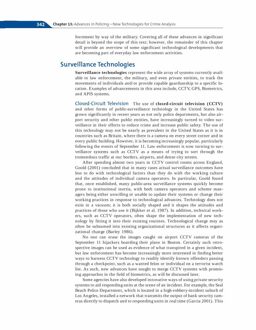
Closed-Circuit Television The use of closed-circuit television (CCTV)and other forms of public-surveillance technology in the United States hasgrown significantly in recent years as not only police departments, but also air-port security and other public entities, have increasingly turned to video sur-veillance in their efforts to reduce crime and increase public safety. The use ofthis technology may not be nearly as prevalent in the United States as it is incountries such as Britain, where there is a camera on every street corner and inevery public building. However, it is becoming increasingly popular, particularlyfollowing the events of September 11. Law enforcement is now turning to sur-veillance systems such as CCTV as a means of trying to sort through thetremendous traffic at our borders, airports, and dense city streets.
After spending almost two years in CCTV control rooms across England,Goold (2001) concluded that in many cases actual surveillance outcomes haveless to do with technological factors than they do with the working cultureand the attitudes of individual camera operators. In particular, Goold foundthat, once established, many public-area surveillance systems quickly becomeprone to institutional inertia, with both camera operators and scheme man-agers being either unwilling or unable to update their systems or change theirworking practices in response to technological advances. Technology does notexist in a vacuum; it is both socially shaped and it shapes the attitudes andpractices of those who use it (Bijkker et al. 1987). In addition, technical work-ers, such as CCTV operators, often shape the implementation of new tech-nology by fitting it into their existing routines. Technological change may asoften be subsumed into existing organizational structures as it affects organi-zational change (Barley 1986).
No one can erase the images caught on airport CCTV cameras of theSeptember 11 hijackers boarding their plane in Boston. Certainly such retro-spective images can be used as evidence of what transpired in a given incident,but law enforcement has become increasingly more interested in finding betterways to harness CCTV technology to readily identify known offenders passingthrough a checkpoint, such as a wanted felon or individual on a terrorist watchlist. As such, new advances have sought to merge CCTV systems with promis-ing approaches in the field of biometrics, as will be discussed later.
Some agencies have also developed innovative ways of using private securitysystems to aid responding units at the scene of an incident. For example, the SealBeach Police Department, which is located in a high-robbery-incident suburb ofLos Angeles, installed a network that transmits the output of bank security cam-eras directly to dispatch and to responding units in real time (Garcia 2001). This
Chapter 13: Advances in Policing—New Technologies for Crime Analysis342
network transmits video over the air in the same manner that images are sentover the Internet through encrypted wireless communication paths.
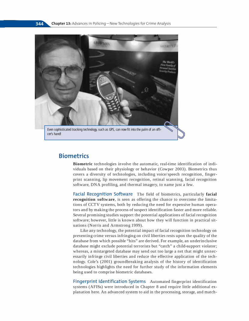
Global Positioning Systems Global positioning systems have been used toenhance the tracking of offenders and officer deployments. Global positioningsystems (GPS) use satellite-based technologies for the purpose of tracking themovement of patrol cars or specially equipped stolen vehicles. In some cases, anofficer’s cell phone can be equipped with GPS technology, providing an impor-tant alternative to conventional address-matching for an officer responding to acall. GPS technology has also proven to significantly enhance aerial photographyof crime incident locations, allowing for greater visualization of the completecontext of a situation (Harries 2001). The state of Iowa has capitalized on thesurveillance capacity of GPS to monitor the real-time location of high-risk of-fenders released from prison. With offender-monitoring systems, law enforce-ment and correctional agencies can “prevent offenders from venturing nearschools, daycare centers, and other restricted areas” (Greene 2001).
The Escambia County Sheriff ’s Department’s SWAT team in Florida used abroadband-via-satellite system when responding to an emergency call involvinga shooting victim and a barricaded suspect. Communicating through the MobileCommand Center’s satellite system, the SWAT officers were able to determinethat the suspect had fled the scene and the victim was likely dead (HughesNetwork Systems 2002). Pictures of the suspect were immediately obtained viasatellite and distributed to patrol, rather than taking hours or days, which wasthe norm before such technology was available to law enforcement agencies.
Twenty-first Century Technologies in Policing 343
New technology research seeks to merge facial recognition software with CCTV surveillancecameras.
BiometricsBiometric technologies involve the automatic, real-time identification of indi-viduals based on their physiology or behavior (Cowper 2003). Biometrics thuscovers a diversity of technologies, including voice/speech recognition, finger-print scanning, lip movement recognition, retinal scanning, facial recognitionsoftware, DNA profiling, and thermal imagery, to name just a few.
Facial Recognition Software The field of biometrics, particularly facialrecognition software, is seen as offering the chance to overcome the limita-tions of CCTV systems, both by reducing the need for expensive human opera-tors and by making the process of suspect identification faster and more reliable.Several promising studies support the potential applications of facial recognitionsoftware; however, little is known about how they will function in practical sit-uations (Norris and Armstrong 1999).
Like any technology, the potential impact of facial recognition technology onpreventing crime versus infringing on civil liberties rests upon the quality of thedatabase from which possible “hits” are derived. For example, an underinclusivedatabase might exclude potential terrorists but “catch” a child-support violator;whereas, a mistargeted database may send out too large a net that might unnec-essarily infringe civil liberties and reduce the effective application of the tech-nology. Cole’s (2001) groundbreaking analysis of the history of identificationtechnologies highlights the need for further study of the information elementsbeing used to comprise biometric databases.
Fingerprint Identification Systems Automated fingerprint identificationsystems (AFISs) were introduced in Chapter 8 and require little additional ex-planation here. An advanced system to aid in the processing, storage, and match-
Chapter 13: Advances in Policing—New Technologies for Crime Analysis344
Even sophisticated tracking technology, such as GPS, can now fit into the palm of an offi-cer’s hand!
ing of fingerprints has been introduced by the FBI. Called the IntegratedAutomated Fingerprint Identification System (IAFIS), this enhanced tech-nology offers a two-hour turnaround on electronically submitted criminal printsearches from federal, state, and local law enforcement agencies (Smith 1998).
Interjurisdictional Communication TechnologyAt the core of linkage blindness is the lack of or minimal amount of criticalcommunication that occurs between different law enforcement jurisdictions aswell as other sectors of the criminal justice system and community at large.Given the diversity of criminal justice core functions, including communitypolicing, crime prevention and investigation, prosecution, adjudication, punish-ment, restitution, release, and rehabilitation, the gathering and sharing of crim-inal justice information is particularly complex (Tomek 2001). The need tobuild information-sharing capacities, both technological and organizational, isevidenced by the NIJ’s recent decision to make information sharing the numberone priority for information technology solutions among state and local agen-cies, as well as internationally (Tomek 2001).
The need for information continuity and access is key to informed decisionmaking by all criminal justice stakeholders. One of the biggest challenges tolarger information-sharing collaborations, however, is the large differencesacross agencies in terms of agency protocols, standards, and even measures forthe collection and utilization of data (Tomek 2001).
Offender Databases Efforts have been made in recent years to develop suf-ficient technologies capable of overcoming many of the barriers involved incross- and interjurisdictional information sharing.
The San Diego County Automated Regional Information System(ARJIS) warrants further description as to the possibilities in interjurisdic-tional information sharing. ARJIS compiles information from thirty-eight state,local, and federal law enforcement agencies into one Web site that registered po-lice, court, and correctional officials can access (Walsh 2003). ARJIS includescrime-incident data that are updated every twenty-four hours, most-wantedlists, and interactive maps. Similarly, the Pennsylvania Integrated JusticeNetwork (JNET) connects all of the state’s criminal justice agencies together forthe sharing of critical information, including offender photos and images of dis-tinguishing marks. In one case, an offender was able to be apprehended becausea victim was able to describe the perpetrator’s tattoo to the police (Walsh 2003).
Cross-Jurisdictional Radio Communications Federal efforts to improvecross-jurisdictional radio communications include the NIJ’s development of theAdvanced Generation of Interoperability for Law Enforcement (AGILE)program in 2001. AGILE provides direct connections across the radio systems ofneighboring law enforcement agencies with overlapping or adjacent jurisdic-tions (Kaluta 2001). The possibilities of such technologies for enhancing na-tional security needs has been demonstrated by early evaluation successes of thesystem as an enhancement to communication in San Diego County (ARJIS)(Scanlon 2000). AGILE has also been used to establish an emergency-only radiochannel for presidential inaugurations, linking the Secret Service, the FBI, theCapitol Police, the U.S. Park Police, and the Metropolitan Police Department(Kaluta 2001).
Twenty-first Century Technologies in Policing 345

Electronic Warrant Processes A number of jurisdictions have respondedto the numerous problems involved in the arrest-warrant process. This cumber-some process has traditionally involved the issuance of paper warrants by courtsthat are subsequently used by law enforcement agencies to create a wanted per-son record in their own system, which can then be checked by law enforcementofficials throughout the country through the use of the FBI’s National CrimeInformation Center (see Chapter 8). What is most problematic about thisprocess is that there is often a delay between the time the court either issues orcancels a warrant, which can create serious officer safety concerns if an officercomes in contact with a dangerous individual that has not yet been entered intothe NCIC system (Perbix 2001). Additional concerns arise from the lack of syn-chronization across the systems, in which warrants entered into one system arenot entered into the other.
Electronic warrant processes, such as the Colorado Integrated CriminalJustice Information System (CICJIS), link the state’s main criminal justice sys-tems (including law enforcement, prosecutors, courts, adult and juvenile cor-rections) so that data entered by one agency’s system is automaticallytransferred and loaded into another agency’s system, thereby reducing concernsof linkage blindness and inconsistent data (Perbix 2001).
Information Security Through Encryption Given the confidential in-formation being shared by criminal justice agencies through these enhancedtechnologies, serious privacy concerns inevitably arise. Secure law enforcementcommunication over the Internet or an intranet can be achieved through vir-tual private networking (VPN) technologies. VPNs involve the use of en-cryption software to scramble the contents of communications so that even ifthe system becomes available to hackers, they are unable to read the infor-mation (Taylor 2000). In addition to an advanced encryption algorithm thatis virtually impossible to break, VPNs pass encrypted communications througha “tunnel” between communicating agencies, ensuring that users meet a highlevel of identification to be able to access the information (Taylor 2000). Withthe establishment of proper identification and access protocols, VPNs offer lawenforcement agencies the ability to exchange and track important informationover a secure channel.
The World Wide Web and Community PolicingWith its focus on collaborative problem solving and communication with thepublic, community policing is even more information intensive than traditionalpolicing methods (Monahan 1998). New communication technologies such asthe Internet have proven to be important mechanisms for furthering depart-mental–community policing objectives. Important features that are used bymany departmental Web sites in reaching their constituent audiences include(Hart 1996):
● Officer photo galleries, including photos and biographical sketches
● Libraries devoted to crime prevention and safety tips, including informationabout known scam cases operating within the jurisdiction
Chapter 13: Advances in Policing—New Technologies for Crime Analysis346
● Virtual tours of the department
● Recruitment tool with links to personnel information about the hiringprocess
● Recent citywide and neighborhood crime statistics, including crime map-ping capabilities on the more advanced pages
● Departmental wanted lists and upcoming court cases
● Capacity for anonymous and/or confidential reporting of crime informationor complaints about officer conduct
It should be noted that department home pages on the Internet have movedbeyond the realm of being public relations tools and towards the true support ofcommunity policing activities to the extent that the department shares impor-tant details about activities and arrests rather than the filtered information gen-erally provided to citizens by the media (Price 2001). Departmental posting ofsuch information, however, should be balanced against the privacy needs of vic-tims and nonconvicted offenders.
Improving Accountability—Mobile Communicationswith Patrol
Radio communications with patrol cars revolutionized the ability of depart-ments to monitor the activities of line officers. Although such technology didnot take away the high level of discretion available to officers, enhancements todispatch communications capabilities had a profound effect on the nature oftheir job. More recently, cellular phone technology has provided an alternatecommunication forum for some jurisdictions.
Mobile Digital Communications Mobile digital communications(MDC) offer nonverbal means of communicating information between com-munication centers and patrol (Thibault et al. 2001). Such communication isachieved through the use of a mobile digital terminal in the patrol car. In somejurisdictions, MDC options allow for electronic submission of reports, therebyreducing the volume of paperwork. More recently, some departments have in-stalled new laptop computers into patrol cars, allowing officers instant accessto information, such as notes from the communications officer and even theInternet. Soon officers will not have to leave their cars to write even the mostdetailed reports (Johnson 2003). Available Internet capabilities will also facil-itate interjurisdictional information exchange opportunities, providing an im-portant tool in the reduction of linkage blindness.
Automatic Vehicle Monitoring Through the use of automatic vehiclemonitoring (AVM) technologies, departments are able to know the locationand status of patrol vehicles, including whether the door of the vehicle hasbeen left open (Thibault et al. 2001). AVM systems are thus vitally importantin aiding officers in high-speed pursuit situations and determining whetheran officer is in need of back-up.
Twenty-first Century Technologies in Policing 347
Chapter 13: Advances in Policing—New Technologies for Crime Analysis348
Chapter Summary
● There has been significant advancement intechnology in the past twenty years, and theapplication of this technology to policing hasbenefited law enforcement officers in bothproactive and reactive methods of policing.
● The most important factors in crime analysisare timeliness, relevancy, and reliability, all ofwhich are necessary in order to effectively ex-amine data.
● GIS crime mapping is a virtual map that al-lows police officers to analyze the areas inwhich crime occurs. It has many benefits,particularly in proactive policing. It can helpthe police to understand spatially wherecrimes occur and how to make strategies tocombat crime, particularly in hot spots.
● Advanced technology enables the collection ofmore timely and accurate data, and it helpspatrol officers respond more quickly and ef-fectively to crimes in neighborhoods.
● One of the leading technologies of twenty-first-century policing is CompStat, which en-velopes the problem-oriented policing modeland assists in more effective management ofareas where crime occurs.
● Surveillance technologies such as CCTV areextremely beneficial in tracking all types ofcriminals, from shoplifters to terrorists.Through the taped monitoring of movements,combined with emerging biometrics of facerecognition technology, there are many poten-tial applications of CCTV. GPS also hasproven important in facilitating law enforce-ment operations in both investigatory and de-ployment capacities. Fingerprint identifica-tion systems have aided in the identificationof individuals who have offended acrossboundaries. Other interjurisdictional commu-nication technologies include offender data-bases and electronic warrants system.
KEY TERMS
311 system 328911 system 327Advanced Generation of
Interoperability for LawEnforcement (AGILE) 345
Automated Regional InformationSystem (ARJIS) 345
Automatic vehicle monitoring(AVM) 347
Biometrics 344Buffer zones 334Computer-aided dispatch
(CAD) 327Calls-for-service data 330Causation 335Chicago Alternative Policing
Strategy (CAPS) 341Closed-circuit television
(CCTV) 342CompStat 336Correlations 335Crime analysis 329Crime mapping 331Crime-trend forecasting 330
Electronic warrantprocesses 346
Environmental SystemsResearch Institute, Inc.(ESRI) 340
Essential criteria for crimeanalysis 330
Facial recognition software 344Geocoded 333Geographic information systems
(GIS) 331Geographic profiling 340Global positioning systems
(GPS) 343Incident data 330Information Collection for
Automated Mapping(ICAM) 341
Integrated AutomatedFingerprint IdentificationSystem (IAFIS) 345
Law of accelerating returns 328Linkage analysis 331
Mobile digital communications(MDC) 347
Nearness principle 340Pattern detection 330Pattern Identification Modules
(PIMS) 337Record management systems
(RMS) 341Relevancy 330Reliability 330Rigel 340Social ecology of crime 331Souillere’s stages of technologi-
cal advancement 326Strategic crime analysis 330Surveillance technologies 342Tactical crime analysis 330Tactics 337Target profiling 331Timeliness 330Truancy enforcement 333Virtual private networks
(VPN) 346
References 349
Linking the Dots
1. What have been some of the most significant
technological advancements in policing since
1980?
2. What are some of the dangers associated
with advancements in police technology?
How are these dangers balanced with the
benefits of such technology?
3. Do you think CompStat is partially responsi-
ble for the significant drop in crime in New
York City over the past decade?
4. How does police technology benefit the com-
munity?
5. How can technology be used to help combat
terrorism?
REFERENCES
American City and Country. 2002. “Crime Maps Im-prove Patrols in Camden.” American City andCounty. October 1, 2002. Available at http://www.americancityandcountry.com/ar/government_crime_maps_improve.
Barley, S. 1986. “Technology as an Occasion for Structur-ing Evidence from Observations of CT Scanners andthe Social Order of Radiology Departments.”Administrative Science Quarterly. 31(1): 78–108.
Bijkker, M., T. Hughes, and T. Pinch. 1987. The SocialConstruction of Technological Systems. New Directionsin the Sociology and History of Technology. Cam-bridge, MA: MIT Press.
Brantingham, C., and B. Brantingham. 1981. Environ-mental Criminology. Thousand Oaks, CA: SagePublications.
Canter, P. 2000. “Using a Geographic InformationSystem for Tactical Crime Analysis.” In AnalyzingCrime Patterns: Frontiers of Practice, edited by V. Goldsmith, P. McGuire, J. Mollenkopf, and T.Ross, 3–10. Thousand Oaks, CA: Sage.
Carney, D. 1998. “Arming Beat Cops with GIS Weapons.”Civic.com, April 13, 1998. Available at www.civic.com.
Clarke, K. C. 1990. Analytical and Computer Cartog-raphy. Upper Saddle River, NJ: Prentice-Hall.
Cole, S. 2001. Suspect Identities: A History of Finger-printing and Criminal Identification. Cambridge,MA: Harvard University Press.
Cowen, D. 2001. “Why Is GIS Important?” Available atwww.env.duke.edu/lel/enn351/images/uoi.txt/.
Cowper, T. 2003. “Emerging Technology and the
Future of Policing.” Paper presented at the Interna-tional Police Studies Conference, June 12–15,Eastern Kentucky University, Richmond, Kentucky.
DeAngelis, T. 2000. “GIS: Answering the Why ofWhere?” Police Chief. February 2000. Available atwww.iactechnology.org/library/techtal/techtalk0200.htm.
Goold, B. 2001. CCTV in the United Kingdom. Unpub-lished dissertation. Oxford University, Oxford,United Kingdom.
Garcia, M. 2001. “Force Protection Using WirelessInternet Technology.” Technology Talk. Available athttp://www.loronit.com/solutions/casestudies/iactechtalk1201.pdf.
Grant, H., and K. Terry. 2000. The New York City SexOffender Management Team: Summary ProgressReport. New York, NY: John Jay College of CriminalJustice.
Greene, K. 2003. “Global Positioning Systems Used forSome Offenders.” Noble News Online, April 4.Available at www.nonlenatl.org/news/publish/article_501.shtml.
Harries, K. 2001. Demonstration of OrthophotographicRepresentation and Analysis. Washington, D.C.:National Institute of Justice.
Harries, K. 1999. Mapping Crime: Principle and Practice.Washington, D.C.: National Institute of Justice.
Hart, F. 1996. “How and Why to Implement theWorldwide Web for Community Policing.” PoliceChief. 3(1): 55.
Hughes Network Systems. 2002. Case Study.Germantown, MD: Hughes Network Systems.
Chapter 13: Advances in Policing—New Technologies for Crime Analysis350
Johnson, M. 2003. “City Vehicles Receive Laptops.”Daytona Beach News Journal, April 15, 1.
Kaluta, R. 2001. “New Developments in Interjurisdic-tional Communication Technology.” Police Chief.Available at http://www.iacptechnology.org/library/techtalk/techtalk0401.htm.
Karmen, A. 1996. New York City Murder Mystery. NewYork, NY: NYU Press.
Kelling, G., and M. Moore. 1987. “The Evolving Strategyof Policing.” Perspectives on Policing. 4(1): 1–15.
Kurzweil, R. 2001. “The Law of Accelerating Returns.”Available at www.kurzweilai.net.
McDonald, P. 2002. Managing Police Operations: Imple-menting the New York Crime Control Model—CompStat. Belmont, CA: Wadsworth.
Monahan, M. 1998. “Technology Management forCommunity Policing.” Police Chief. September 1998.Available at http://www.iacptechnology.org/library/techtalk/techtalk0998.htm.
Norris, C., and G. Armstrong. 1999. The MaximumSurveillance Society: The Rise of CCTV. New York,NY: NYU Press.
Onion, A. 2002. “Coordinates of a Killer: A Mathemat-ical Method Can Help Investigators Locate Killers.”ABCnews.com, October 8. Available at www.abcnews.com.
Perbix, M. 2001. “Automating Arrest Warrants BetweenCourts and Law Enforcement.” Police Chief. October2001. Available at http://www.iacptechnology.org/library/AutomatingArrestWarrantsBTCountsandLE.pdf
Phillips, P. 1972. “A Prologue to the Geography ofCrime.” Proceedings, Association of AmericanGeographers 4(1): 86–91.
Presidents Commission on Law Enforcement and theAdministration of Justice. 1967. Final Report of thePresident’s Commission on Law Enforcement and theAdministration of Justice. Washington, D.C.:Presidents Commission on Law Enforcement andthe Administration of Justice.
Price, C. 2001. “The Police Web Site as a CommunityPolicing Tool.” Police Chief. December 2001. Availa-ble at http://www.iacptechnology.org/library/PoliceWebsiteasaCommunity PolicingTool.pdf.
Rich, T. 1996. The Chicago Police Department’sInformation Collection for Automated Mapping(ICAM) Program. Washington, D.C.: NationalInstitute of Justice Program Focus.
Rossmo, K. 1998. Geographic Profiling. Boca Raton, FL:CRC Press.
Scanlon, P. 2000. “A Successful Partnership: WhenPolice and the Feds Team for Technology.” PoliceChief. October, 2000. Available at http://www.iacptechnology.org/library/techtalk/techtalk/co.
Seaskate, Inc. 1998. The Evolution and Development ofPolice Technology. Washington, D.C.: NationalInstitute of Justice.
Shaw, C., and H. McKay. 1942. Juvenile Delinquencyand Urban Areas. Chicago, IL: University of ChicagoPress.
Silverman, E. 1996. “Mapping Change: How the NewYork City Police Department Reengineered Itself toDrive Down Crime.” Law Enforcement News 23.December 15, 1996. Available at http://www.lib.jjay.cuny.edu/len96/15Dec/?/htm.
Silverman, E. 1999. NYPD Battles Crime. Boston, MA:Northeastern University Press.
Skogan, W., and S. Hartnett. 1996. Community PolicingChicago Style. New York, NY: Oxford UniversityPress.
Skolnick, J., and D. Bayley. 1986. The New Blue Line:Police Innovation in Six American Cities. New York,NY: The Free Press.
Smith, K. 1998. “Integrated Automated FingerprintIdentification System: Twenty-first-centuryTechnology for Law Enforcement.” Police Chief.62(6): 23.
Soulliere, N. 1999. Police and Technology: HistoricalReview and Current Status. Ottawa: Canadian PoliceCollege.
Taylor, B. 2000. “Virtual Private Networking: SecureLaw Enforcement Communication on the Internet.”Police Chief. 67(1): 13.
Terry, K., and J. Furlong. 2004. Sex Offender Registra-tion and Community Notification, 2d ed. Kingston,NJ: Civic Research Institute.
Thibault, E., L. Lynch, and R. McBride. 2001. ProactivePolice Management, 5th ed. Upper Saddle River, NJ:Prentice-Hall.
Tomek, W. 2001. “Information Sharing: A StrategicNecessity.” Police Chief. February, 2001. Available athttp://www.iacptechnology.org/library/techtalk/techtalk0201.pdf.
Walsh, T. 2003. “Data Sharing Tightens Net for theLaw—Agencies Put Criminal Justice Data On-linefor Sharing.” Government Computer News, July 10.Available at www.gcn.com.

Note 351
NOTE
1. This introduction draws upon information foundin DeAngelis (2000).