Embed Size (px)
Citation preview
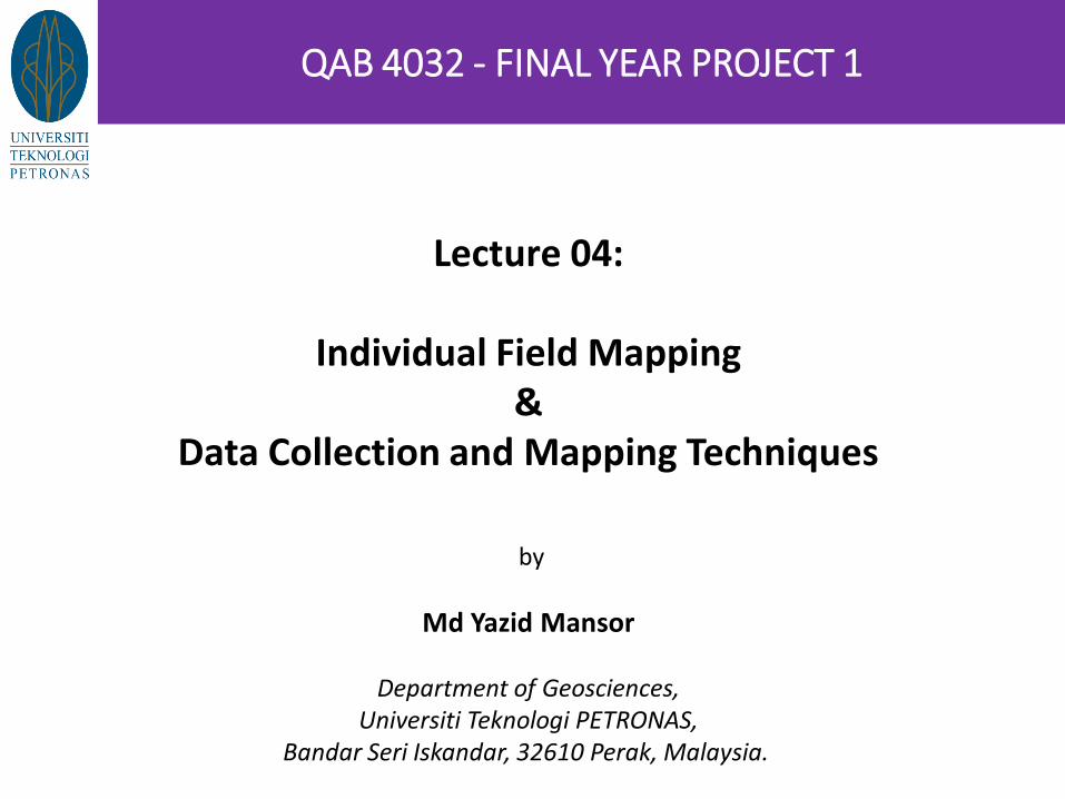
Lecture 04:
Individual Field Mapping &
Data Collection and Mapping Techniques
by
Md Yazid Mansor
Department of Geosciences, Universiti Teknologi PETRONAS,
Bandar Seri Iskandar, 32610 Perak, Malaysia.
QAB 4032 - FINAL YEAR PROJECT 1

Course Learning Outcomes:
At the end of the Final Year Project course, student should be able to:
CLO1: Identify an acceptable research/development/design topic/product, normally that is related to the students’ degree specialization.
CLO2: Produce a realistic plan and work independently over an extended period.
CLO3: Demonstrate an understanding of the context of the investigations.
CLO4: Obtain and evaluate the relevance and quality of information and data from related literatures.
CLO5: Produce a technical report on the project and present orally the performed work in a structured, concise, attractive and effective way.
Individual Field Mapping – Data Collection & Mapping Techniques
Content Outline of this Module: The independent mapping project :
Designed to test the ability of students to interpret the geology of an area based on observations made and data systematically collected in the field, and other relevant references.
Main Objective:
To produce an accurate record of data collected in the field that interprets the geological history of the mapped area, placed within the local and regional context.
The FYP1 and FYP2 is the most important piece of work to be carried out during the degree course, tested through milestone reviews, technical report generation & viva-voce with external examiners.
Learning Method:
Students will arrange regular meetings to receive advice on the project progress and completion. Students spend several weeks mapping in their field area. Field supervisor will visit for 1-2 days and provide advice and feedback in the field. Students to use their ability and multi-discipline knowledge to conduct analysis and discussion. All milestones must be observed to ensure project accomplishment in the form of a field notebook and
field slips, and a report. Subsequent FYP2 topic selection will be a focused analysis related to the mapping area.
Individual Field Mapping – Data Collection & Mapping Techniques
General Workflow:
1. Makes field observations in relation to local geology and regional tectonics.
2. Records accurate field measurements, perform analysis and synthesis of these data.
3. Generates technically meaningful field notes, sketches and cross-sections.
4. Generates industry standard interpretive geological map, cross section(s) and stratigraphic column for inclusion in report.
5. Presents results to professional standards through extensive written report and viva-voce.
Individual Field Mapping – Data Collection & Mapping Techniques
Base Map: A cultural, anthropogenic map that contain grids, scale, reference, datum, topography and
direction information (Appendix attachment in A3 size map – 1:5000 or 1:2,500 scale)
Expected Geological Map: Individual maps with lithological distribution, structural / lineament, raw measurements /
statistics, coordinates / GPS location (Appendix in A3 size maps – 1:5000 or 1:2,500 scale). Opportunity to generate publication standard fair-copy base map (based on Survey Dept
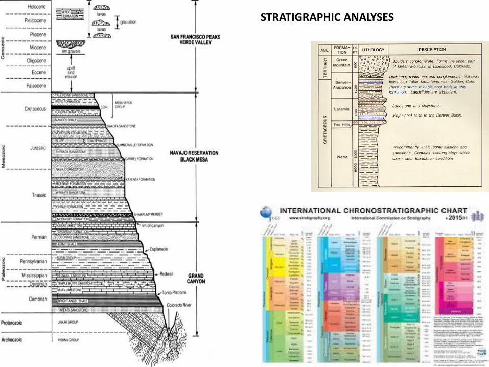
Topographic Maps) with appropriate grids and scale. Composite geology map of studied area. For subsurface data, this might include the wells location, facies map etc. Cross-section eg. Structural, seismic sections. Stratigraphy of an area must be referred to IUGS stratigraphic chart / ICC scheme.
Key Analyses: Specify within legend and title box of map or cross-section, the datum, projection, scale, grids. Map Analyses eg. Explain meaning and implication of processed data and results, composite (e.g.
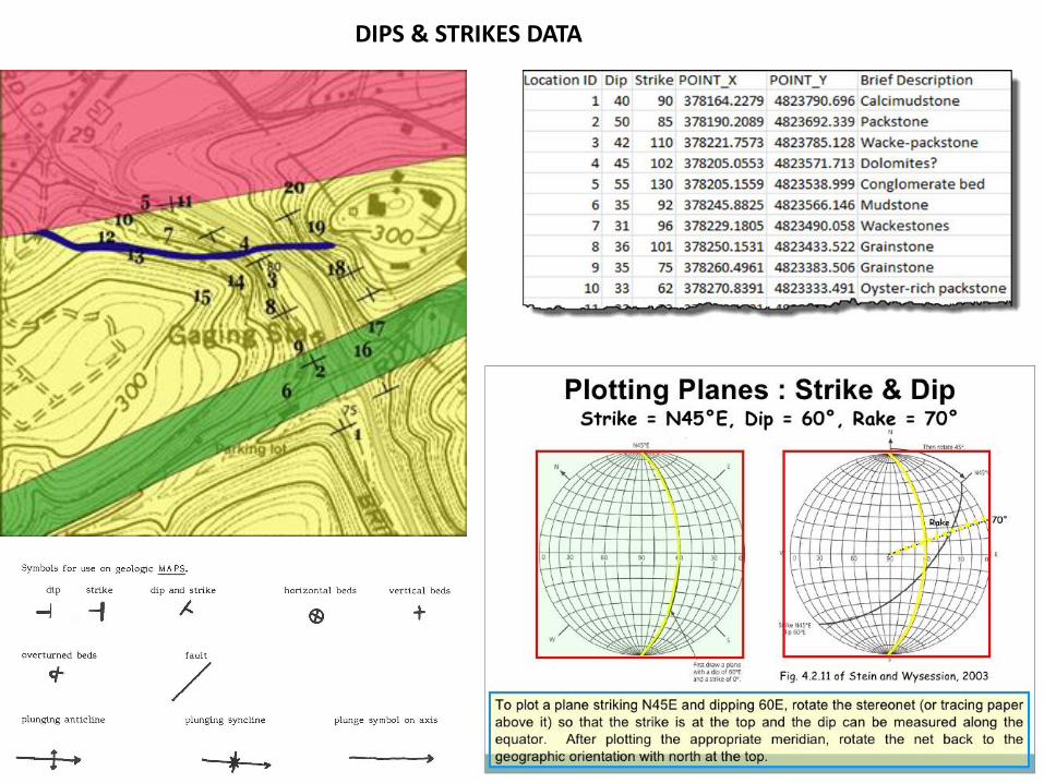
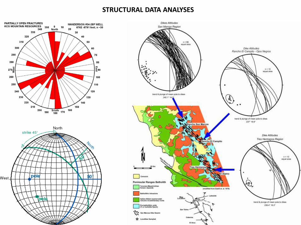
velocity fields) montage, contours, intervals, sweet spot. Structural analysis using rose diagram or structural related stereographic plots, the n-numbers of
structural reading (i.e. dips of faulting, fractures, slickensides etc.) must be annotated in the map / diagram.
Synthesis of tectonic lineament and pattern, and tectono-stratigraphic evolution in regional setting.
Internal
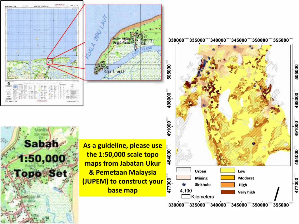
As a guideline, please use the 1:50,000 scale topo
maps from Jabatan Ukur & Pemetaan Malaysia
(JUPEM) to construct your base map
Internal
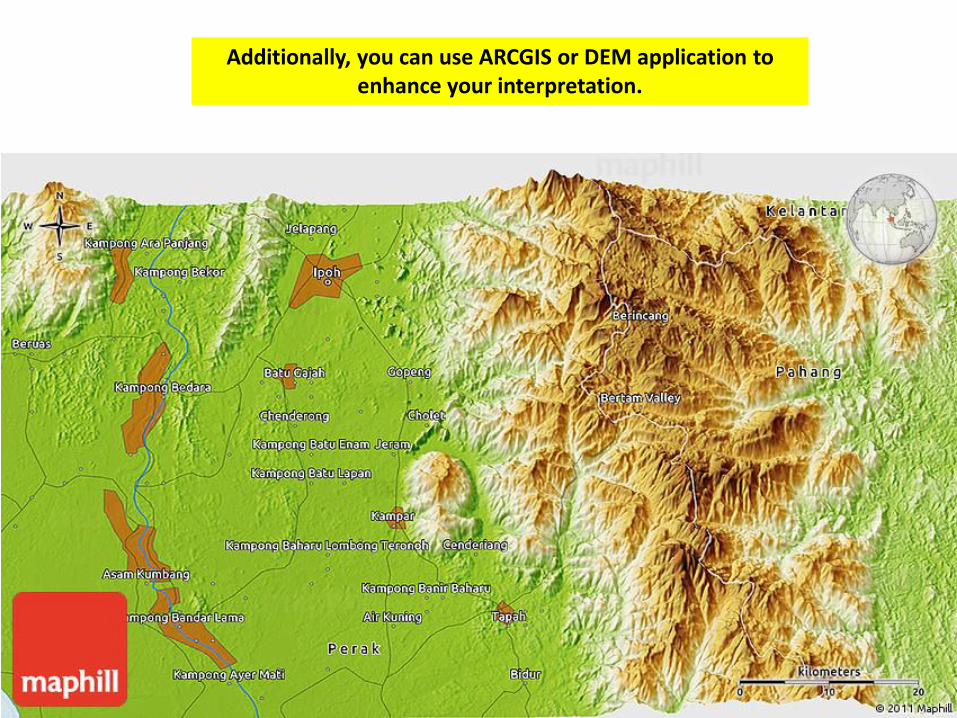
Additionally, you can use ARCGIS or DEM application to enhance your interpretation.
Internal
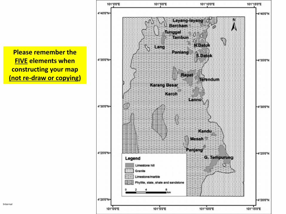
Please remember the FIVE elements when
constructing your map (not re-draw or copying)
Internal
Internal
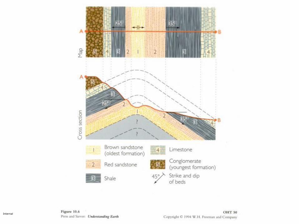
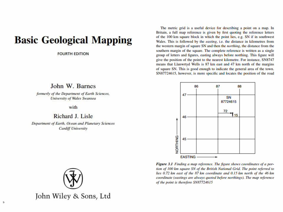
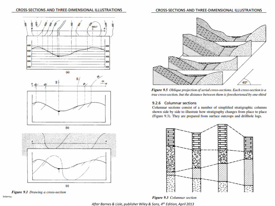
Internal After Barnes & Lisle, publisher Wiley & Sons, 4th Edition, April 2013
Internal After Barnes & Lisle, publisher Wiley & Sons, 4th Edition, April 2013
Internal
After Barnes & Lisle, publisher Wiley & Sons, 4th Edition, April 2013
Internal
After Barnes & Lisle, publisher Wiley & Sons, 4th Edition, April 2013
Internal
After Barnes & Lisle, publisher Wiley & Sons, 4th Edition, April 2013
Internal
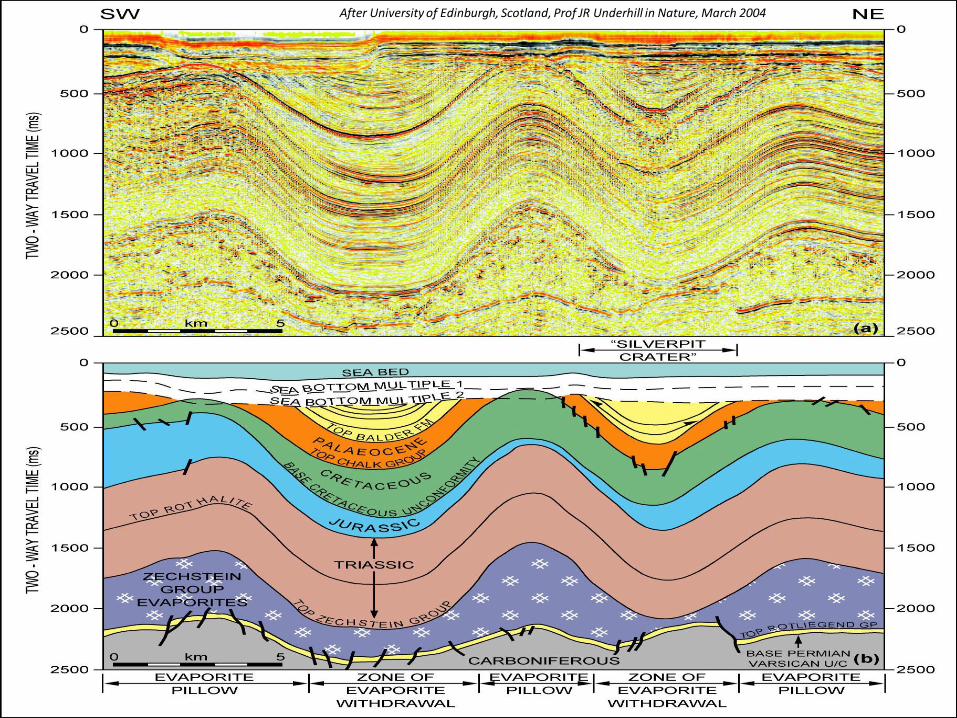
After University of Edinburgh, Scotland, Prof JR Underhill in Nature, March 2004
Internal
STRATIGRAPHIC ANALYSES
Internal
DIPS & STRIKES DATA
Internal
STRUCTURAL DATA ANALYSES

Internal