Embed Size (px)
Citation preview

Lecture 15 – Geodetic Datums
23 February 2010GISC3325

Significant dates
15-19 March 2010 is Spring Break 4 March 2010 is Exam Two
Emphasizing chapters 5, 6 and 8 of text as well as all lectures and labs.
Remember to start on the Article Review Assignment!
Web reference for today’s lecture: http://www.ngs.noaa.gov/PUBS_LIBTRNOS88NGS19.pdf

Assigned outside reading
Articles covering the two tools listed below. Material shall appear on the next exam.
NADCON - North American Datum Conversion VERTCON - Vertical Datum Conversion
http://www.ngs.noaa.gov/TOOLS/Professional_Surveyor_Articles/

Geodetic Datums
A set of constants specifying the coordinate system used for geodetic control, i.e., for calculating the coordinates of points on the Earth.
The datum, as defined in (1), together with the coordinate system and the set of all points and lines whose coordinates, lengths, and directions have been determined by measurement or calculation. From NGS Geodetic Glossary
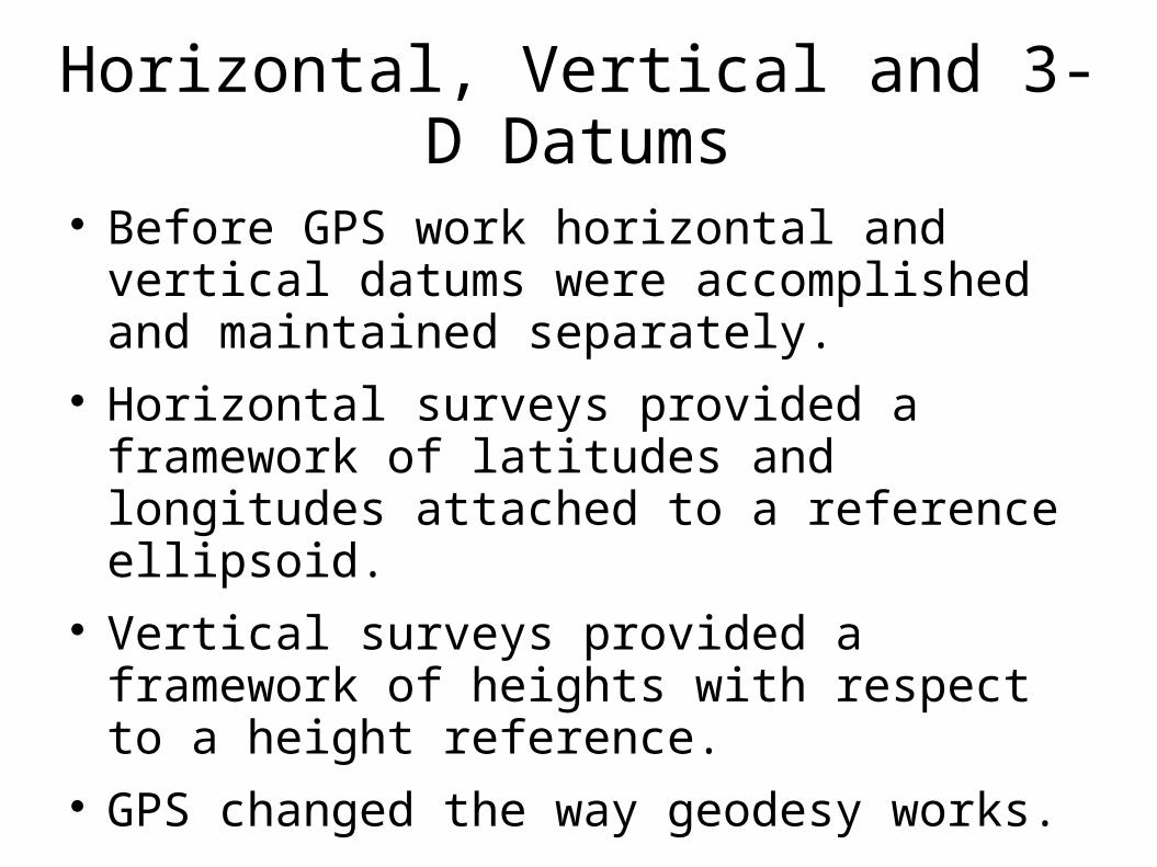
Horizontal, Vertical and 3-D Datums
Before GPS work horizontal and vertical datums were accomplished and maintained separately.
Horizontal surveys provided a framework of latitudes and longitudes attached to a reference ellipsoid.
Vertical surveys provided a framework of heights with respect to a height reference.
GPS changed the way geodesy works.

Horizontal networks
• North American Datum of 1927 (NAD 27)
– Official datum until 1986
– Based on the Clarke Spheroid of 1866 ellipsoid.
• North American Datum of 1983 (NAD 83)
– Modified a number of times.
– First version NAD 83 (1986) did NOT include GPS
– Uses Geodetic Reference System of 1980 (GRS 80) reference ellipsoid.
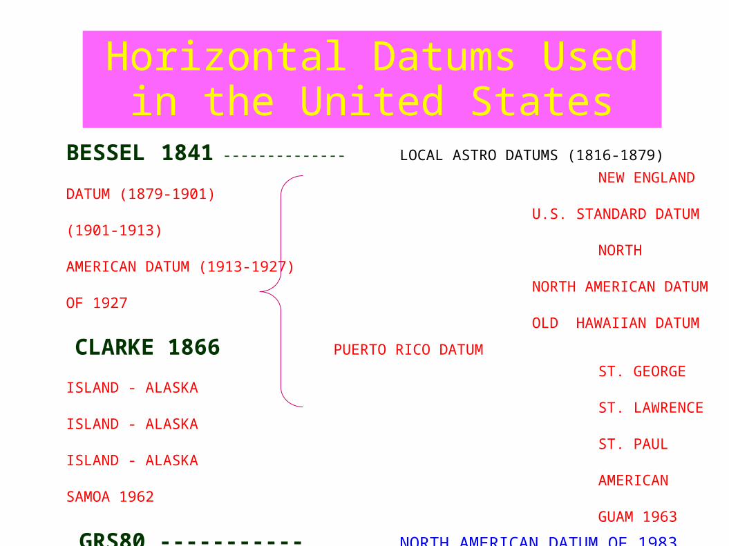
Horizontal Datums Used in the United States
BESSEL 1841 -------------- LOCAL ASTRO DATUMS (1816-1879)
NEW ENGLAND DATUM (1879-1901) U.S. STANDARD DATUM (1901-1913) NORTH AMERICAN DATUM (1913-1927) NORTH AMERICAN DATUM OF 1927 OLD HAWAIIAN DATUM
CLARKE 1866 PUERTO RICO DATUM
ST. GEORGE ISLAND - ALASKA ST. LAWRENCE ISLAND - ALASKA ST. PAUL ISLAND - ALASKA AMERICAN SAMOA 1962 GUAM 1963
GRS80 ----------- NORTH AMERICAN DATUM OF 1983 (As of June 14, 1989)
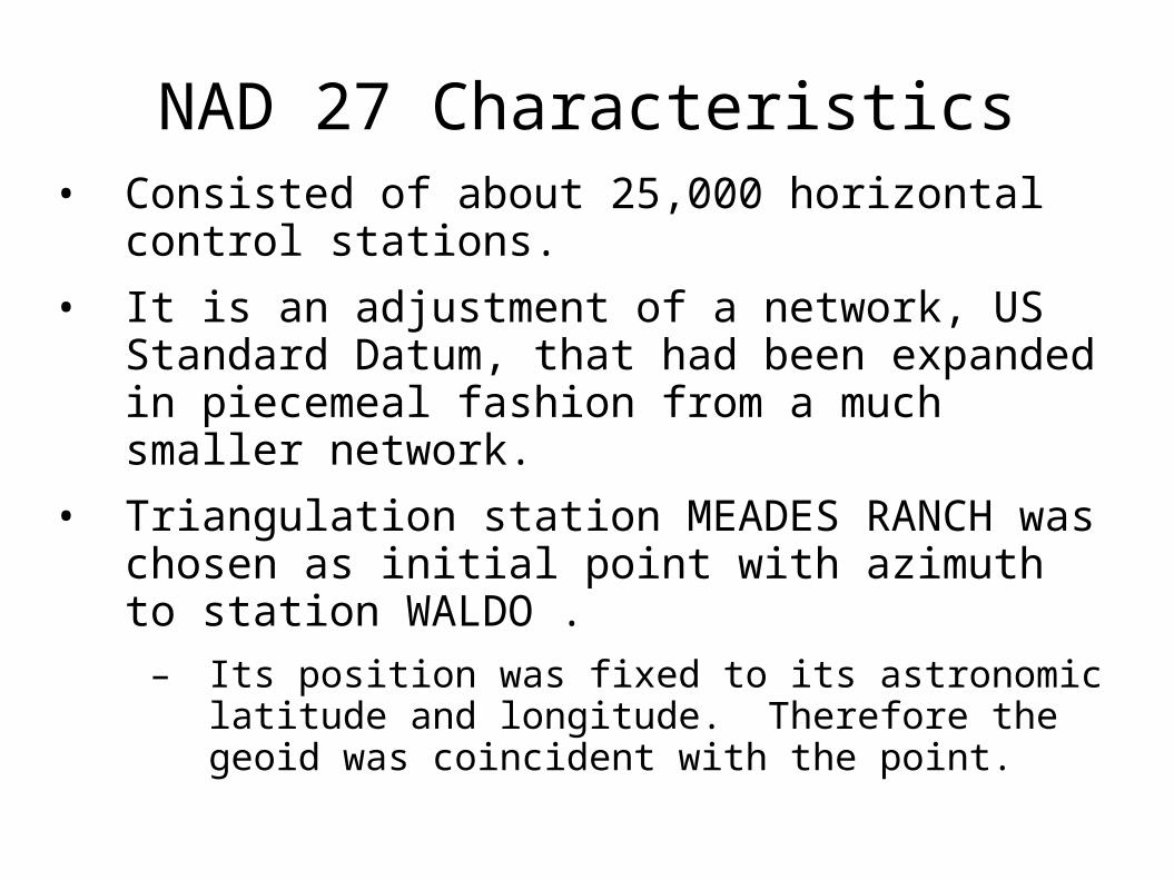
NAD 27 Characteristics• Consisted of about 25,000 horizontal control
stations.
• It is an adjustment of a network, US Standard Datum, that had been expanded in piecemeal fashion from a much smaller network.
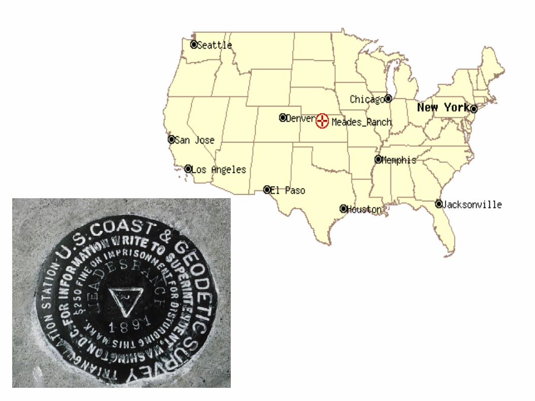
• Triangulation station MEADES RANCH was chosen as initial point with azimuth to station WALDO .
– Its position was fixed to its astronomic latitude and longitude. Therefore the geoid was coincident with the point.

COMPARISON OF DATUM ELEMENTS
NAD 27 NAD 83
ELLIPSOID CLARKE 1866 GRS80 a = 6,378,206.4 m a = 6,378,137. M 1/f = 294.9786982 1/f = 298.257222101
DATUM POINT Triangulation Station NONE MEADES RANCH, KANSAS EARTH MASS CENTER
ADJUSTMENT 25k STATIONS 250k STATIONS Several Hundred Base Lines Appox. 30k EDMI Base Lines Several Hundred Astro Azimuths 5k Astro Azimuths Doppler Point Positions VLBI Vectors
BEST FITTING North America World-Wide

NAD 27
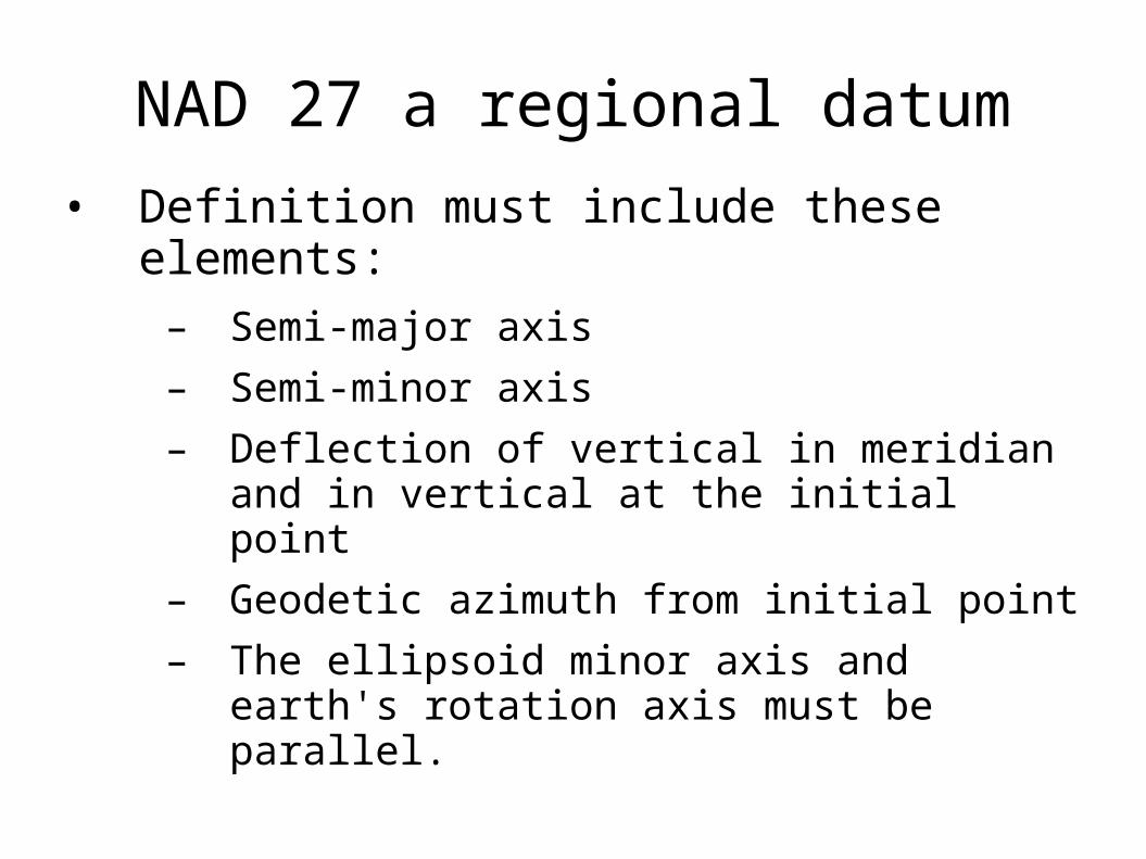
NAD 27 a regional datum
• Definition must include these elements:
– Semi-major axis
– Semi-minor axis
– Deflection of vertical in meridian and in vertical at the initial point
– Geodetic azimuth from initial point
– The ellipsoid minor axis and earth's rotation axis must be parallel.
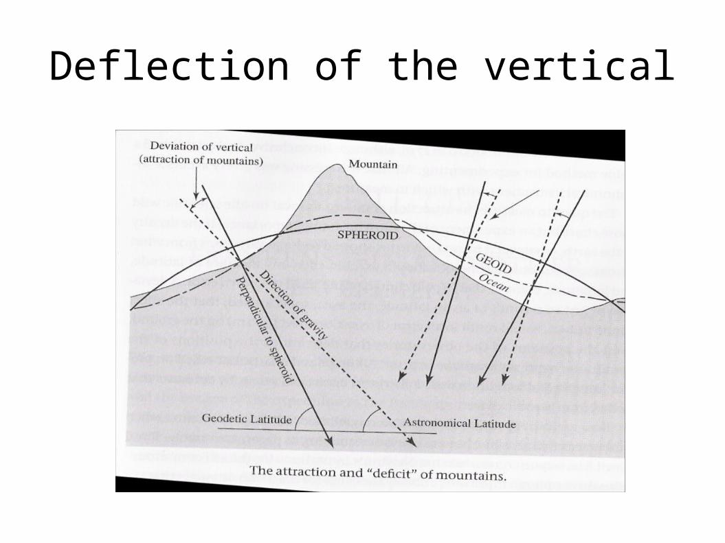
Deflection of the vertical
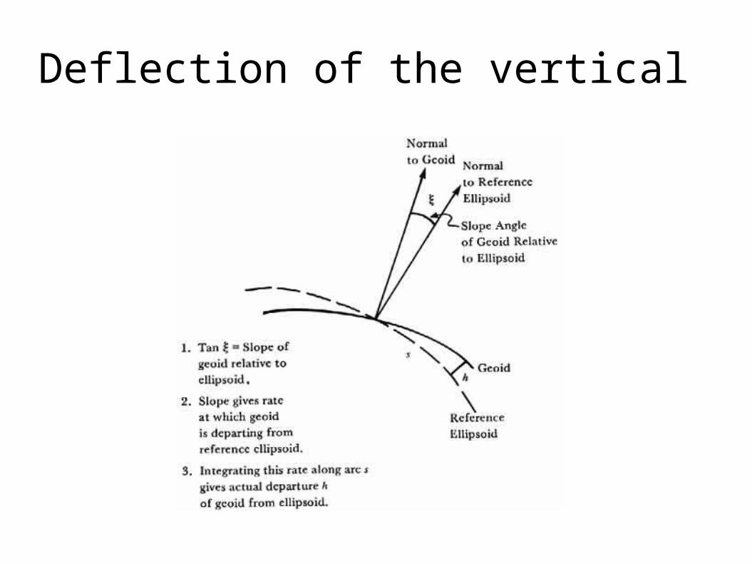
Deflection of the vertical

15

Additional details
• Choice of MEADES RANCH based on an analysis of the minimization of sum of squares of differences between astronomic and geodetic azimuths.
• Clarke 1966 reference ellipsoid was oriented through use of Laplace stations.
– They are points where astronomic latitude, longitude and azimuth are known.
– Deflections and geoid height at initial point were intended to be zero.

Pre-GPS Surveying
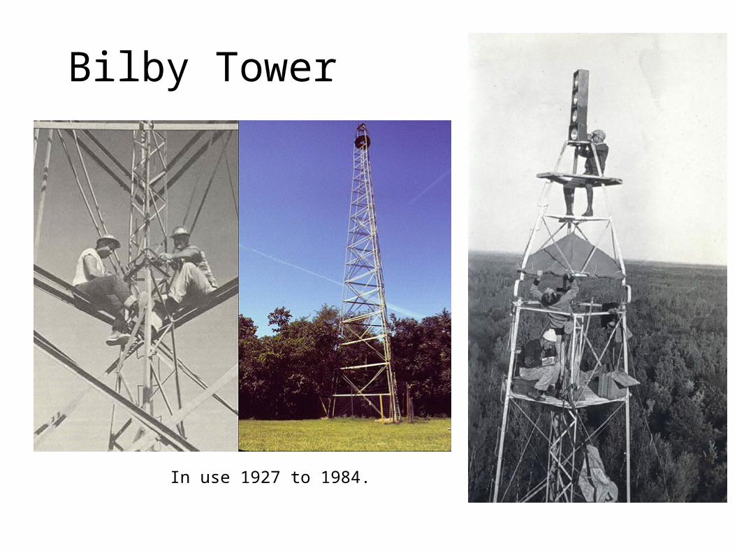
Bilby Tower
In use 1927 to 1984.

NAD 27 network

NAD 27 deficiencies• Despite intent, the components of the
deflection of the vertical at MEADES RANCH were not zero.
– Initial assumptions about initial point map to network.
– As network attached to initial point deflections are relative (NOT GLOBAL).
• Adjustment was NOT simultaneous least squares.
• No geoid model.

More problems ...
• NAD 27 designed to provide relative precision of 1:25,000.
– Insufficient number of baselines
• Work after 1927 was attached to the existing network.
• New work was better than the network could support.
Degradation of results when constraining to NAD 27 control points.

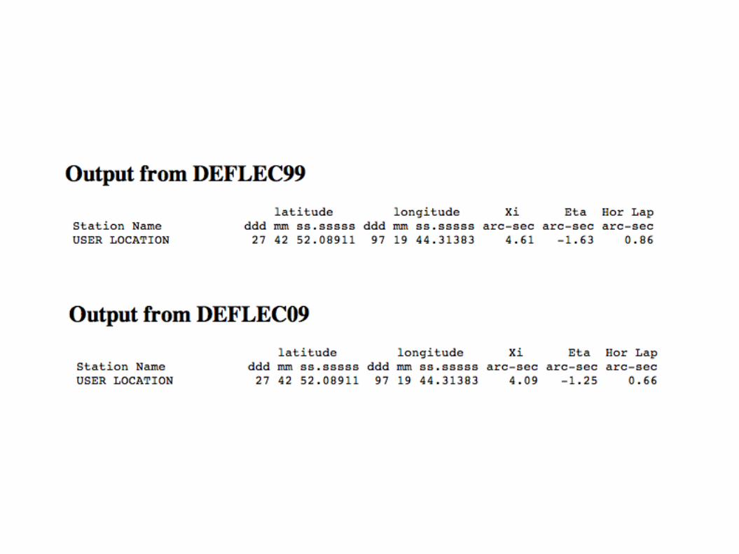
• Deflections are used to relate the orientation of a locally-leveled instrument to a spatial reference system.
– Used to correct zenith distance (vertical angle) measurements, and to convert between astronomic and ellipsoidal azimuths (the Laplace correction).
• Both N-S (Meridian component), "Xi" and E-W components (Prime Vertical component,"Eta")
• Xi and Eta are the differences between astronomic and geodetic latitude/longitude respectively.

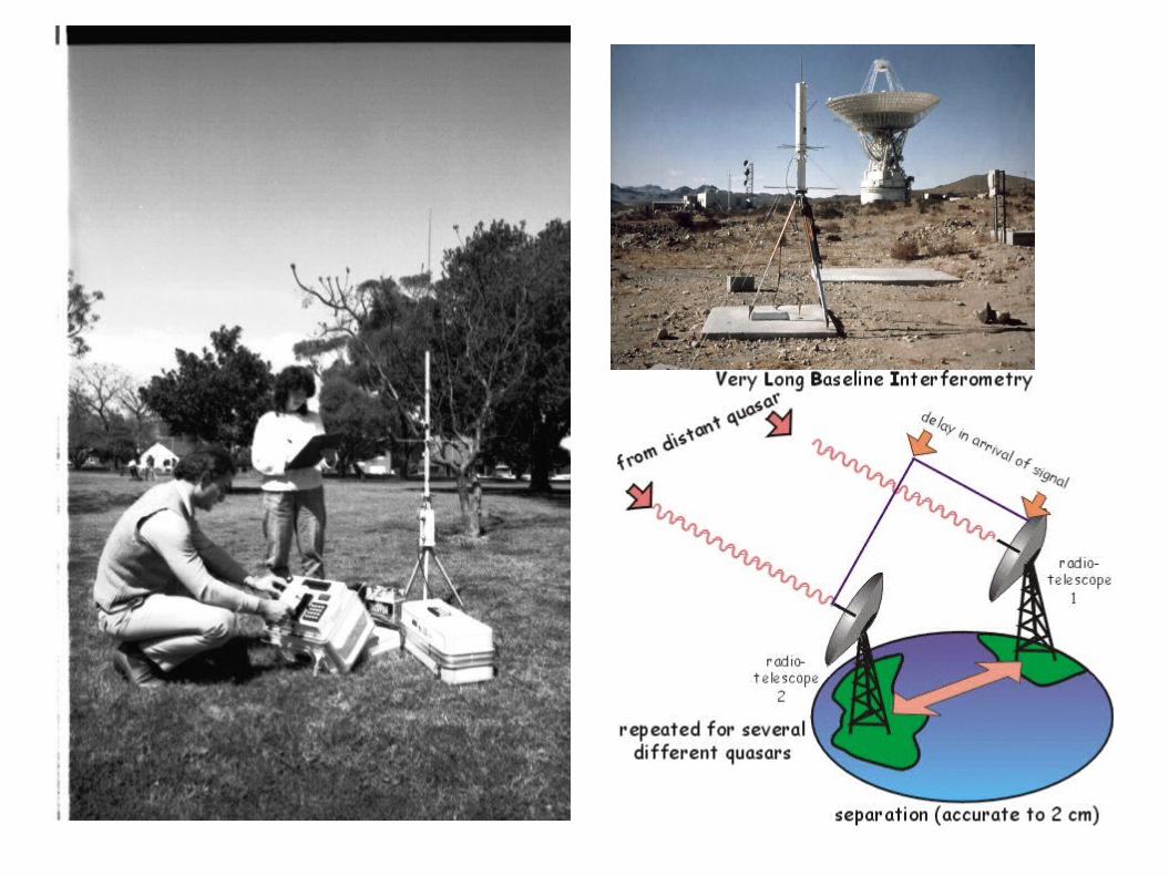
BC-4 Camera Program


BC-4 camera photograph stars in circular pattern
satellite is a series of dots in straight line.

What is to be done?

NGS to the rescue

Versions of NAD 83
• First implementation labeled NAD 83 (1986).
• Deficiencies in this version were discovered resulting in a state-by-state campaign to provide more accurate networks.
– High Accuracy Reference Network (HARN)
– NAD 83 (####) tag given to HARN project adjustment (NOT a new datum)
• Subsequent campaign to re-observe networks to generate good ellipsoid heights.
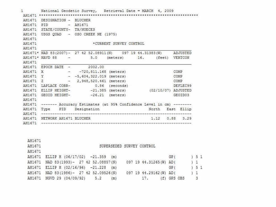
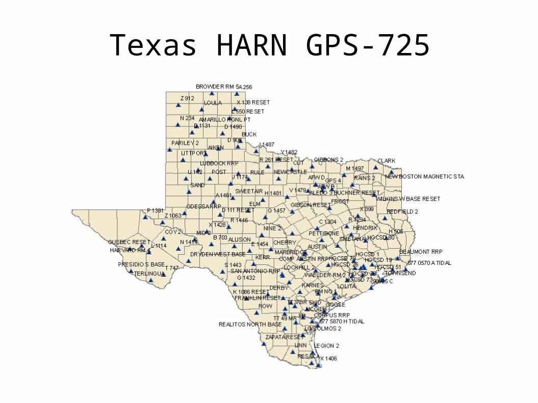
Texas HARN GPS-725
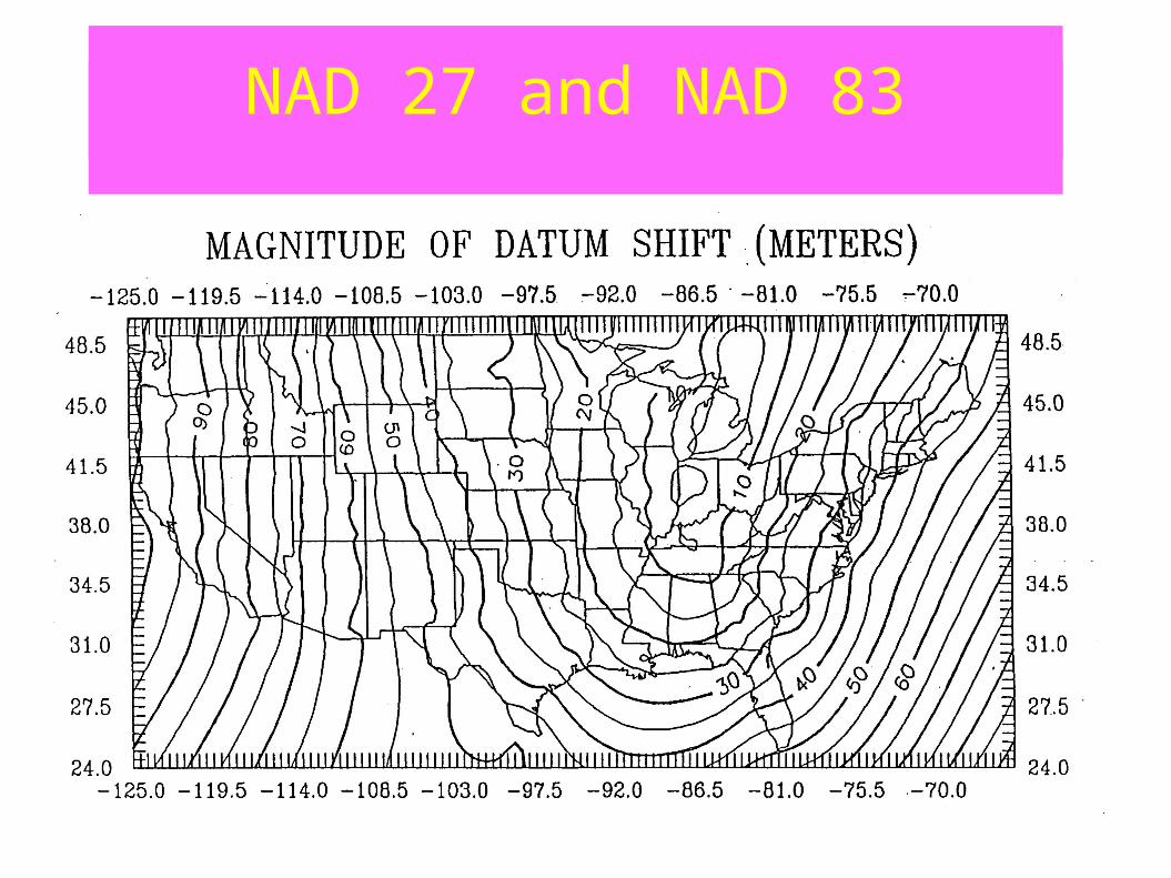
NAD 27 and NAD 83NAD 27 and NAD 83