Embed Size (px)
Citation preview
Lecture 4
Geodatabases
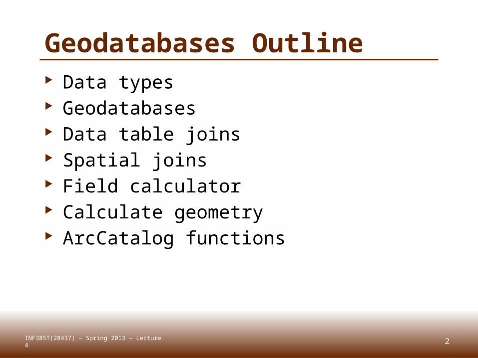
Geodatabases Outline Data types Geodatabases Data table joins Spatial joins Field calculator Calculate geometry ArcCatalog functions
2INF385T(28437) – Spring 2013 – Lecture 4

DATA TYPES Lecture 4
3INF385T(28437) – Spring 2013 – Lecture 4
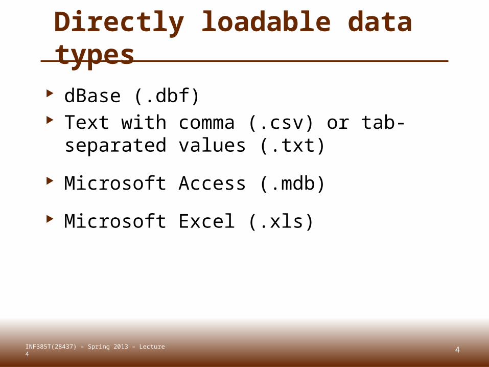
Directly loadable data types
dBase (.dbf) Text with comma (.csv) or tab-
separated values (.txt)
Microsoft Access (.mdb)
Microsoft Excel (.xls)
4INF385T(28437) – Spring 2013 – Lecture 4
5
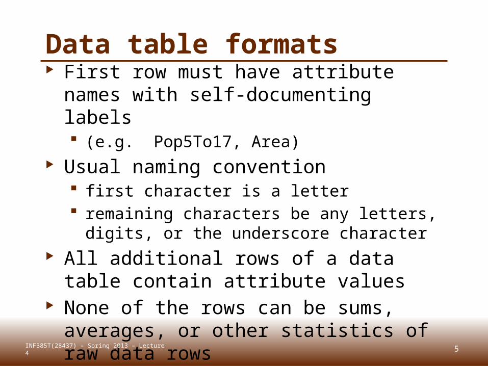
Data table formats First row must have attribute names
with self-documenting labels (e.g. Pop5To17, Area)
Usual naming convention first character is a letter remaining characters be any letters, digits,
or the underscore character All additional rows of a data table
contain attribute values None of the rows can be sums,
averages, or other statistics of raw data rows
INF385T(28437) – Spring 2013 – Lecture 4
GEODATABASESLecture 4
7INF385T(28437) – Spring 2013 – Lecture 4
8
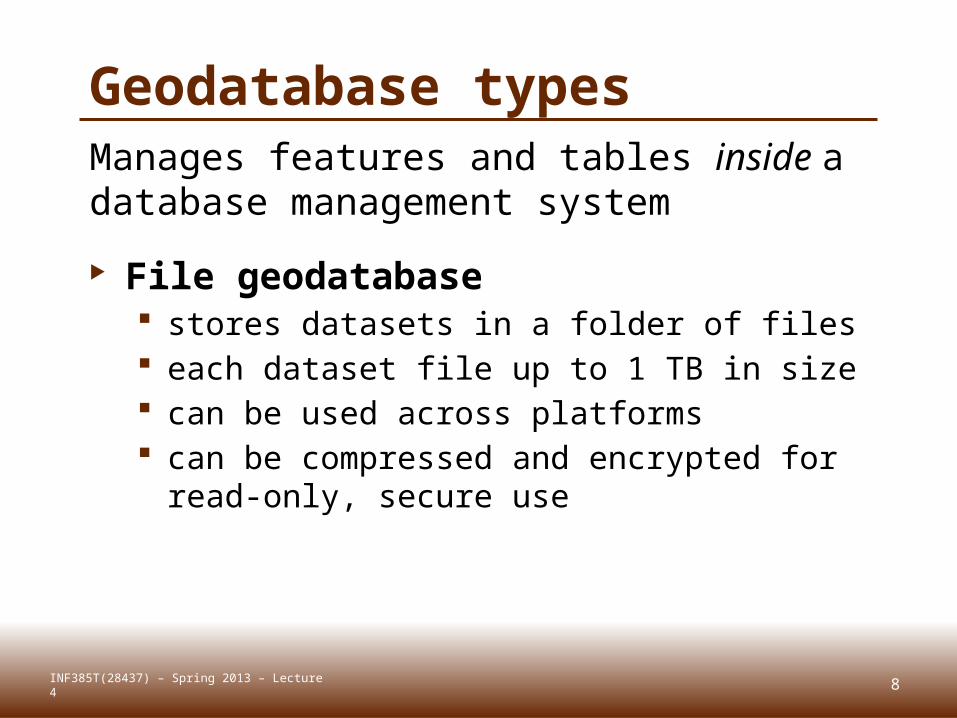
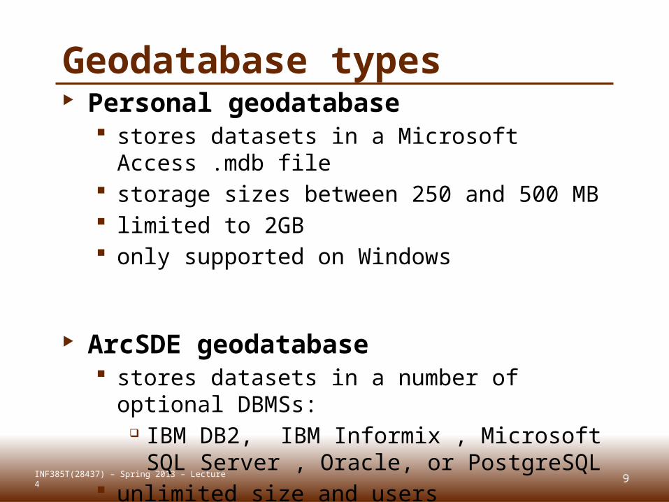
Geodatabase typesManages features and tables inside a database management system
File geodatabase stores datasets in a folder of files each dataset file up to 1 TB in size can be used across platforms can be compressed and encrypted for
read-only, secure use
INF385T(28437) – Spring 2013 – Lecture 4
9
Geodatabase types Personal geodatabase
stores datasets in a Microsoft Access .mdb file
storage sizes between 250 and 500 MB limited to 2GB only supported on Windows
ArcSDE geodatabase stores datasets in a number of optional
DBMSs: IBM DB2, IBM Informix , Microsoft SQL
Server , Oracle, or PostgreSQL unlimited size and users
INF385T(28437) – Spring 2013 – Lecture 4
10
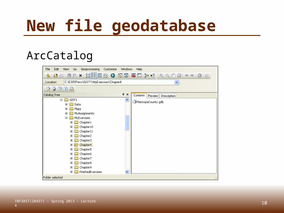
New file geodatabase
ArcCatalog
INF385T(28437) – Spring 2013 – Lecture 4
11
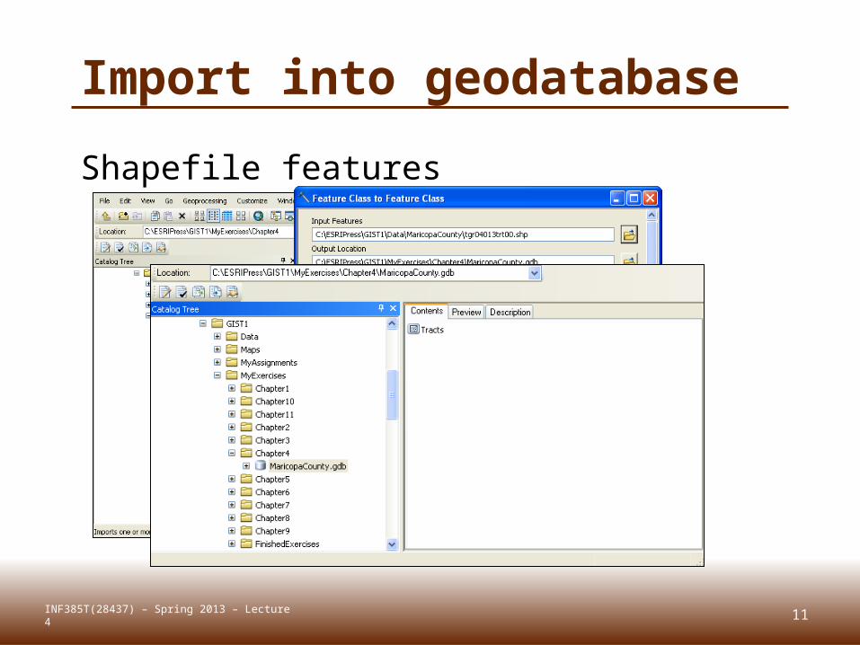
Import into geodatabase
INF385T(28437) – Spring 2013 – Lecture 4
Shapefile features
12
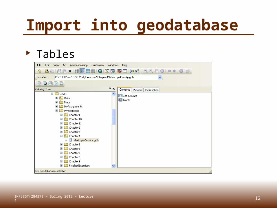
Import into geodatabase
Tables
INF385T(28437) – Spring 2013 – Lecture 4
13
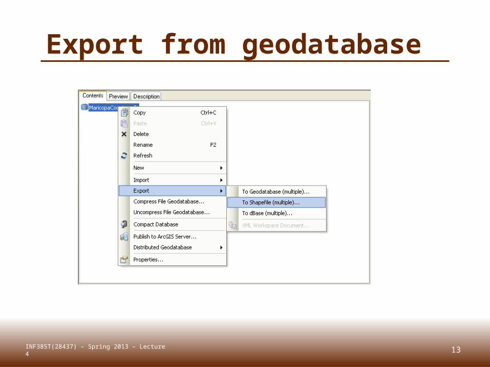
Export from geodatabase
INF385T(28437) – Spring 2013 – Lecture 4
14
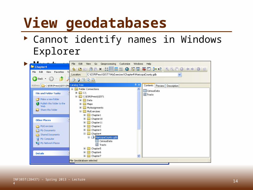
View geodatabases Cannot identify names in Windows
Explorer Must use ArcCatalog
INF385T(28437) – Spring 2013 – Lecture 4
15
Compact geodatabases
File and personal geodatabases Reduces size and improves performance Compact personal geodatabases > 250
MB. Geodatabases with frequent data entry,
deletion, or general editing Open geodatabases in ArcMap cannot be
compacted remove any layers with a source table or
feature class in that database from the TOC
INF385T(28437) – Spring 2013 – Lecture 4
16
Compress geodatabases File geodatabases
Once compressed, a feature class or table is read-only and cannot be edited
Compression is ideally suited to mature datasets that do not require further editing
Compressed dataset can be uncompressed to return it to its original, read-write format
INF385T(28437) – Spring 2013 – Lecture 4

DATA TABLE JOINSLecture 4
17INF385T(28437) – Spring 2013 – Lecture 4
18
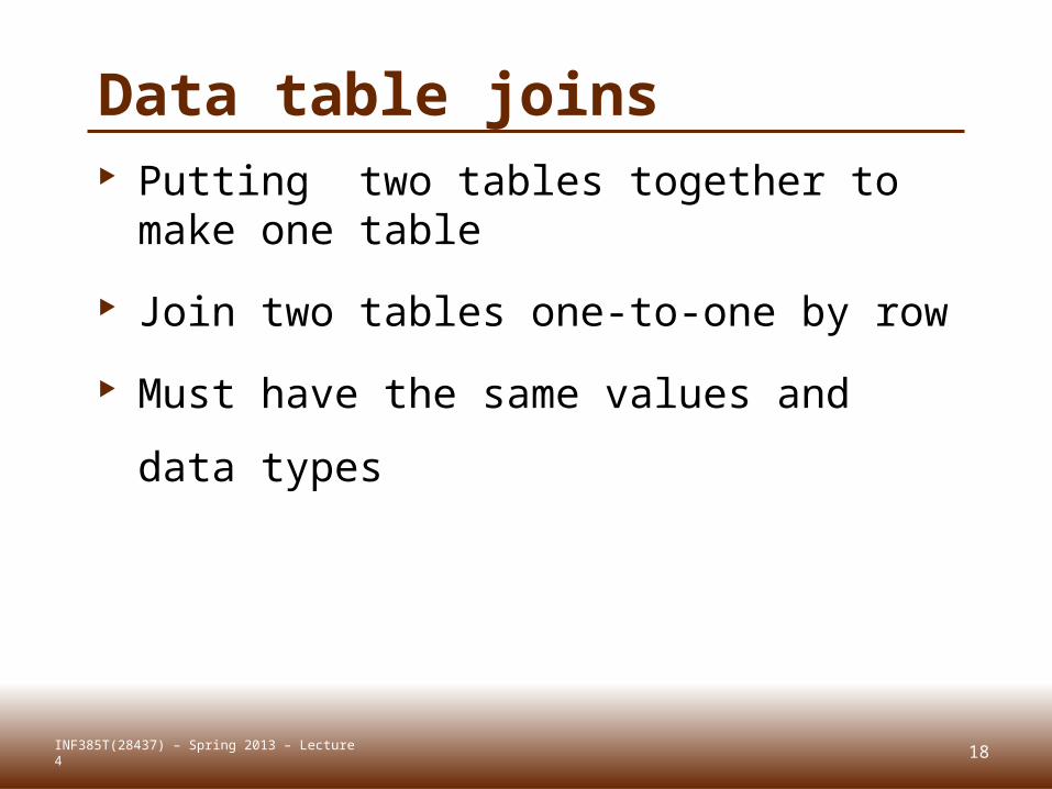
Data table joins Putting two tables together to make
one table
Join two tables one-to-one by row
Must have the same values and data
types
INF385T(28437) – Spring 2013 – Lecture 4

19
Join example
Housing heating fuel study for U.S.
Counties
Source: U.S. Census Data table: Census SF3 table for heating
fuel by county
Map Features: County polygons
INF385T(28437) – Spring 2013 – Lecture 4
20
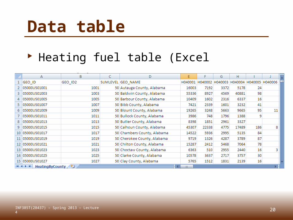
Data table
Heating fuel table (Excel spreadsheet)
INF385T(28437) – Spring 2013 – Lecture 4
21
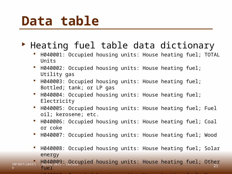
Data table
Heating fuel table data dictionary H040001: Occupied housing units: House heating fuel; TOTAL Units H040002: Occupied housing units: House heating fuel; Utility gas H040003: Occupied housing units: House heating fuel; Bottled; tank;
or LP gas H040004: Occupied housing units: House heating fuel; Electricity
H040005: Occupied housing units: House heating fuel; Fuel oil; kerosene; etc.
H040006: Occupied housing units: House heating fuel; Coal or coke H040007: Occupied housing units: House heating fuel; Wood H040008: Occupied housing units: House heating fuel; Solar energy H040009: Occupied housing units: House heating fuel; Other fuel H040010: Occupied housing units: House heating fuel; No fuel used
INF385T(28437) – Spring 2013 – Lecture 4
22
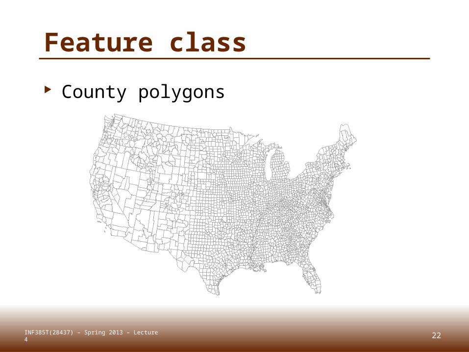
Feature class
County polygons
INF385T(28437) – Spring 2013 – Lecture 4
23
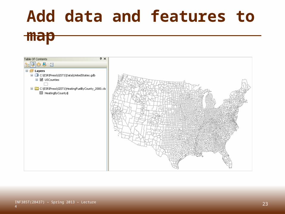
Add data and features to map
INF385T(28437) – Spring 2013 – Lecture 4
24
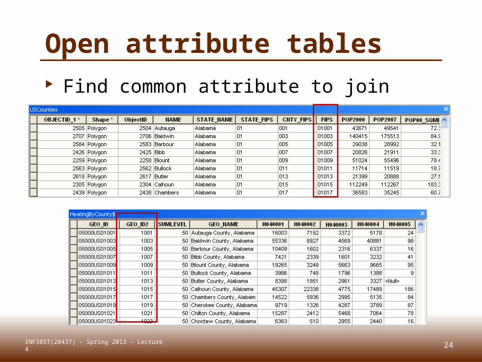
Open attribute tables Find common attribute to join
INF385T(28437) – Spring 2013 – Lecture 4
25
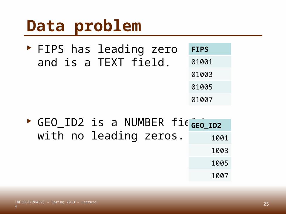
Data problem FIPS has leading zero
and is a TEXT field.
GEO_ID2 is a NUMBER fieldwith no leading zeros.
INF385T(28437) – Spring 2013 – Lecture 4
FIPS
01001
01003
01005
01007
GEO_ID2
1001
1003
1005
1007
26
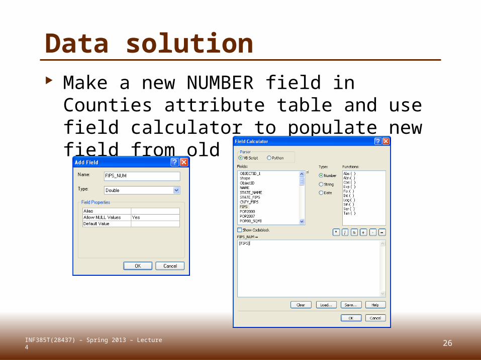
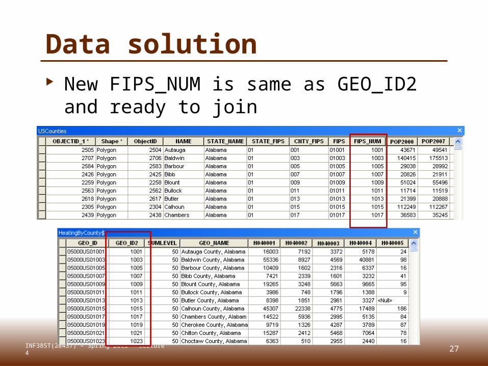
Data solution Make a new NUMBER field in Counties
attribute table and use field calculator to populate new field from old
INF385T(28437) – Spring 2013 – Lecture 4
27
Data solution New FIPS_NUM is same as GEO_ID2 and
ready to join
INF385T(28437) – Spring 2013 – Lecture 4
28
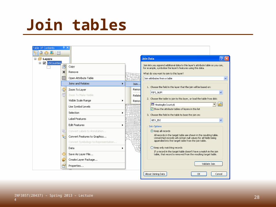
Join tables
INF385T(28437) – Spring 2013 – Lecture 4
29
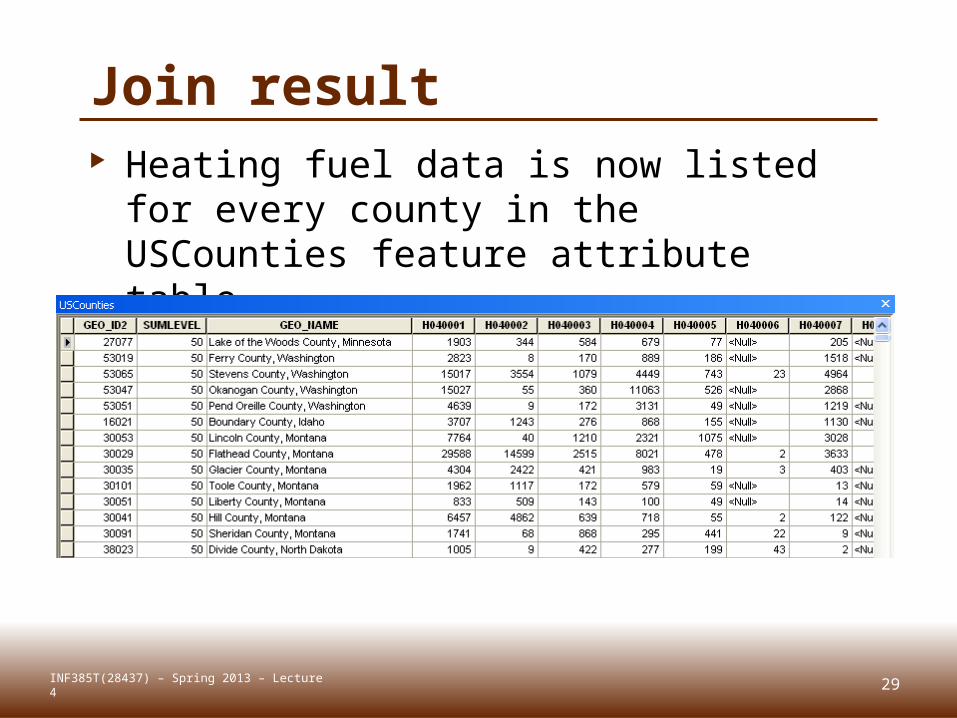
Join result Heating fuel data is now listed for
every county in the USCounties feature attribute table
INF385T(28437) – Spring 2013 – Lecture 4
30
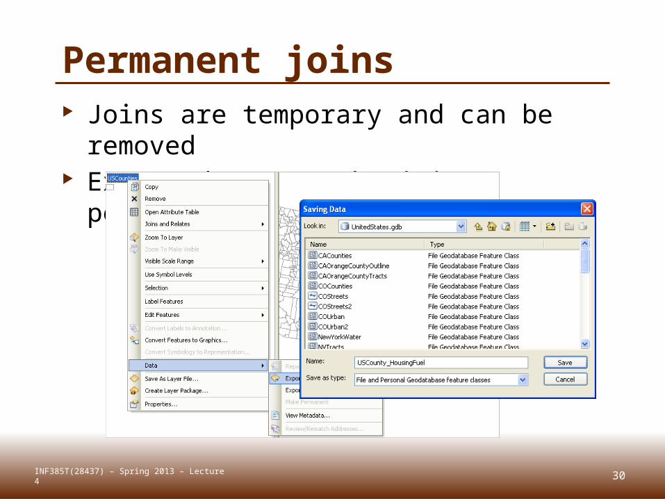
Permanent joins Joins are temporary and can be
removed Export data to make joins permanent
INF385T(28437) – Spring 2013 – Lecture 4
31
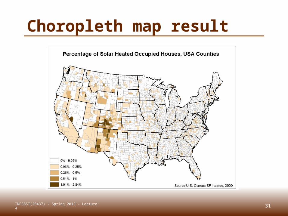
Choropleth map result
INF385T(28437) – Spring 2013 – Lecture 4

SPATIAL JOINSLecture 4
32INF385T(28437) – Spring 2013 – Lecture 4
33
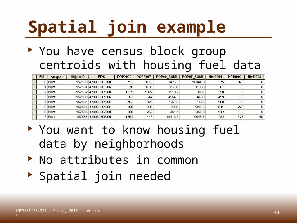
Spatial join example You have census block group centroids
with housing fuel data
You want to know housing fuel data by neighborhoods
No attributes in common Spatial join needed
INF385T(28437) – Spring 2013 – Lecture 4
34
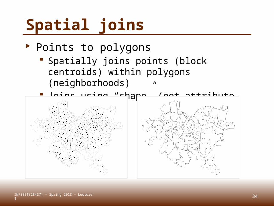
Spatial joins Points to polygons
Spatially joins points (block centroids) within polygons (neighborhoods)
Joins using “shape” (not attribute field)
INF385T(28437) – Spring 2013 – Lecture 4
35
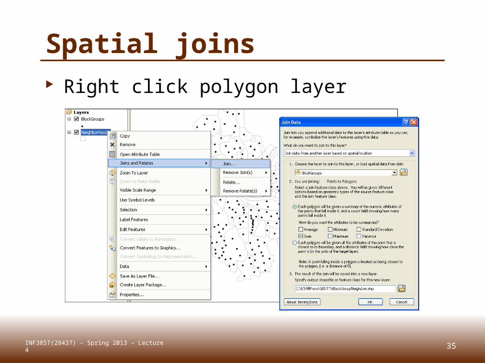
Spatial joins Right click polygon layer
(neighborhoods)
INF385T(28437) – Spring 2013 – Lecture 4
36
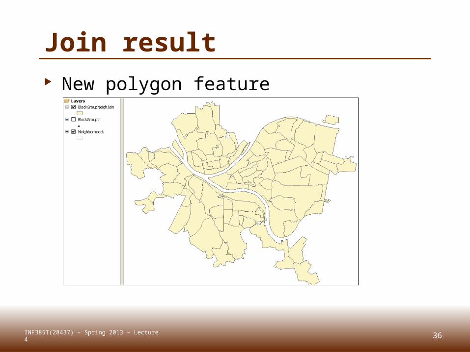
Join result New polygon feature
INF385T(28437) – Spring 2013 – Lecture 4
37
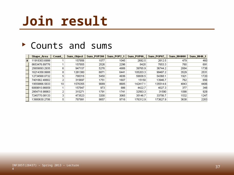
Join result
Counts and sums
INF385T(28437) – Spring 2013 – Lecture 4
38
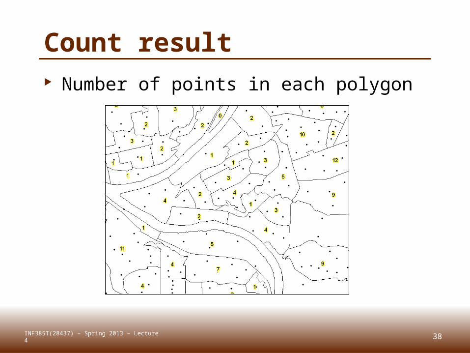
Count result Number of points in each polygon
INF385T(28437) – Spring 2013 – Lecture 4
39
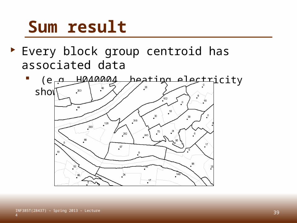
Sum result Every block group centroid has associated
data (e.g. H040004, heating electricity shown in
labels)
INF385T(28437) – Spring 2013 – Lecture 4
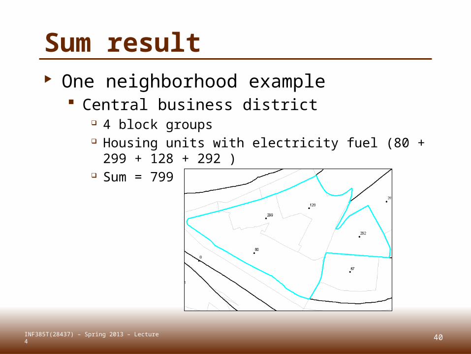
40
Sum result
INF385T(28437) – Spring 2013 – Lecture 4
One neighborhood example Central business district
4 block groups Housing units with electricity fuel (80 + 299 + 128
+ 292 ) Sum = 799
41
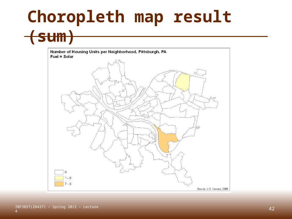
Choropleth map result (sum)
INF385T(28437) – Spring 2013 – Lecture 4
42
Choropleth map result (sum)
INF385T(28437) – Spring 2013 – Lecture 4
43
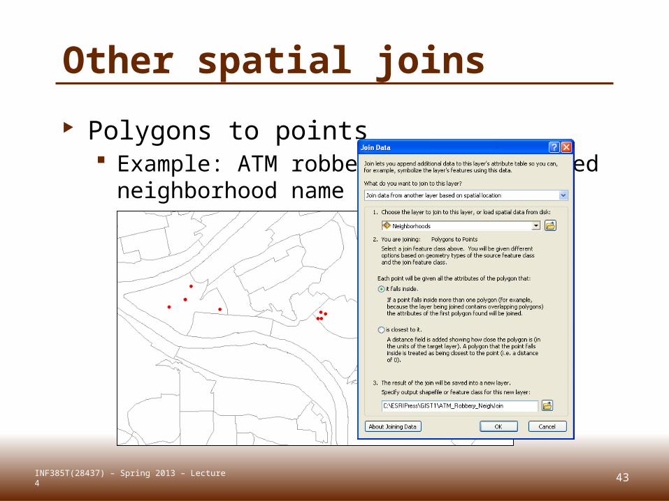
Other spatial joins
Polygons to points Example: ATM robberies (points) need
neighborhood name
INF385T(28437) – Spring 2013 – Lecture 4
44
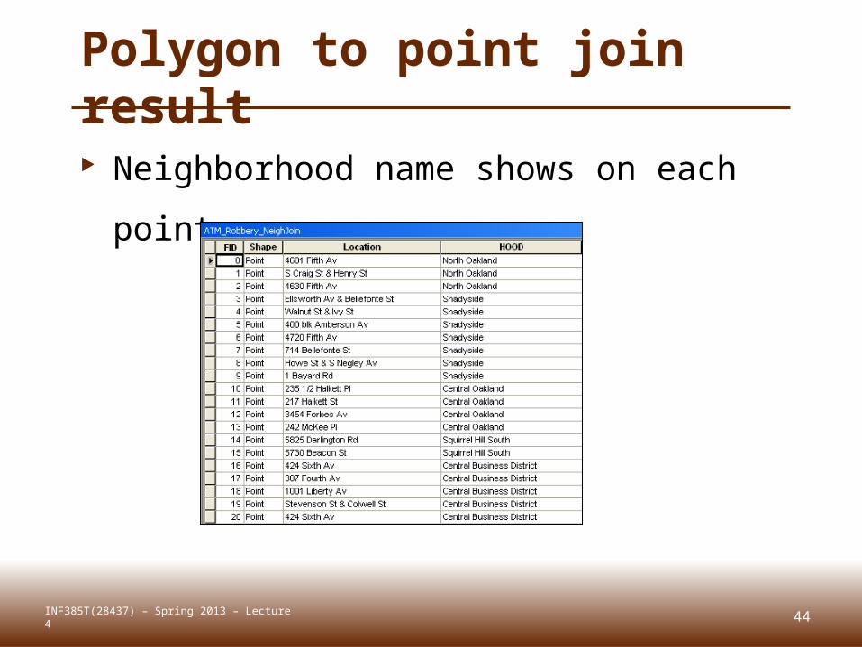
Polygon to point join result
Neighborhood name shows on each
point
INF385T(28437) – Spring 2013 – Lecture 4
45
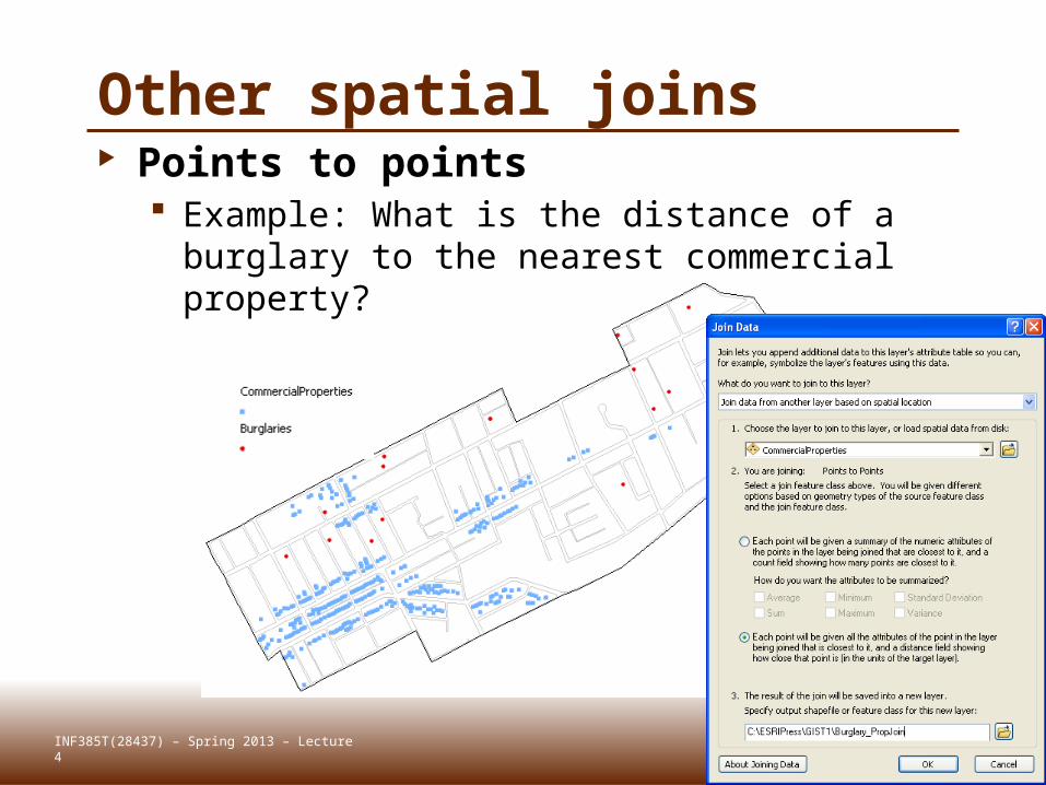
Other spatial joins Points to points
Example: What is the distance of a burglary to the nearest commercial property?
INF385T(28437) – Spring 2013 – Lecture 4
46
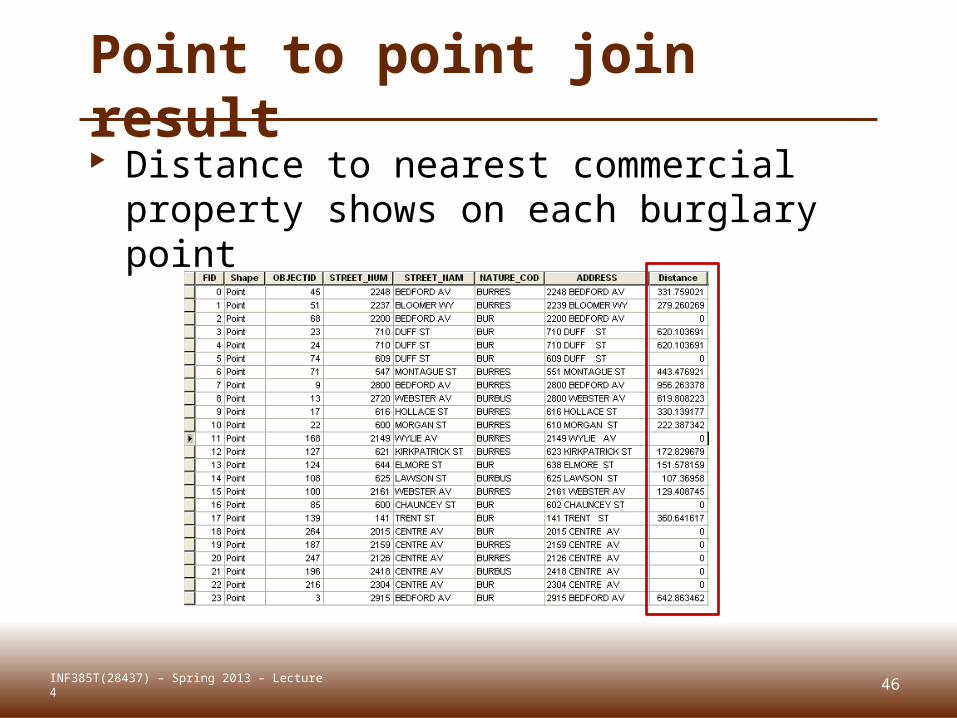
Point to point join result Distance to nearest commercial
property shows on each burglary point
INF385T(28437) – Spring 2013 – Lecture 4
FIELD CALCULATORLecture 4
47INF385T(28437) – Spring 2013 – Lecture 4
(as in “Feature-Attribute” Calculator)
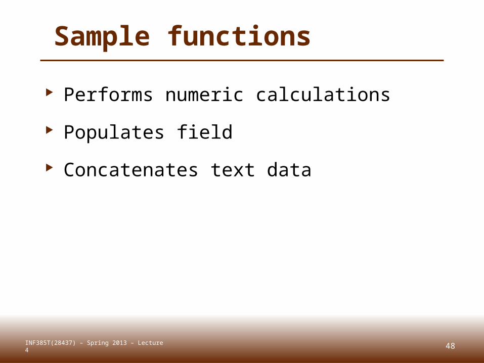
Sample functions
Performs numeric calculations
Populates field
Concatenates text data
48INF385T(28437) – Spring 2013 – Lecture 4
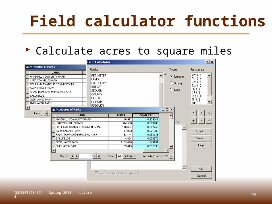
Field calculator functions
Calculate acres to square miles
49INF385T(28437) – Spring 2013 – Lecture 4
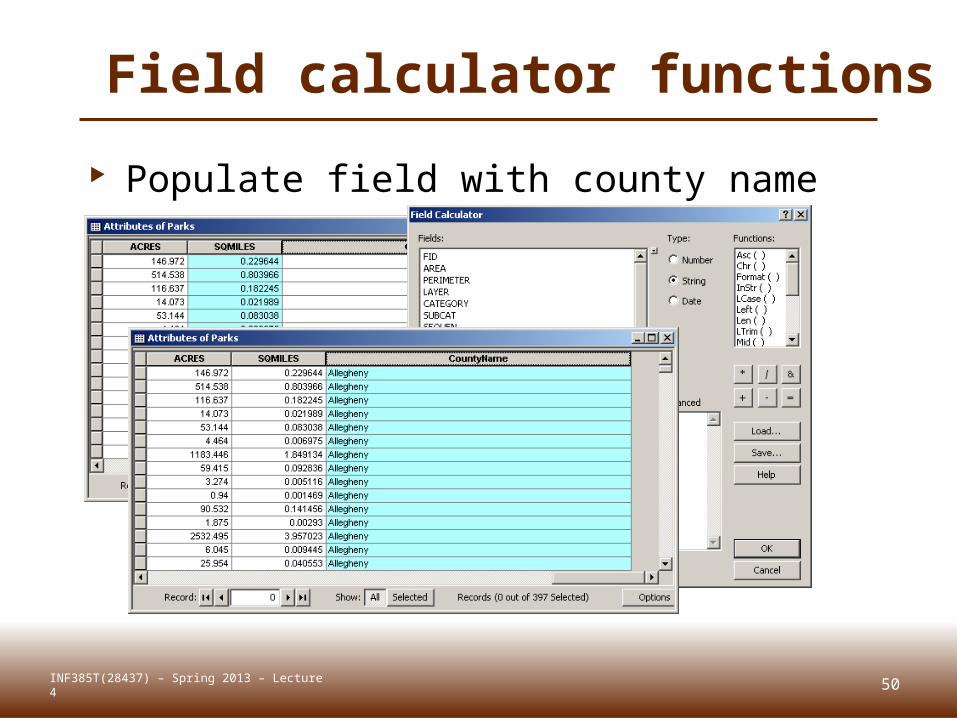
Field calculator functions
Populate field with county name
INF385T(28437) – Spring 2013 – Lecture 4 50
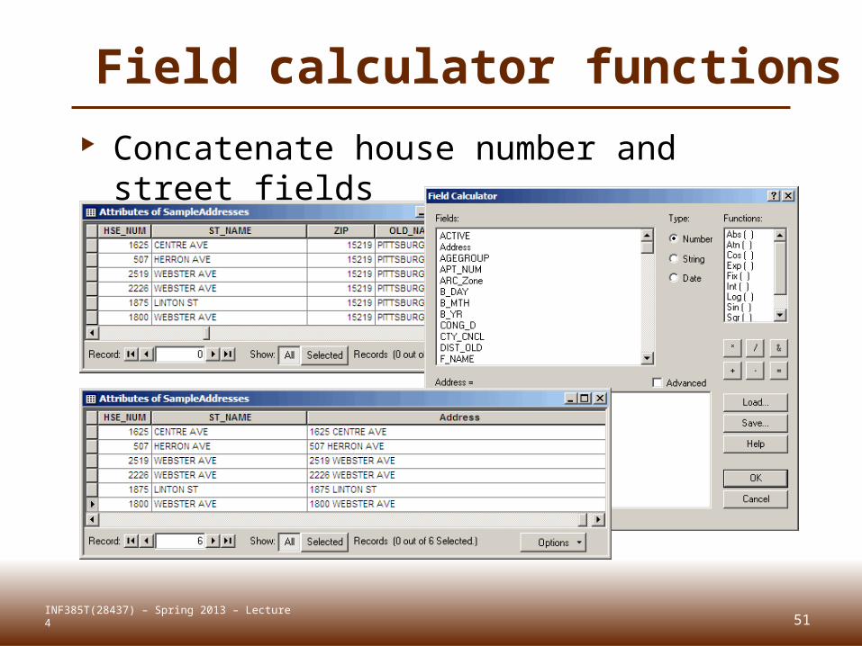
Field calculator functions Concatenate house number and street
fields
INF385T(28437) – Spring 2013 – Lecture 4 51

CALCULATE GEOMETRYLecture 4
52INF385T(28437) – Spring 2013 – Lecture 4
Polygon/point centroids Advanced calculations for finding a
polygon’s point centroid
53INF385T(28437) – Spring 2013 – Lecture 4
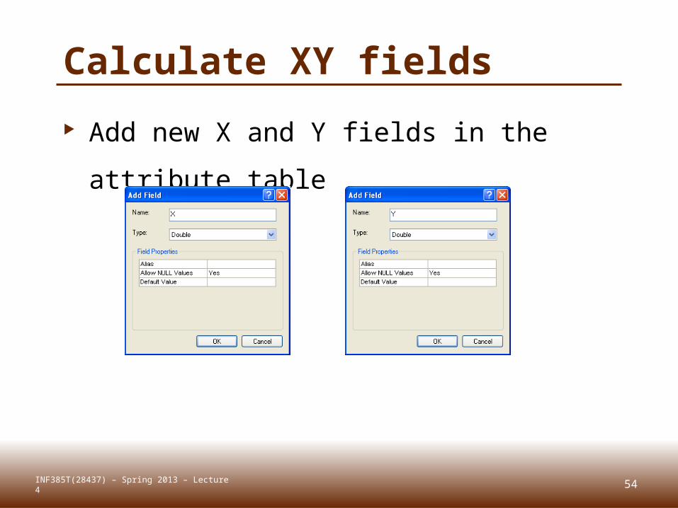
Calculate XY fields
Add new X and Y fields in the attribute
table
INF385T(28437) – Spring 2013 – Lecture 4 54
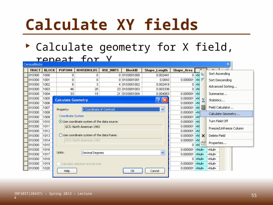
Calculate XY fields Calculate geometry for X field, repeat
for Y
INF385T(28437) – Spring 2013 – Lecture 4 55
56
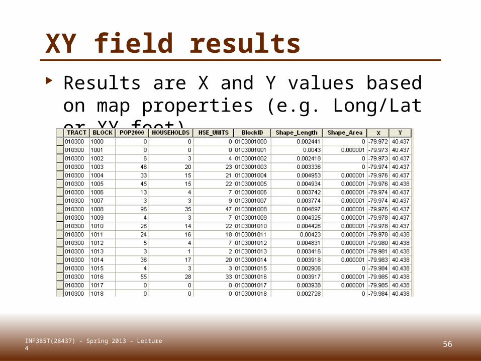
XY field results Results are X and Y values based on
map properties (e.g. Long/Lat or XY feet)
INF385T(28437) – Spring 2013 – Lecture 4
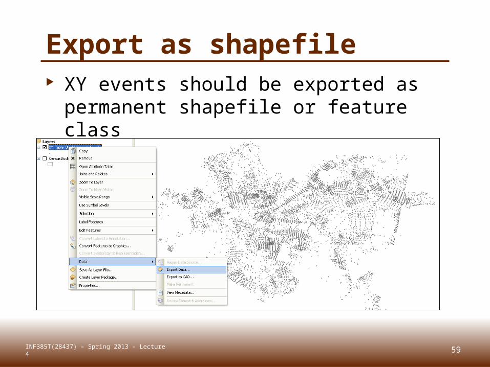
Export as shapefile XY events should be exported as
permanent shapefile or feature class
59INF385T(28437) – Spring 2013 – Lecture 4
ARCCATALOG FUNCTIONSLecture 4
63INF385T(28437) – Spring 2013 – Lecture 4

Basic functions
Copy, paste, rename, etc.
64INF385T(28437) – Spring 2013 – Lecture 4
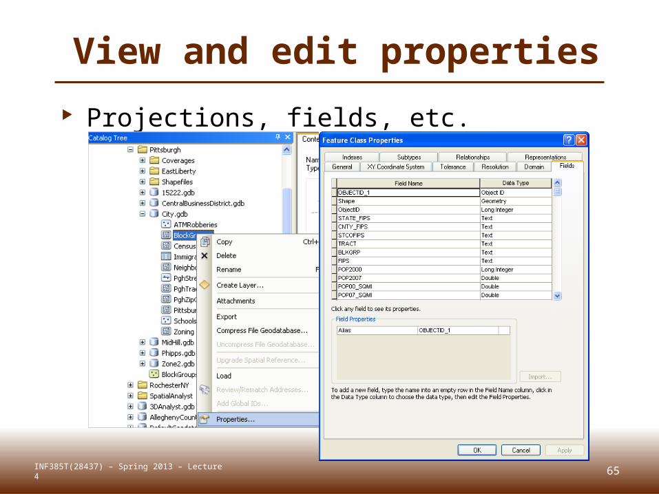
View and edit properties
Projections, fields, etc.
65INF385T(28437) – Spring 2013 – Lecture 4
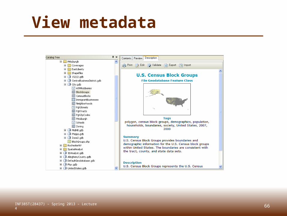
View metadata
66INF385T(28437) – Spring 2013 – Lecture 4
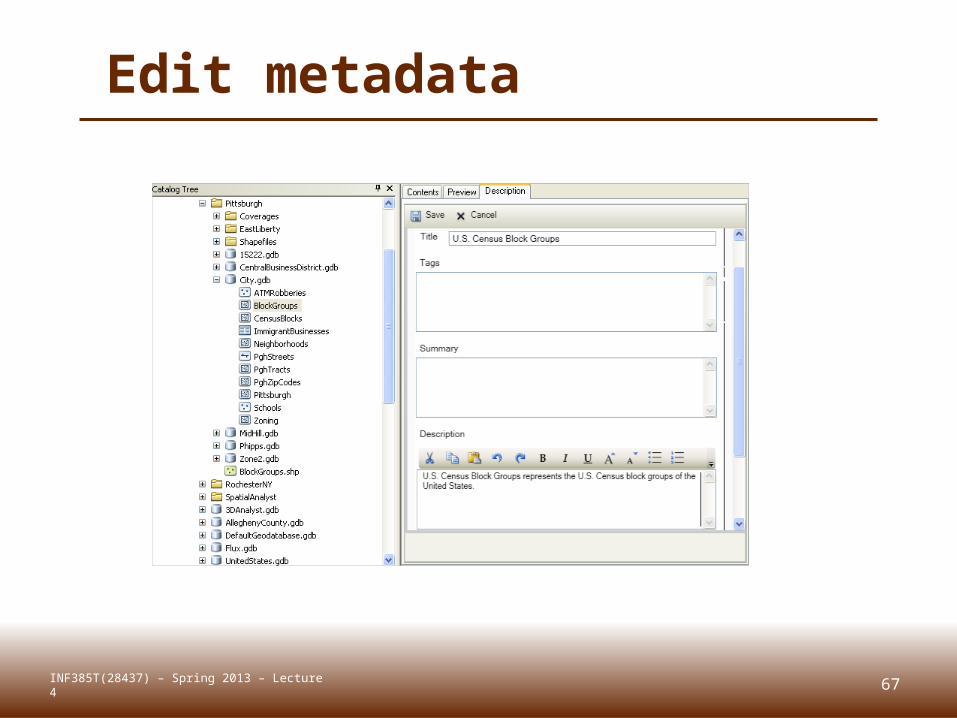
Edit metadata
67INF385T(28437) – Spring 2013 – Lecture 4
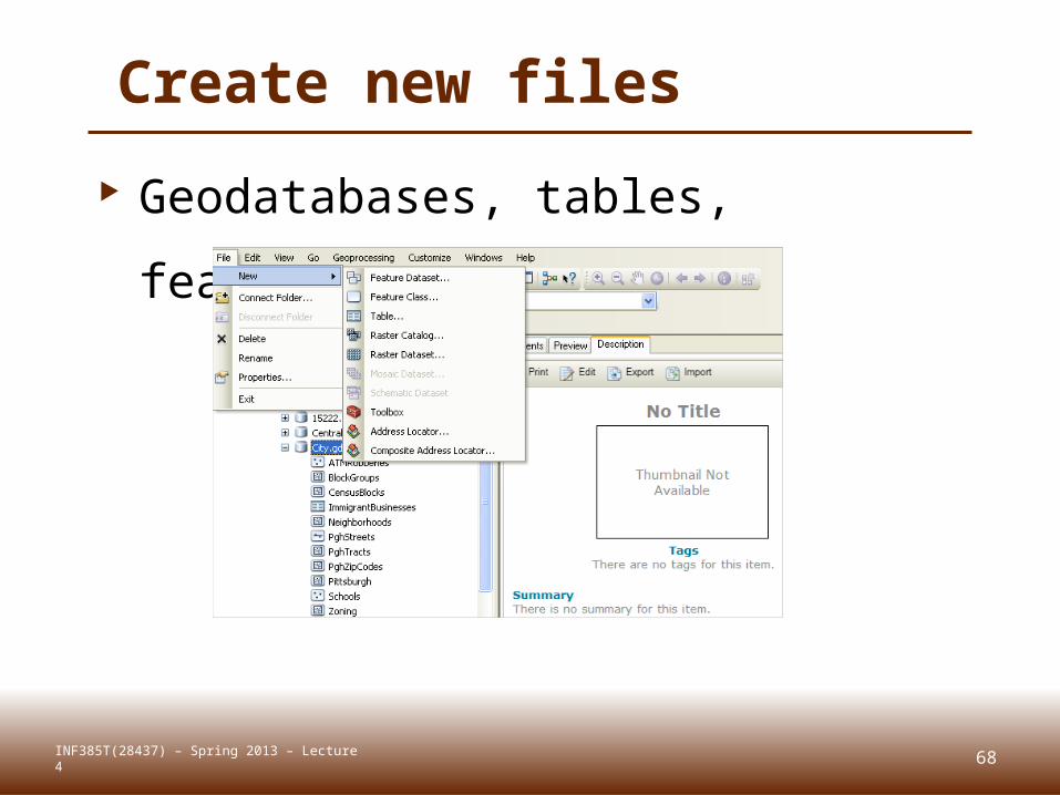
Create new files
Geodatabases, tables, features,
etc.
68INF385T(28437) – Spring 2013 – Lecture 4
Summary Data types Geodatabases Data table joins Spatial joins Field calculator Calculate geometry ArcCatalog functions
69INF385T(28437) – Spring 2013 – Lecture 4