Embed Size (px)
Citation preview
LAS CONCHAS
106°26'0"W
106°26'0"W
106°28'0"W
106°28'0"W
106°30'0"W
106°30'0"W
106°32'0"W
106°32'0"W
106°34'0"W
106°34'0"W
106°36'0"W
106°36'0"W
106°38'0"W
106°38'0"W
106°40'0"W
106°40'0"W
36°0
'0"N
36°0
'0"N
35°5
8'0"N
35°5
8'0"N
35°5
6'0"N
35°5
6'0"N
35°5
4'0"N
35°5
4'0"N
35°5
2'0"N
35°5
2'0"N
35°5
0'0"N
35°5
0'0"N
35°4
8'0"N
35°4
8'0"N
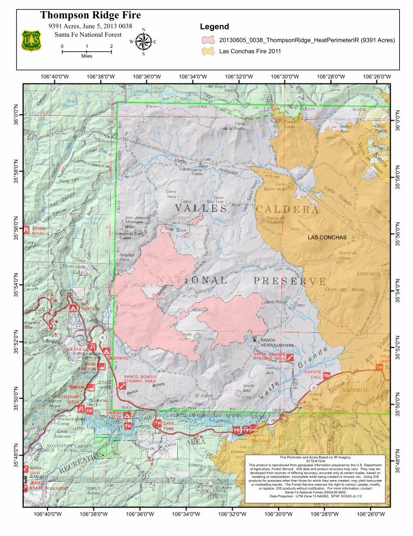
Santa Fe National Forest
Thompson Ridge Fire
0 21Miles
Legend20130605_0038_ThompsonRidge_HeatPerimeterIR (9391 Acres)Las Conchas Fire 2011
9391 Acres, June 5, 2013 0038
Fire Perimeter and Acres Based on IR Imagery.ATTENTION
This product is reproduced from geospatial information prepared by the U.S. Department of Agriculture, Forest Service. GIS data and product accuracy may vary. They may be: developed from sources of differing accuracy, accurate only at certain scales, based on modeling or interpretation, incomplete while being created or revised, etc. Using GIS
products for purposes other than those for which they were created, may yield inaccurate or misleading results. The Forest Service reserves the right to correct, update, modify,
or replace, GIS products without notification. For more information, contact:Santa Fe National Forest (505)438-5600.
Data Projection: UTM Zone 13 NAD83; SFNF SOGIS JL+12

![LOCALITY MAP '] Compartments 486 & 487 Currowan … State Forest No 820 SOUTHERN REGION < ... Mapped LIC Drainage LEGEND State Forest Boundary ... attached table and where appropriate,](https://img.pdfslide.net/doc/110x75/5ac3dfce7f8b9aae1b8cec7c/locality-map-compartments-486-487-currowan-state-forest-no-820-southern-region.jpg)