Embed Size (px)
Citation preview
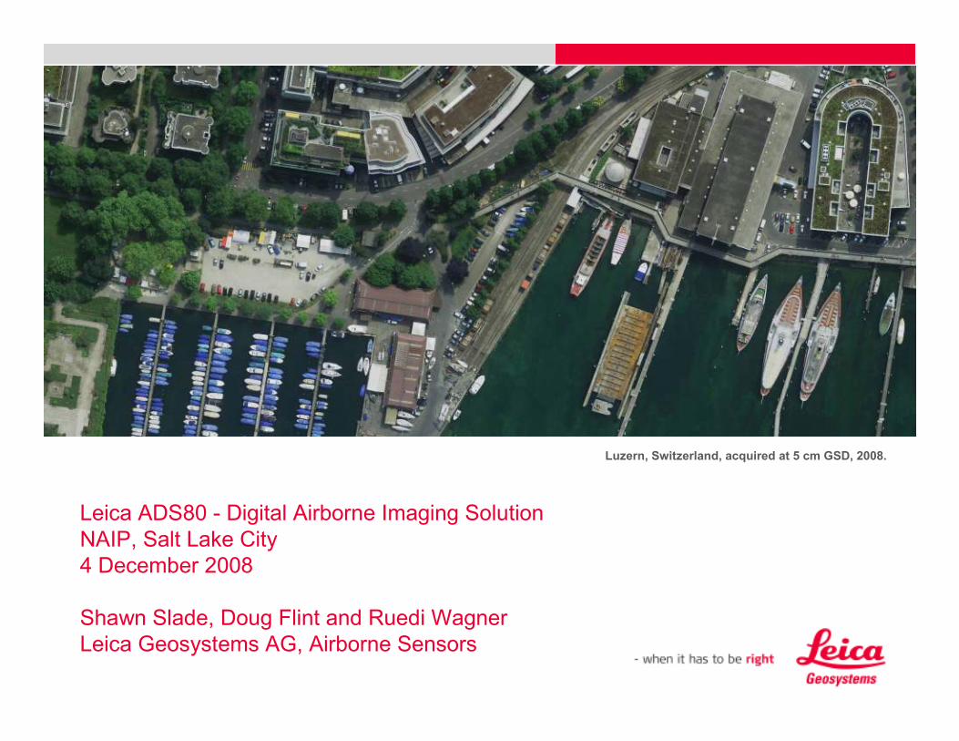
Leica ADS80 - Digital Airborne Imaging Solution
NAIP, Salt Lake City
4 December 2008
Shawn Slade, Doug Flint and Ruedi Wagner
Leica Geosystems AG, Airborne Sensors
Luzern, Switzerland, acquired at 5 cm GSD, 2008.

1. Our History in Airborne Sensing

Leica‘s history in aerial photography
C2 - 1925
ADS40 - 2001
RC30 - 1992
ADS40 - 2006
SH51 & SH52
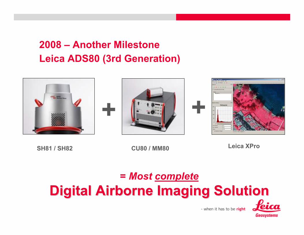
2008 – Another Milestone
= Most complete
Digital Digital AirborneAirborne ImagingImaging SolutionSolution
+ +
SH81 / SH82 CU80 / MM80 Leica XPro
Leica ADS80 (3rd Generation)
MM40
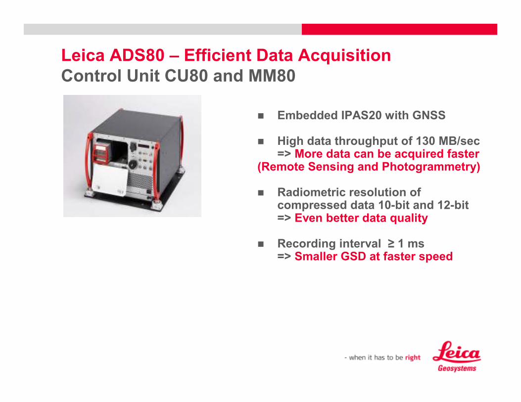
� Embedded IPAS20 with GNSS
� High data throughput of 130 MB/sec=> More data can be acquired faster
(Remote Sensing and Photogrammetry)
� Radiometric resolution of compressed data 10-bit and 12-bit=> Even better data quality
� Recording interval ≥ 1 ms=> Smaller GSD at faster speed
Leica ADS80 – Efficient Data Acquisition
Control Unit CU80 and MM80

2. Basic Design Advantages – Why Pushbroom and
not Frame?
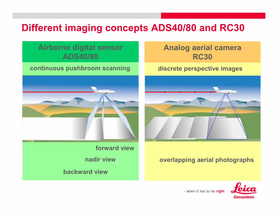
Different imaging concepts ADS40/80 and RC30
overlapping aerial photographs
discrete perspective images
Analog aerial camera
RC30
forward view
nadir view
backward view
continuous pushbroom scanning
Airborne digital sensor
ADS40/80
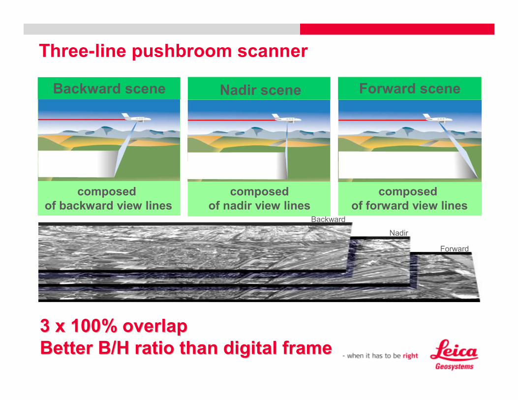
Three-line pushbroom scanner
composed
of backward view lines
Backward scene
composed
of nadir view lines
Nadir scene
composed
of forward view lines
Forward scene
Backward
Nadir
Forward
3 x 100% overlap3 x 100% overlap
Better B/H ratio than digital frameBetter B/H ratio than digital frame

3. Advantages of the Leica ADS80
3.1 Highest Geometric Accuracy
What is „relevant“ to the Customer in aerial digital
mapping?

Leica ADS40-II/ ADS80
Highest Stability during Data Acquisition
� One optical path
� Tight integration
� Very few components
=> Highest Geometric Stability
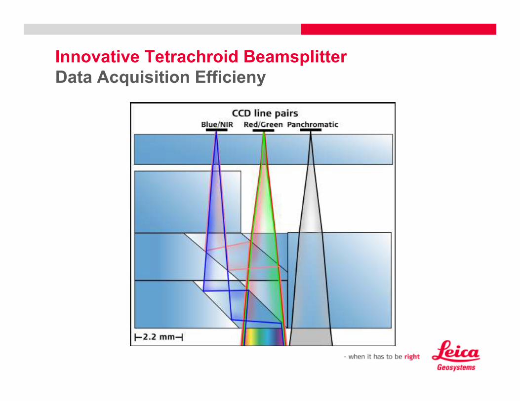
Innovative Tetrachroid Beamsplitter
Data Acquisition Efficieny

Leica ADS40-II/ ADS80 - Data Acquisition Efficiency
Equal resolution in all bands
+
+
=
=Telecentric Lens
Thermal and Pressure
Compensated
Equal Resolution
Co-registered in all
bands
Tetrachroid
NO PAN-SHARPENING
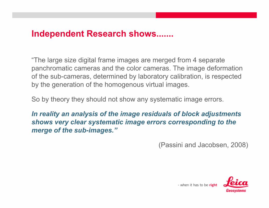
Independent Research shows.......
“The large size digital frame images are merged from 4 separate
panchromatic cameras and the color cameras. The image deformation
of the sub-cameras, determined by laboratory calibration, is respected
by the generation of the homogenous virtual images.
So by theory they should not show any systematic image errors.
In reality an analysis of the image residuals of block adjustments
shows very clear systematic image errors corresponding to the
merge of the sub-images.”
(Passini and Jacobsen, 2008)

Quality of external orientation
Passini & Jacobsen (2008)
Frame Cameras flown 60% forward and sidelap
ADS40 flown with 15% sidelap

3. Advantages of the Leica ADS80
3.2 Data Acquisition Efficiency
What is „relevant“ to the Customer in aerial digital
mapping?
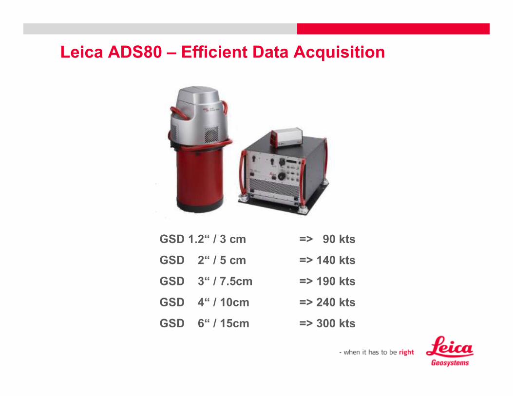
Leica ADS80 – Efficient Data Acquisition
GSD 1.2“ / 3 cm => 90 kts
GSD 2“ / 5 cm => 140 kts
GSD 3“ / 7.5cm => 190 kts
GSD 4“ / 10cm => 240 kts
GSD 6“ / 15cm => 300 kts

RC 30 (film camera)
DMC (digital camera)
ADS40 (digital camera)
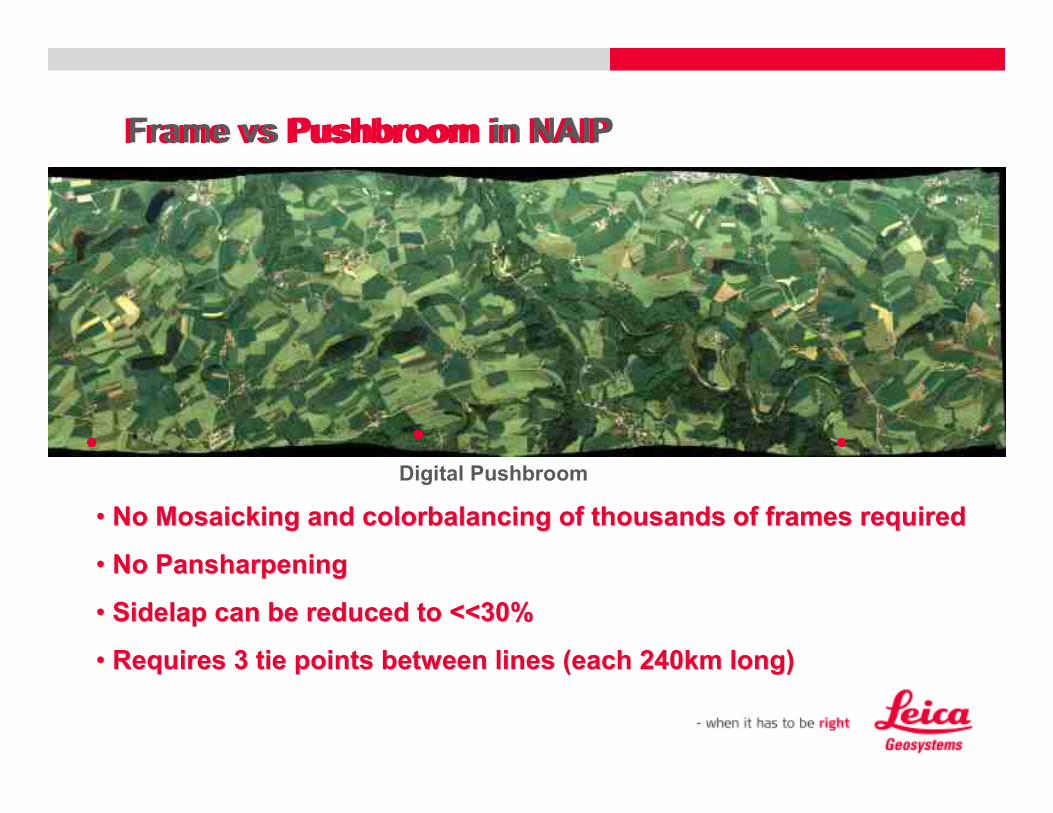
Frame vs Pushbroom in NAIP
Digital Frame
•• Requires Creation of Virtual FramesRequires Creation of Virtual Frames
•• Requires Pansharpening at ratio 1:3Requires Pansharpening at ratio 1:3
•• Minimum 30% sidelap due to AT requirementsMinimum 30% sidelap due to AT requirements
•• Requires 3 tie points per frame Requires 3 tie points per frame –– over 240km long strips means over 240km long strips means
10000s of tie points10000s of tie points
Frame vs Pushbroom in NAIP
RC 30 (film camera)
DMC (digital camera)
ADS40 (digital camera)
Frame vs Pushbroom in NAIP
Digital Pushbroom
•• No Mosaicking and colorbalancing of thousands of frames requireNo Mosaicking and colorbalancing of thousands of frames requiredd
•• No PansharpeningNo Pansharpening
•• Sidelap can be reduced to <<30% Sidelap can be reduced to <<30%
•• Requires 3 tie points between lines (each 240km long)Requires 3 tie points between lines (each 240km long)
Frame vs Pushbroom in NAIP
3. Advantages of the Leica ADS80
3.3 Highest Radiometric Accuracy
What is „relevant“ to the Customer in aerial digital
mapping?
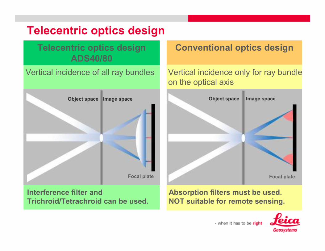
Conventional optics design
Telecentric optics design
Focal plate
Object space Image space
Telecentric optics design
ADS40/80
Object space
Focal plate
Image space
Interference filter and
Trichroid/Tetrachroid can be used.
Vertical incidence of all ray bundles Vertical incidence only for ray bundle
on the optical axis
Absorption filters must be used.
NOT suitable for remote sensing.
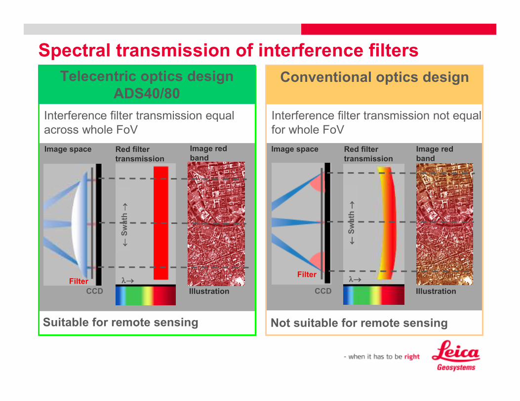
Spectral transmission of interference filters
Image space Red filter
transmission
Interference filter transmission not equal
for whole FoV
Filter
IllustrationCCD
λ→λ→λ→λ→
←←←←Swath →→ →→
Not suitable for remote sensing
Image red
band
Filter
Red filter
transmission
Interference filter transmission equal
across whole FoV
Image space Image red
band
IllustrationCCD
λ→λ→λ→λ→
←←←←Swath →→ →→
Suitable for remote sensing
Telecentric optics design
ADS40/80Conventional optics design

Leica ADS80 – Efficient Data Acquisition
Radiometric Accuracy
Radiometric Calibration/Performance
„For automated classification, the ADS40 SH52 shows by far the
best accuracy.“ [Kass Green, ASPRS 2008]
Clearly separated bands,
optimized for vegetation

Tree Type Identification (Waser, 2008)

3. Advantages of the Leica ADS80
3.4 Data Processing Efficiency
What is „relevant“ to the Customer in aerial digital
mapping?
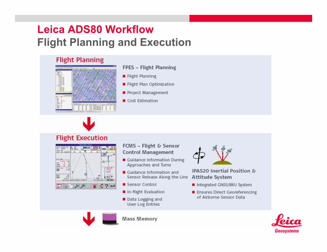
Leica ADS80 Workflow
Flight Planning and Execution
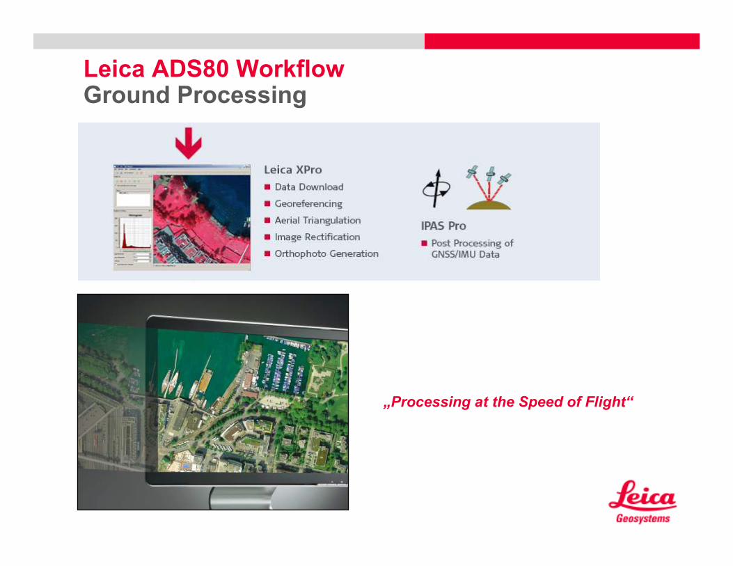
Leica ADS80 WorkflowGround Processing
„Processing at the Speed of Flight“
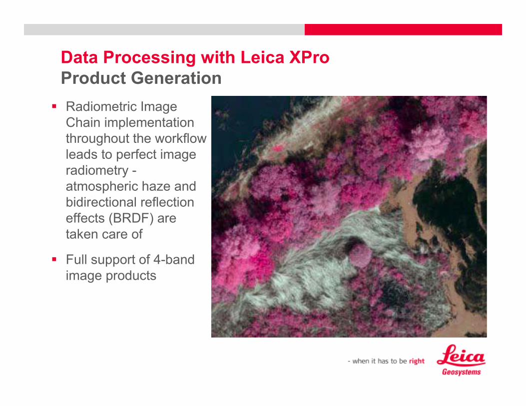
� Radiometric Image
Chain implementation
throughout the workflow
leads to perfect image
radiometry -
atmospheric haze and
bidirectional reflection
effects (BRDF) are
taken care of
� Full support of 4-band
image products
Data Processing with Leica XPro
Product Generation
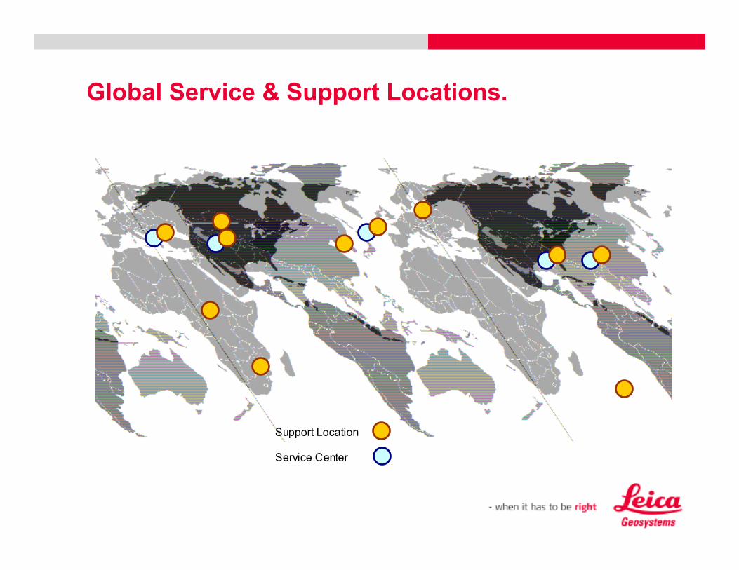
Global Service & Support Locations.
Support Location
Service Center
Continued Technical Advances and how they
benefit USDA programs
• Leica Geosystems has been a pioneer in the transition from aerial film cameras to the digital market. We had
the first large format sensor on the market in 2001 and as you can see here, we have made continual
technological advancements, which to date make it the most versatile, stable and complete mapping camera on
the market. The ADS sensor has served the USDA NAIP program very well over the last several years and in
fact their biggest NAIP contractor utilizes the technology.
� Leica Geosystems has designed and engineered the ADS with mapping in mind. We have ensured that our
cameras are geometrically stable (put together right) and radio metrically the best (perfectly co-registered
bands, spectral separation between bands, radiometric depth allowing to see in the shadows)
•Leica Geosystems currently offers the RCD105 camera system along with airborne LiDAR, which can serve
natural resource programs of various size and GSD/point density requirements very effectively.
•Leica Geosystems has recently formed the Geospatial Solutions Division which brings together the Airborne
Sensor Business Unit, the ERDAS Business Unit, and the Terrestrial Scanner Business Unit.
� ERDAS is launching the new Apollo product which will allow customers to easily and effectively serve and
manage large geospatial datasets via the web.
� With XPro being the driving force behind ADS data processing now, project turn around time is much faster
than before.
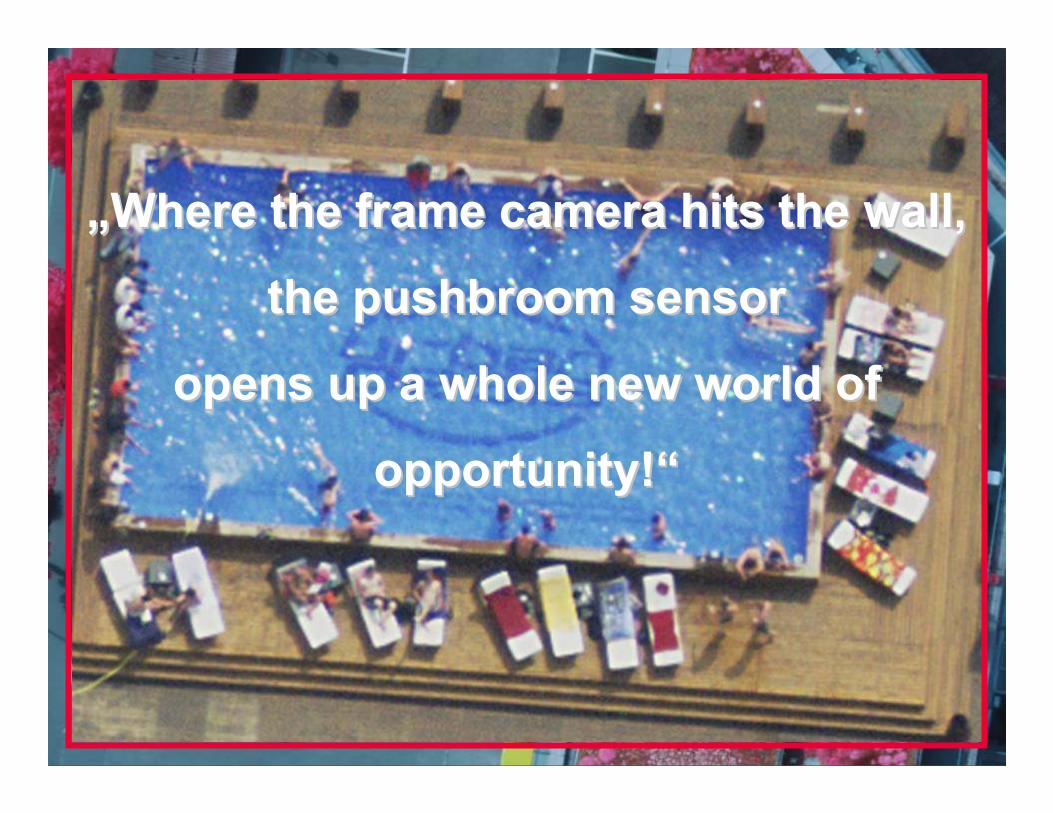
Example Data – Luzern, Switzerland
„„Where the frame camera hits the wall, Where the frame camera hits the wall,
the pushbroom sensor the pushbroom sensor
opens up a whole new world of opens up a whole new world of
opportunity!opportunity!““

Thank You!
Appendix

Analog aerial camera
RC30
Effect of central perspective
Photograph with central perspective
Flight line with overlapping
photographs
Airborne digital sensor
ADS40/80
Forward view strip
Nadir view strip
Backward view strip
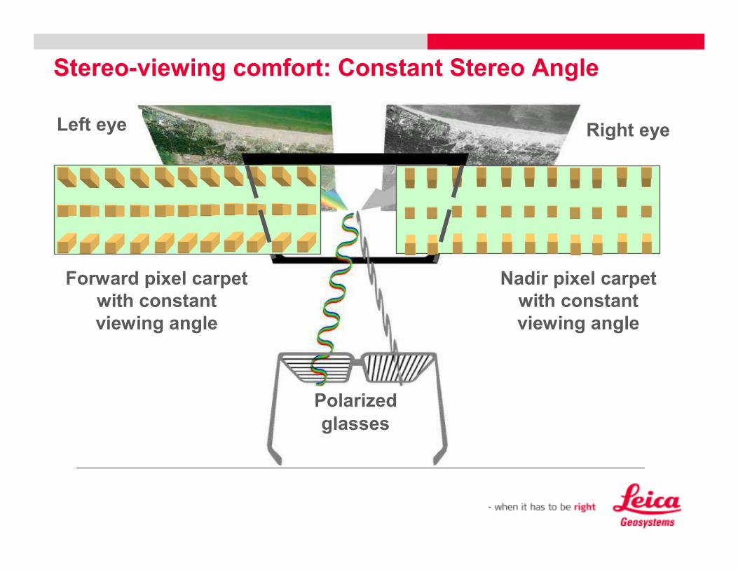
Stereo-viewing comfort: Constant Stereo Angle
Left eye
Polarized
glasses
Nadir pixel carpet
with constant
viewing angle
Forward pixel carpet
with constant
viewing angle
Right eye
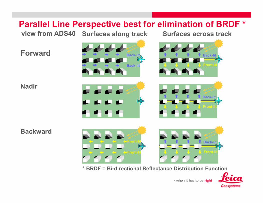
Parallel Line Perspective best for elimination of BRDF *Surfaces across track
Backward
Nadir
view from ADS40
Forward
Surfaces along track
* BRDF = Bi-directional Reflectance Distribution Function

Increased Efficiency through Staggered Line
24000 Pixels in Nadir
PAV30
ADS40
PAV80
ADS80
Proven!
25% Increase
Effective 15000 pixels
50% Increase
Effective 18000 pixels
Pan/MS Ratio
1.25
Pan/MS Ratio
1.5
MM40
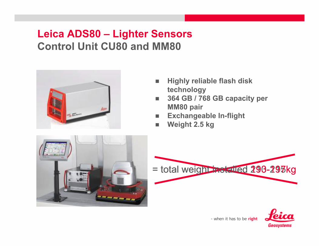
Leica ADS80 – Lighter Sensors
Control Unit CU80 and MM80
� Highly reliable flash disk
technology
� 364 GB / 768 GB capacity per
MM80 pair
� Exchangeable In-flight
� Weight 2.5 kg
= total weight installed 210-215kg= total weight installed 193-197kg
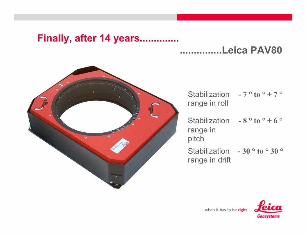
Finally, after 14 years..............:::::::::::::::::::::::::::::::
...............Leica PAV80
- 30 ° to ° 30 °Stabilization range in drift
- 8 ° to ° + 6 °Stabilization
range in pitch
- 7 ° to ° + 7 °Stabilization range in roll

Leica PAV80 - Lighter Sensors
Key Benefits
� Accommodates sensors with a total weight from 5 kg up to 100 kg
� No need for a mass compensator.
= total weight installed 190-195kg= total weight installed 155-160kg

Post processing time – Leica XPro workflow
Flight
Download
Geo-referencing
Aerial triangulation
Ortho photo
Feature extraction
Fly-through
1,200 km2, 15cm GSD12 lines, each 80 km, 3 Pan and 8MSApproximately 7hr flight at 130knots
Trajectory calculation
geo-referencing of L0 images
Automatic Point Measurement
Bundle Adjustment
RGB or FCIR 1,200 km2
Due to image strips slightly faster than in traditional workflow
400 GB ADS data format
WS with 6 server cluster
Similar to traditional workflow
User
actiontime
0.5 h
0.1 h
0.5 h
0.1 h
0.3 h
0.1 h
1.6 h
0.5 h
0.1 h
4 h
0.1 h
0.3 h
1.7 h
6.7 h
Total time
ADS80
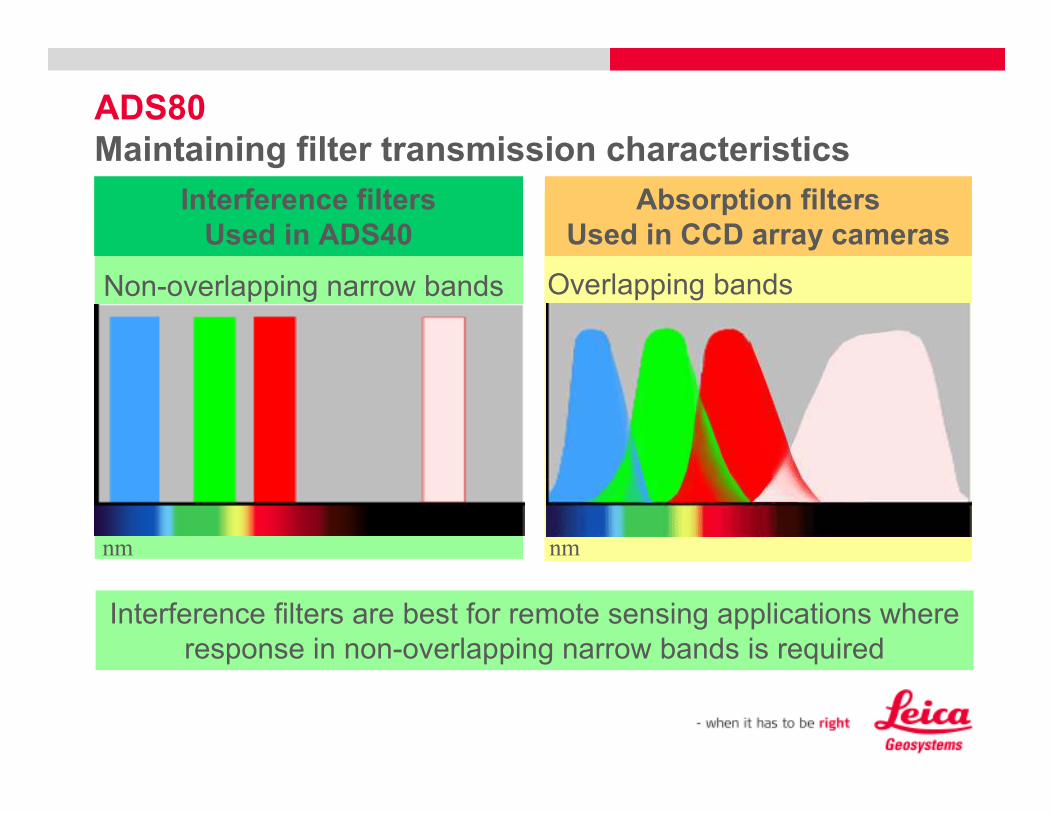
Maintaining filter transmission characteristics
Interference filters are best for remote sensing applications where
response in non-overlapping narrow bands is required
Interference filters
Used in ADS40
Absorption filters
Used in CCD array cameras
Overlapping bandsNon-overlapping narrow bands
nm nm
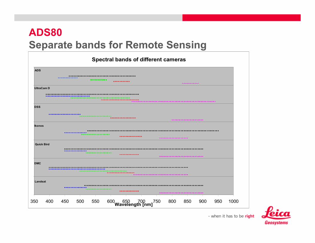
Spectral bands of different cameras
350 400 450 500 550 600 650 700 750 800 850 900 950 1000Wavelength [nm]
Landsat
DSS
Ikonos
Quick Bird
DMC
UltraCam D
ADS
ADS80
Separate bands for Remote Sensing