Embed Size (px)
Citation preview
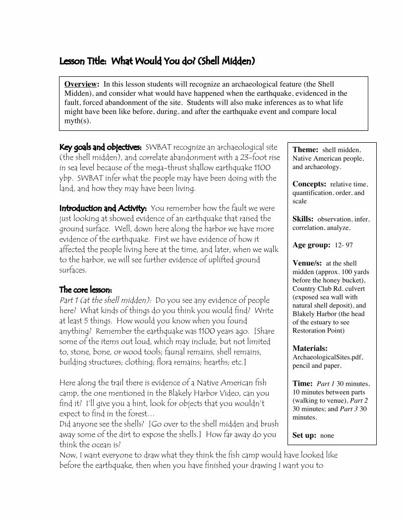
Lesson Title: What Would You do? (Shell Midden)
Key goals and objectives: SWBAT recognize an archaeological site(the shell midden), and correlate abandonment with a 23-foot risein sea level because of the mega-thrust shallow earthquake 1100ybp. SWBAT infer what the people may have been doing with theland, and how they may have been living.
Introduction and Activity: You remember how the fault we werejust looking at showed evidence of an earthquake that raised theground surface. Well, down here along the harbor we have moreevidence of the earthquake. First we have evidence of how itaffected the people living here at the time, and later, when we walkto the harbor, we will see further evidence of uplifted groundsurfaces.
The core lesson:Part 1 (at the shell midden): Do you see any evidence of peoplehere? What kinds of things do you think you would find? Writeat least 5 things. How would you know when you foundanything? Remember the earthquake was 1100 years ago. [Sharesome of the items out loud, which may include, but not limitedto, stone, bone, or wood tools; faunal remains, shell remains,building structures; clothing; flora remains; hearths; etc.]
Here along the trail there is evidence of a Native American fishcamp, the one mentioned in the Blakely Harbor Video, can youfind it? I’ll give you a hint, look for objects that you wouldn’texpect to find in the forest…Did anyone see the shells? [Go over to the shell midden and brushaway some of the dirt to expose the shells.] How far away do youthink the ocean is?Now, I want everyone to draw what they think the fish camp would have looked likebefore the earthquake, then when you have finished your drawing I want you to
Theme: shell midden,Native American people,and archaeology.
Concepts: relative time,quantification, order, andscale
Skills: observation, infer,correlation, analyze,
Age group: 12- 97
Venue/s: at the shellmidden (approx. 100 yardsbefore the honey bucket),Country Club Rd. culvert(exposed sea wall withnatural shell deposit), andBlakely Harbor (the headof the estuary to seeRestoration Point)
Materials:ArchaeologicalSites.pdf,pencil and paper,
Time: Part 1 30 minutes,10 minutes between parts(walking to venue), Part 230 minutes; and Part 3 30minutes.
Set up: none
Overview: In this lesson students will recognize an archaeological feature (the ShellMidden), and consider what would have happened when the earthquake, evidenced in thefault, forced abandonment of the site. Students will also make inferences as to what lifemight have been like before, during, and after the earthquake event and compare localmyth(s).
answer the question, “What would you do?” How did this event change how you gotyour food, where you got your food from, and whether or not you stayed? Did theearthquake destroy their houses?
Part 2 (at the exposed natural shell deposit at the Country Club Rd. culvert (east sideof street, please see image below), and at the head of the estuary or the mill complex,where you can see Restoration Point and explain the raised tidal flats):The flat area in front of the fish camp, and the field that we just crossed to get herewas all once a tidal flat, just like you see in front of us. The wall that we just looked atshows the shells in place that were displaced by the earthquake. The 23 foot rise in seahappened suddenly and the tides have been filling that distance ever since. Can yousee how much the earthquake caused the ground to uplift?Where would you have gone, if an earthquake lifted your home and destroyed yourfeeding area? Write your ideas in your journal.
Part 3: Compare some of the student’s stories with local myths and legends aboutearthquakes (Ludwin 2002) available on learn.islandwood.org.
Conclusion: The mega-earthquake 1100 years ago raised the ground surface about 23feet (7 meters), and directly affected the Native Americans living along the seashore.Because their camp was no longer adjacent to the tidal flats, they were forced to moveto another location.Part 1, Part 2, and Part 3: facilitate a fish bowl discussion around the question:What would you do if such an earthquake occurred? Do you think that your housewould survive the shaking? What kinds of things should you have in the constructionof your house to make it safer?
Assessment: Built-in to the experience or based on a follow-up. Check forunderstanding of how the ground shifted at the estuary, where you can see the uplifton Restoration Point. Have the students share what they would do if an earthquakeaffected their home, as it did to the Native Americans at the shell midden.
Extension: Artifact analysis— students should choose a tangible object that isimportant to them, their family, heritage, culture, ethnicity, or personal use. Theywill draw, describe, explain, and analyze the object as an archaeologist would (seeattached “Artifact Analysis” below and on learn.IslandWood.org). Then studentsshould switch objects, and repeat with someone else’s. Compare what informationwas lost in the second attempt. Did it lose any meaning in the retelling?
Explain that this is the process of archaeology — to make assumptions about pastcultures, ethnicities, and uses based upon a single tangible item found duringexcavation.For an example of how assumptions can be made about a tangible item (such as atooth brush) read Who are the Nacirema?
For more information on the method of archaeology consult the Methods pageavailable on the web at learn.islandwood.org.
Background information: The uplift of the Blakely harbor tidal flat raised both naturaland cultural shell deposits. Natural deposits are distinguishable from cultural depositsprimarily by the absence of cultural artifacts such as bone refuse, fire-modified rocksor boiling stones, lithic debitage, and other characteristics of human activitythroughout the deposit. It is possible that Native people could deposit their owndebris on top of a natural deposition area, due to tectonic events (Rooke,Schumacher, and Hartmann 2002:30).The Shell Midden present on IslandWood campus is between 21 and 60 feet (6.4 to 18meters) above the current mean sea level; there may be two areas associated with thesite: the shell midden adjacent to the trail and the terrace twenty feet away (followingthe utility cable up the hill). These different figures describe the mean elevationchange and the lateral distance from the contemporary shoreline. The distance doesindicate its deposition prior to the earthquake uplift event circa 1100 years ago. Fire-modified rocks, charcoal, and bone were observed (2002:29,39).The uplift event would mean that archaeological shell middens located near thepresent shore were likely deposited after 1100 years ago, while shell midden siteslocated inland were likely deposited prior to the earthquake as these sites should oncehave been located along the shoreline. Site 45KP104 (the IslandWood Shell Midden)located north east of Blakely Harbor, is a prime example of the correlative effects ofthe earthquake 1100 years ago; the shell midden deposit once located on theshoreline, is now located inland as a result of the documented uplift along the Seattlefault zone (2002:45).
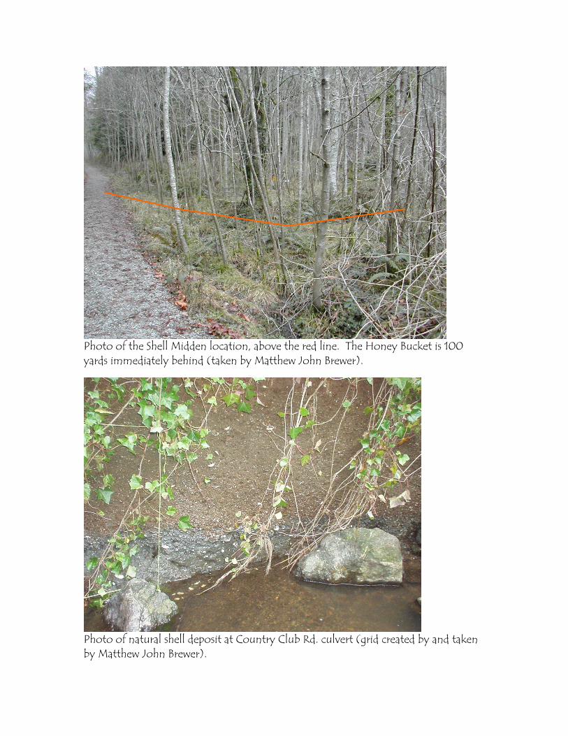
Photo of the Shell Midden location, above the red line. The Honey Bucket is 100yards immediately behind (taken by Matthew John Brewer).
Photo of natural shell deposit at Country Club Rd. culvert (grid created by and takenby Matthew John Brewer).
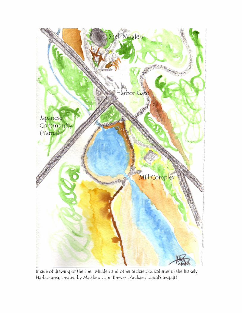
Image of drawing of the Shell Midden and other archaeological sites in the BlakelyHarbor area, created by Matthew John Brewer (ArchaeologicalSites.pdf).
Safety Considerations: There are no immediate safety issues, except to cross the streetto the Harbor.Cultural sensitivity issues may arise if a Native American student is present, or whenpresenting how people used to live. It is important to note that the practice ofarchaeology (the method) makes assumptions about the way past peoples lived basedupon the debitage (both naturally and culturally modified). It is also important tonote that even though a shell midden is often associated with trash that may havebeen left behind, it may also have been an occupied living site — it cannot be referredto as a simple site for refuge.
References:Ames, Kenneth M. and Herbert D.G. Maschner(1999). Peoples of the Northwest Coast: Their Archaeology and Prehistory. London:Thames and Hudson Ltd.
Atwater, Brian and Andrew L. Moore(1992). A Tsunami about 1000 years ago in the Puget Sound, Washington. Science258:1614-1617.
Bucknam, Robert C., Estella B. Leopold, Brian L. Sherrod(1998). Puget Sound Paleoseismology. USGS Project No. 7360-12260. UnitedStates Geological Survey, Annual Projects Summaries. Volume 39, Pacific NorthwestRegion.
Bucknam, Robert C., Eileen Hemphill-Haley, and Estella B. Leopold(1992). Abrupt Uplift within the past 1700 years at Southern Puget Sound,Washington. Science 258:1611-1614.
Clark, Ella E.(1953). Indian Legends of the Pacific Northwest. Berkeley, California: University ofCalifornia Press.
Daugherty, R.D.(1992a). Archaeological Site Inventory Form: 45KP104. On file with theWashington State Office of Archaeological and Historical Preservation, Olympia.
(1992b). Archaeological Site Inventory Form: 45KP105. On file with theWashington State Office of Archaeological and Historical Preservation, Olympia.
(1993). A Cultural Resource Survey of the Proposed Port Blakely Development. PartII Testing and Evaluation. Western Heritage, Lacey.
Erdoes, Richard and Alfonso Ortiz(1984). American Indian Myths and Legends. New York: Pantheon Books.
Forsman, Leonard A., Dennis E. Lewarch, Jason B. Cooper and Lynn L. Larson(1999). Puget Sound Environmental Learning Center, City of Bainbridge Island,Kitsap County, Cultural Resources Assessment, Phase 1. LAAS Technical Report 99-11,Larson Anthropological/ Archaeological Services, Gig Harbor, Washington.
Forsman, L.A. and L.L. Larson(1998). Testing of Site 45KP114 at Jasmine Point, Bainbridge Island. Letter reportfrom Larson Anthropological/ Archaeological Services, Seattle to Carol A. Beck, PortBlakely Communities, Issaquah, Washington, 4 March.
Forsman, L.A. and M. Madson(1998). Washington State Archaeological Site Inventory Form: 45KP114. On file withthe Washington State Office of Archaeological and Historical Preservation, Olympia.
Hannum, M.M.(2000). Cultural Resource Assessment Survey of Jefferson Properties’ Port BlakelyProject, Bainbridge Island, Washington. Short Report 00S-007, Hemisphere FieldServices, Bainbridge Island.
Judson, Katherine Berry(1997). Myths and Legends of the Pacific Northwest. Lincoln, Nebraska: Universityof Nebraska Press.
Ludwin, Ruth(2002). Cascadia Megathrust Earthquakes in PNW Indian Legend. Pages from RuthLudwin, University of Washington Dept. of Earth and Space Sciences. UpdatedDecember 2, 2002. http://www.ess.washington.edu/SEIS/PNSN/HIST_CAT/-STORIES/. Visited November 23, 2003.
Lewarch, D.E.(1995). Washington State Archaeological Site Inventory Form: 45KP110. On filewith the Washington State Office of Archaeological and Historical Preservation,Olympia.

Lewarch, D.E., and L.A. Forsman(1995). Cultural Resources Assessment and Construction Monitoring of the US WestCross Sound Fiber Optic Cable Project, King and Kitsap Counties, Washington. LAASTechnical Report 95-5 Larson Anthropological/ Archaeological Services, Seattle.
McIntosh, Jane(1994). Archaeology. New York: Dorling Kindersley Publishing, Inc.
Miller, Jay(1999). Lushootseed Culture and the Shamanic Odyssey: An Anchored Radiance.Lincoln, Nebraska: University of Nebraska Press.
Murphy, L.R., L.A. Forsman, D.E. Lewarch, L.L. Larson(2000). Puget Sound Environmental Learning Center, City of Bainbridge Island,Kitsap County, Cultural Resources Assessment, Phases 2 and 3, Technical ReportAddendum. LAAS Technical Report 2000-1, Larson Anthropological/Archaeological Services, Seattle.
Price, A. Jr.(1989). Port Blakely: The Community Captain Renton Built. Port Blakely Books,Seattle.
Rooke, Lara C., Schumacher, James, and Hartmann, Glenn(2002). Bainbridge Island Archaeological Overview and Predictive Model. WesternShore Heritage Services Technical Report No. 0106, February 2002.
Waterman, T.T.(1920). Puget Sound Geography. Manuscript No. 1864, National AnthropologicalArchives, Washington D.C.
Welch, Jeanne M., and Richard D. Daugherty(1991). A Cultural Assessment of the Proposed Port Blakely Development: Part ISurvey and Inventory. Report prepared for Port Blakely Mill Company by WesternHeritage, Inc. Olympia, Washington.
Created by Matthew John Brewer on December 2, 2003, modified May 9, 2004.