Embed Size (px)
Citation preview
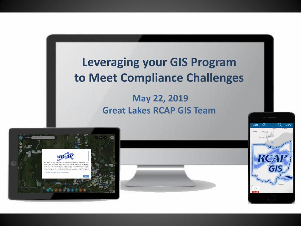
Leveraging your GIS Programto Meet Compliance Challenges
May 22, 2019Great Lakes RCAP GIS Team
Introductions
Laura Schuch, PhD - GIS Analyst
Sam Eitner - GIS Specialist
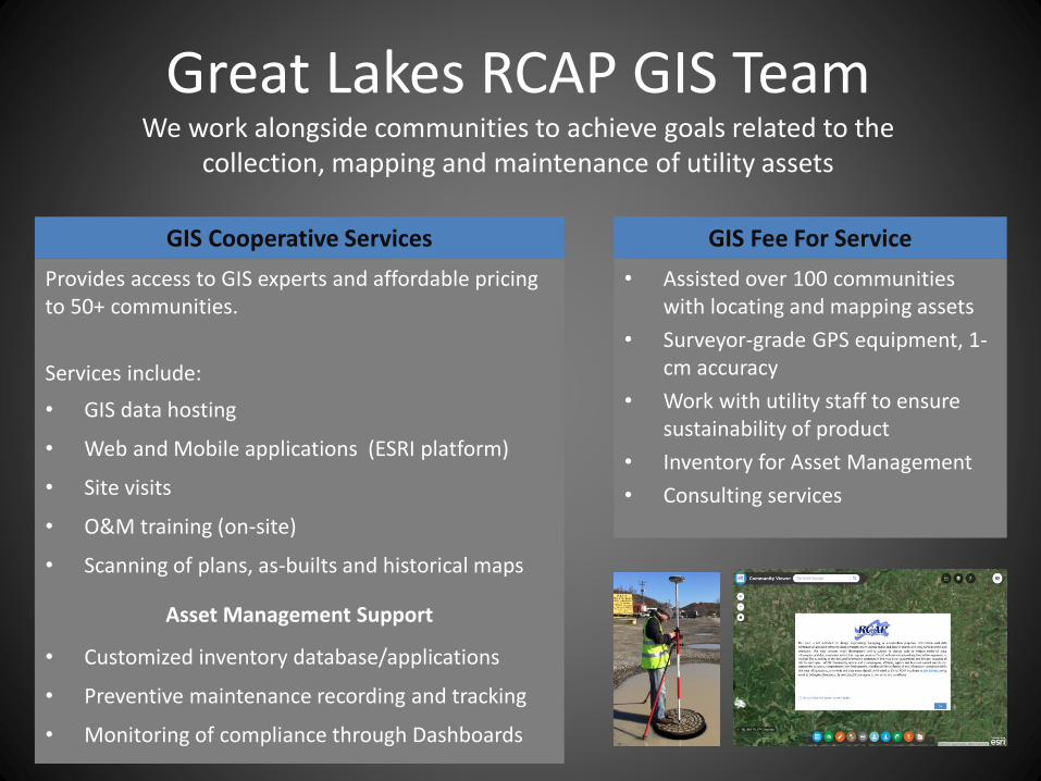
Great Lakes RCAP GIS TeamWe work alongside communities to achieve goals related to the
collection, mapping and maintenance of utility assets
• Assisted over 100 communities with locating and mapping assets
• Surveyor-grade GPS equipment, 1-cm accuracy
• Work with utility staff to ensure sustainability of product
• Inventory for Asset Management
• Consulting services
Provides access to GIS experts and affordable pricing to 50+ communities.
Services include:
• GIS data hosting
• Web and Mobile applications (ESRI platform)
• Site visits
• O&M training (on-site)
• Scanning of plans, as-builts and historical maps
Asset Management Support
• Customized inventory database/applications
• Preventive maintenance recording and tracking
• Monitoring of compliance through Dashboards
GIS Fee For ServiceGIS Cooperative Services
Objective
Learners will be able to describe three ways GIS can aid in compliance with recent regulatory
requirements

New Regulatory Requirements
Is this how YOU feel?
Image: The Birdbox, Netflix
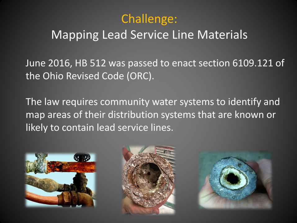
Challenge: Mapping Lead Service Line Materials
June 2016, HB 512 was passed to enact section 6109.121 of the Ohio Revised Code (ORC).
The law requires community water systems to identify and map areas of their distribution systems that are known or likely to contain lead service lines.
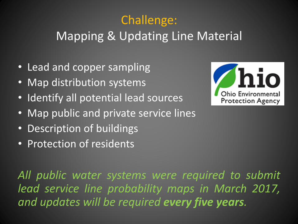
Challenge:Mapping & Updating Line Material
• Lead and copper sampling
• Map distribution systems
• Identify all potential lead sources
• Map public and private service lines
• Description of buildings
• Protection of residents
All public water systems were required to submitlead service line probability maps in March 2017,and updates will be required every five years.
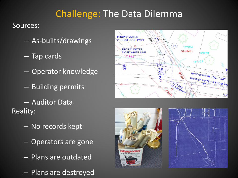
Challenge: The Data DilemmaSources:
– As-builts/drawings
– Tap cards
– Operator knowledge
– Building permits
– Auditor DataReality:
– No records kept
– Operators are gone
– Plans are outdated
– Plans are destroyed
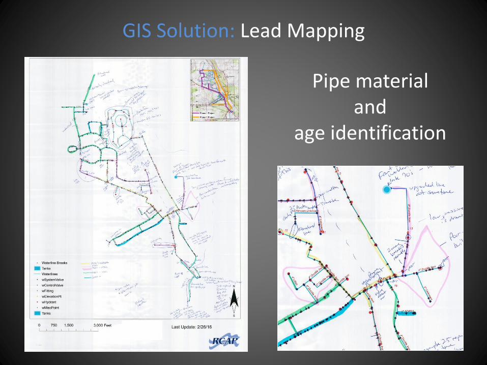
Pipe material and
age identification
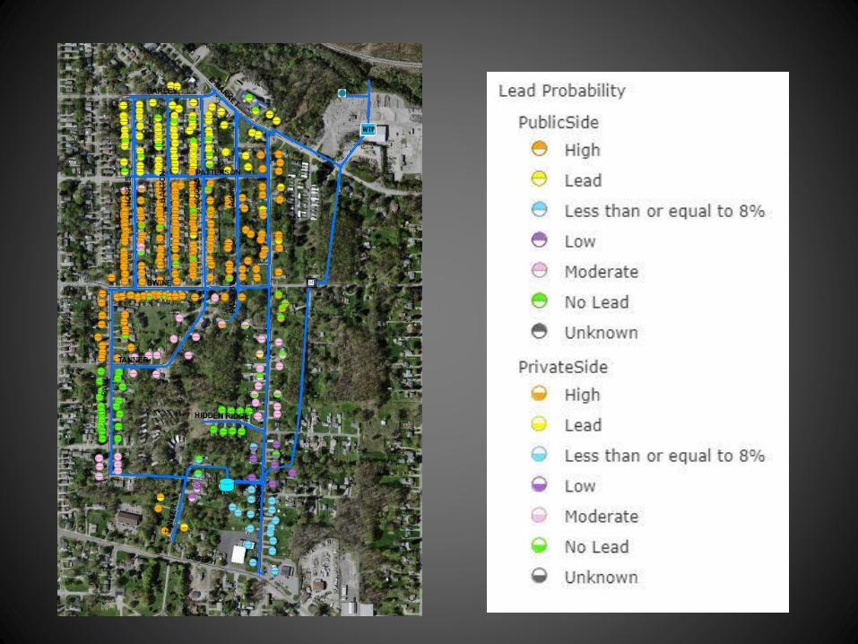
GIS Solution: Lead Mapping
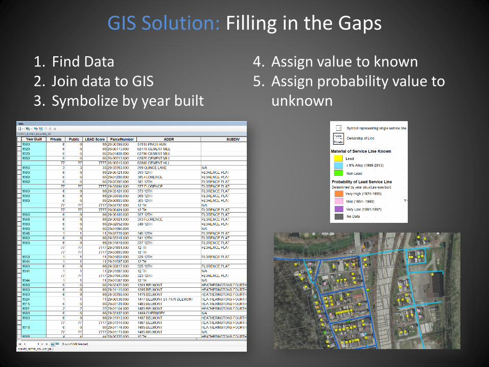
GIS Solution: Filling in the Gaps
1. Find Data 2. Join data to GIS 3. Symbolize by year built
4. Assign value to known5. Assign probability value to
unknown
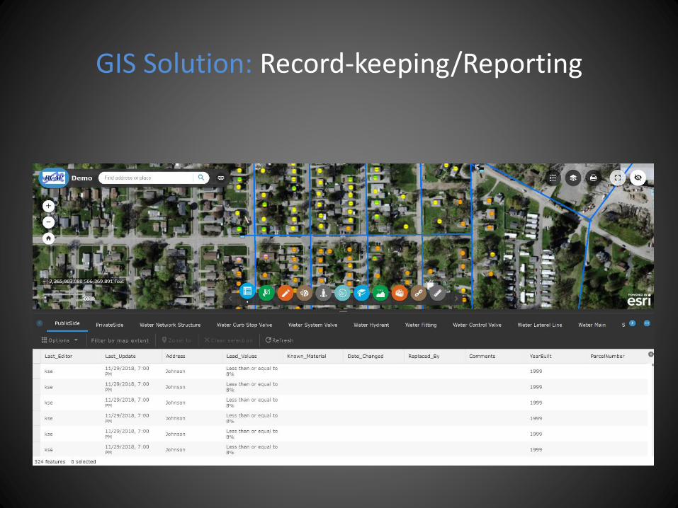
GIS Solution: Record-keeping/Reporting
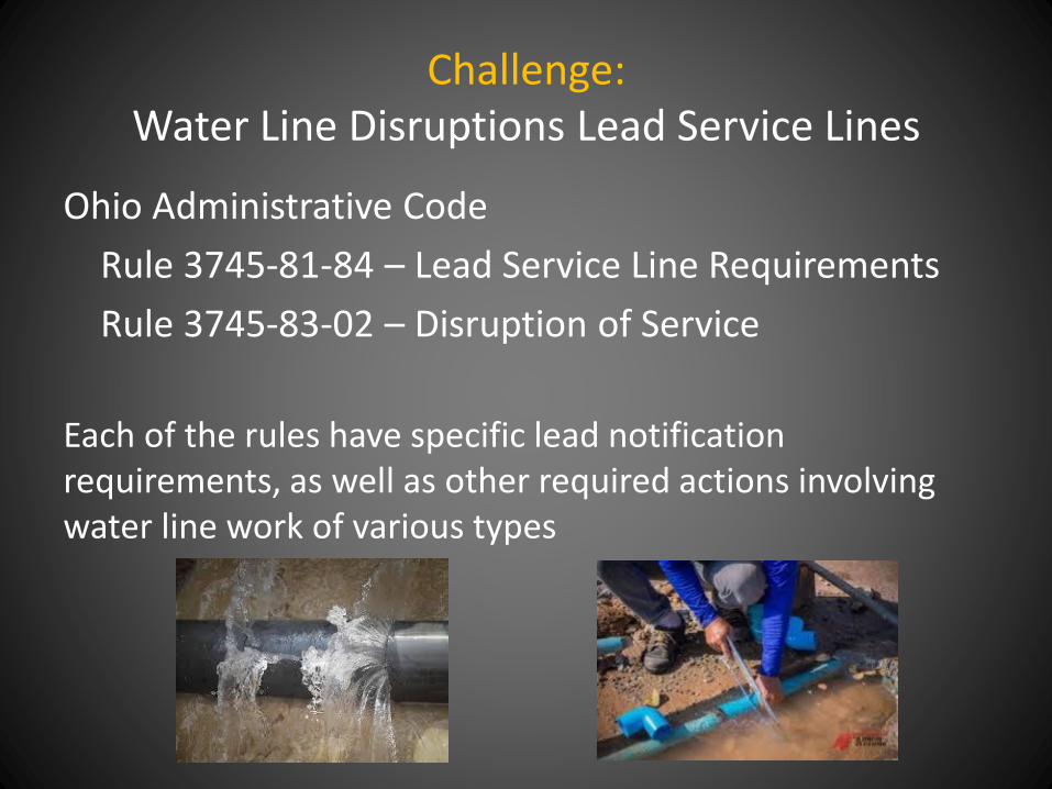
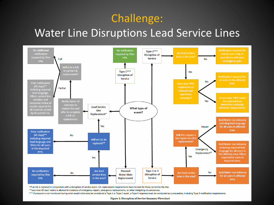
Challenge: Water Line Disruptions Lead Service Lines
Ohio Administrative Code
Rule 3745-81-84 – Lead Service Line Requirements
Rule 3745-83-02 – Disruption of Service
Each of the rules have specific lead notification requirements, as well as other required actions involving water line work of various types
Challenge: Water Line Disruptions Lead Service Lines
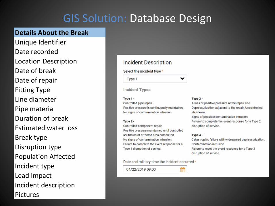
GIS Solution: Database DesignDetails About the Break
Unique Identifier
Date recorded
Location Description
Date of break
Date of repair
Fitting Type
Line diameter
Pipe material
Duration of break
Estimated water loss
Break type
Disruption type
Population Affected
Incident type
Lead Impact
Incident description
Pictures
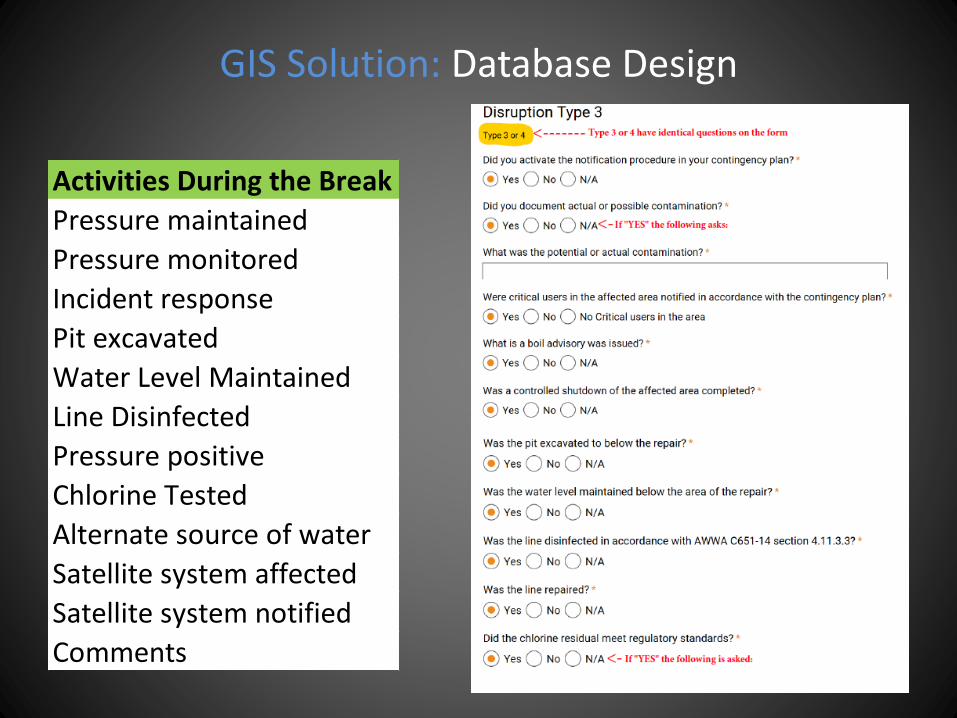
GIS Solution: Database Design
Activities During the Break
Pressure maintained
Pressure monitored
Incident response
Pit excavated
Water Level Maintained
Line Disinfected
Pressure positive
Chlorine Tested
Alternate source of water
Satellite system affected
Satellite system notified
Comments
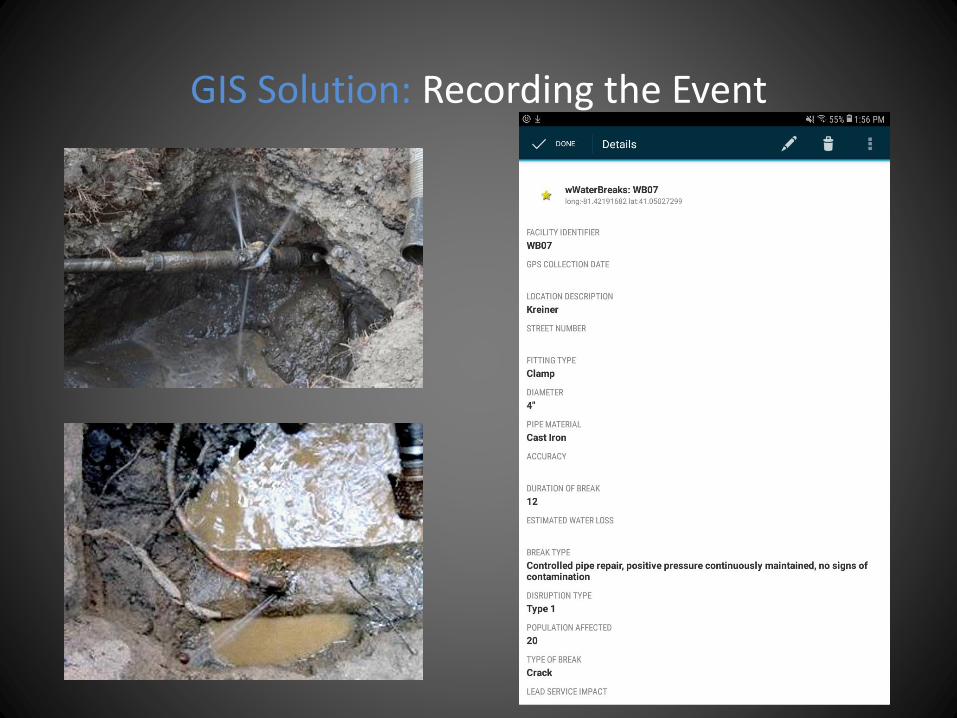
GIS Solution: Recording the Event
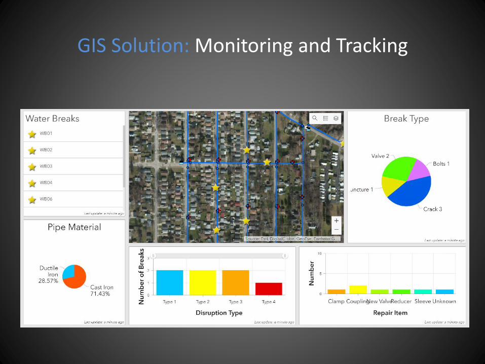
GIS Solution: Monitoring and Tracking
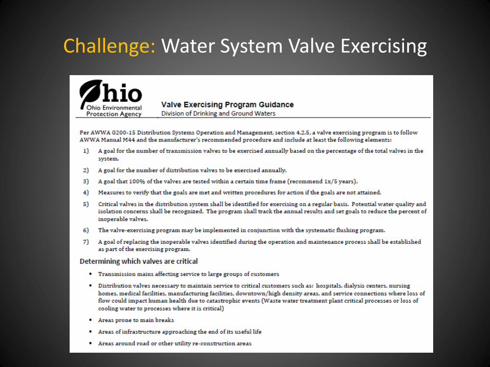
Challenge: Water System Valve Exercising
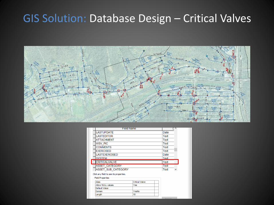
GIS Solution: Database Design – Critical Valves
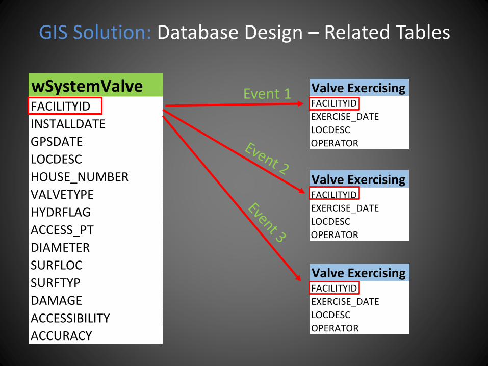
GIS Solution: Database Design – Related Tables
wSystemValveFACILITYID
INSTALLDATE
GPSDATE
LOCDESC
HOUSE_NUMBER
VALVETYPE
HYDRFLAG
ACCESS_PT
DIAMETER
SURFLOC
SURFTYP
DAMAGE
ACCESSIBILITY
ACCURACY
Valve Exercising FormFACILITYID
EXERCISE_DATE
LOCDESC
OPERATOR
Valve Exercising FormFACILITYID
EXERCISE_DATE
LOCDESC
OPERATOR
Valve Exercising FormFACILITYID
EXERCISE_DATE
LOCDESC
OPERATOR
Event 1
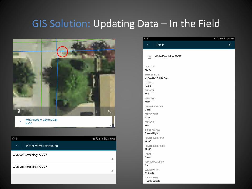
GIS Solution: Updating Data – In the Field
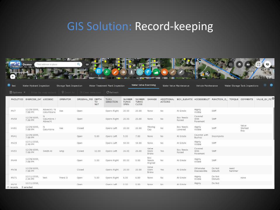
GIS Solution: Record-keeping

GIS Solution: Operations Dashboard
Thank you!Brian Beyeler – GIS Coordinator [email protected]
David Garretson – Database Administrator [email protected]
Laura Schuch - GIS Analyst [email protected]
Sam Eitner - GIS Specialist [email protected]
Amanda Preslicka – GIS Technician [email protected]
Great Lakes RCAP GIS website: http:www.rcapgis.org