Embed Size (px)
Citation preview
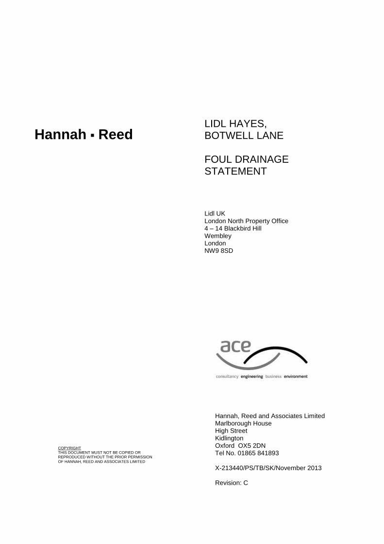
LIDL HAYES, BOTWELL LANE
FOUL DRAINAGE STATEMENT
Lidl UK London North Property Office 4 – 14 Blackbird Hill Wembley London NW9 8SD
Hannah, Reed and Associates Limited Marlborough House High Street Kidlington Oxford OX5 2DN Tel No. 01865 841893 X-213440/PS/TB/SK/November 2013 Revision: C
COPYRIGHT THIS DOCUMENT MUST NOT BE COPIED OR REPRODUCED WITHOUT THE PRIOR PERMISSION
OF HANNAH, REED AND ASSOCIATES LIMITED
Hannah Reed
Lidl Hayes, Botwell Lane Foul Drainage Assessment Lidl UK Revision: C
X-213440/PS/TB/SK/November 2013 Hannah-Reed
CONTENTS
INTRODUCTION................................................................................................................3
1. SITE INFORMATION....................................................................................................3
2. FOUL DRAINAGE OPTIONS........................................................................................4
CONCLUSIONS.................................................................................................................6
APPENDICES
A SITE LOCATION PLANS
B PROPOSED SITE PLAN
C THAMES WATER ASSET LOCATION PLANS
Lidl Hayes, Botwell Lane Foul Drainage Assessment Lidl UK Revision: C
X-213440/PS/TB/SK/November 2013 Page 3 Hannah-Reed
INTRODUCTION
This Foul Water Drainage Assessment (FDA) has been undertaken in order to assess existing foul water drainage infrastructure and to examine potential foul water management options in relation to the proposed development described below. It aims to take into account all the available information at the time of writing in order to provide appropriate foul water management options. This report was prepared on behalf of Lidl UK in support of a planning application to be submitted to the London Borough of Hillingdon. The proposed development consists of the construction of new Lidl store on the site of a former swimming pool complex in Hayes, Greater London.
1. SITE INFORMATION
1.1 Site Location
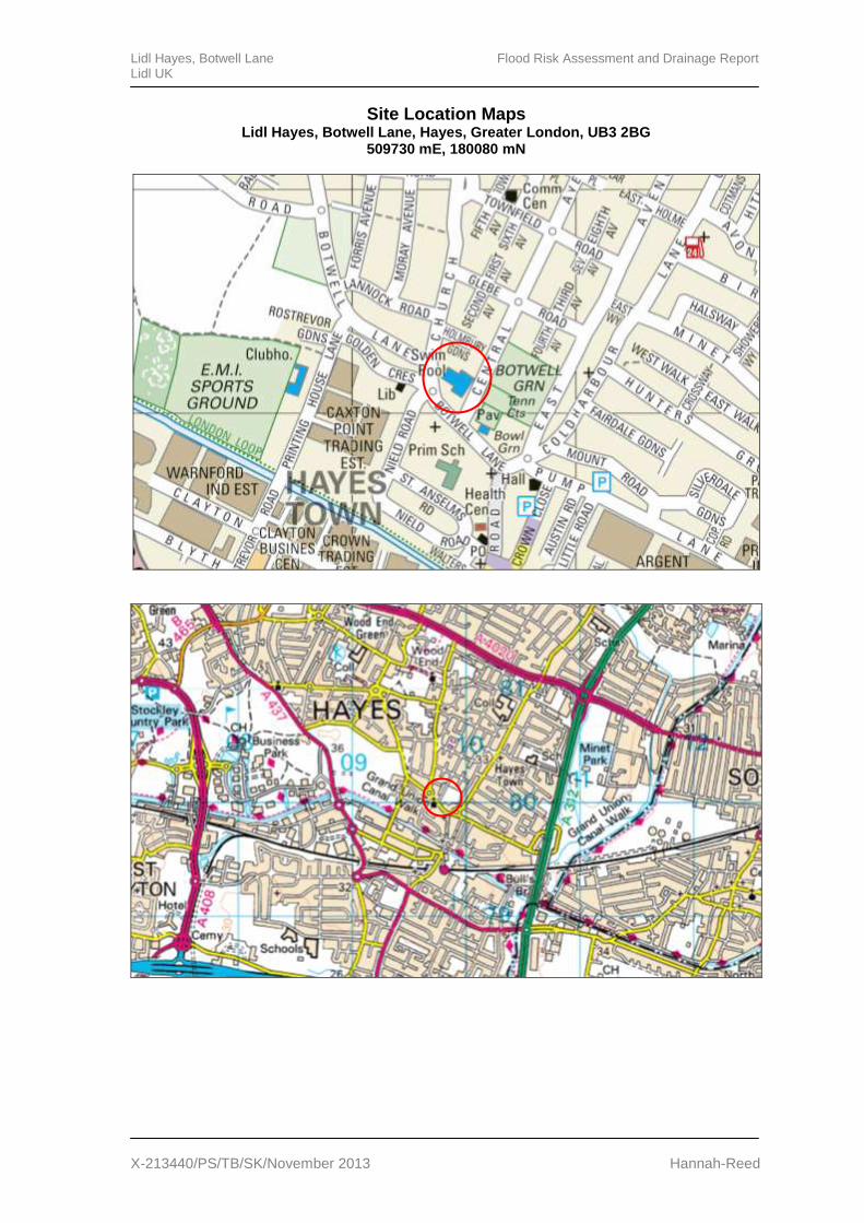
The site of the proposed development lies on Botwell Lane, Hayes, and is located by the postcode UB3 2BG and National Grid Reference 509730 mE, 180080 mN. The site is bound by Central Road to the east, Botwell Lane to the south and west, and residential properties to the north. Site location maps detailing the site and surrounding area are provided in Appendix A.
1.2 Existing Development
The Brownfield site was formerly home to a swimming pool complex which has subsequently been demolished.
1.3 Topography
Ground levels at the site generally appear to fall towards the north west of the site with levels varying between approximately 35.0 m Above Ordnance Datum (AOD) and 33.5 m AOD.
1.4 Existing Foul Water Drainage Infrastructure
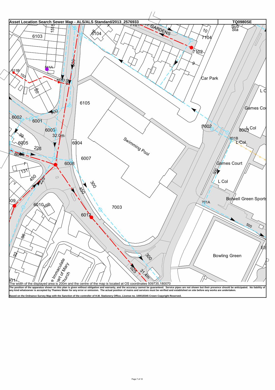
Thames Water is the local water authority and sewerage undertaker. An Asset Location Plan detailing existing public and private sewers at, and in the vicinity of, the site is included in Appendix C. The plans show a 450 mm diameter public foul water sewer running south along Botwell Lane, to the west of the site, which increases in diameter to 525 mm near the southern site boundary.
1.5 Existing Connections to Foul Water Drainage Infrastructure
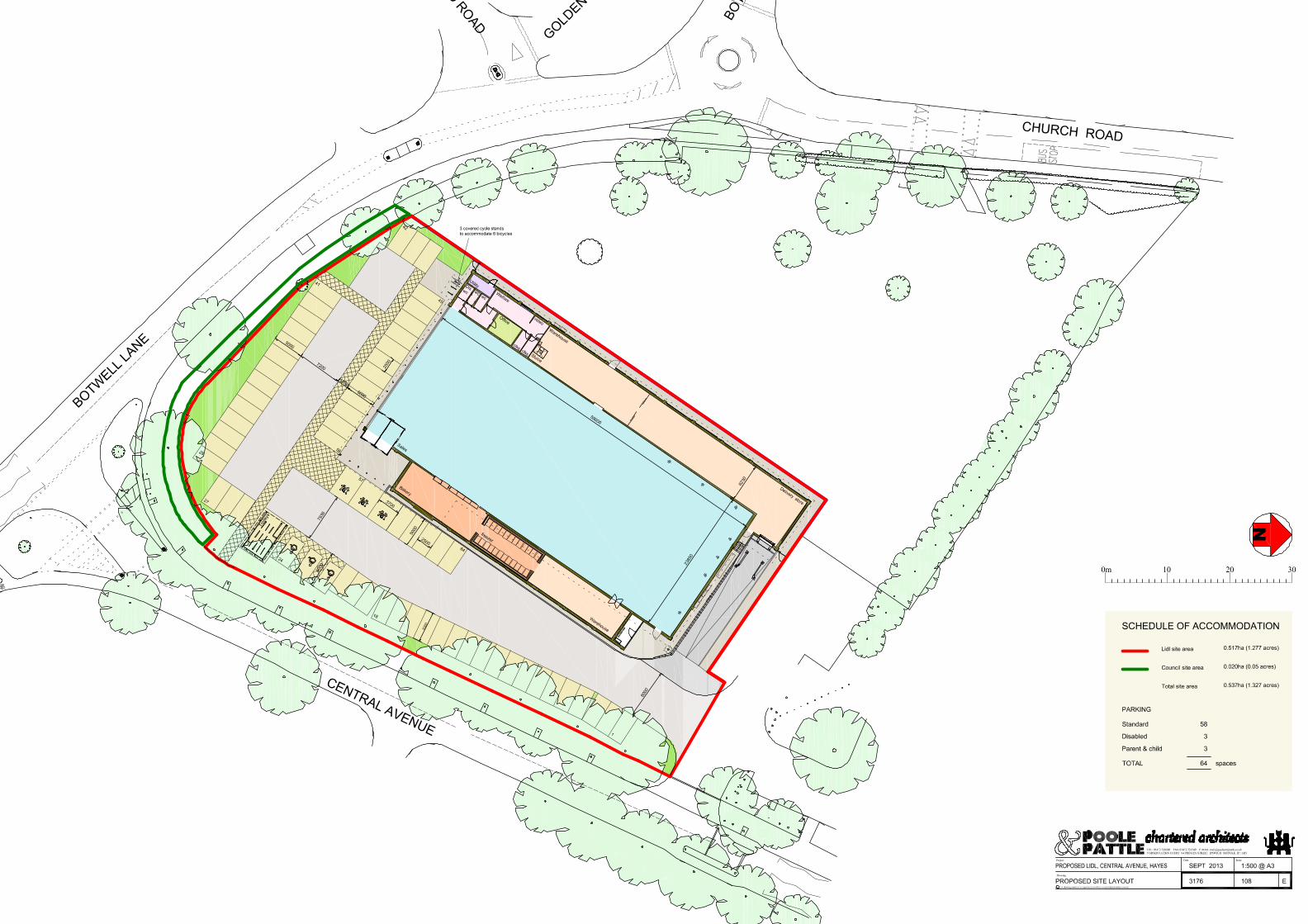
The location of the existing connection to the public foul water sewer at the site is unknown at the time of writing. However, based on the existing site layout and the topography of the site it is considered probable that the existing connection is located in the southern corner of the site, near the junction of Botwell Lane and Central Avenue.
Lidl Hayes, Botwell Lane Foul Drainage Assessment Lidl UK Revision: C
X-213440/PS/TB/SK/November 2013 Page 4 Hannah-Reed
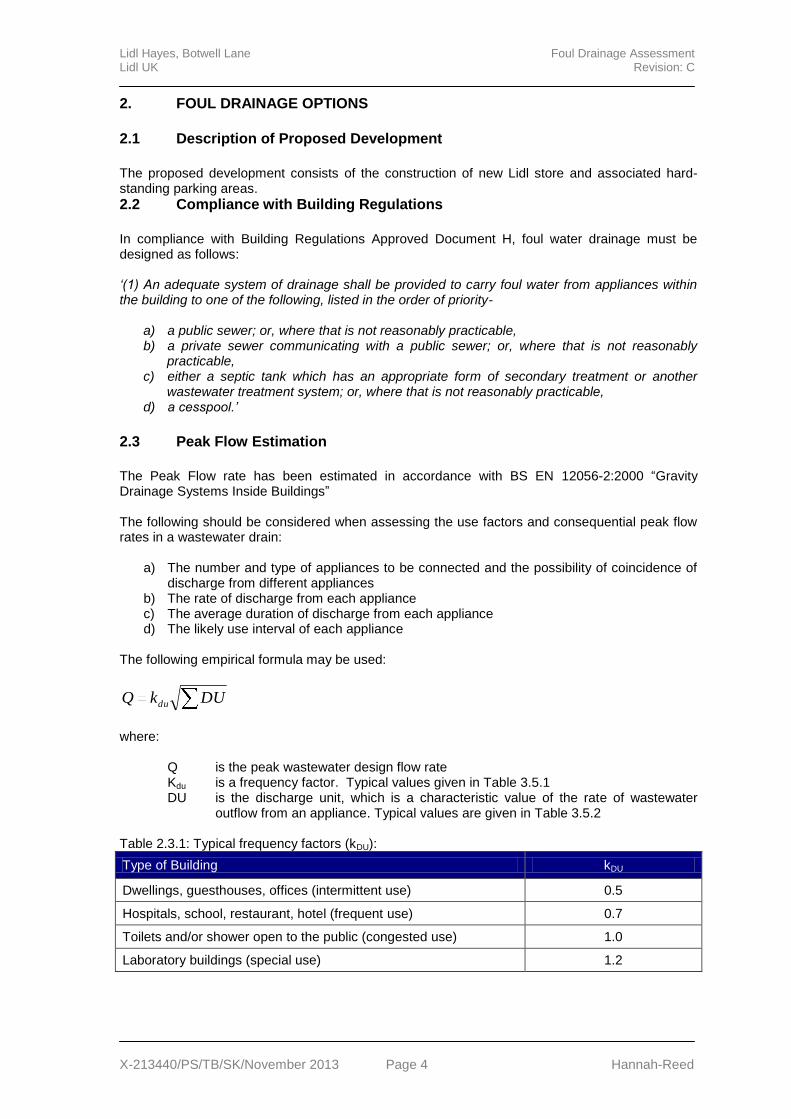
2. FOUL DRAINAGE OPTIONS
2.1 Description of Proposed Development
The proposed development consists of the construction of new Lidl store and associated hard-standing parking areas.
2.2 Compliance with Building Regulations
In compliance with Building Regulations Approved Document H, foul water drainage must be designed as follows: ‘(1) An adequate system of drainage shall be provided to carry foul water from appliances within the building to one of the following, listed in the order of priority-
a) a public sewer; or, where that is not reasonably practicable, b) a private sewer communicating with a public sewer; or, where that is not reasonably
practicable, c) either a septic tank which has an appropriate form of secondary treatment or another
wastewater treatment system; or, where that is not reasonably practicable, d) a cesspool.’
2.3 Peak Flow Estimation
The Peak Flow rate has been estimated in accordance with BS EN 12056-2:2000 “Gravity Drainage Systems Inside Buildings” The following should be considered when assessing the use factors and consequential peak flow rates in a wastewater drain:
a) The number and type of appliances to be connected and the possibility of coincidence of discharge from different appliances
b) The rate of discharge from each appliance c) The average duration of discharge from each appliance d) The likely use interval of each appliance
The following empirical formula may be used:
DUkQ du
where:
Q is the peak wastewater design flow rate Kdu is a frequency factor. Typical values given in Table 3.5.1 DU is the discharge unit, which is a characteristic value of the rate of wastewater
outflow from an appliance. Typical values are given in Table 3.5.2 Table 2.3.1: Typical frequency factors (kDU):
Type of Building kDU
Dwellings, guesthouses, offices (intermittent use) 0.5
Hospitals, school, restaurant, hotel (frequent use) 0.7
Toilets and/or shower open to the public (congested use) 1.0
Laboratory buildings (special use) 1.2
Lidl Hayes, Botwell Lane Foul Drainage Assessment Lidl UK Revision: C
X-213440/PS/TB/SK/November 2013 Page 5 Hannah-Reed
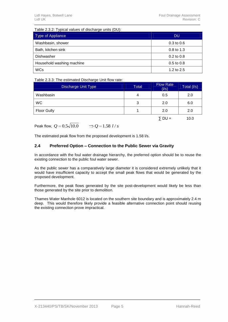
Table 2.3.2: Typical values of discharge units (DU):
Type of Appliance DU
Washbasin, shower 0.3 to 0.6
Bath, kitchen sink 0.8 to 1.3
Dishwasher 0.2 to 0.8
Household washing machine 0.5 to 0.8
WCs 1.2 to 2.5
Table 2.3.3: The estimated Discharge Unit flow rate:
Discharge Unit Type Total Flow Rate
(l/s) Total (l/s)
Washbasin 4 0.5 2.0
WC 3 2.0 6.0
Floor Gully 1 2.0 2.0
∑ DU = 10.0
Peak flow, slQQ /58.10.105.0
The estimated peak flow from the proposed development is 1.58 l/s.
2.4 Preferred Option – Connection to the Public Sewer via Gravity In accordance with the foul water drainage hierarchy, the preferred option should be to reuse the existing connection to the public foul water sewer. As the public sewer has a comparatively large diameter it is considered extremely unlikely that it would have insufficient capacity to accept the small peak flows that would be generated by the proposed development. Furthermore, the peak flows generated by the site post-development would likely be less than those generated by the site prior to demolition. Thames Water Manhole 6012 is located on the southern site boundary and is approximately 2.4 m deep. This would therefore likely provide a feasible alternative connection point should reusing the existing connection prove impractical.
Lidl Hayes, Botwell Lane Foul Drainage Assessment Lidl UK Revision: C
X-213440/PS/TB/SK/November 2013 Page 6 Hannah-Reed
CONCLUSIONS
The proposed development consists of the construction of new Lidl store on the site of a former swimming pool complex in Hayes, Greater London.
The peak flow that would be generated by the proposed development is anticipated to be approximately 1.58 l/s.
In accordance with the foul water drainage hierarchy, the preferred option should be to reuse the existing connection to the public foul water sewer.
It is considered that the public foul water sewer in Botwell Lane would have sufficient capacity to accept the anticipated peak flows that would be generated by the site post development.

Lidl Hayes, Botwell Lane Foul Drainage Assessment Lidl UK Revision: C
X-213440/PS/TB/SK/November 2013 Hannah-Reed
APPENDIX A
Site Location Maps
Lidl Hayes, Botwell Lane Flood Risk Assessment and Drainage Report Lidl UK
X-213440/PS/TB/SK/November 2013 Hannah-Reed
Site Location Maps Lidl Hayes, Botwell Lane, Hayes, Greater London, UB3 2BG
509730 mE, 180080 mN
Lidl Hayes, Botwell Lane Foul Drainage Assessment Lidl UK Revision: C
X-213440/PS/TB/SK/November 2013 Hannah-Reed
APPENDIX B
Proposed Site Plan
Lidl Hayes, Botwell Lane Foul Drainage Assessment Lidl UK Revision: C
X-213440/PS/TB/SK/November 2013 Hannah-Reed
APPENDIX C
Thames Water Asset Location Plans
Page 7 of 10
Asset Location Search Sewer Map - ALS/ALS Standard/2013_2576933 TQ0980SE
٨٨
٨٨
٨٨
٨٨
525
300
450
30022545
0
500
225
900
450
15060
0
500
%
%
%
%
%
%
%
%
%
%
%
%
%
%%
%
%
%
%
%
%
%
% %
8003
701A
801B
7002
7102
6104
7101
901
6012
70036010009
60086007
6006
6005 6004
6003
60016002
6105
611D
611A
71046103
611B
!
==
=
==
=
!
==
=
=
!
!!
=
==
!
=
=
=
=!
=
9
1
Swimming Pool
1015
39
96
92
32.0m
31.4m
Sta
102
131
L Col
Car Park
Bowling Green
Games Court1
L Col
6
20
ElSub
L Col
he Im
mac
ulat
e
2
Games Cou
eart
of M
ary
Chur
ch
RY GARDENS
15
ES
Botwell Green Sports
1
L C
The width of the displayed area is 200m and the centre of the map is located at OS coordinates 509735,180070 The position of the apparatus shown on this plan is given without obligation and warranty, and the accuracy cannot be guaranteed. Service pipes are not shown but their presence should be anticipated. No liability of any kind whatsoever is accepted by Thames Water for any error or omission. The actual position of mains and services must be verified and established on site before any works are undertaken. Based on the Ordnance Survey Map with the Sanction of the controller of H.M. Stationery Office, License no. 100019345 Crown Copyright Reserved.
Page 8 of 10
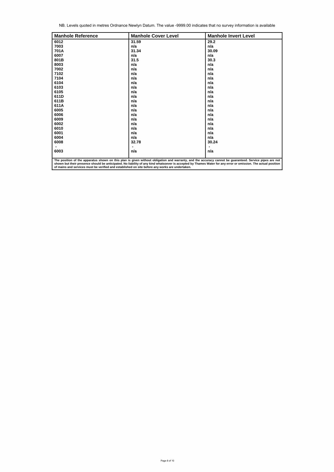
NB. Levels quoted in metres Ordnance Newlyn Datum. The value -9999.00 indicates that no survey information is available
Manhole Reference Manhole Cover Level Manhole Invert Level
6012 7003 701A 6007 801B 8003 7002 7102 7104 6104 6103 6105 611D 611B 611A 6005 6006 6009 6002 6010 6001 6004 6008 - 6003
31.59 n/a 31.34 n/a 31.5 n/a n/a n/a n/a n/a n/a n/a n/a n/a n/a n/a n/a n/a n/a n/a n/a n/a 32.78 - n/a
29.2 n/a 30.09 n/a 30.3 n/a n/a n/a n/a n/a n/a n/a n/a n/a n/a n/a n/a n/a n/a n/a n/a n/a 30.24 - n/a
The position of the apparatus shown on this plan is given without obligation and warranty, and the accuracy cannot be guaranteed. Service pipes are not shown but their presence should be anticipated. No liability of any kind whatsoever is accepted by Thames Water for any error or omission. The actual position of mains and services must be verified and established on site before any works are undertaken.
Page 9 of 10
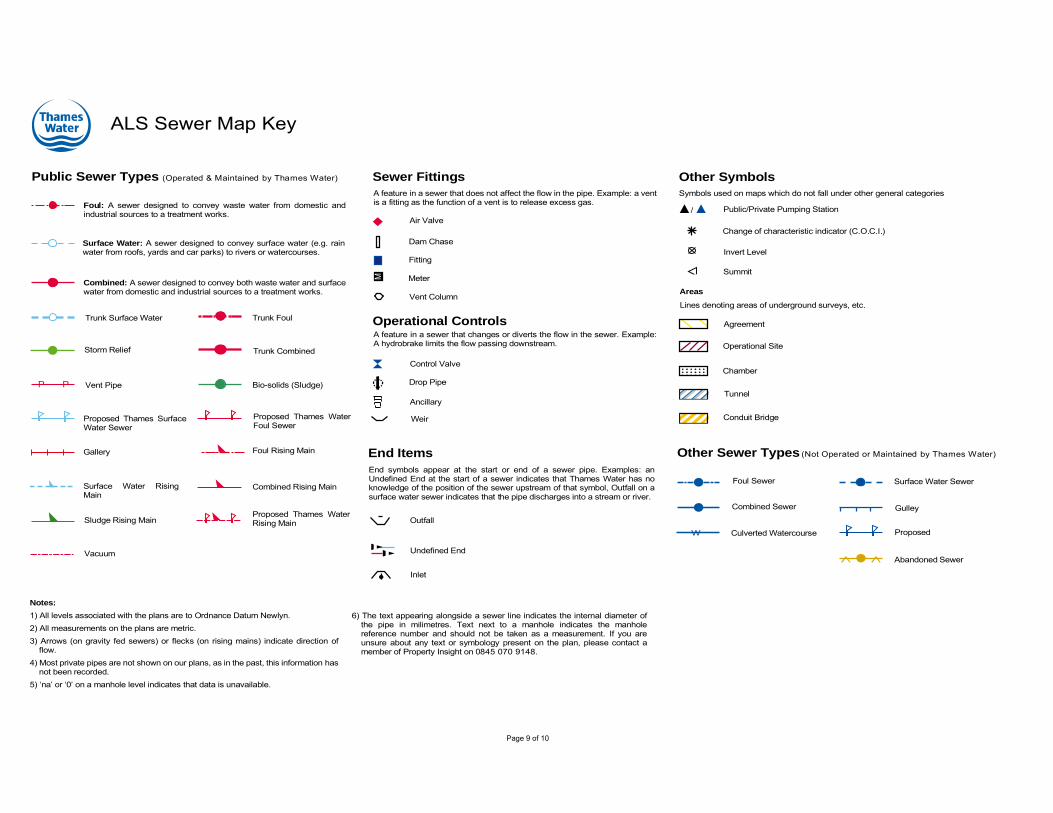
ALS Sewer Map Key
Foul: A sewer designed to convey waste water from domestic andindustrial sources to a treatment works.
Surface Water: A sewer designed to convey surface water (e.g. rainwater from roofs, yards and car parks) to rivers or watercourses.
Combined: A sewer designed to convey both waste water and surfacewater from domestic and industrial sources to a treatment works.
Trunk Surface Water
Storm Relief
Vent Pipe
Proposed Thames SurfaceWater Sewer
Gallery
Surface Water RisingMain
Sludge Rising Main
Vacuum
Public Sewer Types (Operated & Maintained by Thames Water)
Notes:
1) All levels associated with the plans are to Ordnance Datum Newlyn.2) All measurements on the plans are metric.3) Arrows (on gravity fed sewers) or flecks (on rising mains) indicate direction of
flow.4) Most private pipes are not shown on our plans, as in the past, this information has
not been recorded.5) ‘na’ or ‘0’ on a manhole level indicates that data is unavailable.
Trunk Foul
Trunk Combined
Bio-solids (Sludge)
Proposed Thames WaterFoul Sewer
Foul Rising Main
Combined Rising Main
Proposed Thames WaterRising Main
Sewer Fittings
A feature in a sewer that does not affect the flow in the pipe. Example: a ventis a fitting as the function of a vent is to release excess gas.
Operational ControlsA feature in a sewer that changes or diverts the flow in the sewer. Example:A hydrobrake limits the flow passing downstream.
Air Valve
Dam Chase
Fitting
Meter
Vent Column
Control Valve
Drop Pipe
Ancillary
Weir
End Items
End symbols appear at the start or end of a sewer pipe. Examples: anUndefined End at the start of a sewer indicates that Thames Water has noknowledge of the position of the sewer upstream of that symbol, Outfall on asurface water sewer indicates that the pipe discharges into a stream or river.
Outfall
Undefined End
Inlet
Other Symbols
Symbols used on maps which do not fall under other general categories
Summit
Public/Private Pumping Station/
Invert Level
Change of characteristic indicator (C.O.C.I.)
Other Sewer Types (Not Operated or Maintained by Thames Water)
Areas
Lines denoting areas of underground surveys, etc.
Agreement
Chamber
Operational Site
Conduit Bridge
Foul Sewer
Combined Sewer
Culverted Watercourse
Surface Water Sewer
Gulley
Proposed
Abandoned Sewer
Tunnel
6) The text appearing alongside a sewer line indicates the internal diameter ofthe pipe in milimetres. Text next to a manhole indicates the manholereference number and should not be taken as a measurement. If you areunsure about any text or symbology present on the plan, please contact amember of Property Insight on 0845 070 9148.
P PM
W