Embed Size (px)
Citation preview

. . . . . . . . . .
Long-Term Variable Milfoil Management Plan
Lake Massasecum
Bradford, New Hampshire
Prepared by:
NH Department of
Environmental Services
March 2015

Page 2 of 49
Contents
Purpose .............................................................................................................. 4
Invasive Aquatic Plant Overview ................................................................... 4
Variable Milfoil Infestation in Lake Massasecum ........................................ 5
Milfoil Management Goals and Objectives .................................................. 8
Local Support .................................................................................................... 8
Town or Municipality Support .................................................................... 8
Lake Resident Support ............................................................................. 8
Waterbody Characteristics ............................................................................. 8
Beneficial (Designated) Uses of Waterbody .............................................. 10
Aquatic Life ............................................................................................. 10
Recreational Uses and Access Points .................................................... 11
Macrophyte Community Evaluation ............................................................ 11
Wells and Water Supplies ............................................................................. 12
Historical Control Activities .......................................................................... 13
Aquatic Invasive Plant Management Options ........................................... 16
Feasibility Evaluation of Control Options in this Waterbody ................. 17
Recommended Actions, Timeframes and Responsible Parties ............ 18
Notes ................................................................................................................. 23
Target Specificity .................................................................................... 23
Adaptive Management ............................................................................ 23
Figure 1: Map of Variable Milfoil Infestations Over Time .................... 24
Figure 2: Map of Control Actions Over Time ........................................ 25
2009 ........................................................................................................ 25
2014 (proposed) ...................................................................................... 26
2014 (actual- July) .................................................................................. 27

2014 (actual- September) ....................................................................... 28
2015 (proposed) ...................................................................................... 29
Figure 3: Map of Native Aquatic Macrophytes ..................................... 30
Figure 4: Bathymetric Map ....................................................................... 32
Figure 5: Critical Habitats or Conservation Areas ............................... 33
Figure 6: Public Access and Uses .......................................................... 34
Figure 7: Wells and Water Supplies ....................................................... 35
Appendix A Selection of Aquatic Plant Control Techniques ............. 36
Appendix B Summary of Control Practices Used NH ..................... 40
Restricted Use Areas and Fragment Barrier: .......................................... 40
Hand-pulling: ........................................................................................... 40
Diver Assisted Suction Harvesting .......................................................... 41
Mechanical Harvesting ............................................................................ 41
Benthic Barriers: ..................................................................................... 41
Targeted Application of Herbicides: ........................................................ 41
Extended Drawdown ............................................................................... 43
Dredging .................................................................................................. 43
Biological Control .................................................................................... 43
Appendix C Survey Methods/Map for Local Divers ............................. 44
Figure 8: Recommended Milfoil Survey Strategies by Area .............. 48
References ....................................................................................................... 49

Page 4 of 49
Purpose
The purposes of this exotic aquatic plant management and control plan are:
1. To identify and describe the historic and current exotic aquatic
infestation(s) in the waterbody;
2. To identify short-term and long-term exotic aquatic plant control goals;
3. To minimize any adverse effects of exotic aquatic plant management
strategies on non-target species;
4. To recommend exotic plant control actions that meet the goals outlined in
this plan; and
5. To evaluate control practices used in this waterbody over time to
determine if they are meeting the goals outlined in this plan.
This plan also summarizes the current physical, biological, ecological, and
chemical components of the subject waterbody as they may relate to both the
exotic plant infestation and recommended control actions, and the potential
social, recreational and ecological impacts of the exotic plant infestation.
The intent of this plan is to establish an adaptive management strategy for the
long-term control of the target species (in this case variable milfoil) in the
subject waterbody, using an integrated plant management approach.
Appendix A and Appendix B detail the general best management practices
and strategies available for waterbodies with exotic species, and provide more
information on each of the activities that are recommended within this plan.
Invasive Aquatic Plant Overview
Exotic aquatic plants pose a threat to the ecological, aesthetic, recreational,
and economic values of lakes and ponds (Luken & Thieret, 1997, Halstead,
2000), primarily by forming dense growths or monocultures in critical areas of
waterbodies that are important for aquatic habitat and/or recreational use.
Under some circumstances, dense growths and near monotypic stands of
invasive aquatic plants can result, having the potential to reduce overall
species diversity in both plant and animal species, and can alter water
chemistry and aquatic habitat structure that is native to the system.
Since January 1, 1998, the sale, distribution, importation, propagation,
transportation, and introduction of key exotic aquatic plants have been
prohibited (RSA 487:16-a) in New Hampshire. This law was designed as a
tool for lake managers to help prevent the spread of nuisance aquatic plants.

New Hampshire lists 27 exotic aquatic plant species as prohibited in the state
(per Env-Wq 1303.02) due to their documented and potential threat to surface
waters of the state.
According to the federal Section 305(b) and 303(d) Consolidated Assessment
and Listing Methodology (CALM), “exotic macrophytes are non-native, fast
growing aquatic plants, which can quickly dominate and choke out native
aquatic plant growth in the surface water. Such infestations are in violation of
New Hampshire regulation Env-Wq 1703.19, which states that surface waters
shall support and maintain a balanced, integrated and adaptive community of
organisms having a species composition, diversity, and functional
organization comparable to that of similar natural habitats of a region” (DES,
2006). In fact, waterbodies that contain even a single exotic aquatic plant do
not attain water quality standards and are listed as impaired.
Variable Milfoil Infestation in Lake Massasecum
Variable milfoil (Myriophyllum heterophyllum) was documented in Lake
Massasecum in Bradford, New Hampshire in 1996. In the span of two years
the plant covered the majority of the northern 10 acres of the lake with large
dense patches of growth in 4-10 feet of water. This area has continued to
sustain the majority of the milfoil growth over time, though other smaller-
scale infestations have cropped up in other areas of the lake over time.
Figure 1 illustrates the distribution of variable milfoil infestations in this
waterbody over time. The following table provides a summary of each area
indicated in Figure 1, based on updated data from each year (as available) at
the end of the growing season. Note that infestations prior to 2009 did not
involve mapping with handheld GPS units, so information for those years is
lumped into a 2008 and before category.
Area Location/Area
Description
Year Description of Growth Milfoil Percent
Cover in Area
A1 Northern cove and
outlet channel
(Melvin Brook)
2008
and
before
Variable growth patterns
each year depending on
harvesting/matting/diving
efforts by local entities
Range of 20-
60% cover
2009 Dense widespread growth
early season before herbicide
treatment, no milfoil
observed late season after
treatment
75%
2010 Small patchy areas of growth
or single stems
<5%
2011 Small patchy areas of growth <5%

Page 6 of 49
Area Location/Area
Description
Year Description of Growth Milfoil Percent
Cover in Area
or single stems
2012 Increasing growth at north
end despite hand removal
efforts
25%
2013 Similar levels of growth to
2012, though in slightly
different locations due to
diving work on historic
growths
25%
2014 Patches of growth in northern
end early season prior to
treatment, with some single
stems/clumps extending
outside of the fragment
barrier. Post treatment
growth reduced to single
stems and scattered clumps,
managed by divers.
25% pre-
treatment
<5% post
treatment
A2,
A3,
B3
Western shoreline 2008
and
before
None observed 0%
2009 None observed 0%
2010 None observed 0%
2011 None observed 0%
2012 None observed 0%
2013 Scattered stems and patches
of variable milfoil growth
occurring
<1%
2014 Scattered stems and patches
of variable milfoil, identified
and managed by divers
regularly
<1%
B4,
C4
South/southwestern
shoreline
2008
and
before
None observed 0%
2009 None observed 0%
2010 Small scattered growth in C4
along wetland edge and near
boat launch, none in B4
<5%
2011 Small scattered growth in C4
along wetland edge and near
boat launch, none in B4
<5%
2012 Patchy growth and single
stems in C4, new patch of
growth identified in B4 in
wetland cove
<5%
2013 Expanded areas of growth
and broaded areas of single
stems settling in among
native vegetation
5%

Area Location/Area
Description
Year Description of Growth Milfoil Percent
Cover in Area
2014 Scattered early season
growth as single stems or
clumps of plants, increasing
in frequency over growing
season, hard to find and hand
remove due to density of
native plants in this zone
5%
D3,
D4
Southeastern
shoreline
2008
and
before
None observed 0%
2009 None observed 0%
2010 None observed 0%
2011 None observed 0%
2012 None observed 0%
2013 None observed 0%
2014 None observed 0%
B2,
C2
Eastern shoreline 2008
and
before
None observed 0%
2009 None observed 0%
2010 None observed 0%
2011 None observed 0%
2012 None observed 0%
2013 Small patch/single stems
observed to the north of
small island
<1%
2014 Small patch/single stems
observed to the north of
small island
<1%
C3 Open water area in
mid-central part of
basin
2008
and
before
None observed 0%
2009 None observed 0%
2010 None observed 0%
2011 None observed 0%
2012 None observed 0%
2013 None observed 0%
2014 None observed 0%
In terms of the impacts of the variable milfoil in the system, there are several
(at least 70) houses around the shoreline of Lake Massasecum, with mostly
seasonal cottages, though there are a few year-round dwellings. There are
also ten or more back lots with lake rights. Most of these properties are
directly unaffected by the variable milfoil growth, and only those at the
northern end, and a few along the eastern shoreline of the lake directly abut
the milfoil infestation. Unfortunately, occasional milfoil fragments do drift
and settle in other parts of the waterbody, and if unnoticed can lead to an
expanded infestation in the lake.

Page 8 of 49
Lake Massasecum has a relatively shallow mean depth and ample habitat to
support milfoil growth. We expect that milfoil will grow anywhere where
water depths are less than about 15 feet. The invasive plant infestation in this
waterbody is a continuous threat to the Warner River, which Lake
Massasecum flows into.
Milfoil Management Goals and Objectives
The goal for Lake Massasecum is the reduction of overall biomass and
distribution of variable milfoil in the system, with the eventual eradication (if
feasible) using an Integrated Pest Management Approach.
Local Support
Town or Municipality Support
The town of Bradford appreciates the importance of keeping the Lake
Massasecum system usable and controlling the variable milfoil. The town has
allocated funds for milfoil hand-removal for the past several years. Both the
town and several private entities have come forward over the years with
donations for milfoil control. The town has generously awarded funds for
projects dealing with prevention activities (the Lake Host Program) and
control activities (hand-removal projects and fragment barrier net
construction), and has developed an excellent Weed Watcher team for early
detection of new growths in the lake. This is the only infested waterbody in
the town at this point, and the town officials recognize the need to protect
other nearby waterbodies.
Lake Resident Support
The Lake Massasecum Improvement Association (LMIA) has contributed
both time and funds to control variable milfoil in the lake over the years. The
Lake Association has coordinated the installation and the removal of fragment
barriers in the north end each year, the placement of benthic barriers, the
hiring of divers, coordination of mechanical harvesting, and numerous other
activities. In recent years, efforts to establish and extensive dive-team on the
lake, made up of local residents, has had great success.
Waterbody Characteristics
The following table summarizes basic physical and biological characteristics
of Lake Massasecum, including the milfoil infestation. Note that a current
review of the Natural Heritage Bureau (NHB) database was requested and the
results from that search are pending.

A
n
a
q
u
a
t
i
c
Parameter/Measure Value/Description
Lake area (acres) 401.5
Watershed area (acres) 6,041
Shoreline Uses
(residential, forested,
agriculture)
Residential, forested
Max Depth (ft) 54
Mean Depth (ft) 12.5
Trophic Status Mesotrophic
Color (CPU) in
Epilimnion
18
Clarity (ft) 13.2
Flushing Rate (yr-1) 2
Natural
waterbody/Raised by
Damming/Other
Natural
Invasive Plants Variable milfoil (Myriophyllum heterophyllum)
Infested Area (acres) See Figures
Distribution (ringing
lake, patchy growth,
etc)
See Figures
Sediment type in
infested area
(sand/silt/organic/rock)
Sandy/silty
Rare, Threatened, or
Endangered Species in
Waterbody (according
to historic NH Natural
Heritage Bureau
(NHB) Inventory
review)
Pink bog button (Sclerolepsis uniflora)
Sandy Pond Shore System

Page 10 of 49
A native aquatic vegetation map and key (field checked in 2014) by the DES
Biology Section is shown in Figure 3. A bathymetric map is shown in Figure
4.
Beneficial (Designated) Uses of Waterbody
In New Hampshire, beneficial (designated) uses of our waterbodies are
categorized into five general categories: Aquatic Life, Fish Consumption,
Recreation, Drinking Water Supply, and Wildlife (CALM).
Of these, Aquatic Life, Wildlife and Recreation are the ones most often
affected by the presence of invasive plants, though drinking water supplies
can also be affected as well in a number of ways.
Following is a general discussion of the most potentially impacted designated
uses, including water supplies and near shore wells, as they relate to this
system and the actions proposed in this long-term plan.
The goal for aquatic life support is to provide suitable chemical and physical
conditions for supporting a balanced, integrated and adaptive community of
aquatic organisms having a species composition, diversity, and functional
organization comparable to that of similar natural habitats of the region.
Aquatic Life
Fisheries Information
Lake Massasecum is managed for warmwater fish species. Fish species
present include largemouth bass, smallmouth bass, chain pickerel, black
crappie, brown bullhead, yellow perch, common sunfish, redbreast sunfish,
common white sucker, common shiner, golden shiner, and American eel.
According to the Fish and Game Department, fishing pressure is light during
both open-water and winter, but bass fishing is quite good.
Wildlife Information
An abundance of native freshwater mussels were observed in the sandier
substrates at the southern end of the lake.
There were no species of wildlife listed in the historic NHB review for this
waterbody.
There are no NH F&G Wildlife Management Areas within a mile of this
waterbody. The Nelson Farm Easement, and French’s Park lots encompass
approximately 95 acres of conservation land abutting this waterbody. No species
are being managed in this area currently.
Recreational Uses and Access Points
Lake Massasecum is used for numerous recreational activities, including
boating, fishing, swimming, and water skiing by both pond residents and
transient boaters.
There is one designated public access site on Lake Massasecum, it is located
on the southwestern side of the pond. Motor boats, as well as kayaks and
canoes can use this facility. There is limited parking for about two or three
vehicles with trailers along Route 114 near the launch (Figure 6).
There are two designated beaches on Lake Massasecum which are owned by
the town and are public (Figure 6). A designated beach is described in the
CALM as an area on a waterbody that is operated for bathing, swimming, or
other primary water contact by any municipality, governmental subdivision,
public or private corporation, partnership, association, or educational
institution, open to the public, members, guests, or students whether on a fee
or free basis. Env-Wq 1102.14 further defines a designated beach as “a
public bathing place that comprises an area on a water body and associated
buildings and equipment, intended or used for bathing, swimming, or other
primary water contact purposes. The term includes, but is not limited to,
beaches or other swimming areas at hotels, motels, health facilities, water
parks, condominium complexes, apartment complexes, youth recreation
camps, public parks, and recreational campgrounds or camping parks as
defined in RSA 216-I:1, VII. The term does not include any area on a water
body which serves 3 or fewer living units and which is used only by the
residents of the living units and their guests.
In addition to the designated beaches, there are a few small private swim
beaches located on private properties around the pond and scattered docks and
swim platforms on the lake.
Macrophyte Community Evaluation
The littoral zone is defined as the nearshore areas of a waterbody where
sunlight penetrates to the bottom sediments. The littoral zone is typically the
zone of rooted macrophyte growth in a waterbody.

Page 12 of 49
The littoral zone of Lake Massasecum is characterized by a mix of native and
non-native (variable milfoil) plant growth (Figure 3). Native species include a
mix of floating plants (white and yellow water-lilies, floating heart,
watershield), emergent plants (pickerelweed, bulrush, water lobelia), and
submergent plants (bladderwort, pondweed, pink bog button). Native plant
communities are mixed around the entire lake, and are characterized as
‘common/abundant’ by the DES.
The historic NHB review reports that a sandy pond shore system is present in
this waterbody. According to NHB, this is a natural community type that is
extremely vulnerable to trampling (due to recreational us) and water level
fluctuations. Pink bog button (Sclerolepsis uniflora) is a common species in
this community, and it is present throughout much of the photic zone of Lake
Massasecum. Other species documented in this community include bulblet
umbrella sedge, one-flowered muhly, mud rush, sundews, St. John’s wort,
cranberry, sweet gale, and a variety of rushes, sedges and ferns (specific lists
of species can be found in the NHB review.
Wells and Water Supplies
Figure 7 shows the location of wells, water supplies, well-head protection
areas, and drinking water protection areas around the subject waterbody,
based on information in the DES geographic information system records.
Note that it is likely that Figure 7 does not show the location of all private
wells.
Note that the map in Figure 7 cannot be provided on a finer scale than
1:48,000. Due to public water system security concerns, a large-scale map
may be made available upon agreement with DES’ data security policy. Visit
DES’ OneStop Web GIS, http://www2.des.state.nh.us/gis/onestop/ and
register to Access Public Water Supply Data Layers. Registration includes
agreement with general security provisions associated with public water
supply data. Paper maps that include public water supply data may be
provided at a larger-scale by DES’ Exotic Species Program after completing
the registration process.
In the event that an herbicide treatment is needed for this waterbody, the
applicator/contractor will provide more detailed information on the wells and
water supplies within proximity to the treatment areas as required in the
permit application process with the Division of Pesticide Control at the
Department of Agriculture. It is beyond the scope of this plan to maintain
updated well and water supply information other than that provided in Figure
7.

Historical Control Activities
DATE ACTION AREA (ac) OR AMOUNT (GAL) CONTRACTOR
9/30/1997 2,4-D 11 ACRES
AQUATIC CONTROL
TECHNOLGY
6/20/1995
DIVING, MECHANICAL HARVEING, BENTHIC BARRIERS, FRAGMENT
BARRIER 10 ACRES IN NORTH END
LOCAL RESIDENTS/DES
1999
DIVING, MECHANICAL HARVEING, BENTHIC BARRIERS, FRAGMENT
BARRIER 10 ACRES IN NORTH END
LOCAL RESIDENTS/DES
2000
DIVING, MECHANICAL HARVEING, BENTHIC BARRIERS, FRAGMENT
BARRIER 10 ACRES IN NORTH END
LOCAL RESIDENTS/DES
2001
DIVING, MECHANICAL HARVEING, BENTHIC BARRIERS, FRAGMENT
BARRIER 10 ACRES IN NORTH END
LOCAL RESIDENTS/DES
2002
DIVING, MECHANICAL HARVEING, BENTHIC BARRIERS, FRAGMENT
BARRIER 10 ACRES IN NORTH END
LOCAL RESIDENTS/DES
2003
DIVING, MECHANICAL HARVEING, BENTHIC BARRIERS, FRAGMENT
BARRIER 10 ACRES IN NORTH END
LOCAL RESIDENTS/DES
2004
DIVING, MECHANICAL HARVEING, BENTHIC BARRIERS, FRAGMENT
BARRIER 10 ACRES IN NORTH END
LOCAL RESIDENTS/DES
2005
DIVER ASSISTED SUCTION HARVESTING, HAND REMOVAL,
PLANT REPLACEMENT 10 ACRES IN NORTH END
DES AND CONTRACTORS
2006 DIVING, BENTHIC BARRIERS,
FRAGMENT BARRIER
10 ACRES IN NORTH END, AND AT LAUNCH AND SOUTHWESTERN
SHORELINE LOCAL
RESIDENTS/DES
2007 DIVING, BENTHIC BARRIERS,
FRAGMENT BARRIER
10 ACRES IN NORTH END, AND AT LAUNCH AND SOUTHWESTERN
SHORELINE LOCAL
RESIDENTS/DES

Page 14 of 49
DATE ACTION AREA (ac) OR AMOUNT (GAL) CONTRACTOR
2008 DIVING, BENTHIC BARRIERS,
FRAGMENT BARRIER
10 ACRES IN NORTH END, AND AT LAUNCH AND SOUTHWESTERN
SHORELINE LOCAL
RESIDENTS/DES
2009 HERBICIDE TREATMENT (2,4-D)
12.3 ACRES (6.7 ACRES AT 200
LB/ACRE AND 5.6 ACRES AT 100
LB/ACRE)
AQUATIC CONTROL
TECHNOLGY
2010 HAND REMOVAL AS NEEDED LOCAL
RESIDENTS/DES
2011 HAND REMOVAL AS NEEDED LOCAL
RESIDENTS/DES
2012 HAND REMOVAL AS NEEDED LOCAL
RESIDENTS/DES
7/3/13 DIVER HAND REMOVAL 6 GALLONS JOHN RICE
7/5/13 DIVER HAND REMOVAL 2.5 GALLONS JOHN RICE
7/6 & 7/7 2013 DIVER HAND REMOVAL 4 GALLONS JOHN RICE
7/8/2013 DIVER HAND REMOVAL 14.5 GALLONS RUS RICE
7/11/2013 DIVER HAND REMOVAL 0.75 GALLONS ANN & TIM RICE
7/12/2013 DIVER HAND REMOVAL 14.5 GALLONS RUS & TIM RICE
7/14/2013 DIVER HAND REMOVAL 17 GALLONS BEN JONES
7/16/2013 DIVER HAND REMOVAL 8 GALLONS JOHN RICE/LOCAL
DIVERS
7/17/2013 DIVER HAND REMOVAL 20 GALLONS JOHN RICE/LOCAL
DIVERS
7/21/2013 DIVER HAND REMOVAL 8 GALLONS JOHN RICE/LOCAL
DIVERS
7/23/2013 DIVER HAND REMOVAL 2.5 GALLONS JOHN RICE/LOCAL
DIVERS
7/26/2013 DIVER HAND REMOVAL 2.5 GALLONS JOHN RICE/LOCAL
DIVERS
7/27/2013 DIVER HAND REMOVAL 3 GALLONS JOHN RICE/LOCAL
DIVERS
8/1/2013 DIVER HAND REMOVAL 4 GALLONS JOHN RICE/LOCAL
DIVERS

DATE ACTION AREA (ac) OR AMOUNT (GAL) CONTRACTOR
8/2/2013 DIVER HAND REMOVAL 2.5 GALLONS JOHN RICE/LOCAL
DIVERS
8/3/2013 DIVER HAND REMOVAL 4 GALLONS JOHN RICE/LOCAL
DIVERS
8/8/2013 DIVER HAND REMOVAL 24 GALLONS JOHN RICE/LOCAL
DIVERS
8/9/2013 DIVER HAND REMOVAL 1 GALLON JOHN RICE/LOCAL
DIVERS
5/31/2014 DIVER HAND REMOVAL 20 GALLONS TED ALDRICH ET
AL.
6/24/2014 DIVER HAND REMOVAL 1.5 GALLONS SCOTT SMITH
6/26/2014 DIVER HAND REMOVAL 2.5 GALLONS TED ALDRICH ET
AL.
6/27/2014 DIVER HAND REMOVAL 4.0 GALLONS JOHN RICE/LOCAL
DIVERS
6/29/2014 DIVER HAND REMOVAL 3.0 GALLONS JOHN RICE
7/1/2014 DIVER HAND REMOVAL 1 COFFEE CUP
FULL JOHN RICE
7/2/2014 DIVER HAND REMOVAL < 1 GALLON BOB PATTERSON & JOHN RICE
7/5/2014 DIVER HAND REMOVAL 17 GALLONS JOHN RICE/LOCAL
DIVERS
7/9/2014 2,4-D (G) 10.2 ACRES ACT
7/14/2014 DIVER HAND REMOVAL 10 GALLONS TED ALDRICH ET
AL.
7/14/2014 DIVER HAND REMOVAL 5 GALLONS JOHN RICE/LOCAL
DIVERS
7/23/2014 DIVER HAND REMOVAL 15 GALLONS JOHN RICE/LOCAL
DIVERS
7/24/2014 DIVER HAND REMOVAL 5 GALLONS JOHN RICE/LOCAL
DIVERS
7/25/2014 DIVER HAND REMOVAL 10 GALLONS JOHN RICE/LOCAL
DIVERS
7/30/2014 DIVER HAND REMOVAL 0.5 GALLONS BEN JONES
8/3/2014 DIVER HAND REMOVAL < 0.5 GALLONS JOHN RICE/LOCAL
DIVERS
8/4/2014 DIVER HAND REMOVAL 9 GALLONS JOHN RICE/LOCAL
DIVERS
8/5/2014 DIVER HAND REMOVAL 3 GALLONS JOHN RICE/LOCAL
DIVERS

Page 16 of 49
DATE ACTION AREA (ac) OR AMOUNT (GAL) CONTRACTOR
8/6/2014 DIVER HAND REMOVAL 3 GALLONS JOHN RICE/
LOCAL DIVERS
8/10/2014 DIVER HAND REMOVAL 5 GALLONS BEN JONES
8/24/2014 DIVER HAND REMOVAL 1/3 GALLON BEN JONES
8/30/2014 DIVER HAND REMOVAL 5 GALLONS BEN JONES
8/31/2014 DIVER HAND REMOVAL 2 GALLONS BEN JONES
9/10/2014 DIVER HAND REMOVAL 10 GALLONS BEN JONES/
LOCAL DIVERS
9/12/2014 2,4-D (G) TREATMENT 5.6 ACRES ACT
Aquatic Invasive Plant Management Options
The control practices used should be as specific to the target species as
feasible. No control of native aquatic plants is intended.
Exotic aquatic plant management relies on a combination of proven methods
that control exotic plant infestations, including physical control, chemical
control, biological controls (where they exist), and habitat manipulation.
Integrated Pest Management Strategies (IPM) are typically implemented using
Best Management Practices (BMPs) based on site-specific conditions so as to
maximize the long-term effectiveness of control strategies. Descriptions for
the control activities are closely modeled after those prescribed by the Aquatic
Ecosystem Restoration Foundation (AERF) (2004). This publication can be
found online at http://www.aquatics.org/bmp.htm. Additional information can
be obtained from a document prepared for the State of Massachusetts called
the Generic Environmental Impact Report for Lakes and Ponds, available at
http://www.mass.gov/dcr/watersupply/lakepond/geir.htm.
Criteria for the selection of control techniques are presented in Appendix A.
Appendix B includes a summary of the exotic aquatic plant control practices
currently used by the State of New Hampshire.
Feasibility Evaluation of Control Options in this Waterbody
DES has evaluated the feasibility of potential control practices on the subject
waterbody. The following table summarizes DES’ control strategy
recommendations for the subject waterbody:
Management
Method
Use on Lake Massasecum
Restricted Use
Areas (RUAs)
and/or Fragment
Barriers
The purpose of RUAs and fragment barriers is to
contain small areas of exotic aquatic plant growth to
prevent them from spreading further in a system.
Massasecum had an RUA for a number of years
located in the northern end of the lake, where the
primary infestation was located. The RUA was
coupled with a fragment barrier. The RUA was
discontinued in 2010 after an extensive herbicide
treatment and hand pulling effort, but with regrowth
in the north end in recent years, the RUA and
fragment barrier may be reinstalled.
Hand-pulling and
Diver-Assisted
Suction Harvesting
(DASH)
Recommended as a primary means of control for
milfoil growth in Lake Massasecum. Diver work
should suffice in most areas, but DASH is
recommended when milfoil growth is too expansive
for simple diving.
Mechanical
Harvesting/Removal
Not recommended due to the risk of fragmentation
and drift, and subsequent further spread of the
invasive plant. Mechanical harvesting was used in
Massasecum in the late 1990s and early 2000s,
mainly to keep the plants below the water’s surface
to minimize chance of fragmentation. As a control
technique, however, it was ineffective.
Benthic Barriers Recommended for small patches that are 20’ x 20’ in
size or less, and where practical. There are two or
three benthic barriers in Massasecum already, and it
is recommended that they be checked, re-
staked/weighted, and kept in place. Additional
barriers can be added as needed.
Herbicides Herbicide treatment is recommended as a primary
means of control only where infestations of the
exotic plant are too widespread and/or dense for non-
chemical means of control to be effective.
There are several areas identified in the Figures

Page 18 of 49
Management
Method
Use on Lake Massasecum
attached to this plan that outline areas where
herbicide use has been and may be needed to further
reduce historic dense infestations of variable milfoil.
Extended
Drawdown
Not feasible or practical for this waterbody due to
lack of an impoundment structure.
Dredge Cost prohibitive and not often effective for
controlling invasive aquatic plants.
Biological Control No biological controls are yet approved for use on
variable milfoil.
No Control The variable milfoil infestation in Lake Massasecum
expands annually when control actions are not
implemented.
A no control option would only allow for further
spread of this plant within this system and
downstream water resources would be at risk of
infestation from fragment drift.
Recommended Actions, Timeframes and Responsible Parties
An evaluation of the size, location, and type of variable milfoil infestation, as
well as the waterbody uses was conducted at the end of the last growing
season (see attached figures for findings). Based on this survey the following
recommendations are made for variable milfoil control in the system:
Year Action Responsible
Party
Schedule
2014 Weed Watching and
marking/reporting of milfoil
growth, and maintenance of
fragment barrier(s)
Local Weed
Watchers
Once a
month
from May
through
September
Fragment barrier(s) in north end
and other key locations
DES and/or local
volunteers
Install in
May,
remove in
October
Year Action Responsible
Party
Schedule
Thorough survey of all zones of the
lake that are 15’ or less in depth,
using contract divers or local divers
with DES survey strategies. DES
divers will assist as time allows
(reference DES map and survey
methods in Appendix C).
Contract divers,
local divers,
DES divers
June/July
or as
needed
Survey and planning for
summer/fall milfoil control actions
DES May/June
Diver/DASH work as needed and
recommended (areas to be
determined based on updated spring
survey)
Contract
Diver/Local
Divers
June-
September
as needed
Install benthic barriers if/as needed DES/local divers
under DES
guidance
As needed
Herbicide treatment, if needed,
based on diver progress as
monitored by DES (areas to be
determined based on updated spring
survey)
Aquatic Control
Technology,
LLC.
June/July
or
September
Survey waterbody and planning for
next season’s control actions
DES September
2015 Weed Watching and
marking/reporting of milfoil
growth, and maintenance of
fragment barrier(s)
Local Weed
Watchers
Once a
month
from May
through
September
Fragment barrier(s) in north end
and other key locations as needed
(western cove)
DES and/or local
volunteers
Install in
May,
remove in
October
Thorough survey of all zones of the
lake that are 15’ or less in depth,
using contract divers or local divers
with DES survey strategies. DES
divers will assist as time allows
(reference DES map and survey
methods in Appendix C).
Contract divers,
local divers,
DES divers
June/July
or as
needed
Survey and planning for
summer/fall milfoil control actions
DES May/June

Page 20 of 49
Year Action Responsible
Party
Schedule
Diver/DASH work as needed and
recommended (areas to be
determined based on updated spring
survey)
Contract
Diver/Local
Divers
June-
September
as needed
Herbicide treatment, if needed,
based on diver progress as
monitored by DES (areas to be
determined based on updated
surveys)
Aquatic Control
Technology,
LLC.
June
and/or
July
and/or
August
Install benthic barriers if/as needed DES/local divers
under DES
guidance
As needed
Survey waterbody and planning for
next season’s control actions
DES September
2016 Weed Watching and
marking/reporting of milfoil
growth, and maintenance of
fragment barrier(s)
Local Weed
Watchers
Once a
month
from May
through
September
Fragment barrier(s) in north end
and other key locations
DES and/or local
volunteers
Install in
May,
remove in
October
Thorough survey of all zones of the
lake that are 15’ or less in depth,
using contract divers or local divers
with DES survey strategies. DES
divers will assist as time allows
(reference DES map and survey
methods in Appendix C).
Contract divers,
local divers,
DES divers
June/July
or as
needed
Survey and planning for
summer/fall milfoil control actions
DES May/June
Diver/DASH work as needed and
recommended (areas to be
determined based on updated spring
survey)
Contract
Diver/Local
Divers
June-
September
as needed
Install benthic barriers if/as needed DES/local divers
under DES
guidance
As needed

Year Action Responsible
Party
Schedule
Survey waterbody and planning for
next season’s control actions
DES September
2017 Weed Watching and
marking/reporting of milfoil
growth, and maintenance of
fragment barrier(s)
Local Weed
Watchers
Once a
month
from May
through
September
Fragment barrier(s) in north end
and other key locations
DES and/or local
volunteers
Install in
May,
remove in
October
Thorough survey of all zones of the
lake that are 15’ or less in depth,
using contract divers or local divers
with DES survey strategies. DES
divers will assist as time allows
(reference DES map and survey
methods in Appendix C).
Contract divers,
local divers,
DES divers
June/July
or as
needed
Survey and planning for
summer/fall milfoil control actions
DES May/June
Diver/DASH work as needed and
recommended (areas to be
determined based on updated spring
survey)
Contract
Diver/Local
Divers
June-
September
as needed
Install benthic barriers if/as needed DES/local divers
under DES
guidance
As needed
Survey waterbody and planning for
next season’s control actions
DES September
2018 Weed Watching and
marking/reporting of milfoil
growth, and maintenance of
fragment barrier(s)
Local Weed
Watchers
Once a
month
from May
through
September
Fragment barrier(s) in north end
and other key locations
DES and/or local
volunteers
Install in
May,
remove in
October

Page 22 of 49
Year Action Responsible
Party
Schedule
Thorough survey of all zones of the
lake that are 15’ or less in depth,
using contract divers or local divers
with DES survey strategies. DES
divers will assist as time allows
(reference DES map and survey
methods in Appendix C).
Contract divers,
local divers,
DES divers
June/July
or as
needed
Survey and planning for
summer/fall milfoil control actions
DES May/June
Diver/DASH work as needed and
recommended (areas to be
determined based on updated spring
survey)
Contract
Diver/Local
Divers
June-
September
as needed
Install benthic barriers if/as needed DES/local divers
under DES
guidance
As needed
Survey waterbody and planning for
next season’s control actions
DES September
2019 Update and revise Long-Term
Variable Milfoil Control Plan
DES and
Interested
Parties
Fall/
Winter

Notes
Target Specificity
It is important to realize that aquatic herbicide applications are conducted in a
specific and scientific manner. To the extent feasible, the permitting authority
favors the use of selective herbicides that, where used appropriately, will
control the target plant with little or no impact to non-target species, such that
the ecological functions of native plants for habitat, lake ecology, and
chemistry/biology will be maintained. Not all aquatic plants will be impacted
as a result of an herbicide treatment.
Adaptive Management
Because this is a natural system that is being evaluated for management, it is
impossible to accurately predict a management course over five years that
could be heavily dependent on uncontrolled natural circumstances (weather
patterns, temperature, adaptability of invasive species, etc).
This long-term plan is therefore based on the concept of adaptive
management, where current field data (from field survey work using DES
established field survey standard operating procedures) drive decision making,
which may result in modifications to the recommended control actions and
timeframes for control. As such, this management plan should be considered
a dynamic document that is geared to the actual field conditions that present
themselves in this waterbody.
If circumstances arise that require the modification of part or all of the
recommendations herein, interested parties will be consulted for their input on
revisions that may be needed to further the goal of variable milfoil
management in the subject waterbody.

Page 24 of 49
Figure 1: Map of Variable Milfoil Infestations Over Time

Figure 2: Map of Control Actions Over Time
2009

Page 26 of 49
2014 (proposed)

2014 (actual- July)

Page 28 of 49
2014 (actual- September)

2015 (proposed)

Page 30 of 49
Figure 3: Map of Native Aquatic Macrophytes

Plant Key for Lake Massasecum
Symbol Common Name Latin Name
C Pink bog button Sclerolepis uniflora
P Pickerelweed Pontedaria cordata
B Watershield Brasenia schreberi
W Pondweed Potamogeton
F Floating heart Nymphoides cordatum
N White water-lily Nymphaea
b Softstem bulrush Scirpus validus
U Bladderwort Utricularia
L Water lobelia Lobelia dortmanna
Y Yellow water-lily Nuphar

Page 32 of 49
Figure 4: Bathymetric Map

Figure 5: Critical Habitats or Conservation Areas

Page 34 of 49
Figure 6: Public Access and Uses

Figure 7: Wells and Water Supplies
Page 36 of 49
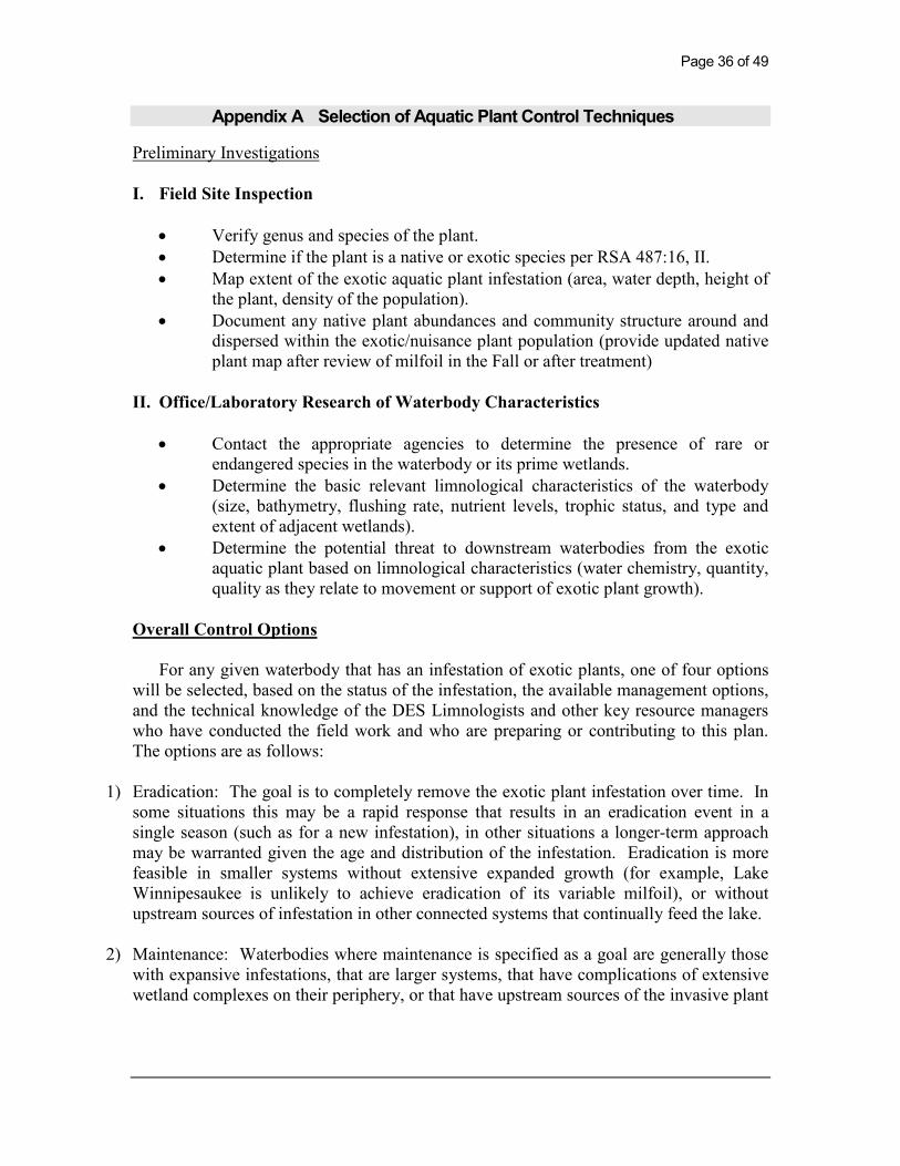
Appendix A Selection of Aquatic Plant Control Techniques
Preliminary Investigations
I. Field Site Inspection
• Verify genus and species of the plant.
• Determine if the plant is a native or exotic species per RSA 487:16, II.
• Map extent of the exotic aquatic plant infestation (area, water depth, height of
the plant, density of the population).
• Document any native plant abundances and community structure around and
dispersed within the exotic/nuisance plant population (provide updated native
plant map after review of milfoil in the Fall or after treatment)
II. Office/Laboratory Research of Waterbody Characteristics
• Contact the appropriate agencies to determine the presence of rare or
endangered species in the waterbody or its prime wetlands.
• Determine the basic relevant limnological characteristics of the waterbody
(size, bathymetry, flushing rate, nutrient levels, trophic status, and type and
extent of adjacent wetlands).
• Determine the potential threat to downstream waterbodies from the exotic
aquatic plant based on limnological characteristics (water chemistry, quantity,
quality as they relate to movement or support of exotic plant growth).
Overall Control Options
For any given waterbody that has an infestation of exotic plants, one of four options
will be selected, based on the status of the infestation, the available management options,
and the technical knowledge of the DES Limnologists and other key resource managers
who have conducted the field work and who are preparing or contributing to this plan.
The options are as follows:
1) Eradication: The goal is to completely remove the exotic plant infestation over time. In
some situations this may be a rapid response that results in an eradication event in a
single season (such as for a new infestation), in other situations a longer-term approach
may be warranted given the age and distribution of the infestation. Eradication is more
feasible in smaller systems without extensive expanded growth (for example, Lake
Winnipesaukee is unlikely to achieve eradication of its variable milfoil), or without
upstream sources of infestation in other connected systems that continually feed the lake.
2) Maintenance: Waterbodies where maintenance is specified as a goal are generally those
with expansive infestations, that are larger systems, that have complications of extensive
wetland complexes on their periphery, or that have upstream sources of the invasive plant

precluding the possibility for eradication. For waterbodies where maintenance is the
goal, control activities will be performed on the waterbody to keep an infestation below a
desirable threshold. For maintenance projects, thresholds of percent cover or other
measurable classification will be indicated, and action will occur when exotic plant
growth exceeds the threshold.
3) Containment: The aim of this approach is to limit the size and extent of the existing
infestation within an infested waterbody if it is localized in one portion of that waterbody
(such as in a cove or embayment), or if a whole lake is infested action may be taken to
prevent the downstream migration of fragments or propagules. This could be achieved
through the use of fragment barriers and/or Restricted Use Areas or other such physical
means of containment. Other control activities may also be used to reduce the infestation
within the containment area.
4) No action. If the infestation is too large, spreading too quickly, and past management
strategies have proven ineffective at controlling the target exotic aquatic plant, DES, in
consultation with others, may elect to recommend ‘no action’ at a particular site.
Feasibility of control or control options may be revisited if new information,
technologies, etc., develop.
If eradication, maintenance or containment is the recommended option to pursue,
the following series of control techniques may be employed. The most appropriate
technique(s) based on the determinations of the preliminary investigation will be selected.
Guidelines and requirements of each control practice are suggested and detailed
below each alternative, but note that site specific conditions will be factored into the
evaluation and recommendation of use on each individual waterbody with an infestation.
A. Hand-Pulling and Diver-Assisted Suction Harvesting
• Hand-pulling can be used if infestation is in a small localized area (sparsely
populated patch of up to 5’ X 5’, single stems, or dense small patch up to 2’ X 2’).
For larger areas Diver-Assisted Suction Harvesting (DASH) may be more
appropriate.
• Can be used if plant density is low, or if target plant is scattered and not dense.
• Can be used if the plant could effectively be managed or eradicated by hand-
pulling or DASH
• Use must be in compliance with the Wetlands Bureau rules.
B. Mechanically Harvest or Hydro-Rake
• Can not be used on plants which reproduce vegetatively by fragmentation (e.g.,
milfoil, fanwort, etc.) unless containment can be ensured.
• Can be used only if the waterbody is accessible to machinery.

Page 38 of 49
• Can be used if there is a disposal location available for harvested plant materials.
• Can be used if plant depth is conducive to harvesting capabilities (~ <7 ft. for
mower, ~ <12 ft. for hydro-rake).
• If a waterbody is fully infested and no other control options are effective,
mechanical harvesting can be used to open navigation channel(s) through dense
plant growth.
C. Herbicide Treatment
• Can be used if application of herbicide is conducted in areas where alternative
control techniques are not optimum due to depth, current, use, or density and type
of plant.
• Can be used for treatment of exotic plants where fragmentation is a high concern.
• Can be used where species specific treatment is necessary due to the need to
manage other plants
• Can be used if other methods used as first choices in the past have not been
effective.
• A licensed applicator should be contacted to inspect the site and make
recommendations about the effectiveness of herbicide treatment as compared with
other treatments.
D. Restricted Use Areas (per RSA 487:17, II (d))
• Can be established in an area that effectively restricts use to a small cove, bay, or
other such area where navigation, fishing, and other transient activities may cause
fragmentation to occur.
• Can not be used when there are several “patches” of an infestation of exotic
aquatic plants throughout a waterbody.
• Can be used as a temporary means of control.
E. Bottom Barrier
• Can be used in small areas, preferably less than 10,000 sq. ft.
• Can be used in an area where the current is not likely to cause the displacement of
the barrier.
• Can be used early in the season before the plant reaches the surface of the water.
• Can be used in an area to compress plants to allow for clear passage of boat
traffic.
• Can be used in an area to compress plants to allow for a clear swimming area.
• Use must be in compliance with the Wetlands Bureau rules.
F. Drawdown
• Can be used if the target plant(s) are susceptible to drawdown control.

• Can be used in an area where bathymetry of the waterbody would be conducive to
an adequate level of drawdown to control plant growth, but where extensive deep
habits exist for the maintenance of aquatic life such as fish and amphibians.
• Can be used where plants are growing exclusively in shallow waters where a
drawdown would leave this area “in the dry” for a suitable period of time (over
winter months) to control plant growth.
• Can be used in winter months to avoid encroachment of terrestrial plants into the
aquatic system.
• Can be used if it will not significantly impact adjacent or downstream wetland
habitats.
• Can be used if spring recharge is sufficient to refill the lake in the spring.
• Can be used in an area where shallow wells would not be significantly impacted.
• Reference RSA 211:11 with regards to drawdown statutes.
G. Dredge
• Can be used in conjunction with a scheduled drawdown.
• Can be used if a drawdown is not scheduled, though a hydraulic pumping dredge
should be used.
• Can only be used as a last alternative due to the detrimental impacts to
environmental and aesthetic values of the waterbody.
H. Biological Control
• Grass carp cannot be used as they are illegal in New Hampshire.
• Exotic controls, such as insects, cannot be introduced to control a nuisance plant
unless approved by Department of Agriculture.
• Research should be conducted on a potential biological control prior to use to
determine the extent of target specificity.

Page 40 of 49
Appendix B Summary of Control Practices Used NH
Restricted Use Areas and Fragment Barrier:
Restricted Use Areas (RUAs) are a tool that can be use to quarantine a portion
of a waterbody if an infestation of exotic aquatic plants is isolated to a small
cove, embayment, or section of a waterbody. RUAs generally consist of a
series of buoys and ropes or nets connecting the buoys to establish an
enclosure (or exclosure) to protect an infested area from disturbance. RUAs
can be used to prevent access to these infested areas while control practices
are being done, and provide the benefit of restricting boating, fishing, and
other recreational activities within these areas, so as to prevent fragmentation
and spread of the plants outside of the RUA.
Hand-pulling:
Hand-pulling exotic aquatic plants is a technique used on both new and existing
infestations, as circumstances allow. For this technique divers carefully hand-
remove the shoots and roots of plants from infested areas and place the plant
material in mesh dive bags for collect and disposal. This technique is suited to
small patches or areas of low density exotic plant coverage.
For a new infestation, hand-pulling activities are typically conducted several
times during the first season, with follow-up inspections for the next 1-2 years
or until no re-growth is observed. For existing infestations, hand-pulling may be
done to slow the expansion of plant establishment in a new area or where new
stems are removed in a section that may have previously been uninfested. It is
often a follow-up technique that is included in most management plans.
In 2007 a new program was created through a cooperative between a volunteer
monitor that is a certified dive instructor, and the DES Exotic Species Program.
A Weed Control Diver Course (WCD) was developed and approved through
the Professional Association of Dive Instructors (PADI) to expand the number
of certified divers available to assist with hand-pulling activities. DES has only
four certified divers in the Limnology Center to handle problems with aquatic
plants, and more help was needed. There is a unique skill involved with hand-
removing plants from the lake bottom. If the process is not conducted correctly,
fragments could spread to other waterbody locations. For this reason, training
and certification are needed to help ensure success. Roughly 100 divers were
certified through this program through the 2010 season. DES maintains a list of
WCD divers and shares them with waterbody groups and municipalities that
seek diver assistance for controlling exotic aquatic plants. Classes are offered
two to three times per summer.

Diver Assisted Suction Harvesting
Diver Assisted Suction Harvesting (DASH) is an emerging and evolving
control technique in New Hampshire. The technique employs divers that
perform hand removal actions as described above, however, instead of using a
dive bag a mechanical suction device is used to entrain the plants and bring
them topside where a tender accumulates and bags the material for disposal.
Because of this variation divers are able to work in moderately dense stands of
plants that cover more bottom area, with increased efficiency and accuracy.
Mechanical Harvesting
The process of mechanical harvesting is conducted by using machines which
cut and collect aquatic plants. These machines can cut the plants up to twelve
feet below the water surface. The weeds are cut and then collected by the
harvester or other separate conveyer-belt driven device where they are stored
in the harvester or barge, and then transferred to an upland site.
The advantages of this type of weed control are that cutting and harvesting
immediately opens an area such as boat lanes, and it removes the upper
portion of the plants. Due to the size of the equipment, mechanical harvesting
is limited to water areas of sufficient size and depth. It is important to
remember that mechanical harvesting can leave plant fragments in the water,
which if not collected, may spread the plant to new areas. Additionally
harvesters may impact fish and insect populations in the area by removing
them in harvested material. Cutting plant stems too close to the bottom can
result in re-suspension of bottom sediments and nutrients. This management
option is only recommended when nearly the entire waterbody is infested, and
harvesting is needed to open navigation channels through the infested areas.
Benthic Barriers:
Benthic barriers are fiberglass coated screening material that can be applied
directly to the lake bottom to cover and compress aquatic plant growth.
Screening is staked or weighted to the bottom to prevent it from becoming
buoyant or drifting with current. The barriers also serve to block sunlight and
prevent photosynthesis by the plants, thereby killing the plants with time. While
a reliable method for small areas of plants (roughly 100 sq. ft. or less), larger
areas are not reasonably controlled with this method due to a variety of factors
(labor intensive installation, cost, and gas accumulation and bubbling beneath the
barrier).
Targeted Application of Herbicides:
Application of aquatic herbicides is another tool employed for controlling
exotic aquatic plants. Generally, herbicides are used when infestations are too

Page 42 of 49
large to be controlled using other alternative non-chemical controls, or if other
techniques have been tried and have proven unsuccessful. Each aquatic plant
responds differently to different herbicides and concentrations of herbicides,
but research performed by the Army Corps of Engineers has isolated target
specificity of a variety of aquatic herbicides for different species.
Generally, 2,4-D (Navigate formulation) is the herbicide that is recommended
for control of variable milfoil. Based on laboratory data this is the most
effective herbicide in selectively controlling variable milfoil in New
Hampshire’s waterbodies.
A field trial was performed during the 2008 summer using the herbicide
Renovate to control variable milfoil. Renovate is a systemic aquatic herbicide
that targets both the shoots and the roots of the target plant for complete
control. In this application it was dispersed as a granular formulation that sank
quickly to the bottom to areas of active uptake of the milfoil plants. A small
(<5 acre) area of Captains Pond in Salem was treated with this systemic
herbicide. The herbicide was applied in pellet form to the infested area in May
2008, and showed good control by the end of the growing season. Renovate
works a little more slowly to control aquatic plants than 2,4-D and it is a little
more expensive, but presents DES with another alternative that could be used in
future treatments.
During the summer of 2010, DES worked with other researchers to
perform field trials of three different formulations of 2,4-D in Lake
Winnisquam, to determine which product was most target-specific to the
variable milfoil. Navigate formulation was used, as were a 2,4-D amine
formulation, and a 2,4-D amine and triclopyr formulation (MaxG). Although
the final report has not been completed for this study, preliminary results
suggest that all three products worked well, but that Navigate formation may be
the most target specific of all three.
Another herbicide, Fluridone, is sometimes also used in New
Hampshire, mainly to control growths of fanwort (Cabomba caroliniana).
Fluridone is a systemic aquatic herbicide that inhibits the formation of
carotenoids in plants. Reduced carotenoids pigment ultimately results in the
breakdown of chlorophyll and subsequent loss of photosynthetic function of the
plants.
Other aquatic herbicides are also used in New Hampshire when
appropriate (glyphosate, copper compounds, etc). The product of choice will
be recommended based on what the target species is, and other waterbody-
specific characteristics that are important to consider when selecting a product.

Extended Drawdown
Extended drawdown serves to expose submersed aquatic plants to dessication
and scouring from ice (if in winter), physically breaking down plant tissue.
Some species can respond well to drawdown and plant density can be reduced,
but for invasive species drawdown tends to yield more disturbance to bottom
sediments, something to which exotic plants are most adapted. In waterbodies
where drawdown is conducted exotic plants can often outcompete native plants
for habitat and come to dominate the system.
Some waterbodies that are heavily infested with exotic plants do conduct
drawdowns to reduce some of the invasive aquatic plant density. During this
reporting period both Northwood Lake (Northwood) and Jones Pond (New
Durham) coordinated deep winter drawdowns to reduce growths of variable
milfoil (the drawdown on Northwood Lake is primarily for flood control
purposes, but they do see some ancillary benefits from the technique for
variable milfoil control).
Dredging
Dredging is a means of physical removal of aquatic plants from the bottom
sediments using a floating or land-based dredge. Dredging can create a
variety of depth gradients creating multiple plant environments allowing for
greater diversity in lakes plant, fish, and wildlife communities. However due
to the cost, potential environmental effects, and the problem of sediment
disposal, dredging is rarely used for control of aquatic vegetation alone.
Dredging can take place in to fashion, including drawdown followed by
mechanical dredging using an excavator, or using a diver-operated suction
dredge while the water level remains up.
Biological Control
There are no approved biological controls for submersed exotic aquatic plant
at this time in New Hampshire.
Page 44 of 49
Appendix C Survey Methods/Map for Local Divers
Submerged Plant Diver Survey
Standard Operating Procedure (SOP)
Purpose: To safely transport divers or snorkelers around a waterbody to
survey and mark submerged exotic plants.
Method I. Line Transect Diver Towing
Equipment:
Motor driven watercraft, rope, dive flag, SCUBA or snorkeling gear, compass,
depth chart and map of the waterbody.
Boat Configuration: The safest configuration for this activity is a boat operating in reverse. Having
both a spotter on the bow and driver on board is the optimal configuration;
however it is possible to have only a driver because of the low speed of the
activity. It is also recommended the boat display a dive flag.
Methodology:
This method involves towing divers or snorkelers using a line off the bow of
the craft at headway speed. The length of the bow line should allow for
approximately 10 feet of distance between the diver/snorkeler and the boat.
Important, the driver of the boat should always have a visual of the diver
during the towing process. If snorkelers are used then slower speeds have to
be maintained so they retain the ability to breathe comfortably. If any
difficulties are encountered; the divers/snorkelers are free to let go of the boat
safely and deal with it, all divers/snorkerlers should wear a wet suit or some
other buoyancy device for safety purposes. Each person in the water should
have their own separate tow line, and if more than one person is used then the
lines should be tied to separate locations across the bow so separation in the
water is maintained.
Transects:
Transects are usually performed on large expanses of the lake or pond’s photic
zone (zone of light penetration to bottom sediments). Small areas can be done
by divers or snorkelers swimming on their own. The distance between
transects is determined by the people in the water as viewing conditions will
vary depending on the weather and water conditions of the day. Two people
in the water will allow for wider transects as each person can view one side of
the boat. After the first trial transect a conversation between the driver and
diver(s) will set a reasonable transect distance to be followed for that day.
Straight line transects: An onboard compass or digital device with compass
capabilities will aid in running straight lines and making parallel transects.
Fixed objects along the shoreline can be used in the absence of such devices.
Contour line transects: First establish the depth at which observation from a
boat can no longer be considered dependable. Then using a depth sounding
unit navigate with the diver along that depth contour following the shoreline.
In areas where the depth does not change over a short distance multiple
transects within the same depth contour may be needed (straight line transects
may work better in these type of areas).
Marking Exotics:
A GPS unit operated by the driver of the boat (or ideally the observer who is
watching the diver) is used to mark the location of exotics growth after they
are found by the divers. When an exotic species is spotted the diver(s) let go
of the tow line and position themselves over the area of growth. The driver
slowly navigates back to the diver and marks the spot(s) found with sufficient
waypoints before proceeding. A “mapping” GPS unit with a daylight readable
screen would be helpful here as the unit could display transects on screen map
as well as any waypoints marked; this would assist the driver in properly
covering the area. In lieu of this any GPS unit capable of storing and
downloading waypoints can be used.
Pros and Cons:
Pros: Can cover a larger area and in far less time than a diver swimming can.
Cons: Often spend time over areas where exotics are known not to be
established, when doing straight line transects.
Hard to do during high wind or wave days due to water entering the boat over
the stern when backing into waves, as well ass difficultly in navigating in
reverse.
Method II: Line Transects with Swimming Divers (divers under their
own power)
Note: DES does not recommend any of the following on an individual basis;
therefore, for safety reasons a dive team consisting of at least two persons is
recommended.
Equipment:

Page 46 of 49
SCUBA gear and or snorkel equipment, floatation devices, waterproof
compass, dive flag, dive bag with markers, GPS unit. Optional equipment:
canoe, kayak, or other type of watercraft.
Configuration:
Swimmers parallel to each other, always within visual distance of each other.
Methodology:
As with the boat tow method above, swimmers can do either straight line
transects or depth contour transects. One person is tasked with control of the
dive flag; this should be displayed consistently (towed along with the
swimmers) for safety reasons. The swimmers follow either a compass heading
or a contour line and swim parallel to one another. Once again in the absence
of a compass fixed object on the shoreline may be used as guides. Multiple
transects may be needed in areas of very shallow slopes.
Marking Exotics:
When an exotic species is observed the swimmer stops and by visual contact
signals the other swimmer to do the same. A marker is placed by the growth to
be GPS’ed at a later time, unless team size allows for a person not in the water
to establish that point concurrently with a marker or GPS unit. Swimmers then
resume their transect lines marking all locations necessary, until they run out
of markers or they come to the end the transect.
Pros and Cons:
Pros: More coverage in a single transect than one diver, the more swimmers
the wider the coverage. A great method for short to moderate lengths of
shoreline area that have steep gradients, or in areas where boulders or other
obstructions make boat or diver tow surveys a challenge.
Cons: More time and physical effort involved
Method III: Block Swimming
Note: DES does not recommend this approach be done by a single individual,
for safety reasons; therefore, a dive team of two or more divers is
recommended.
Equipment:
SCUBA equipment, dive flag, waterproof compass, weed markers, flagging
markers or stationary objects on shore for reference, GPS unit. Optional
equipment: canoe, kayak, small boat.
Methodology:

One person is tasked with control of the dive flag; this should be displayed
consistently (towed along with the swimmers) for safety reasons. If the survey
block is small enough the diver flag can be placed in the middle of the survey
area. Using a reference point on shore as a starting point the divers swim
straight out from shore. Using a compass heading they maintain a straight line
transect. They swim parallel to each other and maintain visual contact. They
swim straight out until they come to the pre determined limiting depth, or the
depth at which no plant growth is occurring. They then pivot about the
internal diver and head back into shore (or pre determined depth near shore)
on the opposite compass heading. Upon attaining the pre determined shallow
depth or the shore they once again pivot on the inside person and head back
out on the original compass heading. They continue this pattern until they
come to the end of the block or the second reference point on shore.
Marking Exotics:
When an exotic species is observed the swimmer stops and by visual contact
signals the other swimmer to do the same. A marker is placed by the growth to
be GPS’ed at a later time, unless team size allows for a person not in the water
to establish that point concurrently. Swimmers then resume there transect
lines marking all locations necessary, until they run out of markers or come to
the end of the box.
Pros and Cons:
Pros: Good way to make sure the entire photic zone is covered in an area.
Best method in small areas.
Cons: More time and physical effort involved.

Page 48 of 49
Figure 8: Recommended Milfoil Survey Strategies by Area

References
Department of Environmental Services. 2006: 2006 Section 305(b) and
303(d) Consolidated Assessment and Listing Methodology. November 2005.
New Hampshire Department of Environmental Services. NHDES-R-WD-05-
29. Available at http://des.nh.gov/WMB/swqa/calm.html
Halstead, J.M., J. Michaud, S. Hallas-Burt, and J.P. Gibbs. 2003. “An
Hedonic Analysis of Effects of a Nonative Invader (Myriophyllum
heterophyllum) on New Hampshire (USA) Lakefront
Properties.” Environmental Management. 32 (3): 391 – 398
Luken, J.O. and J.W. Thieret. 1997. Assessment and Management of Plant
Invasions. Springer-Verlag, New York. 324 pages.
Netherland, M.D. 2010. Evaluation of the Seed Viability of Variable Milfoil
(Myriophyllum heterophyllum) as a Potential Source for Plant Recovery
Following Management with Herbicides. U.S. Army Engineer Research
Development Center. Final Project Report (draft manuscript for publication
currently confidential).