Embed Size (px)
Citation preview

Longitude and LatitudeLongitude and Latitude
Stephanie MorganStephanie Morgan
ED 629ED 629
Latitude and LongitudeLatitude and Longitude
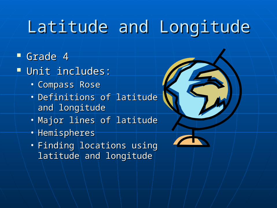
Grade 4Grade 4 Unit includes:Unit includes:
• Compass RoseCompass Rose• Definitions of latitude Definitions of latitude
and longitudeand longitude• Major lines of latitudeMajor lines of latitude• HemispheresHemispheres• Finding locations using Finding locations using
latitude and longitudelatitude and longitude

ObjectivesObjectives Students will be able to identify lines of Students will be able to identify lines of
latitude on a map including latitude on a map including • EquatorEquator• North Pole North Pole • South PoleSouth Pole• Antarctic CircleAntarctic Circle• Tropic of CancerTropic of Cancer• Arctic CircleArctic Circle• Tropic of Capricorn. Tropic of Capricorn.
Students will be able to identify lines of Students will be able to identify lines of longitude on a map includinglongitude on a map including• Prime MeridianPrime Meridian

ObjectivesObjectives
Students will be able to locate all Students will be able to locate all four hemispheres including four hemispheres including • Northern HemisphereNorthern Hemisphere• Southern HemisphereSouthern Hemisphere• Eastern HemisphereEastern Hemisphere• Western HemisphereWestern Hemisphere
Students will be able to identify Students will be able to identify which line divides the earth into the which line divides the earth into the correct hemispheres. correct hemispheres.
Students will be able to find locations Students will be able to find locations on map using longitude and latitude.on map using longitude and latitude.

MaterialsMaterials Compass Rose WorksheetCompass Rose Worksheet GlobeGlobe World MapWorld Map Latitude WorksheetLatitude Worksheet Longitude WorksheetLongitude Worksheet Different colors of yarnDifferent colors of yarn ScissorsScissors Matching Note cardsMatching Note cards Map of world showing latitude and Map of world showing latitude and
longitudelongitude Globe Bingo WorksheetGlobe Bingo Worksheet SkittlesSkittles Student mindsStudent minds

ActivitiesActivities Compass Rose Map HuntCompass Rose Map Hunt Latitude and Longitude WorksheetLatitude and Longitude Worksheet Signing Latitude and LongitudeSigning Latitude and Longitude Yarning about Latitude and LongitudeYarning about Latitude and Longitude Match Latitude and LongitudeMatch Latitude and Longitude Major lines of latitude worksheetMajor lines of latitude worksheet Globe Says…activity about major lines of Globe Says…activity about major lines of
latitudelatitude Globe BingoGlobe Bingo

Pre-AssessmentPre-Assessment
Can you…Can you…• draw and label a compass rose?draw and label a compass rose?• identify the Equator and Prime Meridian on a identify the Equator and Prime Meridian on a
map?map?• label all the major lines of latitude on a map?label all the major lines of latitude on a map?• Identify what line of latitude divides the earth Identify what line of latitude divides the earth
into the Northern and Southern Hemisphere? Can into the Northern and Southern Hemisphere? Can you identify these hemispheres on a map?you identify these hemispheres on a map?
• Identify what line of longitude divides the earth Identify what line of longitude divides the earth into the Western and Eastern Hemisphere? Can into the Western and Eastern Hemisphere? Can you identify these hemispheres on a mapyou identify these hemispheres on a map??

Compass Rose Map HuntCompass Rose Map Hunt
Students will draw and label a Students will draw and label a compass rose.compass rose.
Students will discuss why a Students will discuss why a compass rose is important.compass rose is important.
Students will locate cardinal Students will locate cardinal roses on various types of maps. roses on various types of maps.
Students will discuss what a Students will discuss what a compass rose is used for and compass rose is used for and who uses a compass rose.who uses a compass rose.
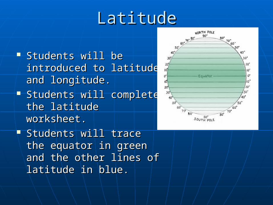
LatitudeLatitude
Students will be Students will be introduced to latitude introduced to latitude and longitude.and longitude.
Students will complete Students will complete the latitude worksheet. the latitude worksheet.
Students will trace the Students will trace the equator in green and the equator in green and the other lines of latitude in other lines of latitude in blue.blue.

Signing LatitudeSigning Latitude
Latitude:Latitude:• ““I'm climbing the I'm climbing the
Ladder of latitudes, Ladder of latitudes, latitudes, latitudes. latitudes, latitudes.
I'm climbing the ladder I'm climbing the ladder of latitudes, all around of latitudes, all around the world.”the world.”

LongitudeLongitude Students will be Students will be
introduced to longitude introduced to longitude by looking at the globe.by looking at the globe.
Students will complete Students will complete the lines of longitude the lines of longitude worksheet.worksheet.
Students will trace the Students will trace the Prime Meridian in Prime Meridian in orange and the other orange and the other lines of longitude in lines of longitude in yellow.yellow.

Signing LongitudeSigning Longitude
Longitude:Longitude:• ““It's a LONG, LONG It's a LONG, LONG
way from pole to pole, way from pole to pole, pole to pole, pole to pole to pole, pole to polepoleIt's a LONG, LONG way It's a LONG, LONG way from pole to pole, so from pole to pole, so we call those we call those LONGITUDES.”LONGITUDES.”

““Yarning about Latitude and Yarning about Latitude and Longitude”Longitude”
Students will participate in making a globeStudents will participate in making a globe Four students will be in North, South, East, and Four students will be in North, South, East, and
West positionsWest positions Different colors of yarn will makeDifferent colors of yarn will make
• Lines of latitudeLines of latitude• Lines of longitudeLines of longitude• EquatorEquator• Prime MeridianPrime Meridian• North PoleNorth Pole• South PoleSouth Pole

Match Longitude and LatitudeMatch Longitude and Latitude
Another name for lines of longitude
MeridiansStates that border Ohio
Indiana, Michigan,
Pennsylvania, West Virginia,
Kentucky
Direction that meridians run
North and SouthThe four cardinal
directions North, East,
South, West
Direction that parallels
run
East and West South Pole 90 S
Another name for lines of
latitudeParallels North Pole 90 N
Major line of latitude at 0
EquatorEquator divides
Earth into
Northern Hemisphere and
Southern Hemisphere
Major line of longitude at
0Prime Meridian
Prime Meridian divides Earth
into
Eastern Hemisphere and
Western Hemisphere

Major lines of LatitudeMajor lines of Latitude
Students will do the Major Students will do the Major lines of latitude worksheet. lines of latitude worksheet.
Students will locate the Students will locate the major lines of latitude on major lines of latitude on the map.the map.
Students will identify the Students will identify the latitude degree of each latitude degree of each major line of latitude.major line of latitude.
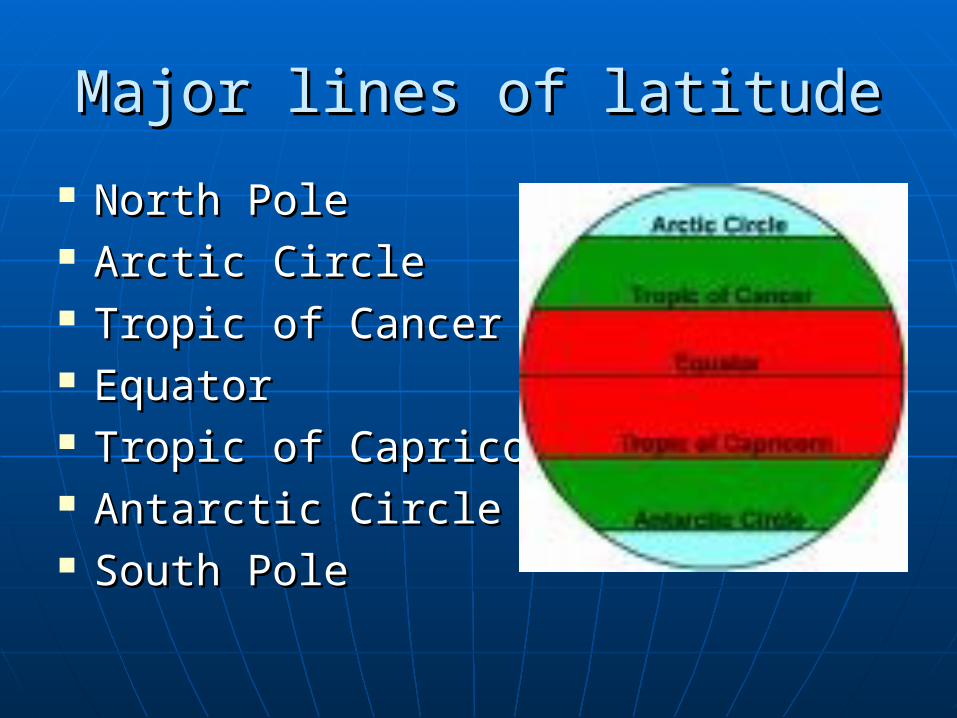
Major lines of latitudeMajor lines of latitude
North PoleNorth Pole Arctic CircleArctic Circle Tropic of CancerTropic of Cancer EquatorEquator Tropic of CapricornTropic of Capricorn Antarctic CircleAntarctic Circle South PoleSouth Pole

Globe Says…Globe Says…
• North PoleNorth Pole• Arctic CircleArctic Circle• Tropic of CancerTropic of Cancer• EquatorEquator• Tropic of CapricornTropic of Capricorn• Antarctic CircleAntarctic Circle• South PoleSouth Pole
Students will complete the worksheet on the Students will complete the worksheet on the major lines of latitudemajor lines of latitude

Globe SaysGlobe Says
After learning the major lines of latitude After learning the major lines of latitude students will perform Globe says….students will perform Globe says….• Body parts represent the major lines of latitudeBody parts represent the major lines of latitude
Top of head – North PoleTop of head – North Pole Ears – Arctic CircleEars – Arctic Circle Shoulders – Tropic of CancerShoulders – Tropic of Cancer Waist – EquatorWaist – Equator Knees – Tropic of CapricornKnees – Tropic of Capricorn Shins – Antarctic CircleShins – Antarctic Circle Toes – South PoleToes – South Pole

Globe BingoGlobe Bingo
To review, students To review, students will be given a will be given a Blank Globe Bingo Blank Globe Bingo Worksheet. Worksheet.
Students will fill in Students will fill in the sheet before the sheet before the next day’s the next day’s class.class.

Globe BingoGlobe Bingo
G L O B E
Word List
Equator Prime Meridian North Pole South Pole
Meridians Parallels East and West Cardinal Rose
Tropic of Cancer Antarctic Circle North and South East
Arctic Circle Tropic of Capricorn Northern Hemisphere Southern Hemisphere

AssessmentAssessment
Students should be able to:Students should be able to:• Draw and label a Compass RoseDraw and label a Compass Rose• Identify the major lines of latitude and Identify the major lines of latitude and
longitude on a maplongitude on a map• Correctly label all four Hemispheres on a Correctly label all four Hemispheres on a
mapmap• Find locations on a map usingFind locations on a map using
latitude and longitudelatitude and longitude

Websites for StudentsWebsites for Students Social Studies for Kids: Basic GeographySocial Studies for Kids: Basic Geography
http://www.socialstudiesforkids.com/articles/geography/latitudelongitude.htm
BoatSafeKids: How are flat charts and maps made BoatSafeKids: How are flat charts and maps made of our round planet?of our round planet?http://www.boatsafe.com/kids/mercator.htm
Interactive Latitude and LongitudeInteractive Latitude and Longitude
http://www.geovista.psu.edu/grants/MapStatsKids/MSK_portal/concepts_latlg.html
Map Stats for KidsMap Stats for Kidshttp://www.eduplace.com/kids/socsci/books/http://www.eduplace.com/kids/socsci/books/applications/imaps/maps/g3_u6/index.htmlapplications/imaps/maps/g3_u6/index.html

Websites for TeachersWebsites for Teachers Geography Classroom Game Geography Classroom Game
http://geography.about.com/od/teachgeography/a/classlatithttp://geography.about.com/od/teachgeography/a/classlatitude.htmude.htm
Great Teaching ToolsGreat Teaching Toolshttp://www.classbrain.com/artteach/publish/http://www.classbrain.com/artteach/publish/article_108.shtmlarticle_108.shtml
Latitude and LongitudeLatitude and Longitudehttp://www.nationalgeographic.com/xpeditions/activities/http://www.nationalgeographic.com/xpeditions/activities/01/popup/lat_long.html01/popup/lat_long.html
Yarning about Latitude and LongitudeYarning about Latitude and Longitudehttp://www.education-world.com/a_tsl/archives/02-1/http://www.education-world.com/a_tsl/archives/02-1/lesson043.shtmllesson043.shtml