Embed Size (px)
Citation preview
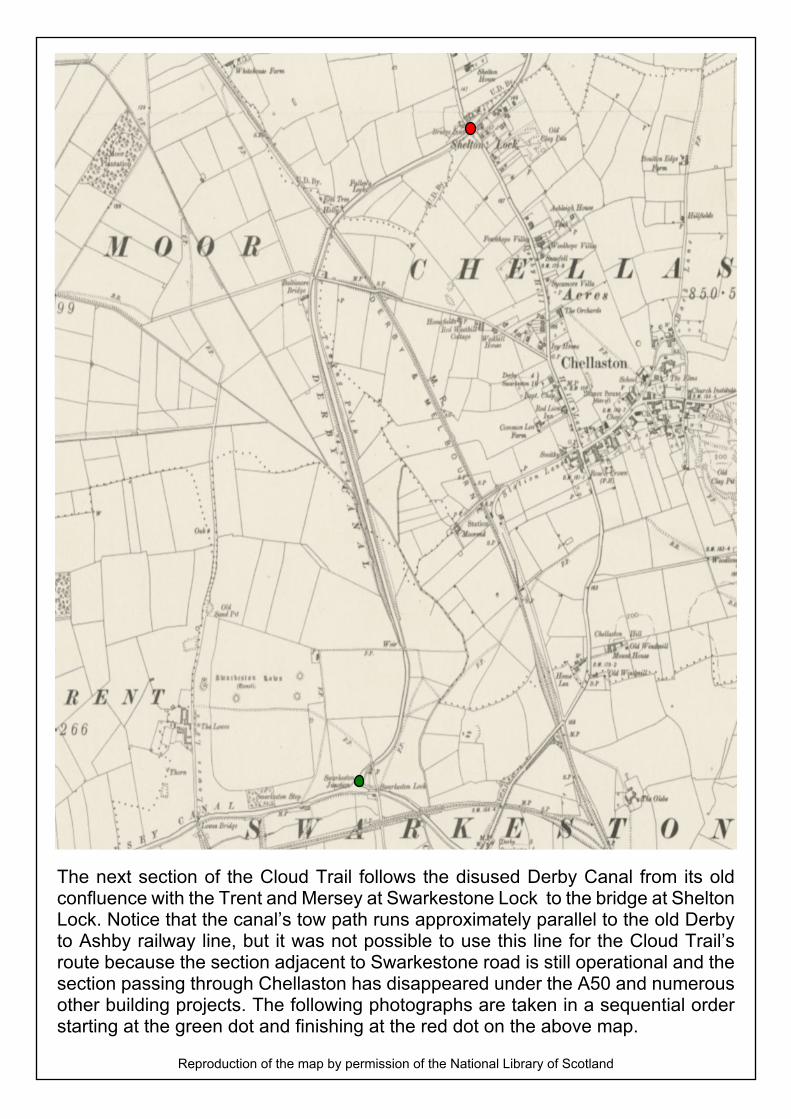
The next section of the Cloud Trail follows the disused Derby Canal from its oldconfluence with the Trent and Mersey at Swarkestone Lock to the bridge at SheltonLock. Notice that the canal’s tow path runs approximately parallel to the old Derbyto Ashby railway line, but it was not possible to use this line for the Cloud Trail’sroute because the section adjacent to Swarkestone road is still operational and thesection passing through Chellaston has disappeared under the A50 and numerousother building projects. The following photographs are taken in a sequential orderstarting at the green dot and finishing at the red dot on the above map.
Reproduction of the map by permission of the National Library of Scotland

Lowes Lock to Shelton Lock on the Derby Canal’s Tow Path
This is the trail immediately after leaving Swarkestone (Lowes) Lock. On theleft hand side of the trail, the remains of the old Derby Canal can be seen, sothe trail is really the canal’s old tow path.
Looking backwards over this initial stretch, it is possible to see a rather sadcanal bridge that straddled the Derby Canal at Swarkestone Lock. Notice thewhite gate on this and above photograph

The trail continues with the dry bed of the Derby Canal on the left and as canbe seen quite large trees have grown into the canal’s cutting.
It is very quiet and peaceful and although there is a feel of being out in thecountry, the housing estate near the Bonnie Prince is close to the trail.

Quite suddenly, the trail seems to leave the past and return to the present andthere is traffic light controlled pedestrian crossing over the road that connectsChellaston and Sinfin.
Once crossed, however, the tranquility returns and it’s hard to believe thatthere is a housing estate on the right hand side of the trail. At this point, naturehas really regained its hold on the Derby Canal.
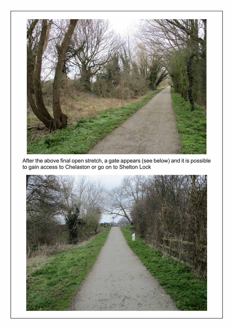
After the above final open stretch, a gate appears (see below) and it is possibleto gain access to Chelaston or go on to Shelton Lock

As the trail leads to Shelton Lock, the old Ashby to Derby railway line appearsagain and its embankment can be seen in front of the pylon.
Looking to the right, it is possible to see the railway embankment as it leftChellaston running on its route to Peartree Station.

My grandparents lived at Worthington and used the train to travel to Derby inthe 1920s. As a small boy, I remember my grandmother telling me how remoteand misty Sinfin Moor appeared from the carriage window. Remembering thatRolls-Royce and the pylons would not be there, I can understand how it wouldgive her this feeling.
Just a little further and Shelton Lock starts to appear,

Approximately, 200 metres further and the bridge at Shelton Lock appears. Itis here that the canal lock which gave Shelton Lock its full name was situated.
There is a sign near to the bridge. We are going to travel on to Alvaston andDerby.