Embed Size (px)
Citation preview
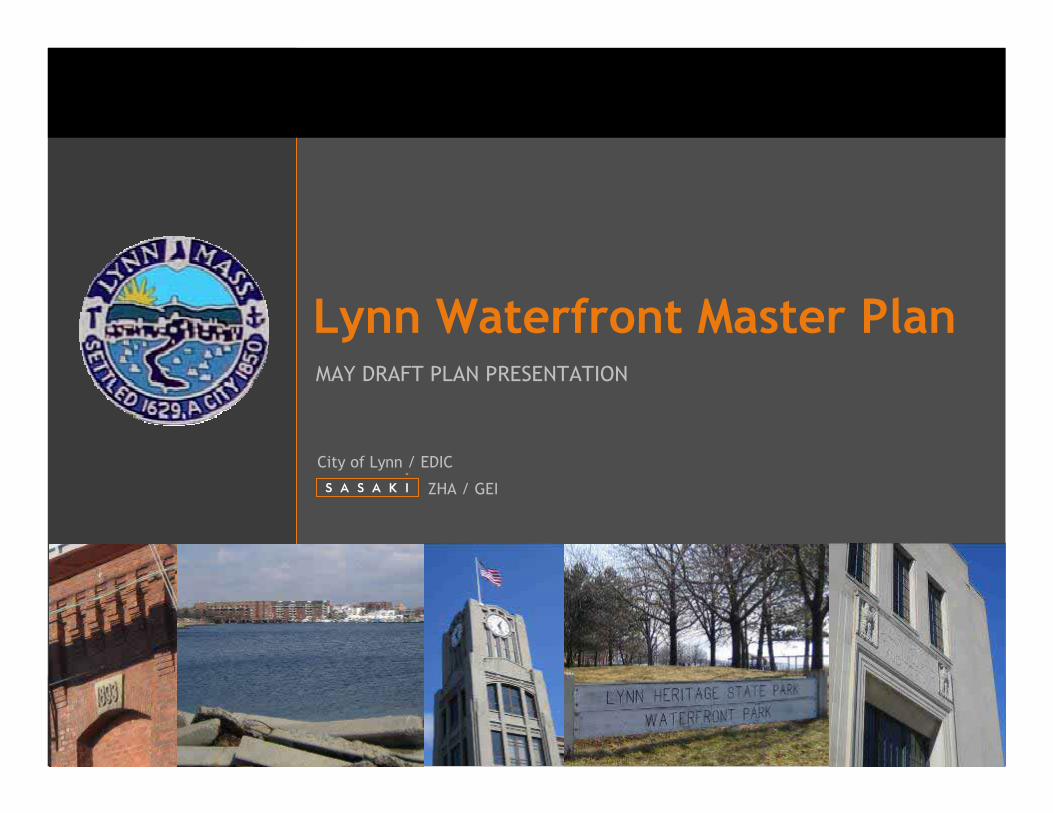
Lynn Waterfront Master PlanMAY DRAFT PLAN PRESENTATION
ZHA / GEI
City of Lynn / EDIC

Work ScheduleJune
June – September
September
October – December
December
January – April
March - April
May
May-June
June
Kick-Off
Site Analysis & Property Owner / Stakeholder Meetings
Analysis Presentation
Alternatives Development
Alternatives Presentation
Preferred Plan Refinement
Economic/Fiscal Impact
Draft Redevelopment Plan Presentation
Refine Plan/Implementation
Final Waterfront Master Plan Presentation
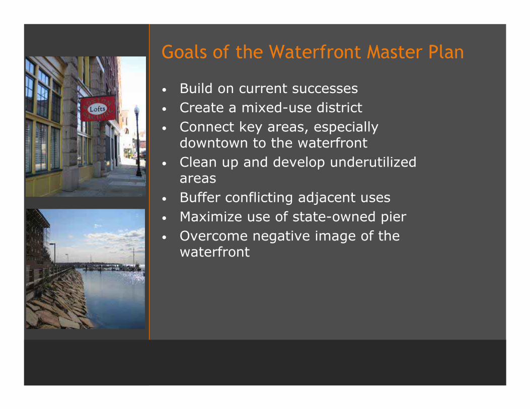
Goals of the Waterfront Master Plan
• Build on current successes• Create a mixed-use district• Connect key areas, especially
downtown to the waterfront• Clean up and develop underutilized
areas• Buffer conflicting adjacent uses• Maximize use of state-owned pier• Overcome negative image of the
waterfront

Property Owners & Stakeholder Meetings
Meetings• National Grid• Lynn Water & Sewer Commission• Representatives of the Miles/O'Brian site• Representatives of the O'Donnell site• Representative from Building 19 site & Lowe's• Mayo Group• Lynn Business Partnership Executive Committee• Mayor Clancy and Senior Staff• North Shore Community College• Representative of the Christie's Site• Interested Developers• Lynn Housing and Neighborhood Development• Department of Conservation and Recreation
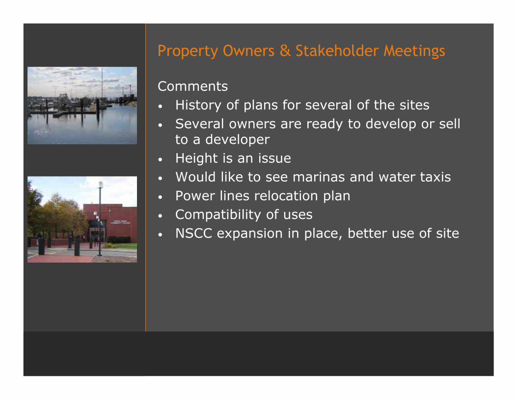
Property Owners & Stakeholder Meetings
Comments• History of plans for several of the sites• Several owners are ready to develop or sell
to a developer• Height is an issue• Would like to see marinas and water taxis• Power lines relocation plan• Compatibility of uses• NSCC expansion in place, better use of site
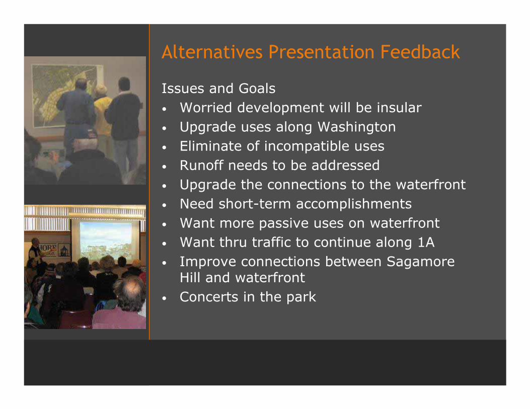
Alternatives Presentation Feedback
Issues and Goals• Worried development will be insular• Upgrade uses along Washington• Eliminate of incompatible uses• Runoff needs to be addressed• Upgrade the connections to the waterfront• Need short-term accomplishments• Want more passive uses on waterfront• Want thru traffic to continue along 1A• Improve connections between Sagamore
Hill and waterfront• Concerts in the park
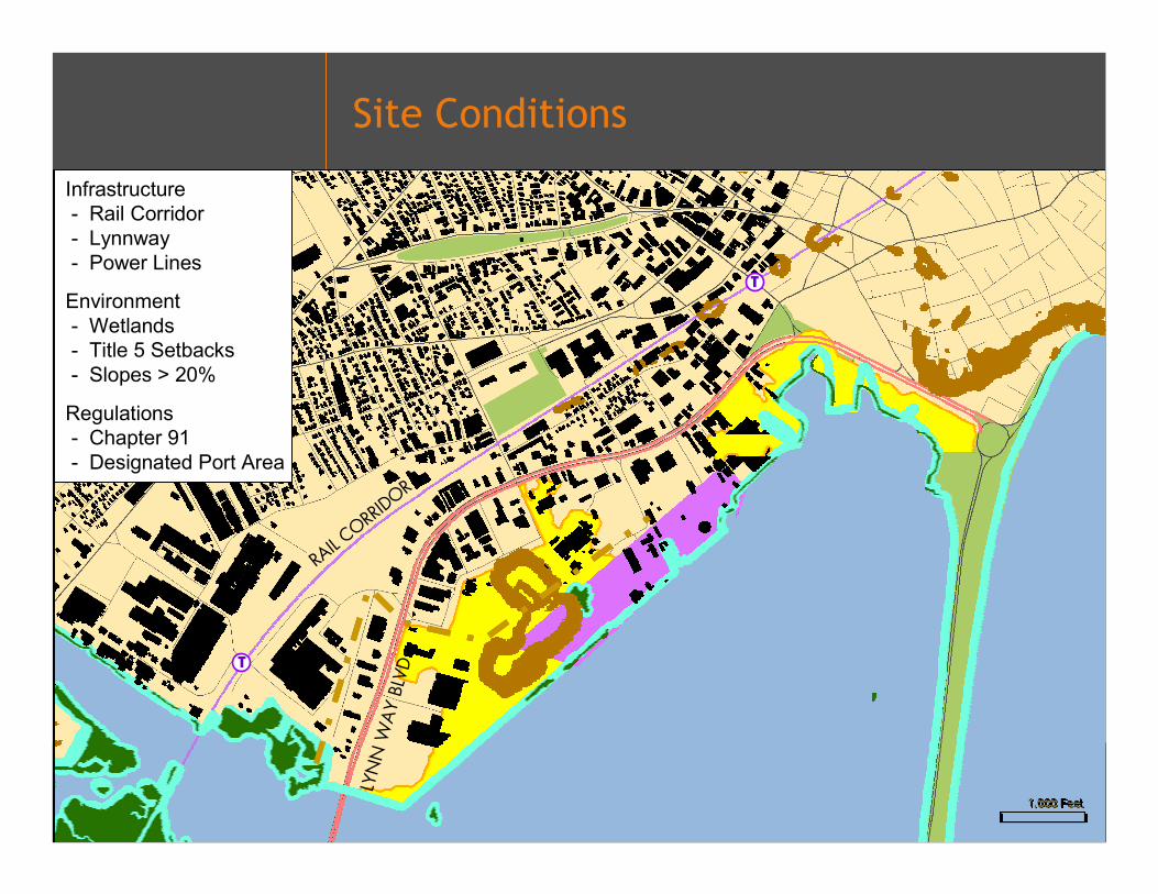
Site Conditions
LYN
N W
AY
BLVD
RAIL C
ORRIDOR
T
T
Infrastructure- Rail Corridor- Lynnway- Power Lines
Environment- Wetlands- Title 5 Setbacks- Slopes > 20%
Regulations- Chapter 91- Designated Port Area

Chapter 91 Area
• Tool for protection and promotion of public use of tidelands and other waterways
• Preserves pedestrian access along the water's edge in return for permission to develop non-water dependant projects on tidelands and provide facilities to enhance public use
• Activities requiring authorization include structures, filling, dredging, change in use, structural alteration, and demolition/removal of structures

Site Conditions
LYN
N W
AY
BLVD
RAIL C
ORRIDOR
T
T
Infrastructure- Rail Corridor- Lynnway- Power Lines
Environment- Wetlands- Title 5 Setbacks- Slopes > 20%
Regulations- Chapter 91- Designated Port Area
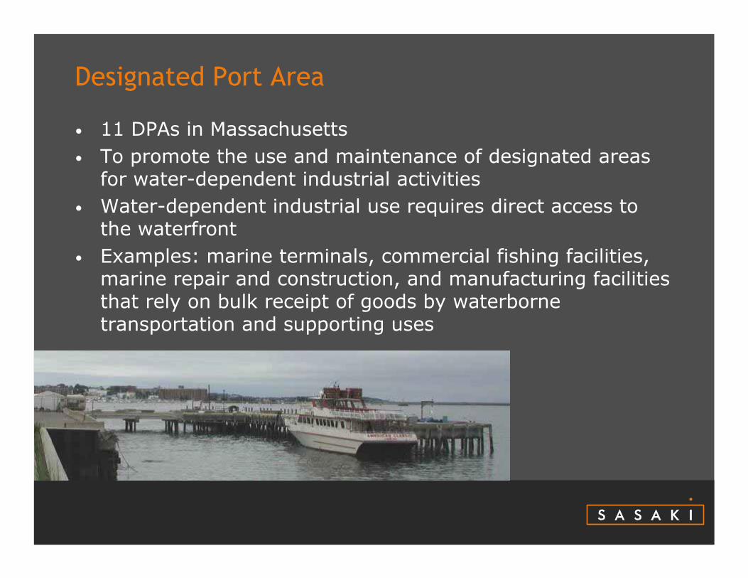
Designated Port Area
• 11 DPAs in Massachusetts • To promote the use and maintenance of designated areas
for water-dependent industrial activities• Water-dependent industrial use requires direct access to
the waterfront• Examples: marine terminals, commercial fishing facilities,
marine repair and construction, and manufacturing facilities that rely on bulk receipt of goods by waterborne transportation and supporting uses
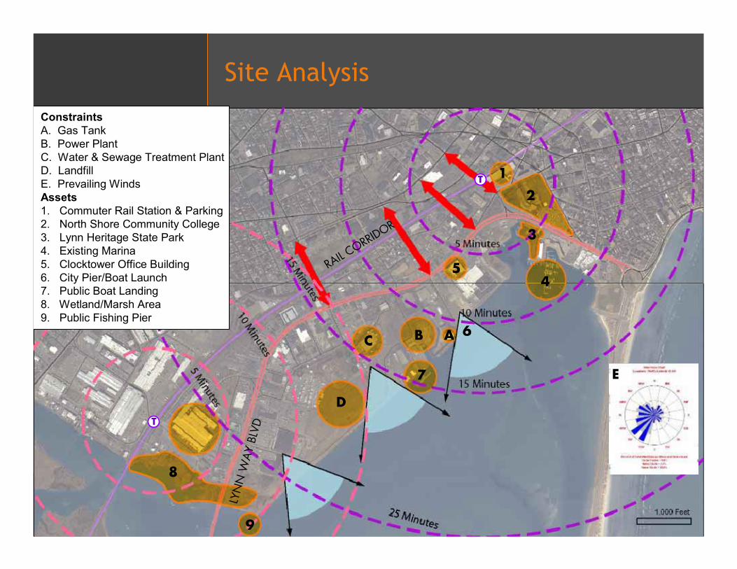
Site Analysis
LYN
N W
AY
BLVD
RAIL C
ORRIDOR
T
T
9
8
D
7
C B A
54
3
2
1
ConstraintsA. Gas TankB. Power PlantC. Water & Sewage Treatment PlantD. LandfillE. Prevailing WindsAssets1. Commuter Rail Station & Parking 2. North Shore Community College 3. Lynn Heritage State Park4. Existing Marina5. Clocktower Office Building6. City Pier/Boat Launch7. Public Boat Landing8. Wetland/Marsh Area9. Public Fishing Pier
E
6
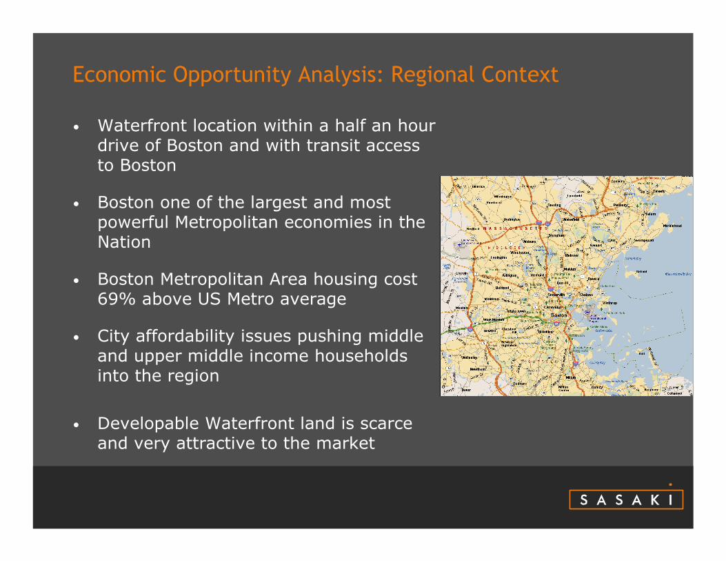
Economic Opportunity Analysis: Regional Context
• Waterfront location within a half an hour drive of Boston and with transit access to Boston
• Boston one of the largest and most powerful Metropolitan economies in the Nation
• Boston Metropolitan Area housing cost 69% above US Metro average
• City affordability issues pushing middle and upper middle income households into the region
• Developable Waterfront land is scarce and very attractive to the market
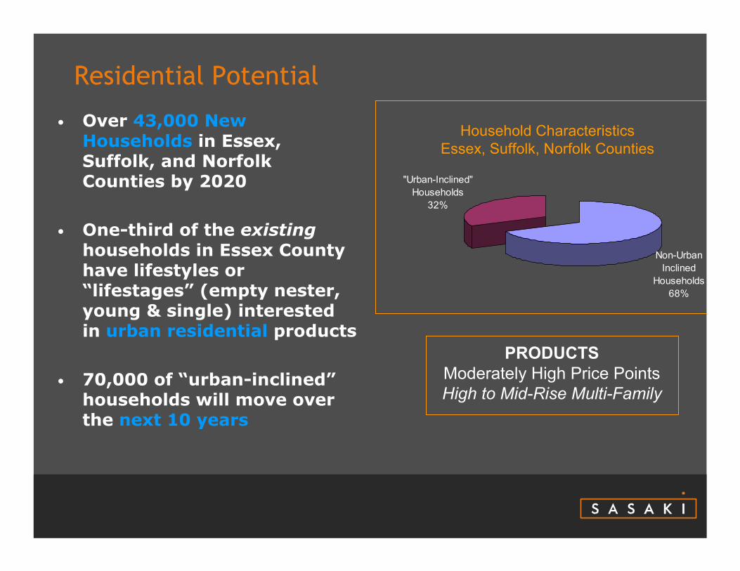
Residential Potential
• Over 43,000 New Households in Essex, Suffolk, and Norfolk Counties by 2020
• One-third of the existinghouseholds in Essex County have lifestyles or “lifestages” (empty nester, young & single) interested in urban residential products
• 70,000 of “urban-inclined”households will move over the next 10 years
Household CharacteristicsEssex, Suffolk, Norfolk Counties
Non-Urban Inclined
Households68%
"Urban-Inclined" Households
32%
PRODUCTSModerately High Price PointsHigh to Mid-Rise Multi-Family
Office Potential
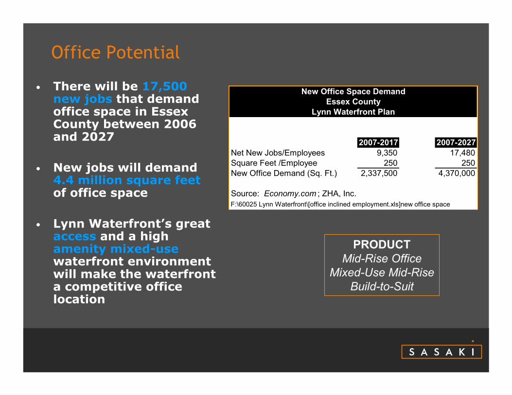
• There will be 17,500 new jobs that demand office space in Essex County between 2006 and 2027
• New jobs will demand 4.4 million square feetof office space
• Lynn Waterfront’s great access and a high amenity mixed-usewaterfront environment will make the waterfront a competitive office location
2007-2017 2007-2027Net New Jobs/Employees 9,350 17,480Square Feet /Employee 250 250New Office Demand (Sq. Ft.) 2,337,500 4,370,000
Source: Economy.com ; ZHA, Inc.F:\60025 Lynn Waterfront\[office inclined employment.xls]new office space
New Office Space DemandEssex County
Lynn Waterfront Plan
PRODUCTMid-Rise Office
Mixed-Use Mid-RiseBuild-to-Suit
Retail Potential
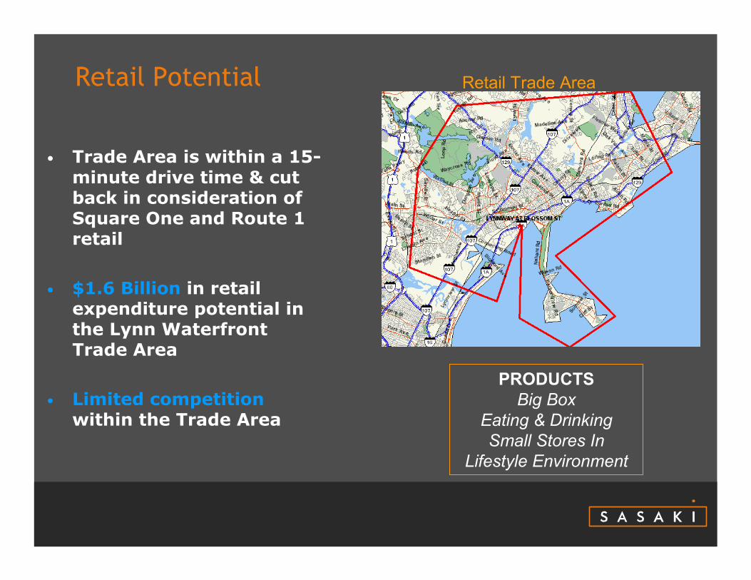
• Trade Area is within a 15-minute drive time & cut back in consideration of Square One and Route 1 retail
• $1.6 Billion in retail expenditure potential in the Lynn Waterfront Trade Area
• Limited competitionwithin the Trade Area
Retail Trade Area
PRODUCTSBig Box
Eating & DrinkingSmall Stores In
Lifestyle Environment
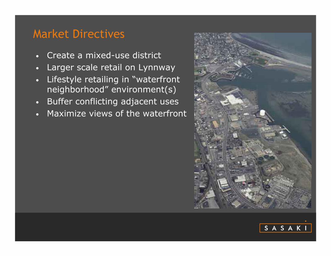
Market Directives
• Create a mixed-use district• Larger scale retail on Lynnway• Lifestyle retailing in “waterfront
neighborhood” environment(s)• Buffer conflicting adjacent uses• Maximize views of the waterfront
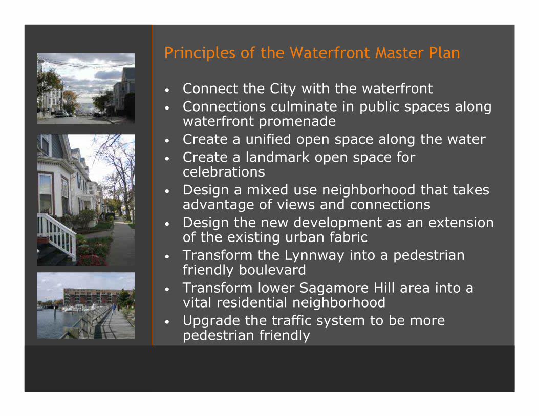
Principles of the Waterfront Master Plan
• Connect the City with the waterfront• Connections culminate in public spaces along
waterfront promenade• Create a unified open space along the water• Create a landmark open space for
celebrations• Design a mixed use neighborhood that takes
advantage of views and connections• Design the new development as an extension
of the existing urban fabric• Transform the Lynnway into a pedestrian
friendly boulevard• Transform lower Sagamore Hill area into a
vital residential neighborhood• Upgrade the traffic system to be more
pedestrian friendly
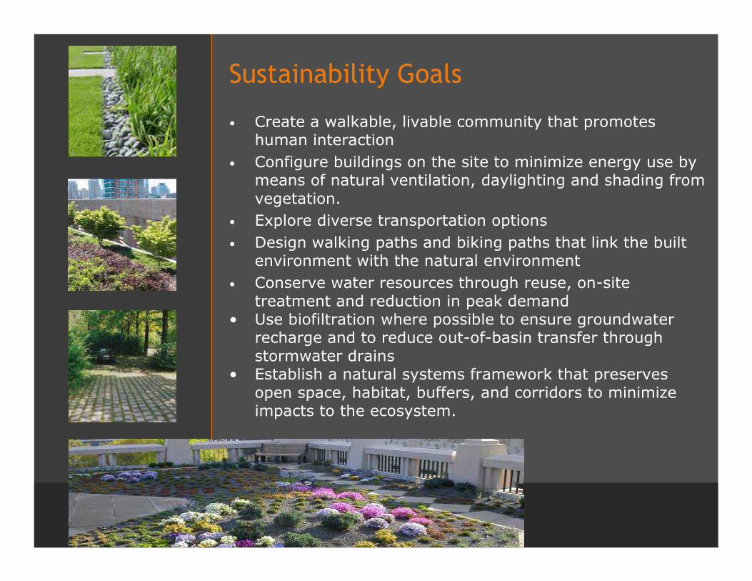
Sustainability Goals
• Create a walkable, livable community that promotes human interaction
• Configure buildings on the site to minimize energy use by means of natural ventilation, daylighting and shading from vegetation.
• Explore diverse transportation options • Design walking paths and biking paths that link the built
environment with the natural environment• Conserve water resources through reuse, on-site
treatment and reduction in peak demand• Use biofiltration where possible to ensure groundwater
recharge and to reduce out-of-basin transfer through stormwater drains
• Establish a natural systems framework that preserves open space, habitat, buffers, and corridors to minimize impacts to the ecosystem.
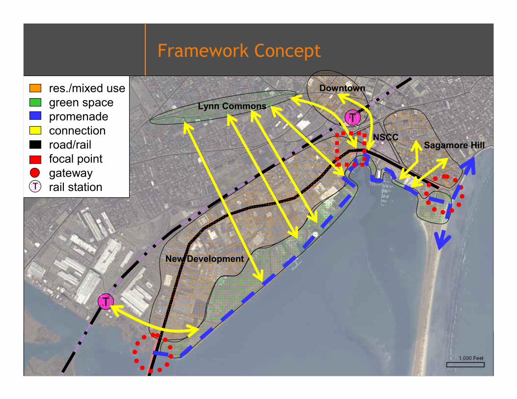
Framework Concept
Lynn Commons
Downtown
T
res./mixed usegreen spacepromenadeconnectionroad/railfocal pointgatewayrail stationT
New Development
Sagamore HillNSCC
T
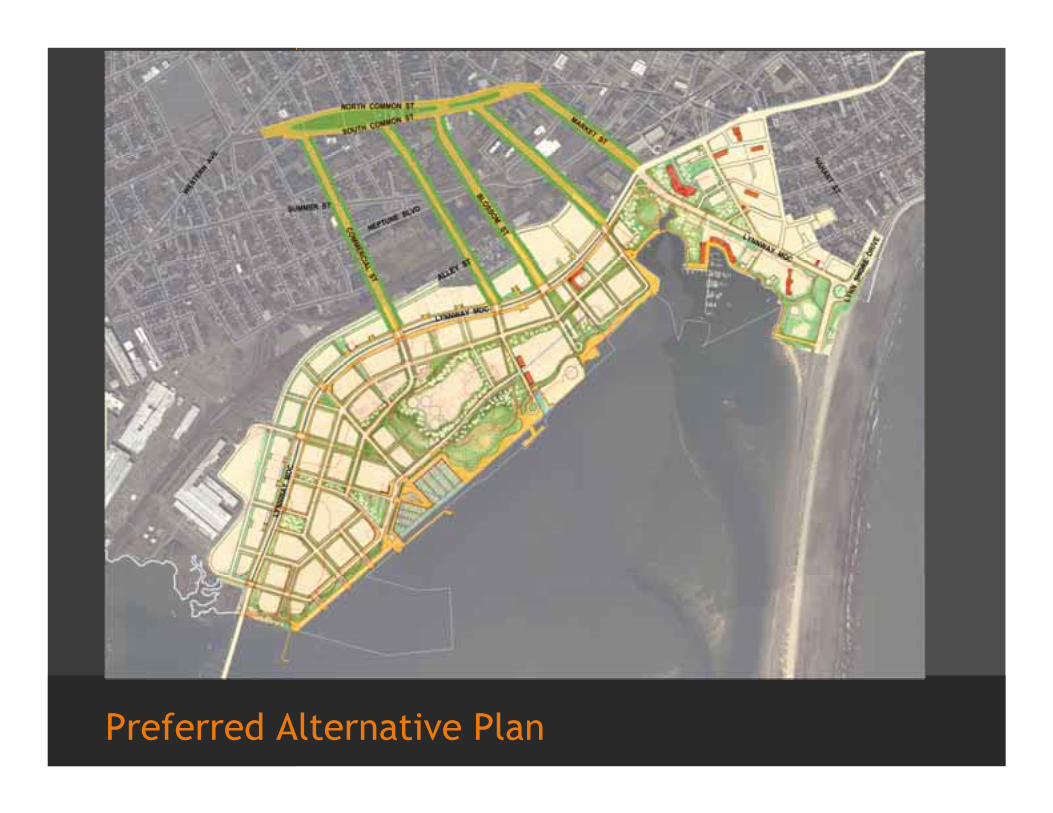
Preferred Alternative Plan
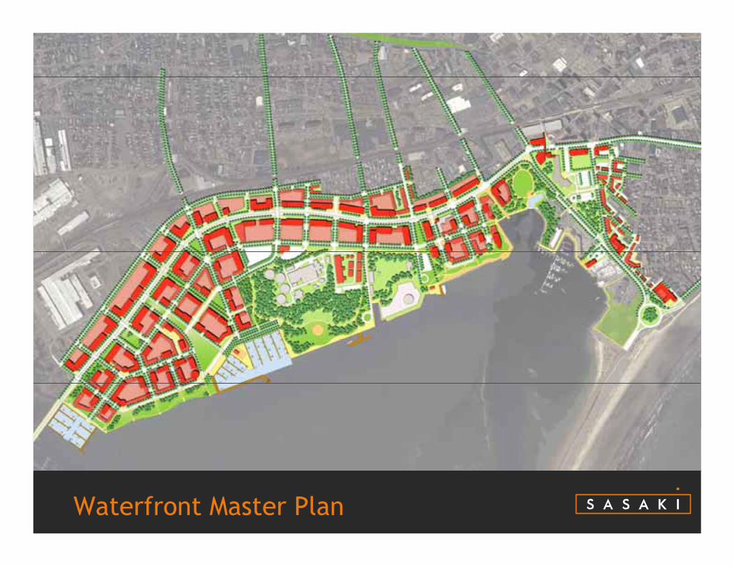
Waterfront Master Plan
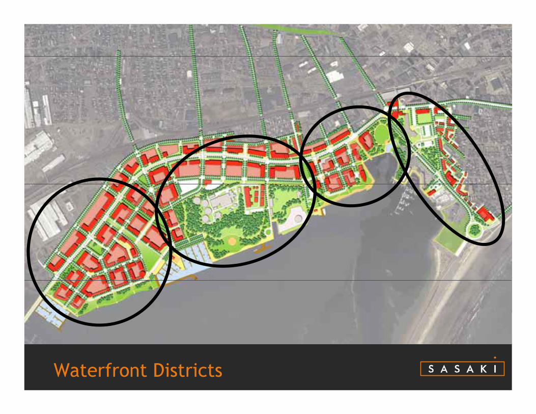
Waterfront Districts
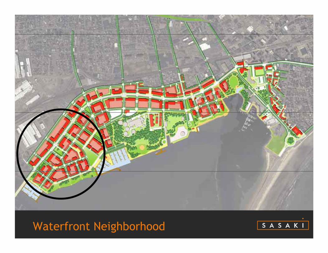
Waterfront Neighborhood

Marine Park/Industry Center

Downtown Waterfront

Sagamore Hill Waterfront

Waterfront Neighborhood
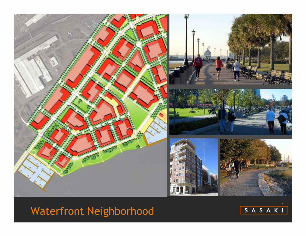
Waterfront Neighborhood

Waterfront Neighborhood
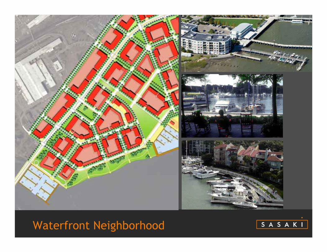
Waterfront Neighborhood

Typical Block Plan
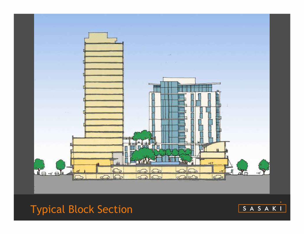
Typical Block Section
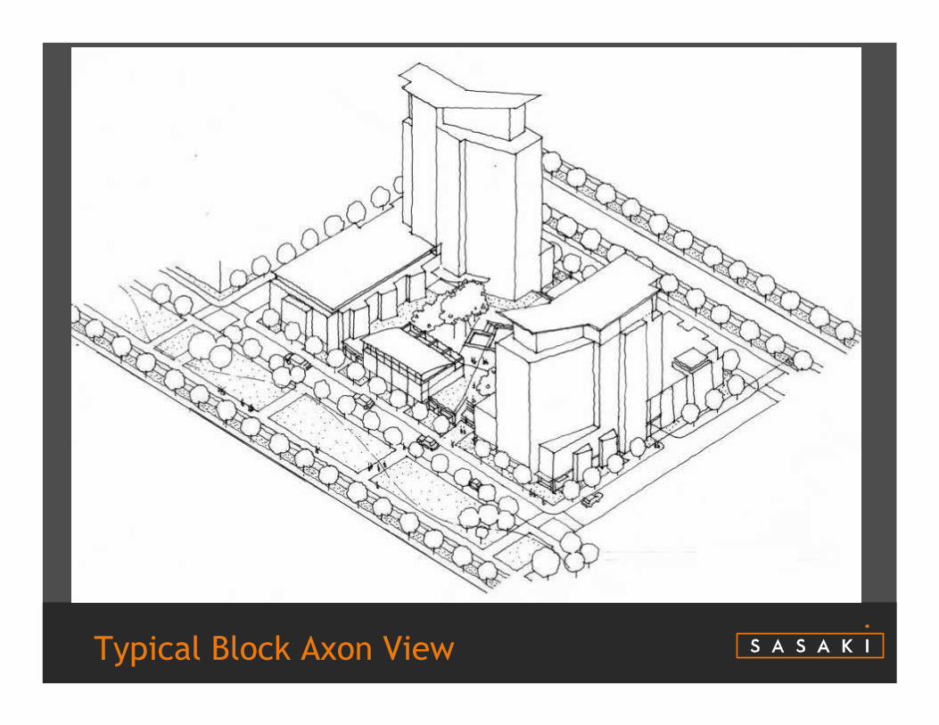
Typical Block Axon View
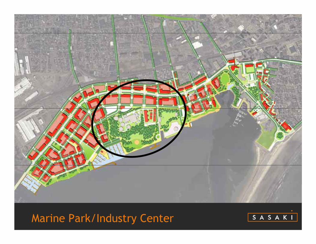
Marine Park/Industry Center
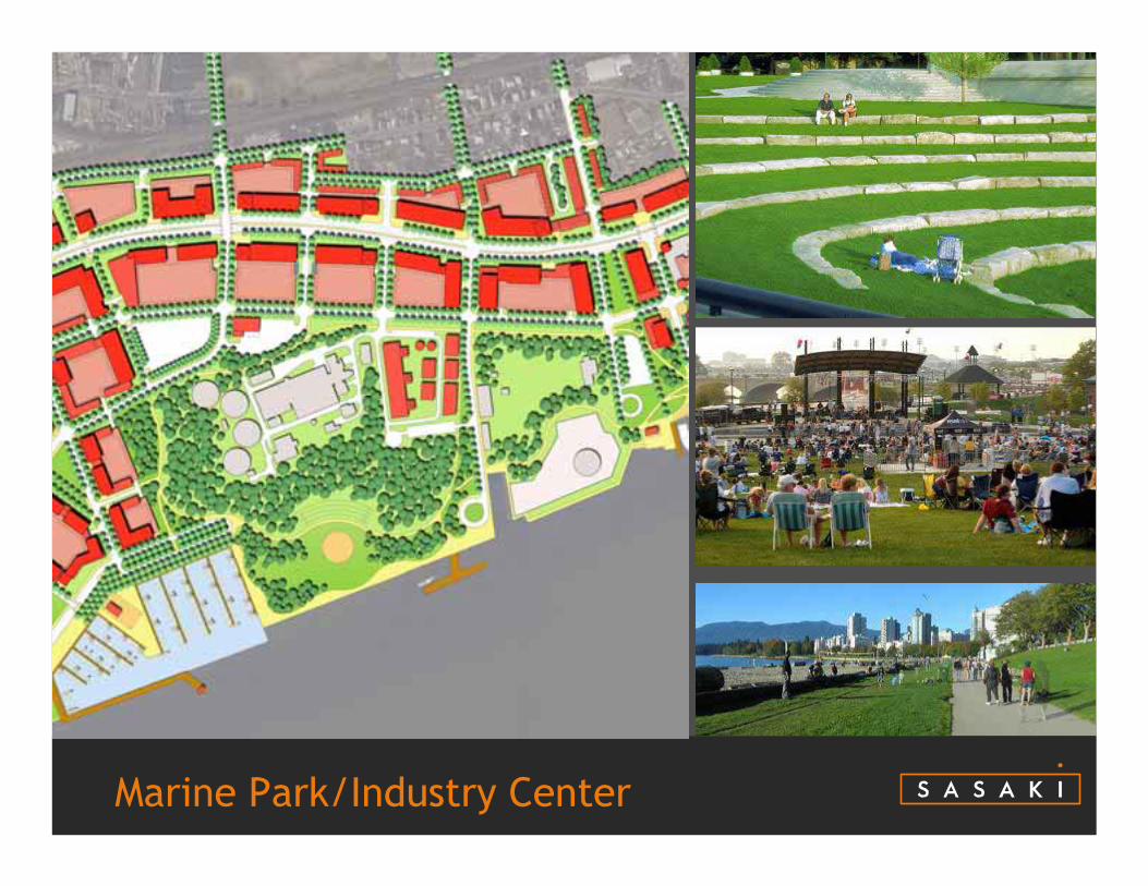
Marine Park/Industry Center
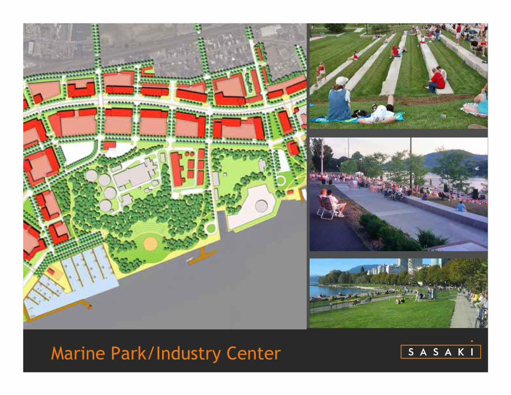
Marine Park/Industry Center
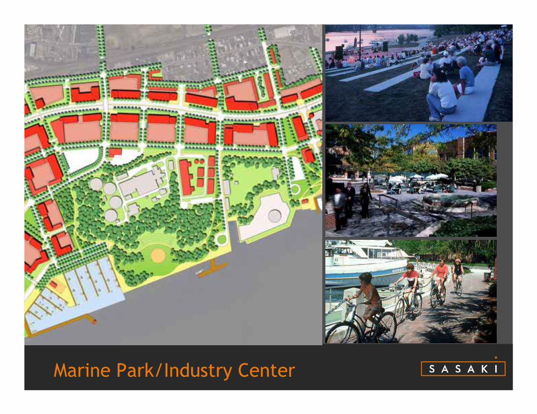
Marine Park/Industry Center
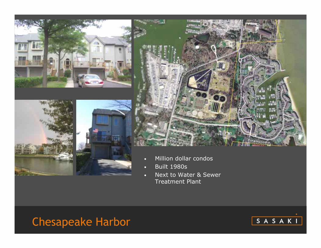
Chesapeake Harbor
• Million dollar condos• Built 1980s• Next to Water & Sewer
Treatment Plant

Downtown Waterfront
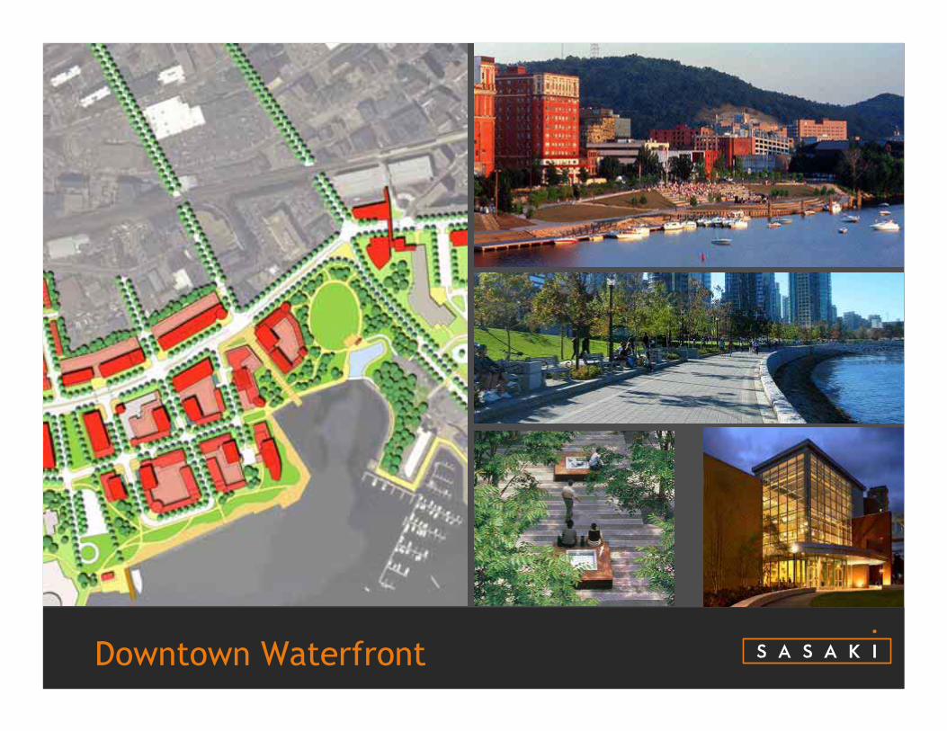
Downtown Waterfront
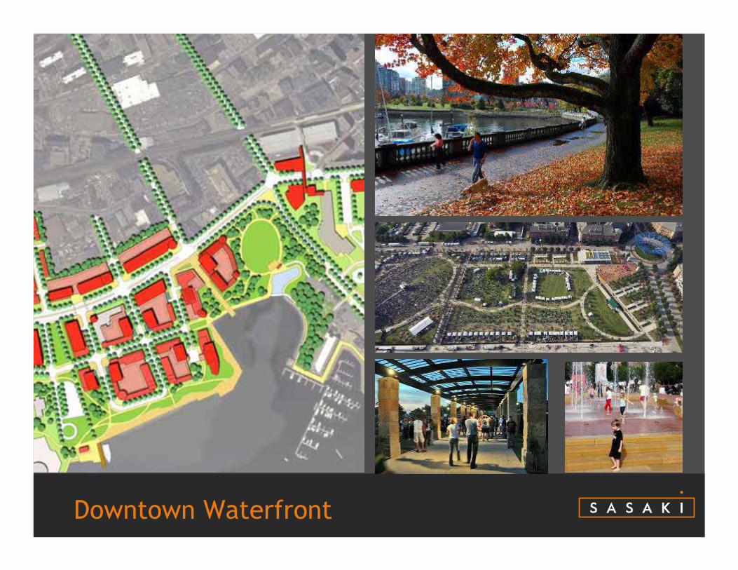
Downtown Waterfront
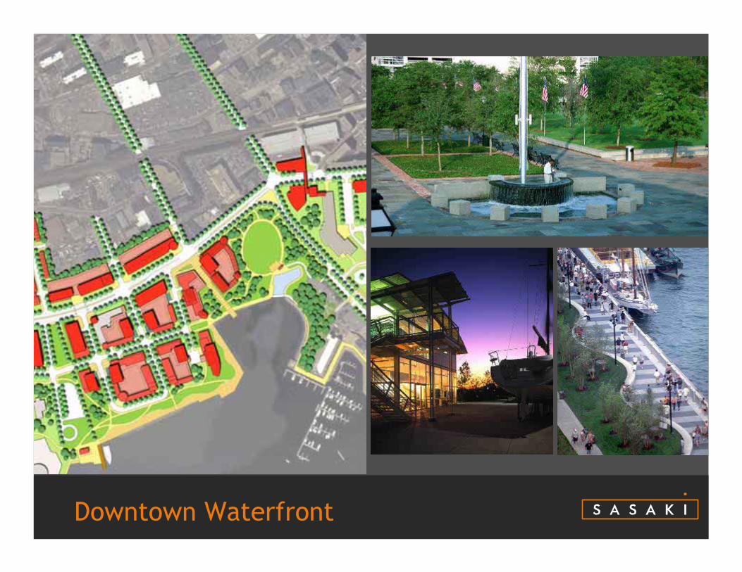
Downtown Waterfront
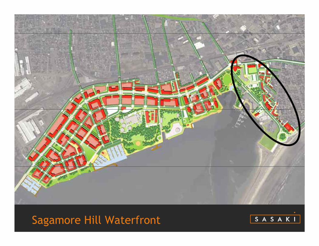
Sagamore Hill Waterfront
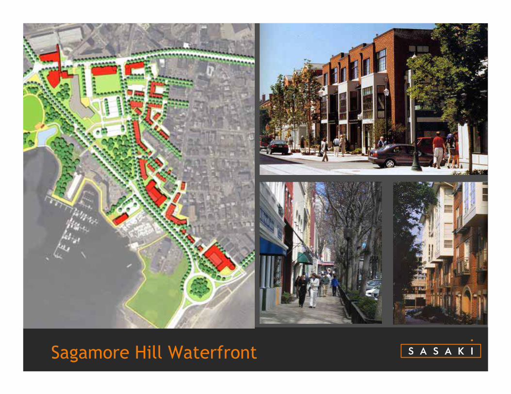
Sagamore Hill Waterfront
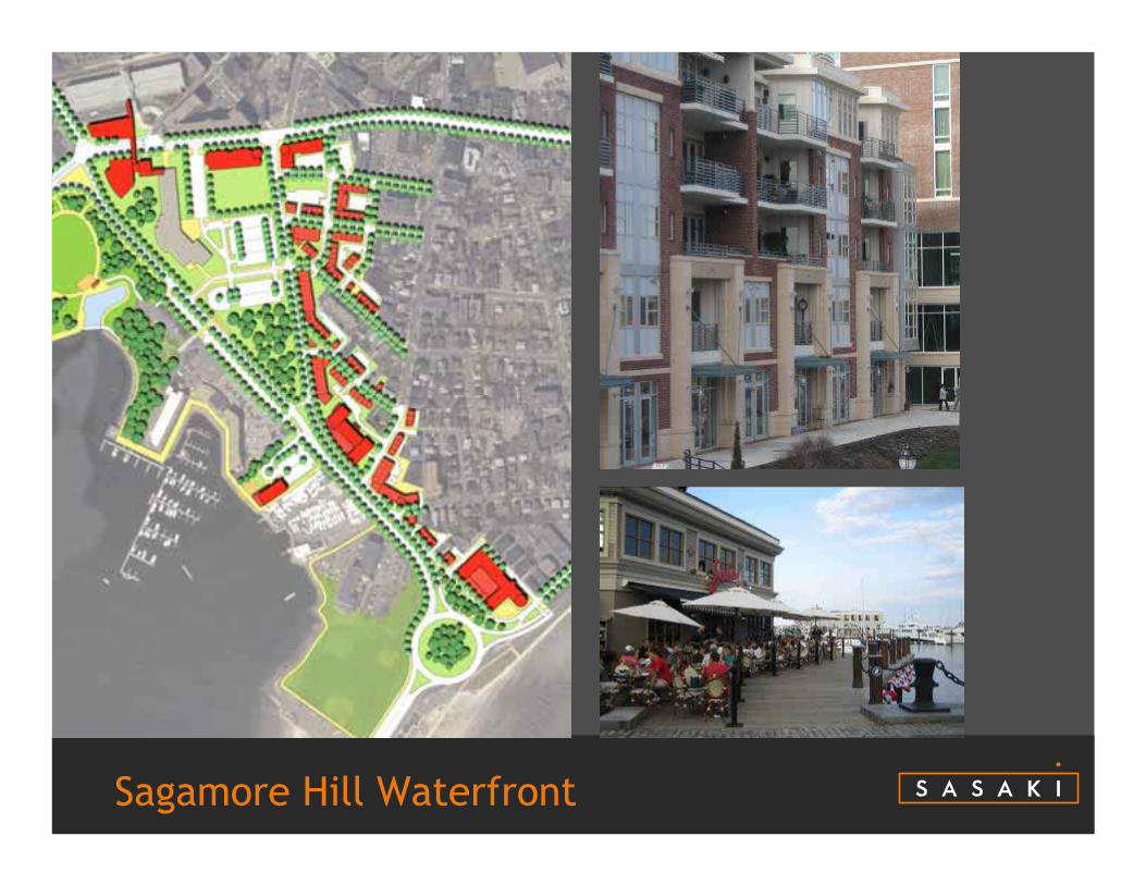
Sagamore Hill Waterfront

Sagamore Hill Waterfront
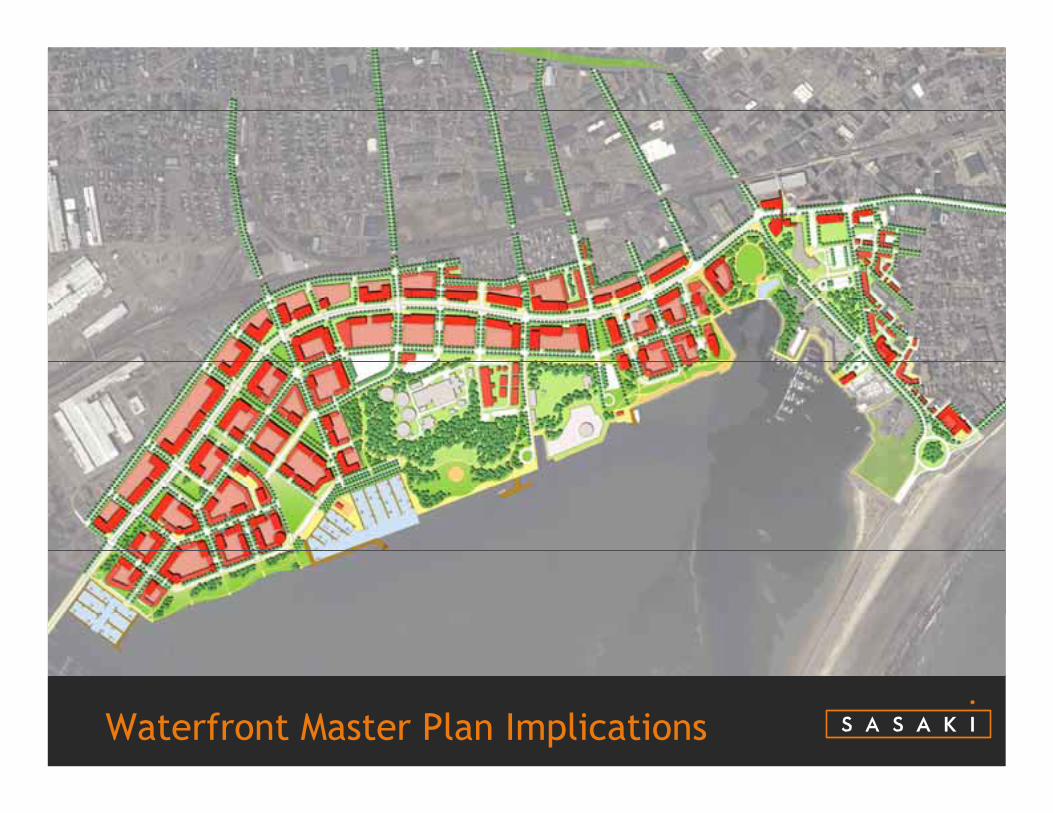
Waterfront Master Plan Implications
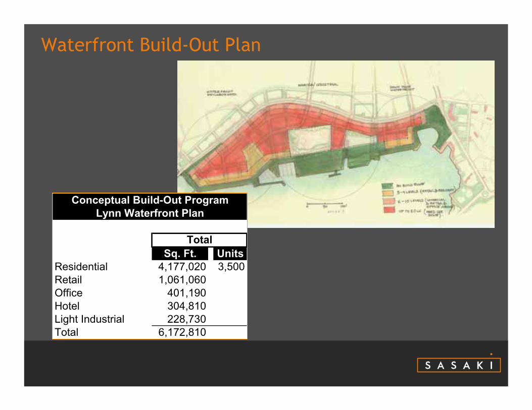
Waterfront Build-Out Plan
Sq. Ft. UnitsResidential 4,177,020 3,500Retail 1,061,060Office 401,190Hotel 304,810Light Industrial 228,730Total 6,172,810
Conceptual Build-Out ProgramLynn Waterfront Plan
Total
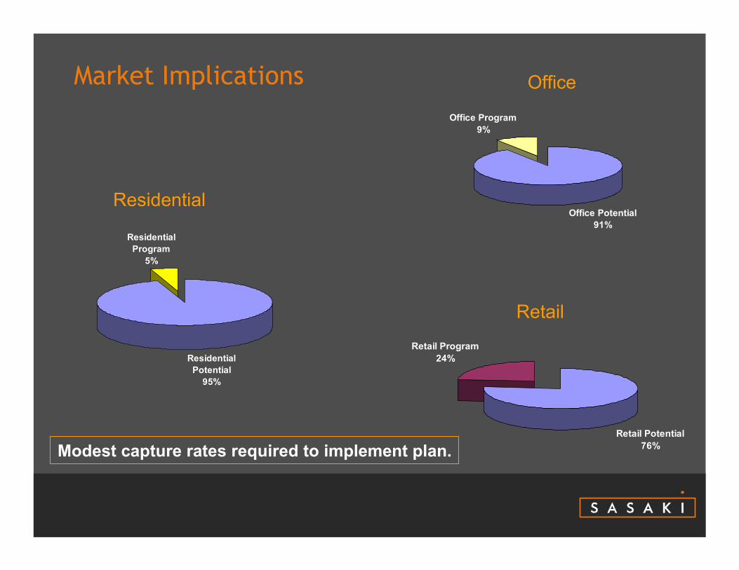
Market Implications
Residential Potential
95%
Residential Program
5%
Office Potential91%
Office Program9%
Retail Potential76%
Retail Program24%
Residential
Retail
Office
Modest capture rates required to implement plan.

Economic Implications of Waterfront Development
• $1.5 billion development program;
• Approximately 10,500construction jobs;
• At full build-out approximately 4,800 permanent jobs on the Waterfront
Sq. Ft. Mkt ValueResidential 4,177,020 $1,019,684,294Retail 1,061,060 $283,989,588Office 401,190 $119,413,024Hotel 304,810 $64,727,355Light Industrial 228,730 $29,062,165Total 6,172,810 $1,516,876,425
Build-Out Market ValueLynn Waterfront Plan
2007 Dollars
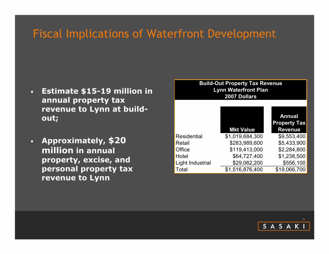
Fiscal Implications of Waterfront Development
• Estimate $15-19 million in annual property tax revenue to Lynn at build-out;
• Approximately, $20 million in annual property, excise, and personal property tax revenue to Lynn
Mkt Value
Annual Property Tax
RevenueResidential $1,019,684,300 $9,553,400Retail $283,989,600 $5,433,900Office $119,413,000 $2,284,800Hotel $64,727,400 $1,238,500Light Industrial $29,062,200 $556,100Total $1,516,876,400 $19,066,700
Build-Out Property Tax RevenueLynn Waterfront Plan
2007 Dollars
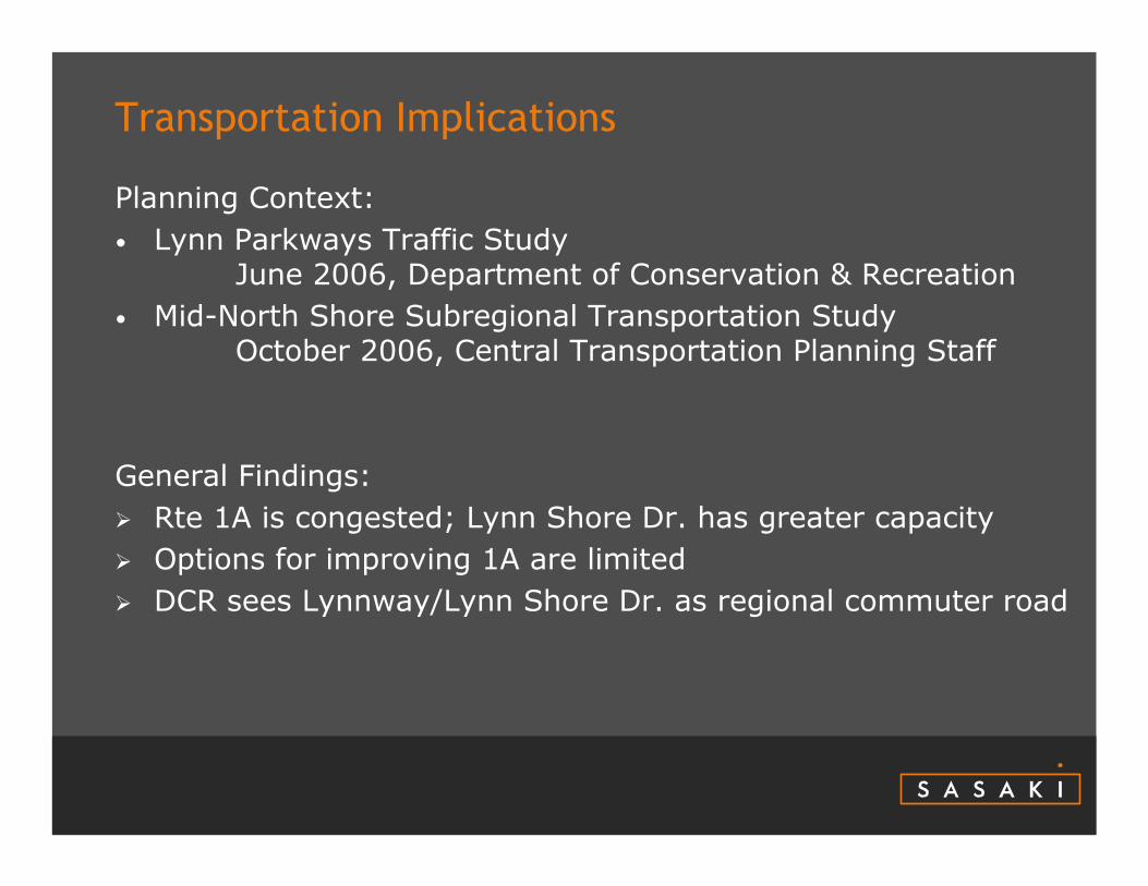
Transportation Implications
Planning Context:• Lynn Parkways Traffic Study
June 2006, Department of Conservation & Recreation• Mid-North Shore Subregional Transportation Study
October 2006, Central Transportation Planning Staff
General Findings:Rte 1A is congested; Lynn Shore Dr. has greater capacityOptions for improving 1A are limitedDCR sees Lynnway/Lynn Shore Dr. as regional commuter road

Increased Local Traffic+ More Cross StreetsHigher Volume : Capacity Ratios

Signature Civic Waterfront Park

Existing Conditions
Pleasant Street
State Street
Broad Street
Washington Street
Market Street

Future Conditions

Projected AM Levels of Service, 2011 volumes
NB Left Turn Prohibited in
AM Peak

Next Steps
• Phasing Plan• Zoning Overlay• Cost Estimate• Implementation Strategy• Presentation to City Council• Future Action Plan
– Detailed Traffic Study– Harbor Plan– Coordination with State Agencies– Legislative Process for Project Support– Funding – Public/Private Partnerships– Build It!
Next Steps

Lynn's Reclaimed Waterfront