Embed Size (px)
Citation preview
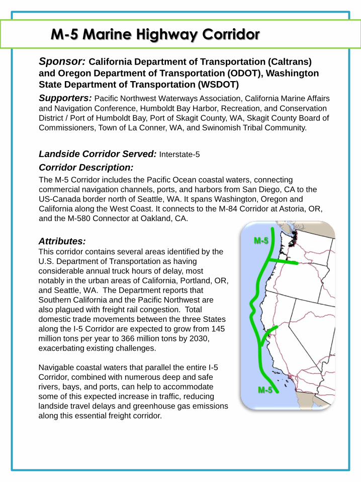
M-5 Marine Highway Corridor
Sponsor: California Department of Transportation (Caltrans)
and Oregon Department of Transportation (ODOT), Washington
State Department of Transportation (WSDOT)
Supporters: Pacific Northwest Waterways Association, California Marine Affairs
and Navigation Conference, Humboldt Bay Harbor, Recreation, and Conservation
District / Port of Humboldt Bay, Port of Skagit County, WA, Skagit County Board of
Commissioners, Town of La Conner, WA, and Swinomish Tribal Community.
Landside Corridor Served: Interstate-5
Corridor Description:
The M-5 Corridor includes the Pacific Ocean coastal waters, connecting
commercial navigation channels, ports, and harbors from San Diego, CA to the
US-Canada border north of Seattle, WA. It spans Washington, Oregon and
California along the West Coast. It connects to the M-84 Corridor at Astoria, OR,
and the M-580 Connector at Oakland, CA.
Attributes: This corridor contains several areas identified by the
U.S. Department of Transportation as having
considerable annual truck hours of delay, most
notably in the urban areas of California, Portland, OR,
and Seattle, WA. The Department reports that
Southern California and the Pacific Northwest are
also plagued with freight rail congestion. Total
domestic trade movements between the three States
along the I-5 Corridor are expected to grow from 145
million tons per year to 366 million tons by 2030,
exacerbating existing challenges.
Navigable coastal waters that parallel the entire I-5
Corridor, combined with numerous deep and safe
rivers, bays, and ports, can help to accommodate
some of this expected increase in traffic, reducing
landside travel delays and greenhouse gas emissions
along this essential freight corridor.
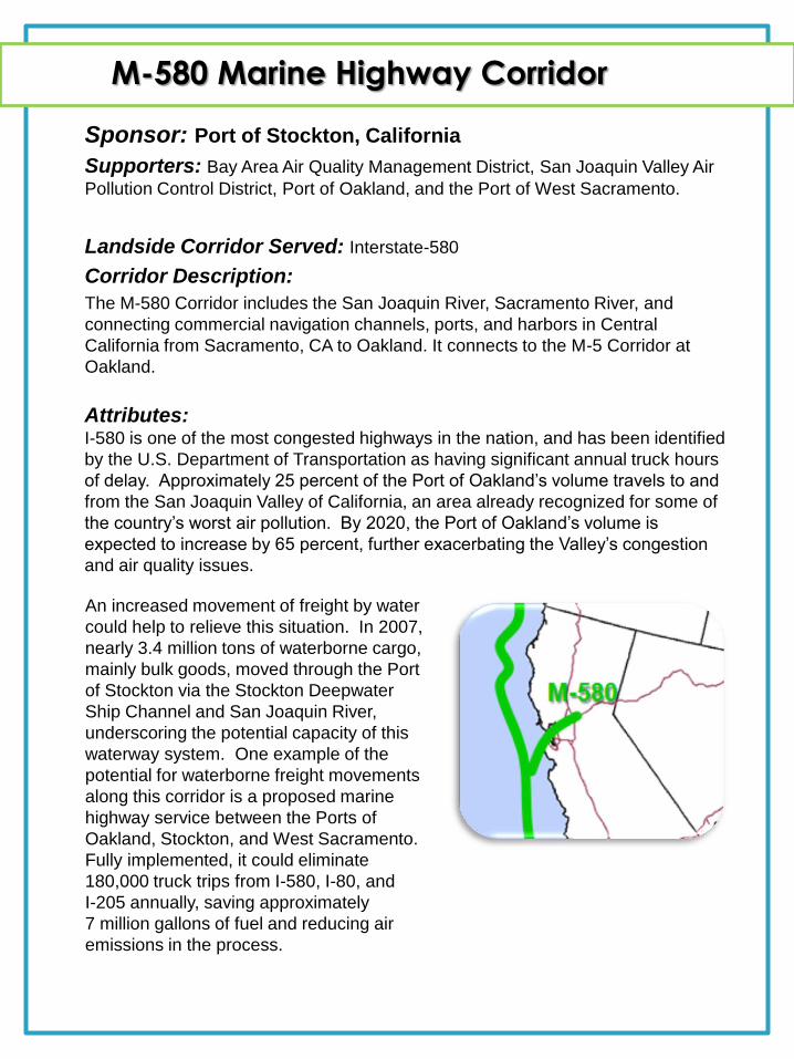
M-580 Marine Highway Corridor
Sponsor: Port of Stockton, California
Supporters: Bay Area Air Quality Management District, San Joaquin Valley Air
Pollution Control District, Port of Oakland, and the Port of West Sacramento.
Landside Corridor Served: Interstate-580
Corridor Description:
The M-580 Corridor includes the San Joaquin River, Sacramento River, and
connecting commercial navigation channels, ports, and harbors in Central
California from Sacramento, CA to Oakland. It connects to the M-5 Corridor at
Oakland.
Attributes: I-580 is one of the most congested highways in the nation, and has been identified
by the U.S. Department of Transportation as having significant annual truck hours
of delay. Approximately 25 percent of the Port of Oakland’s volume travels to and
from the San Joaquin Valley of California, an area already recognized for some of
the country’s worst air pollution. By 2020, the Port of Oakland’s volume is
expected to increase by 65 percent, further exacerbating the Valley’s congestion
and air quality issues.
An increased movement of freight by water
could help to relieve this situation. In 2007,
nearly 3.4 million tons of waterborne cargo,
mainly bulk goods, moved through the Port
of Stockton via the Stockton Deepwater
Ship Channel and San Joaquin River,
underscoring the potential capacity of this
waterway system. One example of the
potential for waterborne freight movements
along this corridor is a proposed marine
highway service between the Ports of
Oakland, Stockton, and West Sacramento.
Fully implemented, it could eliminate
180,000 truck trips from I-580, I-80, and
I-205 annually, saving approximately
7 million gallons of fuel and reducing air
emissions in the process.
M-84 Marine Highway Corridor
Sponsor: Port of Portland, Oregon
Supporter: The Pacific Northwest Waterways Association.
Landside Corridor Served: Interstate-84
Corridor Description:
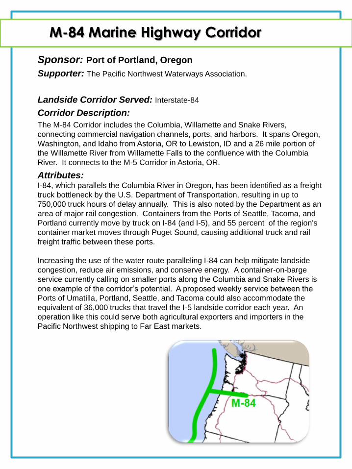
The M-84 Corridor includes the Columbia, Willamette and Snake Rivers,
connecting commercial navigation channels, ports, and harbors. It spans Oregon,
Washington, and Idaho from Astoria, OR to Lewiston, ID and a 26 mile portion of
the Willamette River from Willamette Falls to the confluence with the Columbia
River. It connects to the M-5 Corridor in Astoria, OR.
Attributes: I-84, which parallels the Columbia River in Oregon, has been identified as a freight
truck bottleneck by the U.S. Department of Transportation, resulting in up to
750,000 truck hours of delay annually. This is also noted by the Department as an
area of major rail congestion. Containers from the Ports of Seattle, Tacoma, and
Portland currently move by truck on I-84 (and I-5), and 55 percent of the region's
container market moves through Puget Sound, causing additional truck and rail
freight traffic between these ports.
Increasing the use of the water route paralleling I-84 can help mitigate landside
congestion, reduce air emissions, and conserve energy. A container-on-barge
service currently calling on smaller ports along the Columbia and Snake Rivers is
one example of the corridor’s potential. A proposed weekly service between the
Ports of Umatilla, Portland, Seattle, and Tacoma could also accommodate the
equivalent of 36,000 trucks that travel the I-5 landside corridor each year. An
operation like this could serve both agricultural exporters and importers in the
Pacific Northwest shipping to Far East markets.
M-10 Marine Highway Corridor
Sponsor: Mississippi Department of Transportation
Supporters: Florida DOT, Texas DOT, Louisiana DOT, NW Louisiana Economic
Development Foundation, South Alabama Regional Planning Commission, Port of
Jacksonville, Port of Tampa, Port of Pensacola, Port of Pascagoula, Port of Morgan
City, Port of New Orleans, St. Bernard Terminal and Harbor District, Port of Lake
Charles, Port of Houston Authority, Port of Brownsville, and Gulf Intracoastal Canal
Association.
Landside Corridor Served: Interstate-10
Corridor Description:
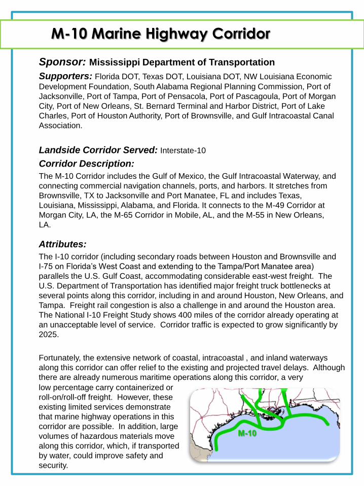
The M-10 Corridor includes the Gulf of Mexico, the Gulf Intracoastal Waterway, and
connecting commercial navigation channels, ports, and harbors. It stretches from
Brownsville, TX to Jacksonville and Port Manatee, FL and includes Texas,
Louisiana, Mississippi, Alabama, and Florida. It connects to the M-49 Corridor at
Morgan City, LA, the M-65 Corridor in Mobile, AL, and the M-55 in New Orleans,
LA.
Attributes:
The I-10 corridor (including secondary roads between Houston and Brownsville and
I-75 on Florida’s West Coast and extending to the Tampa/Port Manatee area)
parallels the U.S. Gulf Coast, accommodating considerable east-west freight. The
U.S. Department of Transportation has identified major freight truck bottlenecks at
several points along this corridor, including in and around Houston, New Orleans, and
Tampa. Freight rail congestion is also a challenge in and around the Houston area.
The National I-10 Freight Study shows 400 miles of the corridor already operating at
an unacceptable level of service. Corridor traffic is expected to grow significantly by
2025.
Fortunately, the extensive network of coastal, intracoastal , and inland waterways
along this corridor can offer relief to the existing and projected travel delays. Although
there are already numerous maritime operations along this corridor, a very
low percentage carry containerized or
roll-on/roll-off freight. However, these
existing limited services demonstrate
that marine highway operations in this
corridor are possible. In addition, large
volumes of hazardous materials move
along this corridor, which, if transported
by water, could improve safety and
security.
M-49 Marine Highway Corridor
Sponsor: Louisiana Department of Transportation & Development
Supporters: NE Louisiana Economic Development Foundation, Rapides Area Planning Commission, The Port of Morgan City, Natchitoches Parish, Port of New Orleans, Port of Greater Baton Rouge, Port of Krotz Springs, and the Caddo/Bossier Port Commission.
Landside Corridor Served: Interstate-49
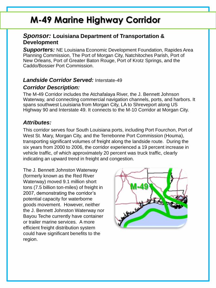
Corridor Description: The M-49 Corridor includes the Atchafalaya River, the J. Bennett Johnson Waterway, and connecting commercial navigation channels, ports, and harbors. It spans southwest Louisiana from Morgan City, LA to Shreveport along US Highway 90 and Interstate 49. It connects to the M-10 Corridor at Morgan City.
Attributes:
This corridor serves four South Louisiana ports, including Port Fourchon, Port of
West St. Mary, Morgan City, and the Terrebonne Port Commission (Houma),
transporting significant volumes of freight along the landside route. During the
six years from 2000 to 2006, the corridor experienced a 19 percent increase in
vehicle traffic, of which approximately 20 percent was truck traffic, clearly
indicating an upward trend in freight and congestion.
The J. Bennett Johnston Waterway
(formerly known as the Red River
Waterway) moved 9.1 million short
tons (7.5 billion ton-miles) of freight in
2007, demonstrating the corridor’s
potential capacity for waterborne
goods movement. However, neither
the J. Bennett Johnston Waterway nor
Bayou Teche currently have container
or trailer marine services. A more
efficient freight distribution system
could have significant benefits to the
region.
M-55 Marine Highway Corridor
Sponsors: Missouri and Illinois Departments of Transportation
Supporters: Southeast Missouri Regional Port Authority, and the Ohio Department of Transportation.
Landside Corridor Served: Interstate-55
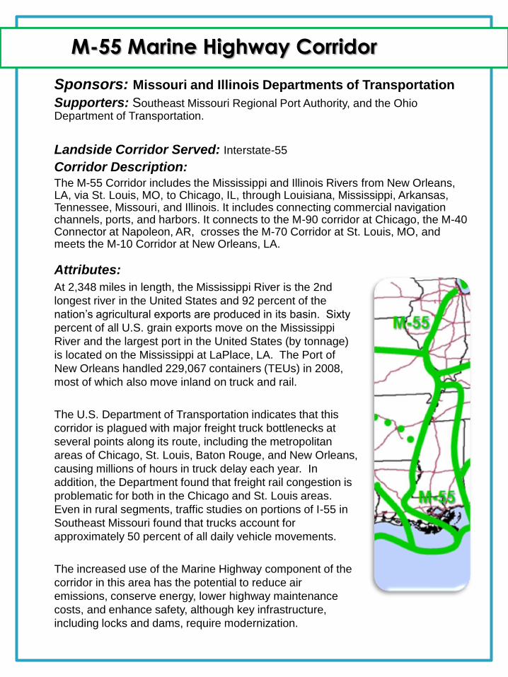
Corridor Description: The M-55 Corridor includes the Mississippi and Illinois Rivers from New Orleans, LA, via St. Louis, MO, to Chicago, IL, through Louisiana, Mississippi, Arkansas, Tennessee, Missouri, and Illinois. It includes connecting commercial navigation channels, ports, and harbors. It connects to the M-90 corridor at Chicago, the M-40 Connector at Napoleon, AR, crosses the M-70 Corridor at St. Louis, MO, and meets the M-10 Corridor at New Orleans, LA.
Attributes:
At 2,348 miles in length, the Mississippi River is the 2nd
longest river in the United States and 92 percent of the
nation’s agricultural exports are produced in its basin. Sixty
percent of all U.S. grain exports move on the Mississippi
River and the largest port in the United States (by tonnage)
is located on the Mississippi at LaPlace, LA. The Port of
New Orleans handled 229,067 containers (TEUs) in 2008,
most of which also move inland on truck and rail.
The U.S. Department of Transportation indicates that this
corridor is plagued with major freight truck bottlenecks at
several points along its route, including the metropolitan
areas of Chicago, St. Louis, Baton Rouge, and New Orleans,
causing millions of hours in truck delay each year. In
addition, the Department found that freight rail congestion is
problematic for both in the Chicago and St. Louis areas.
Even in rural segments, traffic studies on portions of I-55 in
Southeast Missouri found that trucks account for
approximately 50 percent of all daily vehicle movements.
The increased use of the Marine Highway component of the
corridor in this area has the potential to reduce air
emissions, conserve energy, lower highway maintenance
costs, and enhance safety, although key infrastructure,
including locks and dams, require modernization.
M-65 Marine Highway Corridor
Sponsor: Tennessee-Tombigbee Waterway Development Authority
Supporters: State of Alabama, Alabama State Port Authority, West Virginia DOT, South Alabama Regional Planning Commission, Yellow Creek State Inland Port Authority, Paducah-McCracken County Riverport Authority, Port Itawamba, Lowndes County Port Authority, Coalition of Alabama Waterway Associations, Inc.
Landside Corridor Served: Interstate-65
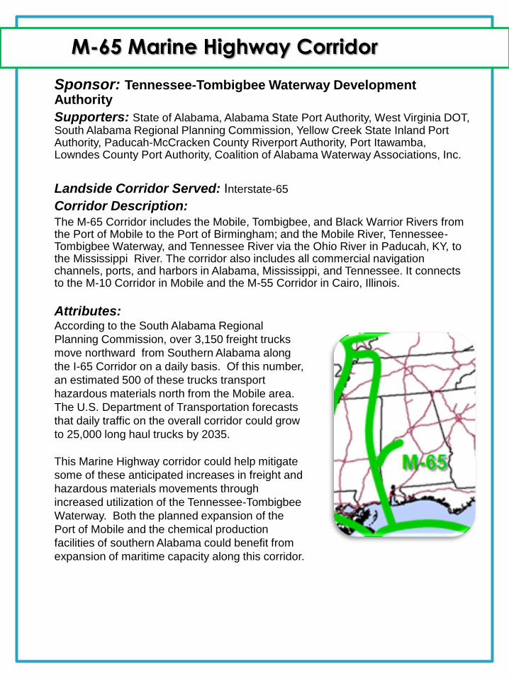
Corridor Description: The M-65 Corridor includes the Mobile, Tombigbee, and Black Warrior Rivers from the Port of Mobile to the Port of Birmingham; and the Mobile River, Tennessee-Tombigbee Waterway, and Tennessee River via the Ohio River in Paducah, KY, to the Mississippi River. The corridor also includes all commercial navigation channels, ports, and harbors in Alabama, Mississippi, and Tennessee. It connects to the M-10 Corridor in Mobile and the M-55 Corridor in Cairo, Illinois.
Attributes: According to the South Alabama Regional
Planning Commission, over 3,150 freight trucks
move northward from Southern Alabama along
the I-65 Corridor on a daily basis. Of this number,
an estimated 500 of these trucks transport
hazardous materials north from the Mobile area.
The U.S. Department of Transportation forecasts
that daily traffic on the overall corridor could grow
to 25,000 long haul trucks by 2035.
This Marine Highway corridor could help mitigate
some of these anticipated increases in freight and
hazardous materials movements through
increased utilization of the Tennessee-Tombigbee
Waterway. Both the planned expansion of the
Port of Mobile and the chemical production
facilities of southern Alabama could benefit from
expansion of maritime capacity along this corridor.

M-70 Marine Highway Corridor
Sponsor: Ohio Department of Transportation
Supporters: Illinois DOT, Missouri Chamber of Commerce, Missouri DOT, and
Cape Girardeau Area MAGNET.
Landside Corridor Served: Interstate-70
Corridor Description:
The M-70 Corridor includes the Ohio, Mississippi, and Missouri Rivers, and
connecting commercial navigation channels, ports, and harbors, from Pittsburgh to
Kansas City. It spans Pennsylvania, Ohio, Indiana, Illinois, and Missouri,
connecting to the M-55 Corridor at St. Louis, MO.
Attributes: This corridor contains major freight truck bottlenecks at numerous points, including
Kansas City, St. Louis, Louisville, Dayton, Cincinnati, Columbus, and Pittsburgh.
According to the U.S. Department of Transportation, long haul truck volumes are
expected to reach 25,000 per day along major segments by 2035. Similarly, rail
congestion is evident in and around Kansas City, St Louis, and several points
along the corridor in Ohio.
This Marine Highway corridor has the potential to help alleviate a portion of the
congestion from the existing landside routes, while at the same time reducing
emissions, conserving energy, improving safety ,and reducing highway
maintenance costs. It can also contribute to increased economic and commercial
activity in the region by removing barriers to efficient freight transportation.
M-90 Marine Highway Corridor
Sponsor: Ohio Department of Transportation
Supporters: Wisconsin DOT, Greater Buffalo-Niagara Regional Transportation
Council, Monroe County Planning & Dev. Dept., Algoma, WI, Port of Milwaukee,
Cleveland-Cuyahoga County Port Authority, Lake Carriers Association, New York
State DOT, and the New York State Canal Corporation.
Landside Corridors Served: Interstate-90 (Also Interstates-80 and 94)
Corridor Description:
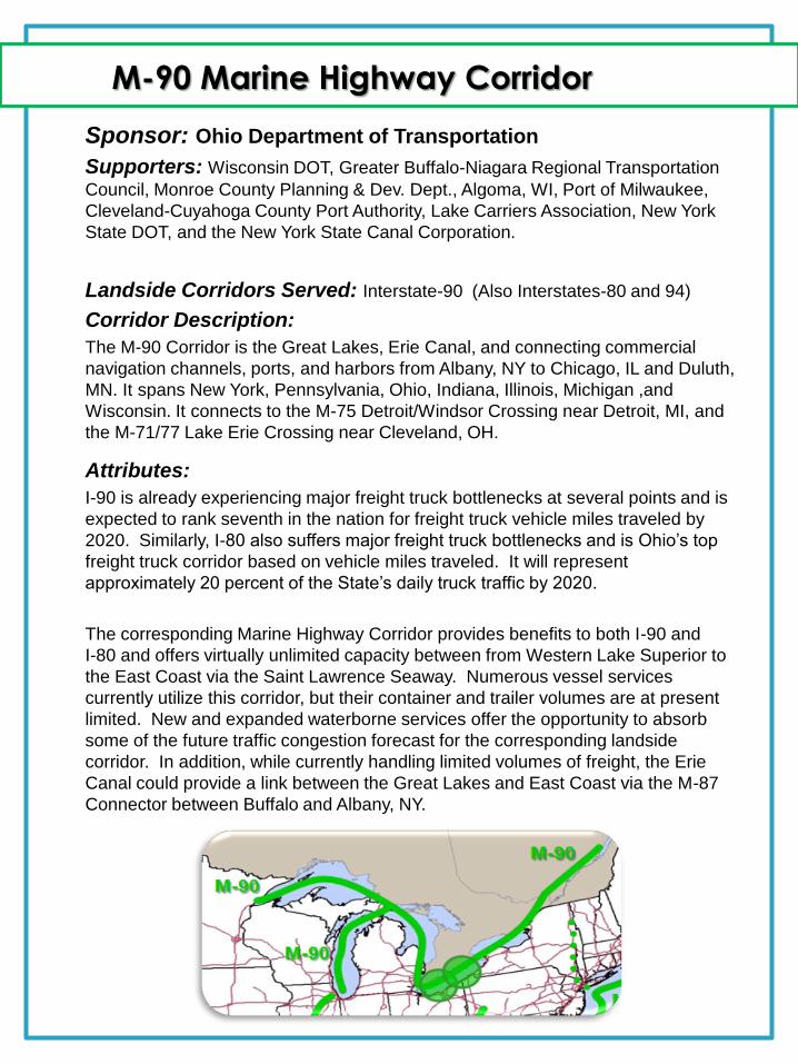
The M-90 Corridor is the Great Lakes, Erie Canal, and connecting commercial
navigation channels, ports, and harbors from Albany, NY to Chicago, IL and Duluth,
MN. It spans New York, Pennsylvania, Ohio, Indiana, Illinois, Michigan ,and
Wisconsin. It connects to the M-75 Detroit/Windsor Crossing near Detroit, MI, and
the M-71/77 Lake Erie Crossing near Cleveland, OH.
Attributes:
I-90 is already experiencing major freight truck bottlenecks at several points and is
expected to rank seventh in the nation for freight truck vehicle miles traveled by
2020. Similarly, I-80 also suffers major freight truck bottlenecks and is Ohio’s top
freight truck corridor based on vehicle miles traveled. It will represent
approximately 20 percent of the State’s daily truck traffic by 2020.
The corresponding Marine Highway Corridor provides benefits to both I-90 and
I-80 and offers virtually unlimited capacity between from Western Lake Superior to
the East Coast via the Saint Lawrence Seaway. Numerous vessel services
currently utilize this corridor, but their container and trailer volumes are at present
limited. New and expanded waterborne services offer the opportunity to absorb
some of the future traffic congestion forecast for the corresponding landside
corridor. In addition, while currently handling limited volumes of freight, the Erie
Canal could provide a link between the Great Lakes and East Coast via the M-87
Connector between Buffalo and Albany, NY.
M-95 Marine Highway Corridor
Sponsor: Interstate-95 Corridor Coalition
Supporters: Council of State Governments' Eastern Regional Conference,
Commonwealth of PA, NJDOT, CT DOT, CT Maritime Commission, Florida DOT, East
Central FL RPC, Space Coast Transportation Planning Authority, Economic Development
Commission of Florida's Space Coast, DE Valley RPC, DE River & Bay Authority, SE
Regional Planning & Economic Dev Commission, Richmond Regional RPC, NJ
Transportation Planning Authority, NY Metropolitan Transportation Council, NYCDOT,
NYSDOT, Port of Baltimore, NC Ports, Port of Mass., Port of New Bedford, MA, City of
New London, CT, Philadelphia Regional Port Authority, MD Port Commission, Philadelphia
Regional Port Authority, ME Port Authority, Port Authority of NY & NJ, Port Canaveral, FL,
SC State Port Authority, VA Port Authority, Port of Davisville, RI, Jaxport, FL, and the
Maritime Association of the Port of New York & New Jersey.
Landside Corridor Served: Interstate-95
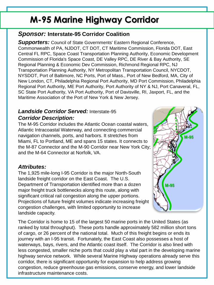
Corridor Description: The M-95 Corridor includes the Atlantic Ocean coastal waters,
Atlantic Intracoastal Waterway, and connecting commercial
navigation channels, ports, and harbors. It stretches from
Miami, FL to Portland, ME and spans 15 states. It connects to
the M-87 Connector and the M-90 Corridor near New York City;
and the M-64 Connector at Norfolk, VA.
Attributes: The 1,925 mile-long I-95 Corridor is the major North-South
landside freight corridor on the East Coast. The U.S.
Department of Transportation identified more than a dozen
major freight truck bottlenecks along this route, along with
significant critical rail congestion along the upper portions.
Projections of future freight volumes indicate increasing freight
congestion challenges, with limited opportunity to increase
landside capacity.
The Corridor is home to 15 of the largest 50 marine ports in the United States (as
ranked by total throughput). These ports handle approximately 582 million short tons
of cargo, or 26 percent of the national total. Much of this freight begins or ends its
journey with an I-95 transit. Fortunately, the East Coast also possesses a host of
waterways, bays, rivers, and the Atlantic coast itself. The Corridor is also lined with
less congested, smaller niche ports that could play a vital part in the developing marine
highway service network. While several Marine Highway operations already serve this
corridor, there is significant opportunity for expansion to help address growing
congestion, reduce greenhouse gas emissions, conserve energy, and lower landside
infrastructure maintenance costs.
M-2 Marine Highway Corridor
Sponsor: San Juan Port Commission
Supporters: The Ports of Ponce and marine/port facilities in Mayaguez, Ceiba
(former US Naval Station Roosevelt Roads), Yabucoa, Guanica, Guayama,
Guayanill, and Arebico.
Landside Corridor Served: Interstate/Route-2
Corridor Description:
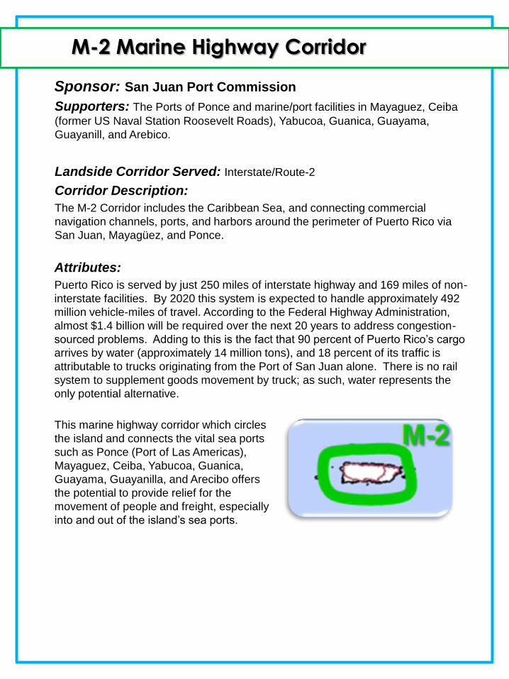
The M-2 Corridor includes the Caribbean Sea, and connecting commercial
navigation channels, ports, and harbors around the perimeter of Puerto Rico via
San Juan, Mayagüez, and Ponce.
Attributes:
Puerto Rico is served by just 250 miles of interstate highway and 169 miles of non-
interstate facilities. By 2020 this system is expected to handle approximately 492
million vehicle-miles of travel. According to the Federal Highway Administration,
almost $1.4 billion will be required over the next 20 years to address congestion-
sourced problems. Adding to this is the fact that 90 percent of Puerto Rico’s cargo
arrives by water (approximately 14 million tons), and 18 percent of its traffic is
attributable to trucks originating from the Port of San Juan alone. There is no rail
system to supplement goods movement by truck; as such, water represents the
only potential alternative.
This marine highway corridor which circles
the island and connects the vital sea ports
such as Ponce (Port of Las Americas),
Mayaguez, Ceiba, Yabucoa, Guanica,
Guayama, Guayanilla, and Arecibo offers
the potential to provide relief for the
movement of people and freight, especially
into and out of the island’s sea ports.
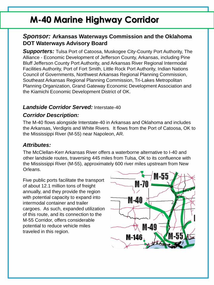
M-40 Marine Highway Corridor
Sponsor: Arkansas Waterways Commission and the Oklahoma
DOT Waterways Advisory Board
Supporters: Tulsa Port of Catoosa, Muskogee City-County Port Authority, The
Alliance - Economic Development of Jefferson County, Arkansas, including Pine
Bluff Jefferson County Port Authority, and Arkansas River Regional Intermodal
Facilities Authority, Port of Fort Smith, Little Rock Port Authority, Indian Nations
Council of Governments, Northwest Arkansas Regional Planning Commission,
Southeast Arkansas Regional Planning Commission, Tri-Lakes Metropolitan
Planning Organization, Grand Gateway Economic Development Association and
the Kiamichi Economic Development District of OK.
Landside Corridor Served: Interstate-40
Corridor Description:
The M-40 flows alongside Interstate-40 in Arkansas and Oklahoma and includes
the Arkansas, Verdigris and White Rivers. It flows from the Port of Catoosa, OK to
the Mississippi River (M-55) near Napoleon, AR.
Attributes:
The McClellan-Kerr Arkansas River offers a waterborne alternative to I-40 and
other landside routes, traversing 445 miles from Tulsa, OK to its confluence with
the Mississippi River (M-55), approximately 600 river miles upstream from New
Orleans.
Five public ports facilitate the transport
of about 12.1 million tons of freight
annually, and they provide the region
with potential capacity to expand into
intermodal container and trailer
cargoes. As such, expanded utilization
of this route, and its connection to the
M-55 Corridor, offers considerable
potential to reduce vehicle miles
traveled in this region.
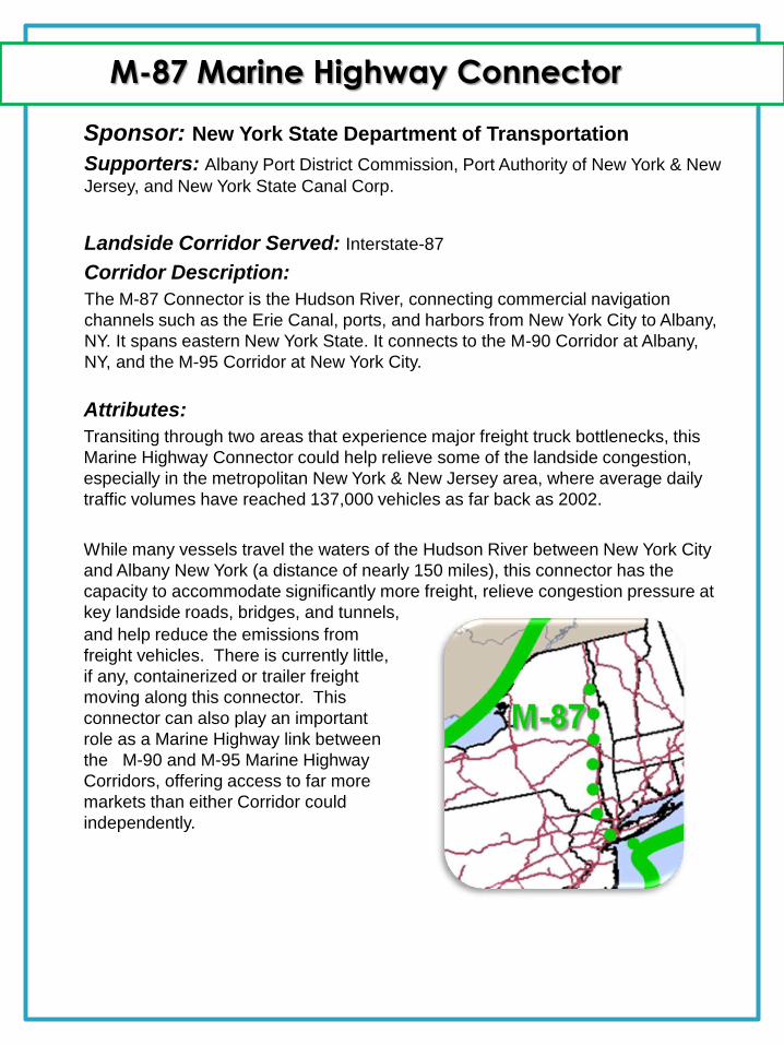
M-87 Marine Highway Connector
Sponsor: New York State Department of Transportation
Supporters: Albany Port District Commission, Port Authority of New York & New
Jersey, and New York State Canal Corp.
Landside Corridor Served: Interstate-87
Corridor Description:
The M-87 Connector is the Hudson River, connecting commercial navigation
channels such as the Erie Canal, ports, and harbors from New York City to Albany,
NY. It spans eastern New York State. It connects to the M-90 Corridor at Albany,
NY, and the M-95 Corridor at New York City.
Attributes:
Transiting through two areas that experience major freight truck bottlenecks, this
Marine Highway Connector could help relieve some of the landside congestion,
especially in the metropolitan New York & New Jersey area, where average daily
traffic volumes have reached 137,000 vehicles as far back as 2002.
While many vessels travel the waters of the Hudson River between New York City
and Albany New York (a distance of nearly 150 miles), this connector has the
capacity to accommodate significantly more freight, relieve congestion pressure at
key landside roads, bridges, and tunnels,
and help reduce the emissions from
freight vehicles. There is currently little,
if any, containerized or trailer freight
moving along this connector. This
connector can also play an important
role as a Marine Highway link between
the M-90 and M-95 Marine Highway
Corridors, offering access to far more
markets than either Corridor could
independently.
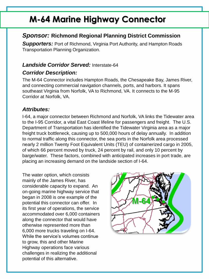
M-64 Marine Highway Connector
Sponsor: Richmond Regional Planning District Commission
Supporters: Port of Richmond, Virginia Port Authority, and Hampton Roads
Transportation Planning Organization.
Landside Corridor Served: Interstate-64
Corridor Description:
The M-64 Connector includes Hampton Roads, the Chesapeake Bay, James River,
and connecting commercial navigation channels, ports, and harbors. It spans
southeast Virginia from Norfolk, VA to Richmond, VA. It connects to the M-95
Corridor at Norfolk, VA.
Attributes:
I-64, a major connector between Richmond and Norfolk, VA links the Tidewater area
to the I-95 Corridor, a vital East Coast lifeline for passengers and freight. The U.S.
Department of Transportation has identified the Tidewater Virginia area as a major
freight truck bottleneck, causing up to 500,000 hours of delay annually. In addition
to normal traffic along this connector, the sea ports in the Norfolk area processed
nearly 2 million Twenty Foot Equivalent Units (TEU) of containerized cargo in 2005,
of which 66 percent moved by truck, 24 percent by rail, and only 10 percent by
barge/water. These factors, combined with anticipated increases in port trade, are
placing an increasing demand on the landside section of I-64.
The water option, which consists
mainly of the James River, has
considerable capacity to expand. An
on-going marine highway service that
began in 2008 is one example of the
potential this connector can offer. In
its first year of operations, the service
accommodated over 6,000 containers
along the connector that would have
otherwise represented more than
6,000 more trucks traveling on I-64.
While the service’s volumes continue
to grow, this and other Marine
Highway operations face various
challenges in realizing the additional
potential of this alternative.
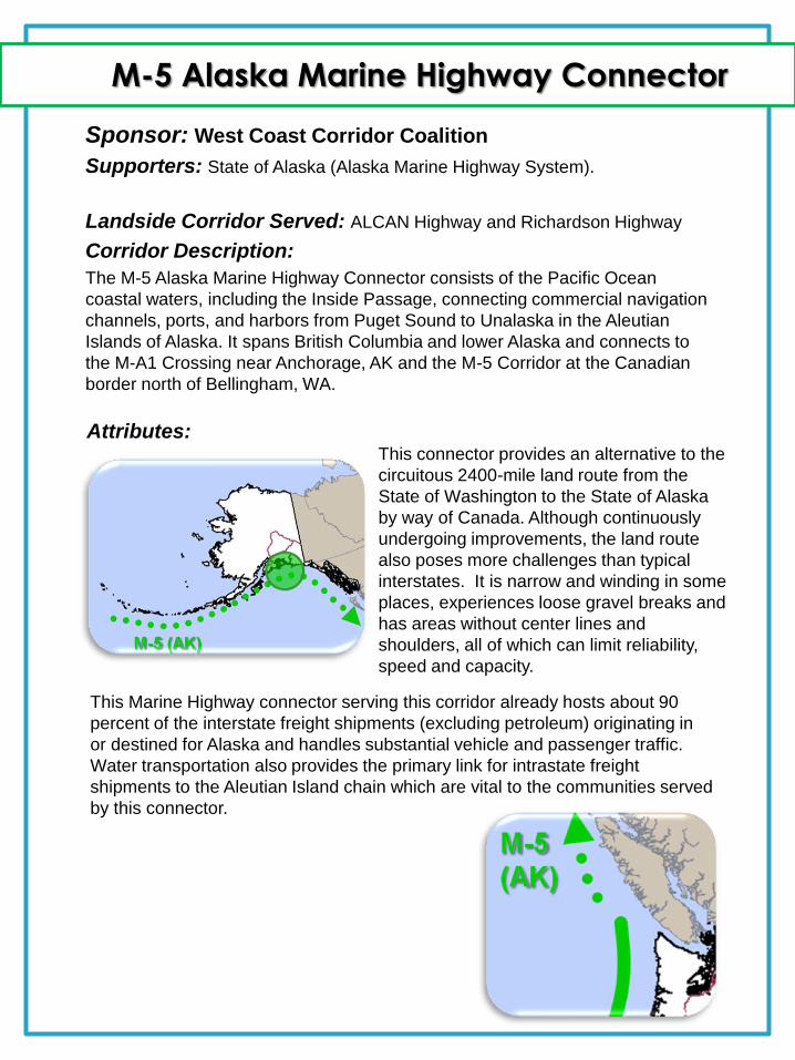
M-5 Alaska Marine Highway Connector
Sponsor: West Coast Corridor Coalition
Supporters: State of Alaska (Alaska Marine Highway System).
Landside Corridor Served: ALCAN Highway and Richardson Highway
Corridor Description:
The M-5 Alaska Marine Highway Connector consists of the Pacific Ocean
coastal waters, including the Inside Passage, connecting commercial navigation
channels, ports, and harbors from Puget Sound to Unalaska in the Aleutian
Islands of Alaska. It spans British Columbia and lower Alaska and connects to
the M-A1 Crossing near Anchorage, AK and the M-5 Corridor at the Canadian
border north of Bellingham, WA.
This connector provides an alternative to the
circuitous 2400-mile land route from the
State of Washington to the State of Alaska
by way of Canada. Although continuously
undergoing improvements, the land route
also poses more challenges than typical
interstates. It is narrow and winding in some
places, experiences loose gravel breaks and
has areas without center lines and
shoulders, all of which can limit reliability,
speed and capacity.
Attributes:
This Marine Highway connector serving this corridor already hosts about 90
percent of the interstate freight shipments (excluding petroleum) originating in
or destined for Alaska and handles substantial vehicle and passenger traffic.
Water transportation also provides the primary link for intrastate freight
shipments to the Aleutian Island chain which are vital to the communities served
by this connector.
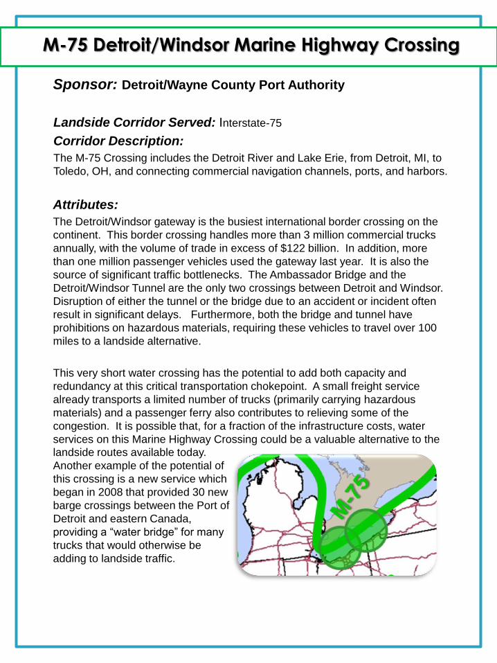
M-75 Detroit/Windsor Marine Highway Crossing
Sponsor: Detroit/Wayne County Port Authority
Landside Corridor Served: Interstate-75
Corridor Description:
The M-75 Crossing includes the Detroit River and Lake Erie, from Detroit, MI, to
Toledo, OH, and connecting commercial navigation channels, ports, and harbors.
Attributes:
The Detroit/Windsor gateway is the busiest international border crossing on the
continent. This border crossing handles more than 3 million commercial trucks
annually, with the volume of trade in excess of $122 billion. In addition, more
than one million passenger vehicles used the gateway last year. It is also the
source of significant traffic bottlenecks. The Ambassador Bridge and the
Detroit/Windsor Tunnel are the only two crossings between Detroit and Windsor.
Disruption of either the tunnel or the bridge due to an accident or incident often
result in significant delays. Furthermore, both the bridge and tunnel have
prohibitions on hazardous materials, requiring these vehicles to travel over 100
miles to a landside alternative.
This very short water crossing has the potential to add both capacity and
redundancy at this critical transportation chokepoint. A small freight service
already transports a limited number of trucks (primarily carrying hazardous
materials) and a passenger ferry also contributes to relieving some of the
congestion. It is possible that, for a fraction of the infrastructure costs, water
services on this Marine Highway Crossing could be a valuable alternative to the
landside routes available today.
Another example of the potential of
this crossing is a new service which
began in 2008 that provided 30 new
barge crossings between the Port of
Detroit and eastern Canada,
providing a “water bridge” for many
trucks that would otherwise be
adding to landside traffic.
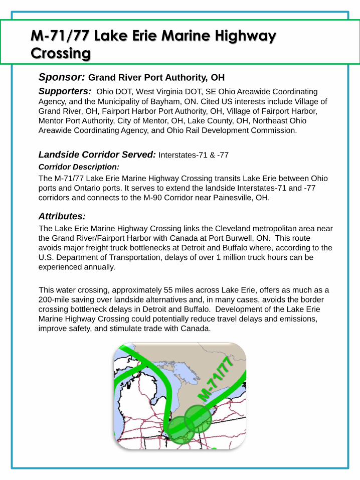
Sponsor: Grand River Port Authority, OH
Supporters: Ohio DOT, West Virginia DOT, SE Ohio Areawide Coordinating
Agency, and the Municipality of Bayham, ON. Cited US interests include Village of
Grand River, OH, Fairport Harbor Port Authority, OH, Village of Fairport Harbor,
Mentor Port Authority, City of Mentor, OH, Lake County, OH, Northeast Ohio
Areawide Coordinating Agency, and Ohio Rail Development Commission.
Landside Corridor Served: Interstates-71 & -77
Corridor Description:
The M-71/77 Lake Erie Marine Highway Crossing transits Lake Erie between Ohio
ports and Ontario ports. It serves to extend the landside Interstates-71 and -77
corridors and connects to the M-90 Corridor near Painesville, OH.
Attributes:
The Lake Erie Marine Highway Crossing links the Cleveland metropolitan area near
the Grand River/Fairport Harbor with Canada at Port Burwell, ON. This route
avoids major freight truck bottlenecks at Detroit and Buffalo where, according to the
U.S. Department of Transportation, delays of over 1 million truck hours can be
experienced annually.
This water crossing, approximately 55 miles across Lake Erie, offers as much as a
200-mile saving over landside alternatives and, in many cases, avoids the border
crossing bottleneck delays in Detroit and Buffalo. Development of the Lake Erie
Marine Highway Crossing could potentially reduce travel delays and emissions,
improve safety, and stimulate trade with Canada.
M-71/77 Lake Erie Marine Highway
Crossing
M-A1 Marine Highway Crossing
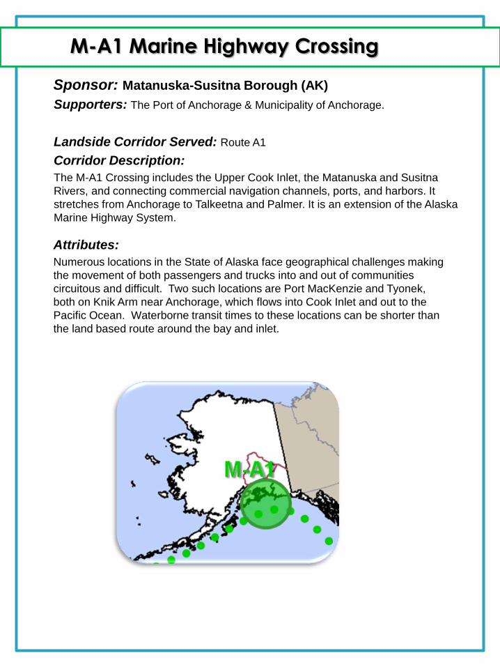
Sponsor: Matanuska-Susitna Borough (AK)
Supporters: The Port of Anchorage & Municipality of Anchorage.
Landside Corridor Served: Route A1
Corridor Description:
The M-A1 Crossing includes the Upper Cook Inlet, the Matanuska and Susitna
Rivers, and connecting commercial navigation channels, ports, and harbors. It
stretches from Anchorage to Talkeetna and Palmer. It is an extension of the Alaska
Marine Highway System.
Attributes:
Numerous locations in the State of Alaska face geographical challenges making
the movement of both passengers and trucks into and out of communities
circuitous and difficult. Two such locations are Port MacKenzie and Tyonek,
both on Knik Arm near Anchorage, which flows into Cook Inlet and out to the
Pacific Ocean. Waterborne transit times to these locations can be shorter than
the land based route around the bay and inlet.
The water route between Port MacKenzie and
Anchorage has the potential to significantly
reduce vehicle miles traveled by as much as
160 miles round trip. This water route would
result in reduced emissions, energy savings,
and less road wear in comparison with the
longer landside alternative. Additionally, it can
reduce the average travel time by about 25
percent to approximately 30 minutes per
round trip. In the case of the route between
Tyonek and Anchorage, the proposed 40-mile
crossing would provide service to a remote
Alaskan Native village which is currently only
accessible by small plane or barge.
M-146 Marine Highway Connector
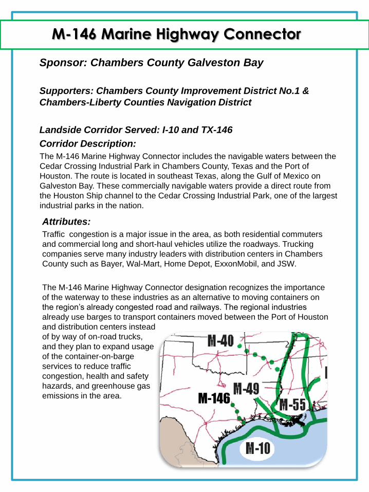
Sponsor: Chambers County Galveston Bay
Supporters: Chambers County Improvement District No.1 &
Chambers-Liberty Counties Navigation District
Landside Corridor Served: I-10 and TX-146
Corridor Description:
The M-146 Marine Highway Connector includes the navigable waters between the
Cedar Crossing Industrial Park in Chambers County, Texas and the Port of
Houston. The route is located in southeast Texas, along the Gulf of Mexico on
Galveston Bay. These commercially navigable waters provide a direct route from
the Houston Ship channel to the Cedar Crossing Industrial Park, one of the largest
industrial parks in the nation.
Attributes:
Traffic congestion is a major issue in the area, as both residential commuters
and commercial long and short-haul vehicles utilize the roadways. Trucking
companies serve many industry leaders with distribution centers in Chambers
County such as Bayer, Wal-Mart, Home Depot, ExxonMobil, and JSW.
The M-146 Marine Highway Connector designation recognizes the importance
of the waterway to these industries as an alternative to moving containers on
the region’s already congested road and railways. The regional industries
already use barges to transport containers moved between the Port of Houston
and distribution centers instead
of by way of on-road trucks,
and they plan to expand usage
of the container-on-barge
services to reduce traffic
congestion, health and safety
hazards, and greenhouse gas
emissions in the area.
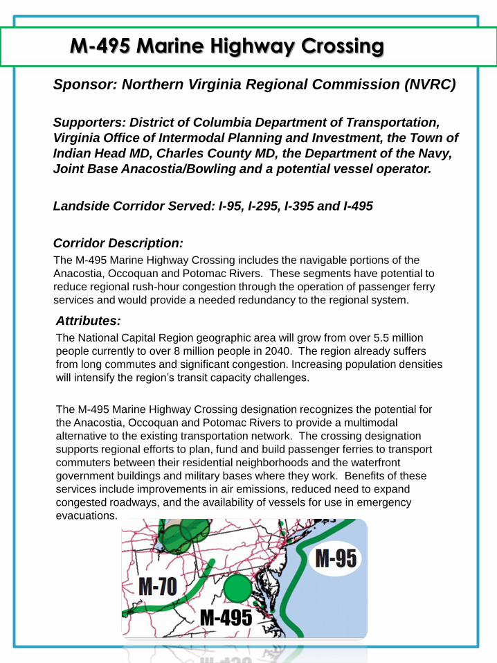
M-495 Marine Highway Crossing
Sponsor: Northern Virginia Regional Commission (NVRC)
Supporters: District of Columbia Department of Transportation,
Virginia Office of Intermodal Planning and Investment, the Town of
Indian Head MD, Charles County MD, the Department of the Navy,
Joint Base Anacostia/Bowling and a potential vessel operator.
Landside Corridor Served: I-95, I-295, I-395 and I-495
Corridor Description:
The M-495 Marine Highway Crossing includes the navigable portions of the
Anacostia, Occoquan and Potomac Rivers. These segments have potential to
reduce regional rush-hour congestion through the operation of passenger ferry
services and would provide a needed redundancy to the regional system.
Attributes:
The National Capital Region geographic area will grow from over 5.5 million
people currently to over 8 million people in 2040. The region already suffers
from long commutes and significant congestion. Increasing population densities
will intensify the region’s transit capacity challenges.
The M-495 Marine Highway Crossing designation recognizes the potential for
the Anacostia, Occoquan and Potomac Rivers to provide a multimodal
alternative to the existing transportation network. The crossing designation
supports regional efforts to plan, fund and build passenger ferries to transport
commuters between their residential neighborhoods and the waterfront
government buildings and military bases where they work. Benefits of these
services include improvements in air emissions, reduced need to expand
congested roadways, and the availability of vessels for use in emergency
evacuations.
M-29 Marine Highway Connector
Sponsor: The Port Authority of Kansas City and Missouri
DOT
Supporters: Kansas DOT, the Mid-America Regional Council, St.
Joseph Area Transportation Study Organization, Missouri
Department of Economic Development, the Inland River Ports and
Terminals Association and the Nebraska City Dock Board.
Attributes: Kansas City is a regional freight hub and home to the Nation’s second largest
rail center and third largest trucking center. The M-29 Connector will provide a
third transportation option for regional freight movement between Kansas City’s
intermodal infrastructure and shippers in Missouri, Kansas, Iowa, Nebraska,
South Dakota and Minnesota. It has the potential to contribute to a safe, cost-
efficient and environmentally sustainable regional transportation system.
Increasing freight transportation on the Missouri River, both north to Sioux City,
Iowa and east to the Mississippi River, can serve to slow freight traffic growth on
local roads, interstate highways, railroads and bridges in the surrounding
counties. The M-29 Connector will provide a crucial linkage to the larger M-70
Corridor, serving areas previously unconnected to that Corridor, as well as
strengthening the M-70 Corridor itself by encouraging increased utilization. This
will ease congestion between Missouri and Kansas, in other cities adjacent to
the Missouri River such as Omaha, Nebraska and Sioux City, Iowa, and
throughout the Midwest region in general.
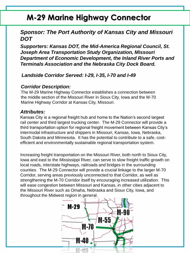
Landside Corridor Served: I-29, I-35, I-70 and I-49
Corridor Description: The M-29 Marine Highway Connector establishes a connection between
the middle section of the Missouri River in Sioux City, Iowa and the M-70
Marine Highway Corridor at Kansas City, Missouri.
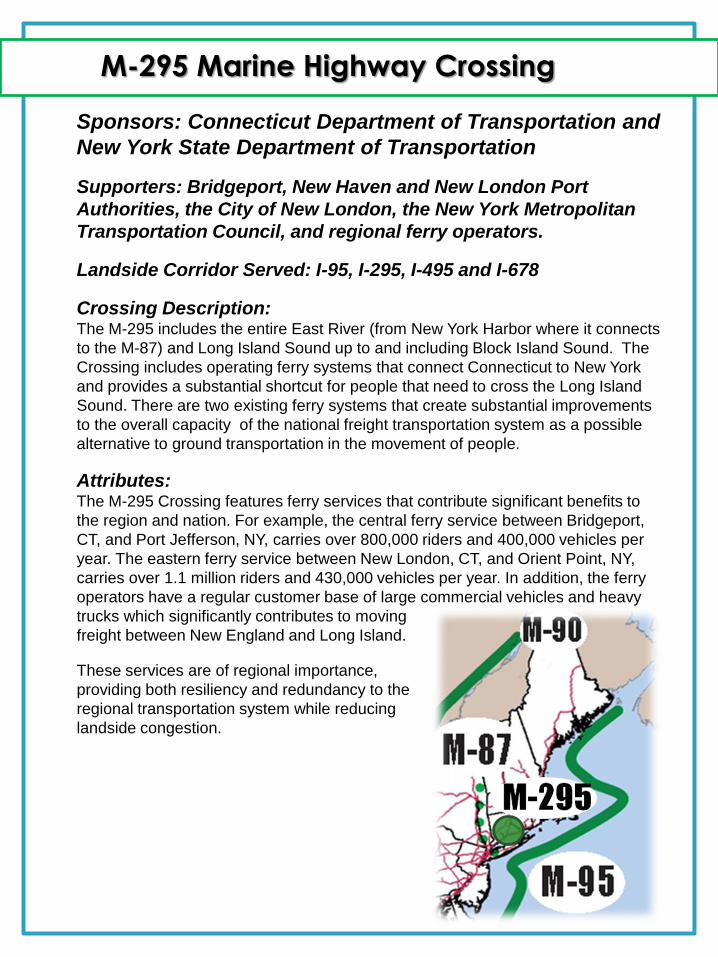
M-295 Marine Highway Crossing
Sponsors: Connecticut Department of Transportation and
New York State Department of Transportation
Supporters: Bridgeport, New Haven and New London Port
Authorities, the City of New London, the New York Metropolitan
Transportation Council, and regional ferry operators.
Landside Corridor Served: I-95, I-295, I-495 and I-678
Crossing Description: The M-295 includes the entire East River (from New York Harbor where it connects
to the M-87) and Long Island Sound up to and including Block Island Sound. The
Crossing includes operating ferry systems that connect Connecticut to New York
and provides a substantial shortcut for people that need to cross the Long Island
Sound. There are two existing ferry systems that create substantial improvements
to the overall capacity of the national freight transportation system as a possible
alternative to ground transportation in the movement of people.
Attributes: The M-295 Crossing features ferry services that contribute significant benefits to
the region and nation. For example, the central ferry service between Bridgeport,
CT, and Port Jefferson, NY, carries over 800,000 riders and 400,000 vehicles per
year. The eastern ferry service between New London, CT, and Orient Point, NY,
carries over 1.1 million riders and 430,000 vehicles per year. In addition, the ferry
operators have a regular customer base of large commercial vehicles and heavy
trucks which significantly contributes to moving
freight between New England and Long Island.
These services are of regional importance,
providing both resiliency and redundancy to the
regional transportation system while reducing
landside congestion.
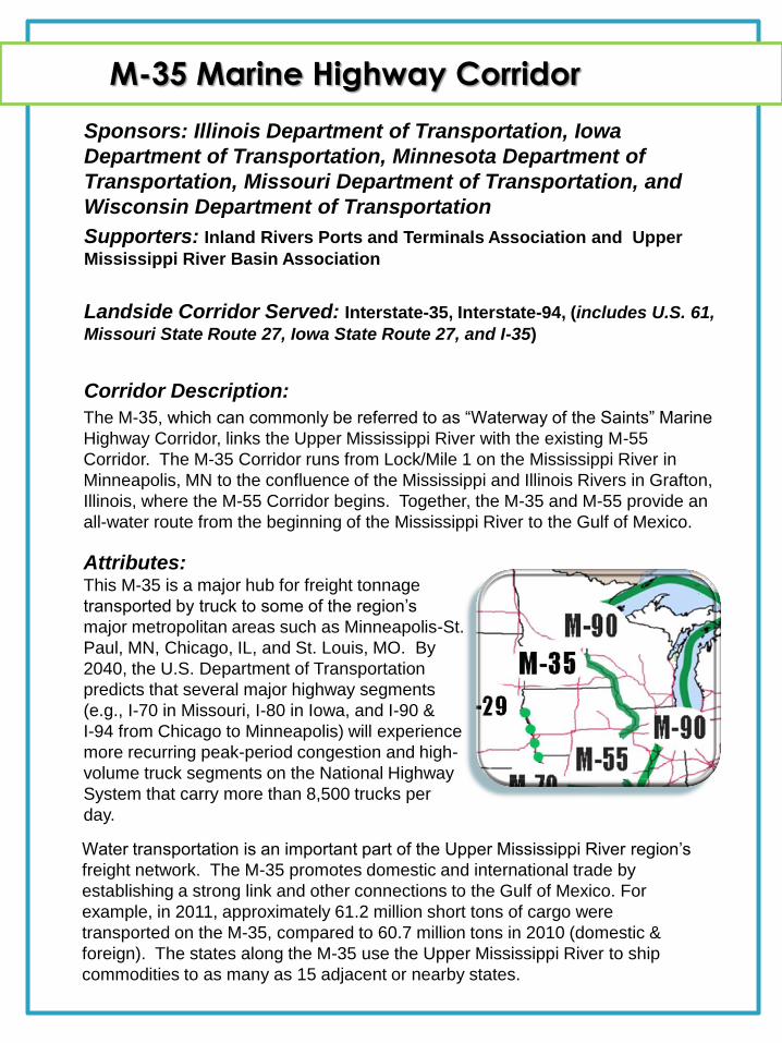
M-35 Marine Highway Corridor
Sponsors: Illinois Department of Transportation, Iowa
Department of Transportation, Minnesota Department of
Transportation, Missouri Department of Transportation, and
Wisconsin Department of Transportation
Supporters: Inland Rivers Ports and Terminals Association and Upper
Mississippi River Basin Association
Landside Corridor Served: Interstate-35, Interstate-94, (includes U.S. 61,
Missouri State Route 27, Iowa State Route 27, and I-35)
Corridor Description:
The M-35, which can commonly be referred to as “Waterway of the Saints” Marine
Highway Corridor, links the Upper Mississippi River with the existing M-55
Corridor. The M-35 Corridor runs from Lock/Mile 1 on the Mississippi River in
Minneapolis, MN to the confluence of the Mississippi and Illinois Rivers in Grafton,
Illinois, where the M-55 Corridor begins. Together, the M-35 and M-55 provide an
all-water route from the beginning of the Mississippi River to the Gulf of Mexico.
Attributes: This M-35 is a major hub for freight tonnage
transported by truck to some of the region’s
major metropolitan areas such as Minneapolis-St.
Paul, MN, Chicago, IL, and St. Louis, MO. By
2040, the U.S. Department of Transportation
predicts that several major highway segments
(e.g., I-70 in Missouri, I-80 in Iowa, and I-90 &
I-94 from Chicago to Minneapolis) will experience
more recurring peak-period congestion and high-
volume truck segments on the National Highway
System that carry more than 8,500 trucks per
day.
Water transportation is an important part of the Upper Mississippi River region’s
freight network. The M-35 promotes domestic and international trade by
establishing a strong link and other connections to the Gulf of Mexico. For
example, in 2011, approximately 61.2 million short tons of cargo were
transported on the M-35, compared to 60.7 million tons in 2010 (domestic &
foreign). The states along the M-35 use the Upper Mississippi River to ship
commodities to as many as 15 adjacent or nearby states.