Embed Size (px)
Citation preview
Safe roads, reliable journeys, informed travellers
An executive agency of the Department for Transport
Volu
me
7.0
M4 junctions 3 to 12 smart motorway
TR010019
7.1 Planning statement 5(2) (q)
Revision 0
March 2015
Planning Act 2008
Infrastructure Planning (Applications: Prescribed Forms and Procedure) Regulations 2009

HIGHWAYS AGENCY – M4 JUNCTIONS 3 TO 12 SMART MOTORWAY
M4 JUNCTIONS 3 TO 12 SMART MOTORWAY VOLUME 7
7.1 PLANNING STATEMENT
MARCH 2015
PAGE I
EXECUTIVE SUMMARY
The Application
This Planning Statement relates to an application (the "Application") made by the
Highways Agency (the "Agency") to the Secretary of State for Transport (the
"Secretary of State") pursuant to the Planning Act 2008 ("PA 2008").
The Application is for the M4 (Junctions 3 to 12) (Smart Motorway) Development
Consent Order ("DCO") which would grant development consent, authorising the
construction, operation and maintenance of a smart motorway between the M4
between junctions 3 to 12 (the "Scheme"), along with the compulsory acquisition of
all land necessary to enable this.
The Scheme
The Scheme lies wholly within England and includes the alteration and improvement
of a highway for which the Secretary of State is the highway authority. The area of
development is greater than 15 hectares, and the improvement of the highway is
considered to have the potential for a significant effect on the environment. Hence
the Scheme is classified as a nationally significant infrastructure project ("NSIP").
The Scheme’s key objectives are to:
a) reduce congestion, smooth the flow of traffic to improve journey times and
make journeys more reliable;
b) support and enhance the role of the M4 as a major national and inter-urban
regional transport artery;
c) support the economy and facilitate economic growth within the regions, by
providing much needed capacity on the motorway;
d) continue to deliver a high level of safety performance of the network using
smart motorway techniques; and
e) deliver environmental improvements and mitigation where appropriate and
required.
Need for the Scheme
The strategic case for providing additional capacity on the M4 within the Thames
Valley was first examined in ‘The Thames Valley Multi-Modal Study’ (2003) (the
"TVMMS"), prepared by WS Atkins on behalf of the Government Office for the South
HIGHWAYS AGENCY – M4 JUNCTIONS 3 TO 12 SMART MOTORWAY
M4 JUNCTIONS 3 TO 12 SMART MOTORWAY VOLUME 7
7.1 PLANNING STATEMENT
MARCH 2015
PAGE II
East. The purpose of the TVMMS was ‘to identify the most effective means of
addressing current and future transport-related problems in the Thames Valley’.
TVMMS reported that congestion on the road network was responsible for many of
the transport-related problems in the Thames Valley. Moreover, such congestion had
wider, adverse implications for the environment including impacts of road traffic in
terms of noise, severance and air quality – which were experienced well beyond the
peak periods.
TVMMS identified a range of interventions, following which a preferred transport
strategy was developed in line with national and local policy objectives and
stakeholders’ aspirations.
In March 2008, the Advanced Motorway Signalling and Traffic Management
Feasibility Study, published by the Department of Transport for the Secretary of
State, identified the M4 junction 3 to junction 12 as a priority for the provision of
additional capacity. Ministers agreed that hard shoulder running as an alternative to
widening should be investigated.
Further governmental research has taken the concept of managed motorways
forward, along with more recent ministerial announcements confirming funding
support (subject to assessment of value for money and deliverability) for the
development of the now renamed ‘smart motorway schemes’.
Determination - important and relevant considerations
The Planning Inspectorate will consider the Application and will make a
recommendation to the Secretary of State, who will decide whether development
consent for the Scheme should be granted. In so doing, the Secretary of State must
decide the Application in accordance with any relevant national policy statement, but
other important and relevant considerations include the National Planning Policy
Framework ("NPPF") and development plan policies of the 11 Local Planning
Authorities (“LPA”), together with any other important and relevant considerations.
The National Policy Statement for National Networks ("NN NPS"), designated in
January 2015, sets out the Government’s objectives, including environmental and
other principles, relating to the development of NSIPs for national road and rail
networks in England. NPS NN is the primary policy document against which the
Scheme will be assessed by and for the Secretary of State in determining the
Application.
HIGHWAYS AGENCY – M4 JUNCTIONS 3 TO 12 SMART MOTORWAY
M4 JUNCTIONS 3 TO 12 SMART MOTORWAY VOLUME 7
7.1 PLANNING STATEMENT
MARCH 2015
PAGE III
National networks national policy statement
The Scheme has been appraised against the various polices contained in the NN
NPS, particularly having regard to the assessment matters identified in that
document in relation to environmental effects.
Each topic chapter in the Environmental Statement ("ES") addresses those
paragraphs of the NN NPS which are relevant to the environmental assessment and
provides an analysis of the Scheme's compliance with the NN NPS.
The Scheme accords with the NN NPS is all material respects, and on that basis, a
presumption in favour of the Scheme exists under the terms of section 104 of the PA
2008. This legislative provision provides that the relevant NPS is the primary policy
document for the Secretary of State in the consideration of applications for
development consent under the PA 2008.
National planning policy framework
The Scheme strongly accords with the key aims of the NPPF, notably by improving
the conditions by which people travel. This is a key element of the Scheme.
The Scheme supports the delivery of the NPPF’s core land-use planning principles,
by providing improved infrastructure to support economic growth within the region
through improved capacity on the M4 motorway. This will be achieved whilst
conserving the natural environment to a greater extent than a traditional motorway
widening scheme. This is because the use of land for the Scheme is largely within
the existing motorway corridor. This approach involves the use of previously
developed land (the motorway and its associated verges and embankments),
another core planning principle of the NPPF.
Development within the Green Belt is a key issue within the NPPF. It is
acknowledged, but not agreed that the Scheme may potentially represent
inappropriate development within the Green Belt. For that reason, a full assessment
of the Scheme against the NN NPS has been carried out, and the assessment
demonstrates that ‘very special circumstances’ exist for development within Green
Belt land and the Scheme’s compliance with both the tests of openness, and the five
purposes of the Green Belt.
The assessment undertaken within the ES addresses a range of environmental
issues and demonstrates how the Scheme satisfies the relevant policy guidance.
HIGHWAYS AGENCY – M4 JUNCTIONS 3 TO 12 SMART MOTORWAY
M4 JUNCTIONS 3 TO 12 SMART MOTORWAY VOLUME 7
7.1 PLANNING STATEMENT
MARCH 2015
PAGE IV
The Scheme crosses a number of floodplains classified as Flood Zones 2 and 3. A
Flood Risk Assessment has been prepared as an addendum to the ES to identify
potential sources of flood risk in relation to the Scheme. It is concluded that overall,
the Scheme will not have a detrimental impact upon the existing floodplains and
groundwater resources.
The Scheme potentially lies within the area of influence of a number of
internationally, nationally and locally designated sites, including Sites of Special
Scientific Interest. However, the ES concludes that the Scheme will not result in any
direct impacts on designated or non-designated sites of nature conservation value.
The overall effects on nature conservation are therefore assessed as neutral.
Other key issues addressed in the policy guidance are both noise and air quality.
With regard to noise, the ES shows that, once operational, the significance of effect
of the operation of the Scheme is assessed as being ‘slight adverse in the short term
and neutral in the long term’. This falls within the requirements of NPPF for
development to ‘avoid noise from giving rise to significant adverse impacts.’
The ES concludes that, from the locations modelled, the overall impact of the
Scheme on air quality during construction and operation is not significant.
Overall, therefore, the Scheme is considered to be consistent with the provisions and
requirements of NPPF.
Local planning policy
The main local planning policies relevant to the Application across all 11 ‘host’ local
authorities relate to the environmental effects of the Scheme, particularly in relation
to air quality, noise, flood risk, nature conservation, heritage and landscape.
With the exception of the North Wessex AONB, located at the western edge of the
Scheme, there are no landscape designations of national or local importance along
the extent of the Scheme. Nor does the Scheme fall within any nature conservation
sites of international, national or local importance. Whilst the Scheme runs close to, it
does not directly affect cultural heritage sites, historic gardens, or conservation
areas.
Through the assessments undertaken within the ES, the Scheme has been shown to
accord with local planning policy in relation to air quality and noise and where
located within Flood Zones 2 and 3, the proposed mitigation measures address
potential flood risks, in compliance with policy guidance.
HIGHWAYS AGENCY – M4 JUNCTIONS 3 TO 12 SMART MOTORWAY
M4 JUNCTIONS 3 TO 12 SMART MOTORWAY VOLUME 7
7.1 PLANNING STATEMENT
MARCH 2015
PAGE V
Spatially, elements of the Scheme between the local authority areas of Windsor and
Maidenhead to the west and Hounslow to the east lie in Green Belt, where a clear
presumption exists within local planning policy against ‘inappropriate’ development.
Nonetheless, compliance has been demonstrated for the Scheme when considered
against the relevant policy tests set out in local and national guidance.
Whilst the impact of the Scheme at the outer edge of the North Wessex AONB is
contrary to the local plan policy, this must be balanced against the range of planning
policies that are either supportive of the Scheme or with which the Scheme is in
compliance.
On balance, the Scheme accords with the provisions of the development plans and
relevant policies of the emerging local plans across its host authorities.
Other important and relevant considerations
Traffic congestion is regarded as a major constraint to economic development and
policies for relieving it are key to the Government’s aspirations for sustainable
economic growth.
It follows that addressing the current congestion between junction 3 and junction 12
of the M4 accords with national policy. The recognition given to improving the
Strategic Road Network through the development of smart motorways lends further
support to the Scheme.
Importantly, the inclusion of the Scheme as part of the Government’s current
investment programme provides a clear recognition of the importance of the Scheme
in meeting national policy aspirations and is therefore an important and relevant
consideration in support of the Scheme.
The planning balance
Although the various ES assessments and review of planning policy reveal
environmental issues that have to be given due regard (mainly Green Belt, air
quality, noise, flood risk, nature conservation, heritage and landscape) this Planning
Statement provides a comprehensive overview that confirms the ability of the
Scheme to satisfactorily address those matters. The Scheme accords with policy in
all material respects, which means that a presumption in its favour exists under the
terms of section 104 PA 2008.
Where there is potential for the Scheme to have an adverse impact in relation to
planning policy, these impacts must be considered and weighed in the context of:
HIGHWAYS AGENCY – M4 JUNCTIONS 3 TO 12 SMART MOTORWAY
M4 JUNCTIONS 3 TO 12 SMART MOTORWAY VOLUME 7
7.1 PLANNING STATEMENT
MARCH 2015
PAGE VI
a) the linear nature of the Scheme and the containment of the most of the
Scheme elements within an existing strategic highway corridor; and
b) the significant role the Scheme will play in underpinning the Government’s
social, economic and environmental policy aspirations, and the substantially
improved travelling conditions which the Scheme will provide.
On the basis of the need case for the Scheme, it is clear that there is a compelling
case in the public interest for the Scheme. Against a background of overwhelming
compliance in terms of national and local planning policy, any adverse effects of the
Scheme are not considered to outweigh its benefits. Accordingly, the policy
presumption in favour of the Scheme and the overall planning balance lie strongly in
favour of the grant of development consent.
HIGHWAYS AGENCY – M4 JUNCTIONS 3 TO 12 SMART MOTORWAY
M4 JUNCTIONS 3 TO 12 SMART MOTORWAY VOLUME 7
7.1 PLANNING STATEMENT
MARCH 2015
PAGE VII
CONTENTS
LIST OF TABLES: 1 INTRODUCTION ................................................ 1
1.1 OVERVIEW 1
1.2 THE SCHEME 1
1.3 PURPOSE AND STRUCTURE OF THE PLANNING STATEMENT 5
1.4 THE APPLICATION 7
2 DESCRIPTION OF THE ORDER LAND ............ 8
2.1 INTRODUCTION 8
3 THE SCHEME .................................................. 20
3.1 INTRODUCTION 20
4 RELEVANT PLANNING HISTORY.................. 27
4.1 PLANNING HISTORY 27
4.2 CONCLUSIONS 27
5 PLANNING POLICY CONSIDERATIONS ....... 30
5.1 INTRODUCTION 30
5.2 NATIONAL PLANNING POLICY 31
5.3 LOCAL PLANNING POLICY 71
5.4 POLICY ASSESSMENT 73
6 OTHER IMPORTANT AND RELEVANT CONSIDERATIONS......................................... 83
6.1 INTRODUCTION 83
6.2 GOVERNMENT POLICY 83
7 OVERALL CONCLUSIONS AND THE PLANNING BALANCE .................................... 91
7.1 THE APPLICATION 91
7.2 THE SCHEME 91
7.3 DETERMINATION AND IMPORTANT AND RELEVANT
CONSIDERATIONS 91
7.4 NATIONAL NETWORKS NATIONAL POLICY STATEMENT 92
7.5 NATIONAL PLANNING POLICY FRAMEWORK 92
7.6 LOCAL PLANNING POLICY 93
7.7 OTHER IMPORTANT AND RELEVANT CONSIDERATIONS 94
7.8 THE PLANNING BALANCE 95
APPENDIX 1 - LOCAL AUTHORITY PLANNING
HIGHWAYS AGENCY – M4 JUNCTIONS 3 TO 12 SMART MOTORWAY
M4 JUNCTIONS 3 TO 12 SMART MOTORWAY VOLUME 7
7.1 PLANNING STATEMENT
MARCH 2015
PAGE VIII
AND TRANSPORT POLICIES
LIST OF FIGURES: FIGURE 2: M4 JUNCTION 3 TO JUNCTION 12 SCHEME ................................................................ 9
FIGURE 3 – SOUTH EAST PLAN REGIONAL SPATIAL STRATEGY – INTERNATIONAL AND INTER-REGIONAL CORRIDORS ................................ 26
HIGHWAYS AGENCY – M4 JUNCTIONS 3 TO 12 SMART MOTORWAY
M4 JUNCTIONS 3 TO 12 SMART MOTORWAY VOLUME 7.1 PLANNING STATEMENT
MARCH 2015
PAGE 1
1 INTRODUCTION
1.1 Overview
1.1.1 This Planning Statement (the "Statement") relates to an application made
by the Highways Agency (the "Agency") to the Secretary of State for
Transport (the "Secretary of State") pursuant to the Planning Act 2008
("PA 2008") (the "Application").
1.1.2 The Application is for the M4 (Junction 3 to 12) (Smart Motorway)
development consent order ("DCO") which would grant development
consent, authorising the construction, operation and maintenance of the
M4 Junctions 3 to 12 Smart Motorway Scheme (the "Scheme"), along with
the compulsory acquisition of all land and interests in land necessary to
enable this.
1.1.3 The Scheme lies wholly within England and includes the alteration and
improvement of a highway for which the Secretary of State is the highway
authority. The area of development (the "Order land") for the Scheme is
greater than 15 hectares, and the improvement of the highway is
considered to have the potential for a significant effect on the environment.
As such, the Scheme is classified as a nationally significant infrastructure
project (“NSIP”) for the purposes of sections 14(1) (h) and 22 of the PA
2008. Under the PA 2008, an application for development consent is
required under section 37 to authorise the alteration or improvement of
such a highway.
1.1.4 This Statement has been prepared in accordance with Regulation 5(2) (q)
of the Infrastructure Planning (Applications: Prescribed Forms and
Procedure) Regulations 2009 ("APFP 2009") and comprises part of the
Application documents.
1.1.5 The Planning Inspectorate (“Inspectorate”) will consider the application for
development consent and will make a recommendation to the Secretary of
State, who will decide whether development consent for the Scheme
should be granted.
1.2 The Scheme
1.2.1 The Scheme’s key objectives are to:
a) reduce congestion, smooth the flow of traffic to improve journey
times and make journeys more reliable;
HIGHWAYS AGENCY – M4 JUNCTIONS 3 TO 12 SMART MOTORWAY
M4 JUNCTIONS 3 TO 12 SMART MOTORWAY VOLUME 7.1 PLANNING STATEMENT
MARCH 2015
PAGE 2
b) support and enhance the role of the M4 as a major national and
inter-urban regional transport artery;
c) support the economy and facilitate economic growth within the
regions, by providing much needed capacity on the motorway;
d) continue to deliver a high level of safety performance of the network
using smart motorway techniques; and
e) deliver environmental improvements and mitigation where
appropriate and required.
1.2.2 The Scheme comprises a number of key components to be included within
the Application. A detailed description of the various elements that
comprise the Scheme is included in Chapter 4 Scheme Description of the
Environmental Statement ("ES"). A summary of the main elements of the
Scheme, is provided below:
a) conversion of the hard shoulder to a permanent running lane and,
where no hard shoulder is in place at present, the construction of a
new lane. This will mainly take place between junction 4b and
junction 8/9;
b) replacement of overbridge structures where portals are too narrow
to accommodate the improved motorway;
c) extension of underbridges and other structures such as culverts and
subways to accommodate the improved motorway;
d) changes to junctions and slip roads needed to accommodate traffic
joining and leaving the improved motorway, and to allow use of the
hard shoulder as a running lane, as well as allowing "through
junction running" ("TJR");
e) provision of new gantries and signs to allow the motorway to
function as a smart motorway with a variable speed limit, and to
provide messages to road users; and
f) other infrastructure needed for the improved motorway, such as
Emergency Refuge Areas (“ERAs”), enhanced communication
systems, closed circuit television (“CCTV”) and electrical supplies,
as well as works to accommodate statutory undertakers' apparatus
and other parties who may be affected by the Scheme.

HIGHWAYS AGENCY – M4 JUNCTIONS 3 TO 12 SMART MOTORWAY
M4 JUNCTIONS 3 TO 12 SMART MOTORWAY VOLUME 7.1 PLANNING STATEMENT
MARCH 2015
PAGE 3
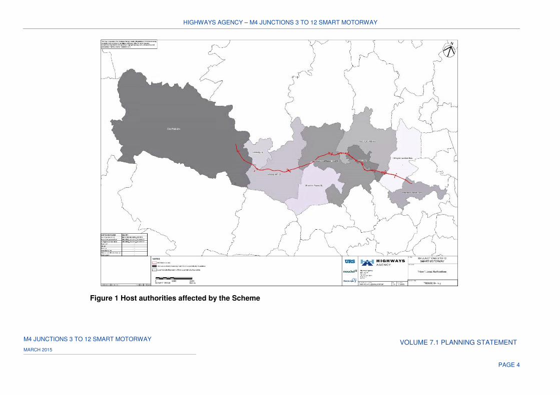
1.2.3 The Scheme passes through the administrative areas of 11 local
authorities. The 11 ‘host’ authorities, whose areas are directly affected by
the Scheme, are shown in Figure 1 below, and comprise the following:
a) West Berkshire Council;
b) Reading Borough Council;
c) Wokingham Borough Council;
d) Bracknell Forest Council;
e) The Royal Borough of Windsor and Maidenhead;
f) Slough Borough Council;
g) London Borough of Hillingdon;
h) London Borough of Hounslow;
i) South Bucks District Council;
j) Buckinghamshire County Council; and
k) Greater London Authority.
HIGHWAYS AGENCY – M4 JUNCTIONS 3 TO 12 SMART MOTORWAY
M4 JUNCTIONS 3 TO 12 SMART MOTORWAY VOLUME 7.1 PLANNING STATEMENT
MARCH 2015
PAGE 4
Figure 1 Host authorities affected by the Scheme
HIGHWAYS AGENCY – M4 JUNCTIONS 3 TO 12 SMART MOTORWAY
M4 JUNCTIONS 3 TO 12 SMART MOTORWAY VOLUME 7
7.1 PLANNING STATEMENT MARCH 2015
PAGE 5
1.2.4 The PA 2008 confers specific duties in respect of ‘host’ local authorities
and those authorities in adjacent areas in relation to pre-application
consultation as well as in relation to the Application and the Examination
process. A detailed assessment of the policy framework in place for each
‘host’ authority and its relevance to the Scheme is provided in Chapter 5 of
this Statement.
1.3 Purpose and structure of the Planning Statement
1.3.1 The purpose of the Planning Statement is to set out the relevant planning
policy context and the overall case for the Scheme and making of the
DCO.
1.3.2 The Statement accompanies the application for the DCO and draws upon
other Application documents, including the ES, to demonstrate the
planning merits of the Scheme. The Planning Statement is supported by a
suite of documents, namely the:
a) Environmental Statement;
b) Flood Risk Assessment;
c) Drainage Strategy Report;
d) Engineering and Design Report;
e) Socio-economic Report;
f) Consultation Report;
g) Statutory Instrument Consultation;
h) Funding Statement;
i) Book of Reference;
j) Statement of Reasons; and
k) Explanatory Memorandum to Draft Development Consent Order
1.3.3 Whilst its submission is not a mandatory requirement under the PA 2008
or APFP 2009, this Statement has been prepared to accompany the
Application in order to summarise the relevant planning policies for the
Scheme and present the overall planning balance for the Scheme within
that context.
HIGHWAYS AGENCY – M4 JUNCTIONS 3 TO 12 SMART MOTORWAY
M4 JUNCTIONS 3 TO 12 SMART MOTORWAY VOLUME 7
7.1 PLANNING STATEMENT MARCH 2015
PAGE 6
1.3.4 The categories of Application documents included within the Application
for the Scheme reflect those suggested in Appendix 1 to the Inspectorate’s
Advice Note Six: ‘Preparation and submission of application documents’
(October 2014). The lists of documents in Advice Note Six reflects APFP
2009 Regulation 5(2)(q), which states that an application must be
accompanied by "any other documents considered necessary to support
the application". Under the list of such ‘other documents’ listed in Advice
Note Six, reference is made to "information that the applicant would
normally want to submit for the development proposal." A planning
statement is provided as an example of such a document.
1.3.5 The Application will be determined in accordance with PA 2008. In
particular, section 104 PA 2008 provides for the decision in cases where a
national policy statement ("NPS") has effect. Section 104(2) (a) provides
that in deciding the Application, the Secretary of State "must have regard
to…'a relevant national policy statement'. Section 104(3) provides that the
Secretary of State must decide an application in accordance with any
relevant NPS. As the NPS is (subject to section 104(4) and (8)) the
primary policy reference for the Secretary of State, it sets the scope of
matters for this Statement to consider.
1.3.6 This Statement sets out other "important and relevant" considerations to
be weighed by the Examining Authority and the Secretary of State
including national planning and transport policy of relevance to the
Scheme. The Statement assesses the Scheme against policy and
important and relevant considerations, drawing on the environmental
information presented in the ES, submitted with the Application.
1.3.7 This Statement has also been prepared to take account of section 60 PA
2008 concerning the preparation of Local Impact Reports ("LIRs") by
relevant authorities which are invited to submit a LIR, in order to provide
"details of the likely impact of the proposed development on the authority’s
area".
1.3.8 The Inspectorate’s ‘Advice Note One: Local Impact Reports’ suggests a
list of topics which may be of assistance to a local authority in writing a
LIR. This includes the following topic areas:
a) "Relevant development plan policies, supplementary planning
guidance or documents, development briefs or approved master-
plans and an appraisal of their relationship and relevance to the
proposals
HIGHWAYS AGENCY – M4 JUNCTIONS 3 TO 12 SMART MOTORWAY
M4 JUNCTIONS 3 TO 12 SMART MOTORWAY VOLUME 7
7.1 PLANNING STATEMENT MARCH 2015
PAGE 7
b) Relevant development proposals under consideration or granted
permission but not commenced or completed."
1.3.9 As the above information is not addressed in any other single document
submitted with the Application, this Statement is also intended to assist
local authorities in compiling their LIRs by providing relevant information
on these matters.
1.3.10 The Statement is structured as follows:
a) chapter 1 provides a brief introduction to the proposed development
and details relating to the Application;
b) chapter 2 provides a description of the Scheme on a junction by
junction basis;
c) chapter 3 provides a description of the Order land and surroundings
(on a junction by junction basis), along with details of the Scheme
proposals. It sets out the ‘need’ case for the Scheme;
d) chapter 4 deals with the planning history of the Order land;
e) chapter 5 considers the extent to which the proposed development
complies with the national planning policy and relevant
development plan policies at a local level;
f) chapter 6 considers other important and relevant planning
considerations; and
g) chapter 7 reaches conclusions on the overall compliance of the
proposed development with planning policy, (principally that
contained within the National Networks National Policy Statement
(“NN NPS”)), along with other important and relevant
considerations, providing a justification on the proposed weighting
to be applied to each to assist the Secretary of State in reaching a
decision on the Application.
1.4 The Application
1.4.1 Following submission of the Application, elements of the Scheme may be
subject to further minor refinement known as ‘micro-siting’, for a number of
reasons in order to:
a) reflect the findings of post-submission and pre-construction ground
investigations; and
b) reflect any minor relocations required due to ecological reasons.
HIGHWAYS AGENCY – M4 JUNCTIONS 3 TO 12 SMART MOTORWAY
M4 JUNCTIONS 3 TO 12 SMART MOTORWAY VOLUME 7
7.1 PLANNING STATEMENT MARCH 2015
PAGE 8
2 DESCRIPTION OF THE ORDER LAND
2.1 Introduction
2.1.1 This chapter describes the Order land which is the subject of the
Application. A fuller description of the Order land can be found in Chapter
2 of the ES and in the Engineering and Design Report ("EDR").
Scheme location
2.1.2 The Scheme is located between junction 3 (Hayes) in west London, and
junction 12 (Theale), immediately to the west of Reading. The Scheme is
linear in nature and extends for some 51km (32 miles) between these two
junctions. Along the route of the Scheme are the main conurbations of
Reading, Maidenhead, Slough, Hillingdon and Hounslow. Smaller, but
notable, urban areas located along the route include Wokingham,
Bracknell, Windsor, West Drayton and Hayes.
Order Land and surroundings
2.1.3 The Order land is characterised by a complex variety of land uses, which
includes a large rural component, much of which is designated as Green
Belt, principally along the eastern sections of the M4 corridor. There is no
single dominant urban centre along the route of the Scheme, although
there are several larger settlements which function as centres of
employment and residential development. At the eastern fringe of this
section of the M4 corridor is the Greater London conurbation, with
Heathrow, the UK's main international airport, lying in close proximity to
the south of, and served by, the M4.
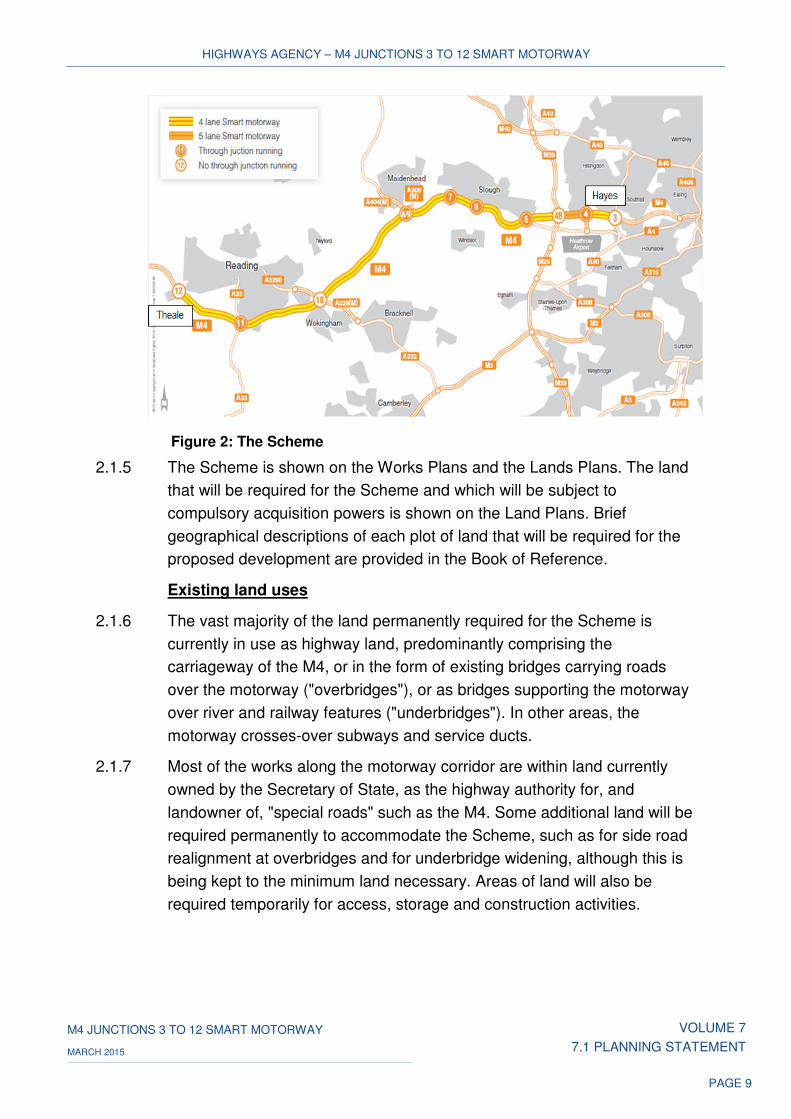
2.1.4 The Order land extends from junction 3 to junction 12 of the M4, as shown
in Figure 2 below:
HIGHWAYS AGENCY – M4 JUNCTIONS 3 TO 12 SMART MOTORWAY
M4 JUNCTIONS 3 TO 12 SMART MOTORWAY VOLUME 7
7.1 PLANNING STATEMENT MARCH 2015
PAGE 9
Figure 2: The Scheme
2.1.5 The Scheme is shown on the Works Plans and the Lands Plans. The land
that will be required for the Scheme and which will be subject to
compulsory acquisition powers is shown on the Land Plans. Brief
geographical descriptions of each plot of land that will be required for the
proposed development are provided in the Book of Reference.
Existing land uses
2.1.6 The vast majority of the land permanently required for the Scheme is
currently in use as highway land, predominantly comprising the
carriageway of the M4, or in the form of existing bridges carrying roads
over the motorway ("overbridges"), or as bridges supporting the motorway
over river and railway features ("underbridges"). In other areas, the
motorway crosses-over subways and service ducts.
2.1.7 Most of the works along the motorway corridor are within land currently
owned by the Secretary of State, as the highway authority for, and
landowner of, "special roads" such as the M4. Some additional land will be
required permanently to accommodate the Scheme, such as for side road
realignment at overbridges and for underbridge widening, although this is
being kept to the minimum land necessary. Areas of land will also be
required temporarily for access, storage and construction activities.
HIGHWAYS AGENCY – M4 JUNCTIONS 3 TO 12 SMART MOTORWAY
M4 JUNCTIONS 3 TO 12 SMART MOTORWAY VOLUME 7
7.1 PLANNING STATEMENT MARCH 2015
PAGE 10
Existing character
2.1.8 The predominant nature of the Order land is that of a ‘transport corridor’
dominated by the route of the M4 and its associated highway structures.
Along its length, the highway corridor is bisected by a series of north-south
routes linking to the M4, together with entry and exit slip roads for service
areas along the route. Located at various points along the length of the
highway corridor are traditional regulatory, directional and warning sings,
along with modern Intelligent Transport System (“ITS”) apparatus on
gantry signs for managing the flow of traffic.
2.1.9 Due to the length of the Scheme, a more detailed description of the Order
land and the surrounding area is best provided in terms of its linear form
on a junction to junction basis, running from west to east - from junction 12
to junction 3, as follows:
Junction 12 to junction 11
2.1.10 The M4 between junction 12 (Theale) and junction 11 (Three Mile Cross)
is approximately 7.3km long with three running lanes in each direction.
There is also a hard shoulder on the near-side of each carriageway and
lighting columns in the central reserve. The general landform through this
link is rural. There are wetlands with industrial areas around both
junctions.
2.1.11 The motorway skirts the southern edge of Reading, which forms the
principal settlement along this section of the M4. To the western extremity
of the Scheme, west of junction 12, lies the North Wessex Downs Area of
Outstanding Natural Beauty (“AONB”), the Sulham and Tidmarsh Woods
and Meadows, and Pincent’s Kiln Site of Special Scientific Interest
("SSSI"). To the east of junction 12 the M4 crosses the Kennet and Avon
Canal and then skirts south of the settlement of Reading, through an area
of agricultural land, within which extensive gravel extraction activity has
occurred, resulting in water filled gravel pits. Reading Motorway Service
Area (eastbound and westbound) is located on this link.
2.1.12 The Thames Valley Cycle Route, which forms part of the National Cycle
Network (“NCN”) Route 4, runs along the towpath of the Kennet and Avon
Canal prior to it passing under the M4, from which point the cycle path
turns south and runs adjacent to the M4 until Reading Services, where it
turns north to re-join the towpath. A connecting cycle path runs along the
Holy Brook to join NCN4 close to the M4.
HIGHWAYS AGENCY – M4 JUNCTIONS 3 TO 12 SMART MOTORWAY
M4 JUNCTIONS 3 TO 12 SMART MOTORWAY VOLUME 7
7.1 PLANNING STATEMENT MARCH 2015
PAGE 11
2.1.13 The link includes a number of overbridges and underbridges, in addition to
the gyratory overbridges at junctions 12 and 11. These are Theale Railway
underbridge (which carries the M4 over the Western Region mainline
railway), Holybrook underbridge, River Kennet underbridge, Wellmans
Farm Access underbridge, Burghfield Road overbridge (at Reading
Motorway Service Area), Mortimer Line Railway underbridge and
Poundgreen Road overbridge.
Junction 11 to junction 10
2.1.14 The M4 between junction 11 (Three Mile Cross) and junction 10
(Winnersh) is approximately 8.7km long with three running lanes in each
direction. There is also a hard shoulder on the near-side of each
carriageway and lighting columns in the central reserve. Environmental
barriers are located on both the westbound and eastbound verges towards
junction 10. The general landform through this link is residential to the
north of the carriageways and rural to the south of the carriageways.
2.1.15 The M4 continues around the southern suburbs of Reading at Whitley and
Lower Earley towards Winnersh at junction 10. To the south of the
motorway, the area is characterised by smaller villages and settlements,
including Shinfield and Sindlesham, until reaching the outskirts of
Wokingham to the south of junction 10.
2.1.16 Between junction 11 and junction 10, the M4 passes through an area of
agricultural land predominantly within the low lying floodplain of the River
Loddon and to the east between the urban edges of Sindlesham,
Winnersh and Wokingham. Agricultural land is interspersed with a number
of woodlands and copses, with trees along the River Loddon corridor. The
urban areas nearest to the M4 predominantly comprise modern residential
suburbs north of the M4.
2.1.17 A footpath and cycleway runs parallel with the A33 to the south of the M4,
in addition to a cycle route along part of the River Loddon to the north of
Lower Earley Way. A number of public rights of way ("PRoWs") are
identified in close proximity to the M4, including a footpath connecting the
old Basingstoke Road with Church Lane and a footpath connecting Betty
Grove Lane with Mill Lane, both immediately to the south of the M4
carriageway. A footpath/cycleway connecting Brookers Hill with Old
Whitley Wood Lane to the north, via the Shinfield Footbridge, also runs to
the south of the M4. Immediately adjacent to the north side of the
HIGHWAYS AGENCY – M4 JUNCTIONS 3 TO 12 SMART MOTORWAY
M4 JUNCTIONS 3 TO 12 SMART MOTORWAY VOLUME 7
7.1 PLANNING STATEMENT MARCH 2015
PAGE 12
carriageway of the M4 and connecting with residential parts of Winnersh to
the north is a section of footpath running west from King Street Lane.
2.1.18 This link comprises a number of overbridges and underbridges, in addition
to the gyratory overbridges at junctions 11 and 10. These are Shinfield
Road overbridge, Cutbush Lane overbridge, River Loddon underbridge,
Mill Lane underbridge, King Street Lane underbridge, Reading Road
underbridge and Southern Region Winnersh underbridge (supporting the
M4 over the Southern Region Railway Line).
Junction 10 to junction 8/9
2.1.19 The M4 between junction 10 (Winnersh) and junction 8/9 (Holyport) is
approximately 12km long, with three running lanes in each direction. There
is also a hard shoulder on the near-side of each carriageway, but there is
no lighting between these junctions. The general landform through this link
is rural.
2.1.20 The M4 passes through a relatively sparsely populated rural area,
characterised by scattered farms, homesteads and rural businesses. This
rural area lies between Reading/Wokingham to the west and Maidenhead
to the east. The M4 is located within an area of Green Belt from The
Straight Mile overbridge (east of junction 10) to junction 8/9. Gently
undulating agricultural land is interspersed with considerable woodland
cover and mature hedgerows defining field boundaries, with established
tree planting within the verges along this section of the motorway. Few
settlements are found within this area, with Shurlock Row, White Waltham,
Paley Street and Stud Green forming the principal villages prior to
reaching Maidenhead.
2.1.21 PRoWs identified in close proximity to the M4 in this area include a
footpath linking a fishing lake and Howe Lane immediately adjacent to the
south of the M4, and a footpath linking Paley Street to the south of the M4
with Snowball Hill to the north, via the Paley Street Farm overbridge. In
addition, a PRoW runs along Thrift Lane, crossing the M4 by means of the
Stud Green Access overbridge; a further PRoW runs adjacent to the north
of the M4 in this location, linking Thrift Lane with Ockwells Park.
2.1.22 This link comprises a number of overbridges and underbridges, in addition
to the gyratory overbridges at junctions 10 and 9. These are Bill Hill
overbridge, Straight Mile overbridge, Billingbear Farm overbridge,
Beenhams Overbidge, Littlefield Green overbridge, Paley Street Farm
overbridge and Stud Green Access overbridge.
HIGHWAYS AGENCY – M4 JUNCTIONS 3 TO 12 SMART MOTORWAY
M4 JUNCTIONS 3 TO 12 SMART MOTORWAY VOLUME 7
7.1 PLANNING STATEMENT MARCH 2015
PAGE 13
Junction 8/9 to junction 7
2.1.23 The M4 between junction 8/9 (Holyport) and junction 7 (Huntercombe) is
approximately 4.9km long, with three running lanes in each direction.
There is also a hard shoulder on the near-side of each carriageway, but
each hard shoulder has intermittent breaks, or discontinuities, due to the
presence of overbridge structures. The main carriageway lighting columns
are located in the central reserve. The general landform through this link is
rural with isolated residential and industrial areas.
2.1.24 To the north of the M4 at this location an area of industrial land is slightly
elevated above the line of the motorway, whilst to the south the land falls
away to a residential area.
2.1.25 The M4 is located within Green Belt passing north of Holyport before
crossing the A330 and through the urban fringe area to the south of
Maidenhead, before returning to Green Belt east of the A308. From here,
the M4 passes the village of Bray to the north before crossing the River
Thames and then continuing east past the villages of Dorney Reach and
Dorney to the south. The River Thames and the nearby man-made Jubilee
River and recreational lakes, together with adjacent wet pasture, occupy
most of the land between settlements. These watercourses and areas of
open water are lined by riparian tree species, providing vegetation cover
within the local landscape.
2.1.26 The Thames Valley Cycle Route (NCN4) passes through the village of
Bray and over the M4 via Monkey Island Lane continuing southwards
towards Dorney Lake. There is also a cycle route around part of Bray
Lake, connecting with Tithe Barn Drive and the A308. Cycle Route NCN61
runs north-south along the towpath of the Jubilee River, passing under the
M4.
2.1.27 This link comprises a number of overbridges and underbridges, in addition
to the gyratory overbridges at junctions 8/9 and 7 (Huntercombe Spur
overbridge). Ascot Road overbridge, located at the end of the slip-road on
the westbound carriageway to junctions 8/9 has no hard shoulder under
the bridge. Other bridge structures along this section of the Motorway
include Windsor Road underbridge, Cut underbridge and Monkey Lane
Island overbridge, (which has a discontinuous hard shoulder at this point).
The hard shoulder resumes for some 300m, before ending again prior to
Thames Bray underbridge located to the east. The Thames Bray
underbridge has footway/cycleways over the river, on each side of the
HIGHWAYS AGENCY – M4 JUNCTIONS 3 TO 12 SMART MOTORWAY
M4 JUNCTIONS 3 TO 12 SMART MOTORWAY VOLUME 7
7.1 PLANNING STATEMENT MARCH 2015
PAGE 14
Motorway. Two other overbridges at Marsh Lane and Lake End Road also
have short discontinuities in the M4 hard shoulder.
Junction 7 to junction 6
2.1.28 The M4 between junction 7 (Huntercombe) and junction 6 (Chalvey) Is
2.9km long, with three running lanes in each direction. There is also a hard
shoulder on the nearside of each carriageway, but each hard shoulder has
discontinuities due to the presence of overbridge structures. The main
carriageway lighting columns are located in the central reserve. The
general landform through this link is residential.
2.1.29 The M4 is located within the northern fringe of Green Belt and between the
outskirts of Slough to the north (including the area of Cippenham) and
Eton Wick and the River Thames floodplain to the south. Slough waste-
water treatment works occupies land to the south-east of junction 7,
between the M4 and the Jubilee River. As it approaches junction 6 the
motorway lies immediately to the north of and parallel with the Jubilee
River.
2.1.30 The River Thames is located further south of the M4 beyond the villages of
Dorney and Eton Wick. To the south of junction 6 are the towns of Windsor
and Eton, home to Windsor Castle and Eton College respectively. Windsor
itself is located on an escarpment to the south of the River Thames and
south east of junction 6.
2.1.31 A cycle path runs along the southern bank of the Jubilee River, to the
south of the M4. The route contains a number of spurs connecting to the
settlements of Dorney Reach and Eton Wick to the south of the river, and
northwards across a footbridge to the Mercian Way Recreation Ground
and to the residential area of Cippenham/Slough. Other PRoWs within the
vicinity of the M4 include a footpath running north across the Oldway Lane
overbridge immediately to the south of the M4, and a footpath running in a
north-south direction over the M4 via the Wood Lane overbridge
2.1.32 This link comprises a number of overbridges and underbridges, in addition
to the gyratory overbridge at junction 7 (Huntercombe Spur) and the
gyratory underbridge at junction 6. The surrounding landform to
Huntercombe Spur overbridge is mainly rural with the exception of the
area to the north-east, which is residential. Both hard shoulders are
currently discontinuous under the overbridge structure.
HIGHWAYS AGENCY – M4 JUNCTIONS 3 TO 12 SMART MOTORWAY
M4 JUNCTIONS 3 TO 12 SMART MOTORWAY VOLUME 7
7.1 PLANNING STATEMENT MARCH 2015
PAGE 15
2.1.33 Other overbridges along this section include Oldway Lane and Wood Lane
overbridges, both of which have discontinuities in the M4 hard shoulder,
along with Chalvey Culvert, as well as an underbridge carrying a drainage
channel through the motorway embankment below the M4.
2.1.34 Environmental bunds are also located within this link. This includes a bund
some 1100m in length along the eastbound verge between Oldway Lane
overbridge and Wood Lane overbridge. A further bund is located on
parkland to the north of the carriageway between this overbridge and
junction 6. In addition, an environmental barrier runs the full length of
verge to the eastbound slip road to this junction.
Junction 6 to junction 5
2.1.35 The M4 between junction 6 (Chalvey) and junction 5 (Langley) is 5.9km
long, with three running lanes in each direction. There is also a hard
shoulder on the nearside of each carriageway but each hard shoulder has
discontinuities due to the presence of overbridge and underbridge
structures. The main carriageway lighting columns are located in the
central reserve. The general landform through this link is residential with
isolated areas of parkland.
2.1.36 Junction 6 lies immediately north of the Green Belt, close to the point
where the M4 crosses the Windsor Branch Railway Line on the Windsor
Branch Railway overbridge en route to junction 5. After passing over the
A332, the M4 continues to the south of the suburbs of Slough, including
the areas of Upton Court Park, Ditton Park and Langley. Here the
motorway runs through Green Belt until reaching junction 5. This link of the
M4 also passes to the north of the confluence of the Jubilee River with the
River Thames, the town of Datchet and the Queen Mother Reservoir.
2.1.37 Walking and cycling routes follow both banks of the Jubilee River. Cycle
links from the Jubilee River pass under the M4 to reach Chalvey High
Street and also run along The Myrke, passing to the west of the Slough
Road allotments. Walking and cycling routes are also found within Upton
Court Park and an overbridge linking Upton Court Park to the north of the
M4 with Datchet Road to the south. There is a pedestrian link across the
M4 via Hams Farm Footbridge.
HIGHWAYS AGENCY – M4 JUNCTIONS 3 TO 12 SMART MOTORWAY
M4 JUNCTIONS 3 TO 12 SMART MOTORWAY VOLUME 7
7.1 PLANNING STATEMENT MARCH 2015
PAGE 16
2.1.38 This link comprises a number of overbridges and underbridges, in addition
to the gyratory underbridges at junctions 6 and 5. These include the
Windsor Branch Railway underbridge located at the end of the slip roads
to junction 6, the Prince of Wales underbridge, along with overbridges at
Datchet Road and the Recreation Ground, both of which have
discontinuities in the M4 hard shoulder. In addition, this section includes
culverts under the motorway at Water Main Subway, Water and Gas Main
Subway and Ashley’s Arch Culvert.
Junction 5 to junction 4b
2.1.39 The M4 between junction 5 (Langley) and junction 4b (M25) is 3.3km long,
with four running lanes in each direction. There is also a hard shoulder on
the nearside of each carriageway but each hard shoulder has
discontinuities due to the presence of overbridge structures. The main
carriageway lighting columns are located in the central reserve. The
general landform through this link is residential and industrial around
junction 5 and rural towards junction 4b.
2.1.40 The M4 between junction 5 and junction 4b is located within Green Belt.
From junction 5, the M4 passes along the eastern edge of Slough, through
a semi-rural landscape to the M25 intersection at junction 4b. The urban
area of Slough, immediately north of the M4 corridor, predominantly
comprises modern residential estates. To the east of the town, Richings
Park, Richings Park Golf Course and farmland (traversed by high voltage
power lines) lie to the north of the M4. A gravel pit, gravel pit lakes, waste-
water treatment works, an industrial estate, and farmland (also traversed
by high voltage power lines) lie to the south of the M4.
2.1.41 There is a cycle route accessed from the Common Road Roundabout in
Langley passing along the green buffer between the Axis Business Park
and the M4, re-joining Sutton Lane to the east. To the south of the M4
there is a bridleway connecting Old Slade Lane with the Colnbrook area
and a cycle path connecting London Road to the north and south of the
M4, passing across the roundabout at junction 5 underneath the
motorway.
HIGHWAYS AGENCY – M4 JUNCTIONS 3 TO 12 SMART MOTORWAY
M4 JUNCTIONS 3 TO 12 SMART MOTORWAY VOLUME 7
7.1 PLANNING STATEMENT MARCH 2015
PAGE 17
2.1.42 This link includes two overbridges and a subway, in addition to the
gyratory underbridges at junctions 5 and 4b. Junction 5 is formed of a
gyratory, situated beneath the M4. Junction 5 also includes a subway
providing a route for pedestrians to pass over the gyratory, but under the
M4. Elevated walkways lead from the subway in both directions to spiral
ramps down to pavement level at both sides of the gyratory. The
carriageway has no hard shoulder over these structures.
2.1.43 Sutton Lane overbridge is located immediately at the end of the junction 5
slip roads. Old Slade Lane overbridge is located at the start of the junction
4b and has discontinuities in the M4 hard shoulder.
Junction 4b to junction 4
2.1.44 The M4 between junction 4b (M25) and junction 4 (Heathrow) is 2.9km
long, with four running lanes in each direction. There is also a hard
shoulder on the nearside of each carriageway and lighting columns in both
the central reserve and verge. The general landform through this link is
residential.
2.1.45 The M4 crosses Wraysbury River and the River Colne before passing
Saxon Lake to the south. The motorway in this link is located within Green
Belt to the west of Saxon Lake and forms the northern boundary of the
Green Belt between Saxon Lake and junction 4.
2.1.46 The M4 then passes between the urban area of West Drayton to the north,
comprising largely modern residential and commercial estates and the
villages of Harmondsworth, Sipson and Heathrow to the south.
Harmondsworth and Sipson are situated between Green Belt to the south
of the M4 (comprising active and reclaimed gravel pits, and farmland) and
Heathrow Airport. The presence of the Airport to the south of these
settlements, together with its extensive ancillary developments, represents
a major land-use within the area.
2.1.47 A cycle path links the north and south of the M4 in the vicinity of Saxon Lake,
connecting Wise Lane in West Drayton with Accommodation Lane near
Harmondsworth. A pedestrian footbridge over the M4 in the vicinity of
Saxon Lake links to the residential area of Little Benty to the north of the
Motorway. Other cycle links include a section following the Wraysbury
River to the south of the M4.
HIGHWAYS AGENCY – M4 JUNCTIONS 3 TO 12 SMART MOTORWAY
M4 JUNCTIONS 3 TO 12 SMART MOTORWAY VOLUME 7
7.1 PLANNING STATEMENT MARCH 2015
PAGE 18
2.1.48 Junction 4b serves as an interchange between the M4 and the M25, with
the A329 (M) crossing the M4 by a viaduct. Two of the junction 4b link
roads pass over the M4 on viaducts, whilst the M4 passes over the other
two link roads and Staines Branch Railway Line via the following
underbridges: Staines Branch Line West underbridge, Staines Branch Line
underbridge and Staines Branch Line East underbridge. Junction 4b also
includes Wraysbury River underbridge and River Colne underbridge,
which carry the M4 over the Wraysbury River and River Colne
respectively.
2.1.49 At the end of the junction 4b slip roads the main carriageway separates,
forming a wide central reserve that is covered by dense vegetation. An
environmental barrier is also located within the central reserve and the
eastbound verge.
2.1.50 This section of the M4 passes under Little Benty North and South
Footbridges, Harmondsworth Road North and South overbridges. It also
includes Holloway Lane underbridge carrying the M4 main carriageway
and slip roads at junction 4.
2.1.51 This link also includes an environmental barrier along the eastbound verge
adjacent to the abutment to Harmondsworth Road North overbridge. In
addition, a 850m section of environmental barrier is located along the
eastbound verge over Sipson Road Subway, along with a steel parapet to
the westbound verge. Similarly, an environmental barrier is located on the
eastbound slip road verge to Holloway Lane underbridge, along with steel
parapets to the motorway verges.
Junction 4 to junction 3
2.1.52 The M4 between junction 4 (Heathrow) and junction 3 (Hayes) is 3.0km
long with three running lanes in each direction. There is also a hard
shoulder on the near-side of each carriageway and lighting columns in the
central reserve. The general landform through this link is residential.
2.1.53 The M4 between junction 4 and junction 3 is located within Green Belt,
crossing over Frogs Ditch and the River Crane in this area. The motorway
in this link is bounded to the north by the modern residential areas of
Hayes and to the south by the village of Harlington and more open areas
including Little Harlington Playing Fields and Cranford Park. Further south
of the motorway corridor lies the eastern section of Heathrow Airport. The
south of the M4 also includes open areas and wooded parkland, notably
Cranford Park.
HIGHWAYS AGENCY – M4 JUNCTIONS 3 TO 12 SMART MOTORWAY
M4 JUNCTIONS 3 TO 12 SMART MOTORWAY VOLUME 7
7.1 PLANNING STATEMENT MARCH 2015
PAGE 19
2.1.54 Three pedestrian subways are located along this link – St Peter’s subway,
Fuller subway and St Dunstan’s subway. The latter two provide pedestrian
links between the residential area of West Drayton and the Cranford Park
area to the north of the M4. St Dunstan’s subway also provides access to
St Dunstan’s Church and forms part of the Hillingdon Trail which runs in a
north-south direction.
2.1.55 Junction 4 comprises a gyratory situated beneath the M4. The main
carriageway of the motorway is carried over this junction by two
underbridges: Airport Interchange West overbridge and Airport
Interchange East overbridge. This link also includes Harlington overbridge
and the following three subways over which the M4 passes: St. Peters
Subway, Fuller Subway and St. Dunstan’s Subway. The main carriageway
of the motorway is carried over junction 3 by Cranford Park Avenue
underbridge.
HIGHWAYS AGENCY – M4 JUNCTIONS 3 TO 12 SMART MOTORWAY
M4 JUNCTIONS 3 TO 12 SMART MOTORWAY VOLUME 7
7.1 PLANNING STATEMENT MARCH 2015
PAGE 20
3 THE SCHEME
3.1 Introduction
3.1.1 This Chapter sets out the need for the proposed development and
provides an outline of the main elements of the Scheme. .
3.1.2 A full description of the key features and characteristics of the surrounding
area of the Scheme can be found in ES Volume 1 and in the EDR.
Need for the Scheme
3.1.3 The strategic case for providing additional capacity on the M4 within the
Thames Valley was first examined in ‘The Thames Valley Multi-Modal
Study’ (2003) (the "TVMMS"), prepared by WS Atkins on behalf of the
Government Office for the South East. The purpose of the TVMMS was ‘to
identify the most effective means of addressing current and future
transport-related problems in the Thames Valley.’
3.1.4 The TVMMS study area included the M4 between junctions 3 and 12. The
TVMMS highlighted the highway network as a key feature of the area
characterised by its west-east arteries, and recognised that addressing the
transport problems of the Thames Valley would represent a major
challenge.
3.1.5 The TVMMS identified a number of problems of the transport system in the
area, focussed on ‘the problem of traffic congestion on the strategic and
local highway networks, which is impacting on business efficiency, access
to Heathrow and the environment. These two latter factors were arguably
the main reasons why companies moved into the Thames Valley and
continued deterioration could deter inward investment in the future.’
3.1.6 In its examination of the underlying problems, the TVMMS reported that
congestion on the road network was responsible for many of the transport-
related problems in the Thames Valley, noting ‘the increasing imbalance
between transport demand and supply, which manifests itself most clearly
in congestion on the road network.’
3.1.7 The TVMMS highlighted the scale of the problem, particularly during the
morning and evening workday peaks, where demand was seen to be at, or
exceeding, the available road capacity. The TVMMS noted that ‘this
results in congestion and increasingly unreliable journey times which affect
private vehicle users, and also freight and public transport operators’. It
was therefore considered that in relation to the future performance of the
HIGHWAYS AGENCY – M4 JUNCTIONS 3 TO 12 SMART MOTORWAY
M4 JUNCTIONS 3 TO 12 SMART MOTORWAY VOLUME 7
7.1 PLANNING STATEMENT MARCH 2015
PAGE 21
transport system, ‘without intervention, peak time road congestion will
intensify on roads which are already congested, and that congestion will
spread across more of the network. By 2016 we estimate an increase of
over 70% relative to 2001 in the number of hours of delay on the highway
network during peak periods.’
3.1.8 The TVMMS also drew attention to the wider impacts that would be
experienced, with adverse implications for the environment anticipated.
Whilst these effects were considered to be worst during times of
congestion, it was noted that ‘the impacts of road traffic in terms, for
instance, of noise, severance and air quality are felt well beyond the peak
periods. A number of Air Quality Management Areas (“AQMA”) have been
designated within the study, overwhelmingly as a result of traffic
emissions. AQMA are areas where air pollution exceeds recommended
levels.’
3.1.9 In seeking to address the transport problems in the Thames Valley, the
TVMMS made clear ‘that proposals for major enhancements to highway
capacity, either through new roads or widening of the existing (mainly
east/west) trunk routes, are severely constrained because of the very high
quality of the Thames Valley environment.’
3.1.10 At the same time, consultation work undertaken as part of the study
highlighted the high value placed on the environment by the residents and
businesses within the study area. The quality of the environment was seen
as one of the factors that had contributed to the socio-economic success
of the study area. However, there was little support from the consultation
for new road construction, apart from more local schemes designed to
address specific ‘hot-spots’.
3.1.11 Consideration was given to a range of potential multi-modal interventions
(as set out in Government transport policy) to address the transport
problems within the Thames Valley. It was recommended that each multi-
modal study should identify interventions which were considered to be
most effective and appropriate within their area, on the basis of particular
existing and future problems, issues and local priorities.
HIGHWAYS AGENCY – M4 JUNCTIONS 3 TO 12 SMART MOTORWAY
M4 JUNCTIONS 3 TO 12 SMART MOTORWAY VOLUME 7
7.1 PLANNING STATEMENT MARCH 2015
PAGE 22
3.1.12 The TVMMS identified a range of interventions that had emerged from the
earlier analysis. Following a preliminary appraisal of these interventions, a
preferred transport strategy was developed in line with national and local
policy objectives and stakeholders’ aspirations. The proposed strategy
included the following key inter-related strands, which it was advised
should be implemented as a single integrated package to address the
major challenges facing the Thames Valley:
a) modal shift and improved accessibility through improved public
transport;
b) managing the demand for travel through Local Transport Plans.,
travel plan initiatives, and road user charging; and
c) improved management of road space through design and
information.
3.1.13 The strategy recognised that even with the proposed travel demand
management and public transport enhancements in place, the overall
magnitude of car-based demand would remain higher than now and that
‘congestion will remain and, in specific areas, may intensify significantly,
eroding some of the wider benefits delivered by a wider strategy.’
3.1.14 The proposed strategy for the Thames Valley road network placed an
emphasis on better management of the existing road space, involving the
identification of measures designed to reduce congestion broadly within
existing road space, either through changes to the road layout, or through
use of technology to better control traffic movements.
3.1.15 In March 2008, the Advanced Motorway Signalling and Traffic
Management Feasibility Study, published by the Department of Transport
for the Secretary of State for Transport, highlighted the following causes of
congestion and identified the M4 junction 3 to junction 12 as a priority for
the provision of additional capacity:
a) the large number of commuters using the strategic road network;
b) the number of commuters willing to travel significant distances;
c) low vehicle occupancy;
d) widely dispersed origins and destinations; and
e) a low proportion of trips starting or ending in urban centres.
HIGHWAYS AGENCY – M4 JUNCTIONS 3 TO 12 SMART MOTORWAY
M4 JUNCTIONS 3 TO 12 SMART MOTORWAY VOLUME 7
7.1 PLANNING STATEMENT MARCH 2015
PAGE 23
3.1.16 In addition, the 2008 study also highlighted that both the number of trips
and trip miles would increase significantly over time, which would
exacerbate the existing situation. Ministers agreed that hard shoulder
running as an alternative to widening should be investigated.
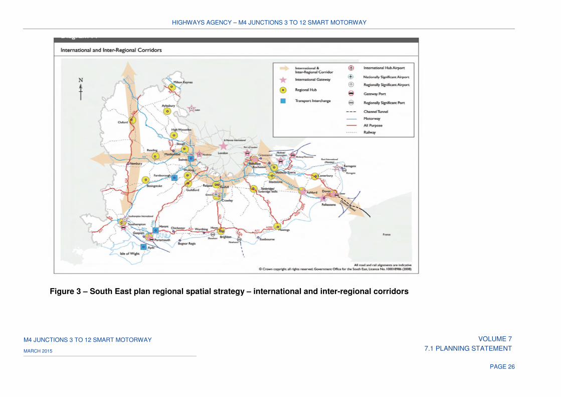
3.1.17 In May 2009 the South East Plan Regional Spatial Strategy ("RSS") was
published for the South East of England to provide a long-term spatial
planning framework for the South East Region between 2006 - 2026.
3.1.18 The RSS included spatial policies for transport within the region and
identified priority transport links, ‘likely to come under increasing transport
pressure as a result of underlying traffic growth and the development
strategy of the RSS, and where further work should be focused to identify
the interventions needed.’ This included the following priority transport link:
‘West of Reading to London, particularly to address unreliability of the
strategic road network, to include consideration of M4 management and
capacity measures.’ (See Figure 3).
3.1.19 The RSS was revoked by Government on 25th March 2013 by virtue of the
Regional Strategy for the South East (Partial Revocation) Order 2013.
3.1.20 Since that time, further governmental research has taken the concept of
managed motorways forward, along with more recent ministerial
announcements confirming funding support (subject to value for money
and deliverability) for the development of the now renamed ‘smart
motorway schemes’. This is considered further in the EDR, in terms of
technical matters, and the Funding Statement in relation to the financial
commitment of the Government to the delivery of the Scheme.
3.1.21 In support of this position, the Government’s policy for the delivery of the
national road network, as set out within the NN NPS, has concluded that at
‘the strategic level there is a compelling need for development of the
national road network.’ The NPS provides the primary basis for decision
making by the Secretary of State on all planning matters raised by the
Application, and will be the primary focus of the assessment of the
Scheme proposals, including the question of need.
HIGHWAYS AGENCY – M4 JUNCTIONS 3 TO 12 SMART MOTORWAY
M4 JUNCTIONS 3 TO 12 SMART MOTORWAY VOLUME 7
7.1 PLANNING STATEMENT MARCH 2015
PAGE 24
The Scheme
3.1.22 The Scheme involves the conversion of the hard shoulder of the M4 to a
permanent running lane, providing four lane all lane running, with five lane
carriageways from Sutton Lane overbridge (just east of junction 5) to
junction 4 and westbound between junctions 4 and 4b. As a result of hard
shoulder discontinuities between junctions 4 and 8/9, where the existing
bridges limit the available carriageway width, it is necessary for these to be
either widened or demolished and rebuilt in order to deliver a permanent
running lane.
3.1.23 Signing and technology to manage traffic using variable mandatory speed
limits ("VMSL") must also be provided, which are being promoted
separately under the Road Traffic Regulation Act 1984. Other minor works
are also required to enable the appropriate lane widths to be achieved and
to secure the necessary Scheme enhancements and mitigation works.
3.1.24 The works are described in detail within Schedule 1 to the DCO and are
described briefly below. A detailed description of the Scheme is contained
in the EDR.
3.1.25 In total, 11 overbridges between junction 8/9 and junction 4b, are
proposed to be demolished and replaced. Of these, six are to be replaced
as off-line improvements and the remaining five are to be replaced as on-
line improvements. It is also proposed to widen four underbridges, two
subways and four culverts where insufficient carriageway width exists at
present.
3.1.26 TJR (allowing through traffic to remain in lane 1 - the nearside lane - at
each junction), is proposed along the route corridor with the exception of
the motorway to motorway interchanges at junction 4b (M25) and junction
10 (A329M) and at the motorway junctions at either end of the Scheme
(i.e. junction 3 and junction 12).
3.1.27 ERAs, similar to laybys and providing safe areas for vehicles to stop in an
emergency, are to be provided within the existing highway verges no more
than 2.5km apart. Adjacent to some ERAs, Police Observation Platforms
(“POPs”) are to be positioned to provide a safe area for stationary police
vehicles.
3.1.28 A rigid concrete safety barrier and paved central reserve are proposed to
be provided throughout the length of the Scheme. Additional verge safety
barriers in the form of steel safety barriers are to be provided at new
hazards, such as gantries, signs and CCTV cameras.
HIGHWAYS AGENCY – M4 JUNCTIONS 3 TO 12 SMART MOTORWAY
M4 JUNCTIONS 3 TO 12 SMART MOTORWAY VOLUME 7
7.1 PLANNING STATEMENT MARCH 2015
PAGE 25
3.1.29 The introduction of concrete barriers within the central reserve will affect
the existing central reserve drainage system. This is to be replaced largely
with linear drains. Improvements are also proposed to drainage within the
highway verges to ensure that there will be no flooding of the widened
carriageway once the hard shoulder is upgraded to a running lane.
3.1.30 It is proposed that all existing links within the Order limits and slip roads
that are currently lit will remain lit. The unlit sections of the M4 between
junction 8/9 and junction 10 are to remain unlit. Where lighting is required,
existing lighting would be removed and replaced with modern light emitting
diode (“LED”) lighting.
3.1.31 A total of 162 gantries incorporating LED signals are proposed along the
length of carriageway to control the operation of the smart motorway; the
majority of these are to be overhead. A total of 40 existing gantries that are
no longer required are to be removed to ground level.
3.1.32 The Scheme will provide Thin Surface Course System (“TSCS”) (normally
referred to as low noise surfacing) throughout. It is assumed that new lane
1 and lane 4 (existing hard shoulder and lane 3 respectively) will require a
new surface course following the verge and central reserve works. Hot
Rolled Asphalt in new lane 2 and lane 3 (existing lane 1 and lane 2
respectively) will be replaced with low noise surfacing.
3.1.33 Environmental barriers in the form of fencing, to mitigate noise from the
carriageway, are to be incorporated as part of the Scheme.
3.1.34 Environmental enhancement will be developed through the preparation of
an environmental masterplan which will accompany the Application. This
will set out the proposed approach to environmental design. Vegetation
cleared during construction will be re-planted, where possible with native
species to provide habitats and visual screening.
HIGHWAYS AGENCY – M4 JUNCTIONS 3 TO 12 SMART MOTORWAY
M4 JUNCTIONS 3 TO 12 SMART MOTORWAY VOLUME 7
7.1 PLANNING STATEMENT MARCH 2015
PAGE 26
Figure 3 – South East plan regional spatial strategy – international and inter-regional corridors
HIGHWAYS AGENCY – M4 JUNCTIONS 3 TO 12 SMART MOTORWAY
M4 JUNCTIONS 3 TO 12 SMART MOTORWAY VOLUME 7
7.1 PLANNING STATEMENT MARCH 2015
PAGE 27
4 RELEVANT PLANNING HISTORY
4.1 Planning history
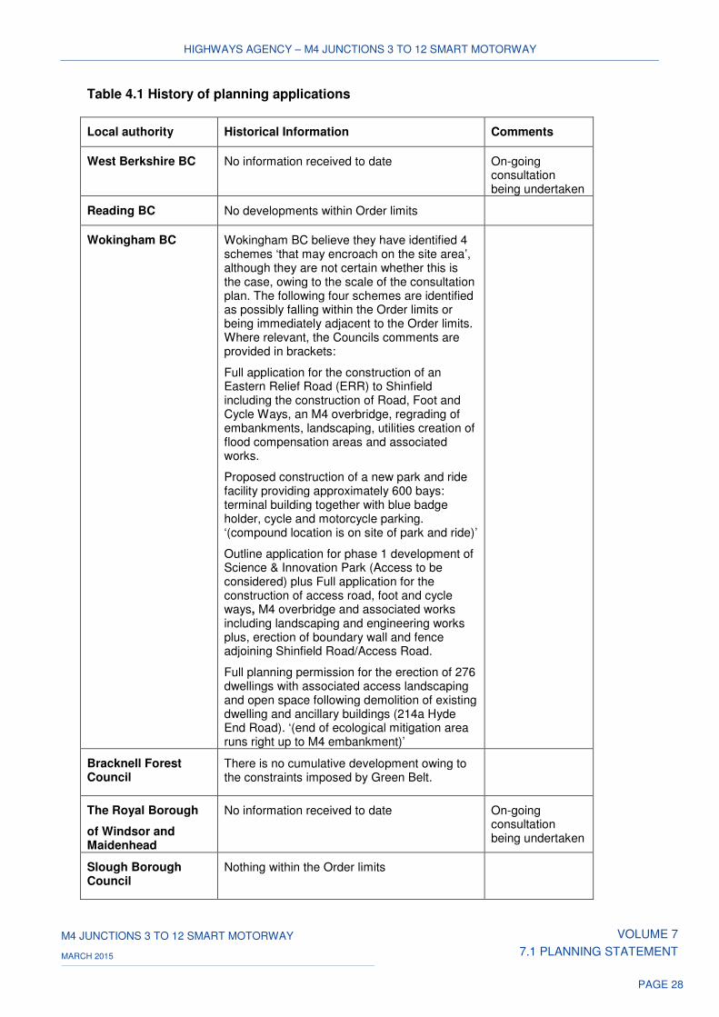
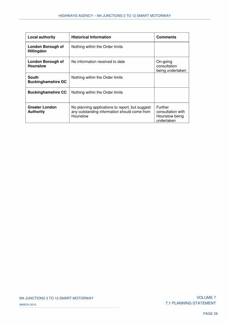
4.1.1 Table 4.1 below provides a summary of the planning history of applications
within the Order limits of the Scheme.
4.1.2 Consultation was undertaken at an early stage with all 11 Local Planning
Authorities (“LPAs”), and this consultation, and the Scheme's response,
has been recorded in the Consultation Report which accompanies the
Application. To date, no consultation response in relation to planning
history has been provided by the following LPAs:
a) The Royal Borough of Windsor and Maidenhead; and
b) London Borough of Hounslow.
4.1.3 However, the two LPAs above have confirmed that they will be providing a
response to the request for planning history information in due course, and
any relevant planning history information will be taken into consideration.
4.1.4 Bracknell Forest and the Greater London Authority (“GLA”) have confirmed
that there are no developments of which they are aware that would have
an impact on the Scheme.
4.2 Conclusions
4.2.1 The results of the planning history search set out in Table 4.1 have been
analysed, and it is considered that the planning applications and decisions
listed are unlikely to have any adverse impacts upon the Scheme.
However, an addendum to this section will be produced after the
Application once the outstanding information has been received and
assessed.
HIGHWAYS AGENCY – M4 JUNCTIONS 3 TO 12 SMART MOTORWAY
M4 JUNCTIONS 3 TO 12 SMART MOTORWAY VOLUME 7
7.1 PLANNING STATEMENT MARCH 2015
PAGE 28
Table 4.1 History of planning applications
Local authority Historical Information Comments
West Berkshire BC No information received to date On-going consultation being undertaken
Reading BC No developments within Order limits
Wokingham BC Wokingham BC believe they have identified 4 schemes ‘that may encroach on the site area’, although they are not certain whether this is the case, owing to the scale of the consultation plan. The following four schemes are identified as possibly falling within the Order limits or being immediately adjacent to the Order limits. Where relevant, the Councils comments are provided in brackets:
Full application for the construction of an Eastern Relief Road (ERR) to Shinfield including the construction of Road, Foot and Cycle Ways, an M4 overbridge, regrading of embankments, landscaping, utilities creation of flood compensation areas and associated works.
Proposed construction of a new park and ride facility providing approximately 600 bays: terminal building together with blue badge holder, cycle and motorcycle parking. ‘(compound location is on site of park and ride)’
Outline application for phase 1 development of Science & Innovation Park (Access to be considered) plus Full application for the construction of access road, foot and cycle ways, M4 overbridge and associated works including landscaping and engineering works plus, erection of boundary wall and fence adjoining Shinfield Road/Access Road.
Full planning permission for the erection of 276 dwellings with associated access landscaping and open space following demolition of existing dwelling and ancillary buildings (214a Hyde End Road). ‘(end of ecological mitigation area runs right up to M4 embankment)’
Bracknell Forest Council
There is no cumulative development owing to the constraints imposed by Green Belt.
The Royal Borough
of Windsor and Maidenhead
No information received to date On-going consultation being undertaken
Slough Borough Council
Nothing within the Order limits
HIGHWAYS AGENCY – M4 JUNCTIONS 3 TO 12 SMART MOTORWAY
M4 JUNCTIONS 3 TO 12 SMART MOTORWAY VOLUME 7
7.1 PLANNING STATEMENT MARCH 2015
PAGE 29
Local authority Historical Information Comments
London Borough of Hillingdon
Nothing within the Order limits
London Borough of Hounslow
No information received to date On-going consultation being undertaken
South Buckinghamshire DC
Nothing within the Order limits
Buckinghamshire CC Nothing within the Order limits
Greater London Authority
No planning applications to report, but suggest any outstanding information should come from Hounslow
Further consultation with Hounslow being undertaken
HIGHWAYS AGENCY – M4 JUNCTIONS 3 TO 12 SMART MOTORWAY
M4 JUNCTIONS 3 TO 12 SMART MOTORWAY VOLUME 7
7.1 PLANNING STATEMENT MARCH 2015
PAGE 30
5 PLANNING POLICY CONSIDERATIONS
5.1 Introduction
5.1.1 This section sets out the national and local planning policy context for the
Scheme. A key element of the Scheme is the ability to manage and control
traffic, through the use of the latest generation of overhead message
signs, the use of variable mandatory speed limits, driver information,
CCTV coverage and enforcement methods. The technology will also be
used to inform drivers of unexpected conditions, including accidents, the
presence of slow moving vehicles, and the potential for queues ahead.
The use of overhead message signs assists in protecting broken down
vehicles by warning drivers, and closing lanes, before the emergency
services arrive. Full CCTV coverage helps to verify the location of
incidents rapidly.
5.1.2 Section 104(2) PA 2008 provides the basis for determining an application
for development consent where a NPS is in force. It requires that in
deciding an application for development consent the Secretary of State
must have regard to:
a) any relevant NPS;
b) any LIR;
c) any matters prescribed in relation to development of the description
to which the application relates; and
d) any other matter that the decision maker thinks is both important
and relevant to its decision.
5.1.3 Under section 104(3), the Secretary of State is required to decide the
application in accordance with any relevant NPS, except in certain
circumstances specified in subsections (4) to (8). These include
circumstances where the adverse effects of a scheme outweigh the
benefits.
5.1.4 The NN NPS was designated on 14 January 2015, meaning that a
"relevant national policy statement" has effect in respect of the Scheme.
This triggers the provisions of section 104 PA 2008.
HIGHWAYS AGENCY – M4 JUNCTIONS 3 TO 12 SMART MOTORWAY
M4 JUNCTIONS 3 TO 12 SMART MOTORWAY VOLUME 7
7.1 PLANNING STATEMENT MARCH 2015
PAGE 31
5.2 National planning policy
National Policy Statement for National Networks, Department for
Transport, January 2015
5.2.1 Paragraph 1.1 of NN NPS states that the purpose of the NPS is to
establish:
'The need for, and Government’s policies to deliver, development of
nationally significant infrastructure projects (NSIPs) on the national road
and rail networks in England. It provides planning guidance for promoters
of nationally significant infrastructure projects on the road and rail
networks, and the basis for the examination by the Examining Authority
and decisions by the Secretary of State.'
5.2.2 NN NPS paragraph 1.2 goes on to say that:
'The Secretary of State will use this NPS as the primary basis for making
decisions on development consent applications for national networks
nationally significant infrastructure projects in England. Under section 104
of the Planning Act the Secretary of State must decide an application for a
national networks nationally significant infrastructure project in accordance
with this NPS unless he/she is satisfied that to do so would:
• lead to the UK being in breach of its international obligations;
• be unlawful;
• lead to the Secretary of State being in breach of any duty imposed by
or under any legislation;
• result in adverse impacts of the development outweighing its benefits;
• be contrary to legislation about how the decisions are to be taken.'
5.2.3 NN NPS paragraph 2.2 recognises that there is a critical need to improve
the national networks to address road congestion in order "…to provide
safe, expeditious and resilient networks that better support social and
economic activity; and to provide a transport network that is capable of
stimulating and supporting economic growth" It also notes that
‘Improvements may also be required to address the impact of the national
networks on quality of life and environmental factors.’
HIGHWAYS AGENCY – M4 JUNCTIONS 3 TO 12 SMART MOTORWAY
M4 JUNCTIONS 3 TO 12 SMART MOTORWAY VOLUME 7
7.1 PLANNING STATEMENT MARCH 2015
PAGE 32
5.2.4 In establishing the national need for the development, NN NPS paragraph
2.10 states:
'The Government has therefore concluded that at a strategic level there is
a compelling need for development of the national networks – both as
individual networks and as an integrated system. The Examining Authority
and the Secretary of State should therefore start their assessment of
applications for infrastructure covered by this NPS on that basis.'
5.2.5 The importance attached to the national road network is referred to in NN
NPS paragraph 2.13 which maintains that: "A well-functioning Strategic
Road Network is critical in enabling safe and reliable journeys and the
movement of goods in support of the national and regional economies."
5.2.6 NN NPS paragraphs 2.17 and 2.18 re-affirm that the national road network
is under significant pressure and that this is forecast to increase. NN NPS
paragraph 2.22 makes clear that:
'Without improvements to the road network, including its performance, it
will be difficult to support further economic development, employment and
housing and this will impede economic growth and reduce people's quality
of life. The Government has therefore concluded that at a strategic level
there is a compelling need for development of the national road network.'
5.2.7 NN NPS paragraph 2.23 refers to the Government’s wider policy of
bringing forward improvements and enhancements to the existing
Strategic Road Network to address identified needs. This includes:
'Implementing "smart motorways" (also known as "managed motorways")
to increase capacity and improve performance.'
5.2.8 The earlier TVMMS prepared on behalf of the Government Office for the
South East in 2003, reached similar conclusions in relation to traffic
congestion within the Thames Valley, and identified the need for
improvements to be made to tackle forecast increases in traffic flows. This
is reflected in the Scheme objectives, which include the provision of
additional capacity on the motorway, both in supporting the economy and
facilitating economic growth within the region.
5.2.9 The TVMMS also placed an emphasis on the better management of the
existing road space, involving the identification of measures designed to
reduce congestion as an effective way of providing increased capacity in a
cost effective and deliverable way, thereby maximising the use of the
existing highway asset.
HIGHWAYS AGENCY – M4 JUNCTIONS 3 TO 12 SMART MOTORWAY
M4 JUNCTIONS 3 TO 12 SMART MOTORWAY VOLUME 7
7.1 PLANNING STATEMENT MARCH 2015
PAGE 33
5.2.10 This approach has led to the development of the Scheme, consistent with
the Government’s policy of supporting improvements to the Strategic Road
Network (“SRN”) through the implementation of the smart motorway
concept.
Environment and social impacts
5.2.11 This Planning Statement provides a broad overview confirming the
Scheme's compliance with the NN NPS. Each topic chapter of the ES
submitted with the Application addresses the particular provisions of the
NN NPS which are applicable to that chapter. The topic chapters respond
in particular to the guidance in chapter 5 of the NN NPS which sets out
guidance for applicants and decision-makers in relation to environmental
topics.
5.2.12 Chapter 3 of NN NPS provides further guidance on the Government’s
wider policies for national networks. Of particular relevance to the Scheme
are the following:
5.2.13 NN NPS paragraph 3.3 states:
‘Applicants should also provide evidence that they have considered
reasonable opportunities to deliver environmental and social benefits as
part of schemes.’
5.2.14 These two component parts of sustainable development influenced the
design of the Scheme, both through the Scheme’s development and in its
responses to stakeholder engagement and public consultation.
5.2.15 Improving the SRN through the introduction of smart motorways, where
highway improvements are now contained largely within the existing
highway corridor, represents a marked change from more traditional
highway schemes, which are typically based on new highway construction
and road widening.
5.2.16 In relation to the Scheme, the requirement to use land outside the existing
motorway carriageway is limited to side road realignment at overbridges,
underbridge widening where no hardshoulder exists, and for minor
alterations to slip roads to accommodate access to the new running lanes.
HIGHWAYS AGENCY – M4 JUNCTIONS 3 TO 12 SMART MOTORWAY
M4 JUNCTIONS 3 TO 12 SMART MOTORWAY VOLUME 7
7.1 PLANNING STATEMENT MARCH 2015
PAGE 34
5.2.17 Keeping the Scheme largely within the footprint of the existing carriageway
represents a significant environmental gain (or at the very least, a
substantial step towards managing the effects of the Scheme) against a
more traditional highway scheme , principally resulting from the use of
previously developed land as opposed to new, greenfield development.
The use of previously developed land also provides other significant
benefits such as reduced environmental impacts of the Scheme on the
natural and built environment. This is evidenced in the accompanying ES.
5.2.18 Although the land-take needed for the Scheme is extensive in absolute
terms (it is 51km in length), the land take remains relatively modest in that
context. Nevertheless, opportunities for environmental enhancement
measures have been taken where possible. Environmental enhancement
of the Scheme has been developed through the preparation of an
environmental masterplan, which is submitted in support of the Application
Proposed measures include, for example, the re-planting of areas cleared
during construction with native species (so far as possible) to provide
habitats and visual screening.
5.2.19 The social benefits of the Scheme include those associated with the
introduction of the Scheme itself, as tackling current and forecast levels of
traffic congestion, will be a catalyst to improved social and economic
activity within the wider region.
5.2.20 A Socio-Economic Report (“SER”) prepared in support of the Application
has set out the strategic socio-economic context for the Scheme, providing
a detailed socio-economic profile of the area through which the Scheme
passes and its effects. The SER concludes that ‘the Scheme may
positively influence decision-making for businesses looking to locate to the
Outer London area, providing future residents and employees with
improved infrastructure to reach homes and jobs. The Scheme is
considered to have a positive effect on strategic development land in the
area, such as the Heathrow Opportunity Area and growth areas in
Hillingdon…For visitors to some of the nationally renowned tourist
attractions in the area (Legoland and Windsor, for example), together with
users of Heathrow Airport, improved journey times and reliability are again
likely to prove beneficial.’
HIGHWAYS AGENCY – M4 JUNCTIONS 3 TO 12 SMART MOTORWAY
M4 JUNCTIONS 3 TO 12 SMART MOTORWAY VOLUME 7
7.1 PLANNING STATEMENT MARCH 2015
PAGE 35
5.2.21 The SER makes reference to the Regeneration Report ("RR") which is
summarised at Appendix B of the SER. The summary identifies that the
Scheme passes within close proximity to five Regeneration Areas (“RAs”),
namely Reading, Wokingham, Bracknell, Maidenhead and Slough. The
RR uses travel-time data to define the hinterland for each RA and from this
assesses the impact on short, medium and long travel times. The results
of the analysis show that there are minor changes to travel times to the
hinterlands from and to the RAs; the largest change in travel time occurs in
the Slough area, where travel time within the 30-60 minute category for
travel to or from RAs, is reduced by 10%. All other travel time changes are
less than 5%. The overall conclusion of this analysis is that in relation to
travel times, the Scheme will have a ‘slight beneficial’ impact on RAs
which are close to it.
5.2.22 In terms of how the Scheme might affect overall amenity in the area (for
example by means of air quality, visual amenity, noise and vibration), the
ES identifies that there are no significant operational air quality effects
anticipated for the Scheme along this link.
5.2.23 The construction phase of the Scheme is likely to have a positive impact
on employment in the sub-region. It is estimated that construction of the
Scheme will create in the region of 400 temporary FTE jobs, equating to
some 2,000 person years of employment over a five year period. The SER
highlights the fact that the Scheme will provide an opportunity to develop
good practice in terms of the use of a proportion of the workforce from
local communities, development of skills and training programmes, and
apprenticeship schemes.
5.2.24 The consideration given within the SER to the construction and operational
effects of the Scheme as it relates to community and private assets
concludes that the effects on community facilities, agricultural land,
recreational activities and infrastructure as a result of Scheme construction
are considered to be neutral. Conversely, the Scheme is predicted to have
economic benefits in terms of its ability to generate employment during
construction and its catalytic effect during operation.
5.2.25 On that basis, it can be concluded that the Scheme complies with the key
principles of the NN NPS in relation to social benefits.
HIGHWAYS AGENCY – M4 JUNCTIONS 3 TO 12 SMART MOTORWAY
M4 JUNCTIONS 3 TO 12 SMART MOTORWAY VOLUME 7
7.1 PLANNING STATEMENT MARCH 2015
PAGE 36
General principles of assessment
5.2.26 Chapter 4 of the NN NPS sets out the assessment principles and general
policies against which applications relating to national networks
infrastructure are to be determined.
5.2.27 NN NPS paragraph 4.5 requires that:
‘Applications for road and rail projects (with the exception of those for
SRFIs, for which the position is covered in paragraph 4.8 below) will
normally be supported by a business case prepared in accordance with
Treasury Green Book principles.’
5.2.28 The approach taken by the Highways Agency has followed the DfT's web-
based Transport Analysis Guidance ("WebTAG") guidance, which forms
the basis for the application of the Treasury Green Book principles for
Transport Schemes.
5.2.29 NN NPS paragraph 4.6 advises that:
‘Applications for road and rail projects should usually be supported by a
local transport model to provide sufficiently accurate detail of the impacts
of a project. The modelling will usually include national level factors around
the key drivers of transport demand such as economic growth,
demographic change, travel costs and labour market participation, as well
as local factors. The Examining Authority and the Secretary of State do not
need to be concerned with the national methodology and national
assumptions around the key drivers of transport demand. We do
encourage an assessment of the benefits and costs of schemes under
high and low growth scenarios, in addition to the core case. The modelling
should be proportionate to the scale of the scheme and include
appropriate sensitivity analysis to consider the impact of uncertainty on
project impacts.’
5.2.30 The traffic forecasts and economic case for the Scheme have been
developed through the use of the M3/M4 variable demand transport
model. This model, which covers a large area of south-east England, has
been validated in accordance with Design Manual for Roads and Bridges
(“DMRB”) standard criteria. In addition to a core scenario, high and low
growth scenarios that take account of the various national level factors
underpinning forecasting have been derived in line with WebTAG
principles. Furthermore, local uncertainty has also been taken into
account. Local authority development and infrastructure proposals have
been identified and afforded appropriate levels of uncertainty, which
HIGHWAYS AGENCY – M4 JUNCTIONS 3 TO 12 SMART MOTORWAY
M4 JUNCTIONS 3 TO 12 SMART MOTORWAY VOLUME 7
7.1 PLANNING STATEMENT MARCH 2015
PAGE 37
together with other national scale proposals have provided the basis for
sensitivity analysis, again in line with TAG principles.
5.2.31 For these reasons, the Scheme can be said to have met the guidance
requirements provided for in the NN NPS.
5.2.32 NN NPS paragraph 4.2 states:
‘Subject to the detailed policies and protections in this NPS, and the legal
constraints set out in the Planning Act, there is a presumption in favour of
granting development consent for national networks NSIPs that fall within
the need for infrastructure established in this NPS.’
5.2.33 In considering any proposed development, NN NPS paragraph 4.3 advises
that the Examining Authority and the Secretary of State should take into
account:
‘its potential benefits, including the facilitation of economic development,
including job creation, housing and environmental improvement, and any
long-term or wider benefits;
its potential adverse impacts, including any longer-term and cumulative
adverse impacts, as well as any measures to avoid, reduce or compensate
for any adverse impacts.’
5.2.34 One of the main drivers for the Scheme is the future forecasts of traffic
flows on the M4, which are anticipated to increase from the current level of
130,000 per day to an average of 160,000 vehicles per day over the next
20 years. If not improvements are made to the M4, this will result in
increased congestion, with incumbent economic, social and environmental
effects. The Scheme responds to the estimates of increasing car-based
demand by delivering the additional capacity required.
5.2.35 An important objective of the Scheme is to facilitate economic growth
within the wider region through the provision of additional capacity on the
motorway. The SER identifies that a benefit of improving the flow of traffic
along the M4 between junctions 3 and 12, is the improvement in the road
network relied upon by local businesses in the vicinity of West London.
HIGHWAYS AGENCY – M4 JUNCTIONS 3 TO 12 SMART MOTORWAY
M4 JUNCTIONS 3 TO 12 SMART MOTORWAY VOLUME 7
7.1 PLANNING STATEMENT MARCH 2015
PAGE 38
5.2.36 The SER goes on to say that:
‘The Scheme is considered to have a moderate to major beneficial effect
on the future economic growth of the region, through improvements to
journey times and reliability. Along this link, the Scheme may positively
influence decision-making for businesses looking to locate to the Outer
London area, providing future residents and employees with improved
infrastructure to reach homes and jobs. The Scheme is considered to have
a positive effect on strategic development land in the area, such as the
Heathrow Opportunity Area and growth areas in Hillingdon. The Scheme is
considered to have a large beneficial residual effect on the local economy
over the long-term.’
Sustainable transport
5.2.37 NN NPS paragraph 3.17 makes clear that "The Government expects
applicants to use reasonable endeavours to address the needs of cyclists
and pedestrians in the design of new schemes."
5.2.38 The Scheme, once operational, will facilitate the use of the motorway
between junctions 3 and 12 by vehicular traffic as its primary purpose. It is
not practical to address the needs of cyclists and pedestrians within the
design of the Scheme, as they are prohibited from using the motorway on
its mainline. However, the existing provision for cyclists and pedestrians in
the vicinity of the Scheme will not be detrimentally affected by the
Scheme. Where works affect local roads in accommodating new bridge
structures and for pedestrian subways, the needs of pedestrians and
cyclists will be addressed during both the construction and operational
phases. Any new provision will therefore be made on a like-for-like basis,
although no enhancement of provision is proposed.
Alternatives
5.2.39 NN NPS paragraph 4.27 states:
‘All projects should be subject to an options appraisal. The appraisal
should consider viable modal alternatives and may also consider other
options (in light of the paragraphs 3.23 to 3.27 of this NPS). Where
projects have been subject to full options appraisal in achieving their
status within Road or Rail Investment Strategies or other appropriate
policies or investment plans, option testing need not be considered by the
examining authority or the decision maker.’
HIGHWAYS AGENCY – M4 JUNCTIONS 3 TO 12 SMART MOTORWAY
M4 JUNCTIONS 3 TO 12 SMART MOTORWAY VOLUME 7
7.1 PLANNING STATEMENT MARCH 2015
PAGE 39
5.2.40 The Scheme was originally identified by the TVMMS. This considered a
range of viable model alternatives in addressing current and future
transport-related problems in the Thames Valley.
5.2.41 In light of the extensive assessment of options and the policy
announcements addressed in this Planning Statement (particularly in
chapter 6 below), it is clear that the Scheme's status within the Road
Investment Strategy has been subject to full options appraisal. On that
basis, it is considered that option testing should not need to be considered
by the Examining Authority or the Secretary of State.
Design
5.2.42 NN NPS paragraph 4.29 states:
‘Visual appearance should be a key factor in considering the design of
new infrastructure, as well as functionality, fitness for purpose,
sustainability and cost.’
5.2.43 However, NN NPS paragraph 4.30 acknowledges that:
‘Given the nature of much national network infrastructure development….
there may be a limit on the extent to which it can contribute to the
enhancement of the quality of the area.’
5.2.44 NN NPS paragraph 4.34 acknowledges this point, but also recognises
that:
‘…there may be opportunities for the applicant to demonstrate good
design in terms of siting and design measures relative to existing
landscape and historical character and function, landscape permeability,
landform and vegetation.’
5.2.45 NN NPS paragraph 4.35 advises that:
‘Applicants should be able to demonstrate in their application how the
design process was conducted and how the proposed design evolved.’
5.2.46 The EDR explains the design principles and design rationale for the
Scheme and describes how the design has been influenced by the
technical and operational requirements of creating all-lane running, smart
motorway infrastructure.
HIGHWAYS AGENCY – M4 JUNCTIONS 3 TO 12 SMART MOTORWAY
M4 JUNCTIONS 3 TO 12 SMART MOTORWAY VOLUME 7
7.1 PLANNING STATEMENT MARCH 2015
PAGE 40
5.2.47 The EDR notes that the development and design of major highway
projects are governed by the guidance and standards set out in the
DMRB. The DMRB is supplemented by a number of Interim Advice Notes
("IANs") that provide up-to-date guidance on a range of highway issues,
published by the Department for Transport and the Agency. These
guidelines have provided the basis for the design of the Scheme. The
works required are largely within the boundaries of the existing highway
corridor in adapting to the principles of ‘All-Lane Running’.
5.2.48 In reaching a design solution, the EDR describes the design process that
has taken place in developing the preliminary designs for the replacement
bridges in particular. Reference is also made to the design changes that
have taken place, both through consultation responses and the on-going
work in addressing any environmental effects.
5.2.49 In meeting the standards set out in DMRB and the IANs, the Scheme
design can demonstrate that it complies with the guidance set out in the
NN NPS.
Climate change adaptation
5.2.50 Paragraph 4.40 NN NPS states:
‘New national networks infrastructure will be typically long-term
investments which will need to remain operational over many decades, in
the face of a changing climate.’ Accordingly, it advises, ‘that applicants
must consider the impacts of climate change when planning location,
design, build and operation.’
5.2.51 NN NPS paragraph 4.41 goes on to say:
‘Where transport infrastructure has safety-critical elements and the design
life of the asset is 60 years or greater, the applicant should apply the UK
Climate Projections 2009 (UKCP09) high emissions scenario (high impact,
low likelihood) against the 2080 projections at the 50% probability level.’
5.2.52 The relevant chapters of the ES have complied with the NN NPS approach
to climate change. A 30% allowance for climate change, as recommended
in the UKCP09 high emissions scenario 2080 projections, has been
adopted, in place of the more widely used 20% allowance for climate
change (in accordance with Highways Agency’s guidance HD33/0).
HIGHWAYS AGENCY – M4 JUNCTIONS 3 TO 12 SMART MOTORWAY
M4 JUNCTIONS 3 TO 12 SMART MOTORWAY VOLUME 7
7.1 PLANNING STATEMENT MARCH 2015
PAGE 41
5.2.53 As concluded in the ES chapter 15 'Road Drainage and the Water
Environment' and linked documents, the safety of M4 motorway road users
is not considered to be at any significant risk from river flooding as
carriageway levels are mostly above the 1% Annual Exceedance
Probability (“AEP”) + climate change flood levels.
Waste management
5.2.54 Paragraph 5.42 of the NN NPS states that:
‘The applicant should set out the arrangements that are proposed for
managing any waste produced. The arrangements described should
include information on the proposed waste recovery and disposal system
for all waste generated by the development. The applicant should seek to
minimise the volume of waste produced and the volume of waste sent for
disposal unless it can be demonstrated that the alternative is the best
overall environmental outcome.’
5.2.55 A wide range of material resources will be required to construct the
Scheme. This includes elements of the existing M4 which could be reused
or recycled (such as gantries, lighting columns, electricity cabinets and
cabling, concrete foundations broken out for aggregate, road planings and
non-hazardous spoil won from the excavation works) and material
resources brought to site (such as aggregates, cement, steel work, pre-
fabricated components and asphalt). The use of primary materials such as
aggregate and lime will impact on natural resources. This will be mitigated
by sourcing materials from licensed quarries and reducing demand for
natural resources by reusing and recycling.
5.2.56 Wastes will arise from activities such as demolition works, spoil not
suitable for reuse onsite, construction and installation of new bridges and
gantries, road resurfacing, and office activities. The waste hierarchy will be
applied to minimise waste generation and the impact of disposal on the
environment. The final disposal routes will vary between the different
waste streams, so some wastes will be removed for reuse or recycling on
other construction projects, or re-processed to create new materials such
as recycled paper and metals. The remaining waste, as a last resort
option, will be disposed of at nearby and licensed landfill sites that have
sufficient capacity to accept the waste.
HIGHWAYS AGENCY – M4 JUNCTIONS 3 TO 12 SMART MOTORWAY
M4 JUNCTIONS 3 TO 12 SMART MOTORWAY VOLUME 7
7.1 PLANNING STATEMENT MARCH 2015
PAGE 42
5.2.57 The control of waste will be managed by the contractor(s) who will be
responsible for updating and implementing a Materials Management Plan
(“MMP”) and a Site Waste Management Plan (“SWMP”) as part of the
Construction Environmental Management Plan (“CEMP”). Contractors will
also be required to identify and monitor sustainability Key Performance
Indicators to demonstrate their commitment to reducing the impact of their
activities on natural resources and waste disposal. An outline SWMP has
been submitted as part of the Outline Environmental Management Plan
(“EMP”) which has been annexed to the ES.
5.2.58 On this basis, it can be stated that the Scheme is in compliance with the
NN NPS in relation to waste.
Safety
5.2.59 NN NPS paragraph 3.10 requires that:
‘scheme promoters are expected to take opportunities to improve road
safety, including introducing the most modern and effective safety
measures where proportionate.’
5.2.60 The Scheme is based on the ‘managed motorways’ concept and on the
operational principles of Managed Motorways All-Lane Running ("ALR"),
as set-out within the Highways Agency’s IAN 161/13. The Scheme
represents a second generation of managed motorways, and draws of the
knowledge and experience gained from delivering other Managed
Motorway schemes as well as incorporating the latest emerging concepts
in highway design and safety.
5.2.61 The design development of managed motorways and the focus on
maintaining high levels of safety are detailed in the EDR, submitted in
support of the Application.
5.2.62 By ensuring that the high levels of safety are maintained and improved by
the introduction of the Scheme, compliance with the NN NPS in relation to
safety issues can be demonstrated.
5.2.63 NN NPS paragraph 4.61 requires that:
‘The applicant should undertake an objective assessment of the impact of
the proposed development on safety including the impact of any mitigation
measures. This should use the methodology outlined in the guidance from
DfT (WebTAG) and from the Highways Agency.’
HIGHWAYS AGENCY – M4 JUNCTIONS 3 TO 12 SMART MOTORWAY
M4 JUNCTIONS 3 TO 12 SMART MOTORWAY VOLUME 7
7.1 PLANNING STATEMENT MARCH 2015
PAGE 43
5.2.64 In accordance with NN NPS paragraph 4.61, projects undertaken by the
Agency have to be implemented with an appropriate level of safety risk
management in order to provide road users, road workers and third parties
with adequate risk protection. Project safety risk is controlled by deploying
an appropriate Safety Management System ("SMS"), so determining the
activities that make up the SMS is important for all projects.
5.2.65 To assist projects in putting an appropriate SMS in place the Agency has
developed:
a) a set of Work Instructions (001,002,003 and 004) that are used first
to identify SMS requirements for a project and then to apply the
most suitable safety management activities; and
b) a set of Guidance Documents that explain in more detail how to
apply the Work Instructions.
5.2.66 The safety management process for the Scheme will comply with the
requirements as set out in the Work Instructions. Project Safety Risk
Management ("PSRM") Work Instruction 001, IAN139/11 describes the
process by which the SMS is selected.
5.2.67 When initially assessing the feasibility of ALR prior to the implementation
of any scheme it has not been possible to rely on past accident statistics
since the changed motorway does not exist and hence no statistics exist.
Instead, the Agency performs a risk assessment to determine the
expected safety performance, using hazard analysis to take account of
road users and road workers. This is a proven technique used in many
industries such as nuclear, oil and gas, automotive, railways, aviation and
defence. The outcome of this work is a generic hazard log which is
reviewed for each scheme.
5.2.68 The hazard log contains a list of operational hazards, the associated risk
from each hazard, and the mitigation necessary to reduce the risk to an
acceptable level. The Agency’s generic hazard log contains 135 hazards
that specifically relate to smart motorways. Each hazard is assessed to
understand how often it occurs, how likely it will be to lead to an accident,
how severe a typical accident is likely to be and how the risk can be
managed. A hazard log approach was first used for the M42 pilot scheme
which introduced the successful use of the hard shoulder as a running
lane in the UK.
HIGHWAYS AGENCY – M4 JUNCTIONS 3 TO 12 SMART MOTORWAY
M4 JUNCTIONS 3 TO 12 SMART MOTORWAY VOLUME 7
7.1 PLANNING STATEMENT MARCH 2015
PAGE 44
5.2.69 For smart motorway schemes, the level of risk is derived by identifying
hazards through the early stages of a project and then modifying the
design of the scheme to either remove those hazards completely, or to
reduce the risks as soon as they are identified. The purpose of the hazard
analysis is to identify potential hazards and the associated consequences.
Once a hazard is identified, it can be mitigated.
5.2.70 The 20 highest scoring hazards account for around 90% of the total risk
and include: driver fatigue, driving too fast, rapid change of general vehicle
speed, tailgating, vehicle stopping in a running lane, pedestrians in running
lanes and vehicle recovered from refuge area. After analysis, the top nine
scoring hazards were (in descending order of magnitude):
a) driver fatigued – unable to perceive hazards effectively;
b) individual vehicle driven too fast;
c) vehicle stopped in running lane – off-peak;
d) pedestrian in running lane – live traffic;
e) tailgating;
f) vehicle stopped in running lane – peak;
g) rapid change of general vehicle speed;
h) maintenance workers setting up and taking down work site; and
i) vehicle recovered from emergency refuge area.
5.2.71 Some of the hazards can be mitigated. The design and use of technology
to create a controlled environment where drivers comply with signs and
speeds, allows risks to be managed to an acceptable level. For instance,
the hazards of a vehicle being driven too fast or the occurrence of
tailgating are mitigated through the use of VMSL and enforcement.
5.2.72 The hazard analysis of the Scheme suggests that there is an expected
reduction in risk for a significant number (13) of the highest scoring
existing motorway hazards (17), due to a controlled environment being
provided through a combination of regularly spaced mandatory speed
signals, speed enforcement, and comprehensive CCTV coverage.
5.2.73 Paragraph 4.64 NN NPS requires that:
The applicant should be able to demonstrate that their scheme is
consistent with the Highways Agency's Safety Framework for the Strategic
Road Network and with the national Strategic Framework for Road Safety.
HIGHWAYS AGENCY – M4 JUNCTIONS 3 TO 12 SMART MOTORWAY
M4 JUNCTIONS 3 TO 12 SMART MOTORWAY VOLUME 7
7.1 PLANNING STATEMENT MARCH 2015
PAGE 45
Applicants will wish to show that they have taken all steps that are
reasonably required to:
• minimise the risk of death and injury arising from their development;
• contribute to an overall reduction in road casualties;
• contribute to an overall reduction in the number of unplanned incidents;
and contribute to improvements in road safety for walkers and cyclists.’
Each of these points is dealt with below:
Minimise the risk of death and injury arising from their development
5.2.74 The SRN currently has high performance in terms of safety and it is an
objective of the Scheme to maintain that high standard. During the pre-
application phase, the Scheme design was the subject of a Road Safety
Audit and an assessment of operational safety.
5.2.75 A Stage 1 Road Safety Audit, in accordance with the DMRB (HD19/03),
was carried out on the Preliminary Design.
5.2.76 The Agency has developed bespoke procedures for dealing with incidents
and undertaking operational and maintenance activities where there is no
hard shoulder. This has been supplemented by a media campaign to
educate drivers.
5.2.77 It is considered that in relation to the Scheme, appropriate measures are
proposed to reduce the risk of death or injury.
Contribute to an overall reduction in road casualties
5.2.78 The hazard analysis work undertaken suggests that the Scheme is likely to
meet its road user safety objective. Calculations from the hazard analysis
work show that the total score given in relation to the period after
construction of the Scheme represents a reduction of risk of approximately
18% in comparison to the safety baseline (with no motorway incident
detection and automatic signalling ("MIDAS") queue protection). It is noted
that when comparing the predicted reduction in risk with the actual
motorway with MIDAS (10% safety benefit compared to the baseline) the
Scheme would still expect to see a reduction in risk of approximately 8%.
HIGHWAYS AGENCY – M4 JUNCTIONS 3 TO 12 SMART MOTORWAY
M4 JUNCTIONS 3 TO 12 SMART MOTORWAY VOLUME 7
7.1 PLANNING STATEMENT MARCH 2015
PAGE 46
5.2.79 The safety baseline to be used for the Scheme is consistent with the
generic requirements for any ALR scheme, which is the number (averaged
per annum) of Fatal and Weighted Injury ("FWI") casualties and the rate of
FWIs per billion vehicle miles per annum averaged for the three years prior
to the installation of any element of ALR.
5.2.80 As MIDAS is installed on the Scheme, the safety baseline is amended to:
a) 110% of the number (averaged per annum) of FWI casualties and
the rate of FWIs per billion vehicle miles per annum averaged for
the three years prior to the installation of the Scheme.
Contribute to an overall reduction in the number of unplanned
incidents; and contribute to improvements in road safety for walkers
and cyclists
5.2.81 Hazard analysis of smart motorways suggests that there is an expected
reduction in risk for a significant number (13) of the highest scoring
existing motorway hazards (17), due to a controlled environment being
provided through a combination of regularly spaced mandatory speed
signals, speed enforcement, and comprehensive CCTV coverage.
5.2.82 The accident rates on the early smart motorway schemes have supported
the hazard analysis undertaken, as the accident rates are generally much
better than the accident rates on the section of road before the
implementation of the scheme. The STATS19 data published in ‘Appendix
K: Smart Motorways within the annual ‘Reported Road Casualties on the
Strategic Network 2013’ report showed “an improvement in total casualty
rates, all casualty severities showed a decrease when compared to the
pre-implementation rates”.
5.2.83 It is noted that the Scheme will manage traffic congestion on a section of
motorway. Therefore, improvements in road safety for cyclists and walkers
are not an objective of the Scheme, as they are prohibited from using the
motorway
Health
5.2.84 NN NPS paragraph 4.79 notes that:
‘National road networks have the potential to affect the health, well-being
and quality of life of the population and can have direct impacts on health
because of traffic, noise, vibration, air quality and emissions, light pollution,
community severance, dust, odour, polluting water, hazardous waste and
pests.’
HIGHWAYS AGENCY – M4 JUNCTIONS 3 TO 12 SMART MOTORWAY
M4 JUNCTIONS 3 TO 12 SMART MOTORWAY VOLUME 7
7.1 PLANNING STATEMENT MARCH 2015
PAGE 47
5.2.85 Paragraph 4.82 of the NN NPS therefore requires that:
The applicant should identify measures to avoid, reduce or compensate for
adverse health impacts as appropriate.’
5.2.86 Chapter 5 of the NN NPS sets out a range of generic impacts relevant to
any national network infrastructure and describes how these impacts
should be considered by applicants. Those of relevance to the proposed
development are considered further under the following headings:
Air quality
5.2.87 NN NPS paragraph 5.10 states:
‘The Secretary of State should consider air quality impacts over the wider
area likely to be affected, as well as in the near vicinity of the scheme. In
all cases the Secretary of State must take account of relevant statutory air
quality thresholds set out in domestic and European legislation. Where a
project is likely to lead to a breach of the air quality thresholds, the
applicant should work with the relevant authorities to secure appropriate
mitigation measures with a view to ensuring so far as possible that those
thresholds are not breached.’
5.2.88 NN NPS paragraph 5.11 advises that:
‘Air quality considerations are likely to be particularly relevant where
schemes are proposed:
• within or adjacent to Air Quality Management Areas (AQMA); roads
identified as being above Limit Values or nature conservation sites
(including Natura 2000 sites and SSSIs, including those outside
England)…’
5.2.89 Chapter 6 Air Quality of the ES assesses the potential air quality impacts
of the Scheme during the construction and operational phases, based on a
study area of 200m from road sections likely to be affected by the
Scheme. The local operational air quality study area considers the
Scheme itself and those routes considered to be affected by the Scheme.
5.2.90 The ES sets out the relevant regulatory and policy framework at an
international, European and UK level, noting, that in addition to the
assessment of local operational air quality effects for public exposure, an
assessment of National and European designated habitat sites has also
been undertaken within 200m of an affected link.
HIGHWAYS AGENCY – M4 JUNCTIONS 3 TO 12 SMART MOTORWAY
M4 JUNCTIONS 3 TO 12 SMART MOTORWAY VOLUME 7
7.1 PLANNING STATEMENT MARCH 2015
PAGE 48
5.2.91 The ES notes that due to the presence of sensitive receptors adjacent to
affected routes AQMAs included within the assessment have been
assessed on a location-specific basis.
5.2.92 The assessment findings show that a comparison between the results of
the local operational air quality assessment and those links reported by
Defra to the European Commission as non-compliant has found that there
is one affected link within the study area that is reported by Defra as non-
compliant in 2020 and when projected to 2022 (the proposed opening year
of the Scheme). An increase of less than 1% of the limit value for NO2 is
predicted along this link and as a result it should not be necessary to
complete an Air Quality Action Plan for this Scheme.
5.2.93 Overall, the ES concludes:
a) the number of properties with adverse changes in air quality above
the objective is below the significance criteria described within the
assessment;
b) there is no adverse effect on air quality for compliance links or
European and Nationally designated habitat sites, and
c) accordingly, an overall evaluation of ‘not significant’ has been
assigned to the Schemes operational air quality effects.
5.2.94 The results of the assessment suggest that the Scheme is consistent with
relevant national, regional and local planning policy.
Carbon Emissions
5.2.95 Paragraph 5.17 NN NPS comments:
‘It is very unlikely that the impact of a road project will, in isolation, affect
the ability of Government to meet its carbon reduction plan targets.
However, for road projects applicants should provide evidence of the
carbon impact of the project and an assessment against the Government’s
carbon budgets.’
5.2.96 As noted, in comparison to national CO2 emissions targets, increases in
CO2 from the whole of the road building scheme anticipated over the next
10-15 years are considered to be small (less than 0.1% of annual carbon
budget). The increases associated with the Scheme comprise part of that
small increase.
5.2.97 Evidence of the Scheme's carbon impact and an assessment against the
carbon budget is provided in ES chapter 11 Materials.
HIGHWAYS AGENCY – M4 JUNCTIONS 3 TO 12 SMART MOTORWAY
M4 JUNCTIONS 3 TO 12 SMART MOTORWAY VOLUME 7
7.1 PLANNING STATEMENT MARCH 2015
PAGE 49
Biodiversity and ecological conservation
5.2.98 NN NPS paragraph 5.22 states that:
‘Where the project is subject to EIA the applicant should ensure that the
environmental statement clearly sets out any likely significant effects on
internationally, nationally and locally designated sites of ecological or
geological conservation importance (including those outside England) on
protected species and on habitats and other species identified as being of
principal importance for the conservation of biodiversity and that the
statement considers the full range of potential impacts on ecosystems.’
5.2.99 The assessment undertaken within the ES has considered the likely
impacts upon designated sites of international, national and local
importance, protected species, habitats and other species of principal
importance for the conservation of biodiversity, and has sought
opportunities which may benefit biodiversity interests within the Order
limits and the wider environment.
5.2.100 Paragraph 5.25 states:
‘As a general principle, and subject to the specific policies below,
development should avoid significant harm to biodiversity and geological
conservation interests, including through mitigation and consideration of
reasonable alternatives. The applicant may also wish to make use of
biodiversity offsetting in devising compensation proposals to counteract
any impacts on biodiversity which cannot be avoided or mitigated. Where
significant harm cannot be avoided or mitigated, as a last resort,
appropriate compensation measures should be sought.’
5.2.101 Chapter 9 Ecology and Nature Conservation of the ES has undertaken an
assessment of the potential effects of the Scheme on Ecology and Nature
Conservation. This has included, amongst other assessments, statutory
and non-statutory designated sites, habitats, flora, terrestrial invertebrates,
amphibians, reptiles, birds, bats, dormice, water voles, otters and badgers.
5.2.102 The findings of the assessments undertaken to analyse the effects of the
Scheme during its operational phase on ecology and nature conservation,
show that there will be an increase in road mortality, because of the
proposed concrete barrier within the central reserve, but these effects are
not considered to be significant. The ES confirms that no other significant
effects on ecology and nature conservation are anticipated during the
operational phase of the Scheme.
HIGHWAYS AGENCY – M4 JUNCTIONS 3 TO 12 SMART MOTORWAY
M4 JUNCTIONS 3 TO 12 SMART MOTORWAY VOLUME 7
7.1 PLANNING STATEMENT MARCH 2015
PAGE 50
5.2.103 As a consequence of the finding of an increase in road mortality, the
mitigation proposed is in the form of otter and badger-resistant fencing in
key locations (as outlined in the Environmental Masterplan) in order to
prevent these animals from accessing the Scheme.
5.2.104 The ES concludes that whilst measures to mitigate the effects on otters
and badgers can be implemented, similar measures to reduce the
movement of reptiles onto the carriageway are not practical. A small
increase in reptile road mortality associated with the concrete barriers in
the central reserve is therefore considered likely. The residual effect of this
during the Scheme’s operation is considered by the ES to be slight
adverse.
5.2.105 Whilst the ES acknowledges the limitations placed on enhancement
measures as a consequence of the limited land take for the Scheme,
proposals include landscape planting and native tree species where
possible and provision for otters bats and other ecological receptors.
5.2.106 NN NPS paragraph 5.33 states that: ‘Development proposals potentially
provide many opportunities for building in beneficial biodiversity or
geological features as part of good design. When considering proposals,
the Secretary of State should consider whether the applicant has
maximised such opportunities in and around developments.’
5.2.107 NN NPS paragraph 5.36 continues by requiring that ‘Applicants should
include appropriate mitigation measures as an integral part of their
proposed development, including identifying where and how these will be
secured.’
5.2.108 The assessment undertaken within the ES demonstrates the approach the
Scheme has taken to avoid and mitigate its effects on ecology and nature
conservation and notes that ‘the nature of the Scheme, being intrinsically
tied to the existing M4 infrastructure and having only a small land take,
means that opportunities to provide biodiversity enhancements are
limited.’ Nevertheless, it considers that where benefits can be achieved
(for example, the construction of otter ledges within existing culverts, and
the provision of bat and bird boxes), biodiversity enhancement measures
will be delivered in accordance with this policy requirement.
HIGHWAYS AGENCY – M4 JUNCTIONS 3 TO 12 SMART MOTORWAY
M4 JUNCTIONS 3 TO 12 SMART MOTORWAY VOLUME 7
7.1 PLANNING STATEMENT MARCH 2015
PAGE 51
Dust, odour, artificial light, smoke, and steam
5.2.109 NN NPS paragraph 5.87 advises that:
‘The Secretary of State should be satisfied that all reasonable steps have
been taken, and will be taken, to minimise any detrimental impact on
amenity from emissions of odour, dust, steam, smoke and artificial light.
This includes the impact of light pollution from artificial light on local
amenity, intrinsically dark landscapes and nature conservation.’
5.2.110 With the exception of dust, which is referred to in relation to air quality
impacts, and artificial light, the impacts on amenity from emissions of
odour, steam and smoke were not considered to be relevant to the
Scheme and thus no assessment was undertaken in relation to them.
5.2.111 With the exception of junction 8/9 to junction 10, the Scheme is currently lit
with either central reserve or verge lighting. The extent of lighting is to
remain as it is currently, although the existing lighting columns with be
replaced by modern LED lighting with a central management control
system.
5.2.112 The ES addresses the impacts of the Scheme in relation to both dust and
artificial lighting and concluded that it is unlikely that either will result in
significant effects, particularly in relation to the night time landscape and
visual amenity. Nevertheless, the ES proposed mitigation to further protect
receptors.
5.2.113 It is considered, therefore, that Secretary of State can be satisfied that all
reasonable steps have been, or will be taken to minimise detrimental
impacts on amenity where they arise, and complies with the NN NPS in
this regard.
Water quality and resources
5.2.114 NN NPS paragraph 5.226 states that:
‘The Secretary of State should be satisfied that a proposal has had regard
to the River Basin Management Plans and the requirements of the Water
Framework Directive (including Article 4.7) and its daughter directives,
including those on priority substances and groundwater.’
HIGHWAYS AGENCY – M4 JUNCTIONS 3 TO 12 SMART MOTORWAY
M4 JUNCTIONS 3 TO 12 SMART MOTORWAY VOLUME 7
7.1 PLANNING STATEMENT MARCH 2015
PAGE 52
5.2.115 Chapter 15 of the ES assesses the impacts of the Scheme on road
drainage and the water environment during construction and operation,
focussing on the effects of highway drainage on the quality and hydrology
of receiving waters. This has been supplemented by a Drainage Strategy
Report focused on the management of surface water runoff and a Flood
Risk Assessment (“FRA”) to identify potential sources of flood risk in
relation to the Scheme. The FRA has been produced in accordance with
the Technical Guidance to the National Planning Policy Framework.
5.2.116 In addition, a Water Framework Directive ("WFD") Assessment has been
carried out, which assesses the Scheme against the Thames River Basin
Management Plan and the requirements of the WFD and its daughter
directives. Although cognisant of Article 4.7 of the WFD, the WFD
Assessment concludes that Article 4.7 is not engaged.
5.2.117 It is considered, therefore, that Secretary of State can be satisfied that
Scheme has had regard to the relevant the relevant plans and directives
and complies with the NN NPS in this regard.
Flood risk
5.2.118 NN NPS paragraph 5.102 states:
‘The Secretary of State should expect that reasonable steps have been
taken to avoid, limit and reduce the risk of flooding to the proposed
infrastructure and others.’
5.2.119 The ES outlines the approach to the Scheme’s design and mitigation in
relation to flood risk, both during the construction and operational phases
and has undertaken a residual assessment of the flood risks during both
phases of the Scheme.
5.2.120 During the construction phase, the ES notes that with good site
management practice, the construction works are anticipated to generate
only minor changes from the existing situation. This good site
management practice includes the preparation of an Emergency Flood
Response Plan as part of the CEMP setting out what to do before, during
and after a flood. In addition, the contractor(s) will be required during
construction to monitor EA Flood Warnings, and take action to minimise
the effect of flooding. It is considered that this will result in a negligible
adverse impact.
HIGHWAYS AGENCY – M4 JUNCTIONS 3 TO 12 SMART MOTORWAY
M4 JUNCTIONS 3 TO 12 SMART MOTORWAY VOLUME 7
7.1 PLANNING STATEMENT MARCH 2015
PAGE 53
5.2.121 During the operational phase, the ES indicates that there will be a
relatively small increase in impermeable area (almost entirely ERAs), with
no changes predicted, as a consequence, in the operation of the vast bulk
of the drainage system. However, the ES confirms that mitigation for the
Scheme will be included in the drainage arrangements to ensure that there
will be no significant changes as a result of impacts upon the existing
drainage network and outfalls. On that basis, the ES concludes that the
Scheme will result in a negligible impact on flood risk.
5.2.122 Reference is also made in the ES to works required on the banks of
watercourses and flood relief channels in the vicinity of the Monkey Island
overbridge following the extension of existing overbridges. The ES
concludes that with suitable mitigation, which will include reinstatement of
affected flood relief channels, the impact will be negligible.
5.2.123 Paragraph 5.100 NN NPS states:
‘For construction work which has drainage implications, approval for the
project’s drainage system will form part of any development consent
issued by the Secretary of State. The Secretary of State will therefore
need to be satisfied that the proposed drainage system complies with any
National Standards published by Ministers under Paragraph 5(1) of
Schedule 3 to the Flood and Water Management Act 2010.’
5.2.124 A Drainage Strategy has been prepared to manage the surface water
runoff generated by the Scheme; this has been submitted as a separate
document in support of the Application. The Strategy outlines suitable
mitigation measures to manage the additional runoff from the increased
impermeable area and examines the need for providing new drainage
systems in the central reserve and the verge.
5.2.125 Design of the proposed drainage system is compliant with the latest
published draft National Standards in terms of flood risk and drainage
strategies.
5.2.126 In accordance with the NN NPS, it can be seen that all reasonable steps
have been taken to avoid, limit and reduce the flood risk to the Scheme..
HIGHWAYS AGENCY – M4 JUNCTIONS 3 TO 12 SMART MOTORWAY
M4 JUNCTIONS 3 TO 12 SMART MOTORWAY VOLUME 7
7.1 PLANNING STATEMENT MARCH 2015
PAGE 54
Land instability
5.2.127 NN NPS paragraph 5.118 requires that:
‘A preliminary assessment of ground instability should be carried out at the
earliest possible stage before a detailed application for development
consent is prepared. Applicants should ensure that any necessary
investigations are undertaken to ascertain that their sites are and will
remain stable or can be made so as part of the development.
5.2.128 Chapter 10 Geology and Soils of the ES considers the impact of the
Scheme on geology and soils. An assessment has been made into the
potential effects of the Scheme on the geology and soils present along the
Scheme, both during the construction and operational phases.
5.2.129 The ES notes that a preliminary ground stability assessment was
undertaken as part of the preparation of a Preliminary Sources Study
Report which included an examination of mining and quarrying records,
the natural cavities database and earthwork instabilities. This concluded
that the occurrence of land instability as a result of mining and quarrying
activities in the area of the Scheme was likely to be very low. In relation to
the presence of natural cavities in the chalk between junctions 12 and 10,
the likelihood of land instability occurring was also assessed as being
likely to be extremely low.
5.2.130 A review undertaken of the Agency’s Geotechnical Data Management
System revealed a large number of land instability related defects across
the Scheme, although the ES notes that many of the defects listed have
been either remedied and or are currently being monitored. However, for
those defects identified within areas of the Scheme where widening is to
take place, or where new structures are to be built, the ES concludes that
a further assessment will need to be undertaken during detailed design of
the Scheme, and appropriate measures adopted, to ensure the long term
stability of the Scheme.
The historic environment
5.2.131 NN NPS paragraph 5.128 states:
'In determining applications the Secretary of State should seek to identify
and assess the particular significance of any heritage asset that may be
affected by the proposed development (including by development affecting
the setting of a heritage asset).’
HIGHWAYS AGENCY – M4 JUNCTIONS 3 TO 12 SMART MOTORWAY
M4 JUNCTIONS 3 TO 12 SMART MOTORWAY VOLUME 7
7.1 PLANNING STATEMENT MARCH 2015
PAGE 55
5.2.132 Chapter 7 Cultural Heritage of the ES considers the potential effects of the
Scheme on the cultural heritage resource within a defined study area,
during both the construction and operational phases. The assessment
undertaken followed the guidelines set out in DMRB Volume 11, Section 3,
Part 2 – Cultural Heritage for a simple level assessment. The Secretary of
State confirmed that this approach is appropriate in the Scoping Opinion
(Document Reference 6.1 Appendix 5.1).
5.2.133 Paragraph 5.129 NN NPS states:
‘In considering the impact of a proposed development on any heritage
assets, the Secretary of State should take into account the particular
nature of the significance of the heritage asset and the value that they hold
for this and future generations.’
5.2.134 The assessment undertaken complies with the requirements of the NN
NPS, as it provides an opportunity for the Secretary of State to assess the
impact on the heritage assets, as all identified heritage assets have been
given a relative value. This addresses the nature of the heritage asset, and
the value which it holds. Further, the findings of the ES confirm that the
Scheme is not expected to have an impact on the setting of cultural
heritage sites within the study area.
5.2.135 Paragraph 5.130 NN NPS states:
‘The Secretary of State should take into account the desirability of
sustaining and, where appropriate, enhancing the significance of heritage
assets, the contribution of their settings and the positive contribution that
their conservation can make to sustainable communities – including their
economic vitality. The Secretary of State should also take into account the
desirability of new development making a positive contribution to the
character and local distinctiveness of the historic environment. The
consideration of design should include scale, height, massing, alignment,
materials, use and landscaping (for example, screen planting).
5.2.136 The assessment undertaken within the ES demonstrates that there are no
direct physical impacts to identified heritage assets (both designated and
non-designated) associated with the Scheme and that all impacts to the
setting of any heritage asset are minimal.
HIGHWAYS AGENCY – M4 JUNCTIONS 3 TO 12 SMART MOTORWAY
M4 JUNCTIONS 3 TO 12 SMART MOTORWAY VOLUME 7
7.1 PLANNING STATEMENT MARCH 2015
PAGE 56
5.2.137 Paragraph 5.131 NN NPS states:
‘When considering the impact of a proposed development on the
significance of a designated heritage asset, the Secretary of State should
give great weight to the asset’s conservation. The more important the
asset, the greater the weight should be……..Substantial harm to or loss of
a grade II Listed Building or a grade II Registered Park or Garden should
be exceptional. Substantial harm to or loss of designated assets of the
highest significance, including World Heritage Sites, Scheduled
Monuments, grade I and II* Listed Buildings, Registered Battlefields, and
grade I and II* Registered Parks and Gardens should be wholly
exceptional.’
5.2.138 The assessment undertaken within the ES confirms that none of the
classes of heritage asset listed in the NN NPS will experience substantial
harm or loss as a result of the Scheme. For this reason, paragraph 5.131
of the NN NPS should not form part of the Secretary of State's
consideration of the planning balance.
Landscape impact
5.2.139 Paragraph 5.149 NN NPS states that:
‘Landscape effects depend on the nature of the existing landscape likely to
be affected and nature of the effect likely to occur. Both of these factors
need to be considered in judging the impact of a project on landscape.
Projects need to be designed carefully, taking account of the potential
impact on the landscape. Having regard to siting, operational and other
relevant constraints, the aim should be to avoid or minimise harm to the
landscape, providing reasonable mitigation where possible and
appropriate.’
5.2.140 NN NPS paragraph 5.150 notes that:
‘Great weight should be given to conserving landscape and scenic beauty
in nationally designated areas. National Parks, the Broads and Areas of
Outstanding Natural Beauty have the highest status of protection in
relation to landscape and scenic beauty.’
5.2.141 NN NPS paragraph 5.155 states:
‘The fact that a proposed project will be visible from within a designated
area should not in itself be a reason for refusing consent.’
HIGHWAYS AGENCY – M4 JUNCTIONS 3 TO 12 SMART MOTORWAY
M4 JUNCTIONS 3 TO 12 SMART MOTORWAY VOLUME 7
7.1 PLANNING STATEMENT MARCH 2015
PAGE 57
5.2.142 Paragraph 5.158 of the NN NPS states:
‘The Secretary of State will have to judge whether the visual effects on
sensitive receptors, such as local residents, and other receptors, such as
visitors to the local area, outweigh the benefits of the development.’
5.2.143 The western extremity of the Scheme, west of junction 12, is the only
section of the Scheme that falls within the North Wessex Downs AONB.
This stretch of the M4 is almost entirely enclosed by mature woodland and
trees. The M4 is therefore not readily noticeable within the AONB
landscape, part of which comprises agricultural fields, on elevated hill
sides, to the north of the Scheme.
5.2.144 The only work to the west of junction 12 will be the installation of a single
gantry within the splitter island between the eastbound off slip and the
main carriageway. There are no other works within this area, and the
existing screening vegetation within the highway estate would remain
intact. For that reason, it is anticipated that beyond the highway estate, the
Scheme works will not be readily noticeable within the wider North Wessex
Downs AONB landscape and its setting.
5.2.145 The Scheme has been designed, so far as possible, to minimise
landscape and visual effects. This design brief recognises that the
alignment of the existing highway corridor is already established and many
of the Scheme proposals are determined by the operational requirements
of the Scheme. However, through the design development stages, a
number of alternative options were considered for the replacement of
bridges. The options selected were those which reduced impacts on
residential properties. Similarly, whilst gantry locations are determined by
design standards and considerations such as safety, gantries have been
positioned with input from a landscape architect to minimise visual effects
where practical and possible.
5.2.146 The ES recognises that new and modified Scheme components such as
new signs, replacement bridges, and ERAs will introduce new elements
into the landscape. Therefore, location-specific mitigation, such as
replacement planting, has been secured in order to minimise the impacts
of the Scheme on the landscape, urban areas, and on visual amenity, as
far as practical and possible.
HIGHWAYS AGENCY – M4 JUNCTIONS 3 TO 12 SMART MOTORWAY
M4 JUNCTIONS 3 TO 12 SMART MOTORWAY VOLUME 7
7.1 PLANNING STATEMENT MARCH 2015
PAGE 58
5.2.147 The ES takes into account the proposed mitigation as secured in the
Environmental Masterplan. Within the ES, the residual significance of
effects in the Design Year (2037) of the Scheme are typically assessed as
slight adverse in relation to the North Wessex Downs AONB, and neutral
in relation to the wider Thames Valley landscape. However, where
receptors, and in particular, residential properties, have a permanent view
to an adjacent gantry, the residual significance of effects are considered to
be moderate adverse.
Land use including open space, green infrastructure and green belt
5.2.148 NN NPS paragraph 5.163 provides that:
‘The re-use of previously developed land for new development can make a
major contribution to sustainable development by reducing the amount of
countryside and undeveloped greenfield land that needs to be used.’
5.2.149 The Scheme is confined largely to the existing highway carriageway, as it
is based on converting the hard shoulder to a running lane and avoiding
the need for major road widening. There remains a need for localised
widening at junctions to accommodate slip roads, as well as the
replacement of 11 overbridges, and the widening of 5 underbridges and
subways in areas where there is no existing motorway hard shoulder.
However, in relation to an existing site area of over 15 hectares, the
additional permanent land requirement beyond the boundary of the
existing highway, represents a demonstrably small increase in the use of
greenfield land.
5.2.150 On that basis, the Scheme should be considered to re-use previously
developed land, and to reduce (when compared to alternative provision)
the amount of countryside and greenfield land required.
5.2.151 It should be noted that much of the additional land required beyond the
existing highway corridor is associated with the provision of construction
compounds along the route of the Scheme, on green field land. However,
these works are temporary, not all construction compounds are anticipated
to be used, and, following completion of the construction phase, the land
will be restored to its current use.
HIGHWAYS AGENCY – M4 JUNCTIONS 3 TO 12 SMART MOTORWAY
M4 JUNCTIONS 3 TO 12 SMART MOTORWAY VOLUME 7
7.1 PLANNING STATEMENT MARCH 2015
PAGE 59
5.2.152 NN NPS paragraph 5.166 states:
‘Existing open space, sports and recreational buildings and land should
not be developed unless the land is surplus to requirements or the loss
would be replaced by equivalent or better provision in terms of quantity
and quality in a suitable location.’
5.2.153 The basis of the Scheme is the utilisation of the existing road space within
the motorway corridor, thereby limiting the need to extend beyond the
physical boundaries of the highway carriageway. However, it is necessary
to extend an existing water main subway that passes under the M4 to
within part of the allotments at The Myrke. This is for maintenance
purposes which are currently undertaken within the hard shoulder of the
motorway.
5.2.154 Discussions are ongoing with Thames Water with regard to alternative
options, either to reduce the extent of the works required or to remove the
need for the works altogether, which will lessen and potentially remove the
impact. The Application reflects the worst case position that the allotment
land will be required to enable the subway to be extended.
5.2.155 In the event that the allotment land is needed, the use of part of the
allotments for the purposes of the works would be for a temporary period,
and would be necessary to provide essential infrastructure to support the
upgrade of a major motorway.
5.2.156 NN NPS Paragraph 5.171 states that:
‘Linear infrastructure linking an area near a Green Belt with other locations
will often have to pass through Green Belt land. The identification of a
policy need for linear infrastructure will take account of the fact that there
will be an impact on the Green Belt and as far as possible, of the need to
contribute to the achievement of the objectives for the use of land in Green
Belts.’
5.2.157 Chapter 3 of this Planning Statement sets out the need case for the
Scheme, as a form of linear infrastructure. The Scheme, on the main
strategic route between London, the West of England and Wales, passes
through the London Green Belt, which extends from the London Borough
of Hounslow and the Greater London Authority in the east, to the Royal
Borough of Windsor and Maidenhead to the west.
HIGHWAYS AGENCY – M4 JUNCTIONS 3 TO 12 SMART MOTORWAY
M4 JUNCTIONS 3 TO 12 SMART MOTORWAY VOLUME 7
7.1 PLANNING STATEMENT MARCH 2015
PAGE 60
5.2.158 The route of the M4 along this section already lies within the Green Belt,
and the Scheme is confined largely to the existing physical boundaries of
the motorway. The extent of any impact on the Green Belt and the
Scheme’s contribution to the objectives of development within it are
considered further below.
5.2.159 Paragraph 5.178 NN NPS states:
‘When located in the Green Belt national networks infrastructure projects
may comprise inappropriate development. Inappropriate development is
by definition harmful to the Green Belt and there is a presumption against
it except in very special circumstances. The Secretary of State will need to
assess whether there are very special circumstances to justify
inappropriate development. Very special circumstances will not exist
unless the potential harm to the Green Belt by reason of
inappropriateness, and any other harm, is clearly outweighed by other
considerations. In view of the presumption against inappropriate
development, the Secretary of State will attach substantial weight to the
harm to the Green Belt, when considering any application for such
development.’
5.2.160 The designated Green Belt through which the Scheme passes runs
through the local authority areas of Windsor and Maidenhead, Slough,
South Bucks, Buckinghamshire, Hillingdon, Hounslow and the Greater
London Authority.
5.2.161 As noted previously, the Scheme is confined mostly to the existing
highway carriageway. The exception to this is the localised widening at
junctions of the motorway to accommodate slip roads, and in areas where
there is no existing hard shoulder which results in the need to replace
overbridges, and to widen underbridges.
5.2.162 Six potential construction compounds are located close to the main
carriageway, but are within Green Belt land. The use of these compounds
will be temporary, and the land will be reinstated after any use. For those
elements of the Scheme that lie outside the highway boundary within
designated Green Belt land, it is considered that such uses may not be
development inappropriate in the Green Belt, as NPPF paragraph 90
provides that "local transport infrastructure which can demonstrate a
requirement for a Green Belt location" can be an acceptable use, provided
that it does not conflict with the purposes of including land in Green Belt.
Given the nature of the Scheme, there is a clearly a requirement, and a
HIGHWAYS AGENCY – M4 JUNCTIONS 3 TO 12 SMART MOTORWAY
M4 JUNCTIONS 3 TO 12 SMART MOTORWAY VOLUME 7
7.1 PLANNING STATEMENT MARCH 2015
PAGE 61
sensible need, for the supporting infrastructure to be located near to the
main works on a practical and an environmental basis.
5.2.163 Even if it were considered that the Scheme may represent inappropriate
development in the Green Belt, the Scheme can demonstrate that any
actual or perceived harm to the openness of the Green Belt is outweighed
by other material considerations which would justify the application of ‘very
special circumstances.’ In this regard, the relevant policy restrictions on
development in the Green Belt are to be weighed against the other policy
considerations which inform the planning balance put forward in this
Planning Statement.
5.2.164 The need for the Scheme is an important and relevant consideration which
should be attributed significant weight. The rationale behind the Scheme
has been set out in Chapter 3 of this Statement.
5.2.165 The Scheme is the product of a rigorous assessment process and has
been included as a priority infrastructure investment for the Government,
following the commitments made in the 2013 Spending Round.
5.2.166 The importance of the Scheme at a national level is shown by its inclusion
as a key transport project in a number of Government policy documents.
This includes, ‘Investing in Britain’s Future’ (HM Treasury, June 2013) and
‘Action for Roads: A network for the 21st Century’ (Department for
Transport, July 2013).
5.2.167 In determining the extent to which harm may be caused to the Green Belt
as a result of the Scheme, reference is made to the five purposes of the
Green Belt, set out in Paragraph 80 of the NPPF.
5.2.168 Taking each in-turn, the purposes of including land within the Green Belt
and the associated responses are set out below:
To check the unrestricted sprawl of large built-up areas
5.2.169 The Scheme involves improvement works to the carriageway between
junctions 3 and 12 of the M4. Whilst the works represent a major linear
development, the nature and scale of the Scheme does not result in, or set
the precedent for urban sprawl. The Scheme is contained largely within
existing physical boundaries of the site and does not involve the creation
of any additional highway junctions. The use of land for construction
compounds will be for a temporary period only in support of the main
construction works, and any compound areas used will be returned to their
former state on completion of the Scheme.
HIGHWAYS AGENCY – M4 JUNCTIONS 3 TO 12 SMART MOTORWAY
M4 JUNCTIONS 3 TO 12 SMART MOTORWAY VOLUME 7
7.1 PLANNING STATEMENT MARCH 2015
PAGE 62
To prevent neighbouring towns from merging into one another
5.2.170 Although the Scheme adjoins and passes through a number of urban
settlements along its route between junctions 3 and 12, it does not involve
the creation of any additional highway junctions and will not therefore
facilitate the merger of neighbouring towns. On the contrary, the
improvement works to the main motorway carriageway will reinforce the
presence of the M4 as a physical barrier between neighbouring towns and
its continued role as the main strategic route between London, the West of
England and Wales.
To assist in safeguarding the countryside from encroachment
5.2.171 The footprint of the existing motorway largely defines the extent of the
Scheme. The outward expansion of development is limited to the
replacement and widening of existing bridges, alterations to slip roads,
temporary construction compounds and the use of areas of land for
environmental enhancement as part of the Scheme’s mitigation. Based on
the purpose and extent of the proposals and their relationship to the
existing highway infrastructure, this does not, in itself represent
unacceptable encroachment into the countryside.
To preserve the setting and special character of historic towns
5.2.172 The ES has considered the landscape and visual implications of the
Scheme. The assessments undertaken along the route of the motorway
corridor have not identified any impacts as a consequence of the Scheme
in relation to the setting and special character of any historic towns.
To assist in urban regeneration by encouraging the recycling of
derelict and other urban land
5.2.173 The SER prepared in support of the Application considers that the Scheme
will have a beneficial effect on the future economic growth of the region,
through improvements to journey times and reliability. This, in turn, is seen
as having a positive effect on strategic development land in the area,
focussed, in particular, on the Heathrow Opportunity Area and identified
growth areas in Hillingdon.
HIGHWAYS AGENCY – M4 JUNCTIONS 3 TO 12 SMART MOTORWAY
M4 JUNCTIONS 3 TO 12 SMART MOTORWAY VOLUME 7
7.1 PLANNING STATEMENT MARCH 2015
PAGE 63
5.2.174 On the basis set out in this section, it is considered that the Scheme is not
inappropriate development within the Green Belt. However, even if this
assessment is not accepted, the analysis demonstrates that very special
circumstances exist which indicate that the Scheme can be justified. The
potential harm to the Green Belt is minimal, and is clearly outweighed by
the other important and relevant considerations in relation to the need for
the Scheme. That there is no harm identified to the Green Belt under the
tests established in the NPPF should be a significant factor in determining
the weight given to any effects on the Green Belt when considering the
Application.
5.2.175 Paragraph 5.185 NN NPS provides that:
‘Public rights of way can be extinguished under Section 136 of the Act if
the Secretary of State is satisfied that an alternative has been or will be
provided or is not required.’
5.2.176 There are no PRoWs to be permanently extinguished as a result of the
Scheme, although a number will be temporarily extinguished. Any
diversions required in relation to walking and cycling routes during the
construction phase will be well publicised prior to the commencement of
the works, and clearly signed.
Noise and vibration
5.2.177 NN NPS paragraph 5.194 requires that:
‘The project should demonstrate good design through optimisation of
scheme layout to minimise noise emissions and, where possible, the use
of landscaping, bunds or noise barriers to reduce noise transmission. The
project should also consider the need for the mitigation of impacts
elsewhere on the road and rail networks that have been identified as
arising from the development, according to Government policy.’
5.2.178 NN NPS paragraph 5.195 adds:
‘The Secretary of State should not grant development consent unless
satisfied that the proposals will meet, the following aims, within the context
of Government policy on sustainable development:
• avoid significant adverse impacts on health and quality of life from
noise as a result of the new development;
• mitigate and minimise other adverse impacts on health and quality of
life from noise from the new development; and
HIGHWAYS AGENCY – M4 JUNCTIONS 3 TO 12 SMART MOTORWAY
M4 JUNCTIONS 3 TO 12 SMART MOTORWAY VOLUME 7
7.1 PLANNING STATEMENT MARCH 2015
PAGE 64
• contribute to improvements to health and quality of life through the
effective management and control of noise, where possible.’
5.2.179 The Scheme is based on conversion to ALR and the works are confined
largely within the physical boundaries of the existing motorway
carriageway. Exceptions to this include localised widening of the
carriageway at junctions to accommodate slip roads and the need to
replace a total of 11 overbridges and 5 underbridges where no hard
shoulder currently exists. The layout and design of replacement bridges
has been designed to relate as closely as possible to the existing
structures whilst minimising environmental impacts.
5.2.180 This approach has permitted design iterations in response to
environmental concerns, particularly in the realignment of overbridges and
the bisymmetrical widening of underbridges to avoid impacting on
residential properties.
5.2.181 In addition, the whole of the Scheme will be surfaced across all lanes with
a low noise surface. This is a significant improvement on the current
surface within the Scheme. Further mitigation has also been incorporated
in the Scheme design at identified locations in the form of additional noise
barriers for receptors which may have experienced significant increases in
noise level as a result of the operation of the Scheme.
5.2.182 Chapter 12 of the ES details the assessment of predicted noise and
vibration impacts of the Scheme during construction and operation. The
study area for the assessment of impacts for both phases extends 1km
from the centreline of the Scheme, and thereby includes other routes
predicted to be subject to significant change in traffic conditions, as well as
those affected by the construction compounds during the construction
phase.
5.2.183 The noise assessment undertaken also proposed good site practices in
order to mitigate construction phase noise and vibration. These measures
are documented in the CEMP. Prior to the start of construction, the ES
also notes that further construction compound noise assessments will take
place, and these noise assessments will be used to implement appropriate
mitigation, such as optimised site layout and the provision of bunding
and/or barriers to ensure that the significance of any noise effects may be
reduced to negligible or minor.
HIGHWAYS AGENCY – M4 JUNCTIONS 3 TO 12 SMART MOTORWAY
M4 JUNCTIONS 3 TO 12 SMART MOTORWAY VOLUME 7
7.1 PLANNING STATEMENT MARCH 2015
PAGE 65
5.2.184 For the operation phase, the ES concludes that, overall, the magnitude of
impact of noise on the Scheme is minor beneficial in the short term and
negligible in the long term. The significance of effect of the operation of the
Scheme is assessed as slight beneficial in the short term and neutral in
the long term.
5.2.185 It can be seen that in relation to the NN NPS, the Scheme complies with
each limb of the policy guidance in paragraph 35.195.
Impacts on transport networks
5.2.186 Paragraph 5.211 NN NPS states:
‘The Examining Authority and the Secretary of State should give due
consideration to impacts on local transport networks and policies set out in
local plans, for example, policies on demand management being
undertaken at the local level.’
5.2.187 A wide-area transport model, used on all Agency schemes has been used
to assess the effects of the Scheme on local transport networks.
Information derived from the model has been made available to local
authorities through direct consultation.
5.2.188 Consultation with local authorities will continue throughout the examination
period for the Scheme, and areas of concern in relation to local transport
networks will be identified and addressed. It can be noted as this stage
that the Scheme provides additional road space that will enable the
strategic highway to fulfil its function of reducing the need for extraneous
traffic to use unsuitable routes in conflict with local highway authority
aspirations and policies. This in itself can be seen to be a significant
positive impact on local transport networks.
Conclusion on the NN NPS
5.2.189 The NN NPS references the compelling need for the development of the
national road network, of which the M4 forms part. The NN NPS
acknowledges that all major infrastructure projects may have an adverse
impact on the environment but states that these impacts must be weighed
against the need for such development.
5.2.190 The policy presumption in support of the Scheme recognises the Scheme
as a positive measure to relieve traffic congestion, to deliver a high level of
safety performance and to support economic growth within the region.
These considerations in favour of the Scheme must attract significant
weight.
HIGHWAYS AGENCY – M4 JUNCTIONS 3 TO 12 SMART MOTORWAY
M4 JUNCTIONS 3 TO 12 SMART MOTORWAY VOLUME 7
7.1 PLANNING STATEMENT MARCH 2015
PAGE 66
5.2.191 The NN NPS confirms the test set out in the NPPF in respect of
development within in the Green Belt. The assessment of the Scheme
demonstrates that the Scheme complies with the test in relation to
demonstrating the very special circumstances required for development in
the Green Belt.
5.2.192 When assessed against the relevant environmental topic headings, it is
concluded that where environmental affects arise as a result of the
Scheme, these are few in nature and do not result in any adverse impacts.
The approach taken to the design, operation, control and mitigation
proposed for the Scheme, adequately addresses any potential impacts,
thereby satisfying the policy criteria set out within NN NPS.
National Planning Policy Framework, Department for Communities
and Local Government, March 2012
5.2.193 The National Planning Policy Framework (“NPPF”) sets out the
Government’s economic, environmental and social planning policies for
England.
5.2.194 Paragraph 1.17 of the NN NPS states that the NPS and NPPF are
consistent, with paragraph 1.18, going on to say that the NPPF will be an
important and relevant consideration 'but only to the extent relevant to [the]
project'. Therefore, it is necessary to consider the extent of any such
relevance and compliance with the policies that it contains.
5.2.195 NPPF paragraph 2 states:
‘The National Planning Policy Framework must be taken into account in
the preparation of local and neighbourhood plans, and is a material
consideration in planning decisions.’
5.2.196 Paragraph 3 of the NPPF notes that:
‘The Framework does not contain specific policies for nationally significant
infrastructure projects for which particular considerations apply. These are
determined in accordance with the decision-making framework set out in
the Planning Act 2008 and relevant national policy statements for major
infrastructure, as well as any other matters that are considered both
important and relevant (which may include the National Planning Policy
Framework). National policy statements form part of the overall framework
of national planning policy, and are a material consideration in decisions
on planning applications.’
HIGHWAYS AGENCY – M4 JUNCTIONS 3 TO 12 SMART MOTORWAY
M4 JUNCTIONS 3 TO 12 SMART MOTORWAY VOLUME 7
7.1 PLANNING STATEMENT MARCH 2015
PAGE 67
5.2.197 One of the stated aims of the planning process is in pursuing sustainable
development which will lead to an improvement in the quality of life. This
includes improving the conditions in which people travel (NPPF paragraph
9).
5.2.198 Within the overarching roles that the planning system ought to play, NPPF
paragraph 17 sets out a list of 12 core land-use planning principles that
should underpin both plan-making and decision-taking. These include the
need to:
• ‘proactively drive and support sustainable economic development to
deliver the homes, business and industrial units, infrastructure and
thriving local places that the country needs;
• contribute to conserving and enhancing the natural environment and
reducing pollution;
• encourage the effective use of land by reusing land that has been
previously developed (brownfield land), provided that it is not of high
environmental value.’
5.2.199 NPPF paragraph 19 advises that:
‘The Government is committed to ensuring that the planning system does
everything it can to support sustainable economic growth. Planning should
operate to encourage and not act as an impediment to sustainable growth.
‘Therefore significant weight should be placed on the need to support
economic growth through the planning system.’
5.2.200 NPPF paragraph 30 goes on to say:
‘Encouragement should be given to solutions which support reductions in
greenhouse gas emissions and reduce congestion.’
5.2.201 The following paragraphs are considered to be the main topic-specific
policies within the NPPF that are of relevance to the Scheme.
5.2.202 NPPF paragraph 60 addresses design matters and makes clear that:
‘Planning policies and decisions should not attempt to impose architectural
styles or particular tastes and they should not stifle innovation, originality
or initiative through unsubstantiated requirements to conform to certain
development forms or styles. It is, however, proper to seek to promote or
reinforce local distinctiveness.’
HIGHWAYS AGENCY – M4 JUNCTIONS 3 TO 12 SMART MOTORWAY
M4 JUNCTIONS 3 TO 12 SMART MOTORWAY VOLUME 7
7.1 PLANNING STATEMENT MARCH 2015
PAGE 68
5.2.203 NPPF paragraphs 79 - 90 address planning policy in relation to the Green
Belt, and is addressed fully in the consideration of NN NPS policy at
paragraph 5.2.157 onwards above.
5.2.204 On the issue of Flood Risk, NPPF paragraph 103 states:
‘When determining planning applications, local planning authorities should
ensure flood risk is not increased elsewhere and only consider
development appropriate in areas at risk of flooding where, informed by a
site-specific flood risk assessment following the Sequential Test, and if
required the Exception Test, it can be demonstrated that:
• within the site, the most vulnerable development is located in areas of
lowest flood risk unless there are overriding reasons to prefer a
different location; and
• development is appropriately flood resilient and resistant, including
safe access and escape routes where required, and that any residual
risk can be safely managed, including by emergency planning; and it
gives priority to the use of sustainable drainage systems.’
5.2.205 NPPF paragraph 111 maintains that:
‘Planning policies and decisions should encourage the effective use of
land by re-using land that has been previously developed (brownfield
land), provided that it is not of high environmental value. Local planning
authorities may continue to consider the case for setting a locally
appropriate target for the use of brownfield land.’
5.2.206 NPPF paragraph 118 provides that in determining planning applications,
local planning authorities should aim to conserve and enhance biodiversity
by applying a number of principles. These are concerned with the adverse
effects of development on Sites of Special Scientific Interest, the
opportunities to incorporate biodiversity within development proposals, the
loss or deterioration of irreplaceable habitats and the status to be afforded
to the protection of wildlife sites.
5.2.207 NPPF paragraph 120 states:
‘To prevent unacceptable risks from pollution and land instability, planning
policies and decisions should ensure that new development is appropriate
for its location. The effects (including cumulative effects) of pollution on
health, the natural environment or general amenity, and the potential
sensitivity of the area or proposed development to adverse effects from
pollution, should be taken into account.’
HIGHWAYS AGENCY – M4 JUNCTIONS 3 TO 12 SMART MOTORWAY
M4 JUNCTIONS 3 TO 12 SMART MOTORWAY VOLUME 7
7.1 PLANNING STATEMENT MARCH 2015
PAGE 69
5.2.208 Paragraph 123 of the NPPF states that planning policies and decisions
should, amongst other matters, aim to ‘avoid noise from giving rise to
significant adverse impacts on health and quality of life as a result of new
development.’
5.2.209 NPPF paragraph 124 contains a requirement that:
‘Planning policies should sustain compliance with and contribute towards
EU limit values or national objectives for pollutants, taking into account the
presence of Air Quality Management Areas and the cumulative impacts on
air quality from individual sites in local areas. Planning decisions should
ensure that any new development in Air Quality Management Areas is
consistent with the local air quality action plan.’
5.2.210 In the determination of applications, NPPF paragraph 196 notes that:
‘Planning law requires that applications for planning permission must be
determined in accordance with the development plan, unless material
considerations indicate otherwise. This Framework is a material
consideration in planning decisions.’
Conclusions in Relation to NPPF
5.2.211 The Scheme strongly accords with the key aims of the NPPF, notably by
improving the conditions in which people travel. This is a key objective of
the Scheme.
5.2.212 The Scheme supports the delivery of the NPPF’s core land-use planning
principles, by providing improved infrastructure to support economic
growth within the wider region through improved capacity on the M4
motorway. This will be achieved at the same time as conserving the
natural environment to a greater extent than would a traditional widening
scheme, based largely on the use of land within the existing motorway
corridor. The Scheme involves the use of previously developed land,
another core planning principle of the NPPF.
5.2.213 In terms of specific policies of relevance to the Scheme, development
within the Green Belt is an issue of importance within the NPPF. The
response to the policy guidance has already been addressed within the
NN NPS in which similar considerations apply. Although it is consider that
the Scheme does not represent inappropriate development in the Green
Belt, in acknowledging that this interpretation may not meet with
agreement, the response to the NN NPS demonstrates the special
circumstances of the Scheme’s development within Green Belt land and
HIGHWAYS AGENCY – M4 JUNCTIONS 3 TO 12 SMART MOTORWAY
M4 JUNCTIONS 3 TO 12 SMART MOTORWAY VOLUME 7
7.1 PLANNING STATEMENT MARCH 2015
PAGE 70
its compliance with the relevant tests (see paragraphs 5.2.32 – 5.2.38
above).
5.2.214 The environmental impact assessments carried out for the Application
demonstrate that across the range of environmental topics addressed
within the NPPF, the Scheme has taken account of and accords with the
relevant policy guidance of the NPPF.
5.2.215 The FRA prepared as an addendum to the ES to addresses potential
sources of flood risk to and from the Scheme. The FRA provides further
details on the Sequential and Exception tests as required by the NPPF.
5.2.216 The ES notes that, in relation to biodiversity, the Scheme potentially lies
within the area of influence of a number of internationally, nationally and
locally designated sites, including Sites of Special Scientific Interest.
However, the conclusions reached in the ES are that the Scheme will not
result in any direct significant impacts on designated or non-designated
sites of nature conservation value. It is further stated that once the new
vegetation proposed as part of the Scheme matures, the operation of the
Scheme will not be considered to change the current ecological
environment of the M4 corridor. The overall effects on nature conservation
are therefore assessed as neutral.
5.2.217 Regarding other environmental matters referred to within the NPPF, both
noise and air quality feature prominently. In relation to the former, the
findings within the ES show that once operational, the significance of effect
of the operation of the Scheme is assessed as being ‘slight adverse in the
short term and neutral in the long term’. This falls within the requirements
of NPPF for development to ‘avoid noise from giving rise to significant
adverse impacts.’
5.2.218 In terms of air quality, the ES concludes that, from the locations modelled,
the overall impact of the Scheme on air quality during construction and
operation is not significant.
5.2.219 On design matters, it is appropriate that the NPPF does not seek to
impose particular architectural styles or tastes, particularly for
infrastructure projects where the design elements of the Scheme are
based on the replacement or widening of existing motorway bridges and
the introduction of highway technology.
HIGHWAYS AGENCY – M4 JUNCTIONS 3 TO 12 SMART MOTORWAY
M4 JUNCTIONS 3 TO 12 SMART MOTORWAY VOLUME 7
7.1 PLANNING STATEMENT MARCH 2015
PAGE 71
5.3 Local planning policy
5.3.1 This section considers the local planning policy context and assesses the
Scheme against relevant local planning and transport policies for each of
the 11 host local authorities listed in paragraph 1.1.8. It considers whether
the Scheme is in accordance with the policy framework at this level, as
compliance with local planning policy is an important and relevant
consideration, and material in assessing the planning balance.
5.3.2 The various plans in place and their current status are set out in Table 1
below for each local authority. Where local plans have been adopted, they
provide the statutory Development Plan framework for planning decisions
affecting those local authorities. The extent to which emerging plans are to
be considered as a material (or important and relevant) consideration in
planning decisions, will depend on, amongst other matters, the stage
reached in their preparation.
5.3.3 Two Local Plans that have not yet progressed to adoption, namely the
Proposed Submission by the London Borough of Hounslow in March 2014
and the Development Management Policies Document by the London
Borough of Hillingdon in September 2014. Both Local Plans are at an
advanced stage of preparation and can be afforded considerable weight in
planning decisions. By contrast, publication of the Preferred Options
Consultation in January 2014 by the Royal Borough of Windsor and
Maidenhead and the Call for Sites as part of the newly emerging Local
Plan by Reading Borough Council, also in January 2014, carry little weight
in planning decisions.
5.3.4 The submission by the Mayor of London, in December 2014, to the
Secretary of State of the 'intention to publish' Further Alterations to the
London Plan ("FALP"), followed an Inspector’s Report into the
Examination in Public on the Draft FALP in June 2013. The FALP was
published by the GLA on 10 March 2015 and so represents the relevant
planning policy framework, and is a strong material consideration for
decision-making on developments within the GLA.
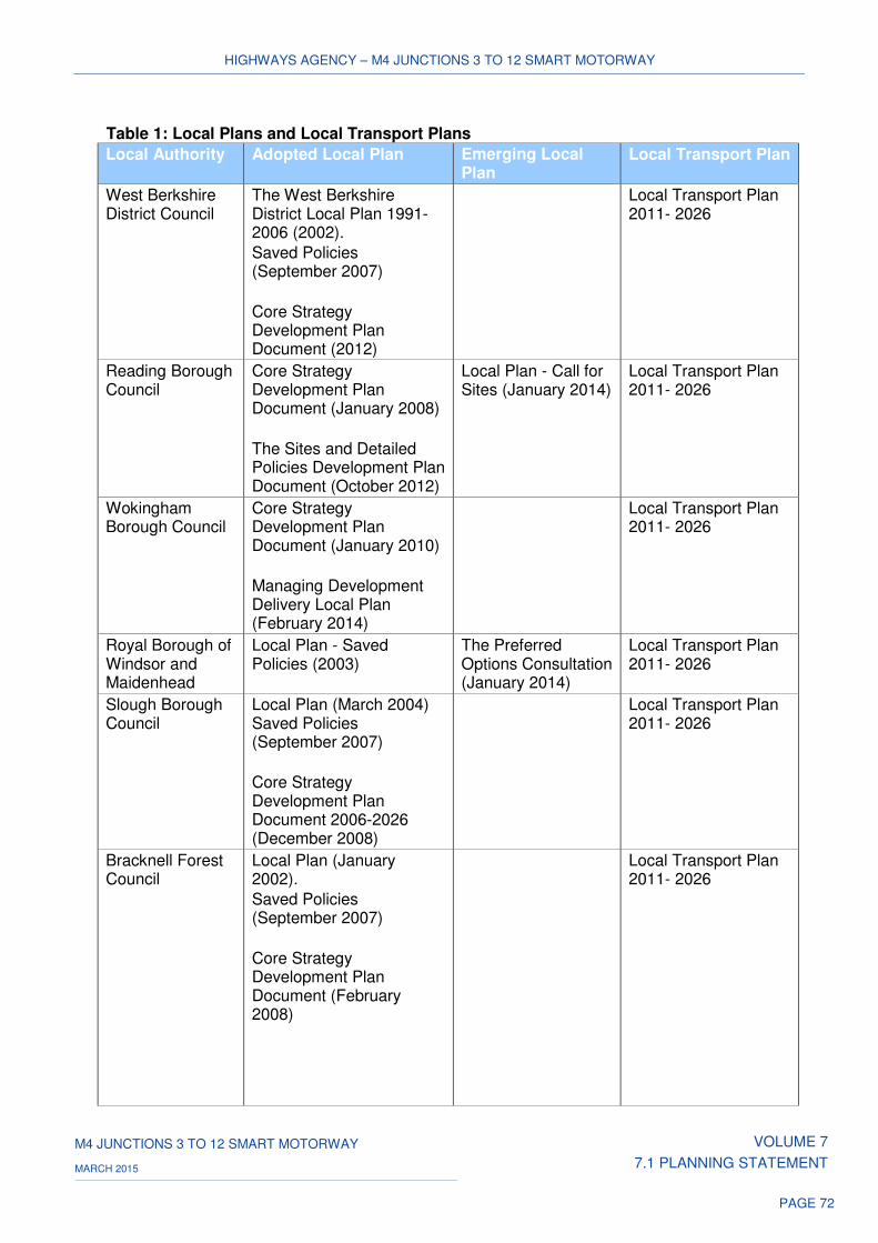
HIGHWAYS AGENCY – M4 JUNCTIONS 3 TO 12 SMART MOTORWAY
M4 JUNCTIONS 3 TO 12 SMART MOTORWAY VOLUME 7
7.1 PLANNING STATEMENT MARCH 2015
PAGE 72
Table 1: Local Plans and Local Transport Plans
Local Authority Adopted Local Plan Emerging Local Plan
Local Transport Plan
West Berkshire District Council
The West Berkshire District Local Plan 1991-2006 (2002).
Saved Policies (September 2007)
Core Strategy Development Plan Document (2012)
Local Transport Plan 2011- 2026
Reading Borough Council
Core Strategy Development Plan Document (January 2008)
The Sites and Detailed Policies Development Plan Document (October 2012)
Local Plan - Call for Sites (January 2014)
Local Transport Plan 2011- 2026
Wokingham Borough Council
Core Strategy Development Plan Document (January 2010)
Managing Development Delivery Local Plan (February 2014)
Local Transport Plan 2011- 2026
Royal Borough of Windsor and Maidenhead
Local Plan - Saved Policies (2003)
The Preferred Options Consultation (January 2014)
Local Transport Plan 2011- 2026
Slough Borough Council
Local Plan (March 2004) Saved Policies (September 2007)
Core Strategy Development Plan Document 2006-2026 (December 2008)
Local Transport Plan 2011- 2026
Bracknell Forest Council
Local Plan (January 2002).
Saved Policies (September 2007)
Core Strategy Development Plan Document (February 2008)
Local Transport Plan 2011- 2026
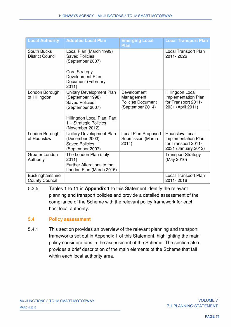
HIGHWAYS AGENCY – M4 JUNCTIONS 3 TO 12 SMART MOTORWAY
M4 JUNCTIONS 3 TO 12 SMART MOTORWAY VOLUME 7
7.1 PLANNING STATEMENT MARCH 2015
PAGE 73
5.3.5 Tables 1 to 11 in Appendix 1 to this Statement identify the relevant
planning and transport policies and provide a detailed assessment of the
compliance of the Scheme with the relevant policy framework for each
host local authority.
5.4 Policy assessment
5.4.1 This section provides an overview of the relevant planning and transport
frameworks set out in Appendix 1 of this Statement, highlighting the main
policy considerations in the assessment of the Scheme. The section also
provides a brief description of the main elements of the Scheme that fall
within each local authority area.
Local Authority Adopted Local Plan Emerging Local Plan
Local Transport Plan
South Bucks District Council
Local Plan (March 1999) Saved Policies (September 2007)
Core Strategy Development Plan Document (February 2011)
Local Transport Plan 2011- 2026
London Borough of Hillingdon
Unitary Development Plan (September 1998)
Saved Policies (September 2007)
Hillingdon Local Plan, Part 1 – Strategic Policies (November 2012)
Development Management Policies Document (September 2014)
Hillingdon Local Implementation Plan for Transport 2011-2031 (April 2011)
London Borough of Hounslow
Unitary Development Plan (December 2003)
Saved Policies (September 2007)
Local Plan Proposed Submission (March 2014)
Hounslow Local Implementation Plan for Transport 2011-2031 (January 2012)
Greater London Authority
The London Plan (July 2011)
Further Alterations to the London Plan (March 2015)
Transport Strategy (May 2010)
Buckinghamshire County Council
Local Transport Plan 2011- 2016
HIGHWAYS AGENCY – M4 JUNCTIONS 3 TO 12 SMART MOTORWAY
M4 JUNCTIONS 3 TO 12 SMART MOTORWAY VOLUME 7
7.1 PLANNING STATEMENT MARCH 2015
PAGE 74
West Berkshire District Council
5.4.2 The Scheme within the District is contained largely within the physical
boundaries of the motorway carriageway. The exceptions are the minor
alterations to the slip roads at junction 12 to accommodate the new
running lane within the existing hard shoulder of the motorway, and a
temporary construction compound to the south of junction 12, both of
which are outside the existing boundaries.
5.4.3 Both adopted Plans contain detailed policy guidance on key areas of the
Scheme in relation to flood risk, noise, biodiversity and landscape
(including the North Wessex Downs AONB). The Scheme is located within
Flood Zones 2 and 3. However, a range of mitigation measures are
proposed to address flood risks, in line with Local Plan policies. The
impact of the Scheme on statutory and non-statutory nature conservation
sites is considered within the ES to be neutral, thereby demonstrating no
harm to biodiversity interests.
5.4.4 The location of the Scheme within the North Wessex Downs AONB is
considered to result in slight adverse landscape and visual effects,
contrary to the policy guidance to conserve and enhance its local
distinctiveness.
5.4.5 Noise impacts of the Scheme are shown to be neutral in the long term.
The provision of low-noise surfacing across all lanes of the motorway will
assist in minimising the operational noise impacts of the Scheme.
5.4.6 The Scheme also supports the Council’s Local Transport Plan in
minimising traffic congestion and introducing new technology.
Reading Borough Council
5.4.7 The Scheme within the Borough is focussed on junction 11 and involves
minor alterations to the slip roads to accommodate the new running lane
within the existing hard shoulder of the motorway.
5.4.8 Both adopted Local Plans include a number of detailed policies of
relevance to the Scheme. On environmental matters, the more recently
published Sites and Detailed Policies Document (2012) requires that
proposals should not have a ‘significant detrimental impact’ on the
environment in terms of privacy and overlooking, visual dominance, noise
or light pollution. The assessment of the Scheme has shown the proposals
to be in compliance with the policy guidance. There are also no identified
HIGHWAYS AGENCY – M4 JUNCTIONS 3 TO 12 SMART MOTORWAY
M4 JUNCTIONS 3 TO 12 SMART MOTORWAY VOLUME 7
7.1 PLANNING STATEMENT MARCH 2015
PAGE 75
statutory or non-statutory nature conservation sites or heritage assets
affected by the Scheme within the local authority area.
5.4.9 In relation to flood risk, the Scheme is located within Flood Zones 2 and 3,
for which policy guidance places a presumption against development.
However, a range of mitigation measures are proposed to address flood
risk, to meet the policy requirements.
5.4.10 The emphasis placed within the Sites and Detailed Policies Document on
sustainable development and the incorporation of measures to adapt to
climate change have been fully demonstrated by the Scheme.
5.4.11 In line with the Local Transport Plan, the Agency has undertaken
consultation with Reading Borough Council during the development of the
Scheme and proposes the use of innovative technology.
Wokingham Borough Council
5.4.12 The Scheme proposals within the Borough include the improvement of the
existing highway carriageway to provide the necessary information
technology systems and operational features such as ERAs. With the
exception of alterations to junction 10 to accommodate access to the new
running lane, the Scheme does not extend beyond the existing motorway
carriageway.
5.4.13 The Scheme also includes the provision of a construction compound to be
sited within the boundaries of the roundabout at junction 10. As this is a
temporary use in this location, this element is not considered not to raise
any significant planning issues.
5.4.14 A primary consideration of Core Strategy concerns the policy implications
of development, which is ‘not normally’ permitted outside the defined
development limits. The location of the motorway, although outside these
limits, is considered acceptable within the context of this policy.
5.4.15 The environmental impacts of the Scheme have also been considered.
There are considered to be no adverse noise impacts, especially given the
mitigation provided by low-noise surfacing across all lanes of the
motorway. There are also no predicted impacts to known archaeology
remains during the construction of the Scheme.
5.4.16 The Scheme is located within Flood Zones 2 and 3. However, a range of
mitigation measures are proposed to address flood risk, in line with policy
requirements. The Scheme has also addressed surface water issues
through the preparation of a Drainage Strategy.
HIGHWAYS AGENCY – M4 JUNCTIONS 3 TO 12 SMART MOTORWAY
M4 JUNCTIONS 3 TO 12 SMART MOTORWAY VOLUME 7
7.1 PLANNING STATEMENT MARCH 2015
PAGE 76
5.4.17 The landscape assessment undertaken within the ES has acknowledged
the impacts of the Scheme within the Borough, through the loss, in part, of
some landscape resource. As this is not considered to affect the integrity
of these landscape elements, the Scheme is considered to be largely
compliant with the policy requirement of retaining landscape character.
5.4.18 The Scheme will help deliver the Council’s Local Transport Plan policies
as it will assist in tackling congestion and uses intelligent transport
systems.
Royal Borough of Windsor and Maidenhead
5.4.19 The Scheme proposals within the Borough are confined largely to the
existing motorway carriageway, with the exception of minor alterations to
the slip roads at junction 9 and an off-line replacement to Ascot Road
overbridge, immediately to the east of the existing bridge structure. In
addition, two temporary construction compounds are proposed close to
junctions 8/9 and 6.
5.4.20 A primary consideration within the adopted Local Plan is the development
of the Scheme within the designated Green Belt. The Scheme is
considered an acceptable land use within the Green Belt, as defined within
the Local Plan. Furthermore, compliance with the policy tests of
maintaining openness and the purposes of including land within the Green
Belt are both demonstrated.
5.4.21 The Plan includes a range of policy guidance of relevance to the Scheme.
In relation to heritage assets, there are shown to be no impacts to either
listed buildings or their settings, historic gardens and formal landscapes as
a result of the Scheme. In view of the potential of the Scheme to cause
direct physical impacts to currently unknown archaeological remains,
archaeological watching briefs are to be undertaken in accordance with
the policy requirement.
5.4.22 The Scheme will not lead to unacceptable levels of noise pollution.
5.4.23 The preparation of a Drainage Strategy, incorporating mitigation measures
is intended to address any unacceptable risks to the quality of
groundwater or surface water in accordance with plan policies.
5.4.24 The Scheme has met the Council’s aspirations for partnership working in
addressing transport issues.
HIGHWAYS AGENCY – M4 JUNCTIONS 3 TO 12 SMART MOTORWAY
M4 JUNCTIONS 3 TO 12 SMART MOTORWAY VOLUME 7
7.1 PLANNING STATEMENT MARCH 2015
PAGE 77
Slough Borough Council
5.4.25 The Scheme within the Borough is contained largely within the existing
highway carriageway. However, it is also necessary to widen and replace
a number of bridges where, currently, there is no hard shoulder. This
includes the demolition and replacement of Wood Lane and Datchet Road
overbridges, immediately to the east of the existing bridges, plus the
demolition and replacement of Oldway Lane and Recreation Ground
overbridges in the same location. It is also necessary to widen the
sliproads at junctions 5 and 6 to accommodate access to the new running
lanes. Two temporary construction compounds are proposed close to
junctions 5 and 4b.
5.4.26 The Scheme is partly located within the designated Green Belt and
Strategic Gap. In response to the policy guidance, the ‘very special
circumstances’ justifying the location of the Scheme within the Green Belt,
have been set out in the discussion of the NN NPS above. This includes
the inclusion of a minor alteration to junction 4b within the Strategic Gap,
as an essential requirement to enable the implementation of the Scheme
in this location.
5.4.27 Both adopted plans include a number of environmental policies of
relevance to the Scheme. The assessments undertaken within the ES
have demonstrated no detrimental effects on nature conservation interests
or watercourses and the floodplain. In relation to archaeology and
landscaping, mitigation measures and enhancement measures are
proposed in compliance with the policy requirements.
5.4.28 The Scheme is aligned with the policy guidance set out within the
Council’s Local Transport Plan. With no significant overall changes in air
quality and negligible noise impacts, the Scheme is considered to accord
with the Plan’s policy framework.
Bracknell Forest Council
5.4.29 The Scheme proposals are confined within the existing motorway
carriageway and are limited to the installation of information technology
systems and operational features such as ERAs. The Scheme is located
within Green Belt and open countryside. The policy guidance requiring
justification of the ‘very special circumstances’ allowing development
within the Green Belt, has been set out in paragraphs 5.2.32 – 5.2.38
above. Similarly, in relation to open countryside, the Scheme is not
HIGHWAYS AGENCY – M4 JUNCTIONS 3 TO 12 SMART MOTORWAY
M4 JUNCTIONS 3 TO 12 SMART MOTORWAY VOLUME 7
7.1 PLANNING STATEMENT MARCH 2015
PAGE 78
considered to adversely affect the character, appearance or function of the
land, in accordance with Local Plan policy.
5.4.30 In relation to the range of relevant environmental policies within the
Adopted Plans, there are no identified nature conservation interests,
ancient monuments or archaeological remains of national importance
within the study area in this local authority area. The Scheme lies outside
any flood risk area and is not considered, through the assessments within
the ES, to generate unacceptable levels of air quality or noise pollution, in
compliance with Local Plan policies.
5.4.31 The implementation of key road capacity improvements and a reduction in
the impacts of congestion, as set out within the Local Transport Plan, are
both being promoted by the Scheme.
South Bucks District Council
5.4.32 The proposals for the Scheme within the Borough are confined largely to
works within the existing carriageway of the M4. The exceptions are the
demolition and reconstruction of Marsh Lane, Lake End Road,
Huntercombe Spur and Old Slade Lane overbridges to provide a running
lane in the absence of a hard shoulder along these sections of the
motorway. The Scheme also involves the widening of Thames Bray
overbridge on its northern side and the alteration to the slip roads at
junctions 7 and 4b to connect with the newly formed hard shoulder running
lane. A temporary construction compound is proposed at junction 7.
5.4.33 The Scheme is located within the designated Green Belt. The policy
guidance, justifying the ‘very special circumstances’ which would permit
development within the Green Belt, is set out in paragraphs 5.2.32 –
5.2.38 above. The policy protection afforded to the built and natural
environment is complied with, including that relating to the setting of the
River Thames.
5.4.34 The Scheme has been shown to largely accord with the relevant
objectives of the Local Transport Plan in seeking to ease congestion,
reduce traffic accidents, as well as carbon emissions.
HIGHWAYS AGENCY – M4 JUNCTIONS 3 TO 12 SMART MOTORWAY
M4 JUNCTIONS 3 TO 12 SMART MOTORWAY VOLUME 7
7.1 PLANNING STATEMENT MARCH 2015
PAGE 79
London Borough of Hillingdon
5.4.35 The Scheme is contained largely within the physical boundaries of the
motorway, although it includes the widening of Sipson Road subway and
alterations to the slip roads at junctions 4B, 4 and 3 to accommodate the
new running lane within the existing hard shoulder of the motorway
beyond the motorway carriageway. It is also proposed to locate a
construction compound, a temporary use, immediately to the north of
junction 4.
5.4.36 The Scheme is located within the designated Green Belt. The policy
guidance, justifying the ‘very special circumstances’ which would permit
development within the Green Belt, is set out in paragraphs 5.2.32 –
5.2.38 above.
5.4.37 The adopted Local Plans contain a number of environmental policies of
relevance to the Scheme. The Scheme will not cause a deterioration in
local air quality and there are no worsening of impacts within the Air
Quality Management Areas. The Scheme is considered to introduce a
reduction in noise levels, in compliance with Local Plan policy for
promoting reductions in noise levels.
5.4.38 There are no sites of special scientific interest in close proximity to the
Scheme in this local authority area. The assessments undertaken within
the ES on Local Nature Reserves and Sites of Nature Conservation
Interest in proximity to the Scheme have concluded that the residual
effects of the Scheme on these sites are neutral. The Scheme does not fall
within defined archaeological priority areas and any potential impacts to
archaeological remains are to be mitigated through archaeological
watching briefs. The proposed works within this section of the Scheme are
not at risk of flooding and have therefore been excluded from the FRA.
5.4.39 The Adopted Unitary Development Plan seeks to safeguard land for the
widening of the M4 between junctions 3 and 4 within the Borough.
5.4.40 The emerging Local Plan provides a similar policy framework to the
adopted plans. An additional policy regarding development in Green Edge
Locations is included; this requires the assimilation of development into
the surrounding area. The limited extent of works within the motorway
corridor and the introduction of environmental enhancements are
considered to be in compliance with the policy requirement.
HIGHWAYS AGENCY – M4 JUNCTIONS 3 TO 12 SMART MOTORWAY
M4 JUNCTIONS 3 TO 12 SMART MOTORWAY VOLUME 7
7.1 PLANNING STATEMENT MARCH 2015
PAGE 80
5.4.41 The relevant objectives of the Council’s Local Implementation Plan for
Transport in reducing the negative impacts of transport on noise,
improving journey time reliability and in reducing congestion are all
considered to have been met by the Scheme.
London Borough of Hounslow
5.4.42 The Scheme does involves the construction of alterations to the slip road
at junction 3 and installation of information technology systems and
operational features such as ERAs within the existing highway
carriageway.
5.4.43 The Scheme is located within the designated Green Belt. The policy
guidance, justifying the ‘very special circumstances’ which would permit
development within the Green Belt, is set out in paragraphs 5.2.32 –
5.2.38 above.
5.4.44 The Scheme is not considered to be at risk of flooding in this area and the
effects on nature conservation interests are considered to be neutral.
5.4.45 Predicted changes in air quality are not considered to be significant and for
this reason no mitigation measures are proposed. The Scheme is not
therefore seen as causing a deterioration in local air quality and no
worsening of impacts within the Air Quality Management Areas. The
Scheme is considered to result in a reduction in noise levels, in
compliance with the Council’s policy.
5.4.46 The Council’s Local Implementation Plan for Transport refers on the need
to reduce traffic congestion and to maximise the current capacity of the
network addressed, which are objectives of the Scheme.
Greater London Authority
5.4.47 The newly Adopted ‘Further Alterations to the London Plan’ includes a
number of strategic policies aimed at guiding development within London
up to 2036. Those of relevance to the Scheme include policies relating to
development within the Green Belt, air quality and noise issues, along with
the effects on sites of nature conservation importance. These have been
fully addressed within the planning frameworks of both Hillingdon and
Hounslow local planning authorities. An additional policy relates to the
support given in the FALP to the implementation of the ‘Western Wedge
extending from west London to the Thames Valley,’ within which area the
Scheme falls.
HIGHWAYS AGENCY – M4 JUNCTIONS 3 TO 12 SMART MOTORWAY
M4 JUNCTIONS 3 TO 12 SMART MOTORWAY VOLUME 7
7.1 PLANNING STATEMENT MARCH 2015
PAGE 81
5.4.48 The Mayor’s Transport Plan sets out a policy objective to support
sustainable capacity enhancements to the strategic road network serving
London. The policy assessment has noted the ongoing work with the GLA
in relation to the development of the Scheme.
Buckinghamshire County Council
5.4.49 Relevant policy objectives within the Council’s Local Transport Plan
relating to maintaining or improving the reliability of journey times on key
routes and improving connectivity and access between key centres are
met by the Scheme.
Conclusions on Local Plan Policies
5.4.50 The main planning policy issues raised by the Application across all 11
host local authorities relate to the environmental effects of the Scheme,
particularly in relation to air quality, noise, flood risk, nature conservation,
heritage and landscape.
5.4.51 With the exception of the North Wessex AONB, located at the western
edge of the Scheme, there are no landscape designations of national or
local importance along the extent of the Scheme between junctions 12 and
3 of the M4. Equally, the Scheme does not fall within any nature
conservation sites of international, national or local importance. Whilst the
Scheme runs close to, it does not directly affect cultural heritage sites,
historic gardens, or conservation areas.
5.4.52 Through the assessments undertaken within the ES, the Scheme has
been shown to accord with policy guidance on air quality and noise and
where located within Flood Zones 2 and 3, the proposed mitigation
measures address potential flood risks, in complying with policy guidance.
5.4.53 Spatially, elements of the Scheme between the local authority areas of
Windsor and Maidenhead to the west and Hounslow to the east lie in
Green Belt, where a clear presumption exists against ‘inappropriate’
development. Nonetheless, even if the Scheme is seen to be inappropriate
development, compliance has been demonstrated for the Scheme when
considered against the relevant tests set out in local and national
guidance.
HIGHWAYS AGENCY – M4 JUNCTIONS 3 TO 12 SMART MOTORWAY
M4 JUNCTIONS 3 TO 12 SMART MOTORWAY VOLUME 7
7.1 PLANNING STATEMENT MARCH 2015
PAGE 82
5.4.54 Whilst the impact of the Scheme at the outer edge of the North Wessex
AONB is contrary to the local plan policy, this must be balanced against
the range of planning policies that are either supportive of the Scheme or
are in compliance with it. On balance therefore, the Scheme accords with
the provisions of the development plan and relevant policies of the
emerging Local Plans of the host authorities.
HIGHWAYS AGENCY – M4 JUNCTIONS 3 TO 12 SMART MOTORWAY
M4 JUNCTIONS 3 TO 12 SMART MOTORWAY VOLUME 7
7.1 PLANNING STATEMENT MARCH 2015
PAGE 83
6 OTHER IMPORTANT AND RELEVANT CONSIDERATIONS
6.1 Introduction
6.1.1 This section identifies other important and relevant considerations in
support of the Scheme to be considered alongside the national and local
planning policy referred to in section 5.
6.2 Government policy
National Infrastructure Plan, HM Treasury, December 2014
6.2.1 The Executive Summary ("Summary") to the National Infrastructure Plan
("Plan") makes clear that it aims to reinforce ‘the government’s
commitment to investing in infrastructure and improving its quality and
performance. It is underpinned by a pipeline of over £460 billion of planned
public and private investment.’
6.2.2 The Summary goes on to say that, ‘the government is prioritising the
public funding of infrastructure, putting in place the right policy framework
to give investors the confidence to commit to long-term projects, and
ensuring the supply chain has the certainty and tools it needs to deliver
effectively.’
6.2.3 Paragraph 1.13 of the Plan states that ‘having previously set out long-term
capital commitments for key publicly-funded sectors, the government is
now in a position to set out a clear delivery plan for each of the key
infrastructure sectors for the next five years. This includes providing details
of specific publicly-funded capital projects and programmes being taken
forward as a result of the commitments made at Spending Round 2013.’
6.2.4 In relation to Roads, paragraph 3.1 states that ‘the government’s aim is to
create a national road network fit for the 21st century, which improves
economic productivity and supports jobs and growth across the country. It
seeks to increase capacity, tackle congestion, support development,
strengthen connectivity, improve reliability and resilience, and ensure a
road network of the best possible quality.’
HIGHWAYS AGENCY – M4 JUNCTIONS 3 TO 12 SMART MOTORWAY
M4 JUNCTIONS 3 TO 12 SMART MOTORWAY VOLUME 7
7.1 PLANNING STATEMENT MARCH 2015
PAGE 84
6.2.5 On the issue of ‘need’ paragraph 3.2 notes that, ‘the road network is vital
to the economic sustainability of the UK’ and highlights the long-term trend
of growth in road traffic. With the expected rise in GDP and population,
paragraph 3.3 predicts that ‘demand for travel on the UK’s Strategic Road
Network will increase further’. This growth, if ‘unaccompanied by the
required level of investment or appropriate policies to encourage mode
shift, is likely to have a significant impact on levels of congestion.’
6.2.6 In terms of strategy, paragraph 3.7 states that ‘the government is taking
action across the Strategic Road Network to address growing demand and
the resulting pressures on the network. This includes:
making the best use of road capacity – including through ‘Smart
Motorways’, making extra lanes available at key times on more of the
busiest routes by opening up the hard shoulder, and using innovative
technology to keep traffic moving.’
6.2.7 Paragraph 16.1 notes that in order to support delivery of its objectives in
each sector the Government has set out its ‘Top 40 priority infrastructure
investments,’ allowing ‘the government to focus on the delivery of those
investments which either make the most significant contribution towards
achieving a particular objective or carry the most risk should they fail, both
strategically and in value for money terms.’
6.2.8 Paragraph 16.5 goes on to say that the Top 40 priority investments are
selected on the basis of three main criteria:
• 'potential contribution to economic growth
• nationally significant investment that delivers substantial new or
replacement infrastructure with enhanced quality, sustainability and
capacity
• projects that attract or unlock significant private investment.'
6.2.9 Table 16.1 provides the full list of Top 40 priority infrastructure investments
within the current National Infrastructure Plan. This includes the Scheme
as a key project under the Roads programme.
HIGHWAYS AGENCY – M4 JUNCTIONS 3 TO 12 SMART MOTORWAY
M4 JUNCTIONS 3 TO 12 SMART MOTORWAY VOLUME 7
7.1 PLANNING STATEMENT MARCH 2015
PAGE 85
Business Plan 2012-2015, Department for Transport, May 2012
6.2.10 The Department for Transport’s current Business Plan identifies seven
priorities for the Coalition Government, including a need to:
• Invest in the strategic road network to promote growth and address the
congestion that affects people and businesses, and continue to
improve road safety.
Investing in Britain’s Future, HM Treasury, June 2013
6.2.11 In its foreword, Investing in Britain's Future highlights the fact that ‘our
roads are congested, which costs the economy billions every year.’
6.2.12 Paragraph 1.8 states that ‘the Government recognises the need for
continued investment and is now committing to publicly fund a pipeline of
specific projects worth over £100 billion over the next parliament, including
over £70 billion in transport.’ This includes:
• ‘building all available Highways Agency road projects to tackle the
most congested parts of the network, subject to value for money and
deliverability, including…….the M4 from London to Reading.’
6.2.13 Paragraph 1.9 states that ‘these projects have been prioritised through a
zero-based review of the economic returns of every central government
capital programme, with investment being targeted increasingly at
economic infrastructure.’
6.2.14 In relation to transforming the network, paragraph 2.10 notes that ‘the
demands on the national road network will continue to rise toward 2020
and beyond, so the Government is making the historic decision to increase
roads investment in major projects to treble today’s levels by the end of
the decade. This will mark the start of a once-in-a-generation programme
of works worth between £30 billion to £50 billion over a 10 to 15 year
period to upgrade the nation’s roads to an entirely new standard.’
6.2.15 As part of this programme, paragraph 2.11 re-affirms the Government’s
investment in key strategic projects to include, ‘introducing four lane
capacity on the M4 from London to Reading – one of the most congested
parts of the motorway network in the country.’
HIGHWAYS AGENCY – M4 JUNCTIONS 3 TO 12 SMART MOTORWAY
M4 JUNCTIONS 3 TO 12 SMART MOTORWAY VOLUME 7
7.1 PLANNING STATEMENT MARCH 2015
PAGE 86
Action for Roads: a network for the 21st Century, Department for
Transport, July 2013
6.2.16 Paragraph 5 reports that the Department for Transport, in transforming
strategic roads, has, ‘just announced the biggest-ever upgrade of our
motorways and key A roads – our strategic road network. By 2021,
spending on road enhancements will have tripled from today’s levels, and
we will have resurfaced 80% of the network.’
6.2.17 Paragraph 7 goes on to say that ‘this means new, improved motorways for
the information age, building on pioneering managed motorway schemes
to tackle congestion on our busiest links. We will take this technology,
which has only been used on specific links, and apply it as a standard to
some of our busiest national routes.’
6.2.18 Paragraph 1.6 notes that, ‘well-connected road infrastructure with
sufficient capacity for our needs is a vital component of economic success.
However, our roads must overcome significant challenges if they are to
keep supporting our economy and driving growth into the future.’
6.2.19 Paragraph 1.22 expands on this, stating that ‘our latest estimates show
that even in the worst economic circumstances and assuming low
population growth, traffic levels on strategic roads will be 24% higher in
2040 than they are today. In our central case traffic will rise by 46% above
today’s levels.’
6.2.20 Paragraph 1.23 states that ‘even under our lowest growth forecasts we
would expect traffic growth to cause major increases in congestion,
greater delays and more unpredictable journeys. Without action, growing
demand will place unsustainable pressure on our roads, constraining the
economy, limiting our personal mobility and forcing us to spend more time
stuck in traffic. This will mean more pollution and more frustration for
motorists.’
6.2.21 Paragraph 1.24 states that ‘strategic roads may be under more pressure
than their local counterparts. Between 2000 and 2012, the last year for
which there is confirmed data, motorists drove an extra ten billion miles on
strategic roads, while traffic was steady on the rest of the network. Even in
the current economic climate, there have been significant increases in
traffic on the strategic road network – more than a billion extra vehicle
miles since 2010 alone.’
HIGHWAYS AGENCY – M4 JUNCTIONS 3 TO 12 SMART MOTORWAY
M4 JUNCTIONS 3 TO 12 SMART MOTORWAY VOLUME 7
7.1 PLANNING STATEMENT MARCH 2015
PAGE 87
6.2.22 Paragraph 1.25 warns that, ‘without investment, conditions on the most
important routes are expected to worsen by 2040. By then, around 15% of
the entire strategic road network may experience regular peak-time
congestion and often suffer poor conditions at other times of the day.’
6.2.23 Paragraph 1.25 continues, highlighting the following consequences of
increased traffic and lack of investment in the highway network:
• ‘Major national arteries will start to jam.
• Workers will find their job opportunities constrained by travel times.
• Congestion will work against current efforts to help the economy grow.
• British businesses will find it harder to access export markets as stress
increases on roads to ports and airports.
• Safety and the environment will also suffer, as congested traffic is more
polluting and more at-risk of accidents.’
6.2.24 In response to the identified issues, the Department for Transport
proposes in paragraph 2.5:
‘to build 52 national road projects, subject to value for money and
deliverability considerations, in order to tackle the most congested parts of
the network. These will include key strategic projects such as:
• Introducing four lane capacity on the M4 from London to Reading – one
of the most congested parts of the motorway network in the country
and vital for providing access to Heathrow.’
6.2.25 The Department for Transport highlights the fact, in paragraph 2.12, that
‘in recent years, we have become world-leaders in the use of technology
and traffic management to improve the flow of traffic on our motorways –
measures known collectively as managed motorways…….Overall,
managed motorways have been a great success story, improving traffic
management and the safety of day-to-day operations while opening up a
whole additional lane to traffic at busy times.’
6.2.26 As a result, the Department for Transport makes clear, in paragraph 2.13,
that ‘we are committing to this technology on a grand scale.’
HIGHWAYS AGENCY – M4 JUNCTIONS 3 TO 12 SMART MOTORWAY
M4 JUNCTIONS 3 TO 12 SMART MOTORWAY VOLUME 7
7.1 PLANNING STATEMENT MARCH 2015
PAGE 88
6.2.27 Paragraph 2.15 justifies this level of commitment stating that:
‘Because of the way managed motorways work, they have many
advantages over conventional widening. They can be introduced without
the need to take large amounts of land. They have a significant impact on
journey reliability and fewer environmental impacts. They can also be
delivered at up to 40% less cost with improved safety.’
Road Investment Strategy, Department for Transport, December 2014
6.2.28 The Department for Transport’s first Road Investment Strategy ("RIS") sets
out the Department’s longer term investment and planning, outlining how it
will invest in the SRN between 2015/16 and 2020/21.
6.2.29 The Department for Transport’s aim within the RIS is that by 2040, ‘we will
have transformed the busiest sections of the network to enable improved
safety levels, smoother traffic flow, and increased capacity. Smart
Motorways, which use technology to expand capacity and regulate the
flow of traffic, will form the core of the SRN.’
6.2.30 Looking forward to 2040, the vision seeks an upgraded network, supported
by technology, which involves ‘Smart Motorways becoming the standard
for the busiest sections of the network, delivering smoother traffic flow,
increased capacity and improved safety’.
6.2.31 The RIS underlines the importance of the SRN to British businesses and
the successful functioning of the economy, though it also acknowledges
that capacity has become a major issue in recent years, with parts of the
network becoming increasingly congested.
6.2.32 The RIS refers to a large scale programme of social research undertaken
by The Department for Transport which found that ‘if all roads were in
comparable condition, users believe that investment in the SRN should be
prioritised over investment in other roads.’
6.2.33 In meeting future needs, the RIS notes that ‘We live in a modern, vibrant
and internationally competitive country and, to maintain and build on this,
our country needs a high-performing SRN that matches the aspirations we
have for the future.’
6.2.34 The urgency attached to this is highlighted, with evidence showing that
whilst overall traffic has levelled off, demand for the SRN has continued to
grow, with little sign of demand on the SRN abating. The RIS predicts that,
‘on the SRN, we forecast that traffic (in terms of total miles driven) will be
between 27% and 57% higher in 2040 than it was in 2013.’
HIGHWAYS AGENCY – M4 JUNCTIONS 3 TO 12 SMART MOTORWAY
M4 JUNCTIONS 3 TO 12 SMART MOTORWAY VOLUME 7
7.1 PLANNING STATEMENT MARCH 2015
PAGE 89
6.2.35 In response, the RIS highlights the overarching challenges that need to be
considered. This includes building a smarter network that ‘can unlock the
potential of our roads, as we are already seeing through the deployment of
Smart Motorways.’
6.2.36 Realising the RIS is an assertion that ‘today’s Smart Motorways are at the
cutting edge of technology and we want it to stay that way. This means
keeping pace with innovation and incorporating emerging technologies,
allowing for continued improvements to journeys where it matters most. To
ensure this happens, we are requiring the Company to set out its approach
to innovation, technology and research during the early part of this Road
Period.’
6.2.37 The RIS refers to the transformational level of investment in the SRN,
announced as part of the Government’s 2013 Spending Round,
commenting that ‘new schemes will deliver improved local and regional
journeys, whilst also addressing critical challenges faced by the country
and the SRN.’ Key areas of impact will include ‘Developing a core network
of Smart Motorways and Expressways.’
6.2.38 The RIS goes on to state:
‘Our busiest and most economically important routes should benefit from
technology-enabled Smart Motorways, which offer safer, more reliable
journeys and an extra lane of capacity, while avoiding the need to
physically widen the road. We are, therefore, transforming the core of the
network so the busiest motorways are upgraded to Smart Motorway
standard.’
6.2.39 In order to deliver the long term vision, the RIS outlines how the
Department for Transport will invest in the SRN between 2015/16 and
2020/21. For London and the South East, the RIS refers to the previously
announced and committed M4 Junctions 3 to 12 Scheme, described as,
‘upgrading the M4 to Smart Motorway between junction 3 (Uxbridge) and
junction 12 (west of Reading), linking Reading and Heathrow.’
6.2.40 The RIS makes clear its intention to provide a long term funding
commitment by the Government to support delivery of this programme,
‘which involves ring-fencing investment for the Strategic Road Network in
a way which takes it outside of the normal decisions on departmental
budgets.’
HIGHWAYS AGENCY – M4 JUNCTIONS 3 TO 12 SMART MOTORWAY
M4 JUNCTIONS 3 TO 12 SMART MOTORWAY VOLUME 7
7.1 PLANNING STATEMENT MARCH 2015
PAGE 90
6.2.41 The RIS advises that the schemes included within it, such as ‘new smart
technology’ on the M4, will have access to committed funding, allowing
them to enter construction during the first Road Period ending in 2019/20.
Conclusions on other important and relevant considerations
6.2.42 It is evident from the policy documents reviewed that traffic congestion is
regarded as a major constraint to economic development and that
relieving it is key to the Government’s aspirations for sustainable economic
growth.
6.2.43 Addressing the current congestion between junction 3 and junction 12 of
the M4 accords with the national policy position. The strong support given
to improving the Strategic Road Network by central government through
the development of smart motorways lends further weight to the Scheme.
6.2.44 The inclusion of the Scheme as part of the Government’s current
investment programme provides a clear recognition of the importance of
the Scheme in meeting national policy aspirations, emphasises the need
case for the Scheme and must be seen as a strongly important and
relevant consideration in support of the Scheme.
HIGHWAYS AGENCY – M4 JUNCTIONS 3 TO 12 SMART MOTORWAY
M4 JUNCTIONS 3 TO 12 SMART MOTORWAY VOLUME 7
7.1 PLANNING STATEMENT MARCH 2015
PAGE 91
7 OVERALL CONCLUSIONS AND THE PLANNING BALANCE
7.1 The Application
7.1.1 This Planning Statement relates to the Application made by the Agency to
the Secretary of State pursuant to PA 2008.
7.1.2 The Application is for the M4 (Junctions 3 to 12) (Smart Motorway)
Development Consent Order which would grant development consent
authorising the construction, operation and maintenance of the Scheme,
along with the compulsory acquisition of all land necessary to enable this.
7.2 The Scheme
7.2.1 The Scheme lies wholly within England and includes the alteration and
improvement of a highway for which the Secretary of State is the highway
authority. The area of development is greater than 15 hectares, and the
improvement of the highway is considered to have the potential for a
significant effect on the environment. As such, the Scheme is classified as
a NSIP.
7.2.2 The Scheme’s key objectives are to:
a) reduce congestion, smooth the flow of traffic to improve journey
times and make journeys more reliable;
b) support and enhance the role of the M4 as a major national and
inter-urban regional transport artery;
c) support the economy and facilitate economic growth within the
regions, by providing much needed capacity on the motorway;
d) continue to deliver a high level of safety performance of the network
using smart motorway techniques; and
e) deliver environmental improvements and mitigation where
appropriate and required.
7.3 Determination and important and relevant considerations
7.3.1 The Examining Authority will consider the application for development
consent and will make a recommendation to the Secretary of State, who
will decide whether development consent for the Scheme should be
granted. In so doing, the Secretary of State must decide the Application in
accordance with any relevant national policy statement, but other
important and relevant considerations are the National Planning Policy
HIGHWAYS AGENCY – M4 JUNCTIONS 3 TO 12 SMART MOTORWAY
M4 JUNCTIONS 3 TO 12 SMART MOTORWAY VOLUME 7
7.1 PLANNING STATEMENT MARCH 2015
PAGE 92
Framework ("NPPF") and development plan policies of the 11 LPAs,
together with any other important and relevant considerations.
7.4 National networks national policy statement
7.4.1 The Scheme has been appraised against the various polices contained in
the NN NPS, particularly having regard to the assessment matters
identified in that document in relation to environmental effects.
7.4.2 Each topic chapter in the ES addresses those paragraphs of the NN NPS
which are relevant to the environmental assessment and provides an
analysis of the Scheme's compliance with the NN NPS.
7.4.3 The Scheme accords with the NN NPS in all material respects, and on that
basis a presumption in its favour exists under the terms of section 104 of
the PA 2008.
7.5 National planning policy framework
7.5.1 The Scheme strongly accords with the key aims of the NPPF, notably by
improving the conditions in which people travel. This is a key objective of
the Scheme.
7.5.2 The Scheme supports the delivery of the NPPF’s core land-use planning
principles, by providing improved infrastructure to support economic
growth within the region through improved capacity on the M4 motorway.
This will be achieved at the same time by conserving the natural
environment to a greater extent than a traditional motorway widening
scheme. This is because the use of land for the Scheme is largely within
the existing motorway corridor. This approach involves the use of
previously developed land (the motorway and its associated verges and
embankments), another core planning principle of the NPPF.
7.5.3 Development within the Green Belt is a key issue within the NPPF. It is
acknowledged, but not agreed that the Scheme may potentially represent
inappropriate development within the Green Belt. For that reason, a full
assessment of the Scheme against the NN NPS has been carried out, and
the assessment demonstrates that ‘very special circumstances’ exist for
development within Green Belt land and the Scheme’s compliance with
both the tests of openness, and the five purposes of the Green Belt.
7.5.4 The assessment undertaken within the ES addresses a range of
environmental issues and demonstrates how the Scheme satisfies the
relevant policy guidance.
HIGHWAYS AGENCY – M4 JUNCTIONS 3 TO 12 SMART MOTORWAY
M4 JUNCTIONS 3 TO 12 SMART MOTORWAY VOLUME 7
7.1 PLANNING STATEMENT MARCH 2015
PAGE 93
7.5.5 The Scheme crosses a number of floodplains classified as Flood Zones 2
and 3. A Flood Risk Assessment has been prepared as an addendum to
the ES to identify potential sources of flood risk in relation to the Scheme.
It is concluded that overall, the Scheme will not have a detrimental impact
upon the existing floodplains and groundwater resources.
7.5.6 The Scheme potentially lies within the area of influence of a number of
internationally, nationally and locally designated sites, including Sites of
Special Scientific Interest. However, the ES concludes that the Scheme
will not result in any direct impacts on designated or non-designated sites
of nature conservation value. The overall effects on nature conservation
are therefore assessed as neutral.
7.5.7 The NPPF also addresses both noise and air quality. With regard to noise,
the ES shows that, once operational, the significance of effect of the
operation of the Scheme is assessed as being ‘slight adverse in the short
term and neutral in the long term’. This falls within the requirements of
NPPF for development to ‘avoid noise from giving rise to significant
adverse impacts.’
7.5.8 In terms of air quality, the ES concludes that, from the locations modelled,
the overall impact of the Scheme on air quality during construction and
operation is not significant.
7.5.9 On design matters, the NPPF does not seek to impose particular
architectural styles or tastes, this is particularly so for infrastructure
projects where the design elements of the Scheme are based on the
replacement or widening of existing motorway bridges and the introduction
of highway technology.
7.5.10 Overall, the Scheme is considered to be consistent with the provisions and
requirements of NPPF.
7.6 Local planning policy
7.6.1 The main planning policy issues raised by the Application across all 11
host local authorities relate to the environmental effects of the Scheme,
particularly in relation to air quality, noise, flood risk, nature conservation,
heritage and landscape.
HIGHWAYS AGENCY – M4 JUNCTIONS 3 TO 12 SMART MOTORWAY
M4 JUNCTIONS 3 TO 12 SMART MOTORWAY VOLUME 7
7.1 PLANNING STATEMENT MARCH 2015
PAGE 94
7.6.2 With the exception of the North Wessex AONB, located at the western
edge of the Scheme, there are no landscape designations of national or
local importance along the extent of the Scheme between junctions 12 and
3 of the M4. Equally, the Scheme does not fall within any nature
conservation sites of international, national or local importance. Whilst the
Scheme runs close to, it does not directly affect cultural heritage sites,
historic gardens, or conservation areas.
7.6.3 Through the assessments undertaken within the ES, the Scheme has
been shown to accord with policy guidance on air quality and noise and
where located within Flood Zones 2 and 3, the proposed mitigation
measures address potential flood risks, in complying with policy guidance.
7.6.4 Spatially, elements of the Scheme between the local authority areas of
Windsor and Maidenhead to the west and Hounslow to the east lie in
Green Belt, where a clear presumption exists against ‘inappropriate’
development. Nonetheless, even if the Scheme is seen to be inappropriate
development, compliance has been demonstrated for the Scheme when
considered against the relevant tests set out in local and national
guidance.
7.6.5 Whilst the impact of the Scheme at the outer edge of the North Wessex
AONB is contrary to the local plan policy, this must be balanced against
the range of planning policies that are either supportive of the Scheme or
are in compliance with it. On balance therefore, the Scheme accords with
the provisions of the development plan and relevant policies of the
emerging Local Plans of the host authorities.
7.7 Other important and relevant considerations
7.7.1 It is evident from the policy documents reviewed that traffic congestion is
regarded as a major constraint to economic development and that
relieving it is key to the Government’s aspirations for sustainable economic
growth.
7.7.2 Addressing the current congestion between junction 3 and junction 12 of
the M4 accords with the national policy position. The strong support given
to improving the Strategic Road Network by central government through
the development of smart motorways lends further weight to the Scheme.
HIGHWAYS AGENCY – M4 JUNCTIONS 3 TO 12 SMART MOTORWAY
M4 JUNCTIONS 3 TO 12 SMART MOTORWAY VOLUME 7
7.1 PLANNING STATEMENT MARCH 2015
PAGE 95
7.7.3 The inclusion of the Scheme as part of the Government’s current
investment programme provides a clear recognition of the importance of
the Scheme in meeting national policy aspirations, emphasises the need
case for the Scheme and must be seen as a strongly important and
relevant consideration in support of the Scheme.
7.8 The planning balance
7.8.1 The review of planning policy carried out as part of this Planning
Statement shows that environmental issues are important and relevant
considerations for the decision-maker (mainly in relation to Green Belt, air
quality, noise, flood risk, nature conservation, and heritage and
landscape). This Planning Statement provides a comprehensive overview
that confirms the ability of the Scheme to satisfactorily address the matters
identified.
7.8.2 That the Scheme is in accordance with the NN NPS in all material
respects indicates that a presumption in favour of it exists under PA 2008.
7.8.3 Where there is potential for the Scheme to have an adverse impact in
relation to planning policy, these impacts must be considered and weighed
in the context of:
a) the linear nature of the Scheme and the containment of the most of
the Scheme elements within an existing strategic highway corridor;
b) the NN NPS presumption in favour of the Scheme; and
c) the significant role of the Scheme will play in underpinning the
Government’s social, economic and environmental policy
aspirations, and the substantially improved conditions in which
people travel that the Scheme will provide.
7.8.4 On the basis of the need case for the Scheme, it is clear that there is a
compelling case in the public interest for the Scheme. Against a
background of overwhelming compliance in terms of national and local
planning policy, any adverse effects of the Scheme are not considered to
outweigh its benefits. Accordingly, the policy presumption in favour of the
Scheme and the overall planning balance lie strongly in favour of the grant
of development consent.
HIGHWAYS AGENCY – M4 JUNCTIONS 3 TO 12 SMART MOTORWAY
M4 JUNCTIONS 3 TO 12 SMART MOTORWAY VOLUME 7.1 PLANNING STATEMENT
MARCH 2015
APPENDIX 1 PAGE 1
APPENDIX 1 - LOCAL AUTHORITY PLANNING AND TRANSPORT POLICIES
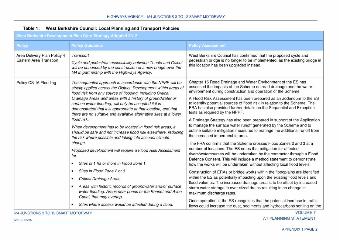
HIGHWAYS AGENCY – M4 JUNCTIONS 3 TO 12 SMART MOTORWAY
M4 JUNCTIONS 3 TO 12 SMART MOTORWAY VOLUME 7
7.1 PLANNING STATEMENT MARCH 2015
APPENDIX 1 PAGE 2
Table 1: West Berkshire Council: Local Planning and Transport Policies
West Berkshire Development Plan Core Strategy Adopted 2012
Policy Policy Guidance Policy Assessment
Area Delivery Plan Policy 4
Eastern Area Transport
Transport
Cycle and pedestrian accessibility between Theale and Calcot
will be enhanced by the construction of a new bridge over the
M4 in partnership with the Highways Agency.
West Berkshire Council has confirmed that the proposed cycle and
pedestrian bridge is no longer to be implemented, as the existing bridge in
this location has been upgraded instead.
Policy CS 16 Flooding The sequential approach in accordance with the NPPF will be
strictly applied across the District. Development within areas of
flood risk from any source of flooding, including Critical
Drainage Areas and areas with a history of groundwater or
surface water flooding, will only be accepted if it is
demonstrated that it is appropriate at that location, and that
there are no suitable and available alternative sites at a lower
flood risk.
When development has to be located in flood risk areas, it
should be safe and not increase flood risk elsewhere, reducing
the risk where possible and taking into account climate
change.
Proposed development will require a Flood Risk Assessment
for:
• Sites of 1 ha or more in Flood Zone 1.
• Sites in Flood Zone 2 or 3.
• Critical Drainage Areas.
• Areas with historic records of groundwater and/or surface
water flooding. Areas near ponds or the Kennet and Avon
Canal, that may overtop.
• Sites where access would be affected during a flood.
Chapter 15 Road Drainage and Water Environment of the ES has assessed the impacts of the Scheme on road drainage and the water environment during construction and operation of the Scheme.
A Flood Risk Assessment has been prepared as an addendum to the ES to identify potential sources of flood risk in relation to the Scheme. The FRA has also provided further details on the Sequential and Exception tests as required by the NPPF.
A Drainage Strategy has also been prepared in support of the Application
to manage the surface water runoff generated by the Scheme and to
outline suitable mitigation measures to manage the additional runoff from
the increased impermeable area.
The FRA confirms that the Scheme crosses Flood Zones 2 and 3 at a
number of locations. The ES notes that mitigation for affected
rivers/watercourses will be undertaken by the contractor through a Flood
Defence Consent. This will include a method statement to demonstrate
how the works will be undertaken without affecting local flood levels.
Construction of ERAs or bridge works within the floodplains are identified
within the ES as potentially impacting upon the existing flood levels and
flood volumes. The increased drainage area is to be offset by increased
storm water storage in over-sized drains resulting in no change in
maximum discharge rates.
Once operational, the ES recognises that the potential increase in traffic
flows could increase the dust, sediments and hydrocarbons settling on the
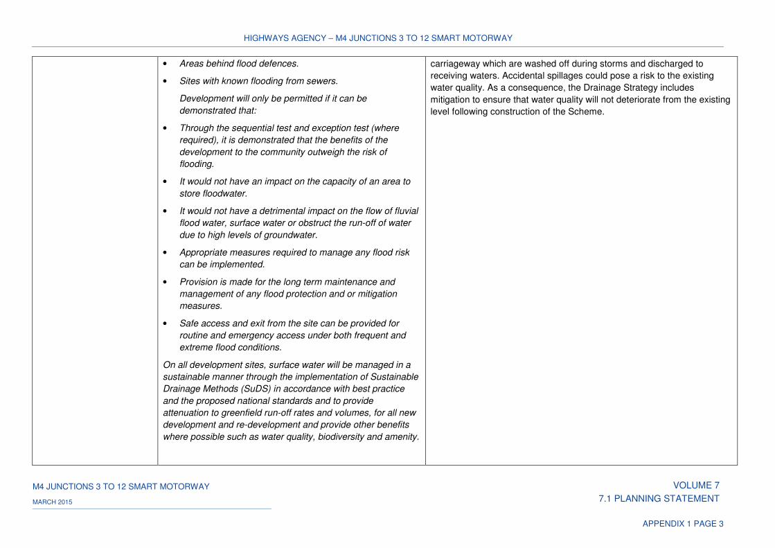
HIGHWAYS AGENCY – M4 JUNCTIONS 3 TO 12 SMART MOTORWAY
M4 JUNCTIONS 3 TO 12 SMART MOTORWAY VOLUME 7
7.1 PLANNING STATEMENT MARCH 2015
APPENDIX 1 PAGE 3
• Areas behind flood defences.
• Sites with known flooding from sewers.
Development will only be permitted if it can be
demonstrated that:
• Through the sequential test and exception test (where
required), it is demonstrated that the benefits of the
development to the community outweigh the risk of
flooding.
• It would not have an impact on the capacity of an area to
store floodwater.
• It would not have a detrimental impact on the flow of fluvial
flood water, surface water or obstruct the run-off of water
due to high levels of groundwater.
• Appropriate measures required to manage any flood risk
can be implemented.
• Provision is made for the long term maintenance and
management of any flood protection and or mitigation
measures.
• Safe access and exit from the site can be provided for
routine and emergency access under both frequent and
extreme flood conditions.
On all development sites, surface water will be managed in a
sustainable manner through the implementation of Sustainable
Drainage Methods (SuDS) in accordance with best practice
and the proposed national standards and to provide
attenuation to greenfield run-off rates and volumes, for all new
development and re-development and provide other benefits
where possible such as water quality, biodiversity and amenity.
carriageway which are washed off during storms and discharged to
receiving waters. Accidental spillages could pose a risk to the existing
water quality. As a consequence, the Drainage Strategy includes
mitigation to ensure that water quality will not deteriorate from the existing
level following construction of the Scheme.
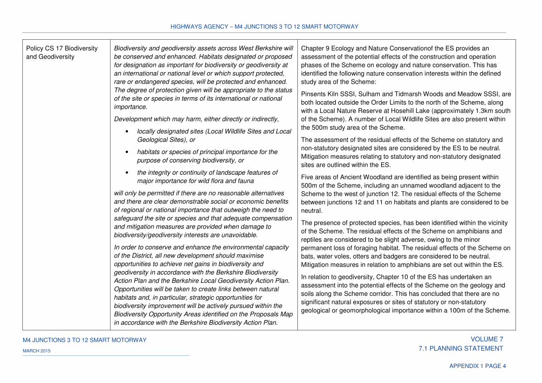
HIGHWAYS AGENCY – M4 JUNCTIONS 3 TO 12 SMART MOTORWAY
M4 JUNCTIONS 3 TO 12 SMART MOTORWAY VOLUME 7
7.1 PLANNING STATEMENT MARCH 2015
APPENDIX 1 PAGE 4
Policy CS 17 Biodiversity
and Geodiversity
Biodiversity and geodiversity assets across West Berkshire will
be conserved and enhanced. Habitats designated or proposed
for designation as important for biodiversity or geodiversity at
an international or national level or which support protected,
rare or endangered species, will be protected and enhanced.
The degree of protection given will be appropriate to the status
of the site or species in terms of its international or national
importance.
Development which may harm, either directly or indirectly,
• locally designated sites (Local Wildlife Sites and Local
Geological Sites), or
• habitats or species of principal importance for the
purpose of conserving biodiversity, or
• the integrity or continuity of landscape features of
major importance for wild flora and fauna
will only be permitted if there are no reasonable alternatives
and there are clear demonstrable social or economic benefits
of regional or national importance that outweigh the need to
safeguard the site or species and that adequate compensation
and mitigation measures are provided when damage to
biodiversity/geodiversity interests are unavoidable.
In order to conserve and enhance the environmental capacity
of the District, all new development should maximise
opportunities to achieve net gains in biodiversity and
geodiversity in accordance with the Berkshire Biodiversity
Action Plan and the Berkshire Local Geodiversity Action Plan.
Opportunities will be taken to create links between natural
habitats and, in particular, strategic opportunities for
biodiversity improvement will be actively pursued within the
Biodiversity Opportunity Areas identified on the Proposals Map
in accordance with the Berkshire Biodiversity Action Plan.
Chapter 9 Ecology and Nature Conservationof the ES provides an
assessment of the potential effects of the construction and operation
phases of the Scheme on ecology and nature conservation. This has
identified the following nature conservation interests within the defined
study area of the Scheme:
Pinsents Kiln SSSI, Sulham and Tidmarsh Woods and Meadow SSSI, are
both located outside the Order Limits to the north of the Scheme, along
with a Local Nature Reserve at Hosehill Lake (approximately 1.3km south
of the Scheme). A number of Local Wildlife Sites are also present within
the 500m study area of the Scheme.
The assessment of the residual effects of the Scheme on statutory and
non-statutory designated sites are considered by the ES to be neutral.
Mitigation measures relating to statutory and non-statutory designated
sites are outlined within the ES.
Five areas of Ancient Woodland are identified as being present within
500m of the Scheme, including an unnamed woodland adjacent to the
Scheme to the west of junction 12. The residual effects of the Scheme
between junctions 12 and 11 on habitats and plants are considered to be
neutral.
The presence of protected species, has been identified within the vicinity
of the Scheme. The residual effects of the Scheme on amphibians and
reptiles are considered to be slight adverse, owing to the minor
permanent loss of foraging habitat. The residual effects of the Scheme on
bats, water voles, otters and badgers are considered to be neutral.
Mitigation measures in relation to amphibians are set out within the ES.
In relation to geodiversity, Chapter 10 of the ES has undertaken an
assessment into the potential effects of the Scheme on the geology and
soils along the Scheme corridor. This has concluded that there are no
significant natural exposures or sites of statutory or non-statutory
geological or geomorphological importance within a 100m of the Scheme.
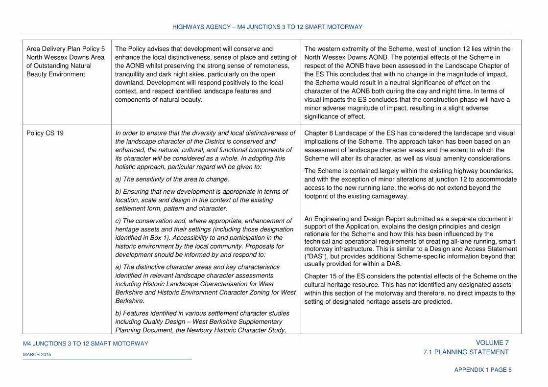
HIGHWAYS AGENCY – M4 JUNCTIONS 3 TO 12 SMART MOTORWAY
M4 JUNCTIONS 3 TO 12 SMART MOTORWAY VOLUME 7
7.1 PLANNING STATEMENT MARCH 2015
APPENDIX 1 PAGE 5
Area Delivery Plan Policy 5
North Wessex Downs Area
of Outstanding Natural
Beauty Environment
The Policy advises that development will conserve and
enhance the local distinctiveness, sense of place and setting of
the AONB whilst preserving the strong sense of remoteness,
tranquillity and dark night skies, particularly on the open
downland. Development will respond positively to the local
context, and respect identified landscape features and
components of natural beauty.
The western extremity of the Scheme, west of junction 12 lies within the
North Wessex Downs AONB. The potential effects of the Scheme in
respect of the AONB have been assessed in the Landscape Chapter of
the ES This concludes that with no change in the magnitude of impact,
the Scheme would result in a neutral significance of effect on the
character of the AONB both during the day and night time. In terms of
visual impacts the ES concludes that the construction phase will have a
minor adverse magnitude of impact, resulting in a slight adverse
significance of effect.
Policy CS 19 In order to ensure that the diversity and local distinctiveness of
the landscape character of the District is conserved and
enhanced, the natural, cultural, and functional components of
its character will be considered as a whole. In adopting this
holistic approach, particular regard will be given to:
a) The sensitivity of the area to change.
b) Ensuring that new development is appropriate in terms of
location, scale and design in the context of the existing
settlement form, pattern and character.
c) The conservation and, where appropriate, enhancement of
heritage assets and their settings (including those designation
identified in Box 1). Accessibility to and participation in the
historic environment by the local community. Proposals for
development should be informed by and respond to:
a) The distinctive character areas and key characteristics
identified in relevant landscape character assessments
including Historic Landscape Characterisation for West
Berkshire and Historic Environment Character Zoning for West
Berkshire.
b) Features identified in various settlement character studies
including Quality Design – West Berkshire Supplementary
Planning Document, the Newbury Historic Character Study,
Chapter 8 Landscape of the ES has considered the landscape and visual
implications of the Scheme. The approach taken has been based on an
assessment of landscape character areas and the extent to which the
Scheme will alter its character, as well as visual amenity considerations.
The Scheme is contained largely within the existing highway boundaries,
and with the exception of minor alterations at junction 12 to accommodate
access to the new running lane, the works do not extend beyond the
footprint of the existing carriageway.
An Engineering and Design Report submitted as a separate document in support of the Application, explains the design principles and design rationale for the Scheme and how this has been influenced by the technical and operational requirements of creating all-lane running, smart motorway infrastructure. This is similar to a Design and Access Statement ("DAS"), but provides additional Scheme-specific information beyond that usually provided for within a DAS.
Chapter 15 of the ES considers the potential effects of the Scheme on the
cultural heritage resource. This has not identified any designated assets
within this section of the motorway and therefore, no direct impacts to the
setting of designated heritage assets are predicted.
HIGHWAYS AGENCY – M4 JUNCTIONS 3 TO 12 SMART MOTORWAY
M4 JUNCTIONS 3 TO 12 SMART MOTORWAY VOLUME 7
7.1 PLANNING STATEMENT MARCH 2015
APPENDIX 1 PAGE 6
Conservation Area Appraisals and community planning
documents which have been adopted by the Council such as
Parish Plans and Town and Village Design Statements.
c) The nature of and the potential for heritage assets identified
through the Historic Environment Record for West Berkshire
and the extent of their significance.
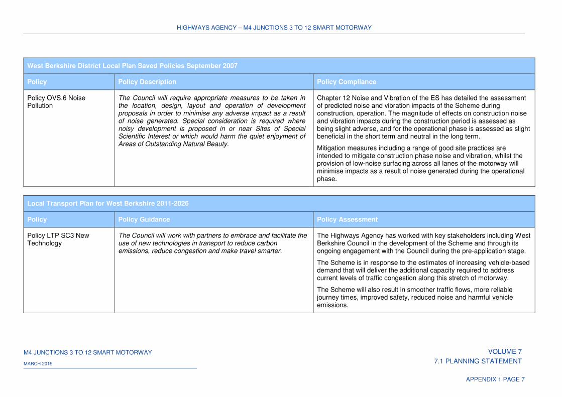
HIGHWAYS AGENCY – M4 JUNCTIONS 3 TO 12 SMART MOTORWAY
M4 JUNCTIONS 3 TO 12 SMART MOTORWAY VOLUME 7
7.1 PLANNING STATEMENT MARCH 2015
APPENDIX 1 PAGE 7
West Berkshire District Local Plan Saved Policies September 2007
Policy Policy Description Policy Compliance
Policy OVS.6 Noise Pollution
The Council will require appropriate measures to be taken in the location, design, layout and operation of development proposals in order to minimise any adverse impact as a result of noise generated. Special consideration is required where noisy development is proposed in or near Sites of Special Scientific Interest or which would harm the quiet enjoyment of Areas of Outstanding Natural Beauty.
Chapter 12 Noise and Vibration of the ES has detailed the assessment of predicted noise and vibration impacts of the Scheme during construction, operation. The magnitude of effects on construction noise and vibration impacts during the construction period is assessed as being slight adverse, and for the operational phase is assessed as slight beneficial in the short term and neutral in the long term.
Mitigation measures including a range of good site practices are intended to mitigate construction phase noise and vibration, whilst the provision of low-noise surfacing across all lanes of the motorway will minimise impacts as a result of noise generated during the operational phase.
Local Transport Plan for West Berkshire 2011-2026
Policy Policy Guidance Policy Assessment
Policy LTP SC3 New Technology
The Council will work with partners to embrace and facilitate the use of new technologies in transport to reduce carbon emissions, reduce congestion and make travel smarter.
The Highways Agency has worked with key stakeholders including West Berkshire Council in the development of the Scheme and through its ongoing engagement with the Council during the pre-application stage.
The Scheme is in response to the estimates of increasing vehicle-based demand that will deliver the additional capacity required to address current levels of traffic congestion along this stretch of motorway.
The Scheme will also result in smoother traffic flows, more reliable journey times, improved safety, reduced noise and harmful vehicle emissions.
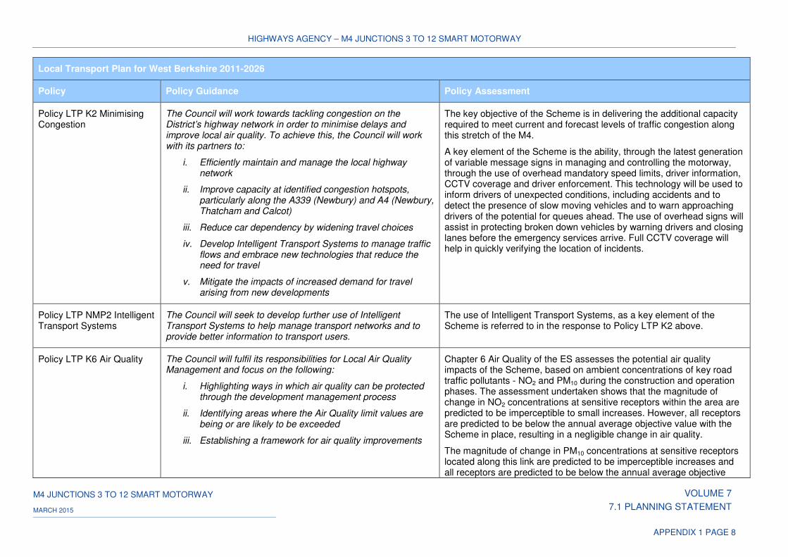
HIGHWAYS AGENCY – M4 JUNCTIONS 3 TO 12 SMART MOTORWAY
M4 JUNCTIONS 3 TO 12 SMART MOTORWAY VOLUME 7
7.1 PLANNING STATEMENT MARCH 2015
APPENDIX 1 PAGE 8
Local Transport Plan for West Berkshire 2011-2026
Policy Policy Guidance Policy Assessment
Policy LTP K2 Minimising Congestion
The Council will work towards tackling congestion on the District’s highway network in order to minimise delays and improve local air quality. To achieve this, the Council will work with its partners to:
i. Efficiently maintain and manage the local highway network
ii. Improve capacity at identified congestion hotspots, particularly along the A339 (Newbury) and A4 (Newbury, Thatcham and Calcot)
iii. Reduce car dependency by widening travel choices
iv. Develop Intelligent Transport Systems to manage traffic flows and embrace new technologies that reduce the need for travel
v. Mitigate the impacts of increased demand for travel arising from new developments
The key objective of the Scheme is in delivering the additional capacity required to meet current and forecast levels of traffic congestion along this stretch of the M4.
A key element of the Scheme is the ability, through the latest generation of variable message signs in managing and controlling the motorway, through the use of overhead mandatory speed limits, driver information, CCTV coverage and driver enforcement. This technology will be used to inform drivers of unexpected conditions, including accidents and to detect the presence of slow moving vehicles and to warn approaching drivers of the potential for queues ahead. The use of overhead signs will assist in protecting broken down vehicles by warning drivers and closing lanes before the emergency services arrive. Full CCTV coverage will help in quickly verifying the location of incidents.
Policy LTP NMP2 Intelligent Transport Systems
The Council will seek to develop further use of Intelligent Transport Systems to help manage transport networks and to provide better information to transport users.
The use of Intelligent Transport Systems, as a key element of the Scheme is referred to in the response to Policy LTP K2 above.
Policy LTP K6 Air Quality The Council will fulfil its responsibilities for Local Air Quality Management and focus on the following:
i. Highlighting ways in which air quality can be protected through the development management process
ii. Identifying areas where the Air Quality limit values are being or are likely to be exceeded
iii. Establishing a framework for air quality improvements
Chapter 6 Air Quality of the ES assesses the potential air quality impacts of the Scheme, based on ambient concentrations of key road traffic pollutants - NO2 and PM10 during the construction and operation phases. The assessment undertaken shows that the magnitude of change in NO2 concentrations at sensitive receptors within the area are predicted to be imperceptible to small increases. However, all receptors are predicted to be below the annual average objective value with the Scheme in place, resulting in a negligible change in air quality.
The magnitude of change in PM10 concentrations at sensitive receptors located along this link are predicted to be imperceptible increases and all receptors are predicted to be below the annual average objective
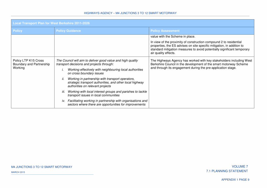
HIGHWAYS AGENCY – M4 JUNCTIONS 3 TO 12 SMART MOTORWAY
M4 JUNCTIONS 3 TO 12 SMART MOTORWAY VOLUME 7
7.1 PLANNING STATEMENT MARCH 2015
APPENDIX 1 PAGE 9
Local Transport Plan for West Berkshire 2011-2026
Policy Policy Guidance Policy Assessment
value with the Scheme in place.
In view of the proximity of construction compound 2 to residential properties, the ES advises on site specific mitigation, in addition to standard mitigation measures to avoid potentially significant temporary air quality effects.
Policy LTP K15 Cross Boundary and Partnership Working
The Council will aim to deliver good value and high quality transport decisions and projects through:
i. Working effectively with neighbouring local authorities on cross boundary issues
ii. Working in partnership with transport operators, strategic transport authorities, and other local highway authorities on relevant projects
iii. Working with local interest groups and parishes to tackle transport issues in local communities
iv. Facilitating working in partnership with organisations and sectors where there are opportunities for improvements
The Highways Agency has worked with key stakeholders including West Berkshire Council in the development of the smart motorway Scheme and through its engagement during the pre-application stage.
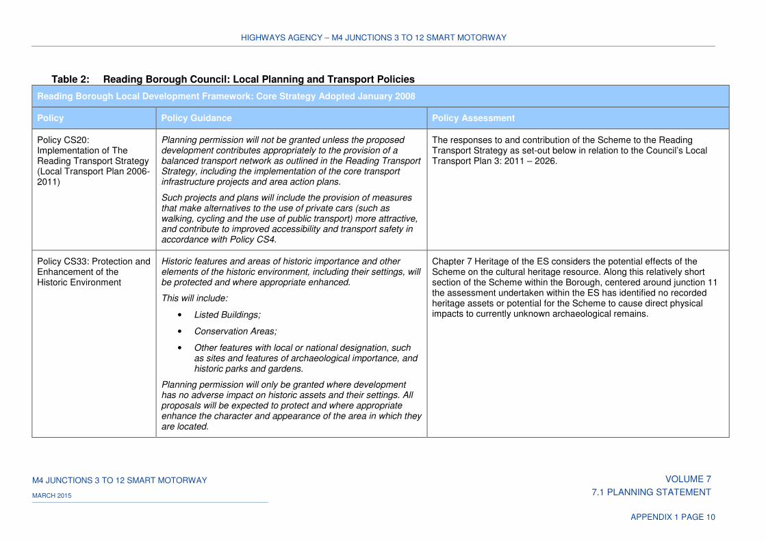
HIGHWAYS AGENCY – M4 JUNCTIONS 3 TO 12 SMART MOTORWAY
M4 JUNCTIONS 3 TO 12 SMART MOTORWAY VOLUME 7
7.1 PLANNING STATEMENT MARCH 2015
APPENDIX 1 PAGE 10
Table 2: Reading Borough Council: Local Planning and Transport Policies
Reading Borough Local Development Framework: Core Strategy Adopted January 2008
Policy Policy Guidance Policy Assessment
Policy CS20: Implementation of The Reading Transport Strategy (Local Transport Plan 2006-2011)
Planning permission will not be granted unless the proposed development contributes appropriately to the provision of a balanced transport network as outlined in the Reading Transport Strategy, including the implementation of the core transport infrastructure projects and area action plans.
Such projects and plans will include the provision of measures that make alternatives to the use of private cars (such as walking, cycling and the use of public transport) more attractive, and contribute to improved accessibility and transport safety in accordance with Policy CS4.
The responses to and contribution of the Scheme to the Reading Transport Strategy as set-out below in relation to the Council’s Local Transport Plan 3: 2011 – 2026.
Policy CS33: Protection and Enhancement of the Historic Environment
Historic features and areas of historic importance and other elements of the historic environment, including their settings, will be protected and where appropriate enhanced.
This will include:
• Listed Buildings;
• Conservation Areas;
• Other features with local or national designation, such as sites and features of archaeological importance, and historic parks and gardens.
Planning permission will only be granted where development has no adverse impact on historic assets and their settings. All proposals will be expected to protect and where appropriate enhance the character and appearance of the area in which they are located.
Chapter 7 Heritage of the ES considers the potential effects of the Scheme on the cultural heritage resource. Along this relatively short section of the Scheme within the Borough, centered around junction 11 the assessment undertaken within the ES has identified no recorded heritage assets or potential for the Scheme to cause direct physical impacts to currently unknown archaeological remains.
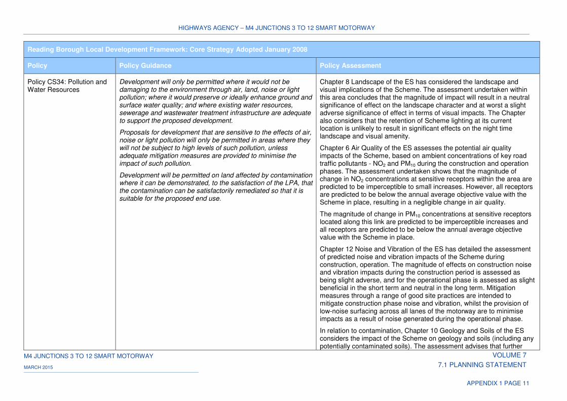
HIGHWAYS AGENCY – M4 JUNCTIONS 3 TO 12 SMART MOTORWAY
M4 JUNCTIONS 3 TO 12 SMART MOTORWAY VOLUME 7
7.1 PLANNING STATEMENT MARCH 2015
APPENDIX 1 PAGE 11
Reading Borough Local Development Framework: Core Strategy Adopted January 2008
Policy Policy Guidance Policy Assessment
Policy CS34: Pollution and Water Resources
Development will only be permitted where it would not be damaging to the environment through air, land, noise or light pollution; where it would preserve or ideally enhance ground and surface water quality; and where existing water resources, sewerage and wastewater treatment infrastructure are adequate to support the proposed development.
Proposals for development that are sensitive to the effects of air, noise or light pollution will only be permitted in areas where they will not be subject to high levels of such pollution, unless adequate mitigation measures are provided to minimise the impact of such pollution.
Development will be permitted on land affected by contamination where it can be demonstrated, to the satisfaction of the LPA, that the contamination can be satisfactorily remediated so that it is suitable for the proposed end use.
Chapter 8 Landscape of the ES has considered the landscape and visual implications of the Scheme. The assessment undertaken within this area concludes that the magnitude of impact will result in a neutral significance of effect on the landscape character and at worst a slight adverse significance of effect in terms of visual impacts. The Chapter also considers that the retention of Scheme lighting at its current location is unlikely to result in significant effects on the night time landscape and visual amenity.
Chapter 6 Air Quality of the ES assesses the potential air quality impacts of the Scheme, based on ambient concentrations of key road traffic pollutants - NO2 and PM10 during the construction and operation phases. The assessment undertaken shows that the magnitude of change in NO2 concentrations at sensitive receptors within the area are predicted to be imperceptible to small increases. However, all receptors are predicted to be below the annual average objective value with the Scheme in place, resulting in a negligible change in air quality.
The magnitude of change in PM10 concentrations at sensitive receptors located along this link are predicted to be imperceptible increases and all receptors are predicted to be below the annual average objective value with the Scheme in place.
Chapter 12 Noise and Vibration of the ES has detailed the assessment of predicted noise and vibration impacts of the Scheme during construction, operation. The magnitude of effects on construction noise and vibration impacts during the construction period is assessed as being slight adverse, and for the operational phase is assessed as slight beneficial in the short term and neutral in the long term. Mitigation measures through a range of good site practices are intended to mitigate construction phase noise and vibration, whilst the provision of low-noise surfacing across all lanes of the motorway are to minimise impacts as a result of noise generated during the operational phase.
In relation to contamination, Chapter 10 Geology and Soils of the ES considers the impact of the Scheme on geology and soils (including any potentially contaminated soils). The assessment advises that further
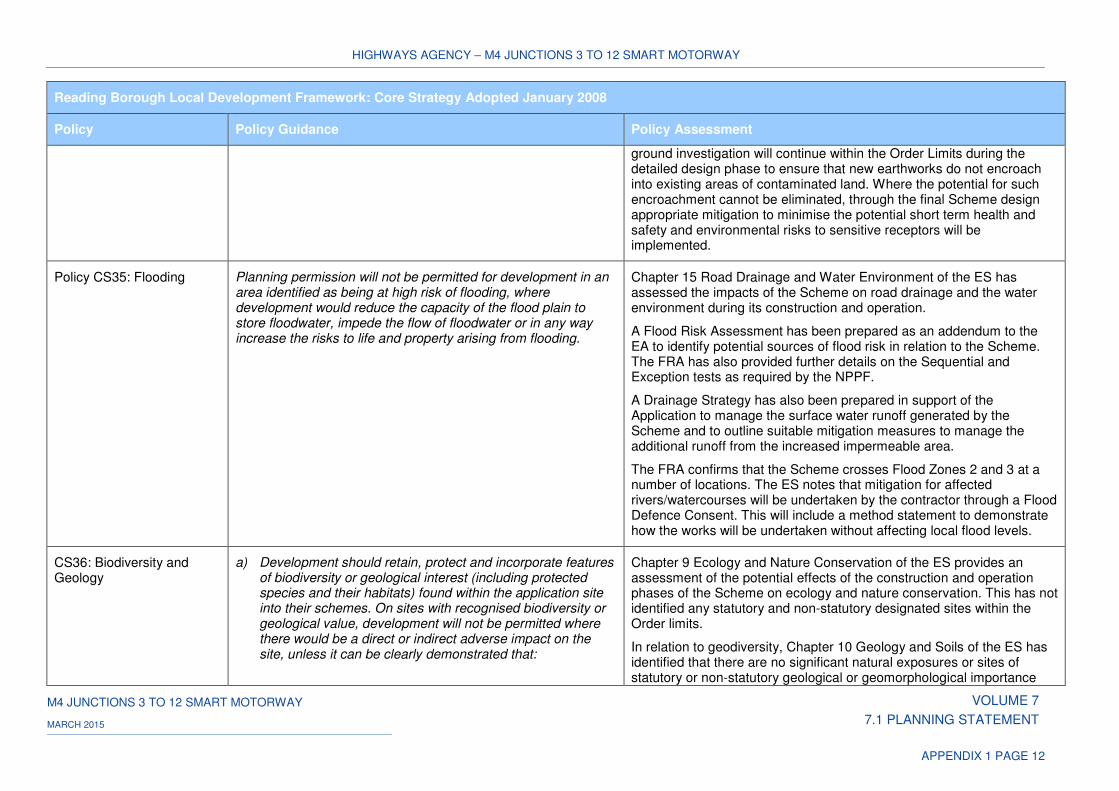
HIGHWAYS AGENCY – M4 JUNCTIONS 3 TO 12 SMART MOTORWAY
M4 JUNCTIONS 3 TO 12 SMART MOTORWAY VOLUME 7
7.1 PLANNING STATEMENT MARCH 2015
APPENDIX 1 PAGE 12
Reading Borough Local Development Framework: Core Strategy Adopted January 2008
Policy Policy Guidance Policy Assessment
ground investigation will continue within the Order Limits during the detailed design phase to ensure that new earthworks do not encroach into existing areas of contaminated land. Where the potential for such encroachment cannot be eliminated, through the final Scheme design appropriate mitigation to minimise the potential short term health and safety and environmental risks to sensitive receptors will be implemented.
Policy CS35: Flooding Planning permission will not be permitted for development in an area identified as being at high risk of flooding, where development would reduce the capacity of the flood plain to store floodwater, impede the flow of floodwater or in any way increase the risks to life and property arising from flooding.
Chapter 15 Road Drainage and Water Environment of the ES has assessed the impacts of the Scheme on road drainage and the water environment during its construction and operation.
A Flood Risk Assessment has been prepared as an addendum to the EA to identify potential sources of flood risk in relation to the Scheme. The FRA has also provided further details on the Sequential and Exception tests as required by the NPPF.
A Drainage Strategy has also been prepared in support of the Application to manage the surface water runoff generated by the Scheme and to outline suitable mitigation measures to manage the additional runoff from the increased impermeable area.
The FRA confirms that the Scheme crosses Flood Zones 2 and 3 at a number of locations. The ES notes that mitigation for affected rivers/watercourses will be undertaken by the contractor through a Flood Defence Consent. This will include a method statement to demonstrate how the works will be undertaken without affecting local flood levels.
CS36: Biodiversity and Geology
a) Development should retain, protect and incorporate features of biodiversity or geological interest (including protected species and their habitats) found within the application site into their schemes. On sites with recognised biodiversity or geological value, development will not be permitted where there would be a direct or indirect adverse impact on the site, unless it can be clearly demonstrated that:
Chapter 9 Ecology and Nature Conservation of the ES provides an assessment of the potential effects of the construction and operation phases of the Scheme on ecology and nature conservation. This has not identified any statutory and non-statutory designated sites within the Order limits.
In relation to geodiversity, Chapter 10 Geology and Soils of the ES has identified that there are no significant natural exposures or sites of statutory or non-statutory geological or geomorphological importance
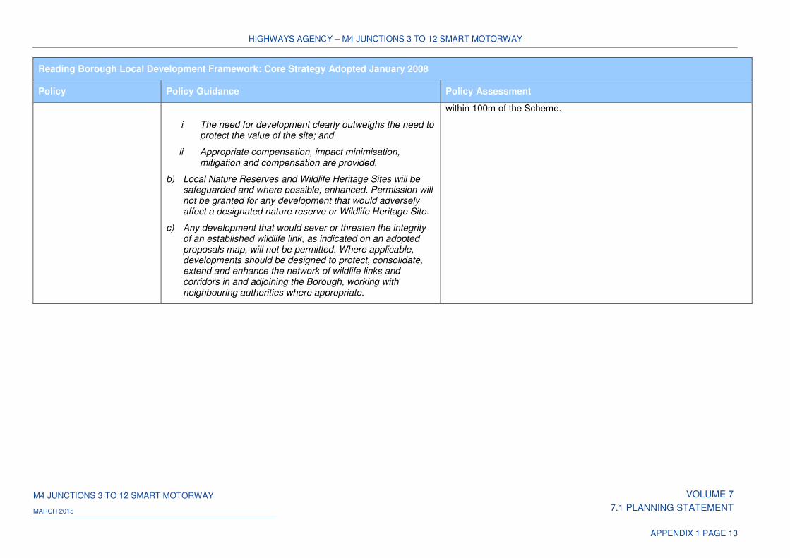
HIGHWAYS AGENCY – M4 JUNCTIONS 3 TO 12 SMART MOTORWAY
M4 JUNCTIONS 3 TO 12 SMART MOTORWAY VOLUME 7
7.1 PLANNING STATEMENT MARCH 2015
APPENDIX 1 PAGE 13
Reading Borough Local Development Framework: Core Strategy Adopted January 2008
Policy Policy Guidance Policy Assessment
i The need for development clearly outweighs the need to protect the value of the site; and
ii Appropriate compensation, impact minimisation, mitigation and compensation are provided.
b) Local Nature Reserves and Wildlife Heritage Sites will be safeguarded and where possible, enhanced. Permission will not be granted for any development that would adversely affect a designated nature reserve or Wildlife Heritage Site.
c) Any development that would sever or threaten the integrity of an established wildlife link, as indicated on an adopted proposals map, will not be permitted. Where applicable, developments should be designed to protect, consolidate, extend and enhance the network of wildlife links and corridors in and adjoining the Borough, working with neighbouring authorities where appropriate.
within 100m of the Scheme.
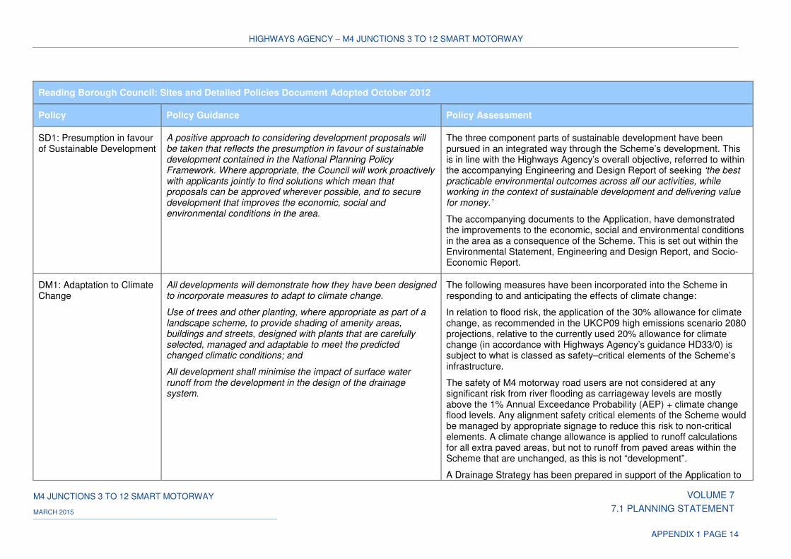
HIGHWAYS AGENCY – M4 JUNCTIONS 3 TO 12 SMART MOTORWAY
M4 JUNCTIONS 3 TO 12 SMART MOTORWAY VOLUME 7
7.1 PLANNING STATEMENT MARCH 2015
APPENDIX 1 PAGE 14
Reading Borough Council: Sites and Detailed Policies Document Adopted October 2012
Policy Policy Guidance Policy Assessment
SD1: Presumption in favour of Sustainable Development
A positive approach to considering development proposals will be taken that reflects the presumption in favour of sustainable development contained in the National Planning Policy Framework. Where appropriate, the Council will work proactively with applicants jointly to find solutions which mean that proposals can be approved wherever possible, and to secure development that improves the economic, social and environmental conditions in the area.
The three component parts of sustainable development have been pursued in an integrated way through the Scheme’s development. This is in line with the Highways Agency’s overall objective, referred to within the accompanying Engineering and Design Report of seeking ‘the best practicable environmental outcomes across all our activities, while working in the context of sustainable development and delivering value for money.’
The accompanying documents to the Application, have demonstrated the improvements to the economic, social and environmental conditions in the area as a consequence of the Scheme. This is set out within the Environmental Statement, Engineering and Design Report, and Socio-Economic Report.
DM1: Adaptation to Climate Change
All developments will demonstrate how they have been designed to incorporate measures to adapt to climate change.
Use of trees and other planting, where appropriate as part of a landscape scheme, to provide shading of amenity areas, buildings and streets, designed with plants that are carefully selected, managed and adaptable to meet the predicted changed climatic conditions; and
All development shall minimise the impact of surface water runoff from the development in the design of the drainage system.
The following measures have been incorporated into the Scheme in responding to and anticipating the effects of climate change:
In relation to flood risk, the application of the 30% allowance for climate change, as recommended in the UKCP09 high emissions scenario 2080 projections, relative to the currently used 20% allowance for climate change (in accordance with Highways Agency’s guidance HD33/0) is subject to what is classed as safety–critical elements of the Scheme’s infrastructure.
The safety of M4 motorway road users are not considered at any significant risk from river flooding as carriageway levels are mostly above the 1% Annual Exceedance Probability (AEP) + climate change flood levels. Any alignment safety critical elements of the Scheme would be managed by appropriate signage to reduce this risk to non-critical elements. A climate change allowance is applied to runoff calculations for all extra paved areas, but not to runoff from paved areas within the Scheme that are unchanged, as this is not “development”.
A Drainage Strategy has been prepared in support of the Application to
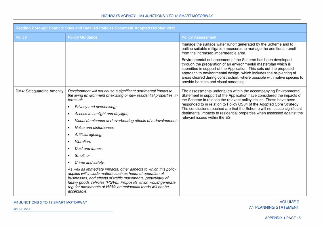
HIGHWAYS AGENCY – M4 JUNCTIONS 3 TO 12 SMART MOTORWAY
M4 JUNCTIONS 3 TO 12 SMART MOTORWAY VOLUME 7
7.1 PLANNING STATEMENT MARCH 2015
APPENDIX 1 PAGE 15
Reading Borough Council: Sites and Detailed Policies Document Adopted October 2012
Policy Policy Guidance Policy Assessment
manage the surface water runoff generated by the Scheme and to outline suitable mitigation measures to manage the additional runoff from the increased impermeable area.
Environmental enhancement of the Scheme has been developed through the preparation of an environmental masterplan which is submitted in support of the Application. This sets out the proposed approach to environmental design, which includes the re-planting of areas cleared during construction, where possible with native species to provide habitats and visual screening.
DM4: Safeguarding Amenity Development will not cause a significant detrimental impact to the living environment of existing or new residential properties, in terms of:
• Privacy and overlooking;
• Access to sunlight and daylight;
• Visual dominance and overbearing effects of a development;
• Noise and disturbance;
• Artificial lighting;
• Vibration;
• Dust and fumes;
• Smell; or
• Crime and safety.
As well as immediate impacts, other aspects to which this policy applies will include matters such as hours of operation of businesses, and effects of traffic movements, particularly of heavy goods vehicles (HGVs). Proposals which would generate regular movements of HGVs on residential roads will not be acceptable.
The assessments undertaken within the accompanying Environmental Statement in support of the Application have considered the impacts of the Scheme in relation the relevant policy issues. These have been responded to in relation to Policy CS34 of the Adopted Core Strategy. The conclusions reached are that the Scheme will not cause significant detrimental impacts to residential properties when assessed against the relevant issues within the ES.
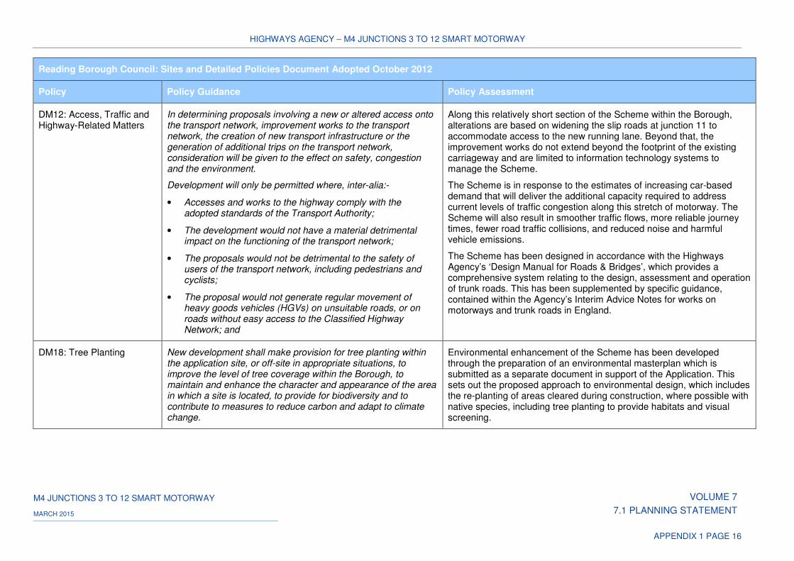
HIGHWAYS AGENCY – M4 JUNCTIONS 3 TO 12 SMART MOTORWAY
M4 JUNCTIONS 3 TO 12 SMART MOTORWAY VOLUME 7
7.1 PLANNING STATEMENT MARCH 2015
APPENDIX 1 PAGE 16
Reading Borough Council: Sites and Detailed Policies Document Adopted October 2012
Policy Policy Guidance Policy Assessment
DM12: Access, Traffic and Highway-Related Matters
In determining proposals involving a new or altered access onto the transport network, improvement works to the transport network, the creation of new transport infrastructure or the generation of additional trips on the transport network, consideration will be given to the effect on safety, congestion and the environment.
Development will only be permitted where, inter-alia:-
• Accesses and works to the highway comply with the adopted standards of the Transport Authority;
• The development would not have a material detrimental impact on the functioning of the transport network;
• The proposals would not be detrimental to the safety of users of the transport network, including pedestrians and cyclists;
• The proposal would not generate regular movement of heavy goods vehicles (HGVs) on unsuitable roads, or on roads without easy access to the Classified Highway Network; and
Along this relatively short section of the Scheme within the Borough, alterations are based on widening the slip roads at junction 11 to accommodate access to the new running lane. Beyond that, the improvement works do not extend beyond the footprint of the existing carriageway and are limited to information technology systems to manage the Scheme.
The Scheme is in response to the estimates of increasing car-based demand that will deliver the additional capacity required to address current levels of traffic congestion along this stretch of motorway. The Scheme will also result in smoother traffic flows, more reliable journey times, fewer road traffic collisions, and reduced noise and harmful vehicle emissions.
The Scheme has been designed in accordance with the Highways Agency’s ‘Design Manual for Roads & Bridges’, which provides a comprehensive system relating to the design, assessment and operation of trunk roads. This has been supplemented by specific guidance, contained within the Agency’s Interim Advice Notes for works on motorways and trunk roads in England.
DM18: Tree Planting New development shall make provision for tree planting within the application site, or off-site in appropriate situations, to improve the level of tree coverage within the Borough, to maintain and enhance the character and appearance of the area in which a site is located, to provide for biodiversity and to contribute to measures to reduce carbon and adapt to climate change.
Environmental enhancement of the Scheme has been developed through the preparation of an environmental masterplan which is submitted as a separate document in support of the Application. This sets out the proposed approach to environmental design, which includes the re-planting of areas cleared during construction, where possible with native species, including tree planting to provide habitats and visual screening.
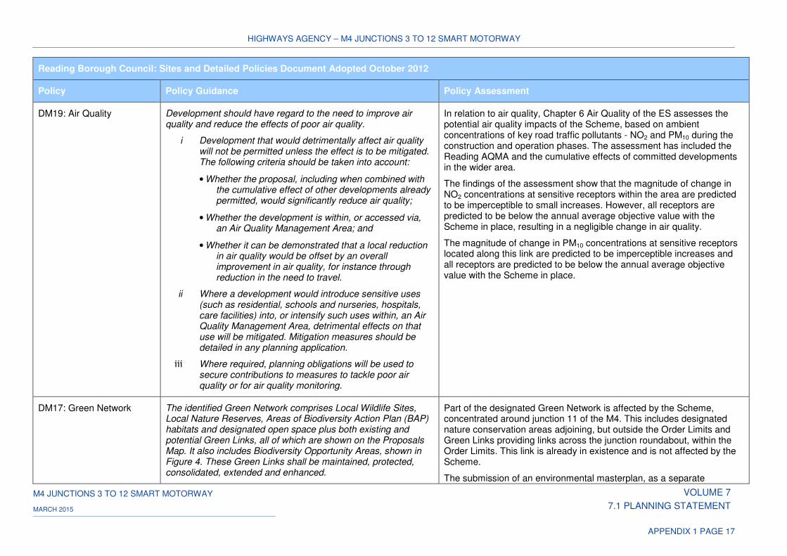
HIGHWAYS AGENCY – M4 JUNCTIONS 3 TO 12 SMART MOTORWAY
M4 JUNCTIONS 3 TO 12 SMART MOTORWAY VOLUME 7
7.1 PLANNING STATEMENT MARCH 2015
APPENDIX 1 PAGE 17
Reading Borough Council: Sites and Detailed Policies Document Adopted October 2012
Policy Policy Guidance Policy Assessment
DM19: Air Quality Development should have regard to the need to improve air quality and reduce the effects of poor air quality.
i Development that would detrimentally affect air quality will not be permitted unless the effect is to be mitigated. The following criteria should be taken into account:
• Whether the proposal, including when combined with the cumulative effect of other developments already permitted, would significantly reduce air quality;
• Whether the development is within, or accessed via, an Air Quality Management Area; and
• Whether it can be demonstrated that a local reduction in air quality would be offset by an overall improvement in air quality, for instance through reduction in the need to travel.
ii Where a development would introduce sensitive uses (such as residential, schools and nurseries, hospitals, care facilities) into, or intensify such uses within, an Air Quality Management Area, detrimental effects on that use will be mitigated. Mitigation measures should be detailed in any planning application.
iii Where required, planning obligations will be used to secure contributions to measures to tackle poor air quality or for air quality monitoring.
In relation to air quality, Chapter 6 Air Quality of the ES assesses the potential air quality impacts of the Scheme, based on ambient concentrations of key road traffic pollutants - NO2 and PM10 during the construction and operation phases. The assessment has included the Reading AQMA and the cumulative effects of committed developments in the wider area.
The findings of the assessment show that the magnitude of change in NO2 concentrations at sensitive receptors within the area are predicted to be imperceptible to small increases. However, all receptors are predicted to be below the annual average objective value with the Scheme in place, resulting in a negligible change in air quality.
The magnitude of change in PM10 concentrations at sensitive receptors located along this link are predicted to be imperceptible increases and all receptors are predicted to be below the annual average objective value with the Scheme in place.
DM17: Green Network The identified Green Network comprises Local Wildlife Sites, Local Nature Reserves, Areas of Biodiversity Action Plan (BAP) habitats and designated open space plus both existing and potential Green Links, all of which are shown on the Proposals Map. It also includes Biodiversity Opportunity Areas, shown in Figure 4. These Green Links shall be maintained, protected, consolidated, extended and enhanced.
Part of the designated Green Network is affected by the Scheme, concentrated around junction 11 of the M4. This includes designated nature conservation areas adjoining, but outside the Order Limits and Green Links providing links across the junction roundabout, within the Order Limits. This link is already in existence and is not affected by the Scheme.
The submission of an environmental masterplan, as a separate
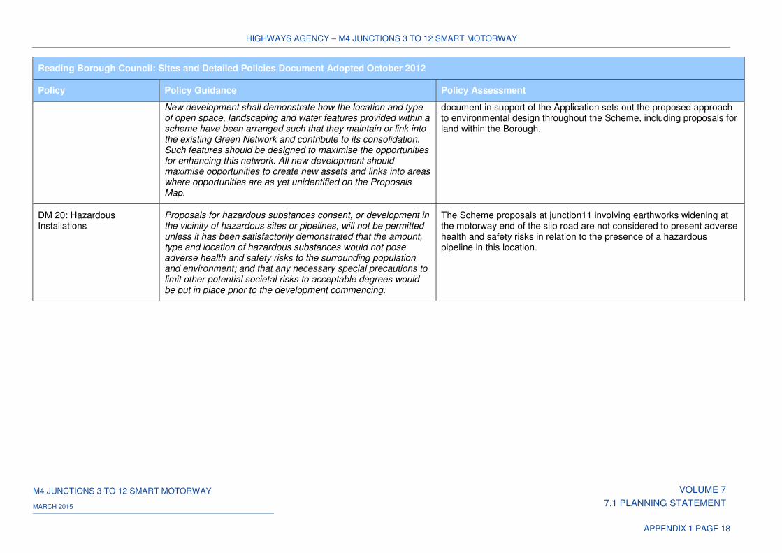
HIGHWAYS AGENCY – M4 JUNCTIONS 3 TO 12 SMART MOTORWAY
M4 JUNCTIONS 3 TO 12 SMART MOTORWAY VOLUME 7
7.1 PLANNING STATEMENT MARCH 2015
APPENDIX 1 PAGE 18
Reading Borough Council: Sites and Detailed Policies Document Adopted October 2012
Policy Policy Guidance Policy Assessment
New development shall demonstrate how the location and type of open space, landscaping and water features provided within a scheme have been arranged such that they maintain or link into the existing Green Network and contribute to its consolidation. Such features should be designed to maximise the opportunities for enhancing this network. All new development should maximise opportunities to create new assets and links into areas where opportunities are as yet unidentified on the Proposals Map.
document in support of the Application sets out the proposed approach to environmental design throughout the Scheme, including proposals for land within the Borough.
DM 20: Hazardous Installations
Proposals for hazardous substances consent, or development in the vicinity of hazardous sites or pipelines, will not be permitted unless it has been satisfactorily demonstrated that the amount, type and location of hazardous substances would not pose adverse health and safety risks to the surrounding population and environment; and that any necessary special precautions to limit other potential societal risks to acceptable degrees would be put in place prior to the development commencing.
The Scheme proposals at junction11 involving earthworks widening at the motorway end of the slip road are not considered to present adverse health and safety risks in relation to the presence of a hazardous pipeline in this location.
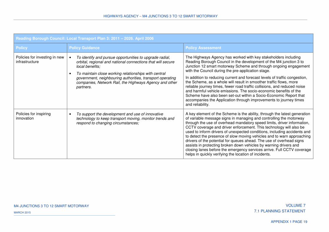
HIGHWAYS AGENCY – M4 JUNCTIONS 3 TO 12 SMART MOTORWAY
M4 JUNCTIONS 3 TO 12 SMART MOTORWAY VOLUME 7
7.1 PLANNING STATEMENT MARCH 2015
APPENDIX 1 PAGE 19
Reading Borough Council: Local Transport Plan 3: 2011 – 2026. April 2006
Policy Policy Guidance Policy Assessment
Policies for investing in new infrastructure
• To identify and pursue opportunities to upgrade radial, orbital, regional and national connections that will secure local benefits;
• To maintain close working relationships with central government, neighbouring authorities, transport operating companies, Network Rail, the Highways Agency and other partners.
The Highways Agency has worked with key stakeholders including Reading Borough Council in the development of the M4 junction 3 to Junction 12 smart motorway Scheme and through ongoing engagement with the Council during the pre-application stage.
In addition to reducing current and forecast levels of traffic congestion, the Scheme, as a whole will result in smoother traffic flows, more reliable journey times, fewer road traffic collisions, and reduced noise and harmful vehicle emissions. The socio-economic benefits of the Scheme have also been set-out within a Socio-Economic Report that accompanies the Application through improvements to journey times and reliability.
Policies for inspiring innovation
• To support the development and use of innovative technology to keep transport moving, monitor trends and respond to changing circumstances;
A key element of the Scheme is the ability, through the latest generation of variable message signs in managing and controlling the motorway through the use of overhead mandatory speed limits, driver information, CCTV coverage and driver enforcement. This technology will also be used to inform drivers of unexpected conditions, including accidents and to detect the presence of slow moving vehicles and to warn approaching drivers of the potential for queues ahead. The use of overhead signs assists in protecting broken down vehicles by warning drivers and closing lanes before the emergency services arrive. Full CCTV coverage helps in quickly verifying the location of incidents.
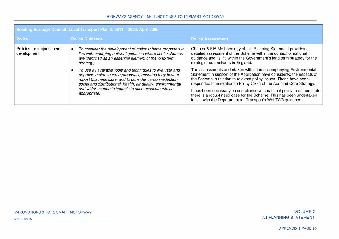
HIGHWAYS AGENCY – M4 JUNCTIONS 3 TO 12 SMART MOTORWAY
M4 JUNCTIONS 3 TO 12 SMART MOTORWAY VOLUME 7
7.1 PLANNING STATEMENT MARCH 2015
APPENDIX 1 PAGE 20
Reading Borough Council: Local Transport Plan 3: 2011 – 2026. April 2006
Policy Policy Guidance Policy Assessment
Policies for major scheme development
• To consider the development of major scheme proposals in line with emerging national guidance where such schemes are identified as an essential element of the long-term strategy;
• To use all available tools and techniques to evaluate and appraise major scheme proposals, ensuring they have a robust business case, and to consider carbon reduction, social and distributional, health, air quality, environmental and wider economic impacts in such assessments as appropriate;
Chapter 5 EIA Methodology of this Planning Statement provides a detailed assessment of the Scheme within the context of national guidance and its ‘fit’ within the Government’s long term strategy for the strategic road network in England.
The assessments undertaken within the accompanying Environmental Statement in support of the Application have considered the impacts of the Scheme in relation to relevant policy issues. These have been responded to in relation to Policy CS34 of the Adopted Core Strategy.
It has been necessary, in compliance with national policy to demonstrate there is a robust need case for the Scheme. This has been undertaken in line with the Department for Transport’s WebTAG guidance.

HIGHWAYS AGENCY – M4 JUNCTIONS 3 TO 12 SMART MOTORWAY
M4 JUNCTIONS 3 TO 12 SMART MOTORWAY VOLUME 7
7.1 PLANNING STATEMENT MARCH 2015
APPENDIX 1 PAGE 21
Table 3: Wokingham Borough Council: Local Planning and Transport Policies
Wokingham Borough Core Strategy Adopted January 2010
Policy Policy Guidance Policy Assessment
CP11 - Proposals outside Development Limits (including countryside)
In order to protect the separate identity of settlements and maintain the quality of the environment, proposals outside of development limits will not normally be permitted except where:
1 It contributes to diverse and sustainable rural enterprises within the borough, or in the case of other countryside based enterprises and activities, it contributes and/or promotes recreation in, and enjoyment of, the countryside; and
2 It does not lead to excessive encroachment or expansion of development away from the original buildings; and
3 It is contained within suitably located buildings which are appropriate for conversion, or in the case of replacement buildings would bring about environmental improvement; or
4 In the case of residential extensions, does not result in inappropriate increases in the scale, form or footprint of the original building;
5 In the case of replacement dwellings the proposal must:
i. Bring about environmental improvements; or
ii. Not result in inappropriate increases in the scale, form or footprint of the original building.
6 Essential community facilities cannot be accommodated within development limits or through the re-use / replacement of an existing building;
7 Affordable housing on rural exception sites in line with CP9.
The Scheme proposes the introduction of a smart motorway between junctions 3 and 12 of the M4, part of which passes through the Borough.
The Policy restrictions on proposals outside development limits, excludes highway schemes. The Scheme involves the improvement of the existing highway carriageway and with the exception of alterations to junction 10 to accommodate access to the new running lane, does not extend beyond the footprint of the existing motorway corridor.
The Scheme also includes the provision of a temporary construction compound which is sited within the boundaries of the roundabout at junction 10.
Within the context of this Policy, the Scheme will continue to maintain the separate identity of settlements and will not lead to their coalescence. The environmental impacts of the Scheme are set out in the accompanying ES and are considered elsewhere within this assessment, including mitigation measures and Scheme enhancements.
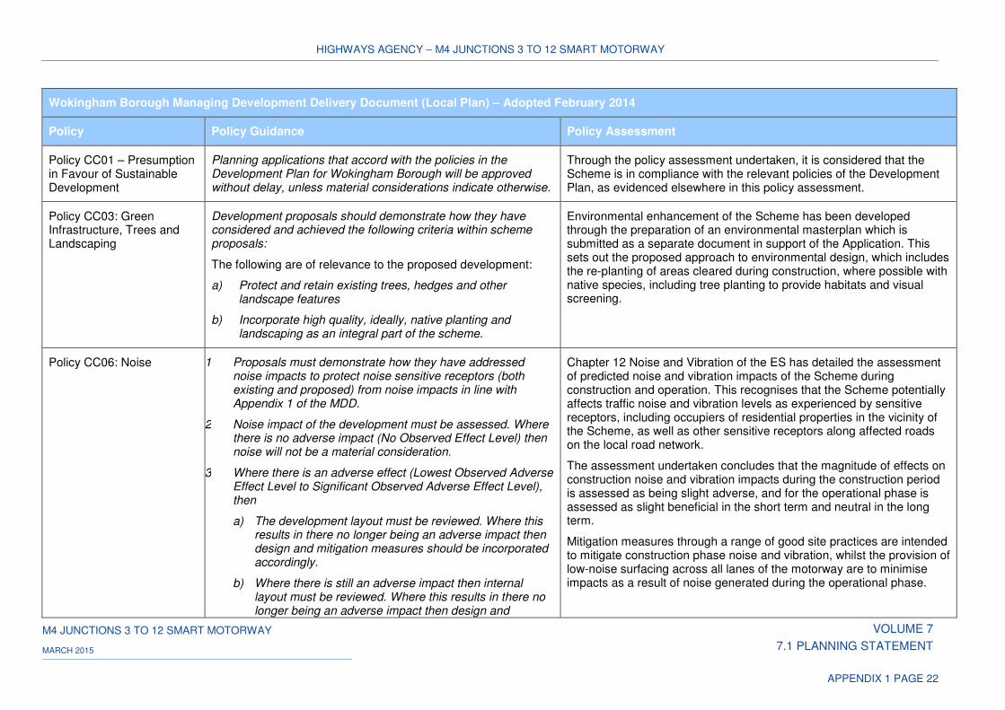
HIGHWAYS AGENCY – M4 JUNCTIONS 3 TO 12 SMART MOTORWAY
M4 JUNCTIONS 3 TO 12 SMART MOTORWAY VOLUME 7
7.1 PLANNING STATEMENT MARCH 2015
APPENDIX 1 PAGE 22
Wokingham Borough Managing Development Delivery Document (Local Plan) – Adopted February 2014
Policy Policy Guidance Policy Assessment
Policy CC01 – Presumption in Favour of Sustainable Development
Planning applications that accord with the policies in the Development Plan for Wokingham Borough will be approved without delay, unless material considerations indicate otherwise.
Through the policy assessment undertaken, it is considered that the Scheme is in compliance with the relevant policies of the Development Plan, as evidenced elsewhere in this policy assessment.
Policy CC03: Green Infrastructure, Trees and Landscaping
Development proposals should demonstrate how they have considered and achieved the following criteria within scheme proposals:
The following are of relevance to the proposed development:
a) Protect and retain existing trees, hedges and other landscape features
b) Incorporate high quality, ideally, native planting and landscaping as an integral part of the scheme.
Environmental enhancement of the Scheme has been developed through the preparation of an environmental masterplan which is submitted as a separate document in support of the Application. This sets out the proposed approach to environmental design, which includes the re-planting of areas cleared during construction, where possible with native species, including tree planting to provide habitats and visual screening.
Policy CC06: Noise 1 Proposals must demonstrate how they have addressed noise impacts to protect noise sensitive receptors (both existing and proposed) from noise impacts in line with Appendix 1 of the MDD.
2 Noise impact of the development must be assessed. Where there is no adverse impact (No Observed Effect Level) then noise will not be a material consideration.
3 Where there is an adverse effect (Lowest Observed Adverse Effect Level to Significant Observed Adverse Effect Level), then
a) The development layout must be reviewed. Where this results in there no longer being an adverse impact then design and mitigation measures should be incorporated accordingly.
b) Where there is still an adverse impact then internal layout must be reviewed. Where this results in there no longer being an adverse impact then design and
Chapter 12 Noise and Vibration of the ES has detailed the assessment of predicted noise and vibration impacts of the Scheme during construction and operation. This recognises that the Scheme potentially affects traffic noise and vibration levels as experienced by sensitive receptors, including occupiers of residential properties in the vicinity of the Scheme, as well as other sensitive receptors along affected roads on the local road network.
The assessment undertaken concludes that the magnitude of effects on construction noise and vibration impacts during the construction period is assessed as being slight adverse, and for the operational phase is assessed as slight beneficial in the short term and neutral in the long term.
Mitigation measures through a range of good site practices are intended to mitigate construction phase noise and vibration, whilst the provision of low-noise surfacing across all lanes of the motorway are to minimise impacts as a result of noise generated during the operational phase.
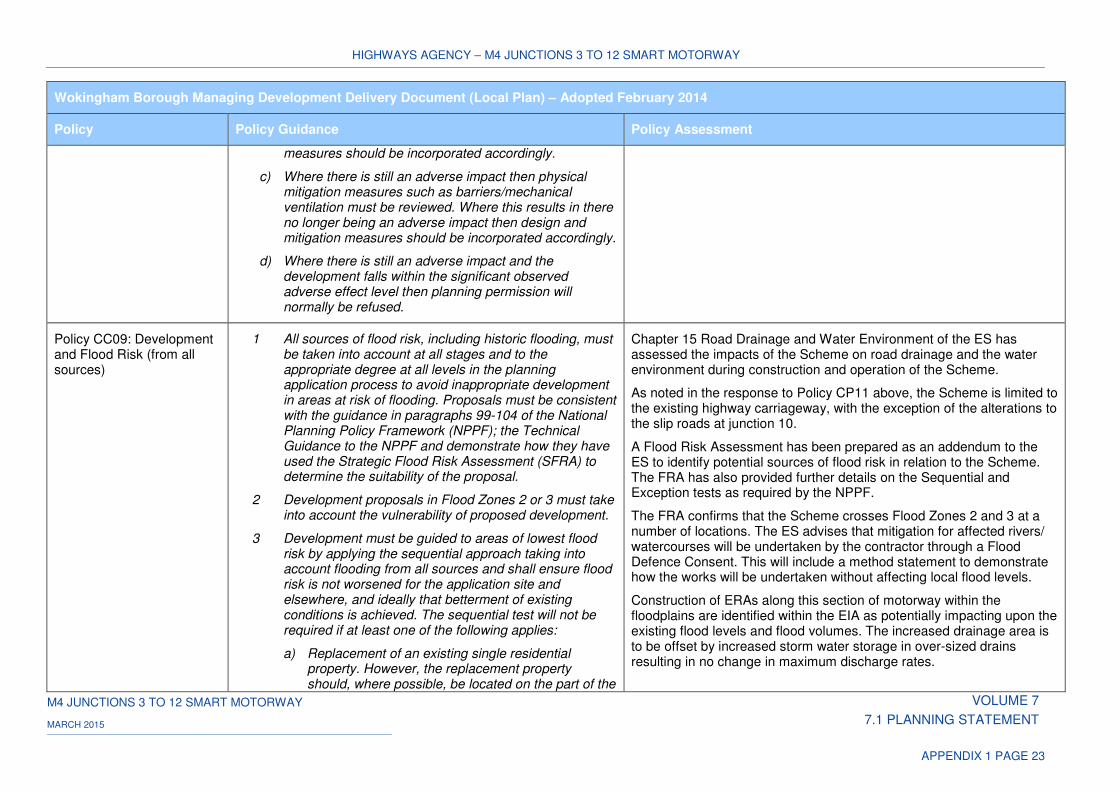
HIGHWAYS AGENCY – M4 JUNCTIONS 3 TO 12 SMART MOTORWAY
M4 JUNCTIONS 3 TO 12 SMART MOTORWAY VOLUME 7
7.1 PLANNING STATEMENT MARCH 2015
APPENDIX 1 PAGE 23
Wokingham Borough Managing Development Delivery Document (Local Plan) – Adopted February 2014
Policy Policy Guidance Policy Assessment
measures should be incorporated accordingly.
c) Where there is still an adverse impact then physical mitigation measures such as barriers/mechanical ventilation must be reviewed. Where this results in there no longer being an adverse impact then design and mitigation measures should be incorporated accordingly.
d) Where there is still an adverse impact and the development falls within the significant observed adverse effect level then planning permission will normally be refused.
Policy CC09: Development and Flood Risk (from all sources)
1 All sources of flood risk, including historic flooding, must be taken into account at all stages and to the appropriate degree at all levels in the planning application process to avoid inappropriate development in areas at risk of flooding. Proposals must be consistent with the guidance in paragraphs 99-104 of the National Planning Policy Framework (NPPF); the Technical Guidance to the NPPF and demonstrate how they have used the Strategic Flood Risk Assessment (SFRA) to determine the suitability of the proposal.
2 Development proposals in Flood Zones 2 or 3 must take into account the vulnerability of proposed development.
3 Development must be guided to areas of lowest flood risk by applying the sequential approach taking into account flooding from all sources and shall ensure flood risk is not worsened for the application site and elsewhere, and ideally that betterment of existing conditions is achieved. The sequential test will not be required if at least one of the following applies:
a) Replacement of an existing single residential property. However, the replacement property should, where possible, be located on the part of the
Chapter 15 Road Drainage and Water Environment of the ES has assessed the impacts of the Scheme on road drainage and the water environment during construction and operation of the Scheme.
As noted in the response to Policy CP11 above, the Scheme is limited to the existing highway carriageway, with the exception of the alterations to the slip roads at junction 10.
A Flood Risk Assessment has been prepared as an addendum to the ES to identify potential sources of flood risk in relation to the Scheme. The FRA has also provided further details on the Sequential and Exception tests as required by the NPPF.
The FRA confirms that the Scheme crosses Flood Zones 2 and 3 at a number of locations. The ES advises that mitigation for affected rivers/ watercourses will be undertaken by the contractor through a Flood Defence Consent. This will include a method statement to demonstrate how the works will be undertaken without affecting local flood levels.
Construction of ERAs along this section of motorway within the floodplains are identified within the EIA as potentially impacting upon the existing flood levels and flood volumes. The increased drainage area is to be offset by increased storm water storage in over-sized drains resulting in no change in maximum discharge rates.
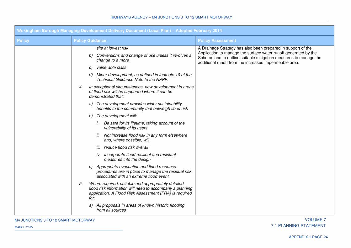
HIGHWAYS AGENCY – M4 JUNCTIONS 3 TO 12 SMART MOTORWAY
M4 JUNCTIONS 3 TO 12 SMART MOTORWAY VOLUME 7
7.1 PLANNING STATEMENT MARCH 2015
APPENDIX 1 PAGE 24
Wokingham Borough Managing Development Delivery Document (Local Plan) – Adopted February 2014
Policy Policy Guidance Policy Assessment
site at lowest risk
b) Conversions and change of use unless it involves a change to a more
c) vulnerable class
d) Minor development, as defined in footnote 10 of the Technical Guidance Note to the NPPF.
4 In exceptional circumstances, new development in areas of flood risk will be supported where it can be demonstrated that:
a) The development provides wider sustainability benefits to the community that outweigh flood risk
b) The development will:
i. Be safe for its lifetime, taking account of the vulnerability of its users
ii. Not increase flood risk in any form elsewhere and, where possible, will
iii. reduce flood risk overall
iv. Incorporate flood resilient and resistant measures into the design
c) Appropriate evacuation and flood response procedures are in place to manage the residual risk associated with an extreme flood event.
5 Where required, suitable and appropriately detailed flood risk information will need to accompany a planning application. A Flood Risk Assessment (FRA) is required for:
a) All proposals in areas of known historic flooding from all sources
A Drainage Strategy has also been prepared in support of the Application to manage the surface water runoff generated by the Scheme and to outline suitable mitigation measures to manage the additional runoff from the increased impermeable area.
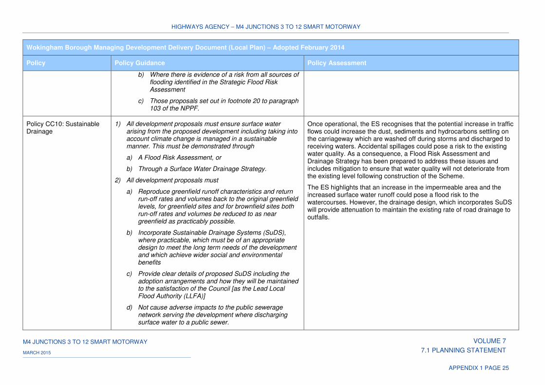
HIGHWAYS AGENCY – M4 JUNCTIONS 3 TO 12 SMART MOTORWAY
M4 JUNCTIONS 3 TO 12 SMART MOTORWAY VOLUME 7
7.1 PLANNING STATEMENT MARCH 2015
APPENDIX 1 PAGE 25
Wokingham Borough Managing Development Delivery Document (Local Plan) – Adopted February 2014
Policy Policy Guidance Policy Assessment
b) Where there is evidence of a risk from all sources of flooding identified in the Strategic Flood Risk Assessment
c) Those proposals set out in footnote 20 to paragraph 103 of the NPPF.
Policy CC10: Sustainable Drainage
1) All development proposals must ensure surface water arising from the proposed development including taking into account climate change is managed in a sustainable manner. This must be demonstrated through
a) A Flood Risk Assessment, or
b) Through a Surface Water Drainage Strategy.
2) All development proposals must
a) Reproduce greenfield runoff characteristics and return run-off rates and volumes back to the original greenfield levels, for greenfield sites and for brownfield sites both run-off rates and volumes be reduced to as near greenfield as practicably possible.
b) Incorporate Sustainable Drainage Systems (SuDS), where practicable, which must be of an appropriate design to meet the long term needs of the development and which achieve wider social and environmental benefits
c) Provide clear details of proposed SuDS including the adoption arrangements and how they will be maintained to the satisfaction of the Council [as the Lead Local Flood Authority (LLFA)]
d) Not cause adverse impacts to the public sewerage network serving the development where discharging surface water to a public sewer.
Once operational, the ES recognises that the potential increase in traffic flows could increase the dust, sediments and hydrocarbons settling on the carriageway which are washed off during storms and discharged to receiving waters. Accidental spillages could pose a risk to the existing water quality. As a consequence, a Flood Risk Assessment and Drainage Strategy has been prepared to address these issues and includes mitigation to ensure that water quality will not deteriorate from the existing level following construction of the Scheme.
The ES highlights that an increase in the impermeable area and the increased surface water runoff could pose a flood risk to the watercourses. However, the drainage design, which incorporates SuDS will provide attenuation to maintain the existing rate of road drainage to outfalls.
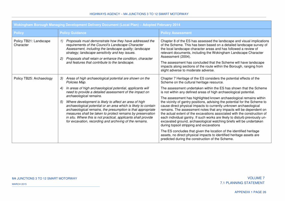
HIGHWAYS AGENCY – M4 JUNCTIONS 3 TO 12 SMART MOTORWAY
M4 JUNCTIONS 3 TO 12 SMART MOTORWAY VOLUME 7
7.1 PLANNING STATEMENT MARCH 2015
APPENDIX 1 PAGE 26
Wokingham Borough Managing Development Delivery Document (Local Plan) – Adopted February 2014
Policy Policy Guidance Policy Assessment
Policy TB21: Landscape Character
1) Proposals must demonstrate how they have addressed the requirements of the Council’s Landscape Character Assessment, including the landscape quality; landscape strategy; landscape sensitivity and key issues.
2) Proposals shall retain or enhance the condition, character and features that contribute to the landscape.
Chapter 8 of the ES has assessed the landscape and visual implications of the Scheme. This has been based on a detailed landscape survey of the local landscape character areas and has followed a review of relevant documents, including the Wokingham Landscape Character Assessment (2004).
The assessment has concluded that the Scheme will have landscape impacts along sections of the route within the Borough, ranging from slight adverse to moderate adverse.
Policy TB25: Archaeology 3) Areas of high archaeological potential are shown on the Policies Map.
4) In areas of high archaeological potential, applicants will need to provide a detailed assessment of the impact on archaeological remains.
5) Where development is likely to affect an area of high archaeological potential or an area which is likely to contain archaeological remains, the presumption is that appropriate measures shall be taken to protect remains by preservation in situ. Where this is not practical, applicants shall provide for excavation, recording and archiving of the remains.
Chapter 7 Heritage of the ES considers the potential effects of the Scheme on the cultural heritage resource.
The assessment undertaken within the ES has shown that the Scheme is not within any defined areas of high archaeological potential.
The assessment has highlighted known archaeological remains within the vicinity of gantry positions, advising the potential for the Scheme to cause direct physical impacts to currently unknown archaeological remains. The assessment notes that any impacts will be dependent on the actual extent of the excavations associated with the construction of each individual gantry. If such works are likely to disturb previously un-excavated ground, archaeological watching briefs will be undertaken during topsoil stripping and excavations
The ES concludes that given the location of the identified heritage assets, no direct physical impacts to identified heritage assets are predicted during the construction of the Scheme.
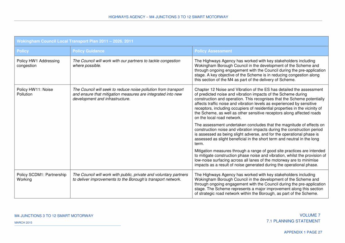
HIGHWAYS AGENCY – M4 JUNCTIONS 3 TO 12 SMART MOTORWAY
M4 JUNCTIONS 3 TO 12 SMART MOTORWAY VOLUME 7
7.1 PLANNING STATEMENT MARCH 2015
APPENDIX 1 PAGE 27
Wokingham Council Local Transport Plan 2011 – 2026. 2011
Policy Policy Guidance Policy Assessment
Policy HW1 Addressing congestion
The Council will work with our partners to tackle congestion where possible.
The Highways Agency has worked with key stakeholders including Wokingham Borough Council in the development of the Scheme and through ongoing engagement with the Council during the pre-application stage. A key objective of the Scheme is in reducing congestion along this section of the M4 as part of the delivery of Scheme.
Policy HW11: Noise Pollution
The Council will seek to reduce noise pollution from transport and ensure that mitigation measures are integrated into new development and infrastructure.
Chapter 12 Noise and Vibration of the ES has detailed the assessment of predicted noise and vibration impacts of the Scheme during construction and operation. This recognises that the Scheme potentially affects traffic noise and vibration levels as experienced by sensitive receptors, including occupiers of residential properties in the vicinity of the Scheme, as well as other sensitive receptors along affected roads on the local road network.
The assessment undertaken concludes that the magnitude of effects on construction noise and vibration impacts during the construction period is assessed as being slight adverse, and for the operational phase is assessed as slight beneficial in the short term and neutral in the long term.
Mitigation measures through a range of good site practices are intended to mitigate construction phase noise and vibration, whilst the provision of low-noise surfacing across all lanes of the motorway are to minimise impacts as a result of noise generated during the operational phase.
Policy SCDM1: Partnership Working
The Council will work with public, private and voluntary partners to deliver improvements to the Borough’s transport network.
The Highways Agency has worked with key stakeholders including Wokingham Borough Council in the development of the Scheme and through ongoing engagement with the Council during the pre-application stage. The Scheme represents a major improvement along this section of strategic road network within the Borough, as part of the Scheme.
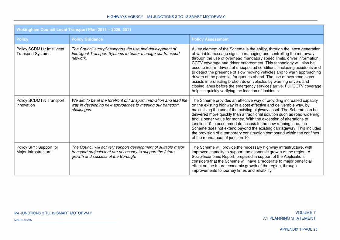
HIGHWAYS AGENCY – M4 JUNCTIONS 3 TO 12 SMART MOTORWAY
M4 JUNCTIONS 3 TO 12 SMART MOTORWAY VOLUME 7
7.1 PLANNING STATEMENT MARCH 2015
APPENDIX 1 PAGE 28
Wokingham Council Local Transport Plan 2011 – 2026. 2011
Policy Policy Guidance Policy Assessment
Policy SCDM11: Intelligent Transport Systems
The Council strongly supports the use and development of Intelligent Transport Systems to better manage our transport network.
A key element of the Scheme is the ability, through the latest generation of variable message signs in managing and controlling the motorway through the use of overhead mandatory speed limits, driver information, CCTV coverage and driver enforcement. This technology will also be used to inform drivers of unexpected conditions, including accidents and to detect the presence of slow moving vehicles and to warn approaching drivers of the potential for queues ahead. The use of overhead signs assists in protecting broken down vehicles by warning drivers and closing lanes before the emergency services arrive. Full CCTV coverage helps in quickly verifying the location of incidents.
Policy SCDM13: Transport innovation
We aim to be at the forefront of transport innovation and lead the way in developing new approaches to meeting our transport challenges.
The Scheme provides an effective way of providing increased capacity on the existing highway in a cost effective and deliverable way, by maximising the use of the existing highway asset. The Scheme can be delivered more quickly than a traditional solution such as road widening and is better value for money. With the exception of alterations to junction 10 to accommodate access to the new running lane, the Scheme does not extend beyond the existing carriageway. This includes the provision of a temporary construction compound within the confines of the roundabout at junction 10.
Policy SP1: Support for Major Infrastructure
The Council will actively support development of suitable major transport projects that are necessary to support the future growth and success of the Borough.
The Scheme will provide the necessary highway infrastructure, with improved capacity to support the economic growth of the region. A Socio-Economic Report, prepared in support of the Application, considers that the Scheme will have a moderate to major beneficial effect on the future economic growth of the region, through improvements to journey times and reliability.
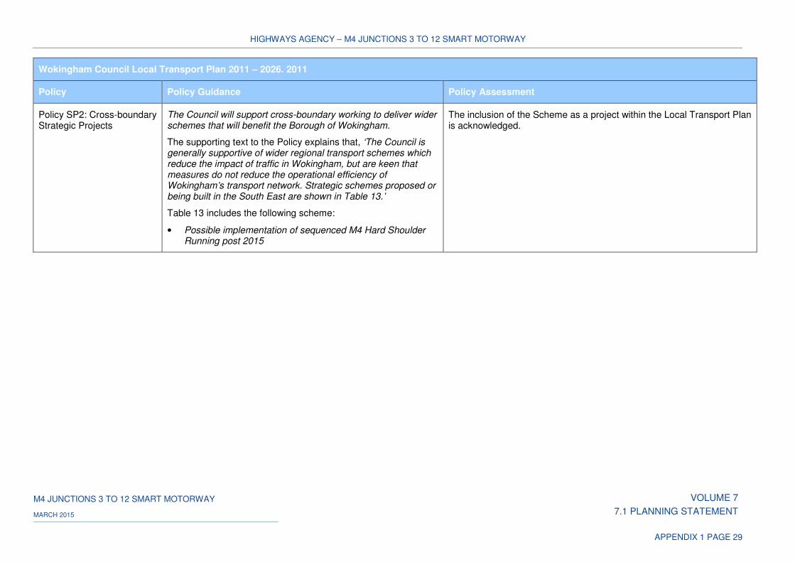
HIGHWAYS AGENCY – M4 JUNCTIONS 3 TO 12 SMART MOTORWAY
M4 JUNCTIONS 3 TO 12 SMART MOTORWAY VOLUME 7
7.1 PLANNING STATEMENT MARCH 2015
APPENDIX 1 PAGE 29
Wokingham Council Local Transport Plan 2011 – 2026. 2011
Policy Policy Guidance Policy Assessment
Policy SP2: Cross-boundary Strategic Projects
The Council will support cross-boundary working to deliver wider schemes that will benefit the Borough of Wokingham.
The supporting text to the Policy explains that, ‘The Council is generally supportive of wider regional transport schemes which reduce the impact of traffic in Wokingham, but are keen that measures do not reduce the operational efficiency of Wokingham’s transport network. Strategic schemes proposed or being built in the South East are shown in Table 13.’
Table 13 includes the following scheme:
• Possible implementation of sequenced M4 Hard Shoulder Running post 2015
The inclusion of the Scheme as a project within the Local Transport Plan is acknowledged.
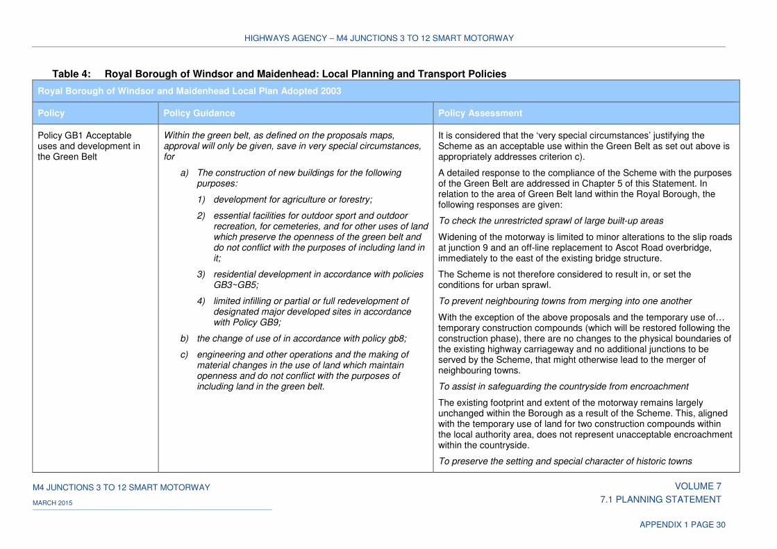
HIGHWAYS AGENCY – M4 JUNCTIONS 3 TO 12 SMART MOTORWAY
M4 JUNCTIONS 3 TO 12 SMART MOTORWAY VOLUME 7
7.1 PLANNING STATEMENT MARCH 2015
APPENDIX 1 PAGE 30
Table 4: Royal Borough of Windsor and Maidenhead: Local Planning and Transport Policies
Royal Borough of Windsor and Maidenhead Local Plan Adopted 2003
Policy Policy Guidance Policy Assessment
Policy GB1 Acceptable uses and development in the Green Belt
Within the green belt, as defined on the proposals maps, approval will only be given, save in very special circumstances, for
a) The construction of new buildings for the following purposes:
1) development for agriculture or forestry;
2) essential facilities for outdoor sport and outdoor recreation, for cemeteries, and for other uses of land which preserve the openness of the green belt and do not conflict with the purposes of including land in it;
3) residential development in accordance with policies GB3~GB5;
4) limited infilling or partial or full redevelopment of designated major developed sites in accordance with Policy GB9;
b) the change of use of in accordance with policy gb8;
c) engineering and other operations and the making of material changes in the use of land which maintain openness and do not conflict with the purposes of including land in the green belt.
It is considered that the ‘very special circumstances’ justifying the Scheme as an acceptable use within the Green Belt as set out above is appropriately addresses criterion c).
A detailed response to the compliance of the Scheme with the purposes of the Green Belt are addressed in Chapter 5 of this Statement. In relation to the area of Green Belt land within the Royal Borough, the following responses are given:
To check the unrestricted sprawl of large built-up areas
Widening of the motorway is limited to minor alterations to the slip roads at junction 9 and an off-line replacement to Ascot Road overbridge, immediately to the east of the existing bridge structure.
The Scheme is not therefore considered to result in, or set the conditions for urban sprawl.
To prevent neighbouring towns from merging into one another
With the exception of the above proposals and the temporary use of… temporary construction compounds (which will be restored following the construction phase), there are no changes to the physical boundaries of the existing highway carriageway and no additional junctions to be served by the Scheme, that might otherwise lead to the merger of neighbouring towns.
To assist in safeguarding the countryside from encroachment
The existing footprint and extent of the motorway remains largely unchanged within the Borough as a result of the Scheme. This, aligned with the temporary use of land for two construction compounds within the local authority area, does not represent unacceptable encroachment within the countryside.
To preserve the setting and special character of historic towns
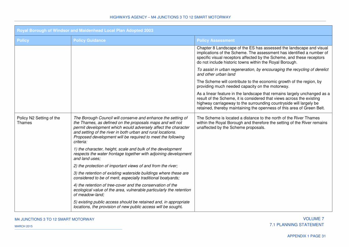
HIGHWAYS AGENCY – M4 JUNCTIONS 3 TO 12 SMART MOTORWAY
M4 JUNCTIONS 3 TO 12 SMART MOTORWAY VOLUME 7
7.1 PLANNING STATEMENT MARCH 2015
APPENDIX 1 PAGE 31
Royal Borough of Windsor and Maidenhead Local Plan Adopted 2003
Policy Policy Guidance Policy Assessment
Chapter 8 Landscape of the ES has assessed the landscape and visual implications of the Scheme. The assessment has identified a number of specific visual receptors affected by the Scheme, and these receptors do not include historic towns within the Royal Borough.
To assist in urban regeneration, by encouraging the recycling of derelict and other urban land
The Scheme will contribute to the economic growth of the region, by providing much needed capacity on the motorway.
As a linear feature in the landscape that remains largely unchanged as a result of the Scheme, it is considered that views across the existing highway carriageway to the surrounding countryside will largely be retained, thereby maintaining the openness of this area of Green Belt.
Policy N2 Setting of the Thames
The Borough Council will conserve and enhance the setting of the Thames, as defined on the proposals maps and will not permit development which would adversely affect the character and setting of the river in both urban and rural locations. Proposed development will be required to meet the following criteria:
1) the character, height, scale and bulk of the development respects the water frontage together with adjoining development and land uses;
2) the protection of important views of and from the river;
3) the retention of existing waterside buildings where these are considered to be of merit, especially traditional boatyards;
4) the retention of tree-cover and the conservation of the ecological value of the area, vulnerable particularly the retention of meadow-land;
5) existing public access should be retained and, in appropriate locations, the provision of new public access will be sought.
The Scheme is located a distance to the north of the River Thames within the Royal Borough and therefore the setting of the River remains unaffected by the Scheme proposals.
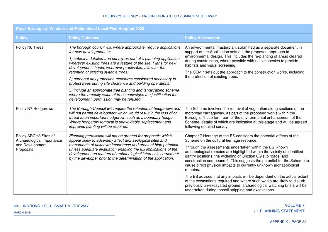
HIGHWAYS AGENCY – M4 JUNCTIONS 3 TO 12 SMART MOTORWAY
M4 JUNCTIONS 3 TO 12 SMART MOTORWAY VOLUME 7
7.1 PLANNING STATEMENT MARCH 2015
APPENDIX 1 PAGE 32
Royal Borough of Windsor and Maidenhead Local Plan Adopted 2003
Policy Policy Guidance Policy Assessment
Policy N6 Trees The borough council will, where appropriate, require applications for new development to:
1) submit a detailed tree survey as part of a planning application wherever existing trees are a feature of the site. Plans for new development should, wherever practicable, allow for the retention of existing suitable trees;
2) carry out any protection measures considered necessary to protect trees during site clearance and building operations;
3) include an appropriate tree planting and landscaping scheme where the amenity value of trees outweighs the justification for development, permission may be refused.
An environmental masterplan, submitted as a separate document in support of the Application sets out the proposed approach to environmental design. This includes the re-planting of areas cleared during construction, where possible with native species to provide habitats and visual screening.
The CEMP sets out the approach to the construction works, including the protection of existing trees.
Policy N7 Hedgerows The Borough Council will require the retention of hedgerows and will not permit development which would result in the loss of or threat to an important hedgerow, such as a boundary hedge. Where hedgerow removal is unavoidable, replacement and improved planting will be required.
The Scheme involves the removal of vegetation along sections of the motorway carriageway, as part of the proposed works within the Borough. These form part of the environmental enhancement of the Scheme, details of which are indicative at this stage and will be agreed following detailed survey.
Policy ARCH3 Sites of Archaeological Importance and Development Proposals
Planning permission will not be granted for proposals which appear likely to adversely affect archaeological sites and monuments of unknown importance and areas of high potential unless adequate evaluation enabling the full implications of the development on matters of archaeological interest is carried out by the developer prior to the determination of the application.
Chapter 7 Heritage of the ES considers the potential effects of the Scheme on the cultural heritage resource.
Through the assessments undertaken within the ES, known archaeological remains are highlighted within the vicinity of identified gantry positions, the widening of junction 8/9 slip roads, and construction compound 4. This suggests the potential for the Scheme to cause direct physical impacts to currently unknown archaeological remains.
The ES advises that any impacts will be dependent on the actual extent of the excavations required and where such works are likely to disturb previously un-excavated ground, archaeological watching briefs will be undertaken during topsoil stripping and excavations.
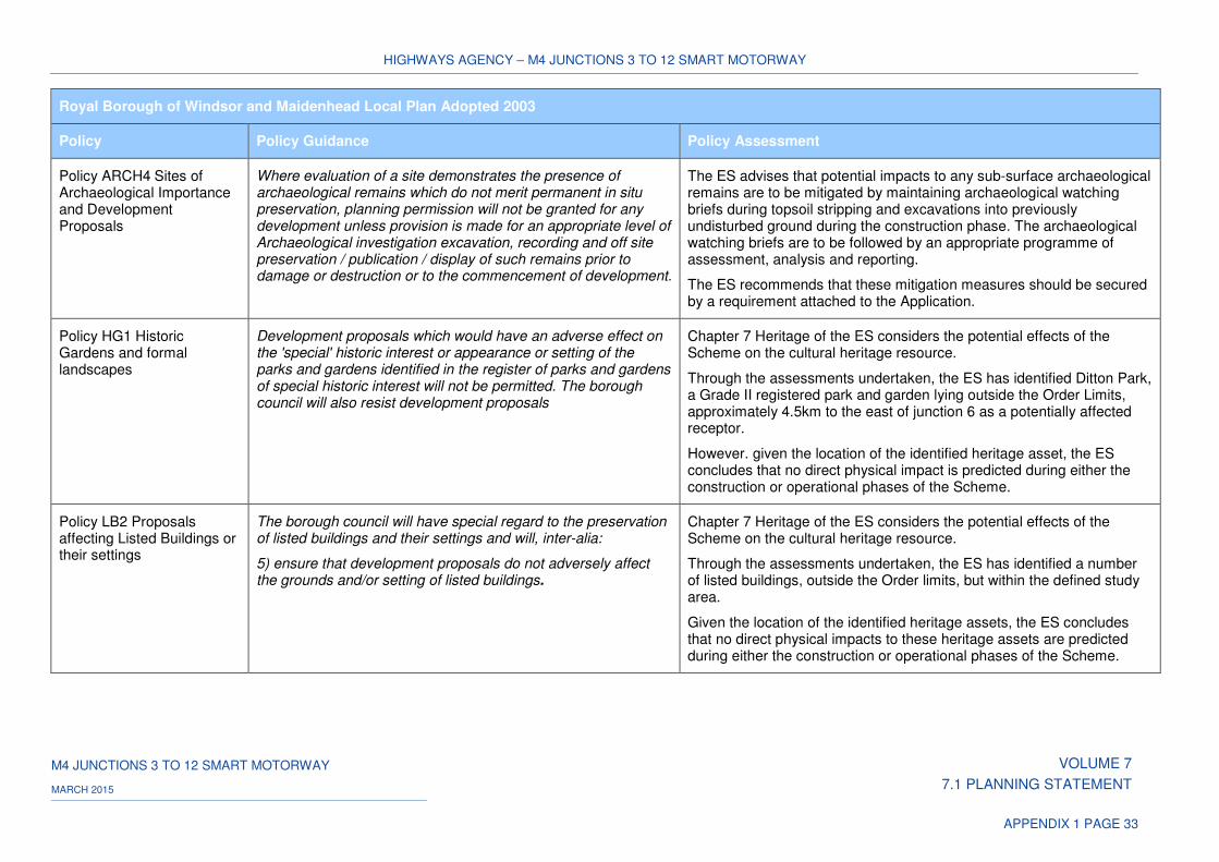
HIGHWAYS AGENCY – M4 JUNCTIONS 3 TO 12 SMART MOTORWAY
M4 JUNCTIONS 3 TO 12 SMART MOTORWAY VOLUME 7
7.1 PLANNING STATEMENT MARCH 2015
APPENDIX 1 PAGE 33
Royal Borough of Windsor and Maidenhead Local Plan Adopted 2003
Policy Policy Guidance Policy Assessment
Policy ARCH4 Sites of Archaeological Importance and Development Proposals
Where evaluation of a site demonstrates the presence of archaeological remains which do not merit permanent in situ preservation, planning permission will not be granted for any development unless provision is made for an appropriate level of Archaeological investigation excavation, recording and off site preservation / publication / display of such remains prior to damage or destruction or to the commencement of development.
The ES advises that potential impacts to any sub-surface archaeological remains are to be mitigated by maintaining archaeological watching briefs during topsoil stripping and excavations into previously undisturbed ground during the construction phase. The archaeological watching briefs are to be followed by an appropriate programme of assessment, analysis and reporting.
The ES recommends that these mitigation measures should be secured by a requirement attached to the Application.
Policy HG1 Historic Gardens and formal landscapes
Development proposals which would have an adverse effect on the 'special' historic interest or appearance or setting of the parks and gardens identified in the register of parks and gardens of special historic interest will not be permitted. The borough council will also resist development proposals
Chapter 7 Heritage of the ES considers the potential effects of the Scheme on the cultural heritage resource.
Through the assessments undertaken, the ES has identified Ditton Park, a Grade II registered park and garden lying outside the Order Limits, approximately 4.5km to the east of junction 6 as a potentially affected receptor.
However. given the location of the identified heritage asset, the ES concludes that no direct physical impact is predicted during either the construction or operational phases of the Scheme.
Policy LB2 Proposals affecting Listed Buildings or their settings
The borough council will have special regard to the preservation of listed buildings and their settings and will, inter-alia:
5) ensure that development proposals do not adversely affect the grounds and/or setting of listed buildings.
Chapter 7 Heritage of the ES considers the potential effects of the Scheme on the cultural heritage resource.
Through the assessments undertaken, the ES has identified a number of listed buildings, outside the Order limits, but within the defined study area.
Given the location of the identified heritage assets, the ES concludes that no direct physical impacts to these heritage assets are predicted during either the construction or operational phases of the Scheme.
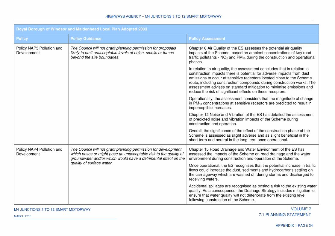
HIGHWAYS AGENCY – M4 JUNCTIONS 3 TO 12 SMART MOTORWAY
M4 JUNCTIONS 3 TO 12 SMART MOTORWAY VOLUME 7
7.1 PLANNING STATEMENT MARCH 2015
APPENDIX 1 PAGE 34
Royal Borough of Windsor and Maidenhead Local Plan Adopted 2003
Policy Policy Guidance Policy Assessment
Policy NAP3 Pollution and Development
The Council will not grant planning permission for proposals likely to emit unacceptable levels of noise, smells or fumes beyond the site boundaries.
Chapter 6 Air Quality of the ES assesses the potential air quality impacts of the Scheme, based on ambient concentrations of key road traffic pollutants - NO2 and PM10 during the construction and operational phases.
In relation to air quality, the assessment concludes that in relation to construction impacts there is potential for adverse impacts from dust emissions to occur at sensitive receptors located close to the Scheme route, including construction compounds during construction works. The assessment advises on standard mitigation to minimise emissions and reduce the risk of significant effects on these receptors.
Operationally, the assessment considers that the magnitude of change in PM10 concentrations at sensitive receptors are predicted to result in imperceptible increases.
Chapter 12 Noise and Vibration of the ES has detailed the assessment of predicted noise and vibration impacts of the Scheme during construction and operation.
Overall, the significance of the effect of the construction phase of the Scheme is assessed as slight adverse and as slight beneficial in the short term and neutral in the long term once operational.
Policy NAP4 Pollution and Development
The Council will not grant planning permission for development which poses or might pose an unacceptable risk to the quality of groundwater and/or which would have a detrimental effect on the quality of surface water.
Chapter 15 Road Drainage and Water Environment of the ES has assessed the impacts of the Scheme on road drainage and the water environment during construction and operation of the Scheme.
Once operational, the ES recognises that the potential increase in traffic flows could increase the dust, sediments and hydrocarbons settling on the carriageway which are washed off during storms and discharged to receiving waters.
Accidental spillages are recognised as posing a risk to the existing water quality. As a consequence, the Drainage Strategy includes mitigation to ensure that water quality will not deteriorate from the existing level following construction of the Scheme.
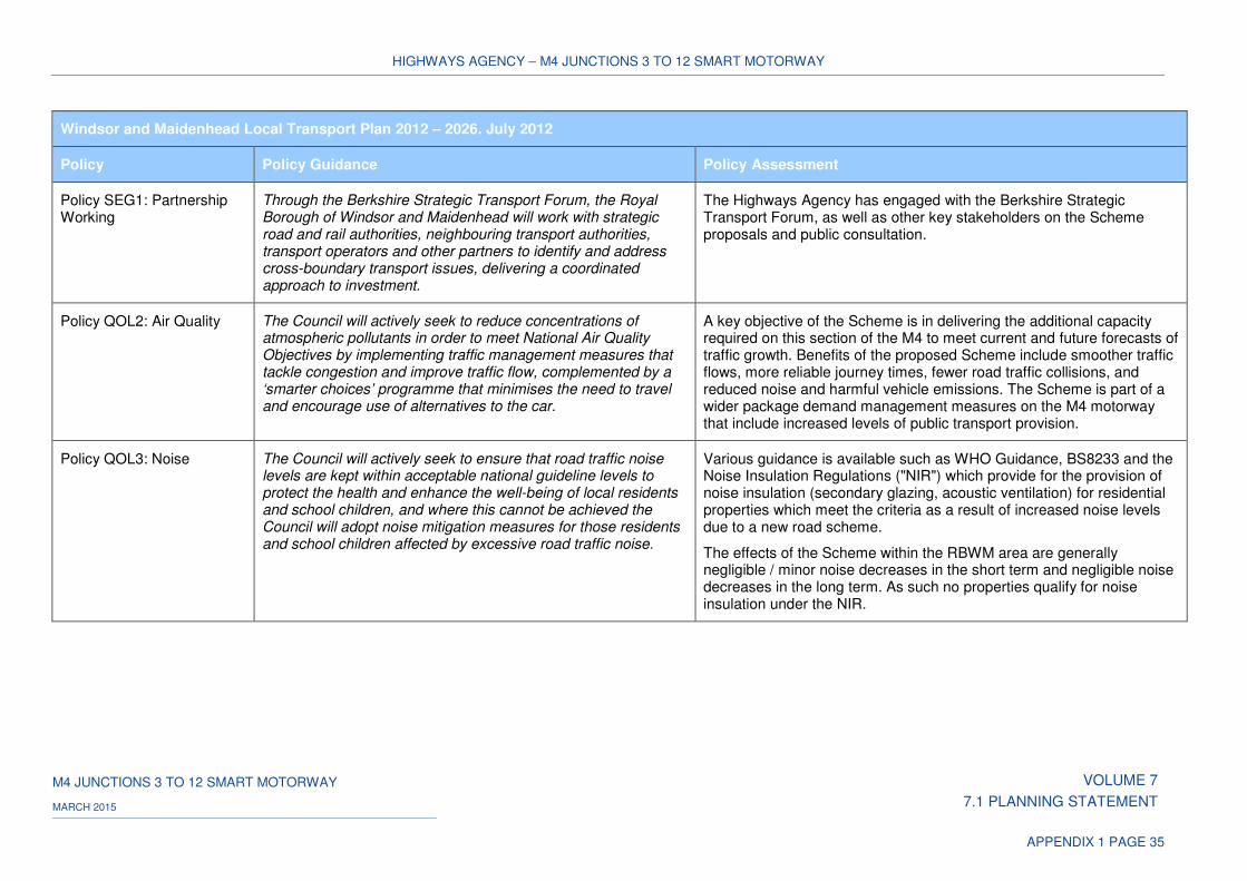
HIGHWAYS AGENCY – M4 JUNCTIONS 3 TO 12 SMART MOTORWAY
M4 JUNCTIONS 3 TO 12 SMART MOTORWAY VOLUME 7
7.1 PLANNING STATEMENT MARCH 2015
APPENDIX 1 PAGE 35
Windsor and Maidenhead Local Transport Plan 2012 – 2026. July 2012
Policy Policy Guidance Policy Assessment
Policy SEG1: Partnership Working
Through the Berkshire Strategic Transport Forum, the Royal Borough of Windsor and Maidenhead will work with strategic road and rail authorities, neighbouring transport authorities, transport operators and other partners to identify and address cross-boundary transport issues, delivering a coordinated approach to investment.
The Highways Agency has engaged with the Berkshire Strategic Transport Forum, as well as other key stakeholders on the Scheme proposals and public consultation.
Policy QOL2: Air Quality The Council will actively seek to reduce concentrations of atmospheric pollutants in order to meet National Air Quality Objectives by implementing traffic management measures that tackle congestion and improve traffic flow, complemented by a ‘smarter choices’ programme that minimises the need to travel and encourage use of alternatives to the car.
A key objective of the Scheme is in delivering the additional capacity required on this section of the M4 to meet current and future forecasts of traffic growth. Benefits of the proposed Scheme include smoother traffic flows, more reliable journey times, fewer road traffic collisions, and reduced noise and harmful vehicle emissions. The Scheme is part of a wider package demand management measures on the M4 motorway that include increased levels of public transport provision.
Policy QOL3: Noise The Council will actively seek to ensure that road traffic noise levels are kept within acceptable national guideline levels to protect the health and enhance the well-being of local residents and school children, and where this cannot be achieved the Council will adopt noise mitigation measures for those residents and school children affected by excessive road traffic noise.
Various guidance is available such as WHO Guidance, BS8233 and the Noise Insulation Regulations ("NIR") which provide for the provision of noise insulation (secondary glazing, acoustic ventilation) for residential properties which meet the criteria as a result of increased noise levels due to a new road scheme.
The effects of the Scheme within the RBWM area are generally negligible / minor noise decreases in the short term and negligible noise decreases in the long term. As such no properties qualify for noise insulation under the NIR.
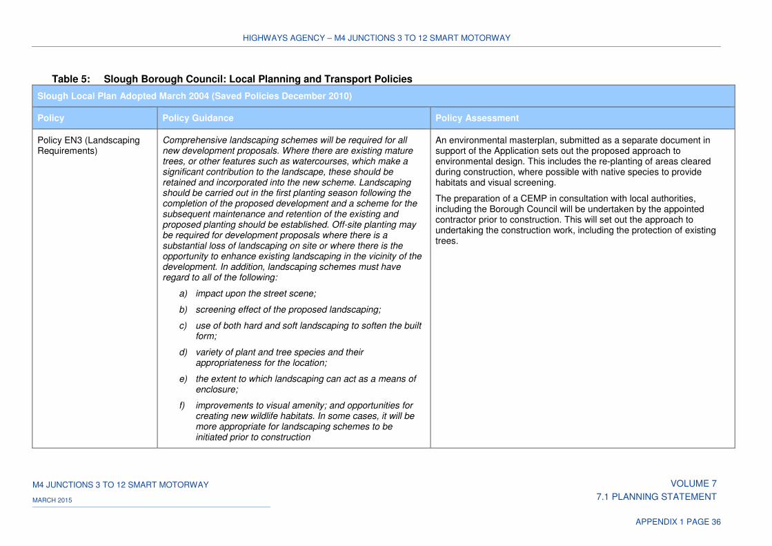
HIGHWAYS AGENCY – M4 JUNCTIONS 3 TO 12 SMART MOTORWAY
M4 JUNCTIONS 3 TO 12 SMART MOTORWAY VOLUME 7
7.1 PLANNING STATEMENT MARCH 2015
APPENDIX 1 PAGE 36
Table 5: Slough Borough Council: Local Planning and Transport Policies
Slough Local Plan Adopted March 2004 (Saved Policies December 2010)
Policy Policy Guidance Policy Assessment
Policy EN3 (Landscaping Requirements)A
Comprehensive landscaping schemes will be required for all new development proposals. Where there are existing mature trees, or other features such as watercourses, which make a significant contribution to the landscape, these should be retained and incorporated into the new scheme. Landscaping should be carried out in the first planting season following the completion of the proposed development and a scheme for the subsequent maintenance and retention of the existing and proposed planting should be established. Off-site planting may be required for development proposals where there is a substantial loss of landscaping on site or where there is the opportunity to enhance existing landscaping in the vicinity of the development. In addition, landscaping schemes must have regard to all of the following:
a) impact upon the street scene;
b) screening effect of the proposed landscaping;
c) use of both hard and soft landscaping to soften the built form;
d) variety of plant and tree species and their appropriateness for the location;
e) the extent to which landscaping can act as a means of enclosure;
f) improvements to visual amenity; and opportunities for creating new wildlife habitats. In some cases, it will be more appropriate for landscaping schemes to be initiated prior to construction
An environmental masterplan, submitted as a separate document in support of the Application sets out the proposed approach to environmental design. This includes the re-planting of areas cleared during construction, where possible with native species to provide habitats and visual screening.
The preparation of a CEMP in consultation with local authorities, including the Borough Council will be undertaken by the appointed contractor prior to construction. This will set out the approach to undertaking the construction work, including the protection of existing trees.
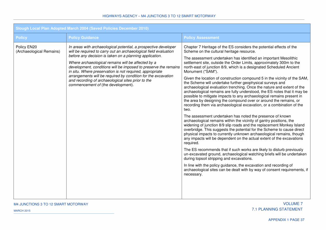
HIGHWAYS AGENCY – M4 JUNCTIONS 3 TO 12 SMART MOTORWAY
M4 JUNCTIONS 3 TO 12 SMART MOTORWAY VOLUME 7
7.1 PLANNING STATEMENT MARCH 2015
APPENDIX 1 PAGE 37
Slough Local Plan Adopted March 2004 (Saved Policies December 2010)
Policy Policy Guidance Policy Assessment
Policy EN20 (Archaeological Remains)
In areas with archaeological potential, a prospective developer will be required to carry out an archaeological field evaluation before any decision is taken on a planning application.
Where archaeological remains will be affected by a development, conditions will be imposed to preserve the remains in situ. Where preservation is not required, appropriate arrangements will be required by condition for the excavation and recording of archaeological sites prior to the commencement of (the development).
Chapter 7 Heritage of the ES considers the potential effects of the Scheme on the cultural heritage resource.
The assessment undertaken has identified an important Mesolithic settlement site, outside the Order Limits, approximately 300m to the north-east of junction 8/9, which is a designated Scheduled Ancient Monument ("SAM").
Given the location of construction compound 5 in the vicinity of the SAM, the Scheme will undertake further geophysical surveys and archaeological evaluation trenching. Once the nature and extent of the archaeological remains are fully understood, the ES notes that it may be possible to mitigate impacts to any archaeological remains present in the area by designing the compound over or around the remains, or recording them via archaeological excavation, or a combination of the two.
The assessment undertaken has noted the presence of known archaeological remains within the vicinity of gantry positions, the widening of junction 8/9 slip roads and the replacement Monkey Island overbridge. This suggests the potential for the Scheme to cause direct physical impacts to currently unknown archaeological remains, though any impacts will be dependent on the actual extent of the excavations required.
The ES recommends that if such works are likely to disturb previously un-excavated ground, archaeological watching briefs will be undertaken during topsoil stripping and excavations.
In line with the policy guidance, the excavation and recording of archaeological sites can be dealt with by way of consent requirements, if necessary.
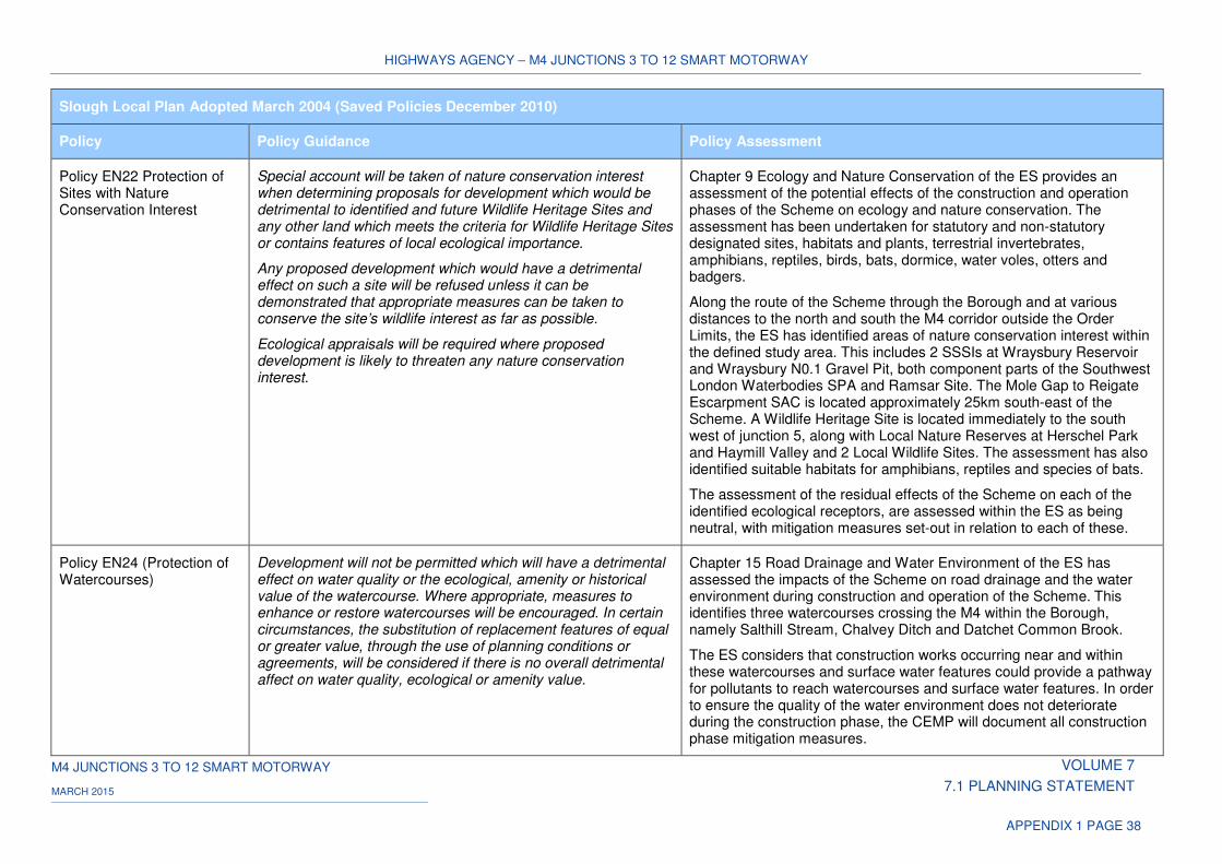
HIGHWAYS AGENCY – M4 JUNCTIONS 3 TO 12 SMART MOTORWAY
M4 JUNCTIONS 3 TO 12 SMART MOTORWAY VOLUME 7
7.1 PLANNING STATEMENT MARCH 2015
APPENDIX 1 PAGE 38
Slough Local Plan Adopted March 2004 (Saved Policies December 2010)
Policy Policy Guidance Policy Assessment
Policy EN22 Protection of Sites with Nature Conservation Interest
Special account will be taken of nature conservation interest when determining proposals for development which would be detrimental to identified and future Wildlife Heritage Sites and any other land which meets the criteria for Wildlife Heritage Sites or contains features of local ecological importance.
Any proposed development which would have a detrimental effect on such a site will be refused unless it can be demonstrated that appropriate measures can be taken to conserve the site’s wildlife interest as far as possible.
Ecological appraisals will be required where proposed development is likely to threaten any nature conservation interest.
Chapter 9 Ecology and Nature Conservation of the ES provides an assessment of the potential effects of the construction and operation phases of the Scheme on ecology and nature conservation. The assessment has been undertaken for statutory and non-statutory designated sites, habitats and plants, terrestrial invertebrates, amphibians, reptiles, birds, bats, dormice, water voles, otters and badgers.
Along the route of the Scheme through the Borough and at various distances to the north and south the M4 corridor outside the Order Limits, the ES has identified areas of nature conservation interest within the defined study area. This includes 2 SSSIs at Wraysbury Reservoir and Wraysbury N0.1 Gravel Pit, both component parts of the Southwest London Waterbodies SPA and Ramsar Site. The Mole Gap to Reigate Escarpment SAC is located approximately 25km south-east of the Scheme. A Wildlife Heritage Site is located immediately to the south west of junction 5, along with Local Nature Reserves at Herschel Park and Haymill Valley and 2 Local Wildlife Sites. The assessment has also identified suitable habitats for amphibians, reptiles and species of bats.
The assessment of the residual effects of the Scheme on each of the identified ecological receptors, are assessed within the ES as being neutral, with mitigation measures set-out in relation to each of these.
Policy EN24 (Protection of Watercourses)
Development will not be permitted which will have a detrimental effect on water quality or the ecological, amenity or historical value of the watercourse. Where appropriate, measures to enhance or restore watercourses will be encouraged. In certain circumstances, the substitution of replacement features of equal or greater value, through the use of planning conditions or agreements, will be considered if there is no overall detrimental affect on water quality, ecological or amenity value.
Chapter 15 Road Drainage and Water Environment of the ES has assessed the impacts of the Scheme on road drainage and the water environment during construction and operation of the Scheme. This identifies three watercourses crossing the M4 within the Borough, namely Salthill Stream, Chalvey Ditch and Datchet Common Brook.
The ES considers that construction works occurring near and within these watercourses and surface water features could provide a pathway for pollutants to reach watercourses and surface water features. In order to ensure the quality of the water environment does not deteriorate during the construction phase, the CEMP will document all construction phase mitigation measures.
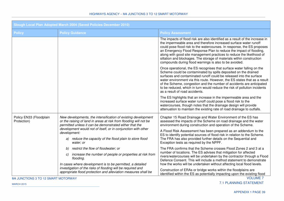
HIGHWAYS AGENCY – M4 JUNCTIONS 3 TO 12 SMART MOTORWAY
M4 JUNCTIONS 3 TO 12 SMART MOTORWAY VOLUME 7
7.1 PLANNING STATEMENT MARCH 2015
APPENDIX 1 PAGE 39
Slough Local Plan Adopted March 2004 (Saved Policies December 2010)
Policy Policy Guidance Policy Assessment
The impacts of flood risk are also identified as a result of the increase in the impermeable area and therefore increased surface water runoff could pose flood risk to the watercourses. In response, the ES proposes an Emergency Flood Response Plan to reduce the impact of flooding, along with good site management practices to reduce the likelihood of siltation and blockages. The storage of materials within construction compounds during flood warnings is also to be avoided.
Once operational, the ES recognises that surface water falling on the Scheme could be contaminated by spills deposited on the drained surfaces and contaminated runoff could be released into the surface water environment via this route. However, the ES states that as a result of the Scheme, congestion and the number of accidents are anticipated to be reduced, which in turn would reduce the risk of pollution incidents as a result of road accidents.
The ES highlights that an increase in the impermeable area and the increased surface water runoff could pose a flood risk to the watercourses, though notes that the drainage design will provide attenuation to maintain the existing rate of road drainage to outfalls.
Policy EN33 (Floodplain Protection)
New developments, the intensification of existing development or the raising of land in areas at risk from flooding will not be permitted unless it can be demonstrated either that the development would not of itself, or in conjunction with other development:
a) reduce the capacity of the flood plain to store flood water; or
b) restrict the flow of floodwater; or
c) increase the number of people or properties at risk from flooding.
In cases where development is to be permitted, a detailed investigation of the risks of flooding will be required and appropriate flood protection and alleviation measures shall be
Chapter 15 Road Drainage and Water Environment of the ES has assessed the impacts of the Scheme on road drainage and the water environment during construction and operation of the Scheme.
A Flood Risk Assessment has been prepared as an addendum to the ES to identify potential sources of flood risk in relation to the Scheme. The FRA has also provided further details on the Sequential and Exception tests as required by the NPPF.
The FRA confirms that the Scheme crosses Flood Zones 2 and 3 at a number of locations. The ES advises that mitigation for affected rivers/watercourses will be undertaken by the contractor through a Flood Defence Consent. This will include a method statement to demonstrate how the works will be undertaken without affecting local flood levels.
Construction of ERAs or bridge works within the floodplains are identified within the ES as potentially impacting upon the existing flood
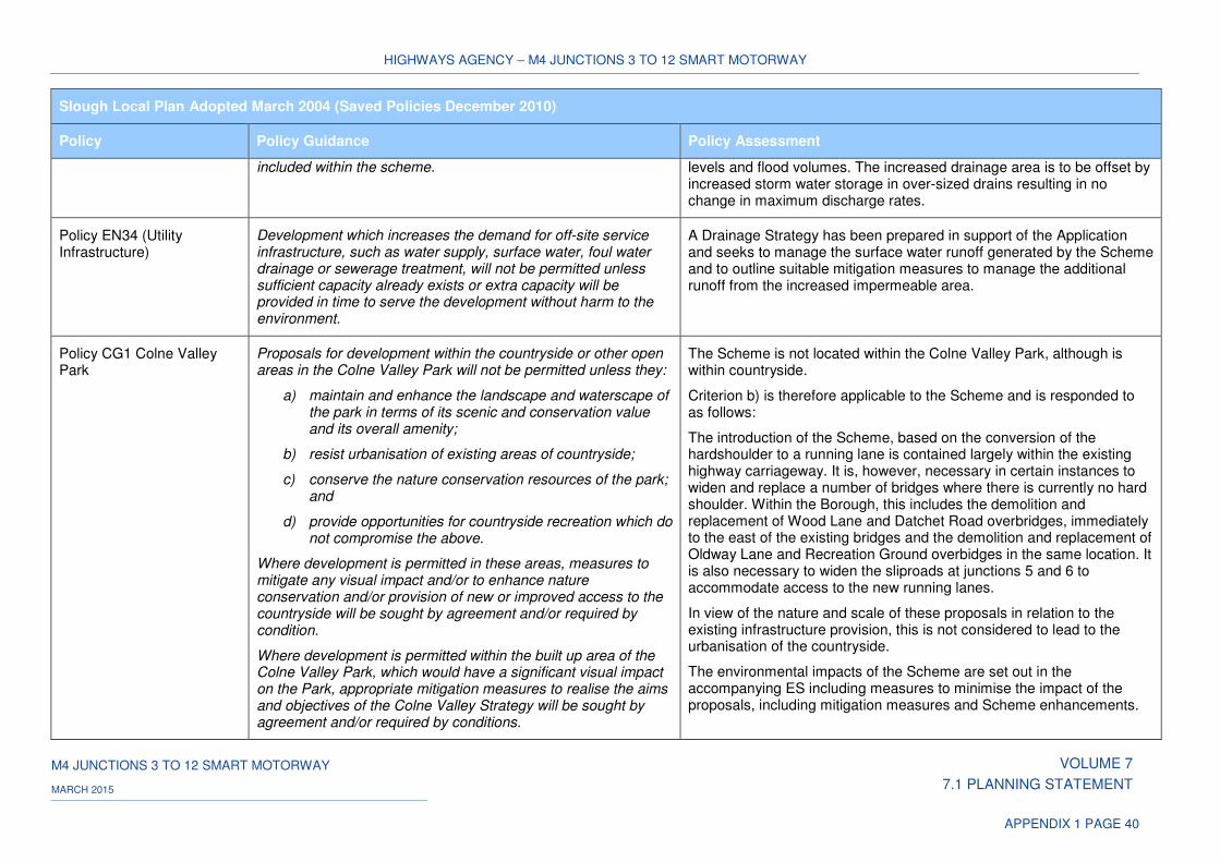
HIGHWAYS AGENCY – M4 JUNCTIONS 3 TO 12 SMART MOTORWAY
M4 JUNCTIONS 3 TO 12 SMART MOTORWAY VOLUME 7
7.1 PLANNING STATEMENT MARCH 2015
APPENDIX 1 PAGE 40
Slough Local Plan Adopted March 2004 (Saved Policies December 2010)
Policy Policy Guidance Policy Assessment
included within the scheme. levels and flood volumes. The increased drainage area is to be offset by increased storm water storage in over-sized drains resulting in no change in maximum discharge rates.
Policy EN34 (Utility Infrastructure)
Development which increases the demand for off-site service infrastructure, such as water supply, surface water, foul water drainage or sewerage treatment, will not be permitted unless sufficient capacity already exists or extra capacity will be provided in time to serve the development without harm to the environment.
A Drainage Strategy has been prepared in support of the Application and seeks to manage the surface water runoff generated by the Scheme and to outline suitable mitigation measures to manage the additional runoff from the increased impermeable area.
Policy CG1 Colne Valley Park
Proposals for development within the countryside or other open areas in the Colne Valley Park will not be permitted unless they:
a) maintain and enhance the landscape and waterscape of the park in terms of its scenic and conservation value and its overall amenity;
b) resist urbanisation of existing areas of countryside;
c) conserve the nature conservation resources of the park; and
d) provide opportunities for countryside recreation which do not compromise the above.
Where development is permitted in these areas, measures to mitigate any visual impact and/or to enhance nature conservation and/or provision of new or improved access to the countryside will be sought by agreement and/or required by condition.
Where development is permitted within the built up area of the Colne Valley Park, which would have a significant visual impact on the Park, appropriate mitigation measures to realise the aims and objectives of the Colne Valley Strategy will be sought by agreement and/or required by conditions.
The Scheme is not located within the Colne Valley Park, although is within countryside.
Criterion b) is therefore applicable to the Scheme and is responded to as follows:
The introduction of the Scheme, based on the conversion of the hardshoulder to a running lane is contained largely within the existing highway carriageway. It is, however, necessary in certain instances to widen and replace a number of bridges where there is currently no hard shoulder. Within the Borough, this includes the demolition and replacement of Wood Lane and Datchet Road overbridges, immediately to the east of the existing bridges and the demolition and replacement of Oldway Lane and Recreation Ground overbidges in the same location. It is also necessary to widen the sliproads at junctions 5 and 6 to accommodate access to the new running lanes.
In view of the nature and scale of these proposals in relation to the existing infrastructure provision, this is not considered to lead to the urbanisation of the countryside.
The environmental impacts of the Scheme are set out in the accompanying ES including measures to minimise the impact of the proposals, including mitigation measures and Scheme enhancements.
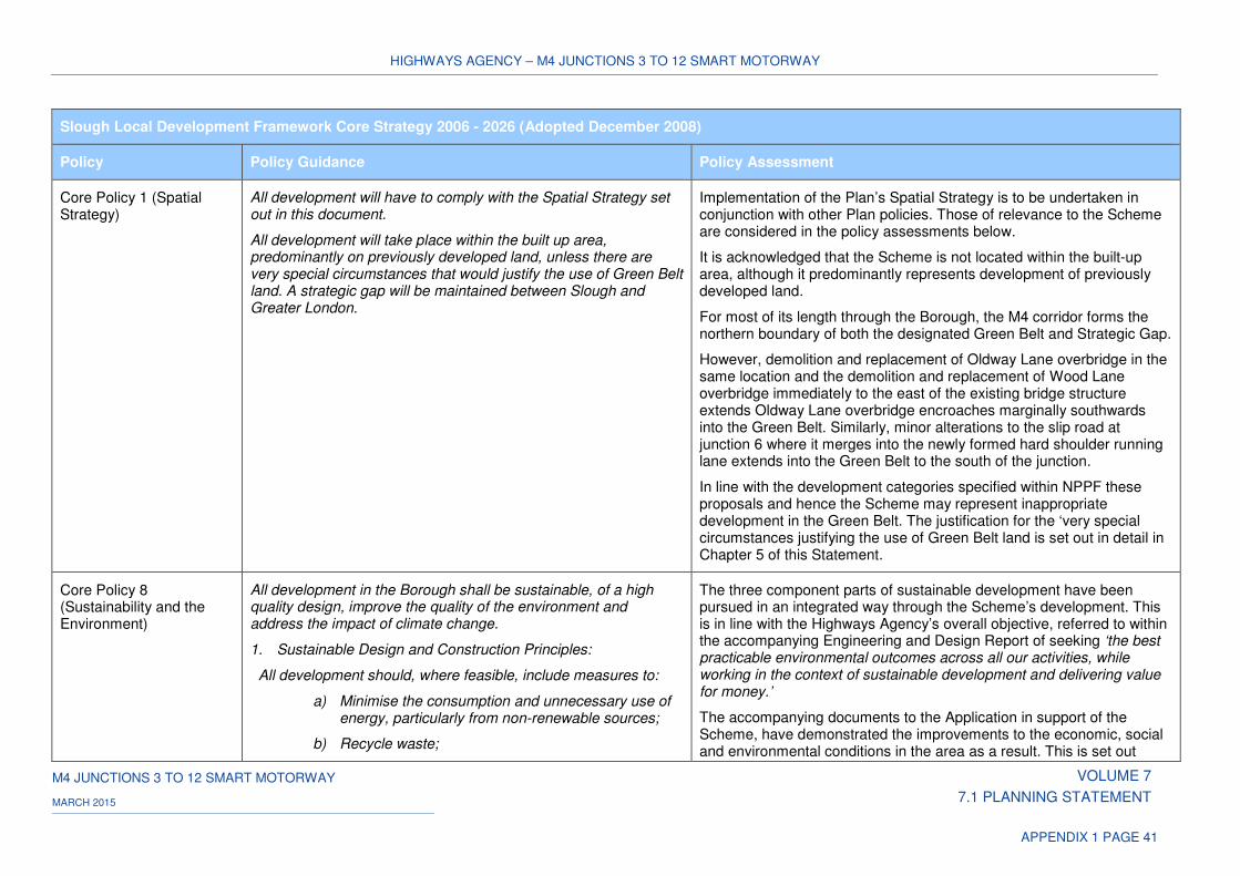
HIGHWAYS AGENCY – M4 JUNCTIONS 3 TO 12 SMART MOTORWAY
M4 JUNCTIONS 3 TO 12 SMART MOTORWAY VOLUME 7
7.1 PLANNING STATEMENT MARCH 2015
APPENDIX 1 PAGE 41
Slough Local Development Framework Core Strategy 2006 - 2026 (Adopted December 2008)
Policy Policy Guidance Policy Assessment
Core Policy 1 (Spatial Strategy)
All development will have to comply with the Spatial Strategy set out in this document.
All development will take place within the built up area, predominantly on previously developed land, unless there are very special circumstances that would justify the use of Green Belt land. A strategic gap will be maintained between Slough and Greater London.
Implementation of the Plan’s Spatial Strategy is to be undertaken in conjunction with other Plan policies. Those of relevance to the Scheme are considered in the policy assessments below.
It is acknowledged that the Scheme is not located within the built-up area, although it predominantly represents development of previously developed land.
For most of its length through the Borough, the M4 corridor forms the northern boundary of both the designated Green Belt and Strategic Gap.
However, demolition and replacement of Oldway Lane overbridge in the same location and the demolition and replacement of Wood Lane overbridge immediately to the east of the existing bridge structure extends Oldway Lane overbridge encroaches marginally southwards into the Green Belt. Similarly, minor alterations to the slip road at junction 6 where it merges into the newly formed hard shoulder running lane extends into the Green Belt to the south of the junction.
In line with the development categories specified within NPPF these proposals and hence the Scheme may represent inappropriate development in the Green Belt. The justification for the ‘very special circumstances justifying the use of Green Belt land is set out in detail in Chapter 5 of this Statement.
Core Policy 8 (Sustainability and the Environment)
All development in the Borough shall be sustainable, of a high quality design, improve the quality of the environment and address the impact of climate change.
1. Sustainable Design and Construction Principles:
All development should, where feasible, include measures to:
a) Minimise the consumption and unnecessary use of energy, particularly from non-renewable sources;
b) Recycle waste;
The three component parts of sustainable development have been pursued in an integrated way through the Scheme’s development. This is in line with the Highways Agency’s overall objective, referred to within the accompanying Engineering and Design Report of seeking ‘the best practicable environmental outcomes across all our activities, while working in the context of sustainable development and delivering value for money.’
The accompanying documents to the Application in support of the Scheme, have demonstrated the improvements to the economic, social and environmental conditions in the area as a result. This is set out
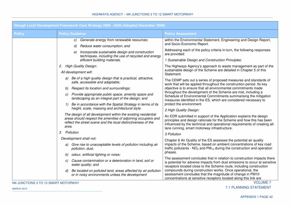
HIGHWAYS AGENCY – M4 JUNCTIONS 3 TO 12 SMART MOTORWAY
M4 JUNCTIONS 3 TO 12 SMART MOTORWAY VOLUME 7
7.1 PLANNING STATEMENT MARCH 2015
APPENDIX 1 PAGE 42
Slough Local Development Framework Core Strategy 2006 - 2026 (Adopted December 2008)
Policy Policy Guidance Policy Assessment
c) Generate energy from renewable resources;
d) Reduce water consumption; and
e) Incorporate sustainable design and construction techniques, including the use of recycled and energy efficient building materials.
2. High Quality Design:
All development will:
a) Be of a high quality design that is practical, attractive, safe, accessible and adaptable;
b) Respect its location and surroundings;
c) Provide appropriate public space, amenity space and landscaping as an integral part of the design; and
1) Be in accordance with the Spatial Strategy in terms of its height, scale, massing and architectural style.
The design of all development within the existing residential areas should respect the amenities of adjoining occupiers and reflect the street scene and the local distinctiveness of the area.
3. Pollution
Development shall not:
a) Give rise to unacceptable levels of pollution including air pollution, dust,
b) odour, artificial lighting or noise;
c) Cause contamination or a deterioration in land, soil or water quality; and
d) Be located on polluted land, areas affected by air pollution or in noisy environments unless the development
within the Environmental Statement, Engineering and Design Report, and Socio-Economic Report.
Addressing each of the policy criteria in-turn, the following responses are provided:
1 Sustainable Design and Construction Principles:
The Highways Agency’s approach to waste management as part of the sustainable design of the Scheme are detailed in Chapter 5 of this Statement.
The CEMP sets out a series of proposed measures and standards of work that will be applied throughout the construction period. Its key objective is to ensure that all environmental commitments made throughout the development of the Scheme are met, including a Schedule of Environmental Commitments summarising the mitigation measures identified in the ES, which are considered necessary to protect the environment.
2 High Quality Design:
An EDR submitted in support of the Application explains the design principles and design rationale for the Scheme and how this has been influenced by the technical and operational requirements of creating all-lane running, smart motorway infrastructure.
3 Pollution
Chapter 6 Air Quality of the ES assesses the potential air quality impacts of the Scheme, based on ambient concentrations of key road traffic pollutants - NO2 and PM10 during the construction and operation phases.
The assessment concludes that in relation to construction impacts there is potential for adverse impacts from dust emissions to occur at sensitive receptors located close to the Scheme route, including construction compounds during construction works. Once operational, the assessment concludes that the magnitude of change in PM10 concentrations at sensitive receptors located along this link are
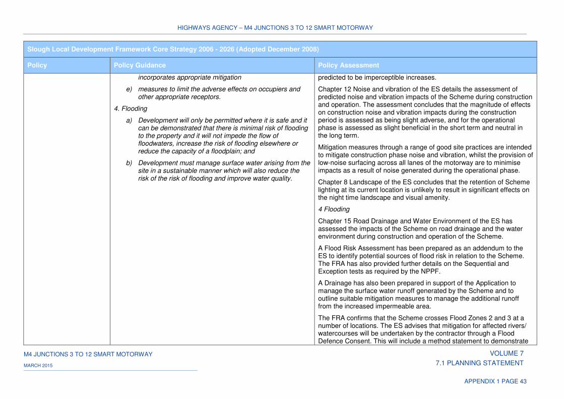
HIGHWAYS AGENCY – M4 JUNCTIONS 3 TO 12 SMART MOTORWAY
M4 JUNCTIONS 3 TO 12 SMART MOTORWAY VOLUME 7
7.1 PLANNING STATEMENT MARCH 2015
APPENDIX 1 PAGE 43
Slough Local Development Framework Core Strategy 2006 - 2026 (Adopted December 2008)
Policy Policy Guidance Policy Assessment
incorporates appropriate mitigation
e) measures to limit the adverse effects on occupiers and other appropriate receptors.
4. Flooding
a) Development will only be permitted where it is safe and it can be demonstrated that there is minimal risk of flooding to the property and it will not impede the flow of floodwaters, increase the risk of flooding elsewhere or reduce the capacity of a floodplain; and
b) Development must manage surface water arising from the site in a sustainable manner which will also reduce the risk of the risk of flooding and improve water quality.
predicted to be imperceptible increases.
Chapter 12 Noise and vibration of the ES details the assessment of predicted noise and vibration impacts of the Scheme during construction and operation. The assessment concludes that the magnitude of effects on construction noise and vibration impacts during the construction period is assessed as being slight adverse, and for the operational phase is assessed as slight beneficial in the short term and neutral in the long term.
Mitigation measures through a range of good site practices are intended to mitigate construction phase noise and vibration, whilst the provision of low-noise surfacing across all lanes of the motorway are to minimise impacts as a result of noise generated during the operational phase.
Chapter 8 Landscape of the ES concludes that the retention of Scheme lighting at its current location is unlikely to result in significant effects on the night time landscape and visual amenity.
4 Flooding
Chapter 15 Road Drainage and Water Environment of the ES has assessed the impacts of the Scheme on road drainage and the water environment during construction and operation of the Scheme.
A Flood Risk Assessment has been prepared as an addendum to the ES to identify potential sources of flood risk in relation to the Scheme. The FRA has also provided further details on the Sequential and Exception tests as required by the NPPF.
A Drainage has also been prepared in support of the Application to manage the surface water runoff generated by the Scheme and to outline suitable mitigation measures to manage the additional runoff from the increased impermeable area.
The FRA confirms that the Scheme crosses Flood Zones 2 and 3 at a number of locations. The ES advises that mitigation for affected rivers/ watercourses will be undertaken by the contractor through a Flood Defence Consent. This will include a method statement to demonstrate
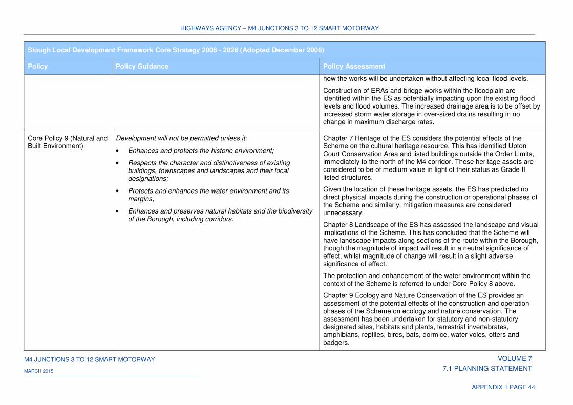
HIGHWAYS AGENCY – M4 JUNCTIONS 3 TO 12 SMART MOTORWAY
M4 JUNCTIONS 3 TO 12 SMART MOTORWAY VOLUME 7
7.1 PLANNING STATEMENT MARCH 2015
APPENDIX 1 PAGE 44
Slough Local Development Framework Core Strategy 2006 - 2026 (Adopted December 2008)
Policy Policy Guidance Policy Assessment
how the works will be undertaken without affecting local flood levels.
Construction of ERAs and bridge works within the floodplain are identified within the ES as potentially impacting upon the existing flood levels and flood volumes. The increased drainage area is to be offset by increased storm water storage in over-sized drains resulting in no change in maximum discharge rates.
Core Policy 9 (Natural and Built Environment)
Development will not be permitted unless it:
• Enhances and protects the historic environment;
• Respects the character and distinctiveness of existing buildings, townscapes and landscapes and their local designations;
• Protects and enhances the water environment and its margins;
• Enhances and preserves natural habitats and the biodiversity of the Borough, including corridors.
Chapter 7 Heritage of the ES considers the potential effects of the Scheme on the cultural heritage resource. This has identified Upton Court Conservation Area and listed buildings outside the Order Limits, immediately to the north of the M4 corridor. These heritage assets are considered to be of medium value in light of their status as Grade II listed structures.
Given the location of these heritage assets, the ES has predicted no direct physical impacts during the construction or operational phases of the Scheme and similarly, mitigation measures are considered unnecessary.
Chapter 8 Landscape of the ES has assessed the landscape and visual implications of the Scheme. This has concluded that the Scheme will have landscape impacts along sections of the route within the Borough, though the magnitude of impact will result in a neutral significance of effect, whilst magnitude of change will result in a slight adverse significance of effect.
The protection and enhancement of the water environment within the context of the Scheme is referred to under Core Policy 8 above.
Chapter 9 Ecology and Nature Conservation of the ES provides an assessment of the potential effects of the construction and operation phases of the Scheme on ecology and nature conservation. The assessment has been undertaken for statutory and non-statutory designated sites, habitats and plants, terrestrial invertebrates, amphibians, reptiles, birds, bats, dormice, water voles, otters and badgers.
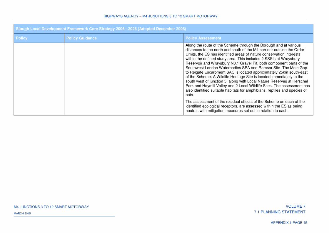
HIGHWAYS AGENCY – M4 JUNCTIONS 3 TO 12 SMART MOTORWAY
M4 JUNCTIONS 3 TO 12 SMART MOTORWAY VOLUME 7
7.1 PLANNING STATEMENT MARCH 2015
APPENDIX 1 PAGE 45
Slough Local Development Framework Core Strategy 2006 - 2026 (Adopted December 2008)
Policy Policy Guidance Policy Assessment
Along the route of the Scheme through the Borough and at various distances to the north and south of the M4 corridor outside the Order Limits, the ES has identified areas of nature conservation interests within the defined study area. This includes 2 SSSIs at Wraysbury Reservoir and Wraysbury N0.1 Gravel Pit, both component parts of the Southwest London Waterbodies SPA and Ramsar Site. The Mole Gap to Reigate Escarpment SAC is located approximately 25km south-east of the Scheme. A Wildlife Heritage Site is located immediately to the south west of junction 5, along with Local Nature Reserves at Herschel Park and Haymill Valley and 2 Local Wildlife Sites. The assessment has also identified suitable habitats for amphibians, reptiles and species of bats.
The assessment of the residual effects of the Scheme on each of the identified ecological receptors, are assessed within the ES as being neutral, with mitigation measures set out in relation to each.
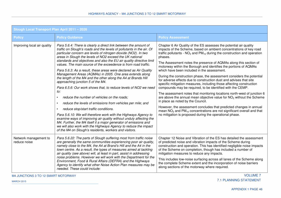
HIGHWAYS AGENCY – M4 JUNCTIONS 3 TO 12 SMART MOTORWAY
M4 JUNCTIONS 3 TO 12 SMART MOTORWAY VOLUME 7
7.1 PLANNING STATEMENT MARCH 2015
APPENDIX 1 PAGE 46
Slough Local Transport Plan April 2011 – 2026
Policy Policy Guidance Policy Assessment
Improving local air quality Para 5.6.4: There is clearly a direct link between the amount of traffic on Slough’s roads and the levels of pollutants in the air. Of particular concern are levels of nitrogen dioxide (NO2). In two areas in Slough the levels of NO2 exceed the UK national standards and objectives and also the EU air quality directive limit values. The main source of the exceedence is from road traffic.
Para 5.6.3: As a result, these areas were declared as Air Quality Management Areas (AQMAs) in 2005. One area extends along the length of the M4 and the other along the A4 at Brands Hill approaching junction 5 of the M4.
Para 6.5.6: Our work shows that, to reduce levels of NO2 we need to:
• reduce the number of vehicles on the roads;
• reduce the levels of emissions from vehicles per mile; and
• reduce stop/start traffic conditions.
Para 5.6.10: We will therefore work with the Highways Agency to examine ways of improving air quality without unduly affecting the M4. Further, the M4 itself it a major generator of emissions and we will also work with the Highways Agency to reduce the impact of the M4 on Slough’s residents, workers and visitors.
Chapter 6 Air Quality of the ES assesses the potential air quality impacts of the Scheme, based on ambient concentrations of key road traffic pollutants - NO2 and PM10 during the construction and operation phases.
The Assessment notes the presence of AQMAs along this section of motorway within the Borough and identifies the portions of AQMAs which have been included in the assessment.
During the construction phase, the assessment considers the potential for adverse effects due to construction dust and advises that site specific mitigation measures, including those affecting construction compounds may be required, to be identified with the CEMP.
The assessment notes that monitoring locations north-west of junction 6 are above the annual mean objective value for NO2 without the Scheme in place as noted by the Council.
However, the assessment concludes that predicted changes in annual mean NO2 and PM10 concentrations are not significant overall and that no mitigation is proposed during the operational phase.
Network management to reduce noise
Para 5.6.22: The parts of Slough suffering most from traffic noise are generally the same communities experiencing poor air quality, namely close to the M4, the A4 at Brand’s Hill and the A4 in the town centre. As a result, the types of measures aimed at tackling air quality (see above) will, at least in part, assist in addressing noise problems. However we will work with the Department for the Environment, Food & Rural Affairs (DEFRA) and the Highways Agency to identify what other Noise Action Plan measures may be needed. These could include:
Chapter 12 Noise and Vibration of the ES has detailed the assessment of predicted noise and vibration impacts of the Scheme during construction and operation. This has identified negligible noise impacts of the Scheme on completion, though has included a number of mitigation measures to reduce any impacts.
This includes low-noise surfacing across all lanes of the Scheme along the complete Scheme extent and the incorporation of noise barriers along sections of the motorway where required.
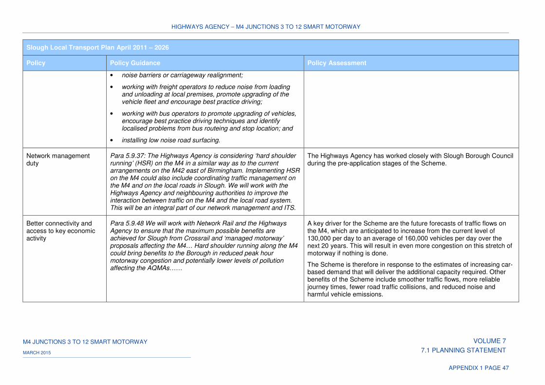
HIGHWAYS AGENCY – M4 JUNCTIONS 3 TO 12 SMART MOTORWAY
M4 JUNCTIONS 3 TO 12 SMART MOTORWAY VOLUME 7
7.1 PLANNING STATEMENT MARCH 2015
APPENDIX 1 PAGE 47
Slough Local Transport Plan April 2011 – 2026
Policy Policy Guidance Policy Assessment
• noise barriers or carriageway realignment;
• working with freight operators to reduce noise from loading and unloading at local premises, promote upgrading of the vehicle fleet and encourage best practice driving;
• working with bus operators to promote upgrading of vehicles, encourage best practice driving techniques and identify localised problems from bus routeing and stop location; and
• installing low noise road surfacing.
Network management duty
Para 5.9.37: The Highways Agency is considering ‘hard shoulder running’ (HSR) on the M4 in a similar way as to the current arrangements on the M42 east of Birmingham. Implementing HSR on the M4 could also include coordinating traffic management on the M4 and on the local roads in Slough. We will work with the Highways Agency and neighbouring authorities to improve the interaction between traffic on the M4 and the local road system. This will be an integral part of our network management and ITS.
The Highways Agency has worked closely with Slough Borough Council during the pre-application stages of the Scheme.
Better connectivity and access to key economic activity
Para 5.9.48 We will work with Network Rail and the Highways Agency to ensure that the maximum possible benefits are achieved for Slough from Crossrail and ‘managed motorway’ proposals affecting the M4… Hard shoulder running along the M4 could bring benefits to the Borough in reduced peak hour motorway congestion and potentially lower levels of pollution affecting the AQMAs……
A key driver for the Scheme are the future forecasts of traffic flows on the M4, which are anticipated to increase from the current level of 130,000 per day to an average of 160,000 vehicles per day over the next 20 years. This will result in even more congestion on this stretch of motorway if nothing is done.
The Scheme is therefore in response to the estimates of increasing car-based demand that will deliver the additional capacity required. Other benefits of the Scheme include smoother traffic flows, more reliable journey times, fewer road traffic collisions, and reduced noise and harmful vehicle emissions.
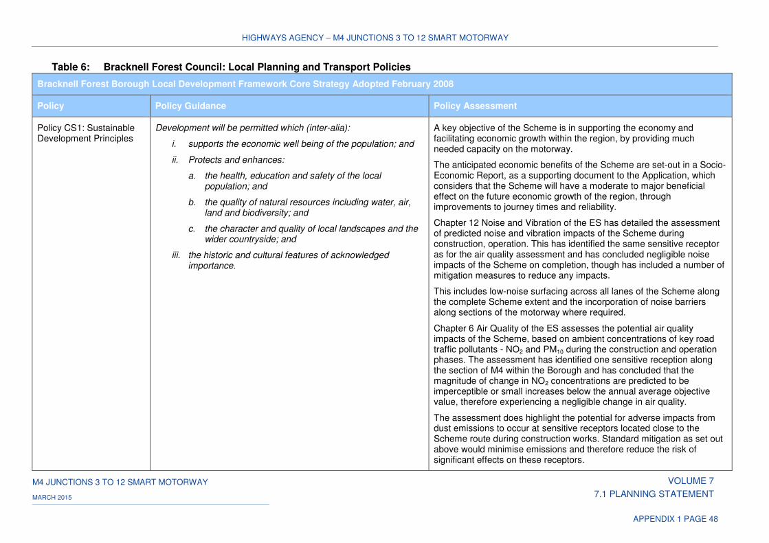
HIGHWAYS AGENCY – M4 JUNCTIONS 3 TO 12 SMART MOTORWAY
M4 JUNCTIONS 3 TO 12 SMART MOTORWAY VOLUME 7
7.1 PLANNING STATEMENT MARCH 2015
APPENDIX 1 PAGE 48
Table 6: Bracknell Forest Council: Local Planning and Transport Policies
Bracknell Forest Borough Local Development Framework Core Strategy Adopted February 2008
Policy Policy Guidance Policy Assessment
Policy CS1: Sustainable Development Principles
Development will be permitted which (inter-alia):
i. supports the economic well being of the population; and
ii. Protects and enhances:
a. the health, education and safety of the local population; and
b. the quality of natural resources including water, air, land and biodiversity; and
c. the character and quality of local landscapes and the wider countryside; and
iii. the historic and cultural features of acknowledged importance.
A key objective of the Scheme is in supporting the economy and facilitating economic growth within the region, by providing much needed capacity on the motorway.
The anticipated economic benefits of the Scheme are set-out in a Socio-Economic Report, as a supporting document to the Application, which considers that the Scheme will have a moderate to major beneficial effect on the future economic growth of the region, through improvements to journey times and reliability.
Chapter 12 Noise and Vibration of the ES has detailed the assessment of predicted noise and vibration impacts of the Scheme during construction, operation. This has identified the same sensitive receptor as for the air quality assessment and has concluded negligible noise impacts of the Scheme on completion, though has included a number of mitigation measures to reduce any impacts.
This includes low-noise surfacing across all lanes of the Scheme along the complete Scheme extent and the incorporation of noise barriers along sections of the motorway where required.
Chapter 6 Air Quality of the ES assesses the potential air quality impacts of the Scheme, based on ambient concentrations of key road traffic pollutants - NO2 and PM10 during the construction and operation phases. The assessment has identified one sensitive reception along the section of M4 within the Borough and has concluded that the magnitude of change in NO2 concentrations are predicted to be imperceptible or small increases below the annual average objective value, therefore experiencing a negligible change in air quality.
The assessment does highlight the potential for adverse impacts from dust emissions to occur at sensitive receptors located close to the Scheme route during construction works. Standard mitigation as set out above would minimise emissions and therefore reduce the risk of significant effects on these receptors.
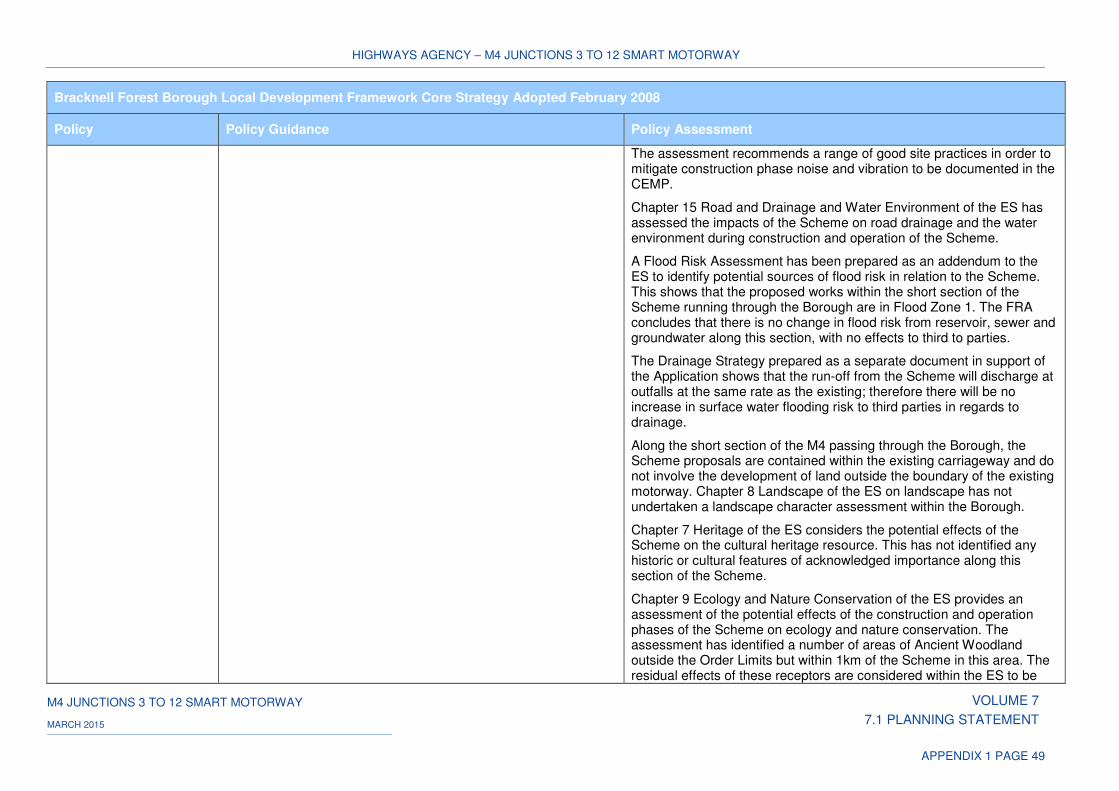
HIGHWAYS AGENCY – M4 JUNCTIONS 3 TO 12 SMART MOTORWAY
M4 JUNCTIONS 3 TO 12 SMART MOTORWAY VOLUME 7
7.1 PLANNING STATEMENT MARCH 2015
APPENDIX 1 PAGE 49
Bracknell Forest Borough Local Development Framework Core Strategy Adopted February 2008
Policy Policy Guidance Policy Assessment
The assessment recommends a range of good site practices in order to mitigate construction phase noise and vibration to be documented in the CEMP.
Chapter 15 Road and Drainage and Water Environment of the ES has assessed the impacts of the Scheme on road drainage and the water environment during construction and operation of the Scheme.
A Flood Risk Assessment has been prepared as an addendum to the ES to identify potential sources of flood risk in relation to the Scheme. This shows that the proposed works within the short section of the Scheme running through the Borough are in Flood Zone 1. The FRA concludes that there is no change in flood risk from reservoir, sewer and groundwater along this section, with no effects to third to parties.
The Drainage Strategy prepared as a separate document in support of the Application shows that the run-off from the Scheme will discharge at outfalls at the same rate as the existing; therefore there will be no increase in surface water flooding risk to third parties in regards to drainage.
Along the short section of the M4 passing through the Borough, the Scheme proposals are contained within the existing carriageway and do not involve the development of land outside the boundary of the existing motorway. Chapter 8 Landscape of the ES on landscape has not undertaken a landscape character assessment within the Borough.
Chapter 7 Heritage of the ES considers the potential effects of the Scheme on the cultural heritage resource. This has not identified any historic or cultural features of acknowledged importance along this section of the Scheme.
Chapter 9 Ecology and Nature Conservation of the ES provides an assessment of the potential effects of the construction and operation phases of the Scheme on ecology and nature conservation. The assessment has identified a number of areas of Ancient Woodland outside the Order Limits but within 1km of the Scheme in this area. The residual effects of these receptors are considered within the ES to be
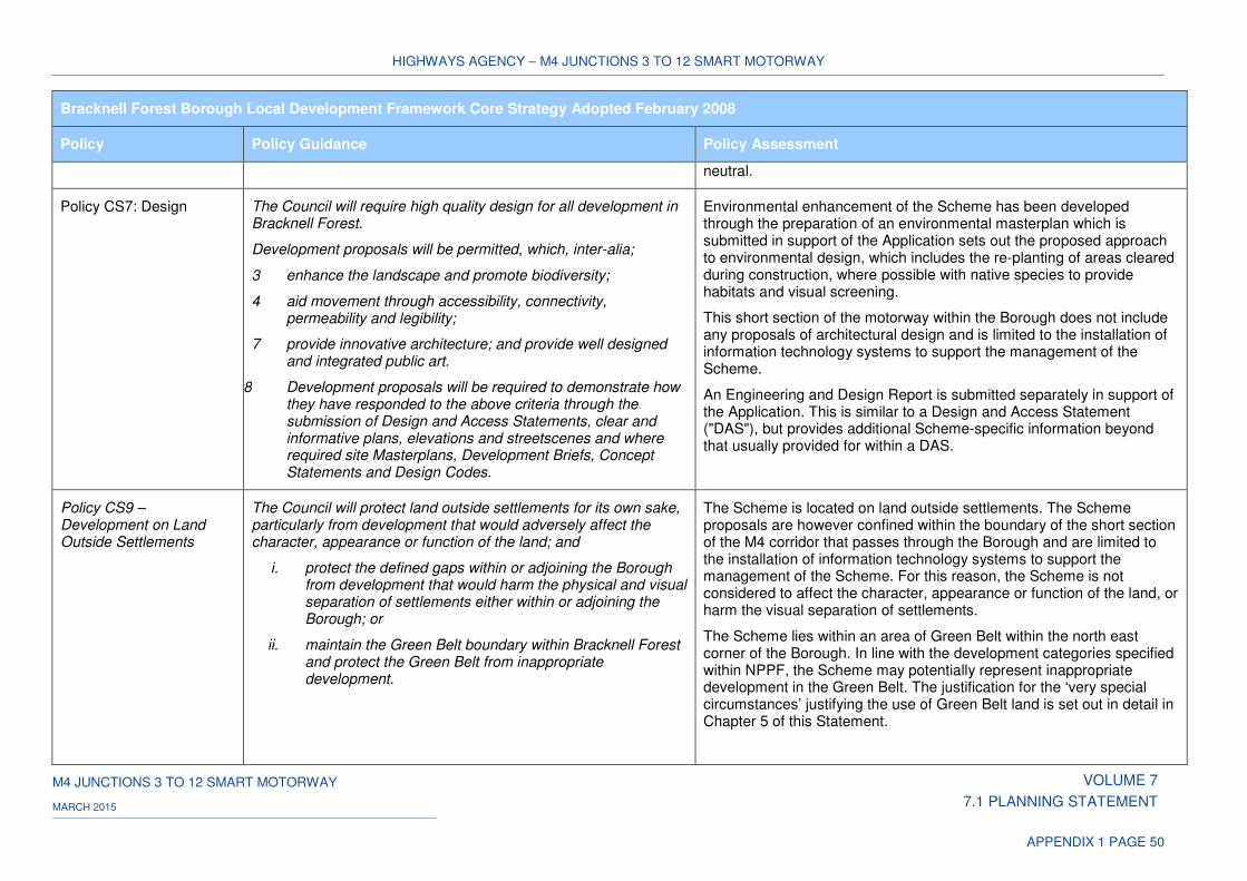
HIGHWAYS AGENCY – M4 JUNCTIONS 3 TO 12 SMART MOTORWAY
M4 JUNCTIONS 3 TO 12 SMART MOTORWAY VOLUME 7
7.1 PLANNING STATEMENT MARCH 2015
APPENDIX 1 PAGE 50
Bracknell Forest Borough Local Development Framework Core Strategy Adopted February 2008
Policy Policy Guidance Policy Assessment
neutral.
Policy CS7: Design The Council will require high quality design for all development in Bracknell Forest.
Development proposals will be permitted, which, inter-alia;
3 enhance the landscape and promote biodiversity;
4 aid movement through accessibility, connectivity, permeability and legibility;
7 provide innovative architecture; and provide well designed and integrated public art.
8 Development proposals will be required to demonstrate how they have responded to the above criteria through the submission of Design and Access Statements, clear and informative plans, elevations and streetscenes and where required site Masterplans, Development Briefs, Concept Statements and Design Codes.
Environmental enhancement of the Scheme has been developed through the preparation of an environmental masterplan which is submitted in support of the Application sets out the proposed approach to environmental design, which includes the re-planting of areas cleared during construction, where possible with native species to provide habitats and visual screening.
This short section of the motorway within the Borough does not include any proposals of architectural design and is limited to the installation of information technology systems to support the management of the Scheme.
An Engineering and Design Report is submitted separately in support of the Application. This is similar to a Design and Access Statement ("DAS"), but provides additional Scheme-specific information beyond that usually provided for within a DAS.
Policy CS9 – Development on Land Outside Settlements
The Council will protect land outside settlements for its own sake, particularly from development that would adversely affect the character, appearance or function of the land; and
i. protect the defined gaps within or adjoining the Borough from development that would harm the physical and visual separation of settlements either within or adjoining the Borough; or
ii. maintain the Green Belt boundary within Bracknell Forest and protect the Green Belt from inappropriate development.
The Scheme is located on land outside settlements. The Scheme proposals are however confined within the boundary of the short section of the M4 corridor that passes through the Borough and are limited to the installation of information technology systems to support the management of the Scheme. For this reason, the Scheme is not considered to affect the character, appearance or function of the land, or harm the visual separation of settlements.
The Scheme lies within an area of Green Belt within the north east corner of the Borough. In line with the development categories specified within NPPF, the Scheme may potentially represent inappropriate development in the Green Belt. The justification for the ‘very special circumstances’ justifying the use of Green Belt land is set out in detail in Chapter 5 of this Statement.

HIGHWAYS AGENCY – M4 JUNCTIONS 3 TO 12 SMART MOTORWAY
M4 JUNCTIONS 3 TO 12 SMART MOTORWAY VOLUME 7
7.1 PLANNING STATEMENT MARCH 2015
APPENDIX 1 PAGE 51
Bracknell Forest Borough Local Development Framework Core Strategy Adopted February 2008
Policy Policy Guidance Policy Assessment
As noted above, the Scheme does not involve proposals outside the motorway corridor and will therefore have no effect on the boundary of the Green Belt.
Policy CS10 – Sustainable Resources
Development proposals will be accompanied by a Sustainability Statement demonstrating how current best practice in the sustainable use of natural resources has been incorporated.
The key component parts of a Sustainability Statement are covered elsewhere within the Application.
Chapter 11 Materials and Waste of the ES provides details of the Scheme's approach to waste management as part of its sustainable design.
The preparation of a CEMP as a supporting document to the Application sets out a series of proposed measures and standards of work that will be applied throughout the construction period. Its key objective is to ensure that all environmental commitments made throughout the development of the project are met, including a Schedule of Environmental Commitments summarising the mitigation measures identified in the ES, which are considered necessary to protect the environment.
Bracknell Forest Local Plan Adopted 2002 (Saved Policies September 2007)
Policy Policy Guidance Policy Assessment
Policy EN1 Protecting tree and hedgerow cover
Planning permission will not be granted for development which would result in the destruction of trees and hedgerows which are important to the retention, where applicable, of:
i. a clear distinction between built up areas and the countryside; or
ii. the character and appearance of the landscape or townscape; or
iii. green links between open spaces and wildlife heritage sites;
The Scheme involves the removal of vegetation along sections of the motorway carriageway, as part of the proposed works within the Borough. These form part of the environmental enhancement of the Scheme, details of which are indicative at this stage and are to be agreed following detailed survey.
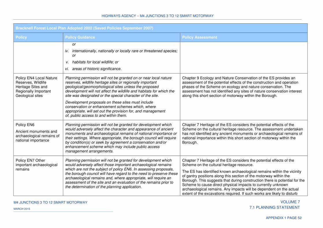
HIGHWAYS AGENCY – M4 JUNCTIONS 3 TO 12 SMART MOTORWAY
M4 JUNCTIONS 3 TO 12 SMART MOTORWAY VOLUME 7
7.1 PLANNING STATEMENT MARCH 2015
APPENDIX 1 PAGE 52
Bracknell Forest Local Plan Adopted 2002 (Saved Policies September 2007)
Policy Policy Guidance Policy Assessment
or
iv. internationally, nationally or locally rare or threatened species; or
v. habitats for local wildlife; or
vi. areas of historic significance.
Policy EN4 Local Nature Reserves, Wildlife Heritage Sites and Regionally Important Geological sites
Planning permission will not be granted on or near local nature reserves, wildlife heritage sites or regionally important geological/geomorphological sites unless the proposed development will not affect the wildlife and habitats for which the site was designated or the special character of the site.
Development proposals on these sites must include conservation or enhancement schemes which, where appropriate, will set out the provision for, and management of, public access to and within them.
Chapter 9 Ecology and Nature Conservation of the ES provides an assessment of the potential effects of the construction and operation phases of the Scheme on ecology and nature conservation. The assessment has not identified any sites of nature conservation interest along this short section of motorway within the Borough.
Policy EN6
Ancient monuments and archaeological remains of national importance
Planning permission will not be granted for development which would adversely affect the character and appearance of ancient monuments and archaeological remains of national importance or their settings. Where appropriate, the borough council will require by condition(s) or seek by agreement a conservation and/or enhancement scheme which may include public access management arrangements.
Chapter 7 Heritage of the ES considers the potential effects of the Scheme on the cultural heritage resource. The assessment undertaken has not identified any ancient monuments or archaeological remains of national importance within this short section of motorway within the Borough.
Policy EN7 Other important archaeological remains
Planning permission will not be granted for development which would adversely affect those important archaeological remains which are not the subject of policy EN6. In assessing proposals, the borough council will have regard to the need to preserve these archaeological remains and, where appropriate, will require an assessment of the site and an evaluation of the remains prior to the determination of the planning application.
Chapter 7 Heritage of the ES considers the potential effects of the Scheme on the cultural heritage resource.
The ES has identified known archaeological remains within the vicinity of gantry positions along this section of the motorway within the Borough. This suggests that during construction there is potential for the Scheme to cause direct physical impacts to currently unknown archaeological remains. Any impacts will be dependent on the actual extent of the excavations required. If such works are likely to disturb
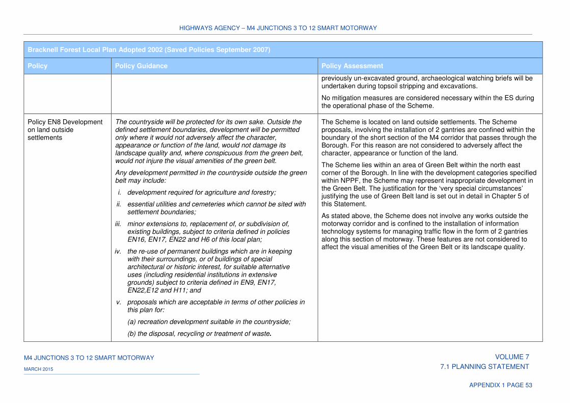
HIGHWAYS AGENCY – M4 JUNCTIONS 3 TO 12 SMART MOTORWAY
M4 JUNCTIONS 3 TO 12 SMART MOTORWAY VOLUME 7
7.1 PLANNING STATEMENT MARCH 2015
APPENDIX 1 PAGE 53
Bracknell Forest Local Plan Adopted 2002 (Saved Policies September 2007)
Policy Policy Guidance Policy Assessment
previously un-excavated ground, archaeological watching briefs will be undertaken during topsoil stripping and excavations.
No mitigation measures are considered necessary within the ES during the operational phase of the Scheme.
Policy EN8 Development on land outside settlements
The countryside will be protected for its own sake. Outside the defined settlement boundaries, development will be permitted only where it would not adversely affect the character, appearance or function of the land, would not damage its landscape quality and, where conspicuous from the green belt, would not injure the visual amenities of the green belt.
Any development permitted in the countryside outside the green belt may include:
i. development required for agriculture and forestry;
ii. essential utilities and cemeteries which cannot be sited with settlement boundaries;
iii. minor extensions to, replacement of, or subdivision of, existing buildings, subject to criteria defined in policies EN16, EN17, EN22 and H6 of this local plan;
iv. the re-use of permanent buildings which are in keeping with their surroundings, or of buildings of special architectural or historic interest, for suitable alternative uses (including residential institutions in extensive grounds) subject to criteria defined in EN9, EN17, EN22,E12 and H11; and
v. proposals which are acceptable in terms of other policies in this plan for:
(a) recreation development suitable in the countryside;
(b) the disposal, recycling or treatment of waste.
The Scheme is located on land outside settlements. The Scheme proposals, involving the installation of 2 gantries are confined within the boundary of the short section of the M4 corridor that passes through the Borough. For this reason are not considered to adversely affect the character, appearance or function of the land.
The Scheme lies within an area of Green Belt within the north east corner of the Borough. In line with the development categories specified within NPPF, the Scheme may represent inappropriate development in the Green Belt. The justification for the ‘very special circumstances’ justifying the use of Green Belt land is set out in detail in Chapter 5 of this Statement.
As stated above, the Scheme does not involve any works outside the motorway corridor and is confined to the installation of information technology systems for managing traffic flow in the form of 2 gantries along this section of motorway. These features are not considered to affect the visual amenities of the Green Belt or its landscape quality.
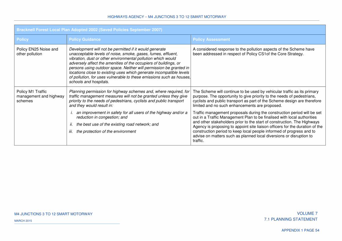
HIGHWAYS AGENCY – M4 JUNCTIONS 3 TO 12 SMART MOTORWAY
M4 JUNCTIONS 3 TO 12 SMART MOTORWAY VOLUME 7
7.1 PLANNING STATEMENT MARCH 2015
APPENDIX 1 PAGE 54
Bracknell Forest Local Plan Adopted 2002 (Saved Policies September 2007)
Policy Policy Guidance Policy Assessment
Policy EN25 Noise and other pollution
Development will not be permitted if it would generate unacceptable levels of noise, smoke, gases, fumes, effluent, vibration, dust or other environmental pollution which would adversely affect the amenities of the occupiers of buildings, or persons using outdoor space. Neither will permission be granted in locations close to existing uses which generate incompatible levels of pollution, for uses vulnerable to these emissions such as houses, schools and hospitals.
A considered response to the pollution aspects of the Scheme have been addressed in respect of Policy CS1of the Core Strategy.
Policy M1 Traffic management and highway schemes
Planning permission for highway schemes and, where required, for traffic management measures will not be granted unless they give priority to the needs of pedestrians, cyclists and public transport and they would result in:
i. an improvement in safety for all users of the highway and/or a reduction in congestion; and
ii. the best use of the existing road network; and
iii. the protection of the environment
The Scheme will continue to be used by vehicular traffic as its primary purpose. The opportunity to give priority to the needs of pedestrians, cyclists and public transport as part of the Scheme design are therefore limited and no such enhancements are proposed.
Traffic management proposals during the construction period will be set out in a Traffic Management Plan to be finalised with local authorities and other stakeholders prior to the start of construction. The Highways Agency is proposing to appoint site liaison officers for the duration of the construction period to keep local people informed of progress and to advise on matters such as planned local diversions or disruption to traffic.
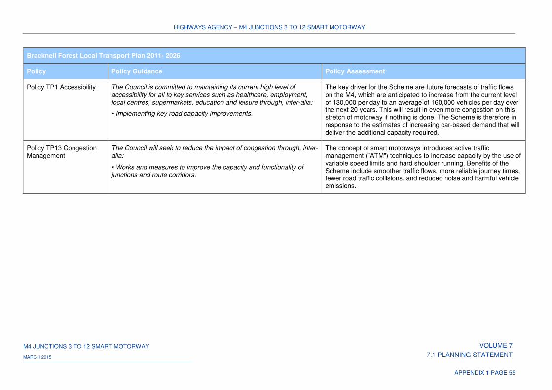
HIGHWAYS AGENCY – M4 JUNCTIONS 3 TO 12 SMART MOTORWAY
M4 JUNCTIONS 3 TO 12 SMART MOTORWAY VOLUME 7
7.1 PLANNING STATEMENT MARCH 2015
APPENDIX 1 PAGE 55
Bracknell Forest Local Transport Plan 2011- 2026
Policy Policy Guidance Policy Assessment
Policy TP1 Accessibility The Council is committed to maintaining its current high level of accessibility for all to key services such as healthcare, employment, local centres, supermarkets, education and leisure through, inter-alia:
• Implementing key road capacity improvements.
The key driver for the Scheme are future forecasts of traffic flows on the M4, which are anticipated to increase from the current level of 130,000 per day to an average of 160,000 vehicles per day over the next 20 years. This will result in even more congestion on this stretch of motorway if nothing is done. The Scheme is therefore in response to the estimates of increasing car-based demand that will deliver the additional capacity required.
Policy TP13 Congestion Management
The Council will seek to reduce the impact of congestion through, inter-alia:
• Works and measures to improve the capacity and functionality of junctions and route corridors.
The concept of smart motorways introduces active traffic management ("ATM") techniques to increase capacity by the use of variable speed limits and hard shoulder running. Benefits of the Scheme include smoother traffic flows, more reliable journey times, fewer road traffic collisions, and reduced noise and harmful vehicle emissions.
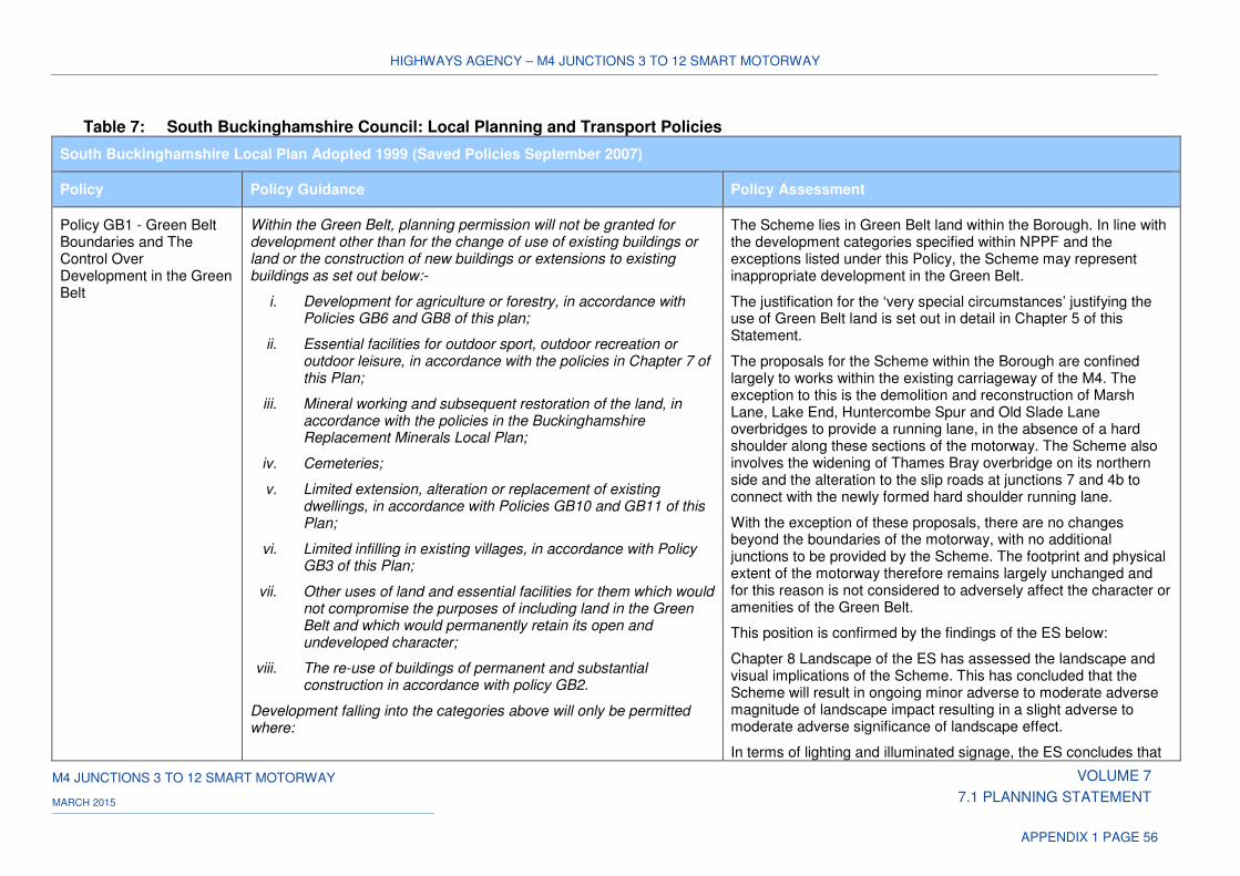
HIGHWAYS AGENCY – M4 JUNCTIONS 3 TO 12 SMART MOTORWAY
M4 JUNCTIONS 3 TO 12 SMART MOTORWAY VOLUME 7
7.1 PLANNING STATEMENT MARCH 2015
APPENDIX 1 PAGE 56
Table 7: South Buckinghamshire Council: Local Planning and Transport Policies
South Buckinghamshire Local Plan Adopted 1999 (Saved Policies September 2007)
Policy Policy Guidance Policy Assessment
Policy GB1 - Green Belt Boundaries and The Control Over Development in the Green Belt
Within the Green Belt, planning permission will not be granted for development other than for the change of use of existing buildings or land or the construction of new buildings or extensions to existing buildings as set out below:-
i. Development for agriculture or forestry, in accordance with Policies GB6 and GB8 of this plan;
ii. Essential facilities for outdoor sport, outdoor recreation or outdoor leisure, in accordance with the policies in Chapter 7 of this Plan;
iii. Mineral working and subsequent restoration of the land, in accordance with the policies in the Buckinghamshire Replacement Minerals Local Plan;
iv. Cemeteries;
v. Limited extension, alteration or replacement of existing dwellings, in accordance with Policies GB10 and GB11 of this Plan;
vi. Limited infilling in existing villages, in accordance with Policy GB3 of this Plan;
vii. Other uses of land and essential facilities for them which would not compromise the purposes of including land in the Green Belt and which would permanently retain its open and undeveloped character;
viii. The re-use of buildings of permanent and substantial construction in accordance with policy GB2.
Development falling into the categories above will only be permitted where:
The Scheme lies in Green Belt land within the Borough. In line with the development categories specified within NPPF and the exceptions listed under this Policy, the Scheme may represent inappropriate development in the Green Belt.
The justification for the ‘very special circumstances’ justifying the use of Green Belt land is set out in detail in Chapter 5 of this Statement.
The proposals for the Scheme within the Borough are confined largely to works within the existing carriageway of the M4. The exception to this is the demolition and reconstruction of Marsh Lane, Lake End, Huntercombe Spur and Old Slade Lane overbridges to provide a running lane, in the absence of a hard shoulder along these sections of the motorway. The Scheme also involves the widening of Thames Bray overbridge on its northern side and the alteration to the slip roads at junctions 7 and 4b to connect with the newly formed hard shoulder running lane.
With the exception of these proposals, there are no changes beyond the boundaries of the motorway, with no additional junctions to be provided by the Scheme. The footprint and physical extent of the motorway therefore remains largely unchanged and for this reason is not considered to adversely affect the character or amenities of the Green Belt.
This position is confirmed by the findings of the ES below:
Chapter 8 Landscape of the ES has assessed the landscape and visual implications of the Scheme. This has concluded that the Scheme will result in ongoing minor adverse to moderate adverse magnitude of landscape impact resulting in a slight adverse to moderate adverse significance of landscape effect.
In terms of lighting and illuminated signage, the ES concludes that
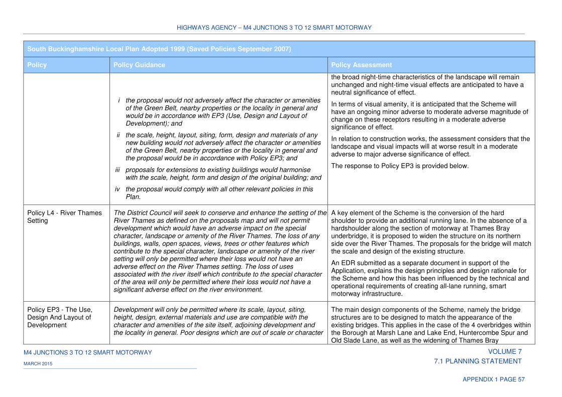
HIGHWAYS AGENCY – M4 JUNCTIONS 3 TO 12 SMART MOTORWAY
M4 JUNCTIONS 3 TO 12 SMART MOTORWAY VOLUME 7
7.1 PLANNING STATEMENT MARCH 2015
APPENDIX 1 PAGE 57
South Buckinghamshire Local Plan Adopted 1999 (Saved Policies September 2007)
Policy Policy Guidance Policy Assessment
i the proposal would not adversely affect the character or amenities of the Green Belt, nearby properties or the locality in general and would be in accordance with EP3 (Use, Design and Layout of Development); and
ii the scale, height, layout, siting, form, design and materials of any new building would not adversely affect the character or amenities of the Green Belt, nearby properties or the locality in general and the proposal would be in accordance with Policy EP3; and
iii proposals for extensions to existing buildings would harmonise with the scale, height, form and design of the original building; and
iv the proposal would comply with all other relevant policies in this Plan.
the broad night-time characteristics of the landscape will remain unchanged and night-time visual effects are anticipated to have a neutral significance of effect.
In terms of visual amenity, it is anticipated that the Scheme will have an ongoing minor adverse to moderate adverse magnitude of change on these receptors resulting in a moderate adverse significance of effect.
In relation to construction works, the assessment considers that the landscape and visual impacts will at worse result in a moderate adverse to major adverse significance of effect.
The response to Policy EP3 is provided below.
Policy L4 - River Thames Setting
The District Council will seek to conserve and enhance the setting of the River Thames as defined on the proposals map and will not permit development which would have an adverse impact on the special character, landscape or amenity of the River Thames. The loss of any buildings, walls, open spaces, views, trees or other features which contribute to the special character, landscape or amenity of the river setting will only be permitted where their loss would not have an adverse effect on the River Thames setting. The loss of uses associated with the river itself which contribute to the special character of the area will only be permitted where their loss would not have a significant adverse effect on the river environment.
A key element of the Scheme is the conversion of the hard shoulder to provide an additional running lane. In the absence of a hardshoulder along the section of motorway at Thames Bray underbridge, it is proposed to widen the structure on its northern side over the River Thames. The proposals for the bridge will match the scale and design of the existing structure.
An EDR submitted as a separate document in support of the Application, explains the design principles and design rationale for the Scheme and how this has been influenced by the technical and operational requirements of creating all-lane running, smart motorway infrastructure.
Policy EP3 - The Use, Design And Layout of Development
Development will only be permitted where its scale, layout, siting, height, design, external materials and use are compatible with the character and amenities of the site itself, adjoining development and the locality in general. Poor designs which are out of scale or character
The main design components of the Scheme, namely the bridge structures are to be designed to match the appearance of the existing bridges. This applies in the case of the 4 overbridges within the Borough at Marsh Lane and Lake End, Huntercombe Spur and Old Slade Lane, as well as the widening of Thames Bray
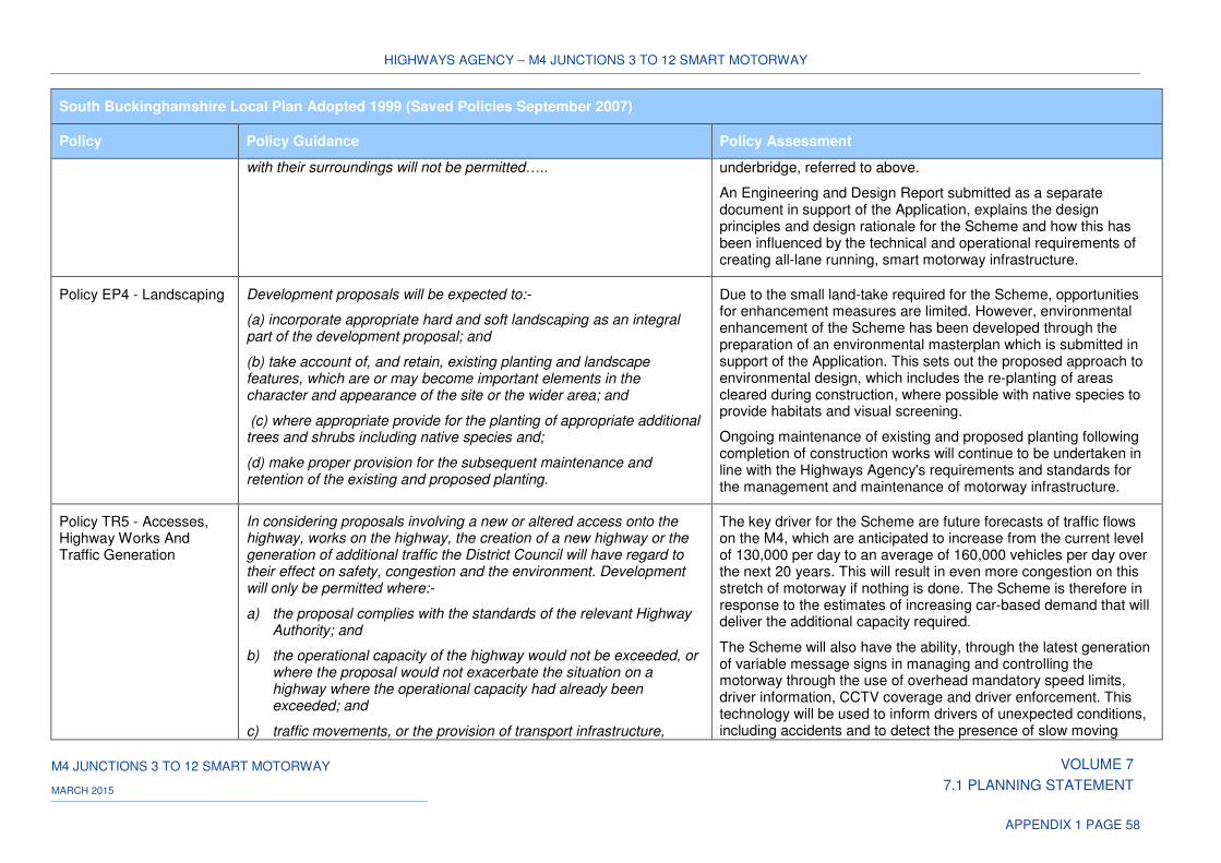
HIGHWAYS AGENCY – M4 JUNCTIONS 3 TO 12 SMART MOTORWAY
M4 JUNCTIONS 3 TO 12 SMART MOTORWAY VOLUME 7
7.1 PLANNING STATEMENT MARCH 2015
APPENDIX 1 PAGE 58
South Buckinghamshire Local Plan Adopted 1999 (Saved Policies September 2007)
Policy Policy Guidance Policy Assessment
with their surroundings will not be permitted….. underbridge, referred to above.
An Engineering and Design Report submitted as a separate document in support of the Application, explains the design principles and design rationale for the Scheme and how this has been influenced by the technical and operational requirements of creating all-lane running, smart motorway infrastructure.
Policy EP4 - Landscaping Development proposals will be expected to:-
(a) incorporate appropriate hard and soft landscaping as an integral part of the development proposal; and
(b) take account of, and retain, existing planting and landscape features, which are or may become important elements in the character and appearance of the site or the wider area; and
(c) where appropriate provide for the planting of appropriate additional trees and shrubs including native species and;
(d) make proper provision for the subsequent maintenance and retention of the existing and proposed planting.
Due to the small land-take required for the Scheme, opportunities for enhancement measures are limited. However, environmental enhancement of the Scheme has been developed through the preparation of an environmental masterplan which is submitted in support of the Application. This sets out the proposed approach to environmental design, which includes the re-planting of areas cleared during construction, where possible with native species to provide habitats and visual screening.
Ongoing maintenance of existing and proposed planting following completion of construction works will continue to be undertaken in line with the Highways Agency's requirements and standards for the management and maintenance of motorway infrastructure.
Policy TR5 - Accesses, Highway Works And Traffic Generation
In considering proposals involving a new or altered access onto the highway, works on the highway, the creation of a new highway or the generation of additional traffic the District Council will have regard to their effect on safety, congestion and the environment. Development will only be permitted where:-
a) the proposal complies with the standards of the relevant Highway Authority; and
b) the operational capacity of the highway would not be exceeded, or where the proposal would not exacerbate the situation on a highway where the operational capacity had already been exceeded; and
c) traffic movements, or the provision of transport infrastructure,
The key driver for the Scheme are future forecasts of traffic flows on the M4, which are anticipated to increase from the current level of 130,000 per day to an average of 160,000 vehicles per day over the next 20 years. This will result in even more congestion on this stretch of motorway if nothing is done. The Scheme is therefore in response to the estimates of increasing car-based demand that will deliver the additional capacity required.
The Scheme will also have the ability, through the latest generation of variable message signs in managing and controlling the motorway through the use of overhead mandatory speed limits, driver information, CCTV coverage and driver enforcement. This technology will be used to inform drivers of unexpected conditions, including accidents and to detect the presence of slow moving
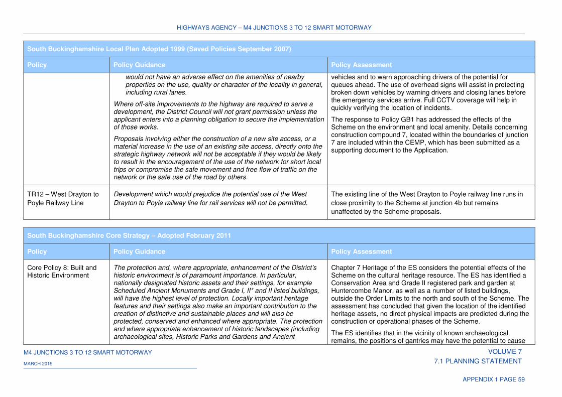
HIGHWAYS AGENCY – M4 JUNCTIONS 3 TO 12 SMART MOTORWAY
M4 JUNCTIONS 3 TO 12 SMART MOTORWAY VOLUME 7
7.1 PLANNING STATEMENT MARCH 2015
APPENDIX 1 PAGE 59
South Buckinghamshire Local Plan Adopted 1999 (Saved Policies September 2007)
Policy Policy Guidance Policy Assessment
would not have an adverse effect on the amenities of nearby properties on the use, quality or character of the locality in general, including rural lanes.
Where off-site improvements to the highway are required to serve a development, the District Council will not grant permission unless the applicant enters into a planning obligation to secure the implementation of those works.
Proposals involving either the construction of a new site access, or a material increase in the use of an existing site access, directly onto the strategic highway network will not be acceptable if they would be likely to result in the encouragement of the use of the network for short local trips or compromise the safe movement and free flow of traffic on the network or the safe use of the road by others.
vehicles and to warn approaching drivers of the potential for queues ahead. The use of overhead signs will assist in protecting broken down vehicles by warning drivers and closing lanes before the emergency services arrive. Full CCTV coverage will help in quickly verifying the location of incidents.
The response to Policy GB1 has addressed the effects of the Scheme on the environment and local amenity. Details concerning construction compound 7, located within the boundaries of junction 7 are included within the CEMP, which has been submitted as a supporting document to the Application.
TR12 – West Drayton to
Poyle Railway Line
Development which would prejudice the potential use of the West
Drayton to Poyle railway line for rail services will not be permitted.
The existing line of the West Drayton to Poyle railway line runs in
close proximity to the Scheme at junction 4b but remains
unaffected by the Scheme proposals.
South Buckinghamshire Core Strategy – Adopted February 2011
Policy Policy Guidance Policy Assessment
Core Policy 8: Built and Historic Environment
The protection and, where appropriate, enhancement of the District’s historic environment is of paramount importance. In particular, nationally designated historic assets and their settings, for example Scheduled Ancient Monuments and Grade I, II* and II listed buildings, will have the highest level of protection. Locally important heritage features and their settings also make an important contribution to the creation of distinctive and sustainable places and will also be protected, conserved and enhanced where appropriate. The protection and where appropriate enhancement of historic landscapes (including archaeological sites, Historic Parks and Gardens and Ancient
Chapter 7 Heritage of the ES considers the potential effects of the Scheme on the cultural heritage resource. The ES has identified a Conservation Area and Grade II registered park and garden at Huntercombe Manor, as well as a number of listed buildings, outside the Order Limits to the north and south of the Scheme. The assessment has concluded that given the location of the identified heritage assets, no direct physical impacts are predicted during the construction or operational phases of the Scheme.
The ES identifies that in the vicinity of known archaeological remains, the positions of gantries may have the potential to cause
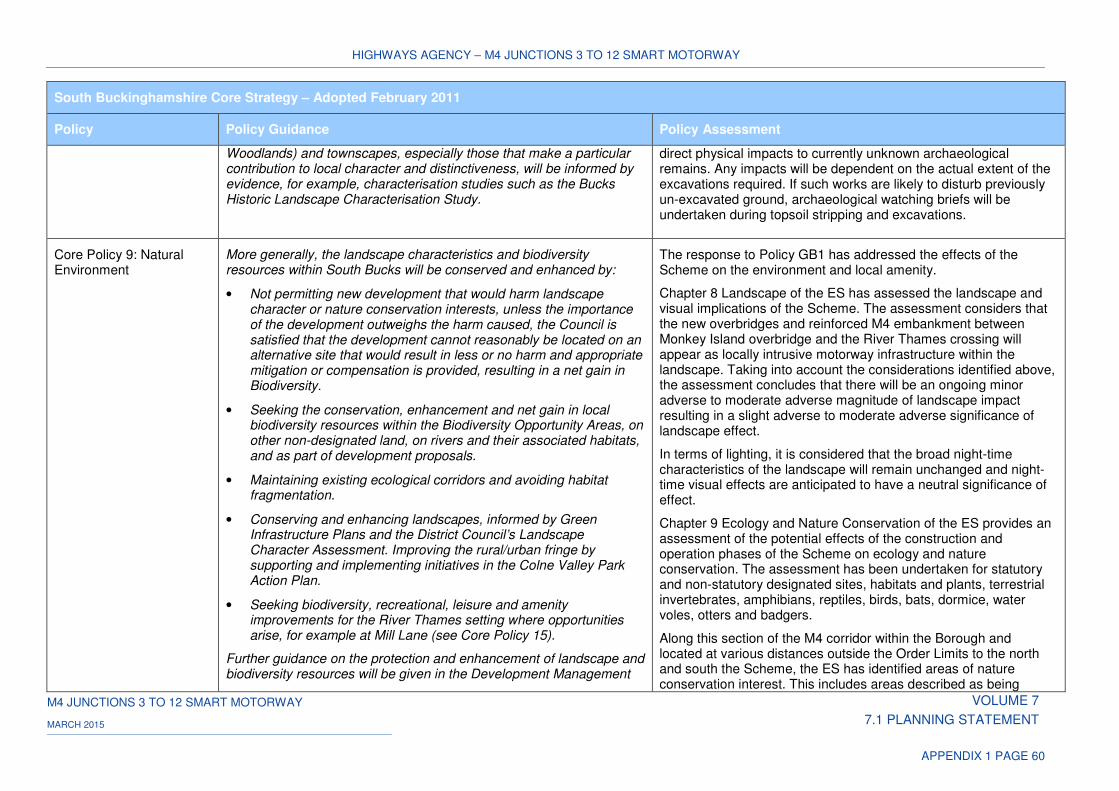
HIGHWAYS AGENCY – M4 JUNCTIONS 3 TO 12 SMART MOTORWAY
M4 JUNCTIONS 3 TO 12 SMART MOTORWAY VOLUME 7
7.1 PLANNING STATEMENT MARCH 2015
APPENDIX 1 PAGE 60
South Buckinghamshire Core Strategy – Adopted February 2011
Policy Policy Guidance Policy Assessment
Woodlands) and townscapes, especially those that make a particular contribution to local character and distinctiveness, will be informed by evidence, for example, characterisation studies such as the Bucks Historic Landscape Characterisation Study.
direct physical impacts to currently unknown archaeological remains. Any impacts will be dependent on the actual extent of the excavations required. If such works are likely to disturb previously un-excavated ground, archaeological watching briefs will be undertaken during topsoil stripping and excavations.
Core Policy 9: Natural Environment
More generally, the landscape characteristics and biodiversity resources within South Bucks will be conserved and enhanced by:
• Not permitting new development that would harm landscape character or nature conservation interests, unless the importance of the development outweighs the harm caused, the Council is satisfied that the development cannot reasonably be located on an alternative site that would result in less or no harm and appropriate mitigation or compensation is provided, resulting in a net gain in Biodiversity.
• Seeking the conservation, enhancement and net gain in local biodiversity resources within the Biodiversity Opportunity Areas, on other non-designated land, on rivers and their associated habitats, and as part of development proposals.
• Maintaining existing ecological corridors and avoiding habitat fragmentation.
• Conserving and enhancing landscapes, informed by Green Infrastructure Plans and the District Council’s Landscape Character Assessment. Improving the rural/urban fringe by supporting and implementing initiatives in the Colne Valley Park Action Plan.
• Seeking biodiversity, recreational, leisure and amenity improvements for the River Thames setting where opportunities arise, for example at Mill Lane (see Core Policy 15).
Further guidance on the protection and enhancement of landscape and biodiversity resources will be given in the Development Management
The response to Policy GB1 has addressed the effects of the Scheme on the environment and local amenity.
Chapter 8 Landscape of the ES has assessed the landscape and visual implications of the Scheme. The assessment considers that the new overbridges and reinforced M4 embankment between Monkey Island overbridge and the River Thames crossing will appear as locally intrusive motorway infrastructure within the landscape. Taking into account the considerations identified above, the assessment concludes that there will be an ongoing minor adverse to moderate adverse magnitude of landscape impact resulting in a slight adverse to moderate adverse significance of landscape effect.
In terms of lighting, it is considered that the broad night-time characteristics of the landscape will remain unchanged and night-time visual effects are anticipated to have a neutral significance of effect.
Chapter 9 Ecology and Nature Conservation of the ES provides an assessment of the potential effects of the construction and operation phases of the Scheme on ecology and nature conservation. The assessment has been undertaken for statutory and non-statutory designated sites, habitats and plants, terrestrial invertebrates, amphibians, reptiles, birds, bats, dormice, water voles, otters and badgers.
Along this section of the M4 corridor within the Borough and located at various distances outside the Order Limits to the north and south the Scheme, the ES has identified areas of nature conservation interest. This includes areas described as being
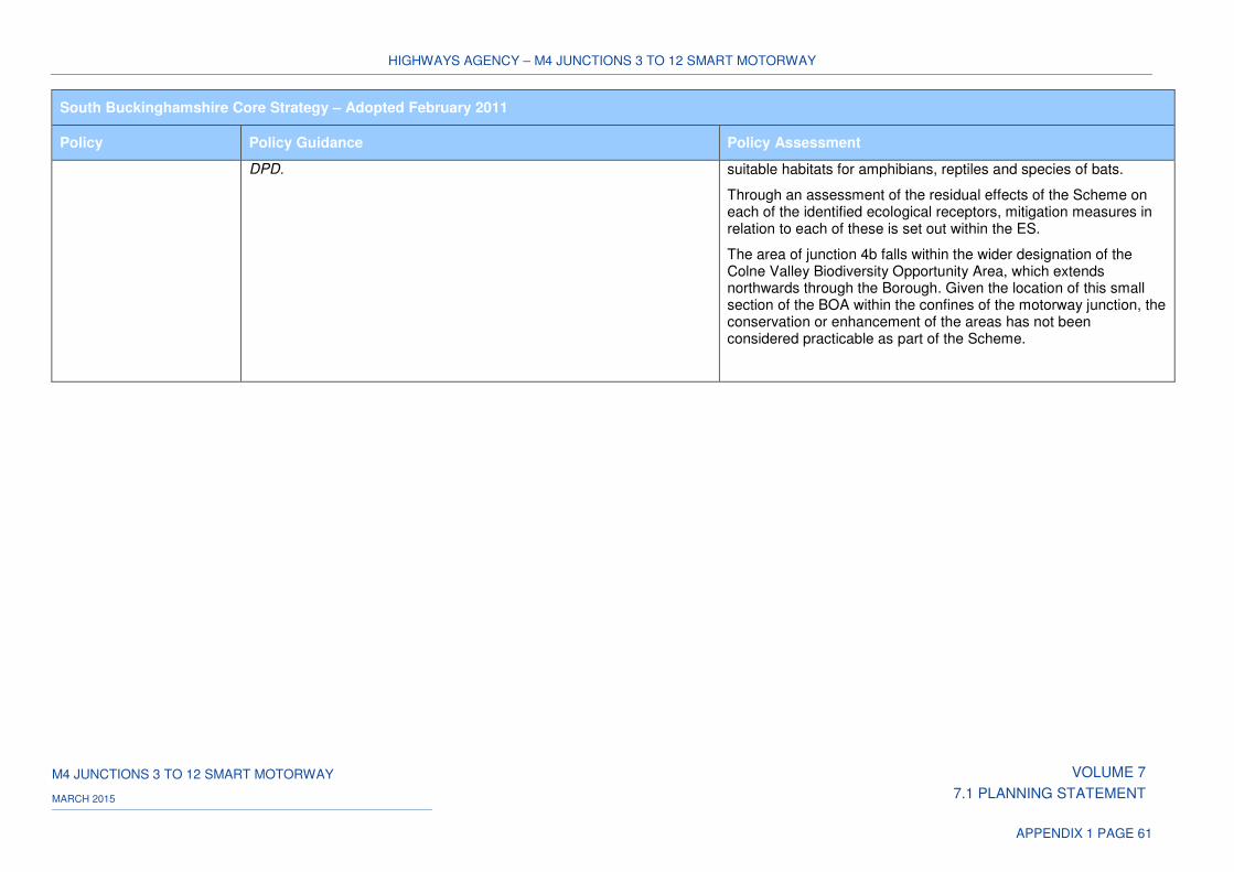
HIGHWAYS AGENCY – M4 JUNCTIONS 3 TO 12 SMART MOTORWAY
M4 JUNCTIONS 3 TO 12 SMART MOTORWAY VOLUME 7
7.1 PLANNING STATEMENT MARCH 2015
APPENDIX 1 PAGE 61
South Buckinghamshire Core Strategy – Adopted February 2011
Policy Policy Guidance Policy Assessment
DPD. suitable habitats for amphibians, reptiles and species of bats.
Through an assessment of the residual effects of the Scheme on each of the identified ecological receptors, mitigation measures in relation to each of these is set out within the ES.
The area of junction 4b falls within the wider designation of the Colne Valley Biodiversity Opportunity Area, which extends northwards through the Borough. Given the location of this small section of the BOA within the confines of the motorway junction, the conservation or enhancement of the areas has not been considered practicable as part of the Scheme.
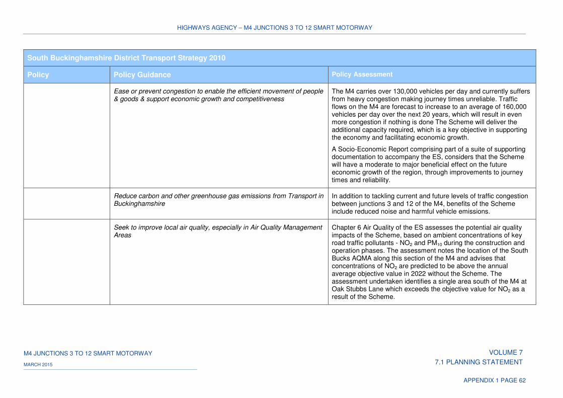
HIGHWAYS AGENCY – M4 JUNCTIONS 3 TO 12 SMART MOTORWAY
M4 JUNCTIONS 3 TO 12 SMART MOTORWAY VOLUME 7
7.1 PLANNING STATEMENT MARCH 2015
APPENDIX 1 PAGE 62
South Buckinghamshire District Transport Strategy 2010
Policy Policy Guidance Policy Assessment
Ease or prevent congestion to enable the efficient movement of people & goods & support economic growth and competitiveness
The M4 carries over 130,000 vehicles per day and currently suffers from heavy congestion making journey times unreliable. Traffic flows on the M4 are forecast to increase to an average of 160,000 vehicles per day over the next 20 years, which will result in even more congestion if nothing is done The Scheme will deliver the additional capacity required, which is a key objective in supporting the economy and facilitating economic growth.
A Socio-Economic Report comprising part of a suite of supporting documentation to accompany the ES, considers that the Scheme will have a moderate to major beneficial effect on the future economic growth of the region, through improvements to journey times and reliability.
Reduce carbon and other greenhouse gas emissions from Transport in Buckinghamshire
In addition to tackling current and future levels of traffic congestion between junctions 3 and 12 of the M4, benefits of the Scheme include reduced noise and harmful vehicle emissions.
Seek to improve local air quality, especially in Air Quality Management Areas
Chapter 6 Air Quality of the ES assesses the potential air quality impacts of the Scheme, based on ambient concentrations of key road traffic pollutants - NO2 and PM10 during the construction and operation phases. The assessment notes the location of the South Bucks AQMA along this section of the M4 and advises that concentrations of NO2 are predicted to be above the annual average objective value in 2022 without the Scheme. The assessment undertaken identifies a single area south of the M4 at Oak Stubbs Lane which exceeds the objective value for NO2 as a result of the Scheme.
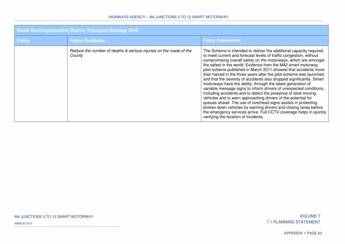
HIGHWAYS AGENCY – M4 JUNCTIONS 3 TO 12 SMART MOTORWAY
M4 JUNCTIONS 3 TO 12 SMART MOTORWAY VOLUME 7
7.1 PLANNING STATEMENT MARCH 2015
APPENDIX 1 PAGE 63
South Buckinghamshire District Transport Strategy 2010
Policy Policy Guidance Policy Assessment
Reduce the number of deaths & serious injuries on the roads of the County
The Scheme is intended to deliver the additional capacity required to meet current and forecast levels of traffic congestion, without compromising overall safety on the motorways, which are amongst the safest in the world. Evidence from the M42 smart motorway pilot scheme published in March 2011 showed that accidents more than halved in the three years after the pilot scheme was launched and that the severity of accidents also dropped significantly. Smart motorways have the ability, through the latest generation of variable message signs to inform drivers of unexpected conditions, including accidents and to detect the presence of slow moving vehicles and to warn approaching drivers of the potential for queues ahead. The use of overhead signs assists in protecting broken down vehicles by warning drivers and closing lanes before the emergency services arrive. Full CCTV coverage helps in quickly verifying the location of incidents.
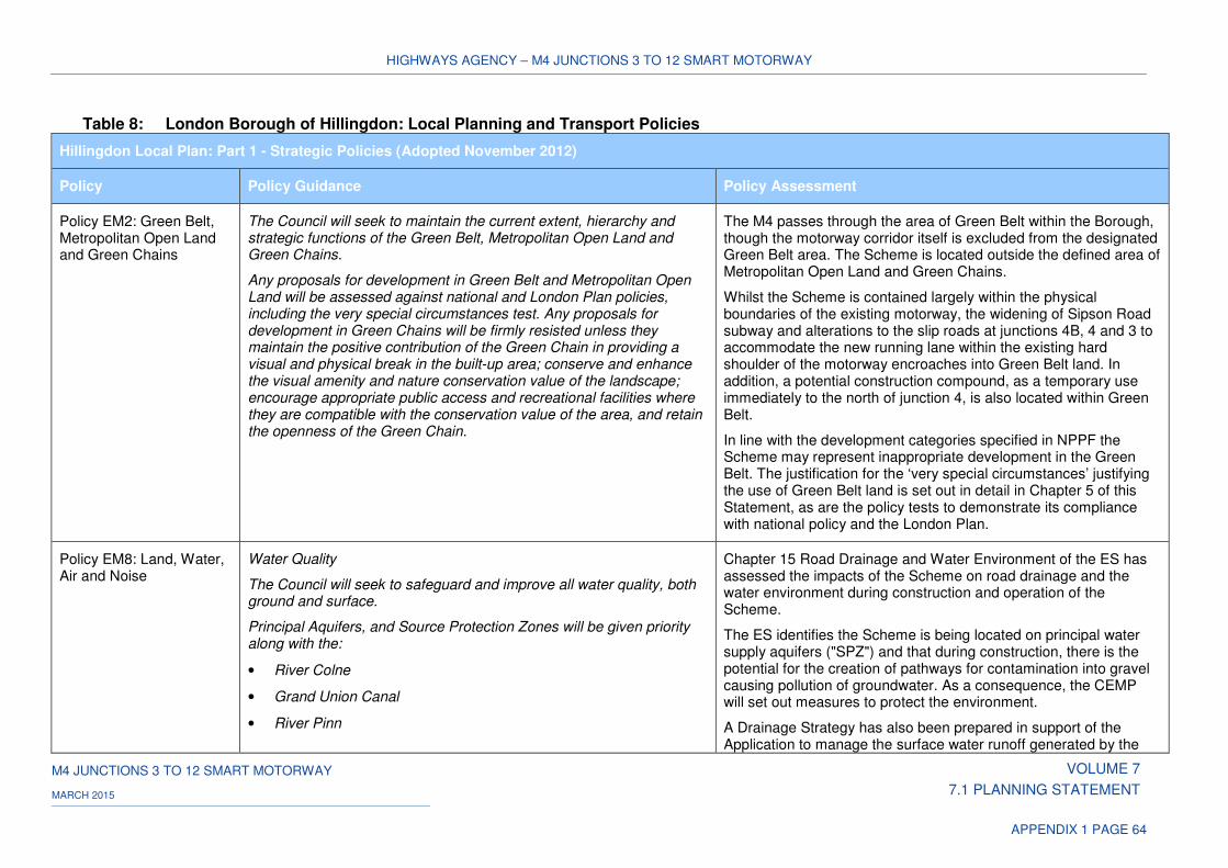
HIGHWAYS AGENCY – M4 JUNCTIONS 3 TO 12 SMART MOTORWAY
M4 JUNCTIONS 3 TO 12 SMART MOTORWAY VOLUME 7
7.1 PLANNING STATEMENT MARCH 2015
APPENDIX 1 PAGE 64
Table 8: London Borough of Hillingdon: Local Planning and Transport Policies
Hillingdon Local Plan: Part 1 - Strategic Policies (Adopted November 2012)
Policy Policy Guidance Policy Assessment
Policy EM2: Green Belt, Metropolitan Open Land and Green Chains
The Council will seek to maintain the current extent, hierarchy and strategic functions of the Green Belt, Metropolitan Open Land and Green Chains.
Any proposals for development in Green Belt and Metropolitan Open Land will be assessed against national and London Plan policies, including the very special circumstances test. Any proposals for development in Green Chains will be firmly resisted unless they maintain the positive contribution of the Green Chain in providing a visual and physical break in the built-up area; conserve and enhance the visual amenity and nature conservation value of the landscape; encourage appropriate public access and recreational facilities where they are compatible with the conservation value of the area, and retain the openness of the Green Chain.
The M4 passes through the area of Green Belt within the Borough, though the motorway corridor itself is excluded from the designated Green Belt area. The Scheme is located outside the defined area of Metropolitan Open Land and Green Chains.
Whilst the Scheme is contained largely within the physical boundaries of the existing motorway, the widening of Sipson Road subway and alterations to the slip roads at junctions 4B, 4 and 3 to accommodate the new running lane within the existing hard shoulder of the motorway encroaches into Green Belt land. In addition, a potential construction compound, as a temporary use immediately to the north of junction 4, is also located within Green Belt.
In line with the development categories specified in NPPF the Scheme may represent inappropriate development in the Green Belt. The justification for the ‘very special circumstances’ justifying the use of Green Belt land is set out in detail in Chapter 5 of this Statement, as are the policy tests to demonstrate its compliance with national policy and the London Plan.
Policy EM8: Land, Water, Air and Noise
Water Quality
The Council will seek to safeguard and improve all water quality, both ground and surface.
Principal Aquifers, and Source Protection Zones will be given priority along with the:
• River Colne
• Grand Union Canal
• River Pinn
Chapter 15 Road Drainage and Water Environment of the ES has assessed the impacts of the Scheme on road drainage and the water environment during construction and operation of the Scheme.
The ES identifies the Scheme is being located on principal water supply aquifers ("SPZ") and that during construction, there is the potential for the creation of pathways for contamination into gravel causing pollution of groundwater. As a consequence, the CEMP will set out measures to protect the environment.
A Drainage Strategy has also been prepared in support of the Application to manage the surface water runoff generated by the
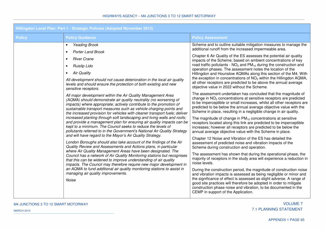
HIGHWAYS AGENCY – M4 JUNCTIONS 3 TO 12 SMART MOTORWAY
M4 JUNCTIONS 3 TO 12 SMART MOTORWAY VOLUME 7
7.1 PLANNING STATEMENT MARCH 2015
APPENDIX 1 PAGE 65
Hillingdon Local Plan: Part 1 - Strategic Policies (Adopted November 2012)
Policy Policy Guidance Policy Assessment
• Yeading Brook
• Porter Land Brook
• River Crane
• Ruislip Lido
• Air Quality
All development should not cause deterioration in the local air quality levels and should ensure the protection of both existing and new sensitive receptors.
All major development within the Air Quality Management Area (AQMA) should demonstrate air quality neutrality (no worsening of impacts) where appropriate; actively contribute to the promotion of sustainable transport measures such as vehicle charging points and the increased provision for vehicles with cleaner transport fuels; deliver increased planting through soft landscaping and living walls and roofs; and provide a management plan for ensuring air quality impacts can be kept to a minimum. The Council seeks to reduce the levels of pollutants referred to in the Government’s National Air Quality Strategy and will have regard to the Mayor’s Air Quality Strategy.
London Boroughs should also take account of the findings of the Air Quality Review and Assessments and Actions plans, in particular where Air Quality Management Areas have been designated. The Council has a network of Air Quality Monitoring stations but recognises that this can be widened to improve understanding of air quality impacts. The Council may therefore require new major development in an AQMA to fund additional air quality monitoring stations to assist in managing air quality improvements.
Noise
Scheme and to outline suitable mitigation measures to manage the additional runoff from the increased impermeable area.
Chapter 6 Air Quality of the ES assesses the potential air quality impacts of the Scheme, based on ambient concentrations of key road traffic pollutants - NO2 and PM10 during the construction and operation phases. The assessment notes the location of the Hillingdon and Hounslow AQMAs along this section of the M4. With the exception in concentrations of NO2 within the Hillingdon AQMA, all other receptors are predicted to be above the annual average objective value in 2022 without the Scheme.
The assessment undertaken has concluded that the magnitude of change in NO2 concentrations at sensitive receptors are predicted to be imperceptible or small increases, whilst all other receptors are predicted to be below the annual average objective value with the Scheme in place, resulting in a negligible change in air quality.
The magnitude of change in PM10 concentrations at sensitive receptors located along this link are predicted to be imperceptible increases; however all receptors are predicted to be below the annual average objective value with the Scheme in place.
Chapter 12 Noise and Vibration of the ES has detailed the assessment of predicted noise and vibration impacts of the Scheme during construction and operation.
The assessment has shown that during the operational phase, the majority of receptors in the study area will experience a reduction in noise levels.
During the construction period, the magnitude of construction noise and vibration impacts is assessed as being negligible or minor and the significance of effect is assessed as slight adverse. A range of good site practices will therefore be adopted in order to mitigate construction phase noise and vibration, to be documented in the CEMP in support of the Application.
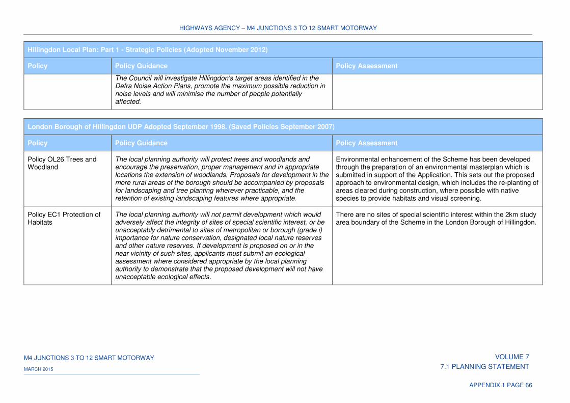
HIGHWAYS AGENCY – M4 JUNCTIONS 3 TO 12 SMART MOTORWAY
M4 JUNCTIONS 3 TO 12 SMART MOTORWAY VOLUME 7
7.1 PLANNING STATEMENT MARCH 2015
APPENDIX 1 PAGE 66
Hillingdon Local Plan: Part 1 - Strategic Policies (Adopted November 2012)
Policy Policy Guidance Policy Assessment
The Council will investigate Hillingdon's target areas identified in the Defra Noise Action Plans, promote the maximum possible reduction in noise levels and will minimise the number of people potentially affected.
London Borough of Hillingdon UDP Adopted September 1998. (Saved Policies September 2007)
Policy Policy Guidance Policy Assessment
Policy OL26 Trees and Woodland
The local planning authority will protect trees and woodlands and encourage the preservation, proper management and in appropriate locations the extension of woodlands. Proposals for development in the more rural areas of the borough should be accompanied by proposals for landscaping and tree planting wherever practicable, and the retention of existing landscaping features where appropriate.
Environmental enhancement of the Scheme has been developed through the preparation of an environmental masterplan which is submitted in support of the Application. This sets out the proposed approach to environmental design, which includes the re-planting of areas cleared during construction, where possible with native species to provide habitats and visual screening.
Policy EC1 Protection of Habitats
The local planning authority will not permit development which would adversely affect the integrity of sites of special scientific interest, or be unacceptably detrimental to sites of metropolitan or borough (grade i) importance for nature conservation, designated local nature reserves and other nature reserves. If development is proposed on or in the near vicinity of such sites, applicants must submit an ecological assessment where considered appropriate by the local planning authority to demonstrate that the proposed development will not have unacceptable ecological effects.
There are no sites of special scientific interest within the 2km study area boundary of the Scheme in the London Borough of Hillingdon.
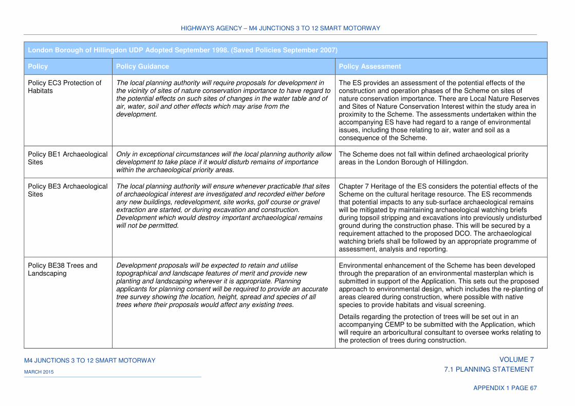
HIGHWAYS AGENCY – M4 JUNCTIONS 3 TO 12 SMART MOTORWAY
M4 JUNCTIONS 3 TO 12 SMART MOTORWAY VOLUME 7
7.1 PLANNING STATEMENT MARCH 2015
APPENDIX 1 PAGE 67
London Borough of Hillingdon UDP Adopted September 1998. (Saved Policies September 2007)
Policy Policy Guidance Policy Assessment
Policy EC3 Protection of Habitats
The local planning authority will require proposals for development in the vicinity of sites of nature conservation importance to have regard to the potential effects on such sites of changes in the water table and of air, water, soil and other effects which may arise from the development.
The ES provides an assessment of the potential effects of the construction and operation phases of the Scheme on sites of nature conservation importance. There are Local Nature Reserves and Sites of Nature Conservation Interest within the study area in proximity to the Scheme. The assessments undertaken within the accompanying ES have had regard to a range of environmental issues, including those relating to air, water and soil as a consequence of the Scheme.
Policy BE1 Archaeological Sites
Only in exceptional circumstances will the local planning authority allow development to take place if it would disturb remains of importance within the archaeological priority areas.
The Scheme does not fall within defined archaeological priority areas in the London Borough of Hillingdon.
Policy BE3 Archaeological Sites
The local planning authority will ensure whenever practicable that sites of archaeological interest are investigated and recorded either before any new buildings, redevelopment, site works, golf course or gravel extraction are started, or during excavation and construction. Development which would destroy important archaeological remains will not be permitted.
Chapter 7 Heritage of the ES considers the potential effects of the Scheme on the cultural heritage resource. The ES recommends that potential impacts to any sub-surface archaeological remains will be mitigated by maintaining archaeological watching briefs during topsoil stripping and excavations into previously undisturbed ground during the construction phase. This will be secured by a requirement attached to the proposed DCO. The archaeological watching briefs shall be followed by an appropriate programme of assessment, analysis and reporting.
Policy BE38 Trees and Landscaping
Development proposals will be expected to retain and utilise topographical and landscape features of merit and provide new planting and landscaping wherever it is appropriate. Planning applicants for planning consent will be required to provide an accurate tree survey showing the location, height, spread and species of all trees where their proposals would affect any existing trees.
Environmental enhancement of the Scheme has been developed through the preparation of an environmental masterplan which is submitted in support of the Application. This sets out the proposed approach to environmental design, which includes the re-planting of areas cleared during construction, where possible with native species to provide habitats and visual screening.
Details regarding the protection of trees will be set out in an accompanying CEMP to be submitted with the Application, which will require an arboricultural consultant to oversee works relating to the protection of trees during construction.
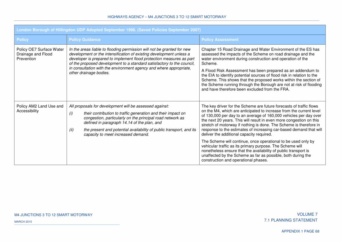
HIGHWAYS AGENCY – M4 JUNCTIONS 3 TO 12 SMART MOTORWAY
M4 JUNCTIONS 3 TO 12 SMART MOTORWAY VOLUME 7
7.1 PLANNING STATEMENT MARCH 2015
APPENDIX 1 PAGE 68
London Borough of Hillingdon UDP Adopted September 1998. (Saved Policies September 2007)
Policy Policy Guidance Policy Assessment
Policy OE7 Surface Water Drainage and Flood Prevention
In the areas liable to flooding permission will not be granted for new development or the intensification of existing development unless a developer is prepared to implement flood protection measures as part of the proposed development to a standard satisfactory to the council, in consultation with the environment agency and where appropriate, other drainage bodies.
Chapter 15 Road Drainage and Water Environment of the ES has assessed the impacts of the Scheme on road drainage and the water environment during construction and operation of the Scheme.
A Flood Risk Assessment has been prepared as an addendum to the EIA to identify potential sources of flood risk in relation to the Scheme. This shows that the proposed works within the section of the Scheme running through the Borough are not at risk of flooding and have therefore been excluded from the FRA.
Policy AM2 Land Use and Accessibility
All proposals for development will be assessed against:
(i) their contribution to traffic generation and their impact on congestion, particularly on the principal road network as defined in paragraph 14.14 of the plan, and
(ii) the present and potential availability of public transport, and its capacity to meet increased demand.
The key driver for the Scheme are future forecasts of traffic flows on the M4, which are anticipated to increase from the current level of 130,000 per day to an average of 160,000 vehicles per day over the next 20 years. This will result in even more congestion on this stretch of motorway if nothing is done. The Scheme is therefore in response to the estimates of increasing car-based demand that will deliver the additional capacity required.
The Scheme will continue, once operational to be used only by vehicular traffic as its primary purpose. The Scheme will nonetheless ensure that the availability of public transport is unaffected by the Scheme as far as possible, both during the construction and operational phases.
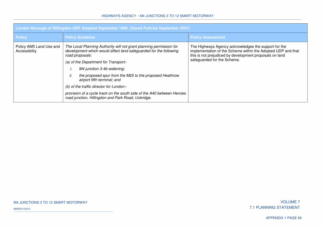
HIGHWAYS AGENCY – M4 JUNCTIONS 3 TO 12 SMART MOTORWAY
M4 JUNCTIONS 3 TO 12 SMART MOTORWAY VOLUME 7
7.1 PLANNING STATEMENT MARCH 2015
APPENDIX 1 PAGE 69
London Borough of Hillingdon UDP Adopted September 1998. (Saved Policies September 2007)
Policy Policy Guidance Policy Assessment
Policy AM5 Land Use and Accessibility
The Local Planning Authority will not grant planning permission for development which would affect land safeguarded for the following road proposals:
(a) of the Department for Transport:-
i. M4 junction 3-4b widening;
ii. the proposed spur from the M25 to the proposed Heathrow airport fifth terminal; and
(b) of the traffic director for London:-
provision of a cycle track on the south side of the A40 between Hercies road junction, Hillingdon and Park Road, Uxbridge.
The Highways Agency acknowledges the support for the implementation of the Scheme within the Adopted UDP and that this is not prejudiced by development proposals on land safeguarded for the Scheme.
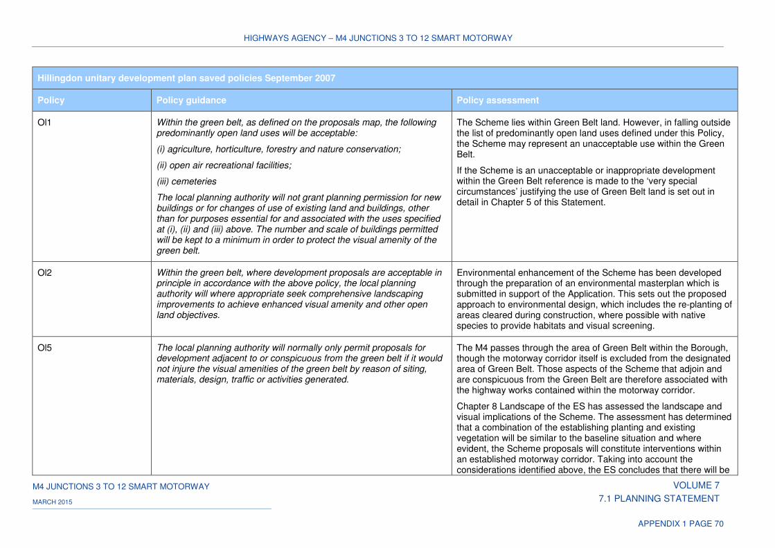
HIGHWAYS AGENCY – M4 JUNCTIONS 3 TO 12 SMART MOTORWAY
M4 JUNCTIONS 3 TO 12 SMART MOTORWAY VOLUME 7
7.1 PLANNING STATEMENT MARCH 2015
APPENDIX 1 PAGE 70
Hillingdon unitary development plan saved policies September 2007
Policy Policy guidance Policy assessment
Ol1 Within the green belt, as defined on the proposals map, the following predominantly open land uses will be acceptable:
(i) agriculture, horticulture, forestry and nature conservation;
(ii) open air recreational facilities;
(iii) cemeteries
The local planning authority will not grant planning permission for new buildings or for changes of use of existing land and buildings, other than for purposes essential for and associated with the uses specified at (i), (ii) and (iii) above. The number and scale of buildings permitted will be kept to a minimum in order to protect the visual amenity of the green belt.
The Scheme lies within Green Belt land. However, in falling outside the list of predominantly open land uses defined under this Policy, the Scheme may represent an unacceptable use within the Green Belt.
If the Scheme is an unacceptable or inappropriate development within the Green Belt reference is made to the ‘very special circumstances’ justifying the use of Green Belt land is set out in detail in Chapter 5 of this Statement.
Ol2 Within the green belt, where development proposals are acceptable in principle in accordance with the above policy, the local planning authority will where appropriate seek comprehensive landscaping improvements to achieve enhanced visual amenity and other open land objectives.
Environmental enhancement of the Scheme has been developed through the preparation of an environmental masterplan which is submitted in support of the Application. This sets out the proposed approach to environmental design, which includes the re-planting of areas cleared during construction, where possible with native species to provide habitats and visual screening.
Ol5 The local planning authority will normally only permit proposals for development adjacent to or conspicuous from the green belt if it would not injure the visual amenities of the green belt by reason of siting, materials, design, traffic or activities generated.
The M4 passes through the area of Green Belt within the Borough, though the motorway corridor itself is excluded from the designated area of Green Belt. Those aspects of the Scheme that adjoin and are conspicuous from the Green Belt are therefore associated with the highway works contained within the motorway corridor.
Chapter 8 Landscape of the ES has assessed the landscape and visual implications of the Scheme. The assessment has determined that a combination of the establishing planting and existing vegetation will be similar to the baseline situation and where evident, the Scheme proposals will constitute interventions within an established motorway corridor. Taking into account the considerations identified above, the ES concludes that there will be
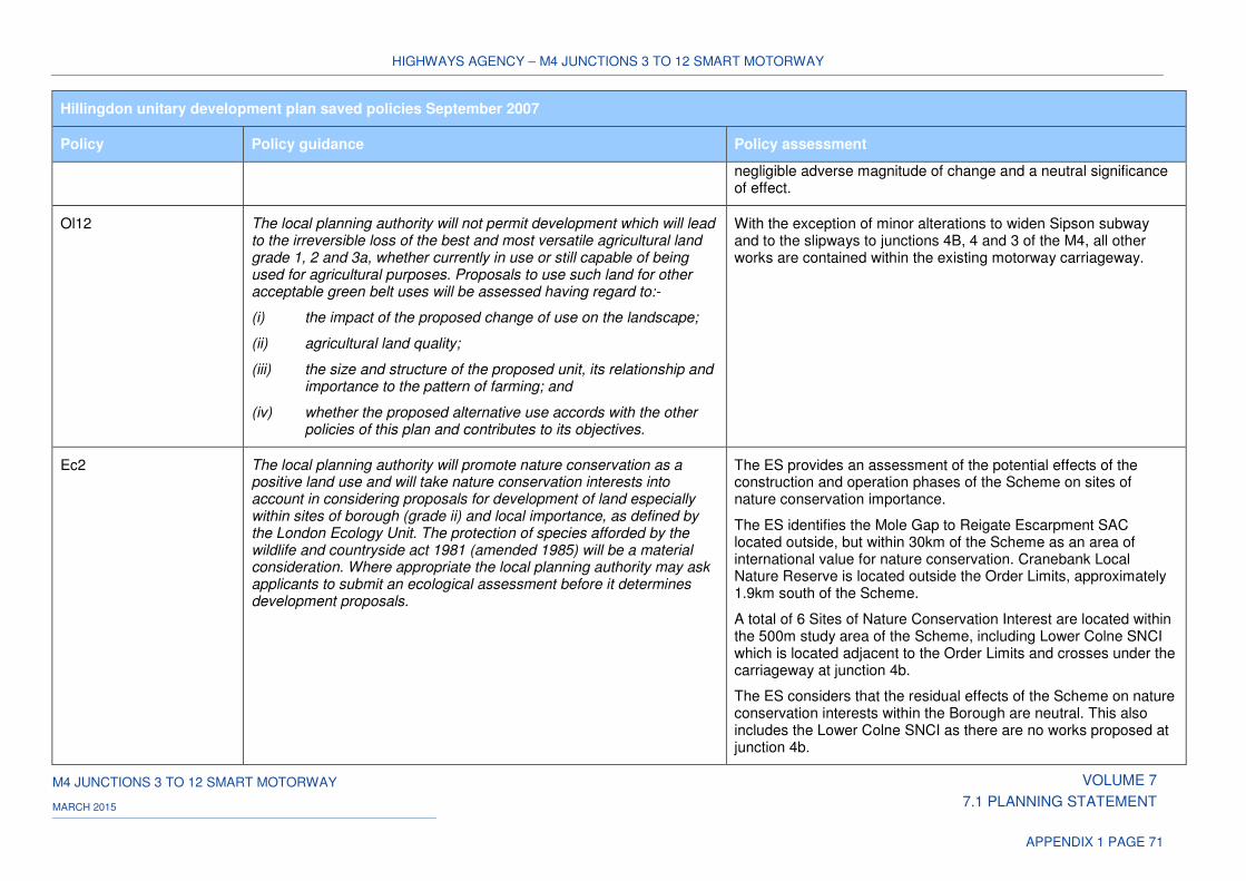
HIGHWAYS AGENCY – M4 JUNCTIONS 3 TO 12 SMART MOTORWAY
M4 JUNCTIONS 3 TO 12 SMART MOTORWAY VOLUME 7
7.1 PLANNING STATEMENT MARCH 2015
APPENDIX 1 PAGE 71
Hillingdon unitary development plan saved policies September 2007
Policy Policy guidance Policy assessment
negligible adverse magnitude of change and a neutral significance of effect.
Ol12 The local planning authority will not permit development which will lead to the irreversible loss of the best and most versatile agricultural land grade 1, 2 and 3a, whether currently in use or still capable of being used for agricultural purposes. Proposals to use such land for other acceptable green belt uses will be assessed having regard to:-
(i) the impact of the proposed change of use on the landscape;
(ii) agricultural land quality;
(iii) the size and structure of the proposed unit, its relationship and importance to the pattern of farming; and
(iv) whether the proposed alternative use accords with the other policies of this plan and contributes to its objectives.
With the exception of minor alterations to widen Sipson subway and to the slipways to junctions 4B, 4 and 3 of the M4, all other works are contained within the existing motorway carriageway.
Ec2 The local planning authority will promote nature conservation as a positive land use and will take nature conservation interests into account in considering proposals for development of land especially within sites of borough (grade ii) and local importance, as defined by the London Ecology Unit. The protection of species afforded by the wildlife and countryside act 1981 (amended 1985) will be a material consideration. Where appropriate the local planning authority may ask applicants to submit an ecological assessment before it determines development proposals.
The ES provides an assessment of the potential effects of the construction and operation phases of the Scheme on sites of nature conservation importance.
The ES identifies the Mole Gap to Reigate Escarpment SAC located outside, but within 30km of the Scheme as an area of international value for nature conservation. Cranebank Local Nature Reserve is located outside the Order Limits, approximately 1.9km south of the Scheme.
A total of 6 Sites of Nature Conservation Interest are located within the 500m study area of the Scheme, including Lower Colne SNCI which is located adjacent to the Order Limits and crosses under the carriageway at junction 4b.
The ES considers that the residual effects of the Scheme on nature conservation interests within the Borough are neutral. This also includes the Lower Colne SNCI as there are no works proposed at junction 4b.
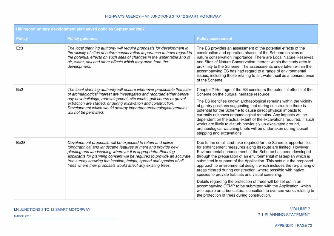
HIGHWAYS AGENCY – M4 JUNCTIONS 3 TO 12 SMART MOTORWAY
M4 JUNCTIONS 3 TO 12 SMART MOTORWAY VOLUME 7
7.1 PLANNING STATEMENT MARCH 2015
APPENDIX 1 PAGE 72
Hillingdon unitary development plan saved policies September 2007
Policy Policy guidance Policy assessment
Ec3 The local planning authority will require proposals for development in the vicinity of sites of nature conservation importance to have regard to the potential effects on such sites of changes in the water table and of air, water, soil and other effects which may arise from the development.
The ES provides an assessment of the potential effects of the construction and operation phases of the Scheme on sites of nature conservation importance. There are Local Nature Reserves and Sites of Nature Conservation Interest within the study area in proximity to the Scheme. The assessments undertaken within the accompanying ES has had regard to a range of environmental issues, including those relating to air, water, soil as a consequence of the Scheme.
Be3 The local planning authority will ensure whenever practicable that sites of archaeological interest are investigated and recorded either before any new buildings, redevelopment, site works, golf course or gravel extraction are started, or during excavation and construction. Development which would destroy important archaeological remains will not be permitted.
Chapter 7 Heritage of the ES considers the potential effects of the Scheme on the cultural heritage resource.
The ES identifies known archaeological remains within the vicinity of gantry positions suggesting that during construction there is potential for the Scheme to cause direct physical impacts to currently unknown archaeological remains. Any impacts will be dependent on the actual extent of the excavations required. If such works are likely to disturb previously un-excavated ground, archaeological watching briefs will be undertaken during topsoil stripping and excavations.
Be38 Development proposals will be expected to retain and utilise topographical and landscape features of merit and provide new planting and landscaping wherever it is appropriate. Planning applicants for planning consent will be required to provide an accurate tree survey showing the location, height, spread and species of all trees where their proposals would affect any existing trees.
Due to the small land-take required for the Scheme, opportunities for enhancement measures along its route are limited. However, Environmental enhancement of the Scheme has been developed through the preparation of an environmental masterplan which is submitted in support of the Application. This sets out the proposed approach to environmental design, which includes the re-planting of areas cleared during construction, where possible with native species to provide habitats and visual screening.
Details regarding the protection of trees will be set out in an accompanying CEMP to be submitted with the Application, which will require an arboricultural consultant to oversee works relating to the protection of trees during construction.
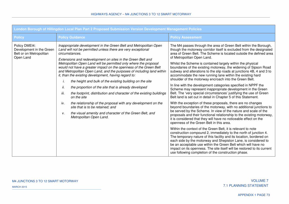
HIGHWAYS AGENCY – M4 JUNCTIONS 3 TO 12 SMART MOTORWAY
M4 JUNCTIONS 3 TO 12 SMART MOTORWAY VOLUME 7
7.1 PLANNING STATEMENT MARCH 2015
APPENDIX 1 PAGE 73
London Borough of Hillingdon Local Plan Part 2 Proposed Submission Version Development Management Policies
Policy Policy Guidance Policy Assessment
Policy DMEI4: Development in the Green Belt or on Metropolitan Open Land
Inappropriate development in the Green Belt and Metropolitan Open Land will not be permitted unless there are very exceptional circumstances.
Extensions and redevelopment on sites in the Green Belt and Metropolitan Open Land will be permitted only where the proposal would not have a greater impact on the openness of the Green Belt and Metropolitan Open Land, and the purposes of including land within it, than the existing development, having regard to:
i. the height and bulk of the existing building on the site
ii. the proportion of the site that is already developed
iii. the footprint, distribution and character of the existing buildings on the site
iv. the relationship of the proposal with any development on the site that is to be retained; and
v. the visual amenity and character of the Green Belt, and Metropolitan Open Land.
The M4 passes through the area of Green Belt within the Borough, though the motorway corridor itself is excluded from the designated area of Green Belt. The Scheme is located outside the defined area of Metropolitan Open Land.
Whilst the Scheme is contained largely within the physical boundaries of the existing motorway, the widening of Sipson Road subway and alterations to the slip roads at junctions 4B, 4 and 3 to accommodate the new running lane within the existing hard shoulder of the motorway encroach into the Green Belt.
In line with the development categories specified in NPPF the Scheme may represent inappropriate development in the Green Belt. The ‘very special circumstances’ justifying the use of Green Belt land is set out in detail in Chapter 5 of this Statement.
With the exception of these proposals, there are no changes beyond boundaries of the motorway, with no additional junctions to be served by the Scheme. In view of the nature and scale of the proposals and their functional relationship to the existing motorway, it is considered that they will have no noticeable effect on the openness of the Green Belt in this area.
Within the context of the Green Belt, it is relevant to note construction compound 2, immediately to the north of junction 4. The temporary nature of this facility and its location, bordered on each side by the motorway and Shepiston Lane, is considered to be an acceptable use within the Green Belt which will have no impact on its openness. The site itself will be restored to its current use following completion of the construction phase.
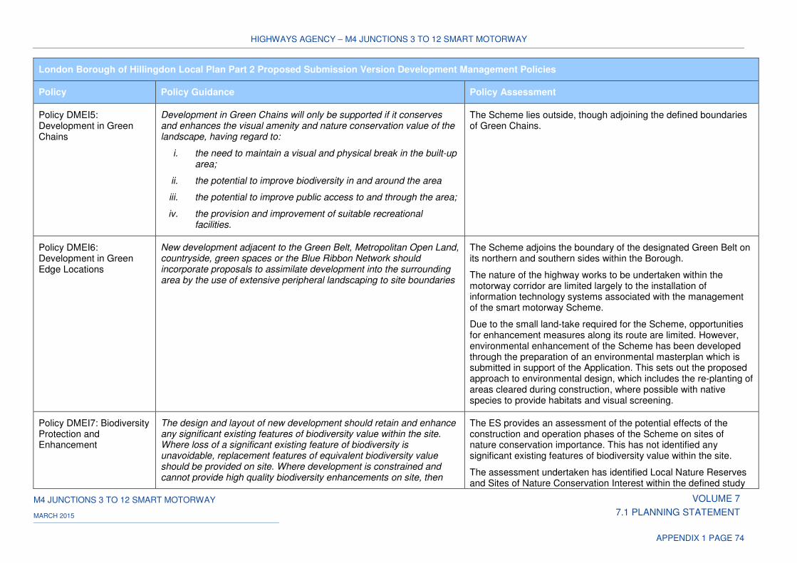
HIGHWAYS AGENCY – M4 JUNCTIONS 3 TO 12 SMART MOTORWAY
M4 JUNCTIONS 3 TO 12 SMART MOTORWAY VOLUME 7
7.1 PLANNING STATEMENT MARCH 2015
APPENDIX 1 PAGE 74
London Borough of Hillingdon Local Plan Part 2 Proposed Submission Version Development Management Policies
Policy Policy Guidance Policy Assessment
Policy DMEI5: Development in Green Chains
Development in Green Chains will only be supported if it conserves and enhances the visual amenity and nature conservation value of the landscape, having regard to:
i. the need to maintain a visual and physical break in the built-up area;
ii. the potential to improve biodiversity in and around the area
iii. the potential to improve public access to and through the area;
iv. the provision and improvement of suitable recreational facilities.
The Scheme lies outside, though adjoining the defined boundaries of Green Chains.
Policy DMEI6: Development in Green Edge Locations
New development adjacent to the Green Belt, Metropolitan Open Land, countryside, green spaces or the Blue Ribbon Network should incorporate proposals to assimilate development into the surrounding area by the use of extensive peripheral landscaping to site boundaries
The Scheme adjoins the boundary of the designated Green Belt on its northern and southern sides within the Borough.
The nature of the highway works to be undertaken within the motorway corridor are limited largely to the installation of information technology systems associated with the management of the smart motorway Scheme.
Due to the small land-take required for the Scheme, opportunities for enhancement measures along its route are limited. However, environmental enhancement of the Scheme has been developed through the preparation of an environmental masterplan which is submitted in support of the Application. This sets out the proposed approach to environmental design, which includes the re-planting of areas cleared during construction, where possible with native species to provide habitats and visual screening.
Policy DMEI7: Biodiversity Protection and Enhancement
The design and layout of new development should retain and enhance any significant existing features of biodiversity value within the site. Where loss of a significant existing feature of biodiversity is unavoidable, replacement features of equivalent biodiversity value should be provided on site. Where development is constrained and cannot provide high quality biodiversity enhancements on site, then
The ES provides an assessment of the potential effects of the construction and operation phases of the Scheme on sites of nature conservation importance. This has not identified any significant existing features of biodiversity value within the site.
The assessment undertaken has identified Local Nature Reserves and Sites of Nature Conservation Interest within the defined study
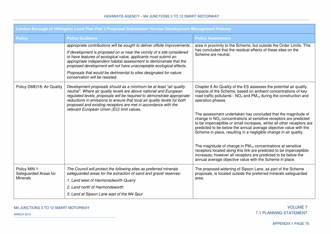
HIGHWAYS AGENCY – M4 JUNCTIONS 3 TO 12 SMART MOTORWAY
M4 JUNCTIONS 3 TO 12 SMART MOTORWAY VOLUME 7
7.1 PLANNING STATEMENT MARCH 2015
APPENDIX 1 PAGE 75
London Borough of Hillingdon Local Plan Part 2 Proposed Submission Version Development Management Policies
Policy Policy Guidance Policy Assessment
appropriate contributions will be sought to deliver offsite improvements.
If development is proposed on or near the vicinity of a site considered to have features of ecological value, applicants must submit an appropriate independent habitat assessment to demonstrate that the proposed development will not have unacceptable ecological effects.
Proposals that would be detrimental to sites designated for nature conservation will be resisted.
area in proximity to the Scheme, but outside the Order Limits. This has concluded that the residual effects of these sites on the Scheme are neutral.
Policy DMEI18: Air Quality
Development proposals should as a minimum be at least “air quality neutral”. Where air quality levels are above national and European regulated levels, proposals will be required to demonstrate appropriate reductions in emissions to ensure that local air quality levels for both proposed and existing receptors are met in accordance with the relevant European Union (EU) limit values.
Chapter 6 Air Quality of the ES assesses the potential air quality impacts of the Scheme, based on ambient concentrations of key road traffic pollutants - NO2 and PM10 during the construction and operation phases.
The assessment undertaken has concluded that the magnitude of change in NO2 concentrations at sensitive receptors are predicted to be imperceptible or small increases, whilst all other receptors are predicted to be below the annual average objective value with the Scheme in place, resulting in a negligible change in air quality.
The magnitude of change in PM10 concentrations at sensitive receptors located along this link are predicted to be imperceptible increases; however all receptors are predicted to be below the annual average objective value with the Scheme in place.
Policy MIN 1: Safeguarded Areas for Minerals
The Council will protect the following sites as preferred minerals safeguarded areas for the extraction of sand and gravel reserves:
1. Land west of Harmonsdworth Quarry
2. Land north of Harmondsworth
3. Land at Sipson Lane east of the M4 Spur
The proposed widening of Sipson Lane, as part of the Scheme proposals, is located outside the preferred minerals safeguarded area.
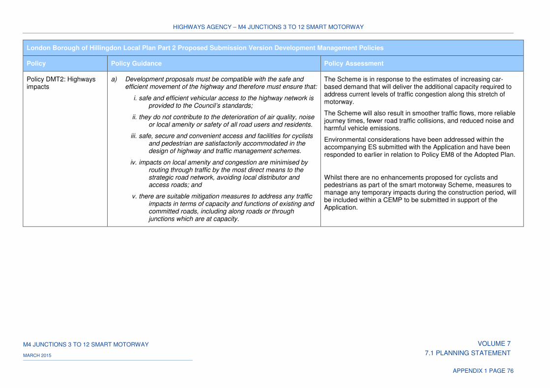
HIGHWAYS AGENCY – M4 JUNCTIONS 3 TO 12 SMART MOTORWAY
M4 JUNCTIONS 3 TO 12 SMART MOTORWAY VOLUME 7
7.1 PLANNING STATEMENT MARCH 2015
APPENDIX 1 PAGE 76
London Borough of Hillingdon Local Plan Part 2 Proposed Submission Version Development Management Policies
Policy Policy Guidance Policy Assessment
Policy DMT2: Highways impacts
a) Development proposals must be compatible with the safe and efficient movement of the highway and therefore must ensure that:
i. safe and efficient vehicular access to the highway network is provided to the Council’s standards;
ii. they do not contribute to the deterioration of air quality, noise or local amenity or safety of all road users and residents.
iii. safe, secure and convenient access and facilities for cyclists and pedestrian are satisfactorily accommodated in the design of highway and traffic management schemes.
iv. impacts on local amenity and congestion are minimised by routing through traffic by the most direct means to the strategic road network, avoiding local distributor and access roads; and
v. there are suitable mitigation measures to address any traffic impacts in terms of capacity and functions of existing and committed roads, including along roads or through junctions which are at capacity.
The Scheme is in response to the estimates of increasing car-based demand that will deliver the additional capacity required to address current levels of traffic congestion along this stretch of motorway.
The Scheme will also result in smoother traffic flows, more reliable journey times, fewer road traffic collisions, and reduced noise and harmful vehicle emissions.
Environmental considerations have been addressed within the accompanying ES submitted with the Application and have been responded to earlier in relation to Policy EM8 of the Adopted Plan.
Whilst there are no enhancements proposed for cyclists and pedestrians as part of the smart motorway Scheme, measures to manage any temporary impacts during the construction period, will be included within a CEMP to be submitted in support of the Application.
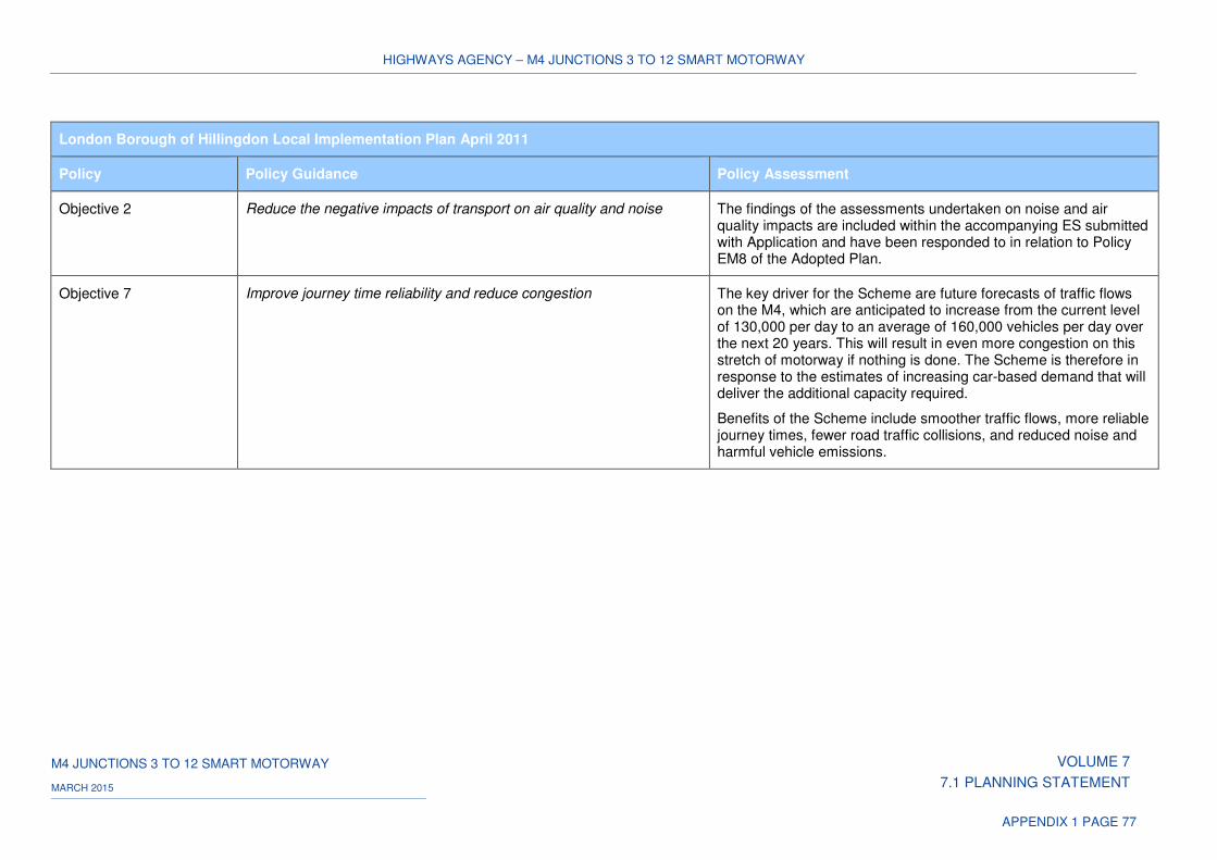
HIGHWAYS AGENCY – M4 JUNCTIONS 3 TO 12 SMART MOTORWAY
M4 JUNCTIONS 3 TO 12 SMART MOTORWAY VOLUME 7
7.1 PLANNING STATEMENT MARCH 2015
APPENDIX 1 PAGE 77
London Borough of Hillingdon Local Implementation Plan April 2011
Policy Policy Guidance Policy Assessment
Objective 2 Reduce the negative impacts of transport on air quality and noise The findings of the assessments undertaken on noise and air quality impacts are included within the accompanying ES submitted with Application and have been responded to in relation to Policy EM8 of the Adopted Plan.
Objective 7 Improve journey time reliability and reduce congestion The key driver for the Scheme are future forecasts of traffic flows on the M4, which are anticipated to increase from the current level of 130,000 per day to an average of 160,000 vehicles per day over the next 20 years. This will result in even more congestion on this stretch of motorway if nothing is done. The Scheme is therefore in response to the estimates of increasing car-based demand that will deliver the additional capacity required.
Benefits of the Scheme include smoother traffic flows, more reliable journey times, fewer road traffic collisions, and reduced noise and harmful vehicle emissions.
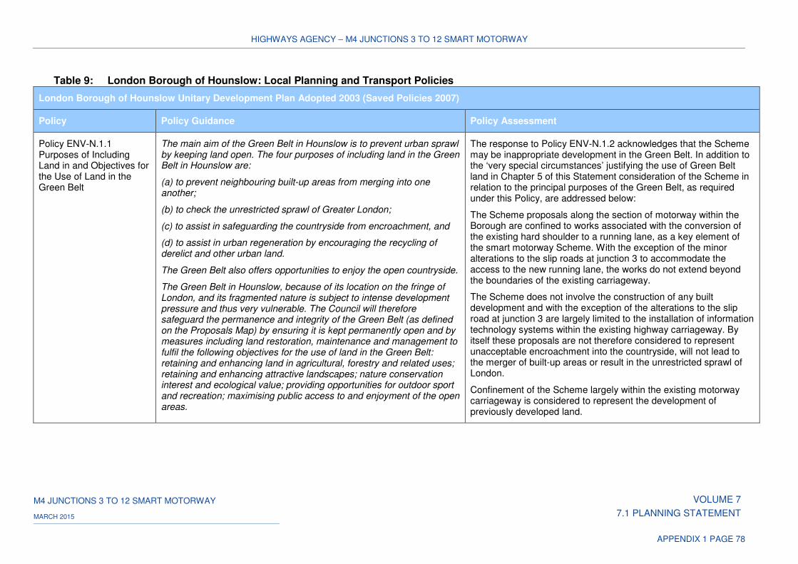
HIGHWAYS AGENCY – M4 JUNCTIONS 3 TO 12 SMART MOTORWAY
M4 JUNCTIONS 3 TO 12 SMART MOTORWAY VOLUME 7
7.1 PLANNING STATEMENT MARCH 2015
APPENDIX 1 PAGE 78
Table 9: London Borough of Hounslow: Local Planning and Transport Policies
London Borough of Hounslow Unitary Development Plan Adopted 2003 (Saved Policies 2007)
Policy Policy Guidance Policy Assessment
Policy ENV-N.1.1 Purposes of Including Land in and Objectives for the Use of Land in the Green Belt
The main aim of the Green Belt in Hounslow is to prevent urban sprawl by keeping land open. The four purposes of including land in the Green Belt in Hounslow are:
(a) to prevent neighbouring built-up areas from merging into one another;
(b) to check the unrestricted sprawl of Greater London;
(c) to assist in safeguarding the countryside from encroachment, and
(d) to assist in urban regeneration by encouraging the recycling of derelict and other urban land.
The Green Belt also offers opportunities to enjoy the open countryside.
The Green Belt in Hounslow, because of its location on the fringe of London, and its fragmented nature is subject to intense development pressure and thus very vulnerable. The Council will therefore safeguard the permanence and integrity of the Green Belt (as defined on the Proposals Map) by ensuring it is kept permanently open and by measures including land restoration, maintenance and management to fulfil the following objectives for the use of land in the Green Belt: retaining and enhancing land in agricultural, forestry and related uses; retaining and enhancing attractive landscapes; nature conservation interest and ecological value; providing opportunities for outdoor sport and recreation; maximising public access to and enjoyment of the open areas.
The response to Policy ENV-N.1.2 acknowledges that the Scheme may be inappropriate development in the Green Belt. In addition to the ‘very special circumstances’ justifying the use of Green Belt land in Chapter 5 of this Statement consideration of the Scheme in relation to the principal purposes of the Green Belt, as required under this Policy, are addressed below:
The Scheme proposals along the section of motorway within the Borough are confined to works associated with the conversion of the existing hard shoulder to a running lane, as a key element of the smart motorway Scheme. With the exception of the minor alterations to the slip roads at junction 3 to accommodate the access to the new running lane, the works do not extend beyond the boundaries of the existing carriageway.
The Scheme does not involve the construction of any built development and with the exception of the alterations to the slip road at junction 3 are largely limited to the installation of information technology systems within the existing highway carriageway. By itself these proposals are not therefore considered to represent unacceptable encroachment into the countryside, will not lead to the merger of built-up areas or result in the unrestricted sprawl of London.
Confinement of the Scheme largely within the existing motorway carriageway is considered to represent the development of previously developed land.
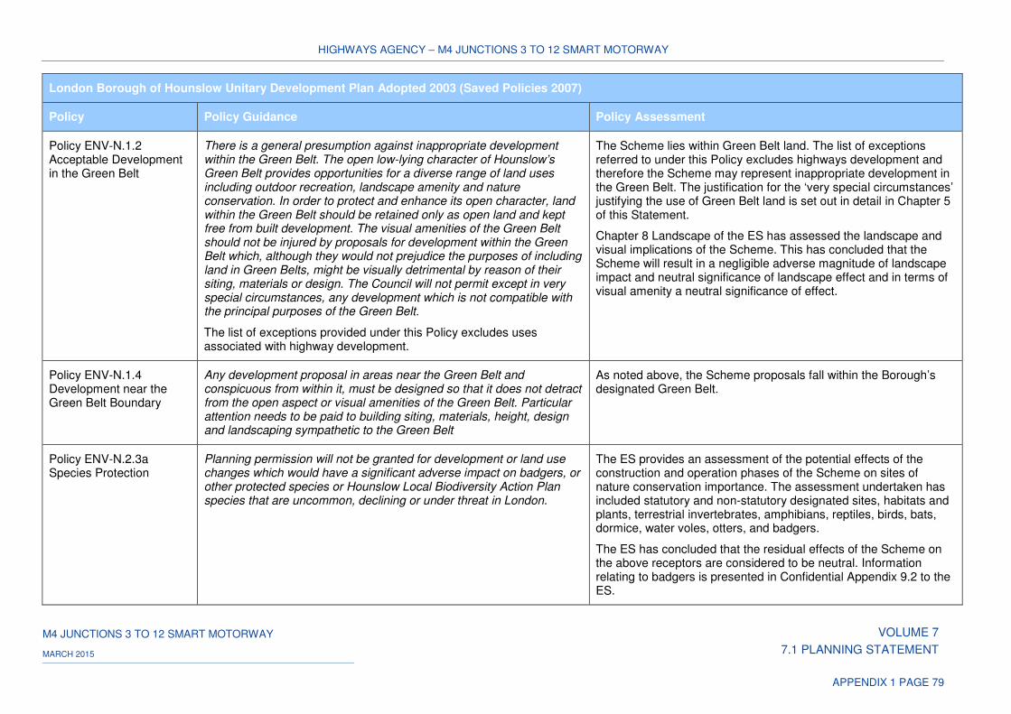
HIGHWAYS AGENCY – M4 JUNCTIONS 3 TO 12 SMART MOTORWAY
M4 JUNCTIONS 3 TO 12 SMART MOTORWAY VOLUME 7
7.1 PLANNING STATEMENT MARCH 2015
APPENDIX 1 PAGE 79
London Borough of Hounslow Unitary Development Plan Adopted 2003 (Saved Policies 2007)
Policy Policy Guidance Policy Assessment
Policy ENV-N.1.2 Acceptable Development in the Green Belt
There is a general presumption against inappropriate development within the Green Belt. The open low-lying character of Hounslow’s Green Belt provides opportunities for a diverse range of land uses including outdoor recreation, landscape amenity and nature conservation. In order to protect and enhance its open character, land within the Green Belt should be retained only as open land and kept free from built development. The visual amenities of the Green Belt should not be injured by proposals for development within the Green Belt which, although they would not prejudice the purposes of including land in Green Belts, might be visually detrimental by reason of their siting, materials or design. The Council will not permit except in very special circumstances, any development which is not compatible with the principal purposes of the Green Belt.
The list of exceptions provided under this Policy excludes uses associated with highway development.
The Scheme lies within Green Belt land. The list of exceptions referred to under this Policy excludes highways development and therefore the Scheme may represent inappropriate development in the Green Belt. The justification for the ‘very special circumstances’ justifying the use of Green Belt land is set out in detail in Chapter 5 of this Statement.
Chapter 8 Landscape of the ES has assessed the landscape and visual implications of the Scheme. This has concluded that the Scheme will result in a negligible adverse magnitude of landscape impact and neutral significance of landscape effect and in terms of visual amenity a neutral significance of effect.
Policy ENV-N.1.4 Development near the Green Belt Boundary
Any development proposal in areas near the Green Belt and conspicuous from within it, must be designed so that it does not detract from the open aspect or visual amenities of the Green Belt. Particular attention needs to be paid to building siting, materials, height, design and landscaping sympathetic to the Green Belt
As noted above, the Scheme proposals fall within the Borough’s designated Green Belt.
Policy ENV-N.2.3a Species Protection
Planning permission will not be granted for development or land use changes which would have a significant adverse impact on badgers, or other protected species or Hounslow Local Biodiversity Action Plan species that are uncommon, declining or under threat in London.
The ES provides an assessment of the potential effects of the construction and operation phases of the Scheme on sites of nature conservation importance. The assessment undertaken has included statutory and non-statutory designated sites, habitats and plants, terrestrial invertebrates, amphibians, reptiles, birds, bats, dormice, water voles, otters, and badgers.
The ES has concluded that the residual effects of the Scheme on the above receptors are considered to be neutral. Information relating to badgers is presented in Confidential Appendix 9.2 to the ES.

HIGHWAYS AGENCY – M4 JUNCTIONS 3 TO 12 SMART MOTORWAY
M4 JUNCTIONS 3 TO 12 SMART MOTORWAY VOLUME 7
7.1 PLANNING STATEMENT MARCH 2015
APPENDIX 1 PAGE 80
London Borough of Hounslow Unitary Development Plan Adopted 2003 (Saved Policies 2007)
Policy Policy Guidance Policy Assessment
Policy ENV-N.2.6 Landscape Features
The Council will protect important landscape features both in the built-up area and open land which are affected by development, and will promote conservation of such features, e.g. groups of trees, specimen trees, hedgerows, ponds, ditches and natural river features and will promote nature conservation management on its own land holdings
The Scheme does not lie within any areas of the Borough identified as comprising important landscape features. The Environmental enhancement of the Scheme has been developed through the preparation of an environmental masterplan which is submitted in support of the Application. This sets out the proposed approach to environmental design, which includes the re-planting of areas cleared during construction, where possible with native species to provide habitats and visual screening.
The Council will aim to protect all trees in the Borough which contribute to the value of the environment. The Council wants to promote the aesthetic value of trees as part of the landscape and for their value as screening. When considering development proposals the Council will normally require all existing trees of amenity and landscape value to be retained. If a tree is considered worthy of retention then its location and protection will be a constraint to development. The Council will seek to achieve replacement of new tree planting in connection with development proposals where appropriate.
The Scheme involves the removal of vegetation along sections of the motorway carriageway, as part of the proposed works within the Borough. These form part of the environmental enhancement of the Scheme, details of which are indicative at this stage and are to be agreed following detailed survey.
London Borough of Hounslow Local Plan Proposed Submission 2014
Policy Policy Guidance Policy Assessment
Policy GB7 - Biodiversity Our approach
We will protect and enhance Hounslow’s natural environment and seek to increase the quantity and quality of the borough’s biodiversity.
We will achieve this by
a) Permitting development only where it can be shown that significant adverse impact on biodiversity is avoided;
b) Protecting designated international, national and local nature conservation areas, as set in Table GB7.1, and supporting new
The ES provides an assessment of the potential effects of the construction and operation phases of the Scheme on sites of nature conservation importance. The assessment undertaken has included statutory and non-statutory designated sites, habitats and plants, terrestrial invertebrates, amphibians, reptiles, birds, bats, dormice, water voles, otters, and badgers.
The assessment has identified Cranebank Local Nature Reserve outside the Order Limits approximately 1.9km south of the Scheme. The ES has concluded that the residual effects of the Scheme on the above receptors are considered to be neutral. Information
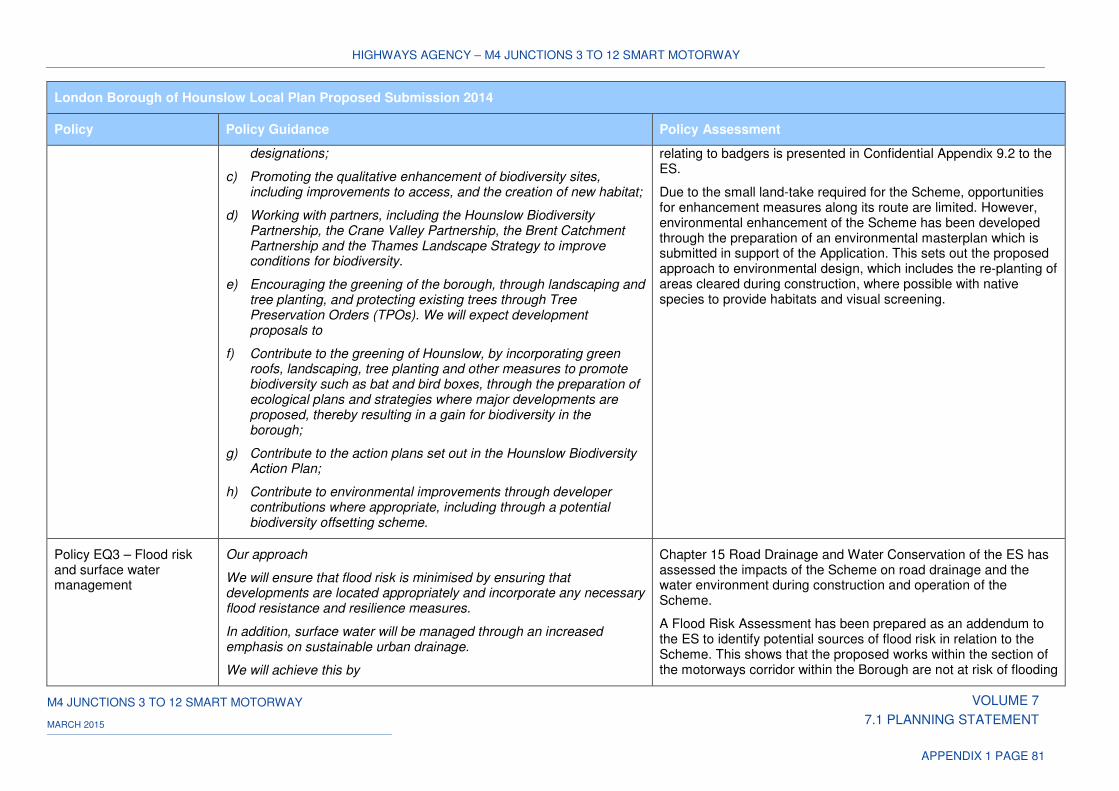
HIGHWAYS AGENCY – M4 JUNCTIONS 3 TO 12 SMART MOTORWAY
M4 JUNCTIONS 3 TO 12 SMART MOTORWAY VOLUME 7
7.1 PLANNING STATEMENT MARCH 2015
APPENDIX 1 PAGE 81
London Borough of Hounslow Local Plan Proposed Submission 2014
Policy Policy Guidance Policy Assessment
designations;
c) Promoting the qualitative enhancement of biodiversity sites, including improvements to access, and the creation of new habitat;
d) Working with partners, including the Hounslow Biodiversity Partnership, the Crane Valley Partnership, the Brent Catchment Partnership and the Thames Landscape Strategy to improve conditions for biodiversity.
e) Encouraging the greening of the borough, through landscaping and tree planting, and protecting existing trees through Tree Preservation Orders (TPOs). We will expect development proposals to
f) Contribute to the greening of Hounslow, by incorporating green roofs, landscaping, tree planting and other measures to promote biodiversity such as bat and bird boxes, through the preparation of ecological plans and strategies where major developments are proposed, thereby resulting in a gain for biodiversity in the borough;
g) Contribute to the action plans set out in the Hounslow Biodiversity Action Plan;
h) Contribute to environmental improvements through developer contributions where appropriate, including through a potential biodiversity offsetting scheme.
relating to badgers is presented in Confidential Appendix 9.2 to the ES.
Due to the small land-take required for the Scheme, opportunities for enhancement measures along its route are limited. However, environmental enhancement of the Scheme has been developed through the preparation of an environmental masterplan which is submitted in support of the Application. This sets out the proposed approach to environmental design, which includes the re-planting of areas cleared during construction, where possible with native species to provide habitats and visual screening.
Policy EQ3 – Flood risk and surface water management
Our approach
We will ensure that flood risk is minimised by ensuring that developments are located appropriately and incorporate any necessary flood resistance and resilience measures.
In addition, surface water will be managed through an increased emphasis on sustainable urban drainage.
We will achieve this by
Chapter 15 Road Drainage and Water Conservation of the ES has assessed the impacts of the Scheme on road drainage and the water environment during construction and operation of the Scheme.
A Flood Risk Assessment has been prepared as an addendum to the ES to identify potential sources of flood risk in relation to the Scheme. This shows that the proposed works within the section of the motorways corridor within the Borough are not at risk of flooding
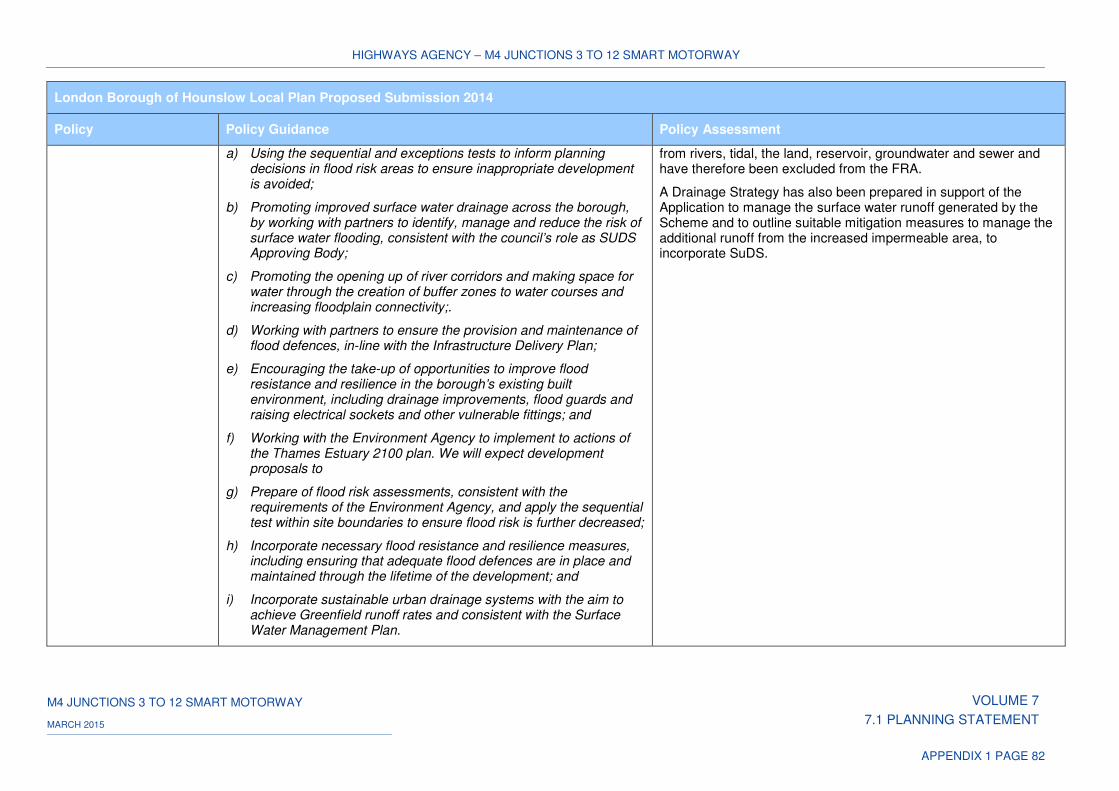
HIGHWAYS AGENCY – M4 JUNCTIONS 3 TO 12 SMART MOTORWAY
M4 JUNCTIONS 3 TO 12 SMART MOTORWAY VOLUME 7
7.1 PLANNING STATEMENT MARCH 2015
APPENDIX 1 PAGE 82
London Borough of Hounslow Local Plan Proposed Submission 2014
Policy Policy Guidance Policy Assessment
a) Using the sequential and exceptions tests to inform planning decisions in flood risk areas to ensure inappropriate development is avoided;
b) Promoting improved surface water drainage across the borough, by working with partners to identify, manage and reduce the risk of surface water flooding, consistent with the council’s role as SUDS Approving Body;
c) Promoting the opening up of river corridors and making space for water through the creation of buffer zones to water courses and increasing floodplain connectivity;.
d) Working with partners to ensure the provision and maintenance of flood defences, in-line with the Infrastructure Delivery Plan;
e) Encouraging the take-up of opportunities to improve flood resistance and resilience in the borough’s existing built environment, including drainage improvements, flood guards and raising electrical sockets and other vulnerable fittings; and
f) Working with the Environment Agency to implement to actions of the Thames Estuary 2100 plan. We will expect development proposals to
g) Prepare of flood risk assessments, consistent with the requirements of the Environment Agency, and apply the sequential test within site boundaries to ensure flood risk is further decreased;
h) Incorporate necessary flood resistance and resilience measures, including ensuring that adequate flood defences are in place and maintained through the lifetime of the development; and
i) Incorporate sustainable urban drainage systems with the aim to achieve Greenfield runoff rates and consistent with the Surface Water Management Plan.
from rivers, tidal, the land, reservoir, groundwater and sewer and have therefore been excluded from the FRA.
A Drainage Strategy has also been prepared in support of the Application to manage the surface water runoff generated by the Scheme and to outline suitable mitigation measures to manage the additional runoff from the increased impermeable area, to incorporate SuDS.
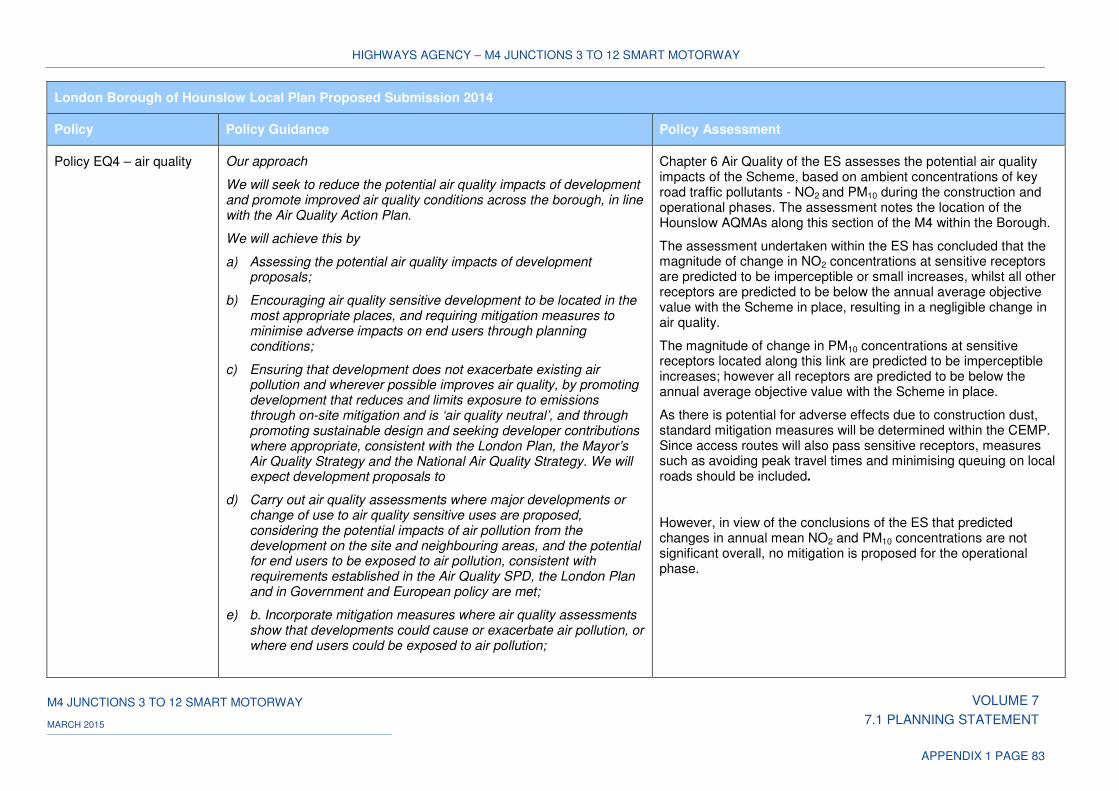
HIGHWAYS AGENCY – M4 JUNCTIONS 3 TO 12 SMART MOTORWAY
M4 JUNCTIONS 3 TO 12 SMART MOTORWAY VOLUME 7
7.1 PLANNING STATEMENT MARCH 2015
APPENDIX 1 PAGE 83
London Borough of Hounslow Local Plan Proposed Submission 2014
Policy Policy Guidance Policy Assessment
Policy EQ4 – air quality Our approach
We will seek to reduce the potential air quality impacts of development and promote improved air quality conditions across the borough, in line with the Air Quality Action Plan.
We will achieve this by
a) Assessing the potential air quality impacts of development proposals;
b) Encouraging air quality sensitive development to be located in the most appropriate places, and requiring mitigation measures to minimise adverse impacts on end users through planning conditions;
c) Ensuring that development does not exacerbate existing air pollution and wherever possible improves air quality, by promoting development that reduces and limits exposure to emissions through on-site mitigation and is ‘air quality neutral’, and through promoting sustainable design and seeking developer contributions where appropriate, consistent with the London Plan, the Mayor’s Air Quality Strategy and the National Air Quality Strategy. We will expect development proposals to
d) Carry out air quality assessments where major developments or change of use to air quality sensitive uses are proposed, considering the potential impacts of air pollution from the development on the site and neighbouring areas, and the potential for end users to be exposed to air pollution, consistent with requirements established in the Air Quality SPD, the London Plan and in Government and European policy are met;
e) b. Incorporate mitigation measures where air quality assessments show that developments could cause or exacerbate air pollution, or where end users could be exposed to air pollution;
Chapter 6 Air Quality of the ES assesses the potential air quality impacts of the Scheme, based on ambient concentrations of key road traffic pollutants - NO2 and PM10 during the construction and operational phases. The assessment notes the location of the Hounslow AQMAs along this section of the M4 within the Borough.
The assessment undertaken within the ES has concluded that the magnitude of change in NO2 concentrations at sensitive receptors are predicted to be imperceptible or small increases, whilst all other receptors are predicted to be below the annual average objective value with the Scheme in place, resulting in a negligible change in air quality.
The magnitude of change in PM10 concentrations at sensitive receptors located along this link are predicted to be imperceptible increases; however all receptors are predicted to be below the annual average objective value with the Scheme in place.
As there is potential for adverse effects due to construction dust, standard mitigation measures will be determined within the CEMP. Since access routes will also pass sensitive receptors, measures such as avoiding peak travel times and minimising queuing on local roads should be included.
However, in view of the conclusions of the ES that predicted changes in annual mean NO2 and PM10 concentrations are not significant overall, no mitigation is proposed for the operational phase.
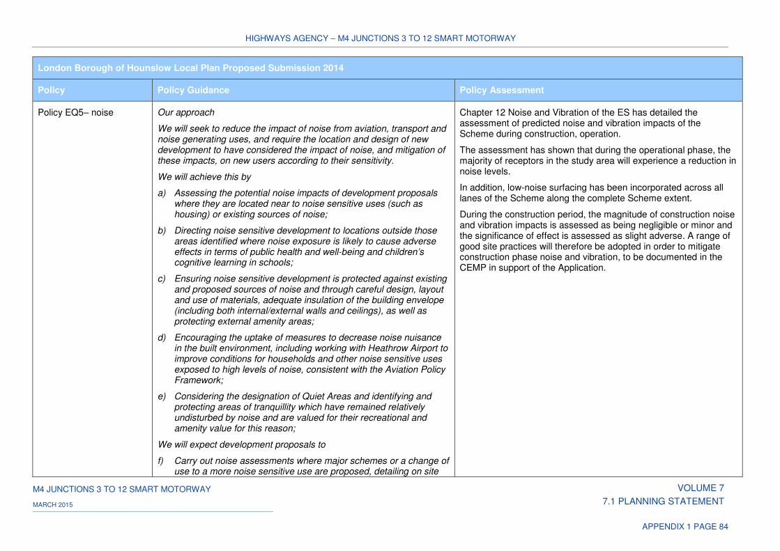
HIGHWAYS AGENCY – M4 JUNCTIONS 3 TO 12 SMART MOTORWAY
M4 JUNCTIONS 3 TO 12 SMART MOTORWAY VOLUME 7
7.1 PLANNING STATEMENT MARCH 2015
APPENDIX 1 PAGE 84
London Borough of Hounslow Local Plan Proposed Submission 2014
Policy Policy Guidance Policy Assessment
Policy EQ5– noise
Our approach
We will seek to reduce the impact of noise from aviation, transport and noise generating uses, and require the location and design of new development to have considered the impact of noise, and mitigation of these impacts, on new users according to their sensitivity.
We will achieve this by
a) Assessing the potential noise impacts of development proposals where they are located near to noise sensitive uses (such as housing) or existing sources of noise;
b) Directing noise sensitive development to locations outside those areas identified where noise exposure is likely to cause adverse effects in terms of public health and well-being and children’s cognitive learning in schools;
c) Ensuring noise sensitive development is protected against existing and proposed sources of noise and through careful design, layout and use of materials, adequate insulation of the building envelope (including both internal/external walls and ceilings), as well as protecting external amenity areas;
d) Encouraging the uptake of measures to decrease noise nuisance in the built environment, including working with Heathrow Airport to improve conditions for households and other noise sensitive uses exposed to high levels of noise, consistent with the Aviation Policy Framework;
e) Considering the designation of Quiet Areas and identifying and protecting areas of tranquillity which have remained relatively undisturbed by noise and are valued for their recreational and amenity value for this reason;
We will expect development proposals to
f) Carry out noise assessments where major schemes or a change of use to a more noise sensitive use are proposed, detailing on site
Chapter 12 Noise and Vibration of the ES has detailed the assessment of predicted noise and vibration impacts of the Scheme during construction, operation.
The assessment has shown that during the operational phase, the majority of receptors in the study area will experience a reduction in noise levels.
In addition, low-noise surfacing has been incorporated across all lanes of the Scheme along the complete Scheme extent.
During the construction period, the magnitude of construction noise and vibration impacts is assessed as being negligible or minor and the significance of effect is assessed as slight adverse. A range of good site practices will therefore be adopted in order to mitigate construction phase noise and vibration, to be documented in the CEMP in support of the Application.
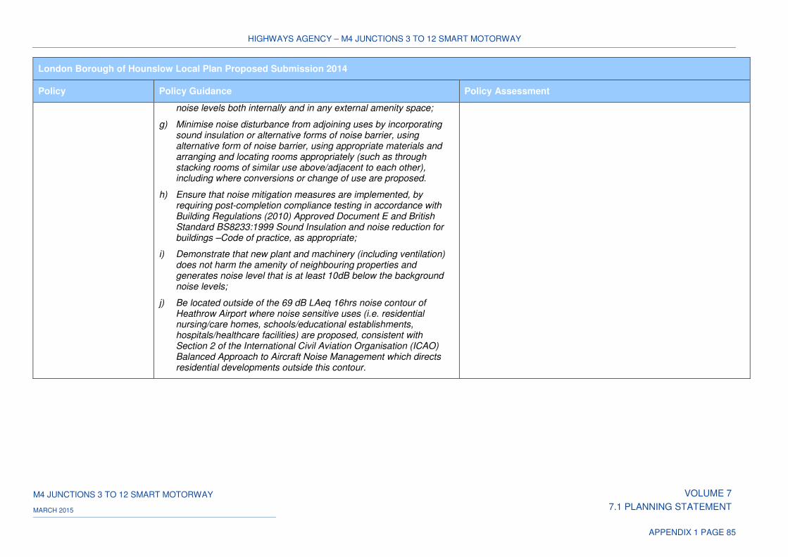
HIGHWAYS AGENCY – M4 JUNCTIONS 3 TO 12 SMART MOTORWAY
M4 JUNCTIONS 3 TO 12 SMART MOTORWAY VOLUME 7
7.1 PLANNING STATEMENT MARCH 2015
APPENDIX 1 PAGE 85
London Borough of Hounslow Local Plan Proposed Submission 2014
Policy Policy Guidance Policy Assessment
noise levels both internally and in any external amenity space;
g) Minimise noise disturbance from adjoining uses by incorporating sound insulation or alternative forms of noise barrier, using alternative form of noise barrier, using appropriate materials and arranging and locating rooms appropriately (such as through stacking rooms of similar use above/adjacent to each other), including where conversions or change of use are proposed.
h) Ensure that noise mitigation measures are implemented, by requiring post-completion compliance testing in accordance with Building Regulations (2010) Approved Document E and British Standard BS8233:1999 Sound Insulation and noise reduction for buildings –Code of practice, as appropriate;
i) Demonstrate that new plant and machinery (including ventilation) does not harm the amenity of neighbouring properties and generates noise level that is at least 10dB below the background noise levels;
j) Be located outside of the 69 dB LAeq 16hrs noise contour of Heathrow Airport where noise sensitive uses (i.e. residential nursing/care homes, schools/educational establishments, hospitals/healthcare facilities) are proposed, consistent with Section 2 of the International Civil Aviation Organisation (ICAO) Balanced Approach to Aircraft Noise Management which directs residential developments outside this contour.
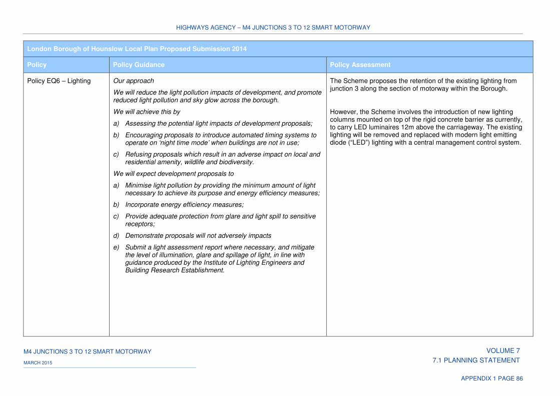
HIGHWAYS AGENCY – M4 JUNCTIONS 3 TO 12 SMART MOTORWAY
M4 JUNCTIONS 3 TO 12 SMART MOTORWAY VOLUME 7
7.1 PLANNING STATEMENT MARCH 2015
APPENDIX 1 PAGE 86
London Borough of Hounslow Local Plan Proposed Submission 2014
Policy Policy Guidance Policy Assessment
Policy EQ6 – Lighting
Our approach
We will reduce the light pollution impacts of development, and promote reduced light pollution and sky glow across the borough.
We will achieve this by
a) Assessing the potential light impacts of development proposals;
b) Encouraging proposals to introduce automated timing systems to operate on ‘night time mode’ when buildings are not in use;
c) Refusing proposals which result in an adverse impact on local and residential amenity, wildlife and biodiversity.
We will expect development proposals to
a) Minimise light pollution by providing the minimum amount of light necessary to achieve its purpose and energy efficiency measures;
b) Incorporate energy efficiency measures;
c) Provide adequate protection from glare and light spill to sensitive receptors;
d) Demonstrate proposals will not adversely impacts
e) Submit a light assessment report where necessary, and mitigate the level of illumination, glare and spillage of light, in line with guidance produced by the Institute of Lighting Engineers and Building Research Establishment.
The Scheme proposes the retention of the existing lighting from junction 3 along the section of motorway within the Borough.
However, the Scheme involves the introduction of new lighting columns mounted on top of the rigid concrete barrier as currently, to carry LED luminaires 12m above the carriageway. The existing lighting will be removed and replaced with modern light emitting diode (“LED”) lighting with a central management control system.
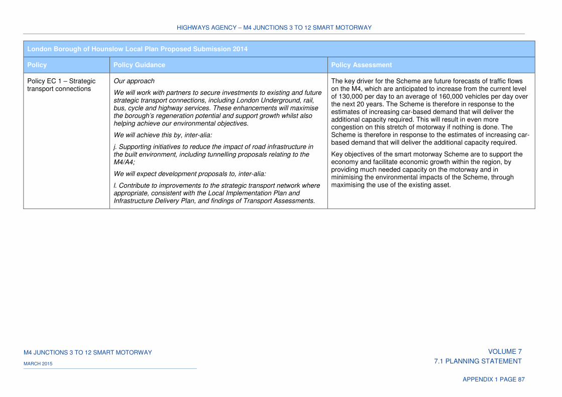
HIGHWAYS AGENCY – M4 JUNCTIONS 3 TO 12 SMART MOTORWAY
M4 JUNCTIONS 3 TO 12 SMART MOTORWAY VOLUME 7
7.1 PLANNING STATEMENT MARCH 2015
APPENDIX 1 PAGE 87
London Borough of Hounslow Local Plan Proposed Submission 2014
Policy Policy Guidance Policy Assessment
Policy EC 1 – Strategic transport connections
Our approach
We will work with partners to secure investments to existing and future strategic transport connections, including London Underground, rail, bus, cycle and highway services. These enhancements will maximise the borough’s regeneration potential and support growth whilst also helping achieve our environmental objectives.
We will achieve this by, inter-alia:
j. Supporting initiatives to reduce the impact of road infrastructure in the built environment, including tunnelling proposals relating to the M4/A4;
We will expect development proposals to, inter-alia:
l. Contribute to improvements to the strategic transport network where appropriate, consistent with the Local Implementation Plan and Infrastructure Delivery Plan, and findings of Transport Assessments.
The key driver for the Scheme are future forecasts of traffic flows on the M4, which are anticipated to increase from the current level of 130,000 per day to an average of 160,000 vehicles per day over the next 20 years. The Scheme is therefore in response to the estimates of increasing car-based demand that will deliver the additional capacity required. This will result in even more congestion on this stretch of motorway if nothing is done. The Scheme is therefore in response to the estimates of increasing car-based demand that will deliver the additional capacity required.
Key objectives of the smart motorway Scheme are to support the economy and facilitate economic growth within the region, by providing much needed capacity on the motorway and in minimising the environmental impacts of the Scheme, through maximising the use of the existing asset.
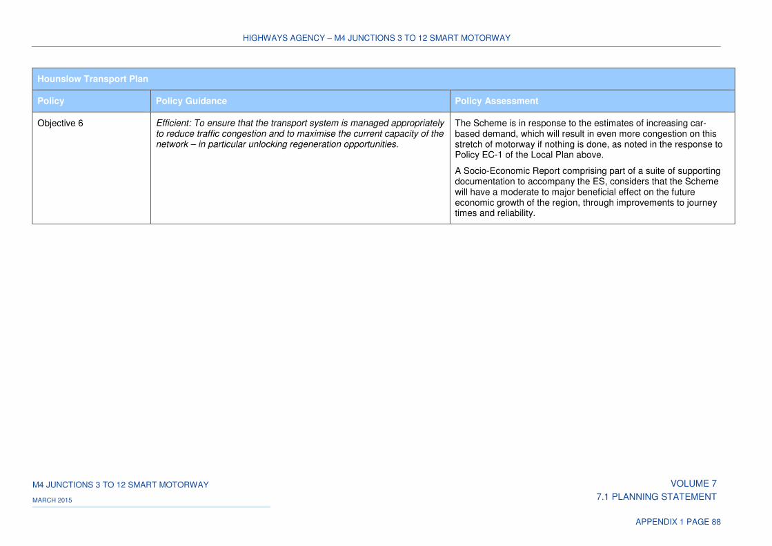
HIGHWAYS AGENCY – M4 JUNCTIONS 3 TO 12 SMART MOTORWAY
M4 JUNCTIONS 3 TO 12 SMART MOTORWAY VOLUME 7
7.1 PLANNING STATEMENT MARCH 2015
APPENDIX 1 PAGE 88
Hounslow Transport Plan
Policy Policy Guidance Policy Assessment
Objective 6 Efficient: To ensure that the transport system is managed appropriately to reduce traffic congestion and to maximise the current capacity of the network – in particular unlocking regeneration opportunities.
The Scheme is in response to the estimates of increasing car-based demand, which will result in even more congestion on this stretch of motorway if nothing is done, as noted in the response to Policy EC-1 of the Local Plan above.
A Socio-Economic Report comprising part of a suite of supporting documentation to accompany the ES, considers that the Scheme will have a moderate to major beneficial effect on the future economic growth of the region, through improvements to journey times and reliability.
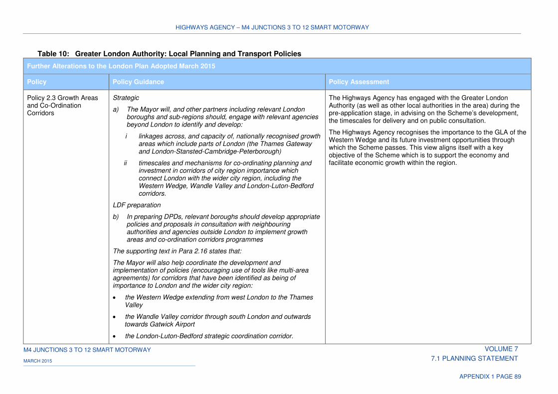
HIGHWAYS AGENCY – M4 JUNCTIONS 3 TO 12 SMART MOTORWAY
M4 JUNCTIONS 3 TO 12 SMART MOTORWAY VOLUME 7
7.1 PLANNING STATEMENT MARCH 2015
APPENDIX 1 PAGE 89
Table 10: Greater London Authority: Local Planning and Transport Policies
Further Alterations to the London Plan Adopted March 2015
Policy Policy Guidance Policy Assessment
Policy 2.3 Growth Areas and Co-Ordination Corridors
Strategic
a) The Mayor will, and other partners including relevant London boroughs and sub-regions should, engage with relevant agencies beyond London to identify and develop:
i linkages across, and capacity of, nationally recognised growth areas which include parts of London (the Thames Gateway and London-Stansted-Cambridge-Peterborough)
ii timescales and mechanisms for co-ordinating planning and investment in corridors of city region importance which connect London with the wider city region, including the Western Wedge, Wandle Valley and London-Luton-Bedford corridors.
LDF preparation
b) In preparing DPDs, relevant boroughs should develop appropriate policies and proposals in consultation with neighbouring authorities and agencies outside London to implement growth areas and co-ordination corridors programmes
The supporting text in Para 2.16 states that:
The Mayor will also help coordinate the development and implementation of policies (encouraging use of tools like multi-area agreements) for corridors that have been identified as being of importance to London and the wider city region:
• the Western Wedge extending from west London to the Thames Valley
• the Wandle Valley corridor through south London and outwards towards Gatwick Airport
• the London-Luton-Bedford strategic coordination corridor.
The Highways Agency has engaged with the Greater London Authority (as well as other local authorities in the area) during the pre-application stage, in advising on the Scheme’s development, the timescales for delivery and on public consultation.
The Highways Agency recognises the importance to the GLA of the Western Wedge and its future investment opportunities through which the Scheme passes. This view aligns itself with a key objective of the Scheme which is to support the economy and facilitate economic growth within the region.
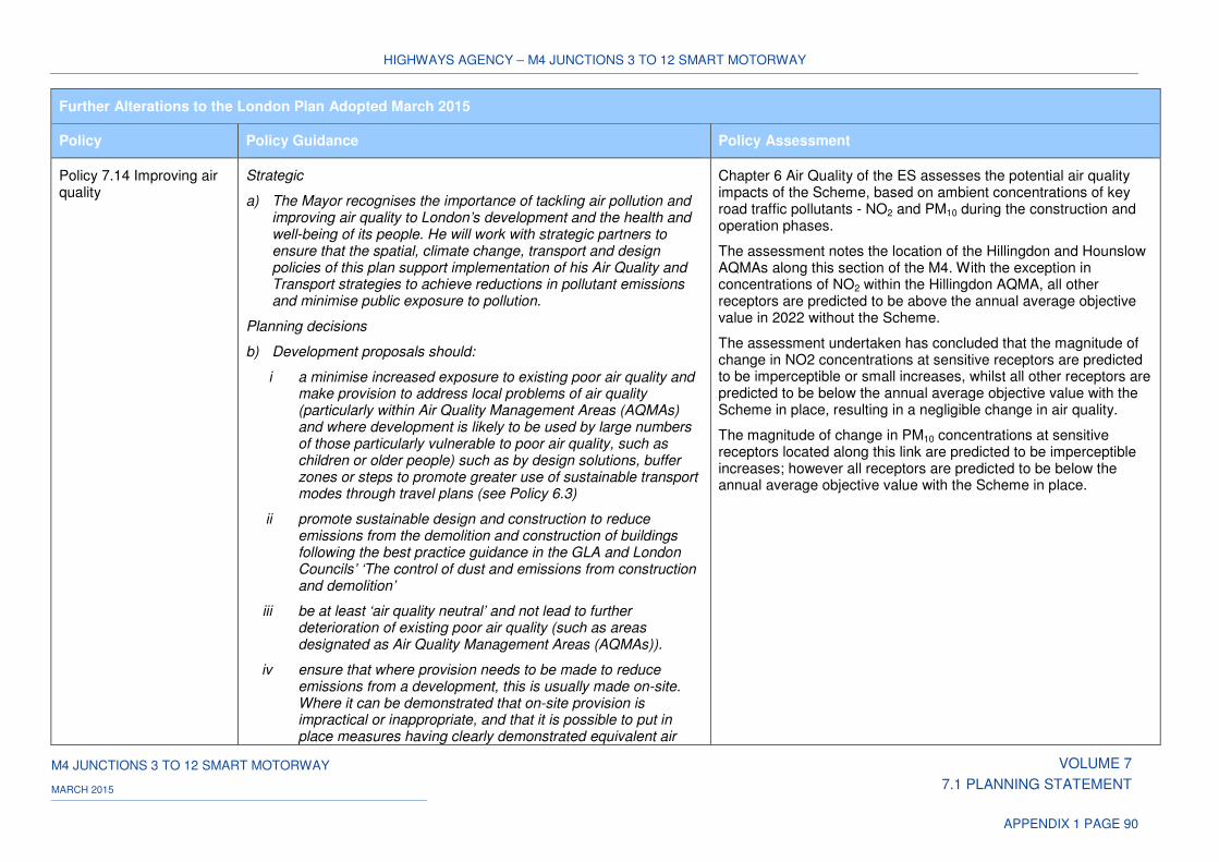
HIGHWAYS AGENCY – M4 JUNCTIONS 3 TO 12 SMART MOTORWAY
M4 JUNCTIONS 3 TO 12 SMART MOTORWAY VOLUME 7
7.1 PLANNING STATEMENT MARCH 2015
APPENDIX 1 PAGE 90
Further Alterations to the London Plan Adopted March 2015
Policy Policy Guidance Policy Assessment
Policy 7.14 Improving air quality
Strategic
a) The Mayor recognises the importance of tackling air pollution and improving air quality to London’s development and the health and well-being of its people. He will work with strategic partners to ensure that the spatial, climate change, transport and design policies of this plan support implementation of his Air Quality and Transport strategies to achieve reductions in pollutant emissions and minimise public exposure to pollution.
Planning decisions
b) Development proposals should:
i a minimise increased exposure to existing poor air quality and make provision to address local problems of air quality (particularly within Air Quality Management Areas (AQMAs) and where development is likely to be used by large numbers of those particularly vulnerable to poor air quality, such as children or older people) such as by design solutions, buffer zones or steps to promote greater use of sustainable transport modes through travel plans (see Policy 6.3)
ii promote sustainable design and construction to reduce emissions from the demolition and construction of buildings following the best practice guidance in the GLA and London Councils’ ‘The control of dust and emissions from construction and demolition’
iii be at least ‘air quality neutral’ and not lead to further deterioration of existing poor air quality (such as areas designated as Air Quality Management Areas (AQMAs)).
iv ensure that where provision needs to be made to reduce emissions from a development, this is usually made on-site. Where it can be demonstrated that on-site provision is impractical or inappropriate, and that it is possible to put in place measures having clearly demonstrated equivalent air
Chapter 6 Air Quality of the ES assesses the potential air quality impacts of the Scheme, based on ambient concentrations of key road traffic pollutants - NO2 and PM10 during the construction and operation phases.
The assessment notes the location of the Hillingdon and Hounslow AQMAs along this section of the M4. With the exception in concentrations of NO2 within the Hillingdon AQMA, all other receptors are predicted to be above the annual average objective value in 2022 without the Scheme.
The assessment undertaken has concluded that the magnitude of change in NO2 concentrations at sensitive receptors are predicted to be imperceptible or small increases, whilst all other receptors are predicted to be below the annual average objective value with the Scheme in place, resulting in a negligible change in air quality.
The magnitude of change in PM10 concentrations at sensitive receptors located along this link are predicted to be imperceptible increases; however all receptors are predicted to be below the annual average objective value with the Scheme in place.
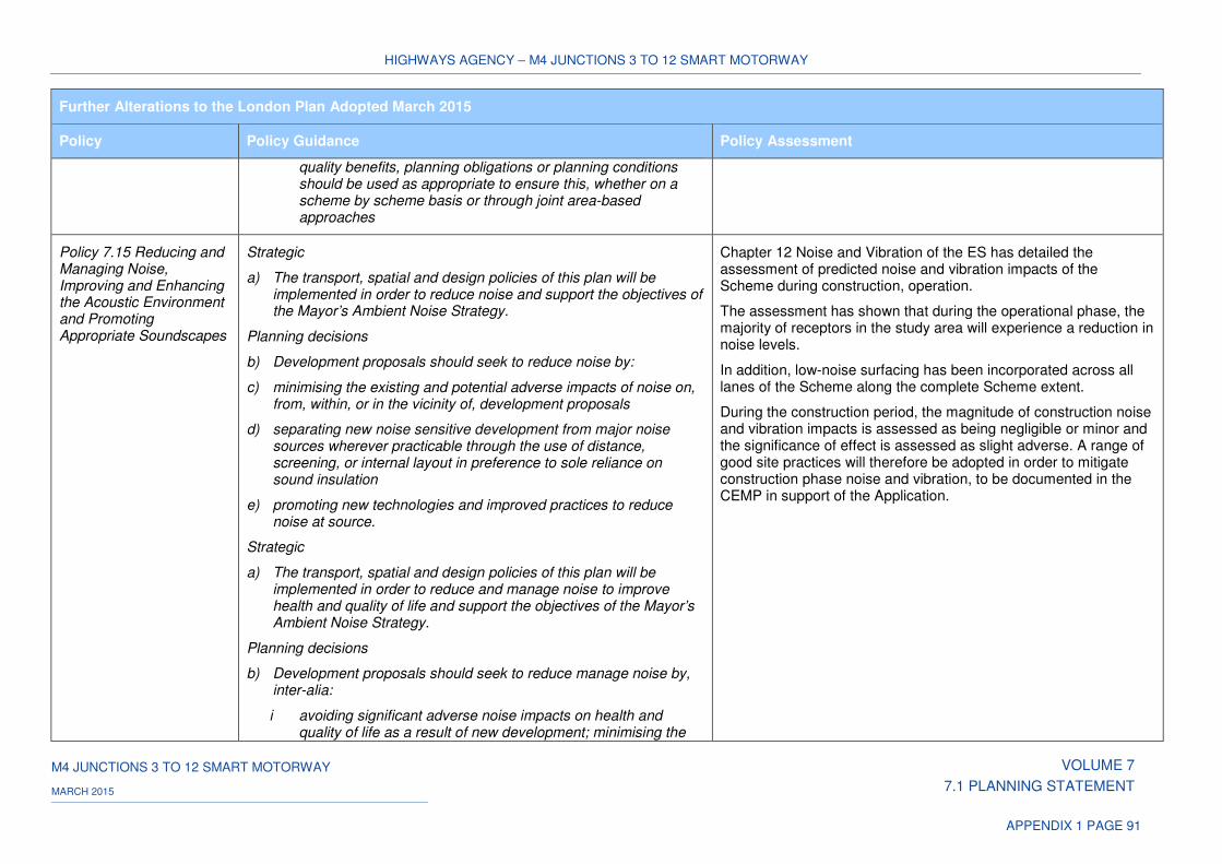
HIGHWAYS AGENCY – M4 JUNCTIONS 3 TO 12 SMART MOTORWAY
M4 JUNCTIONS 3 TO 12 SMART MOTORWAY VOLUME 7
7.1 PLANNING STATEMENT MARCH 2015
APPENDIX 1 PAGE 91
Further Alterations to the London Plan Adopted March 2015
Policy Policy Guidance Policy Assessment
quality benefits, planning obligations or planning conditions should be used as appropriate to ensure this, whether on a scheme by scheme basis or through joint area-based approaches
Policy 7.15 Reducing and Managing Noise, Improving and Enhancing the Acoustic Environment and Promoting Appropriate Soundscapes
Strategic
a) The transport, spatial and design policies of this plan will be implemented in order to reduce noise and support the objectives of the Mayor’s Ambient Noise Strategy.
Planning decisions
b) Development proposals should seek to reduce noise by:
c) minimising the existing and potential adverse impacts of noise on, from, within, or in the vicinity of, development proposals
d) separating new noise sensitive development from major noise sources wherever practicable through the use of distance, screening, or internal layout in preference to sole reliance on sound insulation
e) promoting new technologies and improved practices to reduce noise at source.
Strategic
a) The transport, spatial and design policies of this plan will be implemented in order to reduce and manage noise to improve health and quality of life and support the objectives of the Mayor’s Ambient Noise Strategy.
Planning decisions
b) Development proposals should seek to reduce manage noise by, inter-alia:
i avoiding significant adverse noise impacts on health and quality of life as a result of new development; minimising the
Chapter 12 Noise and Vibration of the ES has detailed the assessment of predicted noise and vibration impacts of the Scheme during construction, operation.
The assessment has shown that during the operational phase, the majority of receptors in the study area will experience a reduction in noise levels.
In addition, low-noise surfacing has been incorporated across all lanes of the Scheme along the complete Scheme extent.
During the construction period, the magnitude of construction noise and vibration impacts is assessed as being negligible or minor and the significance of effect is assessed as slight adverse. A range of good site practices will therefore be adopted in order to mitigate construction phase noise and vibration, to be documented in the CEMP in support of the Application.
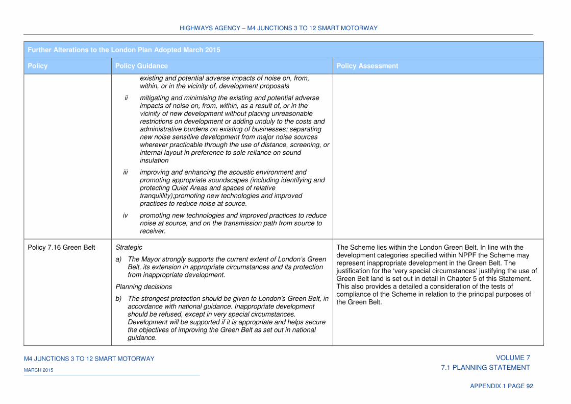
HIGHWAYS AGENCY – M4 JUNCTIONS 3 TO 12 SMART MOTORWAY
M4 JUNCTIONS 3 TO 12 SMART MOTORWAY VOLUME 7
7.1 PLANNING STATEMENT MARCH 2015
APPENDIX 1 PAGE 92
Further Alterations to the London Plan Adopted March 2015
Policy Policy Guidance Policy Assessment
existing and potential adverse impacts of noise on, from, within, or in the vicinity of, development proposals
ii mitigating and minimising the existing and potential adverse impacts of noise on, from, within, as a result of, or in the vicinity of new development without placing unreasonable restrictions on development or adding unduly to the costs and administrative burdens on existing of businesses; separating new noise sensitive development from major noise sources wherever practicable through the use of distance, screening, or internal layout in preference to sole reliance on sound insulation
iii improving and enhancing the acoustic environment and promoting appropriate soundscapes (including identifying and protecting Quiet Areas and spaces of relative tranquillity);promoting new technologies and improved practices to reduce noise at source.
iv promoting new technologies and improved practices to reduce noise at source, and on the transmission path from source to receiver.
Policy 7.16 Green Belt
Strategic
a) The Mayor strongly supports the current extent of London’s Green Belt, its extension in appropriate circumstances and its protection from inappropriate development.
Planning decisions
b) The strongest protection should be given to London’s Green Belt, in accordance with national guidance. Inappropriate development should be refused, except in very special circumstances. Development will be supported if it is appropriate and helps secure the objectives of improving the Green Belt as set out in national guidance.
The Scheme lies within the London Green Belt. In line with the development categories specified within NPPF the Scheme may represent inappropriate development in the Green Belt. The justification for the ‘very special circumstances’ justifying the use of Green Belt land is set out in detail in Chapter 5 of this Statement. This also provides a detailed a consideration of the tests of compliance of the Scheme in relation to the principal purposes of the Green Belt.
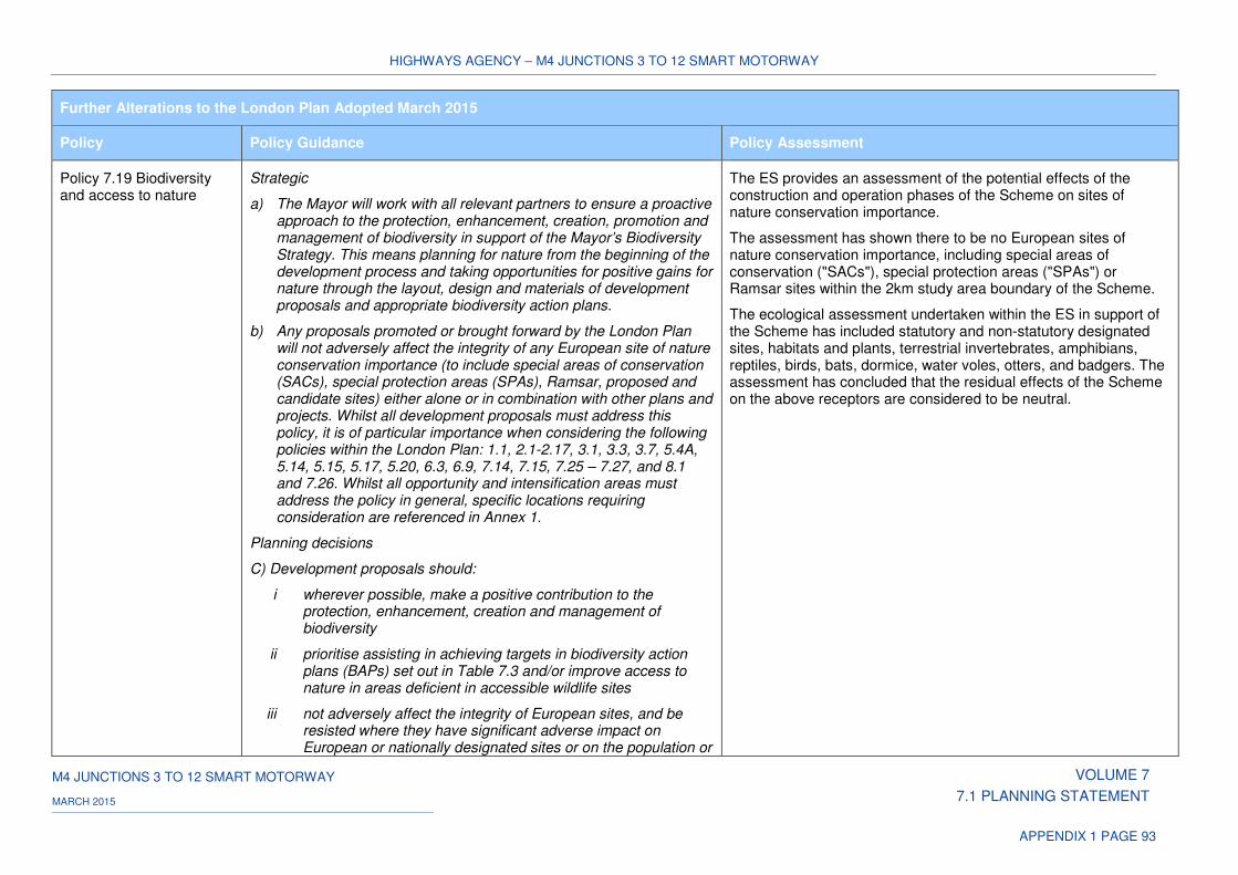
HIGHWAYS AGENCY – M4 JUNCTIONS 3 TO 12 SMART MOTORWAY
M4 JUNCTIONS 3 TO 12 SMART MOTORWAY VOLUME 7
7.1 PLANNING STATEMENT MARCH 2015
APPENDIX 1 PAGE 93
Further Alterations to the London Plan Adopted March 2015
Policy Policy Guidance Policy Assessment
Policy 7.19 Biodiversity and access to nature
Strategic
a) The Mayor will work with all relevant partners to ensure a proactive approach to the protection, enhancement, creation, promotion and management of biodiversity in support of the Mayor’s Biodiversity Strategy. This means planning for nature from the beginning of the development process and taking opportunities for positive gains for nature through the layout, design and materials of development proposals and appropriate biodiversity action plans.
b) Any proposals promoted or brought forward by the London Plan will not adversely affect the integrity of any European site of nature conservation importance (to include special areas of conservation (SACs), special protection areas (SPAs), Ramsar, proposed and candidate sites) either alone or in combination with other plans and projects. Whilst all development proposals must address this policy, it is of particular importance when considering the following policies within the London Plan: 1.1, 2.1-2.17, 3.1, 3.3, 3.7, 5.4A, 5.14, 5.15, 5.17, 5.20, 6.3, 6.9, 7.14, 7.15, 7.25 – 7.27, and 8.1 and 7.26. Whilst all opportunity and intensification areas must address the policy in general, specific locations requiring consideration are referenced in Annex 1.
Planning decisions
C) Development proposals should:
i wherever possible, make a positive contribution to the protection, enhancement, creation and management of biodiversity
ii prioritise assisting in achieving targets in biodiversity action plans (BAPs) set out in Table 7.3 and/or improve access to nature in areas deficient in accessible wildlife sites
iii not adversely affect the integrity of European sites, and be resisted where they have significant adverse impact on European or nationally designated sites or on the population or
The ES provides an assessment of the potential effects of the construction and operation phases of the Scheme on sites of nature conservation importance.
The assessment has shown there to be no European sites of nature conservation importance, including special areas of conservation ("SACs"), special protection areas ("SPAs") or Ramsar sites within the 2km study area boundary of the Scheme.
The ecological assessment undertaken within the ES in support of the Scheme has included statutory and non-statutory designated sites, habitats and plants, terrestrial invertebrates, amphibians, reptiles, birds, bats, dormice, water voles, otters, and badgers. The assessment has concluded that the residual effects of the Scheme on the above receptors are considered to be neutral.
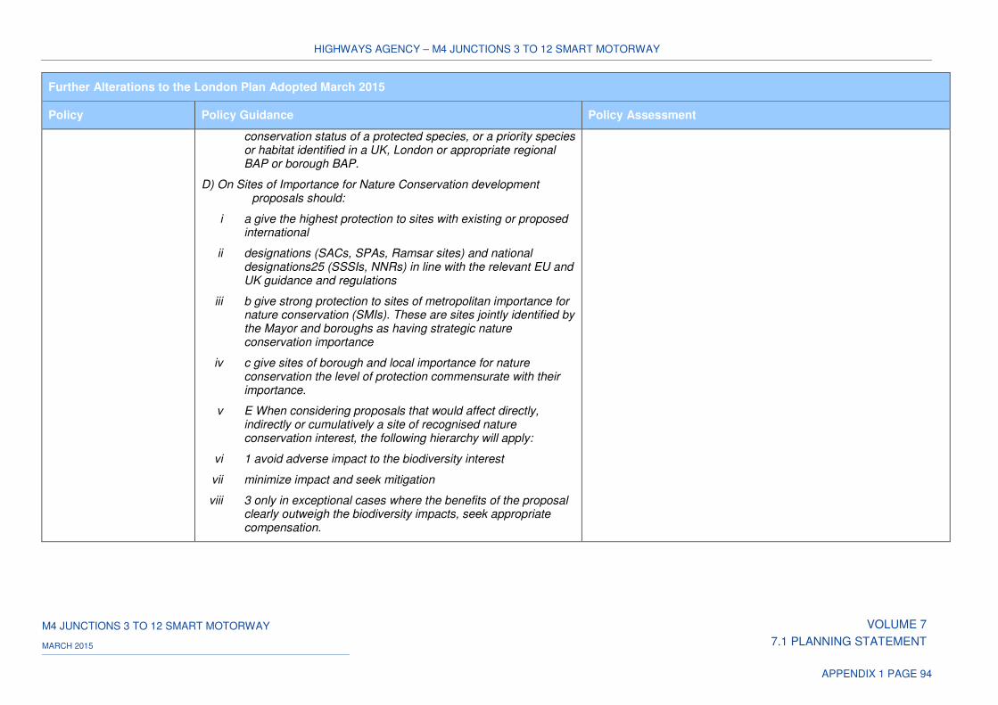
HIGHWAYS AGENCY – M4 JUNCTIONS 3 TO 12 SMART MOTORWAY
M4 JUNCTIONS 3 TO 12 SMART MOTORWAY VOLUME 7
7.1 PLANNING STATEMENT MARCH 2015
APPENDIX 1 PAGE 94
Further Alterations to the London Plan Adopted March 2015
Policy Policy Guidance Policy Assessment
conservation status of a protected species, or a priority species or habitat identified in a UK, London or appropriate regional BAP or borough BAP.
D) On Sites of Importance for Nature Conservation development proposals should:
i a give the highest protection to sites with existing or proposed international
ii designations (SACs, SPAs, Ramsar sites) and national designations25 (SSSIs, NNRs) in line with the relevant EU and UK guidance and regulations
iii b give strong protection to sites of metropolitan importance for nature conservation (SMIs). These are sites jointly identified by the Mayor and boroughs as having strategic nature conservation importance
iv c give sites of borough and local importance for nature conservation the level of protection commensurate with their importance.
v E When considering proposals that would affect directly, indirectly or cumulatively a site of recognised nature conservation interest, the following hierarchy will apply:
vi 1 avoid adverse impact to the biodiversity interest
vii minimize impact and seek mitigation
viii 3 only in exceptional cases where the benefits of the proposal clearly outweigh the biodiversity impacts, seek appropriate compensation.
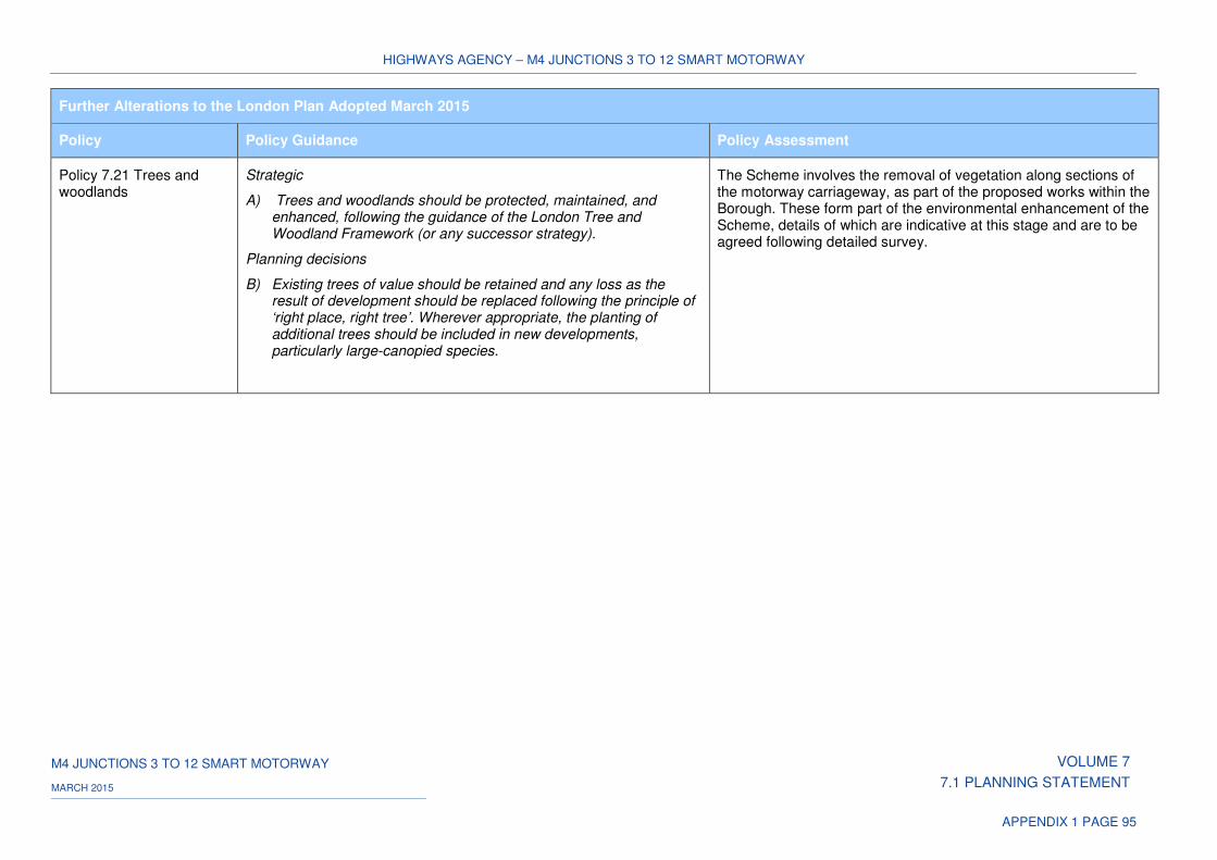
HIGHWAYS AGENCY – M4 JUNCTIONS 3 TO 12 SMART MOTORWAY
M4 JUNCTIONS 3 TO 12 SMART MOTORWAY VOLUME 7
7.1 PLANNING STATEMENT MARCH 2015
APPENDIX 1 PAGE 95
Further Alterations to the London Plan Adopted March 2015
Policy Policy Guidance Policy Assessment
Policy 7.21 Trees and woodlands
Strategic
A) Trees and woodlands should be protected, maintained, and enhanced, following the guidance of the London Tree and Woodland Framework (or any successor strategy).
Planning decisions
B) Existing trees of value should be retained and any loss as the result of development should be replaced following the principle of ‘right place, right tree’. Wherever appropriate, the planting of additional trees should be included in new developments, particularly large-canopied species.
The Scheme involves the removal of vegetation along sections of the motorway carriageway, as part of the proposed works within the Borough. These form part of the environmental enhancement of the Scheme, details of which are indicative at this stage and are to be agreed following detailed survey.
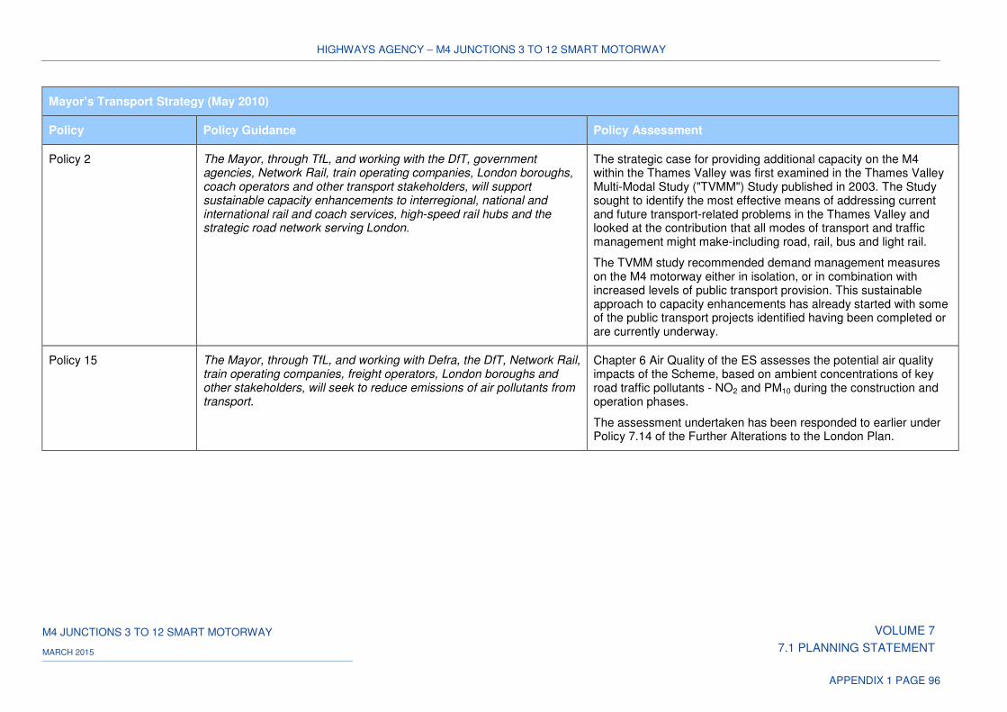
HIGHWAYS AGENCY – M4 JUNCTIONS 3 TO 12 SMART MOTORWAY
M4 JUNCTIONS 3 TO 12 SMART MOTORWAY VOLUME 7
7.1 PLANNING STATEMENT MARCH 2015
APPENDIX 1 PAGE 96
Mayor’s Transport Strategy (May 2010)
Policy Policy Guidance Policy Assessment
Policy 2 The Mayor, through TfL, and working with the DfT, government agencies, Network Rail, train operating companies, London boroughs, coach operators and other transport stakeholders, will support sustainable capacity enhancements to interregional, national and international rail and coach services, high-speed rail hubs and the strategic road network serving London.
The strategic case for providing additional capacity on the M4 within the Thames Valley was first examined in the Thames Valley Multi-Modal Study ("TVMM") Study published in 2003. The Study sought to identify the most effective means of addressing current and future transport-related problems in the Thames Valley and looked at the contribution that all modes of transport and traffic management might make-including road, rail, bus and light rail.
The TVMM study recommended demand management measures on the M4 motorway either in isolation, or in combination with increased levels of public transport provision. This sustainable approach to capacity enhancements has already started with some of the public transport projects identified having been completed or are currently underway.
Policy 15 The Mayor, through TfL, and working with Defra, the DfT, Network Rail, train operating companies, freight operators, London boroughs and other stakeholders, will seek to reduce emissions of air pollutants from transport.
Chapter 6 Air Quality of the ES assesses the potential air quality impacts of the Scheme, based on ambient concentrations of key road traffic pollutants - NO2 and PM10 during the construction and operation phases.
The assessment undertaken has been responded to earlier under Policy 7.14 of the Further Alterations to the London Plan.

HIGHWAYS AGENCY – M4 JUNCTIONS 3 TO 12 SMART MOTORWAY
M4 JUNCTIONS 3 TO 12 SMART MOTORWAY VOLUME 7
7.1 PLANNING STATEMENT MARCH 2015
APPENDIX 1 PAGE 97
Mayor’s Transport Strategy (May 2010)
Policy Policy Guidance Policy Assessment
Policy 16 The Mayor, through TfL, and working with the DfT, Network Rail, train operating companies, freight operators, London boroughs and other stakeholders, will seek to reduce noise impacts from transport.
Chapter 12 Noise and Vibration of the ES has detailed the assessment of predicted noise and vibration impacts of the Scheme during construction, operation.
The assessment has shown that during the operational phase, the majority of receptors in the study area will experience a reduction in noise levels. In addition, low-noise surfacing has been incorporated across all lanes of the Scheme along the complete Scheme extent.
During the construction period, the magnitude of construction noise and vibration impacts is assessed as being negligible or minor and the significance of effect is assessed as slight adverse. A range of good site practices will therefore be adopted in order to mitigate construction phase noise and vibration, to be documented in the CEMP in support of the Application.
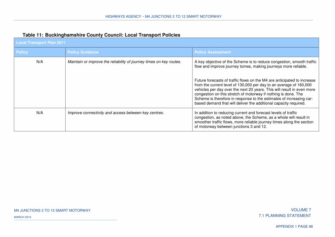
HIGHWAYS AGENCY – M4 JUNCTIONS 3 TO 12 SMART MOTORWAY
M4 JUNCTIONS 3 TO 12 SMART MOTORWAY VOLUME 7
7.1 PLANNING STATEMENT MARCH 2015
APPENDIX 1 PAGE 98
Table 11: Buckinghamshire County Council: Local Transport Policies
Local Transport Plan 2011
Policy Policy Guidance Policy Assessment
N/A Maintain or improve the reliability of journey times on key routes.
A key objective of the Scheme is to reduce congestion, smooth traffic flow and improve journey tomes, making journeys more reliable.
Future forecasts of traffic flows on the M4 are anticipated to increase from the current level of 130,000 per day to an average of 160,000 vehicles per day over the next 20 years. This will result in even more congestion on this stretch of motorway if nothing is done. The Scheme is therefore in response to the estimates of increasing car-based demand that will deliver the additional capacity required.
N/A Improve connectivity and access between key centres. In addition to reducing current and forecast levels of traffic congestion, as noted above, the Scheme, as a whole will result in smoother traffic flows, more reliable journey times along the section of motorway between junctions 3 and 12.


![Welcome [assets.highways.gov.uk]assets.highways.gov.uk/roads/road-projects/M23+junctions+8+to+10... · Welcome Smart motorway M23 junctions 8 to 10 public information exhibition](https://img.pdfslide.net/doc/110x75/5ad58ecf7f8b9a0d2d8dd139/welcome-junctions8to10welcome-smart-motorway-m23-junctions-8-to-10-public.jpg)