Embed Size (px)
Citation preview
Machine Assisted Geodesign
The Team
Ervin Cable Construction
Full service provider of construction, design, and
engineering services to the telecommunications
industry.
3-GIS
Automated planning services and tools for
generation of lower cost fiber network planning, design & construction.
© 2017 All Rights Reserved
FTTx Design Challenges
> Goals– Ambitious Targets– Time to Revenue– Capital Budget
> Obstacles– Ambiguous Requirements– Difficulty and Cost of Scaling– Inconsistency of Delivery– Duplication of Effort– Poor Documentation
Solving the Key problems...
© 2017 All Rights Reserved
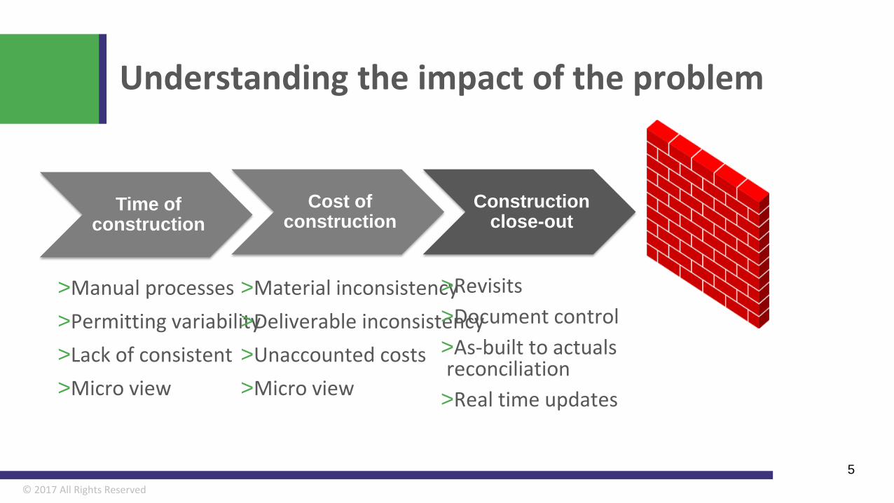
Understanding the impact of the problem
5
Time of construction
>Manual processes>Permitting variability>Lack of consistent>Micro view
Cost of construction
>Material inconsistency>Deliverable inconsistency>Unaccounted costs>Micro view
Construction close-out
>Revisits>Document control>As-built to actuals reconciliation>Real time updates

Historical solutions to the problem…..
© 2017 All Rights Reserved
Traditional Method
© 2017 All Rights Reserved
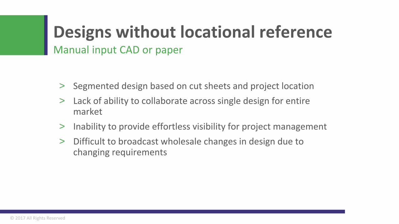
> Segmented design based on cut sheets and project location> Lack of ability to collaborate across single design for entire
market> Inability to provide effortless visibility for project management> Difficult to broadcast wholesale changes in design due to
changing requirements
Designs without locational referenceManual input CAD or paper
© 2017 All Rights Reserved
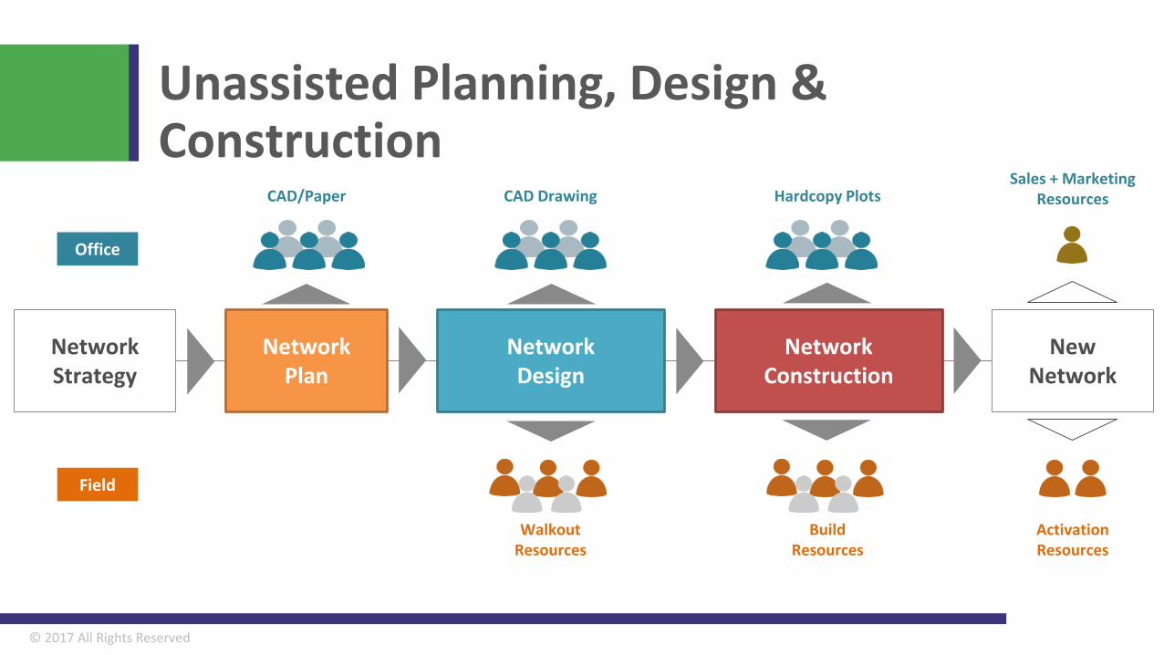
Unassisted Planning, Design & Construction
Walkout Resources
Build Resources
Activation Resources
CAD Drawing Hardcopy PlotsCAD/PaperSales + Marketing
Resources
NewNetwork
NetworkStrategy
NetworkDesign
NetworkConstruction
NetworkPlan
Office
Field
© 2017 All Rights Reserved
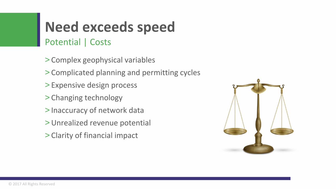
Need exceeds speed
> Complex geophysical variables> Complicated planning and permitting cycles> Expensive design process> Changing technology > Inaccuracy of network data> Unrealized revenue potential> Clarity of financial impact
Potential | Costs
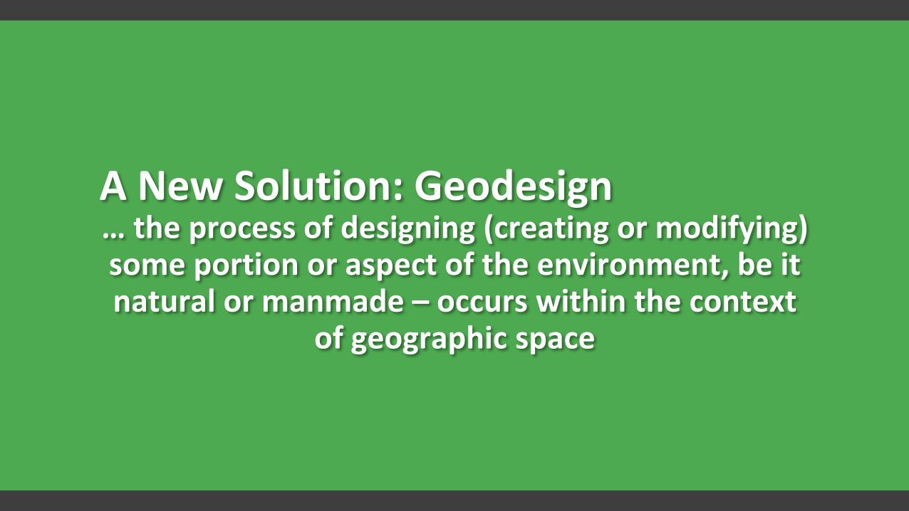
A New Solution: Geodesign… the process of designing (creating or modifying) some portion or aspect of the environment, be it natural or manmade – occurs within the context
of geographic space
© 2017 All Rights Reserved
New Method
© 2017 All Rights Reserved
© 2017 All Rights Reserved
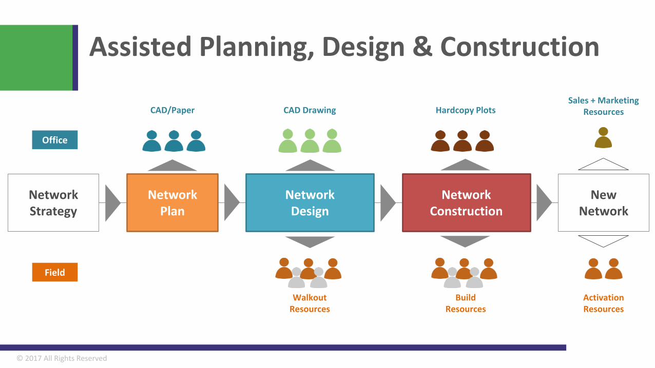
Assisted Planning, Design & Construction
Walkout Resources
Build Resources
Activation Resources
CAD Drawing Hardcopy PlotsCAD/PaperSales + Marketing
Resources
NewNetwork
NetworkStrategy
NetworkDesign
NetworkConstruction
NetworkPlan
Office
Field
© 2017 All Rights Reserved
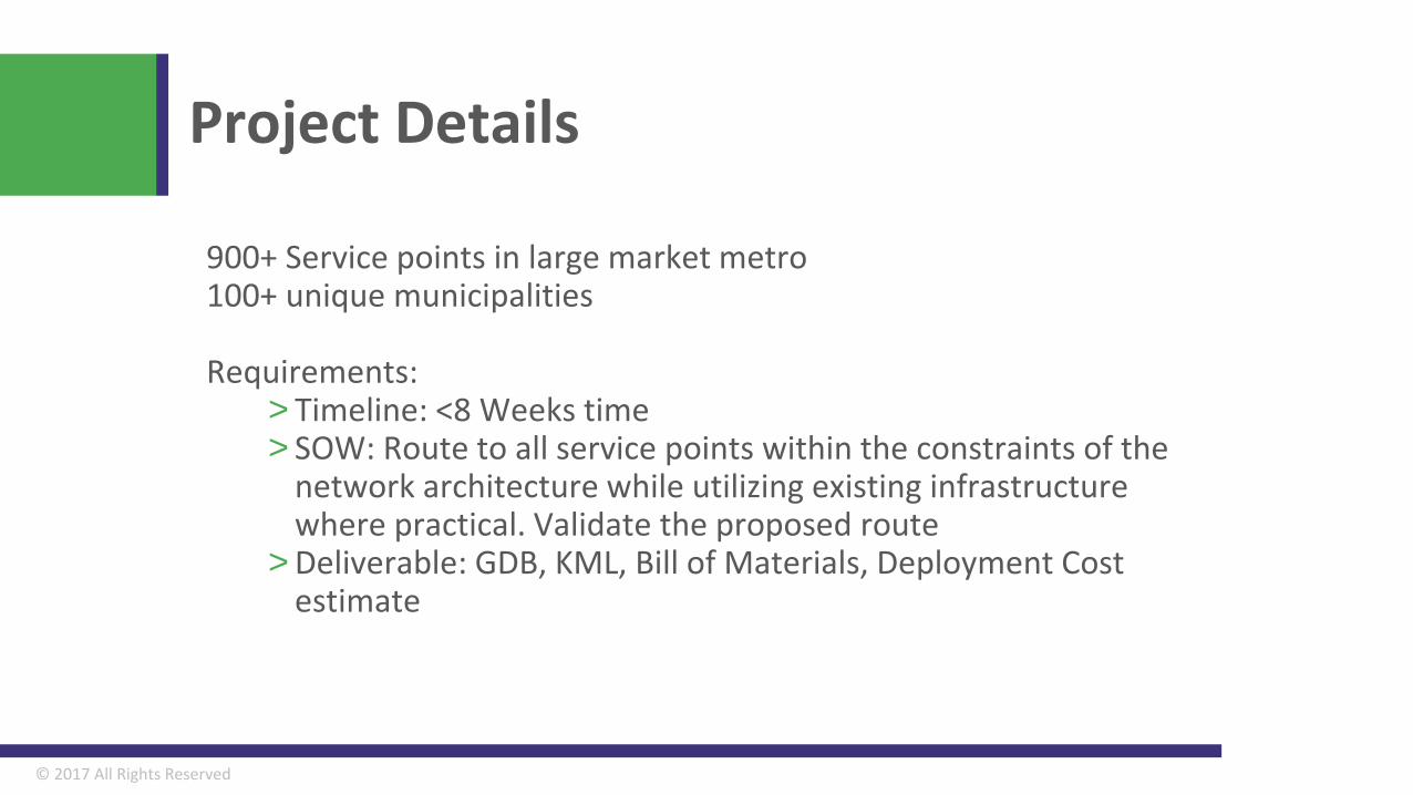
Project Details
900+ Service points in large market metro100+ unique municipalities
Requirements: > Timeline: <8 Weeks time> SOW: Route to all service points within the constraints of the
network architecture while utilizing existing infrastructure where practical. Validate the proposed route
> Deliverable: GDB, KML, Bill of Materials, Deployment Cost estimate
© 2017 All Rights Reserved
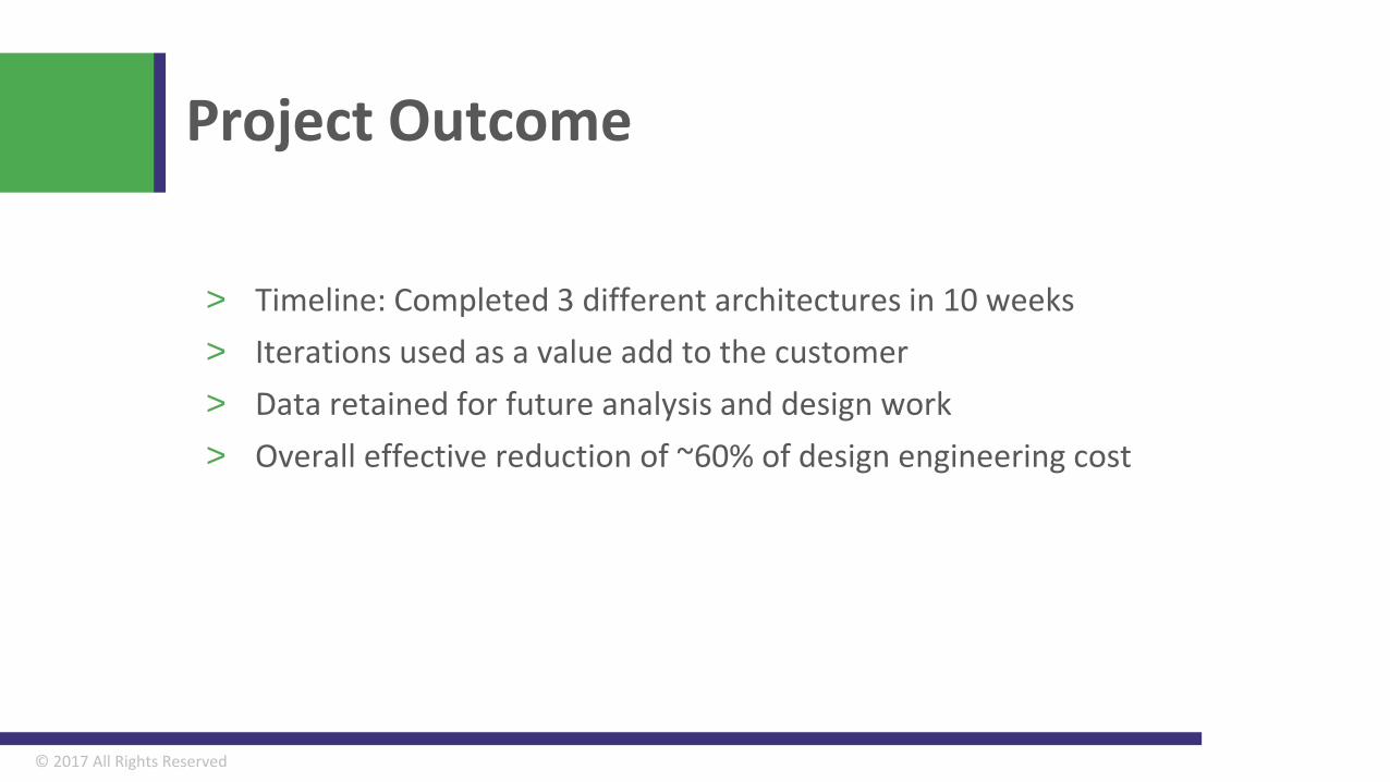
Project Outcome
> Timeline: Completed 3 different architectures in 10 weeks> Iterations used as a value add to the customer> Data retained for future analysis and design work> Overall effective reduction of ~60% of design engineering cost
© 2017 All Rights Reserved
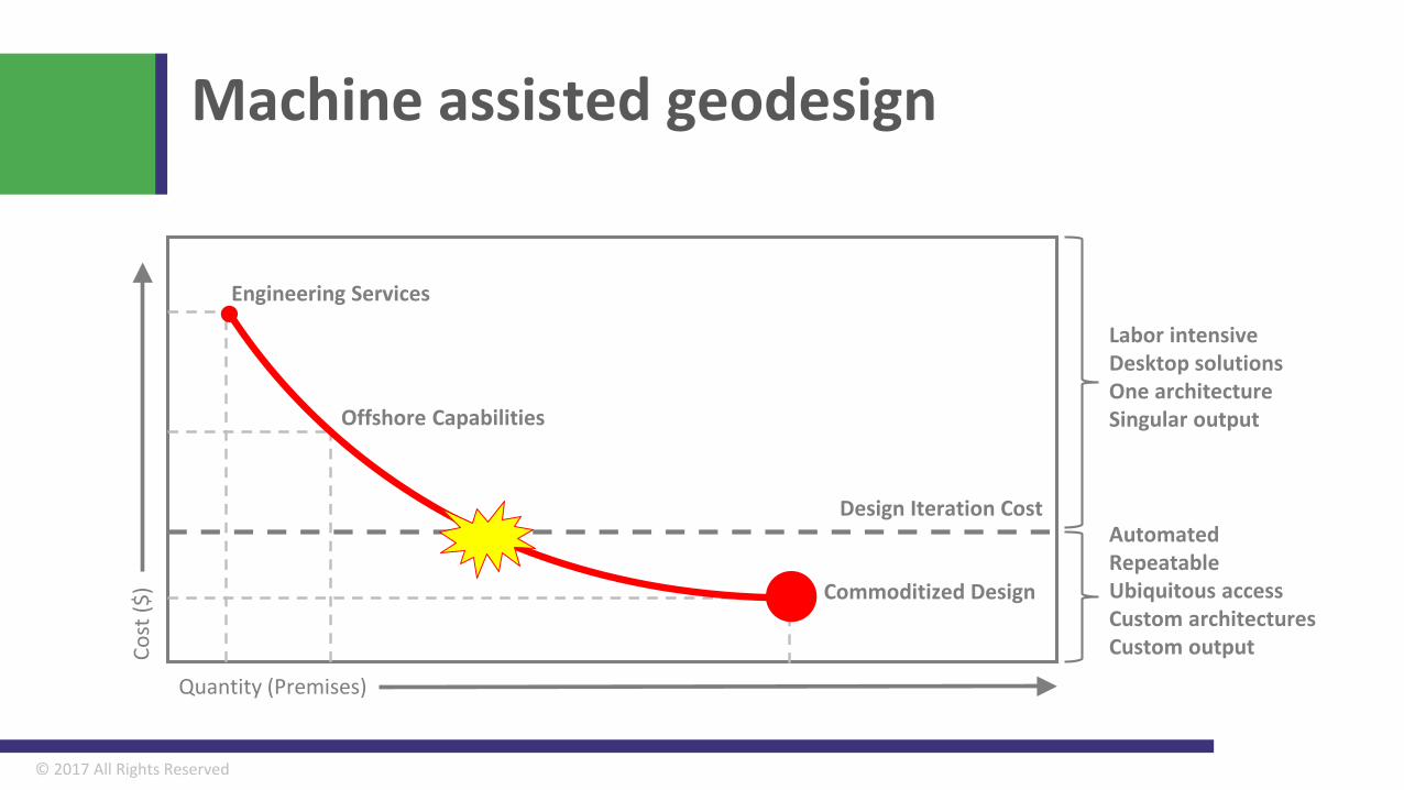
Machine assisted geodesignCo
st ($
)
Quantity (Premises)
Design Iteration Cost
Engineering Services
Offshore Capabilities
Commoditized Design
Labor intensiveDesktop solutionsOne architectureSingular output
AutomatedRepeatableUbiquitous accessCustom architecturesCustom output
© 2017 All Rights Reserved
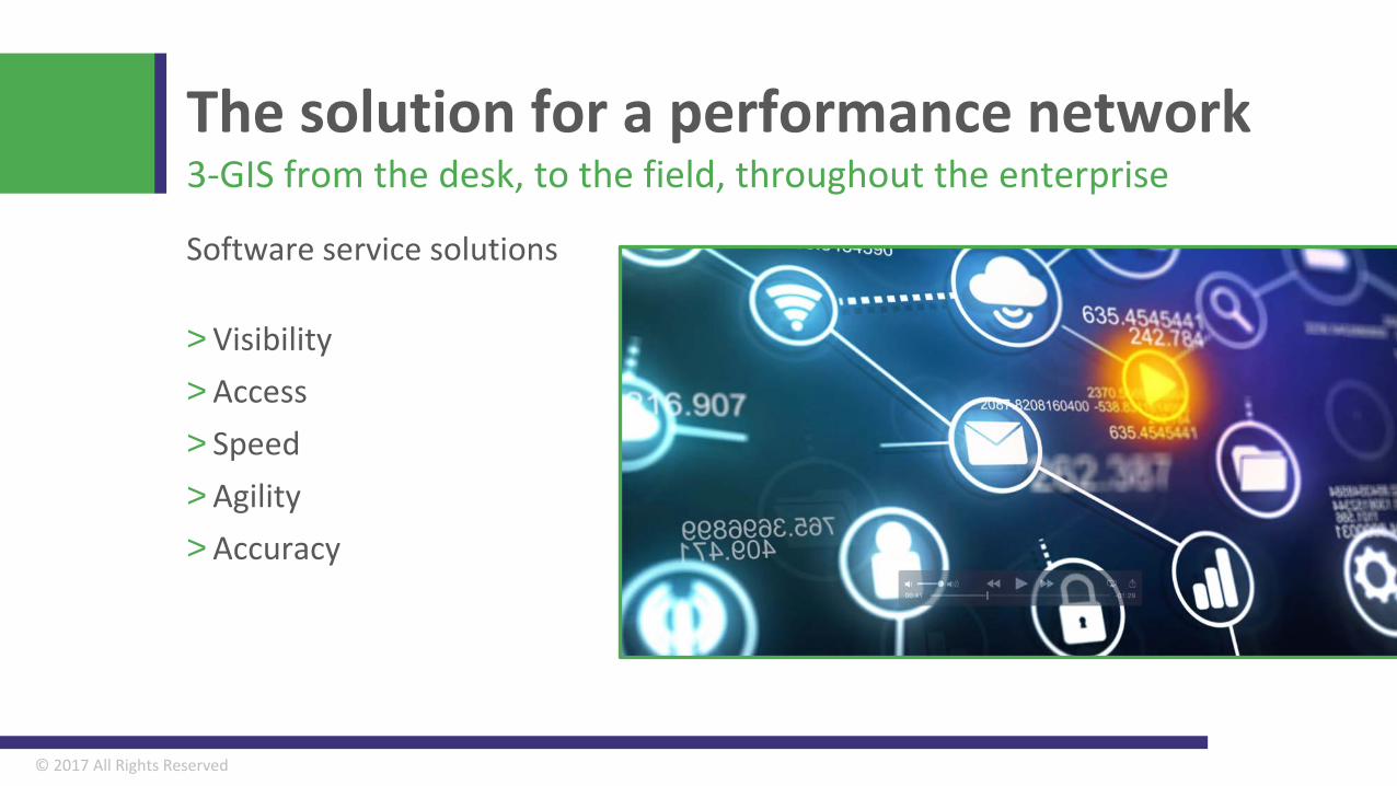
Software service solutions
> Visibility> Access> Speed> Agility> Accuracy
The solution for a performance network3-GIS from the desk, to the field, throughout the enterprise
© 2017 All Rights Reserved
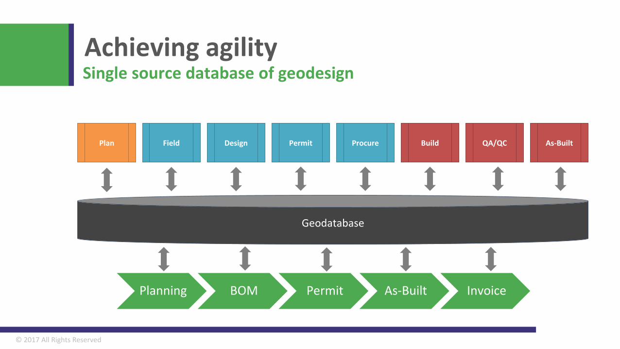
Achieving agilitySingle source database of geodesign
Geodatabase
Plan Field Design Permit Procure Build As-Built
Action
Source
Output
QA/QC
Planning BOM Permit As-Built Invoice
© 2017 All Rights Reserved
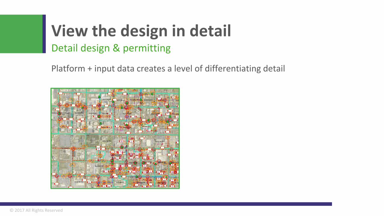
Platform + input data creates a level of differentiating detail
View the design in detailDetail design & permitting
© 2017 All Rights Reserved
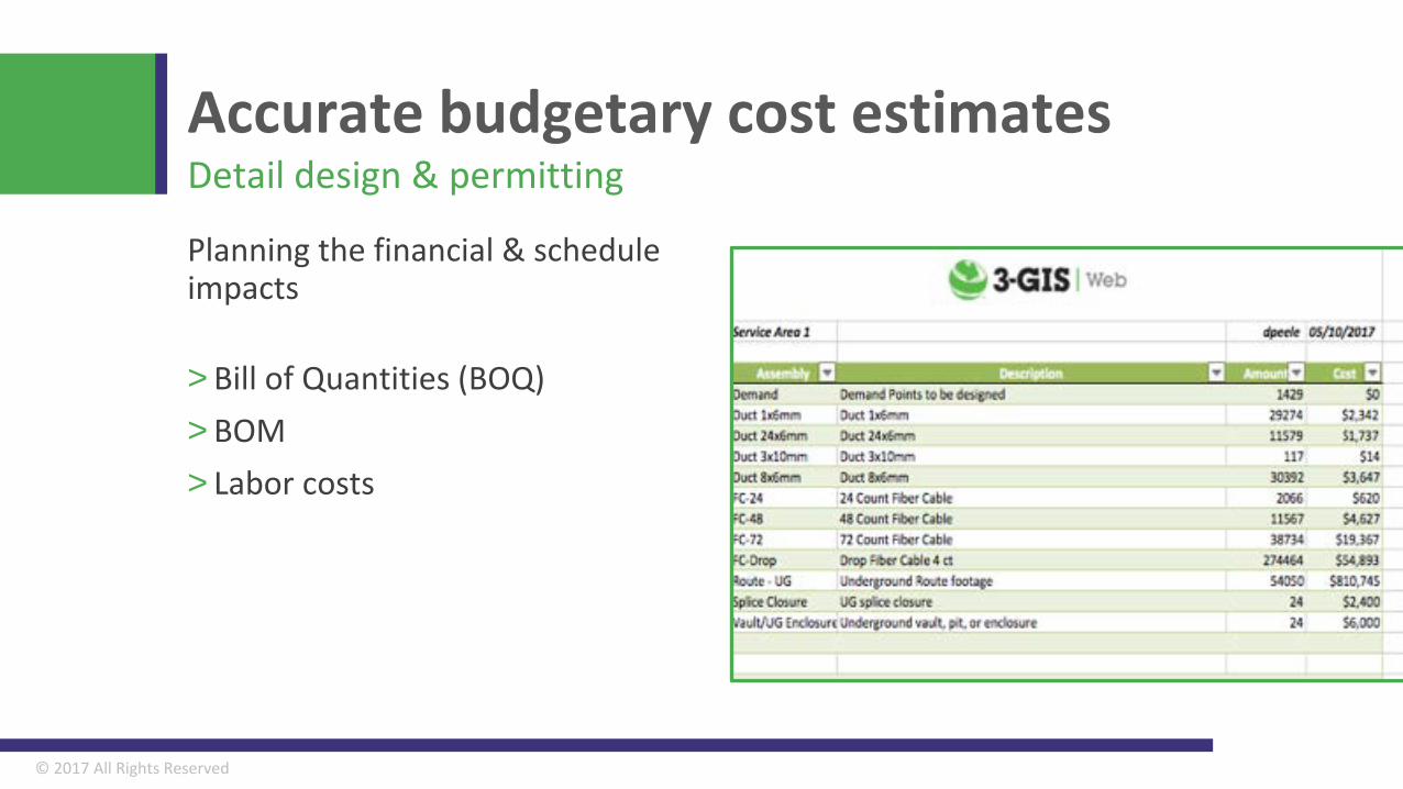
Planning the financial & schedule impacts
> Bill of Quantities (BOQ)> BOM> Labor costs
Accurate budgetary cost estimatesDetail design & permitting
© 2017 All Rights Reserved
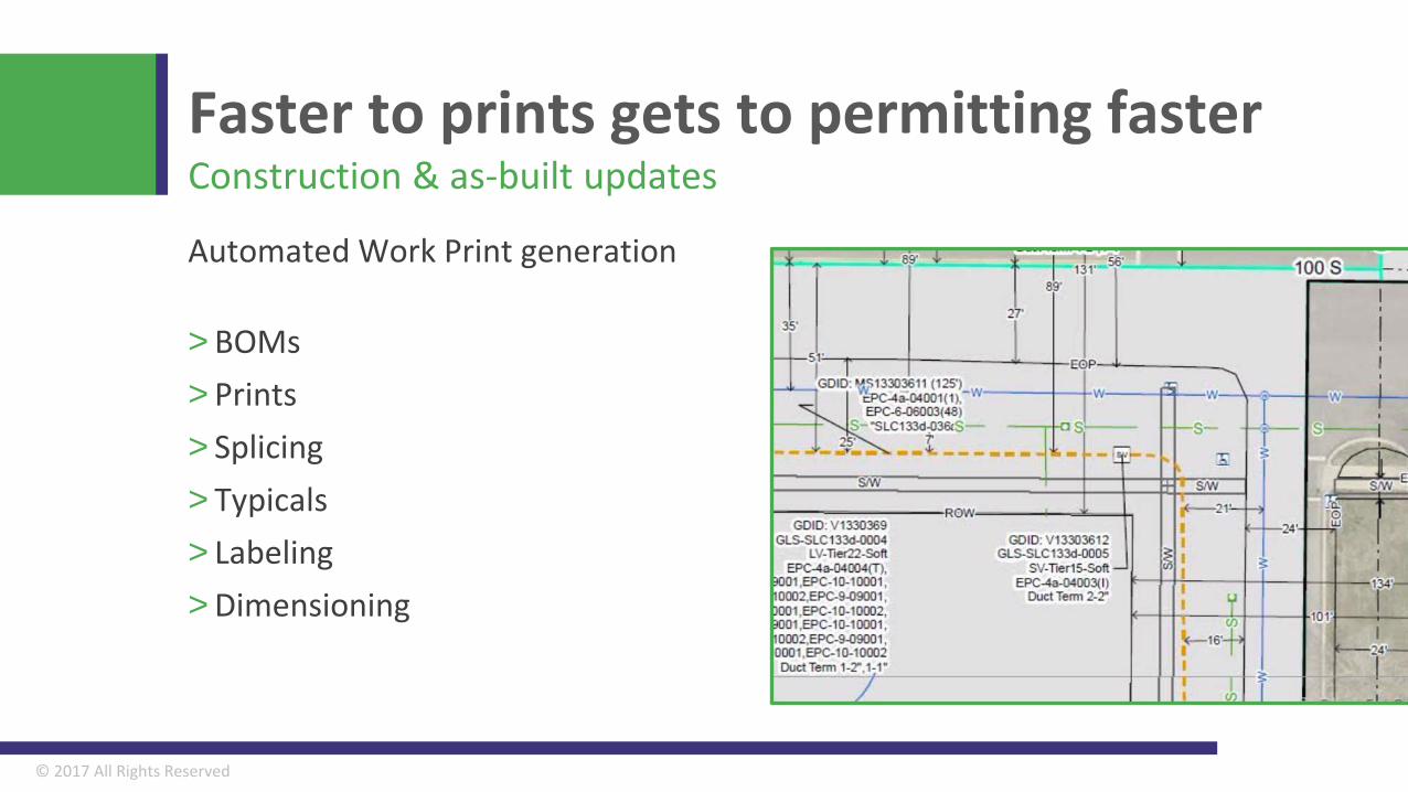
Automated Work Print generation
> BOMs> Prints> Splicing> Typicals> Labeling> Dimensioning
Faster to prints gets to permitting fasterConstruction & as-built updates
Life-of-network solutions
3-GIS is pioneering a data driven approach based on spatial analysis, automation, mobility, and cloud-based services that is revolutionizing the deployment and management of fiber assets.
© 2017 All Rights Reserved
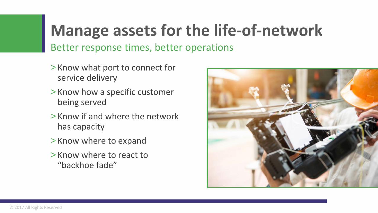
> Know what port to connect for service delivery
> Know how a specific customer being served
> Know if and where the network has capacity
> Know where to expand> Know where to react to
“backhoe fade”
Manage assets for the life-of-networkBetter response times, better operations
Thank you!Kyle Siniard, Director Product Management
Tim Sherman, Engineering Director [email protected]