Embed Size (px)
Citation preview
2.11177 TRUMAN 010
Anbil Explorations(Sudbury)K.R.#i,Site 2,Box 36
Val Caron, ON. P0M 3A0
Consult ants
Magnetometer S* VLF Surveys Gordon Salo's Property
Truman TWP.Sudbury Mining Division
Ontario
RECEIVED
MAY 11 1888
MINING LANDS SECTION
April 23, 1988
Val Lime i ab t? l s Sal oDisk NO. 1-1f- i L en ames s Gor d . d at
Gord2.dat Report Letter
Nei l RichardsonJohn WatkinsGeological Technologists

4II03NVM06 2.11177 TRUMAN 010C
TABLE OF CONTENTS
iNTRQDUCrtGN
INSTRUMENT
PROPERTY AND LOCATION
ACCESS AND FACILITIES
HISTORY AND DEVELOPMENT
GEOF-HYSICAL SURVEYSElectromaqnet survey .
Magnetic Survey
CONCLUSIONS AND RECOMMENDATIONS
CERTIFICATE
REFERENCES
APPENDIX A: Base Map
B: Mag Plot
C: VLF Plot
i
i
l
1,2
2
2,3
3
4
5,6
7
8
9
IhOBCDUCTION
This reoort covars Magnetic and VLF surveys carriad out OH -S c j. a l ^.-
in "ruff-ar, Twp , , Sudbury Mining Division, Ontario, -for Mr. Gordon Salo.
address;?.O. Box 36 Station B, Sudbury,ON. P3E 4N3)
The field wark and the interpretation o-f the data were complstad by
Vibil Explorations(Sudbury). The instrument used was a EDA Omni P", ut,,
the operators were John Watkins and Neil Richardson.
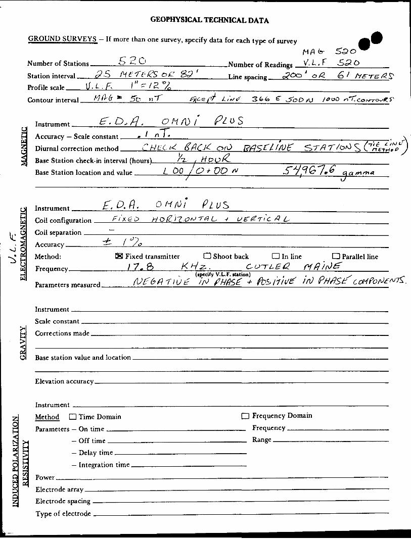
INSTRUMENT
The instrument used during the survey MAS an EDA Omni Plus which
reads magnetic total -Field to an accuracy of G), l nT. The method o-f
diurnal correction was performed using th* tie-line method. VLF
readings where taken using Cutler, Mains at 17.3 kHz. A total
number o-f 5213 readings where taken at 23m spacing.
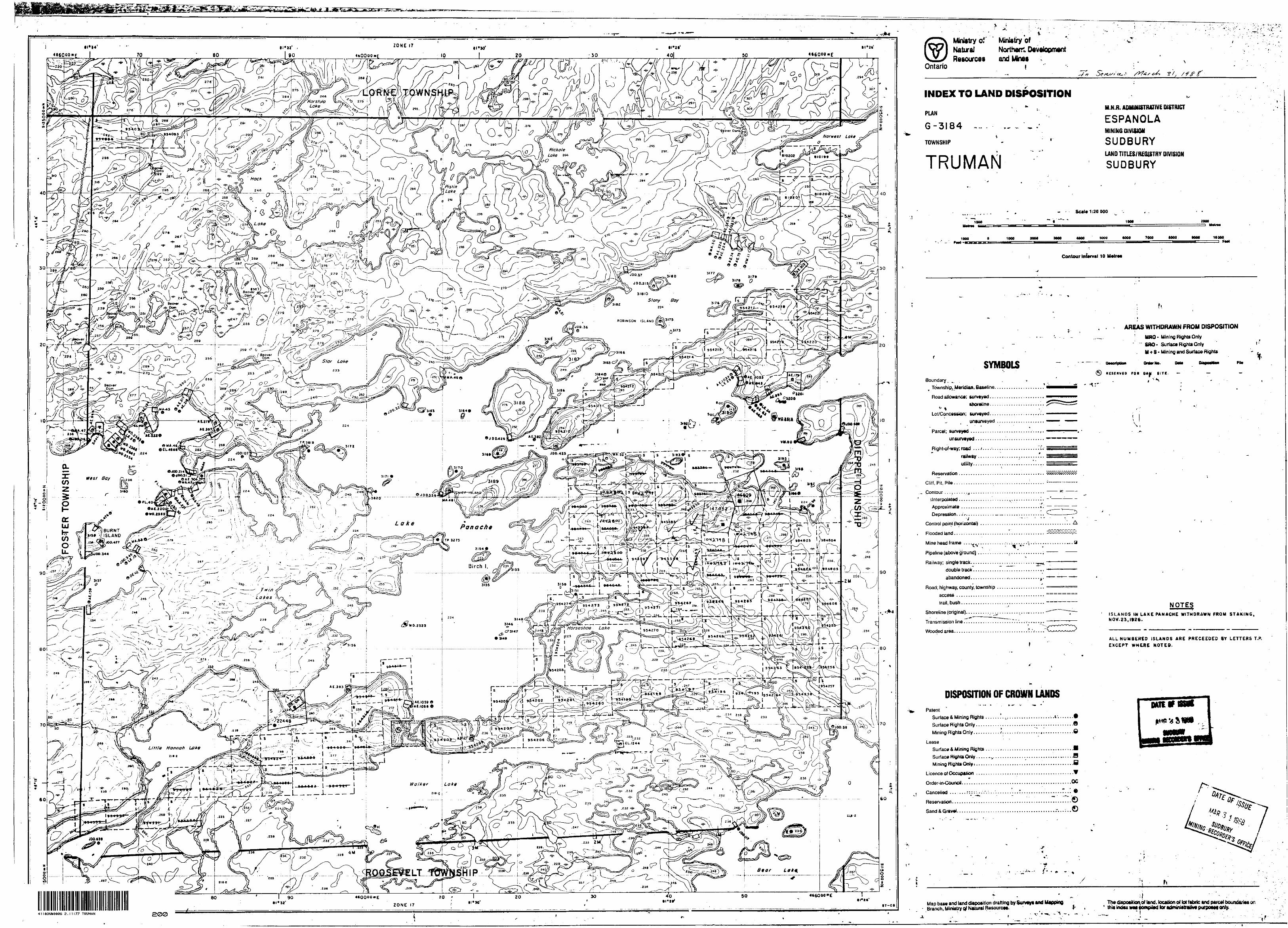
PROPERTY AND LOCATION
The property consists o-f 6 claims: S943S94 to S94359Q incl. plus
S984043, which lies in Truman TWP.
All 6 claims are located in th* Central-Eastern section of Truman
TWP. in the Sudbury Mining Division, Ontario.
ACCESS AND FACILITIES
The property can b* accessed via Highway 17 West, to a town call ad
Whitefish, ON. Highway 349, which lead* to th* north shore of Lake
Panache; traveling west on the north shor* road for approximately
7 miles, is the location of Gordon Salo'* camp. Access to the claims
from here is by boat in the summer or snowmobile in the winter. Tha
claims are located on the south shore across from his camp.
The only ? 5. c: L :'. t y t c r.ota on the claim* is the picket line gri
sy-srcem at 2E53 feet or apprax. 61 meter spacing; which were cut by-
chain sa* i.-! the fall of 1937. A total of 8 line miles or 13 km,
where cut and chained starting on October 19, 1987 and the report
completed and submitted to Mr.Sardon Salo on April 23, 19S8.
HISTORY AND DEVELOPMENT
The claims have no previous recorded assessment work, althouch c-:
the property there are a number of old pits and trenches with
mineralisation in them. The ground had been staked in the early -^i F Li
Mr. Gordon Salo had done same preliminary manual stripping before tha
the line cutting and geophysical survey were completed.
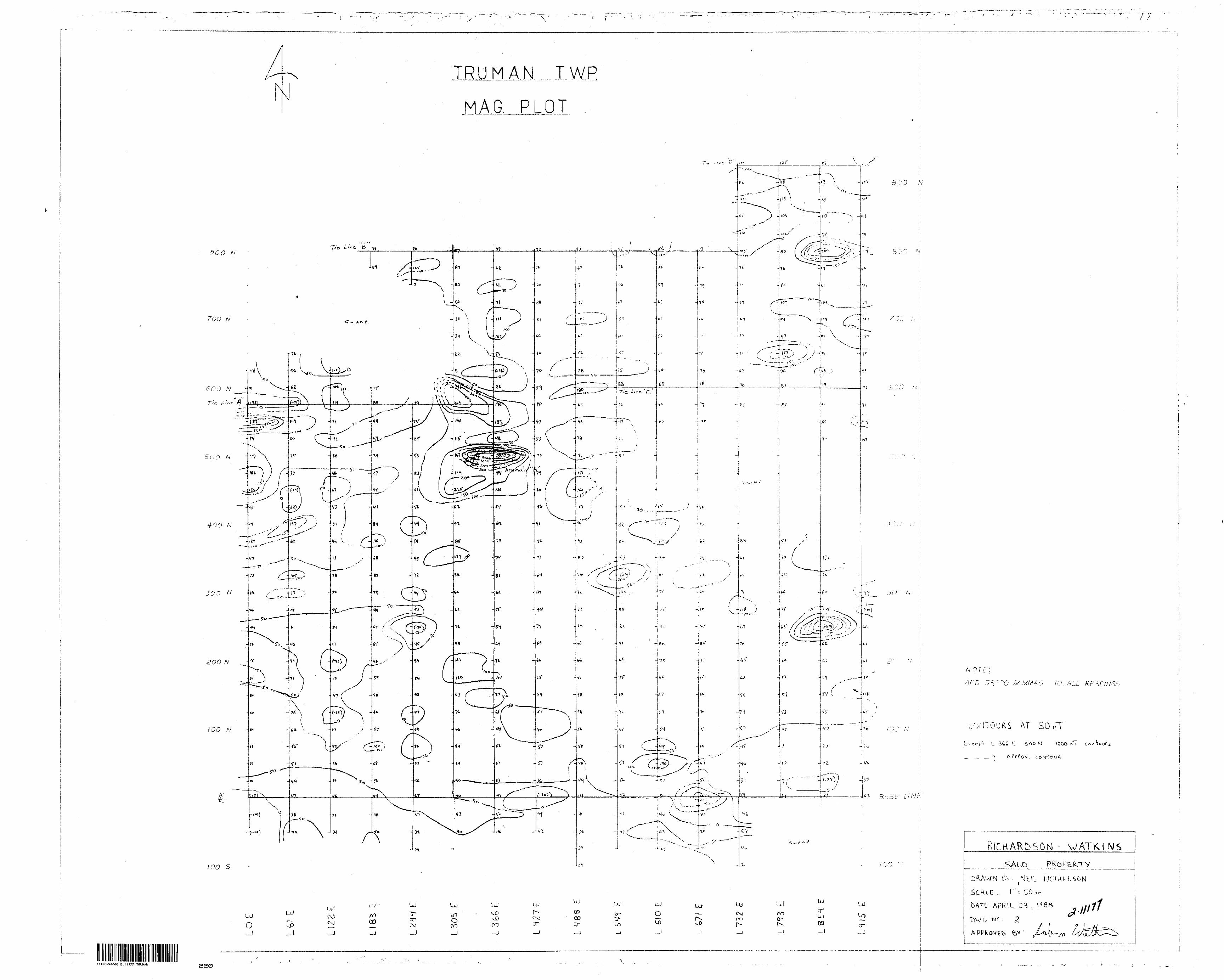
GEOPHYSICAL SURVEYS
Electromagnetic Survey - Three strong VLF anomalies were located on
the claim group; with a number of weak VLF anomalies having no
particular significance. I will lab*l the anomalies as A,B and C
Anomaly "A": Anomaly "A" is located to the south of pit # l,
which has massive sulphide* throughout it. This anomaly appears to
be a structure anomaly such ** a -fault or it is related to the dry
cedar swamp. This anomaly is directly associated with the massive
sulphides located in pit* 1. This VLF anomaly is associated with
the magnetic anomaly on line 366 E. It has a strike lenght of approx.
700 meters. This anomaly strikes N 45 E and then turns @ 500 N to
approx. N 80 E on line 305 E. It is open in both directions along
strike.
Anomaly "B": Anomaly "B" is located to the south of pit 3 and 5.
This anomaly trends S approx. N 45 E and therefore appears to be
150 meter offset extension of anomaly "A".
Arcitaly "C": Anomaly "C" This is an offset anamlay that trends
appro*. N 75 E and strikes for about 100 meters. This anamlay
occurs an lines 244,335 East and about 400 N, This anomaly is an
off se t of aricmlay "ft". This anomlay is also related to structure
such as: fault,or lineation.
Magnetic Survey - One anomaly was located on the claim group just
to the SE of pit l
Anomaly "A": Anomaly "A" is just to the SE o-f pit l, which
contains massive sulphides. Pyrrhotite, which is present with the
sulphides, is ^esponsable -for the high readings. This anomaly doesn't
have much significance as it is the only anomaly throughout the survey
area.
CONCLUSION fc RECOMMENDATIONS
Corel j. s i on s
With the geophysical survey completed and significant VLF and
magneti c anomaly outlined, the massive sulphide in pit "l" appears tc
have little strike length because o-f low magnetic values.
Recammenciati an-s
I would recommend that an EM survey be.conducted on the strong
VLF and magnetic anomalies be-fore any -further work be approved.
If this phase comes out positive geological mapping and
sampling of the property should commence.
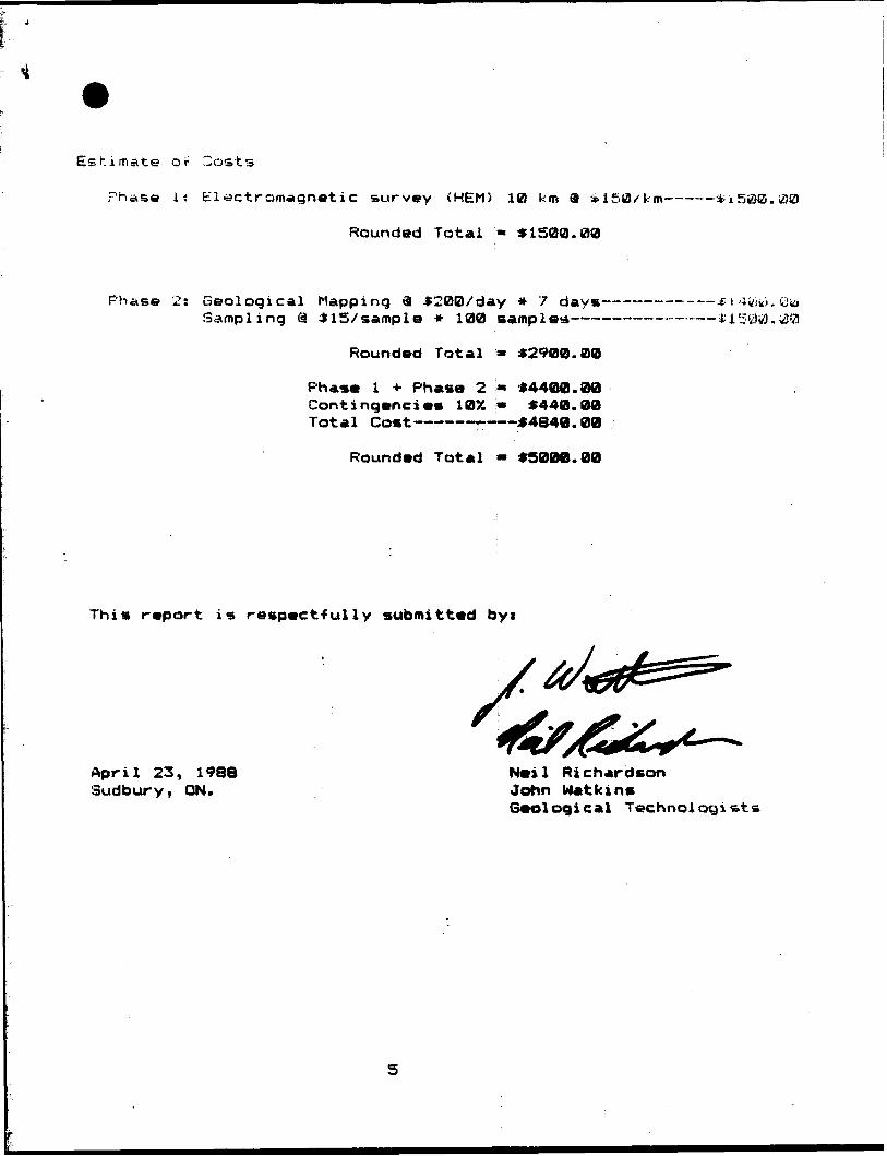
Estimate or Cost s
Phase i: Electromagnetic survey (HEM) 10 km SI ^ISO/km
Rounded Total " 41500.00
Phase 2: Geological Mapping 3 4200/day * 7 days Sampling 9 * 1 5/ samp l e * 100 sampler
f i 4iiiti . Q
Rounded Total
P h aa. l i- Phasa 2 Contingencies 107. Total Comt ————— -
Rounded Total
42900.00
44400.004440.00
44840.00
49000.00
This report is respect-fully submitted by i
April 23, 1988 Sudbury, ON.
Neil RichardsonJohn Wat k in*Geological Technologists
5
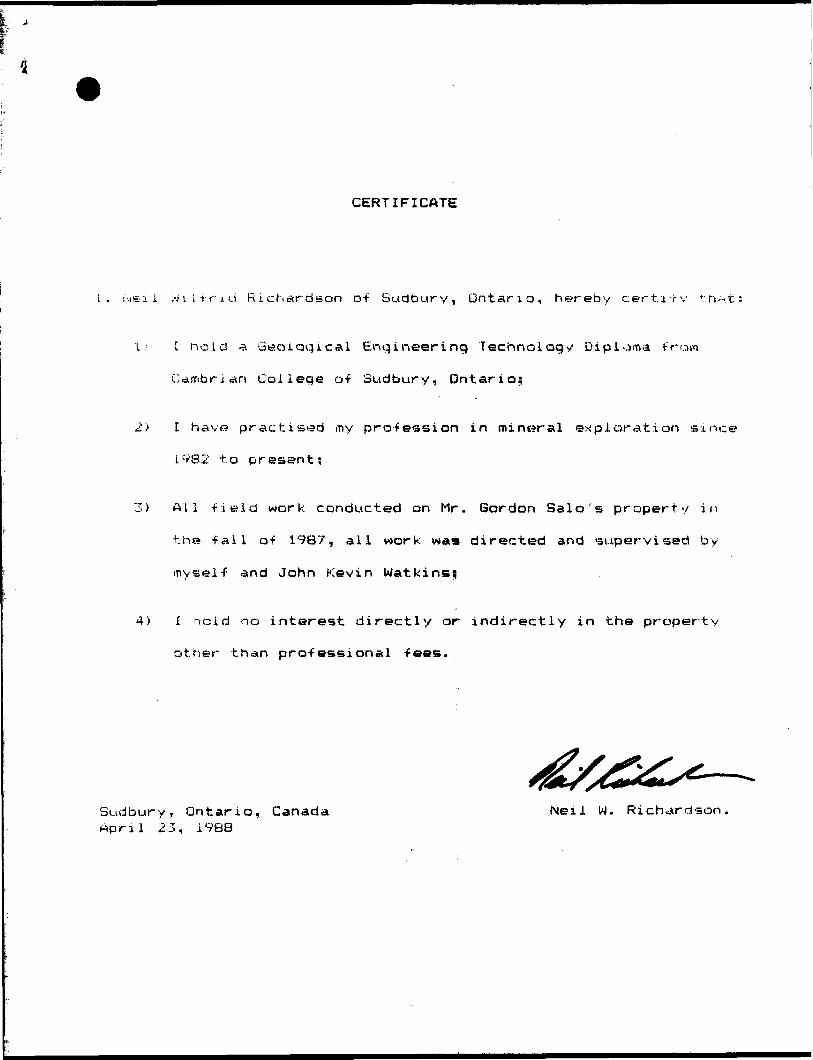
CERTIFICATE
i, f'.iei i W i i i r -t d Richardson of Sudbury, Ontario, hereby cert i TV f. h* t:
l .' t hole! a Geological Engineering Technology Diploma from
Cambrian College of Sudbury, Ontario;
2) I have practised my profession in mineral exploration since
1982 to present;
3) All -field work conducted on Mr. Gordon Salo's property in
the fall of 1987, all work was directed and supervised by
myself and John Kevin Watkins;;
4) l hold no interest directly or indirectly in the property
other than professional fees.
Sudbury, Ontario, Canada April 23, 1988
Neil W. Richardson.
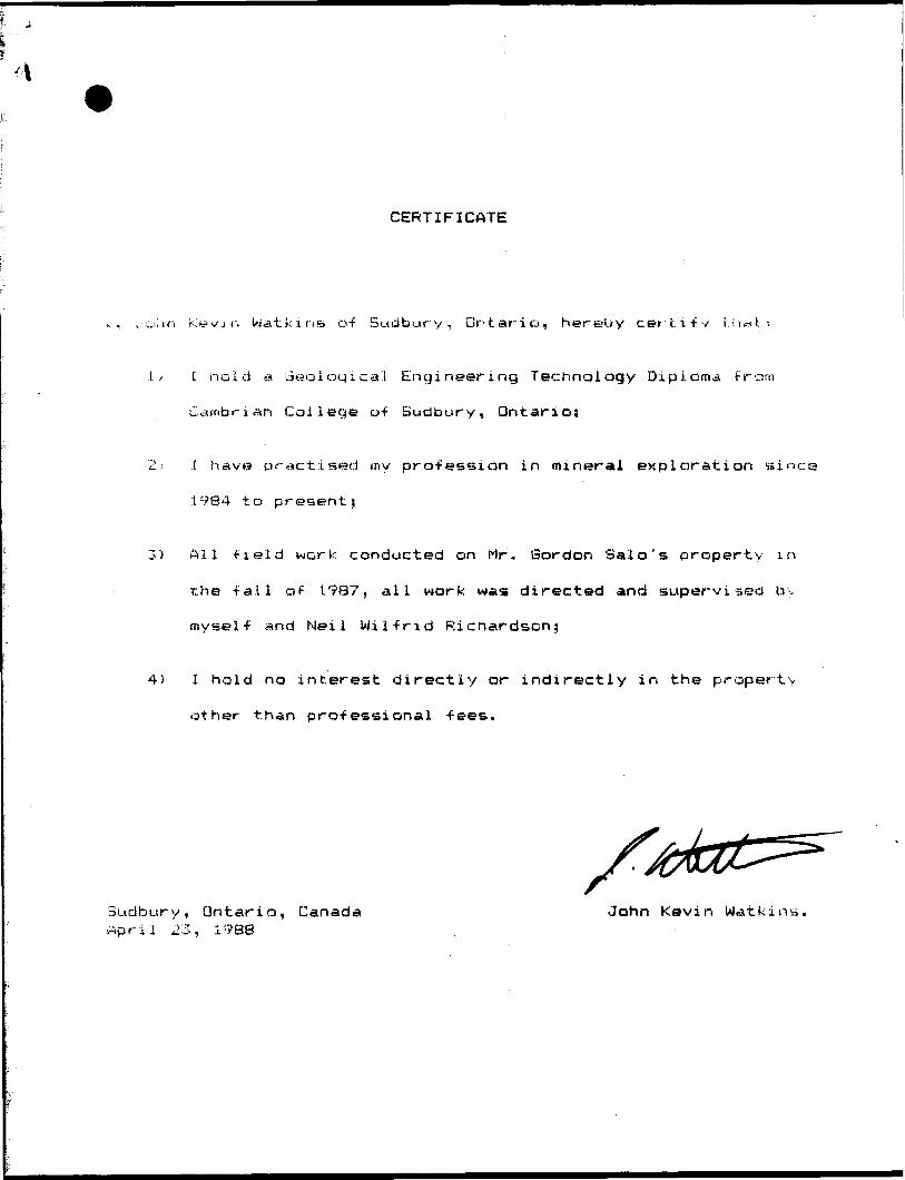
CERTIFICATE
can Kevin Wat k i ri s D-f Sudbury, Ontario, hereUy certify t; i** l:
L.' C hold a ideological Engineering Technology Diploma from
Cambrian College of Sudbury, Ontario;
'2'' l h ave practised my profession in mineral exploration sin
1984 to present;
3) All -field work conducted on Mr. Sordon Sale's property in
the -fail oF 1987, all work was directed and supervised bv
myself and Nei l Wilfrid Ricnardscn;
4) l hold no interest directly or indirectly in the property
other than professional fees.
Sudbury, Ontario, Canada John Kevin Watkins, rtpril 23, 1988
REFERENCE
An t h on y I n s i n n a , BSc. (Hon our s) 49t) Morris St., Bsrnt Apt. Sudbury, ON.P3B i. C l or •:7t3S) 675-9123
Cambrian Colit^q 1400 Barr y downs Sudbury, GN. P3A 3V8 (70S) 566-8101
R d
f:Wnistry of
'hern Development Mines
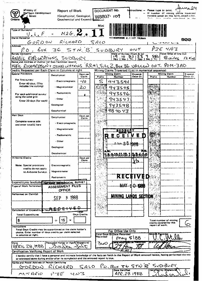
Report of Work(Geophysical, Geological, Geochemical and Expendit
DOCUMENT NO.
W8807-liltructions: Please type or print.
If number of mining claims traversed cxceeils space on this form, nllach a list.
MiniType of Survey(t)
\J.i. HA_________ Claim Holder(i) 4tl*3NtM06 2.11177 TRUMAN
300
Address
P.o . s: T A).'8 OfOT
Survey Company
Name and Address of Author (of Geo-Tecnnical
Date o* Survey (from 81 to)
ig 1
Total Miles of lin* Cut
3 .7.
(IR M 5'^ c. Z. Ot3T.Credits Requested per Each Claim in Columns at right Mining Claims Traversed (List in numerical sequence)Special Provisions
For first survey:Enter 40 days. (This includes line cutting)
For each additional survey: using the same grid:
Enter 20 days (for each)
Man Days
Complete reverse side and enter total (s) here
Airborne Credits
Note: Special provisions credits do not apply to Airborne Surveys.
Expenditures (excludeType of Work Performed
Performed on Claim(s)
Total Expenditures
Geophysical
- Electromagnetic
- Magnetometer
- Radiometric
- Other
Geological
Geochemical
Geophysical
- Electromagnetic
- Magnetometer
- Radiometric
- Other
Geological
Geochemical
Electromagnetic
Magnetometer
Radiometric
Efitfihttf'fll•WkSlCAC
Days per Claim
Ho2.0
4
Days perClaim
Days per Claim
——— ,SURVfeV
ASSESSMENT F\L.tii OFFICE
SEP H 1988
, D.vft.E...C C
S -5- 15
t V 6 P —Days Credits
^
Instructions Total Days Credits may be apportioned at the claim holder's choice. Enter number of days credits per claim selected in columns at right.
Date
F)Ctau Zfc ,ttWCertification Verifying
1 hereby certify that 1 or witnessed same dur
Name and Postal Address
r^-r^vc
Recoi q^nd Holder or Agei•\tSigrature) \l \\f~^
Mining ClaimPrefix
SffifpuS^i&ii.
' . ".' ' ; '(.'v-
-*:.;vv:i'.A^^f^u-'fif
./vs&i".;
s^Vr"-i;VV; . A.;V^' 7i
^J'S
lil
Number
^•J-^S,^cvvj "^c *y*5
9^SS*?61^35^7l *7 J o *? o
98 Vo V3
&UDBUI— "iMtmaw t H C E 1
f. i-v n O R '. ' '- ' i* J
M.3ifylpitlil2i 1
ktc1 J A\/ j—— MAY 1
MININQ LAf
Expend. Days Cr.
Y
\f E I9PQ
awi.
IIVIQ ^J^M-88
OS SE-
)
M. 1?
C\ffi
Mining ClaimPrefix
•Pp^
"C''-*T-- ;V:''^ ': ,;
t'*,'-""'^.^
"^*-^'-''**^-*j
^.t;7" ^bj
Bl
A^'c*'!^1^ ^i
*J?-.'iA'*\iS*
" :'/" v' -*
t';"* 'v*- 1-' ~ ''V*
Hit•VI-S-j 't-f.::':'.'.:As-"'!
•-l'1 ''.;'" -'
NumberExpend, Days Cr.
...-.--.-.
Total number of mining /~- claims covered by this { report of work. M.^
For Office Use OnlyTotal Days Or. Date Recorded Recorded ^^ \ Q^
^C C ^?*y iu- vvr -v? #*/ /V**** rfl
M"OT^Mo
1 i*74.Sctr*r* ^
have a personal and intimate knowledge of the facts set forth in the Report of Work annexed hereto, having performed the woi ng and/or after its completion and the annexed report is true. jof Person Certifying
i ^v'OHO&D
' V'-5Z H
^ALO Po,l?o* Tt' STrtJ 15 5SoOSo*?X^ 1Date Certified CertHlfd by (Signature* \ f., l
w Z
Ministry ofNorthern Developmentand Mines
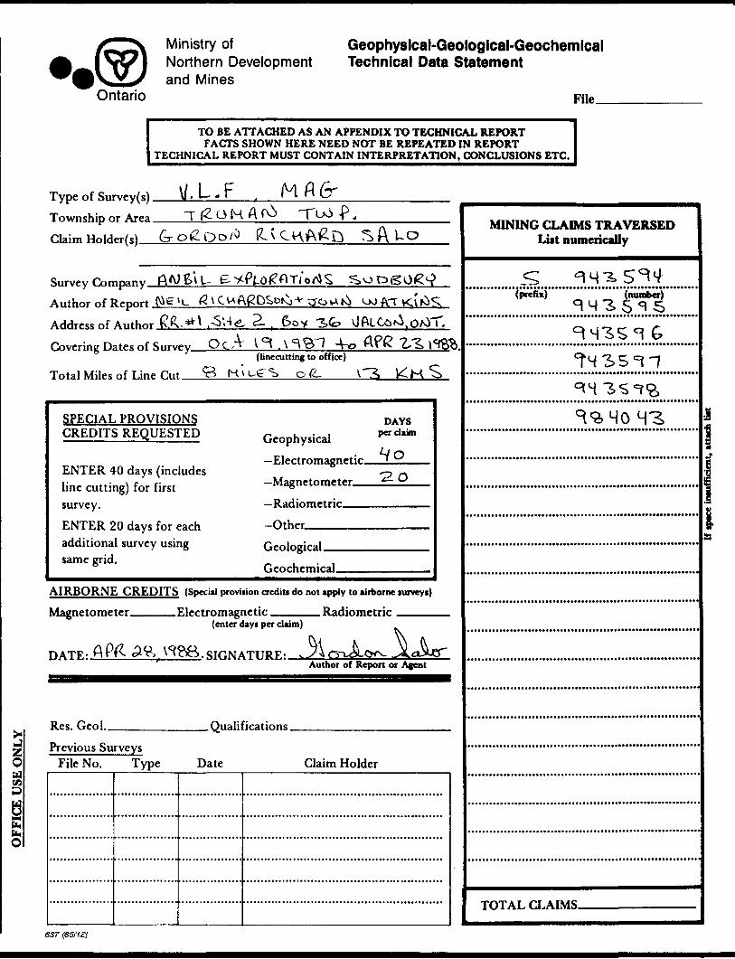
Geophysical-Geologlcal-Geochemlcal Technical Data Statement
Ontario
TO BE ATTACHED AS AN APPENDIX TO TECHNICAL REPORTFACTS SHOWN HERE NEED NOT BE REPEATED IN REPORT
TECHNICAL REPORT MUST CONTAIN INTERPRETATION, CONCLUSIONS ETC.
Type of Survey(s). Township or Area. Claim Holder(s).-
\f,UFT 12 o H A fO* T u*
A
Survey P-nrnpany AA) S\ U
OJ ATAuthor of Report f^g'lAddress of Author EX 5** .-S'.-lgL 2. . 6oy ^fc. \Jftl Co^
Covering Dates of S..™y O C A l ^ . \ ^^"1 4^ Afg(linecutting to office)
Total Miles of Line n..t *8 Kvu^S o fc.
SPECIAL PROVISIONS CREDITS REQUESTED
ENTER 40 days (includes line cutting) for first survey.ENTER 20 days for each additional survey using same grid.
Geophysical—Electromagnetic.—Magnetometer—.
—Radiometric———Other-————
DAYS per claim
Ho-20
Geological.Geochemical.
AIRBORNE CREDITS (Special proviiion credit, do not apply to airborne lurveyi)
Magnetometer
;.APR
.Electromagnetic. . Radiometric(enter days per claim)
Author of Report or Agent
Res. Geol.. . Qualifications.Previous Surveys
File No. Type Date Claim Holder
MINING CLAIMS TRAVERSEDList numerically
(prefix) (number)
l
TOTAL CLAIMS.
FIN
DU
CED
PO
LAR
IZA
TIO
N
\J.L
. F\
RES
ISTI
VIT
Y
GR
AV
ITY
EL
ECTR
OM
AG
NET
IC
MA
GN
ETIC
Electrode
array
Electrode
spacing —
Tvne
"f
eWtrnde
,
? H
Z
:i
H
rt
t *.
aj
ct-
r
! li
SD
5-
O
O
O
H
4 t
S g.
iS
7;
3 3
0r-*
- —
. *—
-*
^—
o"
i3 r-t
- 3 *
3 tt 1
" O 5' D
"n
C C
n n
s s
O
0*^
VJ o o 3 3'
Elevation
accuracy—Instrumen
t69
V
w
rt
w ST r* o' i rt 3 O
. cT s f^- o' 3
Corrections made
a t rt D 0
3
CM
r-*- a 3 rt
Parameters
measured.
Instrument
r— ii
V., ^ \
^J\
•*. ^ rr 'Y
' ^"•^
J5
^•'
1
^g LA ** a \r* ^- K. * ro \ 5- J 1 r\ i ^
Method:
Fremienrv
®^ rt
i Q-
---
r*CP
S 3 VI 3. r-f*
r* rt
x" ~**- . D w g- o cr
0 * ^D )^\
3^ ,
- 5' rt
3 ^ ft\D 1 S rt
Coil
separation
Accuracy \i c.N
S^/
^
1
gi* S rt- 5' x'
(\i \y ^ o o^ •~--
-^ . r H. Ori r^ s fs' ^
Instrument P 3^ v 0 •^ "~~
*
r? C/*
Accuracy — Scale
con
Diurnal
correction
nu Base
Station
check-in
Base
Station
location 3
5'
o-
rts.
1.^
Ir
* C.
o Z M
r- o 0 -^,
r\ s. 8 Jf^
^\
\N ^"^s^ -Q *i^
-v.^
^ | ^
^F i- 0 C f ^
y- Q. rx ~*
^ rr: fN ^V- ON !N l^-T x 0 c s A \
^,
vZ CtY CA vi il O \ ^ ?1 i M
Instrument ' D •"^
™^*
**
sj
S 0 15 ii "^~ * c
Contour
interval ri l ^
If (j. 0 — -1 •^1 tj. (S ^ K V w o1 ^ f ^A rv ^. J H k \
o f** CA R. r- ^ —
X ^ J\j 5^3
Station
interval
C* Lr, r\ vi rj, /^\ C*? *S] 0 V 05 XJ1 --
Niimher
of
Stations
., . en ro Q
GROUND
SURVEYS - 3 o rt r-*
-ST 3 o 3
Ort
[q
I 1
CA
("St
•s s
" ?:
5" 5
gj F
< H
Q.
Wr*
j3
3*
5-
: l
| F
*t3
n ^
NN
S "*
~ E
2
-o
^
^3
-*
"O
H
(jo
i—
rt s^
S^ o
^g
S,Q
- w
o S*
s
\J O
Q 5
r\
o* rt
^*- 0 7^ ft C le i
s
S ^
r**"
j*^*
(ff r
^ *
0 •
X "*
* Oil< 1
SELF POTENTIALInstrument^—-———^—^^———^————.————.^^^-—..—....^^^—. Range.Survey Method ——^^^^————————————————^-^^—^———^^-.—.^^—^—.
Corrections made.
RADIOMETRIC Instrument^———
Values measured.
Energy windows (levels)^——^^-^—.-———————^——-..——-———.—.^———-.—.^— Height of instrument____________________________Background Count. Size of detector-—-—^^^^^—————^^——--^———-——.^^—————^——.———.Overburden ————^—^—-^^^—^—-————.-——.—^——..—...^^—.....^——-.—..—.
(type, depth - include outcrop map)
OTHERS (SEISMIC, DRILL WELL LOGGING ETC.) Type of survey—^—————————^^—————————
Instrument —^^———————.———^—^^—-———— Accuracy,——^^—^———^——^^—^———————Parameters measured.
Additional information (for understanding results).
AIRBORNE SURVEYS Type of survey(s)——^—
Instrument(s) ——————(specify for each type of survey)
Accuracy—————————^—.———.(specify for each type of survey)
Aircraft used_______________________________^
Sensor altitude.Navigation and flight path recovery method.
Aircraft altitude _________________________________ LineMiles flown over total area __________________________ Over claims only.
GEOCHEMICAL SURVEY - PROCEDURE RECORD
Numbers of claims from which samples taken.
Total Number of Samples. Type of Sample.
(Nature of Material)
Average Sample Weight——————— Method of Collection————————
Soil Horizon Sampled. Horizon Development. Sample Depth———— Terrain————————
Drainage Development.Estimated Range of Overburden Thickness.
ANALYTICAL METHODSValues expressed in: per cent
p. p. m. p. p. b.
Da a
Cu, Pb,
Others_
Zn, Ni, Co, Ag, Mo, As.-(circle)
Field Analysis (.Extraction Method. Analytical Method- Reagents Used——
Field Laboratory Analysis No. ___________
SAMPLE PREPARATION(Includes drying, screening, crushing, aihing)
Mesh size of fraction used for analysis————
Extraction Method. Analytical Method . Reagents Used ——,
Commercial Laboratory (. Name of Laboratory.— Extraction Method—— Analytical Method —— Reagents Used——-^
.tests)
.tests)
-tests)
GeneraL General -
FO
ST
ER
TO
WN
SH
IP
o a
II o"
l
5.d
C
'C
S&
v^
' ri V e ffi i ,! f
CO (D Q.
i:
J]
(D
tfl
(D 2(~
v S
i (S
S?
g
S.
" S
g S
w w
go
3
-,
-,
*p,
pi
8 "
•D D)
S
CO
W
ft*
2^
3.
3.
SD
Q
) P
O
O
g
,
1 '
1 1D
1e E. O
i
J 1 i e
1
- 1
fe ! t .
R
M 5' * 5 ^
4
D . M ?
1
c * L
D
D
t l! "j '
\M
\ i
5 (
3 :
D
*-
T n B
-j
W
M.
? 3
*
J^ ?
" K
3
^ o J
3 U
C3
c ^
3'
j
' f
D O
i
Transmission line
Wooded
area...
;
'm
" /l
CO
33
33
"0
2
ID
O
O
1 l
1*5810*3
- 1 -
g S
If
Jl^
llsg
~
^8*5-
wd
tn
E""-
fi"
9.
g
K.
E.:
O
rr
K
*
O"
O
5'
S
— -
2
,D
5-
q
B
-n.
? SI
S w
c fi
g g
p- ^
| S
j? :
l ' y
"s o
* S
S;
* f
, *
: :
.J-
g 3
s?
g 3
. c -
* -
. .
. ^
E 9
C o
2 -
B^i
-
-\
s ?
g. r
i -
S-
: :
! ^ .
.
* . ^ x
e
ef
^
^
-
w .
. :
. .
i\ ?
; i
; i
; i
; i
; ;
;M
i i
i !|i
.i -M
. M N
i:
: :
: :
: i:
: rf
: :
: :
: :
,.
. .
B.
. .
\ 'i 's
1 1
" 'it!
-A' '-
"i
H ;!|
i li
T !;1
K l
H j j
, '
' 'i
i !!i
! i!
1 G
^ fr
'\J-
O
^ CD
-5?
I:]D
^ 5"
J^D
s'8
s i
i^ 1
I'l
3 i
* *
^-s*
t
5?*
5 *
i S
8 S
p f
"
g i
l
1 "
1 f f
i i .
- - s i
: *
: -
: ' l
1 fi
1 m
5
S
m S.
~
., tp
.
. .
5
: :
: ;
: :
: :
: :
: :
-1
!'i iT
'-'l :
i i
1 1 ,
m K O m Tt H C
X 5 tn z
o -t
w c
r r z
c
C BERCD
vi i- Z
-o V
)
3D m
le fxj z
V W P; K m
J z o m C
•* -
Ma
m o m
n
o m o
x .
o t* C
z x o E
r
.m H -t m a *"
H 5 '
z ei
Z O H m CO
GO ! "^
^
l -?
? 3
E
S?
C
O2:
a.
S!
g
o ^
g ^ l
' M
ili|i
si g
te?
s i
58B
g e
i i
O s f
Ti i!
l r
i
l * K) e o
o
Hen z •o
Z
O m X O D
D
(ft O (ft O z

9837-; 983763 96573
94359^184039 '943596943595
LK RESULTS TRUMAN TWR * = IN PHASE PLOT
6404*C/TIJ coda r . t --.^END OF LINE * ASSUMED
at i ve pfias? plo n phase plot
4OO' 500' 6OO' 700' 8OO'
943597984C4t
-^ ' ' X/OO- M RICHARDSON- WATKINS
SALO'S PROPE RT/
: GORDON SALO
|^ 8 8
9640456ase i t r. e
Approved384042
V- r- ~\v
Ti
8QO N
TOO N
s
10 UJ LiJ LJ UJuJ UJ
I.Lf
UJ ^ CM
O n ^ sX?
-J ^J -J
r*r\ "7T~ 1 1~\ s-0 1f** * u)5 S S S ?-J
^0-0"00 ^ —
0- u^ ^
LU
r-
LU
ro Is-
LL!
crr-lit oo-j
cr
4 l le3NW8006 2.l 1177 TRUMAN 220
o J E; :
At D -^ 3SMMAS TO ALL
COf-JTOUKS AT SOnT
L
-7
rsi
WATKINS
bATF:APRIL 23 ,