Embed Size (px)
Citation preview
www.environment.sa.gov.au
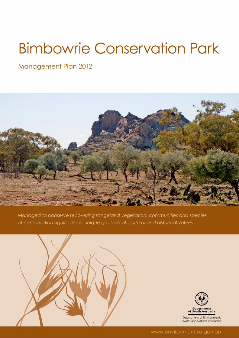
Bimbowrie Conservation ParkManagement Plan 2012
www.environment.sa.gov.au
Managed to conserve recovering rangeland vegetation, communities and species
of conservation significance, unique geological, cultural and historical values.
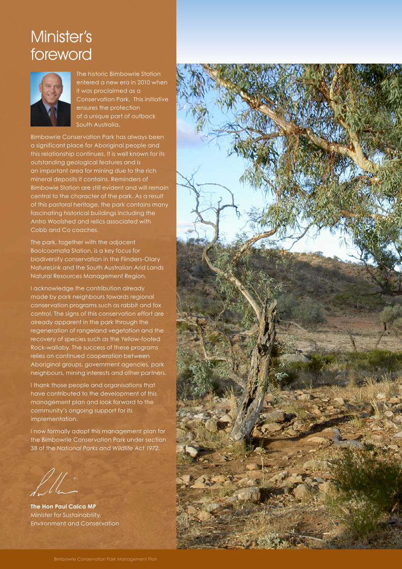
Minister’s foreword
The historic Bimbowrie Station entered a new era in 2010 when it was proclaimed as a Conservation Park. This initiative ensures the protection of a unique part of outback South Australia.
Bimbowrie Conservation Park has always been a significant place for Aboriginal people and this relationship continues. It is well known for its outstanding geological features and is an important area for mining due to the rich mineral deposits it contains. Reminders of Bimbowie Station are still evident and will remain central to the character of the park. As a result of this pastoral heritage, the park contains many fascinating historical buildings including the Antro Woolshed and relics associated with Cobb and Co coaches.
The park, together with the adjacent Boolcoomata Station, is a key focus for biodiversity conservation in the Flinders-Olary NatureLink and the South Australian Arid Lands Natural Resources Management Region.
I acknowledge the contribution already made by park neighbours towards regional conservation programs such as rabbit and fox control. The signs of this conservation effort are already apparent in the park through the regeneration of rangeland vegetation and the recovery of species such as the Yellow-footed Rock-wallaby. The success of these programs relies on continued cooperation between Aboriginal groups, government agencies, park neighbours, mining interests and other partners.
I thank those people and organisations that have contributed to the development of this management plan and look forward to the community’s ongoing support for its implementation.
I now formally adopt this management plan for the Bimbowrie Conservation Park under section 38 of the National Parks and Wildlife Act 1972.
The Hon Paul Caica MP Minister for Sustainability, Environment and Conservation
Bimbowrie Conservation Park Management Plan
ContentsDirections for management . . . . . . . . . . . . . . . . . . . . . . . . 1
Park significance and purpose . . . . . . . . . . . . . . . . . . . . . 2
Setting the management direction . . . . . . . . . . . . . . . . . . 4
What are we protecting? . . . . . . . . . . . . . . . . . . . . . . . . . . 4
What are the challenges? . . . . . . . . . . . . . . . . . . . . . . . . . 5
Management themes and priorities . . . . . . . . . . . . . . . . . 6
Zoning . . . . . . . . . . . . . . . . . . . . . . . . . . . . . . . . . . . . . . . . . 15
References . . . . . . . . . . . . . . . . . . . . . . . . . . . . . . . . . . . . . .16
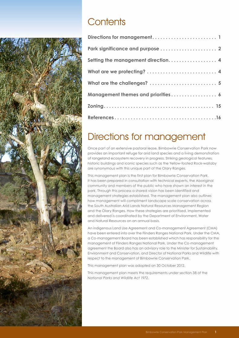
Directions for managementOnce part of an extensive pastoral lease, Bimbowrie Conservation Park now provides an important refuge for arid land species and a living demonstration of rangeland ecosystem recovery in progress. Striking geological features, historic buildings and iconic species such as the Yellow-footed Rock-wallaby are synonymous with this unique part of the Olary Ranges.
This management plan is the first plan for Bimbowrie Conservation Park. It has been prepared in consultation with technical experts, the Aboriginal community and members of the public who have shown an interest in the park. Through this process a shared vision has been identified and management strategies established. The management plan also outlines how management will compliment landscape scale conservation across the South Australian Arid Lands Natural Resources Management Region and the Olary Ranges. How these strategies are prioritised, implemented and delivered is coordinated by the Department of Environment, Water and Natural Resources on an annual basis.
An indigenous Land Use Agreement and Co-management Agreement (CMA) have been entered into over the Flinders Ranges National Park. Under the CMA, a Co-management Board has been established which has responsibility for the management of Flinders Ranges National Park. Under the Co-management agreement the Board also has an advisory role to the Minister for Sustainability, Environment and Conservation, and Director of National Parks and Wildlife with respect to the management of Bimbowrie Conservation Park.
This management plan was adopted on 30 October 2012.
This management plan meets the requirements under section 38 of the National Parks and Wildlife Act 1972.
Bimbowrie Conservation Park Draft Management Plan 1Bimbowrie Conservation Park Management Plan 1
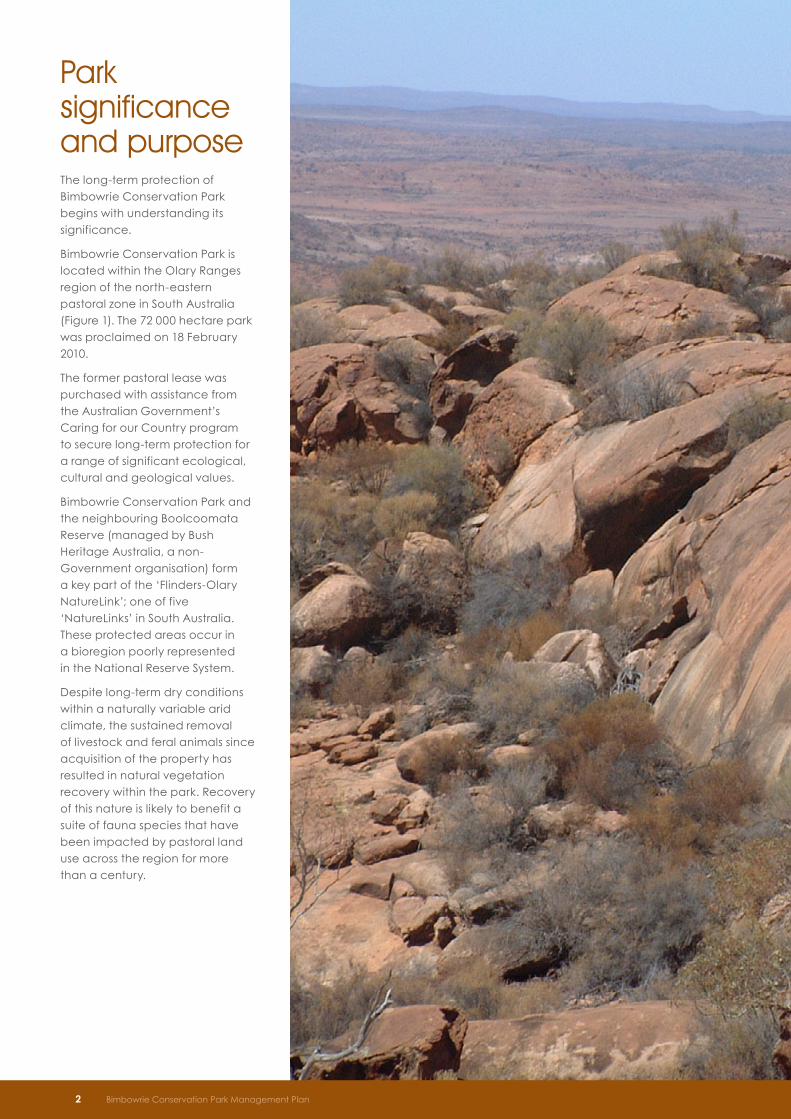
Park significance and purposeThe long-term protection of Bimbowrie Conservation Park begins with understanding its significance.
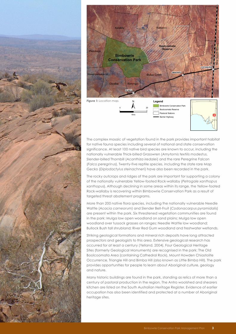
Bimbowrie Conservation Park is located within the Olary Ranges region of the north-eastern pastoral zone in South Australia (Figure 1). The 72 000 hectare park was proclaimed on 18 February 2010.
The former pastoral lease was purchased with assistance from the Australian Government’s Caring for our Country program to secure long-term protection for a range of significant ecological, cultural and geological values.
Bimbowrie Conservation Park and the neighbouring Boolcoomata Reserve (managed by Bush Heritage Australia, a non-Government organisation) form a key part of the ‘Flinders-Olary NatureLink’; one of five ‘NatureLinks’ in South Australia. These protected areas occur in a bioregion poorly represented in the National Reserve System.
Despite long-term dry conditions within a naturally variable arid climate, the sustained removal of livestock and feral animals since acquisition of the property has resulted in natural vegetation recovery within the park. Recovery of this nature is likely to benefit a suite of fauna species that have been impacted by pastoral land use across the region for more than a century.
2 Bimbowrie Conservation Park Management Plan
The complex mosaic of vegetation found in the park provides important habitat for native fauna species including several of national and state conservation significance. At least 100 native bird species are known to occur, including the nationally vulnerable Thick-billed Grasswren (Amytornis textilis modestus, Slender-billed Thornbill (Acanthiza iredalei) and the rare Peregrine Falcon (Falco peregrinus). Twenty-five reptile species, including the state rare Map Gecko (Diplodactylus steinachneri) have also been recorded in the park.
The rocky outcrops and ridges of the park are important for supporting a colony of the nationally vulnerable Yellow-footed Rock-wallaby (Petrogale xanthopus xanthopus). Although declining in some areas within its range, the Yellow-footed Rock-wallaby is recovering within Bimbowrie Conservation Park as a result of targeted threat abatement programs.
More than 200 native flora species, including the nationally vulnerable Needle Wattle (Acacia carneorum) and Slender Bell-Fruit (Codonacarpus pyramidalis) are present within the park. Six threatened vegetation communities are found in the park: Mulga low open woodland on sand plains; Mulga low open woodland over tussock grasses on ranges; Needle Wattle low woodland; Bullock Bush tall shrubland; River Red Gum woodland and freshwater wetlands.
Striking geological formations and mineral rich deposits have long attracted prospectors and geologists to this area. Extensive geological research has occurred for at least a century (Yelland, 2004). Four Geological Heritage Sites (formerly Geological Monuments) are recognised in the park: The Old Boolcoomata Area (containing Cathedral Rock), Mount Howden Chiastolite Occurrence, Triangle Hill and Bimba Hill (also known as Little Bimba Hill). The park provides opportunities for people to learn about Aboriginal culture, geology and nature.
Many historic buildings are found in the park, standing as relics of more than a century of pastoral production in the region. The Antro woolshed and shearers kitchen are listed on the South Australian Heritage Register. Evidence of earlier occupation has also been identified and protected at a number of Aboriginal heritage sites.
New
Sou
th W
ales
Sout
h A
ustr
alia
COCKBURN
MINGARY
OLARY
BoolcoomataReserve
BimbowrieConservation Park
0 20
Kms
PA MS M an ag em e nt Pla n
LegendBimbowrie Conservation Park
Boolcoomata Reserve
Pastoral Stations
Barrier Highway
Kalabity Kalkaroo
Bulloo Creek
Outalpa Abminga
Plumbago
Wawirraweekeroo
Figure 1: Location map.
Bimbowrie Conservation Park Management Plan 3
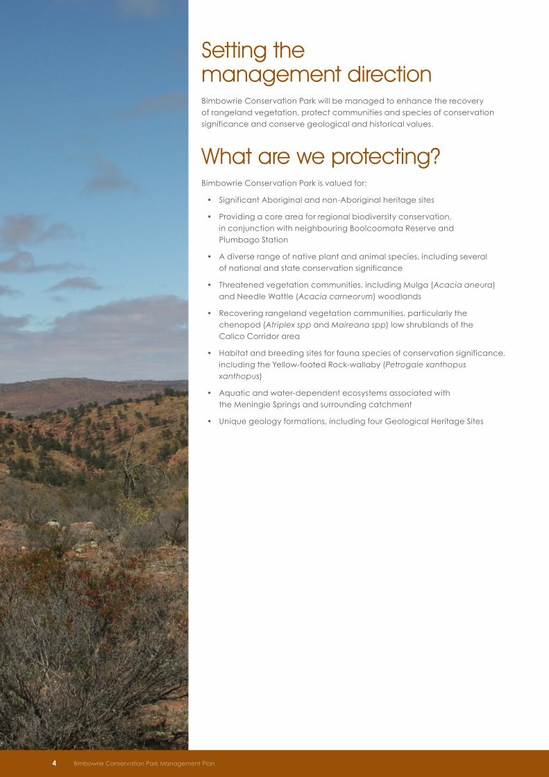
Setting the management directionBimbowrie Conservation Park will be managed to enhance the recovery of rangeland vegetation, protect communities and species of conservation significance and conserve geological and historical values.
What are we protecting? Bimbowrie Conservation Park is valued for:
• Significant Aboriginal and non-Aboriginal heritage sites
• Providing a core area for regional biodiversity conservation, in conjunction with neighbouring Boolcoomata Reserve and Plumbago Station
• A diverse range of native plant and animal species, including several of national and state conservation significance
• Threatened vegetation communities, including Mulga (Acacia aneura) and Needle Wattle (Acacia carneorum) woodlands
• Recovering rangeland vegetation communities, particularly the chenopod (Atriplex spp and Maireana spp) low shrublands of the Calico Corridor area
• Habitat and breeding sites for fauna species of conservation significance, including the Yellow-footed Rock-wallaby (Petrogale xanthopus xanthopus)
• Aquatic and water-dependent ecosystems associated with the Meningie Springs and surrounding catchment
• Unique geology formations, including four Geological Heritage Sites
4 Bimbowrie Conservation Park Management Plan
What are the challenges? Key challenges to the future management and protection of Bimbowrie Conservation Park include:
• Maintaining collaborative partnerships that assist in the delivery of landscape-scale biodiversity conservation programs
• Managing grazing pressure, and competition from introduced plants in priority areas such as watercourses and flood-out areas
• Minimising the impacts of accelerated soil erosion caused by vehicles and inappropriate track locations
• Identifying and meeting future visitor needs, including strategies to minimise public risk associated with historic mining and pastoral infrastructure
• Managing compliance in a remote area
• Understanding the impacts of regional groundwater extraction on park values
• Building ecosystem resilience within a regionally significant park that may be particularly susceptible to climate change impacts
Key management issues
Key management issues identified for the park have been grouped into five priority management themes:
• Landscape scale conservation through partnerships
• Assisting rangeland ecosystem recovery
• Minimising the impacts of resource use
• Protecting a rich cultural heritage
• Managing a safe outback destination
Bimbowrie Conservation Park Management Plan 5
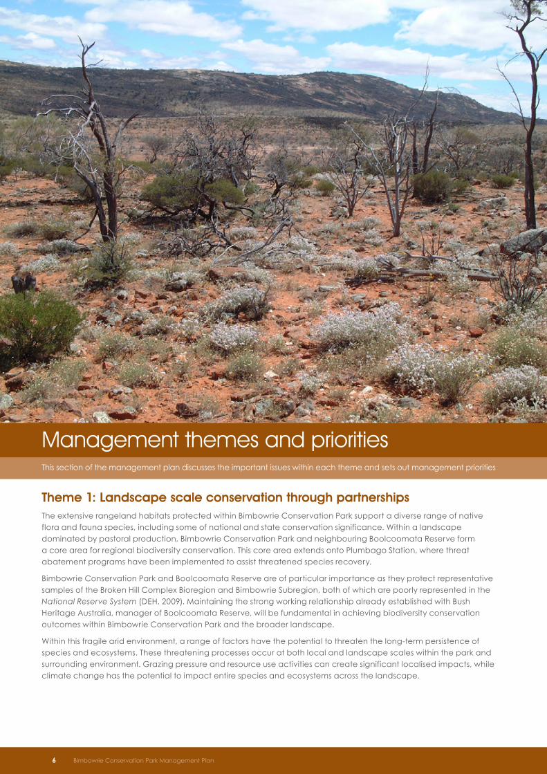
Management themes and priorities This section of the management plan discusses the important issues within each theme and sets out management priorities
Theme 1: Landscape scale conservation through partnershipsThe extensive rangeland habitats protected within Bimbowrie Conservation Park support a diverse range of native flora and fauna species, including some of national and state conservation significance. Within a landscape dominated by pastoral production, Bimbowrie Conservation Park and neighbouring Boolcoomata Reserve form a core area for regional biodiversity conservation. This core area extends onto Plumbago Station, where threat abatement programs have been implemented to assist threatened species recovery.
Bimbowrie Conservation Park and Boolcoomata Reserve are of particular importance as they protect representative samples of the Broken Hill Complex Bioregion and Bimbowrie Subregion, both of which are poorly represented in the National Reserve System (DEH, 2009). Maintaining the strong working relationship already established with Bush Heritage Australia, manager of Boolcoomata Reserve, will be fundamental in achieving biodiversity conservation outcomes within Bimbowrie Conservation Park and the broader landscape.
Within this fragile arid environment, a range of factors have the potential to threaten the long-term persistence of species and ecosystems. These threatening processes occur at both local and landscape scales within the park and surrounding environment. Grazing pressure and resource use activities can create significant localised impacts, while climate change has the potential to impact entire species and ecosystems across the landscape.
6 Bimbowrie Conservation Park Management Plan
A holistic approach to biodiversity management is required to assist species and ecosystems survive, evolve and adapt to these changing conditions.
Bimbowrie Conservation Park is located within the South Australian Arid Lands Natural Resources Management Region. This region covers much of outback South Australia including the Flinders and Olary Ranges. The South Australian Arid Lands Natural Resources Management Plan (SAAL NRM Board, 2010) highlights the importance of a coordinated landscape scale approach and sets directions for the strategic management of natural resources within this region. The South Australian Arid Lands Biodiversity Strategy (DEH, 2009) sets out conservation priorities and Bimbowrie Conservation Park is a key focus for these conservation efforts.
The Department will continue to work with local land managers and organisations to implement strategies identified during regional biodiversity management planning. Priorities include protection of threatened and endemic species, ecological communities and significant ecological processes (DEH, 2009).
Alternative approaches to managing significant biodiversity assets and/or threats will be considered. This may include negotiating with neighbouring land managers to purchase or swap land parcels, or to enter into negotiated management arrangements to provide greater capacity for managing core pest or threatened species populations. Any arrangements would be voluntary and have a clear strategic benefit identified. Collaborative arrangements with neighbouring properties have significantly improved the outcome of goat and fox control activities, and will remain a priority focus in the future. Partnerships with other groups such as the South Australian Sporting Shooters Association (Hunting and Conservation Group) and the Department for Correctional Services’ Mobile Outback Work Camp have also been critical to the success of threat abatement programs. Continued collaboration with these and other reserve partners, including volunteer organisations, will remain a management priority.
Improving research capacity in areas that support priority threat abatement programs or other management programs could be facilitated by encouraging partnerships with research organisations (including investigating the potential for establishing a research station within the park). The research undertaken would complement long-term chenopod shrubland research programs already occurring through the University of Adelaide on nearby Koonamore Vegetation Reserve.
Objectives and strategies
Establish and maintain collaborative partnerships to deliver landscape scale biodiversity management outcomes
• Continue to build partnerships with neighbouring land managers, volunteers and regional natural resource management organisations to implement priority landscape scale threat abatement programs
• Provide strategic advice to neighbouring land managers regarding the establishment of complementary land stewardship projects
• Encourage partnerships to support research that assists in delivering park management objectives, including considering opportunities to establish a research station in conjunction with relevant research organisations
Bimbowrie Conservation Park Management Plan 7
8 Bimbowrie Conservation Park Management Plan
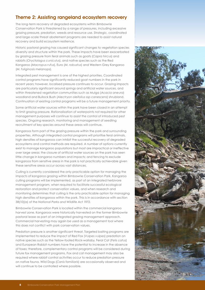
Theme 2: Assisting rangeland ecosystem recovery The long-term recovery of degraded ecosystems within Bimbowrie Conservation Park is threatened by a range of pressures, including excessive grazing pressure, predation, weeds and resource use. Strategic, coordinated and large-scale threat abatement programs are needed to assist natural recovery and build ecosystem resilience.
Historic pastoral grazing has caused significant changes to vegetation species diversity and structure within the park. These impacts have been exacerbated by grazing pressure from feral animals such as goats (Capra hircus) and rabbits (Oryctolagus cuniculus), and native species such as the Red Kangaroo (Macropus rufus), Euro (M. robustus) and Western Grey Kangaroo (M. fuliginosis melanops).
Integrated pest management is one of the highest priorities. Coordinated control programs have significantly reduced goat numbers in the park in recent years; however, localised pressure continues to occur. Grazing impacts are particularly significant around springs and artificial water sources, and within threatened vegetation communities such as Mulga (Acacia aneura) woodland and Bullock Bush (Alectryon oleifolius ssp canescens) shrubland. Continuation of existing control programs will be a future management priority.
Some artificial water sources within the park have been closed in an attempt to limit grazing pressure. Rationalisation of waterpoints not required for other management purposes will continue to assist the control of introduced pest species. Ongoing research, monitoring and management of seedling recruitment of key species around these areas will continue.
Kangaroos form part of the grazing pressure within the park and surrounding properties. Although integrated control programs will prioritise feral animals, high densities of kangaroos can inhibit the successful recovery of degraded ecosystems and control methods are required. A number of options currently exist to manage kangaroo populations but most are impractical or ineffective over large areas: the closure of artificial water sources on the park has seen little change in kangaroo numbers and impacts; and fencing to exclude kangaroos from sensitive areas in the park is not practically achievable given these sensitive areas occur across vast distances.
Culling is currently considered the only practicable option for managing the impacts of kangaroo grazing within Bimbowrie Conservation Park. Kangaroo culling programs will be implemented, as part of an integrated herbivore management program, when required to facilitate successful ecological restoration and protect conservation values, and when research and monitoring determines that culling is the only practicable option for managing high densities of kangaroos within the park. This is in accordance with section 38(10)(a) of the National Parks and Wildlife Act 1972.
Bimbowrie Conservation Park is located within the commercial kangaroo harvest zone. Kangaroos were historically harvested on the former Bimbowrie pastoral lease as part of an integrated grazing management approach. Commercial harvesting may again be used as a management tool where this does not conflict with park conservation values.
Predation pressure is another significant threat. Targeted baiting programs are implemented to reduce the impact of Red Fox (Vulpes vulpes) predation on native species such as the Yellow-footed Rock-wallaby. Feral Cat (Felis catus) and European Rabbit numbers have the potential to increase in the absence of foxes; therefore, complementary control programs will be considered during future fox management programs. Fox and cat management may also be required where rabbit control activities occur to reduce predation pressure on native fauna. Wild Dogs (Canis familiaris) are occasionally observed and will continue to be controlled where possible.
Bimbowrie Conservation Park Management Plan 9
Objectives and strategies
Assist natural ecosystem recovery processes by implementing targeted threat abatement programs at a landscape scale
• Design and implement an adaptive landscape scale threat abatement and monitoring program that addresses specific ecological requirements and conservation outcomes. This will include prioritised yet flexible pest plant, and animal management plans
• Develop and implement a landscape scale kangaroo management plan, as part of an integrated herbivore management program, to minimise grazing impacts and facilitate successful ecological restoration within the park. Provide for the culling of kangaroos when research and monitoring determines this to be the only practicable option for managing high densities of kangaroos within the park
• Build knowledge of fire as a management and ecological restoration tool to support biodiversity management objectives at the landscape scale
• Monitor dieback of River Red Gums along watercourses and encourage research into the impacts of groundwater use in the area
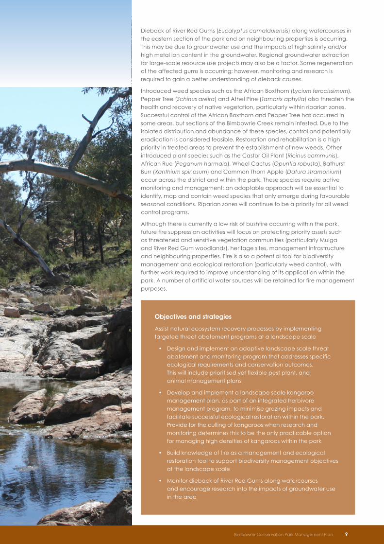
Dieback of River Red Gums (Eucalyptus camaldulensis) along watercourses in the eastern section of the park and on neighbouring properties is occurring. This may be due to groundwater use and the impacts of high salinity and/or high metal ion content in the groundwater. Regional groundwater extraction for large-scale resource use projects may also be a factor. Some regeneration of the affected gums is occurring; however, monitoring and research is required to gain a better understanding of dieback causes.
Introduced weed species such as the African Boxthorn (Lycium ferocissimum), Pepper Tree (Schinus areira) and Athel Pine (Tamarix aphylla) also threaten the health and recovery of native vegetation, particularly within riparian zones. Successful control of the African Boxthorn and Pepper Tree has occurred in some areas, but sections of the Bimbowrie Creek remain infested. Due to the isolated distribution and abundance of these species, control and potentially eradication is considered feasible. Restoration and rehabilitation is a high priority in treated areas to prevent the establishment of new weeds. Other introduced plant species such as the Castor Oil Plant (Ricinus communis), African Rue (Peganum harmala), Wheel Cactus (Opuntia robusta), Bathurst Burr (Xanthium spinosum) and Common Thorn Apple (Datura stramonium) occur across the district and within the park. These species require active monitoring and management; an adaptable approach will be essential to identify, map and contain weed species that only emerge during favourable seasonal conditions. Riparian zones will continue to be a priority for all weed control programs.
Although there is currently a low risk of bushfire occurring within the park, future fire suppression activities will focus on protecting priority assets such as threatened and sensitive vegetation communities (particularly Mulga and River Red Gum woodlands), heritage sites, management infrastructure and neighbouring properties. Fire is also a potential tool for biodiversity management and ecological restoration (particularly weed control), with further work required to improve understanding of its application within the park. A number of artificial water sources will be retained for fire management purposes.
10 Bimbowrie Conservation Park Management Plan
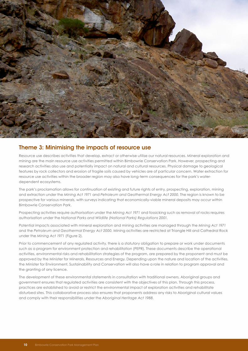
Theme 3: Minimising the impacts of resource use Resource use describes activities that develop, extract or otherwise utilise our natural resources. Mineral exploration and mining are the main resource use activities permitted within Bimbowrie Conservation Park. However, prospecting and research activities also use and potentially impact on natural and cultural resources. Physical damage to geological features by rock collectors and erosion of fragile soils caused by vehicles are of particular concern. Water extraction for resource use activities within the broader region may also have long-term consequences for the park’s water-dependent ecosystems.
The park’s proclamation allows for continuation of existing and future rights of entry, prospecting, exploration, mining and extraction under the Mining Act 1971 and Petroleum and Geothermal Energy Act 2000. The region is known to be prospective for various minerals, with surveys indicating that economically-viable mineral deposits may occur within Bimbowrie Conservation Park.
Prospecting activities require authorisation under the Mining Act 1971 and fossicking such as removal of rocks requires authorisation under the National Parks and Wildlife (National Parks) Regulations 2001.
Potential impacts associated with mineral exploration and mining activities are managed through the Mining Act 1971 and the Petroleum and Geothermal Energy Act 2000. Mining activities are restricted at Triangle Hill and Cathedral Rock under the Mining Act 1971 (Figure 2).
Prior to commencement of any regulated activity, there is a statutory obligation to prepare or work under documents such as a program for environment protection and rehabilitation (PEPR). These documents describe the operational activities, environmental risks and rehabilitation strategies of the program, are prepared by the proponent and must be approved by the Minister for Minerals, Resources and Energy. Depending upon the nature and location of the activities, the Minister for Environment, Sustainability and Conservation will also have a role in relation to program approval and the granting of any licence.
The development of these environmental statements in consultation with traditional owners, Aboriginal groups and government ensures that regulated activities are consistent with the objectives of this plan. Through this process, practices are established to avoid or restrict the environmental impact of exploration activities and rehabilitate disturbed sites. This collaborative process also ensures that proponents address any risks to Aboriginal cultural values and comply with their responsibilities under the Aboriginal Heritage Act 1988.
Bimbowrie Conservation Park Management Plan 11
Objectives and strategies
Minimise the impacts of resource use to ensure appropriate landscape protection and conservation of natural and cultural features
• Assess exploration and extraction activities to ensure impacts on park values are minimised
• Monitor the rehabilitation activities of areas disturbed by resource use to ensure those activities meet the requirements of an approved rehabilitation plan
• Monitor road maintenance activities, including the establishment of borrow pits, to minimise damage to natural and cultural values
• Rationalise the existing track network. Maintain a track network to assist in pest programs and fire fighting as well as a road network for public access. Investigate remediation options to address erosion caused by inappropriately located tracks
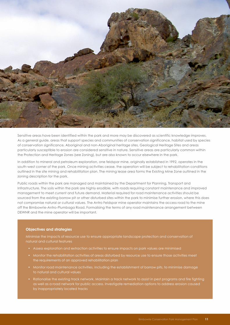
Sensitive areas have been identified within the park and more may be discovered as scientific knowledge improves. As a general guide, areas that support species and communities of conservation significance, habitat used by species of conservation significance, Aboriginal and non-Aboriginal heritage sites, Geological Heritage Sites and areas particularly susceptible to erosion are considered sensitive in nature. Sensitive areas are particularly common within the Protection and Heritage Zones (see Zoning), but are also known to occur elsewhere in the park.
In addition to mineral and petroleum exploration, one feldspar mine, originally established in 1992, operates in the south-west corner of the park. Once mining activities cease, the operation will be subject to rehabilitation conditions outlined in the site mining and rehabilitation plan. The mining lease area forms the Existing Mine Zone outlined in the zoning description for the park.
Public roads within the park are managed and maintained by the Department for Planning, Transport and Infrastructure. The soils within the park are highly erodible, with roads requiring constant maintenance and improved management to meet current and future demand. Material required for road maintenance activities should be sourced from the existing borrow pit or other disturbed sites within the park to minimise further erosion, where this does not compromise natural or cultural values. The Antro Feldspar mine operator maintains the access road to the mine off the Bimbowrie-Antro-Plumbaga Road. Formalising the terms of any road maintenance arrangement between DEWNR and the mine operator will be important.

Objectives and strategies
Ensure the ongoing protection and preservation of Aboriginal and non-Aboriginal cultural heritage
• Consult with the Co-management Board, the traditional owners and other relevant groups in decisions regarding the management of Aboriginal heritage, including identification and protection of sites, objects and remains
• Ensure on ground management activities are consistent with the objectives of existing and future Aboriginal Site Conservation Plans
• Implement the heritage conservation plan for non-Aboriginal heritage
• Investigate opportunities to stabilise, repair and adapt historic buildings for new uses, where this is consistent with site management objectives
12 Bimbowrie Conservation Park Management Plan
Theme 4: Protecting a rich cultural heritage A rich history of Aboriginal and non-Aboriginal occupation within the Olary Ranges region is preserved within Bimbowrie Conservation Park. A number of Aboriginal heritage sites are protected within the park, and some traditional language and stories from the area have been recorded.
Several Aboriginal groups have traditional associations with the land comprising Bimbowrie Conservation Park, an area that is likely to have been the site of interaction and trading between many groups (Tindale, 1974). These groups include the Adnyamathanha, Ngadjuri and Wilyakali people. Bimbowrie Conservation Park falls within the Adnyamathanha and the Ngadjuri Nation native title claim areas.
Fourteen archaeological sites within the park are listed on the South Australian Aboriginal Heritage Register. Five conservation plans have been developed, covering seven of the most vulnerable sites. The full extent of Aboriginal heritage within the park has not been comprehensively researched and it is possible that further sites or objects may be present. Any future cultural heritage surveys should be undertaken in a way that respects the rights and interests of each Aboriginal group which has a traditional association with the park.
In order to protect all sites, the Department will consult with state and local Aboriginal heritage committees and other relevant traditional owners before commencing significant development works within the reserve. Access to known sites will be managed to reduce the incidence of damage caused by visitors.
More recent non-Aboriginal occupation of the region is evident in the many buildings and structures scattered across the park. Most notably, the Antro Woolshed and Shearers Kitchen are listed on the South Australian Heritage Register.
The Heritage Precinct Area near the Bimbowrie Homestead is associated with stagecoach transportation in the 1800’s (Figure 2). This area comprises an array of buildings that are of local heritage significance, including the Bimbowrie Post Office, a Cobb & Co coach house, a blacksmith’s workshop and an explosives magazine. Other important sites include the Old Boolcoomata Homestead and associated outbuildings.
Future management of non-Aboriginal heritage sites will focus on protection and maintenance of structures to conserve historic value and reduce public safety risks. Some buildings may be upgraded and adapted for new purposes such as accommodation or interpretation, where this does not compromise heritage values. There are many opportunities for education and interpretation of heritage sites in the park. A heritage conservation plan for aspects of non-Aboriginal heritage in the park has been developed (Habitable Places Architects/Historical Research, 2007).
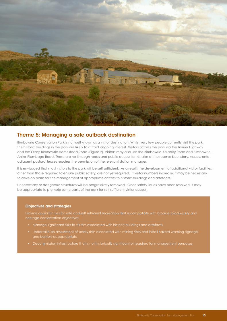
Theme 5: Managing a safe outback destinationBimbowrie Conservation Park is not well known as a visitor destination. Whilst very few people currently visit the park, the historic buildings in the park are likely to attract ongoing interest. Visitors access the park via the Barrier Highway and the Olary-Bimbowrie Homestead Road (Figure 2). Visitors may also use the Bimbowrie-Kalabity Road and Bimbowrie-Antro-Plumbago Road. These are no-through roads and public access terminates at the reserve boundary. Access onto adjacent pastoral leases requires the permission of the relevant station manager.
It is envisaged that most visitors to the park will be self sufficient. As a result, the development of additional visitor facilities, other than those required to ensure public safety, are not yet required. If visitor numbers increase, it may be necessary to develop plans for the management of appropriate access to historic buildings and artefacts.
Unnecessary or dangerous structures will be progressively removed. Once safety issues have been resolved, it may be appropriate to promote some parts of the park for self sufficient visitor access.
Objectives and strategies
Provide opportunities for safe and self sufficient recreation that is compatible with broader biodiversity and heritage conservation objectives
• Manage significant risks to visitors associated with historic buildings and artefacts
• Undertake an assessment of safety risks associated with mining sites and install hazard warning signage and barriers as appropriate
• Decommission infrastructure that is not historically significant or required for management purposes
Bimbowrie Conservation Park Management Plan 13
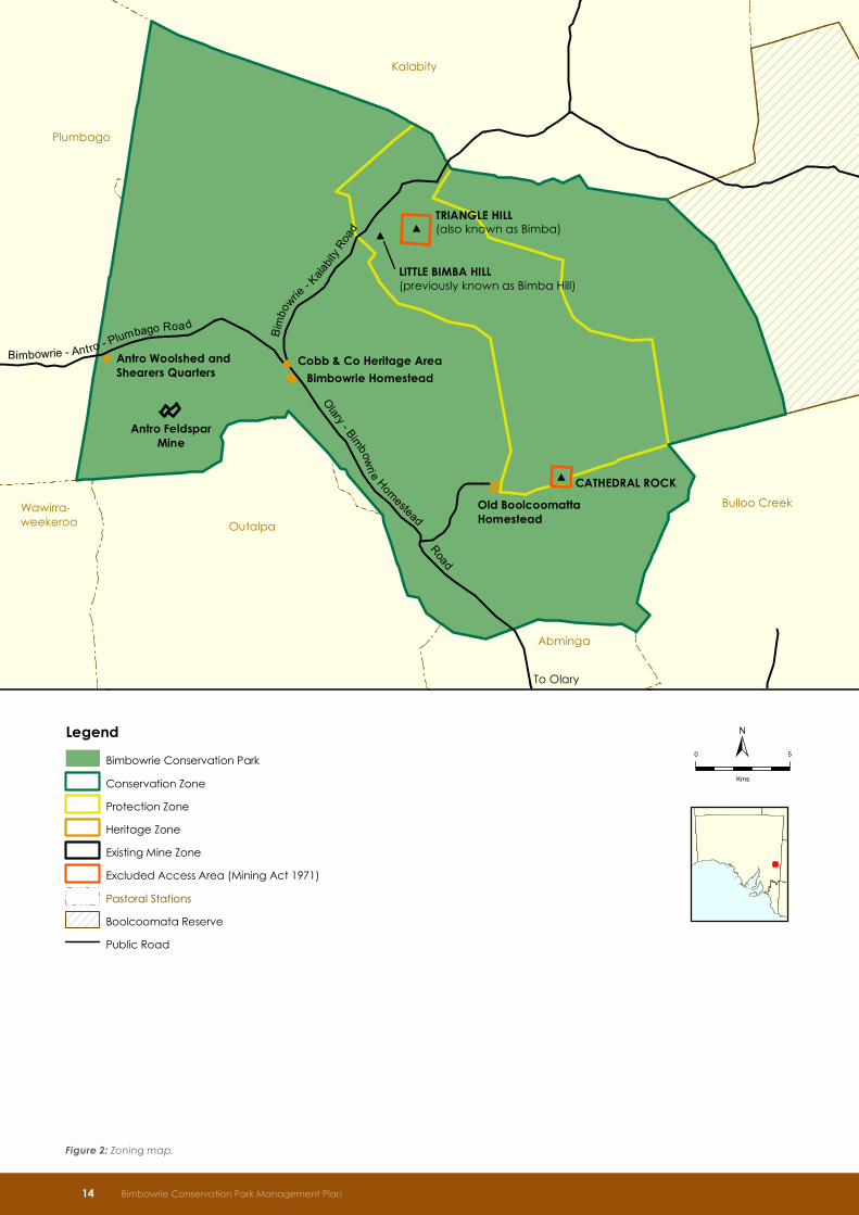
Figure 2: Zoning map.
14 Bimbowrie Conservation Park Management Plan
Plumbago
Kalabity
Bulloo Creek
Abminga
Outalpa
Wawirra-weekeroo
Antro FeldsparMine
Antro Woolshed andShearers Quarters
Cobb & Co Heritage Area
Bimbowrie Homestead
Old BoolcoomattaHomestead
TRIANGLE HILL(also known as Bimba)
LITTLE BIMBA HILL(previously known as Bimba Hill)
CATHEDRAL ROCK
To Olary
Bimbowrie - Antro - Plumbago Road
Olary - Bimbowri e Homestead R
oad
Bim
bowrie
- Kala
bity R
oad
Produced by
Data Source Compiled Projection Datum
<Enter Branch Name>Department for Environment and Heritage<Enter Address><Enter Website><Enter Reference to Data Sources>4 April 2012Lambert Conformal ConicGeocentric Datum of Australia, 1994
© Copyright Department for Environment and Heritage 2011.All Rights Reserved. All works and information displayed are subject to Copyright. Forthe reproduction or publication beyond that permitted by the Copyright Act 1968 (Cwlth)written permission must be sought from the Department.
Although every effort has been made to ensure the accuracy of the information displayed,the Department, its agents, officers and employees make no representations, either expressor implied, that the information displayed is accurate or fit for any purpose and expresslydisclaims all liability for loss or damage arising from reliance upon the information displayed.
0 5
Kms
DE H Sta nd ar d
Legend
Bimbowrie Conservation Park
Conservation Zone
Protection Zone
Heritage Zone
Existing Mine Zone
Excluded Access Area (Mining Act 1971)
Pastoral Stations
Boolcoomata Reserve
Public Road
Plumbago
Kalabity
Bulloo Creek
Abminga
Outalpa
Wawirra-weekeroo
Antro FeldsparMine
Antro Woolshed andShearers Quarters
Cobb & Co Heritage AreaBimbowrie Homestead
Old BoolcoomattaHomestead
TRIANGLE HILL(also known as Bimba)
LITTLE BIMBA HILL(previously known as Bimba Hill)
CATHEDRAL ROCK
To Olary
Bimbowrie - Antro - Plumbago Road
Olary - Bimbowri e Homestead R
oad
Bim
bowrie
- Kala
bity R
oad
Produced by
Data Source Compiled Projection Datum
<Enter Branch Name>Department for Environment and Heritage<Enter Address><Enter Website><Enter Reference to Data Sources>4 April 2012Lambert Conformal ConicGeocentric Datum of Australia, 1994
© Copyright Department for Environment and Heritage 2011.All Rights Reserved. All works and information displayed are subject to Copyright. Forthe reproduction or publication beyond that permitted by the Copyright Act 1968 (Cwlth)written permission must be sought from the Department.
Although every effort has been made to ensure the accuracy of the information displayed,the Department, its agents, officers and employees make no representations, either expressor implied, that the information displayed is accurate or fit for any purpose and expresslydisclaims all liability for loss or damage arising from reliance upon the information displayed.
0 5
Kms
DE H Sta nd ar d
Legend
Bimbowrie Conservation Park
Conservation Zone
Protection Zone
Heritage Zone
Existing Mine Zone
Excluded Access Area (Mining Act 1971)
Pastoral Stations
Boolcoomata Reserve
Public Road
#
##
Plumbago
Kalabity
Bulloo Creek
Abminga
Outalpa
Wawirra-weekeroo
Bimbowrie- Antro - Plumbago Road
Bimb
owrie
Olary -
Homestead
Road
Bimbow
rie- K
alab
ityRo
ad
Antro FeldsparMine
Antro Woolshed andShearers Quarters
Heritage Precinct Area
Bimbowrie Homestead
Old BoolcoomattaHomestead
TRIANGLE HILL
LITTLE BIMBA HILL
CATHEDRAL ROCK
Produced by
Data Source Compiled Projection Datum
<Enter Branch Name>Department for Environment and Heritage<Enter Address><Enter Website><Enter Reference to Data Sources>31 August 2011Lambert Conformal ConicGeocentric Datum of Australia, 1994
© Copyright Department for Environment and Heritage 2011.All Rights Reserved. All works and information displayed are subject to Copyright. Forthe reproduction or publication beyond that permitted by the Copyright Act 1968 (Cwlth)written permission must be sought from the Department.
Although every effort has been made to ensure the accuracy of the information displayed,the Department, its agents, officers and employees make no representations, either expressor implied, that the information displayed is accurate or fit for any purpose and expresslydisclaims all liability for loss or damage arising from reliance upon the information displayed.
0 5
Kms
±
dradnatS HED
Legend
Bimbowrie Conservation Park
Conservation Zone
Protection Zone
Heritage Zone
Existing Mine Zone
Excluded Access Area (Mining Act 1971)
Pastoral Stations
Boolcoomata Reserve
Public Road
Plumbago
Kalabity
Bulloo Creek
Abminga
Outalpa
Wawirra-weekeroo
Antro FeldsparMine
Antro Woolshed andShearers Quarters
Cobb & Co Heritage AreaBimbowrie Homestead
Old BoolcoomattaHomestead
TRIANGLE HILL(also known as Bimba)
LITTLE BIMBA HILL(previously known as Bimba Hill)
CATHEDRAL ROCK
To Olary
Bimbowrie - Antro - Plumbago Road
Olary - Bimbowri e Homestead
Road
Bim
bowrie
- Kala
bity R
oad
Produced by
Data Source Compiled Projection Datum
<Enter Branch Name>Department for Environment and Heritage<Enter Address><Enter Website><Enter Reference to Data Sources>4 April 2012Lambert Conformal ConicGeocentric Datum of Australia, 1994
© Copyright Department for Environment and Heritage 2011.All Rights Reserved. All works and information displayed are subject to Copyright. Forthe reproduction or publication beyond that permitted by the Copyright Act 1968 (Cwlth)written permission must be sought from the Department.
Although every effort has been made to ensure the accuracy of the information displayed,the Department, its agents, officers and employees make no representations, either expressor implied, that the information displayed is accurate or fit for any purpose and expresslydisclaims all liability for loss or damage arising from reliance upon the information displayed.
0 5
Kms
DE H Sta nd ar d
Legend
Bimbowrie Conservation Park
Conservation Zone
Protection Zone
Heritage Zone
Existing Mine Zone
Excluded Access Area (Mining Act 1971)
Pastoral Stations
Boolcoomata Reserve
Public Road
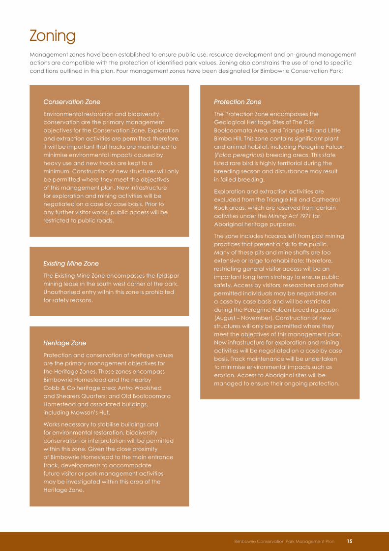
Zoning Management zones have been established to ensure public use, resource development and on-ground management actions are compatible with the protection of identified park values. Zoning also constrains the use of land to specific conditions outlined in this plan. Four management zones have been designated for Bimbowrie Conservation Park:
Conservation Zone
Environmental restoration and biodiversity conservation are the primary management objectives for the Conservation Zone. Exploration and extraction activities are permitted; therefore, it will be important that tracks are maintained to minimise environmental impacts caused by heavy use and new tracks are kept to a minimum. Construction of new structures will only be permitted where they meet the objectives of this management plan. New infrastructure for exploration and mining activities will be negotiated on a case by case basis. Prior to any further visitor works, public access will be restricted to public roads.
Protection Zone
The Protection Zone encompasses the Geological Heritage Sites of The Old Boolcoomata Area, and Triangle Hill and Little Bimba Hill. This zone contains significant plant and animal habitat, including Peregrine Falcon (Falco peregrinus) breeding areas. This state listed rare bird is highly territorial during the breeding season and disturbance may result in failed breeding.
Exploration and extraction activities are excluded from the Triangle Hill and Cathedral Rock areas, which are reserved from certain activities under the Mining Act 1971 for Aboriginal heritage purposes.
The zone includes hazards left from past mining practices that present a risk to the public. Many of these pits and mine shafts are too extensive or large to rehabilitate; therefore, restricting general visitor access will be an important long term strategy to ensure public safety. Access by visitors, researchers and other permitted individuals may be negotiated on a case by case basis and will be restricted during the Peregrine Falcon breeding season (August – November). Construction of new structures will only be permitted where they meet the objectives of this management plan. New infrastructure for exploration and mining activities will be negotiated on a case by case basis. Track maintenance will be undertaken to minimise environmental impacts such as erosion. Access to Aboriginal sites will be managed to ensure their ongoing protection.
Heritage Zone
Protection and conservation of heritage values are the primary management objectives for the Heritage Zones. These zones encompass Bimbowrie Homestead and the nearby Cobb & Co heritage area; Antro Woolshed and Shearers Quarters; and Old Boolcoomata Homestead and associated buildings, including Mawson’s Hut.
Works necessary to stabilise buildings and for environmental restoration, biodiversity conservation or interpretation will be permitted within this zone. Given the close proximity of Bimbowrie Homestead to the main entrance track, developments to accommodate future visitor or park management activities may be investigated within this area of the Heritage Zone.
Existing Mine Zone
The Existing Mine Zone encompasses the feldspar mining lease in the south west corner of the park. Unauthorised entry within this zone is prohibited for safety reasons.
Bimbowrie Conservation Park Management Plan 15
#
##
Plumbago
Kalabity
Bulloo Creek
Abminga
Outalpa
Wawirra-weekeroo
Bimbowrie- Antro - Plumbago Road
Bimb
owrie
Olary -
Homestead
Road
Bimbow
rie- K
alab
ityRo
ad
Antro FeldsparMine
Antro Woolshed andShearers Quarters
Heritage Precinct Area
Bimbowrie Homestead
Old BoolcoomattaHomestead
TRIANGLE HILL
LITTLE BIMBA HILL
CATHEDRAL ROCK
Produced by
Data Source Compiled Projection Datum
<Enter Branch Name>Department for Environment and Heritage<Enter Address><Enter Website><Enter Reference to Data Sources>31 August 2011Lambert Conformal ConicGeocentric Datum of Australia, 1994
© Copyright Department for Environment and Heritage 2011.All Rights Reserved. All works and information displayed are subject to Copyright. Forthe reproduction or publication beyond that permitted by the Copyright Act 1968 (Cwlth)written permission must be sought from the Department.
Although every effort has been made to ensure the accuracy of the information displayed,the Department, its agents, officers and employees make no representations, either expressor implied, that the information displayed is accurate or fit for any purpose and expresslydisclaims all liability for loss or damage arising from reliance upon the information displayed.
0 5
Kms
±
dradnatS HED
Legend
Bimbowrie Conservation Park
Conservation Zone
Protection Zone
Heritage Zone
Existing Mine Zone
Excluded Access Area (Mining Act 1971)
Pastoral Stations
Boolcoomata Reserve
Public Road
Plumbago
Kalabity
Bulloo Creek
Abminga
Outalpa
Wawirra-weekeroo
Antro FeldsparMine
Antro Woolshed andShearers Quarters
Cobb & Co Heritage AreaBimbowrie Homestead
Old BoolcoomattaHomestead
TRIANGLE HILL(also known as Bimba)
LITTLE BIMBA HILL(previously known as Bimba Hill)
CATHEDRAL ROCK
To Olary
Bimbowrie - Antro - Plumbago Road
Olary - Bimbowri e Homestead
Road
Bim
bowrie
- Kala
bity R
oad
Produced by
Data Source Compiled Projection Datum
<Enter Branch Name>Department for Environment and Heritage<Enter Address><Enter Website><Enter Reference to Data Sources>4 April 2012Lambert Conformal ConicGeocentric Datum of Australia, 1994
© Copyright Department for Environment and Heritage 2011.All Rights Reserved. All works and information displayed are subject to Copyright. Forthe reproduction or publication beyond that permitted by the Copyright Act 1968 (Cwlth)written permission must be sought from the Department.
Although every effort has been made to ensure the accuracy of the information displayed,the Department, its agents, officers and employees make no representations, either expressor implied, that the information displayed is accurate or fit for any purpose and expresslydisclaims all liability for loss or damage arising from reliance upon the information displayed.
0 5
Kms
DE H Sta nd ar d
Legend
Bimbowrie Conservation Park
Conservation Zone
Protection Zone
Heritage Zone
Existing Mine Zone
Excluded Access Area (Mining Act 1971)
Pastoral Stations
Boolcoomata Reserve
Public Road
References Department for Environment and Heritage (2007) The Kangaroo Conservation and Management Plan for South Australia 2008 – 2012. Department for Environment and Heritage, Adelaide
Department for Environment and Heritage (2009) South Australian Arid Lands Biodiversity Strategy – Flinders and Olary Ranges Conservation Priorities. South Australian Arid Lands Natural Resource Management Board and Department for Environment and Heritage, Adelaide
Department for Environment and Heritage (2010) Flinders-Olary NatureLinks Plan. Department for Environment and Heritage, Adelaide
Habitable Places Architects/Historical Research (2007) Bimbowrie Conservation Management Plan. Department for Environment and Heritage.
SAAL NRM Board (2010) Regional Natural Resources Management Plan. South Australian Arid Lands Natural Resources Management Board. Government of South Australia.
Tindale, N.B (1974) Aboriginal Tribes of Australia. ANU Press, Canberra.
Yelland (2004) Some Personal Perspectives of Bimbowrie Station. Unpublished correspondence prepared for the Department for Environment and Heritage.
For an extensive bibliography please refer to DEWNR (2012) Supplementary Document to the Management Plan, Bimbowrie Conservation Park . Department of Environment, Water and Natural Resources, Adelaide .
16 Bimbowrie Conservation Park Management Plan

For further information please contact: Department of Environment, Water and Natural Resources Phone Information Line (08) 8204 1910, or see SA White Pages for your local Department of Environment, Water and Natural Resources office. Online information available at: www.environment.sa.gov.au
Permissive Licence © State of South Australia through the Department of Environment, Water and Natural Resources. Apart from fair dealings and other uses permitted by the Copyright Act 1968 (Cth), no part of this publication may be reproduced, published, communicated, transmitted, modified or commercialised without the prior written approval of the Department of Environment, Water and Natural Resources.
Written requests for permission should be addressed to: Communications and Community Engagement Branch, Department of Environment, Water and Natural Resources GPO Box 1047 Adelaide SA 5001
Disclaimer While reasonable efforts have been made to ensure the contents of this publication are factually correct, the Department of Environment, Water and Natural Resources makes no representations and accepts no responsibility for the accuracy, completeness or fitness for any particular purpose of the contents, and shall not be liable for any loss or damage that may be occasioned directly or indirectly through the use of or reliance on the contents of this publication.
Reference to any company, product or service in this publication should not be taken as a Departmental endorsement of the company, product or service.
© Department of Environment, Water and Natural Resources | Printed November 2012 | FIS 91502