Embed Size (px)
Citation preview
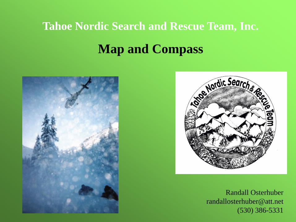
Tahoe Nordic Search and Rescue Team, Inc.
Map and Compass
Randall Osterhuber
(530) 386-5331
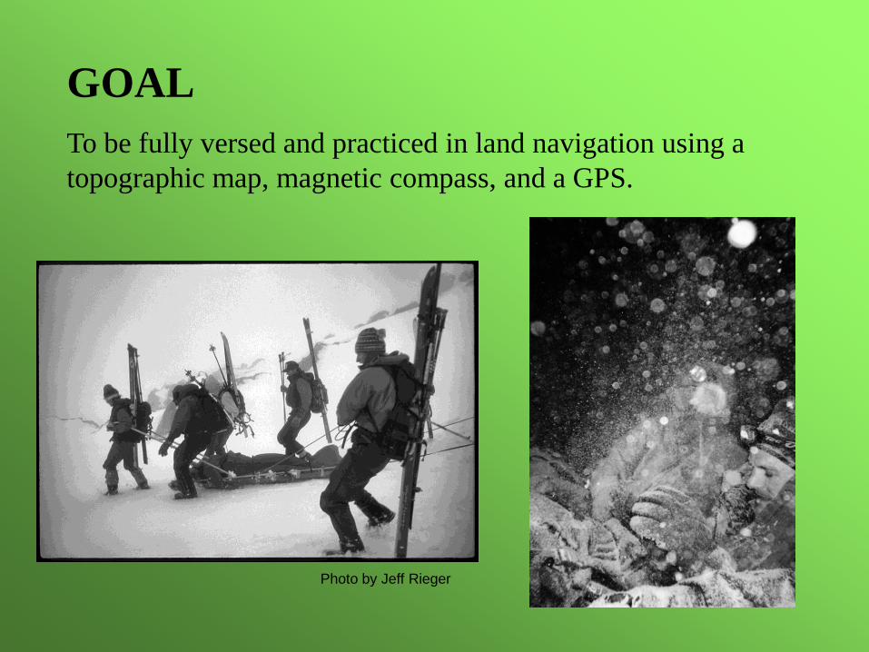
GOAL
To be fully versed and practiced in land navigation using a
topographic map, magnetic compass, and a GPS.
Photo by Jeff Rieger
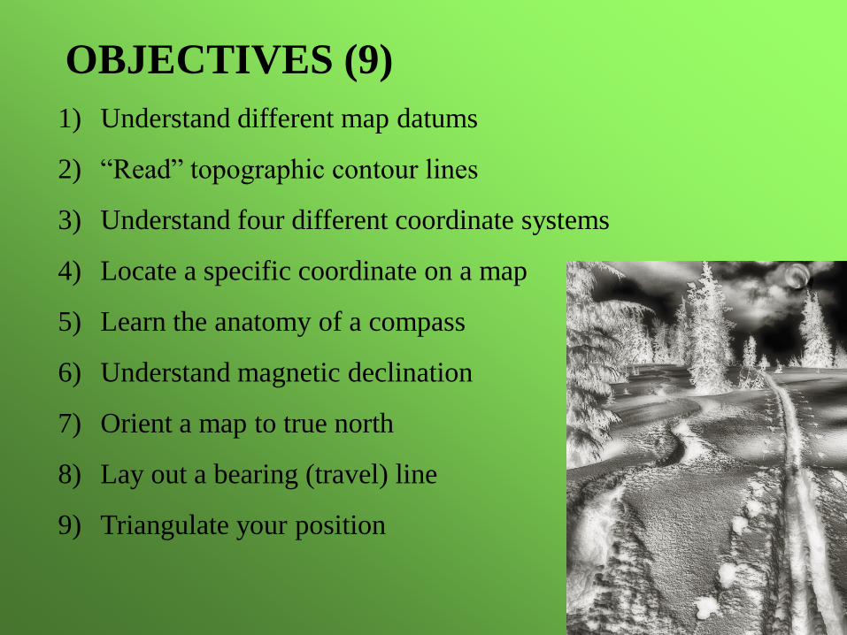
1) Understand different map datums
2) “Read” topographic contour lines
3) Understand four different coordinate systems
4) Locate a specific coordinate on a map
5) Learn the anatomy of a compass
6) Understand magnetic declination
7) Orient a map to true north
8) Lay out a bearing (travel) line
9) Triangulate your position
OBJECTIVES (9)
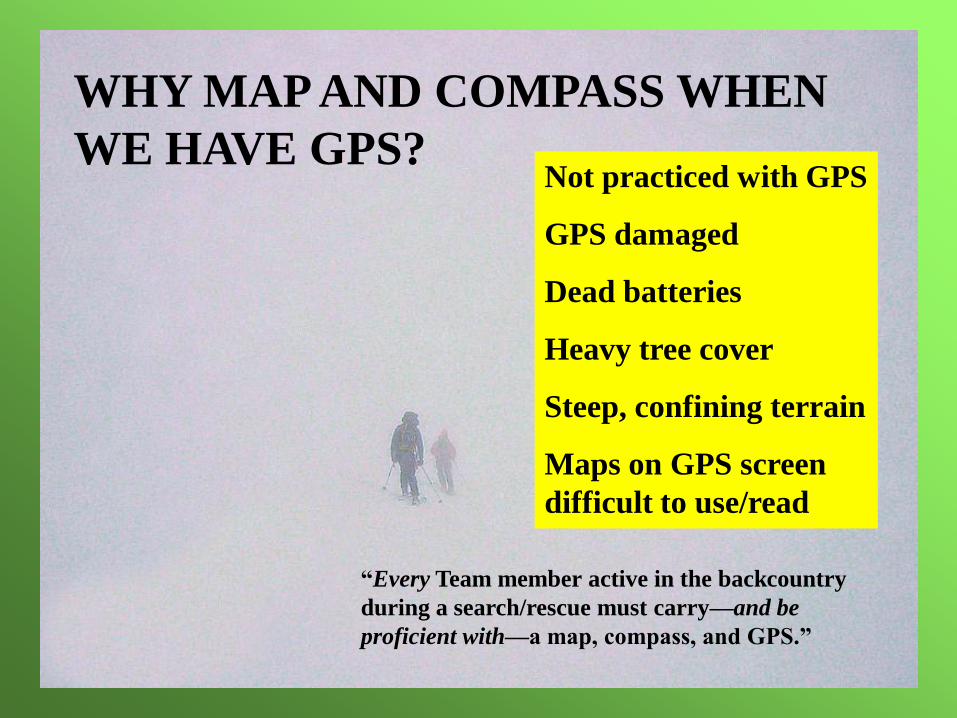
WHY MAP AND COMPASS WHEN
WE HAVE GPS?
“Every Team member active in the backcountry
during a search/rescue must carry—and be
proficient with—a map, compass, and GPS.”
Not practiced with GPS
GPS damaged
Dead batteries
Heavy tree cover
Steep, confining terrain
Maps on GPS screen
difficult to use/read
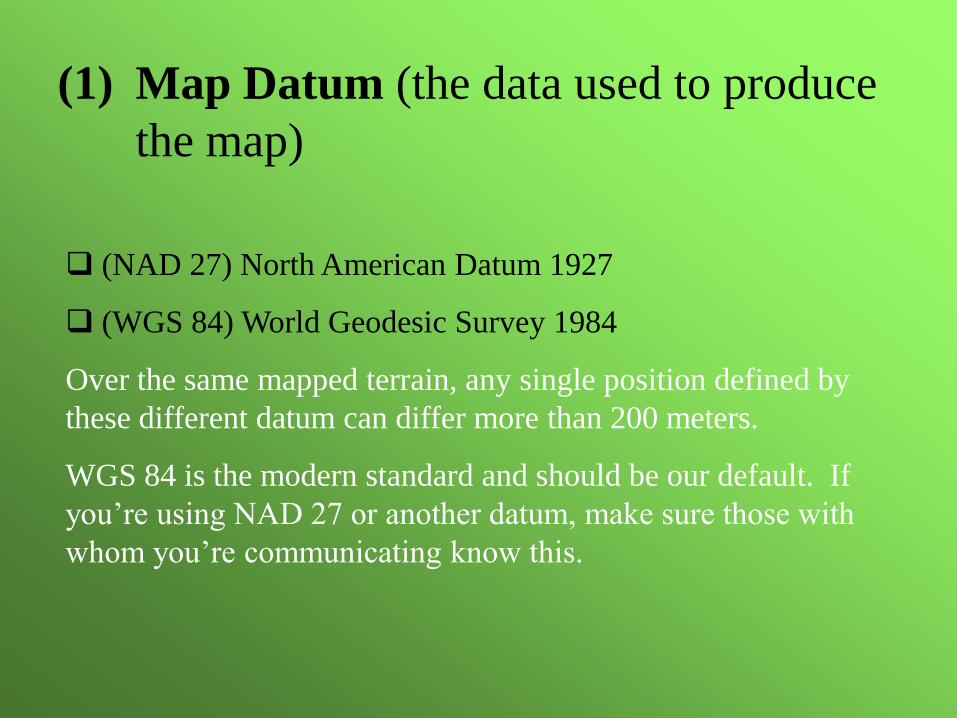
(NAD 27) North American Datum 1927
(WGS 84) World Geodesic Survey 1984
Over the same mapped terrain, any single position defined by
these different datum can differ more than 200 meters.
WGS 84 is the modern standard and should be our default. If
you’re using NAD 27 or another datum, make sure those with
whom you’re communicating know this.
(1) Map Datum (the data used to produce
the map)
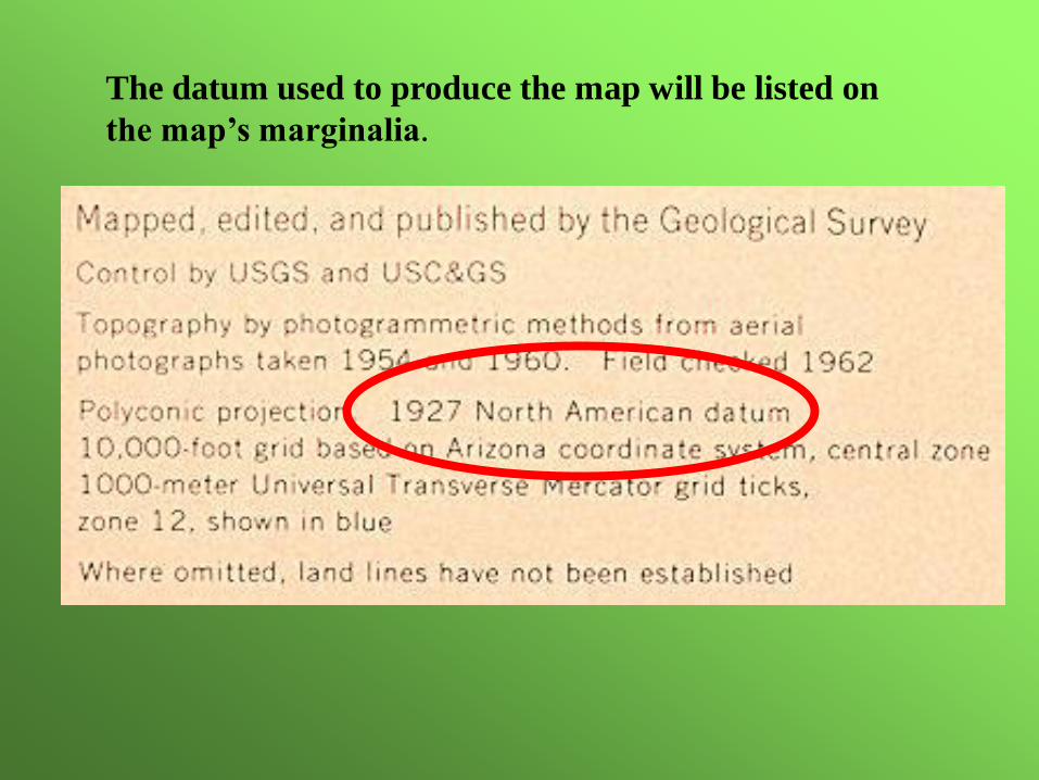
The datum used to produce the map will be listed on
the map’s marginalia.
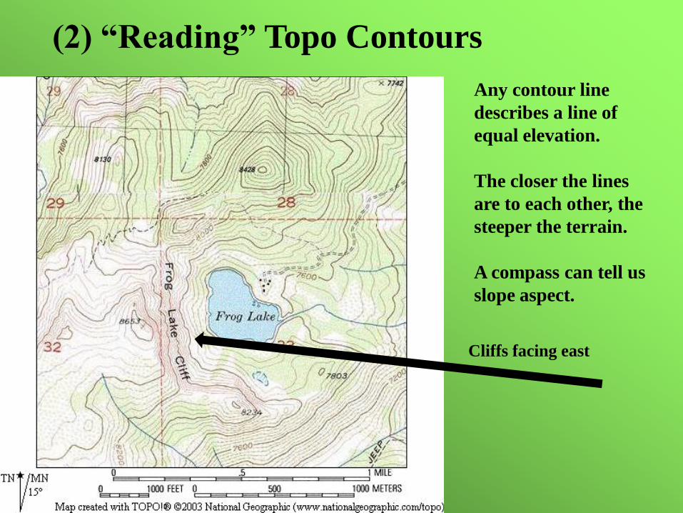
(2) “Reading” Topo Contours
Any contour line
describes a line of
equal elevation.
The closer the lines
are to each other, the
steeper the terrain.
A compass can tell us
slope aspect.
Cliffs facing east
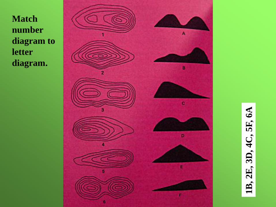
Match
number
diagram to
letter
diagram.
1B
, 2E
, 3D
, 4C
, 5F
, 6A
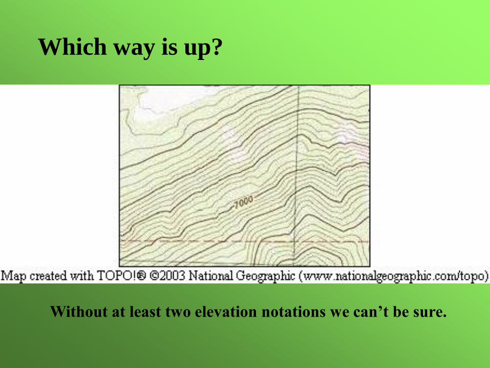
Which way is up?
Without at least two elevation notations we can’t be sure.
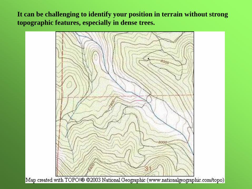
It can be challenging to identify your position in terrain without strong
topographic features, especially in dense trees.
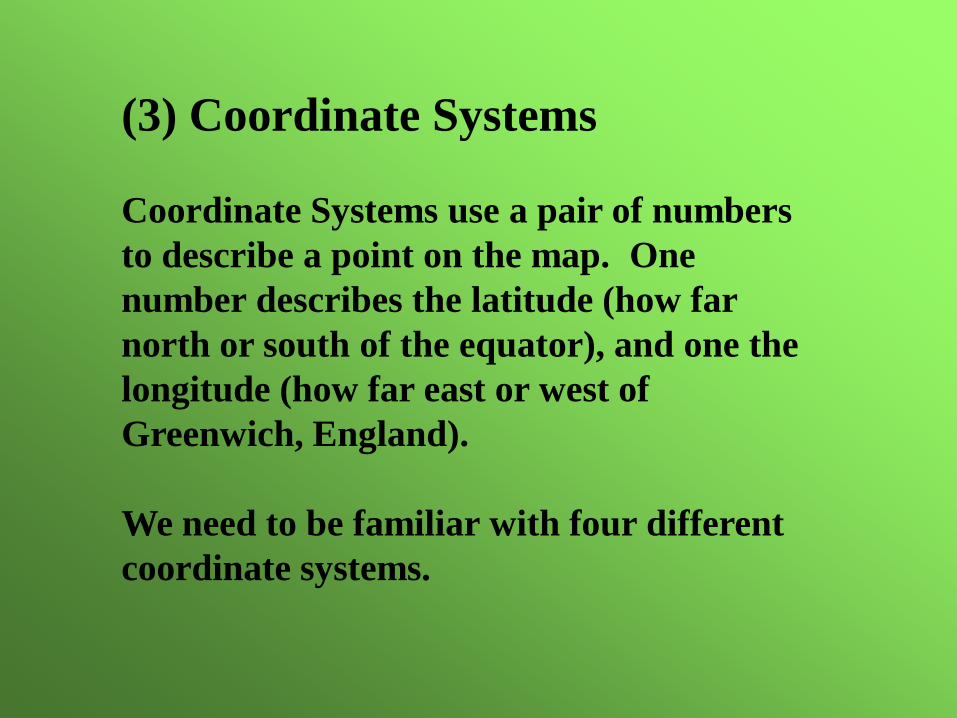
(3) Coordinate Systems
Coordinate Systems use a pair of numbers
to describe a point on the map. One
number describes the latitude (how far
north or south of the equator), and one the
longitude (how far east or west of
Greenwich, England).
We need to be familiar with four different
coordinate systems.
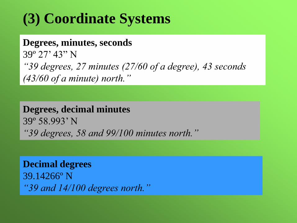
(3) Coordinate Systems
Degrees, minutes, seconds
39º 27’ 43” N
“39 degrees, 27 minutes (27/60 of a degree), 43 seconds
(43/60 of a minute) north.”
Degrees, decimal minutes
39º 58.993’ N
“39 degrees, 58 and 99/100 minutes north.”
Decimal degrees
39.14266º N
“39 and 14/100 degrees north.”
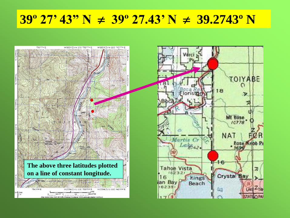
39º 27’ 43” N 39º 27.43’ N 39.2743º N
The above three latitudes plotted
on a line of constant longitude.
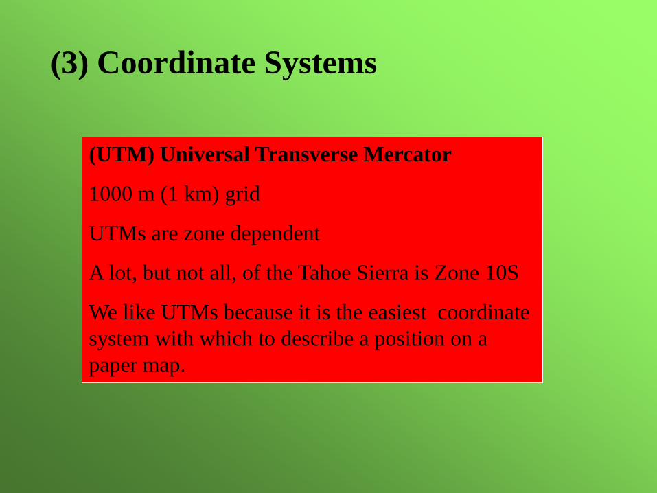
(3) Coordinate Systems
(UTM) Universal Transverse Mercator
1000 m (1 km) grid
UTMs are zone dependent
A lot, but not all, of the Tahoe Sierra is Zone 10S
We like UTMs because it is the easiest coordinate
system with which to describe a position on a
paper map.
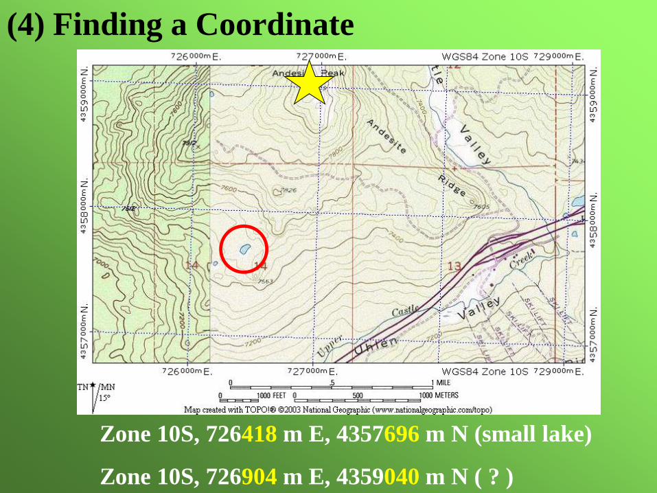
Zone 10S, 726418 m E, 4357696 m N (small lake)
Zone 10S, 726904 m E, 4359040 m N ( ? )
(4) Finding a Coordinate

Zone 10S
733417 m E
4334450 m N
Where am I?
What are the
coordinates of
this location?
Zone 10S
734710 mE
4332650 mN
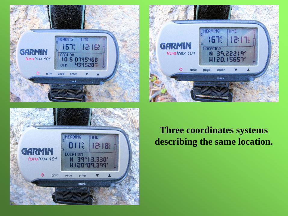
Three coordinates systems
describing the same location.
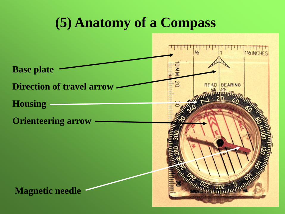
(5) Anatomy of a Compass
Base plate
Direction of travel arrow
Housing
Orienteering arrow
Magnetic needle
A compass’s needle is a very sensitive magnet. When
using the compass, keep it away from metal and
electronics (GPS, radio, avalanche transceiver,
watch). Some rocks and minerals contain large
amounts of iron. These will also deflect a compass’s
needle.
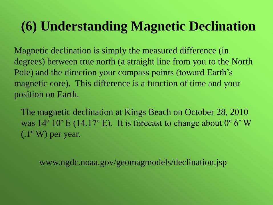
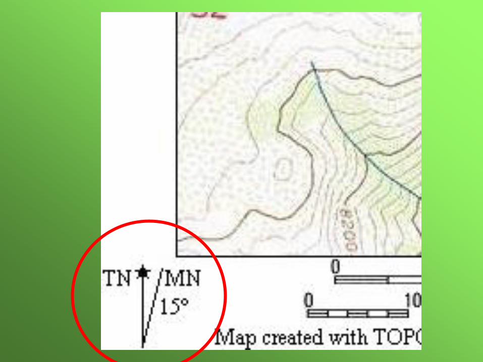
(6) Understanding Magnetic Declination
Magnetic declination is simply the measured difference (in
degrees) between true north (a straight line from you to the North
Pole) and the direction your compass points (toward Earth’s
magnetic core). This difference is a function of time and your
position on Earth.
The magnetic declination at Kings Beach on October 28, 2010
was 14º 10’ E (14.17º E). It is forecast to change about 0º 6’ W
(.1º W) per year.
www.ngdc.noaa.gov/geomagmodels/declination.jsp
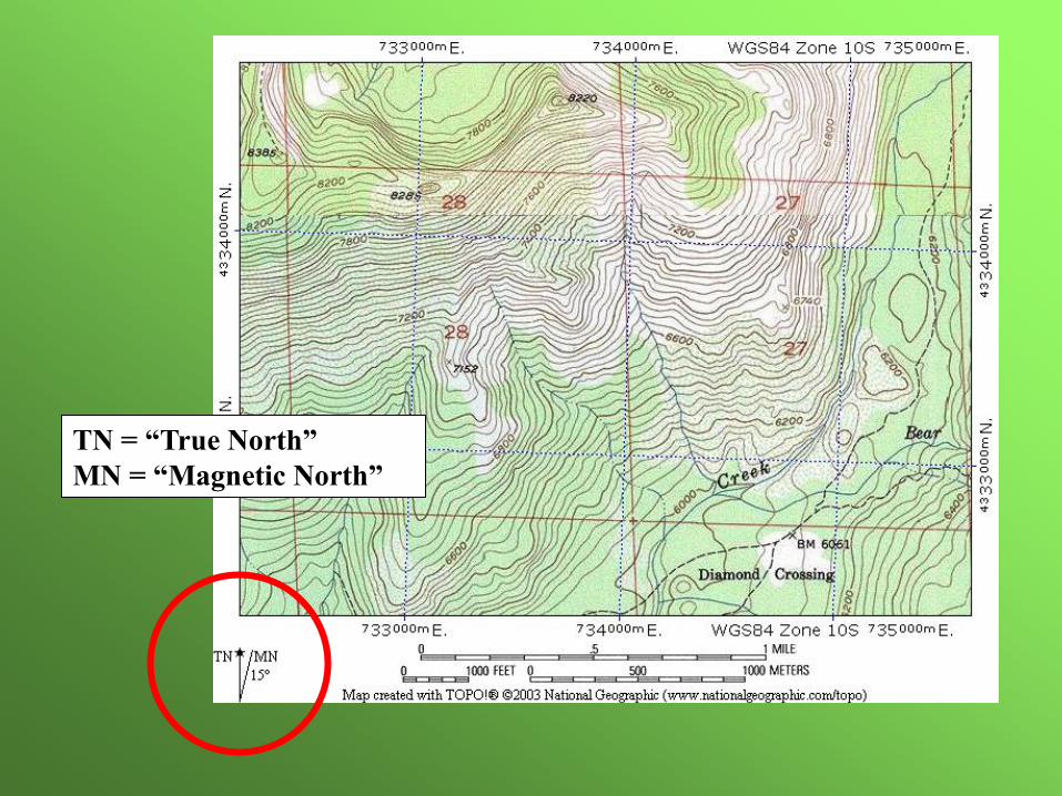
TN = “True North”
MN = “Magnetic North”
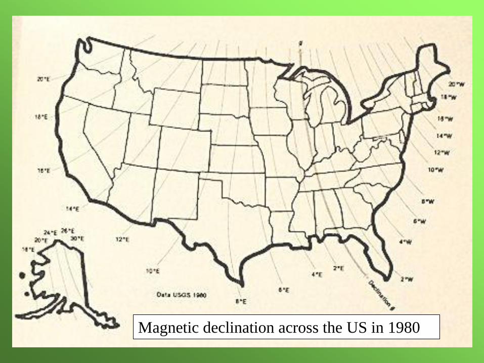
Magnetic declination across the US in 1980
(7) Orienting the map to true north
In order to reckon terrain features with those depicted on
the map, we have to be able to orient the map coincident
with the terrain.
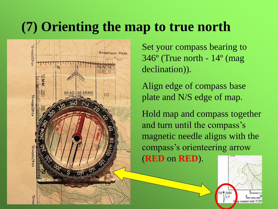
(7) Orienting the map to true north
Set your compass bearing to
346º (True north - 14º (mag
declination)).
Align edge of compass base
plate and N/S edge of map.
Hold map and compass together
and turn until the compass’s
magnetic needle aligns with the
compass’s orienteering arrow
(RED on RED).
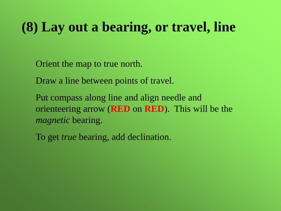
(8) Lay out a bearing, or travel, line
Orient the map to true north.
Draw a line between points of travel.
Put compass along line and align needle and
orienteering arrow (RED on RED). This will be the
magnetic bearing.
To get true bearing, add declination.
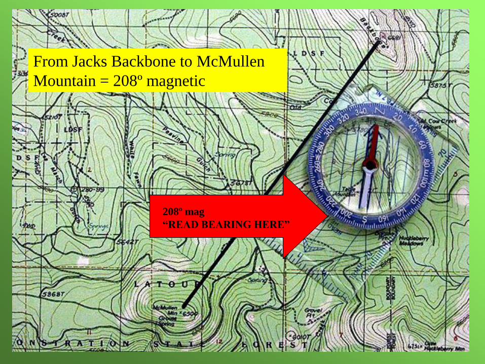
From Jacks Backbone to McMullen
Mountain = 208º magnetic
208º mag
“READ BEARING HERE”
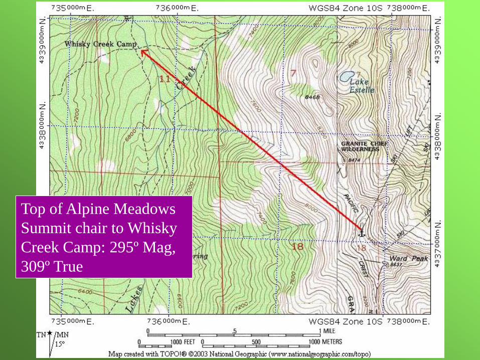
Top of Alpine Meadows
Summit chair to Whisky
Creek Camp: 295º Mag,
309º True
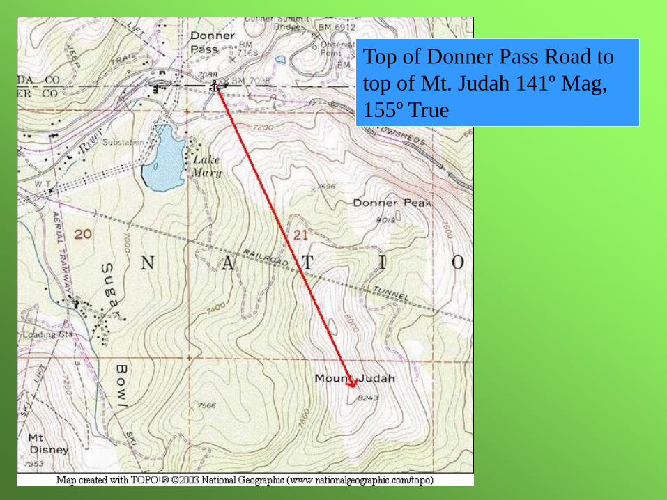
Top of Donner Pass Road to
top of Mt. Judah 141º Mag,
155º True
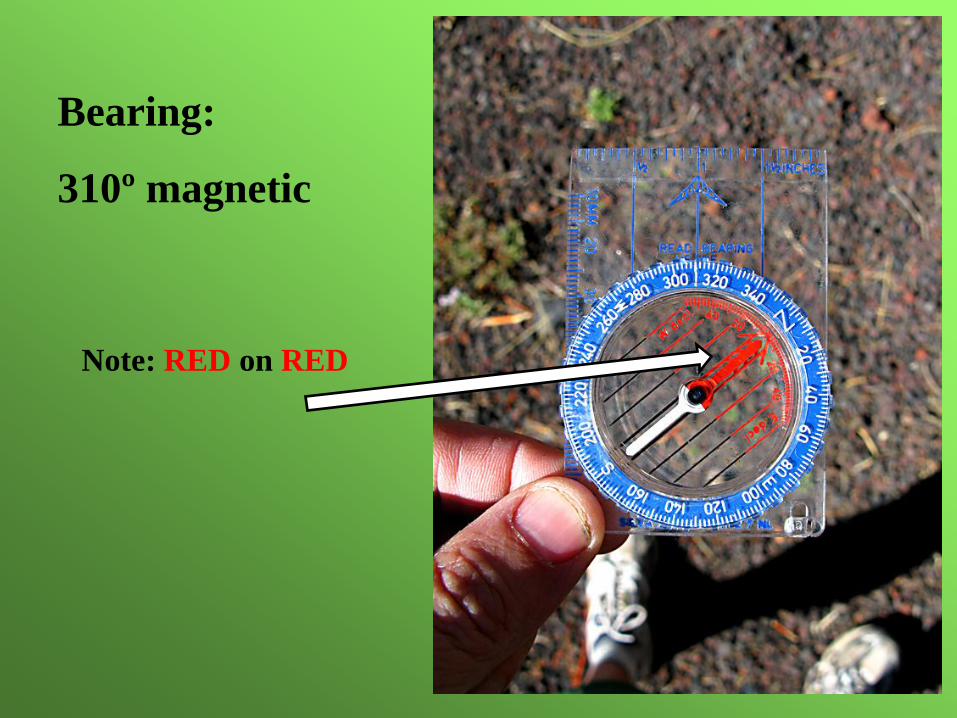
Bearing:
310º magnetic
Note: RED on RED
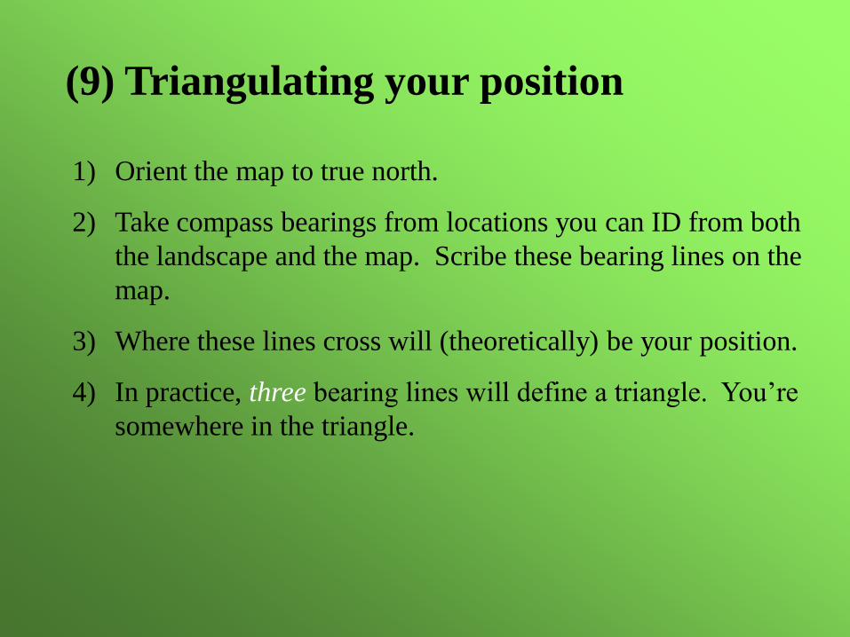
(9) Triangulating your position
1) Orient the map to true north.
2) Take compass bearings from locations you can ID from both
the landscape and the map. Scribe these bearing lines on the
map.
3) Where these lines cross will (theoretically) be your position.
4) In practice, three bearing lines will define a triangle. You’re
somewhere in the triangle.

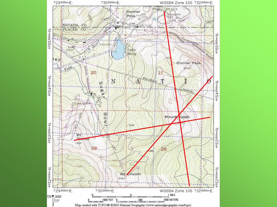
We’re somewhere on Donner Summit. Let’s take
bearings off the bridge on Donner Pass Road, Mt.
Lincoln, and Mt. Disney…


![[Nordic Built Challenge 17.12.2013] Trine Pertou Mach, Nordic Built: Nordic Built](https://img.pdfslide.net/doc/110x75/547174dcb4af9f980a8b4ad9/nordic-built-challenge-17122013-trine-pertou-mach-nordic-built-nordic-built.jpg)