Embed Size (px)
Citation preview
Map ProjectionsMap Projections
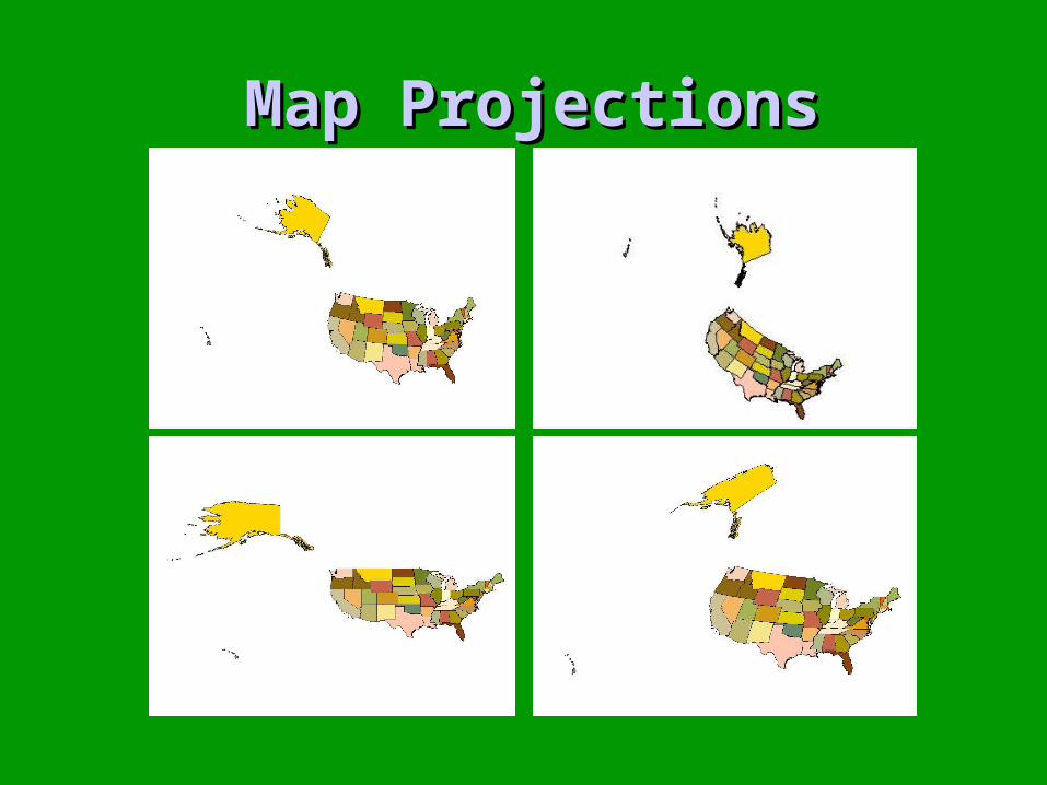
Georegistered ?Georegistered ?
• Representing a curved surface in a flat plane
• Locating that plane on the earth
• 3 issues– sphere
– datum
– projection
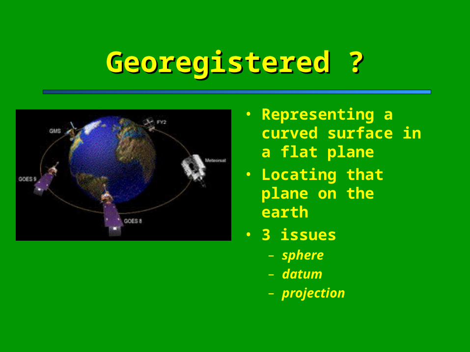
Sphere & DatumSphere & Datum
Mathematically describe a sphere
Lock it down by making it touch the earth somewhere
NAD27- Kansas
Use satellites in modern dayNAD83
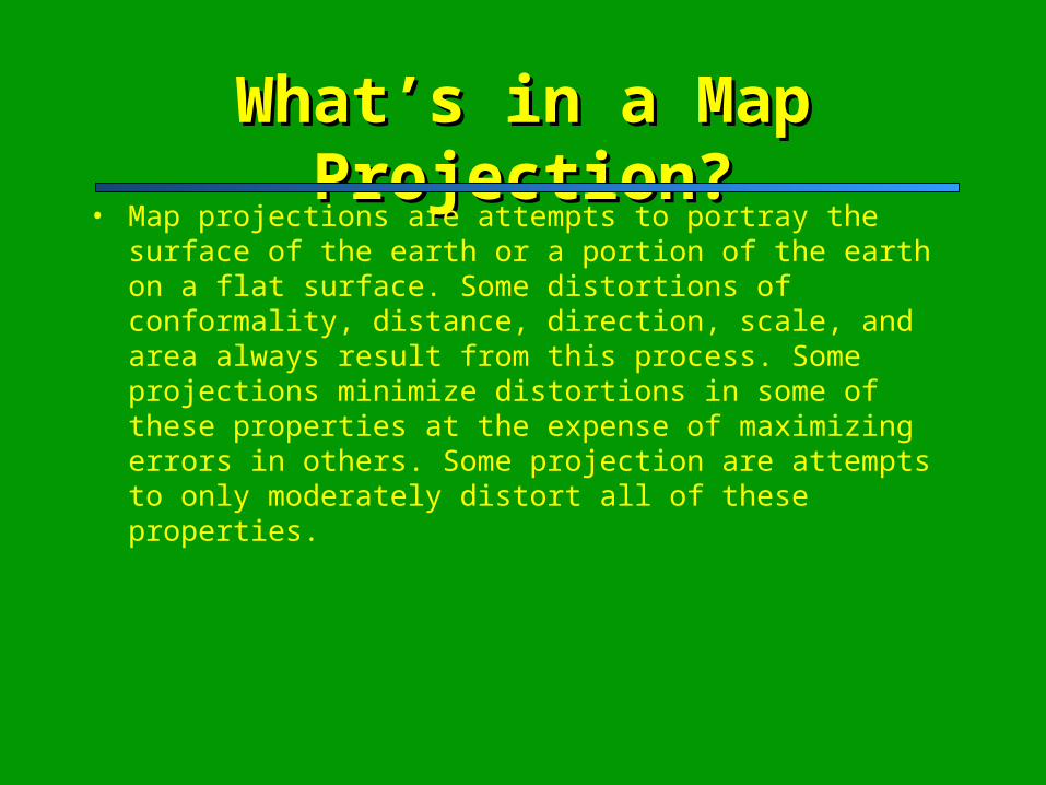
What’s in a Map Projection?What’s in a Map Projection?• Map projections are attempts to portray the surface of the earth or a
portion of the earth on a flat surface. Some distortions of conformality, distance, direction, scale, and area always result from this process. Some projections minimize distortions in some of these properties at the expense of maximizing errors in others. Some projection are attempts to only moderately distort all of these properties.
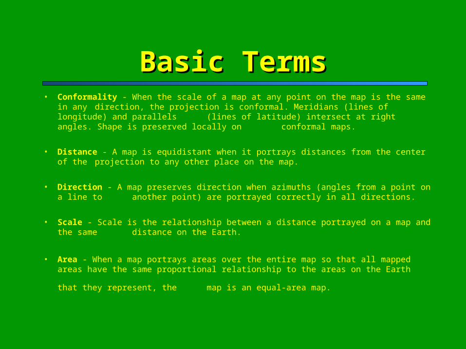
Basic TermsBasic Terms• Conformality - When the scale of a map at any point on the map is the same in any
direction, the projection is conformal. Meridians (lines of longitude) and parallels (lines of latitude) intersect at right angles. Shape is preserved locally on conformal maps.
• Distance - A map is equidistant when it portrays distances from the center of the projection to any other place on the map.
• Direction - A map preserves direction when azimuths (angles from a point on a line to another point) are portrayed correctly in all directions.
• Scale - Scale is the relationship between a distance portrayed on a map and the same distance on the Earth.
• Area - When a map portrays areas over the entire map so that all mapped areas have the same proportional relationship to the areas on the Earth that they represent, the map is an equal-area
map.
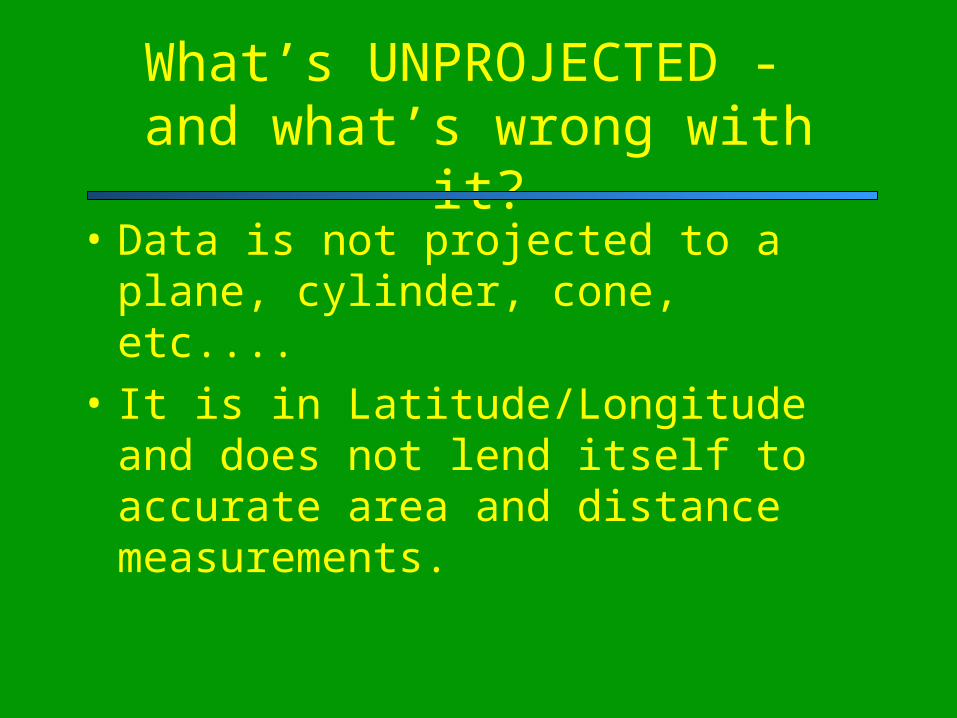
What’s UNPROJECTED - and what’s wrong with it?
• Data is not projected to a plane, cylinder, cone, etc....
• It is in Latitude/Longitude and does not lend itself to accurate area and distance measurements.
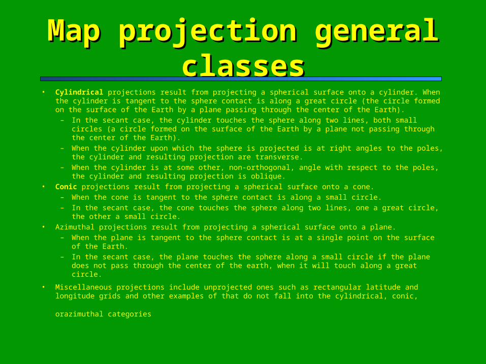
Map projection general classesMap projection general classes• Cylindrical projections result from projecting a spherical surface onto a cylinder. When the cylinder is
tangent to the sphere contact is along a great circle (the circle formed on the surface of the Earth by a plane passing through the center of the Earth).
– In the secant case, the cylinder touches the sphere along two lines, both small circles (a circle formed on the surface of the Earth by a plane not passing through the center of the Earth).
– When the cylinder upon which the sphere is projected is at right angles to the poles, the cylinder and resulting projection are transverse.
– When the cylinder is at some other, non-orthogonal, angle with respect to the poles, the cylinder and resulting projection is oblique.
• Conic projections result from projecting a spherical surface onto a cone. – When the cone is tangent to the sphere contact is along a small circle. – In the secant case, the cone touches the sphere along two lines, one a great circle, the other a small
circle. • Azimuthal projections result from projecting a spherical surface onto a plane.
– When the plane is tangent to the sphere contact is at a single point on the surface of the Earth. – In the secant case, the plane touches the sphere along a small circle if the plane does not pass through
the center of the earth, when it will touch along a great circle.
• Miscellaneous projections include unprojected ones such as rectangular latitude and longitude grids and
other examples of that do not fall into the cylindrical, conic, orazimuthal categories
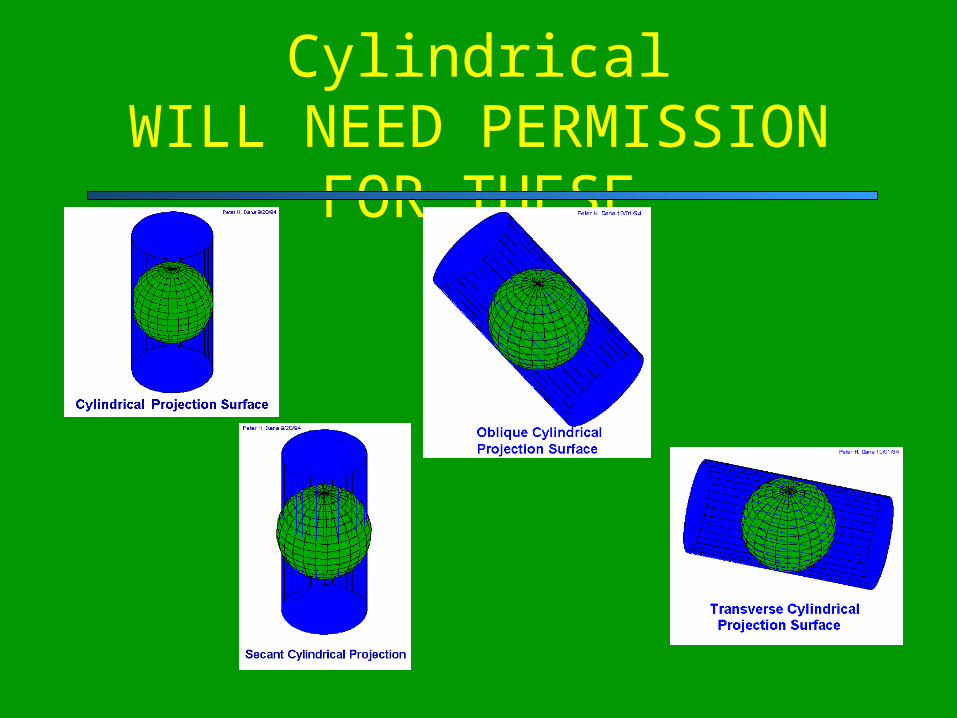
CylindricalWILL NEED PERMISSION
FOR THESE
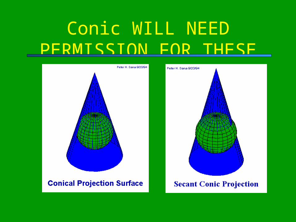
Conic WILL NEED PERMISSION FOR THESE
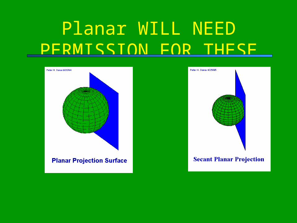
Planar WILL NEED PERMISSION FOR THESE
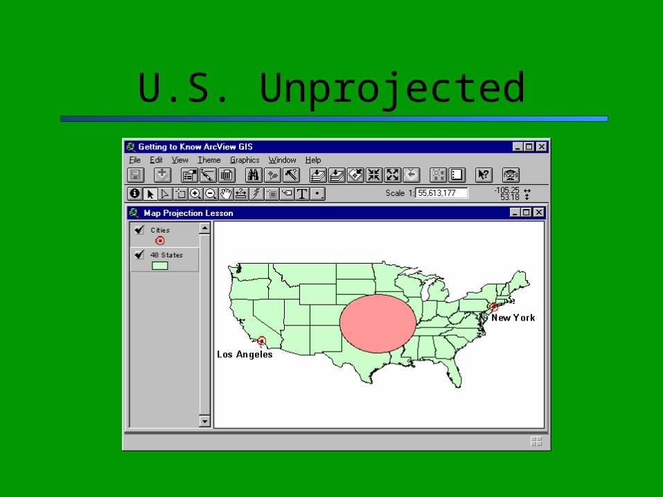
U.S. Unprojected
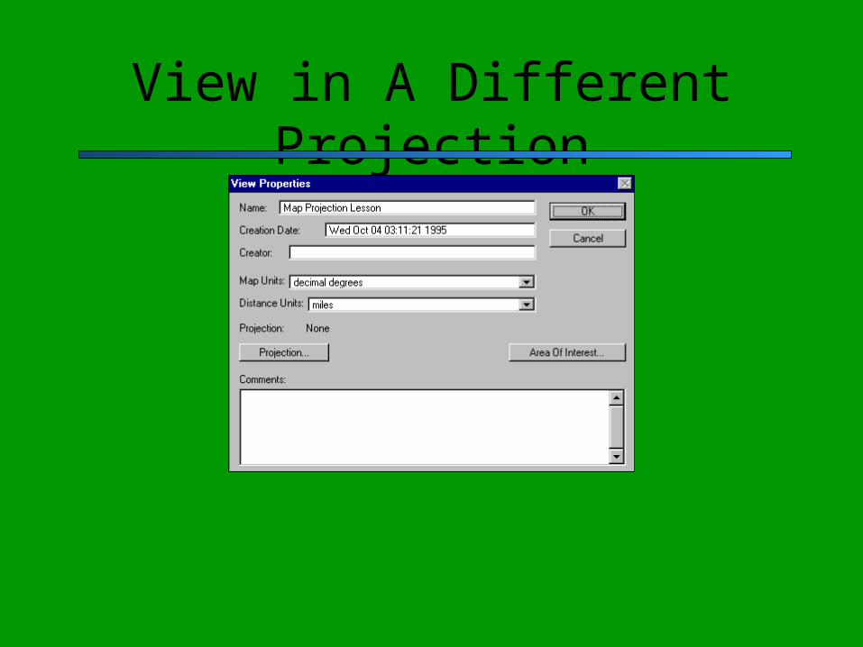
View in A Different Projection
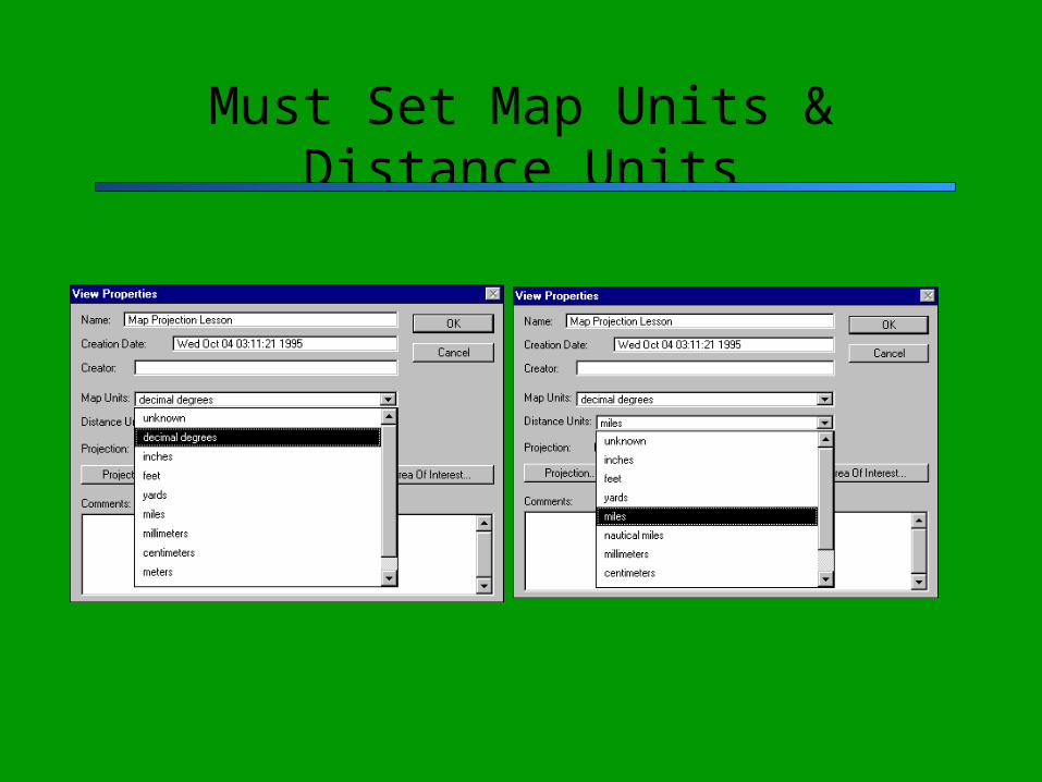
Must Set Map Units & Distance Units
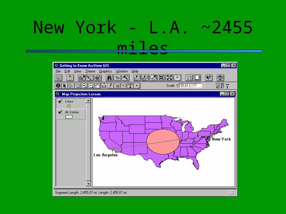
New York - L.A. ~2455 miles
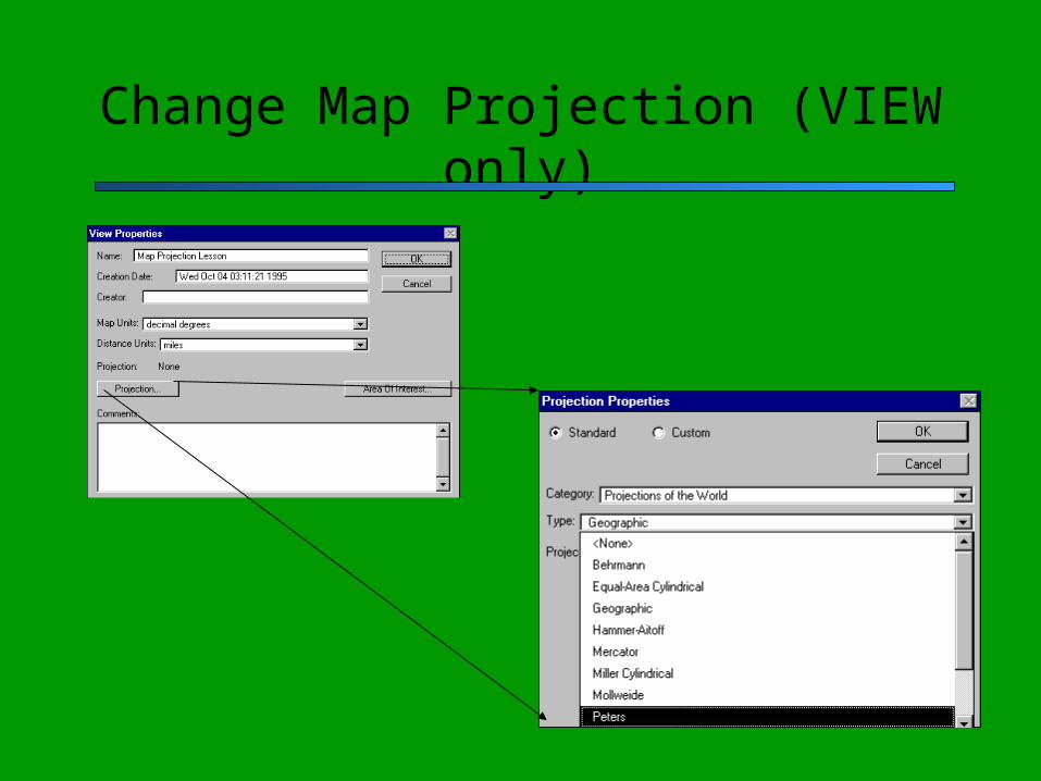
Change Map Projection (VIEW only)
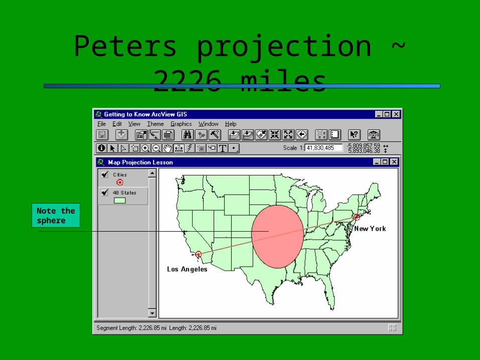
Peters projection ~ 2226 miles
Note the sphere
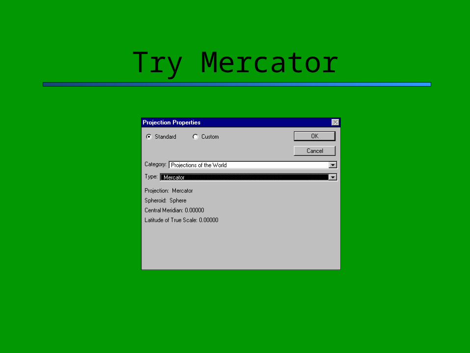
Try Mercator
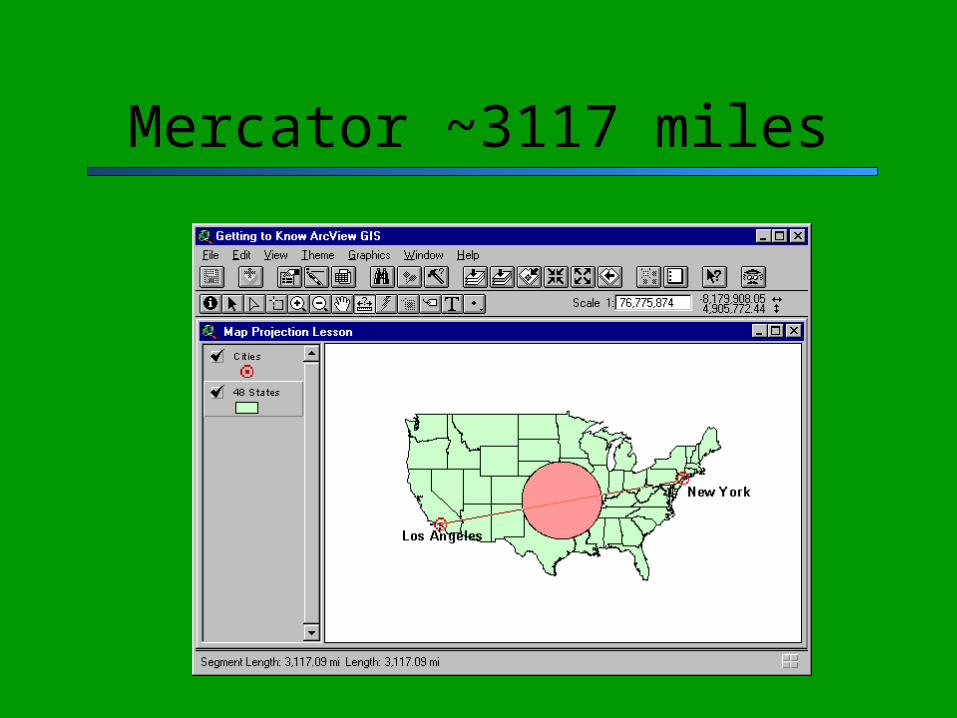
Mercator ~3117 miles
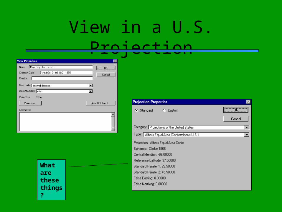
View in a U.S. Projection
What are these things?
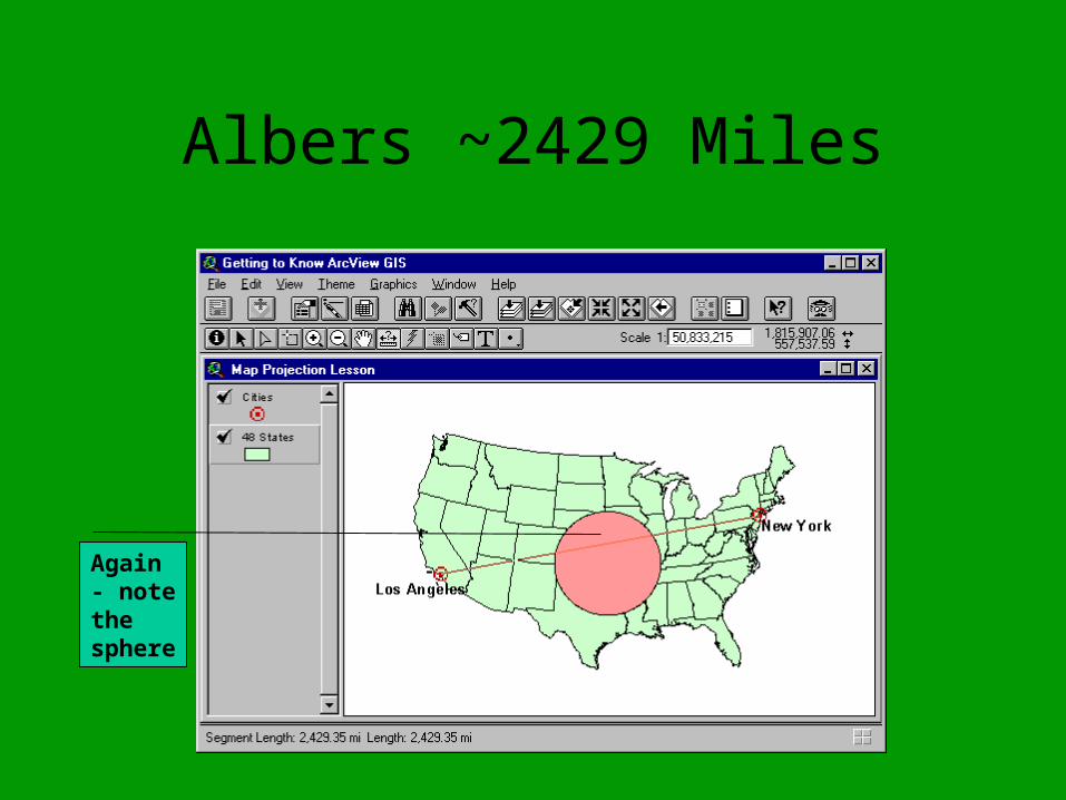
Albers ~2429 Miles
Again - note the sphere
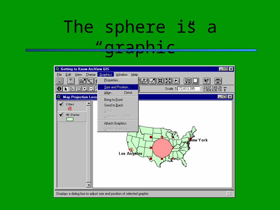
The sphere is a “graphic”

Graphic Information
What are all these #’s?
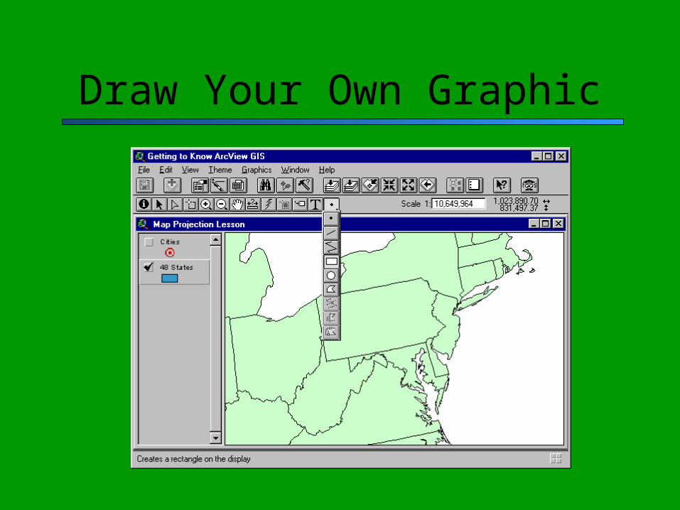
Draw Your Own Graphic
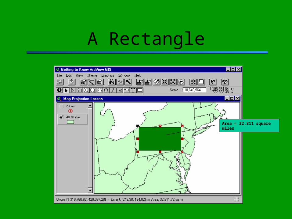
A Rectangle
Area = 32,811 square miles

So Draw a Polygon
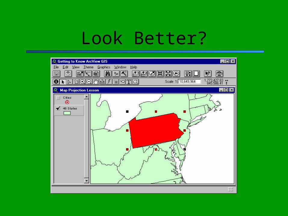
Look Better?
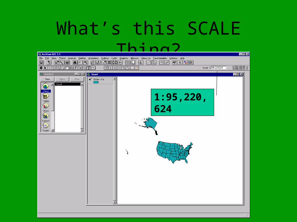
What’s this SCALE Thing?
1:95,220,624
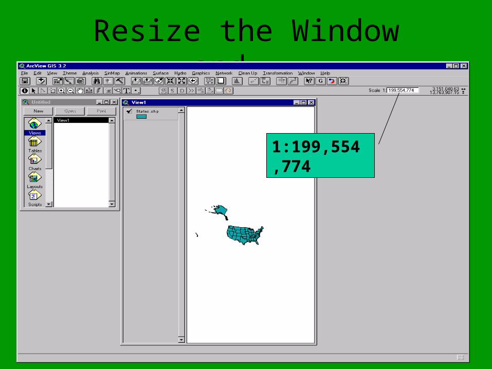
Resize the Window and...
1:199,554,774
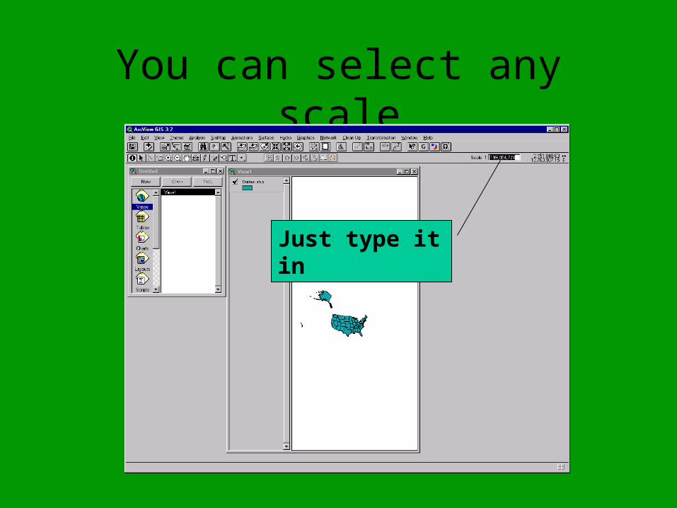
You can select any scale
Just type it in
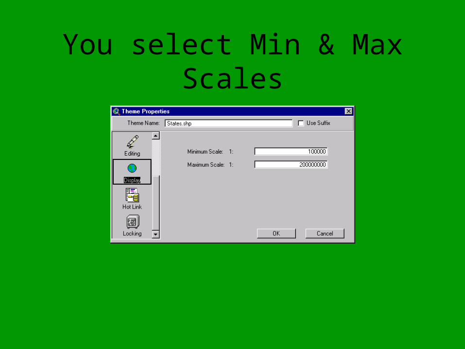
You select Min & Max Scales