Embed Size (px)
Citation preview

MapAction PowerPoint Maps - Iraq
Introduction The aim of this PowerPoint pack to provide you with some simple maps so that you can add your own data and information to them and use in presentations or reports. The maps are saved to the background so that your write or draw over them without touching the map itself. The PowerPoint pack provides all the tools that you would need to produce including symbols, callout boxes, legends and labels. All you need to do is copy and paste.
How to guide Select the map you want to use. Add your data In the Labels and Symbology section there are ready made symbols, labels and callout boxes that can be cut and pasted onto your map. With the callout boxes, double click on them and begin typing your information.

Contents
Introduction and How to guide Country Map Northern Iraq Admin 1 Maps – White Admin 1 Maps – Colour Admin 1 Maps - Editable Labels and Symbology Logos Weblinks Data Collection MapAction User Guide

Country Map Showing Country boundary and Department boundaries
Contents
There are two types of country map:
• Simple Country Reference Map – Copy and paste labels to map
• Advance Country Reference Map – Admin boundaries colours can be changed. Select admin area, Right Click>>Format Shape>>Fill

Reference map of Iraq

Reference map of Iraq

ANBAR
BAGHDAD
BASRAH
DAHUK
DIYALA
ERBIL
KERBALA
MISSAN
MUTHANNA
NAJAF
NINEWA
QADISSIYA
SALAH
AL-DIN
SULAYMANIYAH
KIRKUK
THI-QAR
WASSIT
Dahuk
Erbil
Ba`aqubah
Ramadi
Kerbala
Najaf Amarah
Samawah
Basrah
Hilla
Mosul
Diwaniya
Sulaymaniyah
Samarra
Kut
Nassriyah
Kirkuk
Baghdad
IRAN
JORDAN
KUWAIT
SAUDI ARABIA
SYRIA
TURKEY
0 100
km Reference map of Iraq
This map is editable

Northern Iraq Showing Governorates and Districts
Contents
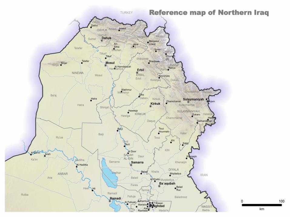
Reference map of Northern Iraq

Reference map of Northern Iraq

Shikhan
Tilkaif
Hamdaniya
Mosul
Telafar
Sumel
Dahuk
Akre
Erbil
Ba'aj
Sinjar
Hatra
Zakho
Shirqat
Baiji
Haditha Khanaqin
Kifri
Baladrooz
Muqdadiya
Khalis
Tooz
Kalar
Tarmia Heet
Rutba
Ka'im
Ramadi
Falluja
Tikrit
Badra Mada'in
Hawiga
Daquq
Makhmur
Chamchamal
Mergasur
Amedi
Soran
Choman
Pshdar Rania
Shaqlawa
Koisnjaq Dokan
Sharbazher
Halabja
Penjwin
Fares
Ana
Ru'ua
Daur
Balad
Thethar
Kirkuk
Dabes
Samarra
IRAN
TURKEY
Dahuk
Erbil
Ba`aqubah
Ramadi
Mosul
Sulaymaniyah
Samarra
Kirkuk
Baghdad
Reference map of Northern Iraq

Admin 1 Maps - White Showing Governorates and Districts
Contents

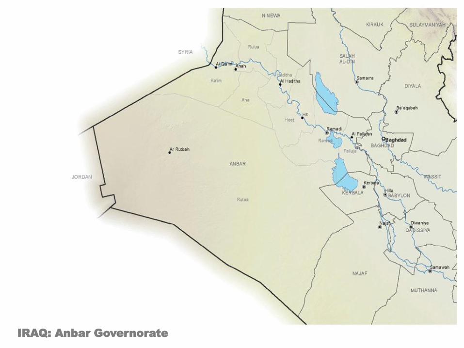
IRAQ: Anbar Governorate

IRAQ: Babylon Governorate

IRAQ: Baghdad Governorate

IRAQ: Basrah Governorate

IRAQ: Dahuk Governorate

IRAQ: Diyala Governorate

IRAQ: Erbil Governorate

IRAQ: Kerbala Governorate
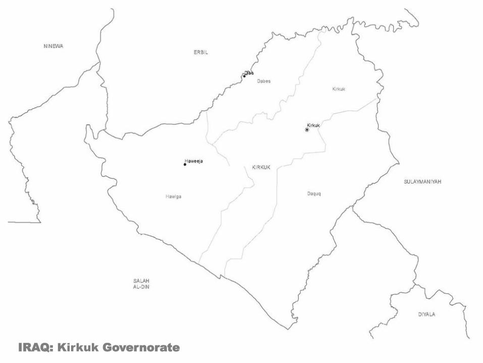
IRAQ: Kirkuk Governorate

IRAQ: Missan Governorate

IRAQ: Muthanna Governorate

IRAQ: Najaf Governorate

IRAQ: Ninewa Governorate
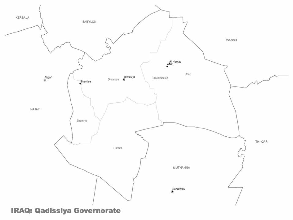
IRAQ: Qadissiya Governorate

IRAQ: Salah al-Din Governorate

IRAQ: Sulaymaniyah Governorate

IRAQ: Thi-Qar Governorate
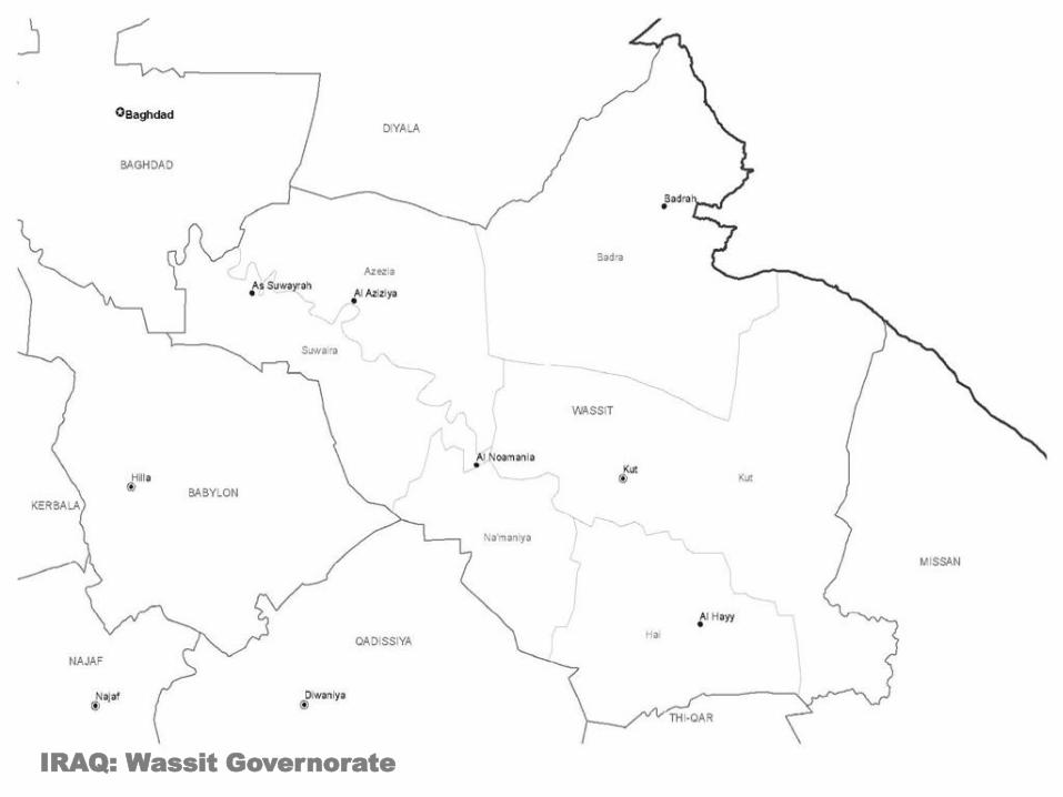
IRAQ: Wassit Governorate

Admin 1 Maps - Coloured Showing Governorates and Districts
Contents
IRAQ: Anbar Governorate

IRAQ: Babylon Governorate

IRAQ: Baghdad Governorate

IRAQ: Basrah Governorate

IRAQ: Dahuk Governorate

IRAQ: Diyala Governorate

IRAQ: Erbil Governorate

IRAQ: Kerbala Governorate

IRAQ: Kirkuk Governorate

IRAQ: Missan Governorate

IRAQ: Muthanna Governorate

IRAQ: Najaf Governorate

IRAQ: Ninewa Governorate

IRAQ: Qadissiya Governorate

IRAQ: Salah al-Din Governorate

IRAQ: Sulaymaniyah Governorate

IRAQ: Thi-Qar Governorate

IRAQ: Wassit Governorate

Admin 1 Maps - Editable Showing Governorates and Districts
Contents
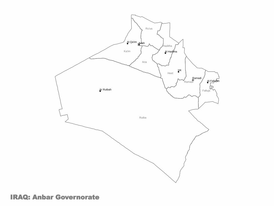
IRAQ: Anbar Governorate
Haditha
Heet
Rutba
Ka'im
Ramadi
Falluja
Ana
Ru'ua
Al Haditha
Hit
Ar Rutbah
Al Qa'im
Al Fallujah
Anah
Ramadi

IRAQ: Babylon Governorate
Mahawil
Hashimiya Hilla
Musayab
Al Mahawil
Al Hashimiyah
Al Misiab
Hilla

IRAQ: Baghdad Governorate
Tarmia
Mahmoudiya
Mada'in
Abu Ghraib
Kadhimia
Adhamia
Karkh
Resafa
Mahmudiya
Abu Gharaib
Kadhimiyah
Adhamiyah
Thawra City
Karkh Mansour
Rasheed
7 Nissan
Karadah
Rusafa
Baghdad

IRAQ: Basrah Governorate
Midaina
Qurna
Zubair
Shatt Al-Arab
Basrah
Abu Al-Khaseeb
Fao
Al Madiana
Al Qurnah
Az Zubayr
Shatt Al Arab
Abu al Khasib
Al Faw
Basrah

IRAQ: Dahuk Governorate
Sumel
Dahuk
Zakho
Amedi
Zakho
Amedi
Dahuk

IRAQ: Diyala Governorate
Khanaqin
Kifri
Baladrooz
Muqdadiya
Khalis
Ba'quba
Khanaqin
Kfri
Balad Ruz
Miqdadiya
Al Khalis
Ba`aqubah

IRAQ: Erbil Governorate
Erbil
Makhmur
Mergasur
Soran
Choman
Shaqlawa
Koisnjaq
Makhmur
Mergasur Lower
Soran Choman [1]
Shaqlawa
Koysinjaq
Erbil

IRAQ: Kerbala Governorate
Ain Al-Tamur
Kerbala
Hindiya
Kerbala
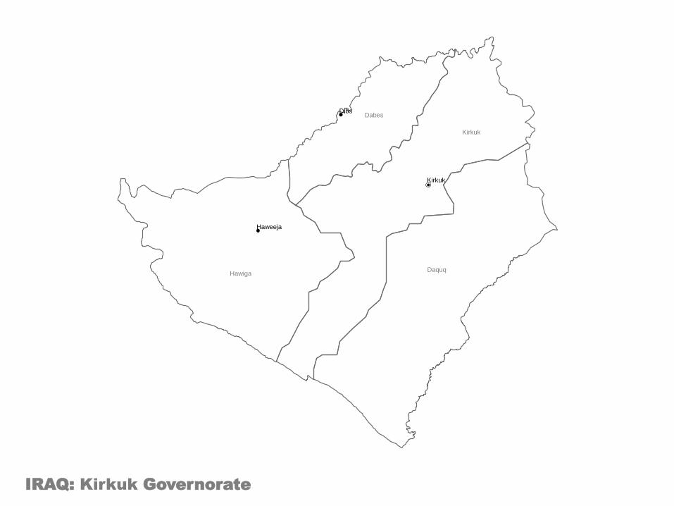
IRAQ: Kirkuk Governorate
Hawiga Daquq
Kirkuk
Dabes
Haweeja
Dibs
Kirkuk

IRAQ: Missan Governorate
Ali Al-Gharbi
Amara
Mejar
Al-Kabi
Maimouna
Kahla
Qal'at Saleh
Ali al Gharbi
Al Mijar al Kabir
Al Miamona Al Kahla
Qal`at Salih
Amarah

IRAQ: Muthanna Governorate
Salman
Rumaitha
Samawa
Khidhir
As Salman
Rumaitha
Al Khithir
Samawah

IRAQ: Najaf Governorate
Najaf
Kufa
Manathera
Al Kufa Najaf

IRAQ: Ninewa Governorate
Shikhan
Tilkaif
Hamdaniya
Mosul
Telafar Akre
Ba'aj
Sinjar
Hatra
Akre Ain Sifne
Tilkef
Al Hamdaniyah
Talafar
Sinjar
Hatra
Mosul

IRAQ: Qadissiya Governorate
Afaq
Diwaniya
Shamiya
Hamza
Afak Al Hamza
Shamiya
Diwaniya

IRAQ: Salah al-Din Governorate
Shirqat
Baiji Tooz
Tikrit
Fares
Daur
Balad
Thethar
Samarra
Bayji Touz Hourmato
Tikrit
Al Door
Balad
Samarra

IRAQ: Sulaymaniyah Governorate
Kalar
Chamchamal
Pshdar Rania
Dokan
Sulaymaniya
Sharbazher
Halabja
Penjwin
Darbandihkan
Kalar
Chamchamal
Ranya
Dukaro
Halabja
Penjwin
Darbandikhan
Sulaymaniyah

IRAQ: Thi-Qar Governorate
Rifa'i
Nassriya
Suq
Al-Shoyokh
Chibayish
Shatra
Refai
Suq ash Shuyukh
Chibayish
Shatrah
Nassriyah

IRAQ: Wassit Governorate
Badra
Kut
Na'maniya
Hai
Azezia
Suwaira
Badrah
Al Hayy
Al Aziziya
Al Noamania
As Suwayrah
Kut

Labels and Symbology General Symbols
OCHA Symbols
Callout Boxes
Contents

Infrastructure
Airport
Airport Civil
Airport Military
Bridge
Buddhism Temple
Church
Community Building
Food Warehouse Storage
Government Office
Helipad
Hindu Temple
Infrastructure
Mosque
Police Station
Road
School
Seaport
Tunnel
Cluster
Agriculture
CCCM
Coordination
Early Recovery
Education
Emergency Shelter
Emergency Telecommunications
Food Security
Health
Logistics
Nutrition
Protection
WASH
Disaster
Cold Wave
Cyclone Hurricane Typhoon
Drought
Earthquake
Epidemic
Fire
Flash Flood
Flood
Heat Wave
Insect Infestation
Landslide Mudslide
Snow Avalanche
Storm
Storm Surge
Tornado
Tsunami
Volcanic Eruption
OCHA Symbols Affected Population
Affected Population
Children
Dead
Injured
Missing
Damage
Affected
Damage
Destroyed
Partially Destroyed

Health Facilities
Clinic
Health Facilities
Health Post
Hospital
Psychological Support
Camp
Fixed
IDP Refugee Camp
Refugee Registration
Temporary
Transition Sites
Security
Arrest Detention Abduction
Assault
Attack
Forced Entry Office Occupation
Harassment and Intimidation
Hijacking
Murder
Robbery
Security
Threat
Physical Closure
Checkpoint
Cross Border
Earthmound
Military Gate
Observation Tower
Physical Closure
Road Barrier
Road Block
Road Gate
Trench
Armed Troop
Armed Troop
Child Combatant
National Army
Rebel Army
Mine and UXO Presence
Dangerous Areas
Mine UXO Presence
Mined Areas
UXO Spots
Water and Sanitation
Borehole
Latrine
Potable Water Source
Spring Water
Submersible Pump
Tapstand
Water Sources
Well
Relief Materials
Blanket
Bottle of Water
Bucket Jerry Can
Clothing
Food
Kitchen Sets
Matress
Medical Supply
Medicine
Mosquito Net
Non Food Item
Plastic Sheeting
Relief Goods
Stove
Tarpauline
Tent
Telecommunications
Fax
Internet
Mobile Phone
Radio
OCHA Symbols Continue

General Symbols

Labelling
Callout 6
Callout 8
Callout 5
Callout 7
Callout 2
Callout 4
Callout 1
Callout 3
Transparent Label
Transparent Label in Italics
Transparent Label in Bold
TRANSPARENT LABEL IN CAPITALS
Label
Label in Italics
Label in Bold
LABEL IN CAPITALS
Creation Date/ Time:
Map Reference Number:
Glide Number:

Legend Details
Creation Date/ Time:
Map Reference Number:
Glide Number:
Additional Metadata Tags
Data Sources:
Location: Subject Date
The map summary (also
Termed the abstract) is
a block of descriptive
text that provides a
useful guide to a user
whether or not they are
looking at the map itself,
a thumbnail or a non-
graphical list of map
products.
Haiti: Department Reference Map
The map summary (also
termed the abstract) is a
block of descriptive text
that provides a useful
guide to a user whether
or not they are looking
at the map itself, a
thumbnail or a non-
graphical list of map
products.
For example:
The map background
shows major
settlements and
Department boundaries.
Map Title
Map Summary Map Summary Example
Map Title Example
Creation Date/ Time: 2010-10-10/ 1200
Map Reference Number: ABC123
Glide Number:
Additional Metadata Tags Examples
Data Sources:

Legend
Population
0 - 10000
10001 - 15000
15001 - 20000
20001 - 25000
25001 - 30000
30001 - 35000
35001 - 40000
40001 - 45000
45001 - 50000
50001 - 75000
75001 - 100000
100001 - 250000
250001 - 500000
500001 - 750000
Legend
SRTMHigh : 2700
Low : 0
Settlements
!!!! Department City
!!̂ National Capital
Water
Waterbody
Perennial/Permanent River
Non-Perennial/Intermittent/Fluctuating River
Population Map Physical Map
Legend
Airfields
U Joint Military/Civilian
W Military
U Civilian
p Other
Roads
PRINCIPAL
SECONDARY
0 Seaport
Transport Map
Legend
!!̂ National Capital
!!! Department Capital
!!!! Commune Capital
Settlements Map
Specific Legends

Logos Logos of key organisations
Contents

Paste your logos here to use in the future
Logos

Weblinks Links to key maps and data sources
Contents

Contents
Map Sources Data Sources
• MapAction - http://www.mapaction.org/ • Reliefweb - http://www.reliefweb.int/ • Reuters Alertnet - http://www.alertnet.org/ • UNOSAT - http://www.unosat.org/
Logos

Data Collection Waypoint Collection Sheet
Contents


Waypoint Collection Sheet
How to use
Contents
Remember that the GPS only records the WP
numbers: you must also make a record of what
these points represent (these are called the
attributes).
Some newer GPS receivers and other GPS-enabled
devices such as hand-held computers allow you to
enter attribute information by keying it into the device
directly when you create a waypoint. By all means
experiment with these, but you may find it awkward
in a field environment to mess around with tiny
keypads to enter information. A paper record as
shown below often proves a more practical way to
capture various kinds of information.
You can use a notebook to record the attributes of
WPs as you go along. Just write down the WP
number, and what you want to record at that place. A
better way is to use a purpose-designed form.
At Appendix 2A is a copy of MapAction’s blank WP
form for you to reproduce and use if you wish. Here
is an example showing how the form can be used.
It is not essential that you use a recording sheet exactly like the one above, but whatever you do you must be able to record
accurately the attributes for each waypoint you have saved with the GPS.

MapAction User Guide
Contents
PowerPoint Map Creation Basic Maps 1. Create base map in ArcGIS, using the PowerPoint_Map_Template found in - 2011-mm-dd-destination-BLANKv02\GIS\3_Mapping\37_PowerPoint_Maps_Basic. 2. Ungroup metadata properties and edit the Scale. 3. Regroup metadata properties. Set the frame properties as follows - Border - 1.0 point, Gap - X and Y - 5pt; Background - White, Gap - X and Y - 5pt. 4. Export map as JPEG to - 2011-mm-dd-destination-BLANKv02\GIS\3_Mapping\37_PowerPoint_Maps. 5. Open the PowerPoint Pack Template and locate the relevant slide. 6. Right click slide and select format background. 7. Select Fill>> Picture or texture fill>> Insert from>> File and select map jpeg. 8. Before applying check that the stretch options>> Offsets are all at 0%. 9. Click Close. 10. Save PowerPoint. Advance Maps 1. Create base map in ArcGIS, using the PowerPoint_Map_Template found in - 2011-mm-dd-destination-BLANKv02\GIS\3_Mapping\37_PowerPoint_Maps_Advance. 2. Export map as EMF to - 2011-mm-dd-destination-BLANKv02\GIS\3_Mapping\37_PowerPoint_Maps. 3. Open the PowerPoint Pack Template and locate the relevant slide. 4. Select Insert>>Picture>>Select EMF File>>Insert. 5. Resize map approximately. 6. Right Click Image>>Group>>Ungroup A dialog box with the following will show: "This is an imported picture, not a group. Do you want to convert it to a Microsoft Office drawing object?“ 7. Select Yes. 8. Make sure the whole map is selected and resize to fit slide. Each part of the map should now be clickable and editable. 9. Save PowerPoint. Adding a border to the map. 1. Click - Insert>>Shapes>>Rectangle. 2. Draw Rectangle around map 3. Right click rectangle>> Format shape>>Fill>>No Fill 4. In the Shape Format>> Select Line Color - Black or Grey 5. In the Shape Format>> Select Line - Width 2pt 6. Close Shape Format.