Embed Size (px)
Citation preview
Marine Debris in the Gulf of Mexico
Peter MurphyNOAA Marine Debris Program / Genwest
Biloxi, MississippiOctober 25, 2009
Outline
1. Project Background2 Process2. Process3. 2006-2007 – Alabama, Mississippi4. 2007-2009 - Louisiana4. 2007 2009 Louisiana5. Outputs
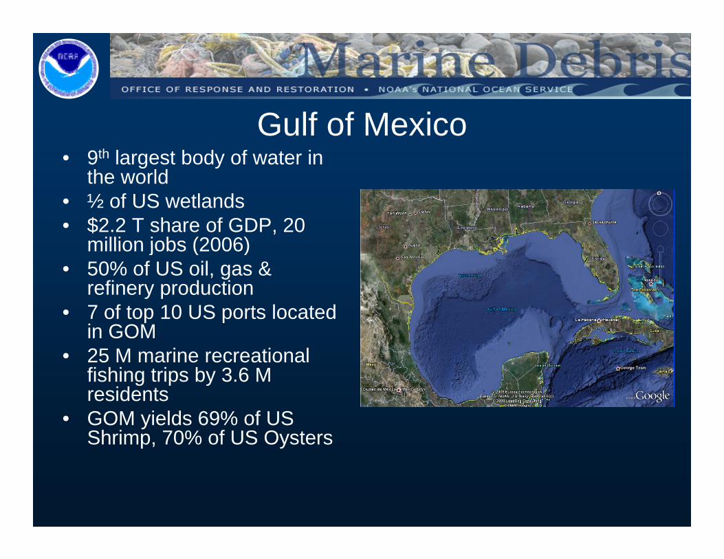
Gulf of Mexico• 9th largest body of water in
the worldthe world• ½ of US wetlands• $2.2 T share of GDP, 20
million jobs (2006)million jobs (2006)• 50% of US oil, gas &
refinery production• 7 of top 10 US ports located7 of top 10 US ports located
in GOM• 25 M marine recreational
fishing trips by 3.6 M g p yresidents
• GOM yields 69% of US Shrimp, 70% of US Oysters

Congressional Response• CongressionalCongressional
Appropriation– 2006-2007 funding to
address debris impactsp• Conduct surveys• Process survey data into
effective and useable informationinformation,
• Conduct risk assessment• Implement outreach plan
– NOAA Marine Debris– NOAA Marine Debris Program and Office of Coast Survey selected to lead data collection and analysis
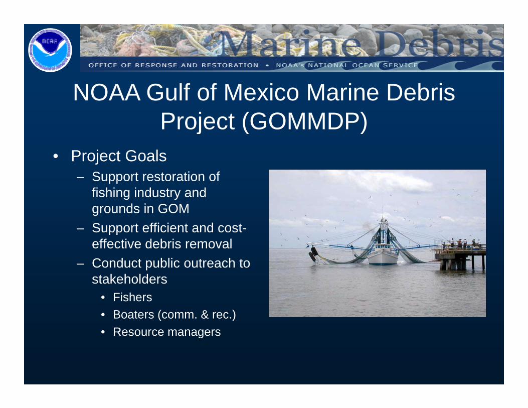
NOAA Gulf of Mexico Marine Debris Project (GOMMDP)Project (GOMMDP)
• Project Goals– Support restoration ofSupport restoration of
fishing industry and grounds in GOM
– Support efficient and cost-Support efficient and costeffective debris removal
– Conduct public outreach to stakeholdersstakeholders
• Fishers• Boaters (comm. & rec.)• Resource managers• Resource managers
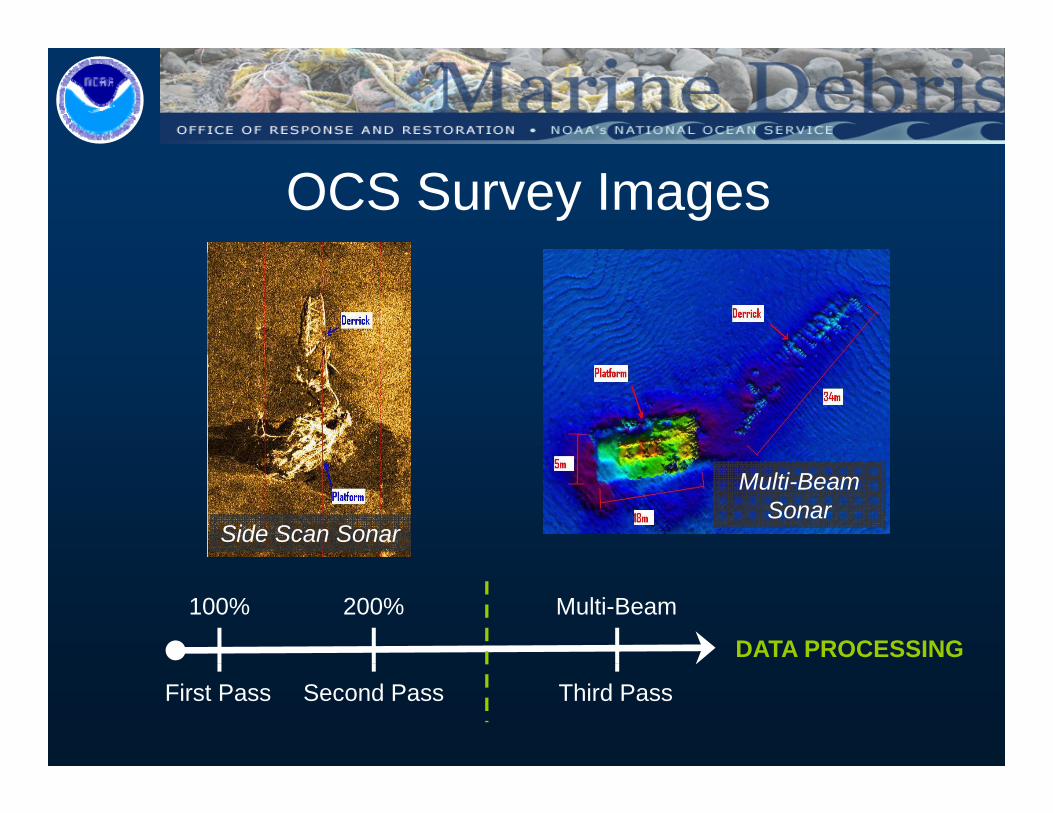
OCS Survey Images
Multi-Beam Sonar
Side Scan Sonar
100% 200% Multi-Beam
DATA PROCESSING
First Pass Second Pass Third Pass
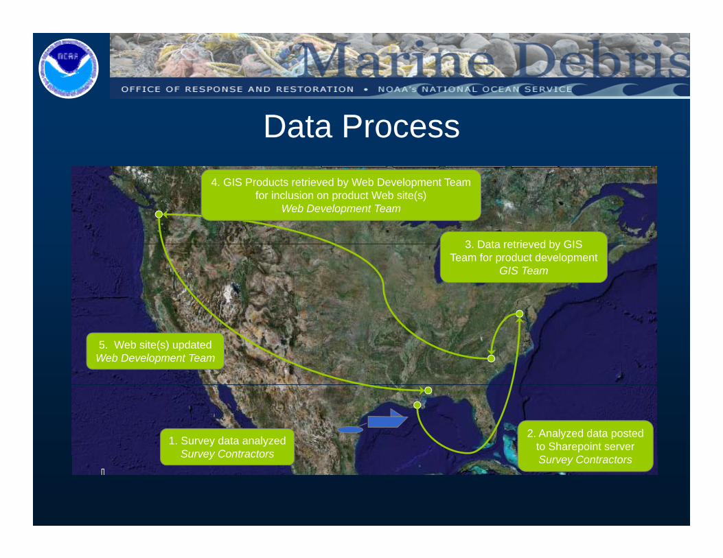
Data Process
3 Data retrieved by GIS
4. GIS Products retrieved by Web Development Teamfor inclusion on product Web site(s)
Web Development Team
3. Data retrieved by GISTeam for product development
GIS Team
5. Web site(s) updatedWeb Development Team
1. Survey data analyzedSurvey Contractors
2. Analyzed data postedto Sharepoint server
Survey Contractors Survey Contractors

Appropriation in Action – SUPP1
• 2006-2007– Alabama, Mississippi, Louisiana
• NOAA, FEMA, USCG, State Agencies– Survey by NOAA based on State input, removal by USCG/state
contractors paid by FEMA funding– Results
• Outreach in partnership with SeaGrant (AL, MS, LA Offices)• 5,000+ targets identified• 700+ mi² surveyed
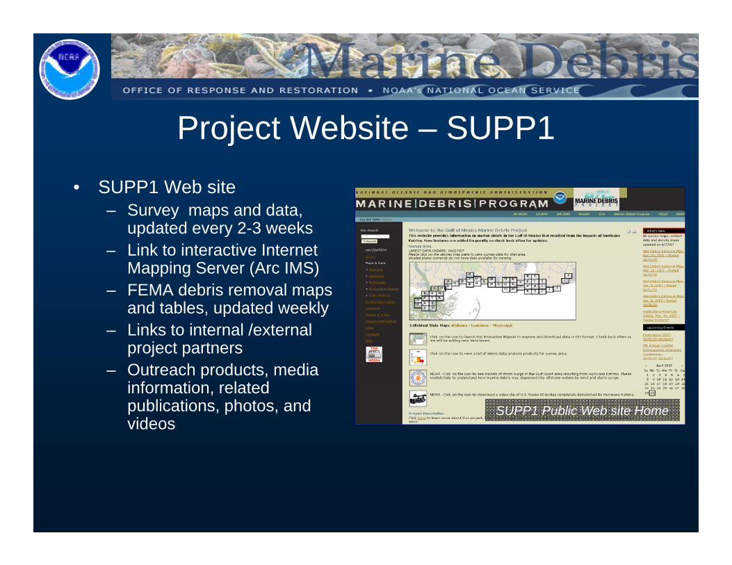
Project Website – SUPP1• SUPP1 Web site
– Survey maps and data, updated every 2-3 weeksLink to interactive Internet– Link to interactive Internet Mapping Server (Arc IMS)
– FEMA debris removal maps and tables, updated weekly
– Links to internal /external project partners
– Outreach products, media information relatedinformation, related publications, photos, and videos
SUPP1 Public Web site Home
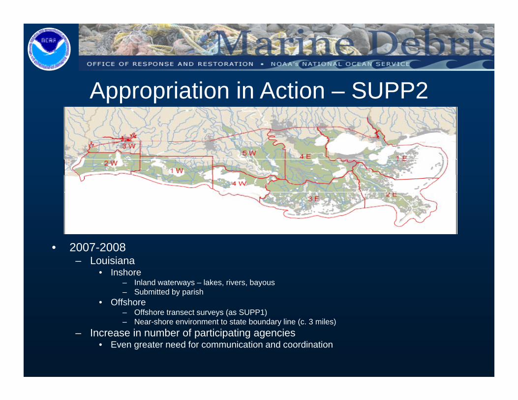
Appropriation in Action – SUPP2
• 2007-2008– Louisiana
• Inshore– Inland waterways – lakes, rivers, bayous– Submitted by parish
• Offshore– Offshore transect surveys (as SUPP1)– Near-shore environment to state boundary line (c. 3 miles)
– Increase in number of participating agencies• Even greater need for communication and coordination
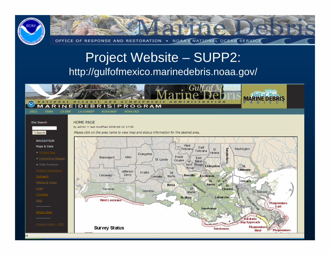
Project Website – SUPP2:http://gulfofmexico.marinedebris.noaa.gov/
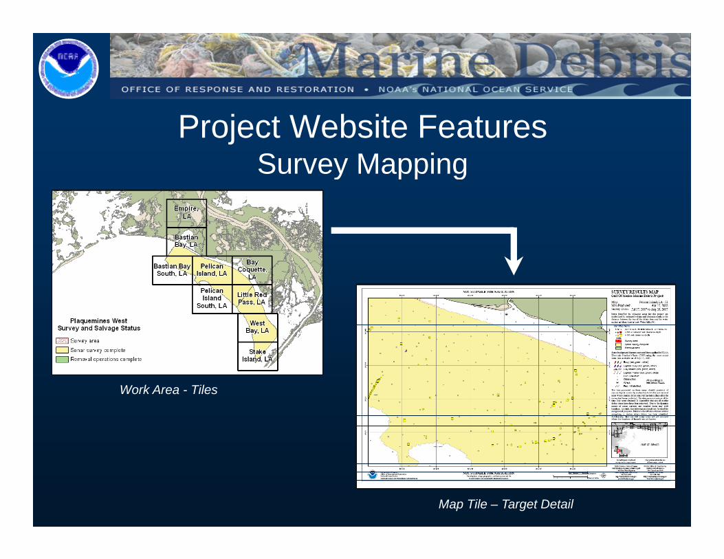
Project Website FeaturesSurvey MappingSu ey app g
W k A TilWork Area - Tiles
Map Tile – Target Detail
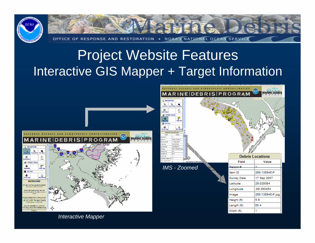
Project Website FeaturesInteractive GIS Mapper + Target Informatione ac e G S appe a ge o a o
IMS ZoomedIMS - Zoomed
Interactive Mapper
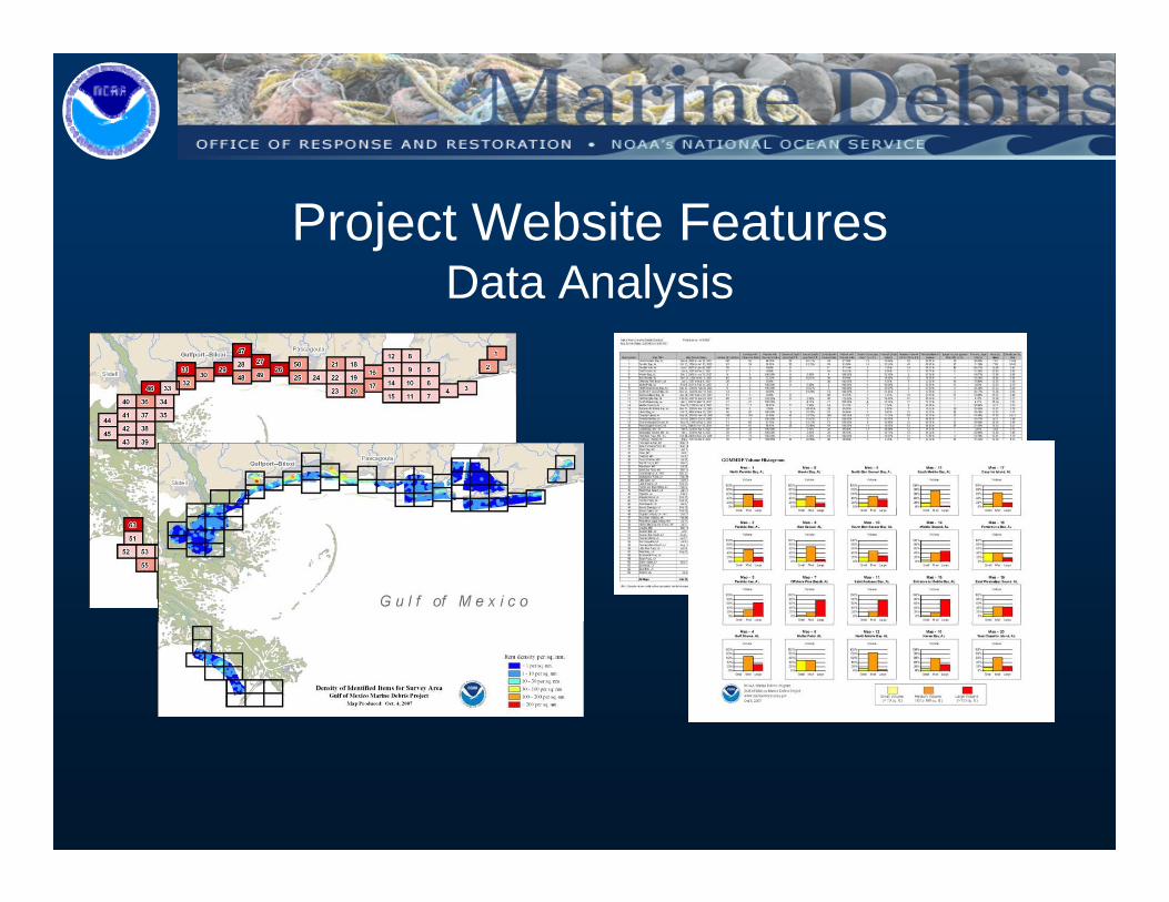
Project Website FeaturesData AnalysisData Analysis
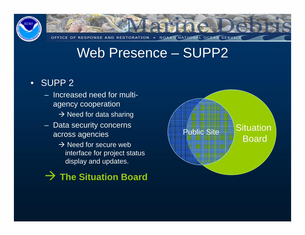
Web Presence – SUPP2
• SUPP 2– Increased need for multi-
agency cooperationagency cooperation Need for data sharing
– Data security concerns i Public Site Situation
across agenciesNeed for secure web interface for project status display and updates
Public SiteBoard
display and updates.
The Situation Board
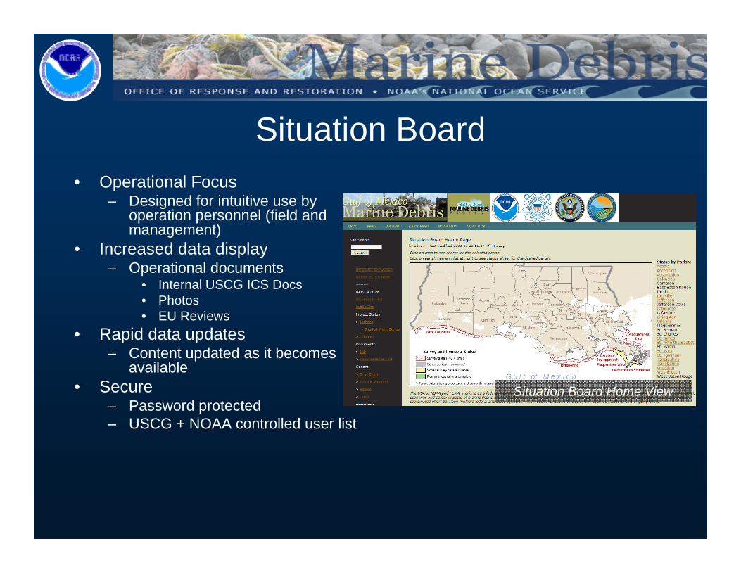
O ti l F
Situation Board• Operational Focus
– Designed for intuitive use by operation personnel (field and management)
• Increased data display• Increased data display– Operational documents
• Internal USCG ICS Docs• Photos• EU Reviews
• Rapid data updates– Content updated as it becomes
available• Secure Situation Board Home View
– Password protected– USCG + NOAA controlled user list
Situation Board Home View
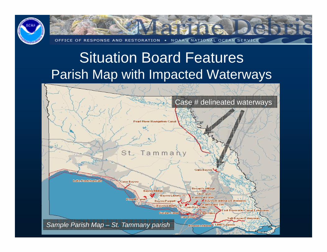
Situation Board FeaturesParish Map with Impacted WaterwaysParish Map with Impacted Waterways
Case # delineated waterways
Sample Parish Map – St. Tammany parish
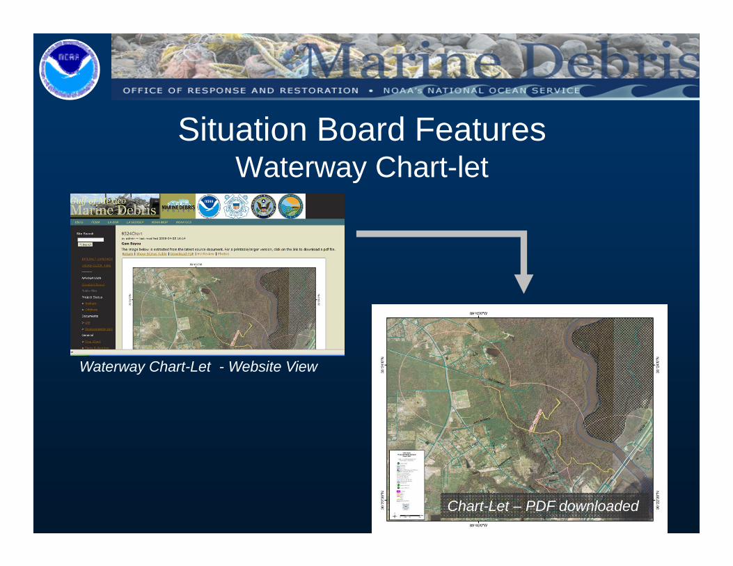
Situation Board FeaturesWaterway Chart-letWaterway Chart let
Waterway Chart-Let - Website View
Chart-Let – PDF downloaded
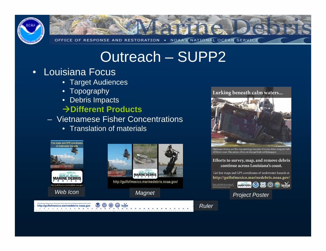
• Louisiana FocusOutreach – SUPP2
• Target Audiences• Topography• Debris Impacts
Different ProductsDifferent Products– Vietnamese Fisher Concentrations
• Translation of materials
Project Poster
R l
Web Icon Magnet
Ruler
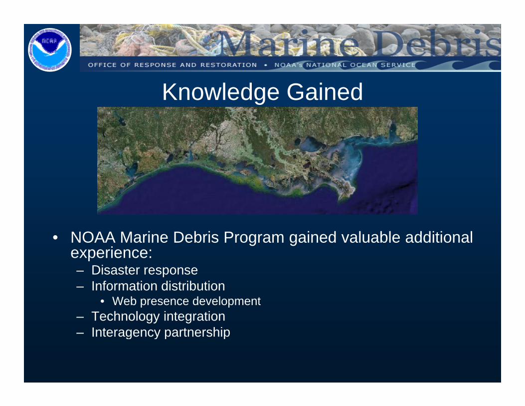
Knowledge Gained
• NOAA Marine Debris Program gained valuable additional experience:– Disaster response– Information distribution
• Web presence development– Technology integration
Interagency partnership– Interagency partnership
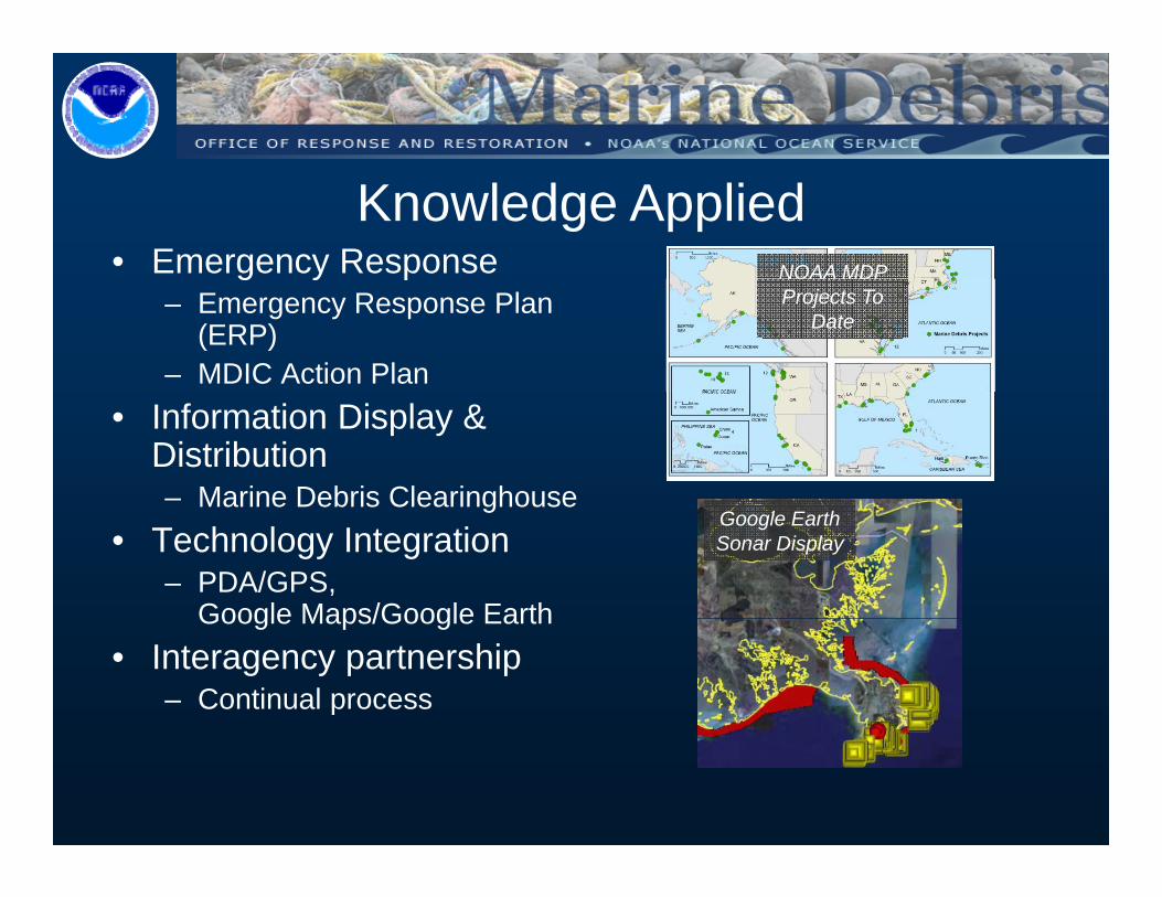
• Emergency ResponseKnowledge Applied
NOAA MDP g y p– Emergency Response Plan
(ERP)– MDIC Action Plan
NOAA MDP Projects To
Date
• Information Display & Distribution– Marine Debris ClearinghouseMarine Debris Clearinghouse
• Technology Integration– PDA/GPS,
Google Maps/Google Earth
Google EarthSonar Display
Google Maps/Google Earth• Interagency partnership
– Continual process
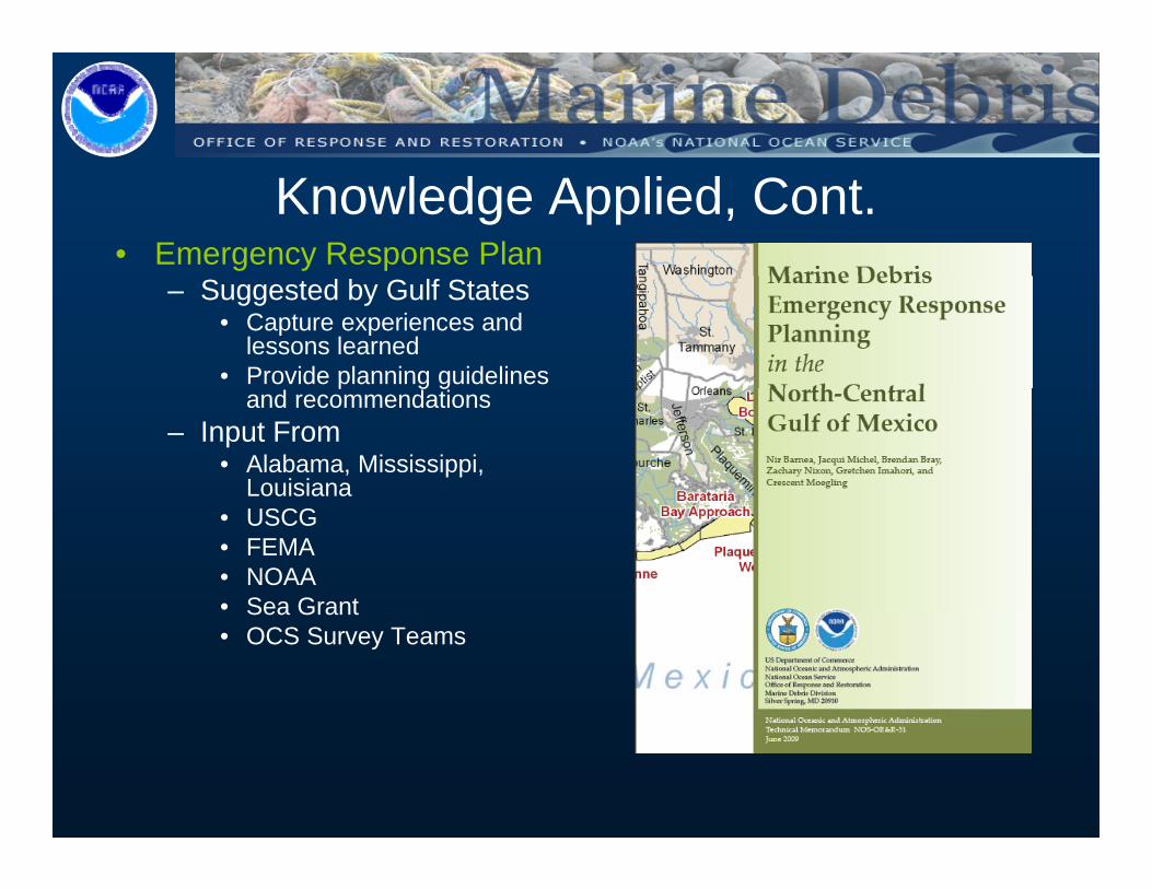
Knowledge Applied, Cont.• Emergency Response Plan
– Suggested by Gulf States• Capture experiences and
lessons learned• Provide planning guidelines p g g
and recommendations– Input From
• Alabama, Mississippi, Louisiana
• USCG• FEMA• NOAA• Sea GrantSea Grant• OCS Survey Teams
Thank YouAny Questions?
Peter MurphyNOAA Marine Debris Program
[email protected] 206 291 0073m.206.291.0073