Embed Size (px)
Citation preview
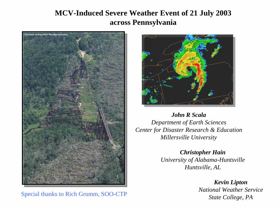
MCV-Induced Severe Weather Event of 21 July 2003across Pennsylvania
John R ScalaDepartment of Earth Sciences
Center for Disaster Research & EducationMillersville University
Christopher HainUniversity of Alabama-Huntsville
Huntsville, AL
Kevin LiptonNational Weather Service
State College, PASpecial thanks to Rich Grumm, SOO-CTP
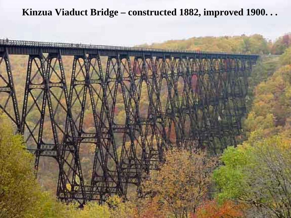
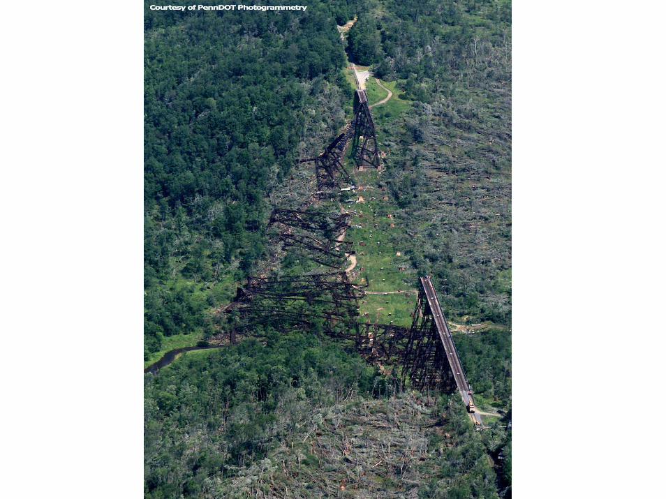
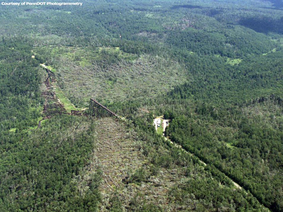
Kinzua Viaduct Bridge – constructed 1882, improved 1900. . .
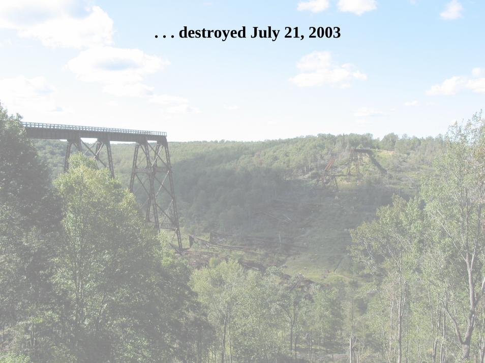
. . . destroyed July 21, 2003
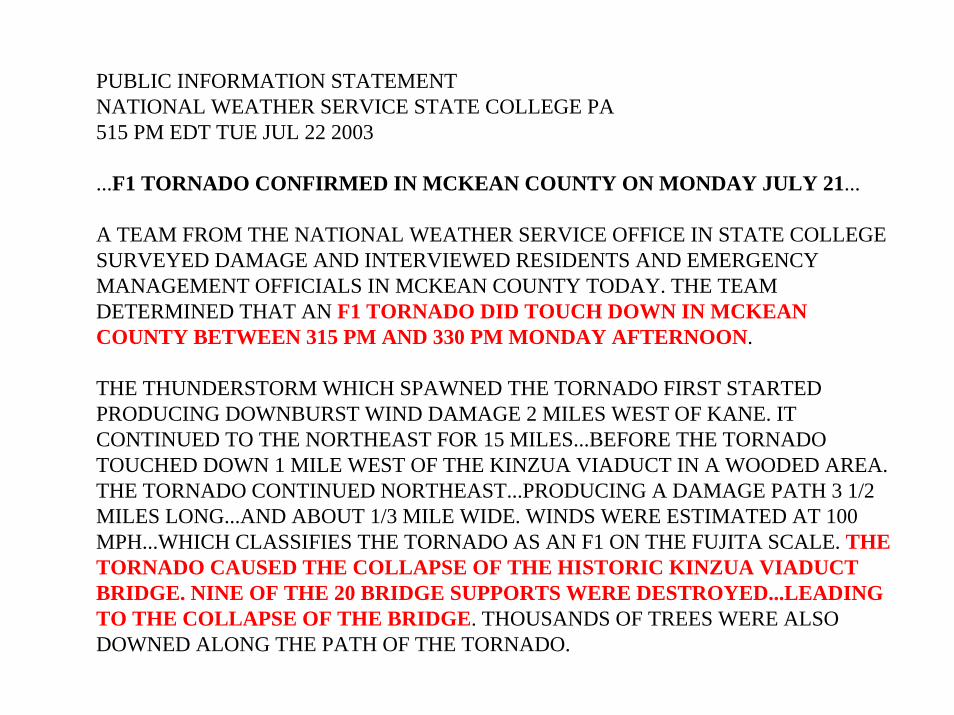
PUBLIC INFORMATION STATEMENTNATIONAL WEATHER SERVICE STATE COLLEGE PA515 PM EDT TUE JUL 22 2003
...F1 TORNADO CONFIRMED IN MCKEAN COUNTY ON MONDAY JULY 21...
A TEAM FROM THE NATIONAL WEATHER SERVICE OFFICE IN STATE COLLEGESURVEYED DAMAGE AND INTERVIEWED RESIDENTS AND EMERGENCY MANAGEMENT OFFICIALS IN MCKEAN COUNTY TODAY. THE TEAM DETERMINED THAT AN F1 TORNADO DID TOUCH DOWN IN MCKEAN COUNTY BETWEEN 315 PM AND 330 PM MONDAY AFTERNOON.
THE THUNDERSTORM WHICH SPAWNED THE TORNADO FIRST STARTED PRODUCING DOWNBURST WIND DAMAGE 2 MILES WEST OF KANE. IT CONTINUED TO THE NORTHEAST FOR 15 MILES...BEFORE THE TORNADO TOUCHED DOWN 1 MILE WEST OF THE KINZUA VIADUCT IN A WOODED AREA.THE TORNADO CONTINUED NORTHEAST...PRODUCING A DAMAGE PATH 3 1/2 MILES LONG...AND ABOUT 1/3 MILE WIDE. WINDS WERE ESTIMATED AT 100 MPH...WHICH CLASSIFIES THE TORNADO AS AN F1 ON THE FUJITA SCALE. THE TORNADO CAUSED THE COLLAPSE OF THE HISTORIC KINZUA VIADUCT BRIDGE. NINE OF THE 20 BRIDGE SUPPORTS WERE DESTROYED...LEADING TO THE COLLAPSE OF THE BRIDGE. THOUSANDS OF TREES WERE ALSO DOWNED ALONG THE PATH OF THE TORNADO.
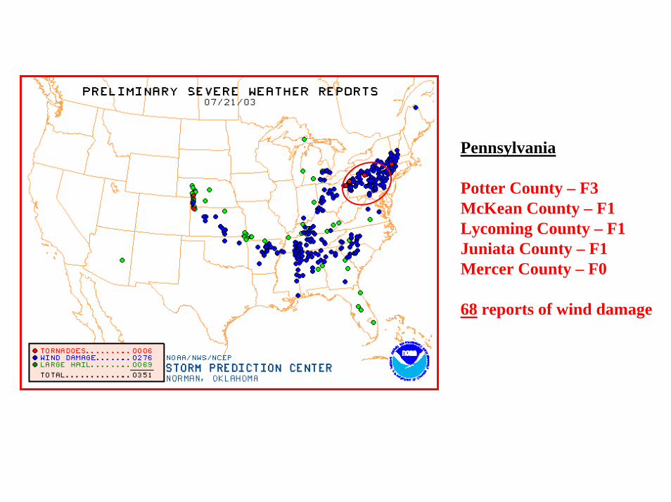
Pennsylvania
Potter County – F3McKean County – F1Lycoming County – F1Juniata County – F1Mercer County – F0
68 reports of wind damage
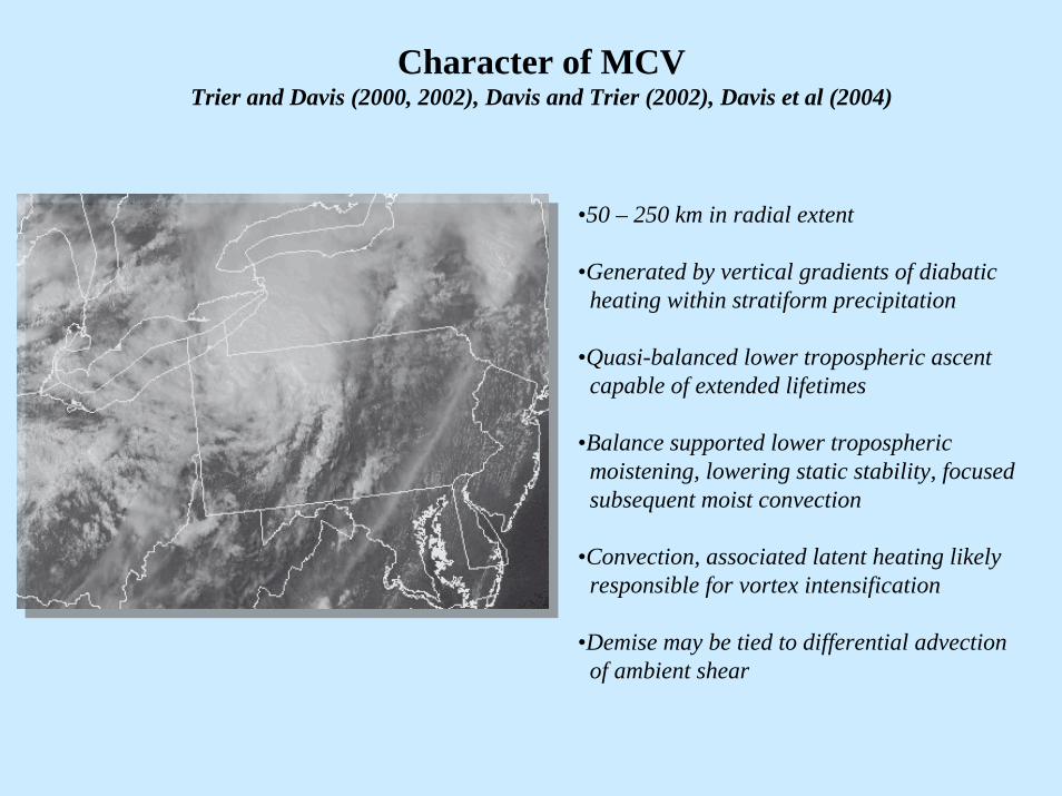
Character of MCVTrier and Davis (2000, 2002), Davis and Trier (2002), Davis et al (2004)
•50 – 250 km in radial extent
•Generated by vertical gradients of diabaticheating within stratiform precipitation
•Quasi-balanced lower tropospheric ascentcapable of extended lifetimes
•Balance supported lower troposphericmoistening, lowering static stability, focusedsubsequent moist convection
•Convection, associated latent heating likelyresponsible for vortex intensification
•Demise may be tied to differential advectionof ambient shear
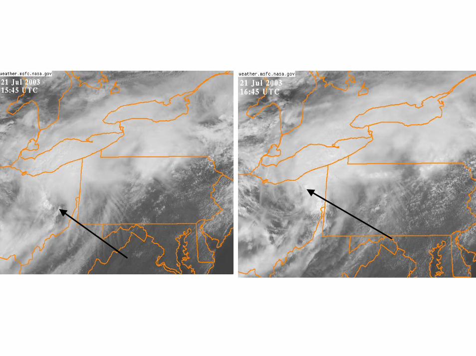
Figure 2. GOES visual satellite imagery at a) 1545 and b) 1645 UTC. Arrow high lights vortex center.
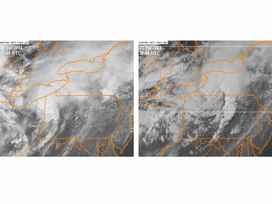
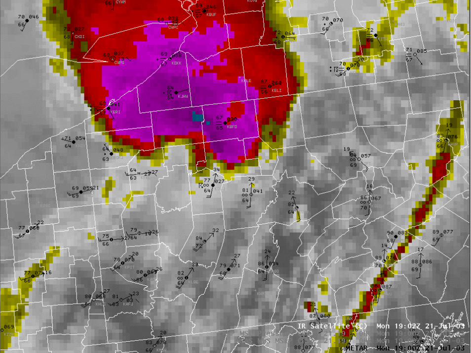
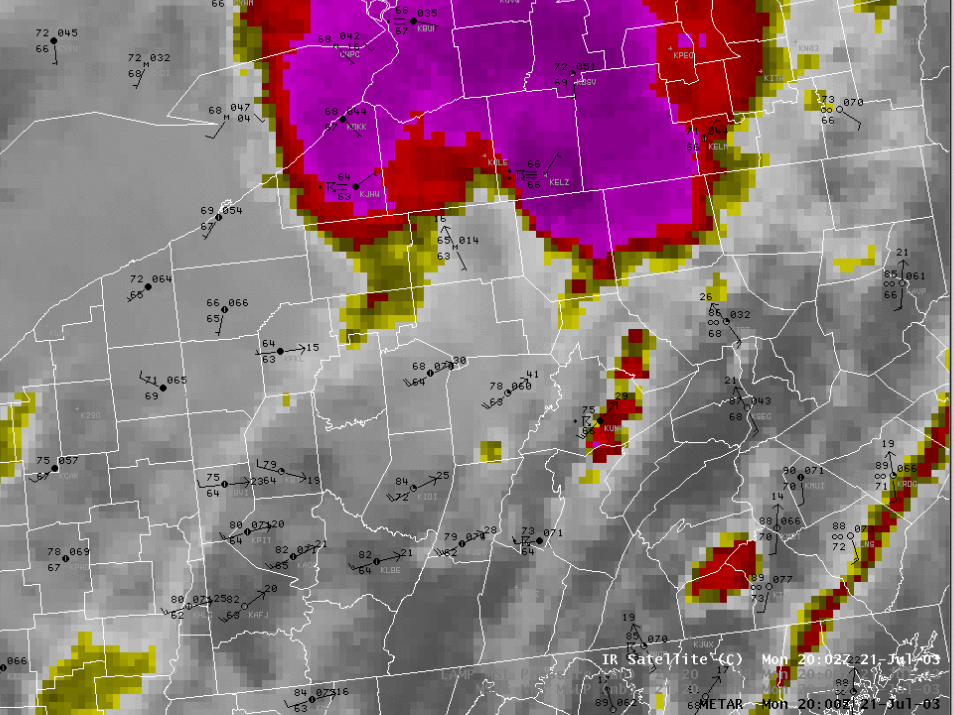
Figure 3. As in Figure 2 except for a) 1740 and b) 2040 UTC.
a b
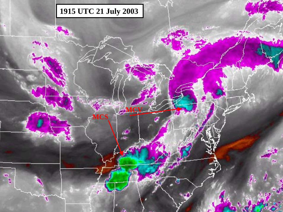
1915 UTC 21 July 2003
MCVMCS
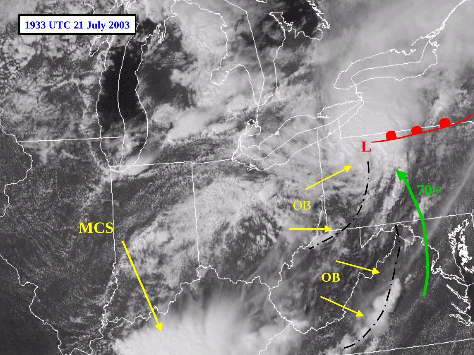
1933 UTC 21 July 2003
L
MCS
70+
OB
OB
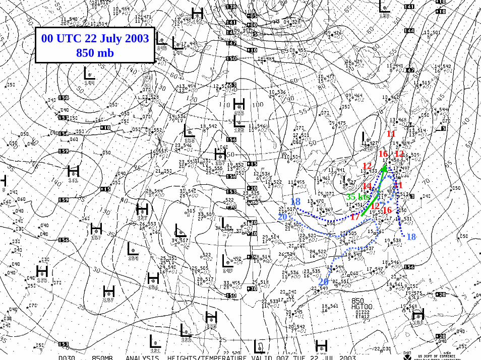
14
12
1216 12
16
11
11
17
18
1820
20
35 kts
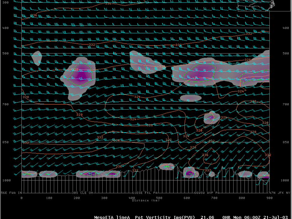
00 UTC 22 July 2003850 mb
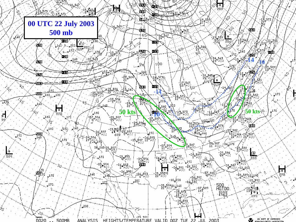
-10
-10
-14
-14
50 kts50 kts
00 UTC 22 July 2003500 mb
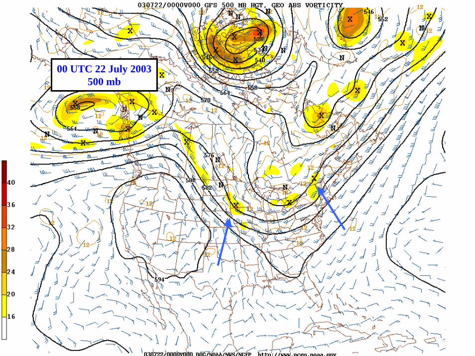
00 UTC 22 July 2003500 mb
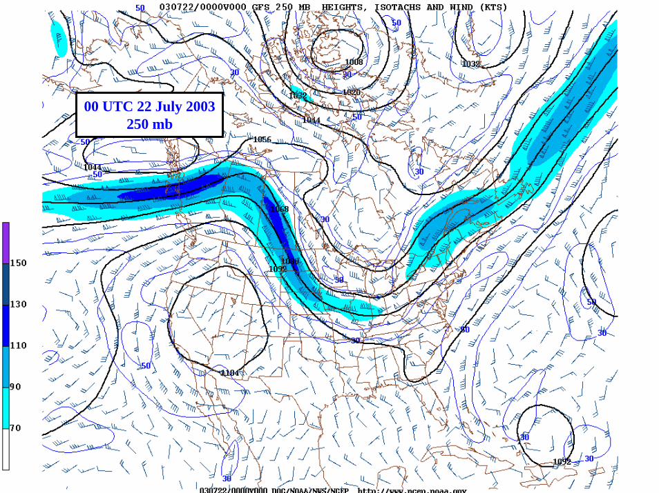
00 UTC 22 July 2003250 mb
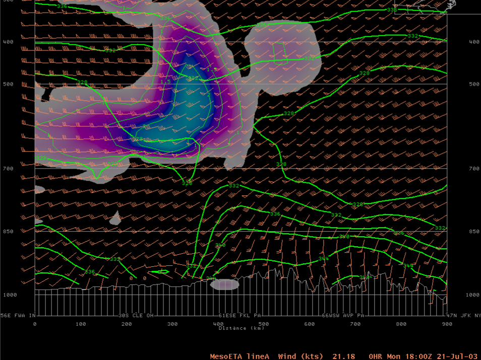
RUC Analysis - SPC
RUC Analysis - SPC
RUC Analysis - SPC
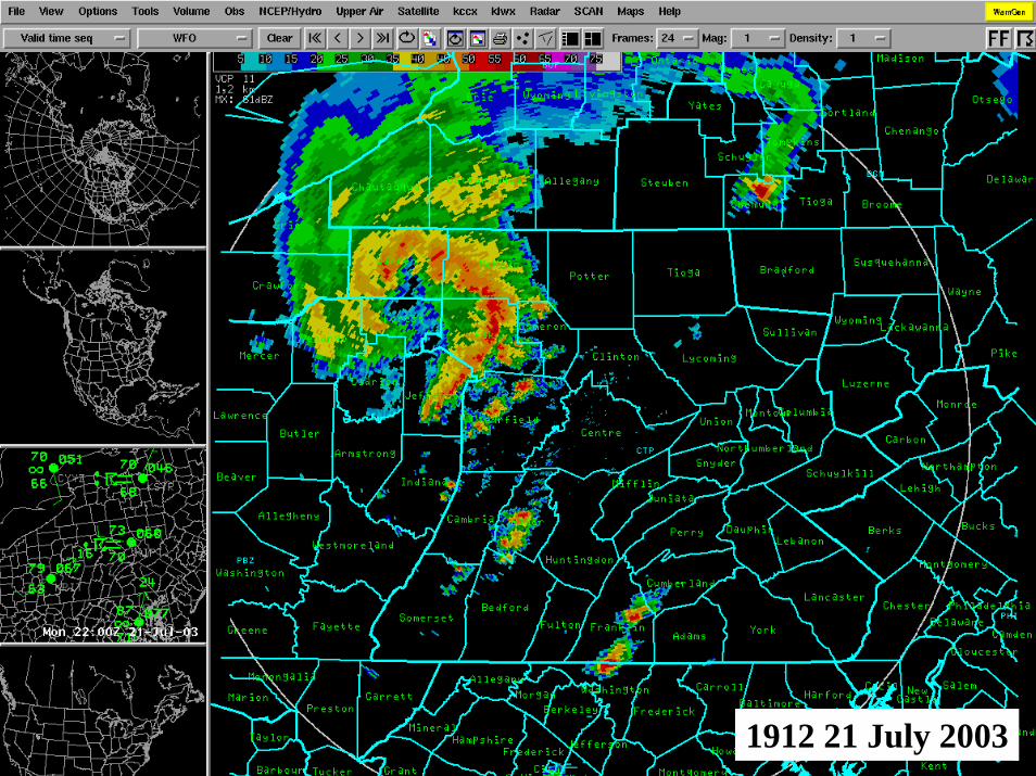
1912 21 July 2003
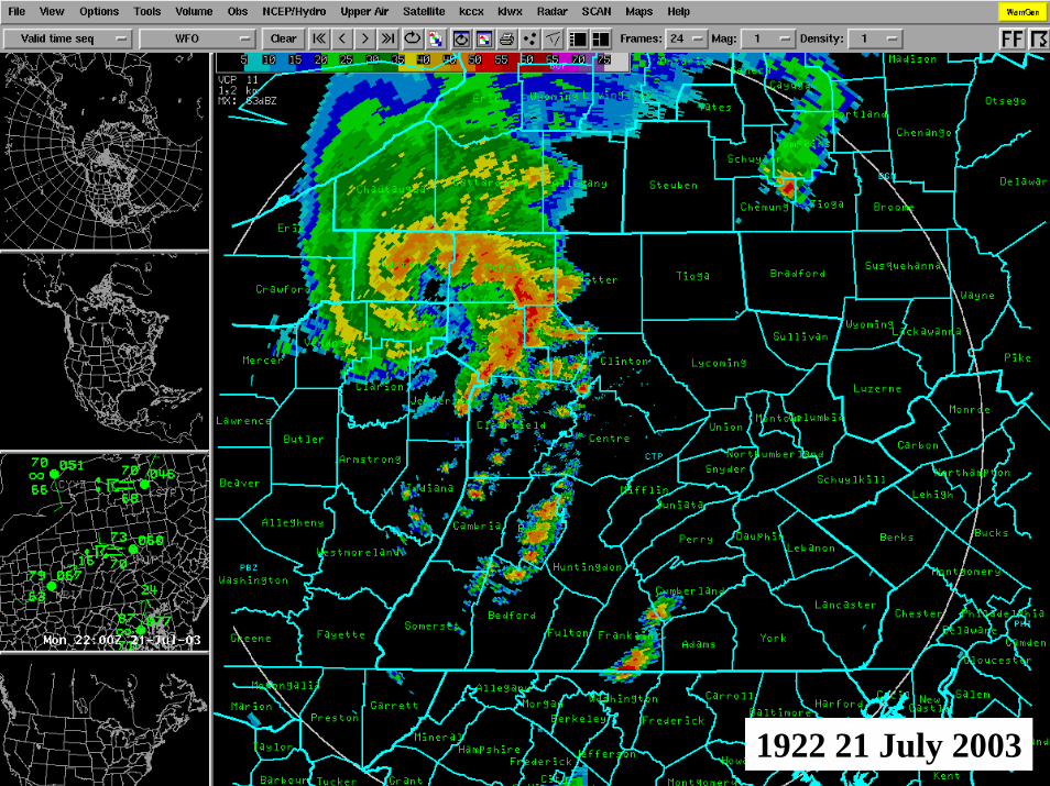
1922 21 July 2003
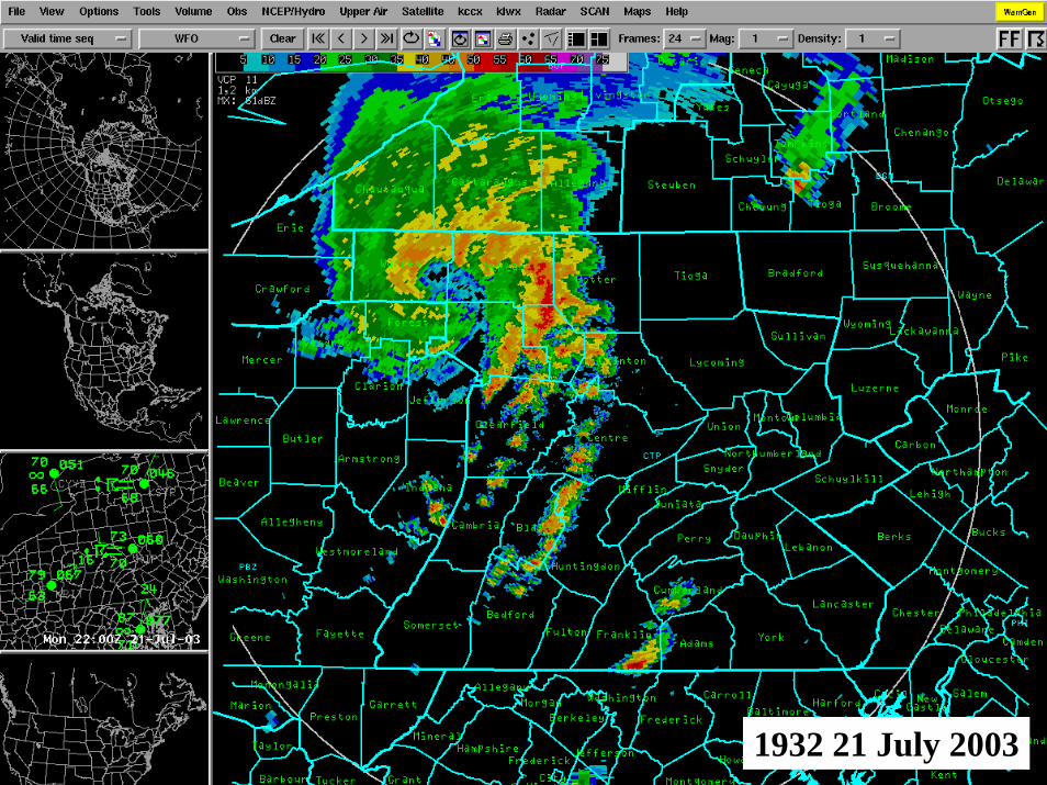
1932 21 July 2003
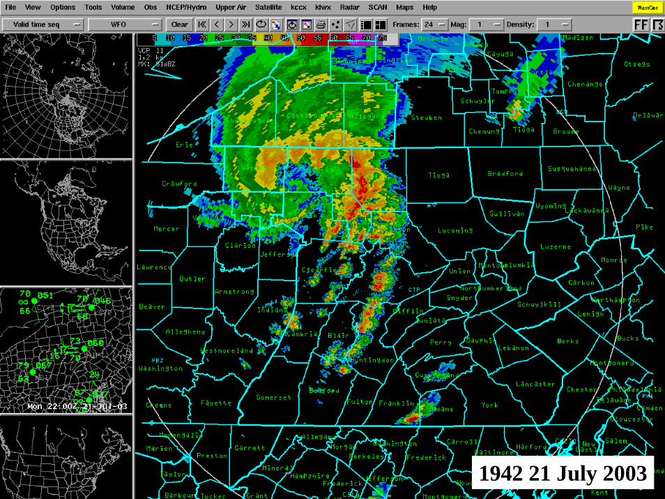
1942 21 July 2003
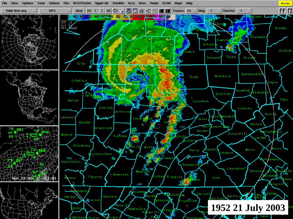
1952 21 July 2003
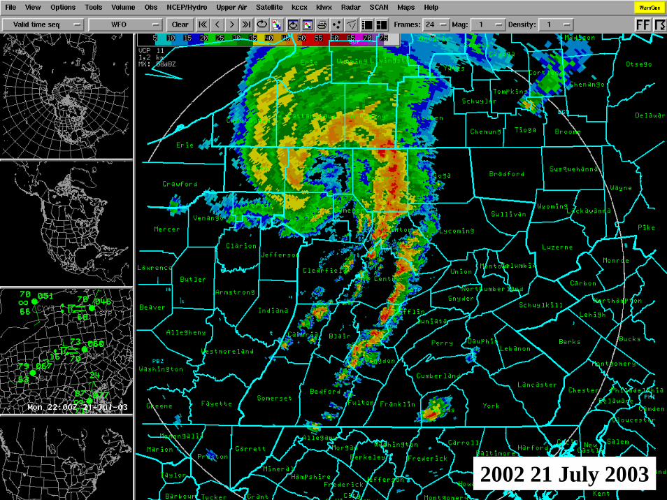
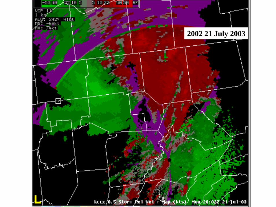
2002 21 July 2003
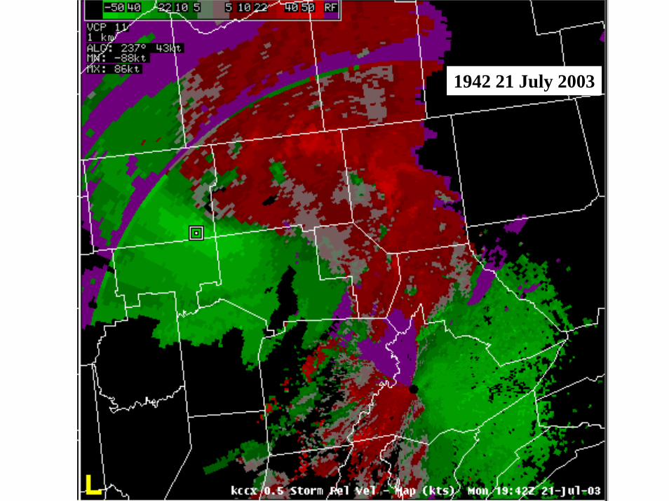
1942 21 July 2003
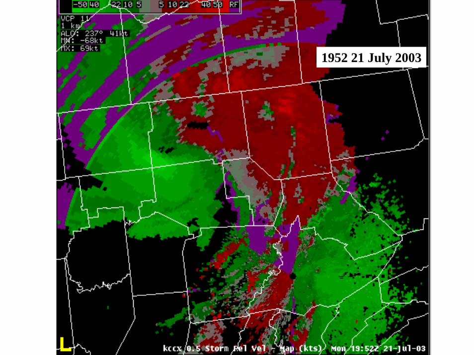
1952 21 July 2003
2002 21 July 2003

In Summary . . .
Convectively-induced mid-level vorticity center
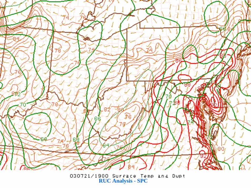
Preceding surface warm front
Several convective OBs
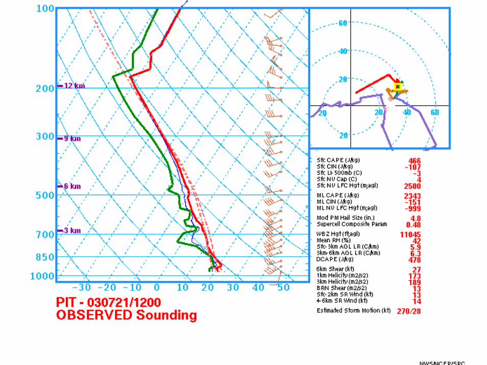
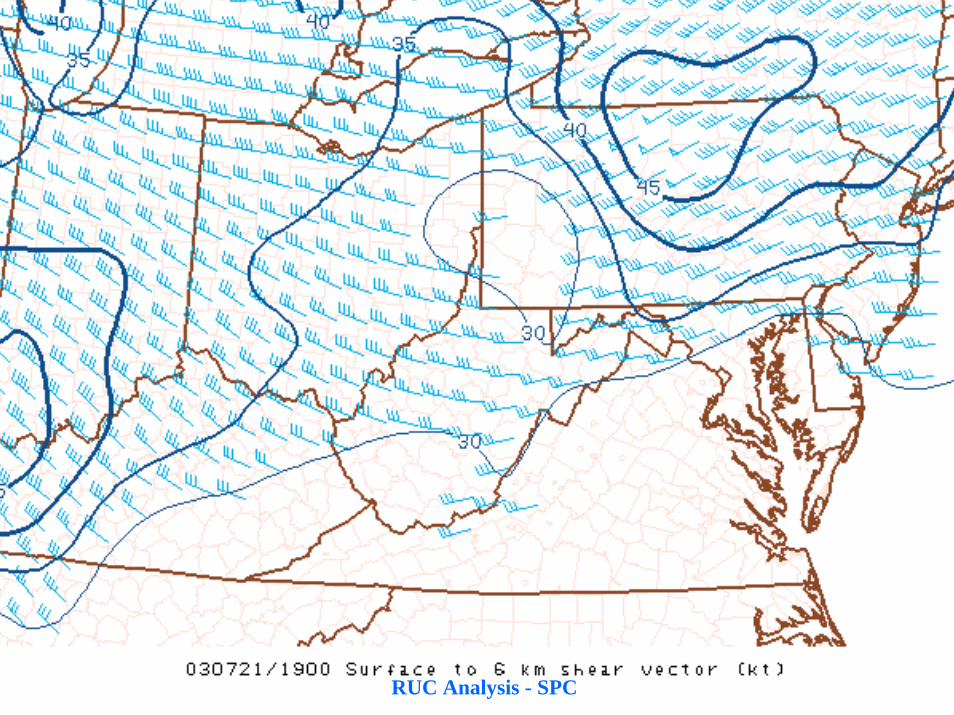
40-50 kts WSW mid level wind enhanced deep layer shear
Mid-level vorticity generation
MCV enhanced LL WAA supported deep convection sustained vortex
Surface pressure rise-fall couplet supported damaging isallobaric wind
Ahead . . .
•Mode of MCV re-intensification
•Role of nocturnal theta-e transport
•Impact of diabatically produced surface cool pool on MCV maintenance
•Predictability of convection near MCV center


![Azathioprine induced severe bone marrow suppression in autoimmune hepatitis. [Case presentation with literature review]](https://img.pdfslide.net/doc/110x75/559c18ac1a28ab22598b45ee/azathioprine-induced-severe-bone-marrow-suppression-in-autoimmune-hepatitis-case-presentation-with-literature-review.jpg)