Embed Size (px)
Citation preview
MERAPI & BOROBUDUR TRIP
• Preparation: sun hat, long sleeves, sport
shoes
• Depart from hotel at 07.30 LT, by bus
• Arrive at Hotel at 17.00 LT
• Detailed schedule is presented in the
guide book
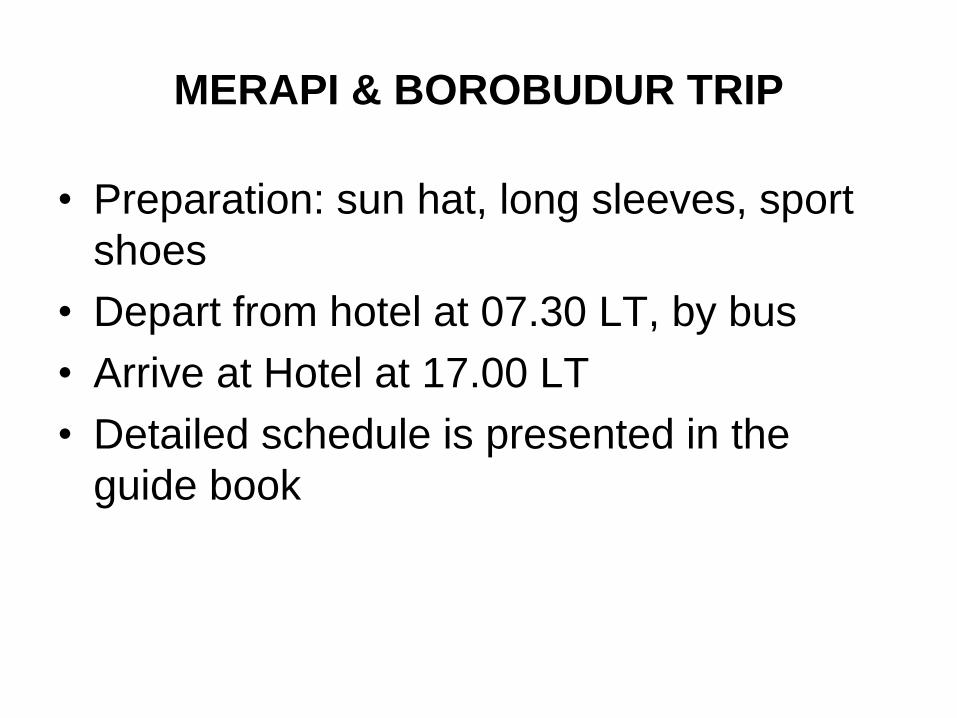
Yogyakarta
Magelang G. MERAPI
G. Merbabu
West
Progo
Mts.
Southern
Mts.
Merapi Volcano
& Yogyakarta
Stop sides for field trip
1.Putih River
2.Borobudur Temple
3.Merapi Museum
1 2 3
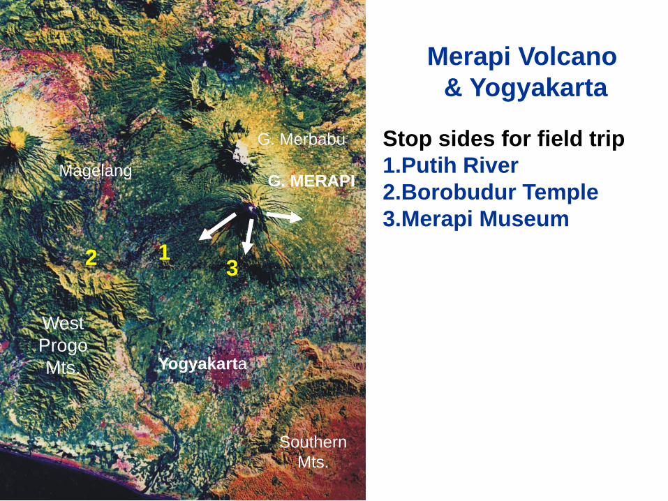
Panorama of Merapi Volcano from the north
Old Merapi
(East)
Young Merapi
(West)
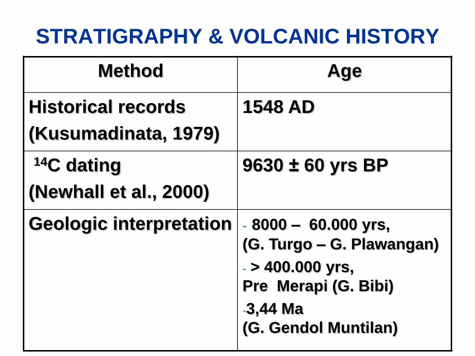
STRATIGRAPHY & VOLCANIC HISTORY
Method Age
Historical records
(Kusumadinata, 1979)
1548 AD
14C dating
(Newhall et al., 2000)
9630 ± 60 yrs BP
Geologic interpretation - 8000 – 60.000 yrs,
(G. Turgo – G. Plawangan)
- > 400.000 yrs,
Pre Merapi (G. Bibi)
-3,44 Ma
(G. Gendol Muntilan)
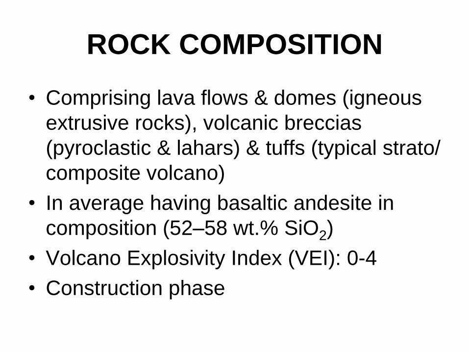
ROCK COMPOSITION
• Comprising lava flows & domes (igneous
extrusive rocks), volcanic breccias
(pyroclastic & lahars) & tuffs (typical strato/
composite volcano)
• In average having basaltic andesite in
composition (52–58 wt.% SiO2)
• Volcano Explosivity Index (VEI): 0-4
• Construction phase
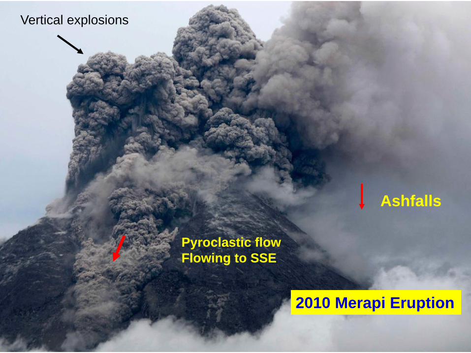
Vertical explosions
Pyroclastic flow
Flowing to SSE
Ashfalls
2010 Merapi Eruption
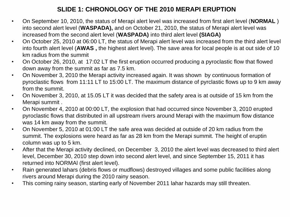
SLIDE 1: CHRONOLOGY OF THE 2010 MERAPI ERUPTION
• On September 10, 2010, the status of Merapi alert level was increased from first alert level (NORMAL )
into second alert level (WASPADA), and on October 21, 2010, the status of Merapi alert level was
increased from the second alert level (WASPADA) into third alert level (SIAGA)
• On October 25, 2010 at 06:00 LT, the status of Merapi alert level was increased from the third alert level
into fourth alert level (AWAS , the highest alert level). The save area for local people is at out side of 10
km radius from the summit
• On October 26, 2010, at 17:02 LT the first eruption occurred producing a pyroclastic flow that flowed
down away from the summit as far as 7.5 km.
• On November 3, 2010 the Merapi activity increased again. It was shown by continuous formation of
pyroclastic flows from 11:11 LT to 15:00 LT. The maximum distance of pyrclastic flows up to 9 km away
from the summit.
• On November 3, 2010, at 15.05 LT it was decided that the safety area is at outside of 15 km from the
Merapi summit .
• On November 4, 2010 at 00:00 LT, the explosion that had occurred since November 3, 2010 erupted
pyroclastic flows that distributed in all upstream rivers around Merapi with the maximum flow distance
was 14 km away from the summit.
• On November 5, 2010 at 01:00 LT the safe area was decided at outside of 20 km radius from the
summit. The explosions were heard as far as 28 km from the Merapi summit. The height of eruptin
column was up to 5 km.
• After that the Merapi activity declined, on December 3, 2010 the alert level was decreased to third alert
level, December 30, 2010 step down into second alert level, and since September 15, 2011 it has
returned into NORMAl (first alert level).
• Rain generated lahars (debris flows or mudflows) destroyed villages and some public facilities along
rivers around Merapi during the 2010 rainy season.
• This coming rainy season, starting early of November 2011 lahar hazards may still threaten.
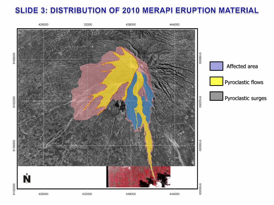
Pyroclastic flows
Pyroclastic surges
Affected area
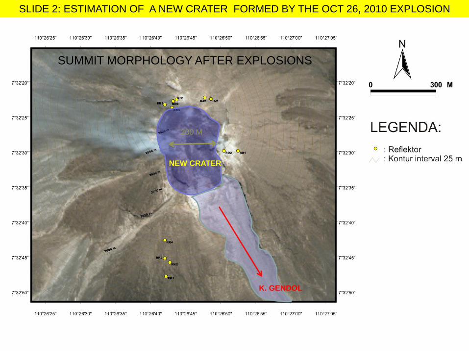
200 M
SLIDE 2: ESTIMATION OF A NEW CRATER FORMED BY THE OCT 26, 2010 EXPLOSION
NEW CRATER
K. GENDOL
SUMMIT MORPHOLOGY AFTER EXPLOSIONS
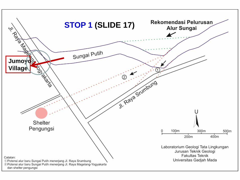
Jumoyo
Village
STOP 1 (SLIDE 17)

Salamsari,
11 Km dari puncak,
625 mdpl
Srumbung,
14 Km dari puncak,
mdpl
Seloiring,
17 Km dari puncak,
mdpl
Jumoyo,
18 Km dari puncak,
mdpl
Sirahan,
24 Km dari puncak,
mdpl
Seloboro,
20 Km dari puncak,
mdpl
SLIDE 15: Lahar hazard map. Red color shows distribution of overflow lahars
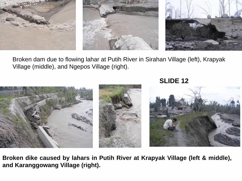
Broken dam due to flowing lahar at Putih River in Sirahan Village (left), Krapyak
Village (middle), and Ngepos Village (right).
Broken dike caused by lahars in Putih River at Krapyak Village (left & middle),
and Karanggowang Village (right).
SLIDE 12
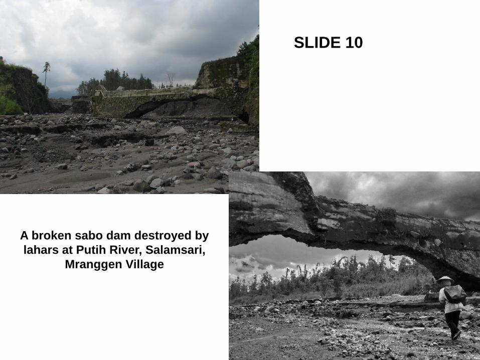
A broken sabo dam destroyed by
lahars at Putih River, Salamsari,
Mranggen Village
SLIDE 10
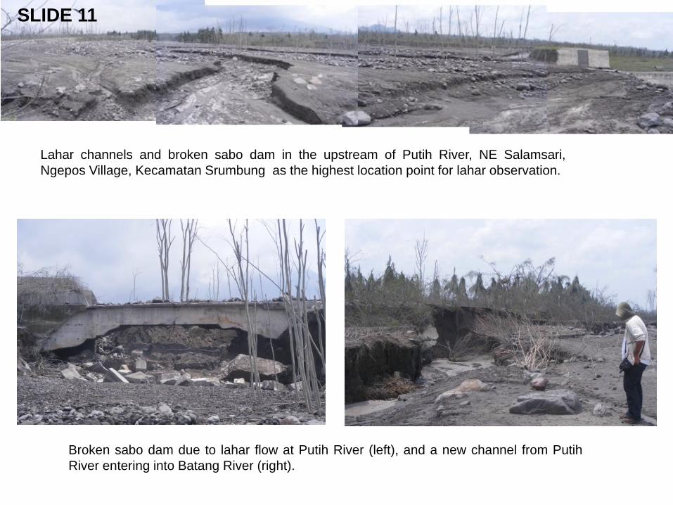
Lahar channels and broken sabo dam in the upstream of Putih River, NE Salamsari,
Ngepos Village, Kecamatan Srumbung as the highest location point for lahar observation.
Broken sabo dam due to lahar flow at Putih River (left), and a new channel from Putih
River entering into Batang River (right).
SLIDE 11
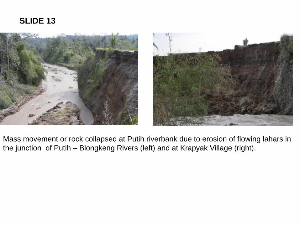
Mass movement or rock collapsed at Putih riverbank due to erosion of flowing lahars in
the junction of Putih – Blongkeng Rivers (left) and at Krapyak Village (right).
SLIDE 13
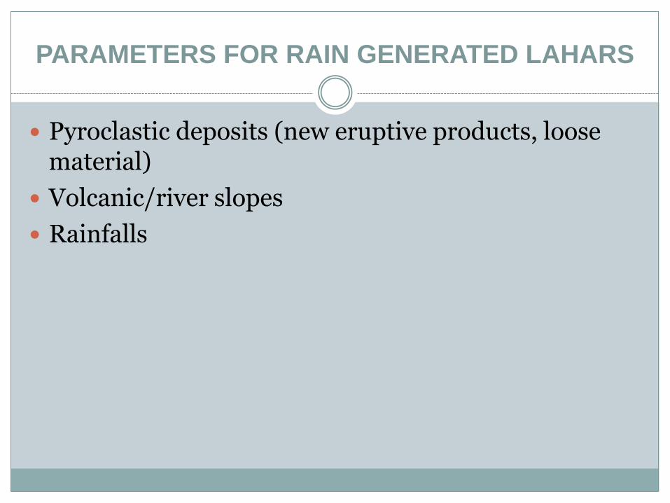
PARAMETERS FOR RAIN GENERATED LAHARS
Pyroclastic deposits (new eruptive products, loose material)
Volcanic/river slopes
Rainfalls
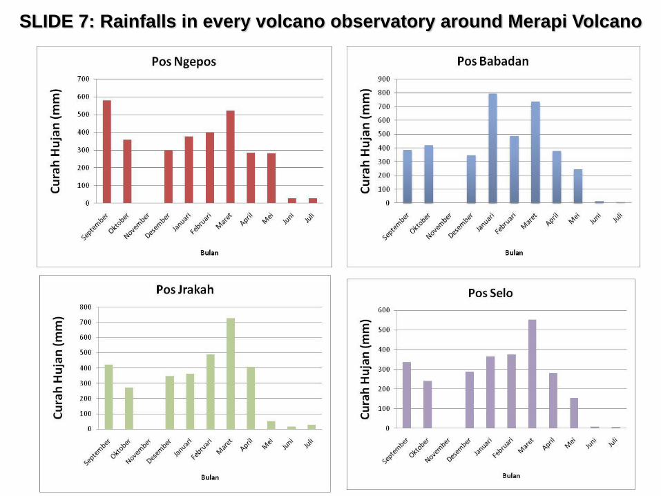
SLIDE 7: Rainfalls in every volcano observatory around Merapi Volcano
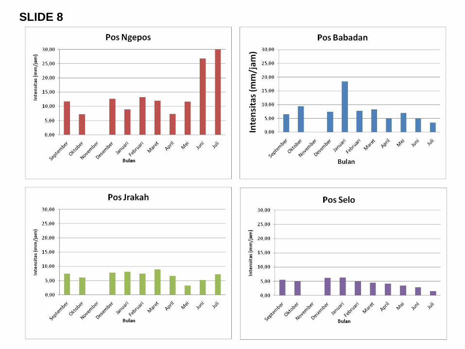
SLIDE 8
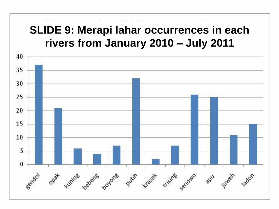
SLIDE 9: Merapi lahar occurrences in each
rivers from January 2010 – July 2011
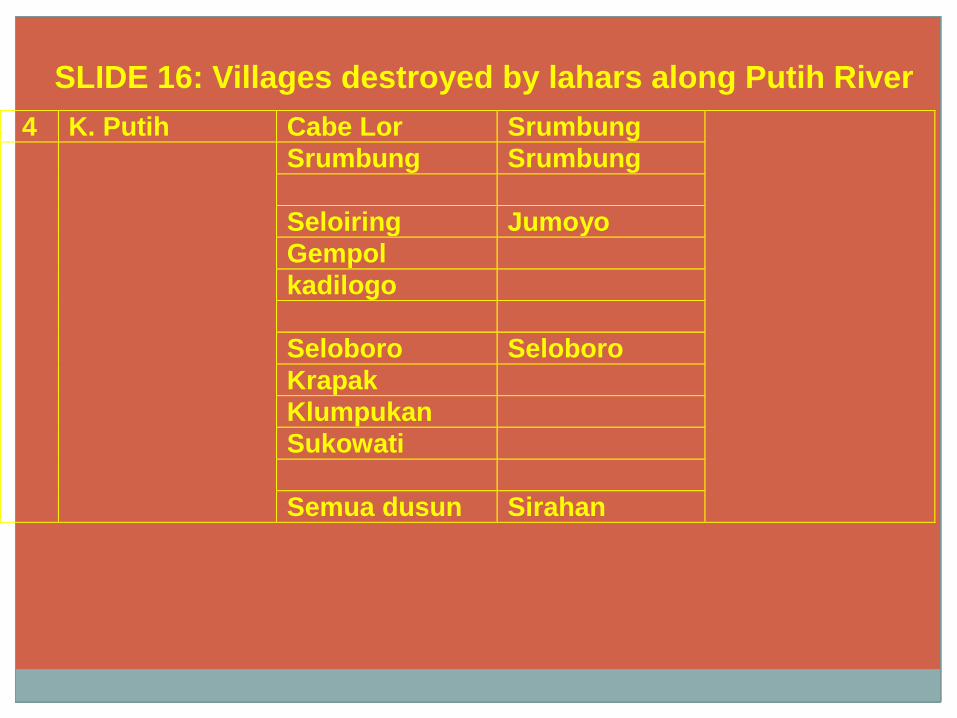
4 K. Putih Cabe Lor Srumbung
Srumbung Srumbung
Seloiring Jumoyo
Gempol
kadilogo
Seloboro Seloboro
Krapak
Klumpukan
Sukowati
Semua dusun Sirahan
SLIDE 16: Villages destroyed by lahars along Putih River
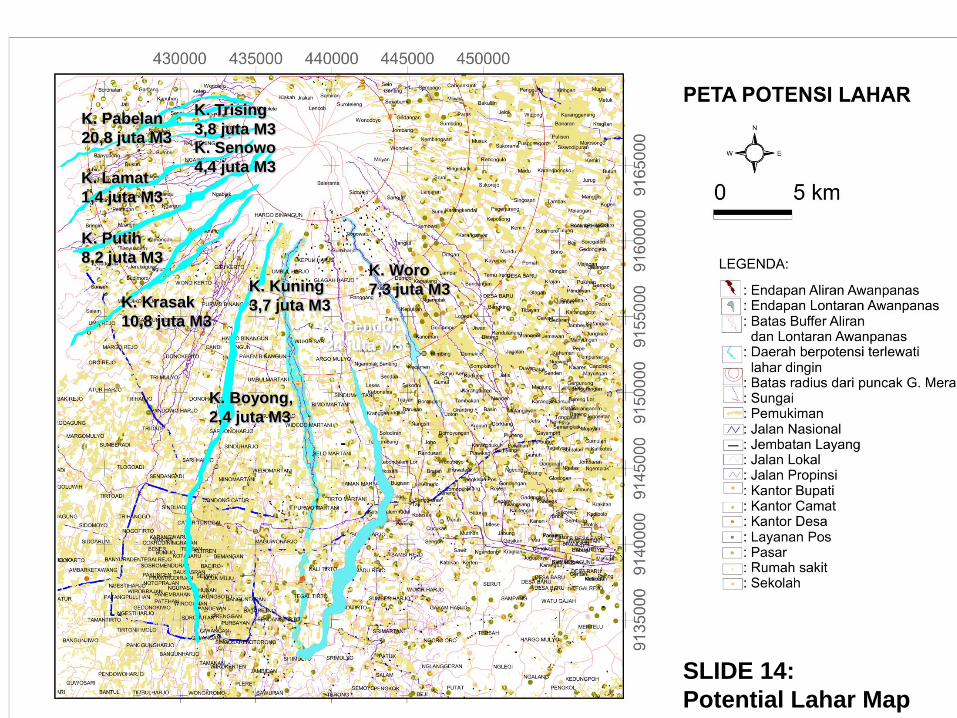
K. Gendol
24 juta M3
K. Boyong,
2,4 juta M3
K. Krasak
10,8 juta M3
K. Putih
8,2 juta M3
K. Lamat
1,4 juta M3
K. Pabelan
20,8 juta M3
K. Kuning
3,7 juta M3
K. Woro
7,3 juta M3
K. Senowo
4,4 juta M3
K. Trising
3,8 juta M3
SLIDE 14:
Potential Lahar Map
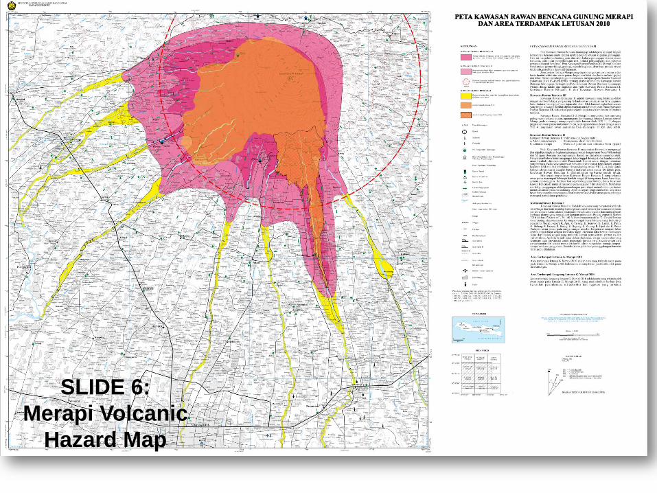
SLIDE 6:
Merapi Volcanic
Hazard Map
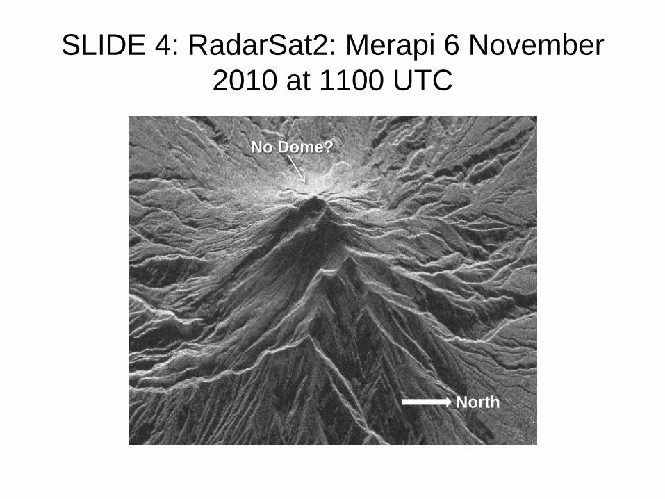
SLIDE 4: RadarSat2: Merapi 6 November
2010 at 1100 UTC
North
No Dome?
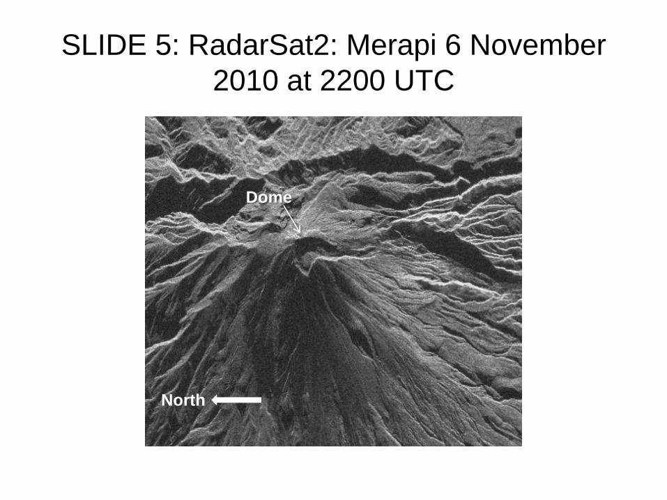
SLIDE 5: RadarSat2: Merapi 6 November
2010 at 2200 UTC
North
Dome

MANY MORE PHOTOS 7 BLOCK
DIAGRAMS IN STOP 3: MERAPI MUSEUM
THANKS & SEE YOU TOMORROW