Embed Size (px)
Citation preview
MET 200 Lecture 8 Stability
1
Quiz 1 Results
0
1
2
3
4
5
6
7
8
9
>90 >80 >70 >50 M
Student Count vs Percent
2
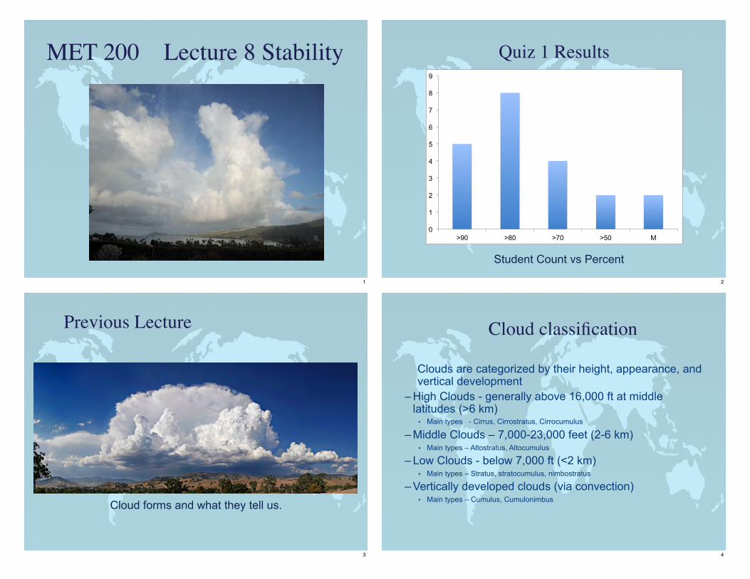
Previous Lecture
Cloud forms and what they tell us.
3
Cloud classification
Clouds are categorized by their height, appearance, and vertical development
– High Clouds - generally above 16,000 ft at middle latitudes (>6 km)• Main types - Cirrus, Cirrostratus, Cirrocumulus
– Middle Clouds – 7,000-23,000 feet (2-6 km)• Main types – Altostratus, Altocumulus
– Low Clouds - below 7,000 ft (<2 km)• Main types – Stratus, stratocumulus, nimbostratus
– Vertically developed clouds (via convection)• Main types – Cumulus, Cumulonimbus
4
Cloud type summary
5
Vertically developed clouds
Cumulus• Puffy “cotton”• Flat base, rounded top• More space between cloud
elements than stratocumulusCumulonimbus• Thunderstorm cloud• Very tall, often reaching
tropopause• Individual or grouped• Large energy release from
water vapor condensation
6
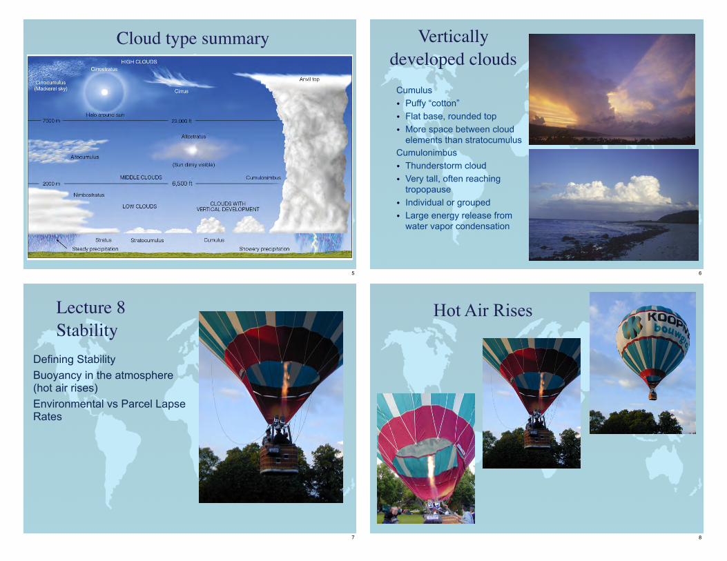
Defining StabilityBuoyancy in the atmosphere (hot air rises)Environmental vs Parcel Lapse Rates
Lecture 8Stability
7
Hot Air Rises
8
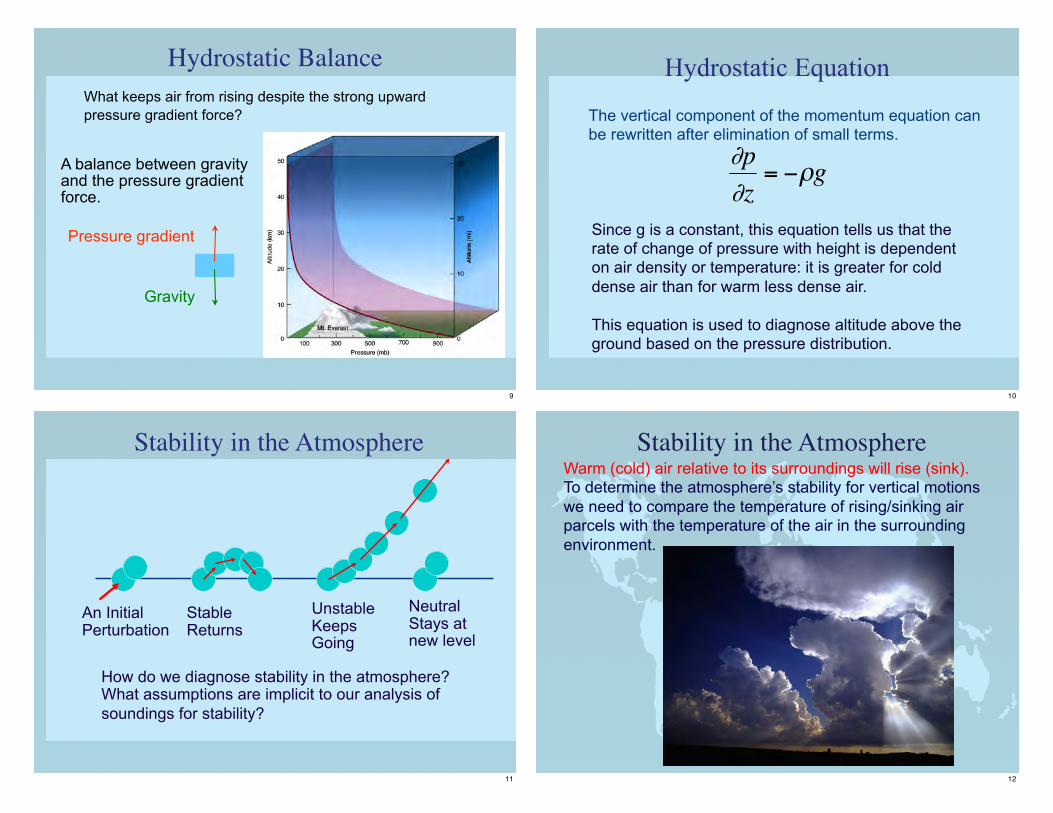
Hydrostatic Balance
A balance between gravity and the pressure gradient force.
Gravity
Pressure gradient
What keeps air from rising despite the strong upward pressure gradient force?
9
Hydrostatic Equation
The vertical component of the momentum equation can be rewritten after elimination of small terms.
Since g is a constant, this equation tells us that the rate of change of pressure with height is dependent on air density or temperature: it is greater for cold dense air than for warm less dense air.
This equation is used to diagnose altitude above the ground based on the pressure distribution.
€
∂p∂z
= −ρg
10
Stability in the Atmosphere
StableReturns
UnstableKeeps Going
NeutralStays atnew level
An InitialPerturbation
How do we diagnose stability in the atmosphere?What assumptions are implicit to our analysis of soundings for stability?
11
Stability in the AtmosphereWarm (cold) air relative to its surroundings will rise (sink). To determine the atmosphere’s stability for vertical motions we need to compare the temperature of rising/sinking air parcels with the temperature of the air in the surrounding environment.
12
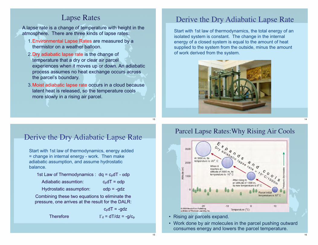
Lapse RatesA lapse rate is a change of temperature with height in the atmosphere. There are three kinds of lapse rates:
1.Environmental Lapse Rates are measured by a thermistor on a weather balloon.
2.Dry adiabatic lapse rate is the change of temperature that a dry or clear air parcel experiences when it moves up or down. An adiabatic process assumes no heat exchange occurs across the parcel’s boundary.
3.Moist adiabatic lapse rate occurs in a cloud because latent heat is released, so the temperature cools more slowly in a rising air parcel.
13
Derive the Dry Adiabatic Lapse RateStart with 1st law of thermodynamics, the total energy of an isolated system is constant. The change in the internal energy of a closed system is equal to the amount of heat supplied to the system from the outside, minus the amount of work derived from the system.
14
Derive the Dry Adiabatic Lapse RateStart with 1st law of thermodynamics, energy added = change in internal energy - work. Then make adiabatic assumption, and assume hydrostatic balance.
1st Law of Thermodynamics : dq = cpdT - αdpAdiabatic assumtion: cpdT = αdpHydrostatic assumption: αdp = -gdz
Combining these two equations to eliminate the pressure, one arrives at the result for the DALR:
cpdT = -gdz Therefore Γd = dT/dz = -g/cp
15
Parcel Lapse Rates:Why Rising Air Cools
• Rising air parcels expand.• Work done by air molecules in the parcel pushing outward
consumes energy and lowers the parcel temperature.16
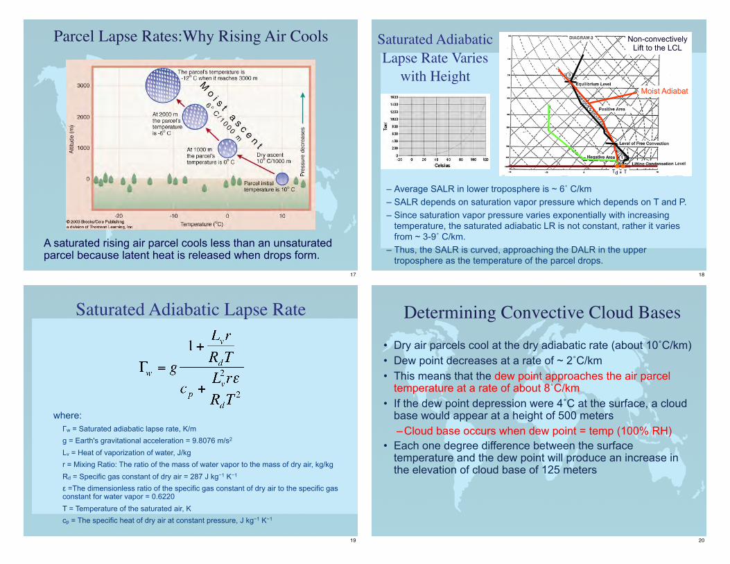
A saturated rising air parcel cools less than an unsaturated parcel because latent heat is released when drops form.
Parcel Lapse Rates:Why Rising Air Cools
17
Saturated Adiabatic Lapse Rate Varies
with Height
– Average SALR in lower troposphere is ~ 6˚ C/km– SALR depends on saturation vapor pressure which depends on T and P.– Since saturation vapor pressure varies exponentially with increasing
temperature, the saturated adiabatic LR is not constant, rather it varies from ~ 3-9˚ C/km.
– Thus, the SALR is curved, approaching the DALR in the upper troposphere as the temperature of the parcel drops.
TTd
Moist Adiabat
Non-convectivelyLift to the LCL
18
Saturated Adiabatic Lapse Rate
where: Γw = Saturated adiabatic lapse rate, K/m g = Earth's gravitational acceleration = 9.8076 m/s2 Lv = Heat of vaporization of water, J/kg r = Mixing Ratio: The ratio of the mass of water vapor to the mass of dry air, kg/kg Rd = Specific gas constant of dry air = 287 J kg−1 K−1 ε =The dimensionless ratio of the specific gas constant of dry air to the specific gas constant for water vapor = 0.6220 T = Temperature of the saturated air, K cp = The specific heat of dry air at constant pressure, J kg−1 K−1
19
Determining Convective Cloud Bases• Dry air parcels cool at the dry adiabatic rate (about 10˚C/km)• Dew point decreases at a rate of ~ 2˚C/km• This means that the dew point approaches the air parcel
temperature at a rate of about 8˚C/km• If the dew point depression were 4˚C at the surface, a cloud
base would appear at a height of 500 meters–Cloud base occurs when dew point = temp (100% RH)
• Each one degree difference between the surface temperature and the dew point will produce an increase in the elevation of cloud base of 125 meters
20
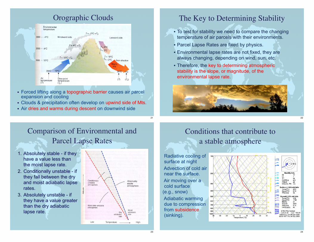
Orographic Clouds
• Forced lifting along a topographic barrier causes air parcel expansion and cooling
• Clouds & precipitation often develop on upwind side of Mts.• Air dries and warms during descent on downwind side
21
The Key to Determining Stability• To test for stability we need to compare the changing
temperature of air parcels with their environments.
• Parcel Lapse Rates are fixed by physics.
• Environmental lapse rates are not fixed, they are always changing, depending on wind, sun, etc.
• Therefore, the key to determining atmospheric stability is the slope, or magnitude, of the environmental lapse rate.
22
Comparison of Environmental and Parcel Lapse Rates
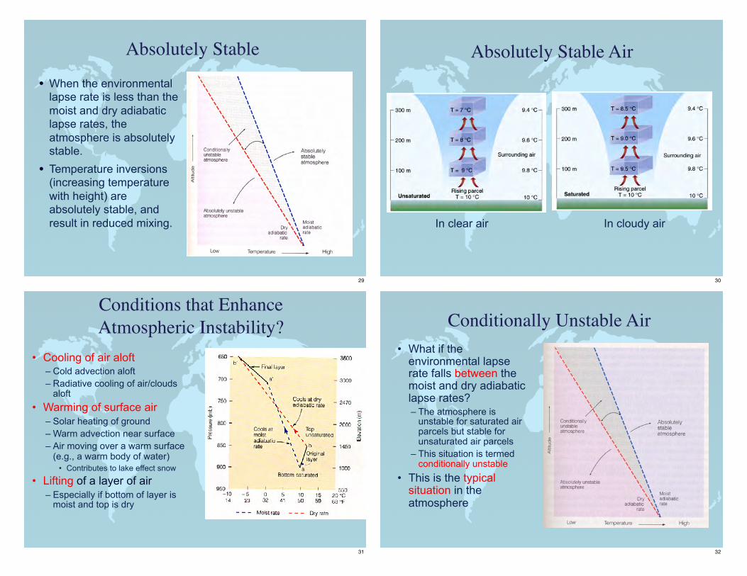
1. Absolutely stable - if they have a value less than the moist lapse rate.
2. Conditionally unstable - if they fall between the dry and moist adiabatic lapse rates.
3. Absolutely unstable - if they have a value greater than the dry adiabatic lapse rate.
23
Conditions that contribute to a stable atmosphere
Radiative cooling of surface at night
Advection of cold air near the surface.
Air moving over a cold surface
(e.g., snow) Adiabatic warming
due to compression from subsidence (sinking).
24
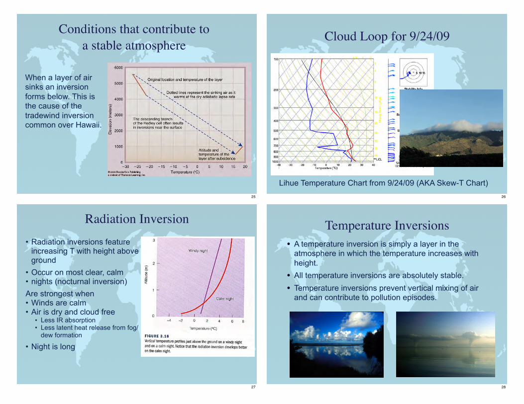
When a layer of air sinks an inversion forms below. This is the cause of the tradewind inversion common over Hawaii.
Conditions that contribute to a stable atmosphere
25
Cloud Loop for 9/24/09
Lihue Temperature Chart from 9/24/09 (AKA Skew-T Chart)26
Radiation Inversion• Radiation inversions feature
increasing T with height above ground• Occur on most clear, calm• nights (nocturnal inversion)Are strongest when• Winds are calm• Air is dry and cloud free• Less IR absorption• Less latent heat release from fog/
dew formation
• Night is long
27
Temperature Inversions• A temperature inversion is simply a layer in the
atmosphere in which the temperature increases with height.
• All temperature inversions are absolutely stable.
• Temperature inversions prevent vertical mixing of air and can contribute to pollution episodes.
28
Absolutely Stable
• When the environmental lapse rate is less than the moist and dry adiabatic lapse rates, the atmosphere is absolutely stable.
• Temperature inversions (increasing temperature with height) are absolutely stable, and result in reduced mixing.
29
Absolutely Stable Air
In clear air In cloudy air
30
Conditions that Enhance Atmospheric Instability?
• Cooling of air aloft– Cold advection aloft– Radiative cooling of air/clouds
aloft• Warming of surface air
– Solar heating of ground– Warm advection near surface– Air moving over a warm surface
(e.g., a warm body of water)• Contributes to lake effect snow
• Lifting of a layer of air – Especially if bottom of layer is
moist and top is dry
31
Conditionally Unstable Air• What if the
environmental lapse rate falls between the moist and dry adiabatic lapse rates?– The atmosphere is
unstable for saturated air parcels but stable for unsaturated air parcels
– This situation is termed conditionally unstable
• This is the typical situation in the atmosphere
32
Cumulonimbus
33
Conditionally Unstable Air
Clear Air - Stable Cloudy Air - Unstable
34
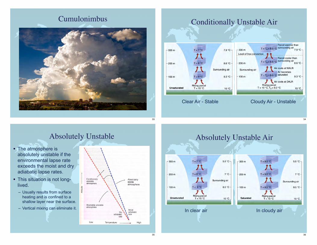
Absolutely Unstable• The atmosphere is
absolutely unstable if the environmental lapse rate exceeds the moist and dry adiabatic lapse rates.
• This situation is not long-lived.– Usually results from surface
heating and is confined to a shallow layer near the surface.
– Vertical mixing can eliminate it.
35
Absolutely Unstable Air
In clear air In cloudy air
36
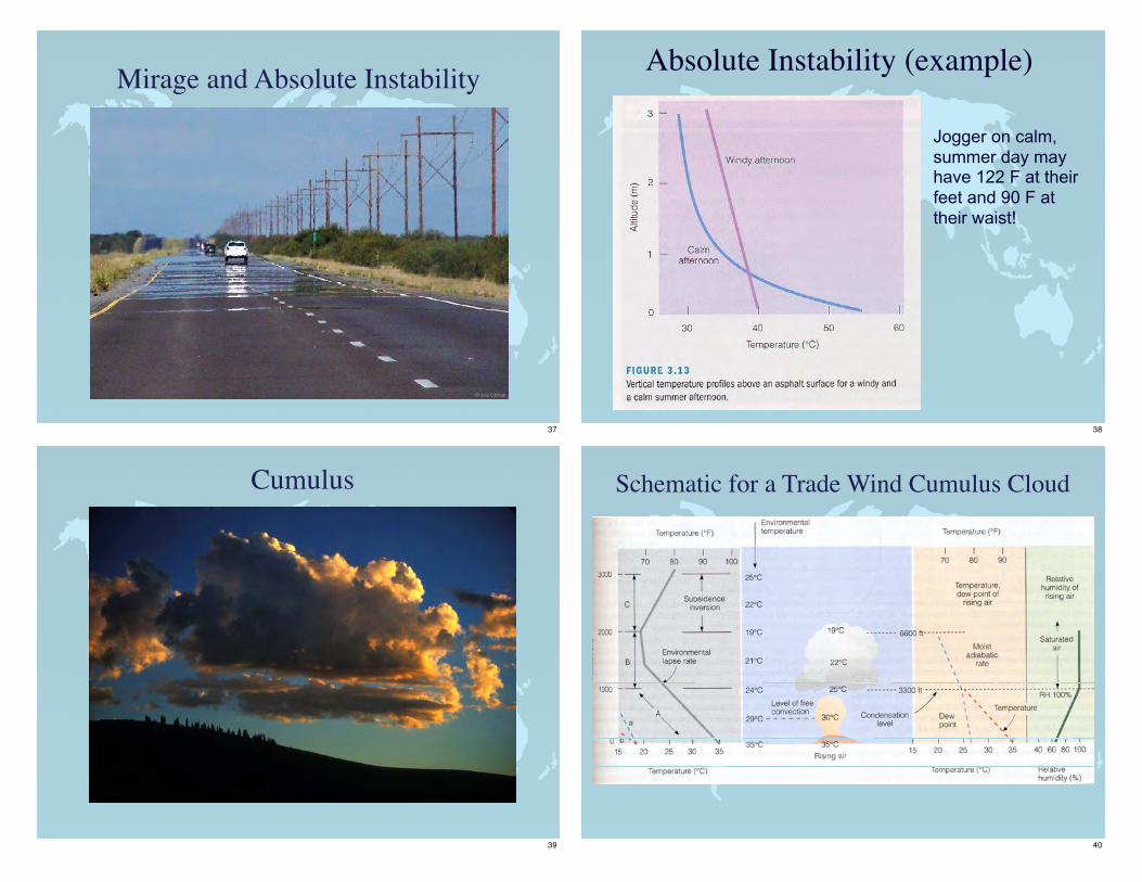
Mirage and Absolute Instability
37
Absolute Instability (example)
Jogger on calm, summer day may have 122 F at their feet and 90 F at their waist!
38
Cumulus
39
Schematic for a Trade Wind Cumulus Cloud
40
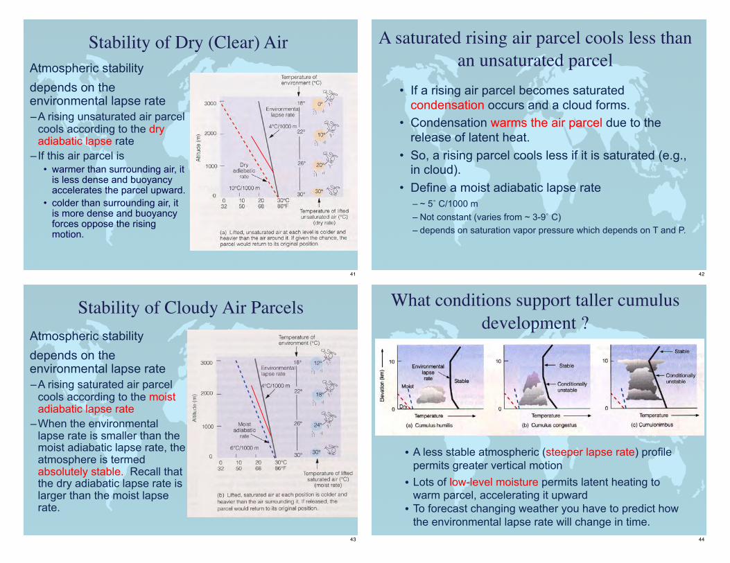
Stability of Dry (Clear) Air Atmospheric stability
depends on the environmental lapse rate–A rising unsaturated air parcel
cools according to the dry adiabatic lapse rate
– If this air parcel is• warmer than surrounding air, it
is less dense and buoyancy accelerates the parcel upward.
• colder than surrounding air, it is more dense and buoyancy forces oppose the rising motion.
41
A saturated rising air parcel cools less than an unsaturated parcel
• If a rising air parcel becomes saturated condensation occurs and a cloud forms.
• Condensation warms the air parcel due to the release of latent heat.
• So, a rising parcel cools less if it is saturated (e.g., in cloud).
• Define a moist adiabatic lapse rate– ~ 5˚ C/1000 m– Not constant (varies from ~ 3-9˚ C)– depends on saturation vapor pressure which depends on T and P.
42
Stability of Cloudy Air Parcels Atmospheric stability
depends on the environmental lapse rate–A rising saturated air parcel
cools according to the moist adiabatic lapse rate
–When the environmental lapse rate is smaller than the moist adiabatic lapse rate, the atmosphere is termed absolutely stable. Recall that the dry adiabatic lapse rate is larger than the moist lapse rate.
43
What conditions support taller cumulus development ?
• A less stable atmospheric (steeper lapse rate) profile permits greater vertical motion• Lots of low-level moisture permits latent heating to
warm parcel, accelerating it upward• To forecast changing weather you have to predict how
the environmental lapse rate will change in time.44
Questions?
45